Archeomatica 2 2022
Tecnologie per i Beni Culturali
Tecnologie per i Beni Culturali

Create successful ePaper yourself
Turn your PDF publications into a flip-book with our unique Google optimized e-Paper software.
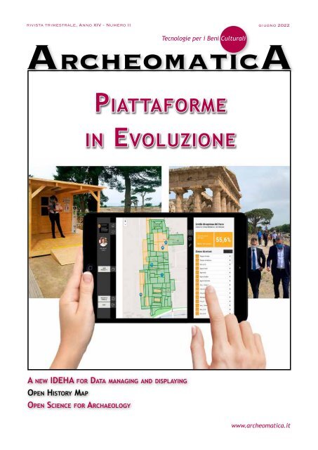
ivista trimestrale, Anno XIV - Numero II giugno <strong>2022</strong><br />
ArcheomaticA<br />
Tecnologie per i Beni Culturali<br />
Piattaforme<br />
in Evoluzione<br />
A new IDEHA for Data managing and displaying<br />
Open History Map<br />
Open Science for Archaeology<br />
www.archeomatica.it
EDITORIALE<br />
Diritto d'autore e Digitale<br />
Questo numero di <strong>Archeomatica</strong> tocca, con l’articolo di Paolo Rosati dal titolo Open<br />
science for archeology, il complesso tema delle Creative Commons Licences. Quante e di<br />
che tipo sono le licenze in Open access, che il Web ha ottenuto di diffondere. Quasi tutte<br />
dispensano la licenza di utilizzo in tutto o in parte di un lavoro letterario o scientifico,<br />
purché siano rispettate le dichiarazioni dei crediti autoriali o, per meglio dire, i crediti<br />
delle istituzioni, fondazioni ed editori che li detengono. Lo spartiacque fondamentale è<br />
tra le edizioni ante e post 1940, ma non per tutti i paesi è ugualmente regolamentato ed<br />
anche per una buona fetta di opere anteriori al 1940, se non tutte, per poterle consultare<br />
il lettore e lo studente dovranno registrarsi e dichiarare di non volerne fare un uso<br />
commerciale per poterle scaricare. Non è chiaro perchè, dal momento che quasi nessuna<br />
delle istituzioni e degli editori coinvolti potrebbero dimostrare di aver mai acquistato i<br />
diritti autoriali delle opere e la loro acquisizione è per lo più soggetta a legislazioni di<br />
singoli stati, mirate alla diffusione pubblica del bene, conditio sine qua non di un uso<br />
commerciale. In altre parole, autori ed editori pioneristici che ne hanno suffragato la<br />
creazione, la pubblicazione e la riproduzione possono continuare a crepare di fame per<br />
generazioni ed il pubblico dovrà continuare a pagare il prezzo di un disagio anche quando<br />
l’accessibilità e i diritti di riproduzione siano scaduti da tempo. Un dato di fatto è che la<br />
fruizione sia un bene commerciale e che le schiere di riproduttori siano schiere di fruitori<br />
che contribuiscono al valore di un’opera. Voler limitare l’accessione ad un prodotto<br />
autoriale da parte di chi non ne è autore, al contrario, è un’operazione commerciale a<br />
tutto tondo. Se opere enciclopediche come Wikipedia hanno mostrato quanto lento sia<br />
l’aggiornamento culturale di una produzione dai confini sempre più illimitati, hanno d’altra<br />
parte dimostrato anche che quasi mai nessuno sa chi ha detto che. E’ che il grosso del<br />
lavoro di ogni autore è tracciare l’identikit di un prodotto culturale, afferrare chi, dove e<br />
quando ne abbia detto che, per finire a scoprire che molte volte i più autorevoli ideatori e<br />
interpreti siano i più taciuti e gratuiti. La letteratura è un lavoro di copia e incolla, dove<br />
il plagio è all’ordine del giorno e forse è proprio questo a fare della ricerca in open access<br />
la novità della crescita di una comunità scientifica: la misura di una fruizione simultanea<br />
di una mole prima d’ora quasi imperscrutabile di dati, in cui anche l’autore neofita possa<br />
addentrarsi come uno scolaretto e raggiungere il bene di leggerla a portata di mano,<br />
ripagando gli autori e gli editori che l’hanno realizzata a questo fine e nessun altro. Il Web<br />
è quel buon padre di famiglia che mette nel nostro scaffale un’indice di opere in un modo o<br />
nell’altro proibite, frutto di un'umanità intera, in cui trovare non tanto e non solo qualcosa<br />
di nuovo da dire, ma le ragioni del nostro dire più pressante, che, dopo aver letto e riletto,<br />
ci sembrerà sempre meno uguale e sempre più comprensibile ad altri, meno divulgativo che<br />
mai. Un obbiettivo fondamentale del web, da non cambiare, è che nessun altro dispensi<br />
un’opera se non chi l’ha creata e che il più acuto dei lettori ne sia anche il suo inventore.<br />
La fruizione digitale non sostituisce il contatto diretto con l’opera d’arte e nemmeno<br />
le possibilità d’investimento commerciale nel prodotto. La sua portata rivoluzionaria e’<br />
paragonabile all’invenzione della stampa tipografica: ci aiuterà a scoprire, come buoni<br />
indagatori, qualcosa di falso in quello che la storia ha riconosciuto vero. Un nuovo impegno<br />
nell’esercizio d’immaginazione, ma con una memoria meno ingombrante nello spazio fisico<br />
che ci circonda e, soprattutto, senza rifiuti.<br />
Buona lettura,<br />
Francesca Salvemini
IN QUESTO NUMERO<br />
DOCUMENTAZIONE<br />
6 Uno strumento per<br />
la digitalizzazione e<br />
gestione<br />
del Patrimonio<br />
Culturale nel Parco<br />
Archeologico<br />
di Paestum e Velia: la<br />
piattaforma HERA di Gabriel Zuchtriegel,<br />
Francesco Uliano Scelza, Riccardo Auci, Cristiano Benedetto De Vita<br />
In copertina dimostrazione del Tablet per la<br />
gestione dei flussi di fruizione della<br />
piattaforma Hera, utilizzata nel Parco<br />
Archeologico di Paestum e Velia.<br />
GUEST Paper<br />
12 Full immersion in<br />
Cultural Heritage<br />
environments:<br />
A new IDEHA for<br />
data managing and<br />
displaying<br />
By Luca Bevilacqua, Bruno<br />
Fanini, Nicola Mariniello, Augusto Palombini, Vladimiro Scotto di Carlo,<br />
Giuseppe Scardozzi, Antonio Sorgente, Paolo Vanacore<br />
Segui l'account di <strong>Archeomatica</strong><br />
su Twitter, Facebook e Instagram<br />
ArcheomaticA<br />
Tecnologie per i Beni Culturali<br />
Anno XIV, N° 2 - GIUGNO <strong>2022</strong><br />
<strong>Archeomatica</strong>, trimestrale pubblicata dal 2009, è la prima rivista<br />
italiana interamente dedicata alla divulgazione, promozione<br />
e interscambio di conoscenze sulle tecnologie per la tutela,<br />
la conservazione, la valorizzazione e la fruizione del patrimonio<br />
culturale italiano ed internazionale. Pubblica argomenti su<br />
tecnologie per il rilievo e la documentazione, per l'analisi e la<br />
diagnosi, per l'intervento di restauro o per la manutenzione e,<br />
in ultimo, per la fruizione legata all'indotto dei musei e dei<br />
parchi archeologici, senza tralasciare le modalità di fruizione<br />
avanzata del web con il suo social networking e le periferiche<br />
"smart". Collabora con tutti i riferimenti del settore sia italiani<br />
che stranieri, tra i quali professionisti, istituzioni, accademia,<br />
enti di ricerca e pubbliche amministrazioni.<br />
Direttore<br />
Renzo Carlucci<br />
dir@archeomatica.it<br />
Direttore Responsabile<br />
Michele Fasolo<br />
michele.fasolo@archeomatica.it<br />
comItAto scIentIfIco<br />
Giuseppe CeRaudo, annalisa CipRiani, MauRizio<br />
FoRte, BeRnaRd FRisCheR, Giovanni ettoRe<br />
GiGante, MaRio MiCheli, steFano Monti,<br />
luCa papi, MaRCo RaMazzotti,<br />
antonino saGGio, FRanCesCa salveMini,<br />
RodolFo MaRia stRollo<br />
Redazione<br />
Maria Chiara Spezia<br />
redazione@archeomatica.it<br />
Matteo Serpetti<br />
matteo.serpetti@archeomatica.it<br />
Valerio Carlucci<br />
valerio.carlucci@archeomatica.it
RUBRICHE<br />
28 AZIENDE E<br />
PRODOTTI<br />
Soluzioni allo Stato<br />
dell'Arte<br />
32 AGORÀ<br />
16 Open History Map – Status of the Project<br />
by Marco Montanari, Lucia Marsicano, Raffaele Trojanis,<br />
Silvia Bernardoni, Lorenzo Gigli<br />
Notizie dal mondo delle<br />
Tecnologie dei Beni<br />
Culturali<br />
40 EVENTI<br />
22 Open Science for<br />
Archaeology:<br />
an up-to-date guide<br />
(<strong>2022</strong>)<br />
by Paolo Rosati<br />
INSERZIONISTI<br />
Esri 27<br />
GEC Software 11<br />
GEOMAX 31<br />
gter 15<br />
Hubstract 36<br />
Nais solutions 40<br />
Planetek 2<br />
Stonex 35<br />
Teorema 38<br />
TechnlogyForAll 39<br />
una pubblicazione<br />
Science & Technology Communication<br />
Science & Technology Communication<br />
Diffusione e Amministrazione<br />
Tatiana Iasillo<br />
diffusione@archeomatica.it<br />
MediaGEO soc. coop.<br />
Via Palestro, 95<br />
00185 Roma<br />
tel. 06.64.87.12.09<br />
fax. 06.62.20.95.10<br />
www.archeomatica.it<br />
Progetto grafico e impaginazione<br />
Daniele Carlucci<br />
daniele@archeomatica.it<br />
Editore<br />
MediaGEO soc. coop.<br />
<strong>Archeomatica</strong> è una testata registrata al<br />
Tribunale di Roma con il numero 395/2009<br />
del 19 novembre 2009<br />
ISSN 2037-2485<br />
Stampa<br />
System Graphic Srl<br />
Via di Torre Santa Anastasia 61 00134 Roma<br />
Condizioni di abbonamento<br />
La quota annuale di abbonamento alla rivista è di<br />
€ 45,00. Il prezzo di ciascun fascicolo compreso<br />
nell’abbonamento è di € 12,00.<br />
Il prezzo di ciascun fascicolo arretrato è di<br />
€ 15,00. I prezzi indicati si intendono Iva inclusa.Per<br />
abbonarsi: www.archeomatica.it<br />
Gli articoli firmati impegnano solo la responsabilità<br />
dell’autore. È vietata la riproduzione anche parziale<br />
del contenuto di questo numero della Rivista<br />
in qualsiasi forma e con qualsiasi procedimento<br />
elettronico o meccanico, ivi inclusi i sistemi di<br />
archiviazione e prelievo dati, senza il consenso scritto<br />
dell’editore.<br />
Data chiusura in redazione: 30 settembre <strong>2022</strong>
DOCUMENTAZIONE<br />
Uno strumento per la digitalizzazione e gestione<br />
del Patrimonio Culturale nel Parco Archeologico<br />
di Paestum e Velia: la piattaforma HERA<br />
di Gabriel Zuchtriegel, Francesco Uliano Scelza, Riccardo Auci, Cristiano Benedetto De Vita<br />
La digitalizzazione del Patrimonio<br />
Culturale sta cambiando<br />
radicalmente i luoghi e gli attori<br />
del sistema Cultura. Tale processo<br />
ha innescato nuovi percorsi di<br />
conoscenza e di valorizzazione,<br />
ponendo l’accento sulla necessità<br />
di individuare strumenti e<br />
metodologie innovative atte a<br />
garantire una razionalizzazione<br />
Fig. 1 - HERA PAESTUM. Schema di sintesi delle caratteristiche e delle funzionalità del<br />
sistema<br />
delle attività alla base del<br />
funzionamento degli Enti<br />
Culturali. Da questo punto di<br />
vista, HERA, la piattaforma di<br />
gestione del Parco Archeologico<br />
di Paestum e Velia, sta<br />
fissando nuovi standard per<br />
la digitalizzazione, per la<br />
la digitalizzazione,<br />
per la conoscenza<br />
e la gestione del<br />
Pat- rimonio.<br />
conoscenza e la gestione del<br />
Paestum e Velia,<br />
sta fissando nuovi<br />
standard per<br />
Patrimonio.<br />
l’accento sulla necessità di individuare strumenti e metodologie<br />
innovative atte a garantire una razionalizzazione delle attività alla base<br />
del funzionamento degli Enti Culturali. Da questo punto di vista, HERA,<br />
la piattaforma di<br />
ges- tione del Parco<br />
Ar- cheologico di<br />
a digitalizzazione del Patrimonio Culturale sta cambiando radicalmente<br />
i luoghi e gli attori del sistema Cultura. Tale processo ha innescato<br />
nuovi percorsi di conoscenza e di valorizzazione, ponendo<br />
L<br />
La forte spinta alla digitalizzazione e lo sviluppo delle<br />
nuove tecnologie per la gestione di big data ha<br />
portato negli ultimi anni a un’ampia rilettura delle<br />
necessità e delle criticità del lavoro degli Enti Culturali,<br />
con l’obiettivo di individuare soluzioni in grado di migliorare<br />
il complesso di attività e di processi che si svolgono<br />
quotidianamente al loro interno. Si riconosce oggi nel digitale<br />
un mezzo per incrementare la cura e la diffusione<br />
del Patrimonio, due degli obiettivi principali di qualunque<br />
Istituzione culturale.<br />
In questo contesto, da alcuni anni il Parco Archeologico di<br />
Paestum e Velia ha avviato la progettazione di uno strumento<br />
digitale di razionalizzazione delle attività e dei<br />
compiti. Il processo ha avuto inizio dall’analisi della complessità<br />
che caratterizza questo Ente: una complessità<br />
riconoscibile in un patrimonio composito costituito da tre<br />
aree archeologiche con i loro monumenti e stratigrafie;<br />
una documentazione scientifica prodotta in almeno cento<br />
anni di attività e un complesso di reperti e manufatti<br />
ricchissimo, in parte esposto e per lo più conservato nei<br />
depositi; e, ancora, strutture, spazi espositivi, laboratori,<br />
documentazione amministrativa.<br />
6 ArcheomaticA N°2 Giugno <strong>2022</strong>
Tecnologie per i Beni Culturali 7<br />
Fig. 2 - Interfaccia schedografica, con visualizzazione dei reperti catalogati (schede MINP e RA)<br />
Rispetto a tale quadro di così grande eterogeneità nelle sue<br />
forme e nelle sue criticità è emerso l’obiettivo di costruire<br />
una piattaforma che potesse collazionare il patrimonio e<br />
gestirne le attività connesse, sia in fase di programmazione,<br />
sia in quelle di progettazione ed esecuzione; sia rivolte<br />
alla tutela, sia alla fruizione e valorizzazione. Scavi archeologici,<br />
catalogazione, restauri, manutenzione, sono operazioni,<br />
alcune esemplificative di un ventaglio ampio di attività,<br />
che richiedono protocolli e procedure che possano<br />
soddisfare, in termini di efficienza e di risultati, l’impiego<br />
di risorse economiche e umane anche consistenti.<br />
Inoltre, è risultato fondamentale creare un sistema digitale<br />
interoperabile con altre piattaforme già esistenti e con<br />
il mondo esterno al parco, con quell’ampio pubblico che è<br />
il destinatario ultimo delle finalità di tutela e valorizzazione<br />
del patrimonio.<br />
In collaborazione con Visivalab, il Parco ha così progettato<br />
e sviluppato HERA, una piattaforma digitale realizzata per<br />
razionalizzare il Patrimonio dell’Istituto e garantirne la gestione,<br />
la cura e la diffusione.<br />
HERA è formulata secondo un approccio multiutente e dinamico<br />
per cui garantisce un accesso globale al Patrimonio<br />
per differenti livelli di utilizzo, e per distinti trasferimenti<br />
e aggiornamenti. La struttura del sistema si articola su<br />
quattro macro blocchi: area archeologica, sale espositive,<br />
deposito ed archivio. Ciascun raggruppamento ha propri<br />
apparati documentali e regole di utilizzo. Le singole sezioni<br />
sono realizzate per soddisfare gli obblighi di legge di<br />
tutela e di valorizzazione: conoscenza (inventario, catalogo,<br />
ricerca, etc.); conservazione (stoccaggio, monitoraggio,<br />
manutenzione, restauro, etc.); fruizione (diffusione,<br />
riproduzione, studio, uso, etc.).<br />
I dati sono raccolti in un sistema web che permette di<br />
gestire le informazioni sul patrimonio con un’interfaccia<br />
grafica intuitiva. Non si tratta solo di un database online,<br />
bensì di uno strumento dinamico, che permette di utilizzare<br />
i dati disponibili, di crearne di nuovi, di ricercarli e<br />
di organizzarli.<br />
Secondo un’ottica GIS based, HERA è costituita da due interfacce<br />
principali: quella schedografica e quella cartografica.<br />
La prima accoglie tutta la documentazione suddivisa<br />
per categorie specifiche. Più di 27.000 elementi ad oggi<br />
importati sono catalogati secondo schede strutturate sugli<br />
standard ICCD. I dati spaziano dalle planimetrie e disegni<br />
agli archivi di tipo scientifico e amministrativo, dalla bibliografia<br />
alle fotografie, ai reperti mobili, alle indagini<br />
archeologiche. Grazie al lavoro dei funzionari e degli archeologi,<br />
è stato possibile organizzare i database presenti<br />
all’interno degli archivi del Parco, e di sistematizzare le<br />
informazioni inedite o raccolte in maniera asistematica.<br />
Le schede di questa sezione possono essere modificate,<br />
esportate e incrementate. Funzionalità aggiuntive della<br />
sezione permettono di avviare attività di catalogazione con<br />
gruppi di reperti che possono poi essere esportati all’interno<br />
del SIGECweb dell’ICCD. Simili procedure possono<br />
essere attivate per le informazioni legate alle indagini di<br />
scavo e alla documentazione scientifica e amministrativa.<br />
La seconda interfaccia è di tipo cartografico, implementata<br />
attraverso una pianta georiferita della città antica,<br />
la più aggiornata possibile, prodotta attraverso la raccolta<br />
di supporti cartacei e digitali. È disponibile anche la<br />
pianta dei depositi del Museo, che riproduce gli ambienti,<br />
la disposizione degli scaffali e dei ripiani sui quali sono<br />
conservati i reperti mobili. La cartografia è aggiornabile: è<br />
possibile aggiungere e sovrapporre ulteriori supporti multiscalari<br />
e multitemporali (rilievi, mappe catastali, carte<br />
tecniche regionali).<br />
Particolare attenzione è stata data anche al territorio, in<br />
quanto la rappresentazione cartografica non ha limiti spaziali,<br />
ed è dunque possibile aggiungere informazioni relative<br />
all’esterno del perimetro dell’area archeologica.<br />
Le basi cartografiche costituiscono i supporti su cui sono<br />
distribuiti i dati: ogni elemento schedato (che sia un reperto,<br />
uno scavo, un monumento, etc.) è rappresentato<br />
vettorialmente, è geolocalizzato ed è individuabile tramite<br />
ricerca o navigazione libera. Elementi topografici e
Fig. 3 - Interfaccia cartografica: in rosso i poligoni riferibili ai saggi di scavo effettuati nell’area archeologica.<br />
indagini (quasi 500 tra scavo e prospezioni, e più di 1000<br />
monumenti e sepolture) sono rappresentati da poligoni, visualizzabili<br />
attraverso una tabella dei layer.<br />
I reperti sono collegati al contesto di rinvenimento e al<br />
luogo di conservazione o di esposizione. Ciò significa che<br />
uno stesso reperto archeologico può essere correlato a<br />
molteplici informazioni di localizzazione (multiple georeferenced<br />
information) relative al luogo di provenienza e<br />
ai luoghi di fruizione. In pratica, questa soluzione segue<br />
la storia di ciascun reperto e ne prevede lo sviluppo. Difatti<br />
è contemplata la possibilità di variare le informazioni<br />
spaziali in funzione dei movimenti che il reperto affronta,<br />
come nei casi di restauri, mostre ed esposizioni. Al tempo<br />
stesso è fissato il collegamento con i contesti di provenienza.<br />
All’interno di questa costruzione, la mappatura dei depositi<br />
e degli spazi espositivi costituisce un elemento essenziale,<br />
poiché fornisce le informazioni di destinazione del<br />
patrimonio mobile. Come già detto, ogni singolo scaffale<br />
o supporto è stato riprodotto digitalmente sotto forma di<br />
poligoni vettoriali ed è consultabile sulla mappa. I poligoni<br />
rappresentano dei veri e propri contenitori nei quali<br />
sono inseriti i reperti e le cassette. Si possono effettuare<br />
ricerche direttamente sulla schermata dei depositi,<br />
Fig. 4 - Gestione dei contenitori e della pianta dei depositi, attraverso l’utilizzo di supporti mobile.<br />
8 ArcheomaticA N°2 Giugno <strong>2022</strong>
Tecnologie per i Beni Culturali 9<br />
Fig. 5 - Il sistema SIMOVI per la gestione dei flussi di visita all’interno dell’area archeologica.<br />
verificare la posizione dei materiali dalle schede di riferimento<br />
o navigare liberamente nella pianta. Il prossimo<br />
aggiornamento del sistema prevede l’applicazione di QR<br />
code o RFID ad ogni singola cassetta. In questo modo, le<br />
operazioni di movimentazione, individuazione, collazione<br />
e riorganizzazione dei materiali saranno rese ancora più<br />
controllate e immediate.<br />
La massa di documentazione importata e i processi di acquisizione<br />
e presentazione del dato archeologico sono stati<br />
validati attraverso una fase di testing. Una seconda fase<br />
di verifica si è svolta insieme ai funzionari e agli operatori<br />
del Parco col fine di sperimentare e di rendere il sistema il<br />
più duttile possibile.<br />
Proprio perché rivolto a destinatari differenti, HERA presenta<br />
un accesso multiutente, con livelli di sicurezza scalari.<br />
Quello minimo garantisce al pubblico la consultazione<br />
del catalogo e dell’apparato cartografico (consultabili<br />
all’indirizzo https://hera.beniculturali.it/catalogo). Per<br />
le funzionalità di gestione e di ricerca sono predisposti<br />
profili specifici con i quali gli operatori del Parco o eventuali<br />
concessionari possono accedere.<br />
Gli utenti avanzati – i funzionari del parco – decidono in<br />
ogni momento cosa pubblicare e come farlo, gestiscono gli<br />
spazi di lavoro in modalità condivisa - evitando così la duplicazione<br />
di informazioni – e possono effettuare ricerche<br />
congiunte o attraverso indici specializzati per tipologia di<br />
materiale.<br />
Un ulteriore modulo del sistema è dedicato alla creazione<br />
di progetti individuali. Questa funzione permette di organizzare<br />
attività di lavoro, come ad esempio restauri, prestiti,<br />
scavi archeologici, etc., poiché consente di raggruppare<br />
in maniera rapida tutte le informazioni necessarie a<br />
procedere con il lavoro. Queste schede di progettazione<br />
sono condivisibili con gruppi di lavoro interni.<br />
È in fase di test un modulo per la gestione delle attività<br />
di manutenzione e la pianificazione di restauri su reperti e<br />
monumenti, che sfrutterà come base l’apparato cartografico,<br />
e si munirà di un sistema di calendarizzazione degli<br />
interventi e di alert nel caso delle emergenze, queste ultime<br />
segnalabili da tutti i tipi di utenti.<br />
Infine, una fondamentale feature che rende HERA flessibile<br />
in rapporto al tema della valorizzazione è la sua integrazione<br />
con l’app di visita PAESTUM. Questo legame rende<br />
semplice la migrazione di contenuti dalla piattaforma<br />
all’applicazione mobile, con la possibilità di creare nuovi<br />
percorsi e punti di interesse, mostre digitali e altro.<br />
Il modulo chiamato SIMOVI consente, tramite la geolocalizzazione<br />
dell’app di visita, il controllo dei flussi dei visitatori<br />
all’interno dell’area archeologica. La raccolta dei<br />
dati, nel totale rispetto della privacy, è stata resa necessaria<br />
con l’inasprirsi della pandemia di Covid-19 a partire<br />
dal marzo del 2020. Proprio il monitoraggio dei flussi ha<br />
permesso al Parco di aprire in sicurezza e di garantire la<br />
visita.<br />
SIMOVI funziona attraverso la perimetrazione in poligoni<br />
dell’area archeologica. Ad ogni poligono è assegnato un<br />
indice di densità massimo delle presenze. Quando questo<br />
indice viene raggiunto, il sistema invia automaticamente<br />
ai visitatori presenti nell’area e agli addetti alla vigilanza<br />
un allarme di sicurezza.<br />
Le informazioni sui flussi si dimostrano utili per riconoscere<br />
le aree a maggior concentrazione e quindi soggette<br />
a maggior degrado, ma anche per individuare quali sono i<br />
percorsi più apprezzati dai visitatori o i punti di interesse
maggiormente evocativi. Si possono così aprire nuovi percorsi,<br />
pianificare la valorizzazione di nuove aree, perimetrare<br />
i cantieri, e molto altro.<br />
La struttura in moduli e la possibilità di aggiornamenti<br />
continui, la logica di georeferenziazione e l’utilizzo di<br />
standard catalografici rendono la piattaforma HERA altamente<br />
scalabile e replicabile, applicabile al singolo Museo,<br />
al Parco, all’Archivio. I moduli possono essere selezionati e<br />
aggiunti, e questo rende anche più semplice la possibilità<br />
di costruire uno strumento via via più completo.<br />
Per concludere, la piattaforma HERA è strutturata con l’intento<br />
di rendere il patrimonio il più possibile permeabile,<br />
gestibile e conoscibile. Il suo utilizzo si configura in un<br />
movimento circolare che permette di passare da un ambito<br />
di interesse ad un altro attraverso legami tematici,<br />
informativi, spaziali. Non esiste un “vicolo cieco” nell’uso<br />
e nella fruizione del patrimonio, ma un processo di conoscenza<br />
e gestione continuo e reiterabile. Sono questi<br />
movimenti, valorizzati nel mondo digitale, che accrescono<br />
il valore storico del Patrimonio di Paestum. Per dirla con<br />
altre parole, attraverso HERA i contesti di produzione del<br />
dato, i processi di acquisizione del patrimonio, il lavoro di<br />
tutela, sono unificati e valorizzati. In HERA l’individuazione,<br />
la catalogazione e la pubblicazione del dato sono integrate<br />
quali funzioni di un processo in continuo svolgimento<br />
che costantemente si alimenta sia dalla ricerca, sia dalla<br />
fruizione.<br />
METADESCRIPTION<br />
HERA è la piattaforma di catalogazione e gestione del patrimonio<br />
archeologico del Parco di Paestum.<br />
BREVE SCHEDA DELL’AZIENDA<br />
Il Parco Archeologico di Paestum e Velia ha demandato la costruzione<br />
della struttura tecnologica di HERA a Visivalab.<br />
La collaborazione è stata avviata con la direzione di Gabriel<br />
Zuchtriegel nel 2019. Le funzionalità del sistema sono state<br />
implementate dall’azienda attraverso le proposte progettuali<br />
dei funzionari del parco, e su indirizzo di Francesco Uliano<br />
Scelza. Visivalab ha collaborato anche nella progettazione<br />
dell’APP di visita e fornisce continuo supporto, didattica e<br />
aggiornamenti sul sistema HERA.<br />
Visivalab è un laboratorio di esperienze che unisce le persone<br />
con le istituzioni culturali e i brand grazie alla fusione di<br />
design e tecnologia specializzata. Dal 2010 offre un'assistenza<br />
completa ai clienti che ha lo scopo di arricchire il lavoro<br />
in tutte le sue fasi, da quelle di indagine ed elaborazione a<br />
quelle di implementazione, installazione e supporto. Tra gli<br />
obiettivi principali di Visivalab è la costruzione di esperienze<br />
immersive capaci di creare un vincolo armonico tra Patrimonio,<br />
utenti e istituzioni. Le priorità sono quelle di garantire<br />
risultati concreti in grado di lasciare il segno nella memoria<br />
del singolo utente, e di migliorare i processi che coinvolgono<br />
l’operato degli esperti dei Beni Culturali.<br />
Piattaforme digitali, sistemi di catalogazione, Realtà Aumentata<br />
e Virtuale, Smart Track, Video Mapping, Assistenti Virtuali,<br />
sono solo alcune delle tecnologie che Visivalab declina<br />
a seconda delle esigenze.<br />
Abstract<br />
The digitization of the Cultural Heritage is radically changing places and workers/professionals/operators<br />
of the italian cultural system. This process has<br />
activated new paths of knowledge and valorization, placing the emphasis on<br />
the need to identify innovative tools and methodologies, and to ensure a rationalization<br />
of activities of Cultural Institutions. From this point of view,<br />
HERA, the digital platform of the Parco Archeologico di Paestum e Velia, is<br />
setting new standards for digitization, knowledge and management of the<br />
Heritage.<br />
Parole Chiave<br />
Digitalizzazione; HERA; Paestum; Database; Patrimonio Culturale<br />
Autore<br />
Gabriel Zuchtriegel<br />
gabriel.zuchtriegel@cultura.gov.it<br />
Direttore Parco Archeologico di Pompei (ex Direttore Parco Archeologico di<br />
Paestum e Velia)<br />
Francesco Uliano Scelza<br />
francescouliano.scelza@cultura.gov.it<br />
Funzionario archeologo Parco Archeologico di Paestum e Velia<br />
Riccardo Auci<br />
riccardo@visivalab.com<br />
Responsabile Visivalab SL<br />
Cristiano Benedetto De Vita<br />
cristiano@visivalab.com<br />
Archeologo, Visivalab SL<br />
10 ArcheomaticA N°2 Giugno <strong>2022</strong>
Tecnologie per i Beni Culturali 11
GUEST PAPER<br />
Full immersion in Cultural Heritage<br />
environments: A new IDEHA for<br />
data managing and displaying<br />
By Luca Bevilacqua, Bruno Fanini, Nicola Mariniello,<br />
Augusto Palombini, Vladimiro Scotto di Carlo,<br />
Giuseppe Scardozzi, Antonio Sorgente, Paolo Vanacore<br />
Fig. 1 - Equirectangular projection of a scene of the viewer (case study of Santa marinella, latium, Italy), with icons targeted<br />
to different kind of media contents.<br />
IDEHA (Innovation for Data<br />
Elaboration in Heritage Areas),<br />
is a PON project coordinated by<br />
CNR, aimed to an open platform<br />
for real-time aggregation<br />
of Cultural Heritage elements<br />
(sites, monuments, etc.) data,<br />
and their "packaging" in sets of<br />
informations for different targets<br />
of outlined public.<br />
THE IDEHA PROJECT<br />
The IDEHA project (“Innovations<br />
for Data Elaboration in Heritage<br />
Area”, PON FSC 2018-<strong>2022</strong> www.<br />
ideha.cnr.it), started in 2018,<br />
funded by the Italian Ministry of<br />
University and Research, under<br />
the coordination of the Italian<br />
National Research Council (CNR),<br />
and involving as partners many research<br />
institutions, as: Università<br />
degli Studi di Firenze, Università<br />
degli Studi di Modena and Reggio<br />
Emilia, Università degli Studi di<br />
Palermo, Università degli Studi di<br />
Bologna; and enterprises as: Engineering<br />
Ingegneria Informatica<br />
S.p.A.; 2038 Innovation Company<br />
S.r.l., Demetrix s.r.l., Centro di<br />
Ricerca, Sviluppo e Studi Superiori<br />
in Sardegna, Innovaway S.p.A.<br />
The overall aim of the project was<br />
an open source real time aggregator<br />
of data from different sources<br />
(archives, social networks, digital<br />
libraries, IoT sensors, etc.), related<br />
to specific CH items (sites,<br />
monuments, objects); to group<br />
them in “packages” tailored for<br />
specific targets of public, according<br />
to their profile (tourists,<br />
scholars, technicians, etc.). The<br />
project was organized in 8 operating<br />
unities (defined as "OR")<br />
12 ArcheomaticA N°2 Giugno <strong>2022</strong>
Tecnologie per i Beni Culturali 13<br />
OR1 Archiving, indexing & semantics<br />
OR2 HBIM for CH<br />
OR3 Open middleware for immersive<br />
& mobile apps<br />
OR4 Smart assisted visits<br />
OR5 Deep learning & Computer Vision<br />
OR6 AR technologies (Visualization<br />
tool)<br />
OR7 Business models for CH<br />
OR8 Case studies coordination<br />
The present communication is Focused<br />
on the work carried on by<br />
OR6, targeted to the creation of a<br />
visualization tool, to represent the<br />
project's output, and touches as<br />
well part of the OR8 activity, in relation to the fieldwork<br />
case studies. The entire pipeline is the result of a joint work<br />
intersecting WP 3,6,8, and, starting from the general need<br />
for a data visualization, it finally evolved to become a new<br />
kind of immersive interactive viewer, useful for different<br />
kinds of data representation in many areas of Cultural Heritage<br />
dissemination and analysis.<br />
The general IDEHA working flow concept<br />
consists in a pipeline that starts<br />
from the harvesting of different<br />
data sources, then setting up their<br />
semantic definition, and grouping<br />
them into 'packages' tailored for different<br />
categories of users, according<br />
to their profile (Fig.1).<br />
In such a context, the data viewer<br />
was conceived as a 360° immersive<br />
interactive environment (Mazzoleni<br />
et al.2006, Skola et al. 2020), to enjoy<br />
multimedia contents of any kind,<br />
through space and time, thanks to<br />
many different narrative metaphors.<br />
The viewer is capable of playing high<br />
definition 360° videos with different<br />
categories of contents embedded, to<br />
be activated through specific icons<br />
by the user. The content type may<br />
consist in any kind of media html5<br />
compatible, including pictures,<br />
texts, audio in the user's language<br />
through real-time translators and<br />
synthesizers, and so on; as well as<br />
the typical "virtual tour" transition<br />
icons to translate the users through<br />
different points of view (Fig. 2).<br />
Fig. 2 - The IDEHA working pipeline (see text for details)<br />
damental importance in the global tourism competition.<br />
Several venues are starting to offer usable digital versions<br />
of their Cultural Heritage site and collections content in<br />
Extended Reality to arouse interest and emotion. The rapid<br />
hardware and software evolution in telecommunication networks<br />
and XR-capable devices provide opportunities to gain<br />
THE VIEWER DEVELOPMENT<br />
Dealing with the data visualization<br />
tool planning, it was immediately<br />
evident the opportunity of creating<br />
a tool whose power could go over<br />
the simple project needs, and conceiving<br />
an immersive framework for<br />
different kinds of CH data. Such an<br />
aim implied a deeper reflection on<br />
the state-of-the art.<br />
For some years now, digital technologies<br />
have become a tool of fun-<br />
Fig. 3 - Screenshot of Web Interface: (a) texts stored in the knowledge base; (b) meta-information<br />
associated with a content
Fig. 4 - Endpoints for retrieving content from the knowledge base<br />
competitive positions in innovation but expose investments<br />
to obsolescence risk. Establishing and maintaining a relevant<br />
presence in the current and foreseeable cultural heritage<br />
metaverse is then a managerial and technical challenge.<br />
Reducing the obsolescence of digital content (videos,<br />
photos, 3D models) and allowing the reuse of existing digital<br />
content while gradually producing more advanced formats<br />
can be very useful.<br />
In the IDEHA project, CNR and Engineering adopted this<br />
strategic drive obtaining technical results that are:<br />
• open and based on standards,<br />
• cloud-native, and therefore very cost-effective,<br />
• horizontally scalable, from single sites to large regions,<br />
• able to manage the life cycle of digital content,<br />
reducing its obsolescence and facilitating its reuse.<br />
The IDEHA system can flexibly repurpose digital CH content,<br />
extending its life cycle by adopting standards to produce<br />
and preserve it, making it easy to create XR experiences<br />
that leverage digital content realized over time. Our current<br />
prototype features the possibility to define and deliver<br />
XR (immersive, interactive) visit experiences, featuring:<br />
- immersive digital content, such as 360° photos and videos,<br />
enriched by overlapping interactive elements, adding<br />
complementary audio and video, multimedia windows<br />
or panels, and links to other interactive scenes,<br />
- multilanguage ML-optimized Text-to-Speech audio descriptions,<br />
- seamless integration of XR experiences with traditional<br />
multimedia stories,<br />
- optimized delivery: high-resolution immersive pictures<br />
and video (up to 16384x8192 pixels), automatic adaptation<br />
to the user device (in terms of language and display<br />
resolutions), transcoding for optimal media delivery (basis<br />
texture formats for immersive static scenes, MPEG-<br />
DASH, or HLS for video scenes)<br />
- reuse of all digital content, immersive or traditional,<br />
maintaining the possibility to refine and update each item<br />
on its own while merging them "on the fly" in the overall<br />
experience,<br />
- html5 output containers to be used in websites, mobile<br />
apps, or virtual reality applications,<br />
- Artificial Intelligence models to reduce the obsolescence<br />
of digital content.<br />
TEXTUAL CONTENT MANAGEMENT<br />
The viewer described so far was conceived and created for<br />
managing and perceiving multimedia contents. Nevertheless,<br />
the different kinds of data produced in the project, in<br />
particular the semantic elaboration of texts, arose the need<br />
of adding a specific service to make textual materials as<br />
enjoyable as pictures and 3d models.<br />
One of the most natural ways to deliver cultural content is<br />
in natural language, particularly through speech. Therefore,<br />
enriching the fruition systems with audio contents that<br />
describe the artworks and/or the environments that are visited<br />
represents an added value.<br />
To this end, a microservices platform has been designed and<br />
developed to provide text and audio content when keyword<br />
queries are made on meta information.<br />
The platform allows the definition of a textual knowledge<br />
base and the organization of information through meta-information<br />
(tags described by a key-value pair) which will be<br />
used for the recovery of the texts. To facilitate use, a userfriendly<br />
web interface has been defined (Fig. 3) that is useful<br />
for managing and creating contents, and REST API services<br />
that allow the retrieval of the contents through program, so<br />
it can be integrated into any software platform (Fig. 4).<br />
For the generation of the audio content, a Text-To-Speech<br />
(TTS) service has been defined which allows us to obtain a<br />
vocal synthesis (audio stream) of the stored texts.<br />
The implemented service is an abstraction of TTS, that is,<br />
it defines a generic interface to which it is possible to connect<br />
and then use third-party services that perform speech<br />
synthesis. In the proposed implementation, TTS Google and<br />
Amazon Polly were added to the service.<br />
Fig.5: The ATON framework (snapshot representing the 3d model of the Augustus Forum virtual reconstruction)<br />
14 ArcheomaticA N°2 Giugno <strong>2022</strong>
TELERILEVAMENTO<br />
Tecnologie per i Beni Culturali 15<br />
The adoption of a Microservices architecture has made it<br />
possible to obtain a highly scalable and integrable system,<br />
oriented towards real-time interaction environments.<br />
This latter issue is particularly relevant in the context of<br />
the IDEHA project.<br />
FUTURE PERSPECTIVES AND MULTIPLE VIEWERS<br />
INTEGRATION<br />
Looking forward, the system may be improved in different<br />
ways. One of the main ones is the interaction with<br />
other viewers and browsers. In fact, any interactive icon<br />
in the 360 panorama may be conceived as an URL, moving<br />
the user towards a different viewpoint, also generated by<br />
another framework. In this way, different viewers, with<br />
their own peculiarities may be connected.<br />
The interactive 360° viewer was developed focusing on<br />
the capabilities of high definition 360° shooting, allowed<br />
by the last generation spherical cameras. Thus, the movie<br />
player skills of the system have been considered as<br />
fundamental, instead of other kinds of functions, such as<br />
browsing digital models in a 3d environment. Nevertheless<br />
the “time machine” function, allowing the user to<br />
observe the same landscape in a different time, is a further<br />
good task to achieve.<br />
Since some ten years, the ISPC-CNR has been developing<br />
the ATON 3d framework (http://osiris.itabc.cnr.it/aton/):<br />
open source, cross-platform, working without plugins and,<br />
again, compatible with all html5 media formats (Fanini et<br />
al. 2021) (Fig.5). Such a tool resulted as a very smart tool<br />
for 3d reconstruction of past environments and, generally,<br />
interactive visual storytelling (Palombini and Fanini<br />
2019, Fanini et al. 2019).<br />
Differently from the IDEHA viewer, ATON is mainly conceived<br />
for 3d landscape browsing. The next step is then<br />
the connection of the two frameworks, in order to allow,<br />
from the HR 2D movie player, to reach the reconstructed<br />
conditions of the same context, modeled and placed as to<br />
be reachable from the same position.<br />
References<br />
Fanini B., Ferdani D., Demetrescu E., Berto S., d’Annibale E. (2021) ATON:<br />
An Open-Source Framework for Creating Immersive, Collaborative and<br />
Liquid Web-Apps for Cultural Heritage. Applied Sciences 11, 22<br />
Fanini B., Pescarin S., Palombini A. (2019) A cloud-based architecture for<br />
processing and dissemination of 3D landscapes online. DAACH (Digital<br />
Applications in Archaeology and Cultural Heritage), 14<br />
Mazzoleni P., Valtolina S., Franzoni S., Mussio P., Bertino E. (2006) Towards<br />
a contextualized access to the cultural heritage world using 360 Panoramic<br />
Images. Proceedings of the Eighteenth International Conference on<br />
Software Engineering and Knowledge Engineering, San Francisco, CA, USA,<br />
July 5-7, 2006.<br />
Palombini A., Fanini B. (2019) Il Museo virtuale dell’Alta Valle del Calore.<br />
Archeologia e Calcolatori 30, 487-490<br />
Škola F., Rizvic S., Cozza M., Barbieri L., Bruno F., Skarlatos D., Liarokapis<br />
F. (2020) Virtual Reality with 360-Video Storytelling in Cultural Heritage:<br />
Study of Presence, Engagement, and Immersion. Sensors 20, 5851<br />
Abstract<br />
IDEHA (Innovation for Data Elaboration in Heritage Areas), is a PON project<br />
coordinated by CNR, aimed to an open platform for real-time aggregation of<br />
Cultural Heritage elements (sites, monuments, etc.) data, and their "packaging"<br />
in sets of informations for different targets of outlined public. The main<br />
tool conceived for displaying data (spread from different sources: news, digital<br />
libraries, IoT, etc.) is an immersive viewer capable of displaying 360° images<br />
and videos, all multimedia inserts html5-compatible, and multi-language<br />
audio-synthesized messages. Such a tool is presented here. It has been planned<br />
thanks to the effort of CNR and Engineering, and will be released in order<br />
to become a trigger of further initiatives both commercial and free.<br />
Keywords<br />
Cultural Heritage; 360° photography; semantics; interactivity; immersivity<br />
Autore<br />
Luca Bevilacqua(1), Bruno Fanini(2), Nicola Mariniello(1), Augusto Palombini(2),<br />
Vladimiro Scotto di Carlo(1), Giuseppe Scardozzi(2), Antonio Sorgente(3), Paolo<br />
Vanacore(1)<br />
(1) Engineering ingegneria informatica S.p.a. [name.surname@eng.it]<br />
(2) CNR- Institute of Heritage Science (ISPC) [name.surname@cnr.it]<br />
(3) CNR- Institute of Cybernetics (ICIB) [name.surname@cnr.it]<br />
MONITORAGGIO 3D<br />
GIS E WEBGIS<br />
www.gter.it<br />
info@gter.it<br />
GNSS<br />
FORMAZIONE<br />
RICERCA E INNOVAZIONE
GUEST PAPER<br />
Open History Map –<br />
Status of the Project<br />
by Marco Montanari, Lucia Marsicano, Raffaele Trojanis, Silvia Bernardoni, Lorenzo Gigli<br />
Open History Map, an open map of the past that<br />
was already presented as a concept a few years<br />
ago, is now in its first year of functioning infrastructure<br />
and collects around 150GB of data from<br />
around 90 sources. The platform is open in all of<br />
its aspects and enables research groups to create<br />
new importers for their own open datasets.<br />
Open History Map aims to be a platform that collects<br />
and displays data about our past with modern tools<br />
and considering several user groups as reference.<br />
This means that, unlike classic “collaborative” approaches,<br />
it does not rely on a users single contribution but<br />
more on blocks of contributions that are bound to research<br />
and to possible publications. This also means that despite<br />
the original approach wanted to be very ontology-centric<br />
[Montanari et al. 2015] and [Bernardoni et al. 2017], this<br />
maximalist requirement had to be changed to a more realistic<br />
and bottom-up approach, where several research<br />
groups use different ontologies and different representations<br />
for similar aspects, as each research group can give a<br />
very specific insight into one specific point of view on the<br />
same phenomenon in history or, on the contrary, similar<br />
points of view on very distant phenomena over time.<br />
This led us to a less strict integration methodology, where<br />
the ontology is still there, on our side, to enable the<br />
interpretation of the data in different ways and to guide<br />
users in the interoperability aspects of data cleaning.<br />
On the other hand, this lead us to a completely different<br />
approach to the infrastructure and to the architecture<br />
of the platform. Specifically, it meant Open History Map<br />
was no longer just “the map” and the data connected to<br />
it, but also the classification system, the importers, the<br />
methodology, the tools around the map itself. Choosing<br />
to open the doors to difference made the platform more<br />
robust and more solid. This also opened up for different<br />
elements we had not, at the beginning, considered. The<br />
“map” usually contains only “things that are there”, i.e.<br />
buildings, trees, objects that shape the world. What about<br />
all those elements that do shape the world in a non-direct<br />
way? Part of the context we aspired to create about things<br />
happening in our past with the original project is defined<br />
by the events that happened, because the “material”<br />
world and the “ephemeral” world are incredibly interwoven<br />
and interconnected.<br />
All these elements brought us to rework some of the concepts<br />
behind the platform itself. Open History Map is now<br />
an ecosystem of tools and points of view on the various<br />
aspects of data. This locates the project at a crossroads<br />
of several branches of knowledge and study, that can be<br />
summed up in the broad concept of Digital/Spatial Humanities.<br />
Nonetheless the platform is built with the idea not<br />
to force providers to bring data in a specific form, but to<br />
have every provider keeping her ontologies and formats in<br />
order to facilitate the work on the leaves of the ecosystem<br />
despite giving more work to the data integrator [Zundert,<br />
2012].<br />
16 ArcheomaticA N°2 Giugno <strong>2022</strong>
Tecnologie per i Beni Culturali 17<br />
Specifically, the ecosystem is now comprised of the following<br />
components:<br />
4Open History Map Data Index, to classify data sources<br />
and papers;<br />
4Open History Map Data Importer, to define transformations<br />
and extractors for the datasets;<br />
4Open History Map Viewer, to display photos, paintings<br />
and reconstructions of moments or views of the past<br />
located correctly in time and space;<br />
4Open History Map Event Index, to collect references to<br />
anthropic and natural events in time and their connections<br />
and relationships;<br />
4Open History Map, the core map of the project.<br />
In addition to these already existing parts, the following<br />
components are either planned or built but being rewritten<br />
to be integrated into the broader platform:<br />
4Open History Map Data Collector, to contain statistical<br />
data about several phenomena about the various time<br />
periods in the various places collected;<br />
4Open History Map Public History Toolkit, a tool to help<br />
researchers and groups to collect data about historical<br />
events and periods in a structured manner;<br />
4GeoContext [Marsicano 2018], a tool to create simple<br />
visualizations of self contained research data; this will<br />
be integrated into the OHM Public History Toolkit in order<br />
to make the datasets created explorable and navigable<br />
as single platforms.<br />
All of these components are different points of view and<br />
different ways to read the data contained in the core<br />
data storage. Technically it is not just one database but<br />
it is a constellation of databases interconnected via high<br />
level APIs enabling the maximization of the data throughput<br />
for the end-user.<br />
Every single one of these components has a well defined<br />
structural core ontology, on which we can rely to do the<br />
majority of the work, and a weaker “content” ontology<br />
part, where elements can be mapped or assigned in various<br />
ways and with varying degrees of quality. The core<br />
part is the one that the components use to define the<br />
main activities for their own function and the general<br />
purpose APIs that interconnect the infrastructure, the<br />
rest gives the possibility to expand and adapt the specific<br />
dataset or data point into a more complex and advanced<br />
structure without requiring the infrastructure to change.<br />
This flexibility is radically important in the first phases of<br />
the project, as the ontology can emerge from the data<br />
collected and can be fixed over time.<br />
The core map has the largest amount of data, being a<br />
collection of polygons, lines and points representing the<br />
structure of the past in its various moments described<br />
by historians, documents and digitized maps. Technically,<br />
the information stored is described in a way that is<br />
very similar to the openstreetmap ontology, except for<br />
the fact that for every dataset imported the source is an<br />
identifier that references one specific dataset described<br />
in the Data Index.<br />
The other major data collectors are the Event Index<br />
and the Viewer. For each the geometries are simpler,<br />
being points, and the API transforms these points into<br />
more complex structures connected either by the same<br />
subject, by context or by other references. This gives<br />
the possibility to visualize connections between items and<br />
create lines and convex containers representing the area<br />
of a specific phenomenon (i.e. a war, a cultural presence)<br />
or the track of a specific object over time (ship, person,<br />
army unit).<br />
The smallest data collection is the one related to the Data<br />
Index. It contains only metadata about the data sources<br />
that are imported into the system. This component is one<br />
of the core elements of the whole system because it is<br />
on this that the definition of the system relies, as the infrastructure<br />
does not in itself have OHM-owned data. The<br />
importer relies on this component to define the import<br />
methodologies for specific datasets.<br />
THE DATA INDEX<br />
The original Open History Map infrastructure did not define<br />
a repository for data sources, while the data quality had<br />
to be considered as a secondary element in the definition<br />
of the map itself. The infrastructure already had a defined<br />
hierarchy of data quality definitions, but this definition<br />
was more addressed towards the quality of the single<br />
specific geographic information, than the source itself as a<br />
whole. The change of paradigm in the import of the data<br />
required a radical change in the quality assessment itself,<br />
because obviously reliable primary sources are way more<br />
useful than unreliable ones, and these are themselves<br />
more useful than reliable hearsay sources, for example.<br />
For this reason, the definition of source reliability and<br />
source quality depend on several important factors and<br />
are the result of a series of simplifications based on the<br />
most common models for the evaluation of data quality. In<br />
addition to a general model for Digital Humanities, a broader<br />
information and data quality paradigm was analyzed,<br />
looking also into metrics for the world wide web, as many<br />
elements could be applied in the Data Index, as it is more<br />
generic than a specific collector.<br />
This considered, [Knight, s.d.] defines 20 dimensions for<br />
Information and Data Quality. Some of these are very weboriented<br />
(i.e. Consistency, Security, Timeliness and others)<br />
and as such not relevant in our specific case. Other dimensions<br />
are, on the other hand, very topic specific (i.e. Concise,<br />
Completeness, Relevancy) and this depends on what<br />
the research we are collecting is about: a study of a very
specific topic relevant to a small number of cities in the<br />
ancient roman age will be way more concise than a broad<br />
study on a very common phenomenon in modern ages.<br />
In [Akoka et al. 2021] a 7-level hierarchy is defined for the<br />
categorization of imprecise temporal assertions in an application<br />
to the prosopographical database definition area.<br />
Based on these two approaches, with the latest iteration<br />
of the Open History Map platform, the Data Index was introduced,<br />
creating the structure to collect, classify and<br />
evaluate the data quality of the various sources that the<br />
platform collects and imports. The importance of an external<br />
metadata information collector is incredibly important<br />
in order to be able to define methodologies and criteria<br />
to uniform the import modes for the single datasets or<br />
dataset groups.<br />
The dimensions defined for this collector are divided into<br />
three classes, Objective, subjective and process and these<br />
into six dimensions. The subdivision is the following:<br />
Space coverage is done using Geonames Identifiers and as<br />
such creating a dynamically populated tree of areas covering<br />
the various researches. For the period a beginning<br />
time and end time of the period covered are the elements<br />
classified.<br />
The topics that are being collected as of now are the following:<br />
4Agriculture - These datasets and researches regard the<br />
area of agriculture, such as for example identification of<br />
agricultural land use or of crops cultivated in the past in<br />
specific areas.<br />
4Climate - These datasets and research cover the changes<br />
in climate in the past.<br />
4Economy - These datasets and researches regard the<br />
changes in economy and the possible normalizations of<br />
the past with modern economic conditions.<br />
4Entertainment - These datasets and researches regard<br />
the world of entertainment, from circus to theatre to<br />
cinema.<br />
4Industry - These datasets and research cover the changes<br />
in the industrial complex of the past.<br />
4Infrastructures - These datasets and researches regard<br />
the transportation infrastructure and its evolution. It is<br />
further subdivided in air, water and land transport.<br />
4Politics - These datasets and researches regard the<br />
changes in borders.<br />
4Religion - These datasets and researches cover the distribution<br />
and activities related to religion<br />
4Urban - These datasets and researches regard urban<br />
evolution over time.<br />
4Ephemeral - These datasets and researches regard movements<br />
of people, ships and anything mobile<br />
4War - These datasets and researches regard detailed<br />
aspects of war.<br />
4Geography - These datasets and researches regard the<br />
changes in nature, both totally natural and anthropic<br />
Class Dimension Meaning<br />
Objective Spatial Coverage What area or areas does the research cover?<br />
Period<br />
Topic<br />
Subtopic<br />
What time frame or time frames does the research cover?<br />
What topic or topics does the research cover?<br />
What kind of information is collected about the topic?<br />
Process Reliability How reliable is the research? What methodologies have been used?<br />
Subjective Quality How precise is the information collected?<br />
18 ArcheomaticA N°2 Giugno <strong>2022</strong>
Tecnologie per i Beni Culturali 19<br />
All of these topics have specific sub-classifiers defining<br />
the kinds of elements collected. Specifically, these subclassifiers<br />
are:<br />
4Location - These researches and datasets give us the<br />
punctual localization of analyzed items.<br />
4Structure - This subtopic regards research that resulted<br />
in the creation of open datasets of the planimetries<br />
of buildings, cities, areas.<br />
4Model - This subtopic regards activities that resulted<br />
in the creation or the collection of 3D models for specific<br />
buildings or items of the main topic.<br />
4Events - These datasets and researches give us timelines<br />
(as datasets or not) about the specific topic in the<br />
specific analyzed period.<br />
4Usage - These datasets and researches give us context<br />
and modes for the fruition.<br />
4Indexes - These datasets and researches analyze specific<br />
indicators, such as for example salary over time<br />
or GDP normalized or population.<br />
4General - These datasets and researches covering the<br />
main topic in general or without a specific viewpoint.<br />
These four levels of classification enable the positioning<br />
of the specific dataset in a multidimensional grid. This<br />
enables the creation of the main visualization of the<br />
Data Index.<br />
The quality and reliability evaluation are given as two<br />
values ranging from 1 to 6. The reliability score is divided<br />
as follows:<br />
46 - Academic peer-reviewed research / Excavation Report;<br />
45 - In-period source material;<br />
44 - Review papers;<br />
43 - Non peer-reviewed research;<br />
42 - Local public history activities, eventually supervised,<br />
but not guaranteed in any way;<br />
41 - Hearsay and oral tradition.<br />
While the data quality is divided as follows:<br />
46 - Precise dataset with well defined and documented<br />
tools, with a validatable high level accuracy<br />
45 - Lower fine granularity of data; data is available<br />
but less precise.<br />
44 - Verifiably incomplete data, some information is<br />
missing for accurate identification<br />
43 - Uncertain data, specification of uncertainty in a<br />
major part of the data.<br />
42 - Uncertain data with no references to other datasets<br />
for cross-validation.<br />
41 - Low quality dataset, with obvious discrepancies and/<br />
or errors<br />
The reliability descriptor represents the intrinsic quality of<br />
the methodology applied in the publication of the data. On<br />
the other hand the data quality depends on the precision<br />
of the published data.<br />
The current infrastructure is currently based on the storage<br />
of items in a public Zotero collection where all the<br />
collected researches are described as structured tags.<br />
The following is the description of the CLIWOC dataset:<br />
The datasets can not be described from the front-end<br />
and for this reason these are currently defined by a name<br />
and, in addition to the previously mentioned ontology a<br />
descriptor for the single dataset or for the whole collection<br />
of datasets associated with the project.<br />
A CLOUD FIRST ARCHITECTURE FOR THE DH<br />
One of the key principles of cloud-first infrastructure design<br />
is to rely on pre-existing services already available<br />
within the cloud infrastructure we are working with. This<br />
is in principle optimal for high burn-rate startups with<br />
huge funding but it might not be an ideal solution for low<br />
budget digital humanities projects. For this reason we<br />
designed an infrastructure that could take advantage of<br />
an abstraction of this basic principle and of other general<br />
principles of software architecture in order to create an<br />
efficient architecture that complies with the needs and<br />
requirements that define the Open History Map platform in<br />
all of its aspects [Montanari 2021] but can also offer some<br />
of the high-level tools that cloud infrastructures typically<br />
lack for use in Digital Humanities.<br />
One of the main factors taken into account during the architectural<br />
planning process was the importance of delaying<br />
and deferring decisions as much as possible both for<br />
us, using the architecture as well as for the architecture<br />
expandability itself [Martin 2017]. This principle is true<br />
when designing an application, an API and a complex architecture.<br />
For this reason most of the API orchestration is<br />
delegated to the various interfaces that use the data and<br />
compose the element in the way that fits best. For example,<br />
the map front-end uses the Data Index API in order to<br />
display information about a given source, using its id as<br />
symbolic reference (which is in itself a symbolic reference<br />
to the identifier defined in Zotero). This means a partial<br />
delegation of the knowledge of the inner workings of one<br />
specific part of the infrastructure to other elements that<br />
might not have to know, in principle, anything of it, but on<br />
the other hand, being part of the same ecosystem means<br />
that many elements can be cross referenced between various<br />
interfaces.<br />
Space coverage ohm:area geonames:6295630<br />
Time coverage ohm:from_time 1750<br />
ohm:to_time 1855<br />
Topic classification ohm:topic ephemeral<br />
ohm:topic:topic<br />
location<br />
Data quality ohm:source_quality 6<br />
Data reliability ohm:source_reliability 5
The infrastructure is divided into several macro-areas,<br />
each of whom covers one specific aspect of the platform.<br />
Wherever possible the vertical architecture of the macroarea<br />
has been structured with the same pattern:<br />
4Database (postgres/mongodb/redis/filesystem/influxdb)<br />
4Writing API, that also controls the database initialization<br />
infrastructure (a python/flask microservice)<br />
4Reading API (a python/flask microservice) with eventually<br />
Tile Server<br />
4Front end (an angular application)<br />
This very basic template may or may not have all of its<br />
components, as for example, a service might not need to<br />
write to a backend, while another service might only be<br />
using interaction-less writing operations, and as such might<br />
not need a direct reading API. Obviously, if the reading operations<br />
are simple enough, they are integrated into the writing<br />
component and vice-versa.<br />
The less cross-depending macro-area is the already explained<br />
Data Index, being simply a visualization of the data<br />
collected in the Zotero collection representing the sources<br />
used for populating all other areas. The infrastructure is<br />
totally stateless, it has no persistent database and downloads<br />
the current collection of sources once the docker image<br />
starts, creating just an on-the-fly database. The api only<br />
exposes the endpoints used by the interface and the APIs<br />
for other macro-areas to get source-specific data to display<br />
on their interfaces. All areas beyond this rely on its presence<br />
and on its being up-to-date.<br />
The main user of the Data Index API is the Data Importer,<br />
an interface-less system that does the heavy lifting of transforming<br />
and importing data into the various databases coordinating<br />
the use of the various APIs. This service is stateless<br />
as well, not having a persistent database, yet it does<br />
connect to the local Docker socket, as it uses the Docker-indocker<br />
methodology to spawn the machines that do the real<br />
ETL operations as well as the test database and test-APIs in<br />
case of import testing. The ETL code is downloaded from a<br />
repository and for each source identifier or source dataset<br />
identifier taken from the Data Index API the importer builds<br />
the specific docker image and launches it, writing, if already<br />
tested, directly on the various production APIs.<br />
The other areas are all full stack infrastructures, as all rely<br />
on one or more databases, APIs and specific front-ends.<br />
Starting from the map, the data is stored in a PostGIS database<br />
configured automatically via the API module and<br />
already set up to be distributed across a cloud infrastructure<br />
via partitioning. The partitioning configuration is done<br />
both on layers (that are bound to topics) and year the dataset<br />
starts being valid. Setting up a variable grain to the<br />
time-dependent partitions enables a major optimization of<br />
the resources for the infrastructure, giving the possibility<br />
to move the storage of data-heavy periods (wars, moments<br />
of major changes) into separate databases. The API relies,<br />
in the writing part, on the possibility of using a redis-based<br />
buffer to have a workload manager deciding when to import<br />
specific items. This is very important because many<br />
polygons are very detailed, and the possibility to do an<br />
indirect upload of data gives the client better feedback on<br />
operations even in very complicated cases. The tile server<br />
is completely separated from the rest of the API and uses<br />
a stored procedure defined in the db-initialization part of<br />
the API. This enables an enormous optimization of the activities,<br />
as it relies on the database-native generation of<br />
MVT tiles for the specific requested tile.<br />
Beyond the main map, all other tools are always cartographic<br />
as well, being the Event Index and the Historical<br />
Street View. Both contain mainly points, in contrast with<br />
the multiple types of geometries stored by the main map.<br />
The data, in the two cases, is bound to mapping events in<br />
time and (not always) in space and mapping documentation<br />
of the form of the world in history, respectively.<br />
The Event Index collects data from various sources enabling<br />
the location of specific events in time and space, but<br />
also tracking particular subjects in their activities in time.<br />
For example it is possible to visualize the course of a specific<br />
ship over time, such as, in this case, the course of the<br />
Endeavour over its travels to New Zealand.<br />
In addition to movements, the layer also contains data<br />
about events caused by anthropic causes of change (wars,<br />
battles, murders, births and deaths) as well as by natural<br />
causes (quakes, volcanic eruptions, various forms of disasters).<br />
This layer is a pure collection of time-space coordinates<br />
with general information about the event and<br />
a reference to the external source. This block contains a<br />
20 ArcheomaticA N°2 Giugno <strong>2022</strong>
Tecnologie per i Beni Culturali 21<br />
modified tileserver, slightly different from the main map<br />
one, optimized for point management.<br />
Finally, the Historical Street View macro-area is, like the<br />
Event Index, simply a point storage for not just space<br />
and time coordinates, but also the reference to external<br />
sources for documents, being photos, paintings of views,<br />
videos. These multimedia sources are not stored or cached<br />
in the system and are visualized directly from other providers.<br />
This is very important in order to guarantee the<br />
maximum independence from local storage.<br />
In conclusion, the defined architecture guarantees a great<br />
amount of flexibility in case of additions to the system<br />
as well as simplicity, based on the templatization of the<br />
single structures. The transformation of the various parts<br />
into microservices gives the whole system additional reliability<br />
and resilience, enabling possible changes to the<br />
implementation and horizontal growth without stopping<br />
the infrastructure.<br />
References<br />
Bernardoni, Silvia, M. Montanari, & R. Trojanis. «Open History Map».<br />
Archeologia e Calcolatori n. XXVIII.2 - 2017. Edizioni All’Insegna del Giglio,<br />
20172-01-01. https://doi.org/10.19282/AC.28.2.2017.44.<br />
Montanari M., Raffaele Trojanis, Silvia Bernardoni, & Luca Tepedino.<br />
«Open history map - a new approach to open access for archaeology and<br />
cultural heritage». In 2015 Digital Heritage, 2:479–80, 2015. https://doi.<br />
org/10.1109/DigitalHeritage.2015.7419557.<br />
Zundert, J. «If You Build It, Will We Come? Large Scale Digital<br />
Infrastructures as a Dead End for Digital Humanities». Historical Social<br />
Research / Historische Sozialforschung 37, n. 3 (141) (2012): 165–86.<br />
Akoka J., Isabelle Comyn-Wattiau, Stéphane Lamassé, & Cédric Du<br />
Mouza. ‘Conceptual Modeling of Prosopographic Databases Integrating<br />
Quality Dimensions’. Journal of Data Mining & Digital Humanities Special<br />
Issue on Data Science... (7 May 2021): 5078. https://doi.org/10.46298/<br />
jdmdh.5078.<br />
Franke M., Ralph Barczok, Steffen Koch, & Dorothea Weltecke. ‘Confidence<br />
as First-Class Attribute in Digital Humanities Data’. In Workshop on<br />
Visualization for the Digital Humanities (VIS4DH), 2019.<br />
Knight, S.. ‘Developing a Framework for Assessing Information Quality on<br />
the World Wide Web’, n.d., 14.<br />
Naumann F., & Claudia R. ‘Assessment Methods for Information Quality<br />
Criteria’, 27 October 2000.<br />
Therón S., Roberto, Alejandro Benito Santos, Rodrigo Santamaría Vicente,<br />
& Antonio Losada Gómez. ‘Towards an Uncertainty-Aware Visualization<br />
in the Digital Humanities’. Informatics 6, no. 3 (September 2019): 31.<br />
https://doi.org/10.3390/informatics6030031.<br />
Martin, Robert C. Clean Architecture : A Craftsman’s Guide to Software<br />
Structure and Design. 1° edition. London, England: Addison-Wesley, 2017.<br />
Abstract<br />
Open History Map, an open map of the past that was already presented as a<br />
concept a few years ago, is now in its first year of functioning infrastructure<br />
and collects around 150GB of data from around 90 sources. The platform is<br />
open in all of its aspects and enables research groups to create new importers<br />
for their own open datasets. In addition to that, OHM enables the visualization<br />
of "ephemeral" datasets, i.e. representation of vicinity for historical<br />
characters and vehicles, battles and events. The present work will analyze<br />
the status of the project and the contributions it is doing to the general DH<br />
and PH sector, specifically on source quality management and general cloud<br />
first architectures.<br />
OHM is based on the collection of open datasets available online. The geographic<br />
precision as well as the informational quality varies a lot between<br />
sources, research teams, projects. These factors higlight the need of a tool<br />
to manage the data quality, which we called OHM Open Data Index, (https://<br />
index.openhistorymap.org) where we collect all sources we find and all datasets<br />
we import in order to analyze and display the general quality and/or<br />
lack of data.<br />
The complexity of the infrastructure behind a project such as Open History<br />
Map required an original and cloud-first approach, enabling the optimization<br />
of every single aspect of the development as well as the deployment and the<br />
usage of the system. For this reason a cloud-first approach was used, trying<br />
to harness all the features of the most common FLOS software platforms in<br />
order to maximize the quality of the final product.<br />
Keywords<br />
Digital Humanities; Digital Archaeology; GIS; GLAM; Data quality;<br />
Software Architecture<br />
Author<br />
Marco Montanari, Lucia Marsicano, Raffaele Trojanis,<br />
Silvia Bernardoni, Lorenzo Gigli<br />
University of Bologna
GUEST PAPER<br />
Open Science for Archaeology:<br />
an up-to-date guide (<strong>2022</strong>)<br />
by Paolo Rosati<br />
This paper was born by<br />
the Open Science author’s<br />
recent research experiences,<br />
post-doc fellow for the<br />
‘PAThs Project’, the ‘Mirrolab<br />
project’ in Sapienza of Rome<br />
and member of the Archeo-<br />
FOSS 2021 editorial board. He<br />
was one of the ArcheoFOSS<br />
2020 Conference Proceedings<br />
authors.<br />
Fig.1 - The “Open Philosophy family“ (Rosati).<br />
Wikimedia Italia and ArcheoFOSS stipulated in 2021<br />
an agreement to publish in ‘Gold OA’ the proceedings<br />
of the ArcheoFOSS 2019 and 2020 conferences.<br />
The aim is to open all the articles (texts, citations, bibliographic<br />
resources, images) and to allow them to upload to<br />
the Wiki projects platforms, starting from Wikibooks.<br />
Before the 2020 conference, ArcheoFOSS did not have a clear<br />
policy on our proceedings licenses. Nevertheless, in the<br />
name of the organisation, FOSS is intrinsically connected<br />
with the Free and Open Source philosophy and has not a<br />
clear Open Access policy was a regret.<br />
In synthesis, having not an Open Access policy hampered<br />
the full spread of the scientifical results of the congresses.<br />
In the past years, the first big trouble was that having no policies<br />
to publish our proceedings caused substantial anarchy.<br />
Continuing in the description of our statement until the past<br />
years, the first great problem has been the lack of publication<br />
politics of our proceedings, which caused a substantial<br />
anarchy.<br />
The publication of an international congress article regarding<br />
computer science with a high standard of double blind<br />
peer review would take about 12 months, but in the past it<br />
took ArcheoFOSS a few years and sometimes the book has<br />
never been published.<br />
This was a problem, considering the scientific purposes of<br />
a conference based on computer science issues. An article<br />
published in such conference may be outdated in the<br />
following two years. However, for seven times ArcheoFOSS<br />
proceedings have been published with an Open Access license,<br />
but for six times with All Rights Reserved one. (Bogdani<br />
- Sciacca 2021)<br />
PHILOSOPHY HERE MATTERS<br />
The organisation cannot name itself FOSS and publish under<br />
the “All rights reserved” copyright. It is not entirely reliable.<br />
The organisation’s name contains the word FOSS (Free<br />
Open Source Software), but what the organisation wants to<br />
mean is FLOSS (Free Libre and Open Source Software). In<br />
the paper context, we must use the word FLOS (Free Libre<br />
and Open Source).<br />
Differences between FOSS and FLOSS:<br />
FOSS indicate reversibility in the license (i.e. today,<br />
my software code is open, pay attention, for<br />
free, and everybody can download it, but if the app<br />
turns out to be a great idea and becomes interesting<br />
for the big companies, I can close the code and sell it).<br />
FLOSS is not reversible. The difference is in the word “Libre”<br />
(the L letter of FLOSS), which is not translatable in<br />
English. It is a Spanish/French word synonym for “free”, but<br />
22 ArcheomaticA N°2 Giugno <strong>2022</strong>
Tecnologie per i Beni Culturali 23<br />
in English, the word free has an ambiguous meaning and can<br />
be translated into the Latin “gratis”. It seems a slight difference,<br />
but this concept is the basis of the GNU philosophy,<br />
the difference between Unix and GNU.<br />
We are closing that issue: if we remove the final “S”, the<br />
word FLOS’s meaning can be used for all innovative products<br />
other than software.<br />
Speaking of Open Access, we often refer to Journal articles,<br />
book chapters, monographs, and conference proceedings.<br />
WHAT IS OPEN ACCESS<br />
“Open Access” for many communities worldwide is not a<br />
fairy concept. There are groups of researchers asking for<br />
Open Access in the dictatorships and the poorest part of<br />
the world, fighting for human rights to democratise Access<br />
to knowledge, accelerate discovery, and increase the investment<br />
return in research and education. SPARC* defines<br />
itself as: “A global advocacy organisation working to make<br />
research and education open and equitable for everyone.”<br />
For that community, “Knowledge” is a fundamental human<br />
right.”<br />
For a definition of Open Access, we borrow the header<br />
of the SPARC* site because it allows us to underline<br />
the political implication of the movement.<br />
“Open Access is the free, immediate, online availability of<br />
research articles combined with the rights to use these articles<br />
fully in the digital environment.” (https://sparcopen.<br />
org/open-access/ )This definition is important because it<br />
underlines the role of the digital environment.<br />
The Web is fundamental for the OA. Only through the Web,<br />
it is possible to organise and imagine how to open the<br />
knowledge.<br />
Before the widespread of the Web, when all the knowledge<br />
was on the physical supports, opening the Access to the<br />
encyclopedias, books, articles, images, and contents was<br />
reasonable to be impossible. There are only some physical<br />
places where sharing knowledge was the role: the “Public<br />
Libraries” have the role of ensuring the knowledge but no<br />
more, if someone stole a book, it was taken away from the<br />
whole community. Physical media such as paper, CDs, and<br />
DVDs need a high cost to reproduce their knowledge.<br />
Trying to go deep into the concept, Open Access works can<br />
be free for anyone to read, share, reuse, and build upon.<br />
Open Access contributions do not require:<br />
4Any expensive subscription<br />
4Affiliations with a major institution<br />
4Any kind of Membership<br />
4Non-disclosure agreements<br />
4Moreover, remember the ambiguity of the term “free”:<br />
We are saying: “‘Free’ as in speech, not as in ‘free’<br />
beer.” - Richard Stallman<br />
Fig. 2 - FOSS, FLOSS, FLOS differences and use.<br />
The rigorous definition is on the website of CreativeCommons.org:<br />
“Creative Commons licenses give everyone from<br />
individual creators to large institutions a standardised way<br />
to grant the public permission to use their creative work under<br />
copyright law.” (https://creativecommons.org/about/<br />
cclicenses/ )<br />
Something on the most important Licenses<br />
Starting from above, the first example, Creative Commons<br />
Licenses 1:<br />
- CC BY: This license allows reusers to distribute, remix,<br />
adapt, and build upon the material in any medium or format,<br />
so long as attribution is given to the creator. The license<br />
allows for commercial use.<br />
CC BY includes the following elements:<br />
BY – Credit must be given to the creator.<br />
- CC BY-SA: This license allows reusers to distribute, remix,<br />
adapt, and build upon the material in any medium or format,<br />
so long as attribution is given to the creator. The license<br />
allows for commercial use. If you remix, adapt or build<br />
upon the material, you must license the modified material<br />
under identical terms.<br />
CC BY-SA includes the following elements:<br />
BY – Credit must be given to the creator.<br />
SA – Adaptations must be shared under the same terms.<br />
Creative Commons Licenses 2:<br />
- CC BY-NC: This license allows reusers to distribute, remix,<br />
adapt, and build upon the material in any medium or format<br />
for non-commercial purposes only, and only so long as attribution<br />
is given to the creator.<br />
Only an Open Access publication can open the text of books<br />
and papers, their citation, the bibliographical resources,<br />
and the images.<br />
However, in our complex world, the concept of Open can be<br />
applied to many other creative contents.<br />
‘CREATIVE COMMONS LICENSES’ WHAT THEY ARE<br />
They underpinning the open philosophy, we can apply a license<br />
to a wide range of products from literary works to<br />
videos, photos, audio, open education, scientific research,<br />
code, 3D models and more.<br />
Fig. 3 - Open Science allied concepts.
It includes the following elements:<br />
BY – Credit must be given to the creator.<br />
NC – Only non-commercial uses of the work are permitted.<br />
- CC BY-NC-SA: This license allows reusers to distribute, remix,<br />
adapt, and build upon the material in any medium or<br />
format for non-commercial purposes only, and only so long<br />
as attribution is given to the creator. If remix, adapt or build<br />
upon the material, must license the modified material<br />
under identical terms.<br />
CC BY-NC-SA includes the following elements:<br />
BY – Credit must be given to the creator.<br />
NC – Only non-commercial uses of the work are permitted.<br />
SA – Adaptations must be shared under the same terms.<br />
Creative Commons Licenses 3:<br />
- CC BY-ND: This license allows reusers to copy and distribute<br />
the material in any medium or format in unadapted form<br />
only, and only so long as attribution is given to the creator.<br />
The license allows for commercial use.<br />
CC BY-ND includes the following elements:<br />
BY – Credit must be given to the creator.<br />
ND – No derivatives or adaptations of the work are permitted.<br />
- CC BY-NC-ND: This license allows reusers to copy and distribute<br />
the material in any medium or format in unadapted<br />
form only, for non-commercial purposes only, and only so<br />
long as attribution is given to the creator.<br />
CC BY-NC-ND includes the following elements:<br />
BY – Credit must be given to the creator.<br />
NC – Only non-commercial uses of the work are permitted.<br />
ND – No derivatives or adaptations of the work are permitted.<br />
The public domain dedication:<br />
- CC0 (aka CC Zero) is a public dedication tool which allows<br />
creators to give up their copyright and put their works into<br />
the worldwide public domain. CC0 allows reusers to distribute,<br />
remix, adapt, and build upon the material in any medium<br />
or format, with no conditions.<br />
How to choose a license for the work, dataset, or text? The<br />
six licenses and the public domain dedication tool give creators<br />
a range of options. The best way to decide which is<br />
appropriate is to think about why is to share the work and<br />
how others will use that work.<br />
Licenses subclasses<br />
Some of these licenses are divided into subclasses. For<br />
example, the CC BY-SA, which is one of the most used licenses<br />
in the world, have four subclasses:<br />
CC BY-SA 1.0 Generic<br />
CC BY-SA 2.0 Generic<br />
CC BY-SA 3.0 Unported<br />
CC BY-SA 4.0 International (our license)<br />
The differences between them are tiny indeed, but they<br />
matter, and if someone wants to go deep in studying them,<br />
can find more information on the CreativeCommons.org<br />
website.<br />
License CC BY-SA 4.0 International:<br />
You are free to:<br />
Share — copy and redistribute the material in any medium<br />
or format.<br />
Adapt — remix, transform, and build upon the material for<br />
any purpose, even commercially.<br />
The licensor cannot revoke these freedoms.<br />
Under the following terms:<br />
Attribution — You must give appropriate credit, provide a<br />
link to the license, and indicate if changes were made. You<br />
may do so reasonably, but not in any way that suggests the<br />
licensor endorses you or your use.<br />
Share Alike — If you remix, transform, or build upon the<br />
material, you must distribute your contributions under the<br />
same license as the original.<br />
No additional restrictions — You may not apply legal terms<br />
or technological measures that legally restrict others from<br />
doing anything the license permits.<br />
OPEN ACCESS ALLIED CONCEPTS<br />
It is possible to apply a Creative Commons License to a broad<br />
kind of creative content. The spread of the CC licenses<br />
origins some other branches similar to the original Open Access<br />
but with different meanings:<br />
Open Education - Refers to teaching materials & pedagogy<br />
Open Textbook - A subset of Open Education<br />
Open Data - Refers to datasets big & small<br />
Open Source - Refers to software or code<br />
Open Science or Research - Refers to the entire process of<br />
scholarship, including data, methods, publications, etc.<br />
“Open” means the same thing in all of these concepts: free<br />
to read, keep, and reuse.<br />
Open vs. Subscription differences:<br />
As you can see, there are no structural metamorphoses.<br />
They are both:<br />
4 Peer reviewed<br />
4 Established scholars as editors<br />
4 Content can be available online<br />
4 Niche topics<br />
4 General field journals<br />
4 Scholarly societies<br />
4 For-profit publishers<br />
4 Non-profit publishers<br />
4 Supported by foundations, libraries, societies, and fees<br />
to authors<br />
The difference is that the Open Access is in the subscription<br />
itself: ‘Free for all to read and reuse’, the subscription publication<br />
is costly to buy the full subscription, and it has no<br />
re-use rights.<br />
Open journals can be free because other business models<br />
support them:<br />
Fig. 4 - DOAJ and DOAB projects.<br />
4 Library subsidy / Subscribe-to-Open models<br />
4 Article Processing Charges (APCs) for authors<br />
4 Membership fees to societies, organisations, and companies<br />
(e.g. you have to be a member to have your article<br />
published)<br />
4 Grant or institutional funding (In our case, the Italian<br />
Ministry for Culture MIC)<br />
4 Sponsorships and advertising (In our case Wikimedia Italia)<br />
Defining “Hybrid OA”, a hybrid open-access journal is a<br />
24 ArcheomaticA N°2 Giugno <strong>2022</strong>
Tecnologie per i Beni Culturali 25<br />
subscription journal in which some of the articles are open<br />
access.<br />
It is often called “Hybrid OA” and is also referred to by some<br />
Open Access advocates as “double-dipping” as the publisher<br />
receives revenue from both the subscription and the Open<br />
Access fees. These journals also may not comply with OA<br />
mandates or grant requirements.<br />
Some institutions and funders have Open Access requirements<br />
built into their policies: any work of scholarship created<br />
while employed or funded by the institution must be<br />
open Access.<br />
The ERC (European Research Council) I am working for is<br />
one of that.<br />
Some require you to publish in OA Journals (notably the ‘cO-<br />
Alition S’ of funders in the EU); others allow you to share<br />
copies in repositories after you publish; if you want to know<br />
if your organisation is listed, you can refer to http://roarmap.eprints.org<br />
.<br />
COALITION S - THE PLAN S<br />
It is a European program for making full and immediate Open<br />
Access a reality. The recent declaration: “With effect from<br />
2021, all scholarly publications on the results from research<br />
funded by public or private grants provided by national, regional<br />
and international research councils and funding bodies,<br />
must be published in Open Access Journals, on Open<br />
Access Platforms, or made immediately available through<br />
Open Access Repositories without embargo.” (https://www.<br />
coalition-s.org/about/)<br />
The “Embargo” is a restriction, generally expressed in the<br />
year before the possible open Access creation.<br />
Plan S has ten roles: at the 8 th, we can read:<br />
“The Funders do not support the ‘hybrid’ model of publishing.<br />
However, as a transitional pathway towards full Open<br />
Access within a clearly defined timeframe, and only as part<br />
of transformative arrangements, Funders may contribute to<br />
financially supporting such arrangements;” (https://www.<br />
coalition-s.org/addendum-to-the-coalition-s-guidance-onthe-implementation-of-plan-s/principles-and-implementation/<br />
)<br />
LEADING OPEN ACCESS PLATFORMS AND WEBSITES<br />
DOAJ and DOAB<br />
Open Access generates services. There are many platforms<br />
where to search Journals and Articles in Open Access:<br />
In the Directory of Open Access Journals (DOAJ), where it is<br />
possible to apply and send your work, services are free of<br />
charge, including being indexed. (https://doaj.org/ )<br />
The Directory of Open Access Book (DOAB) is a communitydriven<br />
discovery service that indexes and provides access to<br />
scholarly, peer-reviewed open access books and helps users<br />
find trusted open-access book publishers. (https://www.doabooks.org/<br />
)<br />
For both these services, all services and data are entirely<br />
freely available.<br />
There are also two important platforms against the scientific<br />
paywall.<br />
Unpaywall<br />
The Unpaywall has several tools for Libraries, enterprises,<br />
and Research, and it is mainly a search engine for Open Access<br />
articles and journals. (https://unpaywall.org/ )<br />
More important and valuable for the community is “The<br />
Open Access Button”, Give them a scholarly paper, and we<br />
will search thousands of sources with millions of articles to<br />
link you to free, legal, full-text articles instantly. (https://<br />
openaccessbutton.org/ )<br />
If access is not granted, a request will start. It is possible<br />
to request articles from authors and guide them on making<br />
the work available.<br />
Another way to find an Open Access Copy for an Article is<br />
through Google Scholar. (https://scholar.google.com/ ) It<br />
is straightforward to access, search, download, or upload<br />
Open Access books, articles, and book sections.<br />
Zenodo<br />
An important platform to share for free research, materials,<br />
and content is Zenodo. Zenodo is derived from Zenodotus,<br />
the first librarian of the Ancient Library of Alexandria and<br />
the father of the first recorded use of metadata, a landmark<br />
in library history. To share and find free contents witH a DOI<br />
(https://zenodo.org/ )<br />
It is possible to upload content for free in Zenodo and share<br />
it with the broad Open-science community. If content<br />
(could be a book of abstract, research paperwork, a pdf<br />
presentation etc...) has not been published before, it is<br />
possible to request your own DOI.<br />
A DOI, or Digital Object Identifier, is a string of numbers,<br />
letters, and symbols used to uniquely identify an article or<br />
document and provide it with a permanent web address<br />
(URL). A DOI will help the reader quickly locate a document<br />
from the quotation.<br />
We can consider the Web the new Alexandria Library, but it<br />
will not burn. The DOI is a unique code that allows a paper<br />
to be archived in several parts of the world, built for a very<br />
long time (in a utopic view of an eternal time), searchable<br />
and downloadable for free. Forever almost until the free or<br />
illuminated government will occur in this world.<br />
Wikibooks:<br />
One of the most important web libraries is Wikibooks, a platform<br />
where everyone can share Open Access Books and Monographies<br />
from all over the world in several languages.<br />
Sharing Books and Journals in Wikibooks have roles, and it is<br />
not simple, but it is advantageous to index on the Web the<br />
entire contents of the book, the authors, the titles, the texts,<br />
the images, the captions, the bibliographical resources.<br />
On Wikibooks, it is possible to share and download books<br />
and monographs, but it is possible to upload only the compatible<br />
license contents: CC BY-SA 3.0 or more (4.0, CC0).<br />
(https://www.wikibooks.org )<br />
Nowadays, most researchers publish their content on social<br />
networks related to academia, like Academia.edu or Researchgate.net.<br />
These platforms help to share, comment and<br />
spread research.<br />
Fig. 5 - Pass the Paywall.
WHY PUBLISH IN OPEN ACCESS<br />
Publishing Papers<br />
Open Access makes research available to a broader audience:<br />
4 a more significant impact of work nowadays and in the<br />
future. It is possible to reach:<br />
a researchers without Access to academic libraries<br />
a researchers at institutions unable to afford<br />
subscriptions to specific journals<br />
4 More immediate access to research<br />
4 Reduced/no cost associated with the publication<br />
4 Authors usually retain copyright to their work<br />
a reuse figures, tables, and illustrations in future<br />
works<br />
a include the full text in a future volume<br />
post work on a website or other repository<br />
4 Synergistic effect in encouraging others to publish<br />
Open Access<br />
Open Access can boost the academic Careers:<br />
4 OA increases indexing in a platform like “Scopus.”<br />
4 It increases h-index<br />
4 A high h-index means stable credibility in the scientific<br />
world<br />
4 It is not possible to reach these results nowadays without<br />
these tools.<br />
Furthermore, some criteria for choosing an OA venue:<br />
4 Open Access outlets encompass a wide variety of disciplines<br />
and subfields<br />
4 Publication types include both journals and book series<br />
4 Some “Standard” criteria for choosing a publication<br />
outlet come into play in choosing an OA outlet are:<br />
a fit between research and journal/series (book)<br />
focus<br />
a visibility (accessibility, prominence)<br />
a quality (previous articles, editorial staff)<br />
a reliability (timeline, process, frequency)<br />
Consult with others about various options (colleagues in<br />
your field, administrators)<br />
Publishing Books<br />
a Many book/monograph publishers are either exclusively<br />
Open Access or have an Open Access option<br />
a The Open Access Directory keeps a list of publishers<br />
(i.e. http://oad.simmons.edu/oadwiki/Publishers_of_<br />
OA_books ) and books (i.e. https://www.doabooks.<br />
org/)<br />
a The level of Open Access varies, and publication fees<br />
(of varying amounts) are commonly assessed, but some<br />
publishers either do not charge fees (e.g. Language<br />
Science Press) and others (e.g. Ubiquity Press) pledge<br />
to waive or reduce them under certain circumstances.<br />
We can conclude by stating that this is the meaning to publish<br />
in Open Access and widely share ArcheoFOSS 2019 –<br />
2020 and 2021 books.<br />
Bibliographical sources<br />
Bogdani J., Montalbano R., Rosati P. (2021), ArcheoFOSS XIV 2020: Open<br />
Software, Hardware, Processes, Data and Formats in Archaeological<br />
Research. Proceedings 2020 Conference, Archeopress, Oxford.<br />
https://www.academia.edu/62506475/_FULL_TEXT_ArcheoFOSS_<br />
XIV_2020_Open_Software_Hardware_Processes_Data_and_Formats_in_<br />
Archaeological_Research_Proceedings_2020_Conference<br />
Bogdani J., Sciacca F. (2021), An introspective, incomplete, view on the<br />
activity of the FLOS community dealing with Archaeology and Cultural<br />
Heritage, in Bogdani J., Montalbano R., Rosati P., ArcheoFOSS XIV 2020:<br />
Open Software, Hardware, Processes, Data and Formats in Archaeological<br />
Research. Proceedings 2020 Conference, Archeopress, Oxford. 178 - 192<br />
Gonizzi Bersanti S., Malatesta S. G., Palombini A., ArcheoFOSS XIII<br />
Workshop - Open Software, Hardware, Processes, Data and Formats in<br />
Archaeological Research, MDPI, Zurich. https://www.mdpi.com/2673-<br />
4931/10/1<br />
Web Sources References<br />
ArcheoFOSS web site:<br />
www.archeofoss.org (accessed 15/05/<strong>2022</strong>)<br />
SPARC*:<br />
https://sparcopen.org/open-access/ (accessed 15/05/<strong>2022</strong>)<br />
Creative Commons Licenses:<br />
https://creativecommons.org/about/cclicenses/ (accessed 15/05/<strong>2022</strong>)<br />
Coalition S web site: https://www.coalition-s.org/ (accessed 15/05/<strong>2022</strong>)<br />
ROAR MAP (Registry of Open Acces Repository MAndates and Policies) web<br />
site:<br />
http://roarmap.eprints.org (accessed 15/05/<strong>2022</strong>)<br />
Coalition S about:<br />
https://www.coalition-s.org/about/ (accessed 15/05/<strong>2022</strong>)<br />
Coalition S definition of a OA Journal:<br />
https://www.coalition-s.org/faq/how-does-coalition-s-define-an-oajournal/<br />
(accessed 15/05/<strong>2022</strong>)<br />
Coalition S definition of a OA Platform:<br />
https://www.coalition-s.org/faq/what-is-an-open-access-platform/<br />
(accessed 15/05/<strong>2022</strong>)<br />
Coalition S principles and implementation:<br />
https://www.coalition-s.org/addendum-to-the-coalition-s-guidance-onthe-implementation-of-plan-s/principles-and-implementation/<br />
(accessed<br />
15/05/<strong>2022</strong>)<br />
DOAJ web site:<br />
https://doaj.org/ (accessed 15/05/<strong>2022</strong>)<br />
DOAB web site:<br />
https://www.doabooks.org/ (accessed 15/05/<strong>2022</strong>)<br />
The Unpaywall project:<br />
https://unpaywall.org/ (accessed 15/05/<strong>2022</strong>)<br />
The OpenAccess button:<br />
https://openaccessbutton.org/ (accessed 15/05/<strong>2022</strong>)<br />
Google Scholar main page:<br />
https://scholar.google.com/ (accessed 15/05/<strong>2022</strong>)<br />
Zenodo web site:<br />
https://zenodo.org/ (accessed 15/05/<strong>2022</strong>)<br />
Wikibooks main page:<br />
https://www.wikibooks.org (accessed 15/05/<strong>2022</strong>)<br />
List of publishers of OA Books:<br />
http://oad.simmons.edu/oadwiki/Publishers_of_OA_books (accessed<br />
15/05/<strong>2022</strong>)<br />
Abstract<br />
It is possible to ensure this talk into the “Open” philosophy tout-court and not<br />
on a specific issue. As it will read, only during the last year did ArcheoFOSS<br />
officially bring the “golden road” for its proceeding publication. The paper<br />
aims to get the public up to date as a brief guide to speed with Open Access<br />
applications and smartly understand the value of Open Access in the research<br />
world. The paper consists of four sessions: during the first, titled “The<br />
project,” we will recognise the previous situation in ArcheoFOSS publication,<br />
and we will define why it was essential to decide to publish from 2020 on all<br />
the proceedings in an Open Access way. The second called “Open Access Basics”,<br />
shows the fundamental rules to remember when discussing this theme.<br />
In the third session, we can find how to “Publish in Open Access”, and the last<br />
one, a “Smart introduction in the Wiki-world”, is a practical chapter.<br />
Parole Chiave<br />
Open Science; Open Access; ArcheoFOSS; Digital Humanities; Wiki<br />
Fig 6 - Zenodo main page.<br />
Autore<br />
Paolo Rosati<br />
“La Sapienza” University of Rome:<br />
paolo.rosati@uniroma1.it<br />
26 ArcheomaticA N°2 Giugno <strong>2022</strong>
Tecnologie per i Beni Culturali 27<br />
Blending the Science of Geography<br />
and Technology of GIS<br />
www.esriitalia.it
AZIENDE E PRODOTTI<br />
RAVENNA DANTESCA: LA RICOSTRUZIONE STORICA<br />
IN 3D GRAZIE A TRE.DIGITAL<br />
La fruizione dei beni culturali nei musei viene tradizionalmente<br />
accompagnata da strumenti quali videoaudioguide,<br />
proiezioni, pannelli, cataloghi e materiale<br />
cartaceo. La direzione della struttura museale,<br />
se interessata a valutare l’efficacia della sua gestione,<br />
si affida inoltre ad una raccolta di informazioni<br />
sul gradimento da parte dei visitatori, spesso attraverso<br />
l’uso di sondaggi. Oltre ai visori in realtà aumentata,<br />
nuove tecnologie, basate sull’Intelligenza<br />
Artificiale applicata alla visione (computer vision),<br />
abilitano gli uffici museali ad un grosso passo avanti<br />
in tema di innovazione per i Beni Culturali.<br />
E’ quanto introdotto dalla soluzione VEDI, realizzata<br />
da Xenia Gestione Documentale srl, assieme all’Università<br />
degli studi di Catania e a IMC Services srl, che<br />
consiste di una piattaforma informatica di raccolta<br />
dei dati provenienti da dispositivi di visione indossabili,<br />
noleggiati dai visitatori all’ingresso del museo. Il<br />
dispositivo fornisce ai visitatori informazioni in realtà<br />
aumentata, proprie al servizio aggiuntivo, sulle opere<br />
osservate nel percorso all’interno della struttura,<br />
consentendo al visitatore di sapere sempre dove si<br />
trova, di orientarsi nella mappa dell’edificio e di ricevere<br />
suggerimenti e informazione culturale in base<br />
alle preferenze mostrate durante la visita: in altre<br />
parole di avvalersene in sostituzione della guida. Il<br />
sistema non usa tag di riferimento per le opere e non<br />
è necessario installare strumentazione e/o dispositivi<br />
nelle sale del museo. Il riconoscimento delle opere<br />
avviene attraverso la visione (object recognition) e<br />
la localizzazione all’interno della struttura è basata<br />
sulle immagini (image based localization) osservate<br />
dal dispositivo indossato, continuativamente solidale<br />
con il punto di vista del visitatore.<br />
La raccolta passiva di queste informazioni alimenta<br />
inoltre la piattaforma di gestione, che permette<br />
alla direzione della struttura di conoscere quali ope-<br />
re sono maggiormente osservate e per quanto tempo,<br />
quali percorsi sono preferenziali e le restituisce attraverso<br />
un’interfaccia grafica (Visual Analytics) sulle<br />
preferenze dei visitatori (Behaviour Analysis). La gestione<br />
di questi dati attraverso mappe di calore, mappe<br />
di percorsi, statistiche sulle opere osservate, etc.,<br />
permette di misurare la “performance” (KPI) del sito<br />
culturale e fornisce all’ente gestore gli strumenti e<br />
gli elementi per sviluppare e dosare i servizi offerti.<br />
Il visitatore, attraverso il dispositivo indossabile, viene<br />
immerso in un contesto sensoriale sempre più ricco,<br />
in cui i limiti della frontiera robotica giorno dopo<br />
giorno fanno coincidere con la flagranza delle visite<br />
le attività museali, anche quelle rivolte allo stato di<br />
conservazione e alla vulnerabilità delle opere, e con<br />
i commenti più professionali di gradimento sulle dinamiche<br />
espositive.<br />
La stessa piattaforma VEDI, infatti, ultimamente è<br />
stata arricchita di un’esperienza multisensoriale di<br />
interazione verbale, in linguaggio naturale, da parte<br />
del visitatore con l’ologramma (avatar) di una guida<br />
virtuale che lo accompagna nel corso della sua visita,<br />
nella quale il fruitore potrà agire da influencer.<br />
HIBOUCOOP-HERITAGE & DIGITAL HUMANITES UNA<br />
COOPERATIVA MULTITASKING<br />
“Voltatevi, uscite da questo mondo a tre dimensioni<br />
ed entrate nell'altro mondo, nella quarta dimensione,<br />
dove il basso diventa l'alto e l'alto diventa il basso”<br />
diceva San Tommaso Moro.<br />
Recenti tecnologie di rappresentazione e sviluppo in<br />
realtà virtuale, affiancate alle opportunità offerte dal<br />
web 2.0 - termine apparso di recente per indicare la<br />
seconda fase di sviluppo e diffusione di Internet - danno<br />
la possibilità, come ben sappiamo, di estendere<br />
all’ambito culturale una nuova dimensione interattiva<br />
ed immersiva nella fruizione del patrimonio culturale:<br />
AR e VR, tecnologie presenti già da tempo, si avvicinano<br />
progressivamente ad un pubblico più ampio. L’AR,<br />
ad esempio, è un’esperienza energica, moderna, che<br />
ha ottimizzato il concetto di fruizione con la costruzione<br />
di uno spazio fisico virtuale, un varco condiviso<br />
che puo’ migliorare la conoscenza del bene da vicino<br />
e da remoto.<br />
L’idea perseguita fin dalle prime sperimentazioni di<br />
realtà aumentata è che lo spazio fisico del costruito<br />
virtuale possa essere una chiave d’accesso condivisa<br />
alla conoscenza del bene, per orientarsi tra piani di<br />
analisi e livelli informativi e formativi che si moltiplicano.<br />
Tecnologie digitali per l’analisi, l’interpretazione,<br />
la comunicazione, la diffusione e la conoscenza<br />
del patrimonio culturale sono solo alcuni degli aspetti<br />
proposti e sviluppati da HibouCoop - Heritage & Digital<br />
Humanites. Una cooperativa di professionisti, nata ad<br />
Imola nel 2019, quattro i soci fondatori che hanno scelto<br />
di unire le loro professionalità, utilizzando la forma<br />
cooperativa per dare corpo al progetto di un soggetto<br />
aziendale solido, intergenerazionale e innovativo che<br />
operasse nei settori del patrimonio culturale e delle<br />
28 ArcheomaticA N°2 Giugno giugno <strong>2022</strong>
Tecnologie per i Beni Culturali 29<br />
Digital humanities con attitudine industriale. La base<br />
sociale, formata oggi da 7 soci, vanta forti competenze<br />
culturali, digitali e organizzative, maturate nel lavoro<br />
e in percorsi di altissima formazione come l’École<br />
Normale Supérieure e l’École des Chartes di Parigi, la<br />
Scuola di archivistica dell’Archivio di Stato di Bologna,<br />
l’Istituto Europeo di Design di Milano, l’Accademia di<br />
Belle Arti di Venezia e l’esperienza professionale negli<br />
enti locali e nella Fondazione Alma Mater dell’Università<br />
di Bologna. Fin dalla nascita, la cooperativa investe<br />
nell’innovazione tecnologica e nello sviluppo digitale:<br />
dalla stampa alla modellazione 3D, a sistemi web avanzati<br />
e a soluzioni basate sull’intelligenza artificiale, un<br />
processo di ricerca e innovazione tecnica e tecnologica<br />
teso al miglioramento continuo della qualità dei servizi<br />
e dei prodotti.<br />
SVILUPPO DIGITALE<br />
Realtà virtuale e realtà aumentata<br />
Sviluppo di soluzioni di rappresentazione tridimensionale<br />
di oggetti, monumenti e scenari in realtà simulata<br />
e aumentata con la dotazione tecnologica di visori e<br />
strumentazione per l’installazione di postazioni.<br />
Chatbot<br />
Progettazione e implementazione chatbot per istituzioni<br />
pubbliche e culturali, curando gli aspetti tecnici<br />
e conversazionali.<br />
Web e app<br />
Progettazione e realizzazione di siti web e app dedicate<br />
per enti culturali, pubblici e privati, associazioni e<br />
realtà turistiche.<br />
HERITAGE MUSEI<br />
Attraverso le sue collezioni, un museo racconta la storia<br />
e la cultura del territorio. Lo spazio del museo, anche<br />
proiettato all’esterno degli istituti culturali, può<br />
inoltre trasformarsi in uno spazio per attività culturali<br />
trasversali aperte a tutti grazie ad attività didattiche<br />
mirate.<br />
Progettazione e allestimento<br />
Progettazione, ideazione e realizzazione di percorsi<br />
espositivi in spazi museali.<br />
Scripta manent<br />
Realizzazione di materiali informativi, didascalie, apparati<br />
didattici e comunicativi del museo. Progettazione<br />
di siti web, supporti digitali per l’interpretazione<br />
dello spazio espositivo e audioguide.<br />
Attività in Museo<br />
Organizzazione e realizzazione di percorsi didattici,<br />
laboratori, proiezioni, visite guidate, performance,<br />
attività culturali e divulgative, percorsi espositivi temporanei<br />
e mostre.<br />
Museo diffuso<br />
Realizzazione di percorsi diffusi sul territorio con l’integrazione<br />
di pannelli informativi, audioguide, visite<br />
guidate dedicate, strumenti web interattivi e app per<br />
dispositivi mobile.<br />
MANIFATTURA DIGITALE<br />
La creazione di copie digitali tridimensionali di qualsiasi<br />
tipo di oggetto o reperto permette di aprire nuove<br />
frontiere alla valorizzazione di beni culturali.<br />
Modellazione e scansione 3D<br />
Realizzazione di scansioni 3D di oggetti e modellazione<br />
virtuale finalizzata sia alla visione in realtà virtuale che<br />
alla stampa tridimensionale additiva in resina o materiali<br />
plastici.<br />
Stampa 3D<br />
Stampanti di ultima generazione che consentono la realizzazione<br />
di modelli 3D accurati in ogni dettaglio, con<br />
l’utilizzo di tutte le tipologie di filamento oggi disponibili<br />
sul mercato, dai materiali plastici a quelli metallici.<br />
SVILUPPO CONTENUTI<br />
Nel mondo dei social e della rete globale, un approccio<br />
narrativo e iconologico unico per la presentazione sul<br />
web, o per prodotti editoriali del profilo storico e culturale<br />
di un ente o di un’associazione, garantiscono riconoscibilità<br />
e valorizzano la propria identità e l’identità<br />
del bene attraverso la determinazione e la dichiarazione<br />
delle specifiche tecniche del tipo di riproduzione digitale<br />
immessa nel web.<br />
Testi, immagini e copywriting<br />
Redazione testi e ricerca iconografica per siti web, social,<br />
presentazioni, bilanci sociali, materiali informativi.<br />
Social Media Management<br />
Realizzazione di strategie di comunicazione adatte ai<br />
diversi social media, creazione di contenuti visivi e testuali<br />
e campagne di advertising.<br />
Motion Graphics<br />
I video animati digitali sono uno dei linguaggi più efficaci<br />
della contemporaneità: immediati nella comunicazione,<br />
ricchi di sfumature e capaci di catturare l’attenzione.<br />
Realizzazione motion graphics sia 2d che 3d,<br />
dalla scrittura dello storyboard, al disegno, all’integrazione<br />
fra 2d e 3d e all’inserzione di ologrammi.
AZIENDE E PRODOTTI<br />
Contenuti multimediali<br />
Realizzazione campagne di shooting, riprese video e audio<br />
in alta definizione per qualsiasi prodotto culturale.<br />
HERITAGE ARCHIVI<br />
Gli archivi sono la testimonianza fisica della storia di un<br />
ente culturale, una fondazione, un’associazione, un’impresa<br />
o una persona. Riordinarli, valorizzarli e renderli<br />
accessibili permette di diventare parte attiva nella costruzione<br />
della memoria condivisa di una comunità. Gli<br />
archivi non sono solo i custodi della documentazione e<br />
della memoria del passato, ma istituti culturali a 360°<br />
che svelano nuovi mondi ai loro visitatori e utenti.<br />
Riordino e valorizzazione<br />
Riordino, inventariazione, valorizzazione e progettazione<br />
di campagne di comunicazione per archivi storici di<br />
istituzioni pubbliche, aziende, enti privati e associazioni,<br />
offrendo alla consultazione gli indici di classificazione<br />
per tipo di ogni immagine e riproduzione tecnologica<br />
digitalmente archiviata secondo le rispettive specifiche<br />
normate.<br />
Ricerca e formazione archivistica<br />
Ricerche su commissione in archivi territoriali e nazionali,<br />
ricerche genealogiche e presentazione dei risultati.<br />
Organizzazione di corsi di formazione archivistica.<br />
PROGETTAZIONE CULTURALE<br />
Le strategie culturali, in ambito pubblico e privato, hanno<br />
bisogno di far leva su una conoscenza precisa del<br />
contesto in cui si opera affinché siano efficaci.<br />
Strategie culturali sul territorio<br />
Supporto alla realizzazione e allo sviluppo delle strategie<br />
culturali nel contesto territoriale specifico, studio<br />
e analisi del contesto socioculturale di riferimento di<br />
ogni realtà. Consulenza e supporto nella progettazione<br />
di piani strategici di promozione, sviluppo culturale, turistico<br />
e consulenza alla ricerca di fondi e per la partecipazione<br />
a bandi e gare in ambito culturale nazionale<br />
ed europeo.<br />
Klimt dedicò tutta la sua vita al disegno, ma anche<br />
al ritratto, soprattutto di donne della ricca borghesia<br />
viennese. Il quadro fu acquistato nel 1925 dal mecenate<br />
Giuseppe Ricci Oddi da Luigi Scopinich, per il tramite<br />
dell’architetto Giulio Ulisse Arat, e arrivò presso la Galleria<br />
d’arte moderna Ricci Oddi nel 1931. A meravigliare<br />
non è tanto la scoperta che il quadro fosse stato dipinto<br />
sopra un altro ritratto, ma la storia del ritrovamento.<br />
All’ordine del giorno i ripensamenti degli artisti, quasi<br />
sempre senza una ragione specifica o guidati semplicemente<br />
dal disegno, dal colore e, quindi, privi della<br />
suspense, che rivede in questo dipinto, nella donna ritratta,<br />
la compositrice austriaca Alma Mahler Schindler<br />
amica di Klimt o l’ebrea Ria Munk, morta giovane e della<br />
quale la madre chiese a Klimt un ritratto.<br />
Il Ritratto: Ritratto di donna con un cappello, rappresentato<br />
unicamente nell’illustrazione pubblicata sulla<br />
rivista Velhagen & Klasings Monatshefte (XXXII-XXXIII.<br />
1917-18, P. 32) ed esposto a Dresda nel 1912, svanisce<br />
nel nulla. La sua rivelazione fu merito di una studentessa,<br />
Claudia Maga da Broni, che all’epoca della scoperta<br />
(1996) era alunna dell’ultimo anno del Liceo Artistico<br />
Sperimentale presso l’Istituto Magistrale “Colombini” di<br />
Piacenza. La ricerca scolastica si basava sullo studio di<br />
circa dieci quadri di ritratti femminili esposti alla Galleria<br />
D’Arte Moderna Ricci Oddi. Il confronto del celebre<br />
dipinto Ritratto di Signora con un'immagine precedente<br />
al 1916-17, riprodotta in un volume dei Classici dell’Arte<br />
Rizzoli, ritenuta persa, si rivelò inatteso, molte erano le<br />
corrispondenze tra i due ritratti. A convalidare l’intuizione<br />
della studentessa furono le indagini scientifiche<br />
-raggi X, infrarosso fotografico colore (I.R.C.), ultravioletto,<br />
fotografia della fluorescenza, riflettografia infrarosso<br />
e raggi X- affidate alla ditta romana il Cenacolo.<br />
Chiuso un capitolo se ne riaprì un altro, il 22 Febbraio<br />
del 1997 il dipinto venne trafugato. Per circa ventidue<br />
anni, nonostante la riapertura delle indagini nel 2014,<br />
Organizzazione di eventi e rassegne<br />
Progettazione e organizzazione di eventi a carattere<br />
culturale, presentazioni di libri, conferenze, festival<br />
tematici e dibattiti.<br />
IL RITRATTO DI SIGNORA DI KLIMT IN<br />
REALTÀ AUMENTATA<br />
Gote rutilanti, capelli nero corvino, pelle incipriata in<br />
netto contrasto con il marcato sopracciglio e occhi cerulei<br />
sono le caratteristiche dominanti del celebre Ritratto<br />
di Signora di Gustav Klimt, 1917 (olio su tela,<br />
cm. 55x60), alla Galleria d’arte Moderna Ricci Oddi di<br />
Piacenza. Un dipinto che porta con sé una storia rocambolesca,<br />
in opposizione alla vita poco mondana dell’artista.<br />
La tela rientra in un gruppo di ritratti femminili<br />
realizzati dal maestro viennese negli ultimi anni della<br />
sua vita (tra il 1916 e il 1918), alcuni dei quali rimasti<br />
incompiuti.<br />
30 ArcheomaticA N°2 Giugno giugno <strong>2022</strong>
Tecnologie per i Beni Culturali 31<br />
non fu raggiunto alcun risultato. Tre anni fa, il 10 Dicembre<br />
2019 è stato ritrovato casualmente in un vano<br />
esterno del museo: tralasciando i motivi del furto e la<br />
storia che ha tutto il sapore di un cult, riaccendiamo i<br />
riflettori sul Ritratto di Signora per un’esperienza interattiva.<br />
Oggi, grazie alle più avanzate tecnologie, è possibile<br />
addentrarsi nei meandri reconditi di un’opera, estendendo<br />
il risultato delle indagini ad un pubblico più ampio.<br />
Cari lettori, e se vi dicessi che solo ora è possibile<br />
evidenziare lo strato emergente sotto il Ritratto di Signora?<br />
Le Tecnologie Immersive riescono a stimolare curiosità<br />
e interesse verso il patrimonio artistico e culturale.<br />
Uqido, azienda informatica dall’esperienza consolidata<br />
nel campo delle Tecnologie di Extended Reality<br />
(Realtà Aumentata, Realtà Virtuale, Realtà Mista), lavora<br />
a numerosi progetti inerenti il settore museale.<br />
Tra i più recenti si distingue proprio la seguente Esperienza<br />
di Realtà Aumentata.<br />
Il progetto nasce, durante il primo lockdown, dalla volontà<br />
di portare i capolavori direttamente alle persone<br />
impossibilitate a recarsi fisicamente al museo. La<br />
committenza chiedeva un’esperienza compatibile con<br />
i device più comuni ed emozionante, atta ad evocare<br />
curiosità e meraviglia. Di qui la decisione di sviluppare<br />
un filtro per smartphone, facile, intuitivo, ma soprattutto<br />
capace di funzionare sia sul dipinto vero sia su<br />
una fedele riproduzione.<br />
Grazie a SparkAR Studio, tool per lo sviluppo professionale<br />
di filtri ed effetti di Realtà Aumentata per i<br />
social media, Uquido ha realizzato una soluzione che<br />
raccontasse la storia dell’opera: il filtro fornisce una<br />
narrazione per immagini di come il dipinto Ritratto di<br />
Signora sia stato realizzato da Klimt sopra una sua opera<br />
precedente sulla stessa tela. L’oggetto 3D propone<br />
una fruizione dinamica e interattiva: puntando un device<br />
mobile sull’opera, l’utente assiste alla scansione<br />
a infrarossi della stessa, che culmina con la rivelazione<br />
del dipinto originario, dimostrando come esso sia diverso<br />
da quello definitivo.<br />
Il filtro è stato ricevuto positivamente, portando a più<br />
di 100k visualizzazioni a soli quattro mesi dalla sua<br />
pubblicazione.<br />
Numeri che rivelano un grande interesse verso soluzioni<br />
tech applicate al settore artistico. La scelta di un<br />
filtro applicato ai social media risponde anche all’urgenza<br />
di intercettare le nuove generazioni, in modo<br />
da far crescere in loro il desiderio e l’abitudine a frequentare<br />
gli enti museali.<br />
Autore: Maria Chiara Spiezia<br />
Time to THE FUSION !<br />
BLK2GO & X-PAD OFFICE FUSION<br />
3D scanning and data processing<br />
are now simpler than ever.<br />
GeoMax provides the solution to increase your efficiency and accuracy.<br />
BLK2GO, a handheld 3D imaging scanner, captures models and point clouds and<br />
X-PAD OFFICE FUSION, GeoMax geodata office software, processes them in a few clicks.<br />
©<strong>2022</strong> Hexagon AB and/or its<br />
subsidiaries and affiliates.<br />
All rights reserved.<br />
Part of Hexagon<br />
Works when you do<br />
GEOJUI22-210x148-BLK-X_Pad.indd 2 07/07/<strong>2022</strong> 17:40
AGORÀ<br />
TECHNOLOGY for ALL <strong>2022</strong> -<br />
Cambio date, si terrà dal 21<br />
al 23 novembre <strong>2022</strong> – Con la<br />
partnership di Istituzioni, enti<br />
di ricerca ed università, ordini<br />
professionali ed aziende specializzate,<br />
l'obiettivo del Forum è<br />
l’esposizione delle tecnologie innovative<br />
per la tutela e la valorizzazione<br />
del territorio, dei beni<br />
culturali e delle smart city storiche<br />
italiane, facilitando nel confronto<br />
l’illustrazione ad un pubblico<br />
il più ampio possibile dell'uso,<br />
dei vantaggi e dei risultati<br />
delle applicazioni, soprattutto<br />
nei termini dell’ecosostenibilità<br />
dei prodotti in ragione della<br />
diminuzione dei tempi lavorativi<br />
per ottenere il risultato previsto.<br />
La complementarietà dei vari ambiti<br />
applicativi delle tecnologie<br />
che saranno trattati e le diverse<br />
modalità con cui sono proposti ai<br />
partecipanti, pone all'attenzione<br />
dei visitatori le ultime innovazioni,<br />
offrendo un’occasione<br />
migliorativa di aggiornamento<br />
professionale e formazione con<br />
l’ampliamento del loro spettro<br />
applicativo.<br />
Il Forum <strong>2022</strong> si articolerà in una<br />
giornata di workshop operativo,<br />
a cui seguiranno due giornate di<br />
sintesi dei laboratori avviati sul<br />
campo, presso la Biblioteca Nazionale<br />
Centrale di Roma, necessarie<br />
a promuovere il confronto<br />
tra creatori, produttori, esperti,<br />
utilizzatori e curiosi delle nuove<br />
tecnologie. Spazio rilevante sarà<br />
inoltre riservato alla formazione<br />
e a dimostrazioni pratiche.<br />
I processi che saranno descritti,<br />
relativi all'acquisizione dei dati,<br />
alla loro elaborazione e diffusione,<br />
interessano un’ampia gamma<br />
di utenti: dagli Enti pubblici alle<br />
aziende private, compresi gli<br />
Enti preposti alle risorse energetiche<br />
e alla tutela dell’ambiente,<br />
intesa come protezione dell’aria,<br />
della terra, agricola e boschiva e<br />
delle acque, anche nella campionatura<br />
di sfruttamento delle rinnovabili<br />
in ragione dei benefici<br />
sperimentati, e dai professionisti<br />
ai ricercatori, dagli studenti ai<br />
cittadini.<br />
In particolare, le attività di laboratorio<br />
consentono ai partecipanti<br />
di vedere realmente in<br />
azione le tecnologie innovative<br />
e quelle consolidate che più<br />
svilupperanno la ricerca mirata<br />
in rapporto agli obbiettivi che<br />
emergono dalla domanda attuale<br />
e dedicano all’ascolto degli intervenuti<br />
le sequenze finali dei<br />
test di funzionamento conseguiti<br />
in pratica.<br />
I temi di grande attualità al centro<br />
del Forum TFA <strong>2022</strong> saranno<br />
imperniati, in particolare,<br />
sull'impiego delle tecnologie per:<br />
• monitoraggio urbano e territoriale<br />
• osservazione della Terra<br />
• acquisizione digitale della realtà<br />
per Digital Twin, BIM e<br />
HBIM<br />
• tecnologie ed efficienza energetica<br />
per l'edilizia anche storica<br />
PROGRAMMA PRELIMINARE<br />
PRIMA GIORNATA<br />
lunedì 21 Novembre <strong>2022</strong> - WOR-<br />
KSHOP SUL CAMPO 9:00 - 18:00<br />
(luogo della cultura in corso di<br />
definizione)<br />
Attività pratiche dimostrative sul<br />
tema del Digitale, Droni, Laser<br />
Scanner, Mobile Mapping, Slam,<br />
Scansione<br />
SECONDA GIORNATA<br />
martedì 22 Novembre <strong>2022</strong> -<br />
CONVEGNO 9:00 - 18:00<br />
BIBLIOTECA NAZIONALE CENTRA-<br />
LE ROMA<br />
Temi: Reality Capture per il BIM,<br />
Digital Twin, Monitoraggio, Geomatica<br />
nella Robotica<br />
TERZA GIORNATA<br />
mercoledì 23 Novembre <strong>2022</strong> -<br />
CONVEGNO 9:00 - 18:00<br />
BIBLIOTECA NAZIONALE CENTRA-<br />
LE ROMA<br />
Temi: Osservazione della Terra,<br />
Digitale nei Beni Culturali, Gestione<br />
dati digitali georiferiti<br />
A fine convegno nella giornata di<br />
Mercoledì 23 Novembre saranno<br />
presentati i risultati della prima<br />
giornata in campo.<br />
Alcune info sui Forum precedenti<br />
Nell’ultima edizione 2019 (successivo<br />
stop di due anni per ragioni<br />
legate al Covid-19), svoltasi<br />
all’interno dell’ISA Istituto<br />
Superiore Antincendi, hanno partecipato<br />
70 relatori ed oltre 1300<br />
iscritti, con molte collaborazioni<br />
istituzionali. Informazioni di dettaglio<br />
sono costantemente riportate<br />
sul sito technologyforall.it<br />
32 32 ArcheomaticA N°2 giugno Giugno <strong>2022</strong>
Tecnologie Tecnologie per per i Beni i Beni Culturali Culturali<br />
33<br />
Primo rilievo tridimensionale integrato<br />
del Colosseo – L'Anfiteatro<br />
Flavio entro la prossima primavera<br />
sarà disponibile in versione 3D, un<br />
rilievo geometrico 3D globale con<br />
l'utilizzo di tecnologie topografiche,<br />
laser scanner, terrestri e da<br />
drone. Fino adesso coinvolto solo<br />
da rilievi dedicati a singole porzioni,<br />
verrà fornita una dettagliata<br />
analisi dell'opera con la georeferenziazione<br />
di ogni singolo punto.<br />
Un progetto di straordinaria importanza<br />
per la tutela del monumento<br />
e che costituirà un riferimento<br />
fondamentale per qualsiasi<br />
intervento di studio, manutenzione<br />
e restauro, valorizzazione.<br />
Il progetto elaborato dal Parco archeologico<br />
del Colosseo (Rup dott.<br />
ssa Federica Rinaldi) vede da alcuni<br />
mesi impegnate imprese leader,<br />
ciascuna con specifiche competenze,<br />
nel settore (raggruppamento<br />
temporaneo aggiudicatario di una<br />
gara pubblica bandita da Invitalia<br />
e costituito da CONSORZIO FU-<br />
TURO in RICERCA CFR di Ferrara<br />
- mandataria - che ha il coordinamento<br />
scientifico delle attività,<br />
GEOGRA’ Srl di Sermide, ETS Srl<br />
e JANUS Srl di Roma). Sono stati,<br />
inoltre, coinvolti esperti nelle diverse<br />
discipline, studiosi e professionisti,<br />
a supportare un'attività<br />
di documentazione di particolare<br />
complessità.<br />
Questa unica e completa banca<br />
dati, riferita al Colosseo e raccolta<br />
in più modelli tridimensionali multidisciplinari,<br />
renderà disponibile<br />
a storici, archeologi, architetti,<br />
restauratori e a tutti i professionisti<br />
provenienti dai diversi ambiti<br />
dei beni culturali una base conoscitiva<br />
inedita per lo studio e la<br />
verifica delle diverse fasi storiche<br />
ed evolutive, nonché la conoscenza<br />
dello stato di conservazione<br />
delle superfici e delle strutture del<br />
monumento, anche in previsione<br />
delle ulteriori e già programmate<br />
verifiche del rischio sismico.<br />
Non da ultimo il rilievo potrà costituire<br />
il supporto digitale per future<br />
restituzioni a scopo scientifico<br />
e didattico dell’originaria decorazione<br />
architettonica grazie alla<br />
previsione, inserita nel Capitolato<br />
di gara, del rilievo di 50 reperti<br />
notevoli, tra capitelli, colonne,<br />
transenne, gradini della cavea,<br />
tripodi.<br />
Alfonsina Russo, direttore del Parco<br />
archeologico del Colosseo dice:<br />
"questo progetto si rivela di fondamentale<br />
importanza, in quanto<br />
consentirà, attraverso un rilievo<br />
per la prima volta integrale e tridimensionale<br />
dell'Anfiteatro Flavio,<br />
di ottenere risultati ancora più incisivi<br />
per la conoscenza e la tutela<br />
di un monumento, noto in tutto il<br />
mondo e patrimonio dell'umanità".<br />
Non da ultimo, il rilievo permetterà<br />
di "rispettare in pieno le<br />
innovazioni normative in tema di<br />
appalti di restauro e manutenzione,<br />
che prevedono a partire dal<br />
2025 l'obbligo di progettazione in<br />
modalità BIM per interventi superiori<br />
a un milione di euro".<br />
Augmented Reality Studio nuove<br />
esperienze museali – La Realtà<br />
Aumentata è una tecnologia innovativa<br />
che permette di sovrapporre<br />
immagini, video, suoni e modelli<br />
3D a ciò che gli utenti sono già in<br />
grado di osservare intorno a loro.<br />
Non sostituisce la realtà, non ne<br />
crea una nuova come avviene con<br />
la Realtà Virtuale, ma impreziosisce<br />
ciò che è già presente, offre<br />
agli artisti nuovi modi per raccontare<br />
una storia e apre le porte a un<br />
modo interattivo di vivere gli spazi<br />
ed esseri coinvolti nel processo<br />
creativo.<br />
La startup Dilium fornisce prodotti<br />
e servizi all’avanguardia in campo<br />
tecnologico – digitale, il suo obbiettivo<br />
principale è l’innovazione<br />
delle esperienze museali, consentendo<br />
agli artisti di adottare<br />
strumenti per integrare la Realtà<br />
Aumentata nelle proprie opere.<br />
Lo sviluppo della piattaforma Augmented<br />
Reality Studio per la creazione<br />
semplificata di esperienze<br />
AR, e la partecipazione nel 2021 al<br />
bando InnovaMusei, ha permesso<br />
all’azienda di avviare progetti sperimentali<br />
in ambito culturale.<br />
Le opportunità per l'uso dell'AR<br />
sono ampie, molte strutture stanno<br />
già adottando Augmented Reality<br />
Studio per aggiungere in pochi<br />
passaggi asset 2D, 3D e veicolare<br />
maggiori informazioni. Versioni digitali<br />
degli artisti, o video, accompagnano<br />
le opere e ne descrivono<br />
i tratti, interi quadri si animano e<br />
si rivolgono in prima persona allo<br />
spettatore. Nuove e numerose pos-
AGORÀ<br />
sibilità per i musei e gli artisti interessati<br />
a creare e vendere opere<br />
immersive possono nascere dal recente<br />
boom del mercato dei token<br />
non fungibili (NFT).<br />
L’AR è lo strumento ideale per aggiungere<br />
valore a un’opera digitale<br />
e il connubio tra Blockchain e AR<br />
può finalmente restituire il giusto<br />
riconoscimento all’arte digitale<br />
che, ancora oggi, purtroppo, viene<br />
spesso svalutata perché non realizzata<br />
con strumenti tradizionali<br />
tangibili. In occasione della Milano<br />
Design Week, Dilium ha realizzato<br />
la mostra LeonARdo, sviluppando<br />
in realtà aumentata opere del<br />
maestro Leonardo Da Vinci. La mostra<br />
è stata un'esperienza unica sul<br />
modello dello 'science center' con<br />
oltre 1200 visitatori da 20 nazioni<br />
differenti. Le opere del genio rinascimentale<br />
sono state interpretate<br />
in chiave moderna e animate<br />
in Realtà Aumentata, dando modo<br />
ai visitatori di avere accesso ad un<br />
canale di comunicazione interattiva<br />
e immateriale con l'esposizione<br />
grazie all’App Bellfish.<br />
Software SaaS progetti digitali<br />
sostenibili per la cultura – L’ultimo<br />
progetto digitale in ambito<br />
culturale di cui avete sentito parlare?<br />
Senz’altro uno che utilizza<br />
tecnologie da buzzword su Wired,<br />
realizzato attraverso finanziamenti<br />
istituzionali. Pochi progetti però<br />
si spingono nel lungo periodo, curando<br />
nello sviluppo l’evoluzione<br />
e la durata che avrà l’applicazione<br />
realizzata di uso pubblico, non<br />
sempre sostenibile nell’ordinaria<br />
amministrazione.<br />
Questo tipo di progetto ha bisogno<br />
infatti di coinvolgere più attori,<br />
per rientrare nei requisiti dei bandi<br />
sempre più comuni, dimostrando<br />
una cooperazione fra diversi<br />
enti (trasferimento tecnologico) e<br />
paesi (partenariati europei). Il risultato<br />
di una coordinazione così<br />
complessa, anche nei casi in cui<br />
la user experience sia considerata,<br />
frequentemente prescinde, per<br />
l’oggettiva condizione di rapidità<br />
della fase di lancio del progetto,<br />
dalla routine di sfruttamento della<br />
risorsa da parte di chi questi progetti<br />
dovrà poi promuoverli e gestirne<br />
i contenuti nel tempo, ovvero<br />
gli uffici dell’ente culturale, siano<br />
questi di un museo, un teatro o<br />
un comune che promuove turismo.<br />
Se il progetto perde utenti non appena<br />
l'hype della notizia inizia a<br />
scendere può voler dire che non si<br />
è riusciti a raggiungere l’obiettivo<br />
principale, che è quello di portare<br />
più pubblico in maniera continuativa<br />
nella fase gestionale, rendendo<br />
efficace l’investimento, anche<br />
quando arriva da un finanziamento<br />
di eccellenza.<br />
Con il PNRR, già dal 2023 sarà<br />
previsto un investimento per gli<br />
operatori dei luoghi pubblici della<br />
cultura, personale sempre più<br />
autonomo e in grado di gestire gli<br />
strumenti digitali che entreranno<br />
continuativamente a far parte del<br />
lavoro di ufficio, come lo è già per<br />
i settori industriali. Doversi affidare<br />
a sistemi chiusi, invariabili nei<br />
contenuti e nelle azioni sarà sempre<br />
di meno un limite con l’orientamento<br />
di personale marketing<br />
qualificabile.<br />
Un enorme vantaggio di questo<br />
genere di software è quello di poter<br />
essere pianificato, distribuito<br />
e anche rivenduto come servizio<br />
e negli ultimi anni sempre di più<br />
si sta facendo strada il Softwareas-a-Service<br />
(SaaS) in ogni settore<br />
economico. Ci sono piattaforme<br />
diffuse come Netflix, AirBnB, Uber<br />
che ci hanno abituato a questo<br />
share di servizio in ambito consumer,<br />
cui si affiancano ora anche<br />
nel settore culturale decisamente<br />
quelli cosiddetti dell’ambito B2B<br />
(come MailChimp, Zoom, Google<br />
Workspace etc.).<br />
Anche la Pubblica Amministrazione<br />
ha cominciato ad aprire le porte a<br />
questo tipo di prodotti, costruendo<br />
un vero proprio marketplace a<br />
riguardo, l’AGID Cloud Marketplace<br />
[2], dove i fornitori possono esibirne<br />
il catalogo dopo aver sottoposto<br />
i loro servizi ad un accurato<br />
processo di certificazione.<br />
I sistemi SaaS esistenti differiscono<br />
dai sistemi Ad-hoc per un alto<br />
livello di standardizzazione e di<br />
sicurezza, definendo chiaramente<br />
costi nel tempo e garantendo<br />
un aggiornamento tecnologico<br />
costante del servizio, ovviamente<br />
installato su ambiente Cloud.<br />
L’obsolescenza del software è un<br />
aspetto senz’altro rilevante quando<br />
se ne sta per realizzare o acquistare<br />
uno, soprattutto in questo<br />
periodo di piccoli ma super rapidi<br />
cambiamenti.<br />
Last but not least, la velocità di<br />
adozione di un sistema SaaS non ha<br />
paragone con l’implementazione<br />
di sistemi proprietari, che sebbene<br />
possano essere realizzati su misura<br />
possono nascondere insidie progettuali<br />
che incideranno sull’investimento<br />
(o sulle funzionalità preventivate)<br />
e sui successivi tempi<br />
di ottimizzazione, solitamente già<br />
elevati in partenza.<br />
“SHOWTIME! APPS” DI MANGO<br />
MOBILE AGENCY<br />
Mango Mobile è un’agenzia che sviluppa<br />
prodotti software e servizi<br />
di marketing per gli enti culturali,<br />
prestando attenzione a massimizzare<br />
l’esperienza utente e a dare<br />
uno strumento efficace per coltivare<br />
vecchio e nuovo pubblico in<br />
open access.<br />
Il prodotto “Showtime! Apps” è un<br />
esempio di SaaS destinato al settore<br />
cultura per rendere il visitor<br />
journey un’esperienza interattiva<br />
in tutte le sue fasi, prima, durante<br />
e dopo la visita, attraverso un'app<br />
ufficiale e dedicata dell’ente culturale.<br />
Autore: Claudio Buda<br />
34 ArcheomaticA N°2 giugno <strong>2022</strong>
Tecnologie per i Beni Culturali 35<br />
Sede in Italia<br />
Più di 100 distributori nel mondo<br />
Una linea di prodotti Made in Italy<br />
Dove siamo Chiamaci Contattaci<br />
Seguici sui Social<br />
Viale dell’Industria 53<br />
20037, Paderno Dugnano (MI)<br />
Tel. +39 02 78619201<br />
www.stonex.it<br />
info@stonex.it - italia@stonex.it
Ogni oggetto, ogni luogo, ogni gesto<br />
racconta l'emozione di una storia<br />
hubstract.org<br />
Hubstract - made for art è uno studio creativo: autori digitali, videomakers, designers e storytellers<br />
realizzano percorsi di visita, allestimenti, eventi e contenuti combinando le nuove tecnologie e i<br />
linguaggi digitali alle esperienze tradizionali.<br />
hubstract.madeforart<br />
hubstract<br />
hubstract
Tecnologie per i Beni Culturali 37<br />
La piattaforma Emma e le<br />
nuove forme di Management<br />
Museale – I forti cambiamenti<br />
nelle forme di avvicinamento<br />
e prenotazione<br />
alla visita nonché le spinte<br />
ministeriali all’innovazione<br />
tecnologica nel settore hanno<br />
portato, negli ultimi anni,<br />
ad un’ampia rilettura delle<br />
necessità e delle criticità del<br />
lavoro degli Enti Culturali,<br />
con l’obiettivo di individuare<br />
soluzioni in grado di migliorare<br />
il complesso di attività<br />
e di processi gestionali che si<br />
svolgono quotidianamente al<br />
loro interno. Oggi è sempre<br />
più necessario il mezzo digitale<br />
per un’ottimale gestione<br />
e valorizzazione del patrimonio,<br />
divenuto imprescindibile<br />
per il coinvolgimento e la gestione<br />
dei flussi di visitatori<br />
presso le istituzioni culturali.<br />
In questo Contesto è nata<br />
grazie a RnB4Culture, la progettazione<br />
di Emma (Electronic<br />
Museum Management<br />
& Analytics), piattaforma<br />
capace di razionalizzare<br />
le innumerevoli attività di<br />
management museale per<br />
renderle di facile gestione e<br />
da un unico punto d’accesso<br />
mobile first. Emma, come<br />
Saas, è formulato secondo<br />
un approccio multiutente e<br />
dinamico al fine di garantirne<br />
globalmente alla singola<br />
istituzione la gestione ai differenti<br />
livelli di utilizzo. Il<br />
progetto è nato con lo scopo<br />
di rendere la digitalizzazione<br />
museale accessibile alle<br />
istituzioni culturali di ogni<br />
ordine e grado, puntando<br />
strategicamente su un rinascimento<br />
culturale diffuso.<br />
Vari sono i moduli previsti da<br />
Emma che manifestano come<br />
unico requisito la copertura<br />
di rete internet e fornire,<br />
oltre alla più comune interfaccia<br />
desktop, la possibilità<br />
di effettuare vendite da mobile,<br />
tramite app dedicata<br />
compatibile con Android e<br />
IOS.<br />
Dato il quadro di così grande<br />
eterogeneità nelle sue forme<br />
e nelle sue criticità che mostra<br />
il panorama delle Istituzioni<br />
culturali italiane, si è<br />
deciso di configurare Emma<br />
come un sistema modulare.<br />
In tal senso il servizio di Ticketing<br />
prevede la possibilità<br />
di disporre di un’interfaccia<br />
di online ticketing integrata<br />
nel proprio sito web altamente<br />
personalizzabile oltre<br />
che di un sistema di cassa fisica.<br />
Al sistema di cassa è legato<br />
il modulo Bookshop che<br />
garantisce una maggior efficienza<br />
nella gestione dell’inventario.<br />
L'operatore museale può scegliere<br />
di registrare nuovi articoli<br />
e aggiornare le giacenze<br />
tramite piattaforma web<br />
o mobile e tenere traccia dei<br />
flussi di giacenza. EMMA permette<br />
di inserire e modificare<br />
autonomamente tutti gli<br />
articoli in vendita, senza la<br />
necessità di richiedere supporto<br />
o l'intervento di tecnici<br />
esterni. L’integrazione diretta<br />
con il sistema di vendite<br />
e il modulo di Analytics permette<br />
un controllo continuo<br />
ed efficiente sull’andamento<br />
su quello che, molto spesso,<br />
è una delle aree più remunerative<br />
dei Musei. Se era un<br />
fenomeno già in forte crescita<br />
il periodo pandemico<br />
ha dimostrato quanto un ottimale<br />
gestione delle prenotazioni,<br />
specialmente online,<br />
sia un elemento determinante<br />
del successo museale sia<br />
per eventi speciali che per la<br />
normale fruizione della mostra<br />
permanente.<br />
In tal senso si è voluto rendere<br />
accessibile anche per<br />
le istituzioni minori la possibilità<br />
di pubblicare sui principali<br />
canali social o sul proprio<br />
sito un evento in modo<br />
centralizzato e immediato,<br />
per poi registrare le prenotazioni<br />
ricevute per eventi e<br />
visite, consultare il programma<br />
settimanale e monitorare<br />
l'affluenza attesa per ogni<br />
fascia oraria della giornata.<br />
A supporto del management<br />
museale è inoltre previsto<br />
un CRM per la gestione del<br />
personale e un avanzato sistema<br />
di Analytics che permette<br />
alla direzione di avere<br />
sempre sotto controllo ogni<br />
singolo aspetto della propria<br />
realtà in simultanea. Particolare<br />
attenzione è stata<br />
data anche al territorio, e<br />
al valore aggiunto dalla collaborazione<br />
con e tra le istituzioni.<br />
Per questo Emma è<br />
utilizzabile sia da istituzioni<br />
culturali singole che connesse<br />
in rete. Le Istituzioni che<br />
decidono di unirsi in rete visualizzeranno<br />
il modulo aggiuntivo<br />
“Rete Museale” nel<br />
proprio portale, comprendente<br />
una sezione dedicata<br />
alla vendita di biglietti e<br />
prodotti in condivisione con<br />
altre realtà museali. Il modulo<br />
permette una gestione<br />
coordinata e simultanea di<br />
vendite ed ingressi da parte<br />
di tutti gli attori appartenenti<br />
ad una stessa rete, agevolando<br />
l'amministrazione di<br />
biglietti unici, card territoriali<br />
e gadgettistica comune.<br />
La rete sarà inoltre in grado<br />
di valutare, in modo aggregato,<br />
i dati statistici prodotti<br />
dalle singole realtà.<br />
Dato l’alto valore dei dati<br />
nella pianificazione dell’area<br />
espositiva, nel distanziamento<br />
sociale, nella possibilità<br />
di implementazione di logiche<br />
di gamification con<br />
le opere, di ottimizzazione<br />
dell’impiantistica Emma si<br />
è arricchita anche di un modulo<br />
di real time tracking dei<br />
visitatori all’interno dell’area<br />
espositiva. Il sistema,<br />
attraverso l’integrazione di<br />
tecnologie innovative Ultra<br />
Wide Band, permette l’analisi<br />
comportamentale dei visitatori<br />
del museo attraverso il<br />
tracciamento puntuale della<br />
loro posizione all’interno<br />
all’area espositiva in tempo<br />
reale. Un sistema simile<br />
permette al management di<br />
usufruire di una base dati<br />
sia real-time che storicizzata,<br />
da cui acquisire insight<br />
utili all’ottimizzazione della<br />
gestione del museo. L’utilizzo<br />
di un sistema simile<br />
permette di riconoscere il<br />
posizionamento del visitatore<br />
all’interno dell’esposizione<br />
con un margine di errore<br />
minore di 20cm permettendo<br />
di aprire innumerevoli possibilità<br />
progettuali con i singoli<br />
Musei. Per l’alto livello<br />
di innovazione del software<br />
Emma, la società RnB4Culture<br />
è stata premiata come<br />
miglior start up innovativa<br />
culturale nell’ambito del<br />
bando InnovaMusei indetto<br />
da Cariplo Factory, Regione<br />
Lombardia, Union Camere<br />
Lombardia e Fondazione<br />
Giordano dell’Amore.<br />
RnB4Culture, parte del gruppo<br />
RnBGate, è una dinamica<br />
start-up ad alto valore sociale<br />
che applica le più innovative<br />
tecnologie di ArtTech<br />
alla promozione e alla valorizzazione<br />
del patrimonio<br />
storico-culturale. Punta alla<br />
salvaguardia e al rilancio del<br />
patrimonio culturale attraverso<br />
il management e la gestione<br />
di istituzioni culturali,<br />
il loro supporto attraverso il<br />
project office bandi e allo<br />
sviluppo di software e hardware<br />
per la loro fruizione.<br />
RnB4Culture ridisegna come<br />
le persone vivono la cultura<br />
associando ricerca e tecnologia<br />
alle ricchezze storiche e<br />
culturali del territorio.
EVENTI<br />
10 - 12 NOVEMBRE <strong>2022</strong><br />
CHNT 27<br />
Conference on Cultural<br />
Heritage<br />
and New Technologies<br />
Vienna (Austria)<br />
https://chnt.at/<br />
21 - 23 NOVEMBRE <strong>2022</strong><br />
TECHNOLOGY FOR ALL<br />
Roma<br />
http://technologyforall.it<br />
8 - 9 DICEMBRE <strong>2022</strong><br />
YOCOCU <strong>2022</strong> - YOuth in<br />
COnservation of CUltural<br />
Heritage<br />
Francoforte (Germania)<br />
https://www.yococu.com/<br />
14-16 DICEMBRE <strong>2022</strong><br />
XIII Convegno Internazionale<br />
AIES<br />
Napoli (Italia) - Museo<br />
Archeologico Nazionale<br />
https://www.aiesbbcc.it/<br />
19 - 21 APRILE 2023<br />
XII Congresso Nazionale AIAr<br />
Messina (Italia)<br />
http://www.associazioneaiar.<br />
com/<br />
20-23 MARZO 2023<br />
3rd International Conference<br />
TMM-CH<br />
Transdisciplinary Multispectral<br />
Modelling and<br />
Cooperation for the<br />
Preservation of Cultural<br />
Heritage<br />
Atene (Grecia) - Eugenides<br />
Foundation<br />
https://tmm-ch.com/#about<br />
PRIMAVERA 2023<br />
Restauro - Salone<br />
Internazionale dei Beni<br />
Culturali e Ambientali<br />
XXVIII edizione<br />
Ferrara Fiere (Italia)<br />
https://www.<br />
salonedelrestauro.com/<br />
25 - 30 GIUGNO 2023<br />
CIPA 2023<br />
Firenze (Italia)<br />
https://www.<br />
cipa2023florence.org/<br />
LEICA BLK360<br />
CATTURA IL MONDO CHE CI CIRCONDA CON<br />
IMMAGINI PANORAMICHE A COLORI SOVRAPPOSTE<br />
AD ACCURATE NUVOLE DI PUNTI.<br />
◗ Lo scanner più piccolo e leggero della sua categoria:<br />
165 mm di altezza x 100 mm di diametro.<br />
◗ Nuvole di punti ad alta precisione: 360.000 punti/sec.<br />
con risoluzione personalizzabile.<br />
◗ Semplice da utilizzare: si attiva con la pressione di un solo tasto.<br />
◗ Registra le scansioni e visualizza i dati sul campo in pochi istanti.<br />
◗ Rilevazione di immagini termiche con sensore FLIR®,<br />
in contemporanea con la scansione delle immagini.<br />
◗ I dati di realtà acquisita si connettono con le soluzioni di<br />
progettazione Autodesk.<br />
◗ Tramite l'app mobile ReCap Pro, BLK360 trasferisce immagini e<br />
dati di nuvole di punti su un tablet iPad, filtrando e registrando<br />
i dati di scansione in tempo reale per poi effettuarne<br />
il trasferimento a diverse applicazioni CAD, BIM, VR e AR.<br />
per maggiori<br />
informazioni<br />
Contattaci, scoprirai molto di più!<br />
Via A. Romilli, 20/8 - 20139 Milano • Tel. 02 5398739<br />
38<br />
E-mail: teorema@geomatica.it<br />
www.geomatica.it • www.disto.it • ArcheomaticA www.termocamere.com N°2 Giugno <strong>2022</strong>
Tecnologie per i Beni Culturali 39<br />
ROMA 21-23 NOVEMBRE <strong>2022</strong><br />
21<br />
PRIMA GIORNATA<br />
lunedì 21 Novembre <strong>2022</strong><br />
WORKSHOP SUL CAMPO<br />
9:00 - 18:00<br />
SCALO DE PINEDO<br />
FIUME TEVERE<br />
Attività pratiche dimostrative<br />
Droni aerei e acquatici<br />
Laser Scanner<br />
Mobile Mapping<br />
22<br />
SECONDA GIORNATA<br />
martedì 22 Novembre <strong>2022</strong><br />
CONVEGNO<br />
9:00 - 18:00<br />
BIBLIOTECA NAZIONALE<br />
CENTRALE ROMA<br />
Tecnologie per Ambiente e Territorio<br />
Satelliti, droni e aerei<br />
Laser Scanner e Mobile Mapping<br />
Agricoltura di precisione<br />
23<br />
TERZA GIORNATA<br />
mercoledì 23 Novembre <strong>2022</strong><br />
CONVEGNO<br />
9:00 - 18:00<br />
BIBLIOTECA NAZIONALE<br />
CENTRALE ROMA<br />
Tecnologie per i Beni Culturali<br />
Informazione Geografica<br />
Indagini conoscitive avanzate<br />
Sostenibilità energetica<br />
ISCRIZIONI APERTE SUL SITO WWW.TECHNOLOGYFORALL.IT<br />
L’iscrizione è gratuita. CFU riconosciuti CdL (Ing Edilz, Ing. e Tecn. del Costr., Ing Edile Archit)<br />
Macroarea Ingegneria Univ. Roma Tor Vergata e in via di riconoscimento CFU CdL altre Università<br />
di Roma e CFP Ordine degli Architetti di Roma e Provincia, Ordine degli Ingegneri della<br />
Provincia di Roma e dal Collegio Provinciale dei Geometri di Roma.<br />
Science & Technology Communication<br />
info@mediageo.it - tel: 3391498366<br />
Via Palestro 95, 00185 Roma<br />
Science & Technology Communication