Berichtsheft 2001 - Förderergesellschaft der Geodäsie und ...
Berichtsheft 2001 - Förderergesellschaft der Geodäsie und ...
Berichtsheft 2001 - Förderergesellschaft der Geodäsie und ...

Erfolgreiche ePaper selbst erstellen
Machen Sie aus Ihren PDF Publikationen ein blätterbares Flipbook mit unserer einzigartigen Google optimierten e-Paper Software.
45<br />
Use of temporal knowledge in detecting unplanned developments in<br />
urban areas, Regensburger Geogr. Schriften, Heft 35, Remote<br />
Sensing of Urban Areas, proceedings: pp. 119- 128.<br />
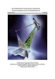
Koch A., Heipke C.: Quality Assessment of Digital Surface Models <strong>der</strong>ived from<br />
the Shuttle Radar Topography Mission (SRTM), IEEE <strong>2001</strong>, International<br />
Geoscience and Remote Sensing Symposium, July 9-13,<br />
University of New South Wales, Sydney, 3 p., CD ROM.<br />
Konecny, G.: Geodata and Information Systems – a German Perspective,<br />
United Nations Economic and Social Council, 7 th UN Regional<br />
Cartographic Conference for the Americas, New York 22.-<br />
26.1.<strong>2001</strong>, E/CONF. 93/Inf.25 (pp. 1-10).<br />
Mapping from Space, in: M.F. Buchroithner (Hrsg.), Remote<br />
Sensing for Environmental Data in Albania: A Strategy for<br />
Integrated Management, Kluwer Academic Publishers, 2000<br />
(Nachtrag).<br />
Lang F.: Component-based building reconstruction by structural multi-image<br />
correspondence analysis, ASPRS Annual Convention, St. Louis,<br />
<strong>2001</strong>, 11 p., CD-ROM.<br />
Pakzad K., Growe S., Heipke C., Liedtke C.-E.: Multitemporale Luftbildinterpretation:<br />
Strategie <strong>und</strong> Anwendung, Künstliche Intelligenz (15) 4, pp.<br />
10-16.<br />
Priemer M., Lohmann P.: Untersuchungen zur Anwendbarkeit <strong>der</strong> linearen<br />
spektralen Entmischung beim Bestandsmonitoring von Waldflächen,<br />
Publikationen <strong>der</strong> Deutschen Gesellschaft für Photogrammetrie <strong>und</strong><br />
Fernerk<strong>und</strong>ung, Band 10, Eckhardt Seyfert (Hrsg.), pp. 441-450,<br />
ISSN 0942-2870.<br />
Rieke-Zapp D., Wegmann H., Nearing M., Santel F.: Digital Photogrammetry<br />
for Measuring Soil Surface Roughness, ASPRS Annual<br />
Convention, St. Louis, <strong>2001</strong>, 8 pages, CD-ROM.<br />
Spreckels V., Musiedlak J., Wegmüller U., Strozzi T., Wichlacz H.-C.: Nutzung<br />
von InSAR-Daten zur großflächigen Erfassung von topographischen<br />
Verän<strong>der</strong>ungen über Abbaubereichen <strong>der</strong> Deutschen Steinkohle<br />
AG (DSK AG), 23 p.<br />
Spreckels V., Musiedlak J., Wegmüller U., Strozzi T., Wichlacz H.-C.: Detection<br />
and Observation of un<strong>der</strong>gro<strong>und</strong> coal mining-induced surface<br />
deformation with differential SAR Interferometry, ISPRS Workshop<br />
“High Resolution Mapping from Space <strong>2001</strong>”, Institut für Photogrammetrie<br />
<strong>und</strong> GeoInformation, Universität Hannover, 8 p, CD-ROM.<br />
Straub B.-M., Heipke C.: Automatic Extraction of Trees for 3D-City Models from<br />
Images and Height Data, Automatic Extraction of Man-Made<br />
Objects from Aerial and Space Images (III), E. Baltsavias, A. Gruen,<br />
L., van Gool (Eds.), A.A. Balkema Publishers, Lisse/Abingdon/Exton<br />
(PA)/ Tokio, pp. 267-277.