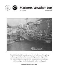
Volume 56, Number 3 December 2012 Photo by Denice Drass
Volume 56, Number 3 December 2012 Photo by Denice Drass
Volume 56, Number 3 December 2012 Photo by Denice Drass

Create successful ePaper yourself
Turn your PDF publications into a flip-book with our unique Google optimized e-Paper software.
North pacific Area<br />
<strong>December</strong> <strong>2012</strong> ~ Mariners Weather Log<br />
40<br />
then south while weakening, and then<br />
dissipated near the Kurile Islands on<br />
the 15 th .<br />
Eastern North Pacific Storm,<br />
January 18: A primary gale force<br />
low well offshore from the U.S. Pacific<br />
Northwest coast of the U.S. spawned a<br />
secondary low on the associated front<br />
approaching the coast on the night of<br />
January 17 th . At 1200 UTC on the 18 th<br />
the secondary low was near 46N 130W<br />
and moving northeast with hurricane<br />
force conditions near the coast to the<br />
east. The low and front moved onshore<br />
later that day and winds diminished.<br />
The Tokyo Express (DGTX) reported<br />
south winds of 45 kts and 10.7 meter<br />
seas (35 feet) near 43N 125W at 1800<br />
UTC on the 18 th . The Cape Arago<br />
C/MAN station (CARO3, 43.3N<br />
124.3W) reported south winds of 45<br />
kts with gusts to 58 kts at 1400 UTC<br />
on the 18 th and a peak gust of 69 kts<br />
at 0000 UTC on the 19 th . Buoy 46050<br />
(44.2N 124.6W) at 1500 UTC on the<br />
18 th reported south winds of 40 kts<br />
with gusts to 51 kts and 8.5 meter seas<br />
(28 feet). Three hours later that buoy<br />
reported 9.0 meter seas (30 feet).<br />
Eastern North Pacific Storm,<br />
January 19-21: A 1000 mb frontal<br />
wave of low pressure formed near 30N<br />
160E early on January 17th and moved<br />
to the central waters on the night of<br />
the 18 th while rapidly developing into<br />
a storm force low near 39N 165W with<br />
a 976 mb central pressure. The system<br />
gradually intensified further over the<br />
next two days while moving into the<br />
Gulf of Alaska and slowing (Figure<br />
9). The cyclone briefly developed<br />
hurricane force winds late on the 20 th<br />
before drifting north and weakening,<br />
and dissipating in the northeast Gulf<br />
of Alaska early on the 22 nd . At 0000<br />
UTC on the 20 th the APL Philippines<br />
(WCX 8884) near 40N 155W reported<br />
southwest winds of 55 kts and 13.4<br />
meter seas (44 feet). At 2000 UTC on<br />
the 20 th the Polar Resolution (WDJK)<br />
encountered east winds of 60 kts and<br />
12.2 meter seas (40 feet). Four hours<br />
later the North Star (KIYI) reported<br />
east winds of 50 kts and 12.0 meter<br />
seas (39 feet). Then the Hanjin<br />
Copenhagen (DHDM) near 54N 143W<br />
at 1800 UTC on the 21 st encountered<br />
northwest winds of 60 kts and 9.0 meter<br />
seas (30 feet).<br />
Eastern North Pacific Storm,<br />
January 21-22: Low pressure formed<br />
near 34N 175E with a 996 mb pressure<br />
early on January 19th and moved to<br />
42N 157W as the 993 mb developing<br />
storm two days later (Figure 9). The<br />
cyclone deepened <strong>by</strong> 24 mb over the<br />
next twenty four hours and briefly<br />
developed hurricane force winds <strong>by</strong><br />
1800 UTC on the 22 nd off Vancouver<br />
Island. Figure 10 shows a compact<br />
system just prior to moving inland<br />
over British Columbia. Figure 11 is<br />
a high resolution ASCAT image with<br />
parts of two passes showing winds to<br />
60 kts south of the center and also in the<br />
southeast flow near Vancouver Island.<br />
The Sea-Land Intrepid (WDB9949)<br />
near 46N 135W reported northwest<br />
winds of 60 kts at 1200 UTC on the<br />
22 nd . The Maui (WSLH) encountered<br />
southeast winds of 50 kts and 8.2 meter<br />
seas (27 feet) near 48N 125W at 1800<br />
UTC on the 22 nd . Buoy 46207 (50.9N<br />
129.9W) reported southeast winds of 43<br />
kts with gusts to <strong>56</strong> kts at 1800 UTC on<br />
the 22 nd and seas as high as 9.5 meters<br />
(31 feet) three hours later. Buoy 46206<br />
(48.8N 126.0W) reported southwest<br />
winds of 43 kts with gusts to 60 kts at<br />
0000 UTC on the 23 rd and seas as high<br />
as 8.5 meters (28 feet).<br />
North Pacific Storms, January<br />
21-25: A gale force low near 29N<br />
161E (Figure 9) move northeast and<br />
intensified into the 968 mb hurricane<br />
force low 39N 173W shown in Figure<br />
10. The central pressure fell 30 mb in<br />
the twenty four hour period ending at<br />
0000 UTC on the 23 rd . At 1200 UTC on<br />
the 23 rd the cyclone developed a lowest<br />
central pressure of 962 mb near 41N<br />
169W. An ASCAT high resolution pass<br />
from 0637 UTC on the 23 rd showed a<br />
partial view of the south side of the<br />
cyclone with southwest winds to 60 kts.<br />
Twenty four hours later, there were two<br />
hurricane force lows with the primary<br />
low 47N 148W with a 966 mb central<br />
pressure and a secondary center to the<br />
northeast near 54N 135W with a 964<br />
mb pressure. Both weakened on the<br />
24 th with the second center becoming<br />
absorbed and the main low moving<br />
inland over Southeast Alaska <strong>by</strong> the<br />
25 th . The Canadian buoy 46185 (52.4N<br />
129.8W) reported southeast winds of 47<br />
kts with gusts to 60 kts at 1000 UTC<br />
on the 24 th and highest seas 10.5 meters<br />
(34 feet) two hours later. Buoy 46004<br />
(50.9N 136.1W) reported west winds 47<br />
kts with gusts to 62 kts at 0200 UTC on<br />
the 25 th and seas reaching 9.0 meters (30<br />
feet) four hours later.<br />
North Pacific Storm, January 26-29:<br />
The next major storm was a developing<br />
cyclone that moved from off Japan on<br />
the 24 th east northeast and developed<br />
hurricane force winds mainly over<br />
the western waters, with the center<br />
developing a lowest central pressure of<br />
952 mb near 44N 165E at 1200 UTC on<br />
the 27 th . The central pressure dropped<br />
35 mb in the twenty four hour period<br />
ending at 0600 UTC on the 27 th . A<br />
WINDSAT image from 1941 UTC on<br />
the 27 th revealed west winds to 60 kts<br />
in a partial coverage of the south side of<br />
the cyclone. See Reference 5 for more<br />
information on WINDSAT and other