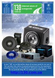
GPS navigator Garmin Nuvi 715 (maps NavLux) with Bluetooth
GPS navigator Garmin Nuvi 715 (maps NavLux) with Bluetooth
GPS navigator Garmin Nuvi 715 (maps NavLux) with Bluetooth

You also want an ePaper? Increase the reach of your titles
YUMPU automatically turns print PDFs into web optimized ePapers that Google loves.
Who Uses <strong>GPS</strong>?<br />
<strong>GPS</strong> technology has many amazing<br />
applications on land, at sea, and in the<br />
air. You might be surprised to learn about<br />
the following examples of how people<br />
or professions are already using <strong>GPS</strong><br />
technology:<br />
Agriculture<br />
In precision farming, <strong>GPS</strong> technology helps<br />
monitor the application of fertilizer and<br />
pesticides. <strong>GPS</strong> technology also provides<br />
location information that helps farmers<br />
plow, harvest, map fields, and mark areas of<br />
disease or weed infestation.<br />
Aviation<br />
Environment<br />
<strong>GPS</strong> technology helps survey disaster areas<br />
and map the movement of environmental<br />
phenomena (such as forest fires, oil spills,<br />
or hurricanes). It is even possible to find<br />
locations that have been submerged or<br />
altered by natural disasters.<br />
Ground Transportation<br />
<strong>GPS</strong> technology helps <strong>with</strong> automatic vehicle<br />
location and in-vehicle navigation systems.<br />
Many navigation systems show the vehicle’s<br />
location on an electronic street map,<br />
allowing drivers to keep track of where they<br />
are and to look up other destinations. Some<br />
systems automatically create a route and give<br />
turn-by-turn directions. <strong>GPS</strong> technology also<br />
helps monitor and plan routes for delivery<br />
130.com.ua<br />
Aircraft pilots use <strong>GPS</strong> technology for en vans and emergency vehicles.<br />
route navigation and airport approaches.<br />
Satellite navigation provides accurate aircraft<br />
Marine<br />
location anywhere on or near the earth.<br />
<strong>GPS</strong> technology helps <strong>with</strong> marine<br />
navigation, traffic routing, underwater<br />
surveying, navigational hazard location, and<br />
mapping. Commercial fishing fleets use it to<br />
navigate to optimum fishing locations and to<br />
track fish migrations.<br />
52 <strong>GPS</strong> Beginner’s Guide<br />
Autogood products internet store http://130.com.ua