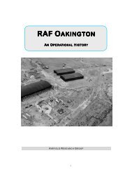
RAF Oakington Volume 2 - The Airfield Research Group
RAF Oakington Volume 2 - The Airfield Research Group
RAF Oakington Volume 2 - The Airfield Research Group

Create successful ePaper yourself
Turn your PDF publications into a flip-book with our unique Google optimized e-Paper software.
1.1 Methodology<br />
1. METHODOLOGY AND SITE OVERVIEW<br />
This gazetteer is a stand-alone document that accompanies the <strong>Oakington</strong> History report. It<br />
covers all extant structures and these have been placed within six chapters, depending on<br />
building type and location.<br />
<strong>The</strong> building descriptions in this report conform to English Heritage’s Level 2 / 3 surveys as<br />
described in Understanding Historic Buildings – A Guide to Good Recording Practice (2006).<br />
<strong>The</strong> gazetteer is based on an earlier one compiled in 2004 but has been enhanced, due to<br />
more information becoming available and as the result of a subsequent series of field work<br />
exercises which were carried out between 21 February and 10 March 2011. It provides a record<br />
of structures at <strong>Oakington</strong> and is not a structural or condition survey. A DVD of images taken<br />
during both surveys and pdf files of building plans is included in support of this report.<br />
All buildings within the 1999 MOD boundary which were covered in the original report are<br />
included here regardless of whether they have been demolished in the intervening period<br />
between 2004 and 2011. This report, like the previous one, does not include the married<br />
quarters; however it does include the WWII domestic site No.3 and the remote sites of the<br />
post-war Illuminated Landing System.<br />
Descriptions are arranged in building numbered order but are also based on type so that similar<br />
structures are grouped together – for example the barrack blocks. Any building numbers<br />
missing in the sequence were demolished before 2004 but an attempt has been made to locate<br />
images of demolished buildings, and these can be found in Appendix 3. Each heading has a<br />
title followed by the Air Ministry drawing number and then a building number in brackets, as<br />
used in the schedule of buildings on record site plans 4542/44 and 6342/54. A ten figure grid<br />
reference (NGR) is included, taken from a set of 1:2500 scale Ordnance Survey maps<br />
(TL 4064-4164, TL 4065-4165, TL 4066-4166). In all cases the reference point is the building’s<br />
centre.<br />
<strong>The</strong> description of each building is based on both the primary source (which in most cases is<br />
the quoted drawing) as well as field work observations. In the text, room dimensions are shown<br />
in imperial units followed by the metric equivalent, displayed as millimetres and shown in<br />
brackets. Wall thickness is also shown in imperial values and in order to cut down on repetition<br />
the following millimetre equivalents apply:<br />
Inches 4.5 6 11 13.5 15 27<br />
Millimetres 114 152 279 343 381 686<br />
After the description there is a footprint dimension shown as a bullet point which is a nominal<br />
figure presented in decimal imperial units (metre equivalents are shown in brackets).<br />
<strong>The</strong> conclusion which accompanied the original report has been omitted as it no longer applies.<br />
• Appendix 1 is a table listing all buildings constructed between 1939 and 1955 and<br />
includes the status of the building in September 2004.<br />
• Appendix 2 is a table containing a room inventory dated 28 February 1941. It is based on<br />
an incomplete set of documents found in building 51.<br />
• Appendix 3 is a small collection of images of buildings demolished before the 2004<br />
survey.<br />
1