Biodiversity Profile of Afghanistan - Disasters and Conflicts - UNEP
Biodiversity Profile of Afghanistan - Disasters and Conflicts - UNEP
Biodiversity Profile of Afghanistan - Disasters and Conflicts - UNEP

You also want an ePaper? Increase the reach of your titles
YUMPU automatically turns print PDFs into web optimized ePapers that Google loves.
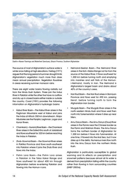
Dasht-e-Nawar Flamingo <strong>and</strong> Waterfowl Sanctuary, Ghazni Province, Southern <strong>Afghanistan</strong><br />
The.source.<strong>of</strong>.most.<strong>of</strong>.<strong>Afghanistan</strong>’s.surface.water.is.<br />
winter.snow.falling.at.high.elevations..Freitag.(1971).<br />
argues.that.the.long.period.<strong>of</strong>.summer.drought.limits.<br />
<strong>Afghanistan</strong>’s. vegetation. much. more. than. does.<br />
mean.annual.precipitation..Vegetation.flourishes.<br />
in.areas.receiving.summer.monsoon.rains.<br />
There.are.eight.water.basins.flowing.radially.out.<br />
from.the.Hindu.Kush.System..Three.join.the.Indus.<br />
River.in.Pakistan.while.the.other.five.have.no.outflow.<br />
<strong>and</strong>.dry.up.in.closed.basins.either.inside.or.outside.<br />
the.country..Coad.(1981).provides.the.following.<br />
information.on.<strong>Afghanistan</strong>’s.hydrologic.basins:<br />
•. Kabul.River.Basin—The.Kabul.River.arises.in.the.<br />
Paghman.Mountains.west.<strong>of</strong>.Kabul.<strong>and</strong>.joins.<br />
the.Indus.at.Attock.350.km.downstream..Major.<br />
tributaries.are.the.Panjshir,.Laghman,.Logar.<strong>and</strong>.<br />
Kunar.Rivers..<br />
•. Chamkani.(=.Kurram).River.Basin—the.Chamkani.<br />
River.arises.in.the.Safed.Kho.south.<strong>of</strong>.Jalalabad.<br />
<strong>and</strong>.flows.southeast.for.320.km.before.reaching.<br />
the.Indus.in.Pakistan.<br />
•. Zhob-Gowmal.Basin—the.Gowmal.River.arises.<br />
in.Paktika.Province.<strong>and</strong>.flows.south-southeast.<br />
into.Pakistan.where.it.joins.the.Zhob.River.<strong>and</strong>.<br />
flows.into.the.Indus..<br />
•. Pishin. Lora. Basin—the. Pishin. Lora. arises.<br />
in. Pakistan. in. the. Toba. Kakar. Range. <strong>and</strong>.<br />
flows. southwest. for. about. 400. km. through.<br />
<strong>Afghanistan</strong>.before.re-entering.Pakistan.<strong>and</strong>.<br />
flowing.into.the.Hamun-i-Lora.<br />
•. Helm<strong>and</strong>-Siestan. Basin—The. Helm<strong>and</strong>. River.<br />
arises.in.the.Koh-i-Baba.Range.not.far.from.the.<br />
source.<strong>of</strong>.the.Kabul.River..It.flows.southwest.for.<br />
1,300.km.before.turning.north.<strong>and</strong>.emptying.<br />
into. marshes. <strong>and</strong>. salt. flats. <strong>of</strong>. the. Hamuni-Helm<strong>and</strong>,.<br />
mostly. in. Iran.. The. Helm<strong>and</strong>. is.<br />
<strong>Afghanistan</strong>’s.largest.basin.<strong>and</strong>.drains.about.<br />
40%.<strong>of</strong>.the.country’s.area..<br />
•. Hari.Rud.Basin—the.Hari.Rud.arises.in.Bamiyan.<br />
Province.<strong>and</strong>.flows.west.for.490.km,.passing.<br />
Herat,. before. turning. north. to. form. the.<br />
<strong>Afghanistan</strong>-Iran.border.<br />
•. Murgab.Basin—The.Murgab.River.arises.in.the.<br />
north-western.Hindu.Kush.<strong>and</strong>.flows.west.then.<br />
north.into.Turkemenistan.where.it.dries.up.near.<br />
Merv..<br />
•. Amu.Darya.Basin—the.Amu.Darya.(Oxus).River.<br />
arises.in.the.Pamirs.near.the.Chinese.border.as.<br />
the.Pamir.<strong>and</strong>.Wakhan.Rivers..The.Amu.Darya.<br />
forms.the.northern.border.<strong>of</strong>.<strong>Afghanistan</strong>.for.<br />
1,300.km.before.it.flows.into.Turkmenistan..At.<br />
one.time,.it.flowed.into.the.Aral.Sea,.but.it.now.<br />
dries.up.in.the.delta..Numerous.rivers.flow.north.<br />
into.the.Amu.Darya.from.the.northern.Hindu.<br />
Kush..<br />
<strong>Afghanistan</strong>. is. particularly. susceptible. to. global.<br />
warming. <strong>and</strong>. its. effects. on. precipitation. <strong>and</strong>.<br />
snowmelt.patterns.because.almost.all.its.water.is.<br />
derived.from.precipitation.falling.within.the.country.<br />
rather.than.flowing.in.from.surrounding.countries.<br />
(<strong>UNEP</strong>.2003a).<br />
14 An Output <strong>of</strong> the National Capacity Needs Self-Assessment