Final EIAR - Aurecon AME Environmental | Environmental Projects
Final EIAR - Aurecon AME Environmental | Environmental Projects
Final EIAR - Aurecon AME Environmental | Environmental Projects

Create successful ePaper yourself
Turn your PDF publications into a flip-book with our unique Google optimized e-Paper software.
PROPOSED WIND AND SOLAR (PHOTOVOLTAIC) ENERGY<br />
FACILITIES NEAR SPRINGBOK, NORTHERN CAPE<br />
WIND: DEA REF. NO.14/12/16/3/3/2/346 / NEAS REF. NO. DEA/EIA/0001222/2012<br />
PV: DEA REF. NO.14/12/16/3/3/2/342 / NEAS REF. NO. DEAT/EIA/0001217/2012<br />
WIND SUBSTATION & GRID CONNECTION: DEA REF. NO.14/12/16/3/3/2/386 / NEAS REF. NO. DEA/EIA/0001344/2012<br />
PV SUBSTATION AND GRIDLINE CONNECTION: (DEA REF. NO: 14/12/16/3/3/2/447; NEA REF NO: DEA/EIA/0001597/2012)<br />
Submitted by:<br />
<strong>Aurecon</strong> South Africa (Pty) Ltd<br />
PO Box 494<br />
Cape Town<br />
8000<br />
Tel: 021 526 9400<br />
Fax: 021 526 9500<br />
E-mail: Louise.corbett@aurecongroup.com<br />
FINAL ENVIRONMENTAL<br />
IMPACT ASSESSMENT<br />
REPORT<br />
Submission date:<br />
February 2013<br />
Report No: 6428a/108495<br />
On behalf of:<br />
South Africa Mainstream Renewable Power<br />
Developments (Pty) Ltd<br />
PO Box 45063<br />
Claremont, Cape Town<br />
7735<br />
Tel: 021 657 4050<br />
Fax: 021 671 5665<br />
E-mail: Hendrik.reyneke@mainstream.com
FEIR + ANNEXURES A, B, C, N, O and Q<br />
(ANNEXURES UPDATED FROM DRAFT TO FINAL)<br />
Annexure A: DEA Acceptance of <strong>Final</strong> Scoping Report<br />
Annexure B: Public Participation Process<br />
Annexure C: Comments and Response Report<br />
Annexure N: Life-cycle EMP<br />
Annexure O: Specific information required by DEA<br />
Annexure Q: Recommended mitigation measures<br />
REFER TO ANNEXURES BELOW IN THE DRAFT EIR<br />
(REMAIN UNCHANGED)<br />
Annexure D: Assessment methodology<br />
Annexure F: Avifaunal study<br />
Annexure G: Bat study<br />
Annexure H: Heritage Impact Assessment<br />
Archaeology Impact Assessment<br />
Palaeontology Impact Assessment<br />
Annexure I: Visual Impact Assessment<br />
Annexure J: Freshwater Impact Assessment<br />
Annexure K: Noise Impact Assessment<br />
Annexure L: Socio – Economic Assessment<br />
Annexure M: Agricultural Impact Assessment<br />
Annexure O: Specific information required by DEA<br />
Annexure P: Compliance with the Equator Principles
OMGEWINGSINVLOEDBEPALING:<br />
BEOOGDE AANLEGTE VIR WIND- EN SONENERGIE<br />
(FOTOVOLTAÏES) NABY SPRINGBOK, NOORD-KAAP<br />
WIND: DOS VERW.NR.14/12/16/3/3/2/346 / NEAS VERW.NR. DEA/EIA/0001222/2012<br />
FV: DOS VERW.NR..14/12/16/3/3/2/342 / NEAS VERW.NR. DEAT/EIA/0001217/2012<br />
WIND-SUBSTASIE & NETWERKLYN: DOS VERW.NR..14/12/16/3/3/2/386 / NEAS VERW.NR.. DEA/EIA/0001344/2012<br />
SON-SUBSTASIE & NETWERKLYN: DOS VERW.NR. 14/12/16/3/3/2/447 / NEAS VERW.NR. DEA/EIA/0001597/2012<br />
FEBRUARIE 2013<br />
OPDATERING VAN KONSEP NA FINALE<br />
OMGEWINGSINVLOEDBEPALINGSVERSLAG<br />
Hierdie opdateringsblad beskryf die proses wat gevolg is sedert die Konsep<br />
Omgewingsinvloedbepalingsverslag (KOIBV) vir ʼn tydperk van 40 dae, vanaf 27 November<br />
2013 tot en met 14 Januarie 2012, vir kommentaarlewering aan Belanghebbende en<br />
Geaffekteerde Partye (B&GPe) beskikbaar gestel is. Dit dui ook die veranderinge aan wat aan<br />
die KOIBV gemaak is as gevolg van die proses van openbare deelname, en gee ʼn kort<br />
uiteensetting van die volgende stappe in die Omgewingsinvloedbepalingsproses (OIB).<br />
Proses van Openbare Deelname sedert die indiening van die Konsep<br />
Omgewingsinvloedbepalingsverslag<br />
Die volgende openbare deelname proses is sedert die indiening van die KOIBV gevolg:<br />
• B&GPe was per pos/ epos op 23 November 2012 in kennis gestel van die<br />
beskikbaarheid van die KOIBV. ʼn Uitvoerende Opsomming van die Konsep OIBV (in<br />
Afrikaans en Engels) is ook by die brief aan B&GPe ingesluit.<br />
• Die Konsep OIBV was beskikbaar gestel by die Springbok en Pofadder Openbare<br />
Biblioteke en op die <strong>Aurecon</strong> webtuiste (www.aurecongroup.com verander “Current<br />
Location” na “South Africa” en volg die “Public Participation”- skakel) vanaf<br />
27 November 2012 tot en met 14 Januarie 2013.<br />
• B&GPe was uitegnooi om die openbare vergadering te Springbok Skousaal by te woon<br />
op 12 Desember 2012 vanaf 11h00- 13h00 waartydens die bevindinge van die Konsep<br />
OIBV voorgedra en bespreek is.<br />
Skriftelike kommentaar ontvang tydens die kommentaartydperk is so opgeteken in<br />
Kommentaar- en Antwoordblad (K&AV3) wat as Bylae C in die <strong>Final</strong>e<br />
Omgewingsinvloedbepalingsverslag (FOIBV) vervat is.<br />
Opdatering van die KOIBV na die FOIBV<br />
ʼn Beperkte aantal veranderinge is aan die KOIBV gemaak. Inligting wat bygevoeg is, is<br />
onderstreep, terwyl inligting wat verwyder/ uitgehaal is, ‘deurstreep’ is. Die vernaamste<br />
veranderinge word gerieflikheidshalwe hieronder uiteengesit.<br />
1
Algemene veranderinge aan die FOIBV:<br />
ʼn Aantal geringe veranderinge is aan die Verslag gemaak wat nie in die teks aangedui is nie, en<br />
dit sluit in die volgende:<br />
• Die KOIBV is opgedateer en staan nou bekend as die “Voorgestelde aanlegte vir Wind- en<br />
Sonenergie (Fotovoltaïese) naby Springbok, Noord-Kaap: <strong>Final</strong>e<br />
Omgewingsinvloedbepalingsverslag”.<br />
• Grammatiese en tipografiese veranderinge.<br />
• Die nommering van tabelle en figure in die FOIBV is opgedateer.<br />
Bylaes is opgedateer en sluit in:<br />
• Kommentaar op die KOIBV is ingesluit in Bylae C.<br />
• Kommentaar op die KOIBV is beantwoord in die Kommentaar- en Antwoordverslag<br />
ingesluit as Bylae C.<br />
• Bylae B1, Bylae N1 en Bylae O is opgedateer tot finale status.<br />
Volgende stappe<br />
Hierdie Opdateringsblad is aan alle geregistreerde B&GPe op die databasis gestuur. Die FOIBV<br />
is vanaf 28 Februarie 2013 aan die publiek beskikbaar gestel by dieselfde plekke as die KOIBV,<br />
sowel as op <strong>Aurecon</strong> se webblad. Die FOIBV is op 28 Februarie 2013 by die bevoegde<br />
owerheid, naamlik die Departement van Omgewingsake (DOS), vir oorweging en besluitneming<br />
ingedien.<br />
Die DOS sal die FOIBV nagaan, en moet binne 60 dae een van die volgende doen:<br />
(i) Die FOIBV aanvaar;<br />
(ii) Die applikant in kennis stel dat die verslag vir deskundige oorsig verwys is;<br />
(iii) Versoek dat wysigings aan die verslag aangebring word; of<br />
(iv) Die verslag verwerp indien dit nie aan die regulasies voldoen nie.<br />
Indien die verslag aanvaar word, moet die DOS binne 45 dae:<br />
a) Magtiging verleen vir die hele of gedeelte van die aktiwiteit; of<br />
b) Magtiging weier vir die hele of gedeelte van die aktiwiteit.<br />
Sodra die DOS sy besluit oor die voorgestelde projek uitgereik het, sal alle B&GPe op die<br />
databasis binne 12 kalenderdae vanaf die datum van die uitreiking van die<br />
Omgewingsmagtiging, dienooreenkomstig in kennis gestel word. Indien enige persoon (lid van<br />
die publiek, geregistreerde B&GP of die applikant) teen die DOS se besluit wil appelleer, moet<br />
die persoon binne 20 kalenderdae nadat die besluit uitgereik is, en in terme van Hoofstuk 7 van<br />
die OIB-regulasies (GK Nr. 543) van die WNOB, ʼn Kennisgewing van Voorneme om te<br />
Appelleer by die Minister van Waterwese en Omgewingsake indien, en moet die volledige Appèl<br />
binne 30 dae van hierdie kennisgewing ingedien word.<br />
<strong>Aurecon</strong> wil graag almal bedank wat tot op datum aan hierdie OIB-proses deelgeneem het.<br />
2
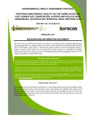
ENVIRONMENTAL IMPACT ASSESSMENT:<br />
PROPOSED WIND AND SOLAR (PHOTOVOLTAIC) ENERGY<br />
FACILITIES NEAR SPRINGBOK, NORTHERN CAPE<br />
WIND: DEA REF. NO.14/12/16/3/3/2/346 / NEAS REF. NO. DEA/EIA/0001222/2012<br />
PV: DEA REF. NO.14/12/16/3/3/2/342 / NEAS REF. NO. DEAT/EIA/0001217/2012<br />
WIND SUBSTATION & GRIDLINE: DEA REF. NO.14/12/16/3/3/2/386 / NEAS REF. NO. DEA/EIA/0001344/2012<br />
SOLAR SUBSTATION & GRIDLINE: DEA REF. NO. 14/12/16/3/3/2/447 / NEAS REF. NO. DEA/EIA/0001597/2012<br />
FEBRUARY 2013<br />
UPDATE OF DRAFT TO FINAL<br />
ENVIRONMENTAL IMPACT ASSESSMENT REPORT<br />
This Update Page describes the process followed since the Draft <strong>Environmental</strong> Impact<br />
Assessment Report (EIR) was made available to Interested and Affected Parties (I&APs) for a<br />
40-day comment period from 27 November 2012 until 14 January 2013. It also highlights the<br />
changes that have been made to the Draft EIR in response to the public participation process,<br />
and briefly reiterates the next steps in the <strong>Environmental</strong> Impact Assessment (EIA) process.<br />
Public Participation Process regarding the lodging of the Draft EIR<br />
The public participation process undertaken during the lodging of the Draft EIR entailed the<br />
following:<br />
• I&APs were informed of the lodging of the Draft EIR and associated 40-day public<br />
comment period by means of letter posted and/or emailed on 23 November 2012. The<br />
letters were accompanied by an Executive Summary of the Draft EIR in English and/or<br />
Afrikaans to registered I&APs.<br />
• The Draft EIR has been lodged at the Springbok and Pofadder Public Libraries and on<br />
<strong>Aurecon</strong>’s website (www.aurecongroup.com change “Current Location” to “South<br />
Africa” and follow the “Public Participation” link) from 27 November 2012 until<br />
14 January 2013.<br />
• I&APs were invited to a public meeting on 12 December 2012 to present and discuss<br />
the findings of the Draft EIR at Springbok Exhibition Hall (Skousaal) at 17h00-19h00.<br />
Written comments received during the comment period have been noted in the Comments and<br />
Response Report (CRR4), included in Annexure C of the <strong>Final</strong> EIR.<br />
Updating of the Draft EIR to the <strong>Final</strong> EIR<br />
A limited number of changes were made to the Draft EIR. Information that has been added has<br />
been underlined, while removed/ deleted information is indicated by a ‘strikethrough’. To assist<br />
readers, the most significant changes are outlined below.<br />
1
General changes to the <strong>Final</strong> EIR:<br />
A number of minor changes were made to the Report that have not been highlighted in the text<br />
and include:<br />
• The Draft EIR has been updated and is now called: “Proposed Wind and solar<br />
(photovoltaic) Energy Facilities near Springbok, Northern Cape: <strong>Final</strong> <strong>Environmental</strong> Impact<br />
Assessment Report”.<br />
• Grammatical and typographic changes.<br />
• Numbering for tables and figures included in the <strong>Final</strong> EIR have been updated.<br />
Annexures have been updated and include:<br />
• Comments on the Draft EIR have been included in Annexure C.<br />
• Comments on the Draft EIR have been responded to in the Comments and Response<br />
Report 4 in Annexure C.<br />
• Annexure B1, Annexure N1 and Annexure O were updated.<br />
Way forward<br />
This Update Page has been sent to all registered I&APs on the database. The <strong>Final</strong> EIR has<br />
been made available to the public at the same venues as the Draft EIR, as well as on <strong>Aurecon</strong>’s<br />
website from 19 February 2013. The <strong>Final</strong> EIR was also submitted to the competent authority,<br />
namely the Department of <strong>Environmental</strong> Affairs (DEA) for their consideration and review on 19<br />
February 2013.<br />
DEA will review the <strong>Final</strong> EIR, who must, within 60 days, do one of the following:<br />
(i) Accepting the <strong>Final</strong> EIR;<br />
(ii) Notify the applicant that the report has been referred for specialist review;<br />
(iii) Request amendments to the report; or<br />
(iv) Reject the report if it does not materially comply with regulations.<br />
If the report is accepted, DEA must within 45 days:<br />
(a) Grant authorisation in respect of all or part of the activity applied for; or<br />
(b) Refuse authorisation in respect of all or part of the activity.<br />
Once DEA issues their decision on the proposed project, all registered I&APs on the project<br />
database will be notified of the outcome of the decision within 12 calendar days of the date of<br />
the decision should an <strong>Environmental</strong> Authorisation (EA) be issued. Should anyone (a member<br />
of public, registered I&AP or the Applicant) wish to appeal DEA’s decision, a Notice of Intention<br />
to Appeal in terms of Chapter 7 of the EIA Regulations (GN No. 543) in terms of NEMA must be<br />
lodged with the Minister of Water and <strong>Environmental</strong> Affairs within 20 calendar days of the<br />
decision being issued and the substantive Appeal must be lodged within 30 days of the Notice.<br />
<strong>Aurecon</strong> would like to thank all those who have participated in this EIA process thus far.<br />
2
OMGEWINGSINVLOEDBEPALING:<br />
BEOOGDE AANLEGTE VIR WIND- EN SONENERGIE<br />
(FOTOVOLTAÏES) NABY SPRINGBOK, NOORD-KAAP<br />
WIND: DOS VERW.NR.14/12/16/3/3/2/346 / NEAS VERW.NR. DEA/EIA/0001222/2012<br />
FV: DOS VERW.NR..14/12/16/3/3/2/342 / NEAS VERW.NR. DEAT/EIA/0001217/2012<br />
WIND-SUBSTASIE & NETWERKLYN: DOS VERW.NR..14/12/16/3/3/2/386 / NEAS VERW.NR.. DEA/EIA/0001344/2012<br />
SON-SUBSTASIE & NETWERKLYN: DOS VERW.NR.TBC / NEAS VERW.NR. TBC<br />
FEBRUARIE 2013<br />
OPSOMMENDE DOKUMENT:<br />
FINALE OMGEWINGSINVLOEDBEPALINGSVERSLAG<br />
Agtergrond<br />
South Africa Mainstream Renewable Power Developments (Edms) Bpk (Mainstream) beoog om ʼn 560<br />
MW (vier fases van 140 MW) windenergie- en ʼn 225 MW (drie fases van 75 MW) fotovoltaïese<br />
sonenergie-aanleg, elkeen met ʼn gepaardgaande substasie, op ʼn aantal plase naby Springbok in die<br />
Noord-Kaap op te rig. Aanvanklik is beoog om onderskeidelik ʼn 750 MW en 250 MW wind- en<br />
sonenergie-aanleg op te rig, maar hierdie is op aanbeveling van die deskundiges afgeskaal om buffers<br />
rondom omgewingsensitiewe eienskappe te bewerkstellig. <strong>Aurecon</strong> Suid-Afrika (Edms) Bpk (<strong>Aurecon</strong>) is<br />
aangestel om die voorgeskrewe omgewingsproses kragtens die Wet op Nasionale Omgewingsbestuur<br />
(Wet Nr. 107 van 1998), soos gewysig, namens Mainstream uit te voer.<br />
Die beoogde projek sal plaasvind op die Plase Kangnas (Plaas Nr. 77 Gedeelte 3 en die Restant), Koeris<br />
(Plaas Nr. 78 Gedeelte 1), Areb (Plaas Nr. 75 Gedeelte 0) en Smorgenschaduwe (Plaas Nr. 127<br />
Gedeelte 0) in die Noord-Kaap (verwys na Figuur 1). Die voorgestelde plase is ongeveer 48km oos van<br />
Springbok geleë en kan deur middel van die N14 bereik word. Die vyf plase beslaan ʼn gebied van<br />
ongeveer 46 535 ha.<br />
Beoogde Projekte<br />
Die beoogde projekte behels die opwekking van energie deur middel van wind en son. Die<br />
konstruksietydperk is ongeveer 12 - 18 maande vir die voorgenome windenergie aanleg per fase en 12 –<br />
18 24 maande vir die voorgenome fotovoltaïese (FV) sonenergie-aanleg, per 75 MW fase. Die beoogde<br />
windenergie-aanleg sal bestaan uit vier fases van 140 MW met ‘n gradering van tussen 1.5 en 4 MW, dus<br />
sal die werklike hoeveelheid turbines per 140 MW fase wissel tussen 94 (1.5 MW) tot 35 (4 MW). Die<br />
grootte van die turbines sal geselekteer word gedurende die tender proses van die Departement van<br />
Energie (DvE) se verkrygingsbeleid. Die finale turbine seleksie sal onderhewig wees aan die verskillende<br />
oorwegings wat ligging, kostes, tegnologie en beskikbaarheid insluit en sal voldoen aan die dimensies en<br />
getal turbines wat goedgekeur word. Die voorgenome sonenergie-aanleg (225 MW fotovoltaïese (FV)<br />
energie en/of gekonsentreerde fotovoltaïese energie(KFV)) mag volgtoestelle insluit en sal ʼn maksimum<br />
voetspoor van ongeveer 800 hektaar (ha) beslaan. Daar word beoog om dit op terrein met die bestaande<br />
220 kilovolt (kV) Eskomlyn te verbind. Die bestaande Eskom lyn mag moontlik in die toekoms opgradeer<br />
word na 400 kV, dus sal die wind- en sonkrag aanlegte met die 400kV lyn kan verbind. Daar word ook<br />
beoog om twee hoof-substasies te bou wat elk van die voorgestelde energie-aanlegte met die Eskomlyn<br />
sal verbind.<br />
Wind komponent<br />
Windturbines kan op ʼn horisontale of vertikale as roteer. Die turbines wat vir windplase of die<br />
kommersiële opwekking van elektrisiteit gebruik word, roteer gewoonlik op ’n horisontale as, het drie<br />
blaaie (lemme) en word deur rekenaar-beheerde motors in dieselfde rigting as die wind gedraai.<br />
Masjiene met ʼn horisontale as het ʼn hoë doeltreffendheid en lae wringkrag en dra by tot die<br />
1
etroubaarheid van hierdie energiebron. Die blaaie is gewoonlik liggrys en kan 20 – 60 m lank wees. Die<br />
buisvormige staaltorings is 60 – 120 m hoog. Die blaaie roteer teen 10 – 22 6 – 15 omwentelings per<br />
minuut. Die ratkas word gewoonlik gebruik om die spoed van die kragopwekker te verhoog. Sommige<br />
modelle werk teen ʼn konstante spoed, maar meer krag kan opgewek word deur turbines met ʼn<br />
veranderlike spoed. Alle turbines word toegerus met beskermende eienskappe om skade tydens hoë<br />
windspoedtoestande te voorkom – dit beskik naamlik oor die vermoë om die blaaie na die wind toe te<br />
draai en dus die rotasie daarvan te staak, en ʼn gepaardgaande remstelsel.<br />
Windturbines met horisontale asse se hoof-rotoras en kragopwekker is in ʼn gondel aan die bokant van<br />
die toring geleë. Konvensionele windturbines met horisontale asse kan in die volgende drie komponente<br />
verdeel word.<br />
• Die rotor-komponent, wat die blaaie insluit wat windenergie na lae-spoed roterende energie<br />
omskakel.<br />
• Die opwekkingskomponent, wat die kragopwekker en beheer-elektronika insluit, en waarskynlik<br />
ook ʼn ratkaskomponent vir die omskakeling van lae-spoed inkomende rotasie na ʼn hoëspoed<br />
rotasie wat geskik is vir die opwekking van elektrisiteit.<br />
• Die strukturele ondersteuningskomponent, wat die toring en die rotor-slingermeganisme (wat die<br />
rotor in dieselfde rigting as die wind draai) insluit.<br />
Die finale ontwerp vir die fondasie van die turbines hang af van verdere geotegniese ondersoek, maar die<br />
fondasies vir hierdie beoogde projek sal waarskynlik uit bewapende beton bestaan. Die fondasie sal<br />
ongeveer 20 m x 20 m, en gemiddeld 3 m diep wees. Die fondasie sal in situ gegooi word en opgevul<br />
word met bogrond sodat die plantegroei rondom die staaltoring (ongeveer 6 m in omtrek) weer kan<br />
teruggroei. ʼn Waterdigte oppervlakte (20 m x 40 m) vir ʼn hyskraan sal rondom elke turbine gebou word.<br />
Grond toegangspaaie van 6 – 10 m sal ook benodig word tussen turbines.<br />
Rooster konneksie infrastruktuur (Wind):<br />
Die beoogde windprojek kan by wyse van die twee satelliet-substasies (elk 100 x 100 m in grootte) met<br />
die elektrisiteitsnetwerk verbind word. Die satelliet-substasies sal seksies van die aanlegte met die<br />
beoogde hoof-substasie by die Kangnas windenergie-aanleg verbind, wat op sy beurt weer aansluit by<br />
die dubbelbaan oorhoofse kraglyn. Die satelliet-substasies sal beskik oor ʼn medium (22 – 66 kV) tot hoë<br />
(132 – 400 kV) transformasievermoë, met die gepaardgaande infrastruktuur soos Eskom-verlangde<br />
skakeltuie, telekommunikasie, stoorplek, kontrolekamer, toegangspad, geleistamme, oorhoofse<br />
kraanstellasies, omheining en ander generiese infrastruktuur. ʼn Enkelspoor-grondpad sal dien as<br />
toegangspad vir onderhoudswerk aan die substasie. Die twee satelliet-substasies kan energie voorsien<br />
aan die hoof-substasie via oorhoofse kraglyne.<br />
Die stroomspanning by die beoogde hoof Kangnas substasie sal verhoog word en by wyse van die<br />
bestaande 220 kV Eskom (of toekomstige 132 – 400 kV) kraglyn wat oor die noordelike deel van die<br />
terrein loop, weggevoer word. ‘n Nuwe dubbelstroom 132 – 400 kV kraglyn van ongeveer 18 km lank sal<br />
opgerig word om die hoof substasie te konnekteer aan die bestaande Eskom rooster wat die eiendom<br />
kruis. Daar word verwag dat die nuwe oorhoofse kraglyn sal verbind d.m.v. ‘n lus aan die Eskom rooster<br />
wat sal vereis dat die bestaande kraglyn twee afsonderlike draaie maak in die nuwe dubbelstroom<br />
kraglynne. Alternatiewelik kan Eskom verkies dat ‘n verbindingstasie opgerig word naby die bestaande<br />
Eskom kraglyn. Die hoof-substasie sal beskik oor ʼn medium (22 – 66 kV) tot hoë (132 – 400 kV)<br />
transformasievermoë, met die gepaardgaande infrastruktuur soos Eskom-verlangde skakeltuie,<br />
telekommunikasie, stoorplek, kontrolekamer, toegangspad, geleistamme, oorhoofse kraanstellasies,<br />
omheining en ander generiese infrastruktuur. ʼn Enkelspoor-grondpad sal dien as toegangspad vir<br />
onderhoudswerk aan die substasie. Die totale oppervlakte van die hoof-substasie sal na verwagting nie<br />
groter as 200 x 200 m, oftewel 4 ha, wees nie.<br />
FV Component<br />
FV-stelsels skakel sonlig om na energie. Die kleinste eenheid van ʼn FV-aanleg word ʼn sonkrag-sel<br />
genoem. ʼn Aantal sonkrag-selle wat elektronies met mekaar verbind en op ʼn ondersteunende struktuur<br />
of raam gemonteer is, word ʼn FV-eenheid (module) genoem. ʼn Aantal selle vorm ʼn eenheid en ʼn aantal<br />
eenhede vorm ʼn reeks (wat in Engels as ʼn “array” bekend staan). Eenhede word in afdelings gerangskik<br />
2
wat elk ongeveer 40 x 5 m groot is. Dit staan as tafels bekend, en word op staal- of aluminiumrakke<br />
gemonteer. Eenhede word ontwerp om elektrisiteit teen ʼn sekere stroomspanning te verskaf. Die<br />
hoeveelheid krag wat opgewek word hou direk verband met die hoeveelheid lig wat die eenheid bereik.<br />
Die reeks (“array”) word in rye gerangskik om ʼn sonkragveld te vorm. Die reekse en die rakke word by<br />
wyse van beton-, skroef- of stapelfondasies in die grond geanker. Die reekse word met omkeerders<br />
verbind wat die direkte stroom (DS) na ʼn alternatiewe stroom (AS) omskakel sodat dit in die nasionale<br />
netwerk ingevoer kan word.<br />
Die fundamentele verskil tussen FV- en KFV-tegnologie is dat KFV-tegnologie elektrisiteit opwek deur<br />
optika (soos lense) te gebruik om ʼn groot hoeveelheid sonlig op ʼn klein deel van die FV-materiaal te<br />
konsentreer. Die basiese komponente is egter dieselfde as wat hierbo vir FV beskryf is alhoewel KFV<br />
tegnologie opsporing stelsels om die optiese lense direk op die selle te fokus.<br />
Panele word gemonteer met volgtoestelle wat die son navolg om sodoende die grootste voordeel uit<br />
sonlig te trek, wat beteken dat die grond onder die panele benut kan word.<br />
Rooster konneksie infrastruktuur (Sonkrag):<br />
Die infrastruktuur vir die verspreiding van elektrisiteit sal bestaan uit een transmissielyn (132, 220 of 400<br />
kV) wat oor die terrein loop. Die beoogde sonkragprojek sal via ʼn substasie op terrein by die netwerk<br />
aansluit. Die voorgestelde roete na die substasie is ongeveer 1 km lank. Die stroomspanning sal by die<br />
substasie verhoog word en dan by wyse van die bestaande 220 kV Eskom (of toekomstige 132 – 400 kV)<br />
kraglyn wat oor die noordelike deel van die terrein loop, weggevoer word. Die Nama Aggeneys 220 kV<br />
kragdraad op terrein sal na die hoof-sonkragsubstasie oorgedra word. Die substasie sal beskik oor ʼn<br />
medium (22 – 66 kV) tot hoë (220 – 400 kV) transformasievermoë, met die gepaardgaande infrastruktuur<br />
soos Eskom-verlangde skakeltuie, telekommunikasie, stoorplek, kontrolekamer, toegangspad,<br />
geleistamme, oorhoofse kraanstellasies, omheining en ander generiese infrastruktuur. ʼn Enkelspoorgrondpad<br />
sal dien as toegangspad vir onderhoudswerk aan die substasie. Die totale oppervlakte van die<br />
hoof-substasie sal na verwagting nie groter as 200 x 200 m, oftewel 4 ha, wees nie.<br />
Die twee voorgestelde aanlegte word as volg opgesom:<br />
Voorgestelde windenergie-aanleg:<br />
• Vier fases van 140 MW of 560 MW in totaal.<br />
• Die oprigting van tussen 35 tot 94 windturbines van 1.5 en 4MW kapasiteit vir elk van die vier<br />
fases van 140 MW.<br />
• Gepaardgaande infrastruktuur, wat insluit:<br />
o Harde oppervlaktes, 20 m x 40 m, rondom die turbines;<br />
o Toegangspaaie, 4 – 10 m wyd, tussen turbines;<br />
o Oorhoofse of ondergrondse transmissielyne wat die turbines met mekaar verbind;<br />
o Een hoof-substasie wat die voorgestelde energie-aanleg met die Eskomlyn verbind; en<br />
o Twee satelliet-substasies wat seksies van die aanleg met die oorhoofse kragdrade<br />
verbind.<br />
Voorgestelde sonenergie-aanleg:<br />
• Oprigting van ʼn 225 MW (drie fases van 75 MW) of FV (opsporing of gevestigde) en/of KFV<br />
(opsporing) aanleg;<br />
• Verwante infrastruktuur wat insluit:<br />
o Toegangspaaie, 4 – 10 m wyd, na die FV-aanleg; en<br />
o Een hoof-substasie wat die aanleg met die oorhoofse kragdrade van Eskom verbind.<br />
DvE se huidige hernubare energie verkrygingsbeleid het die maksimum grootte van wind- en sonkrag<br />
energie projekte beperk tot 140 MW en 75 MW onderskeidelik. Hoewel daar geen formele informasie<br />
beskikbaar is dat die limiet op projek groottes gelig gaan word nie, is daar verskeie besprekings in die<br />
industrie om die limiet te verhoog of te lig.<br />
3
• Figuur 1: Ligging van die beoogde wind- en sonenergie-aanlegte (FV) naby Springbok in die Noord-Kaap<br />
4
Die Kangas wind- en sonenergie projekte is ontwikkel op ‘n groot skaal met ‘n langtermyn visie dat die<br />
limiet op energie projekte gelig gaan word. Die wind- en sonenergie projekte is ontwikkel om voorsiening<br />
te maak vir fases van 75 MW (sonkrag) en 140 MW (wind) om die ontwikkelaar in staat te stel om meer<br />
buigsaam te wees in die toekoms om aan toekomstige verkrygingsbeleid behoeftes te voldoen in terme<br />
van grootte.<br />
OIB-proses<br />
Die Regulasies vir ʼn Omgewingsinvloedbepaling (OIB) (Regulasies 544, 545 en 546) wat afgekondig is<br />
kragtens die WNOB, identifiseer sekere bedrywighede wat ʼn “betekenisvolle nadelige invloed op die<br />
omgewing mag hê”. Hierdie gelyste bedrywighede vereis ʼn omgewingsmagtiging van die bevoegde<br />
omgewingsowerheid, naamlik die Departement van Omgewingsake (DOS) voordat daar met die projek<br />
begin mag word.<br />
Die beoogde projekte het ʼn aantal gelyste bedrywighede in terme van die WNOB tot gevolg, en vereis<br />
gevolglik omgewingsmagtigings deur die DOS by wyse van die OIB-proses soos uiteengesit in Regulasie<br />
543 van die WNOB.<br />
<strong>Aurecon</strong> is aangestel om die verlangende omgewingsmagtiging- en lisensiëringsproses namens<br />
Mainstream uit te voer.<br />
Die OIB-proses bestaan uit ʼn Aanvanklike Aansoekfase, ʼn Omvangbepalingsfase en ʼn OIB-fase. Die<br />
doel van die Aanvanklike Aansoekfase is om die projek bekend te stel. Die doel van die<br />
Omvangbepalingsfase is om moontlike positiewe en negatiewe impakte (beide maatskaplik en biofisies)<br />
wat die beoogde projek tot gevolg mag hê, te identifiseer en te beskryf, en om te bepaal watter<br />
lewensvatbare alternatiewe meer omvattend in die OIB-fase ondersoek sal word.<br />
Die doel van die OIB-fase, die huidige fase, is om daardie alternatiewe en impakte wat tydens die<br />
Omvangsbepaling geïdentifiseer is, in meer detail te ondersoek en te beoordeel, en dan<br />
mitigasiemaatreëls aan te beveel wat die negatiewe impakte sal verminder.<br />
Hoe jy betrokke kan raak<br />
Openbare deelname is ʼn sleutelkomponent van hierdie OIB-proses en sal op verskeie stadiums van die<br />
projek plaasvind. Die volgende aspekte was tot op datum deel van hierdie proses:<br />
• Verspreiding van die Agtergrond-inligtingsdokument op 24 Mei 2012 om Belanghebbende en<br />
Geaffekteerde Partye (B&GPe) oor die projek in te lig en B&GPe uit te nooi om op die databasis<br />
te registreer;<br />
• Advertensies in ʼn plaaslike koerant, die Plattelander, waarin die breër publiek in kennis gestel is<br />
van die aanvang met die OIB en hulle uitgenooi is om vanaf 25 Mei 2012 tot 15 Junie 2012 as<br />
B&GPe te registreer;<br />
• ʼn Terrein-kennisgewing is op 28 Mei 2012 opgesit by die ingange na die Plase<br />
Smorgenschaduwe en Kangna, asook by die Biblioteek in Springbok;<br />
• B&GPe is uitgenooi na ʼn openbare vergadering op 3 Julie 2012 en versoek om te RSVP. Geen<br />
persone het laat weet dat hulle kom nie, en die vergadering is gevolglik gekanselleer;<br />
• ʼn Fokusgroepvergadering is op 3 Julie 2012 in die Skousaal in Springbok gehou om die<br />
bevindinge van die KOBV te bespreek. 15 persone het die vergadering bygewoon, wat insluit die<br />
betrokke owerhede (Namakwa Distriksmunisipaliteit, Namakhoi Munisipaliteit en die Departement<br />
van Omgewing- en Natuurbewaring), grondeienaars en bure aangrensend tot die terrein;<br />
• B&GPe het 40 dae tyd gehad, tot 19 Junie 2012, om hulle skriftelike kommentaar op die KOBV in<br />
te dien. Alle kommentaar is in ag geneem by die samestelling van die finale verslag, en die<br />
kommentaar, tesame met die projekspan en proponent se antwoorde daarop, is by die finale<br />
verslag ingesluit;<br />
• Die <strong>Final</strong>e Omvangbepalingsverslag (FOBV) was tot 24 Augustus 2012 op dieselfde plekke as<br />
die KOBV vir openbare oorsig en kommentaar beskikbaar. Alle geregistreerde B&GPe is op 30<br />
Julie 2012 per brief in kennis gestel van die beskikbaarheid van die FOBV. Die FOBV gee ʼn<br />
oorsig van die volledige reeks moontlike omgewingsimpakte en haalbare projek-alternatiewe,<br />
asook hoe dit bepaal is. Ook ingesluit was ʼn Studieplan vir die OIB, waarin die beoogde<br />
5
• benadering tot die huidige OIB-fase, asook die nodige deskundige ondersoeke wat gedoen moet<br />
word, uiteengesit is;<br />
• Die FOBV en gepaardgaande Studieplan vir die OIB is op 1 Augustus 2012 by die DOS ingedien<br />
en op 8 Oktober 2012 aanvaar.<br />
• Die Konsep OIBV is ingedien by die DOS op 27 November 2012.<br />
Alle skriftelike kommentaar op die Konsep OIBVFOBV is ingesluit as ʼn bylae tot die <strong>Final</strong>e OIBV. Alle<br />
kwessies wat op hierdie manier geïdentifiseer is, is tesame met die projekspan se antwoorde daarop in ʼn<br />
Kommentaar- en Antwoordblad (K&AB4) opgeneem, en is ʼn bylae Bylae C tot die Konsep OIBV.<br />
Die doel van die huidige OIB-fase is om geregistreerde B&GPe van die Konsep OIBV in kennis te stel.<br />
Hierdie fase sluit in:<br />
• Beskikbaarstelling van die <strong>Final</strong>e OIBV by die Openbare Biblioteke in Springbok<br />
(Namakwastraat) en Pofadder (Hoofstraat) en op <strong>Aurecon</strong> se webblad<br />
(www.aurecongroup.com – verander “Current Location” na “South Africa” en volg die “Public<br />
Participation”-skakel) vanaf 28 Februarie 2013 tot 19 Maart 2013. Let asb daarop dat<br />
kommentaar nie beantwoord sal word nie, maar dat dit direk aan die DOS aangestuur sal word<br />
vir hulle besluitneming;<br />
• <strong>Final</strong>isering van die OIBV deur alle openbare kommentaar in ʼn Kommentaar- en Antwoordverslag<br />
te vervat en die verslag, waar toepaslik, te verander; en<br />
• Die <strong>Final</strong>e OIBV aan die DOS vir besluitneming in te dien.<br />
Sodra die Omgewingsmagtigings uitgereik word, sal alle geregistreerde B&GPe per brief van die DOS se<br />
besluit in kennis gestel word, en sal die appèlproses begin. Gedurende hierdie tydperk het enige<br />
betrokke party die geleentheid om, in terme van die WNOB, by die Minister van Omgewingsake appèl<br />
aan te teken.<br />
Projek Alternatiewe<br />
Die volgende haalbare alternatiewe is geïdentifiseer vir verdere oorweging in die Omgewingsinvloedbepalingsverslag<br />
(OIBV):<br />
Voorgestelde windenergie-aanleg:<br />
• Alternatiewe liggings:<br />
o Een ligging beboude area vir die voorgestelde windenergie-aanleg.<br />
• Alternatiewe aktiwiteite:<br />
o Die opwekking van windenergie by wyse van windturbines; en<br />
o “No-go” alternatief vir die vervaardiging van windenergie (Geen-ontwikkeling).<br />
• Alternatiewe terrein-uitlegte:<br />
o Een alternatiewe uitleg per terrein (560 MW met 180 turbines vier fases van 35 tot 93<br />
turbines per 140 MW fase);<br />
o Een hoof-substasie met twee satelliet-substasies.<br />
• Alternatiewe tegnologieë:<br />
o ʼn Minimum en maksimum toppunt-hoogte van 100 – 180 m ‘n Reeks van turbine<br />
hoogtes.<br />
Voorgestelde sonenergie-aanleg:<br />
• Alternatiewe liggings:<br />
o Een ligging vir die voorgestelde FV/ KFV-aanleg.<br />
• Alternatiewe aktiwiteite:<br />
o Die opwekking van sonenergie by wyse van ʼn FV/ KFV-aanleg; en<br />
o “No-go” alternatief vir die vervaardiging van sonkrag (Geen-ontwikkeling).<br />
Alternatiewe terrein-uitlegte:<br />
o Een alternatiewe uitleg (225 MW met ʼn maksimum voetspoor van 800793 ha).<br />
Alternatiewe tegnologieë:<br />
6
o Twee alternatiewe tegnologieë vir die tipe sonpanele (FV vs. KFV);<br />
o Monteringstelsel: son-navolgingstelsel vs. vaste montering.<br />
Neem kennis dat die twee beoogde hoof-substasies en netwerkaansluitings (die onderwerp van die derde<br />
en vierde OIB-aansoeke binne hierdie OIB-proses) deel van onderskeidelik die wind- en sonenergieaanlegte<br />
is. Geen alternatiewe is vir die substasies geïdentifiseer nie, aangesien dit deel vorm van die<br />
twee groter projekte. Die aparte aansoek word slegs deur Eskom vereis sodat hulle self die strukture kan<br />
oprig, indien nodig.<br />
Geïdentifiseerde impakte<br />
Die OIBV is ʼn omvattende beoordeling van die moontlike omgewingsimpakte vir die beoogde wind- en<br />
sonenergie-aanlegte, soos geïdentifiseer deur die OIB-span en B&GPe.<br />
Die volgende spesialisstudies is deur onderstaande deskundiges uitgevoer word om meer omvattende<br />
inligting te bekom oor daardie omgewingsimpakte wat as van belang geïdentifiseer is, en/of waar daar nie<br />
genoeg inligting beskikbaar was nie, naamlik:<br />
• Botaniese beoordeling: Dr Dave MacDonald, Bergwind Botanical Tours and Surveys;<br />
• Bepaling van avifauna: Mnr Doug Harebottle, Private Konsultant;<br />
• Opname van vlermuise: Mnr Werner Marais van Animalia Zoological and Ecological Consultation;<br />
• Bepaling van impak op Erfenishulpbronne: Mnr Jayson Orton, ACO Associates (argeologiese<br />
komponent) en dr. John Almond van Natura Viva cc (paleontologiese komponent);<br />
• Beoordeling van visuele impak: Mnr Stephen Stead, Visual Resource Management Africa;<br />
• Sosio-ekonomiese<br />
Economists;<br />
Invloedbepaling: Me Alex Kempthorne, Urban-Econ Development<br />
• Bepaling van geraas-impak: Mnr Morne de Jager, M2 Omgewingal Consulting;<br />
• Bepaling van Landboukundige Potensiaal: Mnr Kurt Barichievy, SiVEST;<br />
• Bepaling van die impak op Akwatiese Ekologie: Me Antony Belcher, Private Konsultant; en<br />
• Meteorologiese Invloedbepaling: Dr Chris Harris, Universiteit van Kaapstad.<br />
Die betekenisvolheid van die moontlike omgewingsimpakte (biofisies en sosio-ekonomies) wat met die<br />
beoogde projek verband hou, word in Tabel 1 opgesom.<br />
Impakte tydens die Bedryfsfase<br />
Beoogde windenergie-aanleg<br />
Volgens Tabel 1 is die mees betekenisvolle (medium-hoog (-)) impakte van die bedryfsfase op die<br />
biofisiese en sosio-ekonomiese omgewing, sonder mitigasie, die moontlike impakte van die beoogde<br />
windenergie-aanleg op avifauna en die visuele estetika. Die betekenisvolheid van die impak op avifauna<br />
sal met die toepassing van mitigasie-maatreëls na medium (-) afneem; en die impak op die visuele<br />
estetika na laag (-). Daar moet kennis geneem word daar drie moontlike positiewe impakte is, naamlik<br />
kragopwekking, die plaaslike ekonomie (werkskepping) en maatskaplike toestande, en<br />
klimaatsverandering. Hierdie impakte is laag-medium (+) betekenisvol; met en sonder<br />
mitigasiemaatreëls.<br />
Daar was geen verskil in die betekenisvolheid van die impakte van die haalbare alternatiewe nie,<br />
alternatiewe turbines ingesluit. Mainstream het egter die voorkeuropsie verkies – soos per die gewysigde<br />
uitleg en met inagneming van die sensitiewe buffers wat deur die deskundiges aanbeveel is, en finansiële<br />
oorwegings. Die moontlike impakte van die hoof-substasie vir die beoogde windenergie-aanleg is as deel<br />
van die impakte van die beoogde windenergie-aanleg beoordeel, en as aanvaarbaar beskou.<br />
Beoogde sonenergie-aanleg<br />
Volgens Tabel 1 is die mees betekenisvolle (medium (-)) impakte van die bedryfsfase op die biofisiese en<br />
sosio-ekonomiese omgewing, sonder mitigasie, en die moontlike impakte van die beoogde windenergie-<br />
7
aanleg op die visuele estetika. Die betekenisvolheid van die impak op die visuele estetika sal met die<br />
toepassing van mitigasie-maatreëls medium (-) bly. Daar moet kennis geneem word daar drie moontlike<br />
positiewe impakte is, naamlik kragopwekking, die plaaslike ekonomie (werkskepping) en maatskaplike<br />
toestande, en klimaatsverandering. Hierdie impakte is laag betekenisvol – met en sonder<br />
mitigasiemaatreëls.<br />
Daar was geen verskil in die betekenisvolheid van die impakte van die haalbare alternatiewe nie,<br />
insluitende die hoogte van die panele, en die KFV- vs. FV-alternatief asook gevestigde vs opsporing<br />
alternatiewe. Mainstream het egter die voorkeuropsie verkies – soos per die gewysigde uitleg en met<br />
inagneming van die sensitiewe buffers wat deur die deskundiges aanbeveel is, en finansiële oorwegings.<br />
Die moontlike impakte van die hoof-substasie vir die beoogde FV-aanleg is as deel van die impakte van<br />
die beoogde sonenergie-aanleg beoordeel, en as aanvaarbaar beskou.<br />
Kumulatiewe impakte<br />
Die moontlike kumulatiewe impakte vir die beoogde wind- en sonenergieprojekte is gesamentlik<br />
beoordeel, sowel as met inagneming van ander soortgelyke projekte in die gebied, en ander beoogde<br />
hernubare energie-aanlegte (waar van toepassing). Die betekenisvolheid hiervan, sonder mitigasie, word<br />
as laag tot hoog (-), en laag tot medium (+) beskou. Die moontlike kumulatiewe impakte sal met die<br />
toepassing van mitigasiemaatreëls vir die beoogde projekte, sowel as vir ander beoogde projekte in die<br />
gebied, afneem, en word dus as aanvaarbaar beskou. Daar moet kennis geneem word dat dit nie<br />
moontlik is om hierdie kumulatiewe impakte in ʼn projek-spesifieke OIB te beoordeel nie, aangesien nie al<br />
die beoogde projekte in die gebied goedgekeur of opgerig mag word nie. Die DOS, of soortgelyke<br />
liggaam, behoort hierdie strategiese beoordeling te doen.<br />
Impakte tydens die Konstruksiefase<br />
Beoogde windenergie-aanleg<br />
Volgens Tabel 1 is die mees betekenisvolle (medium-hoog (-) en hoog (-)) impakte van die<br />
konstruksiefase op die biofisiese en sosio-ekonomiese omgewing, sonder mitigasie, die moontlike<br />
impakte van die beoogde windenergie-aanleg op die botanie, voëllewe en visuele estetika sedimentasie<br />
en erosie, en vervoer. Die betekenisvolheid van die impak van hierdie aspekte sal met die toepassing van<br />
mitigasie-maatreëls vir die botanie, visuele ensedimentasie en erosie voëllewe na baie laag (-) afneem;<br />
terwyl die impak van vervoer medium (-) sal bly. As gevolg van die kort konstruksietydperk word dit egter<br />
wel as aanvaarbaar beskou. Die oorblywende negatiewe impakte van die konstruksiefase word nie as<br />
nadelig op die omgewing beskou nie omdat dit kort van duur (ongeveer 18-36 maande) en plaaslik van<br />
omvang is. Die betekenisvolheid van die oorblywende impakte van die konstruksiefase word as laag (-)<br />
of laer beskou, met en sonder mitigasiemaatreëls. Daar mag ʼn moontlike positiewe impak op die sosioekonomiese<br />
omgewing wees (laag (+) betekenisvol), met en sonder mitigasiemaatreëls. Daar is geen<br />
betekenisvolle verskil in die beoogde wind-alternatiewe nie.<br />
Beoogde sonenergie-aanleg<br />
Volgens Tabel 1 is die mees betekenisvolle (medium-hoog (-) en hoog (-)) impakte van die<br />
konstruksiefase op die biofisiese en sosio-ekonomiese omgewing, sonder mitigasie, die moontlike<br />
impakte van die beoogde sonenergie-aanleg op sedimentasie, erosie, visueel en vervoer. Die<br />
betekenisvolheid van die impak van hierdie aspekte sal met die toepassing van mitigasie-maatreëls vir<br />
sedimentasie, erosie en visueel na laag (-) afneem; terwyl die impak van vervoer hoog (-) sal bly. As<br />
gevolg van die kort konstruksietydperk word dit egter wel as aanvaarbaar beskou. Die oorblywende<br />
negatiewe impakte van die konstruksiefase word nie as nadelig op die omgewing beskou nie omdat dit<br />
kort van duur (ongeveer 24 maande) en plaaslik van omvang is. Die betekenisvolheid van die<br />
oorblywende impakte van die konstruksiefase word as laag (-) of laer beskou, met en sonder<br />
mitigasiemaatreëls. Daar mag ʼn moontlike positiewe impak op die sosio-ekonomiese omgewing wees<br />
(laag (+) betekenisvol), met en sonder mitigasiemaatreëls. Daar is geen betekenisvolle verskil in die<br />
beoogde wind-alternatiewe nie.<br />
8
IMPAK<br />
BEDRYFSFASE IMPAKTE<br />
1.1<br />
1.2<br />
2<br />
3<br />
4<br />
5<br />
6<br />
7<br />
8<br />
9<br />
10<br />
11<br />
12<br />
Impak op flora Voorkeur uitleg L L L-H L<br />
"No-go" alternatief L L L L<br />
Impak op fauna L L VL VL<br />
Impak op avifauna L-M L M-H M<br />
Impak of v lêrmuise N N VL VL<br />
Impak op klimaatsverandering L+ L+ L+ L+<br />
Visuele estetika M M L L<br />
Impak op varswater VL VL VL VL<br />
Impak op energie produksie L+ L+ L+ L+<br />
Impak op plaaslike ekonomie (indiensneming) VL-L+ VL+-M+ VL-L+ VL+-M+<br />
Impak op maatskaplike omstandighede VL-L+ L-M+ VL-L+ L-M+<br />
Impak op geraas N N L L<br />
Impak op grond vir landbou VL VL VL VL<br />
KONSTRUKSIEFASE IMPAKTE<br />
13<br />
14<br />
15<br />
16<br />
17.1<br />
17.2<br />
17.3<br />
18<br />
19<br />
20<br />
21<br />
22<br />
Voorkeur Uitleg Voorkeur Uitleg<br />
sonenergie terrein windenergie<br />
Geen Mit Met Mit Geen Mit t Met i Mit<br />
Impak op flora L L L-H L<br />
Impak op avifauna L-M L M M<br />
Impak of v lêrmuise L L L L<br />
Sedimentasie en erosie VL VL L VL<br />
Impack op erfenis hulbronne: Argeologie L-M L-M L-M L-M<br />
Palaeontologie L L L L<br />
Kultuurerfenis N N N N<br />
Visuele estetika M L M L<br />
Impak op plaaslike ekonomie (indiensneming) en maatskaplike om M+ M+ M+ M+<br />
Impak op landbou VL VL VL VL<br />
Impak op vervoer M M M M<br />
Geraas besoedeling L L L L<br />
23 Stoor van gevaarlike stowwe op terrein L-M L-M L-M L-M<br />
24 Impak van stof L VL L VL<br />
Tabel 1: Opsomming van die betekenisvolheid van die moontlike impakte wat die moontlike<br />
ontwikkelings tot gevolg kan hê<br />
9
KEY<br />
H High Significance<br />
M-H Medium to High Significance<br />
L-H Low to High Significance<br />
M Medium Significance<br />
L-M Low to Medium Significance<br />
VL-M Very Low to Medium Significance<br />
L Low Significance<br />
VL-L Very Low to Low Significance<br />
VL Very Low Significance<br />
N Neutral Significance<br />
H+ High positive significance<br />
M+ Medium positive significance<br />
L+ Low positive significance<br />
Gevolgtrekkings en aanbevelings<br />
Die impakte van die voorgestelde projekte het ook ‘n impak op die streek (beide biofisies en sosioekonomies)<br />
wat die gebied nadelig kan raak. Die betekenisvolheid van hierdie impakte, sonder<br />
mitigasie, word as hoog of laer beskou. Met die toepassing van die aanbevole mitigasiemaatreëls sal<br />
die betekenisvolheid van die negatiewe impakte egter verminder tot medium of laer vir almal behalwe<br />
die impak van vervoer. As gevolg van die kort konstruksietydperk word dit egter wel as aanvaarbaar<br />
beskou. Die positiewe impakte van die beoogde projekte het betrekking op kragopwekking,<br />
klimaatsverandering, en die plaaslike ekonomie (werkskepping) en maatskaplike toestande: Laag (+)<br />
betekenisvol.<br />
Op grond van bogenoemde is die Omgewingsbeoordelingspraktisyn van mening dat die aansoek vir<br />
beide die beoogde windenergie- en sonenergie-aanlegte en verwante infrastruktuur (alternatiewe<br />
ingesluit) gemagtig behoort te word aangesien die voordele die negatiewe omgewingsimpakte verreweg<br />
oortref.<br />
ʼn Lewensiklus Omgewingsbestuursprogram (LOBP), soos in die OIBV beskryf, kan die betekenisvolheid<br />
van die negatiewe impakte by wyse van doeltreffende en toepaslike mitigasie verlaag. Indien gemagtig,<br />
moet die toepassing van ʼn LOBP as voorwaarde vir die goedkeuring ingesluit word.<br />
Wat die alternatiewe betref, is daar geen verskil in die betekenisvolheid van die impakte vanuit ʼn<br />
tegnologiese oogpunt nie. Daar is dus ook vanuit ʼn omgewingsoogpunt geen voorkeur-alternatief nie.<br />
Die OIB het die potensiële impakte van beide die FV (opsporing en gevestigde) en KFV (opsporing) in ag<br />
geneem. Daar is bevind dat albei tegnologië soortgelyke impakte tot gevolg het en dus word daar versoek<br />
dat beide tegnologië goedgekeur word. Die keuse van tegnologie sal afhang van ‘n gedetailleerde<br />
tenderproses voor die sonenergie projek ingedien word volgens die DvE se verkrygingsbeleid-proses. Die<br />
keuse van tegnologie sal afhang van: Tegnologie beskikbaar in die mark op daardie tydstip, koste van<br />
tegnologie, energie-opbrengs van verskeie tegnologië.<br />
10
Ten einde onnodige OM-wysigings te vermy en die mees bekostigbare en gepaste sonenergie vir Suid-<br />
Afrika te fasiliteer, word daar versoek dat beide FV (opsporing en gefasiliteerde) en KFV (opsporing)<br />
tegnologië goedgekeur word.<br />
Volgende stappe<br />
Die Konsep OIBV is beskikbaar gestel by die Openbare Biblioteke in Springbok en Pofadder, asook op<br />
<strong>Aurecon</strong> se webblad (www.aurecongroup.com/) (verander “Current Location” na “South Africa” en volg<br />
die “Public Participation”-skakel). Alle geregistreerde B&GPe is per brief in kennis gestel van die<br />
beskikbaarheid van die Konsep OIBV, tesame met ʼn afskrif van die Konsep OIBV se Uitvoerende<br />
Opsomming. Die publiek kan tot en met 14 Januarie 2013 hulle skriftelike kommentaar op die Konsep<br />
OIBV by <strong>Aurecon</strong> indien.<br />
B&GPe is was uitgenooi om ʼn openbare vergadering op 12 Desember 2012 by te woon waar die<br />
bevindinge van die Konsep OIBV vanaf 11h00 – 13h00 in die Springbok Skousaal bespreek is. B&GPe<br />
word was versoek om teen 7 Desember 2012 te laat weet of hulle die vergadering sal bywoon. Indien<br />
daar nie genoeg belangstelling is was nie, sal sou die vergadering gekanselleer word en sal sou B&GPe<br />
eerder telefonies/ elektronies gekontak word om enige verdere kwessies of kwellinge te bespreek. Drie<br />
B&GPe het die openbare vergadering bygewoon. ‘n Notule van die vergadering en ‘n kopie van die<br />
voorlegging is ingesluit in Bylae B. Die Notule is aan almal gestuur wat die vergadering bygewoon het.<br />
Die <strong>Final</strong>e OIBV sal is voltooi met die byvoeging van enige kommentaar wat vanaf B&GPe ontvang is en<br />
is beskikbaar gestel by die selfde plekke as die Konsep OIBV. Die <strong>Final</strong>e OIBV sal dan vir oorsig en<br />
besluitneming by respektiewelik die Noord-Kaapse DO&NB en die DOS ingedien word. B&GPe het tot en<br />
met 19 Maart 2013 om geskrewe kommentaar op die <strong>Final</strong>e OIBV in te dien by <strong>Aurecon</strong>. Enige<br />
kommentaar ontvang rakende die <strong>Final</strong>e OIBV sal nie in ‘n kommentaar-en-antwoordverslag ingesluit<br />
word nie, maar sal saamgevat word direk aangestuur word aan die DOS.<br />
Sodra die DOS die <strong>Final</strong>e OIBV deurgegaan het, sal hulle bepaal of die OIB-proses aan die wetlike<br />
verpligtinge voldoen het, en of daar genoeg inligting is om ʼn ingeligte besluit te kan neem. Indien alle<br />
vereistes nagekom is, sal hulle besluit oor die omgewingsaanvaarbaarheid van die voorgestelde projek.<br />
Hierdie besluit sal in ʼn Omgewingsmagtiging vervat word waarin die detail van die besluit, die redes<br />
daarvoor en enige ander voorwaardes uiteengesit is. Nadat die omgewingsmagtiging uitgereik is, sal die<br />
DOS se besluit per brief aan alle geregistreerde B&GPe oorgedra word. Dit word gevolg deur ʼn<br />
appelproses waartydens en enige party die geleentheid het om, in terme van die WNOB, by die Minister<br />
van Omgewingsake teen die besluit te appelleer.<br />
11
Lys van Akronieme<br />
B&GP Belanghebbende en Geaffekteerde Party<br />
DOS Departement van Omgewingsake<br />
DO&NB Departement van Omgewing- en Natuurbewaring<br />
FOBV <strong>Final</strong>e Omvangbepalingsverslag<br />
Ha Hektaar<br />
Km Kilometer<br />
KOBV Konsep Omvangbepalingsverslag<br />
Kv Kilovolt<br />
MW Megawatt<br />
LOBP Lewensiklus Omgewingsbestuursprogram<br />
OIB Omgewingsinvloedbepaling<br />
OIBV Omgewingsinvloedbepalingsverslag<br />
WNOB Wet op Nasionale Omgewingsbestuur<br />
WESSA Wildlife and Environment Society of South Africa<br />
SAHRA Suid-Afrikaanse Agentskap vir Erfenishulpbronne<br />
Kontakbesonderhede<br />
Louise Corbett / Corlie Steyn<br />
Tel: (044) 805 5421<br />
Faks: (044) 805 5454<br />
E-pos: cornelia.steyn@aurecongroup.com<br />
louise.corbett@aurecongroup.com<br />
<strong>Aurecon</strong><br />
Posbus 509<br />
George<br />
6530<br />
12
ENVIRONMENTAL IMPACT ASSESSMENT:<br />
PROPOSED WIND AND SOLAR (PHOTOVOLTAIC) ENERGY<br />
FACILITIES NEAR SPRINGBOK, NORTHERN CAPE<br />
WIND: DEA REF. NO.14/12/16/3/3/2/346 / NEAS REF. NO. DEA/EIA/0001222/2012<br />
PV: DEA REF. NO.14/12/16/3/3/2/342 / NEAS REF. NO. DEAT/EIA/0001217/2012<br />
WIND SUBSTATION & GRIDLINE: DEA REF. NO.14/12/16/3/3/2/386 / NEAS REF. NO. DEA/EIA/0001344/2012<br />
SOLAR SUBSTATION & GRIDLINE: DEA REF. NO. 14/12/16/3/3/2/447 / NEAS REF. NO.DEA/EIA/0001597/2012<br />
FEBRUARY 2013<br />
SUMMARY DOCUMENT:<br />
FINAL ENVIRONMENTAL IMPACT ASSESSMENT REPORT<br />
Background<br />
South Africa Mainstream Renewable Power Kangnas (Pty) Ltd (Mainstream) proposes to construct a<br />
560 MW (four phases of 140 MW) wind energy facility and a 225 MW (three phases of 75 MW) solar<br />
photovoltaic energy facility, each with an associated substation, on farms near Springbok in the Northern<br />
Cape. Originally the proposed project consisted of a 750 MW and 250 MW wind and solar energy facility<br />
respectively, but this was reduced due to the incorporation of buffers recommended by specialists around<br />
sensitive environmental features. <strong>Aurecon</strong> South Africa (Pty) Ltd (<strong>Aurecon</strong>) has been appointed to<br />
undertake the requisite environmental process as required in terms of the National <strong>Environmental</strong><br />
Management Act (No. 107 of 1998), as amended, on behalf of Mainstream.<br />
The proposed project would take place on the farms Kangnas (Farm No. 77 Portion 3 and the<br />
Remainder), Koeris (Farm No. 78 Portion 1), Areb (Farm No. 75 Portion 0) and Smorgenschaduwe (Farm<br />
No. 127 Portion 0) in the Northern Cape (see Figure 1). These farms are located approximately 48 km<br />
east of Springbok and are accessed via the N14. The five farms cover an area of approximately<br />
46 535 ha.<br />
Proposed <strong>Projects</strong><br />
The proposed projects entail the generation of electricity from wind and solar resources. The construction<br />
period would be approximately 12 - 18 months for the proposed wind energy facility per phase and 12 -<br />
1824 months for the proposed solar photovoltaic (PV) energy facility, per 75MW phase. The proposed<br />
wind energy facility would consist of four phases of 140 MW using turbines with a rating between 1.5 and<br />
4 MW, thus actual turbines per 140MW phase would range from 94 (1.5 MW) to 35 (4 MW). The size of<br />
turbines would be selected in the tender process of the Department of Energy’s (DoE) procurement<br />
programme. The final turbine selection would be subject to the various considerations such as site, cost,<br />
technology and availability and would comply with dimensions and the number of turbines approved. The<br />
proposed solar energy facility (225 MW of PV and/or Concentrated PV (CPV)) may include tracking<br />
systems and would have an approximate maximum footprint of 800hectares (ha). An onsite connection is<br />
proposed via an existing 220 kilovolt (kV) Eskom line. The existing Eskom line may in future be upgraded<br />
to 400 kV, thus the wind and solar farm may connect at 400 kV. It is proposed to construct two main<br />
substations linking each of the proposed energy facilities and the Eskom line.<br />
Wind Component<br />
Wind turbines can rotate about either a horizontal or a vertical axis. Turbines used in wind farms for<br />
commercial production of electricity are usually horizontal axis, three-bladed and pointed into the wind by<br />
computer-controlled motors. Horizontal axis machines have high efficiency, and low torque ripple, which<br />
contribute to good reliability. The blades are usually coloured light grey and range in length from 20 –<br />
60 m. The tubular steel towers range from 60 - 120 m tall. The blades rotate at 10 - 22 6 – 15 revolutions<br />
per minute. A gear box is commonly used for stepping up the speed of the generator. Some models<br />
operate at constant speed, but more energy can be collected by variable-speed turbines. All turbines are<br />
1
equipped with protective features to avoid damage at high wind speeds, by feathering (turning) the blades<br />
into the wind which ceases their rotation, supplemented by brakes.<br />
Horizontal axis wind turbines have the main rotor shaft and electrical generator at the top of a tower in a<br />
nacelle. Conventional horizontal axis turbines can be divided into three components.<br />
• The rotor component, which includes the blades for converting wind energy to low speed<br />
rotational energy.<br />
• The generator component, which includes the electrical generator, the control electronics, and<br />
most likely a gearbox component for converting the low speed incoming rotation to high speed<br />
rotation suitable for generating electricity.<br />
• The structural support component, which includes the tower and rotor yaw mechanism (which<br />
turns the rotor into the wind).<br />
The final foundation design of turbines is dependent on further geotechnical investigation, however it is<br />
likely that for the proposed project foundations would be made of reinforced concrete. The foundations<br />
would be approximately 20 m x 20 m and an average of 3 m deep. The foundation would be cast in situ<br />
and could be covered with top soil to allow vegetation growth around the approximately 6 m diameter<br />
steel tower. A flat prepared hard standing for a crane will be compacted in gravel and approximately<br />
40 m x 40 m would be constructed adjacent to each turbine. Gravel access roads of 6 – 10 m would also<br />
be required between each turbine.<br />
Grid connection infrastructure (Wind):<br />
The proposed wind project could connect to the grid via two satellite substations (each 100 x 100 m in<br />
size) that would link phases of the facilities to the main proposed Kangnas wind energy facility substation<br />
which would connect to the double circuit overhead line. The satellite substations would consist of<br />
medium (22 – 66 kV) to high voltage transformation (132 – 400 kV) with the associated Eskom-required<br />
switchgear, telecommunications, storage, control room, access road, busbars, overhead gantries, fencing<br />
and all other generic substation infrastructure. There would be a single track gravel access road for<br />
maintenance purpose to the substation. The two satellite substations may feed energy to the main<br />
substation via overhead lines.<br />
At the proposed main Kangnas substation the voltage would be increased and evacuated via the existing<br />
220 kV Eskom (or future 132 – 400 kV) power line crossing the northern portion of the site. A new double<br />
circuit 132 – 400 kV line of approximately 18 km would be constructed to connect the main substation to<br />
the existing Eskom grid running across the site. It is envisaged that the new overhead line would either<br />
connect to Eskom’s grid by a loop in process, which would require the existing line to have two separate<br />
turns into the new double circuit lines. Alternatively Eskom may prefer the construction of a linking station<br />
close to the existing Eskom line. The main substation would consist of medium (22 - 66 kV) to high<br />
voltage transformation (132 – 400 kV) with the associated Eskom required switchgear,<br />
telecommunications, storage, control room, access road, bus bars, overhead gantries, fencing and all<br />
other generic substation infrastructure. There would be a single track gravel access road for maintenance<br />
purpose to the substation. The total main substation size is expected to be a maximum of 200 x 200 m or<br />
4 ha.<br />
PV Component<br />
PV systems convert sunlight into energy. The smallest unit of a PV installation is a cell. A number of<br />
solar cells electrically connected to each other and mounted in a support structure or frame is called a PV<br />
module. A number of cells form a module, and finally a number of modules form an array. Modules are<br />
arranged in section sizes of approximately 40 x 5 m called tables and are installed on racks which are<br />
made of aluminum or steel. Modules are designed to supply electricity at a certain voltage. The current<br />
produced is directly dependent on how much light strikes the module. The arrays are arranged into rows<br />
that form the solar field. The arrays and racks are founded into the ground through either concrete, screw<br />
or pile foundations. The arrays are wired to inverters that convert direct current (DC) into alternate<br />
current (AC) that can be fed into a national grid system.<br />
2
The fundamental difference between PV and CPV technology is that CPV uses optics such as lenses to<br />
concentrate a large amount of sunlight onto a small area of solar PV materials to generate electricity.<br />
The basic components are similar as described above for PV although CPV technology requires tracking<br />
systems to focus the optic lense directly on the cells.<br />
Panels can be mounted on tracking systems which follow the path of the sun to maximize the benefit of<br />
each ray of sunlight and allowing for the land underneath being utilized as well.<br />
Grid connection infrastructure (Solar):<br />
The electricity distribution infrastructure would comprise of one transmission line (132, 220 or 400 kV)<br />
traversing the site. The proposed solar project would connect to the grid via an onsite substation. The<br />
proposed route to the substation is approximately 1 km long. At the substation the voltage would be<br />
increased and evacuated via the existing 220 kV Eskom power line (or future 132 – 400 kV) crossing the<br />
northern portion of the site. The onsite Nama Aggeneys 220 kV line would be connected into the main<br />
solar substation. The substation would consist of medium (22 - 66 kV) to high (220 – 400 kV) voltage<br />
transformation with the associated Eskom required switchgear, telecommunications, storage, control<br />
room, access road, busbars, overhead gantries, fencing and all other generic substation infrastructure.<br />
There would be a single track gravel access road for maintenance purpose to the substation. The total<br />
substation size is expected to be a maximum of 200 x 200 m or 4 ha.<br />
A summary of the two proposed facilities is as follows:<br />
Proposed wind energy facility:<br />
• Four phase of 140 MW or 560 MW in total.<br />
• Construction of between 35 to 94 wind turbines of 1.5 and 4 MW capacity for each of the four<br />
phases of 140 MW ;<br />
• Associated infrastructure including:<br />
o Hard standings of 40 m x 40 m alongside turbines;<br />
o Access roads of 4 – 10 m wide between turbines;<br />
o Overhead or underground transmission lines connecting turbines;<br />
o One main substation connecting the proposed energy facilities to the Eskom line; and<br />
o Two satellite substations that would link sectors of the facility to the main substation with<br />
overhead lines.<br />
Proposed solar energy facility:<br />
• Construction of 225 MW (three phases of 75 MW) of PV (tracking or fixed) and/or CPV (tracking);<br />
• Associated infrastructure including:<br />
o Access roads of 4 – 10 m wide to the PV plant; and<br />
o One main substation that would link the facility with overhead lines to Eskom<br />
DoE’s current renewable energy procurement program has capped the maximum size of wind and solar<br />
energy projects at 140 MW and 75 MW respectively. While there has been no formal information about<br />
the project size cap being lifted various discussions within the industry to increase or remove the cap all<br />
together are taking place.<br />
The Kangnas wind and solar projects have been developed at a large scale with a longer term vision that<br />
the project cap will be lifted. The wind and solar projects have been developed to allow for phases of<br />
75 MW (solar) and 140 MW (wind) to allow the developer flexibility in the future to suit the future<br />
procurement requirements in terms of size.<br />
3
Figure 1: Location of proposed wind and solar (PV) energy facilities near Springbok in the Northern Cape<br />
4
EIA Process<br />
EIA Regulations (Regulations 544, 545 and 546) promulgated in terms of NEMA, identify certain<br />
activities, which “could have a substantial detrimental effect on the environment”. These listed activities<br />
require environmental authorisation from the competent environmental authority, i.e. the Department of<br />
<strong>Environmental</strong> Affairs (DEA) in the case of energy applications, prior to commencing.<br />
The proposed projects trigger a number of listed activities in terms of NEMA and accordingly requires<br />
environmental authorisation from DEA via the EIA process outlined in Regulation 543 of NEMA.<br />
<strong>Aurecon</strong> has been appointed to undertake the required environmental authorisation and licencing<br />
processes on Mainstream’s behalf.<br />
The EIA process consists of an Initial Application Phase, a Scoping Phase and an EIA Phase. The<br />
purpose of the Initial Application Phase is to commence the project via the submission of the relevant<br />
department’s application forms. The purpose of the Scoping Phase is to identify and describe potential<br />
positive and negative environmental impacts, (both social and biophysical), associated with the proposed<br />
project and to screen feasible alternatives to consider in further detail.<br />
The purpose of the EIA Phase, the current phase, is to comprehensively investigate and assess those<br />
alternatives and impacts identified in the Scoping Report and propose mitigation to minimise negative<br />
impacts.<br />
How you can get involved<br />
Public participation is a key component of this EIA process and has taken place at various stages<br />
throughout the project. The public participation process to date has involved the following aspects:<br />
• Distribution of the Background Information Document on 24 May 2012 to inform Interested and<br />
Affected Parties (I&APs) of the project and to invite I&APs to register on the database;<br />
• Advertisements were placed in a local newspaper, the Plattelander, notifying the broader public<br />
of the initiation of the EIA and inviting them to register as I&APs from 25 May 2012 to 15 June<br />
2012;<br />
• A site notice was erected at the entrance to Smorgenschaduwe Farm, Kangnas Farm and<br />
Springbok Library on 28 May 2012;<br />
• I&APs were invited to a public meeting on 3 July 2012 and were requested to RSVP. No RSVP’s<br />
were received and subsequently this meeting was cancelled;<br />
• Holding a Focus Group Meeting on 3 July 2012 to present and discuss the findings of the DSR at<br />
the Exhibition Hall in Springbok and was attended by 15 people, which included relevant<br />
authorities (Namakwa District Municipality, Namakhoi Municipality and the Department of<br />
Environment and Nature Conservation), landowners and neighbours of the site;.<br />
• I&APs had 40 days, until the 19 June 2012 to submit their written comments on the DSR.<br />
Cognisance was taken of all comments when compiling the final report, and the comments,<br />
together with the project team and proponent’s responses thereto, were included in final report;<br />
• The <strong>Final</strong> Scoping Report (FSR) was made available to the public for review and comment at the<br />
same locations as the DSR until 24 August 2012. All registered I&APs were informed of the<br />
lodging of the FSR by means of a letter posted on 30 July 2012. The FSR outlined the full range<br />
of potential environmental impacts and feasible project alternatives and how these were derived.<br />
Moreover, it included a Plan of Study for EIA, which outlined the proposed approach to the<br />
current EIA Phase, including the requisite specialist investigations to be undertaken;<br />
• The FSR and associated Plan of Study for EIA was submitted to DEA on 1 August 2012 and<br />
accepted on 8 October 2012.<br />
• The Draft <strong>EIAR</strong> was submitted to DEA on 27 November 2012.<br />
All written comments received on the Draft <strong>EIAR</strong> FSR were included as an annexure to the <strong>Final</strong> EIR. All<br />
issues raised via written correspondence have been summarised into a Comments and Response Report<br />
with responses (CRR4) from the project team and are included as an annexure Annexure C to the <strong>Final</strong><br />
EIR.<br />
The current EIA Phase aims to present the <strong>Final</strong> EIR to registered I&APs. This phase comprises:<br />
5
• Lodging the <strong>Final</strong> EIR at the Springbok (Namakwa Street) and the Pofadder (Main Street) Public<br />
Libraries and on <strong>Aurecon</strong>’s website (www.aurecongroup.com change “Current Location” to<br />
“South Africa” and follow the Public Participation link) from 27 February 2013 until 19 March<br />
2013. Note that comments will not be responded to but will instead be forwarded to DEA for their<br />
consideration;<br />
• <strong>Final</strong>ising the EIR by incorporating all public comment received into a Comments and Responses<br />
Report and making changes to the report, where relevant; and<br />
• Submitting the <strong>Final</strong> EIR to DEA for decision-making.<br />
Following the issuing of the <strong>Environmental</strong> Authorisations, DEA’s decision will be communicated by<br />
means of a letter to all registered I&APs and the appeal process will commence, during which any party<br />
concerned will have the opportunity to appeal the decision to the Minister of <strong>Environmental</strong> Affairs in<br />
terms of NEMA.<br />
Project alternatives<br />
The following feasible alternatives have been identified for further consideration in the <strong>Environmental</strong><br />
Impact Assessment Report (EIR):<br />
Proposed wind energy facility:<br />
Location alternatives:<br />
• One locationbuildable area for the proposed wind energy facility;<br />
Activity alternatives:<br />
• Wind energy generation via wind turbines; and<br />
• “No-go” alternative to wind energy production.<br />
Site layout alternatives:<br />
• One layout alternative per site (560 MW with 180 turbines four phases of 35 to 93 turbines per<br />
140 MW phase);<br />
• One main substation location, with two satellite substations.<br />
Technology alternatives:<br />
• A minimum and maximum tipheight of 100 – 180mA range of turbine heights.<br />
Proposed solar energy facility:<br />
Location alternatives:<br />
• One location for the proposed PV/CPV plant.<br />
Activity alternatives:<br />
• Solar energy generation via a PV/CPV plant; and<br />
• “No-go” alternative to solar energy production.<br />
Site layout alternatives:<br />
• One layout alternative (225 MW with maximum 800793 ha footprint)<br />
Technology alternatives:<br />
• Two technology alternatives in terms of the solar panel type (PV vs CPV); and<br />
• Mounting system: trackers vs fixed mount.<br />
It should be noted that the two proposed main substations and grid connections, the subject of the third<br />
and fourth EIA applications within this EIA process, forms part of both the wind and solar energy facilities<br />
respectively. No alternatives to the substations were identified as they form part of the two larger projects<br />
proposed. The separate application is simply a requirement from Eskom such that they can construct it<br />
themselves, if necessary.<br />
6
Identified impacts<br />
The EIR has provided a comprehensive assessment of the potential environmental impacts, identified by<br />
the EIA team and I&APs, associated with the proposed wind and solar energy facility.<br />
The following specialist studies and specialists were undertaken to provide more detailed information on<br />
those environmental impacts which had been identified as potentially being of most concern, and/or<br />
where insufficient information is available, namely:<br />
• Botanical assessment: Dr Dave MacDonald, Bergwind Botanical Tours and Surveys;<br />
• Avifauna assessment: Mr Doug Harebottle, Private Consultant;<br />
• Bat assessment: Mr Werner Marais, Animalia Zoological and Ecological Consultation;<br />
• Heritage Impact Assessment: Mr Jayson Orton, ACO Associates (archaeology component) and<br />
Dr John Almond, Natura Viva cc (palaeontology component); and<br />
• Visual Impact Assessment: Mr Stephen Stead, Visual Resource Management Africa<br />
• Socio-economic Impact<br />
Economists<br />
Assessment: Ms Alex Kempthorne, Urban-Econ Development<br />
• Noise Impact Assessment: Mr Morne de Jager, M2 <strong>Environmental</strong> Consulting<br />
• Agricultural Potential Assessment: Mr Kurt Barichievy, SiVEST<br />
• Aquatic Ecology Impact Assessment: Ms Antony Belcher, Private Consultant<br />
• Meteorite Impact Assessment: Dr Chris Harris, University of Cape Town<br />
The significance of the potential environmental (biophysical and socio-economic) impacts associated with<br />
the proposed project are summarised in Table 1.<br />
Operational phase impacts<br />
Proposed wind energy facility<br />
With reference to Table 1, the most significant (medium-high (-)) operational phase impacts on the<br />
biophysical and socio-economic environment, without mitigation was for the potential impacts of the<br />
proposed wind energy facility on avifauna and visual aesthetics. With the implementation of mitigation<br />
measures impacts on avifauna would decrease to medium (-) and visual impacts would decrease to low<br />
(-). It should be noted that three potential positive impacts on energy production on climate change, and<br />
on the local economy (employment) and social conditions would result and these would be of lowmedium<br />
(+) significance, with and without mitigation measures.<br />
There was no difference in the significance of the potential impacts resulting from the feasible<br />
alternatives, including the turbine alternatives. However, Mainstream has chosen their preferred option as<br />
per the revised layouts based on sensitivity buffers from the specialists along with technical and financial<br />
considerations. The potential impacts of the proposed wind energy facility main substation for the<br />
proposed wind energy facility were assessed within the impacts of the proposed wind energy facility and<br />
were considered to be acceptable.<br />
Proposed solar energy facility<br />
With reference to Table 1, the most significant (medium (-)) operational phase impacts on the biophysical<br />
and socio-economic environment, without mitigation was for the potential impacts of the proposed solar<br />
energy facility on visual aesthetics. With the implementation of mitigation measures the impacts on visual<br />
aesthetics would remain medium (-). It should be noted that three potential positive impacts on energy<br />
production and local economy (employment), climate change and social conditions would result and<br />
these would be of low (+) significance, with and without mitigation measures.<br />
There was no difference in the significance of the potential impacts resulting from the feasible<br />
alternatives, including the heights of the panels and CPV vs PV alternatives and fixed vs tracking<br />
alternatives. However Mainstream has chosen their preferred option as per the revised layouts based on<br />
sensitivity buffers from the specialists along with consideration of technical and financial considerations.<br />
7
The potential impacts of the proposed main PV substation for the proposed solar energy facility were<br />
assessed within the impacts of the proposed solar energy facility and were considered to be acceptable.<br />
Cumulative impacts<br />
The potential cumulative impacts were also considered, for the proposed wind and solar energy projects<br />
together as well as for other similar project in the area as well as any other proposed renewable energy<br />
facilities, where applicable. No cumulative impacts were identified as fatal flaws, provided each project<br />
implements the mitigation measures recommended.<br />
It should be noted that while the proposed wind and solar energy facilities are phased the assessment of<br />
each facility considers the impacts of all the phases together i.e. should less phases be constructed the<br />
impact would be equal to or lower than the facility assessment. The significance of these were<br />
considered to be of low to high (-) significance and low to medium (+), without mitigation. These<br />
potential cumulative impacts would decrease, with implementation of mitigation measures for the<br />
proposed projects as well as other proposed projects in the area, and are considered to be acceptable.<br />
However, it should be noted that it is not possible to assess these cumulative impacts in a project specific<br />
EIA, not least because not all the proposed projects in the area may be approved or constructed. As such<br />
it would be necessary for DEA, or a similar body, to undertake a strategic assessment in this regard.<br />
Construction phase impacts<br />
Proposed wind energy facility<br />
With reference to Table 1, the most significant (medium - high (-) and high (-)) construction phase<br />
impacts on the biophysical and socio-economic environment, without mitigation was for the potential<br />
impacts of the proposed wind energy facility on botany, avifauna and visual aesthetics and transport<br />
sedimentation and erosion. With the implementation of mitigation measures the significance of these<br />
potential impacts would be low (-) for botany, visual and sedimentation and erosion avifauna and<br />
transport would remain Medium (-).This is deemed to be acceptable based on the short duration of the<br />
construction period. The remaining negative construction phase impacts were not deemed to have a<br />
significant impact on the environment, given their duration (approximately 18-36 months) and localised<br />
extent. The remaining construction impacts were assessed to be of low (-) or lower significance, with and<br />
without mitigation measures. It should be noted that a potential positive impact on the socio-economic<br />
environment would result and would be of low (+) significance, with and without mitigation measures. No<br />
difference in significance would result from the proposed wind alternatives.<br />
Proposed solar energy facility<br />
With reference to Table 1, the most significant (medium (-) and high (-)) construction phase impacts on<br />
the biophysical and socio-economic environment, without mitigation was for the potential impacts of the<br />
proposed solar energy facility on sedimentation and erosion, visual and transport. With the<br />
implementation of mitigation measures the significance of these potential impacts would be very low (-)<br />
for sedimentation and erosion, low (-) for visual and transport would remain high (-). This is deemed to<br />
be acceptable based on the short duration of the construction period. The remaining negative<br />
construction phase impacts were not deemed to have a significant impact on the environment, given their<br />
duration (approximately 24 months) and localised extent. The remaining construction impacts were<br />
assessed to be of low (-) or lower significance, without mitigation measures. It should be noted that a<br />
potential positive impact on the socio-economic environment would result and would be of low (+)<br />
significance, with and without mitigation measures. No difference in significance would result from the<br />
proposed solar alternatives.<br />
8
IMPACT<br />
OPERATIONAL PHASE IMPACTS<br />
1.1<br />
1.2<br />
2<br />
3<br />
4<br />
5<br />
6<br />
7<br />
8<br />
9<br />
10<br />
11<br />
12<br />
No Mit With Mit No Mit With Mit<br />
Impact on flora: Preferred layout L L L-H L<br />
No-go alternative L L L L<br />
Impact on fauna L L VL VL<br />
Impact on avifauna L-M L M-H M<br />
Impact on bats N N L L<br />
Impact on climate change L+ L+ L+ L+<br />
Visual aesthetics M M M-H L<br />
Impact on fresh water VL VL VL VL<br />
Impact on energy production L+ L+ L+ L+<br />
Impact on local economy (employment) VL-L+ VL+-M+ VL-L+ VL+-M+<br />
Impact on social conditions VL-L+ L-M+ VL-L+ L-M+<br />
Impact of noise N N L L<br />
Impact on agricultural land VL VL VL VL<br />
CONSTRUCTION PHASE IMPACTS<br />
13<br />
14<br />
15<br />
16<br />
17.1<br />
17.2<br />
17.3<br />
18<br />
19<br />
20<br />
21<br />
22<br />
Preferred Layout<br />
solar site<br />
Preferred Layout<br />
wind site<br />
Impacts on flora L L L-H L<br />
Impacts on avifauna L-M L M M<br />
Impacts on bats L L L L<br />
Sedimentation and erosion VL VL L VL<br />
Impact on heritage resources: Archaeology VL-M VL-M L-M L-M<br />
Palaeontology L L L L<br />
Cultural heritage N N N N<br />
Visual aesthetics M L M L<br />
Impact on local economy (employment) and social conditions M+ M+ M+ M+<br />
Impact on agriculture VL VL VL VL<br />
Impact on transport M M M M<br />
Noise pollution L L L L<br />
23 Storage of hazardous substances on site L-M L-M L-M L-M<br />
24 Impact of dust L VL L VL<br />
Table 1: Summary of significance of the potential impacts associated with the potential<br />
developments<br />
9
KEY<br />
H High Significance<br />
M-H Medium to High Significance<br />
L-H Low to High Significance<br />
M Medium Significance<br />
L-M Low to Medium Significance<br />
VL-M Very Low to Medium Significance<br />
L Low Significance<br />
VL-L Very Low to Low Significance<br />
VL Very Low Significance<br />
N Neutral Significance<br />
H+ High positive significance<br />
M+ Medium positive significance<br />
L+ Low positive significance<br />
Conclusions and recommendations<br />
The impacts associated with the proposed projects would result in regional impacts (both biophysical and<br />
socio-economic) that would negatively affect the area. The significance of these impacts without<br />
mitigation is deemed to be of high or lower significance. However, with the implementation of the<br />
recommended mitigation measures the significance of the negative impacts would be minimized and<br />
would be medium or lower, for all but one impact, transport, but is deemed to be acceptable based on<br />
the short duration of the construction period. Associated with the proposed projects are positive impacts<br />
on energy production, on climate change, and on the local economy (employment) and social conditions,<br />
which are of Low (+) significance.<br />
Based on the above, the EAP is of the opinion that both the proposed wind energy and solar energy<br />
facilities and associated infrastructure, including alternatives, being applied for be authorised as the<br />
benefits outweigh the negative environmental impacts.<br />
The significance of negative impacts can be reduced with effective and appropriate mitigation through a<br />
Life-Cycle <strong>Environmental</strong> Management Programme (EMP), as described in the EIR. If authorised, the<br />
implementation of an EMP should be included as a condition of approval.<br />
With regards to the alternatives considered, there is no difference in significance of impacts between<br />
technological alternatives. As such there is no preference of alternatives from an environmental<br />
perspective.<br />
The EIA considered the potential impacts of both PV (tracking and fixed) and CPV (tracking). Both<br />
technologies were considered to have similar impacts and therefore it is requested that both technologies<br />
options are approved. The choice of technology would depend on a detailed tender process before the<br />
solar project is submitted into the DoE’s procurement process. Choice of technology would depend on:<br />
Technology available to the market at that time, cost of technology, energy yield of different technologies,<br />
local content of technology offered, warranties and guarantees offered by different technologies.<br />
10
In order to limit unnecessary EA amendments, and facilitate the most affordable and fit for purpose solar<br />
energy to South Africa, it is requested that both PV (tracking and fixed) and CPV (tracking) technologies<br />
are approved.<br />
Way forward<br />
The Draft EIR was lodged at the Springbok and Pofadder Public Libraries and on <strong>Aurecon</strong>’s website<br />
(www.aurecongroup.com change “Current Location” to “South Africa” and follow the Public Participation<br />
link). All registered I&APs were notified of the availability of the Draft EIR by means of a letter which<br />
included a copy of the Executive Summary. The public had until 14 January 2013 to submit written<br />
comment on the Draft EIR to <strong>Aurecon</strong>.<br />
I&APs have been were invited to a public meeting on 12 December 2012 to present and discuss the<br />
findings of the Draft EIR at Springbok Exhibition Hall (Skousaal) at 11h00-13h00. I&APs are were<br />
requested to RSVP by 7 December 2012 and informed that should the number of RSVP’s be insufficient<br />
the meeting would be cancelled and I&APs would instead be contacted telephonically/electronically to<br />
discuss any issues and concerns they may have. Three I&APs attended the public meeting. Notes of the<br />
meeting and a copy of the presentation are included in Annexure B. Notes of the meeting were sent to all<br />
I&APs that attended.<br />
The <strong>Final</strong> EIR will behas been completed with the addition of any I&AP comments received and has been<br />
lodged at the same locations as the Draft EIR. The <strong>Final</strong> EIR will then be submitted to the Northern Cape<br />
DEANC and DEA for their review and decision-making, respectively. I&APs have until 19 March 2013 to<br />
submit written comment on the <strong>Final</strong> EIR to <strong>Aurecon</strong>. Any comments received on the <strong>Final</strong> EIR will not be<br />
included in a Comments and Response Report and will instead be collated and forwarded directly to<br />
DEA.<br />
Once DEA has reviewed the <strong>Final</strong> EIR, they will need to ascertain whether the EIA process undertaken<br />
met the legal requirements and whether there is adequate information to make an informed decision.<br />
Should the above requirements be met, they will then need to decide on the environmental acceptability<br />
of the proposed project. Their decision will be documented in an <strong>Environmental</strong> Authorisation, which will<br />
detail the decision, the reasons therefore, and any related conditions. Following the issuing of the<br />
<strong>Environmental</strong> Authorisation, DEA’s decision will be communicated by means of a letter to all registered<br />
I&APs and the appeal process will commence, during which any party concerned will have the<br />
opportunity to appeal the decision to the Minister of <strong>Environmental</strong> Affairs in terms of NEMA.<br />
11
List of Acronyms<br />
DEA Department of <strong>Environmental</strong> Affairs<br />
DoE Department of Energy<br />
DSR Draft Scoping Report<br />
EIA <strong>Environmental</strong> Impact Assessment<br />
EIR <strong>Environmental</strong> Impact Assessment Report<br />
EMP <strong>Environmental</strong> Management Programme<br />
FSR <strong>Final</strong> Scoping Report<br />
Ha Hectare<br />
I&AP Interested and Affected Party<br />
Km Kilometer<br />
Kv Kilovolt<br />
MW Megawatts<br />
NEMA National <strong>Environmental</strong> Management Act<br />
Contact Details<br />
Corlie Steyn / Louise Corbett<br />
Tel: (044) 805 5421<br />
Fax: (044) 805 5454<br />
Email: cornelia.steyn@aurecongroup.com /<br />
louise.corbett@aurecongroup.com<br />
PO Box 509<br />
George<br />
6530<br />
12
Proposed Wind and Solar (Photovoltaic) Energy Facilities on Kangnas Farm near Springbok in the Northern Cape: <strong>Final</strong> EIR i<br />
PROJECT DETAILS<br />
REFERENCE NO.S<br />
DEA REF. NO. 14/12/16/3/3/2/346 (WIND)<br />
NEAS REF. NO. DEA/EIA/0001222/2012<br />
DEA REF. NO. 14/12/16/3/3/2/342 (PV)<br />
NEAS REF. NO. DEAT/EIA/0001217/2012<br />
DEA REF. NO. 14/12/16/3/3/2/386 (WEF SUBSTATION &<br />
GRID CONNECTION)<br />
NEAS REF. NO. DEA/EIA/0001344/2012<br />
DEA REF. NO. 14/12/16/3/3/2/447 (PV SUBSTATION & GRID<br />
CONNECTION)<br />
NEAS REF. NO. DEA/EIA/0001597/2012<br />
PROJECT NO. 108495<br />
TITLE <strong>Final</strong> <strong>Environmental</strong> Impact Assessment Report<br />
AUTHORS & PREPARED BY Cornelia Steyn, Simon Clark and Louise Corbett of <strong>Aurecon</strong><br />
South Africa (Pty) Ltd<br />
CLIENT Mainstream Renewable Power South Africa (Pty) Ltd<br />
CLIENT REPRESENTATIVE Hendrik Reyneke<br />
REPORT STATUS <strong>Final</strong><br />
REPORT NUMBER 6428A/108495<br />
REPORT DATE February 2013<br />
Authors:<br />
................................................ ………...........................................<br />
CORNELIA STEYN SIMON CLARK<br />
Practitioner: Environment & Advisory Services Practitioner: Environment & Advisory Services<br />
Reviewed by: Approved by:<br />
................................................ ………...........................................<br />
LOUISE CORBETT (Pr. Sci. Nat.) ANDRIES VAN DER MERWE (Pr.Eng.)<br />
Associate: Environment & Advisory Services Technical Director: Environment & Advisory Services<br />
This report is to be referred to in bibliographies as: AURECON. 2013. Proposed Wind and Solar<br />
(Photovoltaic) Energy Facilities on Kangnas Farm near Springbok in the Northern Cape: <strong>Final</strong><br />
EIA Report: Report No. 6428A<br />
© <strong>Aurecon</strong> (2012) No unauthorised reproduction, copy<br />
or adaptation, in whole or in part, may be made.<br />
P:\<strong>Projects</strong>\108495 Kangnas WEF & PV EIA's\3 Project Delivery\4 Reports\FEIR\FEIR 210213 <strong>Final</strong>.doc
Proposed Wind and Solar (Photovoltaic) Energy Facilities on Kangnas Farm near Springbok in the Northern Cape: <strong>Final</strong> EIR i<br />
CONTENTS<br />
CONTENTS ................................................................................................................................ I<br />
LIST OF ANNEXURES ............................................................................................................. VI<br />
1 INTRODUCTION AND BACKGROUND ............................................................................ 1<br />
1.1 Introduction ............................................................................................................... 1<br />
1.2 Legal requirements ................................................................................................... 5<br />
1.2.1 National <strong>Environmental</strong> Management Act, No. 107 of 1998 ........................ 5<br />
1.2.2 National Water Act, No. 36 of 1998............................................................. 7<br />
1.2.3 National Heritage Resources Act, No. 25 of 1999 ....................................... 8<br />
1.2.4 Astronomy Geographic Advantage Act (No. 21 of 2007) ............................. 8<br />
1.2.5 Aviation Act, No 74 of 1962 ........................................................................ 9<br />
1.2.6 Conservation of Agricultural Resources Act, No. 43 of 1983 ....................... 9<br />
1.2.7 National Road Traffic Act, No. 93 of 1996 (as amended) .......................... 10<br />
1.2.8 The National <strong>Environmental</strong> Management: Biodiversity Act, No. 10 of 2004<br />
10<br />
1.2.9 Mineral and Petroleum Resources Development Act, No. 28 of 2002 ....... 10<br />
1.2.10 National Veld and Forest Fire Act , No 101 of 1998 (as amended) ........... 11<br />
1.3 Terms of reference and Scope of the EIA ............................................................... 11<br />
1.3.1 Guidelines ................................................................................................ 11<br />
1.4 Approach to the project ........................................................................................... 12<br />
1.4.1 Initial Application Phase ............................................................................ 12<br />
1.4.2 The Scoping Phase .................................................................................. 13<br />
1.4.3 The EIA Phase ......................................................................................... 13<br />
1.4.4 The public participation process ............................................................... 15<br />
1.4.5 Authority involvement ............................................................................... 15<br />
1.4.6 Decision making ....................................................................................... 16<br />
1.5 Assumptions and limitations .................................................................................... 17<br />
1.5.1 Assumptions ............................................................................................. 17<br />
1.5.2 Gaps in knowledge ................................................................................... 17<br />
1.6 Independence ......................................................................................................... 18<br />
1.7 Details and expertise of the eapS who compiled the eia report ............................... 18<br />
1.8 STRUCTURE OF THE EIA REPORT ..................................................................... 18<br />
2 FORWARD PLANNING OF ENERGY IN SOUTH AFRICA ............................................ 21<br />
2.1.1 Policies regarding greenhouse gas and carbon emissions ....................... 21<br />
2.1.2 White Paper on the Energy Policy of the Republic of South Africa (1998) 22<br />
2.1.3 White Paper on Renewable Energy (2003) ............................................... 22<br />
2.1.4 National Energy Act (No. 34 of 2008) and Electricity Regulation Act (No. 4<br />
of 2006) 23<br />
2.1.5 IPP Procurement Process ........................................................................ 23<br />
2.1.6 Integrated Energy Plan for the Republic of South Africa ........................... 25<br />
2.1.7 Integrated Resource Plan ......................................................................... 25<br />
2.1.8 Regional Methodology for Wind Energy Site Selection- a DEA&DP<br />
Guideline document (2006) .................................................................................... 26<br />
3 THE PROPOSED ACTIVITY ........................................................................................... 29<br />
© <strong>Aurecon</strong> (2012) No unauthorised reproduction, copy<br />
or adaptation, in whole or in part, may be made.<br />
P:\<strong>Projects</strong>\108495 Kangnas WEF & PV EIA's\3 Project Delivery\4 Reports\FEIR\FEIR 210213 <strong>Final</strong>.doc
Proposed Wind and Solar (Photovoltaic) Energy Facilities on Kangnas Farm near Springbok in the Northern Cape: <strong>Final</strong> EIR ii<br />
3.1 The need for the proposed activity .......................................................................... 29<br />
3.2 Description of the proposed activities ...................................................................... 32<br />
3.2.1 Wind Energy Facility project ..................................................................... 32<br />
3.2.2 Components of a wind turbine .................................................................. 32<br />
3.2.3 Construction and operation of the proposed wind energy facility .............. 35<br />
3.2.4 Decommissioning of the proposed wind energy facility ............................. 40<br />
3.3 Solar Energy Facility Project ................................................................................... 41<br />
3.3.1 Construction and operation of the proposed solar energy facility .............. 46<br />
3.3.2 Decommissioning phase of the proposed solar energy facility .................. 48<br />
3.4 Consideration of alternatives ................................................................................... 48<br />
3.4.1 Introduction ............................................................................................... 48<br />
3.4.2 Location alternatives ................................................................................. 49<br />
3.4.3 Activity alternatives ................................................................................... 50<br />
3.4.4 Site layout alternatives.............................................................................. 50<br />
3.4.5 Technology alternatives ............................................................................ 51<br />
3.4.6 Summary of alternatives ........................................................................... 52<br />
4 ASSESSMENT OF POTENTIAL IMPACTS AND POSSIBLE MITIGATION MEASURES<br />
55<br />
4.1 Introduction ............................................................................................................. 55<br />
4.2 Operational phase impacts on biophysical environment .......................................... 56<br />
4.2.1 Impact on Flora ........................................................................................ 56<br />
4.2.2 Impact on avifauna (birds) ........................................................................ 64<br />
4.2.3 Impact on bats .......................................................................................... 73<br />
4.3 Operational phase impacts on socio-economic environment ................................... 77<br />
4.3.1 Visual impacts .......................................................................................... 77<br />
4.3.2 Impact on climate change ......................................................................... 85<br />
4.3.3 Impact on local and regional economy ...................................................... 87<br />
4.3.4 Operational phase impacts on social environment .................................... 92<br />
4.3.5 Impact on agricultural land ........................................................................ 95<br />
4.3.6 Impact on freshwater ................................................................................ 99<br />
4.3.7 Impact of noise ....................................................................................... 104<br />
4.4 Construction phase impacts on the biophysical and .............................................. 107<br />
4.4.2 Disturbance of avifauna .......................................................................... 108<br />
4.4.3 Disturbance of bats ................................................................................. 109<br />
4.4.4 Sedimentation and erosion of watercourses ........................................... 110<br />
4.4.5 Impact on heritage resources ................................................................. 111<br />
4.4.6 Impact on palaeontology ......................................................................... 119<br />
4.4.7 Impact on socio-economic environment .................................................. 126<br />
4.4.8 Impact on Agriculture .............................................................................. 127<br />
4.4.9 Impact on transport ................................................................................. 128<br />
4.4.10 Noise pollution ........................................................................................ 129<br />
4.6 Compliance with Equator principles ...................................................................... 137<br />
5 CONCLUSIONS AND WAY FORWARD ....................................................................... 138<br />
5.1 Conclusions .......................................................................................................... 138<br />
5.3 Operational phase impacts .................................................................................... 141<br />
5.4 Cumulative impacts ............................................................................................... 142<br />
© <strong>Aurecon</strong> (2012) No unauthorised reproduction, copy<br />
or adaptation, in whole or in part, may be made.<br />
P:\<strong>Projects</strong>\108495 Kangnas WEF & PV EIA's\3 Project Delivery\4 Reports\FEIR\FEIR 210213 <strong>Final</strong>.doc
Proposed Wind and Solar (Photovoltaic) Energy Facilities on Kangnas Farm near Springbok in the Northern Cape: <strong>Final</strong> EIR iii<br />
5.5 Construction phase impacts .................................................................................. 143<br />
5.6 Recommendations ................................................................................................ 144<br />
5.6.1 Considerations in identification of preferred alternative ........................... 144<br />
5.6.2 Compliance with Equator Principles........................................................ 145<br />
5.6.3 Opinion with respect to environmental authorisation ............................... 145<br />
5.7 way forward .......................................................................................................... 147<br />
6 REFERENCES .............................................................................................................. 148<br />
LIST OF FIGURES<br />
Figure 1.1: Location of the proposed wind and solar energy facilities and associated substation<br />
on five farm portions near Springbok in the Northern Cape ........................................ 3<br />
Figure 1.2: The EIA process in terms of NEMA ........................................................................ 14<br />
Figure 3.1: Brazos Wind Ranch located in Texas, USA ............................................................ 33<br />
Figure 3.2: Typical components of a horizontal axis wind turbine ............................................. 34<br />
Figure 3.3: Preliminary area within which turbines of the proposed wind energy facility would be<br />
located on farms near Springbok in the Northern Cape ............................................ 36<br />
Figure 3.4 Revised area within which turbines of the proposed wind energy facility would be<br />
located on farms near Springbok in the Northern Cape ............................................ 37<br />
Figure 3.5: A wind turbine in the process of being erected ....................................................... 35<br />
Figure 3.6: Components of PV technology: (i) Solar cell, (ii) module and (iii) array ................... 42<br />
Figure 3.7: Preliminary focus area of the proposed solar energy facility on farms near Springbok<br />
in the Northern Cape ................................................................................................ 43<br />
Figure 3.8 Revised focus area of the proposed solar energy facility on farms near Springbok in<br />
the Northern Cape .................................................................................................... 44<br />
Figure 3.9: Basic PV system layout .......................................................................................... 45<br />
Figure 3.10: PV ground mounted system ................................................................................. 45<br />
Figure 3.11: CPV energy facilities in the southern area of Spain . Error! Bookmark not defined.<br />
Figure 3.12: Solar panels can be mounted via (a) fixed axis photovoltaic systems, (b) single<br />
axis tracking PV systems and (c) dual axis tracking systems .................................... 52<br />
Figure 4.1 Platbakkies Succulent Shrubland with dwarf succulent shrubs amongst small<br />
boulders (McDonald, 2012) ..................................................................................... 58<br />
Figure 4.2 Dwarf shrubland on shallow calcrete. Such areas although within the Bushmanland<br />
Arid Grassland show affinities to the Platbakkies Succulent Shrubland (McDonald,<br />
2012) ........................................................................................................................ 58<br />
Figure 4.3 Part of the ‘Solar Focus Area’ at Areb (No. 75, Remainder) within the site. The track<br />
runs lengthwise through the seasonal drainage line (McDonald, 2012) .................... 59<br />
Figure 4.4 Parkinsonia africana (wild green hair tree) in the ‘Solar Focus Area’. (McDonald,<br />
2012) ........................................................................................................................ 59<br />
Figure 4.5: Vegetation of the Kangnas study area .................................................................... 60<br />
Figure 4.6: Vegetation types of the area ................................................................................... 61<br />
Figure 4.7: Locations of important bird species at the proposed wind and solar energy facility<br />
sites. (Source: D Harebottle, 2012) ........................................................................... 71<br />
Figure 4.8: Observed flight paths of eight priority bird species at the proposed wind and solar<br />
energy facilities as observed during a field survey from 24-28 June 2012. (Source: D<br />
Harebottle, 2012) ...................................................................................................... 72<br />
© <strong>Aurecon</strong> (2012) No unauthorised reproduction, copy<br />
or adaptation, in whole or in part, may be made.<br />
P:\<strong>Projects</strong>\108495 Kangnas WEF & PV EIA's\3 Project Delivery\4 Reports\FEIR\FEIR 210213 <strong>Final</strong>.doc
Proposed Wind and Solar (Photovoltaic) Energy Facilities on Kangnas Farm near Springbok in the Northern Cape: <strong>Final</strong> EIR iv<br />
Figure 4.9: Bat sensitivity map ................................................................................................. 76<br />
Figure 4.10: Viewshed of proposed wind turbines with offset of 180 m (tallest alternative) above<br />
ground. ..................................................................................................................... 79<br />
Figure 4.11: The location of key observation points and their distance from the proposed site of<br />
the proposed wind turbines. ...................................................................................... 80<br />
Figure 4.12: Photomontage of proposed wind turbines as viewed from the N14 eastbound<br />
foreground (R1 in Figure 3; for illustrative purposes only). ........................................ 81<br />
Figure 4.13: Photomontage of proposed wind turbines as viewed from the N14 westbound (R2<br />
in Figure 3; for illustrative purposes only). ................................................................ 81<br />
Figure 4.14: Viewshed of proposed PV panels with offset of 16m above ground level. ............. 83<br />
Figure 4.15: View of the proposed PV site from the N14 eastbound. ........................................ 84<br />
Figure 4.16: Matrix of environmental impacts by categories (AUMA, 2000) .............................. 86<br />
Figure 4.18: Agricultural potential map (source: SIVEST, 2012) ............................................... 98<br />
Figure 4.19: An ephemeral tributary of the Orange River (source: Belcher, 2012) .................. 100<br />
Figure 4.20: Water features in the study area ......................................................................... 101<br />
Figure 4.21: Freshwater Ecosystem Priority Areas for the study area (SANBI, 2012), general<br />
site area encircled (source: Belcher, 2012) ............................................................. 102<br />
Figure 4.22: Projected change in ambient sound levels (ISO model) showing contours of<br />
constant sound levels for a 5 m/s wind ................................................................... 106<br />
Figure 4.23: Stone artefacts that occurred near the base of hill on the western side of the site (J<br />
Orton, 2012) ........................................................................................................... 112<br />
Figure 4.24: Stone artefacts, pottery and ostrich eggshell fragments (J Orton, 2012) . 112<br />
Figure 4.25: Stone artefacts found at Gobees se Pan (J Orton, 2012) ................................... 112<br />
Figure 4.26: Panoramic view of the entire painted rock face at Kromneus (J, Orton 2012) ..... 113<br />
Figure 4.27: View and close-up view of the ‘cupule’ site (J Orton, 2012) ................................ 113<br />
Figure 4.28: Stone enclosure (J Orton, 2012) ......................................................................... 113<br />
Figure 4.29: Tin cans found at Anglo-Boer War sites (J Orton, 2012) .................................... 113<br />
Figure 4.30: Large historical kraal built against the side of a rocky ridge (J Orton, 2012) ........ 114<br />
Figure 4.31: The “putse” located at Gobeesvlei (Kangnas) and Springbokvlei (Koeris) (J Orton,<br />
2012) ...................................................................................................................... 114<br />
Figure 4.32: Grave alongside the stockpost and bottle found on the grave (J Orton, 2012) .... 115<br />
Figure 4.33: (i) ‘Orange Hill’ on farm Smorgenschaduwe. ....................................................... 116<br />
Figure 4.34: (ii) ‘SMS Hill’ on farm Smorgenschaduwe ........................................................... 116<br />
Figure 4.35: (iii) ’Gobeesvlei’ .................................................................................................. 117<br />
Figure 4.36: (iv) ‘Springbokvlei’ is a large pan located on farm Koeris. ................................... 117<br />
Figure 4.37: (v) Site KNG2012/007 is not of very high significance but nonetheless has value<br />
as, being a pan, the chances of subsurface deposits occurring around it are still<br />
relatively high. It therefore should not be developed. .............................................. 118<br />
Figure 4.39: Reconstruction of a bipedal iguanodontian dinosaur similar to Kangnasaurus from<br />
the Late Cretaceous Bushmanland (source: Natura Viva). ..................................... 122<br />
Figure 4.40: Reconstruction of an extinct Miocene three-toed horse, Hipparion. Fossil remains<br />
or related fossil horses are recorded from Areb in Bushmanland (Northern Cape) as<br />
well as Langebaanweg (West Coast Fossil Park, W. Cape) (Source: Natura Viva). 122<br />
Figure 4.41: Geological map indicating the “crater’’ Kalkom ................................................... 123<br />
Figure 4.42: Identified and confirmed Noise-sensitive Developments in the vicinity of the<br />
proposed wind energy facility ................................................................................. 131<br />
© <strong>Aurecon</strong> (2012) No unauthorised reproduction, copy<br />
or adaptation, in whole or in part, may be made.<br />
P:\<strong>Projects</strong>\108495 Kangnas WEF & PV EIA's\3 Project Delivery\4 Reports\FEIR\FEIR 210213 <strong>Final</strong>.doc
Proposed Wind and Solar (Photovoltaic) Energy Facilities on Kangnas Farm near Springbok in the Northern Cape: <strong>Final</strong> EIR v<br />
LIST OF TABLES<br />
Table 1.1: Listed activities in terms of NEMA GN No. 544, 545 and 546, 18 June 2010, to be<br />
authorised for the proposed wind and solar energy facilities and associated substation<br />
and grid connection. ................................................................................................... 6<br />
Table 1.2: NEMA requirements for EIA Reports and location in this EIR .................................. 18<br />
Table 2.1: Generation capacity and price cap per each technology .......................................... 24<br />
Table 2.2: Bid submission dates, selection of preferred bidders and signing of agreements ..... 24<br />
Table 2.3: Policy adjusted scenario of the IRP2010 as gazetted on 6 May 2011 ...................... 26<br />
Table 3.1: Specific questions as detailed in the Need and Desirability Guideline ...................... 29<br />
Table 3.2 Construction and operation requirements of the four phases of the proposed wind<br />
energy facility ........................................................................................................... 39<br />
Table 3.3: Employment opportunities, and breakdown per skill set, per phase of the proposed<br />
wind energy facility for a total of 750 MW windfarm development ............................. 39<br />
Table 3.4: Summary of proposed wind energy facility infrastructure components, size, footprints<br />
and land requirements .............................................................................................. 40<br />
Table 3.5: Summary of proposed solar infrastructure components, size, footprints and land<br />
requirements ............................................................................................................ 46<br />
Table 3.6: Employment opportunities, and breakdown per skill set, for the proposed solar<br />
energy facility, 250 MW figures ................................................................................. 47<br />
Table 3.7 Change in buildable areas due to incorporation of environmental considerations ..... 51<br />
Table 4.2: New business sales during operational phase, for a 250 MW solar and a 750 MW<br />
wind energy facility ................................................................................................... 89<br />
Table 4.3: Additional GDP during the operational phase, for a 250 MW solar and a 750 MW<br />
wind energy facility ................................................................................................... 90<br />
Table 4.4: Impact on employment during operational phase, for a 250 MW solar and a 750 MW<br />
wind energy facility ................................................................................................... 91<br />
Table 4.5: Employment during operation phase, for a 250 MW solar and a 750 MW wind energy<br />
facility ....................................................................................................................... 93<br />
Table 4.6: Operating expenditure, for a 250 MW solar and a 750 MW wind energy facility ....... 94<br />
Table 4.7: Cost and investment for the construction phase of both a 750 MW wind and 250 MW<br />
solar energy facilities. ............................................................................................. 126<br />
Table 4.8: Summary of potential impacts of the proposed wind, substation and grid connection<br />
projects................................................................................................................... 134<br />
Table 4.9:Summary of potential impacts of the proposed solar project ................................... 136<br />
Table 5.1: Summary of the significance of the environmental impacts associated with the<br />
proposed developments ......................................................................................... 140<br />
© <strong>Aurecon</strong> (2012) No unauthorised reproduction, copy<br />
or adaptation, in whole or in part, may be made.<br />
P:\<strong>Projects</strong>\108495 Kangnas WEF & PV EIA's\3 Project Delivery\4 Reports\FEIR\FEIR 210213 <strong>Final</strong>.doc
Proposed Wind and Solar (Photovoltaic) Energy Facilities on Kangnas Farm near Springbok in the Northern Cape: <strong>Final</strong> EIR vi<br />
LIST OF ANNEXURES<br />
Annexure A: DEA Acceptance of <strong>Final</strong> Scoping Report<br />
Annexure B: Public Participation Process<br />
Annexure C: Comments and Response Report 2<br />
Annexure D: Assessment methodology<br />
Annexure E: Botanical Study<br />
Annexure F: Avifaunal study<br />
Annexure G: Bat study<br />
Annexure H: Heritage Impact Assessment<br />
Archaeology Impact Assessment<br />
Palaeontology Impact Assessment<br />
Annexure I: Visual Impact Assessment<br />
Annexure J: Freshwater Impact Assessment<br />
Annexure K: Noise Impact Assessment<br />
Annexure L: Socio – Economic Assessment<br />
Annexure M: Agricultural Impact Assessment<br />
Annexure N: Life-cycle EMP<br />
Annexure O: Specific information required by DEA<br />
Annexure P: Compliance with the Equator Principles<br />
Annexure Q: Recommended mitigation measures<br />
<strong>Aurecon</strong> Cape Town Office Electronic File Reference: P:\<strong>Projects</strong>\108495 Kangnas WEF & PV EIA's\3 Project Delivery\4 Reports\FEIR\FEIR<br />
250113_LC.doc<br />
© <strong>Aurecon</strong> (2012) No unauthorised reproduction, copy<br />
or adaptation, in whole or in part, may be made.<br />
P:\<strong>Projects</strong>\108495 Kangnas WEF & PV EIA's\3 Project Delivery\4 Reports\FEIR\FEIR 210213 <strong>Final</strong>.doc
Proposed Wind and Solar (Photovoltaic) Energy Facilities on Kangnas Farm near Springbok in the Northern Cape: <strong>Final</strong> EIR vii<br />
GLOSSARY OF TERMS<br />
Environment The surroundings (biophysical, social and economic) within<br />
which humans exist and that are made up of<br />
i. the land, water and atmosphere of the earth;<br />
ii. micro-organisms, plant and animal life;<br />
iii. any part or combination of (i) and (ii) and the<br />
interrelationships among and between them; and<br />
iv. the physical, chemical, aesthetic and cultural properties<br />
<strong>Environmental</strong> Impact<br />
and conditions of the foregoing that influence human health and<br />
wellbeing;<br />
A study of the environmental consequences of a proposed<br />
Assessment (EIA) course of action.<br />
<strong>Environmental</strong> Impact A report assessing the potential significant impacts as identified<br />
Report Assessment (EIR) during the Scoping Phase.<br />
<strong>Environmental</strong> impact An environmental change caused by some human act.<br />
<strong>Environmental</strong><br />
Management Programme<br />
(EMP)<br />
Public Participation<br />
Process<br />
A document that provides procedures for mitigating and<br />
monitoring environmental impacts, during the construction,<br />
operation and decommissioning phases.<br />
A process of involving the public in order to identify needs,<br />
address concerns, in order to contribute to more informed<br />
decision making relating to a proposed project, programme or<br />
development.<br />
Scoping A procedure for determining the extent of and approach to an<br />
EIA, used to focus the EIA to ensure that only the significant<br />
issues and reasonable alternatives are examined in detail<br />
Scoping Report A report describing the issues identified.<br />
Turbine A wind turbine is a rotary device that extracts energy from the<br />
wind.<br />
ABBREVIATIONS<br />
ACO<br />
CAA<br />
CARs<br />
CARA<br />
CO2<br />
Archaeology Contracts Office<br />
Civil Aviation Authority<br />
Civil Aviation Regulations<br />
Conservation of Agricultural Resources Act<br />
Carbon Dioxide<br />
CRR Comments and Response Report<br />
DEA Department of <strong>Environmental</strong> Affairs (previously Department of <strong>Environmental</strong><br />
Affairs and Tourism)<br />
DEA&DP Department of <strong>Environmental</strong> Affairs and Development Planning<br />
DEANC Department of <strong>Environmental</strong> Affairs and Nature Conservations<br />
DM District Municipality<br />
DME Department of Minerals and Energy<br />
DoE Department of Energy<br />
DSR Draft Scoping Report<br />
© <strong>Aurecon</strong> (2012) No unauthorised reproduction, copy<br />
or adaptation, in whole or in part, may be made.<br />
P:\<strong>Projects</strong>\108495 Kangnas WEF & PV EIA's\3 Project Delivery\4 Reports\FEIR\FEIR 210213 <strong>Final</strong>.doc
Proposed Wind and Solar (Photovoltaic) Energy Facilities on Kangnas Farm near Springbok in the Northern Cape: <strong>Final</strong> EIR viii<br />
EAP <strong>Environmental</strong> Assessment Practitioner<br />
EAPSA <strong>Environmental</strong> Assessment Practitioner of South Africa<br />
ECO <strong>Environmental</strong> Control Officer<br />
EIA <strong>Environmental</strong> Impact Assessment<br />
EIR <strong>Environmental</strong> Impact Assessment Report<br />
EMP <strong>Environmental</strong> Management Programme<br />
EMF <strong>Environmental</strong> Management Framework<br />
ERA Electricity Regulation Act<br />
FSR <strong>Final</strong> Scoping Report<br />
GHG Greenhouse Gas emissions<br />
GN Government Notice<br />
GWh Gigawatt hours<br />
ha Hectares<br />
HIA Heritage Impact Assessment<br />
I&APs Interested and Affected Parties<br />
IEA International Energy Agency<br />
IEC International Electro-technical Commission<br />
IEIM Integrated <strong>Environmental</strong> Information Management<br />
IEP Integrated Energy Plan<br />
IPP Independent Power Producer<br />
IRP Integrated Resource Plan<br />
kV<br />
Kilovolt<br />
LOWMA Lower Orange Water Management Area<br />
LM Local Municipality<br />
MW Megawatts<br />
NEMA National <strong>Environmental</strong> Management Act (No. 107 of 1998) (as amended)<br />
NERSA National Energy Regulator of South Africa<br />
NHRA National Heritage Resources Act (No. 25 of 1999)<br />
NRTA National Road Traffic Act<br />
NWA National Water Act<br />
REFIT Renewable Energy Feed-In Tariffs<br />
RFP Request for Qualification and Proposals<br />
SABAP Southern African Bird Atlas Project<br />
SAHRA South African Heritage Resources Agency<br />
SACNSP South African Council for Natural Scientific Professions<br />
SACNSP South African Council for Natural Scientific Professions<br />
SAWS South African Weather Service Station<br />
SDF Spatial Development Framework<br />
SKA Square Kilometre Array<br />
ToR Terms of Reference<br />
UNFCCC United Nations Framework Convention on Climate Change<br />
VIA Visual Impact Assessment<br />
WEF Wind Energy Facility<br />
WMA Water Management Area<br />
WULA Water Use Licence Application<br />
© <strong>Aurecon</strong> (2012) No unauthorised reproduction, copy<br />
or adaptation, in whole or in part, may be made.<br />
P:\<strong>Projects</strong>\108495 Kangnas WEF & PV EIA's\3 Project Delivery\4 Reports\FEIR\FEIR 210213 <strong>Final</strong>.doc
Proposed Wind and Solar (Photovoltaic) Energy Facilities on Kangnas Farm near Springbok in the Northern Cape: <strong>Final</strong> EIR ix<br />
This page has been left deliberately blank.<br />
© <strong>Aurecon</strong> (2012) No unauthorised reproduction, copy<br />
or adaptation, in whole or in part, may be made.<br />
P:\<strong>Projects</strong>\108495 Kangnas WEF & PV EIA's\3 Project Delivery\4 Reports\FEIR\FEIR 210213 <strong>Final</strong>.doc
Proposed Wind and Solar (Photovoltaic) Energy Facilities on Kangnas Farm near Springbok in the Northern Cape: <strong>Final</strong> EIR 1<br />
1 INTRODUCTION AND BACKGROUND<br />
The purpose of this Chapter is to introduce the project and describe the relevant legal framework<br />
within which the project takes place. Other applicable policies and guidelines are also discussed. The<br />
Terms of Reference (ToR), scope of and approach to the <strong>Environmental</strong> Impact Assessment are<br />
described and assumptions and limitations are stated.<br />
1.1 INTRODUCTION<br />
South Africa Mainstream Renewable Power Kangnas (Pty) Ltd (Mainstream) initially intended to<br />
develop a 750 MW wind energy facility and a 250 MW solar Photovoltaic (PV) and /or Concentrated<br />
Photovoltaic (CPV) energy facility on the farms near Springbok in the Northern Cape. Subsequent to<br />
this initial proposal, both the turbine and solar layouts were revised in order to incorporate specialist<br />
recommendations that buffers be implemented around sensitive features and areas. The revised<br />
layouts for the wind component would now potentially consist of four phases of 140MW wind<br />
projects with a potential total capacity of 560 MW and the solar component with three x 75 MW solar<br />
arrays with a potential capacity of 225 MW. Two separate grid connections and substations would be<br />
associated with the proposed projects.<br />
The Department of Energy’s (DoE) current renewable energy procurement program has capped the<br />
maximum size of wind and solar energy projects at 140 MW and 75 MW respectively. While there has<br />
been no formal information about the project size cap being lifted various discussions within the<br />
industry to increase or remove the cap all together are taking place. The main drivers for lifting the<br />
cap would include:<br />
• Achieving the targets set by the Integrated Resource Plan (IRP) 2010 (11 400 MW of new<br />
build renewable energy). After the first two rounds of the DoE’s procurement process Eskom’s<br />
distribution grid is already getting congested and in locations where there is good wind and<br />
solar resource the distribution grid capacity will be limited and only smaller projects will be able<br />
to connect (< 30 MW). That will require larger projects to connect to Eskom’s transmission grid<br />
which is much more expensive and time consuming. To ensure affordable projects connecting<br />
to transmission grid, projects will need to be larger than the current caps to continue the<br />
current pricing levels as seen in Round 2;<br />
• To achieve the local economic development goals quicker and with larger impact;<br />
• To get more energy onto the grid at a faster pace to aid in ensuring South Africa’s energy<br />
security. South Africa will not be able to achieve the IRP targets with project sizes being<br />
limited by grid capacity and financial viability;<br />
• To ensure South Africa’s renewable energy becomes even more affordable.<br />
The Kangnas wind and solar projects have been developed at a large scale with a longer term vision<br />
that the project cap will be lifted. The wind and solar projects have been developed to allow for<br />
phases of 75 MW (solar) and 140 MW (wind) to allow the developer flexibility in the future to suit the<br />
future procurement requirements in terms of size.<br />
As the only grid connection for the Kangnas site is the Nama/Aggeneys 220 kV transmission line, a<br />
140 MW wind or 75 MW solar project will prove very difficult to be competitive or affordable.<br />
© <strong>Aurecon</strong> (2012) No unauthorised reproduction, copy<br />
or adaptation, in whole or in part, may be made.<br />
P:\<strong>Projects</strong>\108495 Kangnas WEF & PV EIA's\3 Project Delivery\4 Reports\FEIR\FEIR 210213 <strong>Final</strong>.doc
Proposed Wind and Solar (Photovoltaic) Energy Facilities on Kangnas Farm near Springbok in the Northern Cape: <strong>Final</strong> EIR 2<br />
The minimum size for a wind project at the Kangnas site, which would be competitive and affordable<br />
and hence a viable option for DoE to select, would be 280 MW, thus two of the proposed four phases.<br />
Phase A and B would be preferred by the developer due to the superior resource and limited<br />
environmental impacts of these phases.<br />
The minimum size for a solar project at the Kangnas site, which would be competitive and affordable<br />
and hence a viable option for DoE to select, would be 225 MW, thus all three of the proposed phases.<br />
It should be noted that Eskom’s current future planning for the Nama/Aggeneys 220 kV line is to<br />
upgrade to 400 kV. Should Eskom embark on the 400 kV upgrade in the near future all four phases<br />
(560 MW) of the proposed Kangnas wind farm would be required in order for the project to be<br />
affordable.<br />
The proposed wind and solar energy facilities and associated substations are located approximately<br />
48 km east of Springbok in the Northern Cape and can be accessed via the N14 as illustrated in<br />
Figure 1.1. <strong>Aurecon</strong> South Africa (Pty) Ltd (<strong>Aurecon</strong>) has been appointed to undertake the requisite<br />
environmental process as required in terms of the National <strong>Environmental</strong> Management Act (No. 107<br />
of 1998), as amended, on behalf of Mainstream.<br />
In terms of the National <strong>Environmental</strong> Management Act (No. 107 of 1998) (as amended) (NEMA),<br />
the proposed projects trigger a suite of activities, which require authorisation from the competent<br />
environmental authority before they can be undertaken. As these proposed projects trigger a number<br />
of listed activities in terms of NEMA, they accordingly require environmental authorisation. Since the<br />
projects are for the generation of energy, and energy projects are dealt with by the national authority,<br />
the competent authority is the national Department of <strong>Environmental</strong> Affairs (DEA). DEA’s decision<br />
will be based on the outcome of this EIA process.<br />
This report serves to document the EIA Phase of the EIA process (the EIA process and sequence of<br />
documents produced as a result of the process are illustrated in Figure 1.2).<br />
The EIA Phase is the last phase in the EIA process. Accordingly, this EIA Report (EIR) 1 aims to<br />
collate, synthesise and analyse information from a range of sources to provide sufficient information<br />
for DEA to make an informed decision on whether or not the potential environmental impacts<br />
associated with the proposed project are acceptable from an environmental perspective (the EIA<br />
process and sequence of documents produced as a result of the process are illustrated in Figure<br />
1.2).<br />
1 Section 31 of EIA Regulation No. 543 of NEMA lists the content required in an EIR.<br />
© <strong>Aurecon</strong> (2012) No unauthorised reproduction, copy<br />
or adaptation, in whole or in part, may be made.<br />
P:\<strong>Projects</strong>\108495 Kangnas WEF & PV EIA's\3 Project Delivery\4 Reports\FEIR\FEIR 210213 <strong>Final</strong>.doc
Proposed Wind and Solar (Photovoltaic) Energy Facilities on Kangnas Farm near Springbok in the Northern Cape: <strong>Final</strong> EIR 3<br />
Figure 1.1: Location of the proposed wind and solar energy facilities and associated substation on five farm portions near Springbok in the Northern Cape<br />
© <strong>Aurecon</strong> (2012) No unauthorised reproduction, copy<br />
or adaptation, in whole or in part, may be made.<br />
P:\<strong>Projects</strong>\108495 Kangnas WEF & PV EIA's\3 Project Delivery\4 Reports\FEIR\FEIR 210213 <strong>Final</strong>.doc
Proposed Wind and Solar (Photovoltaic) Energy Facilities on Kangnas Farm near Springbok in the Northern Cape: <strong>Final</strong> EIR 4<br />
This page has been left deliberately blank.<br />
© <strong>Aurecon</strong> (2012) No unauthorised reproduction, copy<br />
or adaptation, in whole or in part, may be made.<br />
P:\<strong>Projects</strong>\108495 Kangnas WEF & PV EIA's\3 Project Delivery\4 Reports\FEIR\FEIR 210213 <strong>Final</strong>.doc
Proposed Wind and Solar (Photovoltaic) Energy Facilities on Kangnas Farm near Springbok in the Northern Cape: <strong>Final</strong> EIR 5<br />
Accordingly the EIR:<br />
• Outlines the legal and policy framework;<br />
• Describes the Public Participation Process undertaken to date;<br />
• Describes strategic and planning considerations;<br />
• Describes the proposed project and its alternatives;<br />
• Describes the assessment methodology used; and<br />
• Assesses potential impacts and possible mitigation measures.<br />
1.2 LEGAL REQUIREMENTS<br />
Note that the list of Acts relevant to the project, provided below, are not exhaustive and further<br />
might be discovered. However, the Acts relevant to the project and the environment have all<br />
been included.<br />
1.2.1 National <strong>Environmental</strong> Management Act, No. 107 of 1998<br />
NEMA, as amended, establishes the principles for decision-making on matters affecting the<br />
environment. Section 2 sets out the National <strong>Environmental</strong> Management Principles which<br />
apply to the actions of organs of state that may significantly affect the environment.<br />
Furthermore, Section 28(1) states that “every person who causes or may cause significant<br />
pollution or degradation of the environment must take reasonable measures to prevent such<br />
pollution or degradation from occurring, continuing or recurring”. If such pollution or degradation<br />
cannot be prevented then appropriate measures must be taken to minimise or rectify such<br />
pollution or degradation.<br />
Mainstream has the responsibility to ensure that the proposed activities, as well as the EIA<br />
process, conform to the principles of NEMA. In developing the EIA process, <strong>Aurecon</strong> has been<br />
cognisant of this need, and accordingly the EIA process has been undertaken in terms of NEMA<br />
and the EIA Regulations promulgated on 18 June 2010 2 .<br />
In terms of the EIA regulations, certain activities are identified, which require authorisation from<br />
the competent environmental authority, in this case DEA, before commencing. Listed activities<br />
in Government Notice (GN) No. 545 require Scoping and EIA whilst those in GN No. 544 and<br />
546 require Basic Assessment (unless they are being assessed under an EIA process). The<br />
same activities are being applied for in this EIA process, for the proposed wind and solar energy<br />
facilities and associated substation and grid connection, and these are listed in The<br />
consideration of applications within one EIA process is generally acceptable to DEA (pers.<br />
comm. S Vilakazi, 13/09/2011), in order to avoid duplication of information and duplication of<br />
time and effort on DEA’s part in processing the three applications.<br />
Since the proposed projects are based in the Northern Cape, DEA will work closely with the<br />
provincial Department of <strong>Environmental</strong> Affairs and Nature Conservation (DEANC), to ensure<br />
that the provincial environmental concerns are specifically identified and addressed.<br />
2 GN No. R 543, 544, 545, 546 and 547 in Government Gazette No. 33306 of 18 June 2010.<br />
© <strong>Aurecon</strong> (2012) No unauthorised reproduction, copy<br />
or adaptation, in whole or in part, may be made.<br />
P:\<strong>Projects</strong>\108495 Kangnas WEF & PV EIA's\3 Project Delivery\4 Reports\FEIR\FEIR 210213 <strong>Final</strong>.doc
Proposed Wind and Solar (Photovoltaic) Energy Facilities on Kangnas Farm near Springbok in the Northern Cape: <strong>Final</strong> EIR 6<br />
Further information on the EIA approach is provided in Section 1.4.4.<br />
Table 1.1.<br />
The consideration of applications within one EIA process is generally acceptable to DEA (pers.<br />
comm. S Vilakazi, 13/09/2011), in order to avoid duplication of information and duplication of<br />
time and effort on DEA’s part in processing the three applications.<br />
Since the proposed projects are based in the Northern Cape, DEA will work closely with the<br />
provincial Department of <strong>Environmental</strong> Affairs and Nature Conservation (DEANC), to ensure<br />
that the provincial environmental concerns are specifically identified and addressed.<br />
Further information on the EIA approach is provided in Section 1.4.4.<br />
Table 1.1: Listed activities in terms of NEMA GN No. 544, 545 and 546, 18 June 2010, to be<br />
authorised for the proposed wind and solar energy facilities and associated substation and grid<br />
connection.<br />
NO. LISTED ACTIVITY WIND RELEVANCY: SOLAR RELEVANCY: WIND AND SOLAR<br />
SUBSTATION &<br />
GRID CONNECTION<br />
RELEVANCY:<br />
GN No. R544, 18 June 2010<br />
10 The construction of facilities or infrastructure<br />
for the transmission and distribution of<br />
electricity -<br />
• outside urban areas or industrial<br />
complexes with a capacity of more<br />
than 33 , but less than 275 kilovolts;<br />
or<br />
• inside urban areas or industrial<br />
complexes with a capacity of<br />
275 kilovolts or more.<br />
11 The construction of:<br />
(iii) bridges;<br />
(x) buildings exceeding 50 square metres in<br />
size; or<br />
(xi) infrastructure or structures covering 50<br />
square metres or more where such<br />
construction occurs within a watercourse or<br />
within 32 metres of a watercourse, measured<br />
from the edge of a watercourse, excluding<br />
where such construction will occur behind the<br />
development setback line.<br />
GN No. R545, 18 June 2010<br />
1 The construction of facilities or<br />
infrastructure for the generation of electricity<br />
where the electricity output is 20 megawatts<br />
or more.<br />
GN No. R546, 18 June 2010<br />
The proposed wind<br />
facility would connect<br />
to the existing on site<br />
grid via 132, 220 or<br />
400 kV powerlines.<br />
A few wetlands and<br />
drainage lines are<br />
scattered across the<br />
proposed site and one<br />
or more roads are<br />
likely to cross these<br />
lines.<br />
The proposed wind<br />
energy facilitiy would<br />
would have a<br />
generation capacity of<br />
560 MW.<br />
The proposed solar<br />
facility would connect to<br />
the existing on site grid<br />
via 132, 220 or 400 kV<br />
powerlines.<br />
A few wetlands and<br />
drainage lines are<br />
scattered across the<br />
proposed site and one or<br />
more roads are likely to<br />
cross these lines.<br />
The proposed solar<br />
energy facility would<br />
have a generation<br />
capacity of 225 MW.<br />
Two substations<br />
would be constructed<br />
to evacuate the<br />
electricity from the<br />
proposed wind and<br />
solar energy facilities.<br />
N/A<br />
N/A<br />
© <strong>Aurecon</strong> (2012) No unauthorised reproduction, copy<br />
or adaptation, in whole or in part, may be made.<br />
P:\<strong>Projects</strong>\108495 Kangnas WEF & PV EIA's\3 Project Delivery\4 Reports\FEIR\FEIR 210213 <strong>Final</strong>.doc
Proposed Wind and Solar (Photovoltaic) Energy Facilities on Kangnas Farm near Springbok in the Northern Cape: <strong>Final</strong> EIR 7<br />
NO. LISTED ACTIVITY WIND RELEVANCY: SOLAR RELEVANCY: WIND AND SOLAR<br />
SUBSTATION &<br />
GRID CONNECTION<br />
RELEVANCY:<br />
12 The clearance of an area of 300 square<br />
metres or more of vegetation where 75% or<br />
more of the vegetative cover constitutes<br />
indigenous vegetation<br />
14 The clearance of an area of 5 hectares or<br />
more of vegetation where 75 % or more of<br />
the vegetation cover constitutes indigenous<br />
vegetation<br />
(a) in the Northern Cape<br />
(i) All areas outside urban<br />
areas.<br />
1.2.2 National Water Act, No. 36 of 1998<br />
An area of<br />
approximately<br />
346.8 ha of<br />
indigenous vegetation<br />
would be cleared for<br />
the wind facility.<br />
A vegetated area of<br />
approximately 346.8<br />
ha or more would<br />
need to be cleared for<br />
the proposed projects,<br />
which is located in a<br />
rural area. The<br />
vegetation is<br />
comprised of 75 % or<br />
more indigenous<br />
vegetation.<br />
An area of<br />
approximately 793 ha of<br />
indigenous vegetation<br />
would be cleared for the<br />
solar facility.<br />
A vegetated area of<br />
approximately 793 ha or<br />
more would need to be<br />
cleared for the<br />
proposed projects,<br />
which is located in a<br />
rural area. The<br />
vegetation is comprised<br />
of 75 % or more<br />
indigenous vegetation.<br />
An area of<br />
approximately 4 ha of<br />
indigenous<br />
vegetation would be<br />
cleared for each of<br />
the two proposed<br />
substations.<br />
The National Water Act (NWA) (No. 36 of 1998) provides for the sustainable and equitable use<br />
and protection of water resources. It is founded on the principle that the National Government<br />
has overall responsibility for and authority over water resource management, including the<br />
equitable allocation and beneficial use of water in the public interest, and that a person can only<br />
be entitled to use water if the use is permissible under the NWA. Section 21 of the NWA<br />
specifies the water uses which require authorisation from the Department of Water Affairs<br />
(DWA) in terms of the NWA before they may commence.<br />
In terms of Section 21 (c) and (i) 3 of the NWA any activity which takes place within 500 m radius<br />
of the boundary of any wetland is excluded from General Authorisation for these water uses and<br />
as such, must be licenced. Should the proposed development occur within 500 m radius of a<br />
wetland or watercourse it may be necessary to submit a water use license application to the<br />
DWA. Numerous drainage lines and some pans were identified on the site.<br />
Furthermore, Mainstream may source water for the proposed projects from underground<br />
sources. Should water be available and Mainstream is awarded preferred bidder status, they<br />
will apply for a water use licence (WULA). Mainstream will however apply for a non-binding<br />
letter (project and phase specific) from DWA stating water availability for the proposed projects.<br />
3 (c) impeding of diverting the flow of water in a watercourse; (i) altering the bed, banks, course or<br />
characteristics of a watercourse<br />
N/A<br />
© <strong>Aurecon</strong> (2012) No unauthorised reproduction, copy<br />
or adaptation, in whole or in part, may be made.<br />
P:\<strong>Projects</strong>\108495 Kangnas WEF & PV EIA's\3 Project Delivery\4 Reports\FEIR\FEIR 210213 <strong>Final</strong>.doc
Proposed Wind and Solar (Photovoltaic) Energy Facilities on Kangnas Farm near Springbok in the Northern Cape: <strong>Final</strong> EIR 8<br />
1.2.3 National Heritage Resources Act, No. 25 of 1999<br />
In terms of the National Heritage Resources Act (No. 25 of 1999) (NHRA), any person who<br />
intends to undertake “any development … which will change the character of a site exceeding<br />
5000 m 2 in extent”, “the construction of a road…powerline, pipeline…exceeding 300 m in<br />
length” or “the rezoning of site larger than 10 000 m 2 in extent…” must at the very earliest<br />
stages of initiating the development notify the responsible heritage resources authority, namely<br />
the South African Heritage Resources Agency (SAHRA) or the relevant provincial heritage<br />
agency. These agencies would in turn indicate whether or not a full Heritage Impact<br />
Assessment (HIA) would need to be undertaken.<br />
Section 38(8) of the NHRA specifically excludes the need for a separate HIA where the<br />
evaluation of the impact of a development on heritage resources is required in terms of an EIA<br />
process. Accordingly, since the impact on heritage resources would be considered as part of<br />
the EIA process outlined here, no separate HIA would be required. SAHRA or the relevant<br />
provincial heritage agency would review the EIA reports and provide comments to DEA, who<br />
would include these in their final environmental decision. However, should a permit be required<br />
for the damaging or removal of specific heritage resources, a separate application would have<br />
to be submitted to SAHRA or the relevant provincial heritage agency for the approval of such an<br />
activity, if Mainstream obtains environmental authorisation and makes the decision to pursue<br />
the proposed project further.<br />
1.2.4 Astronomy Geographic Advantage Act (No. 21 of 2007)<br />
The Astronomy Geographic Advantage Act (No. 21 of 2007) provides for the preservation and<br />
protection of areas within South Africa that are uniquely suited for optical and radio astronomy;<br />
for intergovernmental co-operation and public consultation on matters concerning nationally<br />
significant astronomy advantage areas and for matters connected thereto.<br />
Chapter 2 of the act allows for the declaration of astronomy advantage areas whilst Chapter 3<br />
pertains to the management and control of astronomy advantage areas. Management and<br />
control of astronomy advantage areas include, amongst others, the following:<br />
• Restrictions on use of radio frequency spectrum in astronomy advantage areas;<br />
• Declared activities in core or central astronomy advantage area;<br />
• Identified activities in coordinated astronomy advantage area; and<br />
• Authorisation to undertake identified activities.<br />
On 19 February 2010, the Minister of Science and Technology (the Minister) declared the whole<br />
of the territory of the Northern Cape province, excluding Sol Plaatje Municipality, as an<br />
astronomy advantage area for radio astronomy purposes in terms of Section 5 of the Act and on<br />
20 August 2010 declared the Karoo Core Astronomy Advantage Area for the purposes of radio<br />
astronomy.<br />
The area consists of three portions of farming land of 13 407 hectares in the Kareeberg and<br />
Karoo Hoogland Municipalities purchased by the National Research Foundation. The Karoo<br />
Core Astronomy Advantage Area will contain the MeerKAT radio telescope and the core<br />
planned Square Kilometre Array (SKA) radio telescope that will be used for the purposes of<br />
radio astronomy and related scientific endeavours. The proposed wind energy facilities fall<br />
outside of the Karoo Core Astronomy Advantage Area.<br />
© <strong>Aurecon</strong> (2012) No unauthorised reproduction, copy<br />
or adaptation, in whole or in part, may be made.<br />
P:\<strong>Projects</strong>\108495 Kangnas WEF & PV EIA's\3 Project Delivery\4 Reports\FEIR\FEIR 210213 <strong>Final</strong>.doc
Proposed Wind and Solar (Photovoltaic) Energy Facilities on Kangnas Farm near Springbok in the Northern Cape: <strong>Final</strong> EIR 9<br />
The Minister may still declare that activities prescribed in Section 23(1) of the Act may be<br />
prohibited within the area, such as the construction, expansion or operation of any fixed radio<br />
frequency interference sources and the operation, construction or expansion of facilities for the<br />
generation, transmission or distribution of electricity. It should be noted that wind energy<br />
facilities are known to cause radio frequency interference. While the Minister has not yet<br />
prohibited these activities it is important that the relevant astronomical bodies are notified of the<br />
proposed projects and provided with the opportunity to comment on the proposed projects.<br />
1.2.5 Aviation Act, No 74 of 1962<br />
In terms of Section 22(1) of the Aviation Act (Act No 74 of 1962) (13 th amendment of the Civil<br />
Aviation Regulations (CARs) 1997) the Minister promulgated amendments pertaining to<br />
obstacle limitation and markings outside aerodromes or heliports. In terms of this act no<br />
buildings or objects higher than 45 m above the mean level of the landing area, or, in the case<br />
of a water aerodrome or heliport, the normal level of the water, shall without the approval of the<br />
Commissioner be erected within a distance of 8 kilometres measured from the nearest point of<br />
the boundary of an aerodrome or heliport. No building, structure or other object which will<br />
project above the approach, transitional or horizontal surfaces of an aerodrome or heliport shall,<br />
without the prior approval of the Commissioner, be erected or allowed to come into existence.<br />
Structures lower than 45 m, which are considered as a danger to aviation shall be marked as<br />
such when specified. Overhead wires, cables etc., crossing a river, valley or major roads shall<br />
be marked and, in addition, their supporting towers marked and lighted if an aeronautical study<br />
indicates it could constitute a hazard to aircrafts.<br />
Section 14 relates specifically to wind energy facilities and it is stated that due to the potential of<br />
wind turbine generators to interfere with radio navigation equipment, no wind farm should be<br />
built closer than 35 km from an aerodrome. In addition, several other conditions relating<br />
specifically to wind turbines are included in Section 14. In terms of the proposed wind energy<br />
facility, Mainstream would need to obtain the necessary approvals from the Civil Aviation<br />
Authority (CAA) for erection of the proposed wind turbines. It should be noted that while no<br />
aerodromes are in close proximity to the site, the Springbok aerodrome is located 28 km south<br />
west, the Aggeneys aerodrome is 42 km north east and the Vaalputs aerodrome is 52 km south<br />
from the proposed site.<br />
1.2.6 Conservation of Agricultural Resources Act, No. 43 of 1983<br />
The Conservation of Agricultural Resources Act (No. 43 of 1983) (CARA) makes provision for<br />
the conservation of the natural agricultural resources of South Africa through maintaining the<br />
production potential of land, combating and preventing erosion, preventing the weakening or<br />
destruction of the water sources, protecting vegetation, and combating weeds and invader<br />
plants. Regulation 15 of CARA lists problem plants (undesired aliens, declared weeds, and<br />
plant invaders). Plants listed in this regulation must be controlled by the landowner.<br />
As such, as part of the EIA process, recommendations should be made to ensure that<br />
measures are implemented to maintain the agricultural production of land, prevent soil erosion,<br />
and protect any water bodies and natural vegetation on site. Mainstream together with the<br />
relevant farmers should also ensure the control of any undesired aliens, declared weeds, and<br />
© <strong>Aurecon</strong> (2012) No unauthorised reproduction, copy<br />
or adaptation, in whole or in part, may be made.<br />
P:\<strong>Projects</strong>\108495 Kangnas WEF & PV EIA's\3 Project Delivery\4 Reports\FEIR\FEIR 210213 <strong>Final</strong>.doc
Proposed Wind and Solar (Photovoltaic) Energy Facilities on Kangnas Farm near Springbok in the Northern Cape: <strong>Final</strong> EIR 10<br />
plant invaders listed in the regulations that may pose a problem as a result of the proposed<br />
projects.<br />
1.2.7 National Road Traffic Act, No. 93 of 1996 (as amended)<br />
The National Road Traffic Act (No. 93 of 1996) (as amended) (NRTA) makes provision for all<br />
matters pertaining to the use and management of roads within South Africa. In terms of this<br />
policy certain vehicles and loads cannot be moved on public roads without exceeding the<br />
limitations in terms of the dimensions and/or mass as prescribed in the Regulations of the<br />
NRTA. Where such a vehicle or load cannot be dismantled without disproportionate effort,<br />
expense or risk of damage, into units that can travel or be transported legally, it is classified as<br />
an abnormal load. When the movement of an abnormal load is considered to be in the<br />
economic and/or social interest of the country, a special permit may be issued to allow it to<br />
operate on a public road for a limited period. Permits are normally issued by the Provincial Road<br />
Authorities and, if necessary, input is obtained from local and metropolitan authorities. Should<br />
such a permit be required, Mainstream would need to obtain the necessary road permits from<br />
the relevant Road Authorities as it is outside of the scope of the EIA process.<br />
1.2.8 The National <strong>Environmental</strong> Management: Biodiversity Act, No. 10 of 2004<br />
The National <strong>Environmental</strong> Management: Biodiversity Act (No.10 of 2004) provides for the<br />
management and conservation of South African biodiversity within the framework of National<br />
<strong>Environmental</strong> Management Act. It deals, inter alia, with the protection of species and<br />
ecosystems that warrant national protection. Chapter 4 of the Act makes provision for the<br />
protection of critically endangered, endangered, vulnerable, and protected ecosystems that<br />
have undergone, or are at risk of undergoing significant degradation of ecological structure,<br />
function, or composition due to anthropogenic influences. Chapter 3 provides for Biodiversity<br />
Planning instruments, such as Bioregional Plans. No such Bioregional Plan exists for the area<br />
of concern yet, but a precursor to this, a Biodiversity Sector Plan (BSP), has been drafted by the<br />
Garden Route Initiative (GRI). A BSP provides a way forward in reconciling the conflict<br />
between development and the maintenance of natural systems. The BSP provides baseline<br />
biodiversity information needed for land-use planning and decision making and other multisectoral<br />
planning processes, through the identification of Critical Biodiversity Areas and<br />
Ecological Support Areas. Protecting these areas is important when considering the<br />
maintenance of Biodiversity. No BSP’s have been identified within the immediate vicinity of the<br />
site.<br />
1.2.9 Mineral and Petroleum Resources Development Act, No. 28 of 2002<br />
By virtue of the Minerals and Petroleum Resources Development Act (No. 28 of 2002)<br />
(MPRDA), the State exercises sovereignty over all mineral and petroleum resources within<br />
South Africa and ensures the equitable access to such resources and the benefits derived there<br />
from. In seeking to promote economic growth and mineral and petroleum resources<br />
development, the Minister must also ensure that the natural resources are developed in a<br />
manner that is ecologically sustainable. Applications can be made for both prospecting and<br />
mining rights, as well as a mining permit to the Minister, which may be granted provided that the<br />
requisite environmental management programmes and plans have been submitted. In terms of<br />
the provisions on the MPRDA, the sourcing of material for road construction and foundation<br />
© <strong>Aurecon</strong> (2012) No unauthorised reproduction, copy<br />
or adaptation, in whole or in part, may be made.<br />
P:\<strong>Projects</strong>\108495 Kangnas WEF & PV EIA's\3 Project Delivery\4 Reports\FEIR\FEIR 210213 <strong>Final</strong>.doc
Proposed Wind and Solar (Photovoltaic) Energy Facilities on Kangnas Farm near Springbok in the Northern Cape: <strong>Final</strong> EIR 11<br />
purposes (i.e. the use of borrow pits 4 ) is regarded as mining and accordingly is subject to the<br />
requirements of the Act. In terms of the current projects, one section of the Act is most relevant:<br />
If material is to be sourced on a property that would not form part of the development, and/ or is<br />
not owned by the applicant, authorisation would be required from Department of Mineral<br />
Resouces (DMR). In terms of Section 27 of the Act, if the proposed borrow pits would be mined<br />
in less than two years and would each be less than 1.5 ha in extent, a Mining Permit would be<br />
required. If the borrow pit exceeds 1.5 ha, a Mining Right would be required. Mainstream is not<br />
applying for any borrow pits and as such no licence or permit in terms of the MPRDA is<br />
required.<br />
1.2.10 National Veld and Forest Fire Act , No 101 of 1998 (as amended)<br />
The National Veld and Forest Fire Act (No. 101 of 1998) reforms the law regulating veld and<br />
forest fires, and seeks to prevent and combat veld, forest and mountain fires within South Africa<br />
by making provision for the establishment of fire protection associations who are tasked with all<br />
aspects of veld fire prevention and fire fighting and the establishment of a fire danger rating<br />
system which will prohibit the lighting of fires in open areas where the fire danger rating is high.<br />
Landowners are required to comply with the National Veld and Forest Fire Act. The Act places a<br />
duty on landowners to prevent veld fires through the preparation and maintenance of firebreaks<br />
and to acquire equipment and have personnel available to fight fires in emergency situations.<br />
1.3 TERMS OF REFERENCE AND SCOPE OF THE EIA<br />
In March 2012, Mainstream appointed <strong>Aurecon</strong> to undertake an EIA process, in terms of NEMA,<br />
for the proposed projects near Springbok in the Northern Cape.<br />
This EIA process specifically excludes any upgrades of existing Eskom infrastructure (i.e. the<br />
existing grid) that may be required, however it does include connections to the grid.<br />
1.3.1 Guidelines<br />
This EIA process is informed by the series of national <strong>Environmental</strong> Guidelines 5 where<br />
applicable and relevant:<br />
• Integrated <strong>Environmental</strong> Information Management (IEIM), Information Series 5:<br />
Companion to the NEMA EIA Regulations of 2010 (DEA, 2010).<br />
• Implementation Guidelines: Sector Guidelines for the EIA Regulations (draft) (DEA,<br />
2010).<br />
• IEIM, Information Series 2: Scoping (Department of <strong>Environmental</strong> Affairs and Tourism<br />
(DEAT), 2002).<br />
• DEAT. 2002. IEIM, Information Series 3: Stakeholder Engagement (DEAT, 2002)<br />
• IEIM, Information Series 4: Specialist Studies (DEAT, 2002).<br />
• IEIM, Information Series 11: Criteria for determining Alternatives in EIA (DEAT, 2004)<br />
• IEIM, Information Series 12: <strong>Environmental</strong> Management Plans (DEAT, 2004).<br />
4 Gravel for construction purposes such as roads and foundations is obtained from a borrow pit, which<br />
consists of a shallow depression generally 1.5-2.5 m deep and 2-4 ha in area.<br />
5 Note that these Guidelines have not yet been subjected to the requisite public consultation process as<br />
required by Section 74 of R385 of NEMA.<br />
© <strong>Aurecon</strong> (2012) No unauthorised reproduction, copy<br />
or adaptation, in whole or in part, may be made.<br />
P:\<strong>Projects</strong>\108495 Kangnas WEF & PV EIA's\3 Project Delivery\4 Reports\FEIR\FEIR 210213 <strong>Final</strong>.doc
Proposed Wind and Solar (Photovoltaic) Energy Facilities on Kangnas Farm near Springbok in the Northern Cape: <strong>Final</strong> EIR 12<br />
• Integrated <strong>Environmental</strong> Management Guideline Series, Guideline 4: Public<br />
Participation, in support of the EIA Regulations. Unpublished (DEAT, 2005).<br />
• Integrated <strong>Environmental</strong> Management Guideline Series, Guideline 7: Detailed Guide to<br />
Implementation of the <strong>Environmental</strong> Impact Assessment Regulations. Unpublished<br />
(DEAT, 2007).<br />
The following guidelines from the Department of <strong>Environmental</strong> Affairs and Development<br />
Planning (Western Cape) (DEA&DP) were also taken into consideration:<br />
• Brownlie. 2005. Guideline for involving biodiversity specialists in EIA process (June<br />
2005).<br />
• Winter & Baumann. 2005. Guideline for involving heritage specialists in the EIR process<br />
(June 2005).<br />
• Oberholzer. 2005. Guideline for involving visual and aesthetic specialists in the EIR<br />
process (June 2005).<br />
• Guideline for <strong>Environmental</strong> Management Plans (June 2005).<br />
• Guideline for determining the scope of specialist involvement in EIA Processes (June<br />
2005).<br />
• Guideline for the review of specialist input into the EIA Process (June 2005).<br />
• DEA&DP.2011. Guideline on Alternatives, EIA Guideline and Information Document<br />
Series. (DEA&DP, October 2011).<br />
• DEA&DP.2011. Guideline on Need and Desirability, EIA Guideline and Information<br />
Document Series. (DEA&DP, October 2011).<br />
• DEA&DP.2011. Guideline on Public Participation, EIA Guideline and Information<br />
Document Series. (DEA&DP, October 2011).<br />
1.4 APPROACH TO THE PROJECT<br />
As outlined in Figure 1.2 on the overleaf, there are three distinct phases in the EIA process, as<br />
required in terms of NEMA, namely the Initial Application Phase, the Scoping Phase and the<br />
EIA Phase. This report covers the third phase, viz. the EIA Phase.<br />
1.4.1 Initial Application Phase<br />
The Initial Application Phase entailed the submission of two EIA Application Forms to notify<br />
DEA of the project, submitted on 9 May 2012. Acknowledgements of receipts of the EIA<br />
Application Forms were received from DEA on 23 May 2012. The Application Forms and DEA’s<br />
letters of acknowledgement are included in the Scoping Report.<br />
Other tasks undertaken include:<br />
• A Background Information Document (BID) (included in the Scoping Report), in English<br />
and Afrikaans, was sent to key Interested and Affected Parties (I&APs) to inform I&APs<br />
of the proposed projects and to invite I&APs to register on the database by 15 June 2012;<br />
• Advertisements in English and Afrikaans were placed in a local newspaper, Die<br />
Plattelander, on 25 May 2012 notifying the broader public of the initiation of the EIA and<br />
inviting them to register as I&APs. Copies of the advertisements are included in the<br />
Scoping Report; and<br />
© <strong>Aurecon</strong> (2012) No unauthorised reproduction, copy<br />
or adaptation, in whole or in part, may be made.<br />
P:\<strong>Projects</strong>\108495 Kangnas WEF & PV EIA's\3 Project Delivery\4 Reports\FEIR\FEIR 210213 <strong>Final</strong>.doc
Proposed Wind and Solar (Photovoltaic) Energy Facilities on Kangnas Farm near Springbok in the Northern Cape: <strong>Final</strong> EIR 13<br />
• Site notices, in English and Afrikaans, were erected at the entrances to the farms and at<br />
the Springbok Public Library on 28 May 2012 (the site notices are included in the Scoping<br />
Report).<br />
1.4.2 The Scoping Phase<br />
Scoping is defined as a procedure for determining the extent of, and approach to, the EIA<br />
Report phase and involves the following key tasks:<br />
• Involvement of relevant authorities and I&APs;<br />
• Identification and selection of feasible alternatives to be taken through to the EIA Phase;<br />
• Identification of significant issues/impacts associated with each alternative to be<br />
examined in the EIA Report; and<br />
• Determination of specific Terms of Reference (ToR) for any specialist studies required in<br />
the EIA Report (Plan of Study for the EIA Report).<br />
The Scoping Phase involved a desktop review of relevant literature, including a review of<br />
previous environmental studies in the area. These included, inter alia, the following:<br />
• Namakwa District Municipality (DM) Integrated <strong>Environmental</strong> Management Program<br />
(IEMP)(African EPA, 2007);<br />
• Namakwa DM Spatial Development Framework (SDF) (2007);<br />
• Nama Khoi Local Municipality LM SDF (Macroplan, 2007);<br />
• Vegetation Map of South Africa (Mucina and Rutherford, 2006); and<br />
• Groundwater Resources in the Northern Cape Province (DWA, 2008).<br />
An inception field trip of the site was undertaken on 25 November 2011 to inform a Fatal Flaw<br />
Analysis (FFA) for Mainstream. The main purpose was to familiarize the consultants with the<br />
site and to allow for a rapid survey of the site to identify potential areas of concern. Valuable<br />
information was also obtained from landowners, who have intimate knowledge of the farms and<br />
general area.<br />
The information gathered during the site visit and subsequent report was used in refining the<br />
Plan of Study for the EIA process and ToR for the specialist studies which were undertaken<br />
during the EIA Phase.<br />
1.4.3 The EIA Phase<br />
The Scoping Phase is followed by the EIA Phase, during which the specialist investigations<br />
occur, and culminates in a comprehensive EIR documenting the outcome of the impact<br />
assessments.<br />
This report covers the third and final phase of the EIA process, namely the EIA Phase. The<br />
purpose of the EIR is to describe and assess the range of feasible alternatives identified during<br />
the Scoping process in terms of the potential environmental impacts identified. The ultimate<br />
purpose is to provide a basis for informed decision making, firstly by the applicant with respect<br />
to the option(s) they wish to pursue, and secondly by the environmental authority regarding the<br />
environmental acceptability of the applicant’s preferred option.<br />
© <strong>Aurecon</strong> (2012) No unauthorised reproduction, copy<br />
or adaptation, in whole or in part, may be made.<br />
P:\<strong>Projects</strong>\108495 Kangnas WEF & PV EIA's\3 Project Delivery\4 Reports\FEIR\FEIR 210213 <strong>Final</strong>.doc
Proposed Wind and Solar (Photovoltaic) Energy Facilities on Kangnas Farm near Springbok in the Northern Cape: <strong>Final</strong> EIR 14<br />
We are here<br />
Figure 1.2: The EIA process in terms of NEMA<br />
© <strong>Aurecon</strong> (2012) No unauthorised reproduction, copy<br />
or adaptation, in whole or in part, may be made.<br />
P:\<strong>Projects</strong>\108495 Kangnas WEF & PV EIA's\3 Project Delivery\4 Reports\FEIR\FEIR 210213 <strong>Final</strong>.doc
Proposed Wind and Solar (Photovoltaic) Energy Facilities on Kangnas Farm near Springbok in the Northern Cape: <strong>Final</strong> EIR 15<br />
The approach to the EIA Phase entailed undertaking further review of relevant literature and<br />
specialist studies. The results of this review have been used to describe and assess the<br />
significance of the identified potential impacts associated with the proposed project. This EIR<br />
also includes the key issues arising out of the public participation to date.<br />
1.4.4 The public participation process<br />
Consultation with the public forms an integral component of this investigation and enables<br />
I&APs (e.g. directly affected landowners, national, provincial and local authorities,<br />
environmental groups, civic associations and communities), to identify their issues and<br />
concerns, relating to the proposed activities, which they feel should be addressed in the EIA<br />
process. To create a transparent process and to ensure that I&APs are well informed about the<br />
project, as much information as is available has been included upfront to afford I&APs<br />
numerous opportunities to review and comment on the proposed project. A summary of the<br />
public participation process is provided in Annexure B.<br />
1.4.5 Authority involvement<br />
The EIA Application Forms were submitted to DEA to notify them of the proposed projects. DEA<br />
acknowledged receipt of the EIA Application Forms and issued reference numbers for the<br />
proposed projects.<br />
Where the need arises, Focus Group meetings will be arranged with representatives from the<br />
relevant national and provincial departments and local authorities. The purpose of these<br />
meetings will be to ensure that the authorities have a thorough understanding of the need for<br />
the project and that <strong>Aurecon</strong> has a clear understanding of the authority requirements. It is<br />
anticipated that beyond providing key inputs into the EIA, this authority scoping process will<br />
ultimately expedite the process by ensuring that the final documentation satisfies the authority<br />
requirements and that the authorities are fully informed with respect to the nature and scope of<br />
the proposed projects.<br />
There are other authorities who have a commenting role to play in the EIA process. Their<br />
comments on the EIA Report will help to inform DEA’s decision making. These authorities<br />
include:<br />
• Department of <strong>Environmental</strong> Affairs;<br />
• Nama Khoi LM;<br />
• Namakwa DM;<br />
• Northern Cape DEANC;<br />
• South African Heritage Resources Agency;<br />
• Department of Agriculture, Forestry and Fisheries;<br />
• Department of Agriculture, Land Reform and Rural Development (Northern Cape);<br />
• Department of Water Affairs; and<br />
• Eskom.<br />
A total of ten Five comments were received from authorities and the respondents and key<br />
issues raised are listed below:<br />
Issues included in CRR3 for comments received on the FSR:<br />
© <strong>Aurecon</strong> (2012) No unauthorised reproduction, copy<br />
or adaptation, in whole or in part, may be made.<br />
P:\<strong>Projects</strong>\108495 Kangnas WEF & PV EIA's\3 Project Delivery\4 Reports\FEIR\FEIR 210213 <strong>Final</strong>.doc
Proposed Wind and Solar (Photovoltaic) Energy Facilities on Kangnas Farm near Springbok in the Northern Cape: <strong>Final</strong> EIR 16<br />
• Department of Environment and Nature Conservation (DENC) relating to concern over<br />
the curtailment of possible expansion of target areas of the Goegap nature reserve and<br />
the adjacent Ratelkraal property owned by World Wildlife Fund (WWF) and the<br />
recommendation of a protected areas buffer for renewable developments;<br />
• Department of Agriculture, Forestry and Fisheries requesting the total development<br />
footprints (ha) for both the solar and wind energy facilities;<br />
• SAHRA recommended a 50 m buffer around the Kalkom crater and that no construction<br />
should take place within that buffer zone;<br />
• DENC Research and Development Support Section Goegap Nature Reserve requests<br />
that their internal botanist must provide comment on the EIA applications.<br />
• Department of Land Reform and Rural Development (Northern Cape) requests that the<br />
developer must comply with the Conservation of Agricultural Resources Act (No. 43 of<br />
1983) especially the protection of vleis, marshes, water sponges and water courses. The<br />
department indicated that a rezoning application is required.<br />
Issues included in CRR4 for comments received on the Draft EIR:<br />
• The Department of Water Affairs (DWA) has stated that water users are expected to<br />
assess the potential water uses (associated with the development) as defined under<br />
section 21 of the National Water Act (36 of 1998). All identified water uses will need to<br />
be authorised in terms of section 40 of the National Water Act unless such a water use<br />
is permissible under section 22 of the Act. DWA will only process applications for water<br />
use authorisations received from developers who have attained preferred bidder status.<br />
• WWF-SA has assessed the application and do not have any concerns at this stage.<br />
• BirdLife South Africa is of the opinion that there is insufficient information on which to<br />
base an informed decision and therefore does not support this application. Should the<br />
proposed developments be approved then recommendations to mitigate potential<br />
impacts on avifauna have been provided in the BirdLife South Africa / Endangered<br />
Wildlife Trust best practice guidelines for avian monitoring and impact mitigation at<br />
proposed wind energy development sites in southern Africa<br />
• Eskom confirmed that the development does not seem to have a direct impact on<br />
existing transmission infrastructure and provided requirements for works at or near<br />
Eskom infrastructure.<br />
• If the recommendations are adhered to, the SAHRA Archaeology, Palaeontology and<br />
Meteorites Unit has no objection to the development (in terms of the archaeological and<br />
palaeontological components of the heritage resources).<br />
Comments have been included in and responded to in CRR3 and CRR4 in Annexure B.C<br />
1.4.6 Decision making<br />
The <strong>Final</strong> EIR, together with all I&AP comments on the Draft EIR, will be submitted to DEA for<br />
their review and decision-making. DEA must, within 60 days, do one of the following:<br />
• Accept the report;<br />
• Notify the applicant that the report has been referred for specialist review;<br />
• Request amendments to the report; or<br />
• Reject the report if it does not materially comply with regulations.<br />
© <strong>Aurecon</strong> (2012) No unauthorised reproduction, copy<br />
or adaptation, in whole or in part, may be made.<br />
P:\<strong>Projects</strong>\108495 Kangnas WEF & PV EIA's\3 Project Delivery\4 Reports\FEIR\FEIR 210213 <strong>Final</strong>.doc
Proposed Wind and Solar (Photovoltaic) Energy Facilities on Kangnas Farm near Springbok in the Northern Cape: <strong>Final</strong> EIR 17<br />
If the report is accepted, DEA must within 45 days:<br />
• Grant authorisation in respect of all or part of the activity applied for; or<br />
• Refuse authorisation in respect of all or part of the activity.<br />
Once DEA issues their decision on the proposed project, all registered I&APs on the project<br />
database will be notified of the outcome of the decision within 12 calendar days of the<br />
<strong>Environmental</strong> Authorisation having been issued. Should anyone (a member of public,<br />
registered I&AP or the Applicant) wish to appeal DEA’s decision, a Notice of Intention to Appeal<br />
in terms of Chapter 7 of the EIA Regulations (GN No. 543) in terms of NEMA must be lodged<br />
with the Minister of Water and <strong>Environmental</strong> Affairs within 20 calendar days of the decision<br />
being issued and the substantive Appeal must be lodged within 30 days of the Notice.<br />
1.5 ASSUMPTIONS AND LIMITATIONS<br />
1.5.1 Assumptions<br />
In undertaking this investigation and compiling the EIR, the following has been assumed:<br />
• The strategic level investigations undertaken by the Department of Energy regarding<br />
South Africa’s proposed energy mix prior to the commencement of the EIA process are<br />
technologically acceptable and robust;<br />
• The information provided by the applicant is accurate and unbiased; and<br />
• The scope of this investigation is limited to assessing the environmental impacts<br />
associated with the proposed wind and solar energy facilities and connections to the grid.<br />
The EIA does not include any infrastructure upgrades which may be required from Eskom<br />
to allow capacity in the local grid for the proposed projects.<br />
1.5.2 Gaps in knowledge<br />
This EIA Report has identified the potential environmental impacts associated with the proposed<br />
activities. However, Mainstream is undertaking further work on the proposed project and<br />
investigations in parallel with this EIA process from a technical feasibility perspective. As such<br />
the nature and significance of the impacts presented in this report could change, should new<br />
information become available, or as the project description is refined. The purpose of this<br />
section is therefore to highlight gaps in knowledge when the EIA Phase of the project was<br />
undertaken, namely that the planning for the proposed projects is at a feasibility level and<br />
therefore some of the specific details are not available to the EIA process. This EIA process<br />
forms a part of the suite of feasibility studies, and as these studies progress, more information<br />
will become available. This will require the various authorities, and especially DEA, to issue their<br />
comments and ultimately their environmental decision to allow for the type of refinements that<br />
typically occur during these feasibility studies and detailed design phase of projects.<br />
Undertaking the EIA process in parallel with the feasibility study does however have a number<br />
of benefits, such as integrating environmental aspects into the layout and design and therefore<br />
ultimately encouraging a more environmentally sensitive and sustainable project.<br />
© <strong>Aurecon</strong> (2012) No unauthorised reproduction, copy<br />
or adaptation, in whole or in part, may be made.<br />
P:\<strong>Projects</strong>\108495 Kangnas WEF & PV EIA's\3 Project Delivery\4 Reports\FEIR\FEIR 210213 <strong>Final</strong>.doc
Proposed Wind and Solar (Photovoltaic) Energy Facilities on Kangnas Farm near Springbok in the Northern Cape: <strong>Final</strong> EIR 18<br />
1.6 INDEPENDENCE<br />
<strong>Aurecon</strong> nor any of its sub-consultants are subsidiaries of Mainstream, nor is Mainstream a<br />
subsidiary to <strong>Aurecon</strong>. Furthermore, all these parties do not have any interests in secondary or<br />
downstream developments that may arise out of the authorisation of the proposed project.<br />
1.7 DETAILS AND EXPERTISE OF THE EAPS WHO COMPILED THE<br />
EIA REPORT<br />
The Project Director, Mr Andries van der Merwe, Project Manager, Miss Louise Corbett, and the<br />
Project Staff, Mrs Cornelia Steyn and Mr Simon Clark, are appropriately qualified and registered<br />
with the relevant professional bodies. Mr van der Merwe is a certified <strong>Environmental</strong><br />
Assessment Practitioner of South Africa (EAPSA), and Miss Corbett is registered as a<br />
Professional Natural Scientist with the South African Council for Natural Scientific Professions<br />
(SACNSP). <strong>Aurecon</strong> is bound by the codes of conduct for EAPSA and SACNASP. The CV<br />
summaries of the key <strong>Aurecon</strong> staff are included in the Plan of Study for EIA contained in the<br />
FSR.<br />
1.8 STRUCTURE OF THE EIA REPORT<br />
As outlined above, the EIA process undertaken to date has culminated in the production of a<br />
comprehensive EIR, which provided detailed information relevant to the project. However, for<br />
the sake of being succinct, information contained within the Scoping Report is not repeated<br />
within this EIA Report unless it has direct bearing on the issues under discussion. Accordingly,<br />
to ensure a holistic understanding of the project, the nature of the activities and the<br />
substance of the EIA process, it is critical that this EIA Report is read in conjunction with<br />
the FSR (<strong>Aurecon</strong>, 2012).<br />
Table 1.2 presents the structure of the EIA report as well as the applicable sections that<br />
address the required information in terms of NEMA. Specifically, Section 31 of the EIA<br />
Regulations requires that the following information is provided:<br />
Table 1.2: NEMA requirements for EIA Reports and location in this EIR<br />
SECTION 31 OF REGULATION 543 CHAPTER<br />
OR<br />
SECTION<br />
Section 31(2) of Regulation 543<br />
(a) Details of:<br />
(i) the EAP who prepared the report; and<br />
(ii) the expertise of the EAP to carry out an EIA;<br />
1.6, page 74<br />
(summaries<br />
of EAP CVs<br />
provided in<br />
Chapter 6 of<br />
FSR)<br />
(b) a detailed description of the proposed activity; Chapter 3<br />
(c) a description of the property on which the activity is to be undertaken<br />
and the location of the activity on the property, or if it is:<br />
(i) a linear activity, a description of the route of the activity; or<br />
(ii) an ocean-based activity, the coordinates where the activity is to be<br />
Chapter 4<br />
© <strong>Aurecon</strong> (2012) No unauthorised reproduction, copy<br />
or adaptation, in whole or in part, may be made.<br />
P:\<strong>Projects</strong>\108495 Kangnas WEF & PV EIA's\3 Project Delivery\4 Reports\FEIR\FEIR 210213 <strong>Final</strong>.doc
Proposed Wind and Solar (Photovoltaic) Energy Facilities on Kangnas Farm near Springbok in the Northern Cape: <strong>Final</strong> EIR 19<br />
SECTION 31 OF REGULATION 543 CHAPTER<br />
OR<br />
SECTION<br />
(d)<br />
undertaken;<br />
a description of the environment that may be affected by the activity and<br />
the manner in which the physical, biological, social, economic and<br />
cultural aspects of the environment may be affected by the proposed<br />
activity;<br />
Chapter 4<br />
(e) details of the public participation process conducted in terms of<br />
subregulation (1), including-<br />
(i) steps undertaken in accordance with the plan of study;<br />
(ii) a list of persons, organisations and organs of state that were<br />
registered as interested and affected parties;<br />
(iii) a summary of comments received from, and a summary of issues<br />
raised by registered interested and affected parties, the date of receipt of<br />
these comments and the response of the EAP to those comments; and<br />
(iv) copies of any representations and comments received from<br />
registered interested and affected parties;<br />
Section 1.4.4<br />
and<br />
Annexure B<br />
(f) a description of the need and desirability of the proposed activity; Section 3.1<br />
(g) a description of identified potential alternatives to the proposed activity,<br />
including advantages and disadvantages that the proposed activity or<br />
alternatives may have on the environment and the community that may<br />
be affected by the activity;<br />
(h) an indication of the methodology used in determining the significance of<br />
potential environmental impacts;<br />
(i) a description and comparative assessment of all alternatives identified<br />
during the environmental impact assessment process;<br />
(j) a summary of the findings and recommendations of any specialist report<br />
or report on a specialised process;<br />
(k) a description of all environmental issues that were identified during the<br />
environmental impact assessment process, an assessment of the<br />
significance of each issue and an indication of the extent to which the<br />
issue could be addressed by the adoption of mitigation measures;<br />
(l) an assessment of each identified potentially significant impact, including-<br />
(i) cumulative impacts;<br />
(ii) the nature of the impact;<br />
(iii) the extent and duration of the impact;<br />
(iv) the probability of the impact occurring;<br />
(v) the degree to which the impact can be reversed;<br />
(vi) the degree to which the impact may cause irreplaceable loss of<br />
resources; and<br />
(vii) the degree to which the impact can be mitigated;<br />
Section 3.4<br />
and<br />
Chapter 4<br />
Annexure D<br />
Chapter 4<br />
Chapter 4<br />
Chapter 4<br />
Chapter 4<br />
(m) a description of any assumptions, uncertainties and gaps in knowledge; Section 1.5<br />
(n) a reasoned opinion as to whether the activity should or should not be<br />
authorised, and if the opinion is that it should be authorised, any<br />
conditions that should be made in respect of that authorisation;<br />
Section 5.6.3<br />
(o) an environmental impact statement which contains- Chapter 5<br />
© <strong>Aurecon</strong> (2012) No unauthorised reproduction, copy<br />
or adaptation, in whole or in part, may be made.<br />
P:\<strong>Projects</strong>\108495 Kangnas WEF & PV EIA's\3 Project Delivery\4 Reports\FEIR\FEIR 210213 <strong>Final</strong>.doc
Proposed Wind and Solar (Photovoltaic) Energy Facilities on Kangnas Farm near Springbok in the Northern Cape: <strong>Final</strong> EIR 20<br />
SECTION 31 OF REGULATION 543<br />
(i) a summary of the key findings of the environmental impact<br />
assessment; and<br />
(ii) a comparative assessment of the positive and negative<br />
implications of the proposed activity and identified alternatives;<br />
CHAPTER<br />
OR<br />
SECTION<br />
(p) a draft environmental management programme containing the aspects<br />
contemplated in regulation 33;<br />
Annexure N<br />
(q) copies of any specialist reports and reports on specialized processes<br />
complying with regulation 32;<br />
(r) any specific information that may be required by the competent authority;<br />
and<br />
(s) any other matters required in terms of sections 24(4)(a) and (b) of the<br />
Act.<br />
Section 31(3) of Regulation 543<br />
The EAP managing the application must provide the competent authority<br />
with detailed, written proof of an investigation as required by Section<br />
24(4)(b)(i) of the Act and motivation if no reasonable or feasible<br />
alternatives, as contemplated in subregulation 31(2)(g), exist.<br />
Annexures<br />
E-M<br />
Annexure O<br />
Chapter 3<br />
and 4<br />
© <strong>Aurecon</strong> (2012) No unauthorised reproduction, copy<br />
or adaptation, in whole or in part, may be made.<br />
P:\<strong>Projects</strong>\108495 Kangnas WEF & PV EIA's\3 Project Delivery\4 Reports\FEIR\FEIR 210213 <strong>Final</strong>.doc
Proposed Wind and Solar (Photovoltaic) Energy Facilities on Kangnas Farm near Springbok in the Northern Cape: <strong>Final</strong> EIR 21<br />
2 FORWARD PLANNING OF ENERGY IN SOUTH AFRICA<br />
This chapter provides an overview of the policy and legislative context in which the development<br />
of renewable energy projects takes place in South Africa. The following policies and legislative<br />
context are described:<br />
-Policies regarding greenhouse gas and carbon emissions;<br />
-White Paper on the Energy Policy of the Republic of South Africa (1998);<br />
-White Paper on Renewable Energy (2003);<br />
-National Energy Act (No. 34 of 2008) and Electricity Regulation Act (ERA) (No. 4 of 2006);<br />
-Integrated Energy Plan for the Republic of South Africa (2003);<br />
-Integrated Resource Plan (2010);and<br />
-Regional Methodology for Wind Energy Site Selection (Department of <strong>Environmental</strong> Affairs<br />
and Development Planning (DEA&DP), 2006 Guideline document).<br />
2.1.1 Policies regarding greenhouse gas and carbon emissions<br />
Gases that contribute to the greenhouse effect are known to include carbon dioxide (CO2),<br />
methane, water vapour, nitrous oxide, chlorofluorocarbons, halons and peroxyacylnitrate. All of<br />
these gases are transparent to shortwave radiation reaching the earth’s surface, but trap longwave<br />
radiation leaving the earth’s surface. This action leads to a warming of the earth’s lower<br />
atmosphere, resulting in changes in the global and regional climates, rising sea levels and<br />
extended desertification. This in turn is expected to have severe ecological consequences and<br />
a suite of implications for mankind.<br />
Electricity generation using carbon based fuels is responsible for a large proportion of CO2<br />
emissions worldwide. In Africa, the CO2 emissions are primarily the result of fossil fuel burning<br />
and industrial processes, such coal fired power stations. South Africa accounts for some 38 %<br />
of Africa’s CO2 emissions. The global per capita CO2 average emission level is 1.23 metric<br />
tonnes. In South Africa however, the average emission rate is 2.68 metric tonnes per person<br />
per annum. The International Energy Agency (IEA) (2008) “Renewables in global energy<br />
supply: An IEA facts sheet” estimates that nearly 50% of global electricity supplies will need to<br />
come from renewable energy sources in order to halve carbon dioxide emissions by 2050 and<br />
minimise significant, irreversible climate change impacts<br />
The United Nations Framework Convention on Climate Change (UNFCCC) has initiated a<br />
process to develop a more specific and binding agreement on the reduction of greenhouse gas<br />
(GHG) emissions. This led to negotiations with a particular focus on the commitments of<br />
developed countries, and culminated in the adoption of the Kyoto Protocol in 1997, which came<br />
into effect in February 2005. Using the above framework to inform their approach, the Kyoto<br />
Protocol has placed specific legal obligations in the form of GHG reduction targets on<br />
developed countries and countries with ‘Economies in Transition’. The developed countries<br />
listed in Annex 1 of the UNFCCC are required to reduce their overall emissions of six GHGs by<br />
at least 5 % below the 1990 levels between 2008 and 2012. While South Africa, as a developing<br />
country, is not obliged to make such reductions, the increase in greenhouse gas emissions<br />
must be viewed in light of global trends to reduce these emissions significantly. More recently<br />
under the Copenhagen Accord 2010, countries representing over 80 % of global emissions<br />
have submitted pledges on emission reductions. South Africa commitment is to reduce GHG<br />
emissions totalling 34 % by 2020 and 42 % by 2025.<br />
© <strong>Aurecon</strong> (2012) No unauthorised reproduction, copy<br />
or adaptation, in whole or in part, may be made.<br />
P:\<strong>Projects</strong>\108495 Kangnas WEF & PV EIA's\3 Project Delivery\4 Reports\FEIR\FEIR 210213 <strong>Final</strong>.doc
Proposed Wind and Solar (Photovoltaic) Energy Facilities on Kangnas Farm near Springbok in the Northern Cape: <strong>Final</strong> EIR 22<br />
The Kyoto Protocol, to which South Africa is a signatory, was informed by the principles of<br />
sustainable development which resulted in related policies and measures being identified to<br />
promote energy efficiency while protecting and enhancing the ‘sinks and reservoirs’ of<br />
greenhouse gases (forests, ocean, etc.). Other methods/approaches included encouraging<br />
more sustainable forms of agriculture, in addition to increasing the use of new and renewable<br />
energy and the adoption/implementation of advanced and innovative environmentally sound<br />
technologies. South African policies are being informed by the Kyoto Protocol (which is valid<br />
until 2012) and its partial successor the Copenhagen Accord 2010 and associated sustainable<br />
development principles whereby emphasis is being placed on industries for ‘cleaner’ technology<br />
and production.<br />
2.1.2 White Paper on the Energy Policy of the Republic of South Africa (1998)<br />
As required by the Constitution of the Republic of South Africa (Act No. 108 of 1996), the White<br />
Paper on the Energy Policy of the Republic of South Africa (1998) was published by the<br />
Department of Minerals and Energy in response to the changing political climate and socioeconomic<br />
outlook. Key objectives are identified in terms of energy supply and demand, as well<br />
as co-ordinated with other social sectors and between energy sub-sectors.<br />
The White Paper commits to government’s focused support for the development, demonstration<br />
and implementation of renewable energy sources for both small and large-scale applications.<br />
With the aim of drawing on international best practice, specific emphasis is given to solar and<br />
wind energy sources, particularly for rural, and often off-grid areas.<br />
While considering the larger environmental implications of energy production and supply, the<br />
White Paper looks into the future to adopting an integrated resource planning approach,<br />
integrating the environmental costs into economic analysis. It is with this outlook that the<br />
renewable energy, including solar energy, is seen as a viable, attractive and sustainable option<br />
to be promoted as part of South Africa’s energy policy towards energy diversification.<br />
2.1.3 White Paper on Renewable Energy (2003)<br />
Published by the Department of Minerals and Energy (DME) in 2003, the White Paper on<br />
renewable Energy supplements the above-mentioned Energy Policy which identified the<br />
medium- and long-term potential for renewable energy as significant. The White Paper sets out<br />
the vision, policy principles, strategic goals, and objectives in terms of renewable energy. At the<br />
outset the policy refers to the long term target of “10 000 GigaWatt hours (GWh) (0.8 Mtoe)<br />
renewable energy contribution to final energy consumption by 2013.” The aim of this 10-year<br />
plan is to meet this goal via the production of mainly biomass, wind, solar, and small-scale<br />
hydro sources. It is estimated that this would constitute approximately 4 % of projected energy<br />
demand for 2013.<br />
The White Paper presents South Africa’s options in terms of renewable energy as extensive<br />
and a viable and sustainable alternative to fossil fuel options. A strategic programme of action to<br />
develop South Africa’s renewable energy resources is proposed, particularly for power<br />
generation and reducing the need for coal-based power generation. The starting point will be a<br />
number of initial investments spread across both relatively low cost technologies, such as<br />
© <strong>Aurecon</strong> (2012) No unauthorised reproduction, copy<br />
or adaptation, in whole or in part, may be made.<br />
P:\<strong>Projects</strong>\108495 Kangnas WEF & PV EIA's\3 Project Delivery\4 Reports\FEIR\FEIR 210213 <strong>Final</strong>.doc
Proposed Wind and Solar (Photovoltaic) Energy Facilities on Kangnas Farm near Springbok in the Northern Cape: <strong>Final</strong> EIR 23<br />
biomass-based cogeneration, as well as technologies with larger-scale application, such as<br />
solar water heating, wind and small-scale hydro.<br />
Addressing environmental impacts and the overarching threats and commitments to climate<br />
change, the White Paper provides the platform for further policy and strategy development in<br />
terms of renewable energy in the South African energy environment.<br />
2.1.4 National Energy Act (No. 34 of 2008) and Electricity Regulation Act (No. 4<br />
of 2006)<br />
South Africa has two acts that direct the planning and development of the country’s electricity<br />
sector:<br />
i. The National Energy Act (No. 34 of 2008); and<br />
ii. The Electricity Regulation Act (ERA) (No. 4 of 2006).<br />
In May 2011, the Department of Energy (DoE) gazetted the Electricity Regulations on New<br />
Generation Capacity under the ERA. The New Generation Regulations establish rules and<br />
guidelines that are applicable to the undertaking of an IPP Bid Programme and the procurement<br />
of an IPP for new generation capacity. They also facilitate the fair treatment and nondiscrimination<br />
between IPPs and the buyer of the energy 6 .<br />
In terms of the New Generation Regulations, the Integrated Resource Plan (IRP) (see<br />
Section 2.1.7) has been developed by the DoE and sets out the new generation capacity<br />
requirement per technology, taking energy efficiency and the demand-side management<br />
projects into account. This required, new generation capacity must be met through the<br />
technologies and projects listed in the IRP and all IPP procurement programmes will be<br />
undertaken in accordance with the specified capacities and technologies listed in the IRP 7 .<br />
2.1.5 IPP Procurement Process<br />
South Africa aims to procure 3 725 MW capacity of renewable energy by 2016 (the first round of<br />
procurement). This 3 725 MW is broadly in accordance with the capacity allocated to renewable<br />
energy generation in IRP2010.<br />
On 3 August 2011, DoE formally invited interested parties with relevant experience to submit<br />
proposals for the finance, operation and maintenance of renewable energy generation facilities<br />
adopting any of onshore wind, solar thermal, solar photovoltaic, biomass, biogas, landfill gas or<br />
small hydro technologies for the purpose of entering, inter alia, an Implementation Agreement<br />
with DoE and a Power Purchase Agreement with a buyer (Eskom) 8 in terms of the ERA. This<br />
Request for Qualification and Proposals (RFP) for new generation capacity was issued under<br />
the IPP Procurement Programme. The IPP Procurement Programme has been designed to<br />
6 http://www.eskom.co.za/c/73/ipp-processes/ (accessed 29/10/11)<br />
7 http://www.eskom.co.za/c/73/ipp-processes/ (accessed 29/10/11)<br />
8 http://www.ipp-renewables.co.za/wp-content/uploads/2011/08/Tender_Notice.png (accessed 30/10/11)<br />
© <strong>Aurecon</strong> (2012) No unauthorised reproduction, copy<br />
or adaptation, in whole or in part, may be made.<br />
P:\<strong>Projects</strong>\108495 Kangnas WEF & PV EIA's\3 Project Delivery\4 Reports\FEIR\FEIR 210213 <strong>Final</strong>.doc
Proposed Wind and Solar (Photovoltaic) Energy Facilities on Kangnas Farm near Springbok in the Northern Cape: <strong>Final</strong> EIR 24<br />
contribute towards the target of 3 725 MW and towards socio-economic and environmentally<br />
sustainable growth, and to start and stimulate the renewable industry in South Africa 9 .<br />
In terms of this IPP Procurement Programme, Bidders will be required to bid on tariff and the<br />
identified socio-economic development objectives of DoE. The tariff will be payable by the<br />
Buyer should the project be selected. Although earlier information was that the 2009 Renewable<br />
Energy Feed In Tariff would act as an upper limit on price, the actual caps are set out in Table<br />
2.1 10 . A bid will be ‘non-compliant’ and automatically rejected during the qualification phase if<br />
the price cap is exceeded. Bid Responses which are submitted must be accompanied by a Bid<br />
Guarantee in the form of a bank guarantee for an amount equal to R 100 000 per MW of the<br />
proposed installed capacity 11 .<br />
The generation capacity allocated to each technology is set out in Table 2.1.<br />
Table 2.1: Generation capacity and price cap per each technology<br />
Technology MW Price cap (per MWh)<br />
Onshore wind 1 850 R 1 150<br />
Concentrated solar thermal 200 R 2850<br />
Solar photovoltaic 1 450 R 2850<br />
Biomass solid 12.5 R 1070<br />
Biogas 12.5 R 800<br />
Landfill gas 25 R 600<br />
Small hydro 75 R 1 030<br />
Small projects 12 100 As above<br />
TOTAL 3 725<br />
Each project procured in terms of this IPP Procurement Programme will be required to achieve<br />
commercial operation by not later than end 2016.<br />
The submission and selection dates for projects for the RFP are given in Table 2.2.<br />
Table 2.2: Bid submission dates, selection of preferred bidders and signing of<br />
agreements 13<br />
Submission<br />
no.<br />
Submission date Preferred bidder<br />
selection date<br />
Signing of<br />
agreements date<br />
First 4 November 2011 25 November 2011 9 July 2012 – 20 July<br />
2012<br />
Second 5 March 2012 21 May 2012 11 - 22 February 2013<br />
Third 7 May 2013 19 August<br />
2013<br />
Fourth Dates to be announced<br />
by DOE<br />
Dates to be announced by<br />
DOE<br />
Dates to be announced by<br />
DOE<br />
Dates to be announced<br />
by DOE<br />
Dates to be announced<br />
by DOE<br />
Fifth Dates to be announced Dates to be announced by Dates to be announced<br />
9<br />
http://www.ipp-renewables.co.za/ (accessed 30/10/11)<br />
10<br />
http://www.nortonrose.com/knowledge/publications/54959/south-africa-renewable-energy-ipp-requestfor-proposals<br />
(accessed 30/10/11)<br />
11<br />
http://www.ipp-renewables.co.za/wp-content/uploads/2011/08/Tender_Notice.png (accessed 30/10/11)<br />
12<br />
Small projects are less than 5 MW.<br />
13<br />
http://www.ipp-renewables.co.za/?page_id=524 (accessed 30/10/11)<br />
© <strong>Aurecon</strong> (2012) No unauthorised reproduction, copy<br />
or adaptation, in whole or in part, may be made.<br />
P:\<strong>Projects</strong>\108495 Kangnas WEF & PV EIA's\3 Project Delivery\4 Reports\FEIR\FEIR 210213 <strong>Final</strong>.doc
Proposed Wind and Solar (Photovoltaic) Energy Facilities on Kangnas Farm near Springbok in the Northern Cape: <strong>Final</strong> EIR 25<br />
Submission<br />
no.<br />
Submission date Preferred bidder<br />
selection date<br />
by DOE DOE by DOE<br />
Signing of<br />
agreements date<br />
The selection process to determine the preferred bidders will be based on both price and other<br />
economic development criteria in a 70 %/ 30 % ratio respectively (Creamer, T. 2011). If the<br />
maximum MW allowance for any particular technology has been allocated during any particular<br />
window, then the subsequent bidding opportunities will not be opened for that technology.<br />
IPPs that wish to connect to Eskom's network will be required to apply for a connection, pay a<br />
connection charge and sign a connection and use-of-system agreement 14 . All IPPs will be<br />
provided non-discriminatory access to Eskom's network, subject to the IPP’s obtaining its<br />
required approvals such as EIA's and a generating and trading licence from NERSA.<br />
2.1.6 Integrated Energy Plan for the Republic of South Africa<br />
Commissioned by DME in 2003, the Integrated Energy Plan (IEP) aims to provide a framework<br />
in which specific energy policies, development decisions and energy supply trade-offs can be<br />
made on a project-by-project basis. The framework is intended to create a balance in providing<br />
low cost electricity for social and economic developments, ensuring security of supply, and<br />
minimising the associated environmental impacts.<br />
The IEP projected that the additional demand in electricity would necessitate an increase in<br />
electricity generation capacity in South Africa by 2007. Furthermore, the IEP concluded that,<br />
based on energy resources available in South Africa, coal would be the primary fuel source in<br />
the 20 year planning horizon, which was specified as the years 2000 to 2020, although other<br />
cleaner technologies continue to be investigated as alternatives in electricity generation options.<br />
Therefore, though the next two decades of energy generation are anticipated to remain coalbased,<br />
alternative technologies and approaches are available and need to be contextually<br />
considered.<br />
2.1.7 Integrated Resource Plan<br />
The Integrated Resource Plan (IRP) is a National Electricity Plan, which is a subset of the<br />
Integrated Energy Plan. The IRP is also not a short or medium-term operational plan but a plan<br />
that directs the expansion of the electricity supply over the given period.<br />
The IRP, indicating the schedule for energy generation programmes, was first gazetted on<br />
31 December 2009. A revised schedule was gazetted on 29 January 2010 and the schedule<br />
has once again been revised and the final IRP (IRP2010-2030) was gazetted on 6 May 2011.<br />
Developed for the period of 2010 to 2030, the primary objective of the IRP2010, as with its<br />
predecessors, is to determine the long-term electricity demand and detail how this demand<br />
should be met in terms of generating capacity, type, timing, and cost. While promoting<br />
increased economic development through energy security, the IRP2010 aims to achieve a<br />
“balance between an affordable electricity price to support a globally competitive economy, a<br />
14 http://www.eskom.co.za/c/article/150/independent-power-prodicers-ipp/ (accessed 30/10/11)<br />
© <strong>Aurecon</strong> (2012) No unauthorised reproduction, copy<br />
or adaptation, in whole or in part, may be made.<br />
P:\<strong>Projects</strong>\108495 Kangnas WEF & PV EIA's\3 Project Delivery\4 Reports\FEIR\FEIR 210213 <strong>Final</strong>.doc
Proposed Wind and Solar (Photovoltaic) Energy Facilities on Kangnas Farm near Springbok in the Northern Cape: <strong>Final</strong> EIR 26<br />
more sustainable and efficient economy, the creation of local jobs, the demand on scarce<br />
resources such as water and the need to meet nationally appropriate emission targets in line<br />
with global commitments”.<br />
As can be seen by Table 2.3 below the current final IRP provides for an additional 20 409 MW<br />
(shaded in grey) of renewable energy in the electricity mix in South Africa by 2030.<br />
Table 2.3: Policy adjusted scenario of the IRP2010 as gazetted on 6 May 2011<br />
Total generating<br />
capacity in 2030<br />
Capacity added<br />
(including committed)<br />
from 2010-2030<br />
New (uncommitted)<br />
capacity options from<br />
2010-2030<br />
Technology MW % MW % MW %<br />
Coal 41 074 45.9 16 383 29.0 6 250 14.7<br />
OCGT 7 330 8.2 4 930 8.7 3 910 9.2<br />
CCGT 2 370 2.6 2 370 4.2 2 370 5.6<br />
Pumped<br />
Storage<br />
2 912 3.3 1 332 2.4 0 0<br />
Nuclear 11 400 12.7 9 600 17.0 9 600 22.6<br />
Hydro 4 759 5.3 2 659 4.7 2 609 6.1<br />
Wind 9 200 10.3 9 200 16.3 8 400 19.7<br />
CSP 1 200 1.3 1 200 2.1 1 000 2.4<br />
PV 8 400 9.4 8 400 14.9 8 400 19.7<br />
Other 890 1.0 465 0.8 0 0<br />
Total 89 532 100 56 539 100 42 539 100<br />
The final IRP2010 reflects both the consultation process on the draft IRP2010 currently being<br />
undertaken with stakeholders and the further technical work undertaken in this period. It is<br />
noted that “given the rapid changes in generation technologies and pricing, especially for<br />
“clean” energy sources, the IRP will have to be reviewed on a regular basis, for instance every<br />
two years, in order to ensure that South Africa takes advantage of emerging technologies. This<br />
may result in adjustments in the energy mix set out in the balanced revised scenario within the<br />
target for total system capacity.”<br />
2.1.8 Regional Methodology for Wind Energy Site Selection- a DEA&DP<br />
Guideline document (2006)<br />
In May 2006 DEA&DP published the Strategic Initiative to Introduce Commercial Land Based<br />
Wind Energy Development to the Western Cape: Towards a Regional Methodology for Wind<br />
Energy Site Selection. With the aim of paving the way for wind energy as a viable, clean,<br />
renewable energy development in the Western Cape the following vision was developed: “The<br />
vision for the Western Cape is to establish a policy on the implementation of regional criteria for<br />
the identification of areas suitable for the establishment of wind energy projects. This will<br />
promote the implementation of wind energy projects while balancing national interests of<br />
promoting alternative energy generation with local strategic environmental objectives. This will<br />
also avoid conflict between local and national interests through a proactive environmental<br />
planning process.”<br />
Further to the above the Guideline aims to facilitate:<br />
© <strong>Aurecon</strong> (2012) No unauthorised reproduction, copy<br />
or adaptation, in whole or in part, may be made.<br />
P:\<strong>Projects</strong>\108495 Kangnas WEF & PV EIA's\3 Project Delivery\4 Reports\FEIR\FEIR 210213 <strong>Final</strong>.doc
Proposed Wind and Solar (Photovoltaic) Energy Facilities on Kangnas Farm near Springbok in the Northern Cape: <strong>Final</strong> EIR 27<br />
• Policy on the implementation of a methodology to be used for the identification of areas<br />
suitable for the establishment of wind energy projects;<br />
• Alignment with the White Paper on Energy Policy for the Republic of South Africa;<br />
• Coordinated implementation;<br />
• Responsible and rational wind energy developments to benefit both developers as well<br />
as affected communities;<br />
• Avoidance of unsuitable sites;<br />
• Public awareness; and<br />
• Guidance in terms of environmental assessments processes.<br />
In a total of seven volumes two alternative assessment methodologies, a criteria<br />
based/quantitative method, and a landscape based/qualitative method are presented. The<br />
comparative assessment pointed towards restricted, negotiable, preferred areas as well as<br />
cumulative impacts. The methodology delineates areas appropriate for wind energy<br />
development including negative and positive thresholds (buffers), cumulative impacts as well as<br />
landscape character, value, sensitivity and capacity. The methodology stops short of<br />
addressing local level issues and indicates the need to address these on a site-specific level.<br />
The methodologies were tested on a large study area on the Cape West Coast.<br />
The document is designed to guide planners and decision-makers to appropriate areas for wind<br />
farm development based on planning, infrastructure, environmental and landscape criteria. As<br />
many of these criteria are also applicable to other areas, outside the Cape West Coast,<br />
reference has been made to this guideline here. Note that it this document is still in draft format<br />
and is not necessarily in line with best practice. As such certain key requirements have been<br />
omitted from the Applicant’s approach.<br />
© <strong>Aurecon</strong> (2012) No unauthorised reproduction, copy<br />
or adaptation, in whole or in part, may be made.<br />
P:\<strong>Projects</strong>\108495 Kangnas WEF & PV EIA's\3 Project Delivery\4 Reports\FEIR\FEIR 210213 <strong>Final</strong>.doc
Proposed Wind and Solar (Photovoltaic) Energy Facilities on Kangnas Farm near Springbok in the Northern Cape: <strong>Final</strong> EIR 28<br />
This page has been left deliberately blank.<br />
© <strong>Aurecon</strong> (2012) No unauthorised reproduction, copy<br />
or adaptation, in whole or in part, may be made.<br />
P:\<strong>Projects</strong>\108495 Kangnas WEF & PV EIA's\3 Project Delivery\4 Reports\FEIR\FEIR 210213 <strong>Final</strong>.doc
Proposed Wind and Solar (Photovoltaic) Energy Facilities on Kangnas Farm near Springbok in the Northern Cape: <strong>Final</strong> EIR 29<br />
3 THE PROPOSED ACTIVITY<br />
This chapter considers the need for the proposed projects, describes the components of the<br />
proposed projects that could have an impact on the environment, then summarises the suite of<br />
alternatives that were proposed for further consideration in the Scoping Report.<br />
3.1 THE NEED FOR THE PROPOSED ACTIVITY<br />
As can be seen by the numerous policies and legislation described in Chapter 2 the need for<br />
renewable energy is well documented. Reasons for the desirability of renewable energy include:<br />
• Creating a more sustainable economy;<br />
• Reducing the demand on scarce resources such as water;<br />
• Meeting nationally appropriate emission targets in line with global climate change<br />
commitments;<br />
• Reducing and where possible eliminating pollution;<br />
• Alleviating energy poverty by providing energy in rural areas;<br />
• Local economic development;<br />
• Local skills development;<br />
• Enhancing energy security by diversifying generation; and<br />
• Local and national job creation.<br />
Furthermore, the IRP allows for an additional 20 409 MW of renewable energy in the electricity<br />
blend in South Africa by 2030. While there are a number of renewable energy options<br />
(including, inter alia, wind, solar and hydropower) being pursued in South Africa, many more<br />
renewable energy projects are required to meet the targets set by the IRP. Consequently,<br />
based on this requirement for renewable energy, Mainstream has identified a number of<br />
projects for both wind and solar energy generation and these proposed projects form one of<br />
many that require the necessary environmental studies. Table 3.1 shows specific questions as<br />
detailed in the Need and Desirability Guideline.<br />
Table 3.1: Specific questions as detailed in the Need and Desirability Guideline<br />
QUESTION RESPONSE<br />
NEED (TIMING)<br />
1. Is the land use (associated with the activity<br />
being applied for) considered within the<br />
timeframe intended by the existing approved<br />
SDF agreed to by the relevant environmental<br />
authority i.e. is the proposed development in<br />
line with the projects and programmes identified<br />
as priorities within the IDP?<br />
The area proposed is currently zoned as Agricultural<br />
land. However the farmers have signed an option for a<br />
long term lease agreement with Mainstream for<br />
portions of their farms. The portions leased have a<br />
relatively low agricultural potential and grazing would<br />
continue below the turbines as such it would not affect<br />
the economic viability of the farm. Grazing would be<br />
excluded from the footprint of the solar energy<br />
facilities. However the additional income would<br />
safeguard the economic sustainability of the farms.<br />
The location of the proposed projects falls outside of<br />
the IDP and SDF areas, however the proposed<br />
facilities would create job opportunities for a wide skill<br />
level. In addition, commitment will be formalised when<br />
the project is tendered to the Department of Energy to<br />
© <strong>Aurecon</strong> (2012) No unauthorised reproduction, copy<br />
or adaptation, in whole or in part, may be made.<br />
P:\<strong>Projects</strong>\108495 Kangnas WEF & PV EIA's\3 Project Delivery\4 Reports\FEIR\FEIR 210213 <strong>Final</strong>.doc
Proposed Wind and Solar (Photovoltaic) Energy Facilities on Kangnas Farm near Springbok in the Northern Cape: <strong>Final</strong> EIR 30<br />
QUESTION RESPONSE<br />
sell energy to the national grid.<br />
2. Should development, or if applicable,<br />
expansion of the town/ area concerned in terms<br />
of this land use (associated with the activity<br />
being applied for) occur at this point in time?<br />
3. Does the community/ area need the activity<br />
and the associated land use concerned (is it a<br />
societal priority)?<br />
4. Are there necessary services with<br />
appropriate capacity currently available (at the<br />
time of application), or must additional capacity<br />
be created to cater for the development?<br />
5. Is this development provided for in the<br />
infrastructure planning of the municipality, and if<br />
not, what will the implication be on the<br />
infrastructure planning of the municipality<br />
(priority and placements of services)?<br />
6. Is this project part of a national programme<br />
to address an issue of national concern or<br />
importance?<br />
DESIRABILITY (PLACING)<br />
1. Is the development the best practicable<br />
environmental option (BPEO) for this land/ site?<br />
2. Would the approval of this application<br />
compromise the integrity of the existing<br />
approved Municipal IDP and SDF as agreed to<br />
by the relevant authorities.<br />
Yes. The activities fall outside of SDF area, but are in<br />
line with the Nama Khoi LM SDF which recognises the<br />
need for economic development to create a<br />
sustainable economy which creates employment<br />
opportunities for local people.<br />
Yes. The closing of mines in the municipality has also<br />
contributed to the high unemployment rate which has<br />
increased from 22.41 % in 1996 to 28.49 % in 2001 in<br />
the Namakwa District Municipality area (Namakwa<br />
District Municipality IDP, 2006 - 2011).<br />
The proposed wind and solar energy facilities in<br />
Springbok would not only be a source of income to the<br />
landowners, but it would create job opportunities for<br />
the local community as the construction and operation<br />
of the facilities require a wide range of skill levels which<br />
Springbok can, to a degree, supply.<br />
Secondary economic impacts may include an increase<br />
in service amenities through an increase in contractors<br />
and associated demand for accommodation, etc.<br />
The proposed project would feed into the national<br />
Eskom grid through an onsite connection, which forms<br />
part of the EIA process.<br />
No. It should be noted that once the proposed projects<br />
are operational, there would be a very limited<br />
requirement for municipal services.<br />
Yes. The establishment of the proposed facilities would<br />
strengthen the existing electricity grid for the area.<br />
Moreover, the projects would contribute towards<br />
meeting the national energy target as set by the<br />
Department of Energy (DoE), of a 30 % share of all<br />
new power generation being derived from independent<br />
power producers (IPPs).<br />
Yes. Springbok is a very arid region of the Northern<br />
Cape where agricultural potential is low and cattle,<br />
sheep and goat farming forms the predominant land<br />
use. The area, being proposed for the facilities has a<br />
low agricultural potential which is why the proposed<br />
facilities are well suited and the best practicable<br />
environmental option for this site.<br />
No. The projects fall outside of IDP area, but are in line<br />
with the Nama Khoi IDP which recognizes the need for<br />
economic development to strengthen and improve the<br />
local economy to create a sustainable economy which<br />
© <strong>Aurecon</strong> (2012) No unauthorised reproduction, copy<br />
or adaptation, in whole or in part, may be made.<br />
P:\<strong>Projects</strong>\108495 Kangnas WEF & PV EIA's\3 Project Delivery\4 Reports\FEIR\FEIR 210213 <strong>Final</strong>.doc
Proposed Wind and Solar (Photovoltaic) Energy Facilities on Kangnas Farm near Springbok in the Northern Cape: <strong>Final</strong> EIR 31<br />
QUESTION RESPONSE<br />
creates employment opportunities for local people. The<br />
Namakwa District IDP pursues economic development<br />
through large programmes to build economic<br />
infrastructure.<br />
3. Would the approval of this application<br />
compromise the integrity of the existing<br />
environmental management priorities for the<br />
area (e.g. as defined in <strong>Environmental</strong><br />
Management Frameworks (EMFs)), and if so,<br />
can it be justified from in terms of sustainability<br />
considerations?<br />
4. Do location factors favour this land use<br />
(associated with the activity applied for) at this<br />
place?<br />
5. How will the activity or the land use<br />
associated with the activity applied for, impact<br />
on sensitive natural and cultural areas (built<br />
and rural/ natural environment)?<br />
6. How will the development impact on people’s<br />
health and wellbeing (e.g. in terms of noise,<br />
odours, visual character and sense of place,<br />
etc.)?<br />
7.Will the proposed activity or the land use<br />
associated with the activity applied for, result in<br />
unacceptable opportunity costs?<br />
8. Will the proposed land use result in<br />
unacceptable cumulative impacts?<br />
No. Neither the Emthanjeni LM or the Nama Khoi LM<br />
have an EMF in place. Furthermore, the EIA process<br />
would ensure that the proposed facilities would be<br />
environmentally sustainable. The site falls within the<br />
Namakwa District Biodiversity Sector Plan (Desmet<br />
and Marsh, 2008). A field survey was undertaken by<br />
the botanical specialist and the subsequent findings<br />
conclude that the lowland areas mapped by Desmet &<br />
Marsh (2008) as part of the ‘higher biodiversity areas’<br />
both within the ‘wind focus area’ and the ‘solar focus<br />
area’ (see Figure 4.6) do not have a high biodiversity<br />
status as indicated by the mapping. Therefore, contrary<br />
to what is indicated by the maps, the latter areas are,<br />
in the opinion of the specialist, acceptable for<br />
consideration for development of wind and solar<br />
renewable energy facilities.<br />
Yes. The site was selected based on the following<br />
criteria:<br />
• Wind resource based on historic data from the<br />
Springbok South African Weather Service Station<br />
(SAWS) and used to provide a comprehensive<br />
macro wind model of the area;<br />
• Solar resource;<br />
• Grid connectivity and close proximity to strong grid<br />
access; and<br />
• Unpopulated and non-arable or low arable potential<br />
land.<br />
Desktop studies furthermore assessed potential<br />
sensitivities of fauna, flora and heritage.<br />
Potential impacts associated with the proposed<br />
activities have been assessed in detail in Chapter 4.<br />
Potential impacts associated with the proposed<br />
activities have been assessed in detail in Chapter 4.<br />
No. The socio-economic impacts have been assessed<br />
in Chapter 4 and are considered to be acceptable.<br />
No. Potential cumulative impacts associated with the<br />
proposed activities have been assessed in detail in<br />
Chapter 4 and are considered to be acceptable.<br />
© <strong>Aurecon</strong> (2012) No unauthorised reproduction, copy<br />
or adaptation, in whole or in part, may be made.<br />
P:\<strong>Projects</strong>\108495 Kangnas WEF & PV EIA's\3 Project Delivery\4 Reports\FEIR\FEIR 210213 <strong>Final</strong>.doc
Proposed Wind and Solar (Photovoltaic) Energy Facilities on Kangnas Farm near Springbok in the Northern Cape: <strong>Final</strong> EIR 32<br />
3.2 DESCRIPTION OF THE PROPOSED ACTIVITIES<br />
3.2.1 Wind Energy Facility project<br />
The proposed wind energy facility would consist out of four phases of 140 MW each, the<br />
turbine sizes would range between 1.5 – 4 MW which means each 140 MW phase may consist<br />
of between 94 (using 1.5 MW machines) to 35 turbines using 4 MW machines). The combined<br />
four phases would have a maximum total installed capacity of 560 MW. The size of the turbines<br />
would be selected by the developer in a tender process nearing the point when this project is<br />
nearing the DoE’s procurement programme, the final turbine would be selected based on fit for<br />
site technology, cost of technology available within required timelines, local content achieved by<br />
respective turbine suppliers, turbine dimensions and numbers approved within this<br />
environmental study, etc.<br />
A wind turbine is a rotary device that extracts energy from the wind. If the mechanical energy is<br />
used directly by machinery, such as for pumping water, cutting lumber or grinding stones, the<br />
machine is called a windmill. If the mechanical energy is instead converted to electricity, the<br />
machine is called a wind turbine. Figure 3.1 shows a wind energy facility in Texas, United<br />
States of America.<br />
3.2.2 Components of a wind turbine<br />
Wind turbines can rotate about either a horizontal or a vertical axis. Turbines used in wind farms<br />
(see Figure 3.1) for commercial production of electricity are usually horizontal axis, threebladed<br />
and pointed into the wind by computer-controlled motors, as is proposed for this project.<br />
These have high tip speeds of over 320 km/hour, high efficiency, and low torque ripple, which<br />
contribute to good reliability.<br />
The main components a wind turbine is made up are listed and described below (see Figure<br />
3.2):<br />
• Rotor and blades;<br />
• Nacelle;<br />
• Generator;<br />
• Tower; and<br />
• Foundation.<br />
3.2.2.1 Rotor and blades<br />
The rotor has three blades that rotate at a constant speed, approximately 6-15 revolutions per<br />
minute (rpm) in the case of the turbines being considered at Springbok. The blades are usually<br />
coloured light grey and, in the case of the proposed project, would be approximately 40 – 60 m<br />
long (80 – 120 m rotor diameter).<br />
© <strong>Aurecon</strong> (2012) No unauthorised reproduction, copy<br />
or adaptation, in whole or in part, may be made.<br />
P:\<strong>Projects</strong>\108495 Kangnas WEF & PV EIA's\3 Project Delivery\4 Reports\FEIR\FEIR 210213 <strong>Final</strong>.doc
Proposed Wind and Solar (Photovoltaic) Energy Facilities on Kangnas Farm near Springbok in the Northern Cape: <strong>Final</strong> EIR 33<br />
Figure 3.1: Brazos Wind Ranch located in Texas, USA 15<br />
Nacelle<br />
15 http://en.wikipedia.org/wiki/Wind_power_in_Texas (accessed 14/06/12)<br />
© <strong>Aurecon</strong> (2012) No unauthorised reproduction, copy<br />
or adaptation, in whole or in part, may be made.<br />
P:\<strong>Projects</strong>\108495 Kangnas WEF & PV EIA's\3 Project Delivery\4 Reports\FEIR\FEIR 210213 <strong>Final</strong>.doc
Proposed Wind and Solar (Photovoltaic) Energy Facilities on Kangnas Farm near Springbok in the Northern Cape: <strong>Final</strong> EIR 34<br />
Figure 3.2: Typical components of a horizontal axis wind turbine 16<br />
3.2.2.2 Nacelle<br />
Larger wind turbines are typically actively controlled to face the wind direction measured by<br />
a wind vane situated on the back of the nacelle. By reducing the misalignment between wind<br />
and turbine pointing direction (yaw angle), the power output is maximised and non-symmetrical<br />
loads minimised. The nacelle can turn the blades to face into the wind (‘yaw control').<br />
All turbines are equipped with protective features to avoid damage at high wind speeds. By<br />
turning the blades into the wind (‘furling’) the turbine ceases its rotation, accompanied by both<br />
electromagnetic and mechanical brakes. This would typically occur at very high wind speeds,<br />
typically over 72 km/h (20 m/s). The wind speed at which shut down occurs is called the cut-out<br />
speed. The cut-out speed is a safety feature which protects the wind turbine from damage.<br />
Normal wind turbine operation usually resumes when the wind drops back to a safe level. The<br />
turbine controls the angle of the blades (‘pitch control') to make optimal use of the available<br />
wind and avoid damage at high wind speeds.<br />
The nacelle also contains the generator, control equipment, gearbox and wind speed measure<br />
(anemometer) in order to monitor the wind speed and direction.<br />
3.2.2.3 Generator<br />
The generator converts the turning motion of the blades into electricity. A gear box is commonly<br />
used for stepping up the speed of the generator. Inside the generator, wire coils rotate in a<br />
magnetic field to produce electricity. Each turbine has a transformer that steps up the voltage to<br />
match the transmission line frequency and voltage for electricity evacuation/distribution.<br />
3.2.2.4 Tower<br />
The tower is constructed from tubular steel or reinforced concrete and supports the rotor and<br />
nacelle. For the proposed project the tower would be between 60 m and 120 m tall, depending<br />
on the selected turbine. Wind has greater velocity at higher altitudes, therefore increasing the<br />
height of a turbine increases the expected wind speeds.<br />
3.2.2.5 Foundation<br />
Foundations are designed to factor in both weight (vertical load) and lateral wind pressure<br />
(horizontal load). Considerable attention is given when designing the footings to ensure that the<br />
turbines are adequately grounded to operate safely and efficiently. The final foundation design<br />
of the proposed turbines is dependent on a geotechnical investigation; however it is likely that<br />
the proposed turbine foundations would be made of reinforced concrete. The foundations would<br />
be approximately 20 m x 20 m and an average of 3 m deep. The foundation would be cast in<br />
situ and could be covered with top soil to allow vegetation growth around the 6 m diameter steel<br />
tower.<br />
16 Source http://www1.eere.energy.gov/windandhydro/images/illust_large_turbine.gif (accessed<br />
15/11/2010)<br />
© <strong>Aurecon</strong> (2012) No unauthorised reproduction, copy<br />
or adaptation, in whole or in part, may be made.<br />
P:\<strong>Projects</strong>\108495 Kangnas WEF & PV EIA's\3 Project Delivery\4 Reports\FEIR\FEIR 210213 <strong>Final</strong>.doc
Proposed Wind and Solar (Photovoltaic) Energy Facilities on Kangnas Farm near Springbok in the Northern Cape: <strong>Final</strong> EIR 35<br />
3.2.3 Construction and operation of the proposed wind energy facility<br />
The turbine tower comprises sections, the first is bolted to the concrete foundation and<br />
subsequent sections are lifted on site by a crane, manoeuvred into position and bolted together<br />
(see Figure 3.3). A permanent hard standing made of compacted gravel of approximately 4020<br />
m x 50 40 m would be constructed adjacent to each turbine location for the crane.<br />
The preliminary area considered for turbines, and assessed by the various specialists, is shown<br />
in Figure 3.4 and the revised layout in Figure 3.5. Details of the proposed wind project are<br />
summarised in Table 3.4.<br />
Gravel surface access roads of approximately 6-10 m wide would also be required between<br />
each turbine. Cables connecting each turbine would interconnect and ultimately become a new<br />
overhead transmission line. The underground cables will run next to the wind turbine connection<br />
roads as far as possible.<br />
Figure 3.3: A wind turbine in the process of being erected 17<br />
17<br />
Source http://www.windpowerninja.com/wind-power-government-industry-news/massive-opportunityfor-wind-turbine-production-in-us-66460/<br />
(accessed 15/11/2010) and http://www.wind-energy-thefacts.org/en/part-i-technology/chapter-3-wind-turbine-technology/technology-trends/transport-andinstallation.html<br />
(accessed 21/10/11)<br />
© <strong>Aurecon</strong> (2012) No unauthorised reproduction, copy<br />
or adaptation, in whole or in part, may be made.<br />
P:\<strong>Projects</strong>\108495 Kangnas WEF & PV EIA's\3 Project Delivery\4 Reports\FEIR\FEIR 210213 <strong>Final</strong>.doc
Proposed Wind and Solar (Photovoltaic) Energy Facilities on Kangnas Farm near Springbok in the Northern Cape: <strong>Final</strong> EIR 36<br />
Figure 3.4: Preliminary area within which turbines of the proposed wind energy facility would be located on farms near Springbok in the<br />
Northern Cape<br />
© <strong>Aurecon</strong> (2012) No unauthorised reproduction, copy<br />
or adaptation, in whole or in part, may be made.<br />
P:\<strong>Projects</strong>\108495 Kangnas WEF & PV EIA's\3 Project Delivery\4 Reports\FEIR\FEIR 210213 <strong>Final</strong>.doc
Proposed Wind and Solar (Photovoltaic) Energy Facilities on Kangnas Farm near Springbok in the Northern Cape: <strong>Final</strong> EIR 37<br />
Figure 3.5 Revised area within which turbines of the proposed wind energy facility would be located on farms near Springbok in the Northern<br />
Cape<br />
© <strong>Aurecon</strong> (2012) No unauthorised reproduction, copy<br />
or adaptation, in whole or in part, may be made.<br />
P:\<strong>Projects</strong>\108495 Kangnas WEF & PV EIA's\3 Project Delivery\4 Reports\FEIR\FEIR 210213 <strong>Final</strong>.doc
Proposed Wind and Solar (Photovoltaic) Energy Facilities on Kangnas Farm near Springbok in the Northern Cape: <strong>Final</strong> EIR 38<br />
Each turbine would have a transformer that steps up the voltage from 690 Volt to a medium<br />
voltage +/- 33 kilovolt (kV). This transformer is housed within each turbine tower or immediately<br />
outside the turbine.<br />
The electricity distribution infrastructure would comprise of a double circuit transmission line<br />
between the wind farm main substation (Kangnas) and existing the Eskom Nama Aggeneys<br />
220 kV grid line.<br />
The existing Eskom 220 kV line will be turned into and out of (looping in and looping out of the<br />
proposed Kangnas Substation) with two separate overhead 220 kV lines for a maximum of 1 km<br />
before the two lines will become a single double circuit transmission line to the proposed<br />
Kangnas substation. There will be a single track gravel access road for maintenance purpose to<br />
the two lines and double circuit transmission line to Kangnas Substation. The proposed route to<br />
the Eskom grid is approximately 20 km long. The transmission lines would be routed within a<br />
200m corridor (i.e. 100 m on either side) which will allow for minor servitude alignment<br />
deviations should sensitive features be identified during the construction phase.<br />
The total Kangnas main substation size is expected to be a maximum of 200 m x 200 m or 4 ha.<br />
The transmission line between the proposed Kangnas sub and Eskom’s grid will be (132 –<br />
400 kV) (the existing Eskom grid onsite to be connected to is 220 kV, through discussions with<br />
Eskom it has been noted that Eskom is doing away with all 220 kV line’s across the national<br />
network over time. At the time of submitting this report no clarity had been received from Eskom<br />
if the line would be upgraded or downgraded to 400 or 132 kV, or at what point in time this will<br />
happen).<br />
The proposed project could connect to the grid via two satellite substations (100 x 100 m) that<br />
would link sectors of the facilities to the main proposed Kangnas wind energy facility substation<br />
which would connect to the double circuit overhead line. The satellite substations would consist<br />
of medium (22 - 66 kV) to high voltage transformation (132 – 400 kV) with the associated<br />
Eskom required switchgear, telecommunications, storage, control room, access road, bus bars,<br />
overhead gantries, fencing and all other generic substation infrastructure. There would be a<br />
single track gravel access road for maintenance purpose to the substation. At the proposed<br />
Kangnas substation the voltage would be increased and evacuated via the existing 220 kV<br />
Eskom (or future 132 – 400 kV) power line crossing the northern portion of the site (see Figure<br />
3.8). The main substation would consist of medium (22 - 66 kV) to high voltage transformation<br />
(132 – 400 kV) with the associated Eskom required switchgear, telecommunications, storage,<br />
control room, access road, bus bars, overhead gantries, fencing and all other generic substation<br />
infrastructure. There will be a single track gravel access road for maintenance purpose to the<br />
substation. The total main substation size is expected to be a maximum of 200 x 200 m or 4 ha.<br />
The proposed wind energy facility would be constructed in four 140 MW phases. Table 3.2<br />
provides details of the construction and operation requirements for the four phases. The timing<br />
of phases would depend on the developer's success in the respective renewable energy IPP<br />
bidding rounds. The timing and format of the bidding rounds as decided by DOE, and the<br />
available grid capacity as determined by Eskom on the grid.<br />
© <strong>Aurecon</strong> (2012) No unauthorised reproduction, copy<br />
or adaptation, in whole or in part, may be made.<br />
P:\<strong>Projects</strong>\108495 Kangnas WEF & PV EIA's\3 Project Delivery\4 Reports\FEIR\FEIR 210213 <strong>Final</strong>.doc
Proposed Wind and Solar (Photovoltaic) Energy Facilities on Kangnas Farm near Springbok in the Northern Cape: <strong>Final</strong> EIR 39<br />
Table 3.2 Construction and operation requirements of the four phases of the proposed<br />
wind energy facility 18<br />
PHASE A B C D Total<br />
No. of Turbines ±65 ±65 ±65 ±65 ±2 60<br />
MW Produced 140 140 140 140 5 60<br />
New Roads (km) 58.5 34 34 33 159.5<br />
Existing roads to be upgraded (km) 25.2 30.5 55.5 33.5 144.7<br />
Cables (km) 83.7 64.5 89.5 66.5 304.2<br />
Footprint (ha) 94.6 74.9 1 00.4 76.9 346.8<br />
Water (construction) (m 3 ) 64 948 60 809 66 200 61 240 253 197<br />
Water (operation) (m 3 /day) 3.4 3.4 3.4 3.4 13.6<br />
Approximately 253 197 cubic meters (m 3 ) (or an average of 87.9 m 3 per day) of water is<br />
required for the construction phase of the proposed wind energy facility is. During the<br />
operational phase it is anticipated to be 13.6 m 3 /day during peak maintenance periods.<br />
Mainstream has indicated that water could be sourced from underground sources (if available)<br />
and, if required, Mainstream will apply for a WUL once it has been confirmed that they are a<br />
preferred bidder. Mainstream will however apply to DWA and or other relevant water control<br />
authorities for a non-binding letter (project and phase specific) confirming the water availability<br />
for the proposed projects.<br />
Turbines are designed to operate continuously, unattended and with low maintenance for more<br />
than 20 years or greater than 120 000 hours of operation. Once operating, the proposed wind<br />
energy facilities would be monitored and controlled remotely, with a mobile team for<br />
maintenance, when required. There would be basic operation and maintenance including<br />
storage facilities on site.<br />
A number of jobs during the construction phases and operational phases of the proposed wind<br />
facility would be created. The proposed project would make use of local labour as far as<br />
possible. As many of the jobs as possible would be filled by people local to the wind farm area.<br />
Records would be kept of local jobs produced and the process used to procure man hours from<br />
the local market. Table 3.3 provides a breakdown of the employment opportunities for the<br />
proposed wind energy facility.<br />
Table 3.3: Employment opportunities, and breakdown per skill set, per phase of the<br />
proposed wind energy facility for a total of 750 MW windfarm development<br />
Phase Permanent Highly Skilled Skilled Unskilled<br />
Construction 285 71 403 686<br />
Operation 130 0 14 55<br />
Training would be provided for technicians to operate the facilities by the suppliers of the<br />
turbines.<br />
As per Section 2.1.5, Mainstream is planning to apply for an IPP contract in the third bidding<br />
round in August 2013. The construction period is anticipated to last 12 – 18 months for each<br />
18<br />
Note that the number of turbines is based on a 2.3 MW machine – the number of turbines would<br />
change if smaller or larger capacity turbines are to be used.<br />
© <strong>Aurecon</strong> (2012) No unauthorised reproduction, copy<br />
or adaptation, in whole or in part, may be made.<br />
P:\<strong>Projects</strong>\108495 Kangnas WEF & PV EIA's\3 Project Delivery\4 Reports\FEIR\FEIR 210213 <strong>Final</strong>.doc
Proposed Wind and Solar (Photovoltaic) Energy Facilities on Kangnas Farm near Springbok in the Northern Cape: <strong>Final</strong> EIR 40<br />
140 MW phase. Only security and key staff would be housed on site. The number and location<br />
of onsite key staff during construction and operation would be in determined in consultation with<br />
the relevant land owners, but would be less than 15 staff. Non local employees would be<br />
accommodated in nearby towns. Electricity for construction would be obtained from temporary<br />
diesel generators and possibly small scale mobile PV units, until the project is connected to the<br />
national grid. Drinking water would be provided from authorised ground water resources on site,<br />
where possible otherwise water would be trucked in from an appropriate source. Basic<br />
sanitation would be provided where all sewage would be either treated and held in septic tanks,<br />
compostable toilets or similar on site and would be removed as necessary to a licensed waste<br />
treatment facility, where necessary.<br />
A summary of the land requirements of various components of the proposed wind energy facility<br />
is provided in Table 3.4.<br />
Table 3.4: Summary of proposed wind energy facility infrastructure components, size,<br />
footprints and land requirements<br />
Component Approximate Size (m) Footprint (m 2) Land Requirement (ha)<br />
wind turbines Hub height: max120<br />
Rotor diameter 120m<br />
max tip height 180<br />
Per turbine: 25<br />
Total: 4 625 – 12 500<br />
0.4625 – 1.25<br />
Foundation 20 x 20 Per foundation: 400<br />
Total: 74000 - 200000<br />
7.4 – 20<br />
Hard Stand 20 x 50 Per turbine: 1 000<br />
Total: 185 000 – 500 000<br />
18.5 - 50<br />
Existing roads to be upgraded Width: 6 – 10<br />
Length: ~144.7 km<br />
~868 200 – 1 447 000 86.82 – 144.7 ha<br />
New Roads Width: 6 – 10<br />
Length: ~159.5 km<br />
~957 000 – 1 595 000 95.7 – 159.5 ha<br />
Main 200 x 200 40 000 4<br />
Satellite substation (2) Per substation:<br />
Per substation: 10 000 2<br />
100 x 100<br />
Total: 20 000<br />
Cable trenches** Width: 0.5<br />
Length: 304.2 km<br />
~152 100 15.2 ha<br />
Construction camp and storage area 2 500 0.25<br />
Excavated material per turbine 20 x 20 x 3.5 (1 400 m3 ) - -<br />
3.2.4 Decommissioning of the proposed wind energy facility<br />
The turbine infrastructure which would be utilised for the proposed project is expected to have a<br />
lifespan of approximately 20 - 30 years (with maintenance). Generally a power purchase<br />
agreement (PPA) of 20 years is signed with the energy buyer. After the PPA comes to an end<br />
the PPA may be renegotiated at terms that are financially viable at that point in time. The PPA<br />
may be based on a shorter term agreement using the existing turbines (if the existing turbines<br />
are still suitable) or a longer term PPA may be negotiated based on re powering (refurbishment)<br />
of the proposed wind energy facility. It is most likely that refurbishment of the infrastructure of<br />
the facility discussed in this EIA would comprise the disassembly and replacement of the<br />
turbines with more appropriate technology/infrastructure available at that time. New turbine<br />
technology may also reduce potential environmental impacts.<br />
© <strong>Aurecon</strong> (2012) No unauthorised reproduction, copy<br />
or adaptation, in whole or in part, may be made.<br />
P:\<strong>Projects</strong>\108495 Kangnas WEF & PV EIA's\3 Project Delivery\4 Reports\FEIR\FEIR 210213 <strong>Final</strong>.doc
Proposed Wind and Solar (Photovoltaic) Energy Facilities on Kangnas Farm near Springbok in the Northern Cape: <strong>Final</strong> EIR 41<br />
Where no new PPA can be negotiated it is likely that the wind farm would be decommissioned<br />
according to requirements in the EMP and as required by any other legislation/regulations at<br />
that time.<br />
The following decommissioning and/or repowering activities have been considered to form part<br />
of the project scope of the proposed wind energy facility:<br />
a) Site preparation<br />
Site preparation activities would include confirming the integrity of the access to the site to<br />
accommodate required equipment and lifting cranes, preparation of the site (e.g. lay down<br />
areas, construction platform) and the mobilisation of decommissioning equipment.<br />
b) Disassemble and replace existing turbines<br />
A large crane would be brought on site. It would be used to disassemble the turbine and tower<br />
sections. These components would be reused, recycled or disposed of in accordance with<br />
regulatory requirements. All parts of the turbine would be considered reusable or recyclable<br />
except for the blades. The land-use would revert back agriculture/ grazing.<br />
3.3 SOLAR ENERGY FACILITY PROJECT<br />
PV systems convert sunlight into energy. The smallest unit of a PV installation is a cell. The PV<br />
cells are made of silicone which acts as a semi-conductor. The cells absorb light energy which<br />
energizes the electrons to produce electricity. A number of solar cells electrically connected to<br />
each other and mounted in a support structure or frame, behind a glass sheet to protect the<br />
cells from the environment, is called a PV module. A number of cells form a module and a<br />
number of modules form an array (see Figure 3.6). Modules are arranged in section sizes of<br />
approximately 40 x 5 m called tables and are installed on racks which are made of aluminum or<br />
steel. Modules are designed to supply electricity at a certain voltage. The current produced is<br />
directly dependent on how much light strikes the module. The arrays are arranged into rows that<br />
form the solar field.<br />
© <strong>Aurecon</strong> (2012) No unauthorised reproduction, copy<br />
or adaptation, in whole or in part, may be made.<br />
P:\<strong>Projects</strong>\108495 Kangnas WEF & PV EIA's\3 Project Delivery\4 Reports\FEIR\FEIR 210213 <strong>Final</strong>.doc
Proposed Wind and Solar (Photovoltaic) Energy Facilities on Kangnas Farm near Springbok in the Northern Cape: <strong>Final</strong> EIR 42<br />
Figure 3.6: Components of PV technology: (i) Solar cell, (ii) module and (iii) array 19<br />
The proposed solar energy facility (225 MW of PV and/or CPV) would have an approximate<br />
maximum footprint of 800 ha 793 ha. (refer to Figure 3.8).<br />
The arrays and racks are founded into the ground through either concrete, screw or pile<br />
foundations (see Figure 3.10). The arrays are wired to inverters that convert direct current<br />
(DC) into alternate current (AC) that can be fed into a national grid system.<br />
Figure 3.7: below illustrates the components of the process of generating electricity from<br />
solar energy (sun) and fed into the grid.<br />
Short wave<br />
sunrays<br />
PV panels Transmission lines Substation / Grid<br />
19 (Source: http://science.nasa.gov/science-news/science-at-nasa/2002/solarcells/)<br />
© <strong>Aurecon</strong> (2012) No unauthorised reproduction, copy<br />
or adaptation, in whole or in part, may be made.<br />
P:\<strong>Projects</strong>\108495 Kangnas WEF & PV EIA's\3 Project Delivery\4 Reports\FEIR\FEIR 210213 <strong>Final</strong>.doc
Proposed Wind and Solar (Photovoltaic) Energy Facilities on Kangnas Farm near Springbok in the Northern Cape: Draft EIR 43<br />
Figure 3.8: Preliminary focus area of the proposed solar energy facility on farms near Springbok in the Northern Cape<br />
© <strong>Aurecon</strong> (2012) No unauthorised reproduction, copy<br />
or adaptation, in whole or in part, may be made.<br />
P:\<strong>Projects</strong>\108495 Kangnas WEF & PV EIA's\3 Project Delivery\4 Reports\FEIR\FEIR 210213 <strong>Final</strong>.doc
Proposed Wind and Solar (Photovoltaic) Energy Facilities on Kangnas Farm near Springbok in the Northern Cape: Draft EIR 44<br />
Figure 3.9 Revised focus area of the proposed solar energy facility on farms near Springbok in the Northern Cape<br />
© <strong>Aurecon</strong> (2012) No unauthorised reproduction, copy<br />
or adaptation, in whole or in part, may be made.<br />
P:\<strong>Projects</strong>\108495 Kangnas WEF & PV EIA's\3 Project Delivery\4 Reports\FEIR\FEIR 210213 <strong>Final</strong>.doc
Proposed Wind and Solar (Photovoltaic) Energy Facilities on Kangnas Farm near Springbok in the Northern Cape: <strong>Final</strong> EIR 45<br />
Figure 3.10: PV ground mounted system 20<br />
PV Panels can also be mounted on tracking systems which follow the path of the sun to<br />
maximize the benefit of each ray of sunlight and allowing for the land underneath to be utilized<br />
as well (see Error! Reference source not found.). Tracking systems do increase the capital cost<br />
and operation and maintenance cost of the project.<br />
Figure 3.11: CPV energy facilities in the southern area of Spain 21<br />
The fundamental difference between PV and CPV technology is that CPV uses optics such as<br />
lenses to concentrate a large amount of sunlight onto a small area of solar PV materials to<br />
generate electricity. It is argued that CPV technology can reduce overall cost by using more<br />
advanced technologies with higher efficiencies. Using CPV technology does require tracking<br />
systems to ensure the sunlight is focused on the small cell.<br />
20 (Source: http://en.wikipedia.org/wiki/Photovoltaicsystem)<br />
21 (Source: http://www.ecofriend.com/entry/concentrated-photovoltaics/)<br />
© <strong>Aurecon</strong> (2012) No unauthorised reproduction, copy<br />
or adaptation, in whole or in part, may be made.<br />
P:\<strong>Projects</strong>\108495 Kangnas WEF & PV EIA's\3 Project Delivery\4 Reports\FEIR\FEIR 210213 <strong>Final</strong>.doc
Proposed Wind and Solar (Photovoltaic) Energy Facilities on Kangnas Farm near Springbok in the Northern Cape: <strong>Final</strong> EIR 46<br />
3.3.1 Construction and operation of the proposed solar energy facility<br />
The preliminary focus area of the proposed solar energy facility, as was assessed by the<br />
specialists, is given in Figure 3.8 and the revised layout in Figure 3.4. Details of the proposed<br />
project are summarised in Table 3.5.<br />
Table 3.5: Summary of proposed solar infrastructure components, size, footprints and<br />
land requirements<br />
Component Size (m) Footprint (m 2) Land Requirement (ha)<br />
1 072 000 x 280 W Panels (estimated)<br />
225 MW<br />
Panel height: 10 or 16 ±3-4 hectares per MW 675 – 900<br />
Access Roads Width: 6-10<br />
Length: ~15 km<br />
Included in above Included in above<br />
Substation 200 x 200 40 000 4<br />
Operation and maintenance building 50 x 504 2500 0.25<br />
Construction camp and storage area 100 x 100 10 000 1<br />
A gravel surface access road of approximately 6-10 m wide would also be required to reach the<br />
array. Cables connecting the arrays would interconnect with overhead transmission lines that<br />
would follow the route of the access roads.<br />
The array would each have an inverter to change the voltage from direct to alternating current. .<br />
The electricity distribution infrastructure would comprise of one transmission line (132, 220 or<br />
400 kV) traversing the site. The proposed project would connect to the grid via an onsite<br />
substation. The proposed route to the substation is approximately 1 km long. At the substation<br />
the voltage would be increased and evacuated via the 220 kV Eskom power line (or future 132<br />
– 400 kV) crossing the northern portion of the site (see Figure 3.5).<br />
The onsite Nama Aggeneys 220 kV line would be turned into the main solar PV substation<br />
(Areb).The substation will consist of medium (22- 66 kV) to high voltage transformation (220 –<br />
400 kV) with the associated Eskom required switchgear, telecommunications, storage, control<br />
room, access road, bus bars, overhead gantries, fencing and all other generic substation<br />
infrastructure. There would be a single track gravel access road for maintenance purpose to the<br />
substation.<br />
The existing line would be turned into and out of (looping in and looping out of the proposed<br />
Areb Substation) with two separate overhead 220 kV lines of approximately maximum length of<br />
1 km. There will be a single track gravel access road for maintenance purpose to the two lines.<br />
The transmission lines would be routed within a 200m corridor (i.e. 100 m on either side) which<br />
will allow for minor servitude alignment deviations should sensitive features be identified during<br />
the construction phase.<br />
The total substation size is expected to be a maximum of 200 x 200 m or 4 ha.<br />
The proposed solar energy facility would be constructed in three 75 MW phases. The timing of<br />
phases would depend on the developer's success in the respective renewable energy IPP<br />
bidding rounds. The timing and format of the bidding rounds as decided by DOE, and the<br />
available grid capacity as determined by Eskom on the grid.<br />
© <strong>Aurecon</strong> (2012) No unauthorised reproduction, copy<br />
or adaptation, in whole or in part, may be made.<br />
P:\<strong>Projects</strong>\108495 Kangnas WEF & PV EIA's\3 Project Delivery\4 Reports\FEIR\FEIR 210213 <strong>Final</strong>.doc
Proposed Wind and Solar (Photovoltaic) Energy Facilities on Kangnas Farm near Springbok in the Northern Cape: <strong>Final</strong> EIR 47<br />
Mainstream has indicated that water could be obtained from underground water sources if<br />
available, and Mainstream would apply for a WUL once it has been confirmed that they are a<br />
preferred bidder. Mainstream will however apply to DWA for a non-binding letter (project and<br />
phase specific) confirming water availability for the proposed projects.<br />
The area’s low rainfall figure suggests minimal need for stormwater management. The<br />
clearance of vegetation for bulk earthworks would increase the total volume of stormwater runoff<br />
emanating from the cleared area and may result in soil erosion. Gravel access roads may<br />
also be vulnerable to erosion by stormwater run-off.<br />
The volume of stormwater runoff from the site would be increased due to the large area covered<br />
by the impermeable surface area of the solar panels. Local scouring or erosion could occur<br />
beneath the solar panels where water falls directly from the solar panels on soil (without plant<br />
cover).<br />
As such, a comprehensive stormwater management plan would be compiled for the solar array,<br />
should the project be approved. This would indicate how water velocities would be reduced<br />
before stormwater is allowed to enter natural channels and how natural processes for water<br />
infiltration of the affected landscape would be accommodated. Mitigation measures would also<br />
be recommended, for example gutter-like rainwater collection channels below the panels could<br />
be constructed, in order to transport runoff water from panels to underground water tanks or<br />
nearby holding ponds. Initial flood calculations for pre- and post-development suggest that an<br />
area of approximately 1.5 ha may be required for retention ponds. This would be incorporated<br />
within the footprint of the proposed solar energy facility.<br />
Approximately 285 jobs during the pre-construction and construction phases and 130 jobs<br />
during the operational phase for the proposed solar facility would be created. The proposed<br />
projects would make use of local labour as far as possible, and a minimum of 50 % of the jobs<br />
would be filled by people local to the surrounding area. A breakdown of the employment<br />
opportunities per skill set and per phase of the proposed solar projects is provided in Table 3.6<br />
below.<br />
Table 3.6: Employment opportunities, and breakdown per skill set, for the proposed solar<br />
energy facility, 250 MW figures<br />
Phase Permanent Highly Skilled Skilled Unskilled<br />
Construction 285 16 101 168<br />
Operation 130 0 15 115<br />
Training would be provided for technicians to operate the facilities by the suppliers of the PV<br />
panels.<br />
The facility would be designed to operate continuously, unattended and with low maintenance<br />
for more than 20 years. Once operating, the proposed solar energy facilities would be monitored<br />
and controlled remotely, with a mobile team for maintenance, when required. Only security and<br />
key staff would be housed on site. The number and location of onsite key staff during<br />
construction and operation would be in determined in consultation with the relevant land<br />
owners, but would be less than 15 staff. Non local employees would be accommodated in<br />
nearby towns. Electricity for construction would be obtained from temporary diesel generators<br />
© <strong>Aurecon</strong> (2012) No unauthorised reproduction, copy<br />
or adaptation, in whole or in part, may be made.<br />
P:\<strong>Projects</strong>\108495 Kangnas WEF & PV EIA's\3 Project Delivery\4 Reports\FEIR\FEIR 210213 <strong>Final</strong>.doc
Proposed Wind and Solar (Photovoltaic) Energy Facilities on Kangnas Farm near Springbok in the Northern Cape: <strong>Final</strong> EIR 48<br />
and possibly small scale mobile PV units, until the project is connected to the national grid.<br />
Drinking water would be provided from authorised ground water resources on site, where<br />
possible otherwise water would be trucked in from an appropriate source. Basic sanitation<br />
would be provided where all sewage would be either treated and held in septic tanks,<br />
compostable toilets or similar on site and would be removed as necessary to a licensed waste<br />
treatment facility, where necessary.<br />
As per Section 2.1.5, Mainstream is applying for an IPP contract in March 2013 and should this<br />
be awarded the proposed project would need to be constructed by June 2016.The construction<br />
period is anticipated to last 24 months for the solar energy facility.<br />
The project will last the full period of the PPA which is currently 20 years. Regular cleaning of<br />
the panels to remove dust, dirt, pollen, and bird excretions would be required to ensure that the<br />
maximum quantity of sunrays can be captured by the PV panels (Ibrahim, 2010). The frequency<br />
of panel cleaning would depend on the site conditions. Panels would be washed with water and<br />
a mild, organic, and non-abrasive detergent.<br />
3.3.2 Decommissioning phase of the proposed solar energy facility<br />
The PV site has a project lifespan of approximately 20 years, based on the photo sensitivity life<br />
cycle of the panels. The loss in efficiency occurs due to various climatic conditions that<br />
contribute to their affectivity. However, as all the infrastructure, such as roads, transmission,<br />
substations and foundations would already be established, and the energy source (solar) is a<br />
renewable one the proposed project would continue to be operated after 20 years. The solar<br />
panels would be upgraded to make use of the latest technology available. All redundant<br />
equipment that would need to be replaced would be removed from site and would be sold off or<br />
recycled.<br />
3.4 CONSIDERATION OF ALTERNATIVES<br />
3.4.1 Introduction<br />
NEMA requires that alternatives are considered during the EIA process. An important function<br />
of the Scoping Phase is to screen alternatives to derive a list of feasible alternatives that need<br />
to be assessed in further detail in the EIA Phase. An alternative can be defined as a possible<br />
course of action, in place of another, that would meet the same purpose and need (DEAT,<br />
2004).<br />
“alternatives”, in relation to a proposed activity, means different means of meeting the general<br />
purpose and requirements of the activity, which may include alternatives to—<br />
(a) the property on which or location where it is proposed to undertake the activity;<br />
(b) the type of activity to be undertaken;<br />
(c) the design or layout of the activity;<br />
(d) the technology to be used in the activity;<br />
(e) the operational aspects of the activity; and<br />
(f) the option of not implementing the activity.<br />
The alternatives most pertinent to the proposed project include the following:<br />
© <strong>Aurecon</strong> (2012) No unauthorised reproduction, copy<br />
or adaptation, in whole or in part, may be made.<br />
P:\<strong>Projects</strong>\108495 Kangnas WEF & PV EIA's\3 Project Delivery\4 Reports\FEIR\FEIR 210213 <strong>Final</strong>.doc
Proposed Wind and Solar (Photovoltaic) Energy Facilities on Kangnas Farm near Springbok in the Northern Cape: <strong>Final</strong> EIR 49<br />
• Location alternatives - alternative locations for the entire project proposal or for<br />
components of the project proposal;<br />
• Activity (type) alternatives - also referred to as project alternatives. Requires a change in<br />
the nature of the proposed activity. This category of alternatives is most appropriate at a<br />
strategic decision-making level;<br />
• Layout alternatives- site layout alternatives permit consideration of different spatial<br />
configurations of an activity on a particular site; and<br />
• Technology alternatives – technology alternatives permit consideration of different types<br />
of technology used in the project.<br />
The above categories of alternatives are the ones most pertinent to this EIA process, and were<br />
be explored in detail in the Scoping Phase and are summarised below. The purpose of this<br />
section of the report is to summarise the potential alternatives assessed in the EIA Phase.<br />
3.4.2 Location alternatives<br />
South Africa is on the verge of increasing the percentage contribution made by renewable<br />
energy power generation to the existing energy mix. In response to this potential for the<br />
implementation of a large scale renewable energy production, and in particular the 1 850 MW<br />
and 1 450 MW which is required from wind and PV energy respectively, Mainstream has<br />
identified many potential sites across the country and is currently pursuing the best suited<br />
locations for wind and PV energy production.<br />
Mainstream undertook a fatal flaw analysis of four sites in the Northern and Western Cape, of<br />
which the current site was one. These sites were identified by considering the following<br />
technical aspects:<br />
The fatal flaw analysis considered the following environmental aspects:<br />
• Surrounding land uses;<br />
• Existing services infrastructure;<br />
• Climate;<br />
• Topography, geology and soils;<br />
• Botany;<br />
• Fauna;<br />
• Avifauna;<br />
• Freshwater ecology;<br />
• Archaeology and palaeontology;<br />
• Visual landscape;<br />
• Socio-economic aspects;<br />
• Agricultural production and potential; and<br />
• Planning consistency.<br />
The sites were visited and desktop studies were undertaken to identify potential issues and fatal<br />
flaws from an EIA perspective. Input was provided by the following specialists:<br />
• Dr Dave McDonald, Bergwind Botanical Tours & Surveys (botany);<br />
• Mr Doug Harebottle, Private Consultant (avifauna);<br />
• Mr Kurt Barichievy, SiVEST (agriculture);<br />
• Dr Tim Hart, ACO & Associates (heritage); and<br />
© <strong>Aurecon</strong> (2012) No unauthorised reproduction, copy<br />
or adaptation, in whole or in part, may be made.<br />
P:\<strong>Projects</strong>\108495 Kangnas WEF & PV EIA's\3 Project Delivery\4 Reports\FEIR\FEIR 210213 <strong>Final</strong>.doc
Proposed Wind and Solar (Photovoltaic) Energy Facilities on Kangnas Farm near Springbok in the Northern Cape: <strong>Final</strong> EIR 50<br />
• Mr Werner Marais, Animalia Zoological and Ecological Consultation (bats).<br />
Based on the Fatal Flaw Analysis, Mainstream decided to pursue two of the four sites, namely<br />
the Kangnas site and a site closer to Pofadder (currently the subject of a separate EIA process<br />
DEA ref. 14/12/16/3/3/2/348 (wind) & DEA ref. 14/12/16/3/3/2/347 (solar)).<br />
Given the favourable technical characteristics of the site and the ready market for renewable<br />
energy it was decided to pursue wind and solar energy facilities on the site. Based on the<br />
selection process undertaken by Mainstream in selecting the site, no other site location<br />
alternatives are assessed in this EIR.<br />
3.4.3 Activity alternatives<br />
As can be seen by the numerous policies and legislation described in Chapter 2 the need for<br />
additional energy generation in South Africa is well documented. Furthermore, numerous<br />
policies and legislation have been promulgated indicating the mixture of renewable and nonrenewable<br />
energy which South Africa wishes to pursue. These strategic documents provide the<br />
road map for the activity alternatives available to South Africa. The IRP2010 allows for an<br />
additional 20 409 MW of renewable energy in the electricity mix in South Africa by 2030 and<br />
based on this requirement for renewable energy Mainstream has identified a number of projects<br />
for wind and solar energy generation.<br />
The sites are suitable for solar and wind power given the high level of solar radiation<br />
experienced and favourable wind regime at Springbok. As such only solar energy generation<br />
will be considered for the proposed solar energy facility and only wind energy generation will be<br />
considered for the proposed wind energy facility.<br />
The no-go alternative is the baseline against which all alternatives are assessed. It consists of<br />
the status quo, and as such will not be explicitly assessed.<br />
3.4.4 Site layout alternatives<br />
One site layout per project has been compiled based on inter alia the following criteria:<br />
• Technical constraints<br />
o Spatial orientation requirements of turbines and solar panels and associated<br />
infrastructure (e.g. roads); and<br />
o Layout relative to other existing infrastructure, such as power lines.<br />
• <strong>Environmental</strong> constraints<br />
o Wind resource profile;<br />
o Solar irradiation;<br />
o Topographical constraints, including surface and groundwater;<br />
o Botanical and avifaunal constraints (presence of sensitive or protected plant<br />
communities or avifauna); and<br />
o Aesthetics.<br />
Originally focus areas were put forward (see Figure 3.4 and Figure 3.8) and this was assessed<br />
by the specialists. Based on the specialist studies, buffers were allowed around sensitive points<br />
or areas and the layout was revised to avoid these (see Figure 3.5 and Figure 3.9). The two<br />
© <strong>Aurecon</strong> (2012) No unauthorised reproduction, copy<br />
or adaptation, in whole or in part, may be made.<br />
P:\<strong>Projects</strong>\108495 Kangnas WEF & PV EIA's\3 Project Delivery\4 Reports\FEIR\FEIR 210213 <strong>Final</strong>.doc
Proposed Wind and Solar (Photovoltaic) Energy Facilities on Kangnas Farm near Springbok in the Northern Cape: <strong>Final</strong> EIR 51<br />
main substations were sited to avoid sensitive areas hence only one location for each has been<br />
proposed. Although other locations were considered these were considered to be<br />
environmentally fatally flawed and hence not feasible. 22 Originally four satellite substations were<br />
considered for the proposed wind energy facility but this was reduced to two, based on<br />
environmental as well as technical considerations. The access roads in the revised layout were<br />
aligned along existing roads where possible. They were located to avoid any perceived<br />
geotechnical and drainage issues.<br />
To indicate how environmental considerations have been incorporated into the proposed<br />
projects see Table 3.7. This table indicates how the buildable area (the area within which the<br />
proposed footprints can be located) has decreased due to considerations such as buffers on<br />
drainage lines, sensitive receptors, steep slopes etc. The revised layouts have been located<br />
within these buildable areas, i.e. they have been located within the best possible areas.<br />
Table 3.7 Change in buildable areas due to incorporation of environmental<br />
considerations<br />
Initiation Phase<br />
(site)<br />
Scoping Phase EIA Phase % reduction in land<br />
from start to finish<br />
Buildable<br />
area<br />
46 535 35 288 20 571 53<br />
MW 1 000 (wind: 750; 1 000 (wind: 750; 785 (wind: 22 (wind: 25; solar: 10)<br />
solar: 250) solar: 250) 560;<br />
225)<br />
solar:<br />
This report assesses the final layout i.e. the layout incorporating relevant buffers and<br />
recommendations of the specialists, whilst the specialist reports assessed the original focus<br />
areas.<br />
3.4.5 Technology alternatives<br />
3.4.5.1 Wind turbines<br />
The most important factors apart from commercial considerations, that need consideration when<br />
selecting a turbine for any site is the annual average wind speed, reference wind speed, the<br />
return period for extreme wind conditions and wind direction (i.e. wind resource profile). Other<br />
determining factors when selecting the preferred turbine are efficiency, full load hours and the<br />
capacity factor. Based on these characteristics Mainstream would ultimately select a turbine<br />
which is best suited to the sites. Mainstream has indicated that the turbines ultimately selected<br />
are likely to range between 60 – 120 m in tower height and 80 – 120 m rotor diameter. In order<br />
to assess the potential impacts of the turbines a minimum and maximum tipheight of 100 –<br />
180 m will be considered. It should however be borne in mind throughout the EIA process that<br />
the turbine dimensions could be anything between this range.<br />
3.4.5.2 Solar technology<br />
22<br />
Although the two main substations are separate EIA applications they form part of the larger energy<br />
facilities projects, hence no other alternatives were considered.<br />
© <strong>Aurecon</strong> (2012) No unauthorised reproduction, copy<br />
or adaptation, in whole or in part, may be made.<br />
P:\<strong>Projects</strong>\108495 Kangnas WEF & PV EIA's\3 Project Delivery\4 Reports\FEIR\FEIR 210213 <strong>Final</strong>.doc
Proposed Wind and Solar (Photovoltaic) Energy Facilities on Kangnas Farm near Springbok in the Northern Cape: <strong>Final</strong> EIR 52<br />
Various technology alternatives were considered in terms of the following:<br />
• Solar panel type: PV vs CPV; and<br />
• Mounting system: trackers vs fixed mount<br />
3.4.5.3 Solar panel type<br />
Two solar panel types, i.e. PV solar cells and CPV, were considered for the proposed solar<br />
plant. The CPV technology use mirrors or lenses to concentrate sunlight onto a small area to<br />
generate electricity directly onto the collector PV cells. Both PV and CPV have been considered<br />
in the EIA phase.<br />
3.4.5.4 Mounting system<br />
Solar panels can be mounted in various ways to ensure maximum exposure of the PV panels to<br />
sunlight. In a fixed axis system the PV panels are installed at a set tilt and cannot move,<br />
whereas in a one or two (dual) axes tracking system the panels follow the sun to ensure<br />
maximum exposure to sunlight 23 . These systems are illustrated in Figure 3.12.<br />
A B C<br />
Figure 3.12: Solar panels can be mounted via (a) fixed axis photovoltaic systems,<br />
(b) single axis tracking PV systems and (c) dual axis tracking systems 24<br />
Mainstream will investigate all three these alternative mounting options for the PV panels.<br />
3.4.5.5 Foundation options<br />
There are various methods for anchoring PV panels. However the preferred foundation option<br />
would be dependent on the soil characteristics of the area, as these anchoring structures would<br />
need to withstand climatic conditions, as well as the response of the soil to these changes, to<br />
prolong the lifespan of the panels. A geotechnical assessment would however be required to<br />
determine the soil conditions and the type of anchoring required.<br />
3.4.6 Summary of alternatives<br />
To summarise, the feasible alternatives which are assessed in the EIR include the following:<br />
23<br />
Source: http://en.wikipedia.org/wiki/Solar_tracker#Tracker_type_selection (Accessed on:<br />
24 October 2011)<br />
24<br />
Source: www.solar-tracking.com/ (Accessed on: 24/10/2011)<br />
© <strong>Aurecon</strong> (2012) No unauthorised reproduction, copy<br />
or adaptation, in whole or in part, may be made.<br />
P:\<strong>Projects</strong>\108495 Kangnas WEF & PV EIA's\3 Project Delivery\4 Reports\FEIR\FEIR 210213 <strong>Final</strong>.doc
Proposed Wind and Solar (Photovoltaic) Energy Facilities on Kangnas Farm near Springbok in the Northern Cape: <strong>Final</strong> EIR 53<br />
Proposed wind energy facility:<br />
Location alternatives:<br />
• One locationbuildable area for the proposed wind energy facility;<br />
Activity alternatives:<br />
• Wind energy generation via wind turbines; and<br />
• “No-go” alternative to wind energy production.<br />
Site layout alternatives:<br />
• One layout alternative per site (560 MW with 180 turbines four phases of 35 to 93<br />
turbines per 140 MW phase);<br />
• One main substation location, with two satellite substations.<br />
Technology alternatives:<br />
• A minimum and maximum tipheight of 100 – 180mA range of turbine heights.<br />
Proposed solar energy facility:<br />
Location alternatives:<br />
• One location for the proposed PV/CPV plant.<br />
Activity alternatives:<br />
• Solar energy generation via a PV/CPV plant; and<br />
• “No-go” alternative to solar energy production.<br />
Site layout alternatives:<br />
• One layout alternative (225 MW with a maximum 800793 ha footprint)<br />
Technology alternatives:<br />
• Two technology alternatives in terms of the solar panel type (PV vs CPV); and<br />
• Mounting system: trackers vs fixed mount.<br />
© <strong>Aurecon</strong> (2012) No unauthorised reproduction, copy<br />
or adaptation, in whole or in part, may be made.<br />
P:\<strong>Projects</strong>\108495 Kangnas WEF & PV EIA's\3 Project Delivery\4 Reports\FEIR\FEIR 210213 <strong>Final</strong>.doc
Proposed Wind and Solar (Photovoltaic) Energy Facilities on Kangnas Farm near Springbok in the Northern Cape: <strong>Final</strong> EIR 54<br />
This page has been left deliberately blank.<br />
© <strong>Aurecon</strong> (2012) No unauthorised reproduction, copy<br />
or adaptation, in whole or in part, may be made.<br />
P:\<strong>Projects</strong>\108495 Kangnas WEF & PV EIA's\3 Project Delivery\4 Reports\FEIR\FEIR 210213 <strong>Final</strong>.doc
Proposed Wind and Solar (Photovoltaic) Energy Facilities on Kangnas Farm near Springbok in the Northern Cape: <strong>Final</strong> EIR 55<br />
4 ASSESSMENT OF POTENTIAL IMPACTS AND POSSIBLE<br />
MITIGATION MEASURES<br />
This Chapter forms the focus of the EIR. It contains a detailed assessment of the operational (or<br />
long-term) impacts as well as the construction phase impacts on the biophysical and socioeconomic<br />
environments using the methodology described in Annexure D. A summary table of<br />
the assessment of all the potential impacts is also provided.<br />
A brief assessment to determine the extent to which the proposed projects comply with the<br />
Equator Principles has also been undertaken and a summary of this information has been<br />
provided in this chapter.<br />
4.1 INTRODUCTION<br />
This Chapter describes the potential impacts on the biophysical and socio-economic<br />
environments, which may occur due to the proposed activities described in Chapter 3. These<br />
include potential impacts, which may arise during the operation of the proposed development<br />
(i.e. long-term impacts) as well as the potential construction related impacts (i.e. short to<br />
medium term). The assessment of potential impacts will help to inform and confirm the selection<br />
of the preferred alternatives to be submitted to DEA for consideration. Note that each of the<br />
proposed main substations and grid connection are assessed within as the wind and solar<br />
energy facilities, as they are considered to be an essential component of these projects. In turn,<br />
DEA’s decision on the environmental acceptability of the proposed project and the setting of<br />
conditions of authorisation (should the projects be authorised) will be informed by this chapter,<br />
amongst other information, contained in this EIR.<br />
The potential impacts identified during the Scoping Phase of this project, and updated where<br />
necessary, are as follows:<br />
• Operational phase impacts on the biophysical environment:<br />
o Impact on flora;<br />
o Impact on avifauna;<br />
o Impact on bats;<br />
o Impacts fauna; and<br />
o Impact on climate change<br />
• Operational phase impacts on the social environment:<br />
o Visual impacts;<br />
o Impact on energy production;<br />
o Impact on local economy (employment) and social conditions;<br />
o Impact on agricultural land;<br />
o Impact on surrounding land uses; and<br />
o Impact of noise.<br />
• Construction phase impacts on the biophysical and social environments:<br />
o Disturbance of flora, avifauna, bats and fauna;<br />
o Sedimentation and erosion of water ways;<br />
o Impact on heritage resources (including palaeontology);<br />
© <strong>Aurecon</strong> (2012) No unauthorised reproduction, copy<br />
or adaptation, in whole or in part, may be made.<br />
P:\<strong>Projects</strong>\108495 Kangnas WEF & PV EIA's\3 Project Delivery\4 Reports\FEIR\FEIR 210213 <strong>Final</strong>.doc
Proposed Wind and Solar (Photovoltaic) Energy Facilities on Kangnas Farm near Springbok in the Northern Cape: <strong>Final</strong> EIR 56<br />
o Visual impacts;<br />
o Impact on local economy (employment) and social conditions;<br />
o Impact on transport;<br />
o Noise pollution;<br />
o Storage of hazardous substances on site; and<br />
o Dust impact.<br />
Each of these impacts is assessed in detail in a section below. The baseline and potential<br />
impacts that could result from the proposed developments are described and assessed. It<br />
should be noted that this assessment considers the impacts of the revised final layouts (dated<br />
November 2012, whilst the specialist assessment considered the focus areas shown in Figure<br />
3.4 and Figure 3.8. The proposed layouts (dated November 2012) (Figure 3.5 and Figure 3.9)<br />
take into account all of the buffers recommended by the specialists. Specialists confirmed that<br />
the revised layouts do not impact on any sensitive areas or features and align with their<br />
reporting and recommendations. Comments from the specialists on the layout revisions are<br />
included in the specialist annexures, namely Annexures E to M.<br />
Mitigation measures are also recommended below. <strong>Final</strong>ly, comment is provided on the<br />
potential cumulative impacts 25 which could result should these developments, and others like it<br />
in the area, be approved.<br />
The methodology used to assess the potential impacts is detailed in Annexure D. The (+) or (-)<br />
after the significance of an impact indicates whether the impact is positive or negative,<br />
respectively.<br />
A brief assessment to determine the extent to which the proposed projects comply with the<br />
Equator Principles has also been undertaken and a summary of this information has been<br />
provided at the end of this chapter.<br />
4.2 OPERATIONAL PHASE IMPACTS ON BIOPHYSICAL<br />
ENVIRONMENT<br />
4.2.1 Impact on Flora<br />
The dominant vegetation type found in the vicinity of the site is Bushmanland Arid Grassland, a<br />
widespread vegetation type in the Bushmanland Bioregion and as such is listed as least<br />
threatened. The proposed projects could have impacts on flora through the footprint of<br />
infrastructure, particularly that of the solar facility, turbines and access roads. A specialist<br />
botanical assessment was undertaken by Dr Dave MacDonald of Bergwind Botanical Surveys<br />
and Tours cc. Dr MacDonald undertook a verification site visit on 23 & 24 July 2012 in order to<br />
better inform the botanical assessment. The botanical study is included in Annexure E. The<br />
findings and recommendations of the botanical study are summarised below.<br />
25<br />
EIA’s are typically carried out on specific developments, whereas cumulative impacts result from<br />
broader biophysical, social and economic considerations, which typically cannot be addressed at the<br />
project level.<br />
© <strong>Aurecon</strong> (2012) No unauthorised reproduction, copy<br />
or adaptation, in whole or in part, may be made.<br />
P:\<strong>Projects</strong>\108495 Kangnas WEF & PV EIA's\3 Project Delivery\4 Reports\FEIR\FEIR 210213 <strong>Final</strong>.doc
Proposed Wind and Solar (Photovoltaic) Energy Facilities on Kangnas Farm near Springbok in the Northern Cape: <strong>Final</strong> EIR 57<br />
a) Description of the environment<br />
The Bushmanland Bioregion falls within the summer rainfall zone of the Northern Cape<br />
Province. The site is approximately on the boundary between the winter and summer rainfall<br />
zones tending more to summer rainfall. The rainfall is, however, highly unpredictable and occurs<br />
mostly in the summer to autumn months. It can vary between 50 to 200 mm per annum.<br />
The site is located in the Bushmanland Bioregion at the western limit of its extent, close to the<br />
Succulent Karoo Biome. This vegetation type is characteristically dominated by ‘white grasses’<br />
in the genus Stipagrostis but has a complement of low shrubs with Salsola sp. important in<br />
some places. The second vegetation type found in the study area is Bushmanland Inselberg 26<br />
Shrubland. It is found on the low but prominent granite-gneiss hills which stand out of the<br />
extensive plains on the farms Kangnas (No. 77 Portion 3), Smorgen Schaduwe (No.127,<br />
Remainder) and Areb (No. 75, Remainder). This vegetation is botanically important with many<br />
succulent species and notably Aloe dichotoma (quiver tree or kokerboom) and Aloe gariepensis<br />
(Orange River aloe). A small area of Platbakkies Succulent Shrubland was mapped by Mucina<br />
et al. (2005) as occurring in the southern corner of Smorgen Schaduwe (No. 127, Remainder).<br />
This vegetation type falls within the Succulent Karoo Biome but spreads eastwards into the<br />
Bushmanland Arid Grassland on gravel patches, many of which are too small to map as<br />
separate units. Bushmanland Inselberg Shrubland is considered to be Least Threatened.<br />
Vegetation of the ‘Wind Focus Area’<br />
The vegetation of the ‘Wind Focus Area’ (see Figure 3.4 is mostly Bushmanland Arid Grassland<br />
on deep red sandy soil (Figure 4.5 and Figure 4.2). The dominant species are Stipagrostis sp.<br />
and Centropodia glauca. No other grass species and no other shrub or herbaceous species<br />
were recorded due to the extremely dry conditions. The discernible areas of Platbakkies<br />
Succulent Shrubland (Figure 4.1) in the study area were mapped and are shown in Figure 4.5<br />
as pink areas. These areas are considered botanically sensitive due to higher species richness<br />
and the increased likelihood of finding endemic plants species than in the extensive areas of<br />
Bushmanland Arid Grassland which are not botanically sensitive.<br />
26 Inselbergs are isolated hills.<br />
© <strong>Aurecon</strong> (2012) No unauthorised reproduction, copy<br />
or adaptation, in whole or in part, may be made.<br />
P:\<strong>Projects</strong>\108495 Kangnas WEF & PV EIA's\3 Project Delivery\4 Reports\FEIR\FEIR 210213 <strong>Final</strong>.doc
Proposed Wind and Solar (Photovoltaic) Energy Facilities on Kangnas Farm near Springbok in the Northern Cape: <strong>Final</strong> EIR 58<br />
Figure 4.1 Platbakkies Succulent Shrubland with dwarf succulent shrubs amongst small<br />
boulders (McDonald, 2012)<br />
Figure 4.2 Dwarf shrubland on shallow calcrete. Such areas although within the<br />
Bushmanland Arid Grassland show affinities to the Platbakkies Succulent Shrubland<br />
(McDonald, 2012)<br />
Vegetation of the ‘Solar Focus Area’<br />
The vegetation of the ‘Solar Focus Area’ is Bushmanland Arid Grassland (Figure 4.3). No<br />
gravel patches are found in the ‘Solar Focus Area’. However, in this area there is a significant<br />
shallow seasonal drainage system (Figure 4.5). The vegetation is generally low shrubland with<br />
sparse grass cover, due mainly to the drought conditions. In this area are numerous tall shrubs<br />
of Parkinsonia africana (wild green hair tree)(Figure 4.4). This is not an uncommon shrub<br />
species in the arid areas of South Africa and Namibia.<br />
© <strong>Aurecon</strong> (2012) No unauthorised reproduction, copy<br />
or adaptation, in whole or in part, may be made.<br />
P:\<strong>Projects</strong>\108495 Kangnas WEF & PV EIA's\3 Project Delivery\4 Reports\FEIR\FEIR 210213 <strong>Final</strong>.doc
Proposed Wind and Solar (Photovoltaic) Energy Facilities on Kangnas Farm near Springbok in the Northern Cape: <strong>Final</strong> EIR 59<br />
Figure 4.3 Part of the ‘Solar Focus Area’ at Areb (No. 75, Remainder) within the site. The<br />
track runs lengthwise through the seasonal drainage line (McDonald, 2012)<br />
Figure 4.4 Parkinsonia africana (wild green hair tree) in the ‘Solar Focus Area’.<br />
(McDonald, 2012)<br />
© <strong>Aurecon</strong> (2012) No unauthorised reproduction, copy<br />
or adaptation, in whole or in part, may be made.<br />
P:\<strong>Projects</strong>\108495 Kangnas WEF & PV EIA's\3 Project Delivery\4 Reports\FEIR\FEIR 210213 <strong>Final</strong>.doc
Proposed Wind and Solar (Photovoltaic) Energy Facilities on Kangnas Farm near Springbok in the Northern Cape: Draft EIR 60<br />
Figure 4.5: Vegetation of the Kangnas study area<br />
© <strong>Aurecon</strong> (2012) No unauthorised reproduction, copy<br />
or adaptation, in whole or in part, may be made.<br />
P:\<strong>Projects</strong>\108495 Kangnas WEF & PV EIA's\3 Project Delivery\4 Reports\FEIR\FEIR 210213 <strong>Final</strong>.doc
Proposed Wind and Solar (Photovoltaic) Energy Facilities on Kangnas Farm near Springbok in the Northern Cape: Draft EIR 61<br />
Figure 4.6: Vegetation types of the area<br />
© <strong>Aurecon</strong> (2012) No unauthorised reproduction, copy<br />
or adaptation, in whole or in part, may be made.<br />
P:\<strong>Projects</strong>\108495 Kangnas WEF & PV EIA's\3 Project Delivery\4 Reports\FEIR\FEIR 210213 <strong>Final</strong>.doc
Proposed Wind and Solar (Photovoltaic) Energy Facilities on Kangnas Farm near Springbok in the Northern Cape: Draft EIR 62<br />
c) Impact assessment<br />
Wind Energy Facility potential impacts<br />
Only a small number of wind turbines would be located within an area marked as ecologically<br />
sensitive by Desmet & Marsh (2008), indicated by the yellow area in Figure 4.5 and Figure 4.6,<br />
however the field survey revealed that this area is open Bushmanland Arid Grassland and is not<br />
botanically or ecologically sensitive. However, a small number of turbines are located within the<br />
botanically sensitive Platbakkies Succulent Shrubland gravel patches. This would have a high<br />
magnitude impact.<br />
The potential impacts on botany are considered to be site specific or local, of low to high<br />
magnitude and long term and therefore of low to high (-) significance, without mitigation. With<br />
mitigation measures implemented, the impacts would be of low (-) significance. Note that the<br />
greatest impact on botany high (-) within the greater Kangnas area is as a result of<br />
fragmentation by access roads and it is not possible to mitigate this impact. However, the<br />
impact is considered to be acceptable based on the low sensitivity of the vegetation and its<br />
widespread distribution. No difference in significance would result from the proposed wind<br />
alternatives.<br />
Solar Energy Facility potential impacts<br />
Comment from DEANC, dated 6 July 2012 and included in Annexure C, indicates that they are<br />
concerned that the proposed solar energy facility would limit the conservation of Bushmanland<br />
Arid Bushveld through the possible expansion of the Goegap Nature Reserve (18 km to the east<br />
of the site) and the WWF owned Ratelkraal (2 km east of the site).<br />
It is noted that there is a large area of Bushmanland Arid Bushveld vegetation to the north of the<br />
site, which could be considered for expansion of the protected areas network (see Figure 4.6).<br />
Additionally, the proposed projects would not cover the entire site hence it is possible that<br />
portions of the site could be considered for conservation. DEANC would need to discuss this<br />
with the landowners. It should be noted that during land negotiations in 2011, landowners were<br />
specifically asked if they had been approached by WWF/DEANC to discuss future expansion of<br />
the Goegap Nature Reserve and all of them indicated that this was not the case.<br />
It should furthermore be noted that Mainstream has been in contact with Ms Natasha Wilson of<br />
WWF, on more than one occasion, specifically with regards to WWF’s expansion plans and the<br />
proposed projects. No objection has been received from WWF to date. Furthermore WWF<br />
confirmed that they did not have any further concerns regarding the proposed projects (refer to<br />
Annexure B for comments received).<br />
More detail on the expansion plans and legal status thereof was requested but this was not<br />
provided. Based on the information provided here the proposed facilities would not limit the<br />
possible expansion of the Goegap Nature Reserve or adjacent Ratelkraal.<br />
The revised solar PV array would cover an array of approximately 705 800ha. The majority of<br />
potential impacts are considered to be site specific or local, of low to high magnitude and long<br />
term and therefore of low (-) significance, without mitigation. With mitigation measures<br />
implemented, the impacts would be of low (-) significance. No difference in significance would<br />
© <strong>Aurecon</strong> (2012) No unauthorised reproduction, copy<br />
or adaptation, in whole or in part, may be made.<br />
P:\<strong>Projects</strong>\108495 Kangnas WEF & PV EIA's\3 Project Delivery\4 Reports\FEIR\FEIR 210213 <strong>Final</strong>.doc
Proposed Wind and Solar (Photovoltaic) Energy Facilities on Kangnas Farm near Springbok in the Northern Cape: Draft EIR 63<br />
result from the proposed solar alternatives, including PV (tracking and fixed) and CPV<br />
(tracking).<br />
b) Mitigation measures<br />
The following mitigation measures are recommended:<br />
Wind Energy Facility<br />
• Wherever possible, restrict construction activities to designated turbine sites and laydown<br />
areas.<br />
• Avoid Platbakkies Succulent Shrubland gravel patches. Specifically locate turbines and<br />
associated infrastructure such as roads beyond a 30 m buffer around the patches.<br />
• Micro-site turbines with the aid of a botanist, to avoid sensitive sites.<br />
• Place underground cables in shallow trenches alongside the internal access roads to<br />
avoid additional impacts to those caused by roads.<br />
Solar Energy Facility<br />
• Avoid drainage lines and maintain a buffer of at least 30 m from drainage lines.<br />
• Collect seeds from Parkinsonia africana (wild green hair trees) to be cultivated offsite.<br />
The cultivated shrubs could be planted on the site and effectively used for visual<br />
screening of the PV infrastructure where required while simultaneously keeping them as<br />
part of the vegetation on the site.<br />
c) Cumulative impacts<br />
Numerous wind energy and solar energy projects are proposed for the Northern Cape Province<br />
and many are targeted on the wide open spaces of Bushmanland and more specifically in<br />
Bushmanland Arid Grassland (refer to 4.2.2 (c) cumulative impacts for a list of projects<br />
proposed for the area). Owing to the vast expanse of this vegetation type and the relatively low<br />
botanical sensitivity, with only a limited number of endemic and Red List species the cumulative<br />
impacts in the foreseeable future would be Low (-) significance. This may change with time as<br />
more renewable energy projects are proposed.<br />
Impacts on fauna<br />
Any animals found on site could be impacted by the maintenance and operation of the proposed<br />
project, through a disturbance or reduction of habitat.<br />
d) Description of the environment<br />
According to the landowner, Mr Weich van Niekerk (pers. comm. 2011), the following fauna<br />
species have been seen on the farm: springbok, aardvark, bat-eared fox, caracal, ground<br />
squirrel, klipspringer, hyraxes and baboons. Reptiles include the puff adder, Cape cobra and<br />
the Many-horned adder. Various other mammals, reptiles, amphibians and invertebrates are<br />
also likely to occur.<br />
© <strong>Aurecon</strong> (2012) No unauthorised reproduction, copy<br />
or adaptation, in whole or in part, may be made.<br />
P:\<strong>Projects</strong>\108495 Kangnas WEF & PV EIA's\3 Project Delivery\4 Reports\FEIR\FEIR 210213 <strong>Final</strong>.doc
Proposed Wind and Solar (Photovoltaic) Energy Facilities on Kangnas Farm near Springbok in the Northern Cape: Draft EIR 64<br />
e) Impact assessment<br />
Wind Energy Facility potential impacts<br />
The proposed wind energy facility would have a footprint of less than 1 % of the site (or<br />
approximately 465.5 ha). The density of the proposed project would also be very low, with<br />
project components, and in particular turbines, spaced far apart. Operation and maintenance of<br />
the proposed project would entail very few on site activities and as such disturbance of animals<br />
or habitat are likely to be very limited. Existing human activities in the area are likely to have<br />
habituated most animals to the presence of humans and as such it is anticipated that any<br />
disturbance would result in animals leaving an area for a short period, if at all, and returning<br />
once the disturbance has passed. As such the potential impact of the proposed project on fauna<br />
is considered to be of low magnitude, local extent and short term (due to the infrequent<br />
disturbances and short nature of disturbances) and therefore of very low (-) significance, with<br />
or without mitigation. No difference in significance would result from the proposed wind<br />
alternatives.<br />
Solar Energy Facility potential impacts<br />
The proposed solar energy facility would have a footprint of approximately 705800ha of the site.<br />
The density of the proposed project would be relatively high as the panels would be in close<br />
proximity to one another. However, operation and maintenance of the proposed project would<br />
entail very few or rare on site activities and as such disturbance of animals or habitat are likely<br />
to be very limited. Existing human activities in the area are likely to have habituated most<br />
animals to the presence of humans and as such it is anticipated that any disturbance would<br />
result in animals leaving an area for a short period, if at all, and returning once the disturbance<br />
has passed. As such the potential impact of the proposed project on fauna is considered to be<br />
of low magnitude, local extent and short term (due to the infrequent disturbances and short<br />
nature of disturbances) and therefore of low (-) significance, with or without mitigation. No<br />
difference in significance would result from the proposed solar alternatives.<br />
f) Mitigation measures<br />
No mitigation measures are recommended.<br />
g) Cumulative impacts<br />
Although a number of energy projects are proposed for the area, these are widely spaced apart<br />
and are unlikely to result in cumulative impacts on animals.<br />
4.2.2 Impact on avifauna (birds)<br />
The avifauna comprises a Nama-Karoo assemblage which reflects the major habitat types<br />
within the Springbok-Pofadder region. Based on atlas data from the first South African Bird<br />
Atlas (SABAP1) and second (SABAP2) bird atlas projects, up to 115 species can be recorded<br />
© <strong>Aurecon</strong> (2012) No unauthorised reproduction, copy<br />
or adaptation, in whole or in part, may be made.<br />
P:\<strong>Projects</strong>\108495 Kangnas WEF & PV EIA's\3 Project Delivery\4 Reports\FEIR\FEIR 210213 <strong>Final</strong>.doc
Proposed Wind and Solar (Photovoltaic) Energy Facilities on Kangnas Farm near Springbok in the Northern Cape: Draft EIR 65<br />
within a 25 km radius of the development zones. Of the 115 species, 12 are red data species,<br />
60 are endemics and four red-listed endemics occur in the broader area. Potential avifaunal<br />
impacts could arise from disturbance caused by vehicular and people traffic during construction,<br />
displacement caused from habitat loss, risk of collision with wind turbine blades and power lines<br />
and behavioural displacement (alteration of flight paths). As such Mr Doug Harebottle was<br />
appointed to undertake an avifaunal specialist study. A field survey was undertaken from 24 –<br />
28 June 2012 to inform the Avifauna Impact Assessment. The Avifauna Impact Assessment is<br />
included in Annexure F and the findings and recommendations are summarised below.<br />
a) Description of the environment<br />
The landscape is dominated by low-lying flat country (plains) and granite inselbergs (particularly<br />
towards the north-west).The proposed development areas and general surroundings are all<br />
located on privately owned farmland. The Goegap Nature Reserve lies approximately 20 km<br />
west of the study area and comprises a similar avifauna to that of the site. The inselbergs<br />
consist of ridges and rocky cliffs faces and are likely to be important sources of lift for soaring<br />
species, notably raptors and possibly bustards. The ridge slopes are well vegetated and provide<br />
habitat for species with montane affinities and the boulder-koppies provide additional habitat for<br />
cliff-nesting and foraging species. Two wetland areas have been identified within the study area<br />
namely Granite Pan and Steenbok Pan which would provide seasonal habitat for wetland<br />
associated species in the area. Eskom powerlines and pylons along the N14 and south western<br />
section of the proposed wind energy facility would provide suitable perches and nesting sites for<br />
certain species such as raptors and corvids. A total of 115 species have been recorded from<br />
SABAP1 and SABAP2 of which 12 species were seen for the first time in the area. Of the 115<br />
species, seven are red-list species, 59 endemics or near endemics and three red-listed<br />
endemics (Ludwig’s Bustard, Red Lark and Sclater’s Lark). All of the red-listed endemics are<br />
likely to breed within the study area.<br />
Although intensive searches during the site survey by Mr Harebottle no active raptor nests were<br />
found. It was however strongly suspected that a Verreaux’s Eagle (previously Black Eagle) nest<br />
on the ridge where a pair of Verreaux’s Eagle was observed in the solar focus area during the<br />
site survey. Cliff lines could possibly also hold resident breeding pairs of other raptors including<br />
Booted Eagle, Jackal Buzzard, Lanner Falcon and Rock Kestrel.<br />
A variety of raptors and large terrestrial species, particularly Ludwig’s Bustard and Karoo<br />
Korhaan, frequent the wind focus area. Southern Pale-chanting Goshawk and Jackal Buzzard<br />
were also noted using areas in and around the solar focus area. Pied Crows and Cape Crows<br />
were observed on a daily basis flying around the proposed wind focus area, usually in small<br />
groups, most likely to search for sheep carcasses.<br />
The South African Shelduck was the only waterbird that was observed. Namaqua Sandgrouse,<br />
a species restricted to the arid western parts of South Africa, was observed flying in a southeasterly<br />
direction to the Granite Pan. The birds would be using the pan as a drinking area.<br />
Sociable Weavers were observed flying short distances (
Proposed Wind and Solar (Photovoltaic) Energy Facilities on Kangnas Farm near Springbok in the Northern Cape: Draft EIR 66<br />
Eagle and Ludwig’s Bustard in the solar focus areas. The birds of greatest potential relevance<br />
and importance in terms of possible impacts relative to the proposed wind energy facility are<br />
likely to be (a) resident and breeding raptors, notably Martial Eagle Polemaetus bellicosus,<br />
Verreaux’s Eagle Aquila verreauxii, Cape Eagle-Owl Bubo capensis and possibly Jackal<br />
Buzzard Buteo rufofuscus; (b) large terrestrial birds and raptors nesting, foraging on, or moving<br />
over, the lowland/plateau interface, including Booted Eagle Aquila pennatus, Southern Palechanting<br />
Goshawk Melierax canorus, Black-chested Snake-Eagle Circaetus pectoralis, Ludwig’s<br />
Bustard Neotis ludwigii, Blue Crane Anthropoides paradiseus and possibly Black Harrier Circus<br />
maurus (c) endemic passerines that utilise the ridge lines (Fairy Flycatcher Stenostira scita and<br />
most likely African Rock Pipit Anthus crenatus and (d) flocks of waterbirds moving between the<br />
wetlands (farm dams and pans) in and around the development sites, notably Greater Flamingo<br />
Phoenicopterus ruber and various duck species.<br />
b) Potential Impacts<br />
Wind Energy Facility Potential Impacts<br />
The potential impacts on the avifauna of the site includes displacement and disturbance of<br />
resident or breeding Karoo species, large terrestrial birds, resident or migrant raptor species,<br />
aerial species and/or mortality of these species caused by collision with the wind turbine blades<br />
or power lines, habitat loss, electrocution on new power infrastructure as well as behavioural<br />
displacement (alteration of flight paths).<br />
Overall the most important species include (i) Resident and breeding raptors, especially<br />
Verreaux’s Eagle (at least one pair was seen and possibly breeding in the footprint area of the<br />
solar focus area) Secretarybird (a known nest site just north of the footprint area of the revised<br />
wind turbine layout), Martial Eagle, Rock Kestrel and Southern Pale-chanting Goshawk ,(ii)<br />
large terrestrial bird species, especially Ludwig’s Bustard, Kori Bustard and Karoo Korhaan (iii)<br />
Populations of localised/range-restricted or biome-restricted species particularly Red Lark,<br />
Stark’s Lark, Karoo Lark and Sickle-winged Chat.<br />
Collisions with turbines and power lines<br />
The number of collisions of birds with turbines and power lines ranges from low to high across<br />
countries and the world. Although collision rates may appear relatively low in many cases,<br />
cumulative effects over time, especially when considered for large, long lived, slow reproducing<br />
and/or threatened species (many of which are collision-prone), may be of considerable<br />
significance.<br />
Many factors influence the number of birds killed at wind energy facilities. These can be<br />
classified into three broad groupings: (i) avian variables, (ii) location variables, and (iii) facilityrelated<br />
variables. It is logical to assume that the more birds there are flying through a site, the<br />
higher the chances of a collision occurring. The types of birds present in the area are also very<br />
important as some species are more vulnerable to collision with turbines and power lines than<br />
others. Species-specific variation in behaviour, from general levels of activity to particular<br />
foraging or commuting strategies, also affect susceptibility to collision. There may also be<br />
seasonal and temporal differences in behaviour, for example breeding males displaying may be<br />
particularly at risk.<br />
© <strong>Aurecon</strong> (2012) No unauthorised reproduction, copy<br />
or adaptation, in whole or in part, may be made.<br />
P:\<strong>Projects</strong>\108495 Kangnas WEF & PV EIA's\3 Project Delivery\4 Reports\FEIR\FEIR 210213 <strong>Final</strong>.doc
Proposed Wind and Solar (Photovoltaic) Energy Facilities on Kangnas Farm near Springbok in the Northern Cape: Draft EIR 67<br />
Landscape features can potentially channel birds towards a certain area, and in the case of<br />
raptors, influence their flight and foraging behaviour. Birds fly lower during strong headwinds<br />
due to poor visibility so when the turbines are functioning at their maximum speed, birds are<br />
likely to be flying at their lowest height, increasing collision risk.<br />
Larger wind energy facilities, with more turbines, are more likely to result in significant numbers<br />
of bird casualties, because they are a greater group risk. Turbine size may also be proportional<br />
to collision risk, with taller turbines associated with higher mortality rates in some instances.<br />
Illumination of turbines and other infrastructure at night is often associated with increased<br />
collision risk, either because birds moving long distances at night do so by celestial navigation,<br />
and may confuse lights for stars or because lights attract insects, which in turn attract night<br />
birds. However, the turbines under consideration would not be lit at night, except with regulation<br />
aviation safety lighting (small, flashing red lights).<br />
Some literature suggests that spacing between turbines can change the number of collisions<br />
(i.e. wider spacing results in less collisions), but other literature suggests that all attempts by<br />
birds to fly between turbines, rather than over or around them, should be discouraged to<br />
minimise collision risk.<br />
Collision prone birds are generally either (i) large species and/or species with high ratios of<br />
body weight to wing surface area (wing loading), which confers low manoeuvrability (cranes,<br />
bustards, vultures, gamebirds, waterfowl, falcons), (ii) species which fly at high speeds<br />
(gamebirds, pigeons and sandgrouse, swifts, falcons), (iii) species which are distracted in flight -<br />
predators or species with aerial displays (many raptors, aerial insectivores, some open country<br />
passerines 27 ), (iv) species which habitually fly in low light conditions, and (v) species with<br />
narrow fields of forward binocular vision. Exposure is greatest in (i) very aerial species, (ii)<br />
species inclined to make regular and/or long distance movements (migrants, any species with<br />
widely separated resource areas - food, water, roost and nest sites), (iii) species that regularly<br />
fly in flocks (increasing the chances of incurring multiple fatalities in a single collision incident).<br />
Soaring species may be particularly prone to colliding with turbines where the turbines are<br />
placed along ridges to exploit the same updrafts favoured by such birds for cross-country flying.<br />
Large soaring birds such as many raptors and storks depend heavily on external sources of<br />
energy for sustainable flight. In terrestrial situations, this generally requires that they locate and<br />
exploit pockets or waves of rising air, either in the form of bubbles of vertically rising,<br />
differentially heated air (thermal soaring) or in the form of wind forced up over rises in the<br />
landscape, creating waves of rising turbulence (slope soaring).<br />
Habitat loss – destruction, disturbance and displacement<br />
Birds in the study area are likely to be disturbed, especially shy and/or ground-nesting species.<br />
Some studies have shown that specific bird species avoid wind energy facilities due to noise or<br />
movement of the turbines or avoidance of the collision impact zone Power line service roads or<br />
servitudes would need to be cleared of excess vegetation at regular intervals in order to allow<br />
access to the line for maintenance, and to prevent vegetation from intruding into the legally<br />
prescribed clearance gaps between the ground and the conductors, although this is unlikely to<br />
27 Perching birds and songbirds.<br />
© <strong>Aurecon</strong> (2012) No unauthorised reproduction, copy<br />
or adaptation, in whole or in part, may be made.<br />
P:\<strong>Projects</strong>\108495 Kangnas WEF & PV EIA's\3 Project Delivery\4 Reports\FEIR\FEIR 210213 <strong>Final</strong>.doc
Proposed Wind and Solar (Photovoltaic) Energy Facilities on Kangnas Farm near Springbok in the Northern Cape: Draft EIR 68<br />
be an issue on site due to the generally low lying vegetation. These activities have an impact on<br />
birds breeding, foraging and roosting in or in close proximity to the servitude, and retaining<br />
cleared servitudes can alter the bird community structure at the site<br />
Electrocution on power infrastructure<br />
Avian electrocutions occur when a bird perches or attempts to perch on an electrical structure<br />
and causes an electrical short circuit by physically bridging the air gap between live components<br />
and/or live and earthed components. Electrocution risk is strongly influenced by the voltage and<br />
design of the hardware installed (generally occurring on lower voltage infrastructure where air<br />
gaps are relatively small), and mainly affects larger, perching species, such as vultures, eagles<br />
and storks, easily capable of spanning the spaces between energised components.<br />
Figure 4.7 and Figure 4.8 show the locations of a few of the species of concern, and flight<br />
paths noted, on the site.<br />
Based on the above, the potential impacts most likely to be experienced at the proposed site<br />
include:<br />
• Disturbance and displacement of resident or breeding Karoo species (notably Red Lark,<br />
Stark’s Lark, Karoo Lark) from foraging/breeding areas by operation of the facilities;<br />
• Disturbance and displacement of large terrestrial birds (notably Ludwig’s Bustard, Kori<br />
Bustard and Northern Black Korhaan) from nesting or foraging areas by operation of the<br />
facilities and/or mortality of these species in collisions with new powerlines.<br />
• Disturbance and displacement of resident/migrant raptor species (notably Verreaux’s<br />
Eagle, Secretarybird, Martial Eagle, Rock Kestrel and Jackal Buzzard) from<br />
foraging/breeding areas by operation of the facilities, and/or mortality of these species in<br />
collisions with new power lines, or electrocution when perched on power lines.<br />
The extent of the potential impacts on avifauna would be regional if Jackal Buzzards or Booted<br />
Eagles are killed or displaced, or local should only other priority species be affected, such as<br />
Ludwig’s Bustard. The duration would be long-term as the ecology of the area would remain<br />
affected for as long as the proposed wind energy facilities are operational. Some priority<br />
species may be displaced for the duration of the project.<br />
Based on the above the potential impact on birds due to disturbance, displacement and<br />
mortality is considered to be of medium -high magnitude, regional extent and long term<br />
therefore of medium to high (-) significance for the proposed wind energy facility, without<br />
mitigation. With the implementation of mitigation measures this is anticipated to reduce to<br />
medium (-) significance. No difference in significance would result from the proposed wind<br />
alternatives.<br />
Solar Energy Facility Potential Impacts<br />
The potential impacts on the avifauna includes the disturbance and displacement of aerial<br />
species (notably raptors, swifts, swallows) from foraging areas by glare and glint from PV cells..<br />
The extent of possible mortality would be local should only priority species such as the Ludwig’s<br />
Bustard and Karoo Korhaan be affected. The potential impact on birds due to disturbance,<br />
displacement and mortality is considered to be of low-medium magnitude, local extent and long<br />
© <strong>Aurecon</strong> (2012) No unauthorised reproduction, copy<br />
or adaptation, in whole or in part, may be made.<br />
P:\<strong>Projects</strong>\108495 Kangnas WEF & PV EIA's\3 Project Delivery\4 Reports\FEIR\FEIR 210213 <strong>Final</strong>.doc
Proposed Wind and Solar (Photovoltaic) Energy Facilities on Kangnas Farm near Springbok in the Northern Cape: Draft EIR 69<br />
term and therefore of low to medium (-) significance for the proposed solar energy facility,<br />
without mitigation. With the implementation of mitigation measures and revised design layout<br />
this is anticipated to reduce to low (-) significance. No difference in significance would result<br />
from the proposed wind alternatives.<br />
c) Mitigation measures<br />
The following mitigation measures are recommended:<br />
Mitigation measures for the wind energy facility<br />
• Monitor the local avifauna pre- and post-construction for a one year (12 month) period<br />
with monitoring in each of the four seasons which will help to establish how birds use the<br />
site on an annual basis. Implement appropriate additional mitigation as and when<br />
significant changes are recorded in the number, distribution or breeding behaviour of<br />
any of the priority species listed in the Avifaunal Impact Assessment, or when collision or<br />
electrocution mortalities are recorded for any of the priority species listed in the<br />
assessment. It should be noted that avifaunal monitoring is currently underway and<br />
interim reports will be submitted to DEA as they become available.<br />
• Minimize the disturbance associated with the operation of the facilities, by scheduling<br />
maintenance activities to avoid and/or reduce disturbance in sensitive areas at sensitive<br />
times. This will primarily be informed by the monitoring and any other additional<br />
information that comes to light. Most of it will be related to breeding activities and sites<br />
particularly of priority species. Disturbance caused by maintenance activities will need to<br />
be kept to a minimum where specific turbines fall within sensitive areas.<br />
Mitigation measures for the solar energy facility<br />
The sae mitigation measures as proposed for the proposed wind energy facility should be<br />
implemented. Post-construction Monitoring of the local avifauna for a one year (12 month)<br />
period in accordance with Birdlife South Africa’s guidelines for solar energy facilities. 28<br />
d) Cumulative impacts<br />
Various wind and solar energy applications are proposed for the Northern Cape Province. The<br />
nearest renewable energy developments to the Kangnas developments include (a) Springbok<br />
wind energy facility (about 50-60 MW, 40 turbines, 8 000 ha, just east of Okiep, approximately<br />
38 km away) and (b) Pofadder wind and solar energy facility (Wind 750 MW, > 500 turbines,<br />
and solar 225 MW with a total project area of 17 500 ha, 80 km east of the proposed Kangnas<br />
The Springbok development has not progressed past the EIA phase while the Pofadder wind<br />
energy facility is currently in the EIA process. An additional development is the Kannikwavlakte<br />
wind energy facility (110 MW, 55 turbines, 1 560 ha) located approximately 90 km westnorthwest<br />
of Springbok) which has been approved and the pre-construction bird monitoring<br />
programme has been finalised.<br />
Viewed in isolation these projects may pose a limited threat to the avifauna of the area.<br />
However, in combination with the development of a number of renewable energy facilities in the<br />
28 Email communication between Doug Harebottle (avifaunal specialist) and Simon Clark (<strong>Aurecon</strong>) dated 21/02/13.<br />
© <strong>Aurecon</strong> (2012) No unauthorised reproduction, copy<br />
or adaptation, in whole or in part, may be made.<br />
P:\<strong>Projects</strong>\108495 Kangnas WEF & PV EIA's\3 Project Delivery\4 Reports\FEIR\FEIR 210213 <strong>Final</strong>.doc
Proposed Wind and Solar (Photovoltaic) Energy Facilities on Kangnas Farm near Springbok in the Northern Cape: Draft EIR 70<br />
region the formation of significant barriers to birds either in the form of displacement from<br />
foraging areas or reducing energy-efficient travel between resource areas will result as a<br />
cumulative impact. Migrant raptors, swallows and swifts and long-distance flyers such as ducks,<br />
might be at risk from collisions should their flight paths traverse the locations of the wind energy<br />
facilities. Cumulative impacts from the proposed Springbok and Pofadder wind energy facilities<br />
would be greatest considering the distances (less than 80 km) between the three development<br />
areas and all sites having similar topography and vegetation. Impacts from the Kannikwavlakte<br />
wind energy facility would probably be negligible based on distance (140 km) from the proposed<br />
Kangnas wind energy facility site.<br />
© <strong>Aurecon</strong> (2012) No unauthorised reproduction, copy<br />
or adaptation, in whole or in part, may be made.<br />
P:\<strong>Projects</strong>\108495 Kangnas WEF & PV EIA's\3 Project Delivery\4 Reports\FEIR\FEIR 210213 <strong>Final</strong>.doc
Proposed Wind and Solar (Photovoltaic) Energy Facilities on Kangnas Farm near Springbok in the Northern Cape: Draft EIR 71<br />
Figure 4.7: Locations of important bird species at the proposed wind and solar energy facility sites. (Source: D Harebottle, 2012)<br />
© <strong>Aurecon</strong> (2012) No unauthorised reproduction, copy<br />
or adaptation, in whole or in part, may be made.<br />
P:\<strong>Projects</strong>\108495 Kangnas WEF & PV EIA's\3 Project Delivery\4 Reports\FEIR\FEIR 210213 <strong>Final</strong>.doc
Proposed Wind and Solar (Photovoltaic) Energy Facilities on Kangnas Farm near Springbok in the Northern Cape: Draft EIR 72<br />
Figure 4.8: Observed flight paths of eight priority bird species at the proposed wind and solar energy facilities as observed during a field<br />
survey from 24-28 June 2012. (Source: D Harebottle, 2012)<br />
© <strong>Aurecon</strong> (2012) No unauthorised reproduction, copy<br />
or adaptation, in whole or in part, may be made.<br />
P:\<strong>Projects</strong>\108495 Kangnas WEF & PV EIA's\3 Project Delivery\4 Reports\FEIR\FEIR 210213 <strong>Final</strong>.doc
Proposed Wind and Solar (Photovoltaic) Energy Facilities on Kangnas Farm near Springbok in the Northern Cape: Draft EIR 73<br />
4.2.3 Impact on bats<br />
Many bat species roost in large communities and congregate in small areas. Therefore, any<br />
major disturbances within and around the roosting areas can adversely impact individuals of<br />
different communities within the same population concurrently. Urban development and<br />
agricultural practices have contributed to a decline in bat numbers globally, as well as in South<br />
Africa. Wind energy facilities are known to impact on bats and as such the proposed projects<br />
could have an impact on any bats found on the sites. As such Werner Marais of Animalia<br />
Zoological & Ecological Consultation was appointed to undertake a bat specialist study. A field<br />
survey was undertaken from 18-22 July 2012. Bat activity was observed at dusk and at night.<br />
Bat echolocation calls were recorded on a continuous basis, during night and day time, while<br />
traversing the study area with a vehicle.The Bat Impact Assessment is included in Annexure G<br />
and the findings and re commendations are summarised below.<br />
a) Description of the environment<br />
The inselbergs found on site can prove useful as roosting sites for bats. The two small caves<br />
found in the study area can offer roosting space as well as the farm buildings. Precipitation in<br />
the area is very low, and channels or streams are temporary, such that surface water on this<br />
site is very limited. This reduces the likelihood of the use of the site for foraging. Drainage lines<br />
and open water sources are generally used for foraging<br />
The following bat species could possibly occur in the study area: Geoffroy’s horseshoe bat<br />
(Rhinolophus clivosus), Darling’s horseshoe bat (Rhinolophus darling), Egyptian slit-faced bat<br />
(Nycteris thebaica), Roberts’s flat-headed bat (Sauromys petrophilus), Egyptian free-tailed bat<br />
(Tadarida aegyptiaca), Natal long-fingered bat (Miniopterus natalensis), Angolan wing-gland bat<br />
(Cistugo seabrae), Long-tailed serotine (Eptesicus hottentotus), Temmink’s myotis (Myotis<br />
tricolor) and Cape serotine (Neoromicia capensis).<br />
The main method of bat detection involved the use of a bat detector which is a device that is<br />
capable of recording ultrasonic bat calls that is not always audible to the human ear for<br />
computer analysis afterwards. One species was identified and confirmed in the study area,<br />
using this method, during the site survey, namely the Egyptian free-tailed bat (Tadarida<br />
aegyptiaca). The Egyptian free-tailed bat is a very common bat and can typically be found<br />
roosting in crevices and roofs of houses. Their conservation status is of “Least Concern”.<br />
Figure 4.9 shows the bat sensitivity of various areas of the site.<br />
b) Potential Impacts<br />
Wind Energy Facility Potential Impacts<br />
Many bat species roost in large aggregations and concentrate in small areas. Furthermore, the<br />
reproductive rates of bats are also much lower than those of most other small mammals- usually<br />
only 1-2 pups per female annually. Therefore any major disturbance to a small area within which<br />
a bat population resides would impact on the whole population and the recovery of the<br />
population would be very slow. Since bats have highly sophisticated navigation by echolocation,<br />
it is not understood why they are hit by rotating turbine blades. A number of theories exist, one<br />
theorizing that under natural circumstances bats’ echolocation is designed to track down and<br />
pursue smaller insect prey or avoid stationary objects, not focus on unnatural objects moving<br />
© <strong>Aurecon</strong> (2012) No unauthorised reproduction, copy<br />
or adaptation, in whole or in part, may be made.<br />
P:\<strong>Projects</strong>\108495 Kangnas WEF & PV EIA's\3 Project Delivery\4 Reports\FEIR\FEIR 210213 <strong>Final</strong>.doc
Proposed Wind and Solar (Photovoltaic) Energy Facilities on Kangnas Farm near Springbok in the Northern Cape: Draft EIR 74<br />
sideways across the flight path. Another is that bats may be attracted to the large turbine<br />
structure as roosting space or that swarms of insects get trapped in low air pockets around<br />
turbines and subsequently attracts bats. Whatever the reasons, it has been found internationally<br />
that wind turbines can have a negative impact on bats either through physical injury or through<br />
barotrauma, the leading cause of bat mortality. This is a condition where the lungs of a bat<br />
collapse in the low air pressure around the moving blades, causing severe and fatal internal<br />
haemorrhage.<br />
These potential impacts are particularly relevant to migrating bats. However, the migration paths<br />
of South African bats in the Northern Cape Province are not well studied and are virtually<br />
unknown. Cave dwelling species like Miniopterus natalensis and Myotis tricolor undertake<br />
annual migrations and the caves on the site could possibly provide roosting space.<br />
Considering the number of bat species which may be found on site, as well as the potential<br />
impacts described above, the majority the potential impact of the proposed projects on bats<br />
during the operational phase is considered to be of a low magnitude, regional extent and long<br />
term, and thus of a low (-) significance, without mitigation. No difference in significance would<br />
result from the proposed wind alternatives.<br />
Solar Energy Facility Potential Impacts<br />
No impacts were identified.<br />
c) Mitigation measures<br />
Mitigation measures for the wind energy facility<br />
The following mitigation measures are recommended:<br />
• No turbines may be placed in the area indicated as having a High Bat Sensitivity (Figure<br />
4.9) Areas of Moderate Bat Sensitivity must receive special attention and be prioritised in<br />
post construction monitoring and implementation of mitigation measures;<br />
• Undertake affordable long term monitoring of bats and the potential impacts of turbines<br />
on them to effectively fine tune mitigation.<br />
• Post-construction monitoring of possible bat fatalities is recommended for at least four<br />
seasons at the proposed wind energy facility, focusing efforts on turbines in the<br />
Moderate bat sensitivity areas and at the two small caves on site. Pre-construction<br />
monitoring is optional for this site. However Mainstream is currently undertaking preconstruction<br />
monitoring. Monitoring should inform and recommend what mitigation<br />
measures are required.<br />
• Consider implementing an ultrasonic deterrent device so as to repel bats from wind<br />
turbines if any turbines are placed in moderate sensitivity areas. Should this measure<br />
prove effective it may be implemented in place of curtailment, should this be agreed to<br />
by a bat specialist, based on long term monitoring;<br />
• Research from long term monitoring should be shared with academic institutions to aid<br />
in research of the potential impacts of wind energy facilities on bats; and<br />
© <strong>Aurecon</strong> (2012) No unauthorised reproduction, copy<br />
or adaptation, in whole or in part, may be made.<br />
P:\<strong>Projects</strong>\108495 Kangnas WEF & PV EIA's\3 Project Delivery\4 Reports\FEIR\FEIR 210213 <strong>Final</strong>.doc
Proposed Wind and Solar (Photovoltaic) Energy Facilities on Kangnas Farm near Springbok in the Northern Cape: Draft EIR 75<br />
• Where recommended by long-term bat monitoring, curtail 29 selected turbines to lessen<br />
bat mortalities. Curtailment should be informed by long term bat monitoring which will<br />
indicate at which turbines, seasons, time of night and in which weather curtailment is<br />
required.<br />
d) Cumulative impacts<br />
The migration of bats travelling several hundred kilometres in South Africa has been recorded,<br />
hence the cumulative impact of several wind energy facilities along migration routes operating<br />
without mitigation would be catastrophic to the population sizes of these migrating bats. It would<br />
be beneficial to collaborate with academic institutions to research any bat migration routes in<br />
relation to location of the site and determine the season of the year migration take place.<br />
Bat populations are slow to recover to equilibrium numbers once major mortalities take place<br />
due to low reproductive rates. If any mortality due to blade collisions is allowed to continue<br />
without mitigation for a long period of time across the proposed wind energy facility as well as<br />
any other wind energy facility proposed in the area, the mortality rate is highly likely to exceed<br />
the reproductive rates of local bat populations, causing a high cumulative impact.<br />
29<br />
Curtailment is where the turbine cut-in speed is raised to a higher wind speed based on the principle<br />
that bats will be less active in strong winds due to the fact that their insect food cannot fly in strong wind<br />
speeds, and the small insectivorous bat species need to use more energy to fly in strong winds.<br />
© <strong>Aurecon</strong> (2012) No unauthorised reproduction, copy<br />
or adaptation, in whole or in part, may be made.<br />
P:\<strong>Projects</strong>\108495 Kangnas WEF & PV EIA's\3 Project Delivery\4 Reports\FEIR\FEIR 210213 <strong>Final</strong>.doc
Proposed Wind and Solar (Photovoltaic) Energy Facilities on Kangnas Farm near Springbok in the Northern Cape: Draft EIR 76<br />
Figure 4.9: Bat sensitivity map<br />
© <strong>Aurecon</strong> (2012) No unauthorised reproduction, copy<br />
or adaptation, in whole or in part, may be made.<br />
P:\<strong>Projects</strong>\108495 Kangnas WEF & PV EIA's\3 Project Delivery\4 Reports\FEIR\FEIR 210213 <strong>Final</strong>.doc
Proposed Wind and Solar (Photovoltaic) Energy Facilities on Kangnas Farm near Springbok in the Northern Cape: Draft EIR 77<br />
4.3 OPERATIONAL PHASE IMPACTS ON SOCIO-ECONOMIC<br />
ENVIRONMENT<br />
4.3.1 Visual impacts<br />
The landscape of the site comprises open, flat plains which are characteristic of the Nama<br />
Karoo. Man-made additions to this are largely restricted to farm-related structures such as<br />
fences and isolated farmsteads. Such landscapes are dominated by horizontal features and<br />
earthy colours, and are hence susceptible to visual intrusion resulting from the construction of<br />
industrial infrastructure such as PV facilities and wind energy facilities.<br />
Due to the potential visual impacts of the proposed projects, an independent consultant, Mr<br />
Steven Stead of Visual Resource Management Africa CC, was appointed to conduct a Visual<br />
Impact assessment (VIA) of the project. This involved a field visit from 25 - 27 June 2012, the<br />
preparation of visual montages illustrating the envisaged visual impact, and the generation of<br />
viewsheds. The report is included in full in Annexure I and summarised below.<br />
a) Description of the environment<br />
The site consists largely of a vast, open and flat plain which is typical of the Nama Karoo. This<br />
landscape is relatively iconic of the Karoo landscape and is strongly associated with South<br />
African cultural heritage. Land use in this area consists mostly of large-scale sheep farming.<br />
The elevation of the area ranges from 1 000 to 1 100 meters above mean sea level (mamsl),<br />
and topographically prominent features include the Koperberg mountain range to the east of the<br />
site (elevation 1 016 to 1 205 mamsl) and hills approximately 20 km to the west. Visibility is<br />
generally high across the plains and may exceed 24 km.<br />
The scenery present at these sites is common in the area, and as such the overall scarcity of<br />
this landscape is rated as low. Modifications to the landscape are dominated by fences and<br />
farm tracks, which are minor in nature. The overall scenic quality of the site is moderate to low.<br />
a) Impact assessment<br />
Wind Energy Facility Potential Impacts<br />
The degree to which the proposed project would be visible is determined largely by the height of<br />
the turbines and rotors. Visibility is moderated by the distance over which this would be seen,<br />
the weather and season conditions and some back-grounding effect from the environment.<br />
Factors affecting visibility are the open quality of the site and the surrounding land uses and<br />
land cover, which promote high visibility.<br />
© <strong>Aurecon</strong> (2012) No unauthorised reproduction, copy<br />
or adaptation, in whole or in part, may be made.<br />
P:\<strong>Projects</strong>\108495 Kangnas WEF & PV EIA's\3 Project Delivery\4 Reports\FEIR\FEIR 210213 <strong>Final</strong>.doc
Proposed Wind and Solar (Photovoltaic) Energy Facilities on Kangnas Farm near Springbok in the Northern Cape: Draft EIR 78<br />
Turbines with a height of 120-180 m would generally have a high visibility and a large viewshed,<br />
however this is limited by the Klein Koperberg Mountains and to the north by low hills located<br />
between the site and the N14. The proposed wind energy facility would fall within the<br />
foreground / middle-ground view (
Proposed Wind and Solar (Photovoltaic) Energy Facilities on Kangnas Farm near Springbok in the Northern Cape: Draft EIR 79<br />
Figure 4.10: Viewshed of proposed wind turbines with offset of 180 m (tallest alternative) above ground.<br />
© <strong>Aurecon</strong> (2012) No unauthorised reproduction, copy<br />
or adaptation, in whole or in part, may be made.<br />
P:\<strong>Projects</strong>\108495 Kangnas WEF & PV EIA's\3 Project Delivery\4 Reports\FEIR\FEIR 210213 <strong>Final</strong>.doc
Proposed Wind and Solar (Photovoltaic) Energy Facilities on Kangnas Farm near Springbok in the Northern Cape: Draft EIR 80<br />
Figure 4.11: The location of key observation points and their distance from the proposed site of the proposed wind<br />
turbines.<br />
© <strong>Aurecon</strong> (2012) No unauthorised reproduction, copy<br />
or adaptation, in whole or in part, may be made.<br />
P:\<strong>Projects</strong>\108495 Kangnas WEF & PV EIA's\3 Project Delivery\4 Reports\FEIR\FEIR 210213 <strong>Final</strong>.doc
Proposed Wind and Solar (Photovoltaic) Energy Facilities on Kangnas Farm near Springbok in the Northern Cape: Draft EIR 81<br />
Figure 4.12: Photomontage of proposed wind turbines as viewed from the N14 eastbound foreground (R1 in Figure 4.11; for<br />
illustrative purposes only).<br />
Figure 4.13: Photomontage of proposed wind turbines as viewed from the N14 westbound (R2 inFigure 4.11; for illustrative<br />
purposes only).<br />
© <strong>Aurecon</strong> (2012) No unauthorised reproduction, copy<br />
or adaptation, in whole or in part, may be made.<br />
P:\<strong>Projects</strong>\108495 Kangnas WEF & PV EIA's\3 Project Delivery\4 Reports\FEIR\FEIR 210213 <strong>Final</strong>.doc
Proposed Wind and Solar (Photovoltaic) Energy Facilities on Kangnas Farm near Springbok in the Northern Cape: Draft EIR 82<br />
The scenic resources of the Goegap Nature Reserve would not be impacted. The majority of the<br />
potential visual impacts are considered to be of low intensity, regional extent and long term and<br />
therefore of medium to high (-) significance, without mitigation. The preliminary layouts were<br />
revised and with the implementation of mitigation measures the intensity would be reduced to<br />
very low and as a result reduce the significance of the visual impact to low (-) for all<br />
alternatives. No difference in significance would result from the proposed wind alternatives<br />
although there is a preference for the taller (180 m) turbines as this would reduce clustering.<br />
Solar Energy Facility Potential Impacts<br />
Three key observation points were identified for the proposed PV facility: the Varsputs<br />
farmstead, the N14 eastbound and the N14 westbound, located 2.52 km east, 1.1 km south and<br />
0.98 km southeast of the site respectively.<br />
The visual absorption capacity of the area around the proposed PV site is low as the terrain is<br />
flat and the vegetation short. The overall sensitivity of the receiving environments, which is<br />
based on an assessment of the type and number of users, the public interest and the presence<br />
of special areas, is generally moderate to high.<br />
The proposed PV array would be visible as a wide, flat horizontal form and hence would have a<br />
low form contrast and impact. The contrast in the texture (smooth PV panels versus rough<br />
background) and colour (grey-black PV panels against grey-brown background), contribute to a<br />
moderate overall visual impact from the Varsputs farmstead.<br />
PV panels with a height of 10 to 16 m have identical viewsheds, extending largely to the<br />
northeast and northwest (Figure 4.14). This is away from Springbok and the Goegap Nature<br />
Reserve, which are located to the southwest and largely shielded from the PV focus area by the<br />
mountains.<br />
The overall visual impact that the proposed PV facility would have is determined to be of<br />
moderate significance as the site is remote and installations are not high. Hills to the west<br />
would shield the site from the Goegap Nature Reserve, and the 750 m buffer around the nature<br />
reserve and existing 220kV power line to the south would shield the site from the N14.<br />
The visual impacts of the proposed PV facility are consider to be medium magnitude, regional<br />
extent and long term and therefore of medium (-) significance without or with mitigation. No<br />
difference in significance would result from the proposed solar alternatives although there is a<br />
preference for the 10 m height.<br />
© <strong>Aurecon</strong> (2012) No unauthorised reproduction, copy<br />
or adaptation, in whole or in part, may be made.<br />
P:\<strong>Projects</strong>\108495 Kangnas WEF & PV EIA's\3 Project Delivery\4 Reports\FEIR\FEIR 210213 <strong>Final</strong>.doc
Proposed Wind and Solar (Photovoltaic) Energy Facilities on Kangnas Farm near Springbok in the Northern Cape: Draft EIR 83<br />
Figure 4.14: Viewshed of proposed PV panels with offset of 16m above ground level.<br />
© <strong>Aurecon</strong> (2012) No unauthorised reproduction, copy<br />
or adaptation, in whole or in part, may be made.<br />
P:\<strong>Projects</strong>\108495 Kangnas WEF & PV EIA's\3 Project Delivery\4 Reports\FEIR\FEIR 210213 <strong>Final</strong>.doc
Proposed Wind and Solar (Photovoltaic) Energy Facilities on Kangnas Farm near Springbok in the Northern Cape: Draft EIR 84<br />
Figure 4.15: View of the proposed PV site from the N14 eastbound.<br />
b) Mitigation measures<br />
Mitigation measures for the wind energy facility<br />
• LED lighting should be used.<br />
• Lighting should be kept to an efficient minimum while still keeping within the safety<br />
norms. See Annexure 3 of the Visual Impact Assessment for an explanation, and<br />
additional information concerning the implementation of the night lighting mitigation<br />
measures for the preferred location of the facility, a copy of ‘Good Neighbour – Outdoor<br />
Lighting’ by The New England Light Pollution Advisory Group (NELPAG) and Sky<br />
Publishing Corporation has been included (see Annexure 3).<br />
• Rehabilitation of previously modified areas should be continually undertaken.<br />
• No branding on the turbines.<br />
• No lights on the blade tips (within safety limits).<br />
Mitigation measures for the solar energy facility<br />
• LED directional lighting, with no overhead lighting, should be used to prevent light<br />
spillage.<br />
• Lighting should be kept to an efficient minimum while still keeping within the safety<br />
norms. See Annexure 3 of the Visual Impact Assessment for an explanation, and<br />
additional information concerning the implementation of the night lighting mitigation<br />
measures for the preferred location of the facility, a copy of ‘Good Neighbour – Outdoor<br />
Lighting’ by The New England Light Pollution Advisory Group (NELPAG) and Sky<br />
Publishing Corporation has been included (see Annexure 3).<br />
• Rehabilitation of previously modified areas should be continually undertaken.<br />
c) Cumulative impacts<br />
The construction of infrastructure to harness solar and wind energy and feed this into the<br />
national grid would likely attract additional PV and solar facilities, and associated transmission<br />
infrastructure, to the area. This may result in the transformation of a significantly larger area<br />
© <strong>Aurecon</strong> (2012) No unauthorised reproduction, copy<br />
or adaptation, in whole or in part, may be made.<br />
P:\<strong>Projects</strong>\108495 Kangnas WEF & PV EIA's\3 Project Delivery\4 Reports\FEIR\FEIR 210213 <strong>Final</strong>.doc
Proposed Wind and Solar (Photovoltaic) Energy Facilities on Kangnas Farm near Springbok in the Northern Cape: Draft EIR 85<br />
from agricultural to energy generation than what is proposed as part of this project. Such a<br />
transformation may limit the area available for farming, and place limitations on eco-tourism<br />
possibilities. However, it is not possible to estimate the significance of this cumulative impacts<br />
as not all facilities receiving environmental approval would be constructed. Furthermore, no<br />
nearby approved facilities have been identified. Only one proposed wind and solar facility near<br />
to Pofadder is currently undergoing an EIA process and hence could have cumulative impacts.<br />
4.3.2 Impact on climate change<br />
The establishment of renewable energy facilities would reduce South Africa’s future reliance on<br />
energy from coal-fired power stations which could in turn reduce the future volume of<br />
greenhouse gases emitted to the atmosphere, reducing the greenhouse effect on a regional,<br />
national and international scale.<br />
a) Description of the environment<br />
Gases which contribute to the greenhouse effect are known to include carbon dioxide (CO2),<br />
methane (CH4), water vapour, nitrous oxide, chloroflurocarbons (CFCs), halons and<br />
peroxyacylnitrate (PAN). All of these gases are transparent to shortwave radiation reaching the<br />
earth’s surface, but trap long-wave radiation leaving the earth’s surface, acting like a<br />
greenhouse. This action leads to a warming of the earth’s lower atmosphere, with changes in<br />
the global and regional climates, rising sea levels and extended desertification. This is turn is<br />
expected to have severe ecological consequences and a suite of implications for humans. Total<br />
greenhouse gas emissions reported to be emitted within South Africa for the 2008 year was<br />
approximately 435 million metric tons of CO2 equivalent (UN Statistical division, 2011).<br />
b) Impact assessment<br />
Greenhouse gases released from a new coal-fired power station are primarily CO2 with minor<br />
amounts of nitrous oxide (N2O). The Medupi Power Station (4 788 MW), currently under<br />
construction near Lephalale in Limpopo, is expected to produce 29.9 million metric tons of CO2<br />
per annum. The emissions from Medupi Power Station would increase South Africa’s CO2<br />
equivalent emissions (2008) by some 7 %. This is a significant increase in greenhouse gas<br />
emissions, given the aims of the Kyoto Protocol, which are to reduce overall emission levels of<br />
the six major greenhouse gases to 5 % below the 1990 levels, between 2008 and 2012 in<br />
developed countries. While South Africa, as a developing country, is not obliged to make such<br />
reductions, the increase in greenhouse gas emissions must be viewed in light of global trends to<br />
reduce these emissions significantly.<br />
No greenhouse gases are produced by wind or solar energy facilities during operation, as wind<br />
drives the turbines that generate the electricity and the rays of the sun are converted to<br />
electrical energy. Although wind and solar energy facilities would not completely replace coalfired<br />
power stations within South Africa, since these would still be required to provide base-load,<br />
they would reduce South Africa’s reliance on them. This would assist in reducing future volumes<br />
of greenhouse gas emissions.<br />
© <strong>Aurecon</strong> (2012) No unauthorised reproduction, copy<br />
or adaptation, in whole or in part, may be made.<br />
P:\<strong>Projects</strong>\108495 Kangnas WEF & PV EIA's\3 Project Delivery\4 Reports\FEIR\FEIR 210213 <strong>Final</strong>.doc
Proposed Wind and Solar (Photovoltaic) Energy Facilities on Kangnas Farm near Springbok in the Northern Cape: Draft EIR 86<br />
A life-cycle analysis looks at the entire chain of activities needed for electricity production and<br />
distribution, such as fuel extraction and transport, processing and transformation, construction<br />
and installation of the plant and equipment, waste disposal, as well as the eventual<br />
decommissioning. Every energy technology (wind, hydro, coal, gas, etc) has its own very<br />
distinct fuel cycle. A comparative life-cycle analysis for the current energy technologies used in<br />
Europe was conducted by AUMA (2000). The study focused mainly on emissions from the<br />
various energy technologies. Although the results of the analysis are not necessarily entirely<br />
accurate in the South African context, they offer a good proxy for a comparative assessment of<br />
coal-fired and wind and solar energy facilities in South Africa. The results of the analysis are<br />
illustrated graphically in Figure 4.16 below.<br />
It is evident from Figure 4.16 above that small to almost negligible environmental impacts are<br />
associated with renewables, particularly wind, relative to fossil fuels such as coal, over the<br />
entire life-cycle.<br />
Figure 4.16: Matrix of environmental impacts by categories (AUMA, 2000)<br />
Lig –Lignite/ Brown Coal<br />
Fuel. - heavy fuel<br />
Coa. - coal<br />
NG- natural gas<br />
Nucl.- nuclear<br />
Win. – wind<br />
PV- PhotovoltaicSMH –<br />
Small Micro Hydro<br />
While the proposed wind and solar energy facilities would not provide an equivalent amount of<br />
energy as a typical new coal-fired power station (560 and 225 MW, respectively compared to<br />
© <strong>Aurecon</strong> (2012) No unauthorised reproduction, copy<br />
or adaptation, in whole or in part, may be made.<br />
P:\<strong>Projects</strong>\108495 Kangnas WEF & PV EIA's\3 Project Delivery\4 Reports\FEIR\FEIR 210213 <strong>Final</strong>.doc
Proposed Wind and Solar (Photovoltaic) Energy Facilities on Kangnas Farm near Springbok in the Northern Cape: Draft EIR 87<br />
4 788 MWWhen considered with regards to climate change and given the spirit of the Kyoto<br />
Protocol, the impact is deemed to be of regional extent, very low magnitude and long term and<br />
therefore of low (+) significance for both the proposed wind and solar energy facilities, without<br />
mitigation.<br />
c) Mitigation measures<br />
No mitigation measures are recommended.<br />
d) Cumulative impacts<br />
Many wind and solar energy facilities are proposed throughout the Northern Cape and South<br />
Africa. Although not all those proposed will be constructed, a large number will be operating in<br />
the next few years. Given the number of wind and solar energy facilities proposed across the<br />
country, the potential cumulative impacts of the proposed projects on the potential reduction in<br />
future greenhouse gas emissions is considered to be of regional extent, low magnitude and long<br />
term, and therefore of medium (+) significance.<br />
4.3.3 Impact on local and regional economy<br />
The Northern Cape region of Southern Africa has been identified as producing levels of sunlight<br />
which is ideal for solar energy plants as well as sufficient wind for wind farms. In light of the<br />
current energy crisis and the pressure on the country to increase its share of renewable energy<br />
the opportunities for private renewable energy producers to supply Eskom power grid with<br />
energy is becoming more financially feasible. In light of the proposed wind and solar energy<br />
facilities a Socio-Economic Impact Assessment was undertaken by Urban-Econ (included in<br />
Annexure L). Background information was gathered through a literature review. A site visit was<br />
conducted from 27-29 June 2012. Modelling was undertaken to determine the economic<br />
impacts of the proposed development using Input-Output modelling. The economic findings and<br />
recommendations of the Socio-Economic Impact Assessment are discussed below.<br />
a) Description of the environment<br />
The Nama Khoi Local Municipality (LM) covers a geographical area of 14 921 km 2 which is<br />
approximately 12 % of Namakwa District Municipality. The municipality has a population density<br />
of 3.9 people per km 2 and a household density of 1.1 households per km 2 in 2012. This indicates<br />
that the communities are very dispersed. The total population equates to approximately 1.1<br />
million and a total of 277 551 households within the Nama Khoi municipal area. The town of<br />
Springbok has the largest population. The majority of households are housed in a permanent<br />
house or brick structure. This is a positive indicator in terms of the development levels and<br />
quality of life in the area.<br />
The majority of the adult population in Nama Khoi LM have some education but did not obtain<br />
their Grade 12. This means that the majority of the adult population have a low skill level and<br />
would either need job employment in low-skill sectors, or better education opportunities in order<br />
to improve the skills level of the area, and therefore their income levels. The majority (48.6 %) of<br />
© <strong>Aurecon</strong> (2012) No unauthorised reproduction, copy<br />
or adaptation, in whole or in part, may be made.<br />
P:\<strong>Projects</strong>\108495 Kangnas WEF & PV EIA's\3 Project Delivery\4 Reports\FEIR\FEIR 210213 <strong>Final</strong>.doc
Proposed Wind and Solar (Photovoltaic) Energy Facilities on Kangnas Farm near Springbok in the Northern Cape: Draft EIR 88<br />
the population is semi- and unskilled. This will not change or improve unless education levels<br />
are improved. The more skilled people become the more income they will earn.<br />
The employment profile of the study area is an important indicator of human development, but<br />
also of the level of disposable income and therefore the expenditure capacity of the residing<br />
population. Nama Khoi LM is largely populated by potentially economically active and young<br />
people. During 2009 38.6 % were employed. This implies that there is a large amount of human<br />
capital available for any kind of work, but also that there is space for training and developing<br />
young and economically active people in highly qualified occupations in the relevant fields<br />
needed. Furthermore development projects need to take into consideration the mode of<br />
transport utilized by the labour force. New industrial developments should not be situated far<br />
away from the pick-up or drop-off points of various means of transportation. The level of<br />
employment and the type of occupations taken up by the population of the LM directly affects<br />
the income levels of its people. 57.7% of households fall within the poverty level. The high<br />
poverty level has social consequences.<br />
b) Impact assessment<br />
Note that construction phase impacts on the local and regional economy are assessed under<br />
Section 4.3.<br />
The main economic effects that were measured were employment numbers, Gross Geographic<br />
Product (GGP) and new business sales in order to determine the impact of the proposed<br />
projects on the local residents. These impacts were quantified in terms of direct, indirect and<br />
induced impacts. Descriptions of these measures are as follows:<br />
• Impact on employment numbers: The number of additional jobs created or jobs lost as a<br />
result of the change in the economic growth of the local economy. This is the most<br />
popular measure of economic impact because it is easier to comprehend than large,<br />
abstract Rand figures.<br />
• GGP: This measures the broader impact of the full income effect and essentially reflects<br />
the sum of wage income and corporate profit generated in the region.<br />
• New Business Sales: This measures the impact on Business Output (also referred to as<br />
revenue or sales volume) and is the broadest measure of economic activity as it<br />
generates the largest numbers. It includes the gross level of business revenue, which<br />
pays for cost of materials and cost of labour, as well as generating net business income<br />
profits.<br />
o Additional New Business Sales:<br />
The cost implications for the proposed projects for the annual operations are less than that of<br />
the construction phase and as a result the impacts on new business sales will be less than the<br />
impacts analysed in the construction phase. However the impacts from the construction phase<br />
are a once off and the impacts during the operational phase would accrue each year during<br />
operation therefore the total impacts from the operational phase would in time surpass those of<br />
the construction phase, provided the projects operate for a number of years. The total impact<br />
that the proposed wind farm should have on new business sales during the operational phase is<br />
R185 500 000 (summation of direct, indirect and induced impacts). These new business sales<br />
should accrue to businesses that are directly involved in the maintenance, security and other<br />
© <strong>Aurecon</strong> (2012) No unauthorised reproduction, copy<br />
or adaptation, in whole or in part, may be made.<br />
P:\<strong>Projects</strong>\108495 Kangnas WEF & PV EIA's\3 Project Delivery\4 Reports\FEIR\FEIR 210213 <strong>Final</strong>.doc
Proposed Wind and Solar (Photovoltaic) Energy Facilities on Kangnas Farm near Springbok in the Northern Cape: Draft EIR 89<br />
operational activities required for the proposed facilities. The total impact for the proposed solar<br />
energy facility during the operational phase is R158 260 000 (Table 4.1).<br />
Table 4.1: New business sales during operational phase, for a 250 MW solar and a 750<br />
MW wind energy facility<br />
Sector Impacted Direct Impact Indirect Impact Induced Impact Total Impact<br />
Agriculture R0 R460, 000 R930, 000 R1, 390, 000<br />
Mining R0 R2, 630, 000 R120, 000 R2, 740, 000<br />
Manufacturing R0 R2, 270, 000 R2, 210, 000 R4, 480, 000<br />
Utilities<br />
R124, 920, 000<br />
R1, 360, 000 R420, 000 R126, 710, 000<br />
Construction R0 R5, 570, 000 R50, 000 R5, 620, 000<br />
Trade and<br />
accommodation<br />
R0 R10, 340, 000 R2, 550, 000 R12, 890, 000<br />
Transport R0 R4, 950, 000 R3, 900, 000 R8, 860, 000<br />
Financing R0 R7, 370, 000 R4, 160, 000 R11, 530, 000<br />
Business services R0 R3. 720, 000 R330, 000 R4, 050, 000<br />
Services R0 R2, 320, 000 R5, 200, 000 R7, 520, 000<br />
Total R124, 920, 000 R41, 010, 000<br />
Photovoltaic Plant<br />
R19, 860, 000 R185, 800, 000<br />
Agriculture R0 R140, 000 R1, 080, 000 R1, 210, 000<br />
Mining R0 R100, 000 R130, 000 R230, 000<br />
Manufacturing R0 R1, 090, 000 R2, 610, 000 R3, 690, 000<br />
Utilities R86, 000, 000 R180, 000 R480, 000 R86, 660, 000<br />
Construction R0 R120, 000 R60, 000 R180, 000<br />
Trade and<br />
accommodation<br />
R0 R23, 530, 000 R2, 960, 000 R26, 500, 000<br />
Transport R0 R5, 730, 000 R4, 520, 000 R10, 260, 000<br />
Financing R0 R15, 430, 000 R4, 630, 000 R20, 060, 000<br />
Business services R0 R680, 000 R380, 000 R1, 060, 000<br />
Services R0 R2, 650, 000 R5, 770, 000 R8.41<br />
Total R86, 000, 000 R49, 650, 000<br />
No-Go Alternative<br />
R22, 610, 000 R158, 260, 000<br />
Agriculture R0 R0 R0 R0<br />
Mining R0 R0 R0 R0<br />
Manufacturing R0 R0 R0 R0<br />
Utilities R0 R0 R0 R0<br />
Construction R0 R0 R0 R0<br />
Trade and<br />
accommodation<br />
R0 R0 R0 R0<br />
Transport R0 R0 R0 R0<br />
Financing R0 R0 R0 R0<br />
Business services R0 R0 R0 R0<br />
Services R0 R0 R0 R0<br />
Total R0 R0 R0 R0<br />
o Additional Gross Domestic Product (GDP):<br />
The total impact that the proposed wind farm would have on additional GDP during the<br />
operational phase is R39 730 000, while the total impacts of the proposed solar energy facility<br />
should amount to R45 470 000 during the operations of the proposed development (Table 4.2).<br />
The direct stimulation for the increase in production is the increase in new business sales. Thus<br />
these two economic indicators are mutually related.<br />
© <strong>Aurecon</strong> (2012) No unauthorised reproduction, copy<br />
or adaptation, in whole or in part, may be made.<br />
P:\<strong>Projects</strong>\108495 Kangnas WEF & PV EIA's\3 Project Delivery\4 Reports\FEIR\FEIR 210213 <strong>Final</strong>.doc
Proposed Wind and Solar (Photovoltaic) Energy Facilities on Kangnas Farm near Springbok in the Northern Cape: Draft EIR 90<br />
Table 4.2: Additional GDP during the operational phase, for a 250 MW solar and a 750 MW<br />
wind energy facility<br />
Sector Impacted Direct Impact Indirect Impact Induced Impact Total Impact<br />
Agriculture R0 R210, 000 R430, 000 R640, 000<br />
Mining R0 R1, 440, 000 R60, 000 R1, 500, 000<br />
Manufacturing R0 R600, 000 R460, 000 R1, 060, 000<br />
Utilities R13, 500, 000 R650, 000 R170, 000 R14, 320, 000<br />
Construction R0 R1, 440, 000 R10, 000 R1, 460, 000<br />
Trade and<br />
accommodation<br />
R0 R4, 760, 000 R1, 140, 000 R5, 900, 000<br />
Transport R0 R1, 820, 000 R1, 430, 000 R3, 260, 000<br />
Financing R0 R4, 090, 000 R2, 330, 000 R6, 420, 000<br />
Business services R0 R1, 390, 000 R120, 000 R1, 520, 000<br />
Services R0 R1, 120, 000 R2, 540, 000 R3, 660, 000<br />
Total R13, 500, 000 R17, 540, 000<br />
Photovoltaic Plant<br />
R8, 700, 000 R39, 730, 000<br />
Agriculture R0 R60, 000 R50, 000 R560, 000<br />
Mining R0 R50, 000 R70, 000 R120, 000<br />
Manufacturing R0 R260, 000 R540, 000 R800, 000<br />
Utilities R12, 040, 000 R80, 000 R200, 000 R12, 310, 000<br />
Construction R0 R30, 000 R10, 000 R40, 000<br />
Trade and<br />
accommodation<br />
R0 R10, 830, 000 R1, 330, 000 R12, 160, 000<br />
Transport R0 R2, 110, 000 R1, 660, 000 R3, 770, 000<br />
Financing R0 R8, 570, 000 R2, 590, 000 R11, 150, 000<br />
Business services R0 R250, 000 R140, 000 R400, 000<br />
Services R0 R1, 330, 000 R2, 820, 000 R4, 150, 000<br />
Total R12, 040, 000 R23, 570, 000<br />
No-Go Alternative<br />
R9, 850, 000 R45, 470, 000<br />
Agriculture R0 R0 R0 R0<br />
Mining R0 R0 R0 R0<br />
Manufacturing R0 R0 R0 R0<br />
Utilities R0 R0 R0 R0<br />
Construction R0 R0 R0 R0<br />
Trade and<br />
accommodation<br />
R0 R0 R0 R0<br />
Transport R0 R0 R0 R0<br />
Financing R0 R0 R0 R0<br />
Business services R0 R0 R0 R0<br />
Services R0 R0 R0 R0<br />
Total R0 R0 R0 R0<br />
o Impact on employment<br />
With the sustainable nature of operational activities, the employment opportunities which would<br />
be generated during this phase of the development, are purported to be full time or long term<br />
employment opportunities and if they are occupied by local residents and provided by local<br />
ventures, the development would benefit the local economies and ease unemployment and<br />
income hindrances, which in turn would stimulate further expenditure and sales within the<br />
economies. The total impact during the operational phase of the proposed wind and solar<br />
energy facilities should have on employment is 226 new permanent employment opportunities<br />
during the operations of the wind energy facility, and 309 new permanent employment<br />
opportunities during the operations of the solar facility (Table 4.3).<br />
© <strong>Aurecon</strong> (2012) No unauthorised reproduction, copy<br />
or adaptation, in whole or in part, may be made.<br />
P:\<strong>Projects</strong>\108495 Kangnas WEF & PV EIA's\3 Project Delivery\4 Reports\FEIR\FEIR 210213 <strong>Final</strong>.doc
Proposed Wind and Solar (Photovoltaic) Energy Facilities on Kangnas Farm near Springbok in the Northern Cape: Draft EIR 91<br />
Table 4.3: Impact on employment during operational phase, for a 250 MW solar and a 750<br />
MW wind energy facility<br />
Sector Impacted Direct Impact Indirect Impact Induced Impact Total Impact<br />
Agriculture 0 3 7 10<br />
Mining 0 4 0 4<br />
Manufacturing 0 6 4 10<br />
Utilities 69 1 0 70<br />
Construction 0 22 0 22<br />
Trade and<br />
accommodation<br />
0 39 10 49<br />
Transport 0 5 3 7<br />
Financing 0 6 2 9<br />
Business services 0 13 1 14<br />
Services 0 9 21 30<br />
Total 69 108<br />
Photovoltaic Plant<br />
49 226<br />
Agriculture 0 1 8 9<br />
Mining 0 0 0 0<br />
Manufacturing 0 2 5 8<br />
Utilities 130 0 0 130<br />
Construction 0 0 0 1<br />
Trade and<br />
accommodation<br />
0 91 12 103<br />
Transport 0 5 3 9<br />
Financing 0 14 3 16<br />
Business services 0 2 1 4<br />
Services 0 9 20 29<br />
Total 130 126<br />
No-Go Alternative<br />
53 309<br />
Agriculture 0 0 0 0<br />
Mining 0 0 0 0<br />
Manufacturing 0 0 0 0<br />
Utilities 0 0 0 0<br />
Construction 0 0 0 0<br />
Trade and<br />
accommodation<br />
0 0 0 0<br />
Transport 0 0 0 0<br />
Financing 0 0 0 0<br />
Business services 0 0 0 0<br />
Services 0 0 0 0<br />
Total 0 0 0 0<br />
o Impact on tourism industry<br />
The operational phase of the proposed wind and solar energy facilities should have a neutral<br />
impact on the tourism industry. Although the operations and presence of a wind and solar<br />
energy facilities could serve as tourist attraction and increase the diversity of tourism operations<br />
in the region (to include green tourism) it would not necessarily contribute to an increase in<br />
tourist. It is not anticipated that the proposed facilities would have any impact on the numbers of<br />
tourists at the Goegap Nature Reserve.<br />
The potential impact from both the proposed wind and solar energy facility on new business<br />
sales, GDP and employment would be of regional extent, very low to low magnitude and<br />
© <strong>Aurecon</strong> (2012) No unauthorised reproduction, copy<br />
or adaptation, in whole or in part, may be made.<br />
P:\<strong>Projects</strong>\108495 Kangnas WEF & PV EIA's\3 Project Delivery\4 Reports\FEIR\FEIR 210213 <strong>Final</strong>.doc
Proposed Wind and Solar (Photovoltaic) Energy Facilities on Kangnas Farm near Springbok in the Northern Cape: Draft EIR 92<br />
medium term and therefore of very low to low (+) significance. With the implementation of the<br />
mitigation measures as recommended below the impact for both the wind and solar energy<br />
facilities would be of very low to medium (+) significance. There would be no difference in<br />
significance for any of the alternatives for the proposed wind or solar energy facility.<br />
c) Mitigation measures<br />
Mitigation measures for the wind energy facility<br />
• Source local labour, businesses and resources for supply, where possible.<br />
• Compile relevant and clearly defined procurement standards to govern choices of<br />
suppliers, products and the methods and procedures that are to be used to<br />
communicate with pertinent suppliers. These standards need to be carefully defined and<br />
analysed by the developer, for quality and sustainability purposes, as well as for<br />
monitoring and evaluation of the suppliers and service providers.<br />
Mitigation measures for the solar energy facility<br />
The same measures as recommended for the proposed wind energy facility should be<br />
implemented.<br />
d) Cumulative impacts<br />
A number of other wind and solar energy developments are planned for the Northern Cape in<br />
addition to the Kangnas Wind and Solar project. A number of other wind and solar<br />
developments are to be located in the vicinity of the Kangnas development (Springbok wind<br />
energy facility, the Pofadder wind energy facility and the Kannikwavlakte wind energy facility).<br />
None of these developments have progressed past the EIA process. The cumulative impacts of<br />
the Kangnas wind and solar facility (independently and collectively with the other proposed<br />
developments) will be positive to both local and regional societies and economies. Cumulatively<br />
the impacts of the Kangnas development and the other proposed developments will be greatest<br />
on employment, and regional development in the form of new business sales and regional GGP<br />
(if mitigation measures and recommendations are implemented to stimulate manufacturing<br />
activities in the region to support the green industry, and spin off investments and activities).<br />
4.3.4 Operational phase impacts on social environment<br />
a) Description of the environment<br />
The majority of households in the Nama Khoi LM are housed in a permanent house or brick<br />
structure. This is a positive indicator in terms of the development levels and quality of life in the<br />
area. The majority of households within the Nama Khoi LM have access to services (i.e. water,<br />
electricity, sanitation, and refuse removal) but these services are not always proved in a<br />
constant way. Many rural areas still lack basic infrastructure such as roads, water and electricity<br />
© <strong>Aurecon</strong> (2012) No unauthorised reproduction, copy<br />
or adaptation, in whole or in part, may be made.<br />
P:\<strong>Projects</strong>\108495 Kangnas WEF & PV EIA's\3 Project Delivery\4 Reports\FEIR\FEIR 210213 <strong>Final</strong>.doc
Proposed Wind and Solar (Photovoltaic) Energy Facilities on Kangnas Farm near Springbok in the Northern Cape: Draft EIR 93<br />
supply. This lack of infrastructure entrenches the problems of chronic poverty and limits the<br />
potential of communities to sustain economic growth, rural livelihoods and social development.<br />
b) Impact assessment<br />
In order to facilitate the operation of the proposed wind and energy facilities a need would arise<br />
for the upgrade of various infrastructures such as roads. This impact is not limited to the<br />
construction phase only as it would promote the local economy and business development in<br />
the Springbok area. The local communities would also benefit as the area currently is in need of<br />
various infrastructure upgrades, especially with regards to electricity infrastructure. With the<br />
operations of the wind and solar energy facilities in the local municipal area, it may serve as a<br />
catalyst for additional investment resulting from and relating to the generation and manufacture<br />
of green energy which might lead to additional investment through the continued operations. An<br />
important social benefit of the operations of the development would be skills development. With<br />
the some 500+ individuals that are forecast to be generated by the development (Table 4.4), a<br />
number of these have been designated for FET (further education training). This will enable<br />
local individuals to stimulate their own local economies, should the skills and training obtained<br />
effectively be reintegrated into the local and regional economies.<br />
Table 4.4: Employment during operation phase, for a 250 MW solar and a 750 MW wind<br />
energy facility<br />
Impact Indicator Direct Impact Indirect Impact Induced Impact Total Impact<br />
Alternative Layout 1: Wind Farm<br />
Employment 69 107 46 222<br />
Alternative 1: Photovoltaic Farm<br />
Employment 130 126 53 309<br />
No-Go Alternative:<br />
Business Sales R0 R0 R0 R0<br />
Additional GGP R0 R0 R0 R0<br />
Employment 0 0 0 0<br />
o Impact on infrastructure and resources<br />
As the proposed site for the development is located outside the town of Springbok, it will not<br />
contribute significantly to improvement of the infrastructure of Springbok or other towns in the<br />
area. The proposed development would contribute to more effective electricity infrastructure in<br />
the region, mainly through the efficient and effective supply of electricity to local communities.<br />
The operations of the development may also result in the improvement of road and water<br />
infrastructure in the area.<br />
o Impact on social lives of local communities<br />
Due to possible new business sales and additional production in the local and regional<br />
economies (see operating expenditure in Table 4.5) improved incomes and business<br />
development would be created that would benefit the standard and quality of living for the<br />
Springbok community. In addition, the employment that would be provided and the<br />
recommended skills development that would result from the construction and operations would<br />
© <strong>Aurecon</strong> (2012) No unauthorised reproduction, copy<br />
or adaptation, in whole or in part, may be made.<br />
P:\<strong>Projects</strong>\108495 Kangnas WEF & PV EIA's\3 Project Delivery\4 Reports\FEIR\FEIR 210213 <strong>Final</strong>.doc
Proposed Wind and Solar (Photovoltaic) Energy Facilities on Kangnas Farm near Springbok in the Northern Cape: Draft EIR 94<br />
also improve the social dynamics of the local and regional area, by not only providing these<br />
households with a source of income, but also providing them with the means to generate their<br />
own income and create additional employment for local communities.<br />
o Impact on employment and income<br />
Employment opportunities generated during the operational phase is assumed to be more<br />
permanent in nature, as this employment created pertains to each year that the proposed<br />
facilities would be in operation. Although the employment will be distributed locally, regionally<br />
and nationally the creation of over 500 permanent employment opportunities by one developing<br />
sector is a significant positive for South Africa and the local and regional economies.<br />
Table 4.5: Operating expenditure, for a 250 MW solar and a 750 MW wind energy facility<br />
Assumptions Entire Project<br />
Wind Farm<br />
Project Size 750 MW<br />
Project Operating Expenditure R124, 900, 000<br />
Local Expenditure R67, 500, 000<br />
% of local expenditure in Total Project cost<br />
Photovoltaic Plant<br />
54%<br />
Project Size 250 MW 30<br />
Project operating expenditure R86, 000, 000<br />
Local Expenditure R60, 200, 000<br />
% of local expenditure in total project<br />
costs<br />
70%<br />
The potential impact on infrastructure and resources, social lives and income of communities for<br />
both the proposed wind and solar energy facilities is of local to regional extent, very low to low<br />
magnitude and medium term and therefore of very low to low (+) significance. With the<br />
implementation of the mitigation measures for both the wind and solar energy facilities as<br />
recommended below this impact would be of low to medium (+) significance. There would be<br />
no difference in significance for any of the alternatives for the proposed wind or solar energy<br />
facility.<br />
c) Mitigation measures<br />
Mitigation measures for the wind and solar energy facility<br />
o Establish an educational notice board in order to provide an ideal practical learning<br />
environment for local and district schools.<br />
o Source supplies from local labour, businesses and resources, where possible.<br />
o It is recommended that the local government and stakeholders undertake the necessary<br />
studies to ascertain as to whether establishing manufacturing activities in the area<br />
related to the proposed activities and the green energy industry is feasible.<br />
30 This has since reduced to 225 MW but this reduction would not affect this assessment significantly.<br />
© <strong>Aurecon</strong> (2012) No unauthorised reproduction, copy<br />
or adaptation, in whole or in part, may be made.<br />
P:\<strong>Projects</strong>\108495 Kangnas WEF & PV EIA's\3 Project Delivery\4 Reports\FEIR\FEIR 210213 <strong>Final</strong>.doc
Proposed Wind and Solar (Photovoltaic) Energy Facilities on Kangnas Farm near Springbok in the Northern Cape: Draft EIR 95<br />
d) Cumulative impacts<br />
The cumulative impacts of the Kangnas wind and solar facility (independently and collectively<br />
with the other proposed developments) would be positive to the social wellbeing of the local<br />
community. Cumulative impacts from the proposed developments will also have significant<br />
cumulative impacts on energy provision in the area. Although the energy generated from the<br />
sites would be sold to Eskom and feed into the main grid, the provision and upgrading of energy<br />
infrastructure in the immediate local municipalities will have positive cumulative impacts on<br />
energy provision which would also benefit local economies, which rely heavily on effective<br />
provision of electricity in order to function efficiently.<br />
4.3.5 Impact on agricultural land<br />
The proposed site is used for agricultural purposes, consisting of sheep, cattle, goats and game<br />
grazing and as such Mr Kurt Barichievy of SiVEST (Pty) Ltd was appointed to undertake an<br />
Agricultural Impact Assessment. Both a desktop review and a field verification was undertaken<br />
from 24 – 30 June 2012 in order to inform the Agricultural Impact Assessment. The study<br />
considered climate, soils, terrain, land capability, geology, current agricultural practices and<br />
agricultural potential. The Agricultural Impact Assessment is included in Annexure M. The<br />
findings and recommendations of the study are summarised below.<br />
e) Description of the environment<br />
Agricultural potential is described as an area’s suitability and capacity to sustainably<br />
accommodate an agricultural land use.<br />
Climate<br />
The study area has a semi-arid to arid continental climate with a winter rainfall regime i.e. most<br />
of the rainfall is confined to winter and early autumn. Mean Annual Precipitation (MAP) is<br />
approximately 195 mm per year. An MAP of 195 mm is deemed extremely low as 500 mm is<br />
considered to be the minimum amount of rain required for sustainable dry land farming. Without<br />
some form of supplementary irrigation natural rainfall for the study area is insufficient to produce<br />
sustainable harvests. This is reflected in the lack of dry land crop production within the site.<br />
The region typically experiences hot days with an average midday temperature of 28 o C in<br />
summer, with average night time temperatures dropping to around 4 o C during winter<br />
(http://www.saexplorer.co.za). Evaporation for the region is estimated at between 2 000 and<br />
2 200 mm per annum. In summary the climate for the study area is severely restrictive to arable<br />
agriculture which is primarily due to the lack of rainfall and severe moisture availability<br />
restrictions.<br />
Geology<br />
The study area is underlain by a variety of geologic materials including, Sedimentary, Gneiss,<br />
Quartzite and Tillite. Non-descript sedimentary geologic materials dominate much of the<br />
Kangnas site, and this material is found on all five farm portions. Tillite, consisting of<br />
© <strong>Aurecon</strong> (2012) No unauthorised reproduction, copy<br />
or adaptation, in whole or in part, may be made.<br />
P:\<strong>Projects</strong>\108495 Kangnas WEF & PV EIA's\3 Project Delivery\4 Reports\FEIR\FEIR 210213 <strong>Final</strong>.doc
Proposed Wind and Solar (Photovoltaic) Energy Facilities on Kangnas Farm near Springbok in the Northern Cape: Draft EIR 96<br />
consolidated masses of unweathered blocks and unsorted glacial till, is found in non-contiguous<br />
zones throughout the site and particularly on the remainder of Farm Kangnas (No.77).<br />
Gneiss, a coarse grained metamorphic rock which is characterised by alternating light and dark<br />
bands, differing in mineral composition, is found along the western boundary of Farm Smorgen<br />
Schaduwe and Farm Areb. A ring of Quartzite, a medium grained metamorphic rock, underlies<br />
the north eastern portion of the study area and is formed from recrystallised sandstone with the<br />
fusion of sedimentary quartz grains.<br />
Slope<br />
Slope or terrain is used to describe the lie of the land. Terrain influences climate and soil<br />
characteristics and thus plays a dominant role in determining whether land is suitable for<br />
agriculture. In most cases sloping land is more difficult to cultivate and is usually less productive<br />
than flatland, and is subject to higher rates of water runoff and soil erosion.<br />
The majority of the site is characterised by flat plains and gently sloping topography with an<br />
average gradient of less than 5 %. These plains are ideal areas for intensive agriculture, with a<br />
high potential for large scale mechanisation. From a developmental perspective, the flat<br />
topography would also allow for minimal earthworks and site preparation. The site does,<br />
however, contain sporadic steep rocky outcroppings and ridges particularly on Farm Arab, Farm<br />
Smorgen Schaduwe and the northern areas of Portion 3 of the Farm Kangnas (No.77). These<br />
outcrops and ridges are limiting to arable agriculture.<br />
Land use<br />
According to the <strong>Environmental</strong> Potential Atlas for South Africa (ENPAT) Database and 2010<br />
land cover data the site consists of a mix of natural veld and unimproved shrubland which is<br />
used as grazing land for sheep, goats and cattle. According to the spatial databases there are<br />
no cultivated fields or irrigated lands on site.<br />
Soils<br />
The ENPAT for the Northern Cape Province shows the majority of the study area is dominated<br />
by shallow Red Apedal (structureless) soils with a high base status. The southern and eastern<br />
portions of the site are classified as having an effective soil depth (depth to which roots can<br />
penetrate the soil) of less than 0.45 m deep, which is a limiting factor in terms of sustainable<br />
crop production. Marginally deeper soils are found on the northern portions of the site and<br />
particularly on Farm Areb.<br />
Agricultural potential<br />
Highly restrictive climate characteristics dramatically reduce the agricultural potential of the site.<br />
The combination of low, unpredictable rainfall and a severe moisture deficit means that<br />
sustainable arable agriculture cannot take place without some form of irrigation. The sites do not<br />
contain, nor are they bounded by a reliable surface water irrigation resource, and the use of<br />
borehole water for this purpose does not seem agriculturally and economically feasible. This is<br />
due to the high cost of borehole installation, the sheer volume of water required for irrigation<br />
purposes and the brackish nature of the local groundwater.<br />
According to the ENPAT agricultural dataset the south eastern portion of the site is dominated<br />
by soils which have a poor suitability for arable agriculture but which can still be used as grazing<br />
© <strong>Aurecon</strong> (2012) No unauthorised reproduction, copy<br />
or adaptation, in whole or in part, may be made.<br />
P:\<strong>Projects</strong>\108495 Kangnas WEF & PV EIA's\3 Project Delivery\4 Reports\FEIR\FEIR 210213 <strong>Final</strong>.doc
Proposed Wind and Solar (Photovoltaic) Energy Facilities on Kangnas Farm near Springbok in the Northern Cape: Draft EIR 97<br />
land. The ridges and high spots are not suitable for agriculture, grazing or forestry due to rocky<br />
soils and rough topography. These areas are confined and are not suitable for arable<br />
agriculture, but still remain suitable for grazing.<br />
By taking all the site characteristics (climate, geology, land use, slope and soils) into account,<br />
the agricultural potential for the majority of the study area is classified as being extremely low for<br />
crop production while moderately low for grazing. This poor agricultural potential rating is<br />
primarily due to highly restrictive climatic characteristics and soil related limitations. The site is<br />
not classified as high potential nor is it a unique dry land agricultural resource (see Figure 4.17<br />
for Agricultural potential map for the site).<br />
h) Impact assessment<br />
The proposed projects primary impacts on agricultural activities would involve the footprints of a<br />
wind energy facility, a solar energy facility, a main substation and associated infrastructure. Only<br />
a portion (less than 1 %) of the site would be affected.<br />
Wind Energy Facility potential impacts<br />
The entire site is dominated by grazing land and is considered non-sensitive when assessed<br />
within the context of the activities associated with the proposed wind energy facilities.<br />
Consequently, the impact of the proposed development on the study area’s agricultural potential<br />
would be extremely low. The hardstandings, turbines and associated infrastructure such as<br />
roads and substations footprint of typical wind energy facility generally covers approximately 1%<br />
of the impacted area, which is considered to be insignificant. The remaining land would continue<br />
to be used for grazing.<br />
There are no centre pivots, irrigation schemes or active agricultural fields which would be<br />
influenced by the proposed wind turbine layout. Consequently the overall impact of the wind<br />
energy facility on soil resources would be of local extent, very low magnitude and long term and<br />
therefore of very low (-) significance, and no mitigation measures are recommended for the<br />
revised final layout. No difference in significance would result from the proposed wind<br />
alternatives.<br />
Solar Energy Facility potential impacts<br />
The proposed PV/CPV solar energy facility’s primary impact on agricultural activities would<br />
involve the construction of the solar fields and associated infrastructure.<br />
Unless grazing is permitted within the solar site, the proposed solar project would effectively<br />
eliminate the lands agricultural potential, for as long as the development persists (worst case<br />
scenario). However, the proposed solar project and associated infrastructure would only<br />
influence a small portion of the total farm area (approximately 800 ha). The remaining land<br />
would continue to function as it did prior to the development (approximately 7 647 ha or 87 % of<br />
the Farm Areb). Farm Areb has low agricultural value and is replaceable. Consequently, the<br />
overall impact of the proposed solar energy facility on the site’s agricultural potential and<br />
production would be low, due to the site’s low inherent agricultural potential and value. Thus the<br />
potential impact on soil resources would be of local extent, very low magnitude and long term<br />
and therefore of very low (-) significance, without mitigation. No difference in significance would<br />
result from the proposed solar alternatives.<br />
© <strong>Aurecon</strong> (2012) No unauthorised reproduction, copy<br />
or adaptation, in whole or in part, may be made.<br />
P:\<strong>Projects</strong>\108495 Kangnas WEF & PV EIA's\3 Project Delivery\4 Reports\FEIR\FEIR 210213 <strong>Final</strong>.doc
Proposed Wind and Solar (Photovoltaic) Energy Facilities on Kangnas Farm near Springbok in the Northern Cape: Draft EIR 98<br />
Figure 4.17: Agricultural potential map (source: SIVEST, 2012)<br />
© <strong>Aurecon</strong> (2012) No unauthorised reproduction, copy<br />
or adaptation, in whole or in part, may be made.<br />
P:\<strong>Projects</strong>\108495 Kangnas WEF & PV EIA's\3 Project Delivery\4 Reports\FEIR\FEIR 210213 <strong>Final</strong>.doc
Proposed Wind and Solar (Photovoltaic) Energy Facilities on Kangnas Farm near Springbok in the Northern Cape: <strong>Final</strong> EIR 99<br />
c) Mitigation measures<br />
Mitigation measures for the wind energy facility<br />
The following mitigation is recommended for the proposed wind energy facility<br />
• Avoid homesteads and interact with land owners with regards to the final turbine<br />
positioning.<br />
Mitigation measures for the solar energy facility<br />
The following mitigation is recommended for the proposed solar energy facility:<br />
• Allow periodic grazing of sheep within the PV site in order to minimise the loss of grazing<br />
land and allow agricultural production to remain virtually unaffected. However, it has<br />
been noted by Mainstream that this would not be possible due to power purchase<br />
agreement (PPA) guarantees and security concerns.<br />
d) Cumulative impacts<br />
The proposed projects are not expected to have any cumulative impact due to the minor loss of<br />
agricultural land.<br />
4.3.6 Impact on freshwater<br />
The topography of the study area is relatively flat, although a few ridges and granite inselbergs<br />
are present in the landscape. The site is situated on a watershed between the Orange River and<br />
the Buffels River and its main freshwater features consisting of small ephemeral streams that<br />
drain the onsite inselbergs for a short period following rainfall events. The potential exists for<br />
the proposed wind and solar energy facilities to impact on freshwater features, modify water<br />
quality, cause erosion and/or invasive plant growth. As such a freshwater study was undertaken<br />
Mrs Antonia Belcher. A desktop review was undertaken as well as a more detailed assessment<br />
of the freshwater features at the sites. A site visit was conducted on 14 July 2012 in order to<br />
inform the Freshwater Impact Assessment. During this study, the characterisation, mapping and<br />
integrity assessments of the freshwater features were undertaken. The Freshwater Impact<br />
Assessment is included in Annexure J. The findings and recommendations of the study are<br />
summarised below.<br />
a) Description of the environment<br />
The site is largely spread over the watershed between minor, northward flowing tributaries of<br />
the Orange River and the south and westward flowing tributaries of the Buffels River. The main<br />
freshwater features within the study area consist of a number of small ephemeral streams<br />
(Figure 4.18, Figure 4.19 and Figure 4.20) that drain the inselbergs for a short period following<br />
rainfall events.<br />
These small drainage channels are discernible only as slightly shallow depressions with no<br />
clear associated vegetation and slightly clayey soils. The presence of larger drainage channels<br />
is a result of the confluence of a number of the small drainage channels and is more defined<br />
© <strong>Aurecon</strong> (2012) No unauthorised reproduction, copy<br />
or adaptation, in whole or in part, may be made.<br />
P:\<strong>Projects</strong>\108495 Kangnas WEF & PV EIA's\3 Project Delivery\4 Reports\FEIR\FEIR 210213 <strong>Final</strong>.doc
Proposed Wind and Solar (Photovoltaic) Energy Facilities on Kangnas Farm near Springbok in the Northern Cape: <strong>Final</strong> EIR 100<br />
and significant in terms of ecosystem functionality. There are also two small springs and<br />
ephemeral pans at farms Kangnas and Koeris.<br />
The geology of the study area can be described as being underlain by bedrock of the Namaqua-<br />
Natal Metamorphic Province. Shallow rock occurs on the higher lying areas of the plateau which<br />
are water recharge areas. Tertiary to recent sand deposits and tillite covers the area and<br />
overlying soils on the plains are freely drained structure-less soils with excessive drainage, high<br />
erodibility and low fertility.The ephemeral streams have no visible aquatic vegetation.<br />
The rivers in the western half of the study area have been identified as having conservation<br />
importance according to Freshwater Ecosystem Protected Areas (FEPA) map (Figure 4.20)<br />
FEPAs are strategic spatial priorities for conserving freshwater ecosystems and associated<br />
biodiversity. There were no aquatic features identified as part of the Critical Biodiversity Areas<br />
mapping. The surrounding terrestrial landscape is seen as an ecological support area with<br />
limited loss of ecological functioning.<br />
Figure 4.18: An ephemeral tributary of the Orange River (source: Belcher, 2012)<br />
b) Potential Impacts<br />
Wind Energy Facility Potential Impacts<br />
The potential impacts on the freshwater systems on the sites would include limited loss of<br />
natural vegetation associated with the ephemeral systems, altered surface runoff, water quality<br />
modification, erosion and invasive plant growth. The turbines are designed to operate<br />
continuously, unattended and with low maintenance. Major impacts associated with the access<br />
roads during the operation phase relate to disturbance to the instream and riparian habitat of the<br />
freshwater ecosystems along the designated routes. There would be basic operation and<br />
maintenance including storage facilities on site. Septic tanks or similar would be installed for<br />
operational staff. Erosion and sedimentation from the project activities, together with the<br />
potential for invasive alien plant growth and the possible modification of surface water runoff<br />
and water quality may lead to additional impacts on the freshwater habitats.<br />
The proposed wind energy facility would not have an impact on the runoff from the 1:100 year<br />
flood as the infrastructure is widely spaced and the impervious surfaces constitute a small<br />
percentage of the total area. However, the proposed facility would be subject to overland or<br />
sheet flow and design of any roads within the development site would have to implement<br />
measures to accommodate this.<br />
© <strong>Aurecon</strong> (2012) No unauthorised reproduction, copy<br />
or adaptation, in whole or in part, may be made.<br />
P:\<strong>Projects</strong>\108495 Kangnas WEF & PV EIA's\3 Project Delivery\4 Reports\FEIR\FEIR 210213 <strong>Final</strong>.doc
Proposed Wind and Solar (Photovoltaic) Energy Facilities on Kangnas Farm near Springbok in the Northern Cape: <strong>Final</strong> EIR 101<br />
Figure 4.19: Water features in the study area<br />
© <strong>Aurecon</strong> (2012) No unauthorised reproduction, copy<br />
or adaptation, in whole or in part, may be made.<br />
P:\<strong>Projects</strong>\108495 Kangnas WEF & PV EIA's\3 Project Delivery\4 Reports\FEIR\FEIR 210213 <strong>Final</strong>.doc
Proposed Wind and Solar (Photovoltaic) Energy Facilities on Kangnas Farm near Springbok in the Northern Cape: <strong>Final</strong> EIR 102<br />
Figure 4.20: Freshwater Ecosystem Priority Areas for the study area (SANBI, 2012), general site area encircled (source: Belcher, 2012)<br />
© <strong>Aurecon</strong> (2012) No unauthorised reproduction, copy<br />
or adaptation, in whole or in part, may be made.<br />
P:\<strong>Projects</strong>\108495 Kangnas WEF & PV EIA's\3 Project Delivery\4 Reports\FEIR\FEIR 210213 <strong>Final</strong>.doc
Proposed Wind and Solar (Photovoltaic) Energy Facilities on Kangnas Farm near Springbok in the Northern Cape: <strong>Final</strong> EIR 103<br />
The potential impact on freshwater is considered to be of local extent, low magnitude and long<br />
term, and therefore of very low (-) significance, with and without mitigation. No difference in<br />
significance would result from the proposed wind alternatives.<br />
Solar Energy Facility Potential Impacts<br />
During the operation phase the proposed solar energy facility would be monitored and<br />
controlled remotely. When required, a mobile team would conduct maintenance of the panels.<br />
Regular cleaning of the panels to remove dust, dirt, pollen, and bird excretions would be<br />
required to ensure that the maximum quantity of sunrays can be captured by the PV panels.<br />
The frequency of panel cleaning would depend on the site conditions. Panels would be washed<br />
with water and a mild, organic, and non-abrasive detergent. Potential impacts associated with<br />
the access roads during the operation phase relate to disturbance to freshwater related habitats<br />
at river crossings for transmission lines and access routes to the solar panels and increased<br />
runoff.<br />
According to a hydrology study undertaken for the proposed project, the PV facility would<br />
increase runoff from the site, however this runoff would not coincide with the flood peak of the<br />
upstream catchment. This means that the larger flood peak from the combined catchment would<br />
not be increased by the increased runoff from the PV area and the impact of the 1:100 year<br />
flood is therefore limited.<br />
A localized long term impact of moderate to low intensity and local extent and therefore very<br />
low (-) significance, without and with mitigation, would result on the aquatic resources. No<br />
difference in significance would result from the proposed solar alternatives.<br />
c) Mitigation measures<br />
The following mitigation measures are recommended:<br />
Mitigation measures for the wind energy facility<br />
• Limit operational activities as far as possible to the delineated site and the identified<br />
access routes.<br />
• Monitor invasive alien plant growth on an ongoing basis to ensure that disturbed areas<br />
do not become infested with invasive alien plants.<br />
• Locate any septic tanks at least 100 m (measured from top of bank) from the ephemeral<br />
streams and at least 1 000 m away from the springs or any boreholes/wellpoints.<br />
• Compile a stormwater management plan and maintain storm water run-off infrastructure<br />
to mitigate both the flow and water quality impacts of any storm water leaving the site.<br />
• Stabilise any erosion areas soon as possible should they develop.<br />
Mitigation measures for the solar energy facility<br />
The same mitigation measures as those recommended for the proposed wind energy facility<br />
should be implemented, as well as:<br />
• The stormwater management plan should address the discharge of runoff into the<br />
watercourses flowing across the site to ensure that erosion of the river channels does<br />
not occur.<br />
© <strong>Aurecon</strong> (2012) No unauthorised reproduction, copy<br />
or adaptation, in whole or in part, may be made.<br />
P:\<strong>Projects</strong>\108495 Kangnas WEF & PV EIA's\3 Project Delivery\4 Reports\FEIR\FEIR 210213 <strong>Final</strong>.doc
Proposed Wind and Solar (Photovoltaic) Energy Facilities on Kangnas Farm near Springbok in the Northern Cape: <strong>Final</strong> EIR 104<br />
d) Cumulative impacts<br />
Current land and water use impacts on the ephemeral streams are low. Due to the ephemeral<br />
character of these surface water systems, they are also slow to recover from any impacts. The<br />
nature of the proposed projects means that they have minimal impact on the surface water<br />
features, with the correct mitigation measures. Most of the proposed activities are outside of the<br />
identified freshwater features therefore the overall cumulative impact should be limited and of<br />
low (-) significance.<br />
4.3.7 Impact of noise<br />
The study area falls in the Nama Karoo Biome and has a rural character in terms of the<br />
background sound levels. The potential exists for noise from the proposed wind turbines to<br />
affect surrounding landowners and the ambient noise environment. As such Mr Morné de Jager<br />
of M 2 <strong>Environmental</strong> Connections was appointed to undertake a specialist study and a site visit<br />
was undertaken between 27 to 29 May 2012 to inform the Noise Impact Assessment (NIA). The<br />
study considered the current ambient sound character and undertook noise propagation<br />
modelling for both the construction and operational phases. Potentially sensitive receptors were<br />
initially identified using Google Earth ® , supported by the site visit to confirm the status of the<br />
identified dwellings. The area studied in terms of the noise impact of the proposed projects was<br />
approximately 466 km 2 and included an area up to a radius of 2 000 m beyond the proposed<br />
wind turbines. The Noise Impact Assessment is included in Annexure K. The findings and<br />
recommendations of this study are summarised below.<br />
a) Description of the environment<br />
The N14 transects the site in the north and there are no residential communities close to the<br />
proposed development. The area can be considered rural in nature and the surface area is<br />
generally flat with low growing and sparse vegetation. Gravel roads traverse the study area and<br />
are mainly used by the farmers in the area. There are a number of notable hills (inselbergs)<br />
present, yet the area where the wind focus area is relatively flat, sloping into a southern<br />
direction. The study area has a rural character in terms of the ambient sound levels and a<br />
number of dwellings and structures are present.<br />
Wind Energy Facility Potential Impacts<br />
The word "noise" is generally used to convey a negative response or attitude to the sound<br />
received by a listener. There are four common characteristics of sound, any or all of which<br />
determine listener response and the subsequent definition of the sound as "noise". These<br />
characteristics are: intensity, loudness, annoyance and offensiveness.<br />
Noise emitted by wind turbines can be associated with two types of noise sources. These are<br />
aerodynamic sources due to the passage of air over the wind turbine blades and mechanical<br />
sources that are associated with components within the turbine, such as the gearbox and<br />
generator. Mechanical noise from wind turbines is generally perceived as audible tones that are<br />
associated with components of the power train within the turbine. In addition there are other<br />
© <strong>Aurecon</strong> (2012) No unauthorised reproduction, copy<br />
or adaptation, in whole or in part, may be made.<br />
P:\<strong>Projects</strong>\108495 Kangnas WEF & PV EIA's\3 Project Delivery\4 Reports\FEIR\FEIR 210213 <strong>Final</strong>.doc
Proposed Wind and Solar (Photovoltaic) Energy Facilities on Kangnas Farm near Springbok in the Northern Cape: <strong>Final</strong> EIR 105<br />
lesser noise sources, such as the substations themselves, traffic (maintenance) as well as<br />
transmission line noise emitted from the proposed wind energy facility.<br />
The exact make and model of wind turbine to be used at this facility is not yet known. It was<br />
indicated by the developer that the proposed wind energy facility would likely use 1.5 – 4.0 MW<br />
wind turbines. For the purpose of the modelling the sound emission levels of a worst-case<br />
conceptual noise source was considered. Typical day time activities would include the operation<br />
of the various wind turbines and maintenance activities (relative insignificant noise source).<br />
However, the day time period (working day) was not considered for this EIA because noise<br />
generated during the day by a wind energy facility is generally masked by other noises from a<br />
variety of sources surrounding potentially noise-sensitive developments.<br />
Times when a quiet environment is desired (at night for sleeping, weekends etc.) ambient sound<br />
levels are more critical. The time period investigated therefore would be a quieter period,<br />
normally associated with the 22:00 – 06:00 timeslot. Maintenance activities were also not<br />
considered for the night time period. Ambient sound levels created due to the operation of the<br />
various Wind Turbine Generators (WTGs) at night were considered. Because of little vegetation,<br />
ground attenuation is minimal, and due to the very quiet ambient sound levels measured, the<br />
extent of the area where the ambient sound levels can be changed is quite extensive. As wind<br />
speeds increase, wind induced noise levels also increase, and the associated ambient sound<br />
levels due to this were also considered at all times together with acoustic energy in the low<br />
frequency range due to wind speed. The magnitude of the sound will depend on a multitude of<br />
variables and will vary from day to day and from place to place with environmental and<br />
operational conditions.<br />
Figure 4.21 illustrates the projected change in ambient sound levels (as modelled with the ISO<br />
model) with a wind blowing at 5 m/s. It considers the likely ambient sound levels (in LA90<br />
statistical sound level descriptor) as well as the projected total noise levels, and calculates how<br />
the operational phase may influence the ambient sound levels at night in similar conditions. The<br />
Noise Control Regulations refers to the 35 dBA level as the acceptable rating for rural areas. As<br />
can be seen the total noise levels however are far below the 35 dBA level and there are few<br />
nearby receptors. As such the possibility of complaints are highly unlikely.<br />
Based on the above considerations, the significance of the noise impact for the revised layout is<br />
considered to be of low intensity, local extent and long term and therefore of low (-) significance<br />
for the proposed wind energy facility. No additional mitigation measures are required and<br />
recommended for the wind energy facility. No operational noise impacts would result from the<br />
proposed solar facility. No difference in significance would result from the proposed wind<br />
alternatives.<br />
c) Mitigation measures<br />
Wind Energy Facility Potential Impacts<br />
• Educate surrounding receptors with respect to the sound generated by the wind energy<br />
facility. Community involvement must continue throughout the lifespan of the proposed<br />
facility.<br />
© <strong>Aurecon</strong> (2012) No unauthorised reproduction, copy<br />
or adaptation, in whole or in part, may be made.<br />
P:\<strong>Projects</strong>\108495 Kangnas WEF & PV EIA's\3 Project Delivery\4 Reports\FEIR\FEIR 210213 <strong>Final</strong>.doc
Proposed Wind and Solar (Photovoltaic) Energy Facilities on Kangnas Farm near Springbok in the Northern Cape: <strong>Final</strong> EIR 106<br />
Figure 4.21: Projected change in ambient sound levels (ISO model) showing contours of constant sound levels for a 5 m/s wind<br />
© <strong>Aurecon</strong> (2012) No unauthorised reproduction, copy<br />
or adaptation, in whole or in part, may be made.<br />
P:\<strong>Projects</strong>\108495 Kangnas WEF & PV EIA's\3 Project Delivery\4 Reports\FEIR\FEIR 210213 <strong>Final</strong>.doc
Proposed Wind and Solar (Photovoltaic) Energy Facilities on Kangnas Farm near Springbok in the Northern Cape: <strong>Final</strong> EIR 107<br />
• Provide a contact number for the operator of the wind farm in the case of sudden and<br />
sharp increases in sound levels result from mechanical malfunctions or perforations or<br />
slits in the blades.<br />
d) Cumulative impacts<br />
As no other wind energy facilities are proposed in the near vicinity it is not anticipated that any<br />
further cumulative noise impacts would result.<br />
4.4 CONSTRUCTION PHASE IMPACTS ON THE BIOPHYSICAL AND<br />
SOCIO-ECONOMIC ENVIRONMENTS<br />
The construction phase is likely to result in a number of negative impacts on the biophysical and<br />
the socio-economic environment. The following potential impacts have been identified as<br />
relevant to the construction of the proposed projects:<br />
• Impact on botany;<br />
• Impact on avifauna;<br />
• Impact on bats;<br />
• Impact on fauna;<br />
• Sedimentation and erosion of water ways;<br />
• Impact on heritage resources including palaeontology;<br />
• Visual impacts;<br />
• Impact on local economy (employment) and social conditions;<br />
• Impact on transport;<br />
• Noise pollution;<br />
• Storage of hazardous substances on site; and<br />
• Dust impact.<br />
The significance of construction phase impacts is likely to be limited by their relatively short<br />
duration, since the construction phase should last approximately 18 months for the wind energy<br />
facility per phase and 24 months for the solar facility. Many of the construction phase impacts<br />
could be mitigated through the implementation of an appropriate EMP. A life-cycle<br />
<strong>Environmental</strong> Management Program (EMP) is contained in Annexure N of this report, which<br />
specifies the mitigation measures that could be implemented to mitigate construction phase<br />
impacts, amongst others.<br />
4.4.1 Impact on botany<br />
The potential impacts on botany would be as a result of the construction of (a) wind turbines and<br />
crane hard-standing areas as well as sub-station sites (b) internal access roads and<br />
underground cabling, and (c) overhead transmission lines. The vegetation of site is mostly<br />
Bushmanland Arid Grassland with Low botanical sensitivity. However, a small number of<br />
turbines are located within the botanically sensitive Platbakkies Succulent Shrubland gravel<br />
patches. Therefore construction of the proposed wind energy facility would result in high<br />
© <strong>Aurecon</strong> (2012) No unauthorised reproduction, copy<br />
or adaptation, in whole or in part, may be made.<br />
P:\<strong>Projects</strong>\108495 Kangnas WEF & PV EIA's\3 Project Delivery\4 Reports\FEIR\FEIR 210213 <strong>Final</strong>.doc
Proposed Wind and Solar (Photovoltaic) Energy Facilities on Kangnas Farm near Springbok in the Northern Cape: <strong>Final</strong> EIR 108<br />
magnitude, local and long term and therefore of high (-) significance without mitigation. With<br />
mitigation measures implemented, the impacts would be of low (-) significance. The potential<br />
construction phase impact on botany of the proposed solar facility would be of low magnitude,<br />
local extent and long term and therefore of low (-) significance, with or without mitigation.<br />
a) Mitigation measures<br />
Mitigation measures for the wind energy facility<br />
The following mitigation measures are recommended for the wind energy facility:<br />
• Wherever possible, restrict construction activities to designated turbine sites and laydown<br />
areas.<br />
• Avoid Platbakkies Succulent Shrubland gravel patches. Specifically locate turbines and<br />
associated infrastructure such as roads beyond a 30 m buffer around the patches;<br />
• Micro-site turbines with the aid of a botanist, to avoid sensitive sites.<br />
• Place underground cables in shallow trenches alongside the internal access roads to<br />
avoid additional impacts to those caused by roads.<br />
Mitigation measures for the solar energy facility<br />
The following mitigation measures are recommended for the solar energy facility:<br />
• Where possible, collect seeds from Parkinsonia africana (wild green hair trees) and<br />
cultivate off site. The cultivated shrubs could be planted on the site and effectively used<br />
for visual screening of the solar PV infrastructure where required while simultaneously<br />
keeping them as part of the vegetation on the site.<br />
4.4.2 Disturbance of avifauna<br />
The primary potential avifaunal impacts would arise from (a) disturbance caused by vehicular<br />
and people traffic during construction, (b) displacement caused from habitat loss, disturbance<br />
during the construction phase and from maintenance activities for both the wind and solar wind<br />
energy facilities respectively. This could have a lasting impact in cases where the site coincides<br />
with critical areas for restricted range, endemic and/or threatened species. Furthermore,<br />
construction activities could disturb breeding, foraging or migrating birds. Bird species of<br />
particular concern, which may be affected, include the Red Lark, Stark’s Lark, Karoo Lark,<br />
Ludwig’s Bustard, Kori Bustard, Northern Black Korhaan, Verreaux’s Eagle, Secretarybird,<br />
Martial Eagle, Rock Kestrel and Jackal Buzzard.<br />
The potential impact on avifauna during-the construction phase of the proposed wind energy<br />
facility is considered to be of local extent resulting in a medium (-) significance, with and without<br />
mitigation. No difference in significance would result from the proposed wind alternatives.<br />
The potential impact on avifauna for the proposed solar energy facility is considered to be of<br />
local extent resulting in a low-medium (-) significance, without mitigation. With the<br />
implementation of mitigation measures the significance would reduce to low (-) significance. No<br />
difference in significance would result from the proposed wind alternatives.<br />
The following mitigation measures are recommended for the wind energy facility:<br />
• Restricting the construction footprint to a bare minimum.<br />
© <strong>Aurecon</strong> (2012) No unauthorised reproduction, copy<br />
or adaptation, in whole or in part, may be made.<br />
P:\<strong>Projects</strong>\108495 Kangnas WEF & PV EIA's\3 Project Delivery\4 Reports\FEIR\FEIR 210213 <strong>Final</strong>.doc
Proposed Wind and Solar (Photovoltaic) Energy Facilities on Kangnas Farm near Springbok in the Northern Cape: <strong>Final</strong> EIR 109<br />
• Demarcation of ‘no-go’ areas identified during the pre-construction monitoring phase to<br />
minimise disturbance impacts associated with the construction of the facility.<br />
• Reducing and maintaining noise disturbance to a minimum particularly with regards to<br />
blasting on the ridge-top associated with excavations for foundations for wind turbines.<br />
Blasting should not take place during the breeding seasons (mostly spring) of the<br />
resident avifaunal community (the avifaunal monitoring programme should recommend<br />
the season) and in particular for priority species. Blasting should be kept to a minimum<br />
and, where possible, synchronized with neighbouring blasts.<br />
• Excluding development or disturbance from sensitive areas. Currently these include the<br />
Secretarybird nest site and the two wetland sites (the ‘Granite Pan’ and Steenbok Pan).<br />
These currently fall outside or on the edge of the footprint area for the wind energy<br />
facility but will be impacted during the construction phase.<br />
• Minimising the length of any new powerlines installed, and ensuring that all new lines are<br />
marked with bird flight diverters along their entire length. It is imperative that all new<br />
powerline infrastructure is adequately insulated and bird friendly when configured.<br />
• Distribution lines connecting each turbine to the installation network should be buried<br />
underground to mitigate the considerable risk of avian collision that would be posed by<br />
overhead lines.<br />
• Additional mitigation arising from the results of pre-construction monitoring might include<br />
re-scheduling construction or maintenance activities on site, adjusting the siting of<br />
turbines positioned in areas subsequently identified as particularly important for<br />
disturbance and/or displacement of sensitive, priority bird species.<br />
• The project should consider marking the turbine blades as a way to reduce collisions.<br />
The following mitigation measures are recommended for the solar energy facility:<br />
The same measures as recommended for the proposed wind energy facility should be<br />
implemented. In addition, an exclusion zone of at least 1 km must be adopted from the known<br />
Verreaux’s Eagle pair nest site.<br />
4.4.3 Disturbance of bats<br />
During the construction phase of the projects, turbine and infrastructure construction activities<br />
may result in loss of foraging and roosting habitat, although the proposed area does not display<br />
a high potential to support an abundance of bats. Roosting space are moderately available but<br />
the lack of open water sources and low insect food abundance results in limited bat colonies<br />
The extent of the impact for both the proposed wind and solar energy facility is site specific,<br />
resulting in a significance rating of low (-) with or without mitigation.<br />
The following mitigation measures are recommended for the wind energy facility:<br />
• The placement of associated infrastructure (substation, gridline, roads) in areas<br />
designated as having a High Bat Sensitivity should be avoided. If possible, underground<br />
cabling should not be laid in these areas. If cabling is located within these areas,<br />
vegetation rehabilitation can be carried out to rectify this impact.<br />
© <strong>Aurecon</strong> (2012) No unauthorised reproduction, copy<br />
or adaptation, in whole or in part, may be made.<br />
P:\<strong>Projects</strong>\108495 Kangnas WEF & PV EIA's\3 Project Delivery\4 Reports\FEIR\FEIR 210213 <strong>Final</strong>.doc
Proposed Wind and Solar (Photovoltaic) Energy Facilities on Kangnas Farm near Springbok in the Northern Cape: <strong>Final</strong> EIR 110<br />
The same measures as recommended for the proposed wind energy facility should be<br />
implemented.<br />
4.4.4 Sedimentation and erosion of watercourses<br />
The site is situated on a watershed between the Orange River and the Buffels River with the<br />
main freshwater features being a number of small ephemeral streams that drain the inselbergs<br />
for a short period following rainfall events, two small springs/well points and some ephemeral<br />
pans at Kangnas and Koeris farms. The ephemeral tributaries of the Buffels and Orange rivers<br />
within the site are considered to be in a largely natural to moderately modified ecological state.<br />
The sediment loads of any drainage depressions or pans may increase due to the excavations<br />
on the site, the laying of linear infrastructure such as roads or power lines across drainage lines<br />
and other construction related activities.<br />
The potential impact of sedimentation and erosion from the construction of the proposed wind<br />
energy facility is considered to be of medium to high magnitude, site specific and short term<br />
and therefore of low (-) significance, without mitigation. The potential of this impact would<br />
reduce to very low (-) significance, after mitigation.<br />
The potential impact of disturbance of freshwater related habitats in the actual solar<br />
development zone is considered to be of moderate magnitude, site specific and short term and<br />
therefore of very low (-) significance, with and without mitigation.<br />
The following mitigation measures are recommended for the wind energy facility:<br />
• Wind turbines should be located outside of any of the identified drainage channels, as is<br />
currently the case.<br />
• Construction activities should as far as possible be limited to the identified sites for the<br />
proposed wind energy facility and the identified access routes.<br />
• Where transmission lines need to be constructed over/through the drainage channels,<br />
disturbance of the channels should be limited. These areas should be rehabilitated after<br />
construction is complete.<br />
• Existing road infrastructure should be utilized as far as possible to minimize the overall<br />
disturbance created by the proposed projects. Where access routes need to be<br />
constructed through ephemeral streams, disturbance of the channel should be limited.<br />
• All crossings over drainage channels or stream beds should be such that the flow within<br />
the drainage channel is not impeded.<br />
• Road infrastructure and power transmission lines should coincide as much as possible<br />
to minimize the impact.<br />
• Any disturbed areas should be rehabilitated to ensure that these areas do not become<br />
subject to erosion or invasive alien plant growth.<br />
• All crossings over drainage channels or stream beds after the construction phase should<br />
be rehabilitated such that the flow within the drainage channel is not impeded.<br />
• A buffer of 30 m (measured from top of bank) should be maintained adjacent to the<br />
identified ephemeral streams and 500m from the springs.<br />
• All materials on the construction sites should be properly stored and contained. Disposal<br />
of waste from the sites should also be properly managed. Construction workers should<br />
be given ablution facilities at the construction sites that are located at least 100 m away<br />
from any drainage areas/ephemeral streams and regularly serviced. These measures<br />
© <strong>Aurecon</strong> (2012) No unauthorised reproduction, copy<br />
or adaptation, in whole or in part, may be made.<br />
P:\<strong>Projects</strong>\108495 Kangnas WEF & PV EIA's\3 Project Delivery\4 Reports\FEIR\FEIR 210213 <strong>Final</strong>.doc
Proposed Wind and Solar (Photovoltaic) Energy Facilities on Kangnas Farm near Springbok in the Northern Cape: <strong>Final</strong> EIR 111<br />
should be addressed, implemented and monitored in terms of the EMP for the<br />
construction phase.<br />
• Any septic tanks constructed for the project should be located at least 100 m (measured<br />
from top of bank) from the ephemeral streams and at least 1 000 m away from the<br />
springs or any boreholes/wellpoints.<br />
• Storm water run-off infrastructure must be maintained to mitigate both the flow and water<br />
quality impacts of any storm water leaving the energy facilities site. Should any erosion<br />
features develop, they should be stabilised as soon as possible.<br />
The same measures as recommended for the proposed wind energy facility should be<br />
implemented.<br />
4.4.5 Impact on heritage resources<br />
Heritage resources include archaeological material (e.g. rock paintings, stone tools),<br />
palaeontological material (e.g. fossilised materials) and cultural heritage material (e.g. old<br />
graveyards, fences or ruins of buildings). Since some potential heritage material is buried, it is<br />
often only found during the construction phase of a project. A large scale development such as<br />
the proposed projects could have a negative impact on the archaeological and cultural heritage<br />
resources (including visual, landscape and sense of place impacts) by damaging or destroying<br />
such material or by requiring the material to be removed and stored in situ. As such a heritage<br />
impact study was undertaken by Mr Jayson Orton. A site survey was conducted from 23-<br />
28 July 2012. The Heritage Impact Assessment is included in Annexure H. The findings and<br />
recommendations of the study are summarised below.<br />
a) Description of the environment<br />
The landscape on and around the study area is dominated by two strongly contrasting<br />
components namely low rocky inselbergs and ranges of hills with flat grassland in between.<br />
During the site survey a large number of heritage occurrences were recorded.<br />
Pre-colonial archaeology<br />
The best pre-colonial sites are often found in caves. These are very rare in the Bushmanland<br />
landscape however four are located on the site. Two of these caves contain rock art, the third<br />
cave had only two quartz artefacts and the fourth cave was located in a small rocky valley and<br />
seemed to contain only light traces of occupation. These traces consisted of fragments of burnt<br />
bone, some fragments of ostrich eggshell and pottery and a few quartz flaked stone artefacts.<br />
The majority of archaeological sites recorded contained scatters of stone artefacts,<br />
predominantly in quartz (milky and clear) and cryptocrystalline silica (CCS) with silcrete,<br />
quartzite and other rocks more rarely represented (Figure 4.22: Stone artefacts that occurred<br />
near the base of hill on the western side of the site (J Orton, 2012))<br />
© <strong>Aurecon</strong> (2012) No unauthorised reproduction, copy<br />
or adaptation, in whole or in part, may be made.<br />
P:\<strong>Projects</strong>\108495 Kangnas WEF & PV EIA's\3 Project Delivery\4 Reports\FEIR\FEIR 210213 <strong>Final</strong>.doc
Proposed Wind and Solar (Photovoltaic) Energy Facilities on Kangnas Farm near Springbok in the Northern Cape: <strong>Final</strong> EIR 112<br />
Figure 4.22: Stone artefacts that occurred near the base of hill on the western side of the<br />
site (J Orton, 2012)<br />
More than 70 individual archaeological finds of varying nature were located near “Gobeesvlei”<br />
on farm Kangnas, including a large horizontally pierced and internally reinforced lug (Figure<br />
4.23). It was thought that the proximity to water, particularly after rains, served as the main<br />
attraction and resulted in the good artefact collection (Figure 4.23).<br />
Figure 4.23: Stone artefacts, pottery and<br />
ostrich eggshell fragments (J Orton, 2012)<br />
Figure 4.24: Stone artefacts found at<br />
Gobees se Pan (J Orton, 2012)<br />
Other finds on site contained pottery, some with fibre temper. The significance of the temper lies<br />
in the fact that fibre (grass) tempered sherds have been directly associated with Bushmen<br />
groups while the other no fibrous sherds are associated with the Khoenhoen. Grindstones were<br />
also found that may have functioned as weights for the ropes that were used to hold down a<br />
matjieshuis.<br />
Pre-colonial rock art<br />
Rock art in the study area took two forms. The first form was located at a site which is locally<br />
known as Kromneus (<br />
Figure 4.25). The rock art sites contain paintings thought by their style and imagery to have<br />
been made by Khoekhoen herders rather than Bushmen hunter-gatherers. The imagery<br />
includes shapes listed as typical of ‘herder art’ such as circles, and grids. Two gemsbok and a<br />
third unidentifiable animal are also present but importantly, all paintings are finger-painted. One<br />
new painted site was discovered. It was found in a small crevice between two boulders on the<br />
farm Areb.<br />
© <strong>Aurecon</strong> (2012) No unauthorised reproduction, copy<br />
or adaptation, in whole or in part, may be made.<br />
P:\<strong>Projects</strong>\108495 Kangnas WEF & PV EIA's\3 Project Delivery\4 Reports\FEIR\FEIR 210213 <strong>Final</strong>.doc
Proposed Wind and Solar (Photovoltaic) Energy Facilities on Kangnas Farm near Springbok in the Northern Cape: <strong>Final</strong> EIR 113<br />
Figure 4.25: Panoramic view of the entire painted rock face at Kromneus (J, Orton 2012)<br />
The second form of rock art takes the form of small hollows or ‘cupules’ pecked and ground into<br />
the surface of the rock face. Eight cupule sites were found, all on the farm Smorgen Schaduwe.<br />
This form of art is very rare outside of the Iron Age and most of the examples were on vertical<br />
rock faces (Figure 4.26).<br />
Figure 4.26: View and close-up view of the ‘cupule’ site (J Orton, 2012)<br />
Historical archaeology (Anglo-Boer war)<br />
Several examples of informal type structures pertaining to the Anglo-Boer war were identified on<br />
site. Most of the structures were perched on the northern edge of a hill with a commanding view<br />
across the plains to the north (Figure 4.27). A number of old tin cans and other similar metal<br />
items were also identified. Such items are frequently found on known Anglo-Boer War sites.<br />
Figure 4.27: Stone enclosure (J Orton,<br />
2012)<br />
Figure 4.28: Tin cans found at Anglo-Boer<br />
War sites (J Orton, 2012)<br />
© <strong>Aurecon</strong> (2012) No unauthorised reproduction, copy<br />
or adaptation, in whole or in part, may be made.<br />
P:\<strong>Projects</strong>\108495 Kangnas WEF & PV EIA's\3 Project Delivery\4 Reports\FEIR\FEIR 210213 <strong>Final</strong>.doc
Proposed Wind and Solar (Photovoltaic) Energy Facilities on Kangnas Farm near Springbok in the Northern Cape: <strong>Final</strong> EIR 114<br />
Historical archaeology (Other)<br />
Several other informally built, piled stone structures were also present on site. These included<br />
small circular features and kraals with walls up to one metre high and single stone high<br />
alignments of rocks possibly dating back to the very late 19 th century or early 20 th century. A<br />
large kraal may have been in use until fairly recently and many historical artefacts typical of the<br />
late 19 th and early 20 th centuries and even a probable grave were associated with this site<br />
(Figure 4.29). Artefacts of glass, ceramic and metal were found, and a number of bones were<br />
also present.<br />
Figure 4.29: Large historical kraal built against the side of a rocky ridge (J Orton, 2012)<br />
The last type of historical archaeological resource noted were ‘putse’ excavated by hand during<br />
the late 19 th and early 20 th centuries. These are essentially wells but with only the uppermost<br />
parts lined with stones. They can be very deep. Three dry ‘putse’, 20 m to 25 m deep and only<br />
about 2.5 m to 3.0 m in diameter, were identified on farm Areb. Another two were identified on<br />
farm Kangnas (in Gobeesvlei) and on farm Koeris (in Springbokvlei) respectively (Figure 4.30).<br />
Figure 4.30: The “putse” located at Gobeesvlei (Kangnas) and Springbokvlei (Koeris) (J<br />
Orton, 2012)<br />
© <strong>Aurecon</strong> (2012) No unauthorised reproduction, copy<br />
or adaptation, in whole or in part, may be made.<br />
P:\<strong>Projects</strong>\108495 Kangnas WEF & PV EIA's\3 Project Delivery\4 Reports\FEIR\FEIR 210213 <strong>Final</strong>.doc
Proposed Wind and Solar (Photovoltaic) Energy Facilities on Kangnas Farm near Springbok in the Northern Cape: <strong>Final</strong> EIR 115<br />
General built environment<br />
Most of the farm buildings in the study area appear to date from the 1930s to 1960s. Some<br />
buildings on farm Smorgen Schaduwe appear to be older. They are vernacular Karoo-style<br />
buildings, now serving as farm outbuildings. The walls of these structures are very thick and<br />
they are flat-roofed. The oldest ‘modern’ house is likely the house at farm Areb. An interesting<br />
item at farm Koeris is an old water pump that may have predated the windmills and is regarded<br />
as a heritage object.<br />
Cemeteries and graves<br />
Family cemeteries on site are located in close proximity to the farm buildings. Isolated graves<br />
might occur away from the houses. A few potential examples were encountered, including two<br />
small neighbouring mounds of stones that seemed like possible graves on farm Smorgen<br />
Schaduwe. Another possible grave was located alongside a stockpost on farm Areb (see Figure<br />
4.31). It was a stone mound with one stone that is probably a headstone. The possible grave<br />
also had a small blue bottle on top of it, perhaps left in memory of the deceased (Figure 4.31).<br />
Figure 4.31: Grave alongside the stockpost and bottle found on the grave (J Orton, 2012)<br />
Cultural landscapes 31<br />
The site was first used for farming relatively recently when compared to, for example, the southwestern<br />
Cape. As a result the cultural landscape has few layers. The landscape is dominated by<br />
vast undeveloped spaces with occasional livestock enclosures, watering points, cement dams<br />
and windmills and trees were very rare. Otherwise the only other elements of cultural landscape<br />
pertain to the farm werfs which are generally 20 th century. Five sites were identified to be of<br />
heritage importance, namely (i) Orange Hill, (ii) SMS Hill, (iii) Gobeesvlei, (iv) Springbokvlei and<br />
(v) Site KNG2012/007 (see Figure 4.34 to Figure 4.36).<br />
31<br />
Pre-colonial refers to the time before colonization of a region or territory (http://www.thefreedictionary.com/precolonial).<br />
Prehistoric refers to historical terms of or relating to man’s development before the appearance of the<br />
written word (http://www.thefreedictionary.com/prehistorically). Before 1488 (Orton, 2012).<br />
© <strong>Aurecon</strong> (2012) No unauthorised reproduction, copy<br />
or adaptation, in whole or in part, may be made.<br />
P:\<strong>Projects</strong>\108495 Kangnas WEF & PV EIA's\3 Project Delivery\4 Reports\FEIR\FEIR 210213 <strong>Final</strong>.doc
Proposed Wind and Solar (Photovoltaic) Energy Facilities on Kangnas Farm near Springbok in the Northern Cape: <strong>Final</strong> EIR 116<br />
Figure 4.32: (i) ‘Orange Hill’ on farm Smorgenschaduwe appears to be geologically<br />
different to the surrounding landscape and has a clearly orange hue. There are a large<br />
number of archaeological sites on and around this hill, including six of the eight ground<br />
‘cupule’ sites described above. There are many scatters of stone artefacts, including one<br />
with a preserved hearth that may be a recent Khoekhoen stockpost.<br />
Figure 4.33: (ii) A large number of archaeological occurrences are present on ‘SMS Hill’<br />
on farm Smorgenschaduwe and, although none are of very high significance, the sheer<br />
number of finds shows the importance ascribed to this hill in both pre-colonial and<br />
historical times.<br />
© <strong>Aurecon</strong> (2012) No unauthorised reproduction, copy<br />
or adaptation, in whole or in part, may be made.<br />
P:\<strong>Projects</strong>\108495 Kangnas WEF & PV EIA's\3 Project Delivery\4 Reports\FEIR\FEIR 210213 <strong>Final</strong>.doc
Proposed Wind and Solar (Photovoltaic) Energy Facilities on Kangnas Farm near Springbok in the Northern Cape: <strong>Final</strong> EIR 117<br />
Figure 4.34: (iii) ’Gobeesvlei’ with extensive granite bedrock outcrops is home to a large<br />
number of archaeological sites and more may be preserved beneath the surface of the<br />
ground.<br />
Figure 4.35: (iv) ‘Springbokvlei’ is a large pan located on farm Koeris. Some of the<br />
bedrock is exposed and water frequently collects within this pan. Many archaeological<br />
sites were located on the surface. There is a possibility that further sites may be fully<br />
preserved beneath the ground.<br />
© <strong>Aurecon</strong> (2012) No unauthorised reproduction, copy<br />
or adaptation, in whole or in part, may be made.<br />
P:\<strong>Projects</strong>\108495 Kangnas WEF & PV EIA's\3 Project Delivery\4 Reports\FEIR\FEIR 210213 <strong>Final</strong>.doc
Proposed Wind and Solar (Photovoltaic) Energy Facilities on Kangnas Farm near Springbok in the Northern Cape: <strong>Final</strong> EIR 118<br />
Figure 4.36: (v) Site KNG2012/007 is not of very high significance but nonetheless has<br />
value as, being a pan, the chances of subsurface deposits occurring around it are still<br />
relatively high. It therefore should not be developed.<br />
b) Impact assessment<br />
Wind Energy Facility Potential Impacts<br />
Direct impacts to heritage resources present on farm Kangnas, Koeris, Areb and Smorgen<br />
Schaduwe are primarily expected to occur during the construction phase of the wind energy<br />
facility. Most of the important heritage resources have already been protected through institution<br />
of buffers around farm werfs, pans and mountains. There are, however, five areas of primary<br />
heritage concern that require action before development and during operation of the proposed<br />
facilities. These areas are (i) Orange Hill, (ii) SMS Hill, (iii) Gobeesvlei, (iv) Springbokvlei and (v)<br />
Site KNG2012/007. No conventional archaeological mitigation work (i.e. excavation, recording)<br />
is required so long as the suggested buffers and no-go areas are implemented. Impacts to<br />
graves and built environment resources will not occur in the actual wind turbine layout zone.<br />
The majority of potential heritage impacts are considered to be of regional extent, low-medium<br />
magnitude and long term and therefore of low to medium (-) significance, with or without<br />
mitigation. No difference in significance would result from the proposed wind energy facility<br />
alternatives.<br />
Solar Energy Facility Potential Impacts<br />
Direct impacts to heritage resources are primarily expected to occur during the construction<br />
phase of the solar energy facility, although indirect visual impacts would continue for the life of<br />
the project. Impacts to graves and built environment resources would not occur in the actual<br />
solar layout zone. Based on the above, the potential impact on heritage resources is considered<br />
© <strong>Aurecon</strong> (2012) No unauthorised reproduction, copy<br />
or adaptation, in whole or in part, may be made.<br />
P:\<strong>Projects</strong>\108495 Kangnas WEF & PV EIA's\3 Project Delivery\4 Reports\FEIR\FEIR 210213 <strong>Final</strong>.doc
Proposed Wind and Solar (Photovoltaic) Energy Facilities on Kangnas Farm near Springbok in the Northern Cape: <strong>Final</strong> EIR 119<br />
to be site specific, very low to medium magnitude and long term and therefore of very low to<br />
medium (-) significance, with or without mitigation. No difference in significance would result<br />
from the proposed solar alternatives.<br />
c) Mitigation measures<br />
Mitigation measures for the wind energy facility<br />
• ‘Orange Hill’ and its surrounds should be considered a no-go area and a buffer as shown<br />
in Figure 4.32 should be implemented. The buffer is approximately 700 m diameter.<br />
• ‘SMS Hill’ and its surrounds should be considered a no-go area and a buffer as shown in<br />
Figure 4.33 should be implemented. The buffer is approximately east/west and 1.9 km<br />
north/south (approximately 450 m from all recorded heritage sources).<br />
• ‘Gobees se Pan’ and its immediate surroundings should be considered a no-go area and<br />
a buffer as shown in Figure 4.34 should be implemented. The buffer is approximately<br />
1.2 km east/west and 1.3 km north/south (approximately 350 m from all recorded<br />
heritage sources).<br />
• ‘Springbokvlei’ and its immediate surroundings should be considered a no-go area and a<br />
buffer as shown in Figure 4.35 should be implemented. The buffer is approximately<br />
9 00 m east/west and 1 000 m north/south (approximately 200 m from all recorded<br />
heritage sources).<br />
4.4.6 Impact on palaeontology<br />
The study area is largely underlain by ancient Precambrian metamorphic and igneous basement<br />
rocks of the Namaqua-Natal Metamorphic Province that crop out as low, rocky inselbergs. In the<br />
intervening flatter, low-lying areas where the wind and solar energy facilities are likely to be<br />
constructed older basement rocks are extensively mantled with geologically young superficial<br />
deposits (Quaternary to Recent sandy alluvium, colluvium, soils, wind-blown sand, calcrete<br />
hardpans etc) that are generally of low to very low palaeontological sensitivity. However, small<br />
but significant areas of older fossiliferous sediments have been recorded in the subsurface<br />
within the general area and have yielded scientifically important vertebrate and plant fossil<br />
material. A large scale development such as the proposed project could have a negative impact<br />
on the palaeontological resources by damaging or destroying such material or by requiring the<br />
material to be removed and stored in situ. As such a Palaeontology Impact Assessment (PIA)<br />
was therefore undertaken by Dr John Almond. The assessment was based on a desktop review<br />
of the paleontological aspects in the project. The PIA is included in Annexure H. The findings<br />
and recommendations of the study is summarised below.<br />
Furthermore two areas were pointed out by a landowner, Mr van Niekerk, that he believes are<br />
meteorite impact sites / craters. Meteorite impact sites are considered to be rare geological<br />
features and as such are protected under the National Heritage Resources Act (No. 25 of 1999)<br />
(NHRA) (ACO, 2012). Professor Chris Harris of the University of Cape Town’s (UCT)<br />
Department Of Geological Sciences undertook a site visit to investigate the two sites on 2 April<br />
2012 (the site visit report is included in Annexure H.<br />
© <strong>Aurecon</strong> (2012) No unauthorised reproduction, copy<br />
or adaptation, in whole or in part, may be made.<br />
P:\<strong>Projects</strong>\108495 Kangnas WEF & PV EIA's\3 Project Delivery\4 Reports\FEIR\FEIR 210213 <strong>Final</strong>.doc
Proposed Wind and Solar (Photovoltaic) Energy Facilities on Kangnas Farm near Springbok in the Northern Cape: <strong>Final</strong> EIR 120<br />
b) Description of the environment<br />
Geological environment<br />
The study area is situated within the arid Bushmanland region between Springbok and<br />
Pofadder. The region is of special geological and palaeontological interest in that the study<br />
area is mantled by unconsolidated Quaternary to Recent superficial sediments. These include a<br />
range of quartz-rich alluvial sands and gravels, skeletal soils, colluvial deposits such as<br />
bouldery or blocky scree, sandy, arkosic (feldspar-rich) and gravelly sheet wash and slope<br />
deposits derived from weathering of the surrounding granite-gneiss terrain and wind-blown<br />
(aeolian) sands. These last may probably be equated with the Quaternary Gordonia Formation<br />
of the Kalahari Group.<br />
The geological map of the region approximately 50 km east of Springbok, Northern Cape,<br />
indicates the following outcrop areas of the main rock units represented within the site (Figure<br />
4.37).<br />
• Mid Proterozoic (Mokolian / Kheisian) metamorphic rocks of the Bushmanland Group<br />
and Gladkop Metamorphic Suite<br />
• Early to Mid Proterozoic (Mokolian / Namaquan) metamorphic and intrusive igneous<br />
rocks of the Little Namaqualand Suite, Korridor Suite<br />
• Tertiary / Quaternary calcrete (pedogenic limestone)<br />
• Quaternary aeolian (wind-blown) sands, probably equivalent to the Gordonia Formation<br />
(Kalahari Group)<br />
• Quaternary sand, scree, rubble, sandy soils of alluvial and colluvial origin<br />
• Kimberlite volcanic pipe<br />
• Olivine melilitite volcanic pipe<br />
• Permo-carboniferous Mbizane Formation (Dwyka Group, Pmb)<br />
Pans and water courses are often associated with thick developments of calcrete (pedogenic<br />
limestone). Calcrete hardpans that date back to Late Tertiary (Neogene) to Quaternary or<br />
Recent age also occur subsurface and extensive surface exposures are mapped at the southeastern<br />
and south-western edges of the study area.<br />
Several kimberlite and olivine melilitite volcanic pipes of Cretaceous age are mapped just to the<br />
east of the site. Some of these pipes are still associated with fossiliferous crater lake deposits<br />
whose preservation reflects the low levels of landscape denudation since Late Cretaceous times<br />
in the Bushmanland region. Of particular interest is the buried double feeder pipe olivinemelilitite<br />
system with a footprint of some one to two hectares that has been deduced on<br />
geophysical as well as geological grounds at Goebeesvlei in the north-eastern portion of the<br />
site. It is quite possible that other potentially-fossiliferous crater lake deposits are hidden<br />
beneath the Late Caenozoic superficial sediments elsewhere within the site (e.g. calcretecapped<br />
pans).<br />
The site is almost entirely underlain by Mid Proterozoic (Mokolian) basement rocks of the<br />
Namaqua-Natal Metamorphic Province. The basement rocks build the numerous isolated<br />
inselbergs and ridges scattered across the Bushmanland landscape. Small Dwyka Group inliers<br />
(Mbizane Formation, Pmb) are mapped just to the southeast of the site with none recorded<br />
within the site itself.<br />
© <strong>Aurecon</strong> (2012) No unauthorised reproduction, copy<br />
or adaptation, in whole or in part, may be made.<br />
P:\<strong>Projects</strong>\108495 Kangnas WEF & PV EIA's\3 Project Delivery\4 Reports\FEIR\FEIR 210213 <strong>Final</strong>.doc
Proposed Wind and Solar (Photovoltaic) Energy Facilities on Kangnas Farm near Springbok in the Northern Cape: <strong>Final</strong> EIR 121<br />
Figure 4.37: Geological map of the region c. 50km east of Springbok, Northern Cape,<br />
showing the outcrop areas of the main rock units represented within the site, outlined in<br />
dark red (Map abstracted from 1: 250 000 geology sheet 2918 Pofadder, Council for<br />
Geoscience, Pretoria). The red triangle indicates the site of the Kangnasaurus<br />
Cretaceous dinosaur fossil site at the Goebees farmstead and the blue triangle the<br />
Miocene fossil horse locality at Areb (approximate position only). (Source: Natura Viva).<br />
Palaeontological heritage<br />
Sediments and fossils of probable Late Cretaceous age have been recorded in the Kangnas<br />
area of Bushmanland, representing some of the oldest remnants of post-Gondwana rocks and<br />
fossils from South Africa. The fossil material largely comprises the teeth and disarticulated postcranial<br />
skeletal elements (leg bones, vertebrae, ribs) of the ornithischian dinosaur<br />
Kangnasaurus. Associated fossils include calcified and silicified wood, lignite, leaf fragments<br />
and aquatic ostracods (microscopic seed shrimps). The dinosaur remains were first recorded<br />
from quartzofeldspathic grits, breccias and laminated calcareous mudrocks in a well and<br />
associated spoil heap at Goebees farmstead (Farm Kangnas 77) at a depth of some 34 m by<br />
Rogers (1915). The dinosaur material was subsequently revised by Cooper (1985), who<br />
considers the remains to belong to a single individual. Nevertheless, the taxonomic validity, age<br />
and systematic position of Kangnasaurus remain uncertain, with some workers regarding the<br />
genus as of dubious status. According to the most recent review, it was probably a basal<br />
bipedal, herbivorous iguanodontian related to Dryosaurus (Figure 4.38). There is a significant<br />
possibility that other small patches of fossiliferous crater lake sediments lie buried beneath the<br />
superficial sediment cover (sands, calcrete etc) within the site.<br />
© <strong>Aurecon</strong> (2012) No unauthorised reproduction, copy<br />
or adaptation, in whole or in part, may be made.<br />
P:\<strong>Projects</strong>\108495 Kangnas WEF & PV EIA's\3 Project Delivery\4 Reports\FEIR\FEIR 210213 <strong>Final</strong>.doc
Proposed Wind and Solar (Photovoltaic) Energy Facilities on Kangnas Farm near Springbok in the Northern Cape: <strong>Final</strong> EIR 122<br />
Figure 4.38: Reconstruction of a bipedal iguanodontian dinosaur similar to<br />
Kangnasaurus from the Late Cretaceous Bushmanland (source: Natura Viva).<br />
Late Tertiary to Recent superficial deposits<br />
The predominantly porous, sandy superficial deposits in the site, including the Quaternary<br />
alluvial and aeolian sands and gravels, are unlikely to contain substantial fossil remains. Among<br />
the limited range of other fossils that might be encountered within Late Caenozoic surface<br />
sediments in the study area are calcretized rhizoliths (root casts), termitaria and other burrows,<br />
freshwater molluscs, ostrich egg shells, sparse bones, teeth and horn cores of mammals, and<br />
tortoise remains. Finer-grained river and pan sediments may contain fossils of fish, frogs,<br />
molluscs, crustaceans (crabs, ostracods, phyllopods such as conchostracans) as well as<br />
microfossils such as diatoms, palynomorphs and macroplant remains (e.g. wood, peats).<br />
Skeletal remains of a Pliocene three-toed horse, Hipparion, have been recorded from a well at<br />
Areb, 65 km east of Springbok and within the northern part of the site, close to the proposed<br />
solar energy facility (Figure 4.39).<br />
Figure 4.39: Reconstruction of an extinct Miocene three-toed horse, Hipparion. Fossil<br />
remains or related fossil horses are recorded from Areb in Bushmanland (Northern Cape)<br />
as well as Langebaanweg (West Coast Fossil Park, W. Cape) (Source: Natura Viva).<br />
© <strong>Aurecon</strong> (2012) No unauthorised reproduction, copy<br />
or adaptation, in whole or in part, may be made.<br />
P:\<strong>Projects</strong>\108495 Kangnas WEF & PV EIA's\3 Project Delivery\4 Reports\FEIR\FEIR 210213 <strong>Final</strong>.doc
Proposed Wind and Solar (Photovoltaic) Energy Facilities on Kangnas Farm near Springbok in the Northern Cape: <strong>Final</strong> EIR 123<br />
Kalkkom<br />
The two possible meteorite impact craters are located near the farm Kangnas (Figure 4.40).<br />
The smaller potential crater showed little evidence of being a crater and is probably a<br />
depression where a thicker than normal sequence of calcrete developed. By contrast, the large<br />
crater (Kalkkom) consisted of a distinct depression about 1 km in diameter and it is therefore<br />
possible that it is a crater. Desktop research indicated that it was likely that the Kalkkom ‘crater’<br />
was formed by the eruption of an olivine melilitie pipe about 55 million years ago (Ma). This is<br />
the opinion of de Wit (1993) and is consistent with the presence of numerous olivine melilitite<br />
pipes in Namaqualand. A series of such pipes is found about 10 – 30 km to the east of Kalkkom.<br />
It is much less likely that the crater was the result of a kimberlite pipe. These are found north of<br />
the Orange River and Kalkkom is situated over 50 km from the area where kimberlites are<br />
found. However, there is no physical evidence to prove that the Kalkkom Crater is an olivine<br />
melilitite pipe. Neither the geological map nor de Wit et al (1993) mention the presence of olivine<br />
melilitite in the immediate vicinity. There are numerous other explanations for the presence of a<br />
pan, for example related to structures in the underlying gneiss. The geological map (see Figure<br />
4.40) indicates that Kalkkom is situated at or near a synform 32 whose axis trends east-west.<br />
Figure 4.40: Geological map indicating the “crater’’ Kalkom<br />
32<br />
A structure formed by the downward bending of rock strata onto earlier and steeper folds of smaller<br />
size (http://encyclopedia2.thefreedictionary.com/Synform, accessed on: 06/06/12)<br />
© <strong>Aurecon</strong> (2012) No unauthorised reproduction, copy<br />
or adaptation, in whole or in part, may be made.<br />
P:\<strong>Projects</strong>\108495 Kangnas WEF & PV EIA's\3 Project Delivery\4 Reports\FEIR\FEIR 210213 <strong>Final</strong>.doc
Proposed Wind and Solar (Photovoltaic) Energy Facilities on Kangnas Farm near Springbok in the Northern Cape: <strong>Final</strong> EIR 124<br />
The ‘crater’ might therefore represent a pan developed at a depression where surface water<br />
was unable to drain away as a result of the underlying structure. One other possible explanation<br />
is the depression was caused by a meteorite impact. The Kalkkom Crater bears a superficial<br />
resemblance to the Kalkkop Crater in the Easter Cape which was shown to be the result of a<br />
meteorite impact about 250 000 years ago (Reimold et al., 1998). Although the crater shape at<br />
Kalkkop is more obvious than at Kalkkom, this may be due to a difference in age or rate of<br />
erosion. The meteorite origin of Kalkkop was only proved as a result of drilling, which<br />
intersected shocked brecciated material below the base of the calcrete in the centre of the<br />
crater (at > 90 m depth).<br />
It was not possible to examine the bedrock that would have been the ‘target’ were this a<br />
meteorite impact crater due to the lack of bedrock exposures as a result of a 10 m of calcrete<br />
covering. According to Mr van Niekerk, the calcrete is typically about 10 m thick in the area, but<br />
is at least 80 m thick in the large crater.<br />
The only way to distinguish between these possible origins would be to undertake drilling<br />
(preferable core drilling) in the centre of the crater through the calcrete into the underlying<br />
bedrock.<br />
b) Impact assessment<br />
The construction phase of the wind and solar energy facilities would entail numerous,<br />
excavations into the superficial sediment cover and in some areas into the underlying bedrock<br />
as well. These include, for example, excavations for the proposed wind turbines and solar panel<br />
foundations, underground cables, new electricity transmission line pylons and substations, as<br />
well as new gravel access roads and any control / administrative buildings. In addition,<br />
substantial areas of bedrock would be sealed-in or sterilized by infrastructure such as lay-down<br />
and standing areas for the proposed wind turbines as well as new access roads. All these<br />
developments may adversely affect fossil heritage within the projects’ footprint by destroying,<br />
disturbing or permanently sealing-in fossils that are then no longer available for scientific<br />
research or other public good.<br />
Most surface rocks within study area are unfossiliferous but highly significant fossil material (e.g.<br />
dinosaur and mammal remains) occurs at small, localized sites (buried crater lake and alluvial<br />
deposits) within the site. Given the uncertainties concerning the patchy distribution of buried<br />
fossil heritage, predicted impacts for the proposed wind and solar energy facilities are not<br />
significantly different, and are considered unsure. However, these deposits are unlikely to be<br />
directly affected except by deeper excavations (> 3 m 33 ) that penetrate the generally<br />
unfossiliferous superficial deposits overlying them. The potential impacts on palaeontology from<br />
both the proposed wind energy facility and solar energy facility developments are considered to<br />
be of low intensity, local extent and long term and therefore of low (-) significance, with or<br />
without mitigation. No difference in significance would result from the proposed wind or solar<br />
alternatives.<br />
33<br />
It is possible that a number of the turbine foundations would be greater than 3 m deep. The<br />
palaeontologist has indicated that this would not change the significance rating.<br />
© <strong>Aurecon</strong> (2012) No unauthorised reproduction, copy<br />
or adaptation, in whole or in part, may be made.<br />
P:\<strong>Projects</strong>\108495 Kangnas WEF & PV EIA's\3 Project Delivery\4 Reports\FEIR\FEIR 210213 <strong>Final</strong>.doc
Proposed Wind and Solar (Photovoltaic) Energy Facilities on Kangnas Farm near Springbok in the Northern Cape: <strong>Final</strong> EIR 125<br />
c) Mitigation measures<br />
The following mitigation measures are recommended:<br />
• The environmental control officer “ECO” responsible for these developments should be<br />
alerted to the two known fossil sites within the site as well as possibility of fossil remains<br />
being found either on the surface or exposed by fresh excavations during construction.<br />
• Should fossil remains (e.g. vertebrate bones and teeth, large blocks of petrified wood,<br />
fossil plant-rich horizons, buried laminated shales) be discovered during construction,<br />
these should be safeguarded (preferably in situ) and the ECO should alert the South<br />
African Heritage Resource Agency (SAHRA) so that appropriate mitigation (e.g.<br />
recording, sampling or collection) can be taken by a professional palaeontologist. The<br />
specialist involved would require a collection permit from SAHRA. Fossil material must<br />
be curated in an approved repository (e.g. museum or university collection) and all<br />
fieldwork and reports should meet the minimum standards for palaeontological impact<br />
studies developed by SAHRA.<br />
4.6.7 Visual impact<br />
The construction of the proposed facilities would typically include land clearing for site<br />
preparation and access routes; excavation, possible blasting if founded on rock, and filling;<br />
transportation of supply materials and fuels; construction of foundations involving excavations<br />
and placement of concrete; operating cranes for unloading and installation of equipment; and<br />
commissioning of new equipment. The potential visual impact of the proposed facilities are<br />
considered to be of low magnitude, regional extent and long term and therefore of medium (-)<br />
significance without mitigation. With the implementation of mitigation measures and the revised<br />
layout, the significance would be reduced to low (-).<br />
Mitigation measures for the wind energy facility<br />
The following mitigation measures are recommended for the wind farm during construction:<br />
• Implement dust control measures.<br />
• Litter needs to be strictly controlled.<br />
• All topsoil (if any) needs to be stockpiled in a suitable location and re-utilised for<br />
landscaping / rehabilitation.<br />
• Excess material from earthworks of infrastructure and roads should be disposed of<br />
offsite or through natural landscaping of areas. No dumping or piling should be allowed.<br />
• Fencing should be a grey chain link fence, or similar, that will blend with the agricultural<br />
landscape context and should not extend up to the N14.<br />
• Rehabilitation of foundation area must be commenced once construction phase has<br />
been completed.<br />
• Signage (if any) should be constrained.<br />
Mitigation measures for the solar energy facility<br />
The same measures as recommended for the proposed wind energy facility should be<br />
implemented.<br />
© <strong>Aurecon</strong> (2012) No unauthorised reproduction, copy<br />
or adaptation, in whole or in part, may be made.<br />
P:\<strong>Projects</strong>\108495 Kangnas WEF & PV EIA's\3 Project Delivery\4 Reports\FEIR\FEIR 210213 <strong>Final</strong>.doc
Proposed Wind and Solar (Photovoltaic) Energy Facilities on Kangnas Farm near Springbok in the Northern Cape: <strong>Final</strong> EIR 126<br />
4.4.7 Impact on socio-economic environment<br />
As noted in Section 4.3.3 a Socio-Economic Impact Assessment was undertaken. The findings<br />
of this study as it relates to construction phase impacts are given below.<br />
d) Current status<br />
As noted in Section 4.3.3 the Nama Khoi LM population is mostly semi-and unskilled with an<br />
unemployment rate of 16.5 %. Many rural areas lack basic infrastructure such as roads, water<br />
and electricity. This lack of infrastructure entrenches the problems of chronic poverty and limits<br />
the potential of communities to sustain economic growth, rural livelihoods and social<br />
development. The leading sectors within the Nama Khoi LM boundaries are mining, wholesale<br />
and retail trade, government and community services, finance, transport and tourism.<br />
e) Description and significance of potential impact<br />
According to the socio-economic assessment (refer to Annexure L), the proposed wind energy<br />
facility would have a total impact (direct, indirect and induced impact) on new business sales in<br />
the local, regional and national economies to the amount of approximately R13.3 million during<br />
the construction phase of the development. The proposed solar energy facility would have a<br />
total impact on new business sales to the amount of R7.9 million. These impacts would be<br />
distributed across the local, regional and national economies and would be for the entire<br />
duration of the construction phase. This would result in a total value of R4.1 million that would<br />
be generated in the form of new production activities or GDP during the development of the<br />
proposed wind energy facility and a total of R24 million for the development of the proposed<br />
solar energy facility. The increase in new business sales is the catalyst for the stimulation of<br />
additional GDP as an increase in sales has to be accompanied by an increase in production to<br />
satisfy the increase in demand generated by increased new business sales.<br />
During the construction phase of the proposed wind energy facility a total of 20 065 new<br />
employment opportunities should be created. In turn, the total number of new employment<br />
opportunities that would be created as a result of construction of the proposed solar facilities<br />
amounts to 14 688 which would be distributed nationally. The capital expenditure of the<br />
proposed development is given in Table 4.6.<br />
Table 4.6: Cost and investment for the construction phase of both a 750 MW wind and<br />
250 MW solar energy facilities.<br />
Assumptions Entire Project Each Phase of Project<br />
Wind Farm<br />
Project Size 750 MW 140 MW<br />
Project Cost (R’s millions) in 2012 R11, 131, 000, 000 R2, 078, 000, 000<br />
Local Expenditure R4, 783, 000, 000 R893, 000, 000<br />
District Expenditure R901, 000, 000 N/A<br />
Rest of Country Expenditure R3, 881, 000, 000 N/A<br />
% of local expenditure in Total Project cost 43% 43%<br />
Average Duration 8 years 1.5 years<br />
© <strong>Aurecon</strong> (2012) No unauthorised reproduction, copy<br />
or adaptation, in whole or in part, may be made.<br />
P:\<strong>Projects</strong>\108495 Kangnas WEF & PV EIA's\3 Project Delivery\4 Reports\FEIR\FEIR 210213 <strong>Final</strong>.doc
Proposed Wind and Solar (Photovoltaic) Energy Facilities on Kangnas Farm near Springbok in the Northern Cape: <strong>Final</strong> EIR 127<br />
Project Size<br />
Photovoltaic Plant<br />
250 MW 34 N/A<br />
Project Turnover N/A N/A<br />
Project operating expenditure R4, 700, 000, 000 N/A<br />
Local Expenditure R2, 115, 000, 000 N/A<br />
% of local expenditure in total project<br />
costs<br />
45% N/A<br />
Overall, the potential construction phase impacts on the socio-economic environment for both<br />
the proposed wind and solar energy facilities would be regional, medium magnitude and short<br />
term and would therefore be of medium (+) significance, with and without mitigation. No<br />
difference in significance would result from the proposed wind or solar alternatives.<br />
f) Recommended mitigation measures for construction impacts on socioeconomic<br />
environment<br />
Wind Energy Facility Potential Impacts<br />
• Source supplies of services, labour and products from the local and regional economies. It<br />
is recommended that local labour, resources and businesses be sourced during the<br />
construction stage.<br />
• Implement labour contracts whereby Contractors are required to employ a certain<br />
percentage of local labour.<br />
• Encourage the local authority to implement a services management plan to monitor<br />
demand on infrastructure services so that upgrades or new services can be installed in a<br />
timeous manner.<br />
• Provide basic construction skills programs pertaining to the projects in order to maximise<br />
the benefits of the project in the local municipality and to leave a lasting influence on the<br />
workforce.<br />
• Implement an educational initiative during the construction phase of the proposed wind<br />
and solar facilities as it provides an ideal practical learning environment for local and<br />
district schools.<br />
Solar Energy Facility Potential Impacts<br />
The same measures as recommended for the proposed wind energy facility should be<br />
implemented.<br />
4.4.8 Impact on Agriculture<br />
The construction entails the clearing of vegetation around the footprint of the proposed turbines<br />
and the crane hardstand, as well as creating service roads.<br />
The proposed construction of a solar energy facility would entail the initial clearing of vegetation<br />
and levelling of the site. During construction large areas of soil would be exposed, which could<br />
be eroded through rain or wind action. Erosion or sedimentation could extend into the<br />
surrounding agricultural land.<br />
34 This has since reduced to 225 MW but this reduction would not affect this assessment significantly.<br />
© <strong>Aurecon</strong> (2012) No unauthorised reproduction, copy<br />
or adaptation, in whole or in part, may be made.<br />
P:\<strong>Projects</strong>\108495 Kangnas WEF & PV EIA's\3 Project Delivery\4 Reports\FEIR\FEIR 210213 <strong>Final</strong>.doc
Proposed Wind and Solar (Photovoltaic) Energy Facilities on Kangnas Farm near Springbok in the Northern Cape: <strong>Final</strong> EIR 128<br />
The construction of the proposed projects are envisaged to have a potential impact on<br />
agricultural resources of low magnitude, local extent and short term and therefore of<br />
very low (-) significance for both proposed projects, without and with mitigation. No difference in<br />
significance would result from the proposed alternatives.<br />
The following mitigation measures are recommended for both the proposed solar and wind<br />
energy facilities:<br />
• Clearing activities should be kept to a minimum (panel/turbine and road footprint).<br />
• In the unlikely event that heavy rains are expected activities should be put on hold to<br />
reduce the risk of erosion.<br />
• If earth works are required then storm water control and wind screening should be<br />
undertaken to prevent soil loss from the site.<br />
• Clearing activities should be kept to a minimum (turbine and road footprint).<br />
• Where earthworks are required, any steep or large embankments that are expected to<br />
be exposed during the ‘rainy’ months should either be armoured with fascine like<br />
structures. A fascine structure usually consists of a natural wood material and is used for<br />
the strengthening an earthen structures or embankments.<br />
4.4.9 Impact on transport<br />
Construction vehicles are likely to make use of the existing roads, including the N14, to<br />
transport equipment and material to the construction site. For each wind turbine approximately<br />
72 - 83 construction vehicles would be required to bring in construction materials and<br />
components (based on the N100 (2.5 MW) turbine transport requirements in Nordex Energy<br />
GmbH (Nordex), 2009). The proposed projects consist of 180 turbines hence approximately a<br />
maximum of 12 960 – 14 940 construction vehicles trips would be required. The construction<br />
period would be divided into four phases with each phase construction period spread over 12 -<br />
18 months. This equates to an approximate maximum of 13.5-15.6 construction vehicles trips<br />
per day, assuming an even spread over the minimum 12 months construction period for each<br />
phase.<br />
Due to the large size of many of the facility’s components (e.g. tower and blades) and the need<br />
for them to be transported via “abnormal loads” from Port Elizabeth, Cape Town or Saldanha<br />
harbour, construction related transport could impact negatively on the traffic flow in the vicinity<br />
and on the integrity of the affected roads. This may exacerbate the risk of vehicular accidents.<br />
The necessary clearances from the respective Roads Authorities would need to be in place prior<br />
to the transporting of these loads.<br />
Cumulatively, it is estimated by The GreenCape Initiative (2011) that some 13 abnormal loads<br />
would be on roads daily in the Western Cape until 2015. Most of these loads would use on the<br />
N1 or the N7 and many would extend to the Northern Cape.<br />
As with the proposed wind energy facility, construction vehicles are likely to make use of the<br />
existing roads, including the N14, to transport equipment and material to the construction site.<br />
© <strong>Aurecon</strong> (2012) No unauthorised reproduction, copy<br />
or adaptation, in whole or in part, may be made.<br />
P:\<strong>Projects</strong>\108495 Kangnas WEF & PV EIA's\3 Project Delivery\4 Reports\FEIR\FEIR 210213 <strong>Final</strong>.doc
Proposed Wind and Solar (Photovoltaic) Energy Facilities on Kangnas Farm near Springbok in the Northern Cape: <strong>Final</strong> EIR 129<br />
Construction of the solar facility would require approximately 3 286 vehicle trips per 75 MW<br />
phase, and consisting of three phases, making up a total of approximately 9 858 vehicle trips for<br />
all three phases. This equates to some 6.8 vehicle trips per day over each phases 24 month<br />
construction period.<br />
The potential impact of the projects on transport is considered to be of medium magnitude,<br />
regional extent and short term and therefore of medium (-) significance, with or without<br />
mitigation for both proposed projects. The cumulative potential impact of wind and solar energy<br />
projects on transport is considered to be of high magnitude, regional extent and short term and<br />
therefore of high (-) significance, with or without mitigation. No difference in impact significance<br />
would result from the proposed alternatives.<br />
Wind Energy Facility Potential Impacts<br />
The following mitigation measures are recommended:<br />
• Ensure that road junctions have good sightlines;<br />
• Implement traffic control measures where necessary;<br />
• Transport components overnight as far as possible; and<br />
• Engage with the roads authorities prior to construction to ensure the necessary road<br />
upgrades, permits, traffic escorts etc are scheduled.<br />
Solar Energy Facility Potential Impacts<br />
The same measures as recommended for the proposed wind energy facility should be<br />
implemented.<br />
4.4.10 Noise pollution<br />
Projected noise levels for the construction of the proposed wind energy facilities were modelled<br />
using the methods as proposed by SANS 10357:2004. The worst case scenario was considered<br />
with the noisiest activity (laying of turbine foundations) taking place at each proposed wind<br />
turbine location during wind-still conditions, in good sound propagation conditions. The resulting<br />
noise projections indicated that the construction activities, as modelled for the worst case<br />
scenario, would comply with the Noise Control Regulations (GN No. R154) as well as the<br />
acceptable day rating levels as per the SANS 10103:2008 guidelines. The noise levels for the<br />
construction of the solar facility are anticipated to be similarly acceptable.<br />
Various construction activities would be taking place during the development of the facilities and<br />
may pose a noise risk to them. While the noise impact study investigated likely and significant<br />
noisy activities, it did not evaluate all potential activities that could result in a noise impact.<br />
These activities could include temporary or short-term activities where small equipment is used<br />
(such as the digging of trenches to lay underground power-lines).<br />
Based on the above the significance of the construction noise impact was considered to be of<br />
high magnitude, local extent and short term and therefore of low (-) significance, with and<br />
without mitigation measures. No difference in significance would result from the proposed wind<br />
alternatives.<br />
© <strong>Aurecon</strong> (2012) No unauthorised reproduction, copy<br />
or adaptation, in whole or in part, may be made.<br />
P:\<strong>Projects</strong>\108495 Kangnas WEF & PV EIA's\3 Project Delivery\4 Reports\FEIR\FEIR 210213 <strong>Final</strong>.doc
Proposed Wind and Solar (Photovoltaic) Energy Facilities on Kangnas Farm near Springbok in the Northern Cape: <strong>Final</strong> EIR 130<br />
Mitigation measures for the wind energy facility<br />
The following mitigation measures are recommended:<br />
• Ensure equivalent A-weighted daytime noise levels below 45 dBA at potentially sensitive<br />
receptors (see Figure 4.41 for sensitive receptors);<br />
• Ensure that maximum noise levels at potentially sensitive receptors be less than 65 dBA;<br />
• Prevent the generation of disturbing or nuisance noises for example a transformer must be<br />
placed more than 200 m away from any house;<br />
• Ensure acceptable noise levels (within SANS guidelines) at surrounding stakeholders and<br />
potentially sensitive receptors;<br />
• Ensuring compliance with the Noise Control Regulations;<br />
• Ensure a good working relationship between the developer and all potentially sensitive<br />
receptors. Communication channels should be established to ensure prior notice to the<br />
sensitive receptor if work is to take place close to them (within 500 m). Information that<br />
should be provided to the potential sensitive receptor(s), at least 2 days before the work<br />
takes place, include:<br />
o Proposed working times;<br />
o how long the activity is anticipated to take place;<br />
o what is being done, or why the activity is taking place;<br />
o contact details of a responsible person where any complaints can be lodged should<br />
there be an issue of concern.<br />
• Ensuring that equipment is well-maintained and fitted with the correct and appropriate noise<br />
abatement measures.<br />
• If any noise complaints are received, noise monitoring should be conducted at the<br />
complainant, followed by feedback regarding noise levels measured.<br />
• The construction crew must abide by the local by-laws regarding noise; and<br />
• Where possible construction work should be undertaken during normal working hours<br />
(06h00 – 22h00; adopted from SANS 10103:2008), from Monday to Saturday; If agreements<br />
can be reached (in writing) with the all the surrounding (within a 1 km) potentially sensitive<br />
receptors, these working hours can be extended.<br />
4.4.11 Storage of hazardous substances on site<br />
As at any construction site, various hazardous substances are likely to be used and stored on<br />
site. These substances may include amongst other things, diesel, curing compounds, shutter oil<br />
and cement. Utilisation of such substances in close proximity to the aquatic environment such<br />
as pans is of greater concern than when used in a terrestrial environment.<br />
This potential impact is considered to be of high magnitude, local extent and short to medium<br />
term and therefore of low to medium (-) significance, with and without mitigation for both the<br />
proposed wind and solar facilities. With the implementation of mitigation the likelihood of this<br />
impact occurring would reduce. No difference in impact significance would result from the<br />
proposed alternatives.<br />
The following mitigation measures are recommended:<br />
• Implement measures as provided in the EMP, which inter alia specify the storage details<br />
of hazardous compounds and the emergency procedures to follow in the event of a<br />
spillage; and<br />
© <strong>Aurecon</strong> (2012) No unauthorised reproduction, copy<br />
or adaptation, in whole or in part, may be made.<br />
P:\<strong>Projects</strong>\108495 Kangnas WEF & PV EIA's\3 Project Delivery\4 Reports\FEIR\FEIR 210213 <strong>Final</strong>.doc
Proposed Wind and Solar (Photovoltaic) Energy Facilities on Kangnas Farm near Springbok in the Northern Cape: <strong>Final</strong> EIR 131<br />
Figure 4.41: Identified and confirmed Noise-sensitive Developments in the vicinity of the proposed wind energy facility<br />
. © <strong>Aurecon</strong> (2012) No unauthorised reproduction, copy<br />
or adaptation, in whole or in part, may be made.<br />
P:\<strong>Projects</strong>\108495 Kangnas WEF & PV EIA's\3 Project Delivery\4 Reports\FEIR\FEIR 210213 <strong>Final</strong>.doc
Proposed Wind and Solar (Photovoltaic) Energy Facilities on Kangnas Farm near Springbok in the Northern Cape: <strong>Final</strong> EIR 132<br />
• Comply with the various pieces of legislation controlling the use of hazardous<br />
substances at a construction site.<br />
4.4.12 Dust impacts<br />
Construction vehicles are likely to make use of the existing farm roads to transport equipment<br />
and material to the construction site. Earthworks would also be undertaken. These activities<br />
would exacerbate dust especially in the dry winter months.<br />
This potential impact is considered to be of medium magnitude, local extent and short term and<br />
therefore of low (-) significance, without mitigation and very low (-) significance with mitigation<br />
for both proposed wind and solar energy facilities. No difference in significance would result<br />
from the proposed wind alternatives.<br />
The following mitigation measures are recommended:<br />
• Implement measures as provided in the EMP, which includes procedures for dealing<br />
with dust pollution events including watering of roads, etc.<br />
4.5 SUMMARY OF POTENTIAL IMPACTS<br />
A summary of all the potential impacts from the proposed projects assessed above is included<br />
in Table 4.7 and<br />
. © <strong>Aurecon</strong> (2012) No unauthorised reproduction, copy<br />
or adaptation, in whole or in part, may be made.<br />
P:\<strong>Projects</strong>\108495 Kangnas WEF & PV EIA's\3 Project Delivery\4 Reports\FEIR\FEIR 210213 <strong>Final</strong>.doc
Proposed Wind and Solar (Photovoltaic) Energy Facilities on Kangnas Farm near Springbok in the Northern Cape: Draft EIR 133<br />
Table 4.8. While some difference in magnitude of the potential impacts would result from the<br />
proposed alternatives this difference was not considered to be significant for any of the potential<br />
impacts. As such, the tables below applies to all proposed alternatives.<br />
© <strong>Aurecon</strong> (2012) No unauthorised reproduction, copy<br />
or adaptation, in whole or in part, may be made.<br />
P:\<strong>Projects</strong>\108495 Kangnas WEF & PV EIA's\3 Project Delivery\4 Reports\FEIR\FEIR 210213 <strong>Final</strong>.doc
Proposed Wind and Solar (Photovoltaic) Energy Facilities on Kangnas Farm near Springbok in the Northern Cape: <strong>Final</strong> EIR 134<br />
Table 4.7: Summary of potential impacts of the proposed wind, substation and grid connection projects<br />
Potential impact No mit/Mit 35 Extent Magnitude Duration SIGNIFICANCE Probability Conf. 36 Reversibility<br />
OPERATIONAL PHASE<br />
Impact on Botany:<br />
Preferred layout<br />
No mit Local Low - High Long term Low - High (-) Definite Sure Irreversible<br />
Mit Local Low Long term Low (-) Probable Sure Irreversible<br />
No-go alternative No mit Local Low Long term Low (-) Definite Sure Irreversible<br />
Mit Local Low Long term Low (-) Probable Sure Irreversible<br />
Impact on fauna No mit Local Low Short term Very Low (-) Probable Sure Reversible<br />
Mit Local Low Short term Very Low (-) Probable Sure Reversible<br />
Impact on birds No mit Regional Medium-High Long term Medium - High (-) Probable Sure Irreversible<br />
Mit Local Medium Long term Medium (-) Probable Sure Irreversible<br />
Impact on bats No mit Regional Low Long term Low (-) Probable Low Irreversible<br />
Mit Regional Low Long term Low (-) Probable Sure Reversible<br />
Impact on freshwater No mit Local Low Long term Very Low (-) Probable Low Reversible<br />
Mit Local Low Long term Very Low (-) Probable Low Reversible<br />
Impact on climate change No mit Regional Very Low Long Term Low (+) Probable Sure Reversible<br />
Mit Regional Very Low Long Term Low (+) Probable Sure Reversible<br />
Visual aesthetics No mit Regional Low Long term Low (-) Probable Sure Reversible<br />
Mit Regional Low Long term Low (-) Probable Sure Reversible<br />
Impact on energy production No mit Regional Low Long term Low (+) Probable Sure Reversible<br />
Mit Regional Low Long term Low (+) Probable Sure Reversible<br />
Impact on local economy<br />
No mit Regional Very Low - Low Medium term Very Low - Low (+) Probable Sure Reversible<br />
(employment)<br />
Mit Regional Very Low - Low Medium term Very Low - Medium(+) Probable Sure Reversible<br />
Impact on social conditions No mit Regional Very Low - Low Medium term Very Low - Low (+) Probable Sure Reversible<br />
Mit Regional Very Low - Low Medium term Low - Medium(+) Probable Sure Reversible<br />
Impact on agricultural land No mit Local Very Low Long term Very Low (-) Probable Sure Reversible<br />
Mit Local Very Low Long term Very Low (-) Probable Sure Reversible<br />
Impact of noise No mit Local Low Long term Low (-) Probable Sure Reversible<br />
CONSTRUCTION PHASE<br />
Mit Local Low Long term Low (-) Probable Sure Reversible<br />
Impacts on flora No mit Local High Long term Low-High (-) Definite Sure Irreversible<br />
35 Note that this refers to No mitigation and Mitigation.<br />
36 Conf.=Confidence in the assessment of the potential impact.<br />
© <strong>Aurecon</strong> (2012) No unauthorised reproduction, copy<br />
or adaptation, in whole or in part, may be made.<br />
P:\<strong>Projects</strong>\108495 Kangnas WEF & PV EIA's\3 Project Delivery\4 Reports\FEIR\FEIR 210213 <strong>Final</strong>.doc
Proposed Wind and Solar (Photovoltaic) Energy Facilities on Kangnas Farm near Springbok in the Northern Cape: <strong>Final</strong> EIR 135<br />
Potential impact No mit/Mit35 Extent Magnitude Duration SIGNIFICANCE Probability Conf. 36 Reversibility<br />
Mit Local High Long term Low (-) Probable Sure Irreversible<br />
Impacts on avifauna No mit Local Medium Medium term Medium Probable Sure Reversible<br />
Mit Local Medium Medium term Medium Probable Sure Reversible<br />
Impacts on bats No mit Local Low Short term Very Low (-) Probable Sure Reversible<br />
Mit Local Low Short term Very Low (-) Probable Sure Reversible<br />
Sedimentation and erosion No mit Local Medium - High Short term Low (-) Probable Sure Reversible<br />
Mit Local Medium- High Short term Very Low (-) Probable Sure Reversible<br />
Impact on heritage resources: No mit Local Low - Medium Long term Low - Medium (-) Definite Low Irreversible<br />
Archaeology<br />
Mit Local Low - Medium Long term Low - Medium (-) Probable Sure Irreversible<br />
Cultural heritage No mit - - - - - - -<br />
Palaeontology No mit Local Low Long term Low (-) Unlikely Low Reversible<br />
Mit Local Low Long term Low (-) Unlikely Sure Reversible<br />
Visual aesthetics No mit Regional Low Long term Medium (-) Probable Sure Reversible<br />
Mit Regional Low Long term Low (-) Probable Sure Reversible<br />
Impact on local economy<br />
No mit Regional Medium Short term Medium (+) Probable Sure Reversible<br />
(employment) and social conditions Mit Regional Medium Short term Medium (+) Probable Sure Reversible<br />
Impact on agriculture No mit Local Low Short term Very Low (-) Definite Sure Reversible<br />
Mit Local Low Short term Very Low (-) Definite Sure Reversible<br />
Impact on transport No mit Regional Medium Short term Medium (-) Probable Sure Reversible<br />
Mit Regional Medium Short term Medium (-) Probable Sure Reversible<br />
Noise pollution No mit Local High Short term Low (-) Probable Sure Reversible<br />
Mit Local High Short term Low (-) Probable Sure Reversible<br />
Storage of hazardous substances No mit Local High Short - Low – Medium (-) Probable Sure Irreversible<br />
on site<br />
Medium term<br />
Mit Local High Short -<br />
Medium term<br />
Low - Medium (-) Unlikely Sure Irreversible<br />
Impact of dust No mit Local Medium Short term Low (-) Probable Sure Reversible<br />
Mit Local Medium Short term Very Low (-) Probable Sure Reversible<br />
© <strong>Aurecon</strong> (2012) No unauthorised reproduction, copy<br />
or adaptation, in whole or in part, may be made.<br />
P:\<strong>Projects</strong>\108495 Kangnas WEF & PV EIA's\3 Project Delivery\4 Reports\FEIR\FEIR 210213 <strong>Final</strong>.doc
Proposed Wind and Solar (Photovoltaic) Energy Facilities on Kangnas Farm near Springbok in the Northern Cape: <strong>Final</strong> EIR 136<br />
Table 4.8:Summary of potential impacts of the proposed solar project<br />
Potential impact No mit/Mit 37 Extent Magnitude Duration SIGNIFICANCE Probability Conf. 38 Reversibility<br />
OPERATIONAL PHASE<br />
Impact on Botany:<br />
Preferred layout<br />
No mit Local Low- High Long term Low (-) Definite Sure Irreversible<br />
Mit Local Low Long term Low(-) Probable Sure Irreversible<br />
No-go alternative No mit Local Low Long term Low (-) Definite Sure Irreversible<br />
Mit Local Low Long term Low (-) Probable Sure Irreversible<br />
Impact on fauna No mit Local Low Short term Low (-) Probable Sure Reversible<br />
Mit Local Low Short term Low (-) Probable Sure Reversible<br />
Impact on birds No mit Local Low - Medium Long term Low- Medium (-) Probable Sure Irreversible<br />
Mit Local Low Long term Low (-) Probable Sure Irreversible<br />
Impact on bats No mit - - - - - - -<br />
Mit - - - - - -<br />
Impact on freshwater No mit Local Moderate - Low Long term Very Low (-) Probable Low Reversible<br />
Mit Local Moderate - Low Long term Very Low (-) Probable Low Reversible<br />
Impact on climate change No mit Regional Very Low Long Term Low (+) Probable Sure Reversible<br />
Mit Regional Very Low Long Term Low (+) Probable Sure Reversible<br />
Visual aesthetics No mit Regional Medium Long term Medium (-) Probable Sure Reversible<br />
Mit Regional Medium Long term Medium(-) Probable Sure Reversible<br />
Impact on energy production No mit Regional Low Long term Low (+) Probable Sure Reversible<br />
Mit Regional Low Long term Low (+) Probable Sure Reversible<br />
Impact on local economy<br />
No mit Regional Very Low - Low Medium term Very Low -Low (+) Probable Sure Reversible<br />
(employment)<br />
Mit Regional Very Low- Low Medium term Very Low - Medium(+) Probable Sure Reversible<br />
Impact on social conditions No mit Regional Very Low - Low Medium term Very Low -Low (+) Probable Sure Reversible<br />
Mit Regional Very Low - Low Medium term Low - Medium(+) Probable Sure Reversible<br />
Impact on agricultural land No mit Local Very Low Long term Very Low (-) Probable Sure Reversible<br />
CONSTRUCTION PHASE<br />
Mit Local Very Low Long term Very Low (-) Probable Sure Reversible<br />
Impacts on flora No mit Local Low Long term Low (-) Probable Sure Reversible<br />
Mit Local Low Long term Low (-) Probable Sure Reversible<br />
Impacts on avifauna No mit Local Low - Medium (-) Probable Sure Reversible<br />
37 Note that this refers to No mitigation and Mitigation.<br />
38 Conf.=Confidence in the assessment of the potential impact.<br />
© <strong>Aurecon</strong> (2012) No unauthorised reproduction, copy<br />
or adaptation, in whole or in part, may be made.<br />
P:\<strong>Projects</strong>\108495 Kangnas WEF & PV EIA's\3 Project Delivery\4 Reports\FEIR\FEIR 210213 <strong>Final</strong>.doc
Proposed Wind and Solar (Photovoltaic) Energy Facilities on Kangnas Farm near Springbok in the Northern Cape: <strong>Final</strong> EIR 137<br />
Potential impact No mit/Mit37 Extent Magnitude Duration SIGNIFICANCE Probability Conf. 38 Reversibility<br />
Mit Local Low (-) Probable Sure Reversible<br />
Impacts on bats No mit Local Low (-) Probable Sure Reversible<br />
Mit Local Low (-) Probable Sure Reversible<br />
Sedimentation and erosion No mit Local Moderate Short term Very Low (-) Probable Sure Reversible<br />
Mit Local Moderate Short term Very Low (-) Probable Sure Reversible<br />
Impact on heritage resources: No mit Local Low - Medium Long term Low - Medium (-) Definite Low Irreversible<br />
Archaeology<br />
Mit Local Low - Medium Long term Low - Medium (-) Probable Sure Irreversible<br />
Cultural heritage No mit - - - - - - -<br />
Palaeontology No mit Local Low Long term Low (-) Unlikely Low Reversible<br />
Mit Local Low Long term Low (-) Unlikely Sure Reversible<br />
Visual aesthetics No mit Regional Low Long term Medium (-) Probable Sure Reversible<br />
Mit Regional Low Long term Low (-) Probable Sure Reversible<br />
Impact on local economy<br />
No mit Regional Medium Short term Medium (+) Probable Sure Reversible<br />
(employment) and social conditions Mit Regional Medium Short term Medium (+) Probable Sure Reversible<br />
Impact on agriculture No mit Local Low Short term Very Low (-) Definite Sure Reversible<br />
Mit Local Low Short term Very Low (-) Definite Sure Reversible<br />
Impact on transport No mit Regional High Short term Medium (-) Probable Sure Reversible<br />
Mit Regional High Short term Medium (-) Probable Sure Reversible<br />
Noise pollution No mit Local High Short term Low (-) Probable Sure Reversible<br />
Mit Local High Short term Low (-) Probable Sure Reversible<br />
Storage of hazardous substances No mit Local High Short - Low - Medium(-) Probable Sure Irreversible<br />
on site<br />
Medium term<br />
Mit Local High Short-<br />
Medium term<br />
Low – Medium(-) Unlikely Sure Irreversible<br />
Impact of dust No mit Local Medium Short term Low (-) Probable Sure Reversible<br />
Mit Local Medium Short term Very Low (-) Probable Sure Reversible<br />
4.6 COMPLIANCE WITH EQUATOR PRINCIPLES<br />
A brief assessment (see Annexure P) has been undertaken to determine the extent to which the proposed wind and solar energy facilities comply with<br />
the Equator Principles (EP). Also taken into consideration were the requirements noted in the draft EP III document published on 13 August 2012. Based<br />
on the information contained in this report the proposed facilities are most likely Category B projects according to the International Finance Corporation<br />
and comply with the principles (although some aspects to be confirmed fall outside the scope of the EIA/EMP itself).<br />
© <strong>Aurecon</strong> (2012) No unauthorised reproduction, copy<br />
or adaptation, in whole or in part, may be made.<br />
P:\<strong>Projects</strong>\108495 Kangnas WEF & PV EIA's\3 Project Delivery\4 Reports\FEIR\FEIR 210213 <strong>Final</strong>.doc
Proposed Wind and Solar (Photovoltaic) Energy Facilities on Kangnas Farm near Springbok in the Northern Cape: <strong>Final</strong> EIR 138<br />
5 CONCLUSIONS AND WAY FORWARD<br />
The purpose of this Chapter is to briefly summarise and conclude the EIR and describe the way<br />
forward.<br />
5.1 CONCLUSIONS<br />
As per the requirements of NEMA, this EIR investigation has reviewed a range of project<br />
alternatives and contemplated the array of potential environmental impacts associated with the<br />
following proposed activities in Springbok:<br />
Proposed wind energy facility:<br />
• Construction of 180 four phases of 140 MW capacity with wind turbines ranging in size<br />
wind turbines of from1.5-4 MW capacity;<br />
• Associated infrastructure including:<br />
o Hard standings of 20 40 m x 40 m alongside turbines;<br />
o Access roads of 4 – 10 m wide between turbines;<br />
o Overhead or underground transmission lines connecting turbines;<br />
o One main substation connecting the proposed energy facilities to the Eskom line;<br />
and<br />
o Two satellite substations that would link sectors of the facility to a main<br />
substation with overhead lines.<br />
Proposed solar energy facility:<br />
• Construction of 225 MW (three phases of 75 MW) of PV (tracking or fixed) and/or CPV<br />
(tracking);<br />
• Associated infrastructure including:<br />
o Access roads of 4 – 10 m wide to the PV plant; and<br />
o One main substation with overhead lines.<br />
The following feasible alternatives were considered in the EIR:<br />
Proposed wind energy facility:<br />
• Location alternatives:<br />
o One location for the proposed wind energy facility;<br />
• Activity alternatives:<br />
o Wind energy generation via wind turbines; and<br />
o “No-go” alternative to wind energy production.<br />
• Site layout alternatives:<br />
o One layout alternative per site;<br />
o One main substation location, with two satellite substations.<br />
• Technology alternatives:<br />
o A minimum and maximum tipheight of 100 – 180 m.<br />
o A range of turbine heights.<br />
Proposed solar energy facility:<br />
• Location alternatives:<br />
© <strong>Aurecon</strong> (2012) No unauthorised reproduction, copy<br />
or adaptation, in whole or in part, may be made.<br />
P:\<strong>Projects</strong>\108495 Kangnas WEF & PV EIA's\3 Project Delivery\4 Reports\FEIR\FEIR 210213 <strong>Final</strong>.doc
Proposed Wind and Solar (Photovoltaic) Energy Facilities on Kangnas Farm near Springbok in the Northern Cape: <strong>Final</strong> EIR 139<br />
o One location for the proposed PV/CPV plant.<br />
• Activity alternatives:<br />
o Solar energy generation via a PV/CPV plant; and<br />
o “No-go” alternative to solar energy production.<br />
• Site layout alternatives:<br />
o One layout alternative (225 MW with 800793 ha footprint).<br />
• Technology alternatives:<br />
o Two technology alternatives in terms of the solar panel type (PV vs CPV); and<br />
o Mounting system: trackers vs fixed mount.<br />
<strong>Aurecon</strong> submits that this EIR provides a comprehensive assessment of the environmental<br />
issues associated with each of the feasible alternatives of the proposed projects outlined in the<br />
FSR and the associated Plan of Study for EIA. These impacts and alternatives were derived in<br />
response to inputs from consultation with I&APs, provincial and local authorities, and the EIA<br />
project team.<br />
Table 5.1 provides a summary of the significance of the environmental impacts associated with<br />
the proposed developments<br />
© <strong>Aurecon</strong> (2012) No unauthorised reproduction, copy<br />
or adaptation, in whole or in part, may be made.<br />
P:\<strong>Projects</strong>\108495 Kangnas WEF & PV EIA's\3 Project Delivery\4 Reports\FEIR\FEIR 210213 <strong>Final</strong>.doc
Proposed Wind and Solar (Photovoltaic) Energy Facilities on Kangnas Farm near Springbok in the Northern Cape: <strong>Final</strong> EIR 140<br />
IMPACT<br />
OPERATIONAL PHASE IMPACTS<br />
1.1<br />
1.2<br />
2<br />
3<br />
4<br />
5<br />
6<br />
7<br />
8<br />
9<br />
10<br />
11<br />
12<br />
No Mit With Mit No Mit With Mit<br />
Impact on flora: Preferred layout L L L-H L<br />
No-go alternative L L L L<br />
Impact on fauna L L VL VL<br />
Impact on avifauna L-M L M-H M<br />
Impact on bats N N VL VL<br />
Impact on climate change L+ L+ L+ L+<br />
Visual aesthetics M M L L<br />
Impact on fresh water VL VL VL VL<br />
Impact on energy production L+ L+ L+ L+<br />
Impact on local economy (employment) VL-L+ VL+-M+ VL-L+ VL+-M+<br />
Impact on social conditions VL-L+ L-M+ VL-L+ L-M+<br />
Impact of noise N N L L<br />
Impact on agricultural land VL VL VL VL<br />
CONSTRUCTION PHASE IMPACTS<br />
13<br />
14<br />
15<br />
16<br />
17.1<br />
17.2<br />
17.3<br />
18<br />
19<br />
20<br />
21<br />
22<br />
Preferred Layout<br />
solar site<br />
Preferred Layout<br />
wind site<br />
Impacts on flora L L L-H L<br />
Impacts on avifauna L-M L M M<br />
Impacts on bats L L L L<br />
Sedimentation and erosion VL VL L VL<br />
Impact on heritage resources: Archaeology L-M L-M L-M L-M<br />
Palaeontology L L L L<br />
Cultural heritage N N N N<br />
Visual aesthetics M L M L<br />
Impact on local economy (employment) and social conditions M+ M+ M+ M+<br />
Impact on agriculture VL VL VL VL<br />
Impact on transport M M M M<br />
Noise pollution L L L L<br />
23 Storage of hazardous substances on site L-M L-M L-M L-M<br />
24 Impact of dust L VL L VL<br />
Table 5.1: Summary of the significance of the environmental impacts associated with the<br />
proposed developments<br />
© <strong>Aurecon</strong> (2012) No unauthorised reproduction, copy<br />
or adaptation, in whole or in part, may be made.<br />
P:\<strong>Projects</strong>\108495 Kangnas WEF & PV EIA's\3 Project Delivery\4 Reports\FEIR\FEIR 210213 <strong>Final</strong>.doc
Proposed Wind and Solar (Photovoltaic) Energy Facilities on Kangnas Farm near Springbok in the Northern Cape: <strong>Final</strong> EIR 141<br />
KEY<br />
H High Significance<br />
M-H Medium to High Significance<br />
L-H Low to High Significance<br />
M Medium Significance<br />
L-M Low to Medium Significance<br />
VL-M Very Low to Medium Significance<br />
L<br />
Low Significance<br />
VL-L Very Low to Low Significance<br />
VL Very Low Significance<br />
N Neutral Significance<br />
H+ High positive significance<br />
M+ Medium positive significance<br />
L+ Low positive significance<br />
5.2 LEVEL OF CONFIDENCE IN ASSESSMENT<br />
With reference to the information available at the feasibility stage of the project planning cycle,<br />
the confidence in the environmental assessment undertaken is regarded as being acceptable<br />
for the decision-making, specifically in terms of the environmental impacts and risks. The EAP<br />
believes that the information contained within the FSR and this EIR is adequate to inform<br />
Mainstream’s decision making regarding which alternatives to pursue and will allow DEA to be<br />
able to determine the environmental acceptability of the proposed alternatives.<br />
It is acknowledged that the projects details will evolve during the detailed design and<br />
construction phases to a limited extent. However, these are unlikely to change the overall<br />
environmental acceptability of the proposed projects and any significant deviation from what<br />
was assessed in this EIR should be subject to further assessment. If this was to occur, an<br />
amendment to the <strong>Environmental</strong> Authorisation may be required in which case the prescribed<br />
process would need to be followed.<br />
5.3 OPERATIONAL PHASE IMPACTS<br />
Wind energy facility<br />
Table 5.1, the most significant (medium-high (-)) operational phase impacts on the biophysical<br />
and socio-economic environment, without mitigation was for the potential impacts of the<br />
proposed wind energy facility on avifauna and visual aesthetics. With the implementation of<br />
mitigation measures impacts on avifauna would decrease to medium (-) and visual impacts<br />
would decrease to low (-).<br />
© <strong>Aurecon</strong> (2012) No unauthorised reproduction, copy<br />
or adaptation, in whole or in part, may be made.<br />
P:\<strong>Projects</strong>\108495 Kangnas WEF & PV EIA's\3 Project Delivery\4 Reports\FEIR\FEIR 210213 <strong>Final</strong>.doc
Proposed Wind and Solar (Photovoltaic) Energy Facilities on Kangnas Farm near Springbok in the Northern Cape: <strong>Final</strong> EIR 142<br />
It should be noted that three potential positive impacts on energy production and local economy<br />
(employment), climate change and social conditions would result and these would be of lowmedium<br />
(+) significance, with and without mitigation measures.<br />
There was no difference in the significance of the potential impacts resulting from the feasible<br />
alternatives, including the turbine alternatives. However Mainstream has chosen their preferred<br />
option as per the revised layouts based on sensitivity buffers from the specialists along with<br />
technical and financial considerations. The potential impacts of the proposed wind energy<br />
facility main substation for the proposed wind energy facility were assessed within the impacts<br />
of the proposed wind energy facility and were considered to be acceptable.<br />
Solar energy facility<br />
Table 5.1, the most significant (medium (-)) operational phase impacts on the biophysical and<br />
socio-economic environment, without mitigation was for the potential impacts of the proposed<br />
solar energy facility on visual aesthetics. With the implementation of mitigation measures the<br />
impacts on visual aesthetics would remain medium (-).<br />
It should be noted that three potential positive impacts on energy production and local economy<br />
(employment), climate change and social conditions would result and these would be of low (+)<br />
significance, with and without mitigation measures.<br />
There was no difference in the significance of the potential impacts resulting from the feasible<br />
alternatives, including the heights of the panels and CPV vs PV alternatives. However<br />
Mainstream has chosen their preferred option as per the revised layouts based on sensitivity<br />
buffers from the specialists along with consideration of technical and financial considerations.<br />
Mainstream has also chosen the PV technology alternative as their preferred alternative.<br />
However both PV (tracking and fixed) and CPV (tracking) are considered to have similar<br />
impacts and therefore it is requested that both technologies options are approved as the choice<br />
of technology will depend on a detailed tender process before the solar project is submitted into<br />
the DoE’s procurement process. The potential impacts of the proposed main PV substation for<br />
the proposed solar energy facility were assessed within the impacts of the proposed solar<br />
energy facility and were considered to be acceptable.<br />
5.4 CUMULATIVE IMPACTS<br />
Section 31(2)(l)(i) of the EIA regulations (GN No. 543 of 2010) required that “An environmental<br />
impact assessment report must contain all information that is necessary for the competent<br />
authority to consider the application and to reach a decision contemplated in regulation 35, and<br />
must include …an assessment of each identified potentially significant impact,<br />
including…cumulative impacts;”. A guideline on cumulative impacts exists (DEAT, 2004) which<br />
notes the difficulties in assessing cumulative impacts within project specific EIA’s.<br />
The potential cumulative impacts were considered within each impact section, where these<br />
could be understood and quantified, for the proposed wind and solar energy projects together<br />
as well as for other similar project in the area as well as any other proposed renewable energy<br />
facilities, where applicable. The significance of these were considered to be of low to high (-)<br />
significance and low to medium (+), without mitigation. These potential cumulative impacts<br />
© <strong>Aurecon</strong> (2012) No unauthorised reproduction, copy<br />
or adaptation, in whole or in part, may be made.<br />
P:\<strong>Projects</strong>\108495 Kangnas WEF & PV EIA's\3 Project Delivery\4 Reports\FEIR\FEIR 210213 <strong>Final</strong>.doc
Proposed Wind and Solar (Photovoltaic) Energy Facilities on Kangnas Farm near Springbok in the Northern Cape: <strong>Final</strong> EIR 143<br />
would decrease, with implementation of mitigation measures for the proposed projects as well<br />
as other proposed projects in the area, and are considered to be acceptable. However, it should<br />
be noted that it is not possible to assess these cumulative impacts in a project specific EIA, not<br />
least because not all the proposed renewable energy projects in the area may be approved or<br />
constructed. In many cases the potential cumulative impacts are not well understood due to lack<br />
of information (e.g. the cumulative impacts on bats cannot be quantified as it is not certain the<br />
degree to which bat migration takes place in South Africa) and it is therefore impossible to<br />
ascribe an intensity, extent, timeframe and/or likelihood to the potential impact. In such<br />
instances mitigation measures have been recommended which would assist in the gathering of<br />
knowledge e.g. bird and bat monitoring. This could result in new mitigation measures being<br />
recommended or at least assisting in the understanding of impacts for future renewable energy<br />
projects. It was also recommended that DEA, or a similar body, undertake a strategic<br />
assessment of cumulative impacts resulting from renewable energy facilities in South Africa. As<br />
such it would be necessary for DEA, or a similar body, to undertake a strategic assessment in<br />
this regard.<br />
The assessment of cumulative impacts within this report takes into consideration the cumulative<br />
impacts of the four applications (the proposed wind energy facility, solar energy facility and the<br />
two proposed substations and grid connections) together with other proposed renewable energy<br />
projects in the area. No cumulative impacts were identified as fatal flaws, provided each project<br />
implements the mitigation measures recommended.<br />
It should be noted that while the proposed wind and solar energy facilities are phased the<br />
assessment of each facility considers the impacts of all the phases together i.e. should less<br />
phases be constructed the impact would be equal to or lower than the facility assessment.<br />
5.5 CONSTRUCTION PHASE IMPACTS<br />
Wind energy facility<br />
With reference to Table 5.1, the most significant (medium - high (-) and high (-)) construction<br />
phase impacts on the biophysical and socio-economic environment, without mitigation was for<br />
the potential impacts of the proposed wind energy facility on botany, avifauna and visual<br />
aesthetics and transport sedimentation and erosion. With the implementation of mitigation<br />
measures the significance of these potential impacts would be low (-) for botany, visual and<br />
sedimentation and erosion avifauna and transport would remain Medium (-).This is deemed to<br />
be acceptable based on the short duration of the construction period. The remaining negative<br />
construction phase impacts were not deemed to have a significant impact on the environment,<br />
given their duration (approximately 18-36 months) and localised extent. The remaining<br />
construction impacts were assessed to be of low (-) or lower significance, with and without<br />
mitigation measures. It should be noted that a potential positive impact on the socio-economic<br />
environment would result and would be of low (+) significance, with and without mitigation<br />
measures. No difference in significance would result from the proposed wind alternatives.<br />
Solar energy facility<br />
The most significant (medium (-) and high (-)) construction phase impacts on the biophysical<br />
and socio-economic environment, without mitigation was for the potential impacts of the<br />
proposed solar energy facility on sedimentation and erosion, visual and transport. With the<br />
© <strong>Aurecon</strong> (2012) No unauthorised reproduction, copy<br />
or adaptation, in whole or in part, may be made.<br />
P:\<strong>Projects</strong>\108495 Kangnas WEF & PV EIA's\3 Project Delivery\4 Reports\FEIR\FEIR 210213 <strong>Final</strong>.doc
Proposed Wind and Solar (Photovoltaic) Energy Facilities on Kangnas Farm near Springbok in the Northern Cape: <strong>Final</strong> EIR 144<br />
implementation of mitigation measures the significance of these potential impacts would be very<br />
low (-) for sedimentation and erosion, low (-) for visual and transport would remain high (-).<br />
This is deemed to be acceptable based on the short duration of the construction period. The<br />
remaining negative construction phase impacts were not deemed to have a significant impact<br />
on the environment, given their duration (approximately 24 months) and localised extent. The<br />
remaining construction impacts were assessed to be of low (-) or lower significance, without<br />
mitigation measures. It should be noted that a potential positive impact on the socio-economic<br />
environment would result and would be of low (+) significance, with and without mitigation<br />
measures. No difference in significance would result from the proposed solar alternatives.<br />
5.6 RECOMMENDATIONS<br />
Chapter 4 has outlined mitigation measures which, if implemented, could significantly reduce<br />
the negative impacts associated with the projects. Where appropriate, these and any others<br />
identified by DEA could be enforced as Conditions of Approval in the <strong>Environmental</strong><br />
Authorisation, should DEA issue a positive <strong>Environmental</strong> Authorisation. The mitigation<br />
measures for each EIA application are included in Annexure Q.<br />
5.6.1 Considerations in identification of preferred alternative<br />
Mainstream has identified their preferred alternatives as follows:<br />
Proposed wind energy facility:<br />
• Revised layout as per Figure 3.5; and<br />
• Technology alternatives can only be chosen after an EA is received.<br />
Proposed solar energy facility:<br />
• Revised layout as per Figure 3.9; and<br />
• Technology alternatives can only be chosen after an EA is received.<br />
Mainstream selected these alternatives as preferred based on specialist input to minimise<br />
potential environmental impacts, as well as technical and financial considerations to inform their<br />
decision.<br />
Wind energy facility<br />
The proposed wind energy facility results in low to medium (+) significance impacts and very<br />
low to high (-) significance impacts on the environment. This assessment has considered the<br />
revision of the layouts in response to the impacts assessed by the various specialists and the<br />
mitigation measures put forward. The potential for the proposed wind energy facility is<br />
considered to be environmentally acceptable, considering the positive impacts.<br />
With regards to the alternatives considered, including the turbine alternatives, there is no<br />
difference in significance of impacts between alternatives. Based on specialist<br />
recommendations, buffers have already been incorporated into the layout revisions to avoid<br />
sensitive features and areas and as such the revised layout is considered to be the preferred<br />
alternative from an environmental perspective.<br />
© <strong>Aurecon</strong> (2012) No unauthorised reproduction, copy<br />
or adaptation, in whole or in part, may be made.<br />
P:\<strong>Projects</strong>\108495 Kangnas WEF & PV EIA's\3 Project Delivery\4 Reports\FEIR\FEIR 210213 <strong>Final</strong>.doc
Proposed Wind and Solar (Photovoltaic) Energy Facilities on Kangnas Farm near Springbok in the Northern Cape: <strong>Final</strong> EIR 145<br />
No alternatives were identified for the proposed main substation.<br />
Solar energy facility<br />
The proposed solar energy facility results in low to medium (+) significance impacts and very<br />
low to high (-) significance impacts on the environment. This assessment has considered the<br />
revision of the layouts in response to the impacts assessed by the various specialists and the<br />
mitigation measures put forward. The potential for the proposed solar energy facility is<br />
considered to be environmentally acceptable, considering the positive impacts.<br />
With regards to the alternatives considered, including the height differences and CPV and PV,<br />
there is no difference in significance of impacts between alternatives. Based on specialist<br />
recommendations, buffers have already been incorporated into the layout revisions to avoid<br />
sensitive features and areas and as such the revised layout is considered to be the preferred<br />
alternative from an environmental perspective.<br />
The EIA considered the potential impacts of both PV (tracking and fixed) and CPV (tracking).<br />
Both technologies were considered to have similar impacts and therefore it is requested that<br />
both technologies options are approved. The choice of technology would depend on a detailed<br />
tender process before the solar project is submitted into the DoE’s procurement process.<br />
Choice of technology would depend on: Technology available to the market at that time, cost of<br />
technology, energy yield of different technologies, local content of technology offered,<br />
warranties and guarantees offered by different technologies.<br />
In order to limit unnecessary EA amendments, and facilitate most affordable and fit for purpose<br />
solar energy to South Africa, it is requested that both PV (tracking and fixed) and CPV (tracking)<br />
technologies are approved.<br />
No alternatives were identified for the proposed main substation.<br />
5.6.2 Compliance with Equator Principles<br />
A brief assessment was undertaken to determine the extent to which the proposed wind and<br />
solar energy facilities comply with the EP. Also taken into consideration were the requirements<br />
noted in the draft EP III document published on 13 August 2012. Based on the information<br />
contained in this report the proposed facilities are most likely Category B projects according to<br />
the International Finance Corporation and comply with the principles (although some aspects to<br />
be confirmed fall outside the scope of the EIA/EMP itself).<br />
5.6.3 Opinion with respect to environmental authorisation<br />
Regulation 32(2) (m) of the EIA Regulations requires that the EAP include an opinion as to<br />
whether the activity should be authorised or not.<br />
The impacts associated with the proposed projects would result in regional impacts (both<br />
biophysical and socio-economic) that would negatively affect the area.<br />
© <strong>Aurecon</strong> (2012) No unauthorised reproduction, copy<br />
or adaptation, in whole or in part, may be made.<br />
P:\<strong>Projects</strong>\108495 Kangnas WEF & PV EIA's\3 Project Delivery\4 Reports\FEIR\FEIR 210213 <strong>Final</strong>.doc
Proposed Wind and Solar (Photovoltaic) Energy Facilities on Kangnas Farm near Springbok in the Northern Cape: <strong>Final</strong> EIR 146<br />
Based on the significance of the potential impacts, summarised in Section 5.3 and 5.5, the EAP<br />
is of the opinion that the proposed wind and solar energy facilities and associated substations,<br />
including alternatives, being applied for be authorised as the benefits outweigh the negative<br />
environmental impacts. The significance of negative impacts can be reduced with effective and<br />
appropriate mitigation through a Life-Cycle EMP, as described in this report. If authorised, the<br />
implementation of an EMP should be included as a condition of approval.<br />
It should be noted that the Department of Energy’s (DoE) current renewable energy<br />
procurement program has capped the maximum size of wind and solar energy projects at 140<br />
MW and 75 MW respectively. While there has been no formal information about the project size<br />
cap being lifted various discussions within the industry to increase or remove the cap all<br />
together are taking place. The main drivers for lifting the cap would include:<br />
• Achieving the targets set by the Integrated Resource Plan (IRP) 2010 (11 400 MW of<br />
new build renewable energy). After the first two rounds of the DoE’s procurement<br />
process Eskom’s distribution grid is already getting congested and in locations where<br />
there is good wind and solar resource the distribution grid capacity will be limited and<br />
only smaller projects will be able to connect (< 30 MW). That will require larger projects<br />
to connect to Eskom’s transmission grid which is much more expensive and time<br />
consuming. To ensure affordable projects connecting to transmission grid, projects will<br />
need to be larger than the current caps to continue the current pricing levels as seen in<br />
Round 2;<br />
• To achieve the local economic development goals quicker and with larger impact;<br />
• To get more energy onto the grid at a faster pace to aid in ensuring South Africa’s<br />
energy security. South Africa will not be able to achieve the IRP targets with project<br />
sizes being limited by grid capacity and financial viability;<br />
• To ensure South Africa’s renewable energy becomes even more affordable.<br />
The Kangnas wind and solar projects have been developed at a large scale with a longer term<br />
vision that the project cap will be lifted. The wind and solar projects have been developed to<br />
allow for phases of 75 MW (solar) and 140 MW (wind) to allow the developer flexibility in the<br />
future to suit the future procurement requirements in terms of size.<br />
As the only grid connection for the Kangnas site is the Nama/Aggeneys 220 kV transmission<br />
line, a 140 MW wind or 75 MW solar project will not be competitive nor affordable.<br />
The minimum size for a wind project at the Kangnas site, which would be competitive and<br />
affordable and hence a viable option for DoE to select, would be 280 MW, thus two of the<br />
proposed four phases. Phase A and B would be preferred by the developer due to the superior<br />
resource and limited environmental impacts of these phases.<br />
The minimum size for a solar project at the Kangnas site, which would be competitive and<br />
affordable and hence a viable option for DoE to select, would be 225 MW, thus all three of the<br />
proposed phases.<br />
It should be noted that Eskom’s current future planning for the Nama/Aggeneys 220 kV line is to<br />
upgrade to 400 kV. Should Eskom embark on the 400 kV upgrade in the near future all four<br />
© <strong>Aurecon</strong> (2012) No unauthorised reproduction, copy<br />
or adaptation, in whole or in part, may be made.<br />
P:\<strong>Projects</strong>\108495 Kangnas WEF & PV EIA's\3 Project Delivery\4 Reports\FEIR\FEIR 210213 <strong>Final</strong>.doc
Proposed Wind and Solar (Photovoltaic) Energy Facilities on Kangnas Farm near Springbok in the Northern Cape: <strong>Final</strong> EIR 147<br />
phases (560 MW) of the proposed Kangnas wind farm would be required in order for the project<br />
to be affordable.<br />
5.7 WAY FORWARD<br />
The Draft EIR was lodged at the Springbok and Pofadder Libraries and on the <strong>Aurecon</strong> website<br />
(www.aurecongroup.com/) (change “Current Location” to South Africa and follow the public<br />
participation link). All registered I&APs were notified of the availability of the Draft EIR by<br />
means of a letter, which included a copy of the Draft EIR Executive Summary. I&APs had until<br />
14 January 2013 to submit written comment on the Draft EIR to <strong>Aurecon</strong>.<br />
I&APs were invited to a public meeting on 12 December 2012 to present and discuss the<br />
findings of the Draft EIR at Springbok Exhibition Hall (Skousaal) at 11h00-13h00. I&APs are<br />
requested to RSVP by 7 December 2012 and should the number of RSVP’s be insufficient the<br />
meeting would be cancelled and I&APs would instead be contacted telephonically/electronically<br />
to discuss any issues and concerns they may have.<br />
The <strong>Final</strong> EIR has been completed with the addition of any I&AP comments received. The <strong>Final</strong><br />
EIR will then be submitted to the Northern Cape DEANC and DEA for their review and decisionmaking,<br />
respectively.<br />
The <strong>Final</strong> EIR has been made available for review at the same locations as the Draft EIR. Any<br />
comments received on the <strong>Final</strong> EIR will not be included in a Comments and Response Report<br />
and will instead be collated and forwarded directly to DEA.<br />
Once DEA has reviewed the <strong>Final</strong> EIR, they will need to ascertain whether the EIA process<br />
undertaken met the legal requirements and whether there is adequate information to make an<br />
informed decision. Should the above requirements be met, they will then need to decide on the<br />
environmental acceptability of the proposed projects. Their decision will be documented in an<br />
<strong>Environmental</strong> Authorisation, which will detail the decision, the reasons therefore, and any<br />
related conditions. Following the issuing of the <strong>Environmental</strong> Authorisations, DEA’s decision<br />
will be communicated by means of a letter to all registered I&APs and the appeal process will<br />
commence, during which any party concerned will have the opportunity to appeal the decision<br />
to the Minister of <strong>Environmental</strong> Affairs in terms of NEMA.<br />
© <strong>Aurecon</strong> (2012) No unauthorised reproduction, copy<br />
or adaptation, in whole or in part, may be made.<br />
P:\<strong>Projects</strong>\108495 Kangnas WEF & PV EIA's\3 Project Delivery\4 Reports\FEIR\FEIR 210213 <strong>Final</strong>.doc
Proposed Wind and Solar (Photovoltaic) Energy Facilities on Kangnas Farm near Springbok in the Northern Cape: <strong>Final</strong> EIR 148<br />
6 REFERENCES<br />
6.1 REPORTS<br />
Brownlie, S. 2005. Guideline for involving biodiversity specialists in EIA processes: Edition 1.<br />
CSIR Report No ENV-S-C 053 F. Republic of South Africa, Provincial Government of the<br />
Western Cape, DEA&DP.<br />
Burton, T., Sharpe, S., Jenkins, N. and Bossanyi, E. 2001. International Electro-technical<br />
Commission (IEC) 62400-1. In Wind Energy Handbook. John Wiley & Sons Ltd.<br />
CSIR. 2009. Investigation into wind energy industrial strategy: Strategic Analysis. 8 September<br />
2010. S Szewczuk.<br />
Department of Environment and Nature Conservation (DENC). 2008. Namakwa District<br />
Biodiversity Sector Plan.<br />
DEA. 2010. Integrated <strong>Environmental</strong> Information Management (IEIM), Information Series 5:<br />
Companion to the NEMA EIA Regulations of 2010<br />
DEA. 2010. Implementation Guidelines: Sector Guidelines for the EIA Regulations (draft)<br />
DEA & DP. 2006. Regional Methodology for Wind Energy Site Selection. Guideline document.<br />
DEAT. 2002. Integrated <strong>Environmental</strong> Information Management, Information Series 2:<br />
Scoping. DEAT, Pretoria.<br />
DEAT. 2002. Integrated <strong>Environmental</strong> Information Management, Information Series 3:<br />
Stakeholder Engagement. DEAT, Pretoria.<br />
DEAT. 2002. Integrated <strong>Environmental</strong> Information Management, Information Series 4:<br />
Specialist Studies. DEAT, Pretoria.<br />
DEAT. 2004. Integrated <strong>Environmental</strong> Management, Information Series 11: Criteria for<br />
determining Alternatives in EIA. DEAT, Pretoria.<br />
DEAT. 2004. Integrated <strong>Environmental</strong> Information Management, Information Series 12:<br />
<strong>Environmental</strong> Management Plans. DEAT, Pretoria.<br />
DEAT. 2004. Cumulative Effects Assessment, Integrated <strong>Environmental</strong> Management,<br />
Information Series 7. DEAT, Pretoria.<br />
DEAT. 2005. Integrated <strong>Environmental</strong> Management Guideline Series, Guideline 4: Public<br />
Participation, in support of the EIA Regulations. Unpublished.<br />
DEAT. 2007. Integrated <strong>Environmental</strong> Management Guideline Series, Guideline 7: Detailed<br />
Guide to Implementation of the <strong>Environmental</strong> Impact Assessment Regulations. Unpublished.<br />
DWA. 2008. Groundwater Resources in the Northern Cape Province<br />
Emthanjeni LM. 2010. Integrated Development Plan 2010<br />
© <strong>Aurecon</strong> (2012) No unauthorised reproduction, copy<br />
or adaptation, in whole or in part, may be made.
Proposed Wind and Solar (Photovoltaic) Energy Facilities on Kangnas Farm near Springbok in the Northern Cape: <strong>Final</strong> EIR 149<br />
International Energy Agency. 2007. Renewables in global energy supply: An IEA facts sheet,<br />
Organisation for Economic Co-operation and Development (OECD)<br />
Macroplan Town and Regional Planners. 2007. Emthanjeni LM Spatial Development<br />
Framework<br />
Monadjem, A., Taylor, P.J., Cotterill, F.P.D and Corrie Schoeman, M. (2010). Bats of Southern<br />
and Central Africa. Wits University Press.<br />
Mucina, L. and Rutherford, M.C.(eds). 2006. The Vegetation of South Africa, Lesotho and<br />
Swaziland. Strelitzia 19. South African National Biodiversity Institute, Pretoria.<br />
Oberholzer, B. 2005. Guideline for involving visual & aesthetic specialists in EIA processes:<br />
Edition 1. CSIR Report No ENV-S-C 053 F. Republic of South Africa, Provincial Government of<br />
the Western Cape, DEA&DP.<br />
Winter, S. & Baumann, N. 2005. Guideline for involving heritage specialists in EIA processes:<br />
Edition 1. CSIR Report No ENV-S-C 053 E. Republic of South Africa, Provincial Government of<br />
the Western Cape, DEA&DP.<br />
6.2 GUIDELINES<br />
Guideline for <strong>Environmental</strong> Management Plans (June 2005).<br />
Guideline for determining the scope of specialist involvement in EIA Processes (June 2005).<br />
Guideline for the review of specialist input into the EIA Process (June 2005).<br />
Guideline on Alternatives, EIA Guideline and Information Document Series. (DEA&DP, October<br />
2011).<br />
Guideline on Need and Desirability, EIA Guideline and Information Document Series.<br />
(DEA&DP, October 2011).<br />
Guideline on Public Participation, EIA Guideline and Information Document Series. (DEA&DP,<br />
October 2011).<br />
6.3 ELECTRONIC RESOURCES<br />
Department of <strong>Environmental</strong> Affairs and Tourism. (2001). <strong>Environmental</strong> Potential Atlas for<br />
South Africa. Source: www.environment.gov.za/enviro-info/enpat.htm.<br />
Desmet, P. and Marsh A. 2008. Namakwa District Biodiversity Sector Plan. Available from BGIS<br />
at http://bgis.sanbi.org/namakwa/project.asp.<br />
Emthanjeni Municipality. 2009. Accessed from [http://www.emthanjeni.co.za/index.php<br />
(accessed 13/10/2011).<br />
FAO. (2007) Mapping biophysical factors that influence agricultural production and rural<br />
vulnerability. Source: www.fao.org/docrep/010/a1075e/a1075e00.HTM.<br />
© <strong>Aurecon</strong> (2012) No unauthorised reproduction, copy<br />
or adaptation, in whole or in part, may be made.
Proposed Wind and Solar (Photovoltaic) Energy Facilities on Kangnas Farm near Springbok in the Northern Cape: <strong>Final</strong> EIR 150<br />
BirdLife International. 2011. Important Bird Areas factsheet: Platberg-Karoo Conservancy.<br />
Accessed from [http://www.birdlife.org/datazone/sitefactsheet.php?id=7103 ] on 13/10/2011<br />
The New England Light Pollution Advisory Group (NELPAG) and Sky Publishing Corp ‘Good<br />
Neighbour – Outdoor Lighting’ www.nelpag.org (accessed 06/12/12)<br />
Platberg-Karoo Conservancy BirdLife International (2011) downloaded from<br />
http://www.birdlife.org/datazone/geomap.php?r=i&c=194 on the 01/11/11<br />
SA Explorer. Source: http://www.saexplorer.co.za/south-africa/climate/Springbokclimate.asp<br />
Wikipedia: http://en.wikipedia.org/wiki/Wind_turbine (accessed 15/11/2010)<br />
http://www.orangesenqurak.org/river/subbasins/lowerorange.aspx (accessed 02/01/11)<br />
http://196.33.85.14/cgs_inter/content/GSSA/GSSASpecialPubsA.htm (accessed 12/11/10)<br />
http://www1.eere.energy.gov/windandhydro/images/illust_large_turbine.gif(accessed<br />
15/11/2010)<br />
http://www.windpowerninja.com/wind-power-government-industry-news/massive-opportunityfor-wind-turbine-production-in-us-66460/<br />
(accessed 15/11/2010)<br />
http://www.energy.siemens.com/br/en/power-generation/renewables/windpower/references.htm#content=APAC%20<br />
(accessed 28/10/2011)<br />
6.4 PERSONAL COMMUNICATION<br />
Personal communication between Louise Corbett of <strong>Aurecon</strong> and Sandile Vilakazi of DEA on<br />
13/09/2011 via e-mail<br />
Personal communication between Simon Clark of <strong>Aurecon</strong> and John Almond of Natura Viva on<br />
04/10/11 via e-mail<br />
Personal communication between Simon Clark of <strong>Aurecon</strong> and Doug Harebottle of Avifaunal<br />
specialist on 21/02/13 via e-mail<br />
© <strong>Aurecon</strong> (2012) No unauthorised reproduction, copy<br />
or adaptation, in whole or in part, may be made.
![CRR IV FEIR ~ 26042010 [FINAL].pdf - Environmental Projects](https://img.yumpu.com/21973020/1/184x260/crr-iv-feir-26042010-finalpdf-environmental-projects.jpg?quality=85)