facilities renewal master plan - National Zoo - Smithsonian Institution
facilities renewal master plan - National Zoo - Smithsonian Institution
facilities renewal master plan - National Zoo - Smithsonian Institution

Create successful ePaper yourself
Turn your PDF publications into a flip-book with our unique Google optimized e-Paper software.
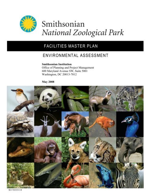
SI # 0333114<br />
FACILITIES MASTER PL AN<br />
ENVIRONMENTAL ASSESS MENT<br />
<strong>Smithsonian</strong> <strong>Institution</strong><br />
Office of Planning and Project Management<br />
600 Maryland Avenue SW, Suite 5001<br />
Washington, DC 20013-7012<br />
May 2008
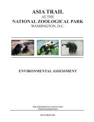
FACILITIES MASTER PLAN<br />
ENVIRONMENTAL ASSESSMENT<br />
NATIONAL ZOOLOGICAL PARK<br />
WASHINGTON, DC<br />
PROPONENT ORGANIZATION FOR THE ACTION:<br />
THE SMITHSONIAN INSTITUTION<br />
Office of Planning and Project Management<br />
Attn: Debra Nauta-Rodriguez, AIA, Project Executive<br />
600 Maryland Avenue SW, Suite 5001<br />
MRC 511 PO Box 37012<br />
Washington, DC 20013-7012<br />
202.633.6548<br />
nautad@si.edu<br />
LEAD RESPONSIBLE FEDERAL AGENCY:<br />
THE NATIONAL CAPITAL PLANNING COMMISSION<br />
ABSTRACT<br />
The <strong>Smithsonian</strong> <strong>Institution</strong> (SI) has prepared this Environmental Assessment (EA) to<br />
evaluate the proposed Comprehensive Facilities Master Plan (the Master Plan) for the<br />
<strong>National</strong> <strong>Zoo</strong>logical Park (the <strong>National</strong> <strong>Zoo</strong>) at its Rock Creek site in the District of<br />
Columbia. This document integrates environmental and cultural resource considerations<br />
consistent with the <strong>National</strong> Environmental Policy Act (NEPA) and the <strong>National</strong> Historic<br />
Preservation Act (NHPA). In the EA, SI analyzes the potential impacts of feasible<br />
alternatives (including the No-Action Alternative) for <strong>facilities</strong> improvements identified<br />
within the Master Plan. The Master Plan emphasizes creating large land areas for exhibit<br />
<strong>renewal</strong> and making site-wide improvements to circulation, entry/arrival experience,<br />
service access, and parking. Government agencies and the public are encouraged to<br />
review and comment on this EA. Comments must be submitted during the 30-day public<br />
review period, beginning on May 19, 2008 and concluding on June 19, 2008.<br />
Please direct written comments on this EA, via U.S. mail or email, to:<br />
<strong>National</strong> <strong>Zoo</strong> Master Plan EA<br />
c/o Greenhorne & O’Mara, Inc<br />
810 Gleneagles Court, Suite 106<br />
Baltimore, MD 21286<br />
jwiser@g-and-o.com<br />
Comments may also be posted online at:<br />
http://nationalzoo.si.edu/AboutUs/FuturePlans/<strong>master</strong><strong>plan</strong>.cfm
This page intentionally left blank.
FACILITIES MASTER PLAN ENVIRONMENTAL ASSESSMENT<br />
TABLE OF CONTENTS<br />
I. PURPOSE AND NEED FOR THE PROPOSED ACTION .............................. 1<br />
A. Introduction .............................................................................................................. 1<br />
B. Purpose and Need .................................................................................................... 1<br />
C. Background .............................................................................................................. 3<br />
D. Planning Policies ...................................................................................................... 6<br />
E. Public Involvement .................................................................................................. 9<br />
F. Agency Coordination ............................................................................................. 11<br />
G. Workshops/Planning Process ................................................................................. 13<br />
II. DESCRIPTION OF ALTERNATIVES ............................................................. 15<br />
A. Process for Alternative Development .................................................................... 15<br />
B. Actions Common to All Alternatives .................................................................... 19<br />
C. No-Action Alternative ........................................................................................... 20<br />
D. Alternative A .......................................................................................................... 21<br />
E. Alternative B .......................................................................................................... 24<br />
F. Alternative C (Preferred Alternative) .................................................................... 27<br />
G. Alternative Concepts .............................................................................................. 30<br />
H. Comparison of Alternatives with Master Plan Objectives ..................................... 35<br />
III. AFFECTED ENVIRONMENT AND ENVIRONMENTAL<br />
CONSEQUENCES ......................................................................................................... 39<br />
A. Natural and Biological Resources .......................................................................... 40<br />
A.1 Soils, Geology, and Topography ........................................................................ 40<br />
A.2 Vegetation .......................................................................................................... 46<br />
A.3 Wildlife including Rare, Threatened, and Endangered Species ......................... 50<br />
A.4 Water Resources ................................................................................................ 53<br />
A.5 Air Quality ......................................................................................................... 56<br />
A.6 Noise .................................................................................................................. 58<br />
B. Cultural Resources ................................................................................................. 61<br />
B.1 Cultural Landscapes ........................................................................................... 61<br />
B.2 Historic Structures .............................................................................................. 67<br />
B.3 Archeological Resources .................................................................................... 76<br />
C. Socioeconomics ..................................................................................................... 81<br />
C.1 Aesthetics/Visual Resources ............................................................................. 81<br />
C.2 Land Use and Zoning ........................................................................................ 86<br />
SMITHSONIAN INSTITUTION – NATIONAL ZOOLOGICAL PARK i | P a g e
FACILITIES MASTER PLAN ENVIRONMENTAL ASSESSMENT<br />
C.3 Demographics..................................................................................................... 89<br />
C.4 Environmental Justice ........................................................................................ 92<br />
C.5 Community Facilities and Services .................................................................... 93<br />
C.6 Infrastructure ...................................................................................................... 93<br />
C.7 Visitor Use and Experience ................................................................................ 95<br />
C.8 Traffic/Transportation/Parking......................................................................... 102<br />
D. Cumulative Effects............................................................................................... 107<br />
IV. REFERENCES ................................................................................................... 109<br />
V. LIST OF PREPARERS ..................................................................................... 113<br />
VI. DISTRIBUTION LIST ...................................................................................... 115<br />
LIST OF FIGURES<br />
Figure 1. Location Map....................................................................................................... 4<br />
Figure 2. Urban Park Concept .......................................................................................... 16<br />
Figure 3. Peninsula Concept ............................................................................................. 17<br />
Figure 4. The No-Action Alternative ................................................................................ 21<br />
Figure 5. Alternative A ..................................................................................................... 24<br />
Figure 6. Alternative B ..................................................................................................... 26<br />
Figure 7. Alternative C ..................................................................................................... 30<br />
Figure 8. Connecticut Avenue Entry Concept .................................................................. 31<br />
Figure 9. Mid-Point Entry Concept .................................................................................. 31<br />
Figure 10. Harvard Street Bridge/Beach Drive Entry Concept ........................................ 32<br />
Figure 11. Beaver Valley Exhibits .................................................................................... 33<br />
Figure 12. North Road Tram Concept .............................................................................. 34<br />
Figure 13. Aerial Tram Concept ....................................................................................... 34<br />
Figure 14. Water Resources .............................................................................................. 54<br />
Figure 15. Cultural Resources........................................................................................... 70<br />
Figure 16. Visual Resources Photo Locations .................................................................. 83<br />
Figure 17. Existing Land Use ........................................................................................... 87<br />
Figure 18. Existing Zoning Map ....................................................................................... 88<br />
Figure 19. Annual Attendance .......................................................................................... 96<br />
Figure 20. Peak Period Visitor Distribution by Activity Type ......................................... 96<br />
Figure 21. Existing Slopes at the <strong>National</strong> <strong>Zoo</strong> ................................................................ 97<br />
Figure 22: Internal Transportation Map .......................................................................... 102<br />
Figure 23. Parking Areas for the <strong>National</strong> <strong>Zoo</strong> ............................................................... 103<br />
LIST OF TABLES<br />
Table 1. Comparison of Alternatives ................................................................................ 38<br />
Table 2. Common Noise Sources and Their Sound Levels .............................................. 59<br />
Table 3. Noise Abatement Thresholds .............................................................................. 60<br />
Table 4. Site Area Demographics ..................................................................................... 91<br />
Table 5. Existing 2006 Intersection Operations at Peak Levels of Service .................... 104<br />
SMITHSONIAN INSTITUTION – NATIONAL ZOOLOGICAL PARK ii | P a g e
FACILITIES MASTER PLAN ENVIRONMENTAL ASSESSMENT<br />
I. PURPOSE AND NEED FOR THE PROPOSED ACTION<br />
A. Introduction<br />
The <strong>Smithsonian</strong> <strong>Institution</strong> (SI) is currently undergoing a comprehensive process to<br />
identify <strong>facilities</strong> and infrastructure needs at the <strong>National</strong> <strong>Zoo</strong>logical Park (the <strong>National</strong><br />
<strong>Zoo</strong>), and proposes to implement strategies for the two decades through a <strong>master</strong><br />
<strong>plan</strong>ning process. The Comprehensive Facilities Master Plan (The Master Plan) will help<br />
guide <strong>facilities</strong> <strong>renewal</strong> at the <strong>National</strong> <strong>Zoo</strong> related to animal welfare, research, exhibits,<br />
visitor services, and circulation. The <strong>master</strong> <strong>plan</strong>ning effort compasses two <strong>National</strong> <strong>Zoo</strong><br />
sites, the public zoological park at Rock Creek Park in Washington, D.C. and the<br />
Conservation Research Center in Front Royal, Virginia. This Environmental Assessment<br />
(EA) describes and addresses the <strong>plan</strong> elements of the alternatives for the <strong>National</strong> <strong>Zoo</strong><br />
Rock Creek site under consideration for the Master Plan.<br />
Recognizing its stewardship responsibilities as an independent trust created by Congress,<br />
SI is committed to integrating environmental considerations into its <strong>plan</strong>ning and<br />
decision-making activities consistent with the spirit of the <strong>National</strong> Environmental Policy<br />
Act (NEPA) of 1969. SI is the lead entity responsible for the preparation of this EA, with<br />
the <strong>National</strong> Capital Planning Commission (NCPC) serving as the responsible federal<br />
agency. To the extent possible at the <strong>master</strong> <strong>plan</strong>ning phase, this project is also<br />
undergoing a review of the project’s potential effects on historic resources consistent with<br />
Section 106 of the <strong>National</strong> Historic Preservation Act (NHPA).<br />
Although the SI is not a “federal agency” within the purview meaning of NEPA and<br />
CEQ, the SI works with federal agencies on NCPC compliance when “federal actions”<br />
occur by those agencies as a result of an SI undertaking. In this case, NCPC’s approval<br />
of the <strong>National</strong> <strong>Zoo</strong> Rock Creek <strong>master</strong> <strong>plan</strong> can be deemed a federal action. The SI has<br />
prepared this EA to be consistent with NEPA requirements, as amended, and the Council<br />
on Environmental Quality’s (CEQ’s) regulations on implementing NEPA. The latest<br />
NCPC environmental guidelines have been used in preparing this EA.<br />
B. Purpose and Need<br />
The purpose of the Master Plan is to affirm SI’s mission at the <strong>National</strong> <strong>Zoo</strong> and provide<br />
a physical framework for implementing the Strategic Plan for the next 20 to 25 years.<br />
Facilities at the <strong>National</strong> <strong>Zoo</strong> are deteriorating due to age. Furthermore, the Master Plan<br />
would identify infrastructure needs and develop an implementation strategy that helps<br />
guide <strong>facilities</strong> <strong>renewal</strong> related to animal welfare, research, exhibits, visitors services, and<br />
circulation at the <strong>National</strong> <strong>Zoo</strong>.<br />
The Master Plan is needed to address the following <strong>facilities</strong> concerns:<br />
Animal habitats require constant <strong>renewal</strong> to keep pace with new knowledge of<br />
animal health and well-being;<br />
New science infrastructure, such as laboratories, is necessary to support the<br />
<strong>National</strong> <strong>Zoo</strong>’s mission and keep the <strong>National</strong> <strong>Zoo</strong> at the forefront of conservation<br />
science;<br />
SMITHSONIAN INSTITUTION – NATIONAL ZOOLOGICAL PARK 1 | P a g e
FACILITIES MASTER PLAN ENVIRONMENTAL ASSESSMENT<br />
Visitor <strong>facilities</strong> have not been upgraded to accommodate expanded programs and<br />
visitation, and do not match SI’s high standards; and<br />
The topography of the site and visitor entry experience makes navigation and<br />
circulation difficult and physically challenging for visitors.<br />
A new Master Plan is also necessary to update the existing <strong>plan</strong>, last revised in 1986, but<br />
also to embody the vision of the new Strategic Plan. This <strong>plan</strong> implements a mission that<br />
emphasizes the <strong>National</strong> <strong>Zoo</strong>’s “leadership in animal care, science, education, and<br />
sustainability” (SI, 2006b). To reach the <strong>National</strong> <strong>Zoo</strong>’s goal of becoming an<br />
international leader, the Strategic Plan emphasizes the necessity for the <strong>National</strong> <strong>Zoo</strong> to<br />
upgrade its current <strong>facilities</strong>. It is noted that “animal habitats require constant <strong>renewal</strong> to<br />
keep pace with new knowledge about animal health and well-being” (SI, 2006b). The<br />
Strategic Plan calls for a “visionary <strong>master</strong> <strong>plan</strong>” proposing development while<br />
understanding the importance of sound land-use strategies to complement the existing<br />
zoo and the need to increase visitor amenities (SI, 2006b).<br />
The number one goal of the <strong>National</strong> <strong>Zoo</strong> identified in the Strategic Plan is to ensure the<br />
highest quality of animal care and management. This can be achieved through applying<br />
the latest knowledge and using best practices in the areas of veterinary medicine,<br />
nutrition, animal husbandry, animal behavior, and habitat design. Specifically, the<br />
Strategic Plan recognizes that the operation of the <strong>National</strong> <strong>Zoo</strong> is not limited to visitor<br />
hours, but is a 24-hour/7-day operation. The <strong>facilities</strong> are aging and some are<br />
deteriorating in quality. The Strategic Plan further states that, with the constantly<br />
expanding knowledge regarding animal health and well-being, the animal enclosures<br />
require regular <strong>renewal</strong>. In order to achieve the goals of the Strategic Plan, the <strong>National</strong><br />
<strong>Zoo</strong> intends to use the Master Plan to identify ways to enhance the unique characteristics<br />
of its land and <strong>facilities</strong> while applying sound land-use practices and using<br />
environmentally sound materials.<br />
The second goal of the Strategic Plan is to maintain international recognition of the<br />
<strong>National</strong> <strong>Zoo</strong>’s science-based approach to conservation, exhibitions, and education.<br />
The third goal of the Strategic Plan is to increase public knowledge and awareness.<br />
Several avenues are proposed to meet this goal, including providing an inspiring and<br />
dynamic science-based zoo experience while ensuring the <strong>National</strong> <strong>Zoo</strong>’s audiences feel<br />
welcome and are well-served by superior visitor amenities such as shading, restrooms,<br />
food service, sitting areas, recycling, and trash collection points.<br />
The <strong>master</strong> <strong>plan</strong>ning process provides the opportunity for the transformation of the<br />
<strong>National</strong> <strong>Zoo</strong>’s infrastructure and <strong>facilities</strong> to reflect the NZP Strategic Plan and mission<br />
and SI-wide goals and objectives. The Master Plan emphasizes six primary areas:<br />
Renew park infrastructure and <strong>facilities</strong> to create large, adaptable land areas to<br />
meet future collection <strong>plan</strong>ning goals;<br />
Clarify the entry and arrival experience by consolidating visitor entry and exit<br />
points, enhancing visitor <strong>facilities</strong>, and providing iconic entry points;<br />
SMITHSONIAN INSTITUTION – NATIONAL ZOOLOGICAL PARK 2 | P a g e
FACILITIES MASTER PLAN ENVIRONMENTAL ASSESSMENT<br />
Simplify and ease circulation around the site by mitigating the topography and<br />
separating vehicular and pedestrian circulation whenever possible;<br />
Revitalize and strategically add visitor and park <strong>facilities</strong>, special event venues,<br />
education <strong>facilities</strong>, and research, administrative, and operational space;<br />
Embody the <strong>National</strong> <strong>Zoo</strong>’s sustainability goals and conservation mission by<br />
celebrating, protecting, and enhancing the Rock Creek ecosystem; and<br />
Celebrate the <strong>National</strong> <strong>Zoo</strong>’s history by protecting and revitalizing the historic<br />
structures and cultural landscapes.<br />
To help further define the <strong>facilities</strong> needs at the <strong>National</strong> <strong>Zoo</strong>, the Master Planning team<br />
conducted a series of workshops and interviews with <strong>National</strong> <strong>Zoo</strong> staff, other SI staff,<br />
Friends of the <strong>National</strong> <strong>Zoo</strong> (FONZ)* staff, and outside interested parties. Through these<br />
workshops and interviews, the <strong>master</strong> <strong>plan</strong>ning team gained further understanding of the<br />
different needs of the <strong>National</strong> <strong>Zoo</strong>. The team then developed concepts and alternatives<br />
to help resolve issues related to: entry and arrival; navigating the site; internal circulation;<br />
visitor amenities; topography; site accessibility; conflicts between service and visitor<br />
access; exhibit <strong>renewal</strong>; staff and guest <strong>facilities</strong>, and parking. The workshops and<br />
interviews confirmed the needs of the <strong>National</strong> <strong>Zoo</strong> as identified in the Strategic Plan.<br />
C. Background<br />
The <strong>National</strong> <strong>Zoo</strong> Rock Creek site consists of 163 acres (65.9 hectares) and is located<br />
east of Connecticut Avenue and west of Rock Creek in Northwest Washington, DC (see<br />
Figure 1). Land use around the <strong>National</strong> <strong>Zoo</strong> is mostly residential, with an area for<br />
commercial use near the Connecticut Avenue entrance and Rock Creek Park abutting the<br />
northern and southern extents of the property. The Rock Creek stream valley meanders<br />
through the eastern portion of the <strong>National</strong> <strong>Zoo</strong>, contributing to the steep and uneven<br />
topography. The <strong>National</strong> <strong>Zoo</strong> houses approximately 2,000 animals from 400 species,<br />
has a staff of 350 <strong>Smithsonian</strong> employees, 15 visiting researchers, approximately 350<br />
full-time, part-time and seasonal FONZ employees, and over 1,500 volunteers. The site<br />
contains 644,000 square feet (59,829 square meters) of buildings within the 104 acres (42<br />
hectares) of the developed portion of the site.<br />
The <strong>National</strong> <strong>Zoo</strong> was created by an Act of Congress in 1889 for “the advancement of<br />
science and instruction and recreation of the people.” Its founding motive was illustrative<br />
of the growing consciousness in the United States for the preservation of the natural<br />
wilderness and wildlife. The original <strong>plan</strong> and layout is reflective of this concept as the<br />
<strong>National</strong> <strong>Zoo</strong> was more of a wildlife refuge than a recreational facility and was<br />
influenced by the directions and collaborations of the noted landscape architect, Frederick<br />
Law Olmsted, and <strong>Smithsonian</strong> Director, S. P. Langley. Olmsted is renowned for his<br />
ability to create picturesque landscape <strong>plan</strong>s that use native <strong>plan</strong>ts and manipulate the<br />
existing land to form scenic vistas. His designs boast a natural appearance that belongs to<br />
the landscape and contain the appearance of having been a part of it for many years.<br />
Secretary Langley had a clear vision for the aesthetic appeal with the desire to use<br />
architecture to communicate the culture and landscape from which an animal originates,<br />
*FONZ is an active partner of the <strong>National</strong> <strong>Zoo</strong> consisting of staff, volunteers, and members who provide<br />
concessions, educational programs and fundraising efforts in support of the <strong>National</strong> <strong>Zoo</strong>’s mission and programs.<br />
SMITHSONIAN INSTITUTION – NATIONAL ZOOLOGICAL PARK 3 | P a g e
FACILITIES MASTER PLAN ENVIRONMENTAL ASSESSMENT<br />
an idea itself originating from the philosophy of Associationism (Farrell, 2004). These<br />
influences intermingled: the natural through Olmsted’s <strong>plan</strong>, using an old quarry to house<br />
bears, to Langley’s attention to aesthetics illustrated through the rusticated architectural<br />
style of the 1891 Lion House and for North American animals, a distinctly North<br />
American style of architecture – a log cabin styled barn for buffaloes.<br />
Figure 1. Location Map<br />
SMITHSONIAN INSTITUTION – NATIONAL ZOOLOGICAL PARK 4 | P a g e
FACILITIES MASTER PLAN ENVIRONMENTAL ASSESSMENT<br />
Through the following decades, however, the <strong>National</strong> <strong>Zoo</strong> began to lose the original<br />
naturalistic design and started to take on the appearance of a typical zoo, with menagerie<br />
style cages. A transformation had begun as the <strong>National</strong> <strong>Zoo</strong> became a recreational<br />
destination with more picnic shelters, public restrooms, drinking fountains and adjacent<br />
tennis courts, a bridle path, and a playground constructed.<br />
The 1920s ushered in a new way of thinking. Architecture should not blend in with the<br />
natural environment, but actively bridge the public to the animals through its design. For<br />
example, the door to the Reptile House is adorned with classical architectural building<br />
elements, until one gets close and sees that the capital is topped with a lizard, or the base<br />
of a column rests on a tortoise. The 1930s brought a plethora of projects as the SI greatly<br />
benefited from the Depression era governmental work programs. Buildings that housed<br />
the animals continued in the distinctive architectural design, while support buildings<br />
settled for the earlier structural tradition of using local Rock Creek gneiss in a loosely<br />
interpreted Colonial Revival style. By the end of the 1930s, the <strong>National</strong> <strong>Zoo</strong> was once<br />
again examining not just the buildings that housed the animals, but the site itself. Cars<br />
and parking were becoming an issue in the forefront.<br />
The 1940s through 1950s saw a decline in the <strong>National</strong> <strong>Zoo</strong>’s ability to keep up with the<br />
rising maintenance costs and began to see other zoos surpass it in terms of modernity. As<br />
the lack of funds became more pressing, a group of local citizens formed the FONZ in<br />
1958. FONZ lobbied Congress to fund the <strong>National</strong> <strong>Zoo</strong>’s budget entirely through the SI;<br />
previously the budget was divided between the SI and Washington, DC’s appropriations.<br />
The year 1961 saw the formation of the first <strong>master</strong> <strong>plan</strong> since the original Olmsted <strong>plan</strong>.<br />
The Master Plan, developed in 1961 by architects Daniel, Mann, Johnson, and<br />
Mendenhall, presented a <strong>plan</strong> that echoed the original intent of the <strong>National</strong> <strong>Zoo</strong>. One of<br />
the main goals of the 1961 Master Plan was to present the animals in a landscape<br />
surrounding that is consistent with their native landscape using modern <strong>facilities</strong> that do<br />
not detract from the natural setting of the park. Whereas the architecture with the first<br />
generation of <strong>National</strong> <strong>Zoo</strong> buildings was designed to look rustic and appropriate with the<br />
setting, the 1961 <strong>plan</strong> provided that the architecture should blend in with the land (i.e.,<br />
the buildings were constructed to look like the land).<br />
During this phase of growth and development, it became clear that the landscape had not<br />
been fully integrated into the <strong>National</strong> <strong>Zoo</strong> Master Plan. In reaction, the 1972 Master<br />
Plan addressed the buildings and landscape by placing buildings behind landscaped hills<br />
and used underground structures to expand exhibit space without impacting the<br />
landscape. The 1972 Master Plan fully intended to update all exhibitions to modern<br />
standards. With regards to the footpath, the 1972 Master Plan resurrected the Olmsted<br />
idea of a unifying circulation path and included his original 1890 <strong>plan</strong> in the study. By<br />
the mid-1980s, the Olmsted Walk was completed.<br />
The Master Plan of 1986 suggested a conceptual change for the <strong>National</strong> <strong>Zoo</strong>, separating<br />
exhibit groups by their ecological relationship into thematic zones. A 1996 study<br />
SMITHSONIAN INSTITUTION – NATIONAL ZOOLOGICAL PARK 5 | P a g e
FACILITIES MASTER PLAN ENVIRONMENTAL ASSESSMENT<br />
examined <strong>National</strong> <strong>Zoo</strong> <strong>facilities</strong> and identified areas that were failing as exhibit areas.<br />
These were incorporated into a 10-year <strong>renewal</strong> <strong>plan</strong> in 2000.<br />
D. Planning Policies<br />
Over the years, <strong>plan</strong>ning policies and focus have changed with the <strong>National</strong> <strong>Zoo</strong>. Often<br />
these alterations have been reflections of various directors’ ideals. They have also been<br />
adjusted to resemble trends of an era, but most often <strong>plan</strong>ning policies have been updated<br />
to make the most of new advances and knowledge about the animals exhibited at the<br />
<strong>National</strong> <strong>Zoo</strong> and the world around them.<br />
Washington, DC has a guiding <strong>plan</strong>ning document, The Comprehensive Plan for the<br />
<strong>National</strong> Capital, which states goals, objectives, and <strong>plan</strong>ning policies to direct and<br />
manage growth in Washington, DC. This <strong>plan</strong> contains both Federal Elements and<br />
Washington, DC Elements.<br />
The Federal Elements of the Comprehensive Plan are directed at existing and future<br />
federal lands and <strong>facilities</strong> in the <strong>National</strong> Capital Region, and contain recommendations<br />
for growth and development. These elements contain policy guidelines for: federal<br />
<strong>facilities</strong>, federal employment, foreign missions and international organizations, parks<br />
and open space, visitors to the Capital, natural environment, and preservation and historic<br />
features. The <strong>National</strong> Capital Planning Commission administers the Federal Elements<br />
(NCPC, 2004).<br />
Ongoing Renewal Efforts<br />
Prior to the development of the most recent Strategic Plan, <strong>renewal</strong> efforts have been<br />
taking place throughout the <strong>National</strong> <strong>Zoo</strong>. Thematic zones have been used to blend the<br />
<strong>National</strong> <strong>Zoo</strong>’s pre-existing priorities of education, research, and conservation into a<br />
single interpretive experience that focuses on one animal or group of animals. Not only<br />
do these exhibits provide an interactive and fun experience to the visitor, they prompt one<br />
to ask questions and become involved in the research and conservation method (Cooper-<br />
Lecky Architects, et al., 1986).<br />
The Think Tank is one example of these animal programs. The Think Tank forces<br />
visitors to ask themselves, “what is thought?”, while fostering conservation by teaching<br />
one to view species as cognitive beings. The Amazonia Science Gallery has proven itself<br />
an exceptional avenue to bridge the gap between scientist and visitor. Individuals get to<br />
see the work being done by researchers and communicate with them directly to have a<br />
greater concept of what daily work in the sciences is like. The Kid’s Farm exhibit<br />
opened in 2004. Here children are able to see where the foods they eat every day come<br />
from; this is a hands on exhibit that explains the abstract concept of species interaction.<br />
The first phase of the Asia Trail is another program which recently opened to the public<br />
(in late 2006) (SI/FONZ, 2006a). All animals in the Asia Trail Exhibit are endangered<br />
species and the <strong>National</strong> <strong>Zoo</strong> is involved in interior situ and exterior situ research on<br />
many of them.<br />
SMITHSONIAN INSTITUTION – NATIONAL ZOOLOGICAL PARK 6 | P a g e
FACILITIES MASTER PLAN ENVIRONMENTAL ASSESSMENT<br />
1986 Revised Master Plan<br />
The most recent update to the Master Plan was presented in 1986. This Plan emphasized<br />
displays of both <strong>plan</strong>ts and animals together with aquatic and terrestrial species. Zones<br />
were developed to showcase themes. These allowed for a more interpretive experience to<br />
educate visitors about species and their eco-geographic area. This experience would<br />
compare animals’ adaptations to their environment and interrelationships between<br />
species. The 1986 Revised Master Plan conceptualized the development of three of these<br />
zones, Aquatic Habitats, Forests, and Grasslands; development of more zones at a later<br />
date was also emphasized (Cooper-Lecky Architects, et al., 1986).<br />
With the intention to push the <strong>National</strong> <strong>Zoo</strong> to become a “Biopark,” the animals’ comfort<br />
was stressed. Efforts were made to ensure that each inhabitant of the <strong>National</strong> <strong>Zoo</strong> was<br />
provided with adequate and accessible food, water, sleeping <strong>facilities</strong>, and health care<br />
(Cooper-Lecky Architects, et al.,1986).<br />
The comfort of the <strong>National</strong> <strong>Zoo</strong>’s visitors was also taken into account. Visitor services<br />
and the restructuring of concessions were a primary focus of the 1986 Revised Master<br />
Plan. Plans were made to eliminate all temporary <strong>facilities</strong> and replace them with<br />
permanent fixtures that architecturally worked in harmony with nearby exhibits. Panda<br />
Plaza was designed to become the major visitor service hub. The expansion of dining<br />
<strong>facilities</strong> as well as gift shops was <strong>plan</strong>ned to alleviate the congestion that was being<br />
experienced at peak periods. Along with visitor concessions, it was proposed that a Loop<br />
Trail be established to link both ends of Olmsted Walk, enhancing pedestrian circulation<br />
while expanding exhibition area. This trail would also provide an important connection<br />
to exhibits that were located “off the beaten path,” (Cooper-Lecky Architects, et al.,<br />
1986).<br />
Included in the <strong>plan</strong>s for expansion, new <strong>plan</strong>s for parking areas and bus circulation were<br />
established according to necessity. With the growth of exhibition areas, it was noted that<br />
parking areas would be swallowed up. Plans for a parking garage over Parking Lot C and<br />
the elimination of Parking Lot B were initiated, but the expected Metro rail expansion<br />
would help reduce the need for additional parking space (Cooper-Lecky Architects, et al.,<br />
1986).<br />
These updates were a revision of the previous 1972 Master Plan.<br />
1972 Master Plan<br />
The Master Plan for the <strong>National</strong> <strong>Zoo</strong> that had been presented in 1972 intended to<br />
increase spaces for the animals while using natural elements to create the exhibit areas.<br />
Water features were introduced to enhance animal habitat, and incorporated as natural<br />
barriers between the animals and visitors. New construction was to be designed<br />
underground to preserve the continuity of the designed landscape, thus decreasing visual<br />
impacts for the visitor. The 1972 Master Plan was the first time many ignored issues<br />
from prior strategies were assessed (Farrell, 2004):<br />
Detailed studies were conducted to evaluate the need for new parking;<br />
SMITHSONIAN INSTITUTION – NATIONAL ZOOLOGICAL PARK 7 | P a g e
FACILITIES MASTER PLAN ENVIRONMENTAL ASSESSMENT<br />
Architectural sites were appraised for their historic value and the need to preserve<br />
them; and<br />
Olmsted’s innovative blueprint was reevaluated and utilized in the redesigned<br />
<strong>plan</strong> for Olmsted Walk, a tribute to the <strong>National</strong> <strong>Zoo</strong>’s original designer.<br />
Upgrades to the <strong>National</strong> <strong>Zoo</strong>’s Olmsted Walk and entry points at Rock Creek Park and<br />
Connecticut Avenue were constructed in 1984. These upgrades and redesigns maintained<br />
and enhanced the original Olmsted concept of curvilinear design. Beaver Valley was<br />
developed to simulate the natural flow of a mountain stream into the ocean. As visitors<br />
wound their way through exhibits, they were prompted to experience animals in<br />
environments that more closely mirrored their natural habitats, and were educated about<br />
the links between differing natural environments (Cooper-Lecky Architects, et al., 1986).<br />
1961 Master Plan<br />
Through the 1950s and into the early 1960s, the <strong>National</strong> <strong>Zoo</strong> had plummeted into<br />
disrepair, primarily due to lack of funds. This was largely a response to our country’s<br />
involvement in World War II and then the Korean War. There was a tragic accident in<br />
1958 involving a 2½-year old girl being killed by a lion at the Lion House. This forced<br />
the <strong>National</strong> <strong>Zoo</strong> to rapidly reevaluate its safety and policies. The product of that<br />
examination was the development of the 1961 Master Plan. Animal health and public<br />
safety became the focal points of this <strong>plan</strong>ned modernization. The prior establishment of<br />
FONZ and the following decision by Congress to fund the <strong>National</strong> <strong>Zoo</strong> entirely through<br />
the SI provided much needed financial security. The <strong>National</strong> <strong>Zoo</strong> began to modernize<br />
its on-site <strong>facilities</strong> as well as develop education, volunteer, and research programs to<br />
help promote conservation throughout the 1960s. The principles behind this <strong>plan</strong> paved<br />
way for new projects such as:<br />
The Conservation and Research Center – est. 1975, an off-site conservation<br />
center;<br />
New on-site hospital and research <strong>facilities</strong>, with an updated and modern<br />
administration building; and<br />
Animal housing designed to resemble caves or grottos, disguising that they are<br />
buildings, (Farrell, 2004).<br />
The Olmsted Concept<br />
The <strong>National</strong> <strong>Zoo</strong>, established in 1889, was built to house a small collection of animals<br />
donated to SI. SI commissioned the firm of renowned landscape architect Frederick Law<br />
Olmsted to design the <strong>National</strong> <strong>Zoo</strong>. Olmsted’s design <strong>plan</strong>ned a naturally scenic park<br />
that worked with the steep and winding topography of Rock Creek Valley. He stayed<br />
away from the linear standard of his period to avoid sharp edges and provide for focal<br />
points and natural vistas along pathways, showcasing the exhibits (Cooper-Lecky<br />
Architects, et al., 1986).<br />
Although the <strong>National</strong> <strong>Zoo</strong> was initially designed with a very naturalist ideal, it didn’t<br />
take long before the park-like setting gave way to more menagerie-type displays. The<br />
method coincided with the exhibiting standards of the early part of the 20 th century, one<br />
SMITHSONIAN INSTITUTION – NATIONAL ZOOLOGICAL PARK 8 | P a g e
FACILITIES MASTER PLAN ENVIRONMENTAL ASSESSMENT<br />
where replication of a species natural environment was forfeited in order to house one or<br />
two examples of many different exotic species. Although this provided a very diverse<br />
range of display specimens, it did not promote animal health or well-being, issues that<br />
were largely not understood in this period (Farrell, 2004).<br />
E. Public Involvement<br />
SI has actively engaged the public in the <strong>plan</strong>ning process for the development of the<br />
Master Plan. Up to the point of this EA, SI has held two public meetings: a Scoping<br />
Informational Workshop and an Alternatives Informational Workshop. A third public<br />
meeting will be held during the public review period for this Environmental Assessment.<br />
The outreach efforts from the two informational meetings and comments received from<br />
the public are summarized in this section.<br />
Scoping Informational Meeting<br />
The public participation process for this EA was initiated by the circulation of a scoping<br />
information package to interested citizens, including nearby residents and FONZ<br />
members. Information contained in the scoping package was also available on the<br />
<strong>National</strong> <strong>Zoo</strong> website. Scoping is a process prescribed by NEPA that provides the public,<br />
agencies, and other interested parties with an opportunity to comment on a proposed<br />
action, and identify issues and concerns that should be addressed. The scoping package<br />
explained the proposed project, stated the SI’s intent to prepare an EA, and described the<br />
environmental review process. It also invited all interested citizens to attend a Public<br />
Scoping Informational Open House, and indicated where comments regarding the scope<br />
of the EA could be submitted.<br />
The Public Scoping Informational Open House was held at the <strong>National</strong> <strong>Zoo</strong>’s Visitor<br />
Center on February 15, 2006. Members of the public were encouraged to ask questions<br />
on topics of interest at several stations set up to address different aspects of the <strong>master</strong><br />
<strong>plan</strong>ning process. Approximately 16 attendees signed in, and 13 written comments were<br />
received during the Open House and/or public comment period. A summary of the<br />
comments received follows:<br />
One individual expressed support for enhancing the visitor experience and many agreed<br />
that enhancement to internal circulation was necessary. Additional interest was<br />
expressed in a surface tram to make the <strong>National</strong> <strong>Zoo</strong> more accessible to individuals with<br />
disabilities, those with strollers, and others who found traversing the steep terrain<br />
problematic.<br />
Multiple suggestions were made to enhance the visitor experience. These included the<br />
expansion and improvement of restaurants and restroom <strong>facilities</strong>, making them more<br />
family-friendly, and the installation of a health unit to treat potentially injured visitors<br />
and staff (although the <strong>National</strong> <strong>Zoo</strong> already has a visitor first-aid unit, this was unknown<br />
to the commenter). Concern was also expressed that the existing signage and trails<br />
offered inadequate guidance and should be expanded to enhance the <strong>National</strong> <strong>Zoo</strong><br />
experience.<br />
SMITHSONIAN INSTITUTION – NATIONAL ZOOLOGICAL PARK 9 | P a g e
FACILITIES MASTER PLAN ENVIRONMENTAL ASSESSMENT<br />
A common theme among all of the comments received was concern for the welfare and<br />
health of the animals. Many noted the importance of education to the continued<br />
conservation of many of these rare and endangered species. Some felt expanded handson<br />
displays and exhibits highlighting the local environment would best convey a message<br />
of conservation to the <strong>National</strong> <strong>Zoo</strong>’s visitors. Others felt it was the <strong>National</strong> <strong>Zoo</strong>’s duty<br />
to represent as much of the natural world’s diversity as feasible within its facility, citing<br />
the surrounding Rock Creek Park as a vehicle to educate individuals on local ecology.<br />
One individual expressed concern that the <strong>National</strong> <strong>Zoo</strong> needed to improve its method of<br />
communication with its local neighbors while being more attentive to the effects of the<br />
<strong>National</strong> <strong>Zoo</strong>’s actions on its surrounding communities.<br />
Alternatives Informational Meeting<br />
An Alternatives Informational Meeting was held on June 28, 2007, and was conducted in<br />
an open house format at the <strong>National</strong> <strong>Zoo</strong>’s Visitor Center. The purpose of this meeting<br />
was to introduce Alternatives A and B under consideration and to engage interested<br />
citizens to submit comments on the Master Plan. Approximately 17 attendees signed in,<br />
and 4 written comments were received during the Open House; an additional 98<br />
comments were received during the public comment period by e-mail.<br />
Each of the comments received expressed the need to elevate the <strong>National</strong> <strong>Zoo</strong> to<br />
international status; however, differences in how this would be accomplished varied<br />
throughout the public comments.<br />
Improvements to the visitor experience were cited in comments regarding overall<br />
enhancement of the <strong>National</strong> <strong>Zoo</strong>. Many comments endorsed the construction of the<br />
aerial tram as presented with Alternative A. Primarily, the comments received reflected a<br />
view that the aerial tram option presented in Alternative A would best fulfill the need to<br />
assist visitors who have difficultly traversing the topography of the <strong>National</strong> <strong>Zoo</strong>.<br />
Additionally, comments in support of the aerial tram suggested that it would provide a<br />
memorable experience, unlike any other, and could be incorporated into exhibits<br />
highlighting the Golden Lion Tamarins, the existing aviary, or a rain forest exhibit.<br />
Conversely, there were comments expressing concern that the aerial tram would not be<br />
able to meet the needs of those with disabilities or it would introduce an amusement parklike<br />
element to the <strong>National</strong> <strong>Zoo</strong>, detracting from the natural beauty of the <strong>National</strong> <strong>Zoo</strong>’s<br />
landscape. These comments also cited the potential for increased operational noise and<br />
the cost of installation and maintenance as reasons not to install an aerial tram. Some of<br />
the parties providing comments were against the installation of an aerial tram, but<br />
supported a ground tram along North Road (Alternative B). Others preferred no tram at<br />
all.<br />
Parking needs were also a commonly expressed concern. While many were in favor of<br />
underground parking garages, others were in support of building multi-level parking<br />
<strong>facilities</strong>. Residents of neighborhoods directly adjacent to the <strong>National</strong> <strong>Zoo</strong> voiced strong<br />
opposition to eliminating any parking. They cited already crowded side streets in a city<br />
with limited parking being filled by the present <strong>National</strong> <strong>Zoo</strong> parking lot overflow. In<br />
SMITHSONIAN INSTITUTION – NATIONAL ZOOLOGICAL PARK 10 | P a g e
FACILITIES MASTER PLAN ENVIRONMENTAL ASSESSMENT<br />
contrast, several parties providing comments emphasized the need for further use of the<br />
Metro system by <strong>Zoo</strong> visitors and staff.<br />
The necessity for additional restroom <strong>facilities</strong> was expressed by numerous individuals.<br />
Multiple comments were received that indicated current signage at the <strong>National</strong> <strong>Zoo</strong> is<br />
uninteresting and not helpful in guiding visitors through exhibits. Other suggestions for<br />
visitation improvement included popcorn stands, fine dining <strong>facilities</strong>, and a proposal for<br />
a bird friendly coffee/espresso bar in the existing Panda Café that would serve the dual<br />
function of highlighting the Migratory Bird Center’s research and produce revenue within<br />
the <strong>National</strong> <strong>Zoo</strong>.<br />
Issues regarding exhibits and the animals featured by the <strong>National</strong> <strong>Zoo</strong> were also<br />
discussed at length in the comments. Many expressed concern that both Alternatives A<br />
and B would redevelop the present Great Ape House, but neither offered a solution for<br />
where the apes might be relocated to or if the apes would remain at the <strong>National</strong> <strong>Zoo</strong><br />
Rock Creek site. Additionally, many were concerned that future <strong>plan</strong>s at the <strong>National</strong><br />
<strong>Zoo</strong> to offer expanded exhibit areas would limit the diversity of species the <strong>National</strong> <strong>Zoo</strong><br />
would be able to showcase, citing the recent removal of the giraffes and polar bears.<br />
Concern was expressed that there must be balance between giving the animal inhabitants<br />
of the <strong>National</strong> <strong>Zoo</strong> ample living space and allowing visitors to the <strong>National</strong> <strong>Zoo</strong> the<br />
opportunity for close interaction with its inhabitants. Many compared the <strong>National</strong> <strong>Zoo</strong><br />
exhibits and their presentation with others such as the San Diego and Bronx <strong>Zoo</strong>s. Other<br />
parties providing comments suggested removing large animals such as elephants from<br />
their Rock Creek facility and opening the <strong>National</strong> <strong>Zoo</strong>’s CRC site at Front Royal to<br />
visitors to see these large animals in a more sanctuary oriented environment. Funding for<br />
the developments presented in each Alternative was also a question of concern. Many<br />
noted that the changes proposed in each action alternative would be very dependent on<br />
the <strong>National</strong> <strong>Zoo</strong>’s ability to fund them and neither alternative offered a suggestion as to<br />
how these funds would be procured.<br />
F. Agency Coordination<br />
Through a series of meetings and presentations, SI and the <strong>National</strong> <strong>Zoo</strong> staff consulted<br />
several pertinent resource agencies and organizations to obtain information and solicit<br />
input on the scope of the EA. During the scoping meetings, SI explained the Master<br />
Planning process and stated the intent to prepare an EA. After considering the collective<br />
participation of the various agencies, the <strong>plan</strong>ning team then developed and presented the<br />
preliminary alternatives.<br />
Members of the consulting team and the <strong>National</strong> <strong>Zoo</strong> Master Planning Working Group<br />
met with the <strong>National</strong> Capital Planning Commission, the Washington, DC Historic<br />
Preservation Office (DC HPO), and the U.S. Commission of Fine Arts (CFA) on July 8,<br />
2005, for an informal discussion. The purpose of this meeting was to review and consult<br />
with agency staff on the proposed project scope, the approach to the Master Plan, NEPA<br />
and Section 106 compliance, and public participation. Additionally the team reviewed<br />
NCPC requirements for the EA and Master Plan.<br />
SMITHSONIAN INSTITUTION – NATIONAL ZOOLOGICAL PARK 11 | P a g e
FACILITIES MASTER PLAN ENVIRONMENTAL ASSESSMENT<br />
On December 19, 2005, SI met with NCPC to discuss project specific requirements for<br />
compliance activities and <strong>master</strong> <strong>plan</strong> submittal.<br />
SI met with the DC Department of Transportation (DDOT), DC Office of Planning, the<br />
Washington Metropolitan Area Transit Authority (WMATA), and DC HPO on February<br />
16, 2006, to provide the agency staff with a general overview of the Master Plan and<br />
schedule. Additional projects near the <strong>National</strong> <strong>Zoo</strong> were discussed during this meeting,<br />
as well as area transportation and traffic circulation.<br />
On March 13, 2006, members of the consulting team met with the DC Department of<br />
Health (DOH) to introduce DOH staff to the Master Plan project, and to discuss<br />
Washington, DC requirements and approval processes for stormwater management and<br />
erosion control. Green Design opportunities for the Rock Creek site were also<br />
investigated.<br />
On May 16, 2006, SI met with agency representatives from NCPC, CFA, and the DC<br />
Office of Planning to provide an update of the Master Plan for the <strong>National</strong> <strong>Zoo</strong>. The<br />
<strong>plan</strong>ning team gave a presentation of the activities leading up to the development of the<br />
preliminary alternatives and provided the agencies with an opportunity to offer feedback<br />
on the draft alternatives prior to presenting them to the public.<br />
On May 30, 2006, SI met with DC HPO and NCPC to present and discuss the<br />
preliminary alternatives and review the Master Plan schedule and important dates in the<br />
<strong>plan</strong>ning and EA/Section 106 processes. During the meeting, an overview of the historic<br />
resources at the <strong>National</strong> <strong>Zoo</strong> was presented.<br />
On November 21, 2007, SI met with NCPC to discuss submittal requirements and<br />
provide an update on the status of alternatives being considered. SI gave NCPC an update<br />
on the status of the Master Planning alternatives and an overview of the public comments<br />
received, and asked for clarification on the appropriate level of assessment for different<br />
concepts being considered, such as the Parking Structure at Parking Lot C and the aerial<br />
tram concept.<br />
On January 2, 2008, SI met with DC HPO to update the agency with the status of the<br />
Master Planning alternatives, review public comments received to date, and get<br />
clarification on the appropriate level of assessment for different concepts being<br />
considered, such as the Parking Structure at Parking Lot C and the aerial tram concept.<br />
SI gave a presentation showing the potential viewshed that may be affected at the<br />
<strong>National</strong> <strong>Zoo</strong>.<br />
On April 1, 2008, SI met with DC HPO to discuss inclusion of a historic preservation<br />
review component in the Master Planning and EA processes. It was noted that more<br />
detailed design information would be needed in order to make a conclusive and complete<br />
historic preservation statement, however, DC HPO will comment on the Draft EA in a<br />
letter to SI. The letter will point out elements of the Master Plan where they feel adverse<br />
SMITHSONIAN INSTITUTION – NATIONAL ZOOLOGICAL PARK 12 | P a g e
FACILITIES MASTER PLAN ENVIRONMENTAL ASSESSMENT<br />
effect is probable, and will state that final determination, concurrences, and/or<br />
agreements will occur when a detailed design is developed later in the process.<br />
On April 11, SI met with the <strong>National</strong> Park Service to provide an update on the <strong>master</strong><br />
<strong>plan</strong>ning process and proposed alternatives. At this meeting, NPS expressed concerns if<br />
any project would have viewshed impacts and requested to be involved as project<br />
<strong>plan</strong>ning and design proceeds for some of the concepts in the <strong>master</strong> <strong>plan</strong> such as the<br />
aerial tram and parking structure.<br />
G. Workshops/Planning Process<br />
The Master Planning team conducted a series of workshops, design charettes, and<br />
interviews with <strong>National</strong> <strong>Zoo</strong>, other SI, and FONZ staffs to identify <strong>facilities</strong> needs and<br />
come up with concepts to address their concerns. During the course of the Master<br />
Planning process between June 2005 and July 2007, 11 multi-day workshops were<br />
conducted: eight workshops were dedicated to the Rock Creek site and three workshops<br />
to the Front Royal site. Additional strategic meetings and work sessions were also held<br />
during the process as needed.<br />
The Observations Phase of work began with a pre-<strong>plan</strong>ning methodology in June 2005 to<br />
outline the methodology for the <strong>plan</strong>ning process and to identify major opportunities and<br />
constraints at both <strong>facilities</strong>. The design team along with SI and <strong>National</strong> <strong>Zoo</strong> staff<br />
documented the existing conditions at each facility by conducting tours of the <strong>facilities</strong><br />
and grounds, interviewing key staff and stakeholders, and reviewing previous studies and<br />
reports. Workshops were conducted on both sites in order to gain insight into the existing<br />
building and site conditions and <strong>facilities</strong> needs and desires. Interviews with staff<br />
(representing scientific research, animal care, visitor services, education, and operations)<br />
and field reconnaissance were conducted in order to gain a comprehensive understanding<br />
of the existing <strong>facilities</strong>. A public scoping meeting was held on March 15, 2006.<br />
During this phase of work, the design team also worked closely with the <strong>National</strong> <strong>Zoo</strong><br />
team to bring a group of nationally-recognized visionaries to the sites to inspire the staff,<br />
provide guidance to the Master Planning process, and discuss trends relevant to a sciencebased<br />
organization like the <strong>National</strong> <strong>Zoo</strong>.<br />
Because the Collection Planning effort is a separate process with its own schedule, the<br />
Master Planning team recognized the need for the flexibility in order to accommodate<br />
current and future collection and exhibit goals. Because animal collection requires<br />
specialized <strong>plan</strong>ning, it was important to create a flexible Master Plan in which future<br />
exhibit designs could be incorporated. This would allow for an integrated, but<br />
independent, Collection Planning effort that could also be modified over time to best<br />
serve the <strong>National</strong> <strong>Zoo</strong> and animal welfare needs.<br />
The Concept Planning and Alternatives Development Phase of work began in November<br />
2005 with an emphasis on the Rock Creek site. Conceptual ideas were tested and more<br />
analyses were conducted on the topics of visitor entry and arrival, circulation, and<br />
sustainability. Alternative development strategies were evaluated and presented to the<br />
SMITHSONIAN INSTITUTION – NATIONAL ZOOLOGICAL PARK 13 | P a g e
FACILITIES MASTER PLAN ENVIRONMENTAL ASSESSMENT<br />
<strong>National</strong> <strong>Zoo</strong> community and public at a public meeting on June 28, 2007. <strong>National</strong> <strong>Zoo</strong><br />
leadership weighed various <strong>plan</strong> elements and public comments, and selected a preferred<br />
direction for the Master Plan. At the same time, an EA and Section 106 documentation<br />
evaluated the impacts of the development <strong>plan</strong> on the natural and cultural resources of the<br />
park. A final site development <strong>plan</strong> was the basis for further technical study and detailed<br />
<strong>plan</strong>ning and design, including the urban design context, landscape <strong>plan</strong>, stormwater<br />
management, cost estimate, and phasing <strong>plan</strong>.<br />
SMITHSONIAN INSTITUTION – NATIONAL ZOOLOGICAL PARK 14 | P a g e
FACILITIES MASTER PLAN ENVIRONMENTAL ASSESSMENT<br />
II. DESCRIPTION OF ALTERNATIVES<br />
A. Process for Alternative Development<br />
The Master Planning Team developed a Conceptual Framework based on the analysis of<br />
existing conditions and the <strong>facilities</strong> needs. Six major elements were emphasized as a way to<br />
test the broad design concepts and development scenarios, and to guide discussion to the core<br />
topics of this Master Plan for <strong>facilities</strong> and infrastructure <strong>renewal</strong> (and away from exhibit<br />
<strong>plan</strong>ning and design, detailed programming, etc). The six objectives of the Master Plan are:<br />
Renew park infrastructure and <strong>facilities</strong> to create large, adaptable land areas to meet<br />
future collection <strong>plan</strong>ning goals;<br />
Clarify the entry and arrival experience by consolidating visitor entry and exit points,<br />
enhancing visitor <strong>facilities</strong>, and providing iconic entry points;<br />
Simplify and ease circulation around the site by mitigating the topography and<br />
separating vehicular and pedestrian circulation whenever possible;<br />
Revitalize and strategically add visitor and park <strong>facilities</strong>, special event venues,<br />
education <strong>facilities</strong>, and research, administrative, and operational space;<br />
Embody the <strong>National</strong> <strong>Zoo</strong>’s sustainability goals and conservation mission by<br />
celebrating, protecting, and enhancing the Rock Creek ecosystem; and<br />
Celebrate the <strong>National</strong> <strong>Zoo</strong>’s history by protecting and revitalizing the historic<br />
structures and cultural landscapes.<br />
Based on this Conceptual Framework, the <strong>plan</strong>ning team developed two concepts for the<br />
future development of the <strong>National</strong> <strong>Zoo</strong>, keeping in mind visitor experience, circulation, and<br />
conservation goals. Two primary concepts, the “urban park” and the “peninsula,” were<br />
introduced and tested. These two concepts were presented at the scoping public informational<br />
open house on February 15, 2006 and were the framework for the development of more<br />
detailed alternatives presented in this Environmental Assessment.<br />
SMITHSONIAN INSTITUTION – NATIONAL ZOOLOGICAL PARK 15 | P a g e
FACILITIES MASTER PLAN ENVIRONMENTAL ASSESSMENT<br />
Urban Park Concept<br />
The urban park concept (see Figure 2) emphasizes a new circulation system with a focus on<br />
visitor entry from Connecticut Avenue and a new mid-point entry experience. Visitors<br />
arriving by car and bus leave their vehicles at a new parking structure and enter the park at<br />
the mid-point, allowing them to experience the upper and lower zones of the park while still<br />
maintaining their orientation at the mid-point. The Connecticut Avenue entrance and a<br />
smaller entry at Harvard Street Bridge/Beach Drive would serve visitors and employees<br />
arriving by mass transit or who park at satellite/partnership locations. Beaver Valley is<br />
restructured as part of a Conservation Zone along Rock Creek; exhibits and programming<br />
emphasize conservation, the Rock Creek ecosystem, and education. Administrative uses are<br />
consolidated within the new parking structure at the mid-point. Research and support<br />
functions are not relocated. Large land areas are created for exhibit <strong>renewal</strong>, regaining flat<br />
land from surface parking lots and revitalizing existing exhibit areas.<br />
Figure 2. Urban Park Concept<br />
SMITHSONIAN INSTITUTION – NATIONAL ZOOLOGICAL PARK 16 | P a g e
FACILITIES MASTER PLAN ENVIRONMENTAL ASSESSMENT<br />
Peninsula Concept<br />
The peninsula concept (see Figure 3) emphasizes a linear circulation pattern between two<br />
entry points at either end of the <strong>National</strong> <strong>Zoo</strong>, Connecticut Avenue and Harvard Street<br />
Bridge/Beach Drive. General public access along North Road is limited. Visitor parking is<br />
available at both entry points, providing easier access from the city streets and limiting<br />
congestion within the park and along North Road. Visitors arriving by mass transit or<br />
walking in from Connecticut Avenue or Adams Morgan have clear entrance points and<br />
visitor <strong>facilities</strong>. Exhibits and circulation follow Olmsted Walk and the natural ridgeline as<br />
they do today. Beaver Valley is converted to an Education Zone, dedicated to school groups<br />
and other programs, limiting general visitor access and circulation. Research and support<br />
functions, including veterinary care, become a focal point at the center of the park and visitor<br />
experience, relocating to the historic core and the Parking Lot C areas. Administrative uses<br />
are consolidated and relocated to the peninsula off of Adams Mill Road. Large land areas are<br />
created for exhibit <strong>renewal</strong> by revitalizing existing exhibit areas.<br />
Figure 3. Peninsula Concept<br />
SMITHSONIAN INSTITUTION – NATIONAL ZOOLOGICAL PARK 17 | P a g e
FACILITIES MASTER PLAN ENVIRONMENTAL ASSESSMENT<br />
Process: Evolution of Alternative Concepts<br />
The <strong>plan</strong>ning team presented these concepts at a public meeting (June 28, 2007) and<br />
during numerous presentations to <strong>National</strong> <strong>Zoo</strong> staff and the Master Planning Work<br />
Group to gather input and comments. Various <strong>plan</strong>ning and design scenarios were drafted<br />
based on the Conceptual Framework. The <strong>plan</strong>ning team developed the following points<br />
as key elements of any development scenario moving forward:<br />
1. Large multi-species exhibits can be achieved through strategic <strong>renewal</strong> of the<br />
<strong>National</strong> <strong>Zoo</strong>. Flat land adjacent to exhibit areas that is currently used for surface<br />
parking should be recaptured for exhibit expansion and <strong>renewal</strong>.<br />
2. The upper (Connecticut Avenue) end of the site is a major entry point that takes<br />
advantage of the urban location and public transportation. This area should be<br />
rejuvenated as an exciting, fun, intensively developed area, with large, multi-species<br />
exhibits as well as visitor services and special events venues.<br />
3. The mid-point of the site should become a major visitor hub. The Small Mammal<br />
building or Great Ape building could be renovated into a Visitor Center with visitor<br />
services such as park orientation services, retail and restrooms.<br />
4. The lower end of the park, closer to Rock Creek, is the most environmentallysensitive<br />
area of the <strong>National</strong> <strong>Zoo</strong>. This end of the site should be developed with this<br />
in mind, with exhibits, structures, and activities that are sustainably-designed and<br />
conservation-oriented. Dynamic hands-on experiences in the natural environment and<br />
opportunities for reflection and contemplation should be created.<br />
5. An internal park conveyance or transportation system is necessary in all scenarios. It<br />
is critical that visitors and employees have an option for traversing the park and<br />
mitigating the topography.<br />
6. With goals to enhance visitation, it is critical to distribute guests throughout the park.<br />
Exhibits, visitor services, and activity areas should be spread out throughout the park<br />
to minimize the actual and perceived crowding conditions on peak days. This will<br />
also increase the time that the visitor spends in the park and/or encourage repeat<br />
visitation.<br />
7. Discovery zones, or other conservation-oriented interpretive exhibit areas, should be<br />
created throughout the <strong>National</strong> <strong>Zoo</strong>. If possible, these areas should create<br />
opportunities for education pertaining to the Rock Creek ecosystem.<br />
8. Rock Creek should be reintegrated into the site and part of the visitor experience as<br />
the Olmsted design originally intended.<br />
9. Elements of fun and discovery should be incorporated into the <strong>National</strong> <strong>Zoo</strong>.<br />
10. The <strong>National</strong> <strong>Zoo</strong>’s historic structures and existing elements of the original Olmsted<br />
design should be respected and celebrated.<br />
SMITHSONIAN INSTITUTION – NATIONAL ZOOLOGICAL PARK 18 | P a g e
FACILITIES MASTER PLAN ENVIRONMENTAL ASSESSMENT<br />
11. Facilities and operations should embody the conservation mission and sustainable<br />
practices.<br />
12. The current concept <strong>plan</strong> for the Elephant Trails is integrated into the Master Plan as<br />
an existing project. The Master Plan would address service issues into the site as well<br />
as the size and location visitor <strong>facilities</strong>.<br />
13. Parking remains on the site, but alternative transportation should be encouraged and<br />
will be necessitated as visitation increases.<br />
14. Parking Lot E remains as a parking resource, but is updated to achieve best<br />
management practices of stormwater management. Parking management solutions<br />
may vary within the development alternatives.<br />
15. Complete <strong>renewal</strong> of visitor services (restrooms, retail, and food service) should be<br />
dispersed throughout the park, with major hubs at Connecticut Avenue and new midpoint<br />
gateway.<br />
16. An external shuttle that travels between the <strong>National</strong> <strong>Zoo</strong> and the Metro rail stations<br />
is a necessary component of any <strong>plan</strong>, and could be accomplished immediately.<br />
After gathering public input, interviewing the <strong>National</strong> <strong>Zoo</strong> and FONZ staff, testing<br />
various development schemes, and conducting detailed technical analysis, the <strong>plan</strong>ning<br />
team developed three action alternatives and a No-Action Alternative for the <strong>renewal</strong> of<br />
<strong>facilities</strong> at the <strong>National</strong> <strong>Zoo</strong> that were carried forward to assess potential effects of each<br />
alternative in accordance with NEPA.<br />
B. Actions Common to All Alternatives<br />
Described below are elements common to all of the alternatives:<br />
NZP Strategic Plan goals are supported and implemented to every extent possible.<br />
“Elephant Trails” site <strong>plan</strong>ning and exhibit design is underway and is considered<br />
an existing condition for each alternative.<br />
Olmsted Walk remains the central circulation spine with improvements made to<br />
accessibility through individual project design.<br />
Exhibit areas continue to be renewed for multi-species exhibits; Collection<br />
Planning efforts will determine future exhibits.<br />
Attendance increases are expected to reach peak attendance levels of the year<br />
2001 (3 million visitors) and increases to visitation beyond past levels would<br />
occur by extending the shoulder seasons or visitor hours through special events.<br />
The peak day visitation and <strong>National</strong> <strong>Zoo</strong> carrying capacity would not change<br />
under any of the action alternatives.<br />
Visitor services and education spaces are revitalized.<br />
Transit incentives are offered to promote alternative transportation and to<br />
accommodate an increase in visitation.<br />
Partnerships for satellite parking are maintained and increased.<br />
SMITHSONIAN INSTITUTION – NATIONAL ZOOLOGICAL PARK 19 | P a g e
FACILITIES MASTER PLAN ENVIRONMENTAL ASSESSMENT<br />
Parking policies are implemented for staff.<br />
North Road and Blue Road become the service backbone of the <strong>National</strong> <strong>Zoo</strong>;<br />
Hawthorne Street is used for emergency access.<br />
A new hay storage facility located near the Kids’ Farm is considered an existing<br />
condition.<br />
In conjunction with the NEPA and NHPA processes of assessing potential impacts of the<br />
action and No-Action Alternatives, the alternatives will also be evaluated for funding and<br />
implementation feasibility. These alternatives are discussed below with illustrative<br />
mapping to further clarify each alternative. More detail for each concept is provided at<br />
the end of the alternatives section to allow the public to visualize the possible concepts<br />
that the team has developed.<br />
C. No-Action Alternative<br />
Under the No-Action Alternative (see Figure 4), current programs and projects would<br />
continue to develop as <strong>plan</strong>ned. Attendance would grow to exceed the peak levels of<br />
2001 (3 million visitors per year). Ongoing improvements would include building<br />
rehabilitation and facility updates related to animal safety, health, and welfare. The<br />
<strong>renewal</strong> of exhibits at the northwest end of the park would carry on with the completion<br />
of Asia Trail and Elephant Trails. Because these exhibits are concentrated in the vicinity<br />
of the Connecticut Avenue entrance, visitors would be most likely to congregate in this<br />
northwestern quadrant of the <strong>National</strong> <strong>Zoo</strong>. Without the availability of the large land<br />
areas necessary for the development of inclusive habitats such as the Asia Trail exhibits,<br />
additional exhibit <strong>plan</strong>ning would continue on a site-by-site basis.<br />
The Connecticut Avenue entrance would be maintained as the primary source for visitor<br />
orientation and information; however, visitors would continue to access the <strong>National</strong> <strong>Zoo</strong><br />
by way of ten different pedestrian entrances and one dedicated bus passenger entry.<br />
Minor improvements to visitor services, such as retail outlets and information kiosks,<br />
would be implemented as currently <strong>plan</strong>ned. Sections of the park would continue to be<br />
non-Americans with Disabilities Act (ADA) compliant. An in-park transportation system<br />
would not be feasible with current infrastructure, offering no relief from the hilly<br />
topography of the <strong>National</strong> <strong>Zoo</strong>. Service conflicts would continue to be mitigated by<br />
scheduling and limiting service hours, so as not to interfere with the visitor experience.<br />
The Holt House would continue to be unusable real estate while space for administrative<br />
offices, research, and education would remain inadequate.<br />
SMITHSONIAN INSTITUTION – NATIONAL ZOOLOGICAL PARK 20 | P a g e
FACILITIES MASTER PLAN ENVIRONMENTAL ASSESSMENT<br />
Figure 4. The No-Action Alternative<br />
D. Alternative A<br />
Alternative A (see Figure 5) would involve the development of large, multi-species<br />
exhibits throughout the <strong>National</strong> <strong>Zoo</strong>, distributing visitors evenly across the <strong>National</strong><br />
<strong>Zoo</strong>’s <strong>facilities</strong>. Entrances would be consolidated into three visitor service hubs. This<br />
would include revitalization of the existing Connecticut Avenue entry (1), the addition of<br />
a Mid-Point entry (2), and reworking of the Harvard Street Bridge/Beach Drive entry (3).<br />
The current Bus Lot (5) would be reclaimed for exhibit space. Two turnarounds along<br />
SMITHSONIAN INSTITUTION – NATIONAL ZOOLOGICAL PARK 21 | P a g e
FACILITIES MASTER PLAN ENVIRONMENTAL ASSESSMENT<br />
North Road (20) would provide flexibility in the circulation systems. An aerial tram (4)<br />
would be utilized to connect the lower and upper ends of the <strong>National</strong> <strong>Zoo</strong>.<br />
Exhibit Strategies/Visitor Experience<br />
Through the reclamation of surface parking, large multi-species exhibits would be<br />
developed throughout the park. This distribution of exhibits would allow visitors to<br />
spread more freely throughout the <strong>National</strong> <strong>Zoo</strong> and permit opportunities for more direct<br />
exposure to the species and exhibits along Olmsted Walk. Older exhibits would be<br />
revitalized and the flat land, once used for surface parking, would be developed as<br />
exhibits. Current Parking Lot B (7) would be reclaimed for exhibit space. The visitor<br />
and arrival sequence would be enhanced through the revitalization and construction of<br />
three major visitor hubs: Connecticut Avenue, a new Mid-Point entry from Parking Lot<br />
C, and Harvard Street Bridge/Beach Drive. The aerial tram (4) would make stops at<br />
these three entry points to assist visitors in traversing the steep topography of the<br />
<strong>National</strong> <strong>Zoo</strong> and provide a unique interpretive experience with aerial views of the<br />
<strong>National</strong> <strong>Zoo</strong> and its tree canopy.<br />
The current Amazonia Science Gallery (12) would be modified so that the main entrance<br />
would be located on Olmsted Walk. Beaver Valley exhibits and walkways (13) would be<br />
redesigned to separate service from visitor circulation and allow universal access through<br />
a series of bridges, structures, lifts, and ramps that mitigate the topography. Stronger<br />
connections would be made between the existing Beaver Valley and Olmsted Walk. A<br />
children’s discovery area or entertainment zone (14) would be located near the Kids’<br />
Farm.<br />
Entry/Arrival/Parking<br />
Connecticut Avenue – The Connecticut Avenue entrance (1) serves as the major entry<br />
point for pedestrians and visitors coming from WMATA buses and trains. This would be<br />
revitalized with a defined plaza for events and informal gatherings. Current Parking Lot<br />
A (6) would be relocated to the interior of a realigned North Road to increase vehicular<br />
flow along the road while decreasing risks to pedestrian safety to and from the parking<br />
lot. The current Bus Lot (5) would be reconfigured slightly to better accommodate the<br />
safe and efficient pick-up of passengers. The Connecticut Avenue visitor center (8)<br />
would be enlarged, renovated, and reprogrammed (8), including visitor services such as<br />
restrooms, information kiosks, educational <strong>facilities</strong>, retail and dining, a FONZ<br />
membership office, event space, and a tram station.<br />
Mid-Point Entry – The new Mid-Point entry (2) would be the entrance used primarily<br />
by patrons arriving to the <strong>National</strong> <strong>Zoo</strong> by personal vehicles. The new parking structure<br />
on the existing Parking Lot C (9) would be linked to a new entrance pavilion (2) by an<br />
access bridge over North Road. The entrance pavilion would be constructed at the site<br />
of the existing Great Ape House and would provide numerous visitor amenities such as<br />
restrooms, information kiosks, educational <strong>facilities</strong>, retail, and dining. The pavilion<br />
would face a new pedestrian plaza (10). This pedestrian plaza would be flanked by the<br />
Small Mammal House, the Reptile House, and the mid-point tram station. The new<br />
SMITHSONIAN INSTITUTION – NATIONAL ZOOLOGICAL PARK 22 | P a g e
FACILITIES MASTER PLAN ENVIRONMENTAL ASSESSMENT<br />
structure on Parking Lot C would also have a small bus drop-off area for efficient midpark<br />
bus loading and unloading.<br />
Harvard Street Bridge/Beach Drive – A third entry near Harvard Street Bridge / Beach<br />
Drive (3) on the east side of the Rock Creek site would provide an entrance for visitors<br />
parking in Parking Lot E, pedestrians entering from Adams Morgan, or visitors coming<br />
from a WMATA shuttle or bus. The entry would be reconfigured and revitalized to<br />
provide visitor services such as information kiosks, educational <strong>facilities</strong>, rental, retail,<br />
event space, and a tram station. The Mane Restaurant would continue to provide dining<br />
and event support. The <strong>National</strong> <strong>Zoo</strong>logical Park’s conservation message would be<br />
enhanced with the reclamation of surface parking (Parking Lot D) and the creation of a<br />
visitor experience focused on the Rock Creek ecosystem (11).<br />
Transportation/Circulation/Service<br />
Congestion along North Road would be mitigated through a comprehensive traffic and<br />
parking management strategy. This would include two traffic circles (20) and a limiteduse<br />
turn lane on North Road. During peak times and events, the traffic circles would be<br />
used for passenger drop-off vehicular turnarounds, and information dissemination.<br />
Service vehicle and visitor conflicts would be minimized by separating the visitor and<br />
service paths in Beaver Valley and by limiting service from Olmsted Walk when<br />
possible.<br />
An aerial tram system (4) would be installed, to connect the upper and lower ends of the<br />
<strong>National</strong> <strong>Zoo</strong> and give visitors an introductory interpretive experience. The aerial tram<br />
would permit more universal access to the various exhibits with loading and unloading<br />
stations at each visitor center to assist visitors in traversing the steep topography.<br />
Administrative/Operational/Service<br />
A new administrative, support, and operations hub (15) would be constructed adjacent to<br />
the parking structure located at the Parking Lot C site. Additions to the General Services<br />
Building would provide new administrative offices for the <strong>National</strong> <strong>Zoo</strong> and FONZ<br />
employees. Additions to the research buildings near the hospital would include new<br />
office and lab space (16). A new greenhouse (17) would be constructed near the existing<br />
Parking Lot C driveway and the Genetics Building (18) would be renovated for other<br />
purposes. In the future, the Holt House (19) would be renovated for <strong>National</strong> <strong>Zoo</strong> uses,<br />
including a Meeting/Training Center with guest housing.<br />
SMITHSONIAN INSTITUTION – NATIONAL ZOOLOGICAL PARK 23 | P a g e
FACILITIES MASTER PLAN ENVIRONMENTAL ASSESSMENT<br />
Figure 5. Alternative A<br />
E. Alternative B<br />
Under Alternative B (see Figure 6), the development of large, multi-species exhibits<br />
would occur throughout the <strong>National</strong> <strong>Zoo</strong>. This development would distribute visitors<br />
more evenly across the <strong>National</strong> <strong>Zoo</strong>’s <strong>facilities</strong>. Older exhibits would be revitalized and<br />
the flat land, once used for surface parking, would be developed as exhibits. The entry<br />
and arrival sequence would be enhanced and consolidated through the revitalization of<br />
two existing visitor entrances, one at Connecticut Avenue (1), the other at Harvard Street<br />
Bridge/ Beach Drive (2). A smaller dedicated entry for those arriving by bus would be<br />
located at Parking Lot B (3). The current Bus Lot (4) would be reclaimed for exhibit<br />
space. A surface tram along the North Road (5) would connect the entries at the upper<br />
SMITHSONIAN INSTITUTION – NATIONAL ZOOLOGICAL PARK 24 | P a g e
FACILITIES MASTER PLAN ENVIRONMENTAL ASSESSMENT<br />
and lower ends of the park to assist visitors in traversing the <strong>National</strong> <strong>Zoo</strong>’s steep<br />
topography.<br />
Exhibit Strategies/Visitor Experience<br />
The Great Ape House (11) would be renovated to provide enhanced visitor services and<br />
education space at a central point in the <strong>National</strong> <strong>Zoo</strong>. Amazonia Science Gallery (12)<br />
would be modified so that the main entrance would be located on Olmsted Walk. Beaver<br />
Valley exhibits and walkways (13) would be designed to separate service from visitor<br />
circulation and allow universal access through a series of bridges, structures, lifts, and<br />
ramps that would mitigate the topography. A children’s discovery area or entertainment<br />
zone (14) would be located near the current Kids’ Farm.<br />
Entry/Arrival/Parking<br />
Connecticut Avenue – The Connecticut Avenue entry (1), the major entry for<br />
pedestrians and visitors coming from WMATA buses and trains, would be revitalized<br />
with a defined plaza for events and informal gathering and a new underground parking<br />
garage (6). Current Parking Lot A (7) would be reclaimed for exhibit space. The current<br />
visitor center (8) would be enlarged, renovated, and reprogrammed to include visitor<br />
services such as restrooms, information kiosks, educational <strong>facilities</strong>, retail, dining, a<br />
FONZ membership office, and event space.<br />
Harvard Street Bridge/Beach Drive – The entry near Harvard Street Bridge/ Beach<br />
Drive (3) on the east side of the Rock Creek site would provide an entrance for visitors<br />
parking in Parking Lots D or E (9), pedestrians entering from Adams Morgan, or visitors<br />
coming from a WMATA shuttle or bus. The entry would be reconfigured and revitalized<br />
to provide visitor services such as information kiosks, educational <strong>facilities</strong>, rental, retail,<br />
event space, and a tram station. The Mane Restaurant would continue to provide dining<br />
and event support. Surface Parking Lots D and E (9) would remain at the lower end of<br />
the park.<br />
Transportation/Circulation/Service<br />
Congestion along North Road would be mitigated through a comprehensive traffic and<br />
parking management strategy. This would include the addition of two traffic circles (17)<br />
and a limited-use turn lane on North Road. During peak times and events, the traffic<br />
circles would be used for passenger drop-off, vehicular turnarounds, and information<br />
dissemination.<br />
A park-based shuttle system running on North Road (5) would connect the lower and<br />
upper traffic circles (17). This would provide an alternative to mitigating the steep<br />
topography within the park for visitors. The efficiency of this service would be based on<br />
traffic conditions on North Road.<br />
Service vehicle and visitor conflicts would be minimized by separating the visitor and<br />
service paths in Beaver Valley and by limiting service from Olmsted Walk when<br />
possible.<br />
SMITHSONIAN INSTITUTION – NATIONAL ZOOLOGICAL PARK 25 | P a g e
FACILITIES MASTER PLAN ENVIRONMENTAL ASSESSMENT<br />
Administrative/Operational/Service<br />
Figure 6. Alternative B<br />
A new administrative, support, and operations hub (10), including staff parking, would be<br />
constructed on the General Services Building/Parking Lot C site. At the administrative,<br />
support, and operations hub, the General Services Building would be expanded to provide<br />
new administrative offices for the <strong>National</strong> <strong>Zoo</strong> and FONZ employees. Additional space<br />
for service and support functions such as security, health services, storage, a new boiler,<br />
and physical <strong>plan</strong>ts would also be constructed here. Current Parking Lot C would be<br />
dedicated to staff parking and the motor pool. No visitors would enter from the middle of<br />
the park. Additions to the research buildings (15) near the hospital would include new<br />
SMITHSONIAN INSTITUTION – NATIONAL ZOOLOGICAL PARK 26 | P a g e
FACILITIES MASTER PLAN ENVIRONMENTAL ASSESSMENT<br />
office and lab space. In the future, the Holt House (16) would be renovated to provide a<br />
meeting and resource center.<br />
F. Alternative C (Preferred Alternative)<br />
Alternative C (see Figure 7) would include revitalization of older exhibits throughout the<br />
<strong>National</strong> <strong>Zoo</strong>. Areas, once dedicated to surface parking, would be reclaimed and utilized<br />
in the development of large, multi-species exhibits similar in form to Asia Trail. This<br />
development would distribute visitors more evenly across the <strong>National</strong> <strong>Zoo</strong>’s <strong>facilities</strong>.<br />
Under Alternative C, the <strong>National</strong> <strong>Zoo</strong>’s entrances and visitor service hubs would be<br />
consolidated in four entry points. This would include revitalization of the existing<br />
Connecticut Avenue entry (1), the addition of a Mid-Point entry (2), the reworking of the<br />
Harvard Street Bridge/Beach Drive entry (3), and the bus drop-off area (6). Traffic<br />
Circles at the Connecticut Avenue and Harvard Street Bridge/Beach Drive entrances (23),<br />
along North Road, would provide flexibility in circulation systems. Visitor transportation<br />
would be incorporated with a surface level tram on North Road (7), bus drop-off area (6),<br />
and an aerial tram (4) with stations near each entry point.<br />
Exhibit Strategies/Visitor Experience<br />
Through the reclamation of surface parking, large multi-species exhibits would be<br />
developed throughout the park and older exhibits would be revitalized. The completion<br />
of an underground parking garage (8) would allow for the recapture of square footage<br />
currently utilized by Parking Lot A (9). Parking Lot D (14) would also be recaptured to<br />
incorporate into the visitor experience a discovery zone and stormwater management<br />
exhibit. Additional Exhibit Space would be explored and noted throughout the <strong>National</strong><br />
<strong>Zoo</strong>.<br />
The visitor and arrival sequence would be enhanced through the revitalization and<br />
construction of three major visitor hubs. An aerial tram (4) would make stops at these<br />
three entry points to assist visitors in traversing Rock Creek and to provide a unique<br />
interpretive experience and views of the <strong>National</strong> <strong>Zoo</strong> and its’ tree canopy. An additional<br />
dedicated entry for visitors arriving by bus would be located at the existing Parking Lot B<br />
(5); this would provide a unique entry experience, incorporating the reuse of Panda Plaza<br />
with this bus entry point.<br />
The current Amazonia Science Gallery (15) would be modified so that the main entrance<br />
would be located on Olmsted Walk. Beaver Valley exhibits and walkways (16) would be<br />
redesigned to separate service from visitor circulation and allow universal access through<br />
a series of bridges, structures, lifts, and ramps that mitigate the topography. Stronger<br />
connections would be made between the existing Beaver Valley and Olmsted Walk. A<br />
children’s entertainment zone (17) would be located near the Kids’ Farm and include<br />
amenities such as a carousel and concession area<br />
Entry/Arrival/Parking<br />
Connecticut Avenue – The Connecticut Avenue entry (1), the major entry for<br />
pedestrians and visitors coming from WMATA buses and trains, would be revitalized<br />
SMITHSONIAN INSTITUTION – NATIONAL ZOOLOGICAL PARK 27 | P a g e
FACILITIES MASTER PLAN ENVIRONMENTAL ASSESSMENT<br />
with a defined plaza for events and informal gathering. The current visitor center (10)<br />
would be enlarged, renovated, and reprogrammed to create an education hub with a<br />
classroom and auditorium along with restrooms, a retail area, a concession center, and<br />
visitor information/orientation space. The aerial tram would have a station at this point.<br />
Mid-Point Entry – The new Mid-Point entry (2) would be the entrance used primarily<br />
by patrons arriving to the <strong>National</strong> <strong>Zoo</strong> by personal vehicles. The new parking structure<br />
on the existing Parking Lot C (11) would be linked to a new entrance pavilion (2) by an<br />
access bridge over North Road. The entrance pavilion would be constructed at the site<br />
of the existing Great Ape House. The Great Ape House would be razed and, through<br />
exhibit <strong>plan</strong>ning efforts, the great ape exhibit would be moved. The entrance pavilion<br />
would provide numerous visitor amenities such as restrooms, information kiosks,<br />
educational <strong>facilities</strong>, retail, and dining. The pavilion would face a new pedestrian plaza<br />
(12). This pedestrian plaza would be flanked by the Small Mammal House, the Reptile<br />
House, and the mid-point tram station. The new structure on Parking Lot C would also<br />
have a small bus drop-off area for efficient mid-park bus loading and unloading.<br />
Harvard Street Bridge/Beach Drive – A third entry near Harvard Street and Beach<br />
Drive on the east side of the Rock Creek site (3) would provide another entrance for<br />
visitors parking in Parking Lot E, pedestrians entering from Adams Morgan, or visitors<br />
coming from a WMATA shuttle or bus. The entry would be reconfigured and revitalized<br />
to provide visitor services such as information kiosks, educational <strong>facilities</strong>, rental, retail,<br />
event space, and a tram station. The Mane Restaurant would continue to provide dining<br />
and event support. The <strong>National</strong> <strong>Zoo</strong>logical Park’s conservation message would be<br />
enhanced with the reclamation of surface parking (Parking Lot D) (14) and the creation<br />
of a visitor experience focused on the Rock Creek ecosystem, a wetlands living garden.<br />
Transportation/Circulation/Service<br />
Congestion along North Road would be mitigated through a comprehensive traffic and<br />
parking management strategy. This would include the addition of two traffic circles (23)<br />
and a limited-use turn lane on North Road. During peak times and events, the traffic<br />
circles would be used for passenger drop-off, vehicular turnarounds, and information<br />
dissemination.<br />
A park-based shuttle system running on North Road (7) would connect the lower and<br />
upper traffic circles (23). This would provide an alternative to mitigating the steep<br />
topography within the park for visitors. The efficiency of this service would be based on<br />
traffic conditions on North Road.<br />
An aerial tram system (4) would be installed to connect the upper and lower ends of the<br />
<strong>National</strong> <strong>Zoo</strong> and give visitors an introductory interpretive experience. The aerial tram<br />
would permit more universal access to the various exhibits, with loading and unloading<br />
stations at each visitor center to assist visitors in traversing the steep topography.<br />
SMITHSONIAN INSTITUTION – NATIONAL ZOOLOGICAL PARK 28 | P a g e
FACILITIES MASTER PLAN ENVIRONMENTAL ASSESSMENT<br />
Service vehicle and visitor conflicts would be minimized by limiting service vehicles<br />
from Olmsted Walk when possible and with the construction of a new service road to<br />
access the bird hill plateau (24).<br />
Administrative/Operational/Service<br />
A new administrative, support, and operations hub (18) would be constructed adjacent to<br />
the parking structure located at the Parking Lot C site. Additions to the General Services<br />
Building would provide new administrative offices for the <strong>National</strong> <strong>Zoo</strong> and FONZ<br />
employees. Additions to the research buildings near the hospital would include new<br />
office and lab space (19) and a new greenhouse (20) would be constructed. Additionally,<br />
the Genetics Building (22) would be renovated for other purposes and approximately 20<br />
parking spaces added near the Holt House. The Police Station would be relocated to the<br />
new General Services Building. The existing Police Station building would then become<br />
FONZ space. In the future, the Holt House (21) would be renovated for <strong>National</strong> <strong>Zoo</strong><br />
uses, including a Meeting/Training Center with guest housing.<br />
SMITHSONIAN INSTITUTION – NATIONAL ZOOLOGICAL PARK 29 | P a g e
FACILITIES MASTER PLAN ENVIRONMENTAL ASSESSMENT<br />
G. Alternative Concepts<br />
Figure 7. Alternative C<br />
This section provides more detailed information supported by illustrations for concepts<br />
being considered in Alternative A through Alternative C in this EA and the Master Plan,<br />
such as the Connecticut Avenue entry, mid-point entry, Harvard Street Bridge/ Beach<br />
Drive entry, aerial and road trams, Parking Lot C structure, and exhibit <strong>renewal</strong> at Beaver<br />
Valley. It should be noted that these are intended to be viewed as concepts for <strong>master</strong><br />
<strong>plan</strong>ning purposes. Additional <strong>plan</strong>ning, design, and engineering would occur to further<br />
define each concept.<br />
SMITHSONIAN INSTITUTION – NATIONAL ZOOLOGICAL PARK 30 | P a g e
FACILITIES MASTER PLAN ENVIRONMENTAL ASSESSMENT<br />
Connecticut Avenue Entry Concept<br />
The Connecticut Avenue entrance (see<br />
Figure 8) would be revitalized with a<br />
defined plaza for events and informal<br />
gatherings. Visitor services, such as<br />
information, membership sales, and<br />
rentals, would be provided in permanent<br />
linear stalls that flank the entry plaza,<br />
providing an immediate and exciting<br />
visitor interaction. This entry would<br />
continue to serve visitors coming from<br />
Metro rail stations and adjacent<br />
neighborhoods. An introduction to the<br />
conservation message and an introductory<br />
animal experience would also be part of<br />
the entry.<br />
The plaza would continue to the Visitor<br />
Center where two building additions and a<br />
total renovation would enhance visitor<br />
services and education capabilities. Restrooms, information kiosks, a renovated<br />
auditorium, educational <strong>facilities</strong>, enlarged retail <strong>facilities</strong>, and event space would be<br />
located within the Visitor Center. Destination dining and a unique venue would attract<br />
visitors outside of normal zoo operating hours and the peak season, and provide increased<br />
capacity for special events. Administrative uses would be relocated to the new<br />
administrative building at the mid-point, freeing space for educational programming. A<br />
new traffic roundabout on North Road would facilitate visitor drop-off and management<br />
of traffic on peak days when the road is congested and parking is limited.<br />
Mid-Point Entry Concept<br />
The new Mid-Point entry (see Figure 9)<br />
would provide an exciting new focal<br />
point at the <strong>National</strong> <strong>Zoo</strong>, allowing<br />
visitors to begin their visit in the middle<br />
of the park, an area rich in history and<br />
poised for new projects. Visitors<br />
arriving by vehicle would park in a new<br />
parking structure on Parking Lot C and<br />
enter the <strong>National</strong> <strong>Zoo</strong> on a footbridge<br />
that extends over North Road,<br />
connecting the garage and the <strong>National</strong><br />
<strong>Zoo</strong>. Visitors would enter directly into a<br />
new pavilion/visitor center on the site<br />
of the Great Ape House, which would<br />
either be reused or demolished. The<br />
new structure would be set back to<br />
Figure 8. Connecticut Avenue Entry<br />
Concept<br />
Figure 9. Mid-Point Entry Concept<br />
SMITHSONIAN INSTITUTION – NATIONAL ZOOLOGICAL PARK 31 | P a g e
FACILITIES MASTER PLAN ENVIRONMENTAL ASSESSMENT<br />
provide a visual connection between the historic buildings from the original Olmsted<br />
<strong>plan</strong>. A grand pedestrian plaza would provide an orientation point and gathering place for<br />
visitors, along with an introduction to the conservation message and an initial animal<br />
experience. This plaza would also serve as a primary location for special events. A full<br />
range of visitor services, including restrooms, informational kiosks, educational <strong>facilities</strong>,<br />
retail, and dining would be offered at the Mid-Point entry. The new plaza would be<br />
framed by two of the <strong>National</strong> <strong>Zoo</strong>’s distinctive historic buildings, the Small Mammal<br />
House and the Reptile House, and an aerial tram station serving the mid-point. This<br />
iconic entry would serve as an orientation point both for visitors entering at the mid-point<br />
and those navigating Olmsted Walk. A parking structure would be constructed atop<br />
Parking Lot C, eliminating the need for several surface lots around the <strong>National</strong> <strong>Zoo</strong>. An<br />
intermittent turn lane would be added to portions of North Road to mitigate congestion<br />
when vehicles are turning into the parking structure or accessing the new dedicated<br />
service lane between the new discovery zone and the Small Mammal House.<br />
Harvard Street Bridge/Beach Drive Entry Concept<br />
The new visitor entry at the crossroads near<br />
Harvard Street Bridge/Beach Drive (see<br />
Figure 10) would provide a unique visitor<br />
entry experience that builds off of the natural<br />
setting of Rock Creek and the adjacent urban<br />
neighborhoods. Visitors arriving at this entry<br />
would arrive on foot, by car, and also by<br />
Metro shuttle. The actual entry onto Olmsted<br />
Walk would be reconfigured and revitalized to<br />
direct visitors into the <strong>National</strong> <strong>Zoo</strong> from the<br />
traffic roundabout. Visitor services such as<br />
restrooms, information kiosks, rental, retail,<br />
and event space would be available.<br />
The Mane Restaurant would continue to<br />
provide dining and event support, and the<br />
bandstand and event area would be upgraded.<br />
An aerial tram station would be located near<br />
the lower entry, providing access to alternative<br />
Figure 10. Harvard Street<br />
Bridge/Beach Drive Entry Concept<br />
transportation to the top of the hill and the Connecticut Avenue entrance. Immediately<br />
upon entering the gates, visitors wishing to utilize the aerial tram would be directed on a<br />
path below the Kids’ Farm and the tram station. A traffic roundabout would be added to<br />
facilitate vehicular entrance and exit from Harvard Street, Beach Drive, and North Road.<br />
Pedestrian safety and access improvements would be made with the addition of sidewalks<br />
and crosswalks leading into the <strong>National</strong> <strong>Zoo</strong>.<br />
SMITHSONIAN INSTITUTION – NATIONAL ZOOLOGICAL PARK 32 | P a g e
FACILITIES MASTER PLAN ENVIRONMENTAL ASSESSMENT<br />
Parking Lot C Detail<br />
The new Mid-Point entry, the major entry for patrons arriving by vehicle, would provide<br />
a parking structure on Parking Lot C connected to the <strong>National</strong> <strong>Zoo</strong> by a new access<br />
bridge over North Road. The Parking Lot C parking structure would provide a total of<br />
1,128 spaces. A new administrative, support, and operations hub would also constructed<br />
on the Parking Lot C site with the parking garage.<br />
Exhibit Renewal at Beaver Valley<br />
The Beaver Valley area (see Figure 11) is<br />
environmentally sensitive and provides a<br />
shaded, quiet respite from Olmsted Walk.<br />
Exhibits would be redeveloped to<br />
maximize environmental sensitivity and<br />
create a visitor interpretive experience that<br />
plays off of this natural yet dynamic<br />
setting. Revitalized exhibit areas would<br />
create more options for visitors and<br />
alleviate crowding on busy days. Exhibits<br />
and walkways would be designed to allow<br />
universal access through a series of<br />
bridges, structures, lifts, and ramps that<br />
flow between the Beaver Valley and<br />
Olmsted Walk exhibits. This system<br />
would allow a visitor to easily navigate the<br />
substantial grade change in this area. The<br />
Amazonia Science Gallery building and Figure 11. Beaver Valley Exhibits<br />
exhibit would be modified so that the main entrance is located on Olmsted Walk. An<br />
upper addition to the building would allow a bridge to connect to a new building in<br />
Beaver Valley, providing access from Beaver Valley. The new visitor building would<br />
also be connected by a bridge to another new exhibit building on the site of the former<br />
Lower Bear exhibit and a new visitor building at the site of the former Upper Bear<br />
exhibit. The buildings would have opportunities for outdoor viewing and interior exhibit<br />
space with the potential for a year- round experience. At grade, an accessible path would<br />
connect to the renovated Seal and Sea Lion exhibits. Renovation of the Seal and Sea Lion<br />
exhibits and the addition of new animal exhibits that use the naturally forested slopes of<br />
the valley would attract visitors and allow crowds to distribute to areas outside of<br />
Olmsted Walk. Elevated boardwalks would likely reduce the current at grade conflict<br />
between pedestrians and service vehicles in Beaver Valley. However, a ground-level<br />
experience would still be open to visitors. Service vehicles and visitors would continue<br />
to share the Beaver Valley path, but service hours would be limited whenever feasible.<br />
Improvements would be made to the path in the Upper Beaver Valley, and the connection<br />
to Olmsted Walk and the new Elephant Trail project would remain. In order to minimize<br />
the reliance on public streets and to create emergency and service access to Bird Hill, a<br />
service road is proposed that would connect Beaver Valley to Bird Hill.<br />
SMITHSONIAN INSTITUTION – NATIONAL ZOOLOGICAL PARK 33 | P a g e
FACILITIES MASTER PLAN ENVIRONMENTAL ASSESSMENT<br />
North Road Tram Concept<br />
The existing road-based shuttle<br />
service that runs on North Road (see<br />
Figure 12) would be upgraded to an<br />
accessible, alternative fuel vehicle.<br />
Service would be offered on a daily<br />
basis at regularly scheduled intervals<br />
between the two traffic roundabouts.<br />
The tram would help to mitigate the<br />
effect of the <strong>National</strong> <strong>Zoo</strong>’s steep<br />
topography on the visitors’<br />
experience. The effectiveness of the<br />
service would be dependent on<br />
traffic conditions along North Road.<br />
Aerial Tram Concept<br />
Figure 12. North Road Tram Concept<br />
An aerial tram system (see Figure<br />
13) would provide an interpretive<br />
experience while providing<br />
transportation through the <strong>National</strong><br />
<strong>Zoo</strong>. This transportation system<br />
would assist in distributing visitors<br />
throughout the <strong>National</strong> <strong>Zoo</strong>,<br />
alleviating crowding conditions on<br />
Olmsted Walk during busy days.<br />
The aerial tram system would consist<br />
of three stations, gondola cars on a<br />
cable, and poles. The cars would run<br />
in a clockwise direction and be<br />
situated low within the tree canopy<br />
to the extent feasible to minimize<br />
visual impacts. Each station would<br />
Figure 13. Aerial Tram Concept<br />
accommodate a queue area and a<br />
load/unload platform, and mechanical equipment. The upper and lower tram station<br />
would also accommodate gondola storage. Each gondola car would be able to hold four<br />
to six passengers. The system would provide ADA and stroller access. More detail<br />
analysis would be needed to determine the exact location, size, and capacity of the system<br />
and the general location and concept is provided for <strong>master</strong> <strong>plan</strong>ning purposes. An aerial<br />
tram would be an alternative transportation solution to help mitigate the effect of the<br />
steep topography on the visitor experience and offer a unique perspective to see animal<br />
exhibits.<br />
SMITHSONIAN INSTITUTION – NATIONAL ZOOLOGICAL PARK 34 | P a g e
FACILITIES MASTER PLAN ENVIRONMENTAL ASSESSMENT<br />
H. Comparison of Alternatives with Master Plan Objectives<br />
The purpose of the <strong>master</strong> <strong>plan</strong>ning process is to compliment the priorities and goals<br />
identified in the <strong>National</strong> <strong>Zoo</strong>’s mission. These goals include ensuring the highest quality<br />
of animal care and management; achieving international recognition through a sciencebased<br />
approach to conservation, exhibitions, and education, and increasing public<br />
knowledge and awareness. Through the <strong>plan</strong>ning process and assessing the needs for the<br />
<strong>National</strong> <strong>Zoo</strong>, six primary objectives for the Master Plan were identified:<br />
1. Renew park infrastructure and <strong>facilities</strong> to create large, adaptable land areas to<br />
meet future collection <strong>plan</strong>ning goals;<br />
2. Clarify the entry and arrival experience by consolidating visitor entry and exit<br />
points, enhancing visitor <strong>facilities</strong>, and providing iconic entry points;<br />
3. Simplify and ease circulation around the site by mitigating the topography and<br />
separating vehicular and pedestrian circulation whenever possible;<br />
4. Revitalize and strategically add visitor and park <strong>facilities</strong>, special event venues,<br />
education <strong>facilities</strong>, and research, administrative, and operational space;<br />
5. Embody the <strong>National</strong> <strong>Zoo</strong>’s sustainability goals and conservation mission by<br />
celebrating, protecting, and enhancing the Rock Creek ecosystem; and<br />
6. Celebrate the <strong>National</strong> <strong>Zoo</strong>’s history by protecting and revitalizing the historic<br />
structures and cultural landscapes.<br />
Table 1 presents a comparison of the alternatives that were developed during the <strong>master</strong><br />
<strong>plan</strong>ning process. Each concept within the alternatives was developed to help meet the<br />
purpose and need for the Master Plan. A brief discussion on how each alternative fulfills<br />
the six primary objectives of the Master Plan follows.<br />
The No-Action Alternative does not provide a framework to renew park infrastructure<br />
that would help meet future collection <strong>plan</strong>ning goals. Visitor experience and circulation<br />
throughout the park would not be clarified through the consolidation of entry points.<br />
Movement through steep topography would not be alleviated and vehicular and<br />
pedestrian circulation would not be separated. Visitor and park <strong>facilities</strong> would be<br />
<strong>plan</strong>ned on a site-by-site basis, and research, operational and administrative space would<br />
continue to be inadequate. The <strong>National</strong> <strong>Zoo</strong> would not have a <strong>plan</strong> to reach<br />
sustainability goals, and conservation efforts would continue to be unconsolidated. The<br />
Great Ape House and the Orangutan Line (O-Line) would continue to detract from the<br />
more prominent historic structures in the park. Holt House would continue as unusable<br />
space. The No-Action Alternative would not fulfill any of the six <strong>master</strong> <strong>plan</strong>ning<br />
objectives.<br />
The implementation of Alternative A would renew park infrastructure by reclaiming flat<br />
and gently sloping areas. These larger exhibit areas would better accommodate future<br />
collection <strong>plan</strong>ning and provide for the highest quality of animal care and management.<br />
New exhibit areas would also enhance visitor experience. Available parking would be<br />
increased and multiple entries would be consolidated to three primary areas. Each area<br />
would include visitor amenities such as restrooms, kiosks, retails and dining and other<br />
services. A new Mid-Point visitor hub would enhance the visitor experience by<br />
expanding special event venues and educational areas, and would provide a stop<br />
SMITHSONIAN INSTITUTION – NATIONAL ZOOLOGICAL PARK 35 | P a g e
FACILITIES MASTER PLAN ENVIRONMENTAL ASSESSMENT<br />
accessible to all visitors for clarification and comprehensive interpretation of the <strong>National</strong><br />
<strong>Zoo</strong>’s mission, goals, and exhibits. Circulation would be eased with the introduction of<br />
an aerial tram system. A new service drive would separate service vehicles and visitors<br />
on Olmstead Walk. Operational and administrative <strong>facilities</strong> would be expanded to<br />
increase the efficiency of park services, and research space, including labs and offices,<br />
would be expanded to better support the <strong>National</strong> <strong>Zoo</strong>’s scientific efforts. The Great Ape<br />
House would be demolished, and the O-Line would be removed for the construction of<br />
the new visitor hub. The new facility would better compliment and emphasize the<br />
historic structures and views throughout the park. The Holt House would also be<br />
rehabilitated, serving the dual purpose of providing more meeting and training space and<br />
restoring this historic resource. In conclusion, Alternative A fulfills the six objectives of<br />
the Master Plan.<br />
Alternative B would also renew park infrastructure by reclaiming flat and gently sloping<br />
areas that could be utilized for exhibits and visitor use. These exhibit areas would<br />
enhance visitor experience, while providing space for future animal habitats that could<br />
consider the newest animal care knowledge and practices. Entry and arrival would be<br />
enhanced through the consolidation of multiple points of entry to three main areas that<br />
would include restrooms, dining, retail and other visitor amenities. The Connecticut<br />
Avenue visitor center would be renovated and reprogrammed. The conversion of the<br />
Great Ape House into a visitor and educational center would also provide a consolidated<br />
area for educational and interpretive experiences. Visitor circulation would be improved<br />
through the design of the new exhibit areas and steep topography would be mitigated<br />
with the introduction of a ground-based tram that would run back and forth on North<br />
Road. Additional park <strong>facilities</strong> and special event venues would be included under<br />
Alternative B. The Holt House would also be rehabilitated and utilized as a meeting and<br />
resource center, fulfilling the goal of revitalizing historic structures. In conclusion,<br />
Alternative B fulfills the six objectives of the Master Plan.<br />
The implementation of Alternative C would reclaim flat and gently sloping areas, such as<br />
parking lots, which could be better utilized for visitor use and exhibit space. These<br />
exhibit areas would enhance visitor experience by renewing outdated or aging <strong>facilities</strong>.<br />
They would also allow flexibility for future exhibit <strong>plan</strong>ning to incorporate the newest<br />
animal care knowledge and management practices. Available parking would be<br />
increased with the addition of a structured parking deck. Multiple entries throughout the<br />
park would be consolidated to three primary areas and a dedicated bus entry, improving<br />
visitor entry and arrival. Each primary entry would include amenities such as restrooms,<br />
kiosks, retail, and dining. A new Mid-Point visitor hub would replace the Great Ape<br />
House, further enhancing the visit by providing additional special event venues and<br />
educational areas. This area would also serve as a stop accessible to all visitors for a<br />
clarified and comprehensive interpretation of the zoos mission, goals, and exhibits.<br />
Circulation would be eased with the introduction of both aerial and ground-based trams.<br />
A new service drive would separate service vehicles and visitors on Olmstead Walk.<br />
Operational and administrative space would be expanded to increase the efficiency of<br />
park services, and additional research offices and lab space would better support the<br />
<strong>National</strong> <strong>Zoo</strong>’s scientific efforts. The demolition of the Great Ape House and the<br />
SMITHSONIAN INSTITUTION – NATIONAL ZOOLOGICAL PARK 36 | P a g e
FACILITIES MASTER PLAN ENVIRONMENTAL ASSESSMENT<br />
removal of O-Line would compliment and emphasize the historic structures and views<br />
within the park. Rehabilitation of the Holt House for zoo uses would further accomplish<br />
the goal of protecting and celebrating historic resources within the park. In conclusion,<br />
Alternative C fulfills the six objectives of the Master Plan, and has been identified as the<br />
“Preferred Alternative.”<br />
SMITHSONIAN INSTITUTION – NATIONAL ZOOLOGICAL PARK 37 | P a g e
FACILITIES MASTER PLAN ENVIRONMENTAL ASSESSMENT<br />
Exhibit<br />
Strategies/<br />
Visitor<br />
Experience<br />
Entry/<br />
Arrival/<br />
Parking<br />
Transportation/<br />
Circulation/<br />
Service<br />
Administrative/<br />
Operational/<br />
Service<br />
No-Action<br />
Alternative<br />
Additional exhibit<br />
<strong>plan</strong>ning would occur<br />
on a site-by-site basis<br />
Entry points not<br />
consolidated,<br />
Connecticut Ave would<br />
remain primary entry,<br />
multiple pedestrian<br />
entrances would remain<br />
throughout the park,<br />
and one bus entry<br />
Existing parking<br />
<strong>facilities</strong> would remain<br />
In-park transportation<br />
system would not be<br />
implemented<br />
All roads will continue to<br />
be used for service<br />
vehicles, conflicts with<br />
visitor access would<br />
continue to be mitigated<br />
by limiting service hours<br />
No new administrative,<br />
research or education<br />
offices.<br />
Table 1. Comparison of Alternatives<br />
Alternative A Alternative B Alternative C<br />
Great Ape House demolished<br />
and a new Mid-Point entry<br />
becomes a visitor hub<br />
Parking Lots A, B, D ,and<br />
Bus Lot reclaimed for new<br />
animal exhibit space/<br />
revitalization of older exhibits<br />
Three visitor entries at<br />
Connecticut Avenue, a Mid-<br />
Point entry from Parking Lot<br />
C and Harvard Street<br />
Bridge/Beach Drive<br />
Structured parking deck at<br />
Parking Lot C would provide<br />
1,128 spaces<br />
New underground parking<br />
structure at Connecticut<br />
Avenue entry would provide<br />
300 spaces<br />
Aerial tram connecting upper<br />
and lower ends of park<br />
Traffic circles on North Road<br />
North Road and Blue Road<br />
are main service roads,<br />
Hawthorne Street used for<br />
emergency access<br />
New service road near<br />
current Parking Lot C site<br />
New administrative, support<br />
and operations structure at<br />
Parking Lot C site<br />
Additions to research<br />
buildings to include office and<br />
lab space, new greenhouse<br />
Holt House rehabilitated for<br />
<strong>Zoo</strong> uses<br />
Great Ape House converted<br />
to visitor/ educational center<br />
Parking Lot A and Bus Lot<br />
reclaimed for new animal<br />
exhibit space/revitalization<br />
of older exhibits<br />
Three visitor entries at<br />
Connecticut Avenue, a bus<br />
entry at current Lot B, and<br />
Harvard Street<br />
Bridge/Beach Drive<br />
Parking Lots D and E<br />
remain<br />
Staff parking at Parking Lot<br />
C site<br />
New underground parking<br />
structure at Connecticut<br />
Avenue entry would provide<br />
300 spaces<br />
Ground-based tram along<br />
North Road<br />
Traffic circles on North<br />
Road<br />
North Road and Blue Road<br />
are main service roads,<br />
Hawthorne Street used for<br />
emergency access<br />
New service road from<br />
Amazonia Science Gallery<br />
to Bird Hill and near current<br />
Parking Lot C site<br />
New administrative, support<br />
and operations structure at<br />
Parking Lot C site<br />
Additions to research<br />
buildings to include office<br />
and lab space, new<br />
greenhouse<br />
Holt House rehabilitated for<br />
<strong>Zoo</strong> uses<br />
Great Ape House demolished<br />
and a new Mid-Point entry<br />
becomes a visitor hub<br />
Parking Lots A, B and D<br />
reclaimed for animal exhibit<br />
space/revitalization of older<br />
exhibits<br />
Three primary visitor entries<br />
at Connecticut Avenue, a<br />
Mid-Point entry from Parking<br />
Lot C and Harvard Street<br />
Bridge/Beach Drive<br />
Bus Lot incorporated with<br />
Panda Plaza for bus entry<br />
Above-ground parking<br />
structure at Parking Lot C<br />
would provide 1,128 spaces<br />
New underground parking<br />
structure at Connecticut<br />
Avenue entry would provide<br />
300 spaces<br />
Small staff parking lot near<br />
Holt House<br />
Aerial tram connecting upper<br />
and lower ends of park and<br />
ground-based tram along<br />
North Road<br />
Traffic circles on North Road<br />
North Road and Blue Road<br />
become main service roads,<br />
Hawthorne Street used for<br />
emergency access<br />
New service road from<br />
Amazonia Science Gallery to<br />
Bird Hill<br />
New administrative, support<br />
and operations structure at<br />
Parking Lot C site<br />
Additions to research<br />
buildings to include office and<br />
lab space, new greenhouse<br />
Holt House rehabilitated for<br />
<strong>Zoo</strong> uses<br />
SMITHSONIAN INSTITUTION – NATIONAL ZOOLOGICAL PARK 38 | P a g e
FACILITIES MASTER PLAN ENVIRONMENTAL ASSESSMENT<br />
III. AFFECTED ENVIRONMENT AND ENVIRONMENTAL<br />
CONSEQUENCES<br />
The description of the affected environment is intended to document the existing<br />
conditions of the <strong>National</strong> <strong>Zoo</strong> Rock Creek site, and includes those resource disciplines<br />
that have the potential to be affected by the proposed alternatives. These descriptions<br />
provide a technical baseline standard for the subsequent evaluation of impacts of each<br />
proposed action alternative and the No-Action Alternative. The analysis of the<br />
environmental consequences or “impacts” of the Facilities Master Plan alternatives as<br />
well as the No-Action Alternative immediately follows the existing conditions<br />
description of each resource discipline.<br />
Alternatives are described in Chapter II of this Environmental Assessment (EA). The No-<br />
Action Alternative provides a baseline for assessing the environmental effects of the<br />
action alternatives. In this EA, SI has made a reasonable effort consistent with NEPA to<br />
assess the potential effects of the feasible and practical alternatives outlined in the Master<br />
Plan. As it is a <strong>master</strong> <strong>plan</strong>, the alternatives described in Chapter II are conceptual and<br />
site layouts and/or building <strong>plan</strong>s have not been finalized. Therefore, impacts in this EA<br />
have been assessed assuming that development activities could affect all the resources<br />
within a development zone. However, as more detailed design proceeds, SI would seek to<br />
further minimize impacts.<br />
Direct, indirect, and cumulative impacts have also been assessed in this chapter. Direct<br />
impacts are caused by a particular action and occur at the same time and place. Indirect<br />
impacts are caused by the actions and are later in time or further removed in distance, but<br />
are still reasonably foreseeable. Cumulative impacts are the impacts on the environment,<br />
which result from the incremental impact of the action when added to other past, present,<br />
and reasonably foreseeable future actions regardless of what agency (federal or non<br />
federal) or persons undertake such other actions. Cumulative impacts can result from<br />
individually minor, but collectively significant actions taking place over a period of time.<br />
Potential impacts are described in terms of:<br />
Intensity, the effects are negligible, minor, moderate, or major;<br />
Type, the effects are beneficial or adverse;<br />
Duration, the effects are short-term, lasting through construction or less than one<br />
year, or long-term, lasting more than one year; and<br />
Context, the effects are site specific, local, or regional.<br />
The thresholds of change for the intensity of impacts are defined as follows:<br />
Negligible, the impacts is localized and not measureable or at the lowest level of<br />
detection;<br />
Minor, the impact is localized and slight but detectable;<br />
Moderate, the impact is readily apparent and appreciable; or<br />
Major, the impact is severely adverse and highly noticeable.<br />
SMITHSONIAN INSTITUTION – NATIONAL ZOOLOGICAL PARK 39 | P a g e
FACILITIES MASTER PLAN ENVIRONMENTAL ASSESSMENT<br />
At the end of each section when applicable, SI provides information on mitigation<br />
measures that would be employed to help avoid, minimize, or mitigate an adverse impact<br />
on a given resource.<br />
A. Natural and Biological Resources<br />
A.1 Soils, Geology, and Topography<br />
The soils of the <strong>National</strong> <strong>Zoo</strong> are classified as urban land soils, which are soils that have<br />
been previously excavated and filled with other soil materials. Some of the site soils<br />
have been historically disturbed for construction, and covered with impervious materials<br />
such as asphalt, concrete, and building materials. In steeply sloped areas of the site, soils<br />
may be mixed with bluestone for stabilization. In other areas, extensive fill may have<br />
been used to create level surface areas for construction of structures. Therefore, the depth<br />
to undisturbed soils on the site varies; the natural soils overlie bedrock at depths of 12 to<br />
15 feet below the natural soil surface. The source of historical fill material has not been<br />
documented in most instances; however, previous excavations in fill materials at the<br />
<strong>National</strong> <strong>Zoo</strong> have not detected any signs of contamination.<br />
The <strong>National</strong> <strong>Zoo</strong> lies within the physiographic province of the Eastern Piedmont Region.<br />
The underlying rocks in this province consist primarily of granite, gneiess and schist.<br />
The depth to bedrock on the site is approximately 12 to 15 feet below the natural soil<br />
surface (USGS, 2008).<br />
The topography of the <strong>National</strong> <strong>Zoo</strong> consists of a moderate to steeply sloping basin<br />
descending eastward from the Connecticut Avenue entrance, at approximately 210 feet in<br />
elevation to mean sea level, to the eastern boundary at Rock Creek, at approximately 55<br />
feet in elevation. The natural topography of the site has been modified over time by the<br />
introduction of fill material to create level surfaces areas for built structures. One unique<br />
aspect of the topography on site is that Olmsted’s design utilized the natural ridge line<br />
affecting the placement of many of the exhibits and circulation.<br />
Impacts to Soils, Topography, and Geology<br />
No-Action Alternative<br />
Additional exhibit <strong>plan</strong>ning outside of the on-going Elephant Trails project would<br />
continue on a site-by-site basis without the availability of large land tracts, preferable for<br />
new exhibits. Other small scale site improvements would continue for site<br />
improvements, building rehabilitation, and <strong>facilities</strong> updates related to safety, health, and<br />
maintenance. The impacts to soils, topography, and geology from exhibit <strong>renewal</strong> and<br />
other improvements would be localized to small areas. With erosion and sediment control<br />
measures to minimize soil runoff and loss, impacts to soils would be minor and shortterm.<br />
There would be no impact to topography or geology because construction activities<br />
such as surface grading, drilling, pile driving, etc. would not occur; therefore, there would<br />
be no change to existing topography or geology.<br />
SMITHSONIAN INSTITUTION – NATIONAL ZOOLOGICAL PARK 40 | P a g e
FACILITIES MASTER PLAN ENVIRONMENTAL ASSESSMENT<br />
Alternative A<br />
Under Alternative A, <strong>facilities</strong> improvements would result in construction activities<br />
requiring land disturbance that would alter topography and disturb soils, including the<br />
construction or renovation of <strong>facilities</strong> and exhibit areas. Construction would occur<br />
mostly within previously disturbed and developed areas of the <strong>National</strong> <strong>Zoo</strong>. Impacts<br />
associated with each activity would include minor and localized soil loss during<br />
construction. Some activities would require fill or excavation that would have minor<br />
changes to the topography. Negligible impacts to geology are anticipated, however<br />
further investigation would be needed prior to constructing the proposed underground<br />
parking structure.<br />
Activities effecting soils, topography, and geology under Alternative A include:<br />
Reclamation of Parking Lots A, B and the Bus Lot for the creation of new large<br />
multi-species exhibit areas and ;<br />
New Beaver Valley exhibits and walkways;<br />
Revitalization/expansion of visitor entrances at Connecticut Avenue, Midpoint<br />
entry, and Harvard Street Bridge/Beach Drive;<br />
New above ground parking structure at current Parking Lot C site,<br />
Two-story underground parking structure near the Connecticut Avenue entry;<br />
Addition of two new traffic circles on North Road;<br />
Construction of an aerial tram system;<br />
The construction of a new administrative, support and operations hub near the<br />
Parking Lot C site; and<br />
Additions to research buildings near the hospital, and a new greenhouse.<br />
Parking Lots A, B and the Bus Lot would be reclaimed and older exhibits and flat land<br />
areas would be revitalized. Land clearing and grading would be required to construct<br />
five new large multi-species habitat and exhibit areas throughout the park to enhance<br />
animal exhibits and visitor experience. It should be noted that collection <strong>plan</strong>ning for<br />
animal exhibits at the <strong>National</strong> <strong>Zoo</strong> is a separate process from the <strong>master</strong> <strong>plan</strong>ning<br />
process. In order to provide flexibility for exhibit <strong>renewal</strong> to keep pace with the latest<br />
knowledge of animal health and well-being, the exact designs and uses of these new<br />
exhibits is unknown at this time. The reclamation of Parking Lots A, B and the Bus Lot,<br />
and revitalization of older exhibits and flat land areas would cause land disturbance,<br />
minor soil erosion, and alteration of existing topography.<br />
The new Beaver Valley exhibits and walkways would be designed to separate park<br />
service from visitor circulation through a series of bridges, structures, lifts, and ramps.<br />
Minor soil loss would occur due to land disturbance activities. The Beaver Valley<br />
walkways would be designed to work within the existing landscape contours, and<br />
therefore would have negligible impacts to topography and geology. Although<br />
construction would occur within previously disturbed areas, the creation of new animal<br />
exhibits would also have minor adverse impacts to soils, geology, or topography due to<br />
activities such as site clearing, excavation, grading, and fill.<br />
SMITHSONIAN INSTITUTION – NATIONAL ZOOLOGICAL PARK 41 | P a g e
FACILITIES MASTER PLAN ENVIRONMENTAL ASSESSMENT<br />
Revitalization of entrances at Connecticut Avenue, Midpoint entry, and Harvard Street<br />
Bridge/Beach Drive would occur within previously disturbed areas of the park.<br />
Construction activities would have minor adverse impacts to soils, resulting in localized<br />
soil loss.<br />
The new parking structure at Parking Lot C would have negligible impacts to geology,<br />
topography, or soils because the structure would be built on top of the existing structure.<br />
Some stabilization and earthwork would be necessary for construction, but the land<br />
disturbance would be minor. The underground parking garage near the Visitor Center at<br />
the Connecticut Avenue entry would have minor impacts to soil and topography from the<br />
excavation necessary to construct this facility. Minor localized impacts would also occur<br />
to geology. More detailed analysis during preliminary design and <strong>plan</strong>ning would occur<br />
to quantify potential impacts.<br />
The addition of two new traffic circles on North Road would require minor earth<br />
disturbance that would result in soil loss and erosion. With sediment and erosion control<br />
measures, the impacts to soils would be minor and localized to the area of construction.<br />
The aerial tram and three drop-off/pick-up stations would cause minor to moderate,<br />
localized adverse impacts to soils due to earth disturbance activities. Negligible impacts<br />
to topography and geology would occur.<br />
The construction of a new administration support and operations center at the current<br />
Parking Lot C site, additions to the research buildings near the hospital, and the addition<br />
of a greenhouse would have minor impacts to soils due to land disturbance. Landgrading<br />
activities would cause negligible to minor long-term impacts to topography.<br />
Alternative B<br />
Under the Alternative B scenario, activities associated with the new construction and<br />
renovation of existing <strong>facilities</strong> and exhibit areas would alter topography and disturb<br />
soils. Construction would occur mostly within previously disturbed and developed areas<br />
of the <strong>National</strong> <strong>Zoo</strong>, and impacts associated with each activity would include minor and<br />
localized soil loss due to land clearing activities, and minor and localized impacts to<br />
topography due to grading, fill and excavation activities. In accordance with<br />
Washington, DC requirements, erosion and sediment control measures would be<br />
implemented to minimize soils loss and erosion. Negligible impacts to geology are<br />
anticipated, but further investigation would be needed prior to constructing a new<br />
underground parking structure.<br />
Activities effecting soils, topography, and geology under Alternative B include:<br />
Reclamation of Parking Lot A and the Bus Lot for creation of new large multispecies<br />
exhibit areas;<br />
New Beaver Valley exhibits and walkways;<br />
Revitalization of visitor entrances at Connecticut Avenue and Harvard Street<br />
Bridge/Beach Drive;<br />
SMITHSONIAN INSTITUTION – NATIONAL ZOOLOGICAL PARK 42 | P a g e
FACILITIES MASTER PLAN ENVIRONMENTAL ASSESSMENT<br />
Construction of a two-story underground parking structure at the Connecticut<br />
Avenue entrance;<br />
Addition of two new traffic circles on North Road;<br />
Construction of a new service road from Amazonia Science Gallery to Bird Hill;<br />
The construction of a new administrative, support and operations hub near the<br />
Parking Lot C site; and<br />
Additions to research buildings near the hospital, and construction of a new<br />
greenhouse.<br />
Parking Lot A and the Bus Lot would be reclaimed and older exhibits and flat land areas<br />
would be revitalized. Land clearing and grading would be required to construct five new<br />
large multi-species habitat and exhibit areas throughout the park to enhance animal<br />
exhibits and visitor experience. The larger exhibit areas would help the <strong>National</strong> <strong>Zoo</strong> to<br />
provide the highest quality animal care and management. It should be noted that<br />
collection <strong>plan</strong>ning for animal exhibits at the <strong>National</strong> <strong>Zoo</strong> is a separate process from the<br />
<strong>master</strong> <strong>plan</strong>ning process. The reclamation of Parking Lot A and the Bus Lot, and<br />
revitalization of older exhibits and flat land areas would cause land disturbance, minor<br />
soil erosion, and alteration of existing topography.<br />
The new Beaver Valley exhibits and walkways would be designed to separate park<br />
service from visitor circulation through a series of bridges, structures, lifts, and ramps.<br />
Minor soil loss would occur due to land disturbance activities. The Beaver Valley<br />
walkways would be designed to work within the existing landscape contours, and<br />
therefore would have negligible impacts to topography and geology. Although<br />
construction would occur within previously disturbed areas, the creation of new animal<br />
exhibits would also have minor adverse impacts to soils, geology, or topography due to<br />
activities such as site clearing, excavation, grading, and fill.<br />
Revitalization of visitor entrances at Connecticut Avenue and Harvard Street<br />
Bridge/Beach Drive, as well as a minor entry at Parking Lot B would occur within<br />
previously disturbed areas of the park. Construction activities would have minor adverse<br />
impacts to soils, resulting in localized soil loss during construction activities.<br />
The new underground parking garage near the Connecticut Avenue entry would likely<br />
have minor impacts to soil and topography due to the excavation necessary to construct<br />
this facility. Moderate localized impacts would also occur to geology. More detailed<br />
analysis during preliminary design and <strong>plan</strong>ning would occur to quantify potential<br />
impacts.<br />
Construction of a new service road from Amazonia Science Gallery to Bird Hill would<br />
have minor to moderate adverse impacts to soils and topography due to vegetation<br />
clearing, excavation, grading and fill activities.<br />
The addition of two new traffic circles on North Road would require minor earth<br />
disturbance that would result in soil loss and erosion. With sediment and erosion control<br />
measures, the impacts to soils would be minor and localized to the area of construction.<br />
SMITHSONIAN INSTITUTION – NATIONAL ZOOLOGICAL PARK 43 | P a g e
FACILITIES MASTER PLAN ENVIRONMENTAL ASSESSMENT<br />
The construction of a new administration support and operations center at the current<br />
Parking Lot C site, additions to the research buildings near the hospital, and construction<br />
of a new greenhouse would have minor impacts on soils due to land disturbance. Landgrading<br />
activities would cause negligible to minor long-term impacts to topography.<br />
Alternative C (Preferred Alternative)<br />
Under Alternative C, new construction and renovation of existing <strong>facilities</strong> and exhibit<br />
areas would alter topography and disturb soils. Construction activity would occur mostly<br />
within previously disturbed and developed areas of the <strong>National</strong> <strong>Zoo</strong>, and impacts<br />
associated with each activity would include minor to moderate localized soil loss due to<br />
land clearing activities, and minor and localized impacts to topography due to grading,<br />
fill and excavation activities. In accordance with Washington, DC requirements, erosion<br />
and sediment control measures would be implemented to minimize soils loss and erosion.<br />
Negligible impacts to geology are anticipated, but further investigation would be needed<br />
prior to constructing a new underground parking structure.<br />
Activities effecting soils, topography, and geology in the Alternative C concept include:<br />
Reclamation of Parking Lots A, B, D, and the Bus Lot for the creation of new<br />
large multi-species exhibit areas;<br />
New Beaver Valley exhibits and walkways;<br />
Revitalization/expansion of visitor entrances at Connecticut Avenue, Midpoint<br />
entry, and Harvard Street Bridge/Beach Drive;<br />
New above ground parking structure at current Parking Lot C site;<br />
Two-story underground parking structure near the Connecticut Avenue entry;<br />
Addition of two new traffic circles on North Road;<br />
Construction of an aerial tram system;<br />
Construction of a new service road from Amazonia Science Gallery to Bird Hill;<br />
The construction of a new administrative, support and operations hub near the<br />
Parking Lot C site; and<br />
Additions to research buildings near the hospital, a new greenhouse, and a small<br />
staff parking lot near Holt House.<br />
Parking Lots A, B, D, and the Bus Lot would be reclaimed and older exhibits and flat<br />
land areas would be revitalized. Land clearing and grading would be required to<br />
construct five new large multi-species habitat and exhibits areas throughout the park to<br />
enhance animal exhibits and visitor experience. The larger exhibit areas would help the<br />
<strong>National</strong> <strong>Zoo</strong> provide the highest quality animal care and management. It should be noted<br />
that collection <strong>plan</strong>ning for animal exhibits at the <strong>National</strong> <strong>Zoo</strong> is a separate process from<br />
the <strong>master</strong> <strong>plan</strong>ning process. The reclamation of Parking Lots A, B, D, and the Bus Lot,<br />
and revitalization of older exhibits and flat land areas would cause land disturbance,<br />
minor soil erosion, and alteration of existing topography.<br />
The new Beaver Valley exhibits and walkways would be designed to separate park<br />
service from visitor circulation through a series of bridges, structures, lifts, and ramps.<br />
Minor soil loss would occur due to land disturbance activities. The Beaver Valley<br />
SMITHSONIAN INSTITUTION – NATIONAL ZOOLOGICAL PARK 44 | P a g e
FACILITIES MASTER PLAN ENVIRONMENTAL ASSESSMENT<br />
walkways would be designed to work within the existing landscape contours, and<br />
therefore would have negligible impacts to topography and geology. Although<br />
construction would occur within previously disturbed areas, the creation of new animal<br />
exhibits would also have minor adverse impacts to soils, geology, or topography due to<br />
activities such as site clearing, excavation, grading and fill.<br />
Revitalization and expansion of visitor entrances at Connecticut Avenue, Midpoint entry,<br />
and Harvard Street Bridge/Beach Drive would occur within previously disturbed areas of<br />
the park. Construction activities would have minor adverse impacts to soils, resulting in<br />
localized soil loss.<br />
The new parking structure at Parking Lot C would have negligible impacts to geology,<br />
topography, or soils because the structure would be built on top of the existing structure.<br />
Some stabilization and earthwork would be necessary for construction, but the land<br />
disturbance would be minor. The underground parking garage near the Visitor Center at<br />
the Connecticut Avenue entry would have minor impacts to soil and topography from the<br />
excavation necessary to construct this facility. Minor localized impacts would also occur<br />
to geology. More detailed analysis during preliminary design and <strong>plan</strong>ning would occur<br />
to quantify potential impacts.<br />
The addition of two new traffic circles on North Road would require minor earth<br />
disturbance that would result in soil loss and erosion. With sediment and erosion control<br />
measures, the impacts to soils would be minor and localized to the area of construction.<br />
The aerial tram and three drop-off/pick-up stations would cause minor to moderate,<br />
localized adverse impacts to soils due to earth disturbance activities. Negligible impacts<br />
to topography and geology would occur.<br />
Construction of a new service road from Amazonia Science Gallery to Bird Hill would<br />
have minor to moderate adverse impacts to soils and topography due to vegetation<br />
clearing, excavation, grading, and fill activities.<br />
The construction of a new administration support and operations center at the current<br />
Parking Lot C site, additions to the research buildings near the hospital, addition of a<br />
greenhouse, and a small staff parking lot near the Holt House would have minor impacts<br />
on soils due to land disturbance. Land-grading activities would cause negligible to minor<br />
long-term impacts to topography.<br />
Mitigation for the Preferred Alternative<br />
As projects identified in the Master Plan are implemented, and more detailed design<br />
occurs, erosion and sediment control <strong>plan</strong>s will be prepared. Each erosion and sediment<br />
control <strong>plan</strong> will include project-specific measures to avoid and/or minimize soil erosion<br />
and transport due to ground-disturbing activities, such as vegetation clearing and grading.<br />
Specific best management practices, such as the use of temporary sediment traps and<br />
filtering devices, will be detailed in individual <strong>plan</strong>s.<br />
SMITHSONIAN INSTITUTION – NATIONAL ZOOLOGICAL PARK 45 | P a g e
FACILITIES MASTER PLAN ENVIRONMENTAL ASSESSMENT<br />
A.2 Vegetation<br />
The <strong>National</strong> <strong>Zoo</strong>’s Rock Creek site is surrounded by an urban environment, with varying<br />
stages of vegetative succession within the park itself. Vegetation throughout the park<br />
ranges from areas in an herbaceous stage, to maturing and mature forested areas.<br />
Undeveloped areas of the <strong>National</strong> <strong>Zoo</strong> consist primarily of deciduous forest. A tree<br />
survey was conducted on the grounds in 2003 in order to categorize the value of the trees<br />
for insurance purposes. Over 60 tree species were identified during this survey, including<br />
a mixture of native and introduced species such as boxelder (Acer negundo), American<br />
holly (Ilex opaca) and tree of heaven (Ailanthus altissima). Numerous native and nonnative<br />
<strong>plan</strong>ts are also present throughout the park within horticultural collections and<br />
exhibit <strong>plan</strong>tings, and are important to the health and welfare of many of the animals on<br />
exhibit. Non-native <strong>plan</strong>ts are considered invasive if they have no natural controls, and<br />
have the ability to out-compete or displace native <strong>plan</strong>ts. Such species occurring within<br />
the park include English ivy (Hedera helix), running bamboos (Phyllostachys, Bambusa,<br />
Pseudosasa) and common reed (Phragmites australis).<br />
Impacts to Vegetation<br />
No-Action Alternative<br />
Under the No-Action Alternative, additional exhibit <strong>plan</strong>ning outside of the on-going<br />
Elephant Trails project would continue on a site-by-site basis. Other small scale site<br />
improvements would continue for site improvements, building rehabilitation, and<br />
<strong>facilities</strong> updates related to safety, health, and maintenance. Minor impacts to vegetation<br />
would occur to existing landscaped areas and no new construction is anticipated in<br />
undisturbed and natural areas of the <strong>National</strong> <strong>Zoo</strong> property. With landscaping of new<br />
exhibits or habitats, vegetation would be replaced. Under the No-Action Alternative,<br />
negligible adverse impacts to vegetation would occur because small scale site<br />
improvements related to safety, health and maintenance could impact existing<br />
landscaping.<br />
Alternative A<br />
Under Alternative A, <strong>facilities</strong> improvements would result in construction activities<br />
requiring land disturbance that would impact vegetation. Construction occurring within<br />
previously disturbed and developed land areas of the <strong>National</strong> <strong>Zoo</strong> would impact current<br />
landscaping, which would be replaced in the context of the new <strong>facilities</strong> and exhibits.<br />
Some undeveloped forested areas would also be cleared under Alternative A with the<br />
construction of the aerial tram. Impacts associated with each activity would include<br />
minor to moderate, site-specific losses to trees and shrubs during construction and<br />
revitalization of <strong>facilities</strong> and exhibits. Similar to past activities at the <strong>National</strong> <strong>Zoo</strong>, SI<br />
would use tree protection measures to the extent practicable to save larger tree specimens<br />
that are indigenous to Rock Creek and the surrounding area.<br />
Activities most likely to impact park vegetation under Alternative A include:<br />
Reclamation of Parking Lots A, B and the Bus Lot for the creation of new, large<br />
multi-species exhibit areas;<br />
Revitalization of the Connecticut Avenue visitor entrance;<br />
SMITHSONIAN INSTITUTION – NATIONAL ZOOLOGICAL PARK 46 | P a g e
FACILITIES MASTER PLAN ENVIRONMENTAL ASSESSMENT<br />
New Beaver Valley exhibits and walkways;<br />
Addition of two new traffic circles on North Road;<br />
Construction of an aerial tram system;<br />
The construction of a new administrative, support and operations hub near the<br />
Parking Lot C site; and<br />
Additions to research buildings near the hospital, as well as a new greenhouse.<br />
Parking Lots A, B and the Bus Lot would be reclaimed in order to construct new animal<br />
exhibit areas and enhance visitor experience. Older exhibits and flat land areas would be<br />
revitalized, creating five new, large multi-species habitat and exhibit area located<br />
throughout the park. The larger exhibit areas would further support the <strong>National</strong> <strong>Zoo</strong> in<br />
providing the highest quality animal care and management. Some localized minor<br />
vegetation disturbance would occur due to construction activities. Native vegetation<br />
would replace exotic or invasive species in the new visitor areas. Any exotic vegetation<br />
<strong>plan</strong>ted within animal habitat areas would be non-invasive. An overall long-term<br />
beneficial impact to vegetation would result. Collection <strong>plan</strong>ning for animal exhibits at<br />
the <strong>National</strong> <strong>Zoo</strong> is a separate process from the <strong>master</strong> <strong>plan</strong>ning process.<br />
Revitalization of the Connecticut Avenue entrance would have impacts to both landscape<br />
and native vegetation that exist at the entrance. Native vegetation would be re<strong>plan</strong>ted<br />
within the construction zone, and overall impacts to vegetation would be localized and<br />
minor.<br />
Revitalization of older exhibit areas and walkways in Beaver Valley would disturb<br />
existing landscaping. Current invasive species would be replaced with native species in<br />
the visitor areas, and native and non-invasive exotic species would be <strong>plan</strong>ted in the<br />
habitat areas. This would result in beneficial impacts to vegetation.<br />
The addition of two new traffic circles and shift of North Road would require clearing<br />
and minor earth disturbance that could potentially impact existing landscaping, resulting<br />
in site-specific minor impacts to vegetation within construction areas.<br />
The pathway of the proposed aerial tram, particularly from Amazonia Science Gallery to<br />
Bird Hill would require clearing of undeveloped forested area, fragmenting an<br />
uninterrupted tract of forest and causing moderate localized adverse impacts to<br />
vegetation.<br />
The construction of a new administration support and operations center at the Parking Lot<br />
C site, additions to the research buildings near the hospital, and the addition of a<br />
greenhouse could potentially disturb existing landscaping. Native vegetation would be<br />
used in any new landscaping, and overall impacts to vegetation due to these activities<br />
would be site-specific and negligible.<br />
Alternative B<br />
Under Alternative B, land clearing activities occurring during new construction and<br />
renovation of existing <strong>facilities</strong> would impact vegetation. Construction occurring within<br />
SMITHSONIAN INSTITUTION – NATIONAL ZOOLOGICAL PARK 47 | P a g e
FACILITIES MASTER PLAN ENVIRONMENTAL ASSESSMENT<br />
previously disturbed and developed land areas of the <strong>National</strong> <strong>Zoo</strong> would impact current<br />
landscaping, which would be replaced in the context of the new <strong>facilities</strong> and exhibits,<br />
and so adverse impacts would be negligible to minor. Construction activities requiring<br />
land clearing of trees and shrubs in undeveloped areas would cause site-specific, minor to<br />
moderate impacts to vegetation. Similar to past activities at the <strong>National</strong> <strong>Zoo</strong>, SI would<br />
use tree protection measures to the extent practicable to save larger tree specimens that<br />
are indigenous to Rock Creek and the surrounding area.<br />
Activities that could potentially impact vegetation under Alternative B include:<br />
Reclamation of Parking Lot A and the Bus Lot for creation of new large multispecies<br />
exhibit areas;<br />
New Beaver Valley exhibits and walkways;<br />
Revitalization of entrance at Connecticut Avenue;<br />
Construction of a two-story underground parking structure at the Connecticut<br />
Avenue entrance;<br />
Addition of two new traffic circles on North Road;<br />
Construction of a new service road from Amazonia Science Gallery to Bird Hill;<br />
The construction of a new administrative, support and operations hub near the<br />
Parking Lot C site; and<br />
Additions to research buildings near the hospital, and a new greenhouse.<br />
Parking Lot A and the Bus Lot would be reclaimed for the construction of new animal<br />
exhibit areas in order to enhance visitor experience. Older exhibit areas would be<br />
revitalized, creating five new, large multi-species habitat and exhibit area located<br />
throughout the park. The larger exhibit areas would further support the <strong>National</strong> <strong>Zoo</strong> in<br />
providing the highest quality animal care and management. Some localized minor<br />
vegetation disturbance would occur during construction. Native vegetation would<br />
replace exotic or invasive species in the new visitor area. Any exotic species <strong>plan</strong>ted in<br />
the animal habitats would be non-invasive. This would result in an overall beneficial<br />
impact to park vegetation. Collection <strong>plan</strong>ning for animal exhibits at the <strong>National</strong> <strong>Zoo</strong> is<br />
a separate process from the <strong>master</strong> <strong>plan</strong>ning process.<br />
Revitalization of the Connecticut Avenue entrance would have impacts to both landscape<br />
and native vegetation that exist at the entrance. Native vegetation would be re<strong>plan</strong>ted<br />
within the construction zone, and overall impacts to vegetation would be localized and<br />
minor.<br />
Revitalization of older exhibit areas and walkways in Beaver Valley would potentially<br />
disturb existing landscaping. Invasive species currently present at this site would be<br />
replaced with native species in the visitor areas, and native and non-invasive exotic<br />
species would be <strong>plan</strong>ted in the revitalized habitat areas. This would result in beneficial<br />
impacts to vegetation.<br />
The addition of two new traffic circles on North Road would require clearing and minor<br />
earth disturbance that could potentially impact landscaping, resulting in site-specific<br />
minor impacts to vegetation, limited to the immediate construction areas.<br />
SMITHSONIAN INSTITUTION – NATIONAL ZOOLOGICAL PARK 48 | P a g e
FACILITIES MASTER PLAN ENVIRONMENTAL ASSESSMENT<br />
Construction of a new service road from Amazonia Science Gallery to Bird Hill would<br />
require clearing of undeveloped forested area, fragmenting an uninterrupted tract of forest<br />
and causing moderate localized adverse impacts to vegetation.<br />
Construction of a new administration support and operations center at the current Parking<br />
Lot C site, additions to the research buildings near the hospital, and construction of a new<br />
greenhouse could potentially disturb current landscaping. However, new landscaping<br />
would be <strong>plan</strong>ted in the context of the new and expanded <strong>facilities</strong>, and overall impacts to<br />
vegetation would be negligible.<br />
Alternative C (Preferred Alternative)<br />
Land clearing activities occurring during new construction and renovation of existing<br />
<strong>facilities</strong> under Alternative C would impact vegetation. Construction occurring within<br />
previously disturbed and developed land areas of the <strong>National</strong> <strong>Zoo</strong> would impact current<br />
landscaping, which would be replaced in the context of the new <strong>facilities</strong> and exhibits.<br />
Adverse impacts to vegetation in these areas would be negligible to minor. Construction<br />
activities requiring land clearing of trees and shrubs in undeveloped areas would cause<br />
site-specific, minor to moderate vegetation impacts. Similar to past activities at the<br />
<strong>National</strong> <strong>Zoo</strong>, SI would use tree protection measures to the extent practicable to save<br />
larger tree specimens that are indigenous to Rock Creek and the surrounding area.<br />
Activities effecting vegetation under Alternative C concept include:<br />
Reclamation of Parking Lots A, B, D, and the Bus Lot for the creation of new<br />
large multi-species exhibit areas;<br />
Revitalization of entrance at Connecticut Avenue;<br />
New Beaver Valley exhibits and walkways;<br />
Addition of two new traffic circles on North Road;<br />
Construction of an aerial tram system;<br />
construction of a new service road from Amazonia Science Gallery to Bird Hill;<br />
The construction of a new administrative, support and operations hub near<br />
Parking Lot C; and<br />
Additions to research buildings near the hospital, a new greenhouse, and a small<br />
staff parking lot near Holt House.<br />
The reclamation of Parking Lots A, B, D, and the Bus Lot for new animal exhibit areas<br />
and visitor experience enhancement would disturb vegetation. Older exhibit areas would<br />
be revitalized, creating five new, large multi-species habitat and exhibit area located<br />
throughout the park. The larger exhibit areas would further support the <strong>National</strong> <strong>Zoo</strong> in<br />
providing the highest quality animal care and management. Some localized minor<br />
vegetation disturbance would occur during construction. Exotic invasive species would<br />
be replaced with native vegetation in visitor areas. Any exotic vegetation <strong>plan</strong>ted within<br />
animal habitat areas would be non-invasive, resulting in an overall beneficial impact to<br />
vegetation. Collection <strong>plan</strong>ning for animal exhibits at the <strong>National</strong> <strong>Zoo</strong> is a separate<br />
process from the <strong>master</strong> <strong>plan</strong>ning process.<br />
SMITHSONIAN INSTITUTION – NATIONAL ZOOLOGICAL PARK 49 | P a g e
FACILITIES MASTER PLAN ENVIRONMENTAL ASSESSMENT<br />
Revitalization of the Connecticut Avenue entrance would have impacts to both landscape<br />
and native vegetation that exist at the entrance. Native vegetation would be re<strong>plan</strong>ted<br />
within the construction zone, and overall impacts to vegetation would be localized and<br />
minor.<br />
Revitalization of older exhibit areas and walkways in Beaver Valley would potentially<br />
disturb existing landscaping. Invasive species currently present at this site would be<br />
replaced with native species in the visitor areas, and native and non-invasive exotic<br />
species would be <strong>plan</strong>ted in the revitalized habitat areas. This would result in beneficial<br />
impacts to vegetation.<br />
The addition of two new traffic circles on North Road would require clearing and minor<br />
earth disturbance that could potentially impact landscaping, resulting in site-specific<br />
minor impacts to vegetation, limited to the immediate construction areas.<br />
The pathway of the proposed aerial tram, particularly from Amazonia Science Gallery to<br />
Bird Hill would require clearing of trees and shrubs from an undeveloped forest,<br />
segmenting the forest stand and causing moderate adverse impacts to vegetation.<br />
Construction of a new service road from Amazonia Science Gallery to Bird Hill would<br />
also require clearing an undeveloped area of forest, causing additional segmentation and<br />
resulting in moderate adverse impacts on vegetation. On their own, these actions would<br />
fragment existing wildlife habitat by disconnecting the forest into two segments.<br />
Combined, these actions would break the continuous forest tract into three segments.<br />
The construction of a new administration support and operations center at the current<br />
Parking Lot C site, additions to the research buildings near the hospital, addition of a<br />
greenhouse, and a small staff parking lot near the Holt House would cause negligible<br />
impacts to vegetation.<br />
Mitigation for the Preferred Alternative<br />
Within visitor areas, non-native and invasive vegetation will be removed and replaced<br />
with native species on a project by project basis. Within the animal exhibits, native<br />
vegetation will be <strong>plan</strong>ted where feasible, and non-invasive exotic species will be utilized<br />
where required to simulate native habitats. To the extent practical, SI will implement<br />
measures to avoid impacts to larger tree specimens indigenous to Rock Creek and the<br />
surrounding area. Such protection may include, but would not be limited to, the<br />
installation of tree protection fencing and incorporation of stress reduction measures such<br />
as root pruning trenches. More detailed <strong>plan</strong>ting <strong>plan</strong>s and tree save measures will be<br />
prepared with individual projects.<br />
A.3 Wildlife including Rare, Threatened, and Endangered Species<br />
Rock Creek Park and the <strong>National</strong> <strong>Zoo</strong> grounds provide a green corridor in the urban<br />
setting of Washington, DC, within which a number of transient wildlife species are<br />
supported. Such species include a variety of birds, small mammals, reptiles and<br />
amphibians. Bird species may also use the forested areas of the <strong>National</strong> <strong>Zoo</strong> and Rock<br />
Creek Park for breeding and in stops during the spring and fall migration periods.<br />
SMITHSONIAN INSTITUTION – NATIONAL ZOOLOGICAL PARK 50 | P a g e
FACILITIES MASTER PLAN ENVIRONMENTAL ASSESSMENT<br />
In addition, the <strong>National</strong> <strong>Zoo</strong> hosts a number of undesirable feral animals, such as wild<br />
dogs and cats that can easily enter and exit the grounds. These animals are likely<br />
attracted to the availability of animal food, as well as the presence of other captive and<br />
wild animal species within the <strong>National</strong> <strong>Zoo</strong> grounds, and have been known to prey upon<br />
them.<br />
The U.S. Fish and Wildlife Service (USFWS), and the DC Department of Health Fish<br />
and Wildlife Division are responsible for collecting data and tracking species in the<br />
Washington, DC area that are federally protected by the Endangered Species Act (ESA).<br />
Maryland state-listed species are also protected in Washington, DC. These agencies were<br />
consulted for information regarding federally protected species occurring at the <strong>National</strong><br />
<strong>Zoo</strong>.<br />
Threatened and endangered animal species listed by USFWS are exhibited at the <strong>National</strong><br />
<strong>Zoo</strong>, and one species occurs naturally both at the <strong>National</strong> <strong>Zoo</strong> and in the adjacent Rock<br />
Creek Park. The Hay’s Spring amphipod (Stygobromus hayi), also known as Hay’s<br />
Spring Scud, is a macroscopic crustacean recorded exclusively in Washington, DC,<br />
specifically in the Rock Creek Valley. The Hay’s Spring amphipod’s only known<br />
occurrences are located in three springs, one spring on the south end of the <strong>National</strong> <strong>Zoo</strong><br />
grounds, and two additional springs within Rock Creek Park. These “island populations”<br />
are the criteria for the amphipod’s listing under the ESA (USFWS, 1982). The amphipod<br />
is located outside of any areas identified for construction in the Facilities Master Plan.<br />
Impacts to Wildlife, Including Rare, Threatened and Endangered Species<br />
No-Action Alternative<br />
Under the No-Action Alternative, additional exhibit <strong>plan</strong>ning outside of the on-going<br />
Elephant Trails project would continue on a site-by-site basis. Other small scale projects<br />
would continue for site improvements, building rehabilitation, and <strong>facilities</strong> updates<br />
related to safety, health, and maintenance. However, with no new construction<br />
anticipated in undisturbed and natural areas of the <strong>National</strong> <strong>Zoo</strong> property, impacts to<br />
wildlife would be negligible.<br />
Alternative A<br />
Under Alternative A, <strong>facilities</strong> improvements and construction activities could potentially<br />
impact wildlife. Reclamation of parking lots and flat areas for exhibits and visitor<br />
walkways, consolidation and revitalization of entrances, and renovation/expansion of<br />
older exhibits and park administration <strong>facilities</strong> would occur mainly within previously<br />
developed areas. Within the urban context of the park, impacts to wildlife and wildlife<br />
habitat due to these activities would be negligible. However, some undeveloped forested<br />
areas would also be disturbed under Alternative A, causing an adverse impact to wildlife.<br />
The pathway of the proposed aerial tram, particularly from Amazonia Science Gallery to<br />
Bird Hill would require clearing of undeveloped forested area, disrupting the canopy<br />
where various birds and tree-dwelling species may occur, and fragmenting an<br />
uninterrupted tract of forest. Disturbance of the forest corridor could also potentially<br />
SMITHSONIAN INSTITUTION – NATIONAL ZOOLOGICAL PARK 51 | P a g e
FACILITIES MASTER PLAN ENVIRONMENTAL ASSESSMENT<br />
effect ground migration of species such as reptiles and amphibians. The adverse impact<br />
to wildlife due to the construction and operation of the aerial tram would be moderate.<br />
The creation of the Discovery Zone and Stormwater Management exhibit at the current<br />
Parking Lot D site would replace current impervious surface with a functioning wetland.<br />
This is likely to attract waterfowl and amphibious species, for a minor long-term<br />
beneficial impact to wildlife.<br />
None of the proposed improvements under Alternative A are located within known areas<br />
of the Hay’s Spring amphipod, and erosion and sediment control measures would ensure<br />
the amphipod’s habitat would not be impacted during construction activities.<br />
Alternative B<br />
Construction of improvements proposed under Alternative B could potentially impact<br />
wildlife. Reclamation of parking lots and flat areas for exhibits and visitor walkways,<br />
consolidation and revitalization of entrances, and renovation/expansion of older exhibits<br />
and park administration <strong>facilities</strong> would occur mainly within previously developed areas.<br />
Any site-specific or localized impacts to wildlife and/or wildlife habitat would be<br />
negligible.<br />
Construction of a new service road from Amazonia Science Gallery to Bird Hill would<br />
require clearing of undeveloped forested area, permanently disrupting an uninterrupted<br />
forest stand. This could potentially segment migration corridors used by tree and landdwelling<br />
species, which would cause moderate localized adverse impacts to wildlife.<br />
None of the proposed improvements under Alternative B are located within the vicinity<br />
of known occurrences of the Hay’s Spring amphipod. Erosion and sediment control<br />
measures would ensure the amphipod’s habitat would not be impacted during<br />
construction activities.<br />
Alternative C (Preferred Alternative)<br />
Under Alternative C, <strong>facilities</strong> improvements and construction activities could potentially<br />
impact wildlife. Most of the proposed improvements, including the reclamation of<br />
parking lots and flat land areas for exhibits and visitor walkways, consolidation and<br />
revitalization of entrances, and renovation/expansion of older exhibits and park<br />
administration <strong>facilities</strong> would occur mainly within previously developed areas. Within<br />
the urban context of the park, impacts to wildlife and wildlife habitat due to these<br />
activities would be negligible.<br />
The pathway of the proposed aerial tram, particularly from Amazonia Science Gallery to<br />
Bird Hill would require clearing of trees and shrubs from an undeveloped forest,<br />
segmenting the forest habitat and causing moderate adverse impacts to wildlife.<br />
Construction of a new service road, also from Amazonia Science Gallery to Bird Hill<br />
would require further clearing of the same undeveloped area of forest, causing additional<br />
segmentation and resulting in moderate adverse impacts to wildlife. Separately, these<br />
actions would fragment existing wildlife habitat by disconnecting the forest into two<br />
SMITHSONIAN INSTITUTION – NATIONAL ZOOLOGICAL PARK 52 | P a g e
FACILITIES MASTER PLAN ENVIRONMENTAL ASSESSMENT<br />
segments. Combined, these actions would break the continuous forest tract into three<br />
segments.<br />
The creation of the Discovery Zone and Stormwater Management exhibit at the current<br />
Parking Lot D site would replace current impervious surface with a functioning wetland.<br />
This is likely to attract waterfowl and amphibious species, for a minor long-term<br />
beneficial impact to wildlife.<br />
None of the proposed improvements under Alternative C are located within the vicinity<br />
of known occurrences of the Hay’s Spring amphipod. Erosion and sediment control<br />
measures would ensure the amphipod’s habitat would not be impacted during<br />
construction activities.<br />
Mitigation for the Preferred Alternative<br />
Best management practices and tree protection measures will be utilized to avoid<br />
preventable impacts to forest habitat. More detailed tree save <strong>plan</strong>s will be prepared for<br />
individual projects. Implementation of erosion and sediment control <strong>plan</strong>s, which will<br />
also be prepared individually for during construction activities will help to minimize<br />
potential soil erosion and sediment transport that could impact aquatic habitat in Rock<br />
Creek Park.<br />
A.4 Water Resources<br />
The <strong>National</strong> <strong>Zoo</strong> is cradled by Rock Creek, a tributary of the Potomac River that<br />
surrounds the <strong>National</strong> <strong>Zoo</strong> almost completely on three sides. Rock Creek is a perennial<br />
stream. Surface waters from the <strong>National</strong> <strong>Zoo</strong> property drain to Rock Creek, which then<br />
flows to the Potomac River. The Rock Creek watershed is a large urbanized surface<br />
drainage area consisting of older, high density residential land use. The average<br />
impervious surface in the watershed is 50 percent. Based on the review of <strong>National</strong><br />
Wetland Inventory mapping, three small wetlands were identified. However, based on<br />
field inspection, it was determined that these wetlands do not exist. There are no<br />
naturally occurring wetlands at the <strong>National</strong> <strong>Zoo</strong>, but manmade ponds which serve as<br />
animal habitats within exhibits are found throughout the park. Stormwater runoff from<br />
the site drains into Rock Creek. Runoff from the animal exhibits is retained in a central<br />
holding tank to allow settling of sediments prior to discharge into the Washington, DC<br />
wastewater main located near Rock Creek. Based on the review of FEMA Flood<br />
Insurance Rate Maps, the lower portion of the <strong>National</strong> <strong>Zoo</strong> is within the 100-year<br />
floodplain (FEMA, 1985). Figure 14 presents the natural resources found within the<br />
<strong>National</strong> <strong>Zoo</strong> Rock Creek site.<br />
SMITHSONIAN INSTITUTION – NATIONAL ZOOLOGICAL PARK 53 | P a g e
FACILITIES MASTER PLAN ENVIRONMENTAL ASSESSMENT<br />
Impacts to Water Resources<br />
Figure 14. Natural Resources<br />
No-Action Alternative<br />
Under the No-Action Alternative, additional exhibit <strong>plan</strong>ning outside of the on-going<br />
Elephant Trails project would continue on a site-by-site basis. Other small scale projects<br />
would continue for site improvements, building rehabilitation, and <strong>facilities</strong> updates<br />
related to safety, health, and maintenance. No new construction is anticipated in<br />
undisturbed and natural areas of the <strong>National</strong> <strong>Zoo</strong> property. Erosion and sediment control<br />
measures would be required during any construction activities, and impacts to water<br />
resources in the No-Action Alternative would be negligible.<br />
Alternative A<br />
Under Alternative A, reclamation of parking lots and flat areas for exhibits and visitor<br />
walkways, consolidation and revitalization of visitor entrances, and renovation/expansion<br />
of older exhibits and park administration <strong>facilities</strong> would occur mainly within previously<br />
developed areas. During construction, erosion and sediment control measures would be<br />
implemented according to Washington, DC requirements, and impacts to water resources<br />
due to these activities would be negligible. The overall reduction of impervious surface<br />
SMITHSONIAN INSTITUTION – NATIONAL ZOOLOGICAL PARK 54 | P a g e
FACILITIES MASTER PLAN ENVIRONMENTAL ASSESSMENT<br />
throughout the <strong>National</strong> <strong>Zoo</strong> under Alternative A would have a minor beneficial impact<br />
to water quality.<br />
The construction of an aerial tram would require clearing of a section of undeveloped<br />
forest within close proximity to Rock Creek. The loss of vegetation could potentially<br />
cause minor adverse impacts to water quality.<br />
The creation of the Discovery Zone and Stormwater Management exhibit at the current<br />
Parking Lot D site occurs within the Rock Creek floodplain. The replacement of<br />
impervious surface with a functioning wetland at this location would have a minor longterm<br />
beneficial impact to water quality.<br />
Alternative B<br />
Alternative B improvements, including reclamation of designated parking lots and flat<br />
areas for exhibits and visitor walkways, consolidation and revitalization of visitor<br />
entrances, and renovation/expansion of older exhibits and park administration <strong>facilities</strong>,<br />
would also occur mainly within previously developed areas. During construction,<br />
erosion and sediment control measures would be implemented according to Washington,<br />
DC requirements, and impacts to water resources due to these activities would be<br />
negligible. The reduction in the total amount of impervious surface throughout the<br />
<strong>National</strong> <strong>Zoo</strong> would have a net beneficial impact to water quality.<br />
The construction of a new service road from Amazonia Science Gallery to Bird Hill<br />
through an intact forest area would require a crossing over a Rock Creek tributary.<br />
Erosion and sediment control measures would be in place during construction, however,<br />
the addition of new impervious surface to this undeveloped area would have minor<br />
adverse impacts to water quality.<br />
Alternative C (Preferred Alternative)<br />
Under Alternative C, reclamation of parking lots and flat land areas for exhibits and<br />
visitor walkways, consolidation and revitalization of visitor entrances, and<br />
renovation/expansion of older exhibits and park administration <strong>facilities</strong> would occur<br />
mainly within previously developed areas. During construction, erosion and sediment<br />
control measures would be implemented according to Washington, DC requirements, and<br />
impacts to water resources due to these activities would be negligible. The reduction of<br />
impervious surface throughout the <strong>National</strong> <strong>Zoo</strong> under Alternative C would have a net<br />
beneficial impact to water quality.<br />
The construction of an aerial tram would require clearing of a section of undeveloped<br />
forest within close proximity to Rock Creek. The loss of vegetation could potentially<br />
cause minor adverse impacts to water quality.<br />
Construction of a new service road from Amazonia Science Gallery to Bird Hill through<br />
an intact forest area would require a crossing over a Rock Creek tributary. Erosion and<br />
sediment control measures would be in place during construction, however, the addition<br />
SMITHSONIAN INSTITUTION – NATIONAL ZOOLOGICAL PARK 55 | P a g e
FACILITIES MASTER PLAN ENVIRONMENTAL ASSESSMENT<br />
of new impervious surface to this undeveloped area would have minor adverse impacts to<br />
water quality.<br />
The creation of the Discovery Zone and Stormwater Management exhibit at the current<br />
Parking Lot D site occurs within the Rock Creek floodplain. The replacement of<br />
impervious surface with a functioning wetland at this location would have a minor longterm<br />
beneficial impact to water quality.<br />
Mitigation for the Preferred Alternative<br />
As individual projects are constructed, implementation of erosion and sediment control<br />
practices, such as sediment trapping, filtering, and other best management practices, will<br />
help avoid temporary impacts to water quality. Stormwater management <strong>plan</strong>s will also<br />
be prepared on a project by project basis to address long-term runoff and pollutant<br />
discharge.<br />
A.5 Air Quality<br />
The guidelines outlined by the Clean Air Act (CAA), 23 CFR Part 771. 49 CFR Part 622,<br />
and the NEPA require an air quality analysis to document existing air quality conditions<br />
and an analysis to evaluate any potential impacts that may occur as a result of the<br />
proposed project. Under the authority of the CAA, the U.S. Environmental Protection<br />
Agency (EPA) has developed <strong>National</strong> Ambient Air Quality Standards (NAAQS) for six<br />
criteria pollutants deemed harmful to public health and the environment. These<br />
pollutants include: nitrogen (NO2), sulfur dioxide (SO2), carbon dioxide (CO2), ozone<br />
(O3), particulate matter equal to or less than 10 microns in size (PM10), fine particulate<br />
matter (PM2.5), and lead (Pb). Areas where concentrations of criteria pollutants are below<br />
the NAAQS are designated as being in “attainment” and areas where a criteria pollutant<br />
level exceeds the NAAQS are designated as “nonattainment” by the EPA. According to<br />
the Metropolitan Washington Council of Governments (MWCOG, 2007a), the <strong>National</strong><br />
<strong>Zoo</strong> lies within the Washington, DC region non-attainment area for ground-level ozone<br />
and PM2.5.<br />
In nonattainment areas the CAA requires the region to achieve attainment by June 2010<br />
(MWCOG, 2007b). MWCOG has developed a State Implementation Plan (the SIP) to<br />
guide in improvements to air quality in the Washington, DC region. The SIP provided an<br />
inventory of existing air emissions and accounts for <strong>plan</strong>ned projects within the region<br />
that have potential to increase pollution emissions. The SIP accounts for general<br />
increases in vehicular travel throughout the region as well as anticipated changes in land<br />
use and demographic/employment patterns.<br />
Impacts to Air Quality<br />
Development activities can affect air quality in three ways: 1) through airborne dust<br />
generated by the construction process; 2) by introducing new stationary sources of<br />
pollutants, such as heating <strong>plan</strong>ts and boilers for new <strong>facilities</strong>; and 3) though increasing<br />
vehicular traffic to the site, which raises vehicle emission levels near the site and possibly<br />
the region.<br />
SMITHSONIAN INSTITUTION – NATIONAL ZOOLOGICAL PARK 56 | P a g e
FACILITIES MASTER PLAN ENVIRONMENTAL ASSESSMENT<br />
No-Action Alternative<br />
Additional exhibit <strong>plan</strong>ning outside of the on-going Elephant Trails project would<br />
continue on a site-by-site basis. Other small scale site improvements would continue for<br />
site improvements, building rehabilitation, and <strong>facilities</strong> updates related to safety, health,<br />
and maintenance. SI would maintain its current operations at the <strong>National</strong> <strong>Zoo</strong> and<br />
negligible changes in emissions are expected to occur. Therefore, the No-Action<br />
Alternative would have negligible impact to air quality.<br />
Alternatives A, B, and C<br />
In general, the impacts on air quality of the three action alternatives are similar and<br />
therefore, have been grouped together in this section. Construction activities under each<br />
alternative would have an effect on air quality from construction equipment emissions,<br />
fugitive dust caused by land disturbance, and additional trips to the site by construction<br />
workers. The duration and intensity of construction activities for each action in<br />
Alternatives A, B, and C varies and is not known at this time; however, with appropriate<br />
best management practices during construction to minimize dust and vehicles emission,<br />
adverse impacts from construction activities to air quality is expected to be minor, and<br />
short-term.<br />
Operational activities most likely to impact air quality under Alternatives A, B, and C<br />
include the addition of the road tram and stationary sources for new or renovated<br />
<strong>facilities</strong>. For the road tram, SI is exploring the use of alternative fuel vehicles that have<br />
lower emissions. The number of trips of the road tram would vary seasonally and would<br />
represent a very small portion of the total trips in the <strong>National</strong> <strong>Zoo</strong> operations. The road<br />
tram emissions would be well below the de mimimis threshold levels and less than 10<br />
percent of the areas annual emission budget. The aerial tram would run on electricity<br />
producing no emissions. Infrastructure improvements in Alternatives A, B, and C could<br />
generate pollutant emission from stationary sources such as the burning of natural gas for<br />
space and water heating of <strong>facilities</strong>. The impacts of emission from building operations<br />
and stationary sources are anticipated to be negligible because no large emission<br />
generators are anticipated.<br />
Under all the alternatives including the No-Action Alternative, visitation at the <strong>National</strong><br />
<strong>Zoo</strong> is expected to steadily climb and exceed the annual visitation of three million visitors<br />
per year, which was the annual visitation prior to September 11 th 2001. In 2006, the<br />
<strong>National</strong> <strong>Zoo</strong> annual attendance was approximately two million. Implementation of<br />
Alternatives A, B, and C would not change the carrying capacity of the <strong>National</strong> <strong>Zoo</strong>.<br />
The addition of the new underground parking structure in Alternatives A, B, and C would<br />
add additional parking (200 spaces) but the carry capacity of the <strong>National</strong> <strong>Zoo</strong> is more<br />
determined by the physical space of the <strong>facilities</strong> and its amenities. As a result,<br />
Alternatives A, B, and C is not anticipated to increase vehicular trips over that of the No-<br />
Action Alternative and therefore, emissions levels would be same. As more detailed<br />
information is available for each project such as the parking structures, a more detailed<br />
quantitative air quality analysis may be warranted.<br />
SMITHSONIAN INSTITUTION – NATIONAL ZOOLOGICAL PARK 57 | P a g e
FACILITIES MASTER PLAN ENVIRONMENTAL ASSESSMENT<br />
The <strong>National</strong> <strong>Zoo</strong> is proposing an incentive for employees to use public transportation<br />
that could result in reduced vehicle trips by employees to the <strong>Zoo</strong> and therefore, reduce<br />
emissions.<br />
Overall, Alternatives A, B, and C would have minor short-term adverse impacts from<br />
construction activities associated with exhibit and <strong>facilities</strong> <strong>renewal</strong>. Implementation of<br />
Alternatives A, B, or C would not be expected to generate an increase in vehicular traffic,<br />
change land use, or affect employment patterns at the <strong>National</strong> <strong>Zoo</strong>; therefore, no longterm<br />
impact on air quality would occur.<br />
Mitigation for the Preferred Alternative<br />
Best management practices will be utilized during construction of individual projects to<br />
avoid and/or minimize the release of airborne pollutants. Such practices could include,<br />
but would not be limited to, the use of water to control airborne dust in active grading<br />
areas and material stockpiles, and the use of temporary vegetative cover and/or barriers<br />
on inactive areas. To the extent possible, commercial power will be used over portable<br />
generators during construction of projects to reduce temporary impacts to air quality.<br />
More detailed air quality mitigation will be prepared during the conceptual design phase<br />
of individual projects.<br />
A.6 Noise<br />
The extent to which individuals are affected by noise is controlled by several factors,<br />
including:<br />
The duration and frequency of sound;<br />
The distance between the sound source and the receptor;<br />
The intervening natural or man-made barriers or structures; and<br />
The ambient environment.<br />
The “A-weighted” decibel (dBA) is a unit of measure used to express the relative<br />
loudness of sounds in the air as perceived by the human ear. The dBA scale deemphasizes<br />
the very low and the very high frequencies and emphasizes the middle<br />
frequencies, thereby closely approximating the frequency response of the human ear.<br />
Common noise sources and their sound levels are described in the table below.<br />
SMITHSONIAN INSTITUTION – NATIONAL ZOOLOGICAL PARK 58 | P a g e
FACILITIES MASTER PLAN ENVIRONMENTAL ASSESSMENT<br />
Table 2. Common Noise Sources and Their Sound Levels<br />
Source Sound Level (dBA)<br />
Near large jet at takeoff 140<br />
Air-raid siren 130<br />
Threshold of pain 120<br />
Thunder or sonic boom 110<br />
Garbage or trailer truck at roadside 100<br />
Power lawn mower at 5 feet 90<br />
Alarm clock or vacuum cleaner 80<br />
Freeway traffic at 50 feet 70<br />
Conversational speech 60<br />
Average residence 50<br />
Bedroom 40<br />
Soft whisper at 15 feet 30<br />
Rustle of leaves 20<br />
Breathing 10<br />
Threshold of hearing 0<br />
Source: Adapted from U.S. <strong>National</strong> Bureau of Standards Handbook 119, 1976.<br />
Human ability to perceive change in noise levels varies widely from person to person, as<br />
do responses to perceived changes. Generally, a three dBA change in noise level would<br />
be barely perceptible to most listeners, whereas a ten dBA change is normally perceived<br />
as doubling (or halving) of noise levels and is considered a substantial change. These<br />
thresholds permit direct estimation of an individual’s probable perception of changes in<br />
noise levels.<br />
Section 5 of the Washington, DC Noise Control Act of 1977 permits noise resulting from<br />
construction or demolition (excluding pile drivers) activity between 7:00 am and 7:00 pm<br />
on any weekday. Noise levels are not permitted to exceed 80 dBA unless granted<br />
variance.<br />
FHWA has established noise abatement criteria (NAC) that define limits beyond which<br />
noise abatement measures must be considered. Since the proposed action is not a FHWA<br />
project, these standards are not directly applicable. However, they provide a convenient<br />
benchmark to assess the level at which noise becomes a marked source of annoyance.<br />
Thresholds vary depending on the type of land use in an area. These are summarized in<br />
the table below. Land use Category B, which represents moderately sensitive land uses,<br />
including residents, churches, and hospitals, best characterizes land uses near <strong>National</strong><br />
<strong>Zoo</strong>. The NAC for Category B land uses is a Leq(1) of 67 dBA.<br />
SMITHSONIAN INSTITUTION – NATIONAL ZOOLOGICAL PARK 59 | P a g e
FACILITIES MASTER PLAN ENVIRONMENTAL ASSESSMENT<br />
Table 3. Noise Abatement Thresholds<br />
Activity<br />
Category<br />
Description of Activity Category Leq(1)<br />
A Land for which serenity and quiet area of<br />
extraordinary significance and serve an important<br />
public need and where the preservation of those<br />
qualities is essential if the area is to continue to<br />
serve its intended purpose<br />
57 (exterior)<br />
B Picnic areas, recreation areas, playgrounds, active<br />
sports areas, parks, residences, motels, hotels,<br />
schools, churches, libraries, and hospitals.<br />
67 (exterior)<br />
C Developed land, properties, or activities not<br />
included in Categories A or B above<br />
72 (exterior)<br />
D Undeveloped lands. N/A<br />
E Residences, motels, public meeting rooms, schools,<br />
churches, libraries, hospitals, and auditoriums.<br />
52 (interior)<br />
Note: The Leq(1) designations represent hourly A-weighted sound levels expressed in<br />
dBA.<br />
Source: FHWA, June 1995<br />
Additionally, sensitive receptors on the project site include the <strong>National</strong> <strong>Zoo</strong>’s animal<br />
exhibits. These exhibits are designed to encourage the natural behaviors of their<br />
inhabitants such as social interaction, sleeping, and breeding. Presently, the predominant<br />
source of noise within the <strong>National</strong> <strong>Zoo</strong> vicinity is vehicular traffic along Connecticut<br />
Avenue and surrounding roadways. Other less contributing noise sources at the <strong>National</strong><br />
<strong>Zoo</strong> include small generators, animals, and maintenance activities such as snow blowers,<br />
street vacuums, or mowers.<br />
Noise Impacts<br />
No-Action Alternative<br />
Under the No-Action Alternative, SI would maintain its current operations at the <strong>National</strong><br />
<strong>Zoo</strong> and no new noise sources would be created. Therefore, there would be no direct or<br />
indirect impacts to noise levels resulting from the No-Action Alternative.<br />
Alternatives A, B, and C<br />
In general, the impacts on noise of the three action alternatives are similar and therefore,<br />
they have been grouped together in this section. Construction activities under each<br />
alternative would have effect on existing noise levels. With any large construction<br />
projects, areas around the construction site are likely to experience varied periods and<br />
degrees of noise impacts. Construction activities associated with the exhibit <strong>renewal</strong>,<br />
entrance revitalizations, the aerial tram, and the parking structures would result in<br />
changes to noise levels. For construction activities, the contractor would have to comply<br />
with the Section 5 of the Washington, DC Noise Control Act of 1977 that only permits<br />
noise resulting from construction or demolition (excluding pile drivers) activity between<br />
SMITHSONIAN INSTITUTION – NATIONAL ZOOLOGICAL PARK 60 | P a g e
FACILITIES MASTER PLAN ENVIRONMENTAL ASSESSMENT<br />
7:00 am and 7:00 pm on any weekday. Noise levels are not permitted to exceed 80 dBA<br />
unless granted variance. For each larger development activities, SI would assess the<br />
potential impacts to noise and seek to minimize noise levels during construction.<br />
Operationally, Alternatives A, B, and C would not result in any substantial changes that<br />
would affect noises levels at the <strong>National</strong> <strong>Zoo</strong> or to the surrounding properties. The road<br />
and aerial trams would add a new noise source but the long-term impacts resulting from<br />
each would be minor. For comparison purposes, the aerial tram noise would be<br />
equivalent to that of a manual typewriter. Additional evaluation would occur to further<br />
assess the impacts associated with the aerial tram. Renovation or the addition of<br />
additional building systems such as heat pumps, air condition units, generators, etc. could<br />
add an additional noise source to the environment that might be perceptible to nearby<br />
residents at night. In each instance, SI would consider screening or noise abatement<br />
measure to reduce noise levels from sensitive noise receptors such as nearby residences.<br />
Overall, impacts associated with Alternatives A, B, and C would have minor short-term<br />
and long-term adverse impacts on noise levels at the <strong>National</strong> <strong>Zoo</strong> because noise<br />
generated from construction activities and other <strong>facilities</strong> improvements such as the road<br />
and aerial trams could be perceptible from outside the <strong>National</strong> <strong>Zoo</strong>.<br />
Mitigation for the Preferred Alternative<br />
Temporary noise impacts will be minimized during construction or demolition activities<br />
of individual projects by utilizing BMPs, as necessary, to meet the requirements of the<br />
Washington, DC Noise Control Act of 1977. In accordance with the standards,<br />
construction and demolition activity would be limited to between 7:00 am and 7:00 pm<br />
on weekdays. If necessary, noise abatement would be used to attenuate excessive<br />
construction noise in proximity of noise sensitive receptors. In addition, it is<br />
recommended that construction specifications require selection of construction truck<br />
routes that would minimize the potential for noise impacts to residences. Before<br />
beginning construction on larger projects, a noise study will be performed and a<br />
construction noise mitigation <strong>plan</strong> will be required. The <strong>plan</strong> will detail specific actions<br />
to be taken by the contractor in order to minimize noise impacts and comply with DC<br />
noise regulations.<br />
B. Cultural Resources<br />
B.1 Cultural Landscapes<br />
The <strong>National</strong> <strong>Zoo</strong> is listed in the <strong>National</strong> Register of Historic Places (NRHP) as a<br />
historic site. It is significant under <strong>National</strong> Register Criteria A and C as one of the<br />
earliest zoological parks developed in the United States, and as a premier recreational<br />
area for Washington, DC. Moreover, the <strong>National</strong> <strong>Zoo</strong>’s original <strong>plan</strong> was prepared by<br />
Frederick Law Olmsted, whose idea of allotting a space for each type of animal that is<br />
appropriate to its needs and indigenous habitat, revolutionized zoo design. As a cultural<br />
landscape, the <strong>National</strong> Register Bulletin No. 18, How to Evaluate and Nominate<br />
Designed Historic Landscapes details various types of designed historic landscapes. The<br />
<strong>National</strong> <strong>Zoo</strong> has these characteristics of a cultural landscape:<br />
SMITHSONIAN INSTITUTION – NATIONAL ZOOLOGICAL PARK 61 | P a g e
FACILITIES MASTER PLAN ENVIRONMENTAL ASSESSMENT<br />
The <strong>National</strong> <strong>Zoo</strong> was consciously designed and laid out by a <strong>master</strong> gardener,<br />
landscape architect, architect, or horticulturist to a design principle;<br />
The <strong>National</strong> <strong>Zoo</strong> is associated with historical trends and events defining the<br />
growth of zoos as a conservation area, versus continuing the tradition of a<br />
menagerie type of exhibition, typical of the time period; and<br />
The <strong>National</strong> <strong>Zoo</strong> set the standard for other zoos in terms of its design features,<br />
significantly enhancing theory of landscape architecture.<br />
Further guidance concerning specific characteristics of cultural landscapes can be found<br />
in <strong>National</strong> Register Bulletin No. 30, Guidelines for Evaluating and Documenting Rural<br />
Historic Landscapes. The following list of characteristics contains those items, which<br />
pertain to the <strong>National</strong> <strong>Zoo</strong> in defining its current historic landscape:<br />
Land uses and activities<br />
Patterns of spatial organization<br />
Response to the natural environment<br />
Circulation networks<br />
Vegetation related to land use<br />
Buildings, structures, and objects<br />
Archeological sites<br />
Small-scale elements<br />
The interplay of these elements adds to the depth and intricacy of the <strong>National</strong> <strong>Zoo</strong> as a<br />
cultural landscape. The land use and associated activities have been associated with the<br />
<strong>National</strong> <strong>Zoo</strong> for over one-hundred years. The patterns of the spatial organization relate<br />
to how the <strong>National</strong> <strong>Zoo</strong> was originally laid out – the paths and the cluster of buildings<br />
constructed on the relatively flat portion of the parcel – are in turn a response to the<br />
natural environment. Moreover, with more than 100 years of the public circulating the<br />
site in various ways to view the animals and exhibits, the <strong>National</strong> <strong>Zoo</strong> has transformed<br />
from horse and buggy paths to fully modern roads, parking lots, bus stops, and the<br />
various walking paths including the Olmsted Walk. These physical aspects of the<br />
landscape, the roads, the paths, the <strong>facilities</strong>, and how they work together constitutes a<br />
rich interaction between people, animals, and the surrounding vegetation that forms the<br />
<strong>National</strong> <strong>Zoo</strong>.<br />
The original <strong>plan</strong> as devised by Olmsted that currently survives as part of the cultural<br />
landscape includes:<br />
Integration of existing topography, views, and woodland vegetation into the site<br />
design;<br />
Portions of the alignment of Olmsted’s primary circulation route that formed the<br />
original spine of the <strong>National</strong> <strong>Zoo</strong>’s <strong>master</strong> <strong>plan</strong> now survive in these portions<br />
of the Olmsted Walk (1) between the Rock Creek entrance and the Reptile<br />
House; (2) between the Small Mammal House and the Elephant House; and (3)<br />
the curve between the Elephant House and the Cheetah exhibit; and<br />
Pastoral recreational use of the banks of Rock Creek, and the hillside below the<br />
knoll.<br />
SMITHSONIAN INSTITUTION – NATIONAL ZOOLOGICAL PARK 62 | P a g e
FACILITIES MASTER PLAN ENVIRONMENTAL ASSESSMENT<br />
Outside of the Olmsted <strong>plan</strong>, other cultural landscape features include the small-scale<br />
features such as stone entry piers and gates, and sculptures that were erected during the<br />
period of significance that are interspersed throughout the park (Tumbling Bears 1935<br />
and Bronze Anteater 1938). Circulation features include the Valley Trail, and the<br />
<strong>National</strong> <strong>Zoo</strong> Staff Drive. Spatial features such as the open lawn for outdoor events and<br />
the picnic areas add an expansive feeling to the site in comparison to the winding,<br />
wooded paths. Buildings and structures are components of the cultural landscape as well<br />
including the stone retaining walls near the Holt House and the stone flood gates near the<br />
Rock Creek corridor.<br />
Impacts to Cultural Landscapes<br />
No-Action Alternative<br />
Under the No-Action Alternative, small scale site improvements would continue for site<br />
improvements, building rehabilitation, and <strong>facilities</strong> updates related to safety, health, and<br />
maintenance. There would be only minor changes to the landscape that would not<br />
diminish the integrity of the cultural landscape. The No-Action would have no impacts<br />
on the cultural landscape of the <strong>National</strong> <strong>Zoo</strong>.<br />
Alternative A<br />
Under Alternative A, facility improvements would result in revitalization of older<br />
exhibits including renovation of exhibits, revitalization of entrances into the <strong>National</strong><br />
<strong>Zoo</strong>, installation of new transportation <strong>facilities</strong> and construction of new administrative<br />
<strong>facilities</strong>. These improvements could have physical and visual impacts to the cultural<br />
landscape features of the <strong>National</strong> <strong>Zoo</strong>. As a result, Alternative A could result in direct<br />
and indirect, long-term, moderate adverse impacts to cultural landscapes. Under Section<br />
106, Alternative A would have an adverse effect. SI has initiated consultation with the<br />
Washington, DC Historic Preservation Office through the Section 106 process. As a<br />
result of this consultation, a programmatic agreement will be sought that identifies future<br />
review requirements and mitigation to be employed during project development. Future<br />
design would consider ways to minimize impacts to the cultural landscape.<br />
Projects under Alternative A that could have an adverse effect to cultural landscapes<br />
include:<br />
Creation of new larger multi-species exhibit areas;<br />
Revitalization of entries at Connecticut Avenue, Mid-Point entry, and Harvard<br />
Street Bridge/Beach Drive with the addition of a new aerial tram;<br />
Transportation improvements including construction of two traffic circles and<br />
the separation of visitor and service vehicle traffic; and<br />
Construction of a new administrative, support, and operations hub.<br />
The creation of new larger, multi-species exhibit areas will physically impact the cultural<br />
landscape components of the <strong>National</strong> <strong>Zoo</strong>. New exhibit spaces may cause changes to the<br />
land use and activities, patterns of spatial organization, and circulation networks of the<br />
SMITHSONIAN INSTITUTION – NATIONAL ZOOLOGICAL PARK 63 | P a g e
FACILITIES MASTER PLAN ENVIRONMENTAL ASSESSMENT<br />
<strong>National</strong> <strong>Zoo</strong>. New construction would also introduce new visual features to the<br />
viewshed.<br />
The rehabilitation of older exhibits would impact the cultural landscape by altering a<br />
portion of the existing circulation pattern and impact spatial relationships. The Beaver<br />
Valley exhibits and walkways would remove the eastern part of the Valley Trail<br />
alignment. The alignment dates from the early twentieth century and was included in<br />
Frederick Law Olmsted’s <strong>plan</strong> for the <strong>National</strong> <strong>Zoo</strong> as “Missouri Valley.” Olmsted<br />
designed this portion of the trail using the existing topography to enhance the visitor<br />
experience. While the remaining historic alignment of the Valley Trail will be retained,<br />
access to the Valley Trail will be limited to service vehicles.<br />
The revitalization of the Mid-Point entry would restore the historic spatial relationship<br />
between the Small Mammals House and the Reptiles through the demolition of the noncontributing<br />
Great Ape House. The subsequent new construction would be setback<br />
further and designed with a smaller scale to retain this important spatial relationship.<br />
Other transportation improvements that would impact the cultural landscape, especially<br />
North Road, through Alternative A’s comprehensive traffic and parking management<br />
strategy include the construction of two traffic circles and a limited-use turn lane on<br />
North Road at the Harvard Street Bridge/Beach Drive entrance. The traffic circle would<br />
physically and visually impact the Open Lawn. Visual impacts will be minimized through<br />
existing vegetation. The traffic circles will also alter the alignment of the southern portion<br />
of the historic North Road alignment.<br />
The proposed parking structure and administrative hub on North Road would have visual<br />
impacts to the <strong>National</strong> <strong>Zoo</strong> Historic Site.<br />
In summary, Alternative A would have minor to moderate long term adverse impacts to<br />
the <strong>National</strong> <strong>Zoo</strong> through the proposed new construction as it would physically and<br />
visually impact several character defining features of the cultural landscape including the<br />
land uses and activities, spatial organization, circulation networks, small-scale features,<br />
and the designed response to the natural environment. As a result of the demolition of<br />
the Great Ape House, there would be a minor long term beneficial impact to the cultural<br />
landscape through the restoration of spatial organization and views between the Small<br />
Mammals House and the Reptile House.<br />
Alternative B<br />
Under Alternative B, facility improvements would result in revitalization of older<br />
exhibits including renovation of exhibits, construction of new entrances into the <strong>National</strong><br />
<strong>Zoo</strong>, installation of new transportation <strong>facilities</strong> and construction of new administrative<br />
<strong>facilities</strong>. These improvements could have physical and visual impacts to the cultural<br />
landscape features of the <strong>National</strong> <strong>Zoo</strong>. As a result, Alternative B could result in direct<br />
and indirect, long-term, moderate adverse impacts to the cultural landscape. Under<br />
Section 106, Alternative B would have an adverse effect. SI has initiated consultation<br />
with the Washington, DC Historic Preservation Office through the Section 106 process.<br />
SMITHSONIAN INSTITUTION – NATIONAL ZOOLOGICAL PARK 64 | P a g e
FACILITIES MASTER PLAN ENVIRONMENTAL ASSESSMENT<br />
As a result of this consultation, a programmatic agreement will be sought that identifies<br />
future review requirements and mitigation to be employed during project development.<br />
Future design would consider ways to minimize impacts to the cultural landscape.<br />
Projects under Alternative B that could have an adverse effect to cultural landscapes<br />
include:<br />
Creation of new larger multi-species exhibit areas;<br />
Revitalization of entrances at Connecticut Avenue and Harvard Street Bridge/<br />
Beach Drive;<br />
Transportation improvements including construction of two traffic circles and the<br />
separation of visitor and service vehicle traffic; and<br />
Construction of a new administrative, support, and operations hub.<br />
The creation of new larger, multi-species exhibit areas will physically impact the cultural<br />
landscape components of the <strong>National</strong> <strong>Zoo</strong>. New exhibit spaces may cause changes to the<br />
land use and activities, patterns of spatial organization, and circulation networks of the<br />
<strong>National</strong> <strong>Zoo</strong>. New construction would also introduce new visual features to the<br />
viewshed.<br />
The rehabilitation of older exhibits would impact the cultural landscape by altering a<br />
portion of the existing circulation pattern and a design feature. The Beaver Valley<br />
exhibits and walkways could remove the eastern part of the Valley Trail alignment. The<br />
alignment dates from the early twentieth century and was included in Frederick Law<br />
Olmsted’s <strong>plan</strong> for the <strong>National</strong> <strong>Zoo</strong> as “Missouri Valley.” Olmsted designed this portion<br />
of the trail using the existing topography to enhance the visitor experience. While the<br />
remaining historic alignment of the Valley Trail will be retained, access to the Valley<br />
Trail will be limited to service vehicles.<br />
Other transportation improvements that would impact the cultural landscape, especially<br />
North Road, through Alternative A’s comprehensive traffic and parking management<br />
strategy include the construction of two traffic circles and a limited-use turn lane on<br />
North Road at the Harvard Street Bridge/Beach Drive entrance. The traffic circle would<br />
physically and visually impact the Open Lawn. Visual impacts will be minimized through<br />
existing vegetation. The traffic circles will also alter the alignment of the southern portion<br />
of the historic North Road alignment.<br />
The expansion of the General Services Building on North Road would have visual<br />
impacts to the character-defining cultural landscape of the <strong>National</strong> <strong>Zoo</strong>.<br />
In summary, Alternative A would have minor to moderate long term adverse impacts to<br />
the <strong>National</strong> <strong>Zoo</strong> through the proposed new construction as it would physically and<br />
visually impact several character defining features of the cultural landscape including the<br />
land uses and activities, spatial organization, circulation networks, small-scale features,<br />
and the designed response to the natural environment.<br />
SMITHSONIAN INSTITUTION – NATIONAL ZOOLOGICAL PARK 65 | P a g e
FACILITIES MASTER PLAN ENVIRONMENTAL ASSESSMENT<br />
Alternative C (Preferred Alternative)<br />
Under Alternative C, facility improvements would result in the renovation of older<br />
exhibits, construction of new entrances to the <strong>National</strong> <strong>Zoo</strong>, installation of new<br />
transportation <strong>facilities</strong>, and construction of new administrative <strong>facilities</strong>. These<br />
improvements would have physical and visual impacts to resources that contribute to the<br />
significance of the <strong>National</strong> Register-listed <strong>National</strong> <strong>Zoo</strong>. As a result, Alternative C<br />
could result in direct and indirect long-term, moderate adverse impacts to the cultural<br />
landscape. Under Section 106, Alternative C would have an adverse effect. SI has<br />
initiated consultation with the Washington, DC Historic Preservation Office through the<br />
Section 106 process. As a result of this consultation, a programmatic agreement will be<br />
sought that identifies future requirements and mitigation to be employed during project<br />
development. Future design would consider ways to minimize impacts to characterdefining<br />
cultural landscape features.<br />
Projects under Alternative C that could have an adverse effect to cultural landscape<br />
include:<br />
Creation of new larger multi-species exhibit areas;<br />
Revitalization of entrances at Connecticut Avenue, Mid-Point entry, and Harvard<br />
Street Bridge/Beach Drive;<br />
The addition of a new aerial tram;<br />
Transportation improvements including construction of two traffic circles, shift of<br />
North Road, and the separation of visitor and service vehicle traffic; and<br />
Construction of a new administrative, support, and operations hub.<br />
The creation of new larger, multi-species exhibit areas will physically impact the cultural<br />
landscape components of the <strong>National</strong> <strong>Zoo</strong>. New exhibit spaces may cause changes to the<br />
land use and activities, patterns of spatial organization, and circulation networks of the<br />
<strong>National</strong> <strong>Zoo</strong>. New construction would also introduce new visual features to the<br />
viewshed.<br />
The revitalization of the Mid-Point entry would restore the historic spatial relationship<br />
between the Small Mammals House and the Reptiles through the demolition of the noncontributing<br />
Great Ape House. The subsequent new construction would be setback<br />
further and designed with a smaller scale to retain this important spatial relationship.<br />
The rehabilitation of older exhibits would impact the cultural landscape by altering a<br />
portion of the existing circulation pattern and a design feature. The Beaver Valley<br />
exhibits and walkways could remove the eastern part of the Valley Trail alignment. The<br />
alignment dates from the early twentieth century and was included in Frederick Law<br />
Olmsted’s <strong>plan</strong> for the <strong>National</strong> <strong>Zoo</strong> as “Missouri Valley.” Olmsted designed this portion<br />
of the trail using the existing topography to enhance the visitor experience. While the<br />
remaining historic alignment of the Valley Trail will be retained, access to the Valley<br />
Trail will be limited to service vehicles.<br />
Other transportation improvements that would impact the cultural landscape, especially<br />
North Road, through Alternative A’s comprehensive traffic and parking management<br />
SMITHSONIAN INSTITUTION – NATIONAL ZOOLOGICAL PARK 66 | P a g e
FACILITIES MASTER PLAN ENVIRONMENTAL ASSESSMENT<br />
strategy include the construction of two traffic circles and a limited-use turn lane on<br />
North Road at the Harvard Street Bridge/Beach Drive entrance. Visual impacts will be<br />
minimized through existing vegetation. The traffic circles will also alter the alignment of<br />
the southern portion of the historic North Road alignment.<br />
The proposed parking structure and administrative hub on North Road would have visual<br />
impacts to the <strong>National</strong> <strong>Zoo</strong> Historic Site.<br />
In summary, Alternative C would have minor to moderate long term adverse impacts to<br />
the <strong>National</strong> <strong>Zoo</strong> through the proposed new construction as it would physically and<br />
visually impact several character defining features of the cultural landscape including the<br />
land uses and activities, spatial organization, circulation networks, small-scale features,<br />
and the designed response to the natural environment.<br />
Mitigation for the Preferred Alternative<br />
As design for individual projects commences, SI will continue to consult with NCPC,<br />
CFA, and DC HPO regarding impacts to cultural landscapes. When applicable, specific<br />
mitigation measures will be detailed as part of the conceptual design process.<br />
B.2 Historic Structures<br />
The <strong>National</strong> <strong>Zoo</strong> is listed in the NRHP and the Washington, DC’s Inventory of Historic<br />
Sites as it contains very unique architecture relating to its individual function and its<br />
surrounding environment. The range in styles reflect the changing theories of how to<br />
best care for the animals and meet their needs while providing a safe, educational, and<br />
entertaining experience for the visitor. The period of significance for the <strong>National</strong> <strong>Zoo</strong><br />
begins in 1889 with the founding of the <strong>National</strong> <strong>Zoo</strong> and the implementation of the<br />
picturesque exhibits and landscapes that guided the design of the <strong>National</strong> <strong>Zoo</strong> to 1960.<br />
After 1960, there was a shift in the focus from the architecture and recreational function<br />
of the <strong>National</strong> <strong>Zoo</strong> buildings towards an emphasis on the animals in a naturalistic<br />
environment.<br />
The Holt House is located within the confines of the <strong>National</strong> <strong>Zoo</strong> and it is also<br />
individually listed in the <strong>National</strong> Register under Criterion C as it is one of the few<br />
remaining houses in Washington, DC with a five-part Georgian <strong>plan</strong>.<br />
When the <strong>National</strong> <strong>Zoo</strong> was nominated for inclusion in the <strong>National</strong> Register in 1972,<br />
character defining and non-character defining resources were not identified as thoroughly<br />
as the practice is today. Therefore, as part of this <strong>plan</strong>ning process, the <strong>National</strong> <strong>Zoo</strong> has<br />
identified the following structures that may be considered character defining resources:<br />
1. 1901 Harvard Bridge<br />
2. 1906 Think Tank (Small Mammal House)<br />
3. 1908 Bear Yards –1913 Stone Bridge<br />
4. 1912 Boiler House<br />
5. 1928 Bird House<br />
6. 1931 Reptile House/Reptile Discover Center<br />
7. 1937 Elephant House<br />
SMITHSONIAN INSTITUTION – NATIONAL ZOOLOGICAL PARK 67 | P a g e
FACILITIES MASTER PLAN ENVIRONMENTAL ASSESSMENT<br />
8. 1937 Small Mammal House<br />
9. 1937 Stone Shop Building or Propagation Building<br />
10. 1940 Mane Restaurant<br />
11. Stone Guard House<br />
12. Camel Building<br />
13. Peccaries<br />
14. Police Station/Public Restrooms<br />
15. Holt House<br />
16. Holt House stone retaining wall<br />
17. Stone Flood Gate House (Rock Creek Parkway)<br />
18. Hoofed Stock Exhibit (1937)<br />
Several design philosophies characterize the buildings at the <strong>National</strong> <strong>Zoo</strong>. Historically,<br />
the early years of the <strong>National</strong> <strong>Zoo</strong> and its philosophical direction was to provide a<br />
natural animal preserve for those endangered species of North American animals that<br />
were quickly disappearing. Buildings were constructed to blend in with the natural<br />
environment, but also to be distinctive to the animal’s heritage. For example, the Buffalo<br />
Barn was constructed in the fashion of a log cabin – rustic, and stereo-typically<br />
American. The Lion House was also rustic – a rough cut stone masonry building with a<br />
low profile, but strong, majestic, and massive – words that also come to mind when<br />
describing lions. While neither of these buildings remain today, the philosophy of<br />
balancing the structures with the environment is an on-going theme that architects and<br />
<strong>plan</strong>ners have wrestled with over the last century.<br />
The 1920s saw a change in the direction of the principle structures and their architectural<br />
style. The <strong>National</strong> <strong>Zoo</strong> had shifted from more of a natural preserve, to an entertainment<br />
and recreational venue. The wellbeing of the animals was still at the forefront, however,<br />
the method of presenting and blending the architecture with the environment took on a<br />
different form. Instead of the buildings blending into the environment, the theory was to<br />
engage the public openly with the architecture, and that the architecture should bridge<br />
and beckon the public to the animals. Buildings of this period are fanciful – the door to<br />
the Reptile House is adorned with classical architectural building elements, until one gets<br />
close and sees that the capital is topped with a lizard, or the base of a column rests on a<br />
tortoise.<br />
The <strong>National</strong> <strong>Zoo</strong> benefited from the national work programs that were established<br />
during the Depression to stimulate the economy. During the 1930s, several major<br />
buildings were constructed including the completion of the Bird House, the Small<br />
Mammal House and the Elephant House as well as several support structures. Building<br />
on the success of the public’s reaction to the fanciful Reptile House and the Bird House,<br />
the Small Mammal House and Elephant House held similar design elements such as<br />
massing and scale, but are more restrained in details. The 1930s doubled the amount of<br />
permanent buildings on the <strong>National</strong> <strong>Zoo</strong> site.<br />
With the onset of World War II, assets and resources were diverted into the war effort<br />
and the <strong>National</strong> <strong>Zoo</strong> worked with reduced personnel and a smaller budget. The only<br />
SMITHSONIAN INSTITUTION – NATIONAL ZOOLOGICAL PARK 68 | P a g e
FACILITIES MASTER PLAN ENVIRONMENTAL ASSESSMENT<br />
historic structure of merit that was constructed of this period is the Mane Restaurant. The<br />
1950s proved to be a similar strain on the <strong>National</strong> <strong>Zoo</strong> and it soon became apparent that<br />
the <strong>National</strong> <strong>Zoo</strong> was unable to keep up with maintenance and other zoos started<br />
surpassing the <strong>National</strong> <strong>Zoo</strong> in modernization efforts. Improvement efforts were limited.<br />
The Police/Public Restrooms building was constructed in 1956 in a loosely interpreted<br />
stone-colonial style in keeping with other support structures.<br />
1961 ushered in the first <strong>master</strong> <strong>plan</strong> since 1905 and the formation of the FONZ. Both of<br />
these worked in conjunction to bring direction and relief to the <strong>National</strong> <strong>Zoo</strong>. Buildings<br />
that were constructed after 1960 fall outside of the period of significance as it relates to<br />
the <strong>National</strong> <strong>Zoo</strong> as a historic site (see Figure 15).<br />
SMITHSONIAN INSTITUTION – NATIONAL ZOOLOGICAL PARK 69 | P a g e
FACILITIES MASTER PLAN ENVIRONMENTAL ASSESSMENT<br />
Figure 15. <strong>National</strong> <strong>Zoo</strong> Exhibit Periods<br />
SMITHSONIAN INSTITUTION – NATIONAL ZOOLOGICAL PARK 70 | P a g e
FACILITIES MASTER PLAN ENVIRONMENTAL ASSESSMENT<br />
Impacts to Historic Structures<br />
No-Action Alternative<br />
Under the No-Action Alternative, small scale site improvements would continue for<br />
<strong>facilities</strong> updates related to safety, health, and maintenance. Exhibit <strong>renewal</strong> would occur<br />
on a site-by-site basis with large land tracts not readily available. There would be only<br />
minor changes to the resource’s location, design, setting, materials, workmanship,<br />
feeling, or association and these actions would not diminish the integrity of the <strong>National</strong><br />
<strong>Zoo</strong> Historic Site. The individually <strong>National</strong> Register-listed Holt House would not be<br />
rehabilitated and would remain unusable space and structurally deficient. The No-Action<br />
would have minor to moderate long term adverse impacts because the Holt House would<br />
continue to deteriorate.<br />
Alternative A<br />
Under Alternative A, facility improvements would result in renovation of older exhibits,<br />
construction of new entries into the <strong>National</strong> <strong>Zoo</strong>, installation of new transportation<br />
<strong>facilities</strong>, and rehabilitation of administrative <strong>facilities</strong>. These improvements could have<br />
physical and visual impacts to resources that contribute to the significance of the <strong>National</strong><br />
Register-listed <strong>National</strong> <strong>Zoo</strong> Historic Site. As a result, Alternative A would result in<br />
direct and indirect, long-term, moderate adverse impacts to historic resources. Under<br />
Section 106, Alternative A would have an adverse effect. SI has initiated consultation<br />
through the Section 106 process with the Washington, DC Historic Preservation Office.<br />
As a result of this consultation, a programmatic agreement will be sought that identifies<br />
future review requirements and mitigation to be employed during project development.<br />
Future design would consider ways to minimize impacts to <strong>National</strong> <strong>Zoo</strong> Historic Site<br />
and the historic structures that comprise the site, such as following the principles outlined<br />
in The Secretary of the Interiors Guidelines for the Treatment of Historic Properties.<br />
Projects under Alternative A that could have an adverse effect to historic resources<br />
include:<br />
Creation of new larger multi-species exhibit areas;<br />
Rehabilitation of older exhibits in historic buildings;<br />
Revitalization of entries at Connecticut Avenue, Mid-Point entry, and Harvard<br />
Street Bridge/Beach Drive with the addition of a new aerial tram;<br />
New Parking structure; and<br />
Rehabilitation of the service buildings such as Propagation Building and the Holt<br />
House.<br />
The creation of new larger multi-species exhibit areas will physically impact the <strong>National</strong><br />
<strong>Zoo</strong> Historic Site because new exhibit spaces could cause changes to the setting, feeling,<br />
and association. New construction also introduces new visual features in the viewshed.<br />
The rehabilitation of older exhibits, such as the rehabilitation of the Small Mammal<br />
House, the Reptile Discovery Center, the Think Tank, the Bird House, and the Great<br />
Flight Cage, could impact these buildings as they are character defining features to the<br />
<strong>National</strong> <strong>Zoo</strong> Historic Site. However, it is anticipated that rehabilitation of these<br />
buildings would generally be restricted to interior modifications to include upgrading the<br />
SMITHSONIAN INSTITUTION – NATIONAL ZOOLOGICAL PARK 71 | P a g e
FACILITIES MASTER PLAN ENVIRONMENTAL ASSESSMENT<br />
building systems, interior renovations, and exhibit <strong>renewal</strong>s. Exterior changes to the<br />
buildings’ character-defining features are not anticipated. However, if such work were<br />
needed, rehabilitation efforts would strive for final designs that retain architectural<br />
features that make each building unique as well as retain the massing, exterior materials,<br />
and fenestration pattern which is in keeping with the Secretary of the Interior’s<br />
Guidelines for the Treatment of Historic Properties.<br />
The revitalization of older exhibits will physically impact the Camel Building and the<br />
Peccaries Building, as they will be relocated.<br />
The revitalization of the entries at Connecticut Avenue, the Mid-Point entry, and Harvard<br />
Street Bridge/Beach Drive would have physical and visual effects on the design, setting,<br />
feeling, and association of the <strong>National</strong> <strong>Zoo</strong> Historic Site. The revitalization of the entry<br />
at Connecticut Avenue would impact the setting through the expansion of the existing<br />
visitor center and the construction of the aerial tram. In particular these actions may<br />
diminish the setting in the area of the Stone Guard Shack and may require the removal of<br />
the stone entry piers. The construction of an aerial tram station would physically and<br />
visually impact the <strong>National</strong> <strong>Zoo</strong> Historic Site through the introduction of a new visual<br />
feature.<br />
The revitalization of the Mid-Point entry would physically and visually impact the<br />
setting, feeling, and association of the <strong>National</strong> <strong>Zoo</strong> Historic Site. In Alternative A, the<br />
Great Ape House would be demolished. The Great Ape House is located between two of<br />
the <strong>National</strong> <strong>Zoo</strong>’s most notable historic structures–the Small Mammals House and the<br />
Reptile House. The result of the demolition of a non-contributing building would restore<br />
the original viewshed between these two historic structures; the subsequent new<br />
construction would be setback further and designed with a smaller scale to retain this<br />
important spatial relationship. In addition, the O-Line would be moved or relocated<br />
depending on future collection <strong>plan</strong>ning. As well, the <strong>National</strong> <strong>Zoo</strong>’s setting would be<br />
impacted visually through the construction of the aerial tram. However, it is anticipated<br />
that the aerial tram would not be higher than the existing the O-Line and that visual<br />
impacts would be minimized through existing vegetation.<br />
The rehabilitation of service buildings would impact the setting, feeling, and association<br />
of the <strong>National</strong> <strong>Zoo</strong> Historic Site. Alternative A proposes the rehabilitation of the<br />
Propagation Building and the Holt House. It is anticipated that rehabilitation of the<br />
Propagation Building will generally be restricted to interior modifications to include<br />
upgrading the building systems, interior renovations, and exhibit <strong>renewal</strong>s. Exterior<br />
changes to the buildings’ character-defining features are not anticipated. However, if<br />
such work were needed, rehabilitation efforts would strive for final designs that retain<br />
architectural features that make it unique as well as retain the massing, exterior materials,<br />
and fenestration pattern which is in keeping with the Secretary of the Interior’s<br />
Guidelines for the Treatment of Historic Properties.<br />
The Holt House is individually listed in the <strong>National</strong> Register. Plans to rehabilitate this<br />
structure, which derives its significance as one of the remaining 5-part Georgian <strong>plan</strong><br />
SMITHSONIAN INSTITUTION – NATIONAL ZOOLOGICAL PARK 72 | P a g e
FACILITIES MASTER PLAN ENVIRONMENTAL ASSESSMENT<br />
homes, would follow the Secretary of the Interiors Guidelines for the Treatment of<br />
Historic Properties.<br />
In summary, Alternative A would have minor to moderate long term adverse impacts to<br />
the <strong>National</strong> <strong>Zoo</strong> Historic Site, as the proposed new construction would physically and<br />
visually impact several character-defining features. Alternative A would also have minor<br />
to moderate long term beneficial impacts to the <strong>National</strong> <strong>Zoo</strong> Historic Site through the<br />
restoration of the setting between the Small Mammal House and Reptile House and the<br />
rehabilitation of the Holt House.<br />
Alternative B<br />
Under Alternative B, facility improvements would result in renovation of older exhibits,<br />
construction of new entrances into the <strong>National</strong> <strong>Zoo</strong>, installation of new transportation<br />
<strong>facilities</strong>, and rehabilitation of administrative <strong>facilities</strong>. These improvements would have<br />
physical and visual impacts to resources that contribute to the significance of the <strong>National</strong><br />
Register-listed <strong>National</strong> <strong>Zoo</strong> Historic Site. As a result, Alternative B would result in<br />
direct and indirect, long-term, moderate adverse impacts to historic resources. Under<br />
Section 106, Alternative B would have an adverse effect. SI has initiated consultation<br />
through the Section 106 process with the Washington, DC Historic Preservation Office.<br />
As a result of this consultation, a programmatic agreement will be sought that identifies<br />
future review requirements and mitigation to be employed during project development.<br />
Future design would consider ways to minimize impacts to the <strong>National</strong> <strong>Zoo</strong> Historic Site<br />
and the historic structures that comprise the Site, such as following the principles outlined<br />
in The Secretary of the Interiors Guidelines for the Treatment of Historic Properties.<br />
Projects under Alternative B that could have an adverse effect to historic resources<br />
include:<br />
Creation of new larger multi-species exhibit areas;<br />
Rehabilitation of older exhibits in historic buildings;<br />
Revitalization of entries at Connecticut Avenue and Harvard Street Bridge/Beach<br />
Drive; and<br />
Rehabilitation of the service buildings, such as Propagation Building and the Holt<br />
House.<br />
The creation of new larger multi-species exhibit areas will physically impact the <strong>National</strong><br />
<strong>Zoo</strong> Historic Site because new exhibit spaces would cause changes to the setting, feeling,<br />
and association. New construction also introduces new visual features in the viewshed.<br />
The rehabilitation of older exhibits, such as the rehabilitation of the Small Mammal<br />
House, the Reptile Discovery Center, the Think Tank, the Bird House, and the Great<br />
Flight Cage could impact these buildings as they are contributing structures to the<br />
<strong>National</strong> <strong>Zoo</strong> Historic Site. However, it is anticipated that rehabilitation of these<br />
buildings will generally be restricted to interior modifications to include upgrading the<br />
building systems, interior renovations, and exhibit <strong>renewal</strong>s. Exterior changes to the<br />
buildings’ character-defining features are not anticipated. However, if such work were<br />
needed, rehabilitation efforts would strive for final designs that retain architectural<br />
SMITHSONIAN INSTITUTION – NATIONAL ZOOLOGICAL PARK 73 | P a g e
FACILITIES MASTER PLAN ENVIRONMENTAL ASSESSMENT<br />
features that make each building unique as well as retain the massing, exterior materials,<br />
and fenestration pattern which is in keeping with the Secretary of the Interior’s<br />
Guidelines for the Treatment of Historic Properties.<br />
The revitalization of older exhibits will physically impact the Camel Building and the<br />
Peccaries Building, as they will be relocated.<br />
The revitalization of the entries at Connecticut Avenue and Harvard Street Bridge/Beach<br />
Drive would have physical and visual effects on the design, setting, feeling, and<br />
association of the <strong>National</strong> <strong>Zoo</strong> Historic Site. The revitalization of the entry at<br />
Connecticut Avenue would impact the setting through the expansion of the existing<br />
visitor center and the construction of the aerial tram. In particular these actions may<br />
diminish the setting in the area of the Stone Guard Shack and may require the removal of<br />
the stone entry piers.<br />
The rehabilitation of service buildings would impact the setting, feeling, and association<br />
of the <strong>National</strong> <strong>Zoo</strong> Historic Site. Alternative B proposes the rehabilitation of the<br />
Propagation Building and the Holt House. It is anticipated that rehabilitation of the<br />
Propagation Building will generally be restricted to interior modifications to include<br />
upgrading the building systems, interior renovations, and exhibit <strong>renewal</strong>s. Exterior<br />
changes to the buildings’ character-defining features are not anticipated. However, if<br />
such work were needed, rehabilitation efforts would strive for final designs that retain<br />
architectural features that make it unique as well as retain the massing, exterior materials,<br />
and fenestration pattern which is in keeping with the Secretary of the Interior’s<br />
Guidelines for the Treatment of Historic Properties.<br />
The Holt House is individually listed in the <strong>National</strong> Register. Plans to rehabilitate this<br />
structure, which derives its significance as one of the remaining 5-part Georgian <strong>plan</strong><br />
homes, should follow the Secretary of the Interiors Guidelines for the Treatment of<br />
Historic Properties.<br />
In summary, Alternative B would have minor to moderate long term adverse impacts to<br />
the <strong>National</strong> <strong>Zoo</strong> Historic Site through the proposed new construction as it would<br />
physically and visually impact several character-defining features. Alternative B would<br />
also have minor to moderate long term beneficial impacts through the rehabilitation of<br />
the Holt House.<br />
Alternative C (Preferred Alternative)<br />
Under Alternative C, facility improvements would result in renovation of older exhibits,<br />
construction of new entries into the <strong>National</strong> <strong>Zoo</strong>, installation of new transportation<br />
<strong>facilities</strong>, and rehabilitation of administrative <strong>facilities</strong>. These improvements could have<br />
physical and visual impacts to resources that contribute to the significance of the <strong>National</strong><br />
Register-listed <strong>National</strong> <strong>Zoo</strong> Historic Site. As a result, Alternative C would result in<br />
direct and indirect, long-term, moderate adverse impacts to historic resources. Under<br />
Section 106, Alternative C would have an adverse effect. SI has initiated consultation<br />
through the Section 106 process with the Washington, DC Historic Preservation Office.<br />
SMITHSONIAN INSTITUTION – NATIONAL ZOOLOGICAL PARK 74 | P a g e
FACILITIES MASTER PLAN ENVIRONMENTAL ASSESSMENT<br />
As a result of this consultation, a programmatic agreement will be sought that identifies<br />
future review requirements and mitigation to be employed during project development.<br />
Future design would consider ways to minimize impacts to <strong>National</strong> <strong>Zoo</strong> Historic Site<br />
and the historic structures that comprise the Site, such as following the principles outlined<br />
in The Secretary of the Interiors Guidelines for the Treatment of Historic Properties.<br />
Projects under Alternative C that could have an adverse effect to historic resources<br />
include:<br />
Creation of new larger multi-species exhibit areas;<br />
Rehabilitation of older exhibits in historic buildings;<br />
Revitalization of entries at Connecticut Avenue, Mid-Point entry, and Harvard<br />
Street Bridge/Beach Drive with the addition of a new aerial tram;<br />
New Parking structure; and<br />
Rehabilitation of the service buildings such as Propagation Building, the<br />
Police/Public Restroom building, and the Holt House.<br />
The creation of new larger multi-species exhibit areas will physically impact the <strong>National</strong><br />
<strong>Zoo</strong> Historic Site because new exhibit spaces would cause changes to the setting, feeling,<br />
and association. New construction also introduces new visual features in the viewshed.<br />
The rehabilitation of older exhibits, such as the rehabilitation of the Small Mammal<br />
House, the Reptile Discovery Center, the Think Tank, the Bird House, and the Great<br />
Flight Cage, could impact these buildings as they are character defining features to the<br />
<strong>National</strong> <strong>Zoo</strong> Historic Site. However, it is anticipated that rehabilitation of these<br />
buildings will generally be restricted to interior modifications to include upgrading the<br />
building systems, interior renovations, and exhibit <strong>renewal</strong>s. Exterior changes to the<br />
buildings’ character-defining features are not anticipated. However, if such work were<br />
needed, rehabilitation efforts would strive for final designs that retain architectural<br />
features that make each building unique as well as retain the massing, exterior materials,<br />
and fenestration pattern which is in keeping with the Secretary of the Interior’s<br />
Guidelines for the Treatment of Historic Properties.<br />
The revitalization of older exhibits will physically impact the Camel Building and the<br />
Peccaries Building, as they will be relocated.<br />
The revitalization of the entries at Connecticut Avenue and Harvard Street Bridge/Beach<br />
Drive would have physical and visual effects on the design, setting, feeling, and<br />
association of the <strong>National</strong> <strong>Zoo</strong> Historic Site. The revitalization of the entry at<br />
Connecticut Avenue would impact the setting through the expansion of the existing<br />
visitor center and the construction of the aerial tram. In particular these actions may<br />
diminish the setting in the area of the Stone Guard Shack and may require the removal of<br />
the stone entry piers.<br />
The rehabilitation of service buildings would impact the setting, feeling, and association<br />
of the <strong>National</strong> <strong>Zoo</strong> Historic Site. Alternative C proposes the rehabilitation of the<br />
Propagation Building, the Police/Public Restroom Building, and the Holt House. It is<br />
SMITHSONIAN INSTITUTION – NATIONAL ZOOLOGICAL PARK 75 | P a g e
FACILITIES MASTER PLAN ENVIRONMENTAL ASSESSMENT<br />
anticipated that rehabilitations of the Propagation Building and the Police/Public<br />
Restroom Building will generally be restricted to interior modifications to include<br />
upgrading the building systems, interior renovations, and exhibit <strong>renewal</strong>s. Exterior<br />
changes to the buildings’ character-defining features are not anticipated. However, if<br />
such work were needed, rehabilitation efforts would strive for final designs that retain<br />
architectural features that make it unique as well as retain the massing, exterior materials,<br />
and fenestration pattern which is in keeping with the Secretary of the Interior’s<br />
Guidelines for the Treatment of Historic Properties.<br />
The Holt House is individually listed in the <strong>National</strong> Register. Plans to rehabilitate this<br />
structure, which derives its significance as one of the remaining 5-part Georgian <strong>plan</strong><br />
homes, should follow the Secretary of the Interiors Guidelines for the Treatment of<br />
Historic Properties.<br />
In summary, Alternative C would have minor to moderate long term adverse impacts to<br />
the <strong>National</strong> <strong>Zoo</strong> Historic Site through the proposed new construction as it would<br />
physically and visually impact several character-defining features. Alternative C would<br />
also have minor to moderate long term beneficial impacts to the <strong>National</strong> <strong>Zoo</strong> Historic<br />
Site through the restoration of the setting between the Small Mammal House and Reptile<br />
House and the rehabilitation of the Holt House.<br />
Mitigation for the Preferred Alternative<br />
As design for individual projects initiates, SI will continue to consult with NCPC, CFA,<br />
and DC HPO regarding impacts to historic structures. When applicable, specific<br />
mitigation measures will be detailed as part of the conceptual design process.<br />
B.3 Archeological Resources<br />
An archeological assessment was performed by comparing historic and existing<br />
conditions maps to identify locations with natural (and undisturbed) topography coupled<br />
with interviews with the <strong>National</strong> <strong>Zoo</strong>’s staff who is familiar with recent grading and<br />
filling related to construction at the <strong>National</strong> <strong>Zoo</strong> and a reconnaissance-level field survey.<br />
Landscaping and construction has altered terrain thereby destroying archeological<br />
resources in many areas within the <strong>National</strong> <strong>Zoo</strong>. Based on the research and field survey,<br />
16 locations were identified as areas likely to include archeological resources. These<br />
locations have not been confirmed through subsurface excavation.<br />
Six areas with high archeological potential are located in the main part of the <strong>National</strong><br />
<strong>Zoo</strong> grounds, at the head of the valley and around the Lion House. Nine areas are located<br />
on the floodplain along Rock Creek, and one is on a bench of land above the creek. All<br />
of the locations have potential for pre-historic deposits, and one is also a historic site of<br />
the former site of the Columbia Mills. Five locations have been identified as potential<br />
prehistoric quarries.<br />
Any location identified as likely to include archeological resources that are to be<br />
subjected to ground disturbance warrants subsurface testing to determine whether or not<br />
archeological resources are present.<br />
SMITHSONIAN INSTITUTION – NATIONAL ZOOLOGICAL PARK 76 | P a g e
FACILITIES MASTER PLAN ENVIRONMENTAL ASSESSMENT<br />
Archeological evidence from the region suggests that Native Americans occupied various<br />
areas in what is now Washington, DC. The lands along the Potomac and Anacostia<br />
Rivers, Rock Creek, Tiber Creek, and the many tributaries that ran through the<br />
Washington, DC area offered game animals and fish, a variety of <strong>plan</strong>t foods, and lithic<br />
resources. The early archeological investigations of Washington, DC revealed a number<br />
of village, camp, and quarry sites within the present boundaries of the city.<br />
Locations along streams were often selected by Native Americans for camp or village<br />
sites and for the exploitation of food resources. Areas with rock outcrops were generally<br />
exploited for lithic resources, quarrying quartz and quartzite for tools, points, and blades,<br />
and quarrying soapstone for the manufacture of vessels for cooking and storing food.<br />
One of the main quarrying and workshop areas was the Piney Branch quarry that was<br />
found in 1880 by Mr. Gill of the US Geologic Survey. The Piney Branch quarry included<br />
several workshops including one below the junction of Piney Branch with Rock Creek,<br />
near the northeast boundary of the <strong>National</strong> <strong>Zoo</strong>. Also, along Harvard Street,<br />
overlooking the <strong>National</strong> <strong>Zoo</strong> and on its grounds, Dr. Titus Ulke found evidence of the<br />
manufacture of stone tools and of a village site, represented by anvils, pestles, concave<br />
stone vessels, and pre-forms of quartz and quartzite. The presence of many quarries in<br />
the area meant that abundant lithic resources were available for manufacturing tools and<br />
vessels. The many quarrying spots located in the vicinity of the <strong>National</strong> <strong>Zoo</strong> indicate<br />
that prehistoric use or occupation of the area is probable. The absence of reported<br />
prehistoric archeological sites on the <strong>National</strong> <strong>Zoo</strong> grounds may be a reflection of site<br />
destruction due to landscaping and construction of the <strong>National</strong> <strong>Zoo</strong> or to the lack of<br />
archeological survey on zoo property.<br />
The Rock Creek valley area north of Georgetown remained rural and undeveloped<br />
through the Civil War era and for nearly a quarter of a century afterward. A<br />
topographical survey map of the future vicinity of the <strong>National</strong> <strong>Zoo</strong> was made in 1867<br />
that shows the sparse, estate-centered development of the Rock Creek valley, dominated<br />
by large landowners. Within the perimeter of the future <strong>National</strong> <strong>Zoo</strong> grounds, only a<br />
few landowners are noted – such as Dr. Henry Holt.<br />
The Holt House was constructed by Roger and/or George Johnson between 1810 and<br />
1830 and they also owned the Columbia Mills located on the shard bend in Rock Creek.<br />
To satisfy debtors, the Columbia Mills was sold off from the Holt House parcel in 1823.<br />
The Columbia Mills was constructed in the 1790s by Benjamin Stoddert, and later owned<br />
by John Quincy Adams. The complex included a plaster-of-paris mill, a grist mill, and<br />
several other buildings to house workers and a stable for horses (Quinn Evans, 2003). It<br />
is not clear if any archeological remains of the mills survive.<br />
The land around the Holt House has been graded, removing any archeological deposits<br />
that may have been associated with the nineteenth-century use of the house. The rest of<br />
the level land on the Holt property has been developed and is occupied by <strong>National</strong> <strong>Zoo</strong><br />
SMITHSONIAN INSTITUTION – NATIONAL ZOOLOGICAL PARK 77 | P a g e
FACILITIES MASTER PLAN ENVIRONMENTAL ASSESSMENT<br />
buildings. Construction disturbance likely destroyed evidence of any early outbuildings<br />
associated with the nineteenth-century occupation of the Holt House.<br />
Impacts to Archaeological Resources<br />
No-Action Alternative<br />
Under the No-Action Alternative, small scale site improvements would continue for site<br />
improvements, building rehabilitation, and <strong>facilities</strong> updates related to safety, health, and<br />
maintenance. There would be only minor changes that would include ground disturbance.<br />
Such disturbance is unlikely to affect the integrity of the archeological resources. Thus,<br />
the No-Action Alternative is not likely to impact archeological resources.<br />
Alternative A<br />
Under Alternative A, facility improvements would result in revitalization of older<br />
exhibits including renovation of exhibits, construction of new entrances into the <strong>National</strong><br />
<strong>Zoo</strong>, installation of new transportation <strong>facilities</strong> and construction of new administrative<br />
<strong>facilities</strong>. These improvements could have physical impacts to prehistoric archeological<br />
resources or resources that contribute to the significance of the <strong>National</strong> Register-listed<br />
<strong>National</strong> <strong>Zoo</strong> Historic Site. As a result, Alternative A could result in direct long-term<br />
moderate impacts to areas of high archeological potential. SI has initiated consultation<br />
with the Washington, DC Historic Preservation Office through the Section 106 process.<br />
As a result of this consultation, a programmatic agreement will be sought that identifies<br />
future review requirements and mitigation to be employed during project development.<br />
Future design would consider ways to minimize impacts to areas of high archeological<br />
potential, such as following the principles outlined in The Secretary of Interiors<br />
Guidelines for the Treatment of Historic Properties.<br />
Projects under Alternative A that could have an adverse effect to areas of high<br />
archeological potential include:<br />
Creation of new larger multi-species exhibit areas;<br />
Revitalization of the entrance at Harvard Street Bridge/Beach Drive; and<br />
Transportation improvements including construction of two traffic circles and<br />
the separation of visitor and service vehicle traffic.<br />
The creation of new multi-species exhibit areas, specifically at the Lion-Tiger Hill, could<br />
physically impact areas of high potential for prehistoric archeological resources (A004<br />
and A005). Ground disturbance in these areas could damage or destroy archeological<br />
resources.<br />
The revitalization of the Harvard Street Bridge/Beach Drive entrance, with new <strong>facilities</strong>,<br />
could physically impact areas A007, A008, and A009. The reclamation of surface<br />
parking (Parking Lot D) and the creation of a visitor experience focused on the Rock<br />
Creek ecosystem could disturb areas A010. Ground disturbance in these areas could<br />
damage or destroy archeological resources.<br />
SMITHSONIAN INSTITUTION – NATIONAL ZOOLOGICAL PARK 78 | P a g e
FACILITIES MASTER PLAN ENVIRONMENTAL ASSESSMENT<br />
The improvements proposed to alleviate congestion along the North Road through a<br />
comprehensive traffic and parking management strategy include the construction of two<br />
traffic circles and a limited-use turn lane on North Road at the Harvard Street Bridge/<br />
Beach Drive entrance. The traffic circle would physically impact areas A007, A008, and<br />
A009. Ground disturbance in these areas could damage or destroy archeological<br />
resources.<br />
In summary, before any ground disturbance associated with Alternative A improvements,<br />
the presence or absence of archeological resources in these areas of high archeological<br />
potential needs to be verified by testing. Alternative A may have minor to moderate long<br />
term adverse impacts through the proposed new construction as it would physically<br />
impact areas of high potential for prehistoric archeological resources. As the final designs<br />
for these improvements have not been fully developed, consultation with the Washington,<br />
DC Historic Preservation Office through the Section 106 process should establish<br />
appropriate testing and mitigation efforts.<br />
Alternative B<br />
Under Alternative B, facility improvements would result in revitalization of older<br />
exhibits including renovation of exhibits, construction of new entrances into the <strong>National</strong><br />
<strong>Zoo</strong>, installation of new transportation <strong>facilities</strong> and construction of new administrative<br />
<strong>facilities</strong>. These improvements could have physical impacts to prehistoric archeological<br />
resources or resources that contribute to the significance of the <strong>National</strong> Register-listed<br />
<strong>National</strong> <strong>Zoo</strong> Historic Site. As a result, Alternative B could result in direct, long-term,<br />
moderate impacts to areas of high archeological potential. SI has initiated consultation<br />
with the Washington, DC Historic Preservation Office through the Section 106 process.<br />
As a result of this consultation, a programmatic agreement will be sought that identifies<br />
future review requirements and mitigation to be employed during project development.<br />
Future design would consider ways to minimize impacts to areas of high archeological<br />
potential, such as following the principles outlined in The Secretary of Interiors<br />
Guidelines for the Treatment of Historic Properties.<br />
Projects under Alternative B that could have an adverse effect to areas of high<br />
archeological potential include:<br />
Creation of new larger multi-species exhibit areas;<br />
Revitalization of the entrance at Harvard Street Bridge/Beach Drive; and<br />
Transportation improvements including construction of two traffic circles and<br />
the separation of visitor and service vehicle traffic.<br />
The creation of new multi-species exhibit areas, specifically at the Lion-Tiger Hill, could<br />
physically impact areas of high potential for prehistoric archeological resources (A004<br />
and A005). Ground disturbance in these areas could damage or destroy archeological<br />
resources.<br />
The revitalization of the Harvard Street Bridge/Beach Drive entrance, with new <strong>facilities</strong>,<br />
could physically impact areas A007, A008, and A009.<br />
SMITHSONIAN INSTITUTION – NATIONAL ZOOLOGICAL PARK 79 | P a g e
FACILITIES MASTER PLAN ENVIRONMENTAL ASSESSMENT<br />
The improvements proposed to alleviate congestion along the North Road through a<br />
comprehensive traffic and parking management strategy include the construction of two<br />
traffic circles and a limited-use turn lane on North Road at the Harvard Street Bridge/<br />
Beach Drive entrance. The traffic circle would physically impact areas A007, A008, and<br />
A009. Ground disturbance in these areas could damage or destroy archeological<br />
resources.<br />
In summary, before any ground disturbance associated with Alternative B improvements,<br />
the presence or absence of archeological resources in these areas of high archeological<br />
potential needs to be verified by testing. Alternative B may have minor to moderate long<br />
term adverse impacts through the proposed new construction as it would physically<br />
impact areas of high potential for prehistoric archeological resources. As the final designs<br />
for these improvements have not been fully developed, consultation with the Washington,<br />
DC Historic Preservation Office through the Section 106 process should establish<br />
appropriate testing and mitigation efforts.<br />
Alternative C (Preferred Alternative)<br />
Under Alternative C, facility improvements would result in revitalization of older<br />
exhibits including renovation of exhibits, revitalization of new entrances, installation of<br />
new transportation <strong>facilities</strong>, and construction of new administrative <strong>facilities</strong>. These<br />
improvements could have physical impacts to prehistoric archeological resources or<br />
resources that contribute to the significance of the <strong>National</strong> Register-listed <strong>National</strong> <strong>Zoo</strong><br />
Historic Site. As a result, Alternative C could result in direct, long-term, moderate<br />
impacts to areas of high archeological potential. SI has initiated consultation with the<br />
Washington, DC Historic Preservation Office through the Section 106 process. As a<br />
result of this consultation, a programmatic agreement will be sought that identifies future<br />
review requirements and mitigation to be employed during project development. Future<br />
design would consider ways to minimize impacts to areas of high archeological potential,<br />
such as following the principles outlined in The Secretary of Interiors Guidelines for the<br />
Treatment of Historic Properties.<br />
Projects under Alternative C that could have an adverse effect to areas of high<br />
archeological potential include:<br />
Creation of new larger multi-species exhibit areas;<br />
Revitalization of the entrance at Harvard Street Bridge/Beach Drive; and<br />
Transportation improvements including construction of two traffic circles and<br />
the separation of visitor and service vehicle traffic.<br />
The creation of new multi-species exhibit areas, specifically at the Lion-Tiger Hill, could<br />
physically impact areas of high potential for prehistoric archeological resources (A004<br />
and A005). Ground disturbance in these areas could damage or destroy archeological<br />
resources.<br />
The revitalization of the Harvard Street Bridge/Beach Drive entrance, with new <strong>facilities</strong>,<br />
could physically impact areas A007, A008, and A009. The reclamation of surface<br />
parking (Parking Lot D) and the creation of a visitor experience focused on the Rock<br />
SMITHSONIAN INSTITUTION – NATIONAL ZOOLOGICAL PARK 80 | P a g e
FACILITIES MASTER PLAN ENVIRONMENTAL ASSESSMENT<br />
Creek ecosystem could disturb areas A010. Ground disturbance in these areas could<br />
damage or destroy archeological resources.<br />
The improvements proposed to alleviate congestion along the North Road through a<br />
comprehensive traffic and parking management strategy include the construction of two<br />
traffic circles and a limited-use turn lane on North Road at the Harvard Street Bridge/<br />
Beach Drive entrance. The traffic circle would physically impact areas A007, A008, and<br />
A009. Ground disturbance in these areas could damage or destroy archeological<br />
resources.<br />
In summary, before any ground disturbance associated with Alternative C improvements,<br />
the presence or absence of archeological resources in these areas of high archeological<br />
potential needs to be verified by testing. Alternative C may have minor to moderate long<br />
term adverse impacts through the proposed new construction as it would physically<br />
impact areas of high potential for prehistoric archeological resources. As the final designs<br />
for these improvements have not been fully developed, consultation with the Washington,<br />
DC Historic Preservation Office through the Section 106 process should establish<br />
appropriate testing and mitigation efforts.<br />
Mitigation for the Preferred Alternative<br />
As design for individual projects commences, SI will continue to consult with NCPC, and<br />
the DC HPO regarding potential impacts to archeological resources. In areas of high<br />
archeological potential, testing will occur prior to any ground disturbing activities. When<br />
applicable, specific mitigation measures for impacts to archeological resources will be<br />
detailed as part of the conceptual design process.<br />
C. Socioeconomics<br />
C.1 Aesthetics/Visual Resources<br />
The area of visual influence a project may have on its surrounding environs is determined<br />
by estimating the visibility of the proposed action to viewers from public places. Factors<br />
that help determine the viewshed include the scale of a project, its proposed location, and<br />
the surrounding topography. The location of visual resources can be described in terms<br />
of foreground, middleground, and background. Resources that may have particular<br />
sensitivity include animal exhibits, historic structures, and background resources such as<br />
Rock Creek Park.<br />
Views that are considered important to the character of the <strong>National</strong> <strong>Zoo</strong> and the visitor<br />
experience include:<br />
Views from Olmsted Walk at the top of the hill east towards Adams Morgan (see<br />
photo 1)<br />
View near visitor center looking southeast to Adams Morgan, and further south to<br />
the views of the Washington, DC skyline (see photo 2)<br />
View along Olmsted Walk looking to the Great Lawn (see photo 3)<br />
A southern view down Rock Creek from Beaver Valley (see photo 4)<br />
View near Small Mammals House looking southeast to Adams Morgan<br />
SMITHSONIAN INSTITUTION – NATIONAL ZOOLOGICAL PARK 81 | P a g e
FACILITIES MASTER PLAN ENVIRONMENTAL ASSESSMENT<br />
Views from near the Kids Farm Exhibit towards the picnic areas along Rock<br />
Creek Parkway<br />
Views along the original portion of Olmsted Walk that are looking toward the<br />
historic buildings, in particular the Small Mammal House and the Reptile House<br />
(see photo 5 and 6)<br />
There are also filtered views from outside the <strong>National</strong> <strong>Zoo</strong> looking toward the <strong>National</strong><br />
<strong>Zoo</strong>. One such view is from Rock Creek Park where trail and parkway users get a<br />
glimpse of the Reptile House and its distinctive roof.<br />
SMITHSONIAN INSTITUTION – NATIONAL ZOOLOGICAL PARK 82 | P a g e
FACILITIES MASTER PLAN ENVIRONMENTAL ASSESSMENT<br />
5 6<br />
View of the Small Mammal House View of the Reptile House<br />
Figure 16. Visual Resources Photo Locations<br />
SMITHSONIAN INSTITUTION – NATIONAL ZOOLOGICAL PARK 83 | P a g e
FACILITIES MASTER PLAN ENVIRONMENTAL ASSESSMENT<br />
Impacts to Aesthetics/Visual Resources<br />
No-Action Alternative<br />
Under the No-Action Alternative, small scale site improvements would continue for site<br />
improvements, building rehabilitation, and <strong>facilities</strong> updates related to safety, health, and<br />
maintenance. There would be no changes to the landscape that would diminish the<br />
existing views within the confines of the park, or impact views to the surrounding<br />
neighborhoods, Rock Creek Park, or the Washington, DC skyline. Therefore, the No-<br />
Action Alternative would have no impacts on aesthetics/visual resources<br />
Alternative A<br />
Under Alternative A, facility improvements have the potential to be visually impacting<br />
by introducing new elements to the viewshed that could alter or block an existing view.<br />
Projects under Alternative A that could have an impact to the notable views include:<br />
Creation of new larger multi-species exhibits;<br />
Revitalization of entries at Connecticut Avenue, Mid-Point entry, and Harvard<br />
Street Bridge/Beach Drive;<br />
Construction of a parking structure on Parking Lot C; and<br />
Addition of an aerial tram.<br />
The creation of new larger, multi-species exhibits has the potential to impact views<br />
because of changes to the landscape necessary to construct new animal habitats or exhibit<br />
space. Impacts for exhibit <strong>renewal</strong> could be adverse or beneficial pending on the design,<br />
massing, and nature of the exhibit. The revitalization of Beaver Valley with a series of<br />
bridges, structures, lifts, and ramps to mitigate the topography may impact views to and<br />
from Rock Creek depending upon the size and location of this project. Care would be<br />
taken during the design process to clearly articulate the presence of views for all exhibit<br />
creations and <strong>renewal</strong>s.<br />
The revitalization of the entries at Connecticut Avenue, Mid-Point, and Harvard Street<br />
Bridge/Beach Drive could impact views within the <strong>National</strong> <strong>Zoo</strong>. Another aspect of the<br />
revitalization of the Mid-Point entry is the removal of the Great Ape House. Currently the<br />
Great Ape House is located between the Small Mammals House and Reptile House and<br />
partially blocks the views from Olmsted Walk to these two buildings. Removing this<br />
structure would open up views to the Small Mammals House and the Reptile House.<br />
The addition of four to five stories parking structure to the top of Parking Lot C would<br />
have an adverse impact to views because of the mass of the structure. The impacts would<br />
be minimized through context sensitive design. Filter views of the structure during the<br />
winter months would be visible from Rock Creek Park. The impacts to viewsheds are<br />
anticipated to be minor to moderate, long-term and adverse because of the added mass of<br />
this facility to the views.<br />
The aerial tram’s height would likely not exceed the height of the existing O-Line. The<br />
aerial tram will provide a new and different opportunity to view the skyline. At the same<br />
time, the aerial tram would add a new element to the viewshed and maybe visual from<br />
properties outside of the zoo. The aerial tram poles, cable, and gondola cars would be<br />
SMITHSONIAN INSTITUTION – NATIONAL ZOOLOGICAL PARK 84 | P a g e
FACILITIES MASTER PLAN ENVIRONMENTAL ASSESSMENT<br />
small in mass and designed in such a manner to be within the existing tree canopy to the<br />
extent possible to minimize being present from properties outside the <strong>National</strong> <strong>Zoo</strong>. The<br />
placement of the aerial tram near the Mid-Point entry would not impact the views to and<br />
from the Small Mammals House or Reptile House from Olmsted Walk as the tram would<br />
be on the opposite side of Olmsted Walk.<br />
In summary, Alternative A would have minor long term adverse impacts to<br />
aesthetics/visual resources at the <strong>National</strong> <strong>Zoo</strong> and surrounding properties because the<br />
parking structure and aerial tram. Alternative A would also have minor long term<br />
beneficial impacts to viewsheds from the <strong>National</strong> <strong>Zoo</strong> by providing new viewing<br />
opportunities to view the Adams Morgan and Washington, DC skyline with the<br />
construction of the aerial tram and removal of the Ape House and O-Line.<br />
Alternative B<br />
Under Alternative B, the development of large, multi-species exhibits would occur<br />
throughout the <strong>National</strong> <strong>Zoo</strong>. Older exhibits would be rehabilitated, and the flat land<br />
once used for parking would be developed into new exhibits. The Connecticut Avenue<br />
entrance and the Harvard Street Bridge/Beach Drive entrances would be revitalized. A<br />
surface tram would be utilized to assist visitors traversing the steep terrain.<br />
Projects under Alternative B that could have an impact to the viewshed include:<br />
Creation of new, larger, multi-species exhibits; and<br />
Rehabilitation of older exhibits.<br />
The creation of new larger multi-species exhibits has the potential to impact views that<br />
are confined to the interior of the <strong>National</strong> <strong>Zoo</strong> and views from the exterior looking<br />
toward the <strong>National</strong> <strong>Zoo</strong>. The revitalization of Beaver Valley with a series of bridges,<br />
structures, lifts, and ramps to mitigate the topography may impact views to Rock Creek<br />
depending upon final design. Care should be taken during the design process to clearly<br />
articulate the presence of viewsheds. In summary, Alternative B would have negligible<br />
to minor long term adverse impacts to viewsheds.<br />
Alternative C (Preferred Alternative)<br />
Alternative C would include the revitalization of older exhibits throughout the <strong>National</strong><br />
<strong>Zoo</strong>. Areas once dedicated to surface parking would be reclaimed and utilized in the<br />
development of large, multi-species exhibits. Alternative C also provides for four entry<br />
points, including revitalization of the existing Connecticut Avenue entry, the Mid-Point<br />
entry, the Harvard Street Bridge/Beach Drive entry, and a bus drop-off area. A surface<br />
level tram and aerial tram would provide flexibility in the circulation system and help<br />
visitors navigate the steep terrain.<br />
Projects under Alternative C that would impact the viewsheds associated with the<br />
<strong>National</strong> <strong>Zoo</strong> include:<br />
The creation of new large, multi-species exhibits;<br />
Revitalization and creation of four entry points;<br />
Construction of a parking structure at Parking Lot C; and<br />
SMITHSONIAN INSTITUTION – NATIONAL ZOOLOGICAL PARK 85 | P a g e
FACILITIES MASTER PLAN ENVIRONMENTAL ASSESSMENT<br />
Addition of an aerial tram.<br />
The creation of new larger, multi-species exhibits has the potential to impact views that<br />
are confined to the interior of the <strong>National</strong> <strong>Zoo</strong> and views from the exterior looking<br />
toward the <strong>National</strong> <strong>Zoo</strong>. The revitalization of Beaver Valley with a series of bridges,<br />
structures, lifts, and ramps to mitigate the topography may impact views to Rock Creek<br />
depending upon final design. Care should be taken during the design process to clearly<br />
articulate the presence of views.<br />
The aerial tram’s height would likely not exceed the height of the existing O-Line. The<br />
aerial tram will provide a new and different opportunity to view the skyline. At the same<br />
time, the aerial tram would add a new element to the viewshed and maybe visual from<br />
properties outside of the zoo. The aerial tram poles, cable, and gondola cars would be<br />
small in mass and designed in such a manner to be within the existing tree canopy to the<br />
extent possible to minimize being present from properties outside the <strong>National</strong> <strong>Zoo</strong>. The<br />
placement of the aerial tram near the Mid-Point entry would not impact the views to and<br />
from the Small Mammals House or Reptile House from Olmsted Walk as the tram would<br />
be on the opposite side of Olmsted Walk.<br />
The placement of the aerial tram would not impact the Olmsted Walk in this area, or the<br />
views to and from the Small Mammals House or Reptile House as the tram would be<br />
shielded through the tree canopy. Another aspect of the revitalization of the Mid-Point<br />
entry is the removal of the Great Ape House. Currently the Great Ape House is located<br />
between the Small Mammals House and Reptile House and partially blocks the views<br />
between these two buildings. Removing this structure would restore the historical views<br />
between the Small Mammals House and the Reptile House.<br />
In summary, Alternative C would have minor long term adverse impacts to<br />
aesthetics/visual resources at the <strong>National</strong> <strong>Zoo</strong> and surrounding properties because of the<br />
parking structure and aerial tram. Alternative C would also have minor long term<br />
beneficial impacts to viewsheds from the <strong>National</strong> <strong>Zoo</strong> by providing new viewing<br />
opportunities to view the Adams Morgan and Washington, DC skyline with the<br />
construction of the aerial tram and removal of the Ape House and O-Line.<br />
Mitigation for the Preferred Alternative<br />
As design for individual projects commences, SI will continue to consult with NCPC,<br />
CFA, DC HPO, and the <strong>National</strong> Park Service regarding impacts to viewshed and<br />
specific mitigation measures. When appropriate, design of individual projects would<br />
incorporate vegetative screening and other practices to minimize visual impacts.<br />
C.2 Land Use and Zoning<br />
The <strong>National</strong> <strong>Zoo</strong>logical Park is approximately 163 acres of land located in the northwest<br />
quadrant of Washington, DC. The <strong>National</strong> <strong>Zoo</strong>’s east side is bordered by Rock Creek.<br />
Rock Creek also defines the <strong>National</strong> <strong>Zoo</strong>’s northern and southern borders, adjacent to<br />
several residential communities (Figure 7). Land uses are directly related to the <strong>National</strong><br />
<strong>Zoo</strong>’s function as an educational, research, conservation, and animal care facility. This<br />
SMITHSONIAN INSTITUTION – NATIONAL ZOOLOGICAL PARK 86 | P a g e
FACILITIES MASTER PLAN ENVIRONMENTAL ASSESSMENT<br />
includes exhibit areas to display and house the collection of approximately 3,000 animals,<br />
a visitor center, administrative buildings, service roads, parking areas, and pedestrian<br />
paths for visitor use. The <strong>National</strong> <strong>Zoo</strong> also preserves the natural environment<br />
surrounding it, highlighting the varied topography provided by Rock Creek Valley and<br />
native species to maintain its setting as a beautiful urban park.<br />
<strong>National</strong> <strong>Zoo</strong><br />
Rock Creek<br />
Commercial<br />
Residential<br />
Forest Area<br />
Figure 17. Existing Land Use<br />
Land uses adjacent to the <strong>National</strong> <strong>Zoo</strong> are historically residential. Woodley Park, to the<br />
west, includes multi-storied apartment buildings and single family attached homes that<br />
border the <strong>National</strong> <strong>Zoo</strong>, with a small section dedicated to a low density community<br />
business center. The neighborhoods of Mount Pleasant, Lanier Heights and Adams<br />
Morgan all border the <strong>National</strong> <strong>Zoo</strong> to the East. These residential communities consist<br />
primarily of low to moderate density apartment housing and single family attached homes<br />
(Washington, DC, 2001). The <strong>National</strong> <strong>Zoo</strong> is bounded immediately on the north and<br />
south ends by Rock Creek Park, which is dedicated to open space and conservation. Rock<br />
Creek Park, which is administered by the <strong>National</strong> Park Service, extends as far north as<br />
the Maryland border and connects at its southern boundary with the Potomac River.<br />
SMITHSONIAN INSTITUTION – NATIONAL ZOOLOGICAL PARK 87 | P a g e
FACILITIES MASTER PLAN ENVIRONMENTAL ASSESSMENT<br />
The <strong>National</strong> <strong>Zoo</strong> property is zoned GOV, Government (Washington, DC, 2001). As a<br />
Federal property, the <strong>National</strong> <strong>Zoo</strong> is not subject to local zoning regulations. The area<br />
immediately west of the <strong>National</strong> <strong>Zoo</strong> is zoned for medium to high density apartment<br />
housing as well as row dwellings and flats, with a small area reserved for low to<br />
moderate density community business. The areas to the east of the site are zoned mostly<br />
for moderate density apartment housing. Areas north of the site and to the far south are<br />
zoned for single family detached dwellings.<br />
Figure 18. Existing Zoning Map<br />
SMITHSONIAN INSTITUTION – NATIONAL ZOOLOGICAL PARK 88 | P a g e
FACILITIES MASTER PLAN ENVIRONMENTAL ASSESSMENT<br />
Impacts to Land Use and Zoning<br />
No-Action Alternative<br />
Under the No-Action Alternative, small scale site improvements would continue for site<br />
improvements, building rehabilitation, and <strong>facilities</strong> updates related to safety, health, and<br />
maintenance. There would be no changes to existing land use or zoning under the No-<br />
Action Alternative; therefore, there would be no impact.<br />
Alternatives A, B and C<br />
Under Alternatives A, B, and C, there would be only minor internal changes to the use of<br />
land within the <strong>Zoo</strong>. For instance, parking lots would be reclaimed and use for animal<br />
exhibits. Alternatives A, B, and C would have no effect on Washington, DC designated<br />
land uses or zoning. Alternatives A, B, and C would have no impacts to land use or<br />
zoning because development activities are consistent with the present use and zoning for<br />
the site.<br />
C.3 Demographics<br />
Information regarding the current population data for the project area was gathered from<br />
the 2000 Census. Census numbers do not reflect <strong>National</strong> <strong>Zoo</strong> population, as there is no<br />
residing human population; however, the <strong>National</strong> <strong>Zoo</strong> is located within Census Tract<br />
5.01. Adjacent neighborhoods relevant to the project area include Woodland-<br />
Normanstone Terrace, Woodland Park, Cleveland Park, Forest Hills, Crestwood, Mt.<br />
Pleasant, Columbia Heights, Lanier Heights, Adams Morgan, and Kalorama Heights. As<br />
of the 2000 Census, The <strong>National</strong> <strong>Zoo</strong> and surrounding Census Tracts had a collective<br />
population of 35,648 people, (NeighborhoodInfoDC, 2000).<br />
As shown on Table 4, the predominant race in the census tracts surrounding and<br />
including the <strong>National</strong> <strong>Zoo</strong> is white, with percentages in many tracts much higher than<br />
that of the rest of Washington, DC. There are a few excepted neighborhoods from this<br />
trend. One of these is Crestwood, located to the north of the <strong>National</strong> <strong>Zoo</strong>. Crestwood<br />
more closely reflects the racial population make-up of the rest of Washington, DC with<br />
approximately 64 percent black, 30 percent white, 1.6 percent Hispanic, and four percent<br />
other races. It may also be noted that Mt. Pleasant, Columbia Heights, and Lanier<br />
Heights hold a significant concentration of the Hispanic population. Their Hispanic<br />
populations are approximately 28 percent, 34 percent, and 19 percent, respectively.<br />
These numbers are comparative to Washington, DC’s racial composition of<br />
approximately 61 percent black, 27 percent white, 7.9 percent Hispanic, and 3.5 percent<br />
other races, (NeighborhoodInfoDC, 2000).<br />
The median household income for Washington, DC is $78,192. This number is much<br />
lower than the majority of the project area for The <strong>National</strong> <strong>Zoo</strong>, which maintains a<br />
median income of $145,646.33. However, it is significant to note that the neighborhoods<br />
of Mt. Pleasant, Columbia Heights, and Lanier Heights have median incomes of $64,261,<br />
$74,170 and $70,573 respectively. With regards to the poverty rate, all neighborhoods<br />
within our project area maintain percentages below that of Washington, DC’s median of<br />
20 percent. Though, reflecting median incomes, Mt. Pleasant has a poverty rate of 17<br />
SMITHSONIAN INSTITUTION – NATIONAL ZOOLOGICAL PARK 89 | P a g e
FACILITIES MASTER PLAN ENVIRONMENTAL ASSESSMENT<br />
percent and Columbia Heights has a poverty rate of 19 percent. This is much nearer the<br />
Washington, DC average than that of the surrounding communities which have an<br />
average poverty rate among them of 5.7 percent, (NeighborhoodInfoDC, 2000).<br />
Private residential areas surround the <strong>National</strong> <strong>Zoo</strong>. Most areas are zoned row dwellings<br />
and low to moderate apartment housing (Washington, DC, 2001). Home ownership rates<br />
fluctuate throughout the census tracts with a median rate of 40.56 percent; the<br />
Washington, DC has a median homeownership rate of 41 percent. Most fluctuation can<br />
be correlated with the proportion of areas zoned for apartment housing versus the zoning<br />
of single family dwellings (NeighborhoodInfoDC, 2000).<br />
Impacts to Demographics<br />
No-Action Alternative<br />
Under the No-Action Alternative, there would be no changes to the area’s population or<br />
demographics; therefore, there would be no impact.<br />
Alternatives A, B, and C<br />
Implementation of Alternatives A, B, and C would have no effect on the area’s<br />
population because the actions would be confined to the <strong>National</strong> <strong>Zoo</strong> property. There<br />
would be no impact on demographics.<br />
SMITHSONIAN INSTITUTION – NATIONAL ZOOLOGICAL PARK 90 | P a g e
FACILITIES MASTER PLAN ENVIRONMENTAL ASSESSMENT<br />
Washington,<br />
DC<br />
Census<br />
Tract<br />
Included<br />
Neighborhood<br />
Census Tract<br />
5.01<br />
The <strong>National</strong><br />
<strong>Zoo</strong> and<br />
Woodley Place<br />
Table 4. Site Area Demographics<br />
Census Tract<br />
4.00<br />
Woodland-<br />
Normanstone<br />
Terrace<br />
Census<br />
Tract 5.02<br />
Woodley<br />
Park<br />
SMITHSONIAN INSTITUTION – NATIONAL ZOOLOGICAL PARK 91 | P a g e<br />
Census<br />
Tract<br />
13.02<br />
Forest<br />
Hills<br />
Census Tract<br />
26.00<br />
Crestwood<br />
Census<br />
Tract<br />
27.01<br />
Mt.<br />
Pleasant<br />
Census<br />
Tract 27.02<br />
Columbia<br />
Heights<br />
Population 275,059 2,774 1,501 3,062 6,350 2,193 5,742 6,052 4,643 3,331<br />
Race<br />
Poverty<br />
Status<br />
Census<br />
Tract<br />
39.00<br />
Lanier<br />
Heights<br />
White 61% 77% 90% 85% 81% 30% 32% 38% 54% 81%<br />
Black 28% 5% 4.7% 3.6% 6.1% 64% 32% 22% 21% 5%<br />
Hispanic 7.9% 8.9% 1.7% 6.3% 6.9% 1.6% 28% 34% 19% 6%<br />
Other<br />
Race<br />
3.5% 9.4% 3.8% 5.3% 6.1% 4.0% 8.2% 6.0% 6.8% 7.9%<br />
20% 6.0% 3.0% 4.3% 4.3% 8.5% 17% 19% 8.4% 5.2%<br />
* Census Tract demographics and neighborhood correspondence are estimated. Census Tracts do not reflect exact neighborhood<br />
boundaries. (NeighborhoodInfoDC, 2000)<br />
Census<br />
Tract<br />
40.01<br />
Adams<br />
Morgan
FACILITIES MASTER PLAN ENVIRONMENTAL ASSESSMENT<br />
C.4 Environmental Justice<br />
Executive Order (EO) 12898 directs Federal agencies to identify and address as<br />
appropriate, disproportionately high and adverse human health or environmental effects<br />
of their programs, policies, and activities on minority populations and low-income<br />
populations. The process to identify potential disproportionate impacts associated with<br />
the proposed action was as follows:<br />
Identification of the potentially affected population in the study area;<br />
Characterization of the study area with respect to minorities and low-income<br />
populations;<br />
Determination of potentially significant adverse impacts of the proposed action<br />
and alternatives; and<br />
Evaluation of the potential for disproportionately high and adverse impacts on<br />
minority populations and low-income populations in proximity of the alternate<br />
sites.<br />
There are minority groups and low-income populations within the study area. The<br />
demographic makeup of the Census Tracts within and adjacent to the project area is<br />
shown in the Table 4.<br />
The Hispanic minority group in the Mt. Pleasant, Columbia Heights, and Lanier Heights<br />
neighborhoods of the study area is significantly higher in proportion to the total<br />
population of Hispanics in Washington, DC (NeighborhoodInfoDC, 2000).<br />
Impacts to Environmental Justice Communities<br />
No-Action Alternative<br />
Under the No-Action Alternative, small scale site improvements would continue for site<br />
improvements, building rehabilitation, and <strong>facilities</strong> updates related to safety, health, and<br />
maintenance. There would be no changes or activities that would impact low-income or<br />
minority populations.<br />
Alternatives A, B, and C<br />
There are minority populations in the vicinity of the <strong>National</strong> <strong>Zoo</strong>. No concentrations of<br />
minority populations have been identified that would be affected by any of the proposed<br />
development scenarios under Alternatives A, B, and C. Construction activities associated<br />
with exhibit and building <strong>renewal</strong>s in Alternatives A, B, and C, could be minor shortterm<br />
impacts to adjacent residents to the <strong>National</strong> <strong>Zoo</strong>. Construction activities would be<br />
limited to the <strong>National</strong> <strong>Zoo</strong> property. Potential noise impacts could occur from<br />
construction activities and traffic impacts from construction vehicles accessing the site.<br />
There is no evidence that low-income or minority populations would be adversely<br />
affected by Alternatives A, B, and C because concentration of these populations have not<br />
been identified adjacent to the site.<br />
SMITHSONIAN INSTITUTION – NATIONAL ZOOLOGICAL PARK 92 | P a g e
FACILITIES MASTER PLAN ENVIRONMENTAL ASSESSMENT<br />
C.5 Community Facilities and Services<br />
The <strong>National</strong> <strong>Zoo</strong> is within the Washington, DC’s Second Police District, located at 3320<br />
Idaho Ave., NW. The rate of reported crime in the Fifth Police District has declined<br />
steadily from 11,166 crimes in 1993 to 2,945 crimes in 2003. These trends are consistent<br />
with declining crime rates throughout Washington, DC (Washington, DC, 2006b).<br />
The Washington, DC Fire and Emergency Medical Services Department provides fire<br />
and rescue services for the AFRH-W. The closest station, located at 1763 Lanier Place,<br />
NW, houses the Engine 21 Station (Washington, DC, 2006a).<br />
Washington, DC is divided into eight Wards which are then subdivided into 37 Advisory<br />
Neighborhood Commissions. These divisions are for legislative purposes to provide<br />
direct contact by the residents of a neighborhood to the government. The project site is<br />
located in Ward Three, Advisory Neighborhood Commission Area C (Washington, DC,<br />
2006a)<br />
Impacts to Community Facilities and Services<br />
No-Action Alternative<br />
Under the No-Action Alternative, there would be no change in operations or new<br />
<strong>facilities</strong> that would have an effect on existing emergency response, fire, police or other<br />
services. The No-Action Alternative would have no impact on community <strong>facilities</strong> and<br />
service.<br />
Alternatives A, B, and C<br />
Under Alternatives A, B, and C, facility improvements would result in revitalization of<br />
older exhibits including renovation of exhibits, revitalization of entrances, installation of<br />
new transportation <strong>facilities</strong>, and construction of new administrative <strong>facilities</strong>. No<br />
activities or change in operations have been identified that would have an effect on<br />
community <strong>facilities</strong> and services. Existing services such as emergency response, fire,<br />
police and other services would continue to be able to serve the <strong>National</strong> <strong>Zoo</strong>.<br />
C.6 Infrastructure<br />
The <strong>National</strong> <strong>Zoo</strong> completed a Utility Infrastructure Master Plan for the Rock Creek site<br />
in 2006. The Utility Infrastructure Master Plan did not include evaluation of high voltage<br />
electric distribution systems. The Master Plan also included recommendations for<br />
improvements to the utility systems. Those recommendations are not repeated here and<br />
should be reviewed in the context of the complete Utility Infrastructure Master Plan. The<br />
Utility Infrastructure Master Plan investigated/analyzed the following site utilities:<br />
Telecommunications (copper and fiber)<br />
Steam<br />
Natural Gas<br />
Water<br />
Storm and Contaminated Storm Sewer<br />
Sanitary Sewer<br />
SMITHSONIAN INSTITUTION – NATIONAL ZOOLOGICAL PARK 93 | P a g e
FACILITIES MASTER PLAN ENVIRONMENTAL ASSESSMENT<br />
Telecommunications<br />
There is an extensive existing copper network providing good connectivity between the<br />
various buildings. There is limited fiber and in many instances the distribution system is<br />
poor or substandard with some of the primary buildings not connected to one another.<br />
Currently, the telecommunications conduits are 80-100 percent full.<br />
Steam<br />
Steam is the primary heating medium at the <strong>National</strong> <strong>Zoo</strong>; it is currently used in fourteen<br />
buildings and exhibits. High-pressure steam is produced by three gas-fired boilers<br />
located in the <strong>National</strong> <strong>Zoo</strong>’s central boiler <strong>plan</strong>t. The boilers are in good shape and<br />
capacity is available for future needs. The <strong>plan</strong>t is currently located in a flood plain<br />
which has a negative impact upon its ongoing operation.<br />
The high-pressure steam is distributed in four ways: (1) tunnels, (2) shallow concrete<br />
trenches, (3) direct buried, pre-insulated piping, and (4) piping through crawl spaces at<br />
individual buildings. There was no observed deterioration of the steam tunnel or the<br />
concrete trenches.<br />
In many cases the steam distribution system is over 50 years old (the commonly<br />
recognized end of its useful life) and is in poor condition. The direct buried piping, while<br />
expedient to install, deteriorates relatively quickly in our local corrosive soils. There is<br />
abandoned steam piping in two locations; piping in a shallow concrete trench that<br />
formerly served the Bird House and direct-buried piping that formerly served the<br />
crocodile exhibit.<br />
There are sixteen steam pressure reducing stations. Based on analysis of the steam<br />
connected demand loads for each <strong>National</strong> <strong>Zoo</strong> building or exhibit, numerous stations are<br />
not optimally sized and have numerous safety concerns.<br />
Natural Gas<br />
Natural gas is the secondary heating medium used at the <strong>National</strong> <strong>Zoo</strong>. The highpressure<br />
natural gas system enters the <strong>National</strong> <strong>Zoo</strong> at two locations; from the northwest<br />
at Klingle Road and from the southeast via Adams Mill Road. There are three main<br />
branches: (1) the North Service Road, (2) the Cheetah and Hardy Hoof House, and (3) the<br />
Asia I/Bird House. In addition, the natural gas system extends to numerous buildings and<br />
exhibits. Gas piping is direct buried. There are reducing regulators at each building that<br />
reduce the high pressure to low pressure service for extension to the building’s gasconsuming<br />
appliances and terminal units.<br />
High-pressure gas enters the boiler <strong>plan</strong>t through a multiple-staged pressure reducing<br />
station to supply gas to the 3 gas-fired steam boilers. Gas is also delivered to gas-fired<br />
emergency generators in many locations.<br />
Additional capacity is available and is highly adaptable and flexible as future needs are<br />
determined.<br />
SMITHSONIAN INSTITUTION – NATIONAL ZOOLOGICAL PARK 94 | P a g e
FACILITIES MASTER PLAN ENVIRONMENTAL ASSESSMENT<br />
Water (Domestic and Fire)<br />
The water service at the <strong>National</strong> <strong>Zoo</strong> is divided into two systems: (1) the Main Water<br />
Distribution System (MWDS) serving the largest portion of the <strong>National</strong> <strong>Zoo</strong>, including<br />
all of the public spaces; and (2) the Annex Distribution Water System (ADWS) serving<br />
the hospital. The MWD is divided into two zones, the upper served from Connecticut<br />
Avenue and the lower from Harvard Street. While the two zones are connected, the<br />
interconnection valve is currently opened.<br />
The largest distribution pipe within the <strong>National</strong> <strong>Zoo</strong> has a diameter of ten inches, with<br />
the majority of the system consisting of six-inch and smaller piping. For reference,<br />
modern development standards for developments of similar size would include twelve to<br />
sixteen inch distribution mains with eight to twelve inch looped connections. Much of<br />
the existing piping dates to pre-1940 (some to 1891) and there hasn’t been a major<br />
renovation or replacement of the original piping. The typical design life for a modern<br />
water distribution system is generally 50 to 75 years, suggesting that the majority of the<br />
system at the <strong>National</strong> <strong>Zoo</strong> is in a state of advanced deterioration. Over time, the insides<br />
of the pipe become constricted for multiple reasons and the water flow decreases.<br />
Both the condition and capacity of the existing water system are poor. There are an<br />
inadequate number of fire hydrants and there is insufficient water supply.<br />
Impacts to Infrastructure<br />
No-Action Alternative<br />
Under the No-Action Alternative, there would be no change in operations or new<br />
<strong>facilities</strong> that would have an effect on existing infrastructure. The <strong>National</strong> <strong>Zoo</strong> would<br />
continue to make improvements as needed to keep the <strong>National</strong> <strong>Zoo</strong> functional and<br />
operational. The No-Action Alternative would have no impact on existing infrastructure.<br />
Alternatives A, B and C<br />
Under Alternatives A, B, and C, facility improvements would result in revitalization of<br />
older exhibits including renovation of exhibits, revitalization of entrances, installation of<br />
new transportation <strong>facilities</strong>, and construction of new administrative <strong>facilities</strong>. Facility<br />
and exhibit <strong>renewal</strong> activities are confined to the existing Rock Creek site. As more<br />
detailed programming, <strong>plan</strong>ning, and preliminary design of improvements to each portion<br />
of the <strong>National</strong> <strong>Zoo</strong> is completed, SI would coordinate with the appropriate utilities to<br />
identify daily demand, peak demand, and supply. These enhancements would give the<br />
<strong>National</strong> <strong>Zoo</strong> in some cases an opportunity to enhance utilities and other infrastructure<br />
with the revitalization of older exhibits and structures. There are no activities that have<br />
been identified at the <strong>master</strong> <strong>plan</strong>ning stages that would cause an adverse impact on<br />
existing infrastructure outside the <strong>National</strong> <strong>Zoo</strong> property; however, additional study<br />
would occur during project <strong>plan</strong>ning and design for utility and other infrastructure needs.<br />
C.7 Visitor Use and Experience<br />
In August 2005, ORCA Consulting Group conducted a study to assess <strong>National</strong> <strong>Zoo</strong><br />
visitor use during a regular day. Based on the data gathered during this study the<br />
SMITHSONIAN INSTITUTION – NATIONAL ZOOLOGICAL PARK 95 | P a g e
FACILITIES MASTER PLAN ENVIRONMENTAL ASSESSMENT<br />
following observations were made. From 2001 to 2003, visitor attendance dropped off<br />
significantly, averaging about 1.9 million visitors annually (ORCA Consulting Group,<br />
2005). Attendance for the last two years has steadily risen with the opening of Asia Trail<br />
and other ongoing efforts to revitalize the <strong>National</strong> <strong>Zoo</strong>.<br />
Annual Attendance<br />
Ref: ORCA, <strong>National</strong> <strong>Zoo</strong>logical Park - Visitor Use Study, 2006<br />
Figure 19. Annual Attendance<br />
According to this study the peak hours for visitation span the timeframe of 1:00 pm to<br />
5:00 pm. During this peak period approximately 50 percent of visitors can be expected to<br />
be viewing exhibits. The disbursement of visitors to other activities is illustrated below:<br />
Peak Period Visitor Distribution by Activity Type<br />
Ref: ORCA, <strong>National</strong> <strong>Zoo</strong>logical Park - Visitor Use Study, 2006<br />
Figure 20. Peak Period Visitor Distribution by Activity Type<br />
In addition to educating visitors through exhibits, the <strong>National</strong> <strong>Zoo</strong>’s <strong>facilities</strong> are utilized<br />
for multiple purposes. Many of these sponsored activities take place outside the scope of<br />
regular business hours and include social events, meeting <strong>facilities</strong>, entertainment and<br />
recreation. “Sunset Serenades” is one such series of events. It is a summer evening<br />
SMITHSONIAN INSTITUTION – NATIONAL ZOOLOGICAL PARK 96 | P a g e
FACILITIES MASTER PLAN ENVIRONMENTAL ASSESSMENT<br />
concert series held on Tiger/Lion Hill multiple Thursdays throughout the summer.<br />
“<strong>Zoo</strong>Fari” is an annual fundraising gala that invites area restaurants and chefs to show off<br />
their creations while supporting the <strong>National</strong> <strong>Zoo</strong>. The <strong>National</strong> <strong>Zoo</strong> is also available for<br />
birthdays, sleepovers, receptions, and numerous other private events (SI/FONZ, 2006).<br />
One existing site condition that has a bearing on visitor use and experience is the<br />
topography. Figure 20 depicts the continuous slope from the top of the <strong>National</strong> <strong>Zoo</strong> near<br />
Connecticut Avenue down to the bottom of the <strong>National</strong> <strong>Zoo</strong> near Rock Creek. Olmsted<br />
Walk is approximately three-quarters of a mile long (1.2 km). Over this distance, the<br />
vertical raise/decline is approximately 160 feet (49 meters), which is the equivalent of a<br />
12 to 15 story building. It is estimated that it takes 23 minutes to walk down hill from<br />
Connecticut Avenue to the end of Olmsted walk by Harvard Street Bridge. The existing<br />
topography affects visitor experience, particularly for the elderly or people visiting with<br />
small children.<br />
Figure 21. Existing Slopes at the <strong>National</strong> <strong>Zoo</strong><br />
SMITHSONIAN INSTITUTION – NATIONAL ZOOLOGICAL PARK 97 | P a g e
FACILITIES MASTER PLAN ENVIRONMENTAL ASSESSMENT<br />
Impacts to Visitor Use and Experience<br />
No-Action Alternative<br />
Under the No-Action Alternative, additional exhibit <strong>plan</strong>ning would occur on a site-bysite<br />
basis. It is anticipated that visitor use at the <strong>Zoo</strong> would reach and exceed preexisting<br />
levels of three million visitors, which was the visitation level prior to September 11,<br />
2001. The visitor entries would not be consolidated, and visitors would continue to enter<br />
the <strong>National</strong> <strong>Zoo</strong> in up to 13 different locations. As a result, the visitor would not have a<br />
clear sense of arrival and visitor services at the entry points would not be readily<br />
available. An in-park transportation system that would provide relief from the steep<br />
topography would not be implemented and service vehicles would continue to use the<br />
same roads as <strong>National</strong> <strong>Zoo</strong> visitors. The visitor experience at the <strong>National</strong> <strong>Zoo</strong> would<br />
continue to be adversely affected by not having a clear sense of arrival, lack of visitor<br />
amenities at clearly defined entry points spread evenly throughout the <strong>National</strong> <strong>Zoo</strong>, lack<br />
of internal transportation to help mitigate the steep topography, and continued conflicts<br />
between service vehicles and visitors. Therefore, the No-Action Alternative would have<br />
minor adverse long-term impacts to the visitor experience.<br />
Alternative A<br />
Under Alternative A, new exhibits would be added and existing exhibits revitalized.<br />
Parking would be increased, and revitalized entrances, including visitor amenities and<br />
services, would improve the arrival and interpretive experience. Circulation and<br />
navigation throughout the <strong>National</strong> <strong>Zoo</strong> would be improved.<br />
Activities most likely to affect visitor use and experience under Alternative A include:<br />
Reclamation of Parking Lots A and B and the Bus Lot for the creation of new<br />
large multi-species exhibit areas,<br />
New Beaver Valley exhibits and walkways;<br />
Renewal of older exhibits;<br />
Revitalization of visitor entrances at Connecticut Avenue, Midpoint entry, and<br />
Harvard Street Bridge/Beach Drive;<br />
New parking deck structure at current Parking Lot C site and two-story<br />
underground parking structure near the Connecticut Avenue entry; and<br />
Construction of an aerial tram system.<br />
The implementation of Alternative A would renew park infrastructure by reclaiming flat<br />
and gently sloping areas for utilization as exhibit areas. Parking Lots A and B and the<br />
Bus Lot would be reclaimed and older exhibits and flat land areas would be revitalized<br />
for visitor use. The addition of large exhibits in areas with more favorable topography<br />
would have a long-term beneficial impact to the visitor experience.<br />
The new Beaver Valley exhibits and walkways would be designed to separate park<br />
service from visitor circulation through a series of bridges, structures, lifts, and ramps. A<br />
new service drive would separate service vehicles and visitors on Olmstead Walk. This<br />
action would enhance the visitor experience both through new exhibits, and by dedicating<br />
the walkways exclusively to visitor use, without conflicts with service vehicles. The<br />
SMITHSONIAN INSTITUTION – NATIONAL ZOOLOGICAL PARK 98 | P a g e
FACILITIES MASTER PLAN ENVIRONMENTAL ASSESSMENT<br />
separation of visitor use and service vehicles would have long-term beneficial impacts to<br />
visitor use and experience.<br />
Consolidation and revitalization of entrances at Connecticut Avenue, Midpoint entry, and<br />
Harvard Street Bridge/Beach Drive would replace the multiple entrances presently found<br />
throughout the <strong>National</strong> <strong>Zoo</strong> site. This action would improve the entry and arrival<br />
experience for visitors by providing iconic entry points. Each area would include visitor<br />
amenities such as restrooms, kiosks, retails and dining and other services. A new Mid-<br />
Point visitor hub would further enhance the visit by providing special event venues and<br />
educational areas, as well as provide a stop accessible to all visitors for clarification and<br />
more comprehensive interpretation of the zoo’s mission, goals, and exhibits. The<br />
revitalized entrances under Alternative A would have long-term beneficial impacts to<br />
visitor use and experience.<br />
The new underground and above ground parking structures would be located near the<br />
consolidated visitor entry points. The structures would increase overall parking capacity<br />
would also ensure the visitors pass through one of the entry points for a more cohesive<br />
arrival than under current parking conditions. The increased parking capacity and the<br />
location of the new structures would have long-term beneficial impacts to the visitor<br />
experience.<br />
The proposed aerial tram would mitigate the steep topography of Olmstead Walk and<br />
help to ease circulation throughout the park. In addition, passengers of the aerial tram<br />
would enjoy the unique perspective of viewing the <strong>National</strong> <strong>Zoo</strong> from above, an<br />
opportunity which is not currently available. The aerial tram would have long-term<br />
beneficial impacts to visitor use and experience.<br />
Alternative B<br />
Under Alternative B, new exhibits would be added and existing exhibits revitalized.<br />
Parking would be increased, and revitalized entrances, including visitor amenities and<br />
services, would improve the arrival and interpretive experience. Circulation and<br />
navigation throughout the <strong>National</strong> <strong>Zoo</strong> would be improved.<br />
Activities with potential impacts to effect visitor use and experience under Alternative B<br />
include:<br />
Reclamation of Parking Lot A and the Bus Lot for the creation of new large<br />
multi-species exhibit areas,<br />
New Beaver Valley exhibits and walkways;<br />
Renewal of older exhibits;<br />
Revitalization/expansion of visitor entrances at Connecticut Avenue, Midpoint<br />
entry, and Harvard Street Bridge/Beach Drive;<br />
Construction of a service road from Amazonia Science Gallery to Bird Hill;<br />
Implementation of a ground-based tram that would travel back and forth along<br />
North Road.<br />
SMITHSONIAN INSTITUTION – NATIONAL ZOOLOGICAL PARK 99 | P a g e
FACILITIES MASTER PLAN ENVIRONMENTAL ASSESSMENT<br />
Parking Lot A and the Bus Lot would be reclaimed and older exhibits and flat land areas<br />
would be revitalized for visitor use. The new Beaver Valley exhibits and walkways, and<br />
the addition of a dedicated service road from Amazonia Science Gallery to Bird Hill<br />
would be designed to separate park service from visitor circulation. The creation of large<br />
exhibit areas and separation of visitors and service access would enhance the visitor<br />
experience.<br />
Revitalization of visitor entrances at Connecticut Avenue and Harvard Street<br />
Bridge/Beach Drive, as well as a minor entry at Parking Lot B would enhance visitor use<br />
and experience through the consolidation of multiple points of entry to three main areas<br />
that would include restrooms, dining, retail and other visitor amenities. Additional park<br />
<strong>facilities</strong> and special event venues would also be included under Alternative B. The<br />
Connecticut Avenue visitor center would be renovated and reprogrammed. The<br />
conversion of the Great Ape House into a visitor and educational center would also<br />
provide a consolidated area for educational and interpretive experiences, causing a longterm<br />
beneficial impact to visitor use and experience.<br />
Visitor circulation would be improved through the design of the new exhibit areas and<br />
steep topography would be mitigated with the introduction of a ground-based tram that<br />
would run back and forth on North Road, having a long-term beneficial impact to visitor<br />
use and experience.<br />
Alternative C (Preferred Alternative)<br />
Under Alternative C, new construction and renovation of existing <strong>facilities</strong> and exhibit<br />
areas would have an effect on visitor use and experience. Available parking would be<br />
increased, and multiple entries throughout the park would be consolidated to three<br />
primary areas, and a dedicated bus entry. A new Mid-Point visitor hub would replace the<br />
Great Ape House, enhancing the visit by providing special event venues and educational<br />
areas. Circulation would be eased with the introduction of both aerial and ground-based<br />
trams.<br />
Activities likely to impact visitor use and experience in the Alternative C concept<br />
include:<br />
Reclamation of Parking Lots A, B and D for the creation of new large multispecies<br />
exhibit areas;<br />
New Beaver Valley exhibits and walkways;<br />
Revitalization/expansion of visitor entrances at Connecticut Avenue, Midpoint<br />
entry, and Harvard Street Bridge/Beach Drive;<br />
New above ground parking structure at current Parking Lot C site; and a twostory<br />
underground parking structure near the Connecticut Avenue entry;<br />
Addition of two new traffic circles on North Road;<br />
Construction of an aerial tram system and implementation of a ground-based<br />
system on North Road;<br />
Construction of a new service road from Amazonia Science Gallery to Bird Hill;<br />
The construction of a new administrative, support and operations hub near the<br />
Parking Lot C site; and<br />
SMITHSONIAN INSTITUTION – NATIONAL ZOOLOGICAL PARK 100 | P a g e
FACILITIES MASTER PLAN ENVIRONMENTAL ASSESSMENT<br />
Additions to research buildings near the hospital, a new greenhouse, and a small<br />
staff parking lot near Holt House.<br />
The implementation of Alternative C would renew park infrastructure by reclaiming<br />
Parking Lots A, B, and D for use as exhibit areas. Older exhibits and flat land areas<br />
would be revitalized, accommodating future collection <strong>plan</strong>ning and enhancing visitor<br />
experience. The addition of large and new exhibits in areas with more favorable<br />
topography would have a long-term beneficial impact to visitor use and experience.<br />
The new Beaver Valley exhibits and walkways, as well as new service roads, would be<br />
designed to separate park service from visitor circulation. This would enhance the visitor<br />
experience both through the addition of new animal exhibits, and by dedicating the<br />
walkways exclusively to visitor use, without conflicts due to service vehicles. The<br />
revitalized Beaver Valley and separation of service from visitor areas would have longterm<br />
beneficial impacts to visitor use and experience.<br />
Consolidation and revitalization of entrances at Connecticut Avenue, Midpoint entry, and<br />
Harvard Street Bridge/Beach Drive would replace the multiple entrances presently found<br />
throughout the <strong>National</strong> <strong>Zoo</strong> site. This would improve the entry and arrival experience<br />
for visitors by providing iconic entry points. Each area would include visitor amenities<br />
such as restrooms, kiosks, retails and dining and other services. A new Mid-Point visitor<br />
hub would replace the Great Ape House and further enhance the visit by providing<br />
special event venues and educational areas, as well as provide a stop accessible to all<br />
visitors for clarification and more comprehensive interpretation of the <strong>National</strong> <strong>Zoo</strong>’s<br />
mission, goals, and exhibits. The revitalized entrances under Alternative C would have<br />
long-term beneficial impacts to visitor use and experience.<br />
The new underground and above ground parking structures would be located near the<br />
consolidated visitor entry points. The structures would not only increase overall parking<br />
capacity, but would also ensure the visitors pass through one of the entry points for a<br />
more cohesive arrival than under current parking conditions. The increased parking<br />
capacity and the location of the new structures would have long-term beneficial impacts<br />
to visitor use and experience.<br />
The proposed aerial and ground-based trams would each help to mitigate the steep<br />
topography of Olmstead Walk and help to ease circulation throughout the park. In<br />
addition, passengers of the aerial tram would enjoy the unique perspective of viewing the<br />
<strong>National</strong> <strong>Zoo</strong> from above, an opportunity which is not currently available. These actions<br />
would have long-term beneficial impacts to visitor use and experience.<br />
Mitigation for the Preferred Alternative<br />
To the extent possible, construction routes for individual projects will be designed to<br />
avoid conflicts with pedestrian traffic. Arrival/departure times will typically be<br />
scheduled around normal visitor hours, and visitors will be redirected around construction<br />
areas. When renovations are underway at entrances, shops, and locations that provide<br />
amenities, similar services will be offered elsewhere on the site to avoid disruptions to<br />
SMITHSONIAN INSTITUTION – NATIONAL ZOOLOGICAL PARK 101 | P a g e
FACILITIES MASTER PLAN ENVIRONMENTAL ASSESSMENT<br />
visitor use and experience. As individual projects are initiated, more detailed mitigation<br />
measures will be identified as part of the design process.<br />
C.8 Traffic/Transportation/Parking<br />
Plans were outlined in the 1986 Revised Master Plan for a completed parking garage over<br />
Parking Lot C, the removal of Parking Lot B, and a centralized Bus Drop-off Area at<br />
Panda Plaza with the widening of North Road to prevent congestion. None of these <strong>plan</strong>s<br />
have been carried through to completion.<br />
Access by vehicle to the <strong>National</strong> <strong>Zoo</strong> is provided by three main points. These are<br />
located at the Connecticut Avenue and North Road intersection, the intersection of<br />
Harvard Street and North Road, and by way of Beach Drive. Transportation around the<br />
<strong>National</strong> <strong>Zoo</strong> is provided for primarily by North Road. This road is a two lane, undivided<br />
route that provides access to all five of the <strong>National</strong> <strong>Zoo</strong>’s parking locations. Throughout<br />
the <strong>National</strong> <strong>Zoo</strong>, Olmsted Walk is the primary pedestrian pathway. This curvilinear<br />
designed pathway meanders from the Connecticut Avenue pedestrian entrance east to the<br />
Rock Creek Parkway entrance. Secondary footpaths link various animal exhibits and<br />
visitor services to Olmsted Walk (see Figure 22).<br />
Figure 22: Internal Transportation Map<br />
SMITHSONIAN INSTITUTION – NATIONAL ZOOLOGICAL PARK 102 | P a g e
FACILITIES MASTER PLAN ENVIRONMENTAL ASSESSMENT<br />
Based on surveys conducted by Rummel, Klepper, & Kahl, LLP (RK&K, 2006), 65<br />
percent of <strong>National</strong> <strong>Zoo</strong> Visitors arrive by automobile. In this same survey it was<br />
estimated that 22 percent of visitors arrive by Metrorail, while 12 percent or visitors<br />
walked. There are 868 parking spaces available on-site. These are distributed through 5<br />
separate parking locations, as illustrated in Figure 23. Twenty of these spaces are<br />
designated as handicapped parking. These spaces must be shared by visitors, <strong>National</strong><br />
<strong>Zoo</strong> staff, and volunteers. Presently, when demand for parking exceeds what is available<br />
visitors are forced to find parking in the adjacent neighborhoods (RK&K, 2006). It was<br />
determined that in 2007, there were 87 days in which the <strong>National</strong> <strong>Zoo</strong> closed its access<br />
gates during peak attendance hours due to lack of available parking.<br />
Figure 23. Parking Areas for the <strong>National</strong> <strong>Zoo</strong><br />
The location of Parking Lots A, C, D, and E require visitors to cross North Road. Access<br />
to the <strong>National</strong> <strong>Zoo</strong> from Parking Lot B does not require visitors to cross public roads<br />
(RK&K, 2006).<br />
SMITHSONIAN INSTITUTION – NATIONAL ZOOLOGICAL PARK 103 | P a g e
FACILITIES MASTER PLAN ENVIRONMENTAL ASSESSMENT<br />
Vehicular access intersections are currently located at 5 points bordering the <strong>National</strong><br />
<strong>Zoo</strong>. Rummel, Klepper & Kahl, LLP evaluated these intersections in terms of the Level<br />
of Service (LOS). The LOS system grants lanes a grade between A and F. LOS A is<br />
intended to describe ideal conditions with little to no delay for motorists. A LOS of D is<br />
the lowest acceptable grade in the District of Columbia, with LOS F representing<br />
excessive delay and intersection failure. As shown in Table 5, during the evaluation no<br />
intersections granting access to the <strong>National</strong> <strong>Zoo</strong> received a LOS lower than B (RK&K,<br />
2006).<br />
Table 5.<br />
Existing 2006 Intersection Operations at Peak Hour Levels of Service<br />
Connecticut Avenue at North Road LOS A<br />
Adams Mill Road at Harvard Street Bridge LOS A<br />
Beach Drive at Lower <strong>Zoo</strong> Entrance LOS B<br />
North Road at Lower <strong>Zoo</strong> Entrance LOS A<br />
North Road at Harvard Street Bridge LOS A<br />
Ref: RK&K, Facilities Master Plan Transportation Management Program, 2006<br />
Regarding the assessment of traffic it is important to note three ongoing projects in the<br />
vicinity of the <strong>National</strong> <strong>Zoo</strong>:<br />
Connecticut Avenue, NW Bridge – a <strong>plan</strong>ned rehabilitation of the structure<br />
carrying Connecticut Avenue over Klingle Valley, near the northwest portion of<br />
the <strong>National</strong> <strong>Zoo</strong>, and an improvement of the roadway there is <strong>plan</strong>ned to begin<br />
soon (A&M, 2006).<br />
Klingle Road – an environmental impact statement is being prepared regarding<br />
the permanent closing or repair and reopening of this roadway that passes near the<br />
northeast corner of the <strong>National</strong> <strong>Zoo</strong> (The Louis Berger Group, Inc., 2006).<br />
18 th Street/Adams Morgan – currently a Transportation and Parking Study is<br />
taking place in this vicinity located to the southeast of the <strong>National</strong> <strong>Zoo</strong> to assess<br />
current pedestrian safety and parking issues and determine any necessary<br />
improvements (HTNB, 2006).<br />
Impacts to Transportation<br />
No-Action Alternative<br />
<strong>National</strong> <strong>Zoo</strong> attendance is expected to continue to increase to preexisting levels of 3<br />
million visitors per year by 2016. Under the No-Action Alternative, no steps would be<br />
taken to manage potential congestion along North Road due to this anticipated increase.<br />
Current congestion along Connecticut Avenue during peak school bus and charter bus<br />
days would not be mitigated and steps would not be taken to increase parking capacity to<br />
manage the number of peak parking overflow days. Current conditions would remain<br />
with regard to pedestrian circulation and safety. The No-Action Alternative would have<br />
minor long-term adverse impacts to the transportation system.<br />
SMITHSONIAN INSTITUTION – NATIONAL ZOOLOGICAL PARK 104 | P a g e
FACILITIES MASTER PLAN ENVIRONMENTAL ASSESSMENT<br />
Alternative A<br />
Under Alternative A, a comprehensive traffic and parking management strategy would be<br />
implemented and additional parking spaces would be available.<br />
Activities affecting transportation in the Alternative A concept include:<br />
New parking garage structure at current Parking Lot C site, and a two-story<br />
underground parking structure near the Connecticut Avenue entry;<br />
Addition of two new traffic circles on North Road;<br />
A limited-use turn lane at North Road;<br />
A new aerial tram system; and<br />
Dedicated service roads.<br />
Two new parking structures would replace the current A, B and Bus Lots. An<br />
underground parking structure near the Connecticut Avenue entrance would provide 300<br />
parking spaces, and the parking garage at the current Parking Lot C site would provide an<br />
additional 1,128 spaces. Based on future attendance expectations, parking under<br />
Alternative A would be adequate for all but 87 days of the year.<br />
The upper level of the parking garage at the current Parking Lot C would be dedicated to<br />
bus drop-off, pick-up and parking, which would increase pedestrian safety at North Road<br />
and Connecticut Avenue.<br />
The traffic management strategy would include the addition of two new traffic circles and<br />
a limited-use turn lane at North Road. During peak times and events, the traffic circles<br />
would be used for passenger drop-off, vehicular turnarounds and information<br />
dissemination.<br />
The introduction of an aerial tram system, as well as new dedicated service roads would<br />
improve park circulation and ease overall traffic congestion.<br />
Implementation of Alternative A would have long-term beneficial impacts on<br />
transportation and parking because of infrastructure and program improvements that<br />
would provide additional parking, ease internal circulation, and reduce visitor/service<br />
conflicts.<br />
Alternative B<br />
Under Alternative B, a comprehensive traffic and parking management strategy would be<br />
implemented, Parking Lot C would be dedicated exclusively to staff parking, and the<br />
current Bus Lot would be utilized as a bus entry.<br />
Activities affecting transportation and parking in Alternative B include:<br />
Dedicated staff parking at the current Parking Lot C site, and a two-story<br />
underground parking structure near the Connecticut Avenue entry;<br />
Addition of two new traffic circles on North Road;<br />
A limited-use turn lane at North Road;<br />
Introduction of ground-based tram system; and<br />
SMITHSONIAN INSTITUTION – NATIONAL ZOOLOGICAL PARK 105 | P a g e
FACILITIES MASTER PLAN ENVIRONMENTAL ASSESSMENT<br />
Dedicated service roads.<br />
Current Parking Lot A would be reclaimed for exhibit space, and an underground parking<br />
structure near the Connecticut Avenue entrance would provide 300 parking spaces.<br />
Parking Lots D and E would remain for visitor parking. Changes to current parking<br />
requirements would be negligible, but future parking needs would not be accommodated<br />
under Alternative B.<br />
The introduction of a ground-based tram system, as well as new dedicated service roads<br />
would improve park circulation and ease overall traffic congestion.<br />
The traffic management strategy would include the addition of two new traffic circles and<br />
a limited-use turn lane at North Road. During peak times and events, the traffic circles<br />
would be used for passenger drop-off, vehicular turnarounds and information<br />
dissemination. Implementation of Alternative B would have long-term beneficial<br />
impacts on traffic and transportation because of infrastructure and program improvements<br />
that would provide additional parking and ease of circulation.<br />
Alternative C (Preferred Alternative)<br />
Similar to the <strong>plan</strong>s outlined in the 1986 Revised Master Plan, Alternative C would<br />
include a parking garage at the current Parking Lot C site, the removal of Parking Lot B,<br />
and a centralized Bus Drop-off Area at Panda Plaza.<br />
The following activities would also impact traffic, transportation and parking:<br />
New above ground parking structure at current Parking Lot C site; and a twostory<br />
underground parking structure near the Connecticut Avenue entry;<br />
Small staff parking lot near Holt House;<br />
Addition of two new traffic circles on North Road;<br />
A limited-use turn lane at North Road;<br />
Introduction of ground and aerial-based tram systems;<br />
Dedicated service roads; and<br />
Bus Lot will be incorporated with Panda Plaza for a bus entry.<br />
Two new parking structures would replace the current A, B, and D Parking Lots. An<br />
underground parking structure near the Connecticut Avenue entrance would provide 300<br />
parking spaces, and the parking garage at the current Parking Lot C site would provide an<br />
additional 1,128 spaces. A small staff parking lot would be built near Holt House. Based<br />
on future attendance expectations, parking under Alternative A would be adequate for all<br />
but 87 days of the year.<br />
The current Bus Lot would be incorporated with Panda Plaza and dedicated to bus dropoff,<br />
pick-up and parking, increasing pedestrian safety at North Road and Connecticut<br />
Avenue.<br />
The introduction of an aerial and ground-based tram system, as well as new dedicated<br />
service roads would improve park circulation and ease overall traffic congestion.<br />
SMITHSONIAN INSTITUTION – NATIONAL ZOOLOGICAL PARK 106 | P a g e
FACILITIES MASTER PLAN ENVIRONMENTAL ASSESSMENT<br />
Congestion and safety issues along North Road would be mitigated through a<br />
comprehensive and parking management strategy including two traffic circles and an<br />
intermittent turn lane. <strong>Zoo</strong> shuttles and Metro shuttles would use the traffic circles for<br />
flexible passenger handling and for accommodating vehicles that need to turn around.<br />
If implemented, the strategies outlined under Alternative C would have long-term<br />
beneficial impacts to traffic, transportation, and parking because of infrastructure and<br />
program improvements that would provide additional parking, ease circulation, and<br />
reduce visitor/service conflicts.<br />
Mitigation for the Preferred Alternative<br />
In order to minimize temporary impacts to transportation, construction routes will be<br />
designed to minimize conflicts with vehicular traffic, and arrivals/departures will be<br />
scheduled around normal visitor hours. Traffic will be redirected when construction<br />
activities occur in areas currently dedicated to vehicular travel and parking. Additional<br />
and more detailed mitigation for transportation impacts will be identified as conceptual<br />
design for individual project is initiated.<br />
D. Cumulative Effects<br />
CEQ regulations, which implement the NEPA, require assessment of cumulative effects<br />
in the decision-making process for projects that are federally funded or require a federal<br />
action. Cumulative impacts are defined as “the impact on the environment which results<br />
from the incremental impact of the action when added to other past, present, and<br />
reasonably foreseeable future actions regardless of what agency (federal or non-federal)<br />
or person undertakes such other actions” (40 CFR 1508.7). Cumulative effects can result<br />
from individually minor, but collectively moderate or major actions taking place over a<br />
period of time. Cumulative effects are considered for all alternatives and are summarized<br />
in this section.<br />
Cumulative effects were determined by combining the impacts of the alternatives with<br />
other past, present, and reasonably foreseeable future actions. Therefore, it was necessary<br />
to identify other past, ongoing, or foreseeable future projects within the <strong>National</strong> <strong>Zoo</strong><br />
and, if necessary, the surrounding region. Cumulative effects are evaluated in a regional<br />
context, which varies for each impact topic. Impacts associated with the <strong>National</strong> <strong>Zoo</strong><br />
are generally limited to the Rock Creek site property (such as soils and topography), its<br />
abutting properties in the case of traffic and noise impacts and the Rock Creek watershed<br />
for water quality. Impact topics that would have no or negligible impacts have been<br />
dismissed from this discussion (such as noise, air quality, geology, socio-economic,<br />
infrastructure, community <strong>facilities</strong>, etc.) because the incremental impact associated with<br />
the impact would be so small or short-term that when added to other past, present, or<br />
reasonably foreseeable actions, it would have no affect on the resource.<br />
Past, present and future projects that have been identified in the vicinity or within the<br />
<strong>National</strong> <strong>Zoo</strong> considered in the cumulative effects scenario include the Elephant Trails<br />
project, Asia Trail, and nearby road projects such as Klingle Road, reconstruction of the<br />
nearby bridge on Connecticut Avenue and 18 th Street/Adam Morgan’s transportation<br />
SMITHSONIAN INSTITUTION – NATIONAL ZOOLOGICAL PARK 107 | P a g e
FACILITIES MASTER PLAN ENVIRONMENTAL ASSESSMENT<br />
improvements. A description of these road projects is provided in the transportation<br />
section of this EA.<br />
Since most of the actions associated with the alternatives are similar and collectively<br />
have similar impacts on the environment, cumulative effects associated with the<br />
implementation of the <strong>National</strong> <strong>Zoo</strong> Master Plan have been grouped together by resource.<br />
There are very little to no differences in the overall cumulative effect of each alternative<br />
considered by SI. Alternatives A, B, and C would have beneficial impacts on<br />
transportation infrastructure and the visitor experience at the <strong>National</strong> <strong>Zoo</strong> and therefore,<br />
there would be no adverse cumulative effects of the action alternatives.<br />
Natural Resources<br />
Alternatives A, B, and C would have minor impacts on soils, topography, vegetation,<br />
wildlife , and water resources associated with site improvements related to reclamation of<br />
parking lots for new expanded exhibit areas, revitalization of visitor entrances,<br />
renovation/expansion of older exhibits and administration <strong>facilities</strong>, and transportation<br />
improvements such as traffic circles and trams as described throughout this<br />
Environmental Assessment. In general, these impacts to natural resources are minor<br />
short-term and long-term, and adverse. The incremental impact to natural resources is<br />
very small when compared to the existing resources in the project vicinity. For instance,<br />
the total affect to vegetation is negligible when compared to existing vegetation and<br />
forest cover nearby. Other projects such as Asia Trail and Elephant Trail have impacted<br />
or will impact vegetation at the <strong>National</strong> <strong>Zoo</strong>. The cumulative effect on natural resources<br />
of Alternatives A, B, and C when added to impacts from other projects identified in the<br />
cumulative impact scenario is minor, long-term and short-term, and adverse.<br />
Cultural Resources<br />
Alternatives A, B, and C have minor to moderate impacts on the cultural landscape,<br />
historic structures, and archeology associated with site improvements related to<br />
reclamation of parking lots for new expanded, exhibit areas, revitalization of visitor<br />
entrances, renovation/expansion of older exhibits and administration <strong>facilities</strong> and<br />
transportation improvements and trams as described throughout this Environmental<br />
Assessment. In general, these impacts to cultural resources are minor to moderate, longterm,<br />
and adverse with some beneficial impacts such as the case for the rehabilitation of<br />
the Holt House. The incremental impact to cultural resources is small when compared to<br />
the existing resources in the project vicinity. For instance, the total affect to the cultural<br />
landscape is negligible when compared to existing cultural landscape features that make<br />
up the <strong>National</strong> <strong>Zoo</strong> Historic Site. Other projects such as Asia Trail and Elephant Trail<br />
have impacted or will impact cultural resources at the <strong>National</strong> <strong>Zoo</strong>. These impacts have<br />
been relatively minor when considering the entire resource. The incrementally small<br />
cumulative effect on cultural resources of Alternatives A, B, and C when added to<br />
impacts from other projects identified in the cumulative impact scenario is minor to<br />
moderate, long-term, and adverse. With mitigation, proper <strong>plan</strong>ning, and design of new<br />
<strong>facilities</strong> that are sensitive to the cultural resources, the integrity of the <strong>National</strong> <strong>Zoo</strong><br />
Historic Site would not be diminished to the point that the resource would no longer be<br />
recognized for listing in the <strong>National</strong> Register of Historic Places.<br />
SMITHSONIAN INSTITUTION – NATIONAL ZOOLOGICAL PARK 108 | P a g e
FACILITIES MASTER PLAN ENVIRONMENTAL ASSESSMENT<br />
IV. REFERENCES<br />
A&M Concrete Corporation<br />
2006 Rehabilitation of Connecticut Avenue, NW Bridge Over Klingle Valley.<br />
[Online] http://www.klinglevalleybridge.com. Accessed June 26, 2006.<br />
Cooper-Lecky Architects, et al.<br />
1986 1986 Revised Master Plan. Prepared for the <strong>Smithsonian</strong> <strong>Institution</strong><br />
<strong>National</strong> <strong>Zoo</strong>logical Park, November 1986.<br />
EDAW<br />
2003 Asia Trail at the <strong>National</strong> <strong>Zoo</strong>logical Park, Washington DC. Prepared for<br />
the <strong>Smithsonian</strong> <strong>Institution</strong> <strong>National</strong> <strong>Zoo</strong>logical Park, 2003.<br />
2005 Asia Trail Elephant Facility, <strong>National</strong> <strong>Zoo</strong>logical Park, Washington DC,<br />
Supplemental Environmental Assessment. Prepared for the <strong>Smithsonian</strong><br />
<strong>Institution</strong> <strong>National</strong> <strong>Zoo</strong>logical Park, January 2005.<br />
Farrell, Garvin<br />
2004 <strong>Smithsonian</strong> <strong>Institution</strong> <strong>National</strong> <strong>Zoo</strong>logical Park: A Historic Resource<br />
Analysis. Prepared for the <strong>Smithsonian</strong> <strong>Institution</strong> <strong>National</strong> <strong>Zoo</strong>logical<br />
Park, September 2004.<br />
Federal Emergency Management Agency (FEMA)<br />
1985 Flood Insurance Rate Map, District of Columbia Washington, DC (Panel<br />
20 1100010020 B). <strong>National</strong> Flood Insurance Program. [Online]<br />
http://msc.fema.gov. Accessed June 30, 2006.<br />
HNTB District of Columbia, P.C.<br />
2006 18 th Street – Adams Morgan Transportation and Parking Study. Prepared<br />
for DDOT and the DC Government, March 2006.<br />
The Louis Berger Group, Inc.<br />
2006 Klingle Road EIS. [Online] http://www.klingleroadeis.com. Accessed June<br />
29, 2006.<br />
Metropolitan Washington Council of Governments (MWCOG)<br />
2007a Overview of the COG Air Quality Program. [Online]<br />
http://www.mwcog.org/environment/air/. Accessed November 16, 2007.<br />
2007b State Implementation Plan: Plan to Improve Air Quality in the<br />
Washington, DC-MD-VA Region. Prepared for DC DOE, MDE, and<br />
VDEQ; on behalf of MWAQC. May 2007. [Online]<br />
http://www.mwcog.org/uploads/pub-documents/. Accessed November 16,<br />
2007.<br />
SMITHSONIAN INSTITUTION – NATIONAL ZOOLOGICAL PARK 109 | P a g e
FACILITIES MASTER PLAN ENVIRONMENTAL ASSESSMENT<br />
<strong>National</strong> Capital Planning Commission<br />
2004 Comprehensive Plan for the <strong>National</strong> Capital: Federal Elements. [Online]<br />
http://www.ncpc.gov/publications. Accessed June 21, 2006.<br />
NeighborhoodInfoDC<br />
2000 DC Census Tract Profile. [Online]<br />
http://www.neighborhoodinfodc.org/censustract. Accessed June 19, 2006.<br />
ORCA Consulting Group<br />
2005 <strong>National</strong> <strong>Zoo</strong>logical Park – Visitor Use Study, Results and Findings.<br />
Prepared for the <strong>Smithsonian</strong> <strong>Institution</strong> <strong>National</strong> <strong>Zoo</strong>logical Park,<br />
November 2005.<br />
Quinn Evans Architects<br />
2003 The Preservation of Holt House: Phase One. Prepared for the Holt<br />
House Preservation Task Force of the Kalorama Citizens Association,<br />
May 2003.<br />
Rummel, Klepper & Kahl, LLP<br />
2006 Facilities Master Plan – Transportation Management Program. Prepared<br />
for the <strong>Smithsonian</strong> <strong>Institution</strong> <strong>National</strong> <strong>Zoo</strong>logical Park, June 2006.<br />
<strong>Smithsonian</strong> <strong>Institution</strong>/FONZ<br />
2006a [Online] http://www.nationalzoo.si.edu. Accessed June, 2006.<br />
2006b Moving Forward – The Next Ten Years at the <strong>National</strong> <strong>Zoo</strong>. [Online]<br />
http://www.nationalzoo.si.edu/AboutUs.Mission. Accessed June, 2006.<br />
United States Fish and Wildlife Service<br />
1982 Endangered and Threatened Wildlife and Plants: Listing Hay’s Spring<br />
amphipods as an endangered species. Federal Register 47(25): 5425-26.<br />
United States Geological Survey<br />
2008 Physiographic Province Map of Maryland, Delaware, and the District of<br />
Columbia. [Online] http://md.water.usgs.gov/groundwater/physiomaps/.<br />
Accessed March 2008.<br />
Washington, DC<br />
1887 Title 20: District of Columbia Municipal Regulations; Chapter 27 Noise<br />
Control. [Online] http://www.adlerbooks.com/Noiseregs.pdf. Accessed<br />
November 19, 2007.<br />
2001 Zoning Map of the District of Columbia. [Online]<br />
http://www.dcoz.dc.gov. Accessed June 2006.<br />
SMITHSONIAN INSTITUTION – NATIONAL ZOOLOGICAL PARK 110 | P a g e
FACILITIES MASTER PLAN ENVIRONMENTAL ASSESSMENT<br />
2006a DC Citizen Atlas Report. [Online] http://www.citizenatlas.dc.gov.<br />
Accessed June 2006.<br />
2006b Second District Crime Statistics Annual Totals, 1993-2005. [Online]<br />
http://www.mpdc/dc/gov. Accessed June 2006.<br />
SMITHSONIAN INSTITUTION – NATIONAL ZOOLOGICAL PARK 111 | P a g e
FACILITIES MASTER PLAN ENVIRONMENTAL ASSESSMENT<br />
This page intentionally left blank.<br />
SMITHSONIAN INSTITUTION – NATIONAL ZOOLOGICAL PARK 112 | P a g e
FACILITIES MASTER PLAN ENVIRONMENTAL ASSESSMENT<br />
V. LIST OF PREPARERS<br />
GREENHORNE & O’MARA, INC.<br />
810 Gleneagles Court, Suite 106<br />
Baltimore, MD 21286<br />
John Wiser<br />
Senior Project Manager<br />
B.S., Biology<br />
Eckerd College, 1991<br />
Rebecca A. Reich<br />
Architectural Historian<br />
M.A., Heritage Preservation<br />
Georgia State University, 1993<br />
B.S., Business Management<br />
The Georgia Institute of Technology,<br />
1988<br />
Sheila Mahoney<br />
Environmental Scientist<br />
M.S., Environmental Sciences & Policy<br />
Johns Hopkins University, 2005<br />
B.A., English<br />
LaSalle University, 1996<br />
Brett Schrader<br />
Environmental Scientist<br />
B.S., Environmental Science & Geology<br />
Susquehanna University, 2003<br />
Alexis Zimmerer<br />
Environmental Scientist<br />
B.S., Environmental Science<br />
Barton College, 2003<br />
Julie Liptak<br />
Senior Graphic Artist<br />
B.S., Graphic Design<br />
University of Cincinnati, 1976<br />
Assoc. Civil Engineering<br />
Cincinnati Technical College, 1984<br />
Theresa Black<br />
Environmental Scientist<br />
M.S., Environmental Science<br />
Towson University, 2007<br />
B.S., Biology<br />
Lycoming College, 2005<br />
Deb Daly<br />
Technical Writer<br />
B.A., Journalism<br />
University of Maryland<br />
AYERS SAINT GROSS<br />
ARCHITECTS & PLANNERS<br />
1040 St. Hull Street, Suite 100<br />
Baltimore, MD 21230<br />
Luanne Greene, AIA, LEED AP<br />
Principal<br />
M.A., Architecture<br />
University of Virginia, 1988<br />
B.S., Architecture<br />
University of Virginia, 1984<br />
Karla Aghajanian<br />
Senior Associate<br />
M.R.P, City and Regional Planning<br />
University of North Carolina at Chapel<br />
Hill, 1998<br />
B.A., Environmental Studies<br />
Denison University, 1995<br />
Glenn Neighbors, AIA, LEED AP<br />
Senior Associate<br />
Bachelor of Architecture<br />
University of Maryland, 1982<br />
Amelle Schultz, RLA, ASLA, LEED AP<br />
Senior Associate<br />
Bachelor of Landscape Architecture,<br />
Pennsylvania State University, 1998<br />
SMITHSONIAN INSTITUTION – NATIONAL ZOOLOGICAL PARK 113 | P a g e
FACILITIES MASTER PLAN ENVIRONMENTAL ASSESSMENT<br />
Jessica L. Leonard<br />
Master of Architecture, Certificate in<br />
Urban Design<br />
University of Maryland, 2007<br />
B.S., Architecture<br />
University of Maryland, 2005<br />
JOHN MILNER AND ASSOCIATES,<br />
INC.<br />
5250 Cherokee Avenue, Suite 300<br />
Alexandria, VA 22312<br />
Donna J. Seifert, Ph.D.<br />
Ph.D., Anthropology<br />
University of Iowa, 1977<br />
M.A., Anthropology<br />
University of Iowa, 1975<br />
B.A., Anthropology<br />
University of Iowa, 1972<br />
SMITHSONIAN INSTITUTION – NATIONAL ZOOLOGICAL PARK 114 | P a g e
FACILITIES MASTER PLAN ENVIRONMENTAL ASSESSMENT<br />
VI. DISTRIBUTION LIST<br />
NATIONAL CAPITAL PLANNING<br />
COMMISSION<br />
Marcel Acosta<br />
Executive Director<br />
<strong>National</strong> Capital Planning Commission<br />
401 9 th Street, NW<br />
Suite 500 – North Lobby<br />
Washington, DC 20576<br />
Gene Keller<br />
Environmental Review Officer<br />
<strong>National</strong> Capital Planning Commission<br />
401 9 th Street, NW<br />
Suite 500 – North Lobby<br />
Washington, DC 20576<br />
Nancy Witherell<br />
Historic Preservation Officer<br />
<strong>National</strong> Capital Planning Commission<br />
401 9 th Street, NW<br />
Suite 500 – North Lobby<br />
Washington, DC 20576<br />
COMMISSION OF FINE ARTS<br />
Thomas Luebke<br />
Commission of Fine Arts<br />
<strong>National</strong> Building Museum<br />
441 F Street, NW<br />
Suite 312<br />
Washington, DC 20001-2195<br />
Fred Lindstrom<br />
Commission of Fine Arts<br />
<strong>National</strong> Building Museum<br />
441 F Street, NW<br />
Suite 312<br />
Washington, DC 20001-2195<br />
NATIONAL PARK SERVICE<br />
Peter May<br />
Associate Regional Director<br />
Division of Lands, Resources,<br />
and Planning<br />
<strong>National</strong> Capital Region<br />
<strong>National</strong> Park Service<br />
1100 Ohio Drive, SW<br />
Washington, DC 20242<br />
Adrienne Applewhaite-Coleman<br />
Superintendent<br />
Rock Creek Park<br />
<strong>National</strong> Park Service<br />
3545 Williamsburg Lane, NW<br />
Washington, DC 20008<br />
Steven Potter<br />
Regional Archeologist<br />
Rock Creek Park<br />
<strong>National</strong> Park Service<br />
3545 Williamsburg Lane, NW<br />
Washington, DC 20008<br />
OTHER FEDERAL AGENCIES<br />
John M. Fowler<br />
Executive Director<br />
Advisory Council on Historic<br />
Preservation<br />
1100 Pennsylvania Avenue, NW<br />
Room 8809<br />
Washington, DC 20004<br />
Horst Greczmiel<br />
Associate Director for NEPA Oversight<br />
Council on Environmental Quality<br />
722 Jackson Place, NW<br />
Washington, DC 20503<br />
SMITHSONIAN INSTITUTION – NATIONAL ZOOLOGICAL PARK 115 | P a g e
FACILITIES MASTER PLAN ENVIRONMENTAL ASSESSMENT<br />
Barbara Rudnick<br />
EPA Region 3<br />
1650 Arch Street<br />
Philadelphia, PA 19103-2029<br />
DISTRICT<br />
Harriet Tregoning<br />
Director<br />
D.C. Office of Planning<br />
801 North Capital Street, NE<br />
Suite 4000<br />
Washington DC 20002<br />
Jennifer Steingasser<br />
Deputy Director<br />
DC Office of Planning<br />
801 North Capital Street, NE<br />
Suite 4000<br />
Washington DC 20002<br />
David Maloney<br />
Office of State Historic Preservation<br />
801 North Capital Street, NE<br />
3 rd Floor<br />
Washington DC 20002<br />
Andrew Lewis<br />
Office of State Historic Preservation<br />
801 North Capital Street, NE<br />
3 rd Floor<br />
Washington DC 20002<br />
Emeke C. Moneme<br />
Director<br />
D.C. Department of Transportation<br />
2000 14 th Street, NW<br />
6 th Floor<br />
Washington, DC 20009<br />
William O. Howland, Jr.<br />
Director<br />
D.C. Department of Public Works<br />
2000 14 th Street, NW<br />
6 th Floor<br />
Washington, DC 20009<br />
Captain Richard D. Fleming<br />
DC Fire and EMS Department<br />
441 4 th Street, NW<br />
Suite 370<br />
Washington, DC 20001<br />
James Ashe<br />
Manager, Environmental Planning and<br />
Compliance<br />
WMATA<br />
600 5 th Street, NW<br />
Washington, DC 20001<br />
The Honorable Jim Graham<br />
Councilmember, Ward 1<br />
Council of the District of Columbia<br />
1350 Pennsylvania Avenue, NW<br />
Washington, DC 20004<br />
PUBLIC REVIEW COPIES<br />
<strong>National</strong> <strong>Zoo</strong>logical Park Visitor Center<br />
3001 Connecticut Avenue, NW<br />
Washington, DC 20008<br />
<strong>Smithsonian</strong> <strong>Institution</strong><br />
OPPM Library and Resource Room<br />
600 Maryland Avenue, SW<br />
Washington, DC 20013-7012<br />
<strong>National</strong> Capital Planning Commission<br />
Library<br />
401 9 th Street, NW<br />
Suite 500 – North Lobby<br />
Washington, DC 20576<br />
Martin Luther King, Jr. Memorial<br />
Library<br />
901 G Street, NW<br />
Washington, DC 20001<br />
Cleveland Park Branch Library<br />
3310 Connecticut Ave, NW<br />
Washington, DC 20008<br />
SMITHSONIAN INSTITUTION – NATIONAL ZOOLOGICAL PARK 116 | P a g e