

environmental assessment for the hog lake road improvement project
environmental assessment for the hog lake road improvement project
environmental assessment for the hog lake road improvement project

Create successful ePaper yourself
Turn your PDF publications into a flip-book with our unique Google optimized e-Paper software.
FINAL<br />
FRANK SPRINGER & ASSOCIATES, INC.<br />
355 WEST GRAND AVE. SUITE 2, ESCONDIDO, CA 92025<br />
ENVIRONMENTAL ASSESSMENT<br />
FOR THE HOG LAKE ROAD<br />
IMPROVEMENT PROJECT<br />
RAMONA INDIAN RESERVATION<br />
ANZA, CA<br />
_________________________________<br />
Prepared For:<br />
_________________________________<br />
_<br />
Reservation Transportation Authority<br />
28860 Old Town Front Street, Suite C-1<br />
Temecula, CA 92590<br />
August 2011
TABLE OF CONTENTS<br />
Summary ........................................................................................................ 1<br />
Introduction .................................................................................................... 2<br />
Document Structure ........................................................................................... 3<br />
Chapter 1 – Purpose and Need ..................................................................... 4<br />
Background ........................................................................................................ 4<br />
Purpose and Need ............................................................................................. 9<br />
Forest Plan Consistency .................................................................................... 9<br />
Proposed Action ............................................................................................... 11<br />
Decision Framework ........................................................................................ 12<br />
Public Involvement ........................................................................................... 12<br />
Chapter 2 – Alternatives.............................................................................. 13<br />
The Proposed Action Alternative ...................................................................... 13<br />
The “No Action” Alternative .............................................................................. 20<br />
Comparison of Alternatives .............................................................................. 21<br />
Chapter 3 – Affected Environment and Environmental Consequences . 24<br />
Cumulative Effects ........................................................................................... 24<br />
Projects Considered When Determining Cumulative Impacts .......................... 25<br />
Air Quality ........................................................................................................ 29<br />
Aes<strong>the</strong>tics / Visual Resources.......................................................................... 37<br />
Biological Resources ....................................................................................... 38<br />
Heritage Resources ......................................................................................... 51<br />
Fire Risk ........................................................................................................... 54<br />
Land Use, Ownership, Easements, Traffic, and Road Maintenance ................ 56<br />
Socio-economic and Noise Effects .................................................................. 59<br />
Soil and Hydrology ........................................................................................... 61<br />
Chapter 4 - Consultation and Communication ......................................... 77<br />
References ................................................................................................... 78
LIST OF TABLES<br />
Table 1: Mitigation Measures / Design Criteria .........................................................15<br />
Table 2: Comparison of Alternatives ........................................................................21<br />
LIST OF FIGURES<br />
Figure 1: General Vicinity ...........................................................................................5<br />
Figure 2: Proposed Project Overview .........................................................................6<br />
Figure 3: Land Ownership and Proposed Easements ................................................8<br />
Figure 4: Typical Section With 2% Road Cross-Slope..............................................13<br />
Figure 5: 10’ x 5’ Double Box Culvert .......................................................................14<br />
Figure 6: Administrative Boundaries.........................................................................26<br />
Figure 7: Air Quality Management Districts .............................................................33<br />
Figure 8: Vegetation Communities ...........................................................................39<br />
Figure 9: Land Use ...................................................................................................58<br />
Figure 10: Soils ........................................................................................................70<br />
Figure 11: Geology ...................................................................................................71<br />
Figure 12: Watersheds and Wilderness Areas .........................................................74<br />
Figure 13: Jurisdictional Drainages ..........................................................................75
Ramona Hog Lake Road Improvement Project August 2011<br />
Summary<br />
The Reservation Transportation Authority (a consortium of 19 Sou<strong>the</strong>rn Cali<strong>for</strong>nia<br />
Indian tribes) proposes to implement <strong>the</strong> Hog Lake Road Improvement Project in two<br />
parts. The first part of <strong>the</strong> proposed Project will occur along Hog Lake Road, from<br />
<strong>the</strong> intersection of Wheat Road extending nor<strong>the</strong>ast to just past <strong>the</strong> first intersection<br />
inside <strong>the</strong> Reservation of <strong>the</strong> Ramona Band of Cahuilla Indians (Ramona<br />
Reservation) boundary. These <strong>road</strong> <strong>improvement</strong>s will occur on National Forest land<br />
and Ramona Reservation land. The first part of <strong>the</strong> <strong>road</strong> <strong>improvement</strong>s is presently<br />
funded The second part of <strong>the</strong> proposed Project will occur along Hog Lake Road,<br />
extending nor<strong>the</strong>ast from Bautista Road to Wheat Road. These <strong>road</strong> <strong>improvement</strong>s<br />
will occur on privately held land in <strong>the</strong> future, once funding has been secured. The<br />
U.S. Department of <strong>the</strong> Interior, Bureau of Indian Affairs (BIA) and <strong>the</strong> USDA Forest<br />
Service (Forest Service) will use this Environmental Assessment (EA) to meet <strong>the</strong><br />
federal <strong>environmental</strong> requirements of <strong>the</strong> National Environmental Policy Act (NEPA)<br />
and o<strong>the</strong>r relevant Federal and State laws and regulations,. Based upon <strong>the</strong> results<br />
of this EA, <strong>the</strong> BIA as Lead Agency and Forest Service as Cooperating Agency will<br />
decide whe<strong>the</strong>r a Finding of No Significant Impact (FONSI) should be issued or<br />
whe<strong>the</strong>r an Environmental Impact Statement (EIS) should be prepared.<br />
The paved route will facilitate safer, easier access <strong>for</strong> residents and provide <strong>for</strong><br />
improved emergency vehicle response time and evacuation route. The installation of<br />
striping and signage will improve <strong>road</strong> safety and navigation. Repair of structural<br />
deficiencies and improved drainage structures will prevent <strong>road</strong> erosion. In short, a<br />
<strong>road</strong> reconstructed, improved and frequently maintained will be much safer <strong>for</strong><br />
residents and visitors, and allow <strong>for</strong> better and more reliable all-season access. As <strong>the</strong><br />
<strong>road</strong> crosses federal, private and reservation lands, several easements along <strong>the</strong> <strong>road</strong><br />
are proposed. The <strong>road</strong> would be brought into <strong>the</strong> BIA transportation system, and <strong>the</strong><br />
BIA would assume future responsibilities <strong>for</strong> <strong>road</strong> reconstruction, <strong>improvement</strong> and<br />
maintenance. The proposed Project will, through issuance of <strong>the</strong>se easements, create<br />
efficiencies in <strong>road</strong> maintenance and management.<br />
Resources such as cultural sites, wildlife, plants, soil, and hydrology will be protected<br />
as directed by applicable Federal and State laws and regulations, as well as <strong>the</strong><br />
2006 San Bernardino National Forest Land Management Plan (LMP). There is<br />
suitable and occupied habitat <strong>for</strong> <strong>the</strong> Quino Checkerspot Butterfly in <strong>the</strong> area.<br />
Frank Springer & Associates, Inc. Page 1 of 79 Environmental Assessment
Ramona Hog Lake Road Improvement Project August 2011<br />
Introduction<br />
The Reservation Transportation Authority (RTA) is a consortium of 19 Sou<strong>the</strong>rn<br />
Cali<strong>for</strong>nia Indian tribes whose purpose is to plan, design and build <strong>road</strong>s on its<br />
members' reservations and to advocate <strong>for</strong> tribal transportation needs. The RTA<br />
proposes to implement <strong>the</strong> Hog Lake Road Improvement Project (Project) with<br />
funding assistance from <strong>the</strong> U.S. Department of <strong>the</strong> Interior, Bureau of Indian Affairs<br />
(BIA). The proposed Project will pave <strong>the</strong> surface of <strong>the</strong> Hog Lake Road, upgrade<br />
drainage structures, correct <strong>road</strong> structure deficiencies, provide better emergency<br />
vehicle access to <strong>the</strong> Ramona Reservation, and improve safety through <strong>the</strong><br />
installation of signs and striping on U.S. Department of Agriculture, Forest Service<br />
(Forest Service), National Forest System lands and privately held lands owned by<br />
<strong>the</strong> Ramona Band of Cahuilla Indians (Ramona Tribe) and ano<strong>the</strong>r private individual.<br />
Initially <strong>for</strong>med in 1998, <strong>the</strong> RTA is a joint, subordinate branch of its member tribal<br />
governments and is recognized by <strong>the</strong> federal government as <strong>the</strong> equivalent of a<br />
tribal government agency. Each member tribal government appoints one Director to<br />
represent it on <strong>the</strong> RTA Board of Directors. The Board of Directors elects five<br />
Directors who serve as <strong>the</strong> RTA Executive Board, which is responsible <strong>for</strong> RTA<br />
management. RTA funding is made available through Public Law 93-638 federal<br />
contracts to carry out <strong>the</strong> BIA Tribal Roads Construction as well as grants and<br />
contracts <strong>for</strong> o<strong>the</strong>r transportation-related activities and <strong>project</strong>s from local, state, and<br />
federal agencies.<br />
The Hog Lake Road Improvement Project has been designated a “high priority<br />
<strong>project</strong>” by <strong>the</strong> RTA and BIA. The Forest Service has previously granted <strong>the</strong> Ramona<br />
Tribe a temporary <strong>road</strong> use permit <strong>for</strong> Hog Lake Road; however this permit expired.<br />
Pursuant to 16 USC 551 and 36 CFR 261.50(a) and (b), and to protect natural<br />
resources and provide <strong>for</strong> public safety, National Forest <strong>road</strong>s are subject to closure<br />
by Forest Order <strong>for</strong> a variety of reasons. The Reservation’s “isolated in-holding”<br />
status warrants a year around long term access authorization.<br />
In conjunction with proposed <strong>road</strong> <strong>improvement</strong>s, several easements are proposed<br />
through federal, private and reservation lands in order to provide reasonable public<br />
and tribal access as well as to assign <strong>road</strong> maintenance responsibilities to <strong>the</strong><br />
appropriate parties (see Figure 3).<br />
The BIA will serve as lead Federal agency <strong>for</strong> compliance with <strong>the</strong> National<br />
Environmental Policy Act (NEPA), consultation under Section 7 of <strong>the</strong> Endangered<br />
Species Act (ESA), and Section 106 of <strong>the</strong> National Historic Preservation Act<br />
(NHPA), with <strong>the</strong> Forest Service participating as a Cooperating Agency. The BIA and<br />
Forest Service will use this EA to determine whe<strong>the</strong>r <strong>the</strong> proposed Project will result<br />
in significant impacts to <strong>the</strong> environment and whe<strong>the</strong>r a Finding of No Significant<br />
Impact (FONSI) should be issued or an EIS should be prepared.<br />
Frank Springer & Associates, Inc. Page 2 of 79 Environmental Assessment
Ramona Hog Lake Road Improvement Project August 2011<br />
The Regional Director, Pacific Regional Office <strong>for</strong> <strong>the</strong> BIA is <strong>the</strong> deciding official <strong>for</strong><br />
<strong>the</strong> BIA. The Regional Forester, Pacific Southwest Regional Office is <strong>the</strong> responsible<br />
official <strong>for</strong> <strong>the</strong> Forest Service.<br />
Document Structure<br />
At <strong>the</strong> direction of <strong>the</strong> RTA, Frank Springer & Associates, Inc. has prepared this EA<br />
in compliance with NEPA and o<strong>the</strong>r relevant Federal and State laws and regulations.<br />
This EA discloses <strong>the</strong> direct, indirect, and cumulative <strong>environmental</strong> impacts that<br />
would result from <strong>the</strong> proposed action and alternatives. The proposed Project will<br />
comply with all local, state and federal laws, regulations and policies including but<br />
not limited to <strong>the</strong> National Forest Management Act, <strong>the</strong> Endangered Species Act,<br />
and <strong>the</strong> San Bernardino National Forest Land Management Plan (2006) (LMP). The<br />
document is organized into four parts:<br />
Chapter 1. Purpose and Need: This chapter includes in<strong>for</strong>mation on <strong>the</strong><br />
history of <strong>the</strong> Project proposal, <strong>the</strong> purpose of and need <strong>for</strong> <strong>the</strong> Project, and<br />
briefly describes <strong>the</strong> agency’s proposal <strong>for</strong> achieving that purpose and need.<br />
This section also details how <strong>the</strong> Forest Service in<strong>for</strong>med <strong>the</strong> public of <strong>the</strong><br />
proposal and how <strong>the</strong> public responded.<br />
Chapter 2. Alternatives: This chapter provides a detailed description of <strong>the</strong><br />
RTA’s proposed action as well as alternative methods <strong>for</strong> achieving <strong>the</strong> stated<br />
purpose. These alternatives were developed based on issues raised by <strong>the</strong><br />
public and o<strong>the</strong>r agencies. This discussion also includes mitigation measures.<br />
Finally, this section provides a summary table of <strong>the</strong> <strong>environmental</strong><br />
consequences associated with each alternative.<br />
Chapter 3. Affected Environment and Environmental Consequences: This<br />
section describes <strong>the</strong> <strong>environmental</strong> effects of implementing <strong>the</strong> proposed<br />
action and o<strong>the</strong>r alternatives. This analysis is organized by resource area.<br />
Within each section, <strong>the</strong> affected environment is described first, followed by <strong>the</strong><br />
effects of <strong>the</strong> No Action Alternative that provides a baseline <strong>for</strong> evaluation and<br />
comparison of <strong>the</strong> o<strong>the</strong>r alternatives that follow.<br />
Chapter 4. Consultation and Coordination: This chapter provides a list of<br />
agencies consulted during <strong>the</strong> development of <strong>the</strong> <strong>environmental</strong> <strong>assessment</strong>.<br />
Additional documentation, including more detailed analyses of Project-area<br />
resources, may be found in <strong>the</strong> Project planning record located at <strong>the</strong> San<br />
Bernardino National Forest, San Jacinto Ranger District, Ranger Station located at<br />
54270 Pine Crest Road, Idyllwild, CA 92549, phone number: 909-382-2922.<br />
Frank Springer & Associates, Inc. Page 3 of 79 Environmental Assessment
Ramona Hog Lake Road Improvement Project August 2011<br />
Chapter 1 – Purpose and Need<br />
Background<br />
The Ramona Reservation is located approximately 30 miles east of <strong>the</strong> City of<br />
Temecula and 4 miles north of <strong>the</strong> town of Anza in Riverside County, Cali<strong>for</strong>nia, as<br />
indicated in Figure 1, General Location. The Ramona Reservation occupies<br />
approximately 560 acres near Thomas Mountain. Hog Lake Road, also known as<br />
Forest Service Route 6S18, provides <strong>the</strong> sole means of <strong>road</strong> access to <strong>the</strong> Ramona<br />
Reservation, and is consequently extremely important to <strong>the</strong> Ramona Tribe. Besides<br />
crossing private parcels, outside <strong>the</strong> Forest boundary, <strong>the</strong> <strong>road</strong> crosses federal<br />
parcels managed by <strong>the</strong> Forest Service be<strong>for</strong>e entering <strong>the</strong> Ramona Reservation.<br />
Nearby transportation routes include U.S. 371 to <strong>the</strong> south and State Highway 74 to<br />
<strong>the</strong> east.<br />
As illustrated in Figure 2, Proposed Project Overview, <strong>the</strong> <strong>project</strong> consists of two<br />
parts. The first part begins on Hog Lake Road at <strong>the</strong> intersection of Wheat Road,<br />
and extends nor<strong>the</strong>ast along Hog Lake Road <strong>for</strong> 6,390 feet through National Forest<br />
System land and a fur<strong>the</strong>r 987 feet north through Ramona Reservation land,<br />
terminating just past <strong>the</strong> first intersection past <strong>the</strong> Reservation boundary. The<br />
second part of <strong>the</strong> Project begins at <strong>the</strong> intersection of Hog Lake Road and Bautista<br />
Road and extends 1,096 feet nor<strong>the</strong>ast along Hog Lake Road, through privately<br />
owned land to <strong>the</strong> intersection of Hog Lake Road and Wheat Road. This document<br />
addresses <strong>the</strong> federal <strong>environmental</strong> NEPA requirements <strong>for</strong> both parts of <strong>the</strong><br />
Project. Due to <strong>the</strong> second part of <strong>the</strong> <strong>project</strong> occurring on privately held lands,<br />
implementation of <strong>the</strong> second part will require CEQA compliance in order to meet<br />
State and County requirements. The in<strong>for</strong>mation contained within this EA may be<br />
used in partial fulfillment of those requirements.<br />
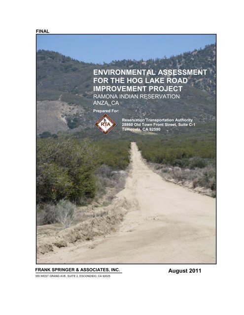
Hog Lake Road is a 8,473 foot-long unpaved <strong>road</strong> extending nor<strong>the</strong>ast from Bautista<br />
Road to <strong>the</strong> Ramona Reservation, and <strong>the</strong>n turns north through <strong>the</strong> Ramona<br />
Reservation. The proposed <strong>road</strong> <strong>improvement</strong>s extend through Township 7 South,<br />
Range 2 East, Section 1; Township 6 South, Range 2 East, Section 36; and<br />
Township 6 South, Range 3 East, Section 30 and 31; within <strong>the</strong> Anza Quadrangle.<br />
Federal lands underlie Hog Lake Road beginning at <strong>the</strong> intersection of Wheat Road,<br />
at <strong>the</strong> Forest Boundary, and extend nor<strong>the</strong>ast along Hog Lake Road <strong>for</strong> 6,390 feet to<br />
<strong>the</strong> Ramona Indian Reservation Boundary. Construction activity will extend a fur<strong>the</strong>r<br />
987 feet nor<strong>the</strong>ast through <strong>the</strong> Reservation, terminating just past <strong>the</strong> first <strong>road</strong><br />
intersection. Non-federal privately held lands begin at <strong>the</strong> intersection of Hog Lake<br />
Road and Bautista Road and extend 1,096 feet nor<strong>the</strong>ast to Wheat Road, at <strong>the</strong><br />
Forest Boundary.<br />
Frank Springer & Associates, Inc. Page 4 of 79 Environmental Assessment
Ramona Hog Lake Road Improvement Project August 2011<br />
Figure 1: General Vicinity<br />
Frank Springer & Associates, Inc. Page 5 of 79 Environmental Assessment
Ramona Hog Lake Road Improvement Project August 2011<br />
Figure 2: Proposed Project Overview<br />
Frank Springer & Associates, Inc. Page 6 of 79 Environmental Assessment
Ramona Hog Lake Road Improvement Project August 2011<br />
Hog Lake Road has structural problems caused by inadequate drainage. The width<br />
of <strong>the</strong> <strong>road</strong> varies and is difficult to maintain. Line of sight is insufficient along many<br />
lengths of <strong>the</strong> <strong>road</strong>, presenting safety concerns. Heavy rain, ice or snow on <strong>the</strong><br />
<strong>road</strong>.in winter often prevents access to <strong>the</strong> Ramona Reservation, as poor wea<strong>the</strong>r<br />
makes <strong>the</strong> already poor <strong>road</strong> conditions even more treacherous. Emergency vehicle<br />
access to <strong>the</strong> Ramona Reservation is presently slowed due to poor <strong>road</strong> conditions<br />
and a lack of signage. An improved access <strong>road</strong> would allow faster, more efficient<br />
navigation and access <strong>for</strong> emergency vehicles.<br />
As seen in Figure 2, Hog Lake Road crosses over two privately owned parcels. The<br />
travel route crossing <strong>the</strong> private land is not recognized in <strong>the</strong> County Transportation<br />
System. Nei<strong>the</strong>r <strong>the</strong> Forest Service nor <strong>the</strong> BIA has a recorded easement across <strong>the</strong><br />
private lands, <strong>the</strong> Reservation or Forest lands, respectively. As part of this Proposed<br />
Action, land use easements along NFR 6S18 alignment will be issued to <strong>the</strong> Forest<br />
Service across <strong>the</strong> private and Ramona Reservation lands and <strong>the</strong> BIA will be issued<br />
easements on behalf of <strong>the</strong> Ramona Tribe across <strong>the</strong> private and National Forest<br />
System lands (see Figure 3).<br />
Frank Springer & Associates, Inc. Page 7 of 79 Environmental Assessment
Ramona Hog Lake Road Improvement Project August 2011<br />
Figure 3: Land Ownership and Proposed Easements<br />
Frank Springer & Associates, Inc. Page 8 of 79 Environmental Assessment
Ramona Hog Lake Road Improvement Project August 2011<br />
Purpose and Need<br />
There is a need <strong>for</strong> safe access to and from <strong>the</strong> Ramona Reservation. The current<br />
condition of <strong>the</strong> <strong>road</strong> does not meet <strong>the</strong> needs of public safety or resource<br />
conditions. There is also a need to resolve right-of-way and <strong>road</strong> maintenance<br />
issues.<br />
There is a need <strong>for</strong> safer, easier access to <strong>the</strong> Ramona Reservation <strong>for</strong> residents and<br />
Tribal members and <strong>for</strong> improved emergency vehicle response time. The current<br />
access <strong>road</strong> is unsafe due to lack of striping, inadequate signage, and poor visibility<br />
(line of sight). In addition, various structural deficiencies are causing <strong>road</strong> and soil<br />
erosion. In short, a <strong>road</strong> reconstructed, improved and frequently maintained would be<br />
much safer <strong>for</strong> residents and visitors, and allow <strong>for</strong> better and more reliable all-season<br />
access.<br />
There is also a need <strong>for</strong> right of ways through both tribal, private, and national <strong>for</strong>est<br />
lands. The current landownership pattern requires tribal members to cross national<br />
<strong>for</strong>est lands and private lands to access <strong>the</strong> reservation. Similarly, access to national<br />
<strong>for</strong>est lands is through both reservation and private land. Right of access is not legally<br />
established through <strong>the</strong> several ownerships. It is desirable that both public and tribal<br />
access issues be resolved due to current inefficiencies in <strong>road</strong> maintenance and<br />
Forest Service inability to meet land management goals.<br />
In addition, <strong>the</strong>re is a need to reconcile <strong>road</strong> construction standards between <strong>the</strong> BIA<br />
and Forest Service. The BIA designs stream crossings to a 25 – year flood standard<br />
while <strong>the</strong> USFS Land and Resource Management Plan requires that such structures<br />
be constructed to a 50 –year standard.<br />
Forest Plan Management Direction<br />
One primary goal of <strong>the</strong> Forest Plan that would be met is <strong>the</strong> establishment and<br />
maintenance of strong relationships and partnerships with Native American tribes. A<br />
desired condition stated in <strong>the</strong> LMP is, “…<strong>the</strong> national <strong>for</strong>ests are maintained in a<br />
condition so that tribes and o<strong>the</strong>r Native American groups and individuals can exercise<br />
and retain traditional connections to <strong>the</strong> land and to foster both traditional and<br />
contemporary cultural uses of <strong>the</strong> national <strong>for</strong>ests.” Implementation of this proposed<br />
Project will help <strong>the</strong> Forest to meet this objective.<br />
Wildfire prevention and community protection is a priority of <strong>the</strong> Forest. The Ramona<br />
Reservation is in a region which has historically been at high risk <strong>for</strong> wildfires. There<br />
is an existing fire break (NFR 6S20) that traverses <strong>the</strong> length of <strong>the</strong> reservation<br />
which is considered strategically valuable in preventing <strong>the</strong> spread of a wildfire or<br />
structure fire in <strong>the</strong> area. Hog Lake Road provides <strong>the</strong> most direct vehicle access to<br />
<strong>the</strong> Ramona Reservation; <strong>the</strong>re<strong>for</strong>e <strong>the</strong> deteriorated <strong>road</strong> conditions are of particular<br />
concern during times when rapid evacuation is required. An improved <strong>road</strong> would<br />
Frank Springer & Associates, Inc. Page 9 of 79 Environmental Assessment
Ramona Hog Lake Road Improvement Project August 2011<br />
provide <strong>for</strong> safer, faster evacuation <strong>for</strong> <strong>the</strong> Ramona Tribe and a more efficient means<br />
of access <strong>for</strong> fire and o<strong>the</strong>r emergency vehicles to get to <strong>the</strong> Reservation.<br />
The goals of <strong>the</strong> LMP include <strong>the</strong> conservation of federally listed species habitats,<br />
and <strong>the</strong> recovery or movement towards recovery, of listed species. This Project is<br />
consistent with management direction <strong>for</strong> threatened, endangered, proposed,<br />
candidate, and sensitive species management contained in Part 2 of <strong>the</strong> LMP.<br />
Resources such as wildlife, plants, soil, and hydrology will be protected as directed<br />
in <strong>the</strong> LMP. There is suitable and occupied habitat <strong>for</strong> <strong>the</strong> federally endangered<br />
Quino checkerspot butterfly in <strong>the</strong> area. Mitigations/design criteria as specified in<br />
<strong>the</strong> Section 7 consultation with U.S. Fish and Wildlife Service will be incorporated to<br />
ensure that all resources are protected and any potential conflicts are avoided.<br />
The Project area is located within <strong>the</strong> Back Country Land Use Zone and <strong>the</strong> Anza<br />
“Place”. Suitable Zone activities include:<br />
Public motorized use on National Forest System Roads<br />
Road re-construction;<br />
The establishment of community protection areas and<br />
Fuelbreak construction<br />
The Anza “Place”, as described in <strong>the</strong> LMP, has unique features that need to be<br />
given attention when <strong>project</strong>s are proposed. The nearby Bautista Creek has been<br />
designated a Wild & Scenic River, and <strong>the</strong> Quino checkerspot butterfly occupied<br />
habitat adjacent to Hog Lake Road. The southwest slope of Thomas Mountain also<br />
figures prominently in <strong>the</strong> Anza “Place”. The proposed Project is consistent with <strong>the</strong><br />
direction in <strong>the</strong> LMP <strong>for</strong> <strong>the</strong> Anza “Place”.<br />
Forest Service Policy<br />
Direction from <strong>the</strong> Forest Service Manual, Roads and Rights-of-way section 2730.2,<br />
states among <strong>the</strong> objectives to "accommodate <strong>the</strong> access needs <strong>for</strong> <strong>the</strong> protection,<br />
development, and utilization of lands and resources owned by private interests …<br />
when <strong>the</strong> planned <strong>for</strong>est development <strong>road</strong> system and public <strong>road</strong> system do not<br />
meet those needs adequately.” Implementation of <strong>the</strong> Proposed Action would provide<br />
better access to adjacent Forest Service land, as well as improved access <strong>for</strong><br />
residents who use this <strong>road</strong> as a primary means of access.<br />
An additional Forest Service Manual objective is to “protect and enhance <strong>the</strong> quality<br />
of air … of Forest Service administered lands in <strong>the</strong> granting of any right-of-way.” Air<br />
pollution by particulate matter is a matter of concern in Cali<strong>for</strong>nia. Fine Particulate<br />
Matter (PM) is comprised of dust, dirt, soot, smoke, and o<strong>the</strong>r particulates from<br />
sources such as wind, fires, transportation, and industry. The U.S. Environmental<br />
Protection Agency (EPA) has designated <strong>the</strong> County of Riverside as an area of<br />
Frank Springer & Associates, Inc. Page 10 of 79 Environmental Assessment
Ramona Hog Lake Road Improvement Project August 2011<br />
“serious” non-attainment area <strong>for</strong> fine particulate matter (PM10). Paving Hog Lake<br />
Road would help improve air quality in <strong>the</strong> immediate area, as it would decrease<br />
fugitive dust production by vehicles driving on <strong>the</strong> <strong>road</strong>. This would enhance <strong>the</strong><br />
quality of wildlife and botanical resources adjacent to <strong>the</strong> <strong>project</strong> area. Paving <strong>the</strong><br />
<strong>road</strong> would also decrease noise caused by vehicles traversing <strong>the</strong> <strong>road</strong>.<br />
The National Forest Management Act (NFMA) gives direction on providing diversity<br />
of plant and animal communities, and <strong>for</strong> providing habitat to maintain viable<br />
populations of existing native and desired non-native vertebrate species in planning<br />
areas. Fur<strong>the</strong>r direction is given in <strong>the</strong> 1983 USDA Departmental Regulation 9500-4<br />
that habitats <strong>for</strong> all existing native and desired non-native wildlife species will be<br />
managed to maintain at least viable populations of such species. The regulations at<br />
36 CFR 219.20 give direction on ecological sustainability, including species diversity<br />
and providing <strong>for</strong> viability of wildlife populations.<br />
Proposed Action<br />
The proposed Project involves <strong>the</strong> paving of Hog Lake Road, site preparation, and<br />
<strong>the</strong> installation of asphalt-concrete berms, downdrains, and rip-rap <strong>for</strong> <strong>the</strong> box culvert<br />
under <strong>the</strong> <strong>road</strong>. Only very minor <strong>road</strong> cuts and fills will be required except at <strong>the</strong> box<br />
culvert structure proposed at an intermittent blue line stream crossing. The culvert<br />
design will require a Forest Plan amendment in order to accommodate <strong>the</strong> smaller<br />
BIA standard design <strong>for</strong> a 25-year flood event ra<strong>the</strong>r than a Forest Service standard<br />
50-year flood event.<br />
Paving and re-designing of <strong>road</strong> structures will occur in such a way as to minimize<br />
<strong>environmental</strong>, economic, and social impacts on <strong>the</strong> surrounding area, and meet <strong>the</strong><br />
requirements of NEPA.<br />
The great majority of paving would occur on disturbed land which is already in use as<br />
<strong>the</strong> existing unpaved <strong>road</strong>. Hog Lake Road has an average width of approximately 30<br />
feet, and <strong>the</strong> proposed paved <strong>road</strong> would be 22 feet in width with 2 foot shoulders.<br />
Except in <strong>the</strong> relatively small area where box culvert would be installed, no <strong>road</strong><br />
widening and very minimal grading would be required.<br />
New easements will be granted by and to <strong>the</strong> BIA, Ramona Tribe, Forest Service, and<br />
<strong>the</strong> owner of APN 572-050-048, a parcel of land located between <strong>the</strong> Ramona Tribe’s<br />
privately held parcel of land and National Forest Land.<br />
The entire <strong>road</strong> within <strong>the</strong> Project area will be brought into <strong>the</strong> BIA Transportation<br />
System and <strong>the</strong> BIA will assume responsibility <strong>for</strong> <strong>road</strong> reconstruction, <strong>improvement</strong>,<br />
and maintenance. The ownership and/or stewardship of <strong>the</strong> underlying estate,<br />
however, would remain unchanged.<br />
Resources such as cultural sites, wildlife, plants, soil, and hydrology will be protected<br />
as directed in <strong>the</strong> LMP. Design criteria/mitigation measures addressing various<br />
Frank Springer & Associates, Inc. Page 11 of 79 Environmental Assessment
Ramona Hog Lake Road Improvement Project August 2011<br />
resource elements will be incorporated into proposed actions to ensure that all<br />
resources are protected and any potential conflicts are avoided . Site-specific<br />
management techniques and applicable guidance from <strong>the</strong> Forest Land Management<br />
Plan and Forest Service Handbook will be followed when conducting activities within<br />
riparian conservation areas (RCAs).<br />
Decision Framework<br />
Responsible Officials: The responsible official <strong>for</strong> BIA is Amy Dutschke, Regional<br />
Director, Pacific Regional Office. The responsible official <strong>for</strong> <strong>the</strong> Forest Service is<br />
<strong>the</strong> Regional Forester, Pacific Southwest Region. A decision will be made to<br />
implement <strong>the</strong> proposed action, modify <strong>the</strong> proposed action, take no action, or<br />
decide if preparation of an EIS is required according to applicable law, regulation<br />
and policy.<br />
Conveyance Signatories: The conveying official <strong>for</strong> BIA is Robert J. Eben,<br />
Superintendent <strong>for</strong> <strong>the</strong> Sou<strong>the</strong>rn Cali<strong>for</strong>nia Agency, Bureau of Indian Affairs<br />
Riverside, Cali<strong>for</strong>nia. The conveying official <strong>for</strong> <strong>the</strong> Forest Service is <strong>the</strong> Regional<br />
Forester, Pacific Southwest Region..<br />
Public Involvement<br />
On February 2, 2009, a scoping letter was sent to individuals, permit holders,<br />
organizations, agencies and Tribal governments who had previously shown an<br />
interest in <strong>the</strong> Forest route inventory or land management actions. The letter<br />
requested comments on <strong>the</strong> proposed action be made during <strong>the</strong> scoping period of<br />
February 5, 2009 to March 6, 2009.<br />
On February 5th, 2009, a notice was published in <strong>the</strong> Idyllwild Town Crier. The<br />
proposal and associated maps were listed on <strong>the</strong> Forest’s Schedule of Proposed<br />
Actions (SOPA) on April 1, 2009. The listing can be found on <strong>the</strong> FOREST Public<br />
website at http://data.ecosystemmanagement.org/nepaweb/nepa_content.php?<strong>project</strong>=28498.<br />
During <strong>the</strong> scoping process, four (4) comments from <strong>the</strong> public were received.<br />
Comments from <strong>the</strong> public and o<strong>the</strong>r agencies are used to <strong>for</strong>mulate issues<br />
concerning <strong>the</strong> proposed action. An issue is a matter of public concern regarding <strong>the</strong><br />
proposed action and its <strong>environmental</strong> impacts.<br />
No issues of importance were raised from <strong>the</strong> four comments received.<br />
Two comments were in full support of <strong>the</strong> <strong>project</strong>.<br />
Two comments were outside of <strong>the</strong> scope of this <strong>project</strong> as <strong>the</strong>ir main concern<br />
was <strong>the</strong> use of federal tax dollars, <strong>the</strong> small number of people <strong>the</strong>y perceived<br />
would benefit (<strong>the</strong> few reservation residents) and desire to pave different <strong>road</strong>s in<br />
<strong>the</strong> Anza area that <strong>the</strong>y perceived would benefit a greater number of people. The<br />
Frank Springer & Associates, Inc. Page 12 of 79 Environmental Assessment
Ramona Hog Lake Road Improvement Project August 2011<br />
proposed <strong>project</strong> was requested by <strong>the</strong> Sovereign Nation of <strong>the</strong> Ramona Tribe<br />
and <strong>the</strong> RTA. It would cross Federal Forest System lands and is funded by Tribal<br />
government.<br />
One comment additionally requested in<strong>for</strong>mation be more available in <strong>the</strong> local<br />
Anza publications. The <strong>project</strong> mailing list has been updated with <strong>the</strong> local<br />
contacts requested.<br />
Chapter 2 – Alternatives<br />
This chapter describes and compares <strong>the</strong> alternatives considered <strong>for</strong> <strong>the</strong> Hog Lake<br />
Road Improvement Project EA. It describes both alternatives considered in detail<br />
and those eliminated from detailed study. The end of this chapter presents <strong>the</strong><br />
alternatives in a table so that <strong>the</strong> alternatives and <strong>the</strong>ir <strong>environmental</strong> impacts can be<br />
readily compared.<br />
The Proposed Action Alternative<br />
The existing Hog Lake Road, within <strong>the</strong> Project area, will be paved and reconstructed<br />
with <strong>the</strong> installation of asphalt-concrete berms, downdrains, a box culvert, and rip-rap<br />
<strong>for</strong> <strong>the</strong> box culvert under <strong>the</strong> <strong>road</strong>. Approximately 800 lineal feet of <strong>the</strong> proposed<br />
<strong>improvement</strong>s are located on <strong>the</strong> Ramona Reservation and 6,700 feet are on National<br />
Forest System lands. The paved <strong>road</strong> specifications will be: 22 feet in width with 2 foot<br />
shoulders, within a right-of-way width of 50 feet, except <strong>for</strong> “pop outs” <strong>for</strong> some<br />
drainage structures. As illustrated below in Figure 4, a 2% cross-slope section<br />
approach is proposed which would enable natural drainage courses and patterns to be<br />
maintained, as <strong>the</strong> present <strong>road</strong> is generally at cross-slopes of approximately 2%.<br />
Figure 4: Typical Section With 2% Road Cross-Slope<br />
Frank Springer & Associates, Inc. Page 13 of 79 Environmental Assessment
Ramona Hog Lake Road Improvement Project August 2011<br />
As illustrated in Figure 5, a 10’ x 5’ double box culvert is proposed at <strong>the</strong> crossing of<br />
<strong>the</strong> existing <strong>road</strong> with <strong>the</strong> intermittent blue-line stream to provide all-wea<strong>the</strong>r access.<br />
This culvert is designed to BIA requirements <strong>for</strong> a 25 year flood event. The design will<br />
require a site specific Forest Plan amendment in order to accommodate <strong>the</strong> smaller<br />
BIA design, as <strong>the</strong> Forest LMP calls <strong>for</strong> culverts designed to accommodate 50 year<br />
events (page 19 and 20 of 33). The amendment will apply only to this area of this<br />
<strong>project</strong>. Only very minor <strong>road</strong> cuts and fills will be required except at <strong>the</strong> box culvert<br />
structure. Paving and re-designing of <strong>road</strong> structures will occur in such a way as to<br />
minimize <strong>environmental</strong>, economic, and social impacts on <strong>the</strong> surrounding area, and<br />
meet <strong>the</strong> requirements of NEPA.<br />
National Forest Road 6S18 (Hog Lake Road) is <strong>the</strong> only potentially year round System<br />
<strong>road</strong> with a direct connection from <strong>the</strong> Reservation to a dedicated year round County<br />
Road (Bautista) outside <strong>the</strong> Forest boundary. The great majority of paving would<br />
occur on encumbered land which is already in use as <strong>the</strong> existing unpaved <strong>road</strong>. Hog<br />
Lake Road has an average width of approximately 30 feet, and <strong>the</strong> proposed paved<br />
<strong>road</strong> would be 22 feet in width with 2 foot shoulders. Except in <strong>the</strong> relatively small area<br />
where <strong>the</strong> 10’ x 5’ double box culvert structure would be installed, no <strong>road</strong> widening<br />
and very minimal grading would be required.<br />
Figure 5: 10’ x 5’ Double Box Culvert<br />
New easements will be granted by and to <strong>the</strong> BIA, Ramona Tribe, Forest Service, and<br />
<strong>the</strong> owner of APN 572-050-048, which is a parcel of land located between <strong>the</strong> Ramona<br />
Tribe’s privately held parcel of land and National Forest Land. Newly created<br />
easements that fall within <strong>the</strong> Project area include <strong>the</strong> following (see Figure 3):<br />
A non-exclusive public <strong>road</strong> easement over those parts of Hog Lake Road<br />
passing over National Forest Land will be granted by <strong>the</strong> Forest Service to<br />
Frank Springer & Associates, Inc. Page 14 of 79 Environmental Assessment
Ramona Hog Lake Road Improvement Project August 2011<br />
<strong>the</strong> BIA, on behalf of <strong>the</strong> Ramona Tribe.<br />
A non-exclusive public <strong>road</strong> easement over those parts of Hog Lake Road<br />
passing over private land held by <strong>the</strong> Ramona Tribe will be granted by <strong>the</strong><br />
Ramona Tribe to <strong>the</strong> Forest Service, <strong>the</strong> owner of APN 572-050-048, and<br />
<strong>the</strong> BIA.<br />
A non-exclusive public <strong>road</strong> easement over those parts of Hog Lake Road<br />
passing over private land owned by <strong>the</strong> owner of APN 572-050-048 will be<br />
granted by <strong>the</strong> owner of APN 572-050-048 to <strong>the</strong> Ramona Tribe, <strong>the</strong> Forest<br />
Service and <strong>the</strong> BIA<br />
A non-exclusive public <strong>road</strong> easement over those parts of Hog Lake Road<br />
passing over Ramona Reservation land will be granted by <strong>the</strong> BIA, on<br />
behalf of <strong>the</strong> Ramona Tribe, to <strong>the</strong> Forest Service.<br />
The <strong>road</strong> would be brought into <strong>the</strong> BIA transportation system and <strong>the</strong> BIA would<br />
assume future responsibilities <strong>for</strong> <strong>road</strong> reconstruction, <strong>improvement</strong> and maintenance.<br />
The ownership and/or stewardship of <strong>the</strong> underlying estate, however, would remain<br />
unchanged. A shifting of jurisdiction of <strong>the</strong> maintenance responsibilities is not <strong>the</strong><br />
same as changing underlying land ownership. No change in title is proposed.<br />
Generation of <strong>the</strong> easement documents will be followed by Construction Stipulations,<br />
Road Maintenance Agreement and Fire Plan to ensure standards in all activities are<br />
matters of agreement.<br />
Resources such as cultural sites, wildlife, plants, soil, and hydrology will be protected<br />
as directed in <strong>the</strong> LMP<br />
Mitigation Measures / Design Criteria<br />
Mitigation measures / design criteria addressing various resource elements will be<br />
incorporated into proposed action to ensure that all resources are protected and any<br />
potential conflicts are avoided.<br />
Table 1: Mitigation Measures / Design Criteria<br />
Resource Mitigation Method / Design Criteria<br />
Air Quality<br />
Fugitive Dust<br />
and Exhaust<br />
Emissions<br />
During grading and earthwork activities, <strong>the</strong> following<br />
mitigation measures / design criteria shall be employed to<br />
minimize <strong>the</strong> emission of pollutants during <strong>the</strong> construction<br />
activities:<br />
AIR-1: Total construction areas disturbed by clearing,<br />
earthmoving, or excavation shall be minimized.<br />
Frank Springer & Associates, Inc. Page 15 of 79 Environmental Assessment
Ramona Hog Lake Road Improvement Project August 2011<br />
Resource Mitigation Method / Design Criteria<br />
Biological Resources<br />
Quino<br />
Checkerspot<br />
Butterfly<br />
AIR-2: Dust suppression techniques shall be employed, such<br />
as watering during construction activities to prevent (or<br />
suppress) <strong>the</strong> fine particulate from leaving <strong>the</strong> surface and<br />
becoming airborne through <strong>the</strong> action of mechanical<br />
disturbance or wind. Watering of exposed soils in traffic areas<br />
and covering stockpiles of sand, soil and similar materials on<br />
construction sites (minimum twice daily)<br />
AIR-3: The load of all haul trucks shall be covered;<br />
AIR-4: Truck speeds on unpaved surfaces shall be limited to<br />
15 miles per hour;<br />
AIR-5: Stationary and mobile equipment shall be maintained<br />
in proper working order, i.e., tuned <strong>for</strong> maximum efficiency<br />
per manufacturer’s specifications;<br />
AIR-6: Cleaning loose soil from construction vehicles be<strong>for</strong>e<br />
exiting <strong>the</strong> work site; and<br />
AIR-7: Restricting or prohibiting work on days of high winds<br />
(>30 mph) or when air quality is very poor.<br />
BIO-1: In order to compensate <strong>for</strong> <strong>the</strong> loss of 0.15 acres of<br />
Red Shank Chamise Chaparral, mitigation credits shall be<br />
purchased at no less than a 1:1 ratio at <strong>the</strong> Wilson Creek<br />
Mitigation Bank or o<strong>the</strong>r suitable (USFWS approved) bank, or<br />
mitigated in <strong>the</strong> Project area, on lands designated and<br />
approved by <strong>the</strong> USFWS.<br />
BIO-2: All <strong>road</strong> grading work shall be conducted outside of<br />
<strong>the</strong> adult Quino checkerspot butterfly flight season and <strong>the</strong><br />
growth season <strong>for</strong> Quino checkerspot butterfly host plants -<br />
February 1 – July 31.<br />
BIO-3: Standard Best Management Practices (BMPs) will be<br />
employed to limit <strong>the</strong> release of fugitive dust. See AQ-1<br />
through AQ-7.<br />
Frank Springer & Associates, Inc. Page 16 of 79 Environmental Assessment
Ramona Hog Lake Road Improvement Project August 2011<br />
Resource Mitigation Method / Design Criteria<br />
Sensitive and<br />
Watch List<br />
Species<br />
A qualified biological monitor shall be present during all<br />
construction activities to consult on minimizing impacts and<br />
monitor implementation of permit conditions. The biological<br />
monitor will:<br />
BIO-4: Conduct a preconstruction walk-over to identify<br />
any new sensitive species within <strong>the</strong> Project impact<br />
area. If located, impacts will be assessed by <strong>the</strong><br />
biological supervisor and recommendations made.<br />
BIO-5: Monitor <strong>the</strong> limits of impacts and construction<br />
and verify that work areas are fenced with highly<br />
visible fencing (e.g., orange construction fencing) to<br />
ensure impacts do not occur outside of <strong>the</strong> Project<br />
footprint.<br />
BIO-6: Walk around and look under machinery each<br />
morning to flush any wildlife.<br />
BIO-7: After construction is complete, <strong>the</strong> speed limit on <strong>the</strong><br />
<strong>road</strong> will be set at 25 mph, and will be en<strong>for</strong>ced by <strong>the</strong><br />
Ramona Tribe.<br />
BIO-8: Road signs will be erected along <strong>the</strong> <strong>road</strong>way asking<br />
motorists to stay on <strong>the</strong> <strong>road</strong> and observe <strong>the</strong> speed limit and<br />
educating <strong>the</strong>m about <strong>the</strong> presence of sensitive and<br />
endangered species in <strong>the</strong> area, to reduce <strong>the</strong> potential <strong>for</strong><br />
pull-offs and future habitat or sensitive plant impacts.<br />
BIO-9: Routine <strong>road</strong> maintenance activities shall be<br />
scheduled to occur between July 1 and February 1. If cases<br />
occur where maintenance activities are required <strong>for</strong> public<br />
safety, <strong>the</strong>n prior to conducting any maintenance, <strong>the</strong><br />
Ramona Tribe will contact <strong>the</strong> US FWS by telephone or<br />
email, in<strong>for</strong>m <strong>the</strong>m of <strong>the</strong> situation prior to conducting <strong>the</strong><br />
maintenance, and follow any precautions or mitigation<br />
measures provided by <strong>the</strong> US FWS that would minimize<br />
impacts to Quino.<br />
BIO-1 and BIO-3 through BIO-8 Additionally:<br />
Frank Springer & Associates, Inc. Page 17 of 79 Environmental Assessment
Ramona Hog Lake Road Improvement Project August 2011<br />
Resource Mitigation Method / Design Criteria<br />
BIO-10: All refuse created or brought on site by construction<br />
personnel or contractors must be placed in covered<br />
containers, removed from <strong>the</strong> site daily and disposed of<br />
properly.<br />
BIO-11: The Biological Monitor shall examine <strong>the</strong> Project<br />
vicinity <strong>for</strong> any bird nests (tree, cavity, or ground) in which<br />
fledging has not occurred. If any are found during layout and<br />
marking or implementation, <strong>the</strong> Project biologist will evaluate<br />
and recommend protection measures.<br />
Management<br />
Indicator Species BIO-1, BIO-3-8, BIO-10 -11. See Above.<br />
Migratory Birds BIO-1, BIO-4, BIO-6, BIO-11. See Above.<br />
Weed Risk BIO-13: All heavy equipment used on this Project will be<br />
cleaned and inspected be<strong>for</strong>e moving into <strong>the</strong> Project area.<br />
This will ensure no noxious weeds will enter <strong>the</strong> Project area.<br />
Fire Risk<br />
Fire Risk<br />
BIO-14: All equipment will be cleaned and inspected be<strong>for</strong>e<br />
leaving <strong>the</strong> Project area to prevent <strong>the</strong> spread of existing<br />
weeds to new areas.<br />
BIO-15: All temporary staging areas shall be placed in<br />
unvegetated areas with compacted soils, and if adjacent to<br />
natural vegetation communities, shall be delineated with silt<br />
fencing. Staging areas will not be infested with noxious<br />
weeds.<br />
FIR-1: In order to minimize fire risk during <strong>the</strong> construction<br />
phase of <strong>the</strong> Project, <strong>the</strong> Fire Plan For Construction And<br />
Service Contracts 6-14-2006 (FSH 6309.32 and 6309.11)<br />
shall be implemented by <strong>the</strong> Project proponent.<br />
Land Use, Ownership, Easements, Traffic, and Road Maintenance<br />
Road<br />
Maintenance<br />
Socio-Economic and Noise Effects<br />
BIO-9, Additionally BMP’s will be employed including:<br />
BIO-13, 14, SOI-1, 2, 3, 4, and AIR-2, 5, 6, 7.<br />
Frank Springer & Associates, Inc. Page 18 of 79 Environmental Assessment
Ramona Hog Lake Road Improvement Project August 2011<br />
Resource Mitigation Method / Design Criteria<br />
Noise<br />
NOI-1: To reduce <strong>the</strong> effects of construction noise, <strong>the</strong><br />
applicant shall require construction contractors to limit high<br />
noise-producing activities to <strong>the</strong> least noise-sensitive times of<br />
day and week (e.g., 7:00 am to 6:00 pm), Monday through<br />
Friday<br />
NOI-2: The applicant shall require that all construction<br />
contractors equip and maintain all construction equipment<br />
with effective muffler exhaust systems no less effective than<br />
those provided on <strong>the</strong> original equipment.<br />
NOI-3: During construction, <strong>the</strong> Project Engineer shall require<br />
all construction contractors to comply with all federal, state,<br />
county and local sound control and noise-level regulations<br />
and ordinances.<br />
NOI-4: As directed by <strong>the</strong> Project Engineer, <strong>the</strong> contractor<br />
shall implement appropriate additional noise mitigation<br />
measures including, but not limited to, changing <strong>the</strong> location<br />
of stationary equipment, shutting off idling equipment,<br />
rescheduling construction activity, notifying adjacent<br />
residents in advance of construction work or installing<br />
acoustical barriers around stationary construction noise<br />
sources<br />
Soils and Hydrology<br />
Soils To reduce <strong>the</strong> possibility of erosion, <strong>the</strong> applicant shall<br />
require construction contractors to utilize <strong>the</strong> following best<br />
management practices (BMPs) to prevent discharges from<br />
entering waters of <strong>the</strong> U.S. during construction.<br />
SOI-1: Erosion control and sedimentation prevention<br />
methods shall be utilized during <strong>the</strong> construction phase of <strong>the</strong><br />
<strong>project</strong>. These will include <strong>the</strong> placement of fiber rolls, sand<br />
bags, rice mats, straw wattles, or similar measures.<br />
SOI-2: No stockpiles shall be placed within waters of <strong>the</strong> U.S.<br />
SOI-3: No vehicle maintenance shall be conducted within or<br />
adjacent to waters of <strong>the</strong> U.S.<br />
Frank Springer & Associates, Inc. Page 19 of 79 Environmental Assessment
Ramona Hog Lake Road Improvement Project August 2011<br />
Resource Mitigation Method / Design Criteria<br />
SOI-4: Proper use and disposal of oil, gasoline, diesel fuel,<br />
antifreeze and o<strong>the</strong>r hazardous substances shall be en<strong>for</strong>ced<br />
by <strong>the</strong> Contractor<br />
Soils and Hydrology, Continued<br />
Hydrology HYD-1: Impacts to federal/ACOE and state/CDFG drainages<br />
<strong>for</strong> culverts and <strong>road</strong> crossings are covered under <strong>the</strong><br />
Sections 404/401 of <strong>the</strong> Clean Water Act Permit Programs<br />
and <strong>the</strong> 1600 Streambed Alteration Program. In order to<br />
compensate <strong>for</strong> <strong>the</strong> loss of waters of <strong>the</strong> U.S., mitigation at a<br />
no less than 1:1 ratio within a suitable and approved<br />
mitigation bank, or mitigated in <strong>the</strong> Project area, on lands<br />
designated and approved by <strong>the</strong> ACOE and/or CDFG.<br />
The “No Action” Alternative<br />
Under <strong>the</strong> No Action alternative <strong>the</strong> RTA will take no affirmative action (<strong>the</strong>re will be<br />
no change in <strong>the</strong> current condition of <strong>the</strong> <strong>road</strong>). The “no action” alternative would<br />
avoid all new impacts. The <strong>road</strong> would remain unpaved and unimproved. No new<br />
drainage structures will be installed. Drainage of <strong>the</strong> <strong>road</strong> at <strong>the</strong> blue line stream<br />
crossing would not be improved to provide all-wea<strong>the</strong>r <strong>road</strong> access. Road use permit<br />
and <strong>road</strong> maintenance issues would remain unresolved. Unsafe <strong>road</strong> conditions<br />
would continue to persist, and emergency vehicle access to Ramona Reservation<br />
would continue to be inefficient, with response times adversely affected. Poor <strong>road</strong><br />
conditions would continue to adversely impact evacuation times of Ramona<br />
Reservation residents during emergency events such as wildfires.<br />
Frank Springer & Associates, Inc. Page 20 of 79 Environmental Assessment
Ramona Hog Lake Road Improvement Project August 2011<br />
Comparison of Alternatives<br />
This section compares <strong>the</strong> alternatives by summarizing key differences between <strong>the</strong><br />
alternatives in <strong>the</strong> following table. Chapter 3 describes <strong>the</strong> <strong>environmental</strong><br />
consequences of <strong>the</strong> alternatives in detail.<br />
Table 2: Comparison of Alternatives<br />
Resource Proposed Action Alternative “No Action” Alternative<br />
Wildlife<br />
RF Sensitive<br />
Animals<br />
(20 species)<br />
Federally-Listed<br />
Animal Species<br />
(1 species - Quino<br />
Checkerspot<br />
butterfly)<br />
Management<br />
Indicator Species –<br />
Animals<br />
(2 species)<br />
Botany<br />
Federally-Listed<br />
Plant Species<br />
RF Sensitive Plants<br />
(14 species)<br />
Management<br />
Indicator Species –<br />
Plants<br />
Air Quality<br />
May affect individuals, but is not<br />
likely to result in a trend toward<br />
Federal listing or loss of viability<br />
<strong>for</strong> <strong>the</strong>se species.<br />
Not likely to jeopardize <strong>the</strong><br />
continued existence of <strong>the</strong> Quino<br />
checkerspot butterfly and is not<br />
likely to adversely modify its<br />
designated critical habitat.<br />
Removal of 0.15 acre of red<br />
shank-chamise chaparral within<br />
<strong>the</strong> <strong>project</strong> area will result in a very<br />
slight but permanent habitat loss<br />
<strong>for</strong> <strong>the</strong> Quino.<br />
No direct or indirect effects to <strong>the</strong><br />
habitat factor <strong>for</strong> which each<br />
species was chosen. A move<br />
nei<strong>the</strong>r toward nor away from <strong>the</strong><br />
desired <strong>for</strong>est condition.<br />
None present N/A<br />
May affect individuals, but is not<br />
likely to result in a trend toward<br />
Federal listing or loss of viability<br />
<strong>for</strong> <strong>the</strong>se species.<br />
None present N/A<br />
Reduction of particulate matter<br />
pollution, as dust generation would<br />
be much less on a paved surface<br />
No change would be<br />
anticipated.<br />
No change would be<br />
anticipated.<br />
No change would be<br />
anticipated.<br />
No change would be<br />
anticipated.<br />
Vehicle emissions would<br />
continue at present<br />
levels and fugitive dust<br />
Frank Springer & Associates, Inc. Page 21 of 79 Environmental Assessment
Ramona Hog Lake Road Improvement Project August 2011<br />
Resource Proposed Action Alternative “No Action” Alternative<br />
Hydrology/Soils<br />
Heritage<br />
than on an unpaved one.<br />
Improved vehicle gas mileage and<br />
reduction in exhaust emissions.<br />
Total impacts are estimated at<br />
4,288 sf (0.098 ac.) federal/ACOE<br />
and 6,429 sf (0.148 ac.)<br />
state/CDFG jurisdictional area.<br />
It is likely that sedimentation may<br />
be reduced over <strong>the</strong> long-term and<br />
erosion and hazardous material<br />
discharge reduced or prevented.<br />
No cultural resources were<br />
identified within <strong>the</strong> Project APE,<br />
so no effects to heritage<br />
resources.<br />
Human Health and Safety<br />
The <strong>road</strong> would be more<br />
accessible in all wea<strong>the</strong>r<br />
conditions. Access <strong>for</strong> emergency<br />
vehicles and response times<br />
would be improved and<br />
evacuation times reduced. Overall<br />
safety <strong>for</strong> residents and visitors<br />
would be improved.<br />
Aes<strong>the</strong>tics<br />
Fire fighting and prevention would<br />
be improved due to improved<br />
access to <strong>the</strong> Reservation and <strong>the</strong><br />
fuel break.<br />
No significant impacts. Views from<br />
<strong>the</strong> nearest residences, <strong>the</strong><br />
Cahuilla Wilderness and o<strong>the</strong>r<br />
nearby viewpoints would not be<br />
significantly affected.<br />
Land Use, Ownership, Easements<br />
A long-term, recordable <strong>road</strong><br />
special use easement would be<br />
granted by <strong>the</strong> FS <strong>for</strong> <strong>the</strong> benefit<br />
would add to particulate<br />
pollution.<br />
Damage to <strong>road</strong><br />
structure from erosion<br />
would be expected to<br />
continue at current<br />
levels.<br />
No effects to heritage<br />
resources.<br />
Safety and access would<br />
remain <strong>the</strong> same or<br />
would deteriorate over<br />
time due to fur<strong>the</strong>r<br />
erosion damage.<br />
Fire risk would remain<br />
<strong>the</strong> same or increase as<br />
access to <strong>the</strong> area<br />
deteriorates.<br />
No change to <strong>the</strong> current<br />
visual quality of <strong>the</strong> area.<br />
Lacking an authorization<br />
<strong>for</strong> maintenance or use,<br />
<strong>the</strong> Tribe would be<br />
Frank Springer & Associates, Inc. Page 22 of 79 Environmental Assessment
Ramona Hog Lake Road Improvement Project August 2011<br />
Resource Proposed Action Alternative “No Action” Alternative<br />
of <strong>the</strong> Ramona Tribe.<br />
subject to inconvenience,<br />
<strong>road</strong> closures due to<br />
driving conditions or<br />
Forest Closures (fire<br />
indexes, snow, etc.).<br />
Frank Springer & Associates, Inc. Page 23 of 79 Environmental Assessment
Ramona Hog Lake Road Improvement Project August 2011<br />
Chapter 3 – Affected Environment and Environmental<br />
Consequences<br />
This chapter summarizes <strong>the</strong> physical, biological, social and economic environments<br />
that are affected by <strong>the</strong> proposed action and alternatives, and describes <strong>the</strong><br />
expected effects on that environment from implementing <strong>the</strong> proposed action and<br />
alternatives. This chapter also presents <strong>the</strong> scientific and analytical basis <strong>for</strong> <strong>the</strong><br />
comparison of alternatives that was outlined in Table 2: Comparison of Alternatives.<br />
The affected environment section under each resource topic describes <strong>the</strong> existing<br />
condition, or baseline, against which <strong>environmental</strong> effects were evaluated and from<br />
which progress toward <strong>the</strong> desired condition can be measured. Environmental<br />
consequences <strong>for</strong>m <strong>the</strong> scientific and analytical basis <strong>for</strong> comparison of alternatives,<br />
including <strong>the</strong> proposed action, through compliance with standards set <strong>for</strong>th in <strong>the</strong><br />
2006 San Bernardino National Forest Land Management Plan (LMP) and a<br />
summary of monitoring required by <strong>the</strong> National Environmental Policy Act of 1969<br />
(NEPA) and National Forest Management Act of 1976. The <strong>environmental</strong><br />
consequences discussion centers on direct, indirect and cumulative effects, along<br />
with applicable mitigation measures. Effects can be neutral, beneficial or adverse.<br />
These terms are defined as follows:<br />
Direct effects are caused by <strong>the</strong> action and occur at <strong>the</strong> same place and time<br />
as <strong>the</strong> action.<br />
Indirect effects are caused by <strong>the</strong> action and are later in time or fur<strong>the</strong>r<br />
removed in distance, but are still reasonably <strong>for</strong>eseeable.<br />
Cumulative effects are those that result from <strong>the</strong> incremental impact of <strong>the</strong><br />
action when added to o<strong>the</strong>r past, present and reasonably <strong>for</strong>eseeable future<br />
actions.<br />
Cumulative Effects<br />
According to <strong>the</strong> Council on Environmental Quality (CEQ) NEPA regulations,<br />
“cumulative impact” is <strong>the</strong> impact on <strong>the</strong> environment which results from <strong>the</strong><br />
incremental impact of <strong>the</strong> action when added to o<strong>the</strong>r past, present and reasonably<br />
<strong>for</strong>eseeable future actions regardless of what agency (Federal or non-Federal) or<br />
person undertakes such actions (40 CFR 1508.7).<br />
In order to understand <strong>the</strong> contribution of past actions to <strong>the</strong> cumulative effects of <strong>the</strong><br />
proposed action and alternatives, this analysis relies on current <strong>environmental</strong><br />
conditions as a proxy <strong>for</strong> <strong>the</strong> impacts of past actions. This is because existing<br />
conditions reflect <strong>the</strong> aggregate impact of all prior human actions and natural events<br />
that have affected <strong>the</strong> environment and might contribute to cumulative effects.<br />
Frank Springer & Associates, Inc. Page 24 of 79 Environmental Assessment
Ramona Hog Lake Road Improvement Project August 2011<br />
This cumulative effects analysis does not attempt to quantify <strong>the</strong> effects of past<br />
human actions by adding up all prior actions on an action-by-action basis. There are<br />
several reasons <strong>for</strong> not taking this approach. First, a catalog and analysis of all past<br />
actions would be impractical to compile and unduly costly to obtain. Current<br />
conditions have been impacted by innumerable actions over <strong>the</strong> last century (and<br />
beyond) and trying to isolate <strong>the</strong> individual actions that continue to have residual<br />
impacts would be nearly impossible. Second, providing <strong>the</strong> details of past actions on<br />
an individual basis would not be useful to predict <strong>the</strong> cumulative effects of <strong>the</strong><br />
proposed action or alternatives. In fact, focusing on individual actions would be less<br />
accurate than looking at existing conditions, because <strong>the</strong>re is limited in<strong>for</strong>mation on<br />
<strong>the</strong> <strong>environmental</strong> impacts of individual past actions and one cannot reasonably<br />
identify each and every action over <strong>the</strong> last century that has contributed to current<br />
conditions. Additionally, focusing on <strong>the</strong> impacts of past human actions risks ignoring<br />
<strong>the</strong> important residual effects of past natural events that may contribute to<br />
cumulative effects just as much as human actions. By looking at current conditions,<br />
we are sure to capture all <strong>the</strong> residual effects of past human actions and natural<br />
events, regardless of which particular action or event contributed those effects.<br />
Third, public scoping <strong>for</strong> this Project did not identify any public interest or need <strong>for</strong><br />
detailed in<strong>for</strong>mation on individual past actions. Finally, <strong>the</strong> Council on Environmental<br />
Quality issued an interpretive memorandum on June 24, 2005 regarding analysis of<br />
past actions, which states, “agencies can conduct an adequate cumulative effects<br />
analysis by focusing on <strong>the</strong> current aggregate effects of past actions without delving<br />
into <strong>the</strong> historical details of individual past actions.” For <strong>the</strong>se reasons, <strong>the</strong> analysis<br />
of past actions in this section is based on current <strong>environmental</strong> conditions.<br />
Specific plans are customized regulatory documents in lieu of standard zoning that<br />
are used to plan <strong>project</strong>s and delineate land uses, infrastructure, development<br />
standards and criteria, and implementation measures. Specific plans must address<br />
consistency with <strong>the</strong> jurisdiction's General Plan, and can be used to implement <strong>the</strong><br />
General Plan within a limited area. The Ramona Reservation is located within <strong>the</strong><br />
Riverside Extended Mountain Plan (REMAP) Area. Projects and development<br />
considered when determining cumulative impacts were located within <strong>the</strong> San<br />
Bernardino National Forest (Forest), San Jacinto Ranger District (District) and <strong>the</strong><br />
Riverside Extended Mountain Area Plan (REMAP) area outlined in <strong>the</strong> Riverside<br />
County General Plan (RCGP) and Multiple Species Habitat Conservation Plan<br />
(MSHCP). These areas are illustrated below in Figure 6, Administrative Boundaries.<br />
Projects Considered When Determining Cumulative Impacts<br />
The following lists presents past, current and reasonably <strong>for</strong>eseeable future actions<br />
potentially contributing to cumulative effects.<br />
1. San Bernardino National Forest, San Jacinto Ranger District<br />
Within <strong>the</strong> District <strong>project</strong>s that are ongoing and/or will impact <strong>the</strong> District in <strong>the</strong><br />
<strong>for</strong>eseeable future include Fuel reduction Projects, Grazing allotments, Forest<br />
Recreation Use and <strong>the</strong> designation of Wilderness areas and Wild and Scenic<br />
Frank Springer & Associates, Inc. Page 25 of 79 Environmental Assessment
Ramona Hog Lake Road Improvement Project August 2011<br />
Rivers. Development or impacts associated with recreational use may include trails<br />
<strong>for</strong> biking, hiking and off-<strong>road</strong> vehicles, kiosk construction, camping sites and<br />
associated parking lot construction, among o<strong>the</strong>rs.<br />
Figure 6: Administrative Boundaries<br />
Fuel Reduction <strong>project</strong>s on <strong>the</strong> District include <strong>the</strong> Thomas Mountain,<br />
Rouse North and South, Garner Valley, Bonita Vista and Baldy Projects. Fuel<br />
Frank Springer & Associates, Inc. Page 26 of 79 Environmental Assessment
Ramona Hog Lake Road Improvement Project August 2011<br />
Reduction involves <strong>the</strong> reduction of excess fuel material from <strong>the</strong> area using<br />
hand removal, mechanical removal, b<strong>road</strong>cast burns, underburns and pile<br />
burns in stages over a period of several years. Fuel Reduction Management<br />
employing small scale burns are intended to reduce fire fuel by reducing<br />
overgrowth and opening areas in chaparral and scrub habitats. The Thomas<br />
Mountain Project supports 1,239 acres of red shank chaparral habitat within<br />
an area of approximately 9,900 acres. The o<strong>the</strong>r <strong>project</strong>s have or will impact<br />
a total of 850± acres of red shank chaparral. Even though <strong>the</strong>re are<br />
immediate impacts to chaparral habitat as a result of fuels reduction <strong>project</strong>s,<br />
<strong>the</strong> use of localized prescribed burns are believed to improve <strong>the</strong> health of<br />
habitats overall and reduce <strong>the</strong> potential <strong>for</strong> large scale wildfires. The<br />
impacts are temporary and are expected to be beneficial to <strong>the</strong> chaparral<br />
habitat. Of <strong>the</strong> 1239 acres within <strong>the</strong> Thomas Mountain Project, 193 acres of<br />
chaparral habitat lies in <strong>the</strong> area described as 29A, which includes and<br />
encompasses <strong>the</strong> proposed Hog Lake Road Improvement Project.<br />
Grazing <strong>project</strong>s on <strong>the</strong> District include <strong>the</strong> Garner, Paradise, Rouse, and<br />
Wellman Allotments. These allotments comprise an existing grazing program<br />
on <strong>the</strong> District. The Rouse Allotment comes closest to <strong>the</strong> proposed Project<br />
area and is approximately one mile from <strong>the</strong> Project area at its closest.<br />
(Grazing is not a component of <strong>the</strong> proposed Project). Most wildlife and plant<br />
habitat impacts that can occur result from overgrazing, trampling and<br />
spreading invasive species. The Environmental Assessment <strong>for</strong> <strong>the</strong> grazing<br />
allotment <strong>project</strong> indicates that <strong>the</strong> impacts to wildlife and plant habitat are not<br />
expected to increase from <strong>the</strong> levels of <strong>the</strong> existing grazing within those<br />
allotments, and have decreased over time due to reduced number of head on<br />
<strong>the</strong> land. Grazing does not specifically remove wildlife and plant habitat, but<br />
can impact habitat quality. Approximately 481 acres of suitable Quino<br />
checkerspot butterfly occurs within <strong>the</strong> grazing lots (acres of chaparral alone<br />
were not specifically documented in <strong>the</strong> draft EA, but suitable habitat <strong>for</strong> <strong>the</strong><br />
Quino in this area is most frequently chaparral based). The Grazing<br />
Allotment EA indicates that dense chaparral areas do not typically receive<br />
grazing use because of <strong>the</strong>ir density except after fire and in less sparse areas<br />
immediately adjacent to primary range or travel routes. Use of chaparral<br />
areas is expected to be very light and incidental. Grazing impacts are difficult<br />
to quantify as only minimum chaparral habitat is expected to be impacted.<br />
Recreational Use will likely increase on <strong>the</strong> San Jacinto Ranger District in a<br />
manner that corresponds with <strong>the</strong> population increase in <strong>the</strong> wider Riverside<br />
County area. Common recreational uses include: hiking, mountain biking,<br />
horseback riding, camping and picnicking. Of <strong>the</strong> numerous on-going and<br />
future <strong>for</strong>est recreation uses, <strong>the</strong> majority are centered in <strong>the</strong> Idyllwild and<br />
San Jacinto Peak area. Designated trails within <strong>the</strong> District are being<br />
maintained and created <strong>for</strong> pedestrians, bicycles, off-highway vehicles (OHV)<br />
and equestrian use with <strong>the</strong> intention of managing un-permitted use and<br />
destruction of natural habitats and creation of a smoo<strong>the</strong>r trail system.<br />
Ongoing <strong>for</strong>est management such as recreational activities, special use<br />
Frank Springer & Associates, Inc. Page 27 of 79 Environmental Assessment
Ramona Hog Lake Road Improvement Project August 2011<br />
permits authorizing use or construction of facilities on <strong>the</strong> land, and fire<br />
suppression can affect area habitat, although <strong>the</strong> impact of past and future<br />
<strong>improvement</strong>s are difficult to quantify.<br />
The recently designated Cahuilla Mountain Wilderness and <strong>the</strong> South Fork<br />
San Jacinto Wilderness and recently designated Wild and Scenic River,<br />
Bautista Creek are near <strong>the</strong> Project site. Designation of <strong>the</strong>se areas will<br />
assure extensive natural open space and a variety of wildlife habitats will be<br />
preserved in <strong>the</strong> Project vicinity. A portion of <strong>the</strong> Bautista Creek comes within<br />
0.25 miles of <strong>the</strong> Project.<br />
2. Riverside County General Plan and Multiple Species Habitat Conservation Plan<br />
The Project area occurs within <strong>the</strong> REMAP area of <strong>the</strong> Riverside County General<br />
Plan (RCGP) (2003, revised 2008). The RCGP states that “The majority of REMAP<br />
lies within Rural and Open Space Foundation Components. The amount of acreage<br />
already under public ownership toge<strong>the</strong>r with <strong>the</strong> constraints imposed by natural<br />
hazards, remoteness and lack of infrastructure, preclude significant new growth in<br />
<strong>the</strong> area” (RCGP). Existing development in <strong>the</strong> area is mainly rural residential with a<br />
variety of dwellings per acre between 2 and 20 acres.<br />
The REMAP area (548,555 acres) provides <strong>for</strong> 398,815 acres of open space, 88,783<br />
acres of rural mountain development (5-10 acre per dwelling minimum), 36,703<br />
acres of Indian land and a build-out population of 76,457. The plan calls <strong>for</strong> focused<br />
community cores and scattered rural residential communities in <strong>the</strong> planning area,<br />
with a minimum of commercial, industrial and public use development (1467 acres).<br />
The land use plan <strong>for</strong> <strong>the</strong> REMAP area is based on preserving <strong>the</strong> character of <strong>the</strong><br />
community with low intensity, large lot rural residential development and maintaining<br />
an economy focused on tourist and recreational use.<br />
Conservation of habitat and species within <strong>the</strong> County is outlined in <strong>the</strong> MSHCP and<br />
it is tied directly to <strong>the</strong> RCGP. So that conservation areas can be coordinated within<br />
<strong>the</strong> County <strong>for</strong> <strong>the</strong> greatest <strong>environmental</strong> benefit and prevent loss and degradation<br />
of habitat. The MSHCP identifies a total of 434,950 acres of chaparral habitat within<br />
<strong>the</strong> MSHCP area, of which 63%, or 272,280 are proposed <strong>for</strong> conservation.<br />
Although acreages of chaparral within <strong>the</strong> REMAP area are not separately totaled,<br />
<strong>the</strong> majority of habitat in <strong>the</strong> plan area is chaparral.<br />
Development within <strong>the</strong> area in <strong>the</strong> future will likely ei<strong>the</strong>r occur in consultation with<br />
<strong>the</strong> USFWS based on <strong>the</strong> extensive Forest Service Lands or under <strong>the</strong> Riverside<br />
County MSHCP, which plans <strong>for</strong> conservation in <strong>the</strong> most sensitive habitat areas.<br />
3. Indian Lands<br />
The Ramona Reservation currently supports two homes. The Tribal office is located<br />
off-site. Future development may include additional homes, though none are<br />
currently planned, and <strong>the</strong> Ramona Reservation population is not expected to<br />
increase substantially.<br />
Frank Springer & Associates, Inc. Page 28 of 79 Environmental Assessment
Ramona Hog Lake Road Improvement Project August 2011<br />
The Ramona Tribe is in <strong>the</strong> early planning stages of developing an Eco-tourist site.<br />
The current plans are conceptual, but could <strong>for</strong>eseeably be completed in <strong>the</strong> next<br />
two to five years. The Eco-tourist site would consist of eight or more individual<br />
lodges and a central conference building. Several of <strong>the</strong> lodges are already<br />
constructed, which would minimize new development. The lodges would support 2-4<br />
persons. Additional day visitors could visit <strong>the</strong> Eco-Center conference building<br />
where Tribal members will teach people Cahuilla Culture including basketry, pottery,<br />
ga<strong>the</strong>ring, health and healing, and flora and fauna. This facility would be supplied by<br />
clean energy sources, solar and wind.<br />
Typical vehicle traffic is not expected to increase, as guests will be required to park<br />
off-site on private property and access to <strong>the</strong> Center will be in a vehicle driven by<br />
employees of <strong>the</strong> Center.<br />
Hiking, biking, bird watching and o<strong>the</strong>r outdoor activities would likely be attractions.<br />
Human presence would be in small, occasional groups. Guests will be directed to<br />
stay along <strong>the</strong> existing <strong>road</strong>s and trails when participating in outdoor activities.<br />
Impacts will be reduced by in<strong>for</strong>mation and restrictions being provided to guests at<br />
<strong>the</strong> Center and by <strong>the</strong> placement of signs along <strong>the</strong> <strong>road</strong>way asking visitors to stay<br />
on <strong>the</strong> <strong>road</strong> and educating <strong>the</strong>m about <strong>the</strong> presence of sensitive and endangered<br />
species in an attempt to promote good stewardship and reduce future habitat or<br />
sensitive plant impacts. Based on <strong>the</strong> site being a center <strong>for</strong> Eco-tourism every<br />
ef<strong>for</strong>t is expected to minimize impacts to <strong>the</strong> natural environment, although<br />
recreational impacts are inherently difficult to quantify.<br />
Air Quality<br />
The purpose of <strong>the</strong> air quality analysis is to determine whe<strong>the</strong>r emissions from a<br />
proposed new or modified source of air pollution, in conjunction with emissions from<br />
existing sources, would cause or contribute to <strong>the</strong> deterioration of <strong>the</strong> air quality in<br />
<strong>the</strong> area.<br />
Direction relevant to <strong>the</strong> proposed action as it affects air resources includes <strong>the</strong><br />
following:<br />
Federal Clean Air Act<br />
Regional Haze Rule (1990 Clean Air Act Amendments) 40 CFR Part 51<br />
General Con<strong>for</strong>mity Rule (1990 Clean Air Act Amendments) (Section 176 (c)<br />
of <strong>the</strong> Clean Air Act (part 51, subpart W and part 93, subpart B))<br />
Cali<strong>for</strong>nia Clean Air Act (H&S §§ 39660 et seq.)<br />
South Coast Air Quality Management District Rules<br />
LMP Direction (Air 1 and Air 2)<br />
Frank Springer & Associates, Inc. Page 29 of 79 Environmental Assessment
Ramona Hog Lake Road Improvement Project August 2011<br />
The Clean Air Act (CAA) requires <strong>the</strong> U.S. Environmental Protection Agency (EPA)<br />
to set National Ambient Air Quality Standards (NAAQS) <strong>for</strong> pollutants considered<br />
harmful to public health and <strong>the</strong> environment. NAAQS include two types of air quality<br />
standards (40 CFR 50.1(e)). Primary standards protect public health, including <strong>the</strong><br />
health of sensitive populations such as asthmatics, children, and <strong>the</strong> elderly.<br />
Secondary standards protect public welfare, including protection against decreased<br />
visibility, damage to animals, crops, vegetation, and buildings. In addition to being<br />
subject to <strong>the</strong> requirements of <strong>the</strong> CAA, air quality in Cali<strong>for</strong>nia is also governed by<br />
more stringent regulations under <strong>the</strong> Cali<strong>for</strong>nia Clean Air Act (CCAA). The CCAA,<br />
amended in 1992, requires all air districts in <strong>the</strong> State to endeavor to achieve and<br />
maintain State Ambient Air Quality Standards. The CCAA is administered statewide<br />
by <strong>the</strong> Cali<strong>for</strong>nia Air Resources Board (CARB).<br />
The State of Cali<strong>for</strong>nia has also established ambient air quality standards, known as<br />
<strong>the</strong> Cali<strong>for</strong>nia Ambient Air Quality Standard (CAAQS) These standards are<br />
generally more stringent than <strong>the</strong> corresponding federal standards and incorporate<br />
additional standards <strong>for</strong> sulfates, hydrogen sulfide, vinyl chloride and visibility<br />
reducing particles CARB regulates mobile air pollution sources (such as motor<br />
vehicles) and also oversees <strong>the</strong> functions of local air pollution control districts and air<br />
quality management districts, which in turn administer air quality activities at <strong>the</strong><br />
regional and county level The CCAA is administered by CARB at <strong>the</strong> state level and<br />
by <strong>the</strong> numerous Air Quality Management Districts at <strong>the</strong> regional level.<br />
Within <strong>the</strong> Project area, <strong>the</strong> South Coast Air Quality Management District (SCAQMD)<br />
and <strong>the</strong> Sou<strong>the</strong>rn Cali<strong>for</strong>nia Association of Governments (SCAG) have responsibility<br />
<strong>for</strong> preparing <strong>the</strong> Air Quality Management Plan (AQMP), which address federal and<br />
state Clean Air Act requirements. The AQMP details goals, policies, and programs<br />
<strong>for</strong> improving air quality and establishes thresholds <strong>for</strong> daily operation emissions.<br />
Environmental review of individual <strong>project</strong>s within <strong>the</strong> region must demonstrate that<br />
daily construction and operational emissions thresholds as established by <strong>the</strong><br />
SCAQMD would not be exceeded, nor would <strong>the</strong> number or severity of existing air<br />
quality violations.<br />
Analysis Area – Spatial and Temporal Boundaries<br />
The Project is located within <strong>the</strong> SCAQMD. Air districts are <strong>the</strong> local authority and<br />
primary agency <strong>for</strong> managing pollutant emitting activities within <strong>the</strong>ir boundaries. As<br />
illustrated in Figure 7, Air Quality Management Districts, <strong>the</strong> SCAQMD extends<br />
across Orange County, most of Los Angeles County and <strong>the</strong> western, highly<br />
urbanized portions of San Bernardino and Riverside counties.<br />
Short-term effects are based on a 1-year duration and long-term effects are based<br />
on 20 years.<br />
Frank Springer & Associates, Inc. Page 30 of 79 Environmental Assessment
Ramona Hog Lake Road Improvement Project August 2011<br />
Existing Condition<br />
Cali<strong>for</strong>nia is currently divided geographically into 15 air basins and 58 counties. The<br />
South Coast Air Quality Management District (SCAQMD) has jurisdiction over an<br />
area of approximately 10,743 square miles, consisting of <strong>the</strong> four-county South<br />
Coast Air Basin (Basin), and <strong>the</strong> Riverside County portions of <strong>the</strong> Salton Sea Air<br />
Basin (SSAB) and Mojave Desert Air Basin (MDAB) (SCAQMD, 2007). As illustrated<br />
in Figure 7, The Ramona Reservation and <strong>the</strong> Hog Lake Road Improvement Project<br />
site are located near <strong>the</strong> sou<strong>the</strong>astern corner of <strong>the</strong> South Coast Air Basin (SCAB).<br />
The Pacific Ocean lies to <strong>the</strong> west of <strong>the</strong> SQAWMD, and <strong>the</strong> San Gabriel, San<br />
Bernardino, and San Jacinto Mountains lie to <strong>the</strong> north and <strong>the</strong> east of <strong>the</strong><br />
SCAQMD.<br />
The SCAQMD is home to over 16.7 million people - about half <strong>the</strong> population of <strong>the</strong><br />
whole state of Cali<strong>for</strong>nia. It is <strong>the</strong> second most populated urban area in <strong>the</strong> United<br />
States and one of <strong>the</strong> smoggiest (CARB, 2006).<br />
The topography and climate of Sou<strong>the</strong>rn Cali<strong>for</strong>nia combine to make <strong>the</strong> SCAB an<br />
area of high air pollution potential. With very light average wind speeds, <strong>the</strong> SCAB<br />
atmosphere has a limited capability to disperse air contaminants horizontally. The<br />
dominant daily wind pattern is a daytime sea breeze (onshore breeze) and a<br />
nighttime land breeze (offshore breeze), broken only occasionally by winter storms<br />
and infrequent strong Santa Ana winds from <strong>the</strong> Great Basin, Mojave, and deserts to<br />
<strong>the</strong> north.<br />
Within <strong>the</strong> SCAQMD, a majority of <strong>the</strong> pollution is derived from <strong>the</strong> nearby urban<br />
areas. The largest source of carbon monoxide (CO), nitrogen oxides (NOx) and<br />
reactive organics gases (ROG) in <strong>the</strong> SCAB are on-<strong>road</strong> motor vehicles (CARB,<br />
2005). Major sources of particulates (PM10 and PM2.5) include miscellaneous<br />
processes that include activities such as construction, dust from paved and unpaved<br />
<strong>road</strong>s, fugitive dust, automobiles, waste burning, fuel combustion, cooking, industrial<br />
processes and agricultural activities. Pollutant transport from <strong>the</strong> SCAB impacts <strong>the</strong><br />
Antelope Valley, Mojave Desert, Ventura county, and San Diego county. SCAQMD<br />
data indicates that mobile sources represent 64 percent of VOC emissions, 92<br />
percent of NOx emissions, and 98 percent of CO emissions. For directly emitted<br />
PM2.5, mobile sources represent 39 percent of <strong>the</strong> emissions with ano<strong>the</strong>r 20 percent<br />
due to vehicle-related entrained <strong>road</strong> dust.<br />
EPA has established NAAQS <strong>for</strong> six principal pollutants, which are called “criteria<br />
pollutants”: ozone (O3), carbon monoxide (CO), nitrogen dioxide (NO2), particulate<br />
matter (PM), particulate matter 10 microns or less (PM10), particulate matter 2.5<br />
microns or less (PM2.5), sulfur dioxide (SO2) and lead (Pb). For some of <strong>the</strong>se<br />
pollutants, notably O3 and PM10, <strong>the</strong> State standards are more stringent than <strong>the</strong><br />
Federal standards. The State has also established ambient air quality standards <strong>for</strong><br />
sulfates, hydrogen sulfide, vinyl chloride and visibility reducing particles. The<br />
abovementioned pollutants are generally known as “criteria pollutants.”<br />
Frank Springer & Associates, Inc. Page 31 of 79 Environmental Assessment
Ramona Hog Lake Road Improvement Project August 2011<br />
The Cali<strong>for</strong>nia Air Resource Board (CARB) is required to designate areas of <strong>the</strong><br />
State as: attainment, non-attainment, or unclassified <strong>for</strong> any State standard. An<br />
“attainment” designation <strong>for</strong> an area signifies that pollutant concentrations did not<br />
violate <strong>the</strong> standard <strong>for</strong> that pollutant in that area. A “non-attainment” designation<br />
indicates that a pollutant concentration violated <strong>the</strong> standard at least once, excluding<br />
those occasions when a violation was caused by an exceptional event, as defined in<br />
<strong>the</strong> criteria. An “unclassified” designation signifies that data do not support ei<strong>the</strong>r an<br />
attainment or non-attainment status.<br />
According to CARB 2009 Area Designations <strong>for</strong> State Ambient Air Quality<br />
Standards, <strong>the</strong> Project area is located in a non-attainment area <strong>for</strong> several State<br />
ambient air quality standards <strong>for</strong> criteria air pollutants including ozone, particulate<br />
matter, and nitrogen dioxide (NO2).<br />
The U.S. Environmental Protection Agency (U.S. EPA) has similarly classified air<br />
basins or counties based on whe<strong>the</strong>r those areas have met Federal Ambient Air<br />
Quality Standards <strong>for</strong> air pollutants including ozone (O3 – 1 hour and 8 hour<br />
standards), carbon monoxide (CO), fine particulate matter (PM10), nitrogen dioxide<br />
(NO2), lead (Pb), and sulfur dioxide (SO2).<br />
According to US EPA 2010 Area Designations <strong>for</strong> National Ambient Air Quality<br />
Standards, <strong>the</strong> Project area is located in a non-attainment area <strong>for</strong> Federal ambient<br />
air quality standards <strong>for</strong> ozone and particulate matter, and is designated as being in a<br />
“maintenance area” <strong>for</strong> nitrogen dioxide.<br />
Hog Lake Road is an existing residential <strong>road</strong> serving Ramona Reservation<br />
residents and Forest Service personnel who use <strong>the</strong> <strong>road</strong> to access National Forest<br />
System lands. The <strong>road</strong> terminates in a cul-de-sac on <strong>the</strong> Ramona Reservation;<br />
<strong>the</strong>re<strong>for</strong>e, once paved <strong>the</strong> <strong>road</strong> will not provide <strong>the</strong> public through access to any<br />
o<strong>the</strong>r destination. The Ramona Reservation currently supports two homes. Tribal<br />
offices are located offsite. Future development may include additional homes,<br />
though none are currently planned and <strong>the</strong> Ramona Reservation population is not<br />
expected to increase substantially. There<strong>for</strong>e, <strong>the</strong> number of vehicles using <strong>the</strong> <strong>road</strong>,<br />
and <strong>the</strong> number of trips per day per person are not expected to increase<br />
substantially due to <strong>the</strong> <strong>improvement</strong>s being made to <strong>the</strong> <strong>road</strong>.<br />
The Ramona Tribe is in <strong>the</strong> early planning stages of developing an Eco-tourist site.<br />
The current plans are conceptual, but could potentially be completed in <strong>the</strong> next two<br />
to five years. The Eco-tourist site would consist of eight or more individual lodges<br />
and a central conference building. Several of <strong>the</strong> lodges are already constructed,<br />
which would minimize new development. The lodges would support 2-4 persons.<br />
Additional day visitors could visit <strong>the</strong> Eco-Center conference building where Tribal<br />
members will teach people Cahuilla Culture including basketry, pottery, ga<strong>the</strong>ring,<br />
health and healing, and flora and fauna. This facility would be supplied by clean<br />
energy sources, solar and wind.<br />
Frank Springer & Associates, Inc. Page 32 of 79 Environmental Assessment
Ramona Hog Lake Road Improvement Project August 2011<br />
Figure 7: Air Quality Management Districts<br />
Frank Springer & Associates, Inc. Page 33 of 79 Environmental Assessment
Ramona Hog Lake Road Improvement Project August 2011<br />
Typical vehicle traffic in <strong>the</strong> future is not expected to increase due to this future<br />
business endeavor of <strong>the</strong> Ramona Tribe, as guests will be required to park offsite<br />
on private property and access to <strong>the</strong> Center will be by electric golf-cart, or<br />
similar vehicle, driven by employees of <strong>the</strong> Center.<br />
Pollutants and Effects<br />
Ozone: The most persistent air quality problem in <strong>the</strong> SCAB is high ozone (O3)<br />
concentrations. SCAB is located in an “extreme” non-attainment area <strong>for</strong> O3. O3 is <strong>the</strong><br />
principal component of smog and is <strong>for</strong>med in <strong>the</strong> atmosphere through a complex<br />
series of photochemical reactions involving reactive organic compounds (ROC) and<br />
nitrogen oxides (NOx), which are commonly referred to as precursors of O3 and are<br />
both considered critical in O3 <strong>for</strong>mation. Motor vehicles are <strong>the</strong> major source of O3<br />
precursors in <strong>the</strong> air basin. During late spring, summer, and early fall, light winds,<br />
low mixing heights, and abundant sunshine combine to produce conditions favorable<br />
<strong>for</strong> maximum production of O3. The SCAB is designated as being in non-attainment<br />
with both <strong>the</strong> federal and State ozone standards.<br />
Carbon Monoxide: CO, a colorless gas, interferes with <strong>the</strong> transfer of oxygen to <strong>the</strong><br />
brain. CO is emitted almost exclusively from <strong>the</strong> incomplete combustion of fossil<br />
fuels. Along with carbon dioxide (CO2), CO is emitted by motor vehicles, power<br />
plants, refineries, industrial boilers, ships, aircraft, and trains. Automobile exhausts<br />
release most of <strong>the</strong> CO in urban areas, CO concentrations, are influenced by local<br />
meteorological conditions, primarily wind speed, topography, and atmospheric<br />
stability. The SCAB is designated as being in attainment with both <strong>the</strong> federal and<br />
State carbon monoxide standards.<br />
Nitrogen Dioxide: NO2 is a brownish gas that irritates <strong>the</strong> lungs. It can cause<br />
breathing difficulties at high concentrations. Like ozone, NO2 is not directly emitted,<br />
but is <strong>for</strong>med by a reaction between nitric oxide (NO) and atmospheric oxygen.<br />
NO and NO2 are collectively referred to as nitrogen oxides (N0x) and are major<br />
contributors to ozone <strong>for</strong>mation. NO2 also contributes to <strong>the</strong> <strong>for</strong>mation of PM10 (small<br />
liquid and solid particles that are less than ten microns in diameter). The SCAB has<br />
not exceeded ei<strong>the</strong>r federal or state standards <strong>for</strong> nitrogen dioxides in <strong>the</strong> past five<br />
years. It is designated as a maintenance area (an area that was once classified as<br />
non-attainment but has recently shown achievement of air quality standards) under<br />
federal standards and as an attainment area under state standards.<br />
Particulate Matter: Fine particulate matter (PM2.5) and coarse particulate<br />
matter (PM10) include dust, dirt, soot, smoke and liquid droplets directly emitted into<br />
<strong>the</strong> air by sources such as factories, power plants, cars, construction activity, fires<br />
and natural windblown dust. Particles <strong>for</strong>med in <strong>the</strong> atmosphere by condensation or<br />
<strong>the</strong> trans<strong>for</strong>mation of emitted gases such as SO2 and VOCs are also considered<br />
particulate matter.<br />
Frank Springer & Associates, Inc. Page 34 of 79 Environmental Assessment
Ramona Hog Lake Road Improvement Project August 2011<br />
Coarse particles (larger than 2.5 but smaller than 10 micrometers, or PM10) come<br />
from a variety of sources, including windblown dust and grinding operations. Fine<br />
particles (less than 2.5 micrometers, or PM2.5) often come from fuel combustion,<br />
power plants and diesel buses and trucks. Fine particles can also be <strong>for</strong>med in <strong>the</strong><br />
atmosphere through chemical reactions. The SCAB is designated as a nonattainment<br />
area <strong>for</strong> both state and federal PM10.<br />
Sulfur Dioxide: SO2 is a colorless, pungent gas <strong>for</strong>med primarily by <strong>the</strong> combustion<br />
of sulfur-containing fossil fuels. SO2 irritates <strong>the</strong> respiratory tract, injures lung tissue<br />
when combined with fine particulate matter and reduces visibility and <strong>the</strong> level of<br />
sunlight. The SCAB is designated as an attainment area <strong>for</strong> both federal and state<br />
sulfur dioxide standards.<br />
Lead: Pb is a gray-white metal that is soft, malleable, and resistant to corrosion.<br />
Sources of lead resulting in concentrations in <strong>the</strong> air include industrial sources<br />
and wea<strong>the</strong>ring of soils, followed by fugitive dust emissions. The SCAB is<br />
designated as an attainment area <strong>for</strong> both federal and state lead standards.<br />
Direct and Indirect Effects<br />
For purposes of meeting Federal requirements, impact significance is related to<br />
Federal con<strong>for</strong>mity with <strong>the</strong> U.S. EPA-approved State Implementation Plan (SIP) and<br />
with <strong>the</strong> national ambient air quality standards (NAAQS). Air quality impacts would<br />
be considered significant if <strong>the</strong>y are expected to cause or contribute to an air quality<br />
violation in a non-attainment or maintenance area. However, if total direct and<br />
indirect <strong>project</strong> emissions fall below designated Applicability threshold levels<br />
established under <strong>the</strong> Con<strong>for</strong>mity Rule, no adverse change in attainment status is<br />
expected. For purposes of meeting State requirements, Air Quality Management<br />
District (AQMD) thresholds of significance <strong>for</strong> <strong>project</strong> emissions serve <strong>the</strong> same<br />
purpose as <strong>the</strong> Federal applicability thresholds.<br />
No Action:<br />
The No Action alternative includes <strong>the</strong> continuing operation of Hog Lake Road<br />
without <strong>the</strong> implementation of any <strong>road</strong> <strong>improvement</strong>s. This would cause no new<br />
adverse impacts to air quality, however <strong>the</strong>re would continue to be impacts from<br />
vehicle emissions (ozone, carbon monoxide, nitrogen dioxide, and sulfur dioxide),<br />
and <strong>the</strong> fugitive dust produced from driving on <strong>the</strong> unpaved surface would add to<br />
particulate pollution (PM2.5 and PM10).<br />
Proposed Action:<br />
The implementation of <strong>the</strong> Proposed Action is not expected to have any long-term<br />
detrimental effect on air quality. Long term, <strong>the</strong> paving of <strong>the</strong> <strong>road</strong> is expected to<br />
actually reduce particulate matter pollution, as dust generation by vehicles would be<br />
much less on a paved surface than on an unpaved one. Additionally, paving <strong>the</strong> <strong>road</strong><br />
will result in less friction, which will improve vehicle gas mileage and reduce exhaust<br />
emissions, due to improved engine efficiency. Traffic volumes are not <strong>for</strong>ecast to<br />
increase significantly with implementation of <strong>the</strong> proposed <strong>project</strong> and traffic<br />
Frank Springer & Associates, Inc. Page 35 of 79 Environmental Assessment
Ramona Hog Lake Road Improvement Project August 2011<br />
congestion is <strong>for</strong>ecast to remain <strong>the</strong> same or improve at all intersections affected by<br />
<strong>the</strong> proposed <strong>project</strong><br />
Short-term and temporary air quality impacts would result from construction related<br />
activities and would include fugitive dust and exhaust emissions from construction<br />
equipment. The primary impact would be due to dust generated by constructionrelated<br />
vehicles and equipment during <strong>the</strong> paving process. Fugitive dust could be<br />
emitted as a result of wind erosion of exposed earth surfaces. Organic gas<br />
emissions would occur from construction vehicle exhaust. Because <strong>the</strong> proposed<br />
newly paved <strong>road</strong> would be built on an already existing unpaved <strong>road</strong>, grading<br />
activities would be minimal. Excavation and earthmoving are also anticipated to be<br />
minimal. Construction would be a relatively short duration and air-pollutant emissions<br />
would be dispersed relatively quickly. It is very unlikely that air quality standards<br />
would be approached or exceeded given <strong>the</strong> small size and short duration of <strong>the</strong><br />
construction Project.<br />
With <strong>the</strong> linear nature of <strong>the</strong> Project any increase in emissions and/or fugitive dust<br />
would be continually progressing along <strong>the</strong> Project area, which would limit <strong>the</strong> time<br />
any one area would be exposed.<br />
This Project would be consistent with <strong>the</strong> federally approved State Implementation<br />
Plan (SIP) <strong>for</strong> <strong>the</strong> San Diego Air Pollution Control District’s Air Quality Management<br />
Plan.<br />
Cumulative Effects<br />
The No Action Alternative, along with past, present and reasonably <strong>for</strong>eseeable<br />
actions, would result in a lower overall air quality <strong>for</strong> <strong>the</strong> region compared to what <strong>the</strong><br />
overall air quality of <strong>the</strong> region would be with <strong>the</strong> proposed <strong>project</strong> implemented.<br />
The Proposed Action would not be expected to lead to a significant increase of<br />
population on <strong>the</strong> Ramona Reservation nor result in larger visitor traffic volumes that<br />
would generate larger amounts of air pollutants because Hog Lake Road is a short,<br />
residential <strong>road</strong> primarily servicing <strong>the</strong> existing residences on <strong>the</strong> Ramona<br />
Reservation. Implementing <strong>the</strong> <strong>project</strong> would result in <strong>the</strong> users of Hog Lake Road<br />
contributing less particulate matter and vehicle emission pollution to <strong>the</strong> area.<br />
Conclusions<br />
With mitigation measures / design criteria implemented, <strong>the</strong> Project demonstrates<br />
con<strong>for</strong>mity with <strong>the</strong> State Implementation Plan under <strong>the</strong> Federal Clean Air Act<br />
(CAA) and does not exceed <strong>the</strong> SCAQMD daily Project emissions significance<br />
thresholds <strong>for</strong> ei<strong>the</strong>r <strong>the</strong> Proposed Action or <strong>the</strong> No Action alternatives. No adverse<br />
change in attainment status is expected to occur as a result of this Project.<br />
Frank Springer & Associates, Inc. Page 36 of 79 Environmental Assessment
Ramona Hog Lake Road Improvement Project August 2011<br />
Aes<strong>the</strong>tics / Visual Resources<br />
Analysis Framework: Statute, Regulation, Forest Plan and Laws<br />
This section evaluates potential impacts to <strong>the</strong> aes<strong>the</strong>tic character and visual<br />
resources as a result of implementation of <strong>the</strong> Proposed Action or No Action<br />
alternatives.<br />
Direction relevant to <strong>the</strong> proposed action as it affects visual resources includes:<br />
National Forest Management Act (NFMA) The National Forest Management Act<br />
(NFMA) and its implementing regulations, required <strong>the</strong> inventory and evaluation of<br />
<strong>the</strong> <strong>for</strong>est’s visual resource, addressing <strong>the</strong> landscape’s visual attractiveness and <strong>the</strong><br />
public’s visual expectations. Management prescriptions <strong>for</strong> definitive lands areas of<br />
<strong>the</strong> <strong>for</strong>est are to include Scenic Integrity Objectives (SIOs).<br />
Wilderness Areas and Wild and Scenic Rivers Two wilderness areas are within<br />
two miles of <strong>the</strong> Project site, <strong>the</strong> Cahuilla Mountain Wilderness and <strong>the</strong> South Fork of<br />
<strong>the</strong> San Jacinto Wilderness. These areas were designated to assure extensive<br />
natural open space and a variety of wildlife habitats will be preserved. The South<br />
Fork San Jacinto area is <strong>the</strong> closest in proximity, located approximately 1.1 miles to<br />
<strong>the</strong> northwest, and it supports similar habitat type to <strong>the</strong> proposed Project area.<br />
Bautista Creek has been designated a Wild and Scenic River. The portion of <strong>the</strong><br />
Creek that is designated comes within 0.25 miles of <strong>the</strong> Project site and would<br />
provide both habitat and a wildlife corridor through <strong>the</strong> area. Impacts around <strong>the</strong><br />
Creek would be restricted and subject to more critical examination.<br />
San Bernardino National Forest Land Management Plan The LMP contains<br />
Forest-wide management direction in <strong>the</strong> <strong>for</strong>m of Scenic Integrity Objectives <strong>for</strong><br />
visual resources and identification of “Key Places” <strong>for</strong> visual management emphasis.<br />
Part 2 and 3 of <strong>the</strong> LMP outlines <strong>the</strong> following landscape aes<strong>the</strong>tics and character<br />
management objectives and standards:<br />
Manage landscapes and built elements to achieve scenic integrity objectives using<br />
best <strong>environmental</strong> design practices to harmonize changes in <strong>the</strong> landscape and<br />
advance <strong>environmental</strong>ly sustainable design solutions. Design management<br />
activities to meet <strong>the</strong> scenic integrity objectives (SIO) <strong>for</strong> <strong>the</strong> Anza “Place” which is<br />
“High”.<br />
Affected Environment<br />
The Project area is located in a rural setting. Visual resources in <strong>the</strong> area include<br />
mountains and topography, rock outcrops, trees and vegetation, as well as<br />
panoramic views of Anza Valley.<br />
Frank Springer & Associates, Inc. Page 37 of 79 Environmental Assessment
Ramona Hog Lake Road Improvement Project August 2011<br />
Direct, Indirect, and Cumulative Effects<br />
No Action:<br />
The No Action Alternative would result in no changes to <strong>the</strong> current visual quality of<br />
<strong>the</strong> Project area, and would have no direct, indirect or cumulative effect on visual<br />
resources, wilderness areas or view points.<br />
Proposed Action:<br />
The Proposed Action alternative is not expected to significantly alter <strong>the</strong> visual<br />
quality of <strong>the</strong> landscape as <strong>the</strong> <strong>road</strong> already exists and is in use as an unpaved<br />
access <strong>road</strong>. Views from <strong>the</strong> nearest residences, <strong>the</strong> Cahuilla Wilderness and o<strong>the</strong>r<br />
nearby viewpoints would not be significantly affected. The Proposed Action is<br />
<strong>the</strong>re<strong>for</strong>e anticipated to have a less than significant effect on visual resources.<br />
Biological Resources<br />
Species accounts are incorporated by reference from <strong>the</strong> San Bernardino National<br />
Forest Land Management Plan (USDA 2006). Detailed species accounts are<br />
available on-line at: http://www/fs.fed.us/r5/scfpr/Projects/lmp/read.htm. For<br />
more detailed in<strong>for</strong>mation, including plant and animal species lists and applied<br />
methodology, please reference <strong>the</strong> Biological Evaluation/Assessment <strong>for</strong> Plants and<br />
Animals, Botany and Wildlife Report, Management Indicator Species Report, and<br />
Weed Risk Assessment <strong>for</strong> <strong>the</strong> Ramona Indian Reservation Access Road<br />
Improvement Project (<strong>the</strong> BE/BA) (L & L Environmental, Inc. 2009) which is part of<br />
<strong>the</strong> Project record and available upon request.<br />
Affected Environment<br />
Vegetation and Habitat<br />
The Proposed Action would take place entirely within an existing, regularly graded<br />
and cleared dirt <strong>road</strong>, with <strong>the</strong> exception of 6500 square feet (sf) (0.15 acres.) (<strong>the</strong><br />
boxed culvert area).<br />
In general, flora in <strong>the</strong> area of <strong>the</strong> Proposed Action consists of species that occur in<br />
red shank-chamise chaparral, Cali<strong>for</strong>nia buckwheat scrub, Interior live oak scrub<br />
communities, and dry washes. The Project impact area consists of an unvegetated,<br />
graded dirt <strong>road</strong> and 0.15 acres of red shank-chamise chaparral (<strong>the</strong> boxed culvert<br />
area). The Project area is surrounded by vast, open and relatively undisturbed<br />
habitat <strong>for</strong> <strong>the</strong>se species.<br />
Frank Springer & Associates, Inc. Page 38 of 79 Environmental Assessment
Ramona Hog Lake Road Improvement Project August 2011<br />
Red Shank-Chamise Chaparral<br />
Red shank-chamise chaparral is <strong>the</strong> dominant vegetation community in <strong>the</strong> proposed<br />
Project area. Red shank-chamise chaparral is a vegetation community dominated<br />
by red shank (Adenostoma sparsifolium) and chamise (Adenostoma fasciculatum).<br />
This chaparral is similar to chamise chaparral, but is typically taller (2-4 meters) and<br />
somewhat more open. It often grows in pure stands of redshank. Red shank<br />
chaparral is usually confined to granitic soils, often at higher elevations than chamise<br />
chaparral, and with greater precipitation and colder winters (Holland 1986).<br />
Dominant species observed within <strong>the</strong> proposed Project area include red shank,<br />
chamise, Cali<strong>for</strong>nia buckwheat (Eriogonum fasciculatum), and big sagebrush<br />
(Artemisia tridentate). The red shank-chamise chaparral onsite is relatively open<br />
with diverse shrub and herb layers. The herbaceous layer included several host<br />
plants <strong>for</strong> <strong>the</strong> Quino checkerspot butterfly (Euphydryas editha quino), including white<br />
snapdragon (Antirrhinum coulterianum) and purple owl’s clover (Castilleja exserta).<br />
Cali<strong>for</strong>nia Buckwheat Scrub<br />
Cali<strong>for</strong>nia buckwheat scrub is a vegetation community dominated by Cali<strong>for</strong>nia<br />
buckwheat. The buckwheat scrub within <strong>the</strong> proposed Project area is heavily<br />
disturbed and contains large areas of open ground. Dominant plants included<br />
matchweed (Gutierrezia cali<strong>for</strong>nica) and Cali<strong>for</strong>nia buckwheat.<br />
Interior Live Oak Scrub<br />
Interior live oak scrub is a vegetation community typically found on north-facing<br />
slopes and shaded ravines. This vegetation community is located along <strong>the</strong><br />
easternmost portion of <strong>the</strong> proposed Project area. The species observed within <strong>the</strong><br />
area included scattered interior live oak (Quercus wislizenii var. frutescens) with a<br />
scrub habitat understory.<br />
Figure 8: Vegetation Communities<br />
L & L Environmental, Inc. 2009<br />
Frank Springer & Associates, Inc. Page 39 of 79 Environmental Assessment
Ramona Hog Lake Road Improvement Project August 2011<br />
Wildlife<br />
Fauna in <strong>the</strong> proposed Project area consists of species that utilize red shankchamise<br />
chaparral, Cali<strong>for</strong>nia buckwheat scrub, Interior live oak scrub, and dry<br />
washes and may include species that utilize sparse individual trees in open habitat<br />
<strong>for</strong> nesting, roosting or perching. The Project impact area consists of an<br />
unvegetated, graded dirt <strong>road</strong> and 0.15 acres of red shank-chamise chaparral. The<br />
Project area is surrounded by vast, open and relatively undisturbed habitat <strong>for</strong> <strong>the</strong>se<br />
species.<br />
A complete list of plant and animal species observed during surveys and expected to<br />
occur in <strong>the</strong> Project area can be found in <strong>the</strong> BE/BA (L & L Environmental, Inc.<br />
2009).<br />
Threatened, Endangered, Proposed and Candidate (TEPC)<br />
Species<br />
Species currently listed as Threatened, Endangered, Candidate, Proposed,<br />
Sensitive, and Watch-list species and that have <strong>the</strong> potential to occur in <strong>the</strong> sou<strong>the</strong>rn<br />
San Jacinto Mountain area were considered in <strong>the</strong> BE/BA (L & L Environmental, Inc.<br />
2009), which is part of <strong>the</strong> Project record and available upon request.<br />
Federally listed plants:<br />
Three TEPC plant species were identified as having <strong>the</strong> potential to occur in <strong>the</strong><br />
Project area:<br />
Slender-horned spineflower (Docecahema leptoceras)<br />
San Bernardino bluegrass (Poa atropurpurea)<br />
Cali<strong>for</strong>nia dandelion (Taraxacum cali<strong>for</strong>nicum)<br />
No occurrences of TEPC plants were identified in <strong>the</strong> record <strong>for</strong> <strong>the</strong> area. No<br />
designated or proposed critical habitat and no suitable habitat <strong>for</strong> <strong>the</strong>se species<br />
occur within <strong>the</strong> proposed Project area.<br />
Federally listed animals:<br />
The Project area contains suitable and occupied habitat <strong>for</strong> <strong>the</strong> Quino checkerspot<br />
butterfly (Euphydryas editha quino). The Project area contains designated Critical<br />
Habitat <strong>for</strong> <strong>the</strong> Quino Checkerspot butterfly (Quino).<br />
Surveys <strong>for</strong> Quino were conducted in <strong>the</strong> area in 2002, 2005 and 2008. Quino were<br />
observed in relatively high numbers adjacent to <strong>the</strong> proposed Project in 2005<br />
(Mooney, Jones and Stokes, 2005).<br />
Frank Springer & Associates, Inc. Page 40 of 79 Environmental Assessment
Ramona Hog Lake Road Improvement Project August 2011<br />
The Quino is a medium-sized butterfly of <strong>the</strong> brush-footed butterfly family. Preferred<br />
habitats consist of open spaces within coastal sage scrub, chaparral, and sparse<br />
native woodlands. Quino has a 4-6 week flight period from late January-early March<br />
and continuing as late as early May, depending on wea<strong>the</strong>r conditions.<br />
In 2008 <strong>the</strong> USFWS proposed an updated and revised critical habitat area, from that<br />
originally designated, based on <strong>the</strong> most recent occupation data <strong>for</strong> Quino. The<br />
revised critical habitat does alter critical habitat in <strong>the</strong> San Jacinto and Cahuilla area<br />
and now includes <strong>the</strong> central portion of <strong>the</strong> Project area. Consultation with <strong>the</strong><br />
USFWS is required <strong>for</strong> <strong>project</strong>s that fall within designated critical habitat.<br />
The U.S. Fish and Wildlife Service Biological Opinion, dated June 9 th , 2010,<br />
concluded that <strong>the</strong> “proposed action is not likely to jeopardize <strong>the</strong> continued<br />
existence of <strong>the</strong> Quino checkerspot butterfly and is not likely to adversely modify its<br />
designated critical habitat” based on <strong>the</strong> following reasons:<br />
1. The <strong>project</strong> affects a small amount of <strong>the</strong> overall range of <strong>the</strong> species.<br />
2. Impact minimization measures: habitat replacement, implementation outside <strong>the</strong><br />
butterfly’s breeding and plant seeding season, numerous BMP’s, bio monitoring<br />
of construction and <strong>the</strong> speed limit of 25 mph.<br />
3. Only a small portion of <strong>the</strong> Bautista Unit of Quino Designated Critical Habitat will<br />
be subject to potential impacts and <strong>the</strong>se impacts will be effectively minimized.<br />
4. The expected use of <strong>the</strong> <strong>road</strong> is low as it is only <strong>for</strong> Reservation access.<br />
USFWS anticipates <strong>the</strong> level of incidental take will not exceed 0.15 acres and this<br />
level of take will not result in jeopardy to <strong>the</strong> Quino Checkerspot butterfly. No<br />
additional reasonable or prudent measures were identified beyond those outlined in<br />
<strong>the</strong> Design Criteria (Table 1) that would minimize incidental take.<br />
Determination<br />
Botanical<br />
Based on <strong>the</strong> lack of habitat, lack of designated or proposed critical habitat and lack<br />
of species occurrence within <strong>the</strong> Project area, <strong>the</strong> Proposed Action would not affect<br />
endangered or threatened botanical species, or designated critical plant habitat.<br />
Wildlife<br />
The BE/BA (L & L Environmental, Inc. 2009), determined that <strong>the</strong> Proposed Action<br />
may affect and is likely to adversely affect <strong>the</strong> Quino Checkerspot butterfly.<br />
According to <strong>the</strong> results of <strong>the</strong> Section 7 Consultation process conducted between<br />
<strong>the</strong> BIA and US Fish & Wildlife Service <strong>the</strong> Proposed Action is not likely to<br />
jeopardize <strong>the</strong> continued existence of <strong>the</strong> Quino checkerspot butterfly and is not<br />
Frank Springer & Associates, Inc. Page 41 of 79 Environmental Assessment
Ramona Hog Lake Road Improvement Project August 2011<br />
likely to adversely modify its designated critical habitat. A copy of <strong>the</strong> USFWS<br />
Biological Opinion dated June 9 th 2010 is available in <strong>the</strong> Project record.<br />
Direct and Indirect Effects<br />
No Action:<br />
For <strong>the</strong> No Action alternative, it is expected that all direct and indirect impacts on all<br />
botanical and wildlife TEPC species and habitat would remain unchanged compared<br />
to current levels.<br />
Proposed Action:<br />
For <strong>the</strong> Proposed Action alternative, <strong>the</strong> following direct and indirect effects could be<br />
anticipated:<br />
Botanical Resources<br />
Based on <strong>the</strong> lack of habitat, no designated or proposed critical habitat in <strong>the</strong> area<br />
and no documented occurrences of <strong>the</strong> species, including <strong>the</strong> previous 2005<br />
botanical report, no impacts are expected to TEPC botanical species as a result of<br />
this Project.<br />
Wildlife Resources<br />
The proposed Project may affect Quino checkerspot butterfly (Quino) and will affect<br />
designated critical habitat during construction. The US Fish and Wildlife service<br />
Biological Opinion (BO), dated June 9, 2010, determined <strong>the</strong> following potential<br />
effects and indicated that <strong>project</strong> design criteria would sufficiently prevent or<br />
minimize <strong>the</strong>m.<br />
Direct Effects<br />
1. The proposed <strong>road</strong> <strong>improvement</strong> construction activities could result in mortality of<br />
Quino by crushing larvae. These direct effects to larvae could occur over <strong>the</strong> 0.15<br />
acres (0.06 hectares) of habitat subject to removal. Additionally, host and nectar<br />
plants may be permanently removed.<br />
Design Criteria: Project activities will not occur between February 1 and July 31,<br />
<strong>the</strong>re<strong>for</strong>e no direct effects are expected to adults, pupae, eggs or host/nectar plants<br />
(see Table 1: Mitigation Measures/Design Criteria; Biological Resources, Bio 2). In<br />
<strong>the</strong> Biological Opinion, <strong>the</strong> USFWS determined that <strong>the</strong> level of anticipated take is<br />
not likely to result in jeopardy to <strong>the</strong> Quino.<br />
2. The proposed Project will remove 0.15 acres (0.06 hectares) of <strong>the</strong> 13,880 acre<br />
(5,618 hectare) Bautista Unit of Quino Designated Critical Habitat. Effects will occur<br />
to primary constituent element 1 (open areas with host plants). This effect should be<br />
minimal since <strong>the</strong> area of removal is small compared to <strong>the</strong> size of <strong>the</strong> unit.<br />
Frank Springer & Associates, Inc. Page 42 of 79 Environmental Assessment
Ramona Hog Lake Road Improvement Project August 2011<br />
Design Criteria: Habitat replacement of 0.15 acres (0.06 hectares) of Quino habitat<br />
(see Table 1: Mitigation Measures/Design Criteria; Biological Resources, Bio1).<br />
3. Increased vehicle speeds may lead to additional mortality to butterflies due to<br />
vehicle strikes. Potential increase in vehicle speed may enhance <strong>the</strong> <strong>road</strong> as a<br />
barrier to Quino movement due to turbulence. Since <strong>the</strong> proposed Project nearly<br />
bisects <strong>the</strong> Bautista Unit of critical habitat, <strong>the</strong> movement of Quino could be affected<br />
within this Unit.<br />
Design Criteria: Road use is expected to be low since <strong>the</strong> <strong>road</strong> only provides access<br />
to and from <strong>the</strong> Ramona Indian Reservation, which only includes two homes and<br />
several lodges. Road use is not expected to increase due to paving. The effects of<br />
potential increased vehicle speeds should be minimized by a reduced and posted<br />
speed limit of 25 mph and educational material provided to regular <strong>road</strong> users (see<br />
Table 1: Mitigation Measures/Design Criteria; Biological Resources, Bio 7 and 8).<br />
Indirect Effects<br />
1. Grading of <strong>the</strong> <strong>road</strong> may increase dust in <strong>the</strong> area during implementation, which<br />
has <strong>the</strong> potential to negatively affect Quino host and nectar plants.<br />
Design Criteria: Implementation of standard BMPs will reduce fugitive dust, i.e<br />
watering <strong>the</strong> <strong>road</strong> and loose soil areas (see Table 1: Mitigation Measures/Design<br />
Criteria; Biological Resources, Bio 3).<br />
2. There could be potential <strong>for</strong> <strong>the</strong> introduction of non-native seeds during<br />
construction that may affect Quino host plants.<br />
Design Criteria: Standard BMPs, i.e washing equipment (see Table 1: Mitigation<br />
Measures/Design Criteria; Biological Resources, Bio 13 and 15).<br />
3. Completion of <strong>the</strong> <strong>project</strong>, i.e. covering <strong>the</strong> existing dirt with pavement, will likely<br />
reduce <strong>the</strong> dust associated with current (unpaved) use, which would be a benefit to<br />
Quino habitat adjacent to <strong>the</strong> <strong>road</strong> by improving host and nectar plant condition.<br />
Cumulative Effects<br />
No Action:<br />
For <strong>the</strong> No Action alternative, it is expected that cumulative impacts on TEPC<br />
species and habitat would remain unchanged.<br />
Proposed Action:<br />
Any Quino habitat loss caused by <strong>the</strong> Proposed Action would add to <strong>the</strong> habitat loss<br />
that has already occurred in <strong>the</strong> area.<br />
Recent fuel reduction <strong>project</strong>s on Forest Service land in <strong>the</strong> area have resulted in <strong>the</strong><br />
temporary decrease of 2088 acres of red shank-chaparral habitat through burning,<br />
which would have impacted <strong>the</strong> Quino in <strong>the</strong> short-term. However, fuel reduction<br />
Frank Springer & Associates, Inc. Page 43 of 79 Environmental Assessment
Ramona Hog Lake Road Improvement Project August 2011<br />
<strong>project</strong>s typically improve habitat <strong>for</strong> <strong>the</strong> species over <strong>the</strong> long-term. Mitigation<br />
measures / design criteria were employed during that Project to avoid any<br />
substantial effects on host plant populations.<br />
Grazing, recreational activities and illegal off-<strong>road</strong> vehicle use in <strong>the</strong> area would have<br />
also affected Quino populations through trampling/crushing habitat or individuals and<br />
potential weed introduction to area habitat.<br />
Future development also has <strong>the</strong> potential to add to <strong>the</strong> impacts to <strong>the</strong> Quino and its<br />
habitat. Future development on <strong>the</strong> Ramona Reservation, although not currently<br />
planned, has <strong>the</strong> potential to also impact Quino and its associated habitat. Private<br />
Development and development of major <strong>road</strong>ways in <strong>the</strong> Project area is limited by<br />
natural and infrastructure constraints and is controlled by <strong>the</strong> Riverside General<br />
Plan. Private development in <strong>the</strong> Project area would be restricted to primarily Rural<br />
Community Development and would likely be subject to USFS, USFWS or MSHCP<br />
review and minimization measures. Existing and future private development is<br />
expected to impact less than 18,000 acres within <strong>the</strong> entire 548,555 acre REMAP<br />
area. No new major artery <strong>road</strong>ways are proposed <strong>for</strong> <strong>the</strong> area. The Riverside<br />
County MSHCP also has provisions dealing with <strong>the</strong> protection of Quino and its<br />
associated habitat.<br />
The ongoing impacts of on-<strong>road</strong> and off-<strong>road</strong> vehicles hitting individuals or crushing<br />
larvae and host plants. Although traffic over <strong>the</strong> Project <strong>road</strong> is not expected to<br />
increase substantially over current levels and despite speed limits and Tribal<br />
en<strong>for</strong>cement, speeding could still occur. Vehicle and off-<strong>road</strong> vehicle impacts could<br />
occur in <strong>the</strong> Project area and throughout <strong>the</strong> vicinity as several Quino populations<br />
have been documented, but vehicle impacts in occupied territories are difficult to<br />
quantify. However, <strong>the</strong> possibility of impact is reduced by <strong>the</strong> lack of a major<br />
freeway in <strong>the</strong> immediate area, and fewer <strong>road</strong>ways in general, due to <strong>the</strong><br />
remoteness of <strong>the</strong> Project area.<br />
Sensitive and Watch List Species<br />
Fourteen Forest Sensitive and Watch-list botanical species have potential to occur in<br />
<strong>the</strong> Project vicinity:<br />
Chaparral sand verbena (Abronia villosa var. aurita)<br />
Johnston's rock cress (Arabis johnstonii)<br />
Payson's jewel-flower (Caulanthus simulans)<br />
Parish’s Chaenactis (Chaenactis parishii)<br />
Cali<strong>for</strong>nia bedstraw (Galium cali<strong>for</strong>nicum ssp. Primum)<br />
Beautiful hulsea (Hulsea vestita ssp. Callicarpha)<br />
Hall's monardella (Monardella macrantha ssp. Hallii)<br />
San Felipe monardella (Monardella nana ssp. Leptosiphon)<br />
White-margined oxy<strong>the</strong>ca (Oxy<strong>the</strong>ca (Sido<strong>the</strong>ca) emarginata)<br />
Cali<strong>for</strong>nia penstemon (Penstemon cali<strong>for</strong>nicus)<br />
Frank Springer & Associates, Inc. Page 44 of 79 Environmental Assessment
Ramona Hog Lake Road Improvement Project August 2011<br />
Parish’s rupertia (Rupertia rigida)<br />
Sou<strong>the</strong>rn jewel-flower (Streptanthus campestris)<br />
Leafy buckwheat (Eriogonum foliosum)<br />
Lemmon’s syntrichopappus (Syntrichopappus lemmonii)<br />
Twenty Sensitive and Forest Watch-List wildlife species have potential to occur in<br />
<strong>the</strong> Project vicinity:<br />
Cali<strong>for</strong>nia legless lizard (Aniella pulchra)<br />
Coastal rosy boa (Lichanura trivirgata rosafusca)<br />
San Bernardino mountain kingsnake (Lampropeltis zonata parvirubra)<br />
Coast patch-nosed snake (Salvadora hexalepis virgultea),<br />
San Diego horned lizard (Phrynosoma coronatum blainvillii)<br />
Turkey vulture (Cathartes aura)<br />
Lewis' woodpecker (Melanerpes lewis)<br />
Loggerhead shrike (Lanius ludovicianus)<br />
Gray vireo (Vireo vicinior)<br />
Sou<strong>the</strong>rn Cali<strong>for</strong>nia rufous-crowned sparrow (Aimophila ruficeps canescens)<br />
Black-chinned sparrow (Spizella atrogularis)<br />
Bell's sage sparrow (Amphispiza belli belli)<br />
Lawrence's goldfinch (Carduelis lawrencei)<br />
Cooper’s hawk (Accipiter cooperii)<br />
Golden eagle (Aquila chrysaetos)<br />
San Diego pocket mouse (Chaetodipus fallax fallax)<br />
San Diego black-tailed jackrabbit (Lepus cali<strong>for</strong>nicus bennettii)<br />
Townsend’s big-eared bat (Corynorhinus townsendii)<br />
Cali<strong>for</strong>nia leaf-nosed bat (Macrotus cali<strong>for</strong>nicus) and<br />
Pallid bat (Antrozous pallidus),<br />
Direct and Indirect Effects<br />
No Action:<br />
For <strong>the</strong> No Action alternative, <strong>the</strong>re would be no anticipated direct or indirect impacts<br />
beyond <strong>the</strong> current condition that would affect Sensitive or Watch-list species in <strong>the</strong><br />
area. Any existing negative impacts from dust due to <strong>road</strong> use would continue.<br />
Proposed Action:<br />
For <strong>the</strong> Proposed Action alternative, <strong>the</strong> following direct and indirect effects would be<br />
expected:<br />
Botanical Species<br />
Fourteen Sensitive and/or Watch-list botanical species have suitable habitat on <strong>the</strong><br />
Frank Springer & Associates, Inc. Page 45 of 79 Environmental Assessment
Ramona Hog Lake Road Improvement Project August 2011<br />
Project site. While no recent occurrences of <strong>the</strong>se plants were documented within<br />
<strong>the</strong> Project area during plant surveys conducted in 2005 or 2008, <strong>the</strong>re is a chance<br />
that unobserved or new growth could be present at <strong>the</strong> time of construction.<br />
Mitigation measures/design criteria will be implemented to reduce <strong>the</strong> chances of<br />
any direct impacts to <strong>the</strong>se plants (see Table 1: Mitigation Measures/Design Criteria;<br />
Biological Resources).<br />
Indirect impacts to sensitive botanical species could occur as a result of chemical<br />
emissions, fugitive dust, human presence, and invasive species. Increases of<br />
chemical emissions and fugitive dust during construction would be temporary and<br />
due to <strong>the</strong> linear nature of <strong>the</strong> Project would be continually progressing along <strong>the</strong><br />
Project area, which would limit <strong>the</strong> time any one area would be exposed. Release of<br />
chemical emissions from vehicles would increase during construction, however due<br />
to <strong>the</strong> remote location, open area and overall minimal traffic, emissions should<br />
disperse. Impacts of chemical emissions after construction are not expected to<br />
increase substantially over current levels. The <strong>road</strong> is not a through <strong>road</strong> and would<br />
still only be utilized by <strong>the</strong> small number of residents and guests of <strong>the</strong> Reservation.<br />
Fugitive dust rates could increase during construction, but would be significantly<br />
reduced from <strong>the</strong> existing levels over <strong>the</strong> long-term by <strong>the</strong> paving of this access<br />
<strong>road</strong>. Mitigation measures/design criteria will be incorporated to minimize indirect<br />
impacts to <strong>the</strong> extent possible during construction (see Table 1: Mitigation<br />
Measures/Design Criteria; Biological Resources). The reduction in dust disturbance<br />
resulting from <strong>the</strong> paving of <strong>the</strong> current dirt <strong>road</strong> is considered a positive effect <strong>for</strong><br />
species in <strong>the</strong> area.<br />
A potential increase in non-native plant species would likely only occur along <strong>the</strong><br />
perimeter 0.15 acre impact area, but could also occur along <strong>the</strong> <strong>road</strong> edges. The<br />
limited impact area and hardscape within <strong>the</strong> impact area would limit <strong>the</strong> potential<br />
areas <strong>for</strong> invasive species to take hold. Invasive and noxious weed species seed<br />
could be spread or introduced into <strong>the</strong> area by construction equipment or normal<br />
traffic. Mitigation measures/design criteria will be employed to reduce <strong>the</strong> spread of<br />
noxious and non-native species (see Table 1: Mitigation Measures/Design Criteria;<br />
Biological Resources).<br />
Wildlife Species<br />
Cali<strong>for</strong>nia Spotted Owl<br />
No direct effects are expected. The proposed impact area and immediately adjacent<br />
lands do not support any suitable <strong>for</strong>est habitat typical to this species <strong>for</strong> nesting or<br />
roosting. The Project area is within <strong>the</strong> range of an historic, currently unoccupied<br />
Cali<strong>for</strong>nia spotted owl territory. If occupied, <strong>the</strong> Project area could be utilized <strong>for</strong><br />
<strong>for</strong>aging. Indirect effects could include avoidance of <strong>for</strong>aging in <strong>the</strong> area due to<br />
construction noise and disturbance and/or reduction in prey due to direct or indirect<br />
impacts to general small mammal species. With <strong>the</strong> wide territories of <strong>the</strong> Cali<strong>for</strong>nia<br />
Frank Springer & Associates, Inc. Page 46 of 79 Environmental Assessment
Ramona Hog Lake Road Improvement Project August 2011<br />
spotted owl, and <strong>the</strong> vast, open and relatively undisturbed habitat in <strong>the</strong> Project area,<br />
<strong>the</strong>se effects would be insignificant.<br />
Birds<br />
No direct effects are expected to nesting birds due to timing of <strong>the</strong> proposed action<br />
(see Table 1: Mitigation Measures/Design Criteria; Biological Resources). Indirect<br />
impacts to <strong>for</strong>aging birds may include avoidance or abandonment of <strong>the</strong> area, over<br />
<strong>the</strong> short-term. Those species that may use <strong>the</strong> Project area <strong>for</strong> <strong>for</strong>aging will still<br />
have access to large expanses of relatively undisturbed habitat in <strong>the</strong> Project area.<br />
Foraging habitat will not be substantially reduced with <strong>the</strong> implementation of <strong>the</strong><br />
Proposed Action.<br />
Large mammal and bat species<br />
No direct effects are expected. There is a slight possibility of vehicle impacts,<br />
however given <strong>the</strong> wide territories of <strong>the</strong>se species, vast open habitat in this area, no<br />
access restrictions around <strong>the</strong> <strong>road</strong>way, no observed denning or roosting habitat in<br />
<strong>the</strong> impact area, <strong>the</strong> nocturnal habits of <strong>the</strong>se species and <strong>the</strong> high visibility of <strong>the</strong><br />
mountain lion, <strong>the</strong> possibility is minimal. Potential indirect effects during construction<br />
include noise, emissions, human presence and vibrations. With <strong>the</strong> vast range of <strong>the</strong><br />
mountain lion and bat species, and <strong>the</strong> fact that mountain lions and bat species are<br />
nocturnal and mountain lions are primarily solitary, <strong>the</strong>se effects would be<br />
considered insignificant. The proposed action will result in an insignificant amount of<br />
additional habitat fragmentation, consisting of <strong>the</strong> loss of 0.15 acre of chaparral.<br />
Given this small size, it is not a significant change beyond <strong>the</strong> current condition.<br />
Terrestrial species<br />
Direct effects may include being impacted by construction activities or as a result of<br />
<strong>the</strong> <strong>road</strong> <strong>improvement</strong>s. The noise, activity and presence of humans on <strong>the</strong> worksite<br />
will likely discourage wildlife from <strong>the</strong> site during working hours, but <strong>the</strong>y may take<br />
refuge around <strong>the</strong> equipment in off hours. These species, if present, could be<br />
injured or killed by construction equipment or vehicles. After completion of<br />
construction, vehicle impacts are not expected to substantially increase over current<br />
conditions. Increased direct effects could result from three main factors; increased<br />
speed, <strong>road</strong> maintenance and <strong>the</strong> preference of some reptiles to sun on paved<br />
surfaces. Mitigation measures/design criteria will be employed to reduce <strong>the</strong> chance<br />
of vehicle impacts with small mammals (see Table 1: Mitigation Measures/Design<br />
Criteria; Biological Resources).<br />
Noise and emission levels should be similar to current conditions after construction,<br />
as additional traffic levels are not expected, but periodic maintenance will occur. It<br />
is even likely that vibrations from <strong>road</strong> traffic would decrease after <strong>the</strong> <strong>road</strong> is paved,<br />
providing a smoo<strong>the</strong>r straighter surface and with <strong>the</strong> speed limit posted at 25 mph.<br />
The reduction in vibrations resulting from <strong>the</strong> paving of <strong>the</strong> current dirt <strong>road</strong> might be<br />
considered a positive outcome.<br />
Frank Springer & Associates, Inc. Page 47 of 79 Environmental Assessment
Ramona Hog Lake Road Improvement Project August 2011<br />
Increases in invasive plant species could affect <strong>the</strong> diet of small herbivore, mammal<br />
species by displacing <strong>the</strong>ir primary food sources. Mitigation measures/design<br />
criteria will be employed to reduce <strong>the</strong> risk of invasive plant species (see Table 1:<br />
Mitigation Measures/Design Criteria; Biological Resources). Large areas of<br />
undisturbed vegetation occur in <strong>the</strong> Project vicinity and would be available food<br />
sources <strong>for</strong> <strong>the</strong>se species.<br />
All wildlife species<br />
All wildlife species in <strong>the</strong> area may experience indirect effects from <strong>road</strong><br />
construction. Increases in noise, chemical emissions and vibration could result in<br />
avoidance or abandonment of <strong>the</strong> area, over <strong>the</strong> short-term. With linear nature of<br />
<strong>the</strong> Project any increase in noise, emissions and/or vibrations would be continually<br />
progressing along <strong>the</strong> Project area, which would limit <strong>the</strong> time any one area would<br />
be exposed. Due to <strong>the</strong> remote location, open area and overall minimal traffic<br />
emissions should disperse. Although some species or individuals may alter<br />
behavior, mitigation measures/design criteria that restrict construction during spring<br />
and summer will reduce impacts to all wildlife during typical reproduction periods.<br />
With incorporated mitigations (see Table 1: Mitigation Measures/Design Criteria;<br />
Biological Resources), <strong>the</strong> short-term period of construction, periodic maintenance<br />
and <strong>the</strong> presence of substantial quality habitat nearby, <strong>the</strong> Project vicinity can<br />
provide sufficient <strong>for</strong>aging and nesting habitat thus indirect effects to wildlife would<br />
be temporary and minimal.<br />
Determination<br />
R5 Sensitive Plants: The proposed Project activities may adversely affect individual<br />
Sensitive Plants, but are not likely to result in a trend toward Federal listing or loss of<br />
viability.<br />
R5 Sensitive Wildlife Species: The Project may affect individuals, but is not likely<br />
to result in a trend toward Federal listing or loss of viability <strong>for</strong> <strong>the</strong>se species.<br />
Cumulative Effects<br />
No Action and Proposed Action<br />
Cumulative effects on Sensitive and Watch-list Species are similar to those listed in<br />
<strong>the</strong> cumulative effects <strong>for</strong> Quino checkerspot butterfly <strong>for</strong> both <strong>the</strong> No Action<br />
alternative and Proposed Action.<br />
The Proposed Action would add 0.15 acres to <strong>the</strong> cumulative loss of red shank<br />
chaparral habitat in <strong>the</strong> area. Given this small size, <strong>the</strong> proposed action’s<br />
contribution to cumulative effects is not significant.<br />
Frank Springer & Associates, Inc. Page 48 of 79 Environmental Assessment
Ramona Hog Lake Road Improvement Project August 2011<br />
Although <strong>the</strong>re is some potential <strong>for</strong> Sensitive and Watch-list species to be impacted<br />
by <strong>the</strong> Proposed Action and isolated impacts cannot be ruled out, no additional<br />
measurable cumulative impacts to <strong>the</strong>se species are expected.<br />
Management Indicator Species<br />
For more detailed in<strong>for</strong>mation, including plant and animal species lists and applied<br />
methodology, please reference <strong>the</strong> BE/BA (L & L Environmental, Inc. 2009) which is<br />
part of <strong>the</strong> Project record and available upon request.<br />
USFS Management Indicator Species (MIS) are identified in <strong>the</strong> 2006 San<br />
Bernardino Land Management Plan (LMP). Species were selected because <strong>the</strong>ir<br />
population OR habitat trends are believed to indicate <strong>the</strong> effects of management<br />
activities, and <strong>the</strong>y are a focus <strong>for</strong> monitoring of those activities.<br />
Botany MIS<br />
None of <strong>the</strong> management indicator plant species are present within or adjacent to<br />
<strong>the</strong> proposed Project area; since none are present <strong>the</strong>re will be no impact to MIS<br />
species.<br />
Wildlife MIS<br />
There are two MIS species that may occur in <strong>the</strong> Project area: mountain lion and<br />
mule deer. Although both species could be directly impacted by traffic and<br />
construction could impact <strong>the</strong>m temporarily, <strong>the</strong> Project would not significantly<br />
change <strong>the</strong> habitat factor <strong>for</strong> which each species was chosen: habitat fragmentation<br />
and healthy diverse habitats, respectively. Implementation of <strong>the</strong> Proposed Action<br />
would be a move nei<strong>the</strong>r toward nor away from <strong>the</strong> desired condition.<br />
Migratory Birds<br />
For more detailed in<strong>for</strong>mation please reference <strong>the</strong> BE/BA (L & L Environmental, Inc.<br />
2009) which is part of <strong>the</strong> Project record and available upon request.<br />
Affected Environment<br />
Migratory Birds include common, sensitive and listed species. Impacts to migratory<br />
birds (o<strong>the</strong>r than those species specifically addressed elsewhere in this document)<br />
under this rule are limited to nesting. Habitat types utilized by migratory birds within<br />
<strong>the</strong> Project vicinity could include <strong>the</strong> interior live oak scrub and chaparral. The<br />
interior live oak habitat consists of only a few scattered trees with a scrub<br />
understory. The trees could be used <strong>for</strong> nesting by migratory birds and raptors.<br />
Species that nest in chaparral could also occur in <strong>the</strong> Project vicinity.<br />
Direct and Indirect Effects<br />
Frank Springer & Associates, Inc. Page 49 of 79 Environmental Assessment
Ramona Hog Lake Road Improvement Project August 2011<br />
No Action:<br />
For <strong>the</strong> No Action alternative, <strong>the</strong>re would be no anticipated direct or indirect impacts<br />
beyond <strong>the</strong> current condition that would affect Migratory Bird species in <strong>the</strong> area.<br />
Any existing negative impacts from dust due to <strong>road</strong> use would continue.<br />
Proposed Action:<br />
Construction could result in abandonment of active nests/dens and <strong>the</strong> losses of<br />
existing eggs, and off-spring. Nests on <strong>the</strong> ground or in trees/bushes within <strong>the</strong> 0.15<br />
acre of habitat impacts could be destroyed. Nests are not expected in <strong>the</strong> active<br />
<strong>road</strong>way.<br />
Disturbances may result in abandonment of areas and disruption of courtship<br />
behaviors resulting in failure to reproduce. Design Criteria are incorporated to<br />
reduce impacts to nesting and breeding species. No construction will occur between<br />
February 1 and July 31 <strong>the</strong>reby impacts to nesting bird species (see Table 1:<br />
Mitigation Measures/Design Criteria; Biological Resources).<br />
O<strong>the</strong>r direct, indirect and cumulative effects and <strong>the</strong> applicable mitigations would be<br />
similar as <strong>the</strong> previously discussed birds and ground dwelling species (see Sensitive<br />
and Watch-list Species discussion above).<br />
General Vegetation and Wildlife<br />
For more detailed in<strong>for</strong>mation, including plant and animal species lists and applied<br />
methodology, please reference <strong>the</strong> BE/BA (L & L Environmental, Inc. 2009) which is<br />
part of <strong>the</strong> Project record and available upon request.<br />
Direct, Indirect and Cumulative Effects<br />
Effects to general vegetation and wildlife are similar to those effects previously<br />
discussed <strong>for</strong> Sensitive and Watch-list species (see above). Incorporated design<br />
features and mitigation measures will suffice to minimize effects on all species.<br />
Weed Risk<br />
Forest Service Manual 2080 Noxious Weed Management (effective since 11/29/95)<br />
states a risk <strong>assessment</strong> <strong>for</strong> noxious weeds must be completed <strong>for</strong> every <strong>project</strong>.<br />
For more detailed in<strong>for</strong>mation, please reference <strong>the</strong> Weed Risk Assessment portion<br />
of <strong>the</strong> BE/BA (L & L Environmental, Inc. 2009) which is part of <strong>the</strong> Project record and<br />
available upon request.<br />
Frank Springer & Associates, Inc. Page 50 of 79 Environmental Assessment
Ramona Hog Lake Road Improvement Project August 2011<br />
The Project area has no Federal or State listed noxious weeds, but has low levels of<br />
invasive weed species. The weeds are concentrated along <strong>road</strong> shoulder. The<br />
primary concern is to keep <strong>the</strong> current populations of weedy species from spreading<br />
both within and beyond <strong>the</strong> Project area.<br />
The dominant vegetation type occurring in <strong>the</strong> Project area is red shank chaparral,<br />
which becomes susceptible to weed invasions after disturbance. The effects of<br />
disturbance associated with <strong>road</strong>s and drainage structure construction will be<br />
reduced by implementing mitigation measures/design criteria (see Table 1:<br />
Mitigation Measures/Design Criteria; Weed Risk).<br />
Determination<br />
The weed risk <strong>for</strong> pathways of introduction is Low based on <strong>the</strong> minimal impacts in<br />
construction and <strong>the</strong> Design Criteria <strong>for</strong> <strong>the</strong> Project which will limit <strong>the</strong> movement of<br />
invasive plants.<br />
Heritage Resources<br />
A series of policies, laws and regulations govern <strong>the</strong> preservation of our past in <strong>the</strong><br />
United States. The most important of <strong>the</strong>se is <strong>the</strong> National Historic Preservation Act<br />
(NHPA). This law and its implementing regulations, 36 CFR Part 800, recognize that<br />
historic properties significant to <strong>the</strong> Nation’s heritage are being lost and that <strong>the</strong><br />
cultural foundations of <strong>the</strong> Nation should be preserved as a living part of our<br />
community life and development in order to give a sense of orientation to <strong>the</strong><br />
American people (16 U.S.C. 470 (1)(b)(2-3)). In 1980 <strong>the</strong> NHPA was amended, and<br />
Section 110 was added to expand and underscore Federal agency responsibility <strong>for</strong><br />
identifying and protecting historic properties and avoiding unnecessary damage to<br />
<strong>the</strong>m. This Act specifies a set of criteria to be used <strong>for</strong> designating historic properties<br />
(e.g., districts, sites, buildings, structures, and objects etc.) as significant. Significant<br />
properties are eligible to <strong>the</strong> National Register of Historic Places (NRHP). Section<br />
106 of <strong>the</strong> NHPA compels federal agencies to take into account <strong>the</strong> effect of its<br />
undertakings on any district, site, building, structure or object that is included in or<br />
eligible <strong>for</strong> inclusion in <strong>the</strong> National Register of Historic Places (36 CFR 60) (Historic<br />
Properties).<br />
Frank Springer & Associates, Inc. Page 51 of 79 Environmental Assessment
Ramona Hog Lake Road Improvement Project August 2011<br />
Analysis Framework: Statute, Regulation, Forest Plan and Laws<br />
Federal laws providing <strong>for</strong> <strong>the</strong> protection and preservation of archaeological and<br />
historic sites, or require <strong>the</strong> identification and evaluation of important historic<br />
properties and <strong>the</strong> consideration of <strong>the</strong> effects of federal agency activities and<br />
programs on significant historic properties as part of land management decisions<br />
include:<br />
Antiquities Act of 1906 (34 Stat. 225; 16 U.S.C. 431-433)<br />
Historic Sites Act of 1935 (49 Stat. 666; 16 U.S.C. 461- 467)<br />
National Historic Preservation Act of 1966, as amended (80 Stat. 915 et seq.;<br />
16 U.S.C. 470 et seq.) (NHPA)<br />
National Environmental Policy Act of 1969 (NEPA), as amended (83 Stat. 852<br />
et seq.; 42 U.S.C. 4321-4347)<br />
Archaeological and Historical Data Preservation Act of 1974 (88 Stat. 174; 16<br />
U.S.C. 469)<br />
American Indian Religious Freedom Act of 1978 (92 Stat. 469; 42 U.S.C.<br />
1996)<br />
The Archaeological Resources Protection Act of 1979, as amended (ARPA)<br />
(93 Stat. 721 et seq.; 16 U.S.C. 470 et seq.) and<br />
The Native American Graves Protection and Repatriation Act of 1990 (104<br />
Stat. 3048-3058; 25 U.S.C. 3001-3013).<br />
Presidential Executive Orders addressing specific issues affecting properties,<br />
locations or resources of importance to American Indian tribes include:<br />
Executive Order 11593 entitled Protection and Enhancement of <strong>the</strong> Cultural<br />
Environment,<br />
Executive Order 13007 entitled Indian Sacred Sites and Executive Order<br />
13175 entitled Consultation and Coordination with Indian Tribal Governments.<br />
The Forest Service has also developed specific policy <strong>for</strong> complying with Section<br />
106 of <strong>the</strong> National Historic Preservation Act (NHPA), direction <strong>for</strong> <strong>the</strong> management<br />
of heritage resources can be found <strong>the</strong> Forest Service Manual (FSM 2360).<br />
Region 5 of <strong>the</strong> Forest Service has also developed specific procedures to meet <strong>the</strong><br />
requirements of NHPA Section 106 (36 CFR 800). Forests in Region 5 can comply<br />
with <strong>the</strong> region’s Motorized Recreation Programmatic Agreement, entitled<br />
Programmatic Agreement among <strong>the</strong> USDA Forest Service, Pacific Southwest<br />
Region, USDA Forest Service, Intermountain Region’s Humboldt-Toiyabe National<br />
Forest, Cali<strong>for</strong>nia State Historic Preservation Officer and Advisory Council on<br />
Historic Preservation Regarding <strong>the</strong> Process <strong>for</strong> Compliance with Section 106 of <strong>the</strong><br />
National Historic Preservation Act <strong>for</strong> Designating Motor Vehicle Routes and<br />
Managing Motorized Recreation on <strong>the</strong> National Forests in Cali<strong>for</strong>nia (Motorized<br />
Recreation PA) (2006).<br />
Frank Springer & Associates, Inc. Page 52 of 79 Environmental Assessment
Ramona Hog Lake Road Improvement Project August 2011<br />
Effects Analysis Methodology<br />
A records search and cultural resources survey was conducted by Tierra<br />
Environmental Services (Tierra Environmental Services, 2002).<br />
The archival research consisted of <strong>the</strong> review of records searches of <strong>the</strong> Project<br />
area conducted by <strong>the</strong> Eastern In<strong>for</strong>mation Center (EIC) located at <strong>the</strong> University of<br />
Cali<strong>for</strong>nia, Riverside. A records search was initially conducted of <strong>the</strong> entire Ramona<br />
Reservation and surrounding 1-mile radius on August 30, 2001.<br />
A supplemental records search was conducted of <strong>the</strong> southwestern most portion of<br />
<strong>the</strong> <strong>road</strong> area of potential effect (APE) and surrounding 1-mile radius on March 21,<br />
2002. Historic maps were also examined. This in<strong>for</strong>mation was used to identify<br />
previously recorded resources and determine <strong>the</strong> types of resources that might<br />
occur in <strong>the</strong> survey area.<br />
Section 106 San Bernardino National Forest Heritage Resources Programmatic<br />
Agreement Certification was provided by <strong>the</strong> San Jacinto Ranger District on March<br />
30, 2010. The APE was determined to have been previously reviewed and it was<br />
determined adequate <strong>for</strong> <strong>the</strong> purpose of historic property identification or Stipulation<br />
III(B)(5) of <strong>the</strong> 2001 Programmatic Agreement <strong>for</strong> Compliance wit Section 106 of <strong>the</strong><br />
NHPA <strong>for</strong> undertakings on <strong>the</strong> National Forests of <strong>the</strong> Pacific Southwest Region<br />
(PA). Under Stipulation III(D)(1), no historic properties were identified on <strong>the</strong> subject<br />
undertaking APE, and it was determined that <strong>the</strong> Proposed Action could be<br />
implemented without management measures.<br />
Affected Environment<br />
On April 7, 2002 <strong>the</strong> <strong>road</strong> alignment was surveyed by Tierra Environment Services<br />
using one transect along each side of <strong>the</strong> <strong>road</strong>. These transects resulted in a survey<br />
coverage of <strong>the</strong> area with less than a five meter interval. The APE has a total width<br />
of 100 feet (measured as 50 feet from each side of <strong>the</strong> <strong>road</strong>’s centerline).<br />
Direct and Indirect Effects<br />
No cultural resources were identified within <strong>the</strong> Project APE. Based on <strong>the</strong> results of<br />
previous surveys in <strong>the</strong> area and <strong>the</strong> 2002 survey, it was determined that no cultural<br />
resources would be expected to be affected by <strong>the</strong> Proposed Action, and that no<br />
fur<strong>the</strong>r cultural resources work was required. If, however, prehistoric or historic<br />
remains are discovered during construction, all activities would cease and <strong>the</strong> district<br />
archaeologist would be contacted immediately.<br />
If <strong>the</strong> No Action alternative were implemented, no direct or indirect effects to cultural<br />
resources would be expected.<br />
Cumulative Effects<br />
Frank Springer & Associates, Inc. Page 53 of 79 Environmental Assessment
Ramona Hog Lake Road Improvement Project August 2011<br />
As <strong>the</strong>re are no cultural resources within <strong>the</strong> Project APE, <strong>the</strong> Proposed Action<br />
would not be expected to contribute to cumulative effects to cultural resources in <strong>the</strong><br />
area.<br />
Determination<br />
The Section 106 Certification, dated March 30, 2010 determined that <strong>the</strong> Proposed<br />
Action would have No Effect on cultural resources.<br />
Rationale <strong>for</strong> Determination:<br />
Record searches did not reveal any prior findings within <strong>the</strong> Project APE (50 feet<br />
from center line).<br />
No cultural resources were found within <strong>the</strong> Project APE.<br />
Fire Risk<br />
Affected Environment<br />
The existing access <strong>road</strong> is presently a local, unpaved <strong>road</strong> which is in deteriorated<br />
condition. Heavy rain, ice or snow on <strong>the</strong> <strong>road</strong> in <strong>the</strong> winter often prevent access to<br />
<strong>the</strong> Ramona Reservation, as poor wea<strong>the</strong>r makes <strong>the</strong> already poor <strong>road</strong> conditions<br />
even more treacherous. Because Hog Lake Road provides <strong>the</strong> only means of<br />
vehicle ingress and egress <strong>for</strong> <strong>the</strong> Ramona Tribe, <strong>the</strong> deteriorated <strong>road</strong> conditions<br />
are of particular concern during times when rapid evacuation is required.<br />
A stated priority of <strong>the</strong> LMP is community protection from wildfires. The Ramona<br />
Reservation is in a region which has historically been at high risk <strong>for</strong> wildfires.<br />
Fire prevention and o<strong>the</strong>r emergency vehicle response to <strong>the</strong> Ramona Reservation<br />
are presently slowed due to poor <strong>road</strong> conditions and a lack of signage. It is often<br />
difficult <strong>for</strong> emergency personnel to navigate <strong>the</strong>ir way around <strong>the</strong> Ramona<br />
Reservation.<br />
Direct and Indirect Effects<br />
No Action:<br />
For <strong>the</strong> No Action alternative, <strong>the</strong> risk to public safety would persist, access and<br />
response time <strong>for</strong> wildfires by emergency vehicles would continue to be slowed, and<br />
<strong>the</strong> Ramona Tribe’s only means of vehicle ingress and egress would continue to be<br />
a primary factor impairing efficient evacuation ef<strong>for</strong>ts during times of emergency or<br />
disaster.<br />
Proposed Action:<br />
Frank Springer & Associates, Inc. Page 54 of 79 Environmental Assessment
Ramona Hog Lake Road Improvement Project August 2011<br />
For <strong>the</strong> Proposed Action, public safety <strong>for</strong> those traveling on Hog Lake Road will be<br />
improved. Emergency and wildfire vehicle access and response times will be<br />
improved. The <strong>road</strong> will be all-wea<strong>the</strong>r accessible, navigation will be made easier <strong>for</strong><br />
emergency vehicle personnel, and <strong>the</strong> <strong>road</strong> will be better able to accommodate<br />
larger, less easily maneuverable vehicles such as fire fighting vehicles. During times<br />
of emergency or disaster, evacuation will be made safer and more efficient <strong>for</strong><br />
Ramona Reservation residents. All construction and maintenance equipment will be<br />
maintained according to BMP’s and have all required spark arrestors and fire<br />
suppression equipment as delineated in <strong>the</strong> Fire Plan. These measures will minimize<br />
<strong>the</strong> potential <strong>for</strong> fire starts from <strong>project</strong> implementation or maintenance. After<br />
construction, <strong>the</strong>re would not be any additional fire risk to area due to<br />
implementation of <strong>the</strong> Proposed Action.<br />
Cumulative Effects<br />
No Action:<br />
Under <strong>the</strong> No Action alternative, <strong>the</strong> risk to public safety from fire would persist at<br />
current levels or increase. O<strong>the</strong>r <strong>project</strong>s in <strong>the</strong> area have reduced fire risk, such as<br />
<strong>the</strong> various fuel reduction <strong>project</strong>s, and <strong>the</strong> continued access and safety problems of<br />
Hog Lake Road would reduce <strong>the</strong> effectiveness and benefits of those o<strong>the</strong>r <strong>project</strong>s.<br />
Under <strong>the</strong> No Action alternative response times <strong>for</strong> wildfires by emergency vehicles<br />
in <strong>the</strong> area would continue to be slow and <strong>the</strong> Ramona Reservation residents and<br />
o<strong>the</strong>r <strong>road</strong> users would continue to be at great risk during times of emergency, as<br />
<strong>the</strong> sole means of vehicle ingress and egress would continue to deteriorate.<br />
Proposed Action:<br />
Under <strong>the</strong> Proposed Action better all-wea<strong>the</strong>r access will add to increased fire safety<br />
in <strong>the</strong> area and will add to <strong>the</strong> fire-risk reduction benefits imparted by <strong>the</strong> fuel<br />
reduction <strong>project</strong>s in <strong>the</strong> area. Emergency and wildfire vehicle access and response<br />
times and all-wea<strong>the</strong>r reliability will be tremendously improved. Navigation will be<br />
made easier <strong>for</strong> emergency vehicle personnel, and <strong>the</strong> <strong>road</strong> will be better able to<br />
accommodate larger, less easily maneuverable vehicles such as fire fighting<br />
vehicles, and this will benefit <strong>the</strong> entire area as fire-fighting vehicles may be able to<br />
access any wildfires starting in <strong>the</strong> area sooner. During times of emergency or<br />
disaster, <strong>the</strong> paved <strong>road</strong> will provide a reliable, safe evacuation route <strong>for</strong> all users of<br />
<strong>the</strong> <strong>road</strong>.<br />
Frank Springer & Associates, Inc. Page 55 of 79 Environmental Assessment
Ramona Hog Lake Road Improvement Project August 2011<br />
Land Use, Ownership, Easements, Traffic, and Road<br />
Maintenance<br />
Analysis Framework: Statute, Regulation, Forest Plan and Laws<br />
Title 36, Code of Federal Regulations, Part 251, Subpart B (36 CFR part 251,<br />
subpart B) is <strong>the</strong> principal authority <strong>for</strong> screening special use proposals, filing and<br />
processing special use applications, and preparing authorizations.<br />
Federal Land Policy and Management Act (PLPMA) of October 21, 1976 (90 Stat.<br />
2743, as amended; 43 U.S.C. 1701) is <strong>the</strong> primary authority <strong>for</strong> <strong>the</strong> Forest Service to<br />
acquire and grant easements. A Section of <strong>the</strong> act authorizes <strong>the</strong> Secretary of<br />
Agriculture to acquire access (lands or interest <strong>the</strong>rein) over non-Federal lands to<br />
units of <strong>the</strong> National Forest System by exchange [of land or rights in land].<br />
Title 36, Code of federal Regulations, Part 251, Subpart B Section 251.63 addresses<br />
reciprocity.<br />
The Department of <strong>the</strong> Interior regulations in Title 25, Code of Federal Regulations,<br />
Part 169 (36 CFR 169). This part contains requirements <strong>for</strong> easements on Indian<br />
lands.<br />
Affected Environment<br />
As illustrated in Figure 3, Land Ownership and Proposed Easements, <strong>the</strong> Proposed<br />
Action begins where Hog Lake Road crosses National Forest System lands, just<br />
north of Wheat Road, and continues along Hog Lake Road (aka NFR 6S18) through<br />
National Forest System land, and ends inside <strong>the</strong> Ramona Reservation near <strong>the</strong><br />
intersection with Table Mountain Road (AKA Forest Service Road 6S20).<br />
There are two privately owned parcels between Bautista Road and Wheat Road and<br />
<strong>the</strong> National Forest Boundary. The parcel at <strong>the</strong> southwest end of <strong>the</strong> <strong>project</strong> has<br />
been purchased by <strong>the</strong> Ramona Tribe (APN 572-050-047). The parcel between it<br />
and <strong>the</strong> National Forest boundary (APN 572-050-048) is owned by ano<strong>the</strong>r<br />
individual. The travel route crossing <strong>the</strong> private land is not recognized in <strong>the</strong> County<br />
Transportation System. Nei<strong>the</strong>r <strong>the</strong> Forest Service nor <strong>the</strong> BIA has a recorded<br />
easement across <strong>the</strong> private lands, <strong>the</strong> Reservation or Forest lands, respectively. As<br />
part of this Proposed Action, land use easements are being requested to be<br />
recorded across <strong>the</strong> private land. The Proposed Action would enable <strong>the</strong> Forest<br />
Service to grant a special use easement to <strong>the</strong> BIA over <strong>the</strong> NFR 6S18 alignment<br />
and approve reconstruction plans <strong>for</strong> a paved and properly drained <strong>road</strong>bed.<br />
Wheat Road runs in an east/west direction south of <strong>the</strong> National Forest Boundary<br />
separating <strong>the</strong> private parcels from National Forest Service (NFS) land. The <strong>road</strong><br />
appears to be unused and is in very poor condition. However it is in <strong>the</strong> County Road<br />
Frank Springer & Associates, Inc. Page 56 of 79 Environmental Assessment
Ramona Hog Lake Road Improvement Project August 2011<br />
System. Hog Lake Road crosses Wheat Road and enters Forest lands. Hog Lake<br />
Road is “a classified Forest Road and necessary <strong>for</strong> <strong>the</strong> protection, administration,<br />
and utilization of <strong>the</strong> National Forest System lands and <strong>the</strong> use and development of<br />
its resources.” Since it is classified any change to its “as built” condition would<br />
require construction stipulations in addition to a special use easement. Hog Lake<br />
<strong>road</strong> continues to <strong>the</strong> Ramona Reservation’s west boundary and continues into <strong>the</strong><br />
Ramona Reservation. The Proposed Action terminates inside <strong>the</strong> Ramona<br />
Reservation at <strong>the</strong> intersection of a <strong>road</strong> leading out towards Hog Lake.<br />
A variety of land uses are permitted on National Forest System lands, including<br />
timber harvesting, <strong>road</strong> construction, horseback riding, camping, and o<strong>the</strong>r<br />
recreational activities.<br />
As illustrated in Figure 9, Land Use, land use on and around <strong>the</strong> Project site includes<br />
shrub and brush rangeland, cropland and pasture, and mixed rangeland. Inside <strong>the</strong><br />
Ramona Reservation boundary <strong>the</strong>re are a number of unoccupied building structures<br />
located near Hog Lake near <strong>the</strong> nor<strong>the</strong>rn terminus of <strong>the</strong> Project site.<br />
Land uses to <strong>the</strong> south of <strong>the</strong> Ramona Reservation in <strong>the</strong> Anza-Terwilliger valleys<br />
are primarily rural residential and agricultural, with apple, potato, grain and pasture<br />
agricultural operations.<br />
There are no Federal Communications Commission (FCC) or Federal Aviation<br />
Administration (FAA) sites located in <strong>the</strong> vicinity of <strong>the</strong> Project area.<br />
Hog Lake Road provides access to National Forest System lands and Ramona<br />
Reservation access to Tribal members of <strong>the</strong> Ramona Tribe. There are presently 3<br />
houses on <strong>the</strong> Ramona Reservation and <strong>the</strong> number of trips per day along <strong>the</strong> <strong>road</strong><br />
is relatively low. Road <strong>improvement</strong>s will terminate on <strong>the</strong> Ramona Reservation near<br />
<strong>the</strong> intersection of Table Mountain Road, and will not provide an attractive means of<br />
through access to o<strong>the</strong>r destinations <strong>for</strong> <strong>the</strong> general public, and <strong>the</strong> improved <strong>road</strong><br />
will <strong>the</strong>re<strong>for</strong>e be unlikely to attract significantly increased traffic volume. Plans <strong>for</strong> a<br />
future ecotourism enterprise by <strong>the</strong> Ramona Tribe would also be unlikely to<br />
significantly increase traffic volumes as all visitors will be directed to park offsite and<br />
would be taken via electric vehicle up and down Hog Lake Road to and from <strong>the</strong><br />
Ramona Reservation.<br />
Road maintenance such as <strong>the</strong> filling of potholes will be provided by <strong>the</strong> Ramona<br />
Tribe on a periodic basis based on site evaluations. Road drainage features will be<br />
checked by <strong>the</strong> Tribe be<strong>for</strong>e and after major storms and maintenance and repairs<br />
per<strong>for</strong>med as required to keep <strong>the</strong> drainage features functional. Additional<br />
maintenance will be per<strong>for</strong>med by <strong>the</strong> Ramona Tribe as needed to per<strong>for</strong>m repairs to<br />
<strong>the</strong> <strong>road</strong> asphalt berms, paved surface, signage, concrete features, and <strong>road</strong> striping<br />
and pavement markings. Any scheduled maintenance of <strong>the</strong> <strong>road</strong> will occur outside<br />
of <strong>the</strong> time period between February 1 st to July 31 st - <strong>the</strong> Quino checkerspot butterfly<br />
Frank Springer & Associates, Inc. Page 57 of 79 Environmental Assessment
Ramona Hog Lake Road Improvement Project August 2011<br />
Figure 9: Land Use<br />
flight season and <strong>the</strong> growth season <strong>for</strong> Quino checkerspot butterfly host plants. If<br />
immediate <strong>road</strong> repairs need to be completed within this time period (due to storm<br />
damage, etc.), <strong>the</strong> Ramona Tribe will contact Fish & Wildlife Service, by email or<br />
telephone, prior to per<strong>for</strong>ming <strong>the</strong> repairs, in order to obtain preventative measures<br />
that must be taken to reduce or eliminate risk to Quino when <strong>the</strong> repairs are<br />
per<strong>for</strong>med.<br />
Transportation Facility Jurisdiction is <strong>the</strong> legal right to control or regulate use of a<br />
transportation facility derived from an easement. While jurisdiction requires authority,<br />
it does not necessarily reflect ownership. The BIA (and <strong>the</strong>re<strong>for</strong>e <strong>the</strong> Ramona Tribe)<br />
would gain jurisdiction of Hog Lake Road, which provides legal ingress and egress to<br />
<strong>the</strong> Ramona Reservation.<br />
Frank Springer & Associates, Inc. Page 58 of 79 Environmental Assessment
Ramona Hog Lake Road Improvement Project August 2011<br />
Direct, Indirect and Cumulative Effects<br />
No Action:<br />
Under <strong>the</strong> No Action alternative <strong>the</strong>re would be no granting of easements. Road<br />
maintenance issues would remain unresolved. Lacking an authorization <strong>for</strong><br />
maintenance or use, <strong>the</strong> Ramona Tribe would be subject to inconvenience, <strong>road</strong><br />
closures due to driving conditions or Forest Closures (due to fire indexes, snow,<br />
etc.).<br />
Proposed Action:<br />
Under <strong>the</strong> Proposed Action, easement and maintenance issues would be resolved.<br />
An easement <strong>for</strong> an already existing <strong>road</strong> has <strong>the</strong> effect of turning over jurisdiction of<br />
<strong>the</strong> <strong>road</strong> to <strong>the</strong> proposing public <strong>road</strong> agency.<br />
The Proposed Action would not cause an increase in traffic which is substantial in<br />
relation to <strong>the</strong> existing traffic load and capacity of <strong>the</strong> street system (i.e., result in a<br />
substantial increase in ei<strong>the</strong>r <strong>the</strong> number of vehicle trips, <strong>the</strong> volume to capacity ratio<br />
on <strong>road</strong>s, or congestion at intersections). The Proposed Action would not cause a<br />
change to traffic patterns. Travel on Hog Lake Road will become safer as a result of<br />
implementing <strong>the</strong> Proposed Action. The <strong>road</strong> width will be uni<strong>for</strong>m, lines of sight<br />
enhanced, striping and signage added, and <strong>the</strong> <strong>road</strong> structure and drainage<br />
improved. Emergency vehicle access will be greatly improved as a result of<br />
implementing <strong>the</strong> Proposed Action.<br />
No negative impacts to traffic and circulation are anticipated from <strong>the</strong> Proposed<br />
Action long term. However, during construction <strong>the</strong>re may be some delays. The<br />
proposed action does not physically divide an established community, or conflict with<br />
any applicable plans or policy. The Project would not impact any existing<br />
recreational activities or facilities. The Proposed Action would not increase <strong>the</strong> use of<br />
an existing neighborhood, regional park, or recreational facility such that substantial<br />
physical deterioration of <strong>the</strong> facility would occur or be accelerated.<br />
Socio-economic and Noise Effects<br />
The social and economic effects are <strong>the</strong> direct and indirect impacts of <strong>the</strong> Proposed<br />
Action or No Action alternatives on <strong>the</strong> residents of <strong>the</strong> Project area.<br />
Affected Environment<br />
Hog Lake Road is presently an unpaved <strong>road</strong> providing <strong>the</strong> only means of vehicle<br />
access to <strong>the</strong> Ramona Reservation. The <strong>road</strong> has structural problems caused by<br />
erosion and improper drainage. Lines of sight are insufficient, presenting safety<br />
concerns. The width of <strong>the</strong> <strong>road</strong> is variable and inconsistent, and not up to Forest<br />
Frank Springer & Associates, Inc. Page 59 of 79 Environmental Assessment
Ramona Hog Lake Road Improvement Project August 2011<br />
Service standards. Heavy rain, ice or snow on <strong>the</strong> <strong>road</strong> in <strong>the</strong> winter often prevents<br />
access to <strong>the</strong> Ramona Reservation, as poor wea<strong>the</strong>r makes <strong>the</strong> already poor <strong>road</strong><br />
conditions even more treacherous. Emergency vehicle access to <strong>the</strong> Ramona<br />
Reservation is presently slowed due to poor <strong>road</strong> conditions and a lack of signage. It<br />
is often difficult <strong>for</strong> emergency personnel to navigate <strong>the</strong>ir way to <strong>the</strong> Ramona<br />
Reservation.<br />
The Forest Service has previously granted <strong>the</strong> Ramona Tribe a <strong>road</strong> use permit <strong>for</strong><br />
Hog Lake Road; however, this easement has now expired. There is no active <strong>road</strong><br />
maintenance agreement <strong>for</strong> this <strong>road</strong>. The proposed Project would rectify <strong>the</strong>se<br />
issues. An easement would be granted to <strong>the</strong> Ramona Tribe by <strong>the</strong> Forest Service.<br />
The <strong>road</strong> would be brought into <strong>the</strong> BIA system, and responsibility <strong>for</strong> future <strong>road</strong><br />
maintenance would be resolved.<br />
Direct, Indirect, and Cumulative Effects<br />
No Action:<br />
For <strong>the</strong> No Action alternative, none of <strong>the</strong> safety concerns presented by <strong>the</strong> existing<br />
<strong>road</strong> conditions would be addressed. Access to <strong>the</strong> Reservation would continue to<br />
be difficult and dangerous in poor wea<strong>the</strong>r conditions. Emergency vehicle response<br />
times and evacuation time <strong>for</strong> residents and visitors on <strong>the</strong> reservation would<br />
continue to be slowed. Erosion damage to <strong>the</strong> <strong>road</strong> would continue as a result of<br />
improper drainage of <strong>the</strong> <strong>road</strong> continuing. No right-of-way, easement, or <strong>road</strong><br />
maintenance issues would be resolved. Noise levels would remain at <strong>the</strong> same<br />
levels as at present.<br />
Proposed Action:<br />
The paved route provided by <strong>the</strong> Proposed Action will facilitate safer, easier access<br />
to <strong>the</strong> Ramona Reservation <strong>for</strong> residents and Tribal members, and provide improved<br />
emergency vehicle response time. The installation of striping and signage will<br />
increase <strong>road</strong> safety and better navigation. Repair of structural deficiencies and<br />
improved drainage structures will prevent <strong>road</strong> erosion. Lines of sight will be<br />
improved. In short, a <strong>road</strong> reconstructed, improved and frequently maintained will be<br />
much safer <strong>for</strong> residents and visitors, and allow <strong>for</strong> better and more reliable allseason<br />
access. The proposed Project will, through issuance of reciprocal<br />
easements, create efficiencies in <strong>road</strong> maintenance and management.<br />
Construction of <strong>the</strong> Proposed Action would temporarily increase noise levels and<br />
may cause ground borne vibrations or noise due to construction equipment. These<br />
temporary construction noise impacts would be reduced to a less than significant<br />
level through implementation of mitigation measures / design criteria.<br />
The Proposed Action would also provide an economic benefit to <strong>the</strong> Ramona Tribe<br />
as a paved <strong>road</strong> would reduce vehicle wear, tear and damage and <strong>the</strong> associated<br />
maintenance and repair costs, as well as <strong>the</strong> likelihood of <strong>road</strong> impassibility due to<br />
poor wea<strong>the</strong>r and <strong>the</strong> subsequent loss of work and wages. Additionally it would<br />
better allow <strong>for</strong> <strong>the</strong> future development of Tribal enterprises.<br />
Frank Springer & Associates, Inc. Page 60 of 79 Environmental Assessment
Ramona Hog Lake Road Improvement Project August 2011<br />
Soil and Hydrology<br />
Statutes, Regulations, Forest Plan and O<strong>the</strong>r Direction<br />
Direction relevant to <strong>the</strong> proposed action as it affects hydrologic resources includes:<br />
San Bernardino National Forest Land Management Plan<br />
The Forest was established to protect <strong>the</strong> watersheds that influence runoff and<br />
supply water to local communities and municipalities. The Soil and Watershed<br />
Program cooperates with various water agencies and o<strong>the</strong>r national <strong>for</strong>est functional<br />
areas to reduce erosion and maintain high quality water <strong>for</strong> various users and natural<br />
resources through application of Best Management Practices in all Forest Service<br />
activities (WAT 1 – Watershed Function) (LMP, Part 2, pg. 27, pg.136).<br />
Forest Service Handbook (FSH), (supplemental to <strong>the</strong> LMP) 2509.22 Chapter 3.21 –<br />
Stream Protection Measures General to all management activities: 1. All applicable<br />
best management practices (BMPs) (USDA <strong>for</strong>est service 2000) should be identified<br />
and followed in all ground disturbing <strong>for</strong>est management actions, including all<br />
contracts, operating plans, and work orders. Chapter 3.30 - Road Construction and<br />
Maintenance: 4. New culverts, bridges and o<strong>the</strong>r stream crossing structures should<br />
be designed to accommodate at least a 50-year flood event, including associated<br />
bed load and debris movement (page 19 and 20 of 33).<br />
Appendix D of <strong>the</strong> LMP – Adaptive Mitigation <strong>for</strong> Recreation Uses lists actions and<br />
practices <strong>for</strong> all existing and new recreation sites and uses whenever a conflict<br />
between uses or sensitive resources is detected. Sensitive resources include<br />
riparian habitats, soils and watersheds.<br />
Appendix E of <strong>the</strong> LMP – Five-Step Project Screening Process <strong>for</strong> Riparian<br />
Conservation Areas provides direction to ensure riparian conservation areas (RCAs)<br />
are recognized, emphasized and managed appropriately during new <strong>project</strong> planning<br />
and implementation.<br />
Frank Springer & Associates, Inc. Page 61 of 79 Environmental Assessment
Ramona Hog Lake Road Improvement Project August 2011<br />
Forest Service Manual Direction<br />
Region 5 Supplement 2500-92-2 to FSM 2526 discusses riparian area management<br />
and is fur<strong>the</strong>r defined by The San Bernardino Supplement to 2509.22 – Soil and<br />
Water Conservation Practices Handbook, FSH 2509.22-2005-1.<br />
Region 5 Supplement 2500-93-1 to FSM 2530 gives guidance on water quality<br />
management and <strong>the</strong> application of Best Management Practices (BMP). Section<br />
2532.03 states “it is <strong>the</strong> policy of Region 5 that water quality management on<br />
National Forest System lands in Cali<strong>for</strong>nia shall be conducted within <strong>the</strong> guidelines<br />
and procedures set <strong>for</strong>th in R-5 FSH 2509.22 Soil and Water<br />
Conservation Handbook and in accordance with <strong>the</strong> Management Agency<br />
Agreement executed in 1981 between <strong>the</strong> Forest Service and State Water<br />
Resources Control Board”.<br />
2560 and 2880 Groundwater Resources Management Draft direction<br />
EO 11988 and 11990, Floodplain and Wetland Protection - Floodplain and wetland<br />
delineation will occur as part of this analysis. Floodplain and wetland protection<br />
BMPs will be integrated into <strong>project</strong> design. Floodplain and wetland guidance is also<br />
found in 2509.22-2005-1 sec 2.3.<br />
Clean Water Act of 1948 (as amended in 1972 and 1987) - The Clean Water Act of<br />
1948 (as amended in 1972 and 1987) establishes as federal policy <strong>the</strong> control of<br />
point and non-point pollution and assigns <strong>the</strong> States <strong>the</strong> primary responsibility <strong>for</strong><br />
control of water pollution. Compliance with <strong>the</strong> Clean Water Act by National Forests<br />
in Cali<strong>for</strong>nia is achieved under State Law (The Cali<strong>for</strong>nia Water Code, including <strong>the</strong><br />
Porter-Cologne Water-Quality Act (as amended in 2006)).<br />
The state of Cali<strong>for</strong>nia, in accordance with EPA and as required by <strong>the</strong> Clean Water<br />
Act (CWA), Section 303(1) (A), has identified water bodies impaired by specific<br />
pollutants. Impaired water bodies may not fully support <strong>the</strong>ir designated beneficial<br />
uses and are placed on <strong>the</strong> State 303(d) list <strong>for</strong> fur<strong>the</strong>r study or development of a<br />
TMDL plan <strong>for</strong> <strong>the</strong> pollutant deemed to be impairing use.<br />
Water Quality Management <strong>for</strong> Forest Service System Lands in Cali<strong>for</strong>nia, 2000 -<br />
Non-point source pollution on national <strong>for</strong>ests is managed through <strong>the</strong> Regional<br />
Water Quality Management Plan (USDA Forest Service 2000), which relies on<br />
implementation of BMPs.<br />
The Cali<strong>for</strong>nia Water Code consists of a comprehensive body of law that<br />
incorporates all state laws related to water, including water rights, water<br />
developments and water quality. The laws related to water quality (sections 13000 to<br />
13485) apply to waters on <strong>the</strong> national <strong>for</strong>ests and are directed at protecting <strong>the</strong><br />
beneficial uses of water. Of particular relevance <strong>for</strong> <strong>the</strong> proposed action is section<br />
13369, which deals with non point-source pollution and BMPs.<br />
Frank Springer & Associates, Inc. Page 62 of 79 Environmental Assessment
Ramona Hog Lake Road Improvement Project August 2011<br />
The Porter-Cologne Water-Quality Act, as amended in 2006 - The Porter-Cologne<br />
Act, (as amended in 2006), is included in <strong>the</strong> Cali<strong>for</strong>nia Water Code. This act<br />
provides <strong>for</strong> <strong>the</strong> protection of water quality by <strong>the</strong> State Water Resources Board and<br />
<strong>the</strong> Regional Water Quality Control Boards, which are authorized by <strong>the</strong> US<br />
Environmental Protection Agency (US EPA) to en<strong>for</strong>ce <strong>the</strong> Clean Water Act of<br />
Cali<strong>for</strong>nia. Section 13263 of <strong>the</strong> Porter Cologne Act requires compliance with <strong>the</strong><br />
Provisions of <strong>the</strong> Federal Water Pollution control Act as amended in 1972 (also<br />
known as <strong>the</strong> CWA) and preparation of a Pollution Prevention Plan <strong>for</strong> all <strong>project</strong>s.<br />
Direction relevant to <strong>the</strong> proposed action as it affects soil resources includes:<br />
San Bernardino National Forest Land Management Plan - The Soil and Watershed<br />
Program cooperates with various water agencies and o<strong>the</strong>r national <strong>for</strong>est functional<br />
areas to reduce erosion and maintain high quality water <strong>for</strong> various users and natural<br />
resources through application of Best Management Practices in all Forest Service<br />
activities (WAT 1 – Watershed Function) (LMP, Part 2, pg. 27,pg. 136)<br />
Forest Service Handbook (FSH), (supplemental to <strong>the</strong> LMP) 2509.22 Chapter 3.21 –<br />
Stream Protection Measures General to all management activities: 1. all applicable<br />
best management practices (BMPs) (USDA <strong>for</strong>est service 2000) should be identified<br />
and followed in all ground disturbing <strong>for</strong>est management actions, including all<br />
contracts, operating plans, and work orders. Chapter 3.30 - Road Construction and<br />
Maintenance: 4. New culverts, bridges and o<strong>the</strong>r stream crossing structures should<br />
be designed to accommodate at least a 50-year flood event, including associated<br />
bed load and debris movement (page 19 and 20 of 33).<br />
National Forest Management Act of 1976 - Renewable Resource Program.<br />
“recognize <strong>the</strong> fundamental need to protect and where appropriate, improve <strong>the</strong><br />
quality of soil, water and air resources.”<br />
Compliance with <strong>the</strong> Forest Plan and O<strong>the</strong>r Direction<br />
San Bernardino National Forest Plan (2006)<br />
Forest Wide Standards and Guidelines, Strategies and Tactics (LMP, Part 2,<br />
Appendix B, pp. 134-136). The Proposed Action is consistent with <strong>the</strong> Forest Plan if<br />
mitigation measures / design criteria are implemented.<br />
Best Management Practices to incorporate into design criteria<br />
Reference: USDA Forest Service, 2000, Water Quality Management <strong>for</strong> Forest<br />
System Lands in Cali<strong>for</strong>nia: Best Management Practices, Pacific Southwest Region.<br />
“Pursuant to Section 208 of <strong>the</strong> Clean Water Act, all agencies responsible <strong>for</strong><br />
carrying out any portion of a State Water Quality Management Plan must be<br />
designated as a Water Quality Management Agency (WQMA). Through <strong>the</strong><br />
execution of a <strong>for</strong>mal Management Agency Agreement (MAA) with <strong>the</strong> Forest<br />
Frank Springer & Associates, Inc. Page 63 of 79 Environmental Assessment
Ramona Hog Lake Road Improvement Project August 2011<br />
Service in 1981, <strong>the</strong> SWRCB designated <strong>the</strong> Forest Service (USFS) as <strong>the</strong> WQMA<br />
<strong>for</strong> NFS lands in Cali<strong>for</strong>nia (See Section 14).”<br />
Erosion Control Plan (PRACTICE: 2-2) - To limit and mitigate erosion and<br />
sedimentation through effective planning prior to initiation of construction activities<br />
and through effective contract administration during construction.<br />
The detailed mitigations are reflected in <strong>the</strong> contract specifications and provisions.<br />
The intent of mitigation is to prevent construction-generated erosion, as well as that<br />
generated from <strong>the</strong> completed <strong>road</strong>, from entering watercourses.<br />
Following <strong>the</strong> decision, <strong>the</strong> Forest Hydrologist will incorporate all appropriate and<br />
applicable BMPs into <strong>the</strong> Erosion Control Plan and be included in pre-construction<br />
meetings with <strong>the</strong> contractor and proponent to describe <strong>the</strong> required BMPs.<br />
Timing of Construction Activities (PRACTICE: 2-3) - To minimize erosion by<br />
conducting operations during minimal runoff periods. Construction of drainage<br />
facilities and per<strong>for</strong>mance of o<strong>the</strong>r contract work to control erosion and<br />
sedimentation will be required in conjunction with earthwork <strong>project</strong>s. The operator<br />
should limit <strong>the</strong> amount of area being graded at a site at any one time, and should<br />
minimize <strong>the</strong> time that an area is laid bare. Erosion control work must be kept current<br />
when <strong>road</strong> construction occurs outside of <strong>the</strong> normal operating season.<br />
Stabilization of Road Slope Surfaces and Spoil Disposal Areas (PRACTICE: 2-<br />
4) - To minimize erosion from exposed cut slopes, fill slopes, and spoil disposal<br />
areas. Depending on site factors such as slope angle, soil type, climate, and<br />
proximity to waterways, many fill slopes, some cut slopes, and some spoil disposal<br />
areas will require vegetative and/or mechanical measures to provide surface soil<br />
stability.<br />
Road Slope Stabilization Construction Practices (PRACTICE: 2-5) - To reduce<br />
sedimentation by minimizing erosion from <strong>road</strong> slopes and slope failure along <strong>road</strong>s.<br />
Plan all <strong>road</strong> construction considering adequate stabilization needs. The first<br />
planning requirement is an adequate soils and geologic investigation, to provide data<br />
necessary <strong>for</strong> proper cut and fill design.<br />
Control of Road Drainage (PRACTICE: 2-7) - Objective: Is to minimize <strong>the</strong> erosive<br />
effects of water concentrated by <strong>road</strong> drainage features; to disperse runoff from<br />
disturbances within <strong>the</strong> <strong>road</strong> clearing limits; to lessen <strong>the</strong> sediment yield from <strong>road</strong>ed<br />
areas; to minimize erosion of <strong>the</strong> <strong>road</strong> prism by runoff from <strong>road</strong> surfaces and from<br />
uphill areas.<br />
Timely Erosion Control Measures on Incomplete Roads and Stream Crossing<br />
Projects (PRACTICE: 2-9) - The best drainage design can be ineffective if erosion<br />
control has not been completed by <strong>the</strong> end of <strong>the</strong> normal operating season. Apply<br />
protective measures to all areas of disturbed, erosion-prone, unprotected ground<br />
that is not to be fur<strong>the</strong>r disturbed in <strong>the</strong> present year. When conditions permit<br />
operations outside of <strong>the</strong> normal operating season, update <strong>the</strong> operating plan as<br />
necessary and keep erosion control measures sufficiently current with ground<br />
Frank Springer & Associates, Inc. Page 64 of 79 Environmental Assessment
Ramona Hog Lake Road Improvement Project August 2011<br />
disturbance to allow rapid closure when wea<strong>the</strong>r conditions deteriorate. Do not leave<br />
<strong>project</strong> areas <strong>for</strong> <strong>the</strong> winter with remedial measures incomplete.<br />
Construction of Stable Embankments (Fills) (PRACTICE: 2-10) - To minimize fill<br />
failures, design and construct <strong>the</strong> <strong>road</strong>way as a stable and durable earthwork<br />
structure with adequate strength to support <strong>the</strong> treadway, shoulders, subgrade and<br />
<strong>the</strong> <strong>road</strong>s traffic loads.<br />
Control of Sidecast Material During Construction and Maintenance<br />
(PRACTICE: 2-11) - Sidecasting is an unacceptable construction alternative in areas<br />
where it can adversely impact water quality. Prior to <strong>the</strong> start of construction, or<br />
maintenance activities, waste areas must be located where excess material can be<br />
deposited and stabilized. During <strong>road</strong> maintenance operations, potential sidecast<br />
and o<strong>the</strong>r waste material will be utilized on <strong>the</strong> <strong>road</strong> surface or removed to<br />
designated disposal sites.<br />
Servicing and Refueling of Equipment (PRACTICE: 2-12) - During servicing and<br />
refueling of <strong>road</strong> construction equipment, any spilled pollutants can be transported<br />
by runoff to surface waters. If <strong>the</strong> volume of fuel exceeds 660 gallons in a single<br />
container, or if total storage at a site exceeds 1,320 gallons, <strong>project</strong> Spill Prevention,<br />
Containment and Counter Measures (SPCC) plans are required.<br />
Control of Construction and Maintenance Activities Adjacent to SMZs<br />
(PRACTICE: 2-13) - To protect water quality by controlling construction and<br />
maintenance actions within and adjacent to any streamside management zone so<br />
that <strong>the</strong> following SMZ functions are not impaired:<br />
1) Acting as an effective filter <strong>for</strong> sediment generated by erosion from bare surfaces,<br />
<strong>road</strong> fills, dust drift, and oil traces;<br />
2) Maintaining shade, riparian habitat (aquatic and terrestrial), and channel<br />
stabilizing effects;<br />
3) Keeping <strong>the</strong> floodplain surface in a resistant, undisturbed condition to slow water<br />
velocities and limit erosion by flood flows.<br />
Controlling In-Channel Excavation (PRACTICE: 2-14) - Excavation during <strong>the</strong><br />
installation of instream structures must follow all of <strong>the</strong> following minimum water<br />
quality protection requirements.<br />
1) Unless o<strong>the</strong>rwise approved, no excavation will be made outside of caissons, cribs,<br />
cofferdams, or sheet piling.<br />
2) The natural streambed or <strong>lake</strong> bottom adjacent to <strong>the</strong> structure will not be<br />
disturbed without prior approval of <strong>the</strong> ER or COR.<br />
3) If any excavation, or dredging is made at <strong>the</strong> site of <strong>the</strong> structure be<strong>for</strong>e caissons,<br />
cribs, or cofferdams are sunk in place, all such excavations will be restored to <strong>the</strong><br />
original surface and <strong>the</strong> streambed or <strong>lake</strong> bottom must be protected with suitable<br />
stable material.<br />
4) Material deposited within <strong>the</strong> steam or <strong>lake</strong> area from foundation, or o<strong>the</strong>r<br />
excavation will not be discharged directly into live streams or <strong>lake</strong>s, but will be put<br />
Frank Springer & Associates, Inc. Page 65 of 79 Environmental Assessment
Ramona Hog Lake Road Improvement Project August 2011<br />
into settling areas as shown on <strong>the</strong> engineering drawings or as approved by <strong>the</strong> ER,<br />
or COR. (See Practice 2-15)<br />
5) If <strong>the</strong> channel or <strong>lake</strong> bottom is disturbed during construction, it must be restored<br />
to its original configuration while minimizing any additional disturbance.<br />
6) Disturbances of stream or <strong>lake</strong> banks are kept to a minimum. Disturbed banks are<br />
stabilized.<br />
Diversion of Flows Around Construction Sites (PRACTICE: 2-15) - Streamflow<br />
must be diverted around construction sites such as bridges, culverts and dams. The<br />
streamflow will be diverted <strong>for</strong> all live streams according to <strong>the</strong> instructions of <strong>the</strong> ER.<br />
The diverted flows are returned to <strong>the</strong>ir natural streamcourse as soon as possible<br />
after construction or at least prior to <strong>the</strong> rainy season. All disturbed areas are<br />
stabilized prior to <strong>the</strong> rainy season or as needed.<br />
Bridge and Culvert Installation (PRACTICE: 2-17) - Excavation is a common<br />
requirement <strong>for</strong> <strong>the</strong> installation of bridges, culverts, weirs, check dam, riprapping and<br />
o<strong>the</strong>r structures. Spoil material generated during construction should nei<strong>the</strong>r obstruct<br />
<strong>the</strong> stream course (including natural floodplains) nor impair <strong>the</strong> efficiency of <strong>the</strong><br />
associated structures.<br />
Preventive measures include:<br />
1) Keep excavated materials out of channels.<br />
2) Remove any materials stacked, or stockpiled on floodplains prior to <strong>the</strong> rainy<br />
season.<br />
3) Divert flowing water around work sites to minimize erosion and sedimentation.<br />
4) Suitably locate bypass <strong>road</strong>s and develop plans <strong>for</strong> <strong>the</strong>ir subsequent obliteration<br />
and stabilization.<br />
5) In some cases, fill material may have to be imported <strong>for</strong> better soil compaction.<br />
Original fill may have to be exported to a disposal site.<br />
Specifying Riprap Composition (PRACTICE: 2-20) - Objective: To minimize<br />
sediment production associated with <strong>the</strong> installation and utilization of riprap material.<br />
Maintenance of Roads (PRACTICE: 2-22) - Objective: To maintain <strong>road</strong>s in a<br />
manner which provides <strong>for</strong> water quality protection by minimizing rutting, failures,<br />
sidecasting, and blockage of drainage facilities all of which can cause erosion and<br />
sedimentation, and deteriorating watershed conditions.<br />
Monitoring requirements to be included in design criteria<br />
ALL in-channel construction occurring in flowing or dry streams must be evaluated.<br />
The following protocols will be used to document <strong>the</strong> activities associated with <strong>the</strong><br />
installation of <strong>the</strong> culvert.<br />
All conditions of <strong>the</strong> 404/401 permits will be followed<br />
The Forest hydrologist and/or Forest engineer will be in<strong>for</strong>med as to <strong>the</strong> time<br />
schedule <strong>for</strong> installation providing <strong>the</strong> opportunity to be onsite during <strong>the</strong><br />
process<br />
Frank Springer & Associates, Inc. Page 66 of 79 Environmental Assessment
Ramona Hog Lake Road Improvement Project August 2011<br />
Prior to <strong>the</strong> beginning of construction, photographs will be taken at <strong>the</strong> site<br />
documenting <strong>the</strong> condition of <strong>the</strong> channel and streambanks to a distance of 5<br />
active channel widths (Active channel width [ACW] is <strong>the</strong> width of channel<br />
inundated by <strong>the</strong> annual peak flow.)<br />
Implementation monitoring will include an evaluation of diversion (if needed),<br />
location of excavated or stockpiled material, and disturbed channel<br />
restoration<br />
Effectiveness monitoring will be more intensive if <strong>the</strong> channel is flowing due to<br />
a localized event or <strong>the</strong> timing of <strong>the</strong> installation. If <strong>the</strong> monitoring shows<br />
excess sedimentation or turbidity <strong>the</strong>n <strong>the</strong> <strong>project</strong> will be halted pending <strong>the</strong><br />
installation of additional BMPs.<br />
o If <strong>the</strong> channel is flowing, <strong>the</strong>n a comparison will be made between a<br />
location 10 ACWs above <strong>the</strong> site and 10 ACWs below <strong>the</strong> construction<br />
o If <strong>the</strong> channel is flowing, <strong>the</strong>n turbidity will be tracked to a distance of<br />
20 ACWs below <strong>the</strong> site.<br />
If <strong>the</strong> channel is not flowing, <strong>the</strong>n <strong>the</strong> protocols <strong>for</strong> effectiveness include:<br />
o disturbed channel will be checked to a distance of 3 ACW, 5 ACW, or<br />
beyond 5 ACW<br />
o if fill is in <strong>the</strong> channel<br />
o if fill and construction material is left in <strong>the</strong> 5-yr floodplain<br />
Monitoring will also be conducted following one winter season after<br />
completion of <strong>the</strong> <strong>project</strong> to see if sediment is eroding from <strong>the</strong> site, if material<br />
left on site is stable or entering <strong>the</strong> channel, and if <strong>the</strong> disturbed channel was<br />
returned to pre-construction condition<br />
Failure of BMP effectiveness following this monitoring will require adaptive<br />
management maintenance to better prevent erosion<br />
Forest Service Manual 2500 Watershed and Air Management<br />
1. Region 5 Supplement 2500-92-4 to FSM 2540 gives guidance on water uses and<br />
developments. This supplement is not applicable, no withdrawal of surface or<br />
groundwater<br />
2. Region 5 Supplement 2500-92-2 to FSM 2526 discusses riparian area<br />
management and is fur<strong>the</strong>r defined by The San Bernardino Supplement to 2509.22 –<br />
Soil and Water Conservation Practices Handbook, FSH 2509.22-2005-1.<br />
3. Region 5 Supplement 2500-93-1 to FSM 2530: This supplement is applicable and<br />
has been applied through <strong>the</strong> implementation and use of best management practices<br />
(BMPs) and o<strong>the</strong>r mitigation measures / design criteria. Erosion control is a concern<br />
and is addressed through implementation of an Erosion Control Plan <strong>for</strong> <strong>the</strong> Project.<br />
4. FSM 2543 and 2880 are both draft direction <strong>for</strong> <strong>the</strong> management of groundwater<br />
resources. Manual direction has been applied<br />
All alternatives are consistent because <strong>the</strong>re would be no withdrawal of surface<br />
and/or groundwater<br />
Frank Springer & Associates, Inc. Page 67 of 79 Environmental Assessment
Ramona Hog Lake Road Improvement Project August 2011<br />
Effects Analysis Methodology<br />
Analysis Area and Spatial/Temporal Boundaries<br />
The analysis area <strong>for</strong> watershed resources includes Hog Lake Road and a 300-foot<br />
buffer. For erosion analysis, effects were analyzed downhill or downstream of <strong>the</strong><br />
<strong>road</strong>.<br />
For purposes of analyzing direct, indirect and cumulative effects, <strong>the</strong> spatial<br />
boundary was <strong>the</strong> Forest boundary, one year was used <strong>for</strong> short-term effects and 20<br />
years was used <strong>for</strong> long-term effects.<br />
Data Sources<br />
In<strong>for</strong>mation on impaired water bodies was obtained from <strong>the</strong> Cali<strong>for</strong>nia Department<br />
of Water Resources website (State of Cali<strong>for</strong>nia, State Water Resources Control<br />
Board, 2005).<br />
Soils within <strong>the</strong> analysis area were mapped and are described in <strong>the</strong> Soil Survey<br />
Geographic (SSURGO) database <strong>for</strong> San Bernardino National Forest Area,<br />
Cali<strong>for</strong>nia CA777 (USDA NRCS 2009) and <strong>the</strong> Western Riverside Area Inventory<br />
CA679 (USDA NRCS 2008). Data <strong>for</strong> a soil survey area includes a tabular<br />
component and a spatial component. The tabular component was imported into a<br />
database <strong>for</strong> querying, reporting and analysis. The spatial component was viewed<br />
and analyzed using a Geographic In<strong>for</strong>mation System (GIS).<br />
Erosion and Runoff Risk Modeling was completed using FS WEPP - Disturbed<br />
WEPP. This is a computer model that allows users to quickly evaluate erosion and<br />
sediment delivery potential from <strong>for</strong>est activities and <strong>road</strong>s. Documentation of <strong>the</strong><br />
model, assumptions and limitations can be found on <strong>the</strong> web site:<br />
http://<strong>for</strong>est.moscowfsl.wsu.edu/fswepp. The modeling illustrates to decision makers<br />
and <strong>the</strong> public various erosion and runoff risks associated with <strong>the</strong> typical soil found<br />
on <strong>the</strong> <strong>for</strong>est. In general as you increase slope, increase traffic and decrease<br />
vegetation on sandy soils, erosion will increase. This modeling provides a baseline<br />
to compare alternatives.<br />
Existing Condition<br />
Elevations of <strong>the</strong> Project site range from 4,045 feet at Bautista Road to 4,720 feet<br />
above mean sea level at <strong>the</strong> Project’s terminus on <strong>the</strong> Ramona Reservation.<br />
Detailed soil surveys were conducted <strong>for</strong> <strong>the</strong> Forest area by <strong>the</strong> U.S. Department of<br />
Agriculture, Natural Resources Conservation Service (USDA 2008 and USDA 2009),<br />
and are included as a part of <strong>the</strong> Soil Survey Geographic (SSURGO) database.<br />
Soil types occurring on <strong>the</strong> site of <strong>the</strong> proposed Project are as illustrated on Figure<br />
10, Soils.<br />
Frank Springer & Associates, Inc. Page 68 of 79 Environmental Assessment
Ramona Hog Lake Road Improvement Project August 2011<br />
Mottsville sandy loam at 2 to 8 percent slopes (MsC) underlies <strong>the</strong> entire Project<br />
area. Mottsville soils are located on alluvial fans, fan remnants and fan aprons.<br />
These soils <strong>for</strong>med in alluvium derived from granitic rocks. Mottsville soils are<br />
excessively drained, have negligible or very low surface runoff and rapid or very<br />
rapid permeability. No effect would be anticipated with respect to expansive soils.<br />
Used mostly <strong>for</strong> grazing, <strong>the</strong> soils may also be used <strong>for</strong> dry-farmed small grain and<br />
irrigated peaches, apples, and alfalfa. Typical vegetation associated with this soil<br />
includes mainly big sagebrush, antelope bitterbrush, Anderson's peachbrush, and<br />
needlegrasses.<br />
While sandy loam soils may not readily compact, <strong>the</strong>y are easily eroded, especially<br />
on a slope or where vegetation has been lost. These sandy soils have a high erosion<br />
risk. Presently existing drainage and erosion problems will be corrected by installing<br />
berms, downdrains and rip-rap energy dissipaters.<br />
Frank Springer & Associates, Inc. Page 69 of 79 Environmental Assessment
Ramona Hog Lake Road Improvement Project August 2011<br />
Figure 10: Soils<br />
The Ramona Reservation is situated in a unique geological area. The San Jacinto<br />
fault zone (SJFZ) actually runs through <strong>the</strong> length of <strong>the</strong> Reservation. The San<br />
Jacinto fault zone is currently <strong>the</strong> most seismically active fault system in sou<strong>the</strong>rn<br />
Cali<strong>for</strong>nia. Since 1890 at least six earthquakes greater than M6 were associated<br />
with this fault zone (Li and Vernon 1994). Locally, <strong>the</strong> Ramona Reservation is<br />
situated in lower areas of <strong>the</strong> SJFZ with several individual faults occurring on <strong>the</strong><br />
Reservation. As is illustrated in Figure 11, Geology, <strong>the</strong> Project alignment intersects<br />
one lineament and two covered faults.<br />
Gemstone mining operations have been documented in <strong>the</strong> Thomas and Cahuilla<br />
Mountain area (Jahns and Wright, 1951), (Kunz, 1905), (Murdoch and Webb, 1956).<br />
The first discovery of tourmaline gems in Cali<strong>for</strong>nia was made on <strong>the</strong> south slope of<br />
Thomas Mountain in 1872. O<strong>the</strong>r mines in <strong>the</strong> area followed this initial discovery<br />
which produced gem quality quartz, beryl, and kunzite until <strong>the</strong> turn of <strong>the</strong> century.<br />
Kunz (1905) described <strong>the</strong> mines on Thomas Mountain occurring in pegmatite dikes<br />
Frank Springer & Associates, Inc. Page 70 of 79 Environmental Assessment
Ramona Hog Lake Road Improvement Project August 2011<br />
as much as fifty feet wide containing multi-colored tourmaline crystals as large as<br />
four inches across. No mines are located on or near <strong>the</strong> Project site, however. One<br />
previous stone quarry is located west of <strong>the</strong> Project alignment, at a point just south<br />
of <strong>the</strong> midpoint. All mining activity is historical, however; <strong>the</strong>re is no mining activity<br />
presently occurring at or near to this location.<br />
Figure 11: Geology<br />
Water Resources<br />
As illustrated in Figure 12, Watersheds and Wilderness Areas, <strong>the</strong> Ramona<br />
Reservation is situated in two watersheds: Santa Margarita and San Jacinto Valley,<br />
each of which occupies approximately half of <strong>the</strong> Reservation. The Santa Margarita<br />
watershed lies within <strong>the</strong> San Diego Basin, and <strong>the</strong> San Jacinto Valley watershed is<br />
in <strong>the</strong> Santa Ana Basin, as delineated by <strong>the</strong> Regional Water Quality Control Boards,<br />
San Diego and Santa Ana Regions. Proposed Action will occur within <strong>the</strong> San<br />
Jacinto Valley watershed. The Reservation lies in <strong>the</strong> Bautista hydrologic subarea,<br />
which drains nor<strong>the</strong>ast from Cahuilla Mountain and southwest from Thomas<br />
Mountain at Tripp Flats. The San Jacinto Valley watershed drains east to Canyon<br />
Lake and Lake Elsinore (TMDL 303 listed water bodies).<br />
Frank Springer & Associates, Inc. Page 71 of 79 Environmental Assessment
Ramona Hog Lake Road Improvement Project August 2011<br />
The Santa Ana Regional Water Quality Control Board regards every land owner in<br />
<strong>the</strong> watershed to be a contributing agent to <strong>the</strong> water quality of <strong>the</strong>se <strong>lake</strong>s. Although<br />
Bautista Creek is not listed on <strong>the</strong> State's 303(d) list of impaired water bodies, <strong>the</strong><br />
Proposed Action will take steps to ensure that sedimentation (which in turn affects<br />
nitrogen and phosphorus) movement in <strong>the</strong> watershed is not negatively affected by<br />
<strong>the</strong> Proposed Action.<br />
Surface water runoff is derived from precipitation in surrounding mountains and<br />
springs with minor perennial surface flow. On <strong>the</strong> Ramona Reservation, <strong>the</strong> primary<br />
source of water supply to <strong>the</strong> groundwater basin appears to be natural recharge from<br />
precipitation; <strong>the</strong>re are no irrigation returned flows and artificial recharge at <strong>the</strong> time<br />
of this writing.<br />
There are no federally-delineated wetlands on or in <strong>the</strong> immediate vicinity of <strong>the</strong><br />
Project area. The field surveys conducted by L & L Environmental Inc. during <strong>the</strong><br />
preparation of <strong>the</strong> Biological Assessment <strong>for</strong> this <strong>project</strong> confirmed that <strong>the</strong>re were<br />
no flood plains located along <strong>the</strong> proposed <strong>project</strong> alignment that could be impacted.<br />
A portion of Bautista Creek has been designated a Wild and Scenic River. The<br />
portion of <strong>the</strong> Creek that is designated comes within 0.25 miles of <strong>the</strong> Project area.<br />
The climate in <strong>the</strong> Anza region is hot to temperate and sub-humid, and water is a<br />
critical resource. Average rainfall in <strong>the</strong> area is approximately 22 inches per year<br />
(Pryde 1979). Wide temperature fluctuations are characteristic of <strong>the</strong> area, with <strong>the</strong><br />
possibility of snow during winter months and temperatures exceeding 100 °F in<br />
summer. The mean annual temperature <strong>for</strong> <strong>the</strong> San Jacinto foothills is<br />
approximately 55 °F. Average annual evapotranspiration is approximately 10 inches<br />
(CDWR, 1975).<br />
A single mapped intermittent blueline stream crosses <strong>the</strong> <strong>road</strong> alignment. Two o<strong>the</strong>r<br />
small drainages are <strong>for</strong>med along <strong>the</strong> <strong>road</strong> alignment and show connectivity to <strong>the</strong><br />
mapped blueline system of <strong>the</strong> area. Although drainages fall within <strong>the</strong> impact area<br />
<strong>the</strong>se are dry drainages with little to no riparian vegetation.<br />
Two small manmade ponding/percolation areas were observed by L&L<br />
Environmental, Inc. during <strong>the</strong> biological survey, but only one (near <strong>the</strong> mapped<br />
blueline) falls within <strong>the</strong> planned impact zone. No riparian, aquatic or vernal pool<br />
habitat occurred at this ponding location or within <strong>the</strong> drainages on <strong>the</strong> Project site.<br />
Nor were any naturally occurring vernal pools suitable <strong>for</strong> occupation by fairy shrimp<br />
were observed during <strong>the</strong> survey.<br />
Direct and Indirect Effects<br />
No Action:<br />
For <strong>the</strong> No Action Alternative, it is expected that all direct and indirect impacts on soil<br />
and water resources would remain unchanged from current condition. Channeling<br />
Frank Springer & Associates, Inc. Page 72 of 79 Environmental Assessment
Ramona Hog Lake Road Improvement Project August 2011<br />
along <strong>the</strong> <strong>road</strong>way already occurs and dirt <strong>road</strong>s are known to produce fine sediment<br />
in streams.<br />
Proposed Action:<br />
For <strong>the</strong> Proposed Action alternative, generalized impacts to jurisdictional drainages<br />
would be expected as a result of equipment use, soil disturbance and construction of<br />
<strong>the</strong> box culvert. These include an increase in erosion and sedimentation as well as<br />
<strong>the</strong> potential <strong>for</strong> <strong>the</strong> discharge of hazardous materials. Channeling along <strong>the</strong><br />
<strong>road</strong>way already occurs and dirt <strong>road</strong>s are known to produce fine sediment in<br />
streams. Construction of <strong>the</strong> <strong>road</strong> could result in increased erosion and<br />
sedimentation with disturbed soils and release hazardous materials from heavy<br />
equipment into <strong>the</strong> streambed.<br />
The proposed action includes <strong>the</strong> use of a culvert with sufficient size and capacity to<br />
pass <strong>the</strong> flows and associated debris from a 25-year return interval storm. While <strong>the</strong><br />
Forest’s Land Management Plan requires sufficient size to accommodate a 50-year<br />
storm, <strong>the</strong> <strong>project</strong> as designed is consistent with BIA standards. As this <strong>project</strong> is a<br />
BIA proposal and <strong>the</strong> <strong>road</strong> will be brought into <strong>the</strong> BIA Transportation System, with<br />
<strong>the</strong> BIA assuming responsibility <strong>for</strong> <strong>road</strong> maintenance, <strong>the</strong> Forest proposes to allow<br />
a site specific amendment to <strong>the</strong> Forest Plan in order to accommodate <strong>the</strong> BIA.<br />
Direct effects associated with implementation of <strong>the</strong> Proposed Action are estimated<br />
as follows: <strong>for</strong> <strong>the</strong> blueline (BL), federal/ACOE 3,977 sf., state/CDFG 6,099 sf.;<br />
drainage 1, federal /ACOE 170 sf., state/CDFG 170 sf; and drainage 14,<br />
federal/ACOE 140 sf., state/CDFG 160 sf. Total impacts are estimated at 4,288 sf<br />
(0.098 acres) federal/ACOE and 6,429 sf (0.148 acres) state/CDFG jurisdictional<br />
area.<br />
Indirect effects associated with implementation of <strong>the</strong> Proposed Action alternative<br />
include impacts resulting from earthmoving or o<strong>the</strong>r construction activities that could<br />
result in discharge of hazardous materials, silt, debris, or excessive erosion into<br />
waters of <strong>the</strong> U.S. during Project construction.<br />
Direct effects associated with <strong>the</strong> smaller BIA 25-year culvert design, ra<strong>the</strong>r than a<br />
50-year design, could include debris plugging <strong>the</strong> culvert during storm events that<br />
exceed <strong>the</strong> capacity of <strong>the</strong> 25-year culvert. Water could be <strong>for</strong>ced out of <strong>the</strong> existing<br />
channel and could erode <strong>the</strong> embankments or cause <strong>the</strong> loss of <strong>the</strong> <strong>road</strong> structure.<br />
Indirect effects include that <strong>the</strong> loss of <strong>the</strong> <strong>road</strong> could cause access to <strong>the</strong><br />
Reservation to be limited to o<strong>the</strong>r, longer routes.<br />
Frank Springer & Associates, Inc. Page 73 of 79 Environmental Assessment
Ramona Hog Lake Road Improvement Project August 2011<br />
Figure 12: Watersheds and Wilderness Areas<br />
Frank Springer & Associates, Inc. Page 74 of 79 Environmental Assessment
Ramona Hog Lake Road Improvement Project August 2011<br />
Figure 13: Jurisdictional Drainages<br />
L & L Environmental, Inc., 2009<br />
Vehicle use increases erosion rates and sedimentation through detachment,<br />
abrasion and changes to <strong>the</strong> <strong>road</strong> surface, making <strong>the</strong> local sandy and cohesionless<br />
soils susceptible to transport. Four-wheeled vehicles and motorcycles apply a shear<br />
stress parallel to <strong>the</strong> soil surface and a compression stress perpendicular to <strong>the</strong><br />
surface. These stresses are most destructive on uphill route segments, on curves or<br />
route segments in which <strong>the</strong> tires may spin. Erosion and sedimentation will be<br />
prevented through <strong>the</strong> implementation of an Erosion Prevention Plan <strong>for</strong> <strong>the</strong> Project.<br />
In order to address The Santa Ana Regional Water Quality Control Board’s<br />
requirement to demonstrate how <strong>the</strong> Proposed Action would affect sedimentation<br />
movement in <strong>the</strong> watershed, <strong>the</strong> WEPP model<br />
(http://<strong>for</strong>est.moscowfsl.wsu.edu/fswepp/) was used to generate estimates of<br />
erosion. Using <strong>the</strong> WEPP model <strong>the</strong> amount of erosion generated was calculated <strong>for</strong><br />
Hog Lake Road at various locations as an unpaved <strong>road</strong> (current condition), and<br />
Frank Springer & Associates, Inc. Page 75 of 79 Environmental Assessment
Ramona Hog Lake Road Improvement Project August 2011<br />
those amounts were compared to <strong>the</strong> amount of erosion generated <strong>for</strong> Hog Lake<br />
Road as a paved <strong>road</strong> (condition after Proposed Action):<br />
An unpaved <strong>road</strong> 24’ wide at 94+77 to 84+77 yielded 1,155.63 lb of <strong>road</strong><br />
prism erosion and 679.96 lbs of sediment leaving buffer.<br />
At 84+77 to 74+77, an unpaved <strong>road</strong> 24’ wide yielded 1,386.99 lb of <strong>road</strong><br />
prism erosion and 850.06 lbs of sediment leaving buffer.<br />
At 74+77 to 64+77, an unpaved <strong>road</strong> 24’ wide yielded 1,397.17 lb of <strong>road</strong><br />
prism erosion and 852.71 lbs of sediment leaving buffer.<br />
At 64+77 to 54+77, an unpaved <strong>road</strong> 24’ wide yielded 1,544.53 lb of <strong>road</strong><br />
prism erosion and 950.69 lbs of sediment leaving buffer.<br />
At 54+77 to 44+77, an unpaved <strong>road</strong> 24’ wide yielded 1,397.17 lb of <strong>road</strong><br />
prism erosion and 852.71 lbs of sediment leaving buffer.<br />
At 44+77 to 34+77, an unpaved <strong>road</strong> 24’ wide yielded 1,559.57 lb of <strong>road</strong><br />
prism erosion and 954.76 lbs of sediment leaving buffer.<br />
At 24+77 to 14+77, an unpaved <strong>road</strong> 24’ wide yielded 1,096.78 lb of <strong>road</strong><br />
prism erosion and 612.56 lbs of sediment leaving buffer.<br />
At 14+77 to 4+77, an unpaved <strong>road</strong> 24’ wide yielded 372.92 lb of <strong>road</strong> prism<br />
erosion and 188.37 lbs of sediment leaving buffer.<br />
At all of <strong>the</strong> above locations, a paved <strong>road</strong> 24’ wide yielded 0 lb of <strong>road</strong> prism<br />
erosion and 0 lbs of sediment leaving buffer. Clearly, paving <strong>the</strong> <strong>road</strong> will greatly<br />
reduce <strong>the</strong> quantity of sediment entering Canyon Lake/Lake Elsinore (TMDL 303<br />
listed water bodies). Although runoff would increase erosion with a paved <strong>road</strong>, <strong>the</strong><br />
implementation of mitigation measures/design features should reduce <strong>the</strong> amount of<br />
erosion to a level that is less than significant.<br />
For <strong>the</strong> Proposed Action, <strong>the</strong> Project would reduce federal/ACOE jurisdictional area<br />
by an additional 4,288 sf (0.098 acres), and state/CDFG jurisdictional area by an<br />
additional 6,429 sf (0.148 acres); however, <strong>the</strong>se losses will be made up through <strong>the</strong><br />
purchase of at least 0.15 acres of approved mitigation bank credit.<br />
If <strong>the</strong> Proposed Action is implemented with mitigation measures / design criteria<br />
employed, impacts to jurisdictional drainages and Canyon <strong>lake</strong>/Lake Elsinore and<br />
downstream in <strong>the</strong> watershed if <strong>the</strong> Proposed Action was implemented would be<br />
reduced to being less than significant.<br />
Cumulative Effects<br />
Projects and general development within <strong>the</strong> Forest, District and <strong>the</strong> Riverside<br />
Extended Mountain Area Plan (REMAP) area outlined in <strong>the</strong> Riverside County<br />
Frank Springer & Associates, Inc. Page 76 of 79 Environmental Assessment
Ramona Hog Lake Road Improvement Project August 2011<br />
General Plan (RCGP) and Multiple Species Habitat Conservation Plan (MSHCP),<br />
and private land development <strong>project</strong>s were considered when determining<br />
cumulative impacts, and included fuel reduction <strong>project</strong>s, grazing <strong>project</strong>s,<br />
recreational use, designated wilderness areas and Wild and Scenic Rivers in <strong>the</strong><br />
vicinity, <strong>road</strong> maintenance activities, and future planned commercial enterprises on<br />
<strong>the</strong> Ramona Reservation. These <strong>project</strong>s and <strong>the</strong>ir impacts to <strong>the</strong> environment in <strong>the</strong><br />
vicinity of <strong>the</strong> proposed Project site are described in detail in <strong>the</strong> Biological<br />
Assessment carried out <strong>for</strong> this <strong>project</strong> (L & L Environmental, Inc., 2009).<br />
No Action:<br />
The No Action Alternative is expected to over time contribute much more to <strong>the</strong><br />
negative cumulative impacts of jurisdictional drainages in <strong>the</strong> area due to <strong>the</strong><br />
continued erosion and sedimentation originating from <strong>the</strong> unpaved <strong>road</strong>.<br />
Proposed Action:<br />
Under <strong>the</strong> Proposed Action construction activities are expected to contribute slightly<br />
more to <strong>the</strong> cumulative effects of jurisdictional drainage impacts in <strong>the</strong> area, but after<br />
construction is complete <strong>the</strong> paved <strong>road</strong> is expected to contribute far less to area<br />
impacts as erosion and sedimentation from a paved <strong>road</strong> will be far less than that<br />
from an unpaved <strong>road</strong>. Energy dissipaters and improved drainage features will<br />
decrease erosion and sedimentation originating from storm water flow.<br />
Chapter 4 - Consultation and Communication<br />
Reservation Transportation Authority (RTA)<br />
The Ramona band of Cahuilla Indians<br />
USDA Forest Service<br />
Frank Springer & Associates, Inc.<br />
L & L Environmental, Inc<br />
US Fish & Wildlife Service (USFWS)<br />
Bureau of Indian Affairs<br />
Mooney & Associates, Inc.<br />
Frank Springer & Associates, Inc. Page 77 of 79 Environmental Assessment
Ramona Hog Lake Road Improvement Project August 2011<br />
References<br />
Cali<strong>for</strong>nia Air Resources Board (CARB). 2006. http://www.arb.ga.gov.<br />
CDWR (Cali<strong>for</strong>nia Department of Water Resources). 1975. Cali<strong>for</strong>nia's Groundwater:<br />
Bulletin 118, 135 pp.<br />
CARB (Cali<strong>for</strong>nia Air Resources Board). 2009. Area Designation Maps, State and<br />
National. http://www.arb.ca.gov/desig/adm/adm.htm#state<br />
Holland, R. F. 1986. Preliminary descriptions of <strong>the</strong> terrestrial natural communities<br />
of Cali<strong>for</strong>nia. Nongame-Heritage Program, Cali<strong>for</strong>nia Dept. Fish and Game. 156 pp.<br />
Jahns, R. H., and Wright, L. A. 1951. Gem and lithium-bearing pegmatites of <strong>the</strong><br />
Pala district, San Diego County, Cali<strong>for</strong>nia: Cali<strong>for</strong>nia Division of Mines Special<br />
Report 7-A, 70 pp.<br />
Kunz, G. F. 1905. Gems, Jewelers' Materials and Ornamental Stones of Cali<strong>for</strong>nia.<br />
Cali<strong>for</strong>nia Minerals Bureau Bulletin 37, 171 pp.<br />
L & L Environmental, Inc. 2009. Biological Evaluation/Assessment <strong>for</strong> Plants and<br />
Animals, Botany and Wildlife Report, Management Indicator Species Report, and<br />
Weed Risk Assessment <strong>for</strong> <strong>the</strong> Ramona Indian Reservation Access Road<br />
Improvement Project. (BE/BA) Unpublished Report.<br />
Li, Y., Vernon, F. 1997. San Jacinto fault zone guided waves: A discrimination <strong>for</strong><br />
recently active fault strands near Anza, Cali<strong>for</strong>nia. J. Geophys. Res.. Vol. 102 (B6),<br />
pp. 11,689-11,701<br />
Mooney, Jones, and Stokes. 2005. Quino Checkerspot Butterfly Survey Report <strong>for</strong><br />
<strong>the</strong> Ramona Indian Reservation, Anza, Cali<strong>for</strong>nia. Unpublished Report<br />
Murdoch, J., and Webb, R. W. 1956. Minerals of Cali<strong>for</strong>nia. Cali<strong>for</strong>nia Division Mines<br />
Bulletin 173, 452 pp.<br />
Pryde, Phillip R. (editor) 1979 San Diego: An Introduction to <strong>the</strong> Region.<br />
Kendall/Hunt Publishing, Dubuque, Iowa.<br />
SCAQMD. 2007. 2007 South Coast Air Quality Management Plan.<br />
http://www.aqmd.gov/aqmp/07aqmp/index.html.<br />
State of Cali<strong>for</strong>nia, State Water Resources Control Board. 2005. Porter-Cologne<br />
WaterQuality Control Act.<br />
http://www.swrcb.ca.gov/laws_regulations/docs/portercologne.pdf Jan 1, 2010<br />
Tierra Environmental Services. 2002. Cultural Resources Inventory <strong>for</strong> <strong>the</strong> Ramona<br />
Road Improvements Project Unpublished Report.<br />
Frank Springer & Associates, Inc. Page 78 of 79 Environmental Assessment
Ramona Hog Lake Road Improvement Project August 2011<br />
USDA Forest Service. V.2009.09.17. WEPP Road: WEPP Interface <strong>for</strong> Predicting<br />
Erosion From Insloped or Outsloped Forest Roads. USDA Forest Service Rocky<br />
Mountain Research Station and San Dimas Technology and Development Center<br />
http://<strong>for</strong>est.moscowfsl.wsu.edu/fswepp.<br />
USDA Forest Service 2006. San Bernardino National Forest Land and Resource<br />
Management Plan. Pacific Southwest Region<br />
http://www.fs.fed.us/r5/sanbernardino/<strong>project</strong>s/lmrp.shtml<br />
USDA Forest Service. LMP 2005. Design Criteria <strong>for</strong> <strong>the</strong> Sou<strong>the</strong>rn Cali<strong>for</strong>nia<br />
National Forests, Part 3, Appendix M: National Forests of Sou<strong>the</strong>rn Cali<strong>for</strong>nia Weed<br />
Management Strategy.<br />
USDA Forest Service. 2000. Noxious Weed ManagementStrategy Sou<strong>the</strong>rn<br />
Cali<strong>for</strong>nia Province, Pacific Southwest Region.<br />
USDA Forest Service. 1991. National Soil Management Handbook FSH 2509, USDA<br />
Forest Service, Washington D.C.<br />
USDA NRCS. 2009. Soil Survey Geographic (SSURGO) database <strong>for</strong> San<br />
Bernardino National Forest Area, Cali<strong>for</strong>nia CA777<br />
http://SoilDataMart.nrcs.usda.gov/<br />
USDA NRCS. 2008. Soil Survey Geographic (SSURGO) database <strong>for</strong> Western<br />
Riverside Area, Cali<strong>for</strong>nia CA679. http://SoilDataMart.nrcs.usda.gov/<br />
U.S. Fish and Wildlife Service. 2008. Endangered and Threatened Wildlife and<br />
Plants; Revised Designation of Critical Habitat <strong>for</strong> <strong>the</strong> Quino Checkerspot Butterfly<br />
(Euphydryas editha quino). Federal Register 73:3327-3373. January 17, 2008.<br />
U.S. Fish and Wildlife Service. 2010. Biological Opinion, Formal Section 7<br />
Consultation on <strong>the</strong> Proposed Ramona Reservation Road Improvement Project,<br />
Riverside County, Cali<strong>for</strong>nia. Unpublished document prepared by <strong>the</strong> Carlsbad Fish<br />
and Wildlife Office. 15 pp.<br />
Frank Springer & Associates, Inc. Page 79 of 79 Environmental Assessment


