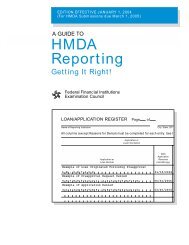
A Guide to HMDA Reporting - ffiec
A Guide to HMDA Reporting - ffiec
A Guide to HMDA Reporting - ffiec

Create successful ePaper yourself
Turn your PDF publications into a flip-book with our unique Google optimized e-Paper software.
Sources of<br />
Geographic<br />
Information<br />
(Geocoding<br />
Tools)<br />
18<br />
To report geographic data accurately,<br />
your institution will need information<br />
about MSA/MD boundaries, which are<br />
defined by the Office of Management<br />
and Budget. You can find MSA/MD numbers<br />
by county in Appendix F. You can<br />
also obtain information on current and<br />
his<strong>to</strong>rical MSA/MD boundaries at<br />
www.census.gov: select Subjects A–Z,<br />
then M, then Metropolitan and Micropolitan<br />
Statistical Areas, then Current<br />
lists of metropolitan and micropolitan statistical<br />
areas—metropolitan statistical<br />
areas and components.<br />
A list of all valid census tract numbers in<br />
each MSA can be produced from the<br />
Census Data CD-ROM. The CD-ROM<br />
can be purchased via the FFIEC CRA/<br />
<strong>HMDA</strong> Data Order Form (item #303) that<br />
is located on the web (www.<strong>ffiec</strong>.gov/<br />
hmda/orderform.htm). The list will help<br />
ensure that you are using only valid census<br />
tract numbers; however, the list is<br />
not a <strong>to</strong>ol for “geocoding” your <strong>HMDA</strong><br />
data.<br />
You may choose from various products<br />
available from the U.S. Census Bureau<br />
for determining the correct 2000 census<br />
tract number for a given property. The<br />
Census Bureau, however, is not able <strong>to</strong><br />
assist in preparing the LAR.<br />
Do not use sources with 1990 census<br />
tract numbers.<br />
To report geographic data, you will also<br />
need one or more of the following <strong>to</strong>ols:<br />
¢ Census Tract Street Address Lookup<br />
Resources;<br />
¢ Census Tract Outline Maps (Census<br />
2000) along with an up-<strong>to</strong>-date local<br />
reference map;<br />
¢ LandView® 5, a Census Bureau<br />
product with maps and a look-up<br />
application.<br />
Census Tract Street Address<br />
Lookup Resources<br />
Several Internet-based products permit<br />
you <strong>to</strong> look up a census tract number,<br />
given a street address:<br />
1. The U.S. Census Bureau’s American<br />
FactFinder (AFF) application, at<br />
http://factfinder.census.gov/.<br />
2. The FFIEC’s application for <strong>HMDA</strong><br />
and CRA reporters, at http://<br />
www.<strong>ffiec</strong>.gov/geocode/default.htm.<br />
3. The Census Bureau’s LandView® 5<br />
has a new feature that allows users <strong>to</strong><br />
map and geocode an address <strong>to</strong><br />
a census tract. LandView® 5, produced<br />
by the Census Bureau Geography<br />
Division, is an authoritative<br />
resource for determining census tract<br />
numbers for a given address or a<br />
specific location on the map.<br />
Note: the U.S. Census Bureau has no<br />
plans <strong>to</strong> produce a Census 2000 TIGER/<br />
Census Tract Street Index®, though the<br />
Bureau is still producing other TIGER<br />
products.<br />
Census Tract Map Resources<br />
Census 2000 Tract Outline Maps. The<br />
Census Tract Outline Map (Census 2000)<br />
product provides map sheets in Adobe®<br />
Acrobat® PDF file format (see Figure 1).<br />
Map sheets are available from the U.S.<br />
Census Bureau Map Products Internet<br />
page at http://www.census.gov/geo/<br />
www/maps/CP_MapProducts.htm.<br />
The highly detailed maps are designed<br />
for a paper sheet size of 33 inches by 36<br />
inches. In viewing the map images in<br />
PDF on the computer screen, the user<br />
can pan and zoom the image <strong>to</strong> locate<br />
the area of interest. Printing the entire<br />
map sheet on a much smaller sheet of<br />
paper will not provide a usable image. A<br />
user has two options for obtaining 33" x<br />
36" copies: