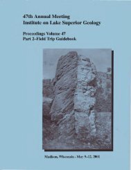
Program, Abstracts, and Guidebooks - University of Minnesota Duluth
Program, Abstracts, and Guidebooks - University of Minnesota Duluth
Program, Abstracts, and Guidebooks - University of Minnesota Duluth

You also want an ePaper? Increase the reach of your titles
YUMPU automatically turns print PDFs into web optimized ePapers that Google loves.
—87—<br />
Guide to the Port Coldwell alkalic complex<br />
INTRODUCTION:<br />
The Port Coldwell Alkali Massif (Fig. 1) is located within<br />
an Archean volcanic—sedimentary belt extending along the North<br />
shore <strong>of</strong> Lake Superior near Marathon. Previous work on the<br />
complex consists <strong>of</strong> reconnaissence work by Kerr (1910), detailed<br />
mapping by Tuominen in 1958—1959 (O.D.M. Prelim. Map P 114) <strong>and</strong><br />
by Puskas in 1960 (O.D.M. Prelim. Map P 114, revised). The<br />
western contact <strong>of</strong> the complex wag mapped by Walker (1956); the<br />
easter-n contact by Thomson (1931) <strong>and</strong> Milne (1964).<br />
The present study was largely carried out by the writer<br />
<strong>and</strong> associates while employed by the Ontario Department <strong>of</strong> Mines.<br />
The author wishes to express his thanks to Pr<strong>of</strong>essor Henri Loubat<br />
<strong>of</strong> Lakehead <strong>University</strong> <strong>and</strong> Clarence Kustra, Ontario Department<br />
<strong>of</strong> Mines, Resident Geologist, for their constant interest <strong>and</strong><br />
co—operationh S. Spivak drafted the diagrams.<br />
FIELD AND GENETIC<br />
RELATIONSHIPS<br />
The Port Coldwell Alkali Massif (Fig. 1) lies within the<br />
eugeosynclinal portion <strong>of</strong> an Archean volcanosedimentary belt,<br />
approximately 18 miles wide <strong>and</strong> extending westward from White<br />
Lake, along the north shore <strong>of</strong> Lake Superior.<br />
The volcanosediments have been tightly folded in a N 70°E<br />
direction; less important, more northerly trending, structures<br />
may be attributed to cross—folding.<br />
The Archean rocks have been successively intruded by sill—<br />
like bodies <strong>of</strong> basic <strong>and</strong> ultrabasic composition, granitoids,<br />
dikes <strong>of</strong> diabasic composition, <strong>and</strong> lastly by the Port Coldwell<br />
Alkali Massif.<br />
The Alkali Massif is a lopolith (Puskas, 1964; Corbett,<br />
1968) circular in plan <strong>and</strong> approximately 580 sq. kilometers in<br />
area. The Massif is considered to typify the so—called (Benson)<br />
Laccomorphic class <strong>of</strong> emplacements.<br />
The rocks <strong>of</strong> the massif can be divided into two groups<br />
called here the Main Group <strong>and</strong> the Secondary Group. However,<br />
in common with many intrusions <strong>of</strong> this type the long crystal—<br />
lisation history has resulted in numerous complex <strong>and</strong> sometimes<br />
confusing cross cutting relationships.<br />
The Main Group is composed <strong>of</strong> gabbros, the oldest <strong>and</strong><br />
more-peripherally located rock—type Map unit 2), <strong>and</strong> laurvikites<br />
(Map unit 3). Both the gabbros <strong>and</strong> laurvikites can exhibit<br />
rhythmic layering which dips inward at moderate angles. The