Production and Industrial Facilities - INSPIRE - Europa
Production and Industrial Facilities - INSPIRE - Europa
Production and Industrial Facilities - INSPIRE - Europa
Create successful ePaper yourself
Turn your PDF publications into a flip-book with our unique Google optimized e-Paper software.
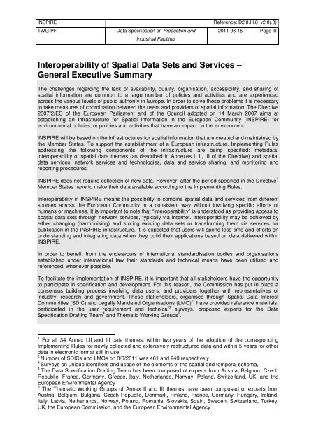
<strong>INSPIRE</strong> Reference: D2.8.III.8_v2.0(.0)<br />
TWG-PF Data Specification on <strong>Production</strong> <strong>and</strong><br />
<strong>Industrial</strong> <strong>Facilities</strong><br />
Interoperability of Spatial Data Sets <strong>and</strong> Services –<br />
General Executive Summary<br />
2011-06-15 Page III<br />
The challenges regarding the lack of availability, quality, organisation, accessibility, <strong>and</strong> sharing of<br />
spatial information are common to a large number of policies <strong>and</strong> activities <strong>and</strong> are experienced<br />
across the various levels of public authority in Europe. In order to solve these problems it is necessary<br />
to take measures of coordination between the users <strong>and</strong> providers of spatial information. The Directive<br />
2007/2/EC of the European Parliament <strong>and</strong> of the Council adopted on 14 March 2007 aims at<br />
establishing an Infrastructure for Spatial Information in the European Community (<strong>INSPIRE</strong>) for<br />
environmental policies, or policies <strong>and</strong> activities that have an impact on the environment.<br />
<strong>INSPIRE</strong> will be based on the infrastructures for spatial information that are created <strong>and</strong> maintained by<br />
the Member States. To support the establishment of a European infrastructure, Implementing Rules<br />
addressing the following components of the infrastructure are being specified: metadata,<br />
interoperability of spatial data themes (as described in Annexes I, II, III of the Directive) <strong>and</strong> spatial<br />
data services, network services <strong>and</strong> technologies, data <strong>and</strong> service sharing, <strong>and</strong> monitoring <strong>and</strong><br />
reporting procedures.<br />
<strong>INSPIRE</strong> does not require collection of new data. However, after the period specified in the Directive 1<br />
Member States have to make their data available according to the Implementing Rules.<br />
Interoperability in <strong>INSPIRE</strong> means the possibility to combine spatial data <strong>and</strong> services from different<br />
sources across the European Community in a consistent way without involving specific efforts of<br />
humans or machines. It is important to note that “interoperability” is understood as providing access to<br />
spatial data sets through network services, typically via Internet. Interoperability may be achieved by<br />
either changing (harmonising) <strong>and</strong> storing existing data sets or transforming them via services for<br />
publication in the <strong>INSPIRE</strong> infrastructure. It is expected that users will spend less time <strong>and</strong> efforts on<br />
underst<strong>and</strong>ing <strong>and</strong> integrating data when they build their applications based on data delivered within<br />
<strong>INSPIRE</strong>.<br />
In order to benefit from the endeavours of international st<strong>and</strong>ardisation bodies <strong>and</strong> organisations<br />
established under international law their st<strong>and</strong>ards <strong>and</strong> technical means have been utilised <strong>and</strong><br />
referenced, whenever possible.<br />
To facilitate the implementation of <strong>INSPIRE</strong>, it is important that all stakeholders have the opportunity<br />
to participate in specification <strong>and</strong> development. For this reason, the Commission has put in place a<br />
consensus building process involving data users, <strong>and</strong> providers together with representatives of<br />
industry, research <strong>and</strong> government. These stakeholders, organised through Spatial Data Interest<br />
Communities (SDIC) <strong>and</strong> Legally M<strong>and</strong>ated Organisations (LMO) 2 , have provided reference materials,<br />
participated in the user requirement <strong>and</strong> technical 3 surveys, proposed experts for the Data<br />
Specification Drafting Team 4 <strong>and</strong> Thematic Working Groups 5 .<br />
1 For all 34 Annex I,II <strong>and</strong> III data themes: within two years of the adoption of the corresponding<br />
Implementing Rules for newly collected <strong>and</strong> extensively restructured data <strong>and</strong> within 5 years for other<br />
data in electronic format still in use<br />
2 Number of SDICs <strong>and</strong> LMOs on 8/6/2011 was 461 <strong>and</strong> 249 respectively<br />
3 Surveys on unique identifiers <strong>and</strong> usage of the elements of the spatial <strong>and</strong> temporal schema,<br />
4 The Data Specification Drafting Team has been composed of experts from Austria, Belgium, Czech<br />
Republic, France, Germany, Greece, Italy, Netherl<strong>and</strong>s, Norway, Pol<strong>and</strong>, Switzerl<strong>and</strong>, UK, <strong>and</strong> the<br />
European Environmental Agency<br />
5 The Thematic Working Groups of Annex II <strong>and</strong> III themes have been composed of experts from<br />
Austria, Belgium, Bulgaria, Czech Republic, Denmark, Finl<strong>and</strong>, France, Germany, Hungary, Irel<strong>and</strong>,<br />
Italy, Latvia, Netherl<strong>and</strong>s, Norway, Pol<strong>and</strong>, Romania, Slovakia, Spain, Sweden, Switzerl<strong>and</strong>, Turkey,<br />
UK, the European Commission, <strong>and</strong> the European Environmental Agency


