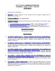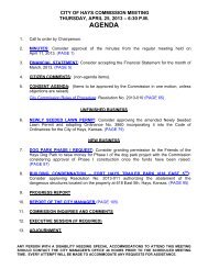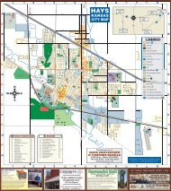
November 4 - City of Hays, KS
November 4 - City of Hays, KS
November 4 - City of Hays, KS

Create successful ePaper yourself
Turn your PDF publications into a flip-book with our unique Google optimized e-Paper software.
ORDINANCE NO.<br />
AN ORDINANCE ANNEXING LAND TO THE CITY OF HAYS,<br />
KANSAS.<br />
WHEREAS, the following described land adjoins the <strong>City</strong> <strong>of</strong> <strong>Hays</strong>, Kansas; and<br />
WHEREAS, written consent for annexation <strong>of</strong> the following described land, signed by all <strong>of</strong><br />
the owners there<strong>of</strong>, has been filed with the <strong>City</strong> <strong>of</strong> <strong>Hays</strong>, Kansas, pursuant to K.S.A. 12-520; and<br />
land.<br />
WHEREAS, the governing body <strong>of</strong> the <strong>City</strong> <strong>of</strong> <strong>Hays</strong>, Kansas finds it advisable to annex such<br />
NOW, THEREFORE, BE IT ORDAINED BY THE GOVERNING BODY OF THE CITY OF<br />
HAYS, KANSAS:<br />
Section 1. Pursuant to K.S.A. 12-520(a) (3) the following described land is hereby annexed<br />
and made part <strong>of</strong> the <strong>City</strong> <strong>of</strong> <strong>Hays</strong>, Kansas:<br />
That part <strong>of</strong> the 37 th Street right <strong>of</strong> way, as platted in the Westridge Addition to Ellis<br />
County, Kansas, located in the Northwest Quarter <strong>of</strong> Section 29, Township 13<br />
South, Range 18 West, <strong>of</strong> the 6 th Principal Meridian, Ellis County, Kansas, described<br />
as follows:<br />
Beginning at the southwest corner <strong>of</strong> Lot 13, Block 6, <strong>of</strong> said Westridge Addition;<br />
thence North 88 degrees 41 minutes 04 seconds East, along the south line <strong>of</strong> Lots<br />
13 and 12 in said Block 6, a distance <strong>of</strong> 379.99 feet; thence on a curve to the left, an<br />
arc distance <strong>of</strong> 140.51 feet, said curve having a radius <strong>of</strong> 1014.83 feet, a central<br />
angle <strong>of</strong> 7 degrees 56 minutes 00 seconds, a chord length <strong>of</strong> 140.40 feet and a<br />
chord bearing <strong>of</strong> North 84 degrees 43 minutes 04 seconds East; thence on a curve<br />
to the right, an arc distance <strong>of</strong> 148.83 feet, said curve having a radius <strong>of</strong> 1074.83<br />
feet, a central angle <strong>of</strong> 7 degrees 56 minutes 00 seconds, a chord length <strong>of</strong> 148.71<br />
feet and a chord bearing <strong>of</strong> North 84 degrees 43 minutes 04 seconds East; thence<br />
North 88 degrees 41 minutes 04 seconds East a distance <strong>of</strong> 40.00 feet to the<br />
southwest corner <strong>of</strong> Lot 3, Block 2, <strong>of</strong> the Second Replat <strong>of</strong> a Portion <strong>of</strong> Westridge<br />
Addition; thence South 00 degrees 14 minutes 26 seconds East a distance <strong>of</strong> 30.00<br />
feet to the center <strong>of</strong> said 37 th Street right <strong>of</strong> way, said point also being on the East-<br />
West 16 th line <strong>of</strong> said Northwest Quarter; thence South 88 degrees 41 minutes 04<br />
seconds West, along said 16 th line, a distance <strong>of</strong> 281.41 feet; thence South 00<br />
degrees 21 minutes 35 seconds East a distance <strong>of</strong> 49.04 feet to a point on the south<br />
line <strong>of</strong> said 37 th Street right <strong>of</strong> way; thence on a curve to the right, an arc distance <strong>of</strong><br />
45.64 feet, said curve having a radius <strong>of</strong> 1074.83 feet, a central angle <strong>of</strong> 2 degrees<br />
25 minutes 59 seconds, a chord length <strong>of</strong> 45.64 feet and a chord bearing <strong>of</strong> South<br />
87 degrees 28 minutes 04 seconds West; thence South 88 degrees 41 minutes 04<br />
seconds West a distance <strong>of</strong> 380.94 feet to the southwest corner <strong>of</strong> said Westridge<br />
Addition; thence North 00 degrees 24 minutes 22 seconds West, along the west line<br />
<strong>of</strong> said Westridge Addition, a distance <strong>of</strong> 60.00 feet to the point <strong>of</strong> beginning. This<br />
tract contains 0.737 acres.<br />
Section 2. This ordinance shall take effect and be in force from and after its publication in<br />
the <strong>of</strong>ficial city newspaper.<br />
49