international hydrographic organization annual report 2011 ... - IHO
international hydrographic organization annual report 2011 ... - IHO
international hydrographic organization annual report 2011 ... - IHO

Create successful ePaper yourself
Turn your PDF publications into a flip-book with our unique Google optimized e-Paper software.
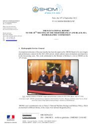
A third preparatory meeting for the establishment of the GGIM, comprising representatives from nearly<br />
30 UN Member States together with representatives from the principal non-governmental <strong>international</strong><br />
<strong>organization</strong>s concerned with global geospatial information management was held at the UN<br />
Headquarters in April.<br />
The meeting reviewed the UN Secretary-General’s <strong>report</strong> and its recommendations intended for<br />
consideration by the ECOSOC and the proposed Terms of Reference and Vision Statement for the GGIM.<br />
The meeting went on to discuss and provide input to the agenda and arrangements for the first UN World<br />
Forum on Global Geospatial Information Management to be hosted in Seoul, Korea from October 24 to<br />
28.<br />
Captain WARD represented the <strong>IHO</strong> at the meeting. He informed the meeting about the <strong>IHO</strong>’s role and<br />
relationship with the UN as tbe recognised competent authority on hydrography and nautical charting<br />
services and the well established <strong>IHO</strong> mechanisms and standards that are already in place to assist in the<br />
exchange and availability of <strong>hydrographic</strong> information in standardised forms across the globe.<br />
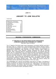
UN GLOBAL FORUM ON GLOBAL GEOSPATIAL INFORMATION MANAGEMENT<br />
AND 1 st MEETING OF THE UN COMMITTEE OF EXPERTS ON GLOBAL GEOSPATIAL<br />
INFORMATION MANAGEMENT (GGIM)<br />
Seoul, Republic of Korea, 24-26 October<br />
In July, the UN Economic and Social Council (ECOSOC) established the<br />
GGIM. The GGIM held its first meeting in Seoul immediately after a threeday<br />
forum on global geospatial information management. UN delegations at<br />
the forum included a number of ministers responsible for geospatial services<br />
in their respective countries. 350 participants from 90 countries and 37<br />
representatives from <strong>international</strong> <strong>organization</strong>s, attended the forum. The<br />
<strong>IHO</strong> has been recognised as an Observer organisation at the GGIM. Captain WARD represented the <strong>IHO</strong><br />
at the first meeting.<br />
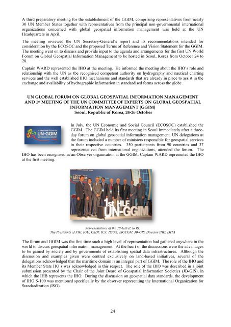
Representatives of the JB-GIS (L to R):<br />
The Presidents of FIG, IGU, GSDI; ICA, ISPRS; ISGCGM, JB-GIS, Director <strong>IHO</strong>, IMTA<br />
The forum and GGIM was the first time such a high level of representation had gathered anywhere in the<br />
world to discuss geospatial information management. At the heart of the discussions were the advantages<br />
to be gained by society and by governments of establishing spatial data infrastructures. Although the<br />
discussion and examples given were centred exclusively on land-based initiatives, several of the<br />
delegations acknowledged that the maritime domain is an integral part of GGIM. The role of the <strong>IHO</strong> and<br />
its Member State HO’s was acknowledged in this respect. The role of the <strong>IHO</strong> was described in a joint<br />
submission presented by the Chair of the Joint Board of Geospatial Information Societies (JB-GIS), in<br />
which the IHB represents the <strong>IHO</strong>. During the discussion on geospatial data standards, the development<br />
of <strong>IHO</strong> S-100 was mentioned specifically by the observer representing the International Organization for<br />
Standardization (ISO).<br />
24