Carlier Group Gaussian User Manual - Virginia Tech
Carlier Group Gaussian User Manual - Virginia Tech
Carlier Group Gaussian User Manual - Virginia Tech
Create successful ePaper yourself
Turn your PDF publications into a flip-book with our unique Google optimized e-Paper software.
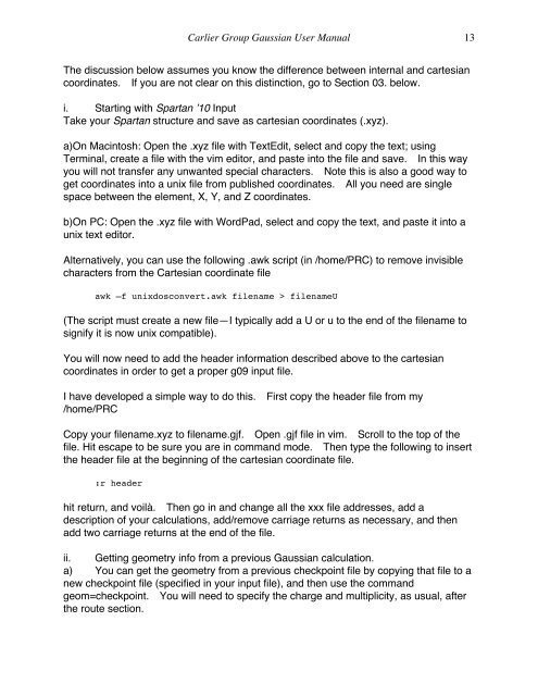
<strong>Carlier</strong> <strong>Group</strong> <strong>Gaussian</strong> <strong>User</strong> <strong>Manual</strong> 13<br />
The discussion below assumes you know the difference between internal and cartesian<br />
coordinates. If you are not clear on this distinction, go to Section 03. below.<br />
i. Starting with Spartan ’10 Input<br />
Take your Spartan structure and save as cartesian coordinates (.xyz).<br />
a)On Macintosh: Open the .xyz file with TextEdit, select and copy the text; using<br />
Terminal, create a file with the vim editor, and paste into the file and save. In this way<br />
you will not transfer any unwanted special characters. Note this is also a good way to<br />
get coordinates into a unix file from published coordinates. All you need are single<br />
space between the element, X, Y, and Z coordinates.<br />
b)On PC: Open the .xyz file with WordPad, select and copy the text, and paste it into a<br />
unix text editor.<br />
Alternatively, you can use the following .awk script (in /home/PRC) to remove invisible<br />
characters from the Cartesian coordinate file<br />
awk –f unixdosconvert.awk filename > filenameU<br />
(The script must create a new file—I typically add a U or u to the end of the filename to<br />
signify it is now unix compatible).<br />
You will now need to add the header information described above to the cartesian<br />
coordinates in order to get a proper g09 input file.<br />
I have developed a simple way to do this. First copy the header file from my<br />
/home/PRC<br />
Copy your filename.xyz to filename.gjf. Open .gjf file in vim. Scroll to the top of the<br />
file. Hit escape to be sure you are in command mode. Then type the following to insert<br />
the header file at the beginning of the cartesian coordinate file.<br />
:r header<br />
hit return, and voilà. Then go in and change all the xxx file addresses, add a<br />
description of your calculations, add/remove carriage returns as necessary, and then<br />
add two carriage returns at the end of the file.<br />
ii. Getting geometry info from a previous <strong>Gaussian</strong> calculation.<br />
a) You can get the geometry from a previous checkpoint file by copying that file to a<br />
new checkpoint file (specified in your input file), and then use the command<br />
geom=checkpoint. You will need to specify the charge and multiplicity, as usual, after<br />
the route section.


