Applying OLAP Pre-Aggregation Techniques to ... - Jacobs University
Applying OLAP Pre-Aggregation Techniques to ... - Jacobs University
Applying OLAP Pre-Aggregation Techniques to ... - Jacobs University

Create successful ePaper yourself
Turn your PDF publications into a flip-book with our unique Google optimized e-Paper software.
2.1 Array Databases 19<br />
<strong>to</strong>ward the s<strong>to</strong>rage of large amounts of data on tertiary s<strong>to</strong>rage media considering<br />
tiling techniques in multidimensional database management systems is presented in<br />
[23, 24, 25].<br />
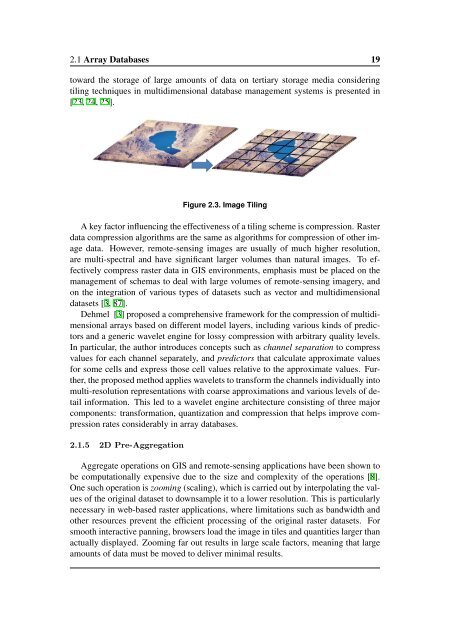
Figure 2.3. Image Tiling<br />
A key fac<strong>to</strong>r influencing the effectiveness of a tiling scheme is compression. Raster<br />
data compression algorithms are the same as algorithms for compression of other image<br />
data. However, remote-sensing images are usually of much higher resolution,<br />
are multi-spectral and have significant larger volumes than natural images. To effectively<br />
compress raster data in GIS environments, emphasis must be placed on the<br />
management of schemas <strong>to</strong> deal with large volumes of remote-sensing imagery, and<br />
on the integration of various types of datasets such as vec<strong>to</strong>r and multidimensional<br />
datasets [3, 87].<br />
Dehmel [3] proposed a comprehensive framework for the compression of multidimensional<br />
arrays based on different model layers, including various kinds of predic<strong>to</strong>rs<br />
and a generic wavelet engine for lossy compression with arbitrary quality levels.<br />
In particular, the author introduces concepts such as channel separation <strong>to</strong> compress<br />
values for each channel separately, and predic<strong>to</strong>rs that calculate approximate values<br />
for some cells and express those cell values relative <strong>to</strong> the approximate values. Further,<br />
the proposed method applies wavelets <strong>to</strong> transform the channels individually in<strong>to</strong><br />
multi-resolution representations with coarse approximations and various levels of detail<br />
information. This led <strong>to</strong> a wavelet engine architecture consisting of three major<br />
components: transformation, quantization and compression that helps improve compression<br />
rates considerably in array databases.<br />
2.1.5 2D <strong>Pre</strong>-<strong>Aggregation</strong><br />
Aggregate operations on GIS and remote-sensing applications have been shown <strong>to</strong><br />
be computationally expensive due <strong>to</strong> the size and complexity of the operations [8].<br />
One such operation is zooming (scaling), which is carried out by interpolating the values<br />
of the original dataset <strong>to</strong> downsample it <strong>to</strong> a lower resolution. This is particularly<br />
necessary in web-based raster applications, where limitations such as bandwidth and<br />
other resources prevent the efficient processing of the original raster datasets. For<br />
smooth interactive panning, browsers load the image in tiles and quantities larger than<br />
actually displayed. Zooming far out results in large scale fac<strong>to</strong>rs, meaning that large<br />
amounts of data must be moved <strong>to</strong> deliver minimal results.