Town of Richmond Hill Draft New Official Plan - Chapter 4
Town of Richmond Hill Draft New Official Plan - Chapter 4
Town of Richmond Hill Draft New Official Plan - Chapter 4

You also want an ePaper? Increase the reach of your titles
YUMPU automatically turns print PDFs into web optimized ePapers that Google loves.
4<br />
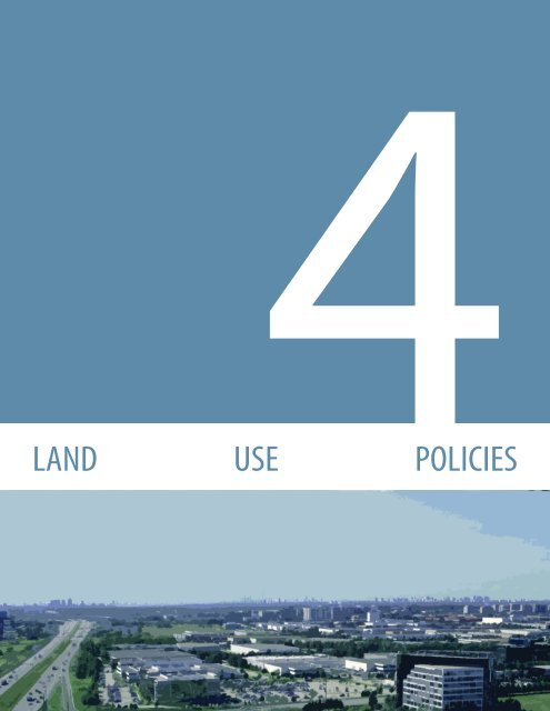
LAND USE POLICIES
1<br />
2<br />
3<br />
LAND USE POLICIES<br />
4. LAND USE POLICIES<br />
This chapter sets out the land use and design policies associated with each land<br />
use designation as shown on Schedule A2 (Land Use) to this <strong>Plan</strong>. The policies <strong>of</strong><br />
each section must be read together with the policies <strong>of</strong> <strong>Chapter</strong> 3 (Building a <strong>New</strong><br />
Kind <strong>of</strong> Urban) and all other relevant sections <strong>of</strong> this <strong>Plan</strong>.<br />
4.1 COMMUNITY USES<br />
Community uses include public, private and not for pr<strong>of</strong>it institutions, facilities<br />
and services that support the health, educational, recreational and socio-cultural<br />
needs <strong>of</strong> the <strong>Town</strong>. Community uses are generally permitted within the land use<br />
designations in the settlement area. A range <strong>of</strong> community uses shall be directed<br />
to appropriate locations within the <strong>Town</strong> to contribute to a complete community.<br />
4.1.1 LAND USE<br />
4<br />
5<br />
6<br />
7<br />
It is the policy <strong>of</strong> Council that:<br />
1. A range <strong>of</strong> community uses shall generally be permitted within the<br />
settlement area, with the broadest range <strong>of</strong> community uses directed to<br />
the centres and corridors. A more limited range <strong>of</strong> community uses may<br />
be permitted in the Neighbourhood, Employment Area and Employment<br />
Corridor designations as set out in the policies <strong>of</strong> this section.<br />
2. Within the centres and corridors, the following community uses shall be<br />
permitted:<br />
a. Hospitals and healthcare centres and ancillary uses such as <strong>of</strong>fices and<br />
pharmacies;<br />
b. Post-secondary institutions and ancillary uses such as <strong>of</strong>fices;<br />
c. Public secondary schools, in accordance with policy 4.1.1.6 <strong>of</strong> this <strong>Plan</strong>;<br />
d. Public elementary schools, in accordance with policy 4.1.1.5 <strong>of</strong> this<br />
<strong>Plan</strong>;<br />
e. Private secondary schools, in accordance with policy 4.1.1.4 <strong>of</strong> this<br />
<strong>Plan</strong> ; and<br />
f. Private elementary schools, in accordance with policy 4.1.1.4 <strong>of</strong> this<br />
<strong>Plan</strong>.<br />
g. Government facilities including:<br />
i. Government <strong>of</strong>fices;<br />
ii. Public community facilities, such as libraries, community<br />
centres, and recreation centres;<br />
iii. Fire and emergency services; and<br />
iv. Other public facilities.<br />
h. Places <strong>of</strong> worship, in accordance with policy 4.1.1.7 <strong>of</strong> this <strong>Plan</strong>;<br />
RICHMOND HILL OFFICIAL PLAN 4-1<br />
DRAFT MAY 6, 2010
LAND USE POLICIES<br />
i. Arts and cultural facilities;<br />
j. Day Nurseries;<br />
k. Private-home day care facilities; and<br />
l. Long-term care facilities.<br />
3. Within the Neighbourhood designation, the following community uses<br />
shall be permitted provided that the site is located:<br />
a. Fronting onto a public street:<br />
i. Private-home daycare facilities.<br />
b. Fronting onto an arterial street:<br />
i. Public secondary schools, in accordance with policies 4.1.1.6<br />
<strong>of</strong> this <strong>Plan</strong>, which shall be encouraged to locate adjacent to a<br />
park or the Greenway System;<br />
ii. Private secondary and elementary schools, in accordance with<br />
policy 4.1.1.4 <strong>of</strong> this <strong>Plan</strong>, which shall be encouraged to locate<br />
adjacent to a park or the Greenway System;<br />
iii. Places <strong>of</strong> worship in accordance with policy 4.1.1.7 <strong>of</strong> this <strong>Plan</strong>;<br />
iv. Government facilities limited to government <strong>of</strong>fices, public<br />
community facilities such as libraries, community centres,<br />
recreation centres, and fire and emergency services;<br />
v. Arts and cultural facilities;<br />
vi. Day Nurseries;<br />
vii. Private-home day care facilities; and<br />
viii. Long-term care facilities.<br />
c. Fronting onto a collector street:<br />
i. Public elementary schools, in accordance with policy 4.1.1.5 <strong>of</strong><br />
this <strong>Plan</strong>, which shall be encouraged to locate adjacent to a park<br />
or the Greenway System;<br />
ii. Government facilities limited to public community facilities<br />
such as libraries, community centres, and recreation centres;<br />
and<br />
iii. Day Nurseries integrated with or adjacent to another community<br />
use or adjacent to a park or the Greenway System.<br />
4. Private secondary and elementary schools, where permitted, shall be<br />
located at the intersection <strong>of</strong> an arterial street and a collector street. Midblock<br />
sites on arterial streets may be considered only where they abut<br />
the Greenway System, a park, educational facility, commercial or retail use<br />
subject to the following requirements:<br />
a. Minimum <strong>of</strong> two access points are provided;<br />
b. The site size shall be a minimum <strong>of</strong> 1 hectare and a maximum <strong>of</strong> 2.5<br />
hectares;<br />
c. Transportation studies shall be submitted in accordance with Section<br />
5.26;<br />
d. Impact on adjacent residential areas is minimized by providing<br />
1<br />
2<br />
3<br />
4<br />
5<br />
6<br />
7<br />
DRAFT MAY 6, 2010<br />
4-2<br />
RICHMOND HILL OFFICIAL PLAN
LAND USE POLICIES<br />
1<br />
2<br />
3<br />
4<br />
5<br />
6<br />
7<br />
adequate parking, landscaping, setbacks and buffering; and<br />
e. Adequate vehicular pick-up and drop-<strong>of</strong>f.<br />
5. Public elementary schools, where permitted, shall be subject to the<br />
following requirements:<br />
a. Frontage on a collector street;<br />
b. Sited on a straight segment <strong>of</strong> a street with good visibility and sufficient<br />
frontage to meet School Board requirements;<br />
c. Adequate vehicular pick-up and drop-<strong>of</strong>f;<br />
d. The campusing <strong>of</strong> schools with parks, the Greenway System or<br />
public community facilities such as libraries, community centres and<br />
recreation centres is encouraged; and<br />
e. Residential driveways opposite school sites shall be minimized<br />
wherever possible.<br />
6. Public secondary schools, where permitted, shall be subject to the<br />
following requirements:<br />
a. Frontage on an arterial street or a collector street in close proximity to<br />
public transit;<br />
b. Located on a straight segment <strong>of</strong> a street with good visibility and<br />
sufficient frontage to meet School Board requirements;<br />
c. The campusing <strong>of</strong> schools with parks, the Greenway System or<br />
public community facilities such as libraries, community centres and<br />
recreation centres is encouraged; and<br />
d. Residential driveways opposite school sites shall be minimized<br />
wherever possible.<br />
7. Places <strong>of</strong> Worship, where permitted, shall be located at the intersection <strong>of</strong><br />
two arterial streets or at the intersection <strong>of</strong> an arterial street and a collector<br />
street. Mid-block sites on arterial streets may be considered only where<br />
they abut the Greenway System, a park, educational facility, commercial<br />
or retail use.<br />
8. Within the Employment Area and Employment Corridor designations, the<br />
following community uses shall be permitted provided that the viability<br />
and planned function <strong>of</strong> the employment lands are maintained:<br />
a. Government facilities such as fire and emergency services and<br />
other public facilities; and<br />
b. Day Nurseries, provided the use is contained within a major <strong>of</strong>fice<br />
building.<br />
4.1.2 DESIGN<br />
It is the policy <strong>of</strong> Council that:<br />
1. Where community uses are permitted, development for such uses shall be<br />
subject to the following requirements:<br />
RICHMOND HILL OFFICIAL PLAN 4-3<br />
DRAFT MAY 6, 2010
LAND USE POLICIES<br />
a. The proposed development shall be designed to be compatible and<br />
integrated with the surrounding area; and<br />
b. The site is <strong>of</strong> an appropriate size to accommodate:<br />
i. Sufficient on-site pick-up/drop-<strong>of</strong>f facilities, access and parking;<br />
ii. Sufficient buffering and landscaping; and<br />
iii. Sufficient amenity space.<br />
2. The campusing or co-location <strong>of</strong> community uses shall be encouraged.<br />
3. The policies <strong>of</strong> this section are to be read in conjunction with the land use<br />
and design policies <strong>of</strong> the applicable land-use designation and <strong>Chapter</strong><br />
3 (Building a <strong>New</strong> Kind <strong>of</strong> Urban) within which the proposed community<br />
use is located. In the event <strong>of</strong> a conflict, the more restrictive policies shall<br />
apply.<br />
4.2 RICHMOND HILL CENTRE<br />
The <strong>Richmond</strong> <strong>Hill</strong> Centre is intended to develop into a compact, mixed-use<br />
urban centre supported by a high quality public realm, walkable streets and<br />
transit-oriented development. As an increasingly regional focal point, <strong>Richmond</strong><br />
<strong>Hill</strong> Centre will be a major residential and employment destination, a meeting<br />
place, and the primary location for cultural facilities, public institutions and major<br />
services. The Centre will be a prominent, major transit node in <strong>Richmond</strong> <strong>Hill</strong> and in<br />
York Region due to its scale, planned density, function and identity. It will continue<br />
to be the primary focal point for transit infrastructure investment and will be a<br />
destination point attracting people from all parts <strong>of</strong> the Region as it evolves into a<br />
vibrant and distinct urban centre.<br />
4.2.1 LAND USE<br />
1<br />
2<br />
3<br />
4<br />
5<br />
It is the policy <strong>of</strong> Council that:<br />
1. The <strong>Town</strong> shall prepare a Secondary <strong>Plan</strong> for the <strong>Richmond</strong> <strong>Hill</strong> Centre in<br />
accordance with the policies <strong>of</strong> Section 5.1 <strong>of</strong> this <strong>Plan</strong> and the land use<br />
and design guidelines which have been endorsed by Council as set out<br />
in the <strong>Richmond</strong> <strong>Hill</strong> Regional Centre Design and Land Use Study Final<br />
Recommendations Report, February 2010.<br />
2. Until such time as Council approves a Secondary <strong>Plan</strong> for the <strong>Richmond</strong><br />
<strong>Hill</strong> Centre, applications for development in the interim shall be assessed<br />
on the basis <strong>of</strong> conformity with the policies <strong>of</strong> this section and the land<br />
use and design guidelines which have been endorsed by Council as set<br />
out in the <strong>Richmond</strong> <strong>Hill</strong> Regional Centre Design and Land Use Study Final<br />
Recommendations Report, February 2010.<br />
6<br />
7<br />
DRAFT MAY 6, 2010<br />
4-4<br />
RICHMOND HILL OFFICIAL PLAN
LAND USE POLICIES<br />
1<br />
2<br />
3<br />
4<br />
5<br />
6<br />
7<br />
<strong>Richmond</strong> <strong>Hill</strong> Centre Model<br />
3. The predominant use <strong>of</strong> land within the <strong>Richmond</strong> <strong>Hill</strong> Centre designation<br />
shown on Schedule A2 (Land Use) shall be mixed-use, transit-oriented<br />
development.<br />
4. The permitted uses within the <strong>Richmond</strong> <strong>Hill</strong> Centre designation shall<br />
include a broad range and mix <strong>of</strong> residential and employment uses in a<br />
well-integrated, compact urban form. The mix <strong>of</strong> uses shall generally be<br />
integrated in the same building and provide connections to public transit<br />
to ensure a high level <strong>of</strong> connectivity.<br />
5. The following land uses shall be permitted within the <strong>Richmond</strong> <strong>Hill</strong> Centre:<br />
a. High density residential;<br />
b. Medium density residential in accordance with policy 4.2.1.7;<br />
c. Major <strong>of</strong>fice;<br />
d. Office;<br />
e. Commercial;<br />
f. Major retail in accordance with policy 4.2.1.7;<br />
g. Retail;<br />
h. Community uses in accordance with Section 4.1 <strong>of</strong> this <strong>Plan</strong>;<br />
i. Parks and urban open spaces in accordance with Section 3.4.4 <strong>of</strong> this<br />
<strong>Plan</strong>; and<br />
j. Live-work units in accordance with policies 3.3.3.2.9 and 3.3.3.2.10 <strong>of</strong><br />
this <strong>Plan</strong>.<br />
6. Medium density residential shall be permitted within the <strong>Richmond</strong> <strong>Hill</strong><br />
Centre designation only as a transitional form <strong>of</strong> development where the<br />
lands abut the Neighbourhood designation.<br />
7. It is a long-term objective <strong>of</strong> this <strong>Plan</strong> that intensification <strong>of</strong> existing major<br />
retail uses occur through redevelopment into a more compact built form.<br />
<strong>New</strong> major retail development shall be permitted in the <strong>Richmond</strong> <strong>Hill</strong> Centre<br />
only where it can be demonstrated that the use is to be integrated into the<br />
base <strong>of</strong> buildings as part <strong>of</strong> mixed-use, transit-oriented development.<br />
8. Major <strong>of</strong>fice and <strong>of</strong>fice development shall be directed to and promoted in<br />
the <strong>Richmond</strong> <strong>Hill</strong> Centre to support the long term employee-to-resident<br />
target ratio <strong>of</strong> 1:1 as set out in this <strong>Plan</strong> and to promote the centre as a<br />
major business destination in the <strong>Town</strong> and York Region.<br />
9. The <strong>Richmond</strong> <strong>Hill</strong> Centre shall be planned to achieve the minimum<br />
population and employment growth targets in accordance with the<br />
policies <strong>of</strong> Section 3.1.3.7 <strong>of</strong> this <strong>Plan</strong>.<br />
10. Development in the <strong>Richmond</strong> <strong>Hill</strong> Centre shall support the integration <strong>of</strong><br />
public rapid transit including the planned extension <strong>of</strong> the Yonge Street<br />
subway, 407 Transitway, VIVA rapid transit, York Region Transit and GO Rail<br />
service to the greatest extent possible.<br />
RICHMOND HILL OFFICIAL PLAN 4-5<br />
DRAFT MAY 6, 2010
LAND USE POLICIES<br />
11. An integrated transit hub station shall be planned and located in the<br />
general area <strong>of</strong> High Tech Road, east <strong>of</strong> Yonge Street and west <strong>of</strong> the CN<br />
Rail line, generally as shown on Appendix 5 (Public Rapid Transit) <strong>of</strong> this<br />
<strong>Plan</strong> and in accordance with the approved Environmental Assessment.<br />
12. The phasing <strong>of</strong> development shall, to the greatest extent possible, be<br />
coordinated with the provision <strong>of</strong> transit and servicing infrastructure.<br />
Detailed phasing policies for development shall be set out in the Secondary<br />
<strong>Plan</strong> for the <strong>Richmond</strong> <strong>Hill</strong> Centre.<br />
13. The street network in the <strong>Richmond</strong> <strong>Hill</strong> Centre shall include proposed<br />
north-south and east-west collector streets and local streets as shown<br />
on Schedule A8 (Street Classification) to this <strong>Plan</strong> promoting a fine grain<br />
street network.<br />
Height & Density<br />
14. The highest and most dense forms <strong>of</strong><br />
development shall be located at the planned<br />
integrated transit hub with progressively<br />
lower, less dense buildings at the edges <strong>of</strong><br />
the <strong>Richmond</strong> <strong>Hill</strong> Centre so as to provide<br />
an appropriate transition to the abutting<br />
Neighbourhood designation.<br />
1<br />
2<br />
3<br />
4<br />
15. Development in <strong>Richmond</strong> <strong>Hill</strong> Centre shall<br />
achieve a minimum density <strong>of</strong> 2.5 FSI per<br />
development block. The boundaries <strong>of</strong><br />
development blocks shall be identified in the<br />
Secondary <strong>Plan</strong> for the <strong>Richmond</strong> <strong>Hill</strong> Centre in<br />
accordance with the policies <strong>of</strong> this <strong>Plan</strong>.<br />
Areas <strong>of</strong> the <strong>Richmond</strong> <strong>Hill</strong> Centre<br />
5<br />
6<br />
7<br />
<strong>Richmond</strong> <strong>Hill</strong> Centre density gradient<br />
DRAFT MAY 6, 2010<br />
4-6<br />
RICHMOND HILL OFFICIAL PLAN
LAND USE POLICIES<br />
1<br />
2<br />
3<br />
4<br />
5<br />
6<br />
7<br />
Stepback on Yonge Street in the <strong>Richmond</strong> <strong>Hill</strong> Centre<br />
Yonge Street<br />
16. The density <strong>of</strong> a development block on the west side <strong>of</strong> Yonge Street and<br />
east <strong>of</strong> the proposed north-south street, south <strong>of</strong> Carrville Road, as shown<br />
on Schedule A8 (Street Classification) shall have a minimum density <strong>of</strong> 2.0<br />
FSI and a maximum density <strong>of</strong> 2.5 FSI.<br />
17. The following height requirements shall apply to development on the west<br />
side <strong>of</strong> Yonge Street and east <strong>of</strong> the proposed north-south local street,<br />
south <strong>of</strong> Carrville Road, as shown on Schedule A8 (Street Classification):<br />
a. A minimum building height <strong>of</strong> 4 storeys;<br />
b. A base building height ranging from 4 storeys to a maximum <strong>of</strong> 6<br />
storeys;<br />
c. A maximum building height <strong>of</strong> 15 storeys; and<br />
d. The tallest building(s) directed to the Yonge Street frontage.<br />
18. The density <strong>of</strong> a development block fronting on the east side <strong>of</strong> Yonge<br />
Street shall:<br />
a. For lands located north <strong>of</strong> Beresford Drive, be a minimum density <strong>of</strong><br />
2.5 FSI and a maximum density <strong>of</strong> 3.0 FSI;<br />
b. For lands located south <strong>of</strong> Beresford Drive, be a minimum density <strong>of</strong><br />
3.5 FSI. The intensity <strong>of</strong> development shall generally increase towards<br />
the planned integrated transit hub to a maximum density <strong>of</strong> 5.0 FSI;<br />
and<br />
c. For lands located within the area <strong>of</strong> the integrated transit hub be a<br />
maximum density <strong>of</strong> 6.5 FSI.<br />
19. The following height requirements shall apply to development fronting on<br />
the east side <strong>of</strong> Yonge Street:<br />
a. A minimum building height <strong>of</strong> 4 storeys;<br />
b. A base building height ranging from 4 storeys to a maximum <strong>of</strong> 6<br />
storeys;<br />
c. A maximum building height <strong>of</strong> 15 storeys; and<br />
d. The tallest building(s) directed to the Yonge Street frontage.<br />
Integrated Transit Hub<br />
20. To ensure that lands are protected for the establishment <strong>of</strong> the planned<br />
integrated transit hub, lands within the general proximity <strong>of</strong> the planned<br />
integrated transit hub may be placed under a Holding Symbol “H” in the<br />
Zoning By-law in accordance with Section 36 <strong>of</strong> the <strong>Plan</strong>ning Act. The<br />
holding provision shall remain in effect until such time as Council is<br />
satisfied that the Yonge Street subway and the planned integrated transit<br />
hub is in place and in operation.<br />
21. Interim uses in the <strong>Richmond</strong> <strong>Hill</strong> Centre on lands subject to a holding<br />
provision shall be determined by the Zoning By-law or by a Temporary<br />
RICHMOND HILL OFFICIAL PLAN 4-7<br />
DRAFT MAY 6, 2010
LAND USE POLICIES<br />
Use By-law in accordance with the requirements <strong>of</strong> Section 39 <strong>of</strong> the<br />
<strong>Plan</strong>ning Act provided that any interim use shall not preclude or hinder the<br />
establishment <strong>of</strong> the planned integrated transit hub.<br />
22. The density <strong>of</strong> a development block within the area <strong>of</strong> the planned<br />
integrated transit hub shall be a minimum <strong>of</strong> 3.5 FSI and a maximum <strong>of</strong><br />
6.5 FSI. The maximum density <strong>of</strong> 6.5 FSI within a development block shall<br />
be located at the integrated transit hub and the density shall progressively<br />
decrease away from the integrated transit hub.<br />
23. The following height requirements shall apply to development within the<br />
area <strong>of</strong> the planned integrated transit hub:<br />
a. A minimum building height <strong>of</strong> 4 storeys; and<br />
b. A maximum building height <strong>of</strong> 40 storeys.<br />
Edges <strong>of</strong> the <strong>Richmond</strong> <strong>Hill</strong> Centre<br />
24. The density <strong>of</strong> a development block abutting a Neighbourhood designation<br />
west <strong>of</strong> Yonge Street shall have a minimum <strong>of</strong> 2.0 FSI and a maximum <strong>of</strong><br />
2.5 FSI. The density <strong>of</strong> a development block abutting a Neighbourhood<br />
designation east <strong>of</strong> Yonge Street shall have a minimum <strong>of</strong> 2.5 FSI and a<br />
maximum <strong>of</strong> 3.0 FSI.<br />
25. Development abutting the Neighbourhood designation shall have a<br />
maximum height <strong>of</strong> 4 storeys except where it abuts existing mid-rise or<br />
high-rise residential buildings in the Neighbourhood designation, subject<br />
to the angular plane policies <strong>of</strong> Section 4.2.2.11 <strong>of</strong> this <strong>Plan</strong>. Building heights<br />
may progressively increase away from lands within the Neighbourhood<br />
designation and shall not exceed a maximum building height <strong>of</strong> 15 storeys.<br />
1<br />
2<br />
3<br />
4<br />
5<br />
4.2.2 DESIGN<br />
It is the policy <strong>of</strong> Council that:<br />
Building a Strong, Vibrant Identity and Character<br />
1. The <strong>Town</strong> shall promote the planned integrated transit hub as a landmark<br />
public destination expressing excellence in design through its architecture<br />
and public space while providing functional transit connectivity.<br />
2. Applications for development shall be required to submit concept plans for<br />
a development block which demonstrate how the proposed development<br />
meets the land use and design policies <strong>of</strong> this <strong>Plan</strong> and the land use and<br />
design guidelines which have been endorsed by Council as set out in the<br />
<strong>Richmond</strong> <strong>Hill</strong> Centre Design and Land Use Study Final Recommendations<br />
Report, February 2010.<br />
6<br />
7<br />
DRAFT MAY 6, 2010<br />
4-8<br />
RICHMOND HILL OFFICIAL PLAN
LAND USE POLICIES<br />
1<br />
3. A linear parks and urban open space system shall<br />
be established to provide connections within<br />
the <strong>Richmond</strong> <strong>Hill</strong> Centre and the abutting<br />
neighbourhoods.<br />
Walkable Streets and People Places<br />
2<br />
3<br />
Desirable built form adjacent to bridges<br />
4. Development adjacent to existing or new bridges<br />
shall be designed to establish the main floor<br />
building level at the street/bridge level. Ground<br />
floor uses should be associated with variations in<br />
grades leading up to the bridge infrastructure.<br />
5. Proponents <strong>of</strong> development shall be encouraged<br />
to provide connections to public transit stops.<br />
Where possible, transit waiting areas should be<br />
integrated into the ground floor <strong>of</strong> buildings.<br />
6. A fine grain street network shall be established to facilitate the flexible and<br />
efficient movement <strong>of</strong> people and goods.<br />
4<br />
5<br />
7. Parks shall be framed by buildings that have entrances or outdoor amenity<br />
areas facing a park or urban open space.<br />
8. Within the <strong>Richmond</strong> <strong>Hill</strong> Centre, parking shall be required to locate below<br />
grade or in structured parking integrated at the rear or side <strong>of</strong> a building.<br />
9. Development <strong>of</strong> the integrated transit hub shall be designed to maximize<br />
transit connectivity, integration and access below grade where feasible.<br />
10. Below grade building connections shall be required to maximize<br />
underground connectivity to transit stations, other buildings and parking<br />
areas within the <strong>Richmond</strong> <strong>Hill</strong> Centre.<br />
Transition to Neighbourhoods<br />
6<br />
7<br />
11. Development that has frontage on Red Maple Road, High Tech Road east<br />
<strong>of</strong> Red Maple Road, Beresford Drive and the proposed north local street<br />
south <strong>of</strong> Carrville Road as shown on Schedule A8 (Street Classification) to<br />
this <strong>Plan</strong>, shall maintain a maximum 450 angular plane from the edge <strong>of</strong><br />
the adjacent property line on the opposite side <strong>of</strong> the street.<br />
4.3 LOCAL CENTRES<br />
Local Centres are historic mixed-use areas <strong>of</strong> the <strong>Town</strong> that will continue to evolve<br />
over time. <strong>Richmond</strong> <strong>Hill</strong> has two Local Centres: Downtown and Oak Ridges.<br />
Located on Yonge Street, which serves as the <strong>Town</strong>’s historic commercial spine<br />
RICHMOND HILL OFFICIAL PLAN 4-9<br />
DRAFT MAY 6, 2010
LAND USE POLICIES<br />
and main street, each Local Centre will evolve into a pedestrian-oriented, humanscaled,<br />
vibrant area with its own unique identity. The identity <strong>of</strong> these areas is<br />
intimately tied to their historic use as main street centres and service areas for<br />
the surrounding neighbourhoods. The policies <strong>of</strong> this <strong>Plan</strong> seek to strengthen<br />
and enhance the character <strong>of</strong> each Local Centre by promoting context-sensitive<br />
development. As a result <strong>of</strong> locational differences and context, each Local Centre<br />
will include varying levels <strong>of</strong> activity and intensity.<br />
4.3.1 DOWNTOWN LOCAL CENTRE<br />
The Downtown Local Centre is focused on Yonge Street between Levendale<br />
Road and Harding Boulevard. It is serviced by public rapid transit on Yonge<br />
Street and, over the long term, will be serviced by planned public rapid transit<br />
on Major Mackenzie Drive. The policies <strong>of</strong> this <strong>Plan</strong> provide direction for the<br />
protection, promotion, and enhancement <strong>of</strong> the Downtown as the historic,<br />
symbolic, cultural and civic heart <strong>of</strong> <strong>Richmond</strong> <strong>Hill</strong>. The Village character<br />
<strong>of</strong> the area is to be protected and enhanced by fostering the protection <strong>of</strong><br />
cultural heritage resources, significant views, and mature trees. Mixed-use<br />
intensification will support the economic vitality <strong>of</strong> the area as a destination<br />
within the <strong>Town</strong> and the larger Region. The character <strong>of</strong> the Downtown Local<br />
Centre will be enhanced by appropriately transitioned development to the<br />
adjacent neighbourhoods, encouraging the establishment <strong>of</strong> new parks,<br />
courtyards and mews, and by enhancing pedestrian connections within the<br />
area. As a whole, the Downtown will continue to be a compact, pedestrianoriented<br />
mixed-use centre.<br />
The Downtown Local Centre has three distinct districts: the Uptown District,<br />
the Village District, and the Civic District as shown on Schedule A9 (Downtown<br />
Local Centre Districts). The Uptown District will be a mixed-use residential area<br />
with mid-rise to high-rise street related buildings. The Village District will be<br />
a low-rise, smaller-format, niche market main street shopping area. A linked<br />
system <strong>of</strong> courtyards will be created to the rear <strong>of</strong> buildings fronting onto<br />
Yonge Street, establishing a unique people-oriented destination. Cultural<br />
heritage resources will be preserved and adaptive re-use solutions encouraged<br />
to compliment the Village character. The Civic District is the civic heart <strong>of</strong><br />
the <strong>Town</strong> and provides opportunities for new development to complement<br />
the <strong>Town</strong>’s Central Library. Mid-rise to high-rise street-related buildings will<br />
be directed to this area to protect the character and significant views to the<br />
church spires in the Village District. Together, the character <strong>of</strong> each district<br />
contributes to the Downtown’s unique identity as the heart <strong>of</strong> <strong>Richmond</strong> <strong>Hill</strong>.<br />
4.3.1.1 LAND USE<br />
It is the policy <strong>of</strong> Council that:<br />
1<br />
2<br />
3<br />
4<br />
5<br />
6<br />
7<br />
1. The <strong>Town</strong> shall prepare a Secondary <strong>Plan</strong> for the Downtown Local Centre<br />
in accordance with the policies <strong>of</strong> Section 5.1 <strong>of</strong> this <strong>Plan</strong> and the land use<br />
DRAFT MAY 6, 2010<br />
4-10<br />
RICHMOND HILL OFFICIAL PLAN
LAND USE POLICIES<br />
1<br />
2<br />
3<br />
4<br />
5<br />
6<br />
7<br />
Downtown Districts<br />
and design guidelines which have been approved by Council as set out in<br />
the Downtown Design and Land Use Strategy Recommendations Report,<br />
May 2009.<br />
2. Until such time as Council approves a Secondary <strong>Plan</strong> for the Downtown<br />
Local Centre, applications for development in the interim shall be assessed<br />
on the basis <strong>of</strong> conformity with the policies <strong>of</strong> this section and the land use<br />
and design guidelines which have been approved by Council as set out in<br />
the Downtown Design and Land Use Strategy Recommendations Report,<br />
May 2009.<br />
3. The predominant use <strong>of</strong> land in the Downtown Local Centre designation<br />
shown on Schedule A2 (Land Use) shall be for mixed-use, transit-oriented<br />
development. The land uses shall be directed within the Downtown<br />
Local Centre designation to correspond with the three districts shown on<br />
Schedule A9 (Downtown Local Centre Districts).<br />
4. The following land uses shall be permitted within the Downtown Local<br />
Centre:<br />
a. Community uses in accordance with Section 4.1 <strong>of</strong> this <strong>Plan</strong>;<br />
b. Parks and urban open spaces in accordance with Section 3.4.4 <strong>of</strong> this<br />
<strong>Plan</strong>; and<br />
c. Live-work units in accordance with policies 3.3.3.2.9 and 3.3.3.2.10 <strong>of</strong><br />
this <strong>Plan</strong>.<br />
5. The following land uses shall be permitted for lands fronting on Yonge<br />
Street in the Downtown Local Centre:<br />
a. Residential apartments in the form <strong>of</strong> low-rise and mid-rise buildings;<br />
b. Office;<br />
c. Commercial;<br />
d. Retail; and<br />
e. Major <strong>of</strong>fice which shall only be permitted in the Uptown and Civic<br />
Districts.<br />
6. Development fronting on Yonge Street shall include retail, commercial,<br />
or community uses at grade in order to foster an animated, pedestrianoriented<br />
main street character.<br />
7. The following land uses shall be permitted for lands without direct frontage<br />
on Yonge Street in the Downtown Local Centre:<br />
a. In the Village District, shall include low density residential and medium<br />
density residential. Small-scale <strong>of</strong>fice, commercial and retail uses<br />
that compliment the residential character <strong>of</strong> the area shall only be<br />
permitted on corner sites at the intersection <strong>of</strong> public streets.<br />
b. In the Uptown District and Civic District, shall include low density<br />
residential and medium density residential.<br />
RICHMOND HILL OFFICIAL PLAN 4-11<br />
DRAFT MAY 6, 2010
LAND USE POLICIES<br />
8. For lands that are through-lots and have frontage on Yonge Street and on<br />
a public street to the rear, development shall generally maintain the intent<br />
<strong>of</strong> policies 4.3.1.1.5 to 4.3.1.1.7 <strong>of</strong> this <strong>Plan</strong>. Commercial and retail uses shall<br />
only be directed to the Yonge Street frontage.<br />
9. Notwithstanding policy 4.3.1.1.7 (b) above, high density residential<br />
uses may be permitted in the Uptown District on the lands shown on<br />
Schedule A9 (Downtown Local Centre Districts) to this <strong>Plan</strong> as “exception<br />
area” provided that the proposed development is consistent with all other<br />
relevant policies <strong>of</strong> this <strong>Plan</strong>.<br />
10. To help maintain the character <strong>of</strong> smaller-format,<br />
niche-market shops in the Downtown Local<br />
Centre, the following policies shall apply:<br />
a. Retail uses shall be limited to a maximum<br />
gross floor area <strong>of</strong> 2,500 square metres; and<br />
b. Retail uses with a gross floor area greater than<br />
2,500 square metres shall only be permitted<br />
on lands fronting on Yonge Street, subject to<br />
a Zoning By-law amendment where it can be<br />
demonstrated that:<br />
i. There is a need for the proposed<br />
use as demonstrated through a<br />
Commercial Needs Study conducted<br />
by a qualified pr<strong>of</strong>essional;<br />
ii. The proposed development enhances<br />
the character <strong>of</strong> the area; and<br />
iii. The proposed development is not in<br />
an enclosed mall.<br />
11. The maximum density <strong>of</strong> a development block within the Downtown<br />
Local Centre shall be 2.0 FSI. The boundaries <strong>of</strong> development blocks shall<br />
be identified in the Secondary <strong>Plan</strong> for the Downtown Local Centre.<br />
12. Applications for development may be required to submit a concept plan<br />
in accordance with the requirements <strong>of</strong> Section 5.2 <strong>of</strong> this <strong>Plan</strong> which<br />
demonstrates how the development meets the land use and design policies<br />
<strong>of</strong> this <strong>Plan</strong> for areas identified as a development block by the <strong>Town</strong>.<br />
13. Building heights shall provide a transition from taller buildings in the<br />
Uptown District and the Civic District to lower buildings in the Village<br />
District.<br />
14. The highest and most dense forms <strong>of</strong> development within the Downtown<br />
Local Centre shall be located at the north end <strong>of</strong> the Uptown District and<br />
at the south end <strong>of</strong> the Civic District with heights ranging from 9 storeys<br />
to a maximum <strong>of</strong> 15 storeys and in accordance with the relevant angular<br />
Height strategy for the Downtown Local Centre<br />
1<br />
2<br />
3<br />
4<br />
5<br />
6<br />
7<br />
DRAFT MAY 6, 2010<br />
4-12<br />
RICHMOND HILL OFFICIAL PLAN
LAND USE POLICIES<br />
1<br />
2<br />
view plane policies <strong>of</strong> this <strong>Plan</strong>.<br />
15. Building heights in the south end <strong>of</strong> the Uptown District and<br />
the north end <strong>of</strong> the Civic District shall be progressively lower<br />
towards the Village District ranging between 6 storeys to a<br />
maximum <strong>of</strong> 8 storeys.<br />
16. The Village District shall contain building heights ranging from<br />
2 storeys to a maximum <strong>of</strong> 5 storeys.<br />
Base building heights for Uptown and Civic Districts<br />
17. In the Village District the base building height shall be a<br />
maximum <strong>of</strong> 3 storeys. In the Uptown District and the Civic<br />
District, the base building height shall be a maximum <strong>of</strong> 6<br />
storeys.<br />
3<br />
4.3.1.2 DESIGN<br />
It is the policy <strong>of</strong> Council that:<br />
4<br />
5<br />
Base building heights for the Village District<br />
Leadership in Design<br />
1. The <strong>Town</strong> may work with landowners, public agencies, or nonpr<strong>of</strong>it<br />
agencies to undertake a demonstration project to act as<br />
a catalyst for the creation <strong>of</strong> or extension <strong>of</strong> a linked system <strong>of</strong><br />
courtyards.<br />
2. The <strong>Town</strong> may establish a coordinated palette <strong>of</strong> unique paving,<br />
lighting, planting, and signage for the public realm including a<br />
linked system <strong>of</strong> courtyards.<br />
Building a Strong, Vibrant Identity and Character<br />
6<br />
7<br />
Example <strong>of</strong> a courtyard<br />
3. The character, identity and heritage attributes <strong>of</strong> the three<br />
distinct districts shown on Schedule A9 (Downtown Local<br />
Centre Districts) shall be reinforced through appropriate height,<br />
massing, and architectural detailing.<br />
4. Proponents <strong>of</strong> development for lands fronting on Yonge<br />
Street shall prepare a concept plan demonstrating that the<br />
proposed development achieves the following in addition to the<br />
requirements <strong>of</strong> Section 5.2 <strong>of</strong> this <strong>Plan</strong>:<br />
a. The creation <strong>of</strong> or extension <strong>of</strong> a linked system <strong>of</strong> courtyards<br />
providing a series <strong>of</strong> informal dual-use spaces for pedestrians<br />
and cars;<br />
b. The creation <strong>of</strong> or extension <strong>of</strong> a linked system <strong>of</strong> courtyards<br />
within the existing or planned parking areas located in the<br />
RICHMOND HILL OFFICIAL PLAN 4-13<br />
DRAFT MAY 6, 2010
LAND USE POLICIES<br />
rear and side yard <strong>of</strong> the development site;<br />
c. The creation <strong>of</strong> or extension <strong>of</strong> a linked system <strong>of</strong><br />
courtyards that has a coordinated palette <strong>of</strong> unique<br />
paving, lighting, planting, and signage; and<br />
d. A secondary entrance located in the rear or side yard<br />
<strong>of</strong> the proposed development site that provides public<br />
access to a linked system <strong>of</strong> courtyards.<br />
Walkable Streets and People Places<br />
5. Buildings fronting onto Yonge Street shall be oriented to<br />
and accessed from the public street generally creating a<br />
continuous street wall.<br />
6. Vehicular access to Yonge Street shall be limited and<br />
generally provided from side or rear streets or the linked<br />
system <strong>of</strong> courtyards.<br />
7. Buildings may be designed to create breaks in the street<br />
wall along Yonge Street to provide pedestrian mews,<br />
courtyards, urban squares, parks, or other appropriate<br />
pedestrian amenities to the satisfaction <strong>of</strong> the <strong>Town</strong>.<br />
8. In the Village District, development shall be designed so as<br />
to provide building façade treatments that are consistent<br />
with the historic treatment <strong>of</strong> façades along Yonge Street.<br />
45 0 View Angular <strong>Plan</strong>e<br />
1<br />
2<br />
3<br />
4<br />
9. Wherever possible, heritage buildings shall be incorporated<br />
into the design <strong>of</strong> new development.<br />
5<br />
Transition to Neighbourhoods<br />
30 0 angular plane on Church Street<br />
10. Development within the Downtown Local Centre shall be<br />
subject to the following angular view plane policies:<br />
a. Development fronting on Yonge Street shall maintain a<br />
maximum 45 degree angular view plane projected from<br />
the adjacent property line on the opposite side <strong>of</strong> Yonge<br />
Street to maintain the significant views to the church<br />
spires;<br />
b. Development fronting on Church Street in the Village<br />
District shall maintain a 30 0 angular plane projected<br />
from the edge <strong>of</strong> the adjacent property line on the<br />
opposite side <strong>of</strong> Church Street; and<br />
c. A maximum 45 degree angular view plane projected from<br />
the adjacent low density residential or medium density<br />
45 0 angular viewplane projected from the adjacent low or medium density<br />
residential property line<br />
6<br />
7<br />
DRAFT MAY 6, 2010<br />
4-14<br />
RICHMOND HILL OFFICIAL PLAN
LAND USE POLICIES<br />
1<br />
residential property line shall be maintained for all other development<br />
on the edges <strong>of</strong> the Downtown Local Centre.<br />
4.3.2 OAK RIDGES LOCAL CENTRE<br />
2<br />
3<br />
The Oak Ridges Local Centre is focused around the existing commercial<br />
corridor in Oak Ridges generally located on Yonge Street between Blackforest<br />
Drive and Old Colony Road and on King Road east <strong>of</strong> Parker Avenue. Within<br />
the larger Region, the area continues to function as a centre for environmental,<br />
recreational and tourism activities on the Oak Ridges Moraine (ORM). Oak<br />
Ridges is envisioned as a low-rise, pedestrian-oriented, human-scaled, mixeduse<br />
centre servicing the Oak Ridges community. It is the intent <strong>of</strong> this <strong>Plan</strong> that<br />
the identity <strong>of</strong> Oak Ridges be enhanced, taking an environment-first approach<br />
through innovative landscape, built form, and environmental design.<br />
4.3.2.1 LAND USE<br />
It is the policy <strong>of</strong> Council that:<br />
4<br />
1. The <strong>Town</strong> shall prepare a Secondary <strong>Plan</strong> for the Oak Ridges Local Centre<br />
in accordance with the policies <strong>of</strong> Section 5.1 <strong>of</strong> this <strong>Plan</strong>.<br />
2. The predominant use <strong>of</strong> land in the Oak Ridges Local Centre designation<br />
shown on Schedule A2 (Land Use) shall be for mixed-use development.<br />
5<br />
6<br />
7<br />
3. The following land uses shall be permitted in the Oak Ridges Local Centre:<br />
a. Medium density residential;<br />
b. Office;<br />
c. Commercial;<br />
d. Retail;<br />
e. Automotive service commercial in accordance with policy 3.4.1.47 <strong>of</strong><br />
this <strong>Plan</strong>;<br />
f. Community uses in accordance with Section 4.1 <strong>of</strong> this <strong>Plan</strong>;<br />
g. Parks and urban open spaces in accordance with Section 3.4.4 <strong>of</strong> this<br />
<strong>Plan</strong>; and<br />
h. Live-work units in accordance with policies 3.3.3.2.9 and 3.3.3.2.10 <strong>of</strong><br />
this <strong>Plan</strong>.<br />
4. To promote a pedestrian-oriented character, the following policies shall<br />
apply to retail in the Oak Ridges Local Centre:<br />
a. Retail uses shall be limited to a maximum gross floor area <strong>of</strong> 5,000<br />
square metres; and<br />
b. Retail uses with a gross floor area greater than 5,000 square metres<br />
shall only be permitted subject to a Zoning By-law Amendment where<br />
it can be demonstrated that:<br />
RICHMOND HILL OFFICIAL PLAN 4-15<br />
DRAFT MAY 6, 2010
LAND USE POLICIES<br />
i. There is a need for the proposed use as demonstrated through a<br />
Commercial Needs Study conducted by a qualified pr<strong>of</strong>essional;<br />
ii. The proposed development enhances the character <strong>of</strong> the area;<br />
and<br />
iii. The proposed development is not in an enclosed mall.<br />
5. The maximum density <strong>of</strong> a development block within the Oak Ridges<br />
Local Centre shall be 1.0 FSI. The boundaries <strong>of</strong> a development block shall<br />
be identified in a Secondary <strong>Plan</strong> for the Oak Ridges Local Centre.<br />
1<br />
2<br />
6. Development shall be encouraged to provide commercial, retail, <strong>of</strong>fice or<br />
community uses at grade in a mixed-use building form.<br />
7. Applications for development shall be required to submit a concept plan,<br />
in accordance with Section 5.2 <strong>of</strong> this <strong>Plan</strong>, which demonstrates how the<br />
development meets the land use and design policies <strong>of</strong> this <strong>Plan</strong> for areas<br />
identified as a development block by the <strong>Town</strong>.<br />
8. Development shall have a maximum building height <strong>of</strong> 4 storeys, with the<br />
tallest massing <strong>of</strong> buildings oriented to the Yonge Street or King Road<br />
frontage.<br />
4.3.2.2 DESIGN<br />
3<br />
4<br />
It is the policy <strong>of</strong> Council that:<br />
Building a Strong, Vibrant Identity and Character<br />
1. Development shall enhance the character and identity <strong>of</strong> the Oak Ridges<br />
Local Centre through landscaping, site, and built form design that should<br />
be inspired by the natural features <strong>of</strong> the Oak Ridges area through such<br />
measures as maintaining views to the skyline to the south, views and<br />
connections to natural features and low impact development technologies.<br />
2. Applications for development shall be in keeping with the design guidelines<br />
prepared as part <strong>of</strong> the Secondary <strong>Plan</strong> for the Oak Ridges Local Centre.<br />
Until such time as Council approves the Secondary <strong>Plan</strong>, applications for<br />
development in the interim shall be assessed on the basis <strong>of</strong> conformity<br />
with the polices <strong>of</strong> this <strong>Plan</strong> and the urban design guidelines which have<br />
been approved by Council as set out in the North Yonge Street Urban<br />
Design Study, 2001.<br />
Walkable Streets and People Places<br />
5<br />
6<br />
7<br />
3. Built form shall provide limited setbacks to Yonge Street to enhance the<br />
sense <strong>of</strong> enclosure along Yonge Street and to create a pedestrian-oriented<br />
DRAFT MAY 6, 2010<br />
4-16<br />
RICHMOND HILL OFFICIAL PLAN
LAND USE POLICIES<br />
1<br />
2<br />
main street character.<br />
4. Vehicular access to Yonge Street shall be limited and generally provided<br />
from side to rear streets.<br />
5. Surface parking areas should be designed to include native, non-invasive<br />
landscaping and low impact development techniques that enhance the<br />
ecological character <strong>of</strong> the Oak Ridges Moraine.<br />
Transition to Neighbourhoods<br />
6. Development shall transition to a compatible built form adjacent to lowrise<br />
residential areas.<br />
3<br />
4<br />
5<br />
6<br />
4.4 KEY DEVELOPMENT AREAS<br />
Key Development Areas (KDAs) are intensification areas located on a Regional<br />
Corridor where public rapid transit services intersect with major nodes <strong>of</strong><br />
retail and commercial development activity, and where opportunities exist for<br />
redevelopment <strong>of</strong> large sites that can support new public streets, parks and urban<br />
open space connections. Two KDAs have been designated on Yonge Street: at the<br />
intersection <strong>of</strong> Yonge Street and Carville/16 th Avenue and at the intersection <strong>of</strong><br />
Yonge Street and Bernard Avenue. The KDAs are envisioned as “sub-centres” or<br />
“inter-modal nodes” between the Local and Regional Centres. The purpose <strong>of</strong> the<br />
KDA designation is to establish mixed-use service centres serving the surrounding<br />
neighbourhoods and future intensification along Yonge Street. The Yonge Street<br />
and 16 th Avenue KDA will be a sub-centre for mixed-use high density development<br />
due to its proximity to public rapid transit on Yonge Street and the opportunity to<br />
intensify underutilized lands in the area. The Yonge Street and Bernard Avenue KDA<br />
will be a sub-centre for mixed-use high density development due to its proximity to<br />
public rapid transit on Yonge Street, including the Bernard transit terminal, and the<br />
opportunity to intensify underutilized lands in the area.<br />
4.4.1 LAND USE<br />
It is the policy <strong>of</strong> Council that:<br />
7<br />
1. The <strong>Town</strong> shall prepare a Secondary <strong>Plan</strong> for the Yonge Street and 16 th<br />
Avenue Key Development Area (KDA) and the Yonge Street and Bernard<br />
Avenue KDA in accordance with the policies <strong>of</strong> Section 5.1 <strong>of</strong> this <strong>Plan</strong>.<br />
2. The predominant use <strong>of</strong> land in the KDA designation shown on Schedule<br />
A2 (Land Use) shall be for mixed-use, transit-oriented development.<br />
3. The following land uses shall be permitted in the KDA designation:<br />
RICHMOND HILL OFFICIAL PLAN 4-17<br />
DRAFT MAY 6, 2010
a. Medium density residential;<br />
b. High density residential;<br />
c. Major Office;<br />
d. Office;<br />
e. Commercial;<br />
f. Major retail;<br />
g. Retail;<br />
h. Community uses in accordance with Section 4.1 <strong>of</strong> this <strong>Plan</strong>;<br />
i. Parks and urban open spaces in accordance with Section 3.4.4 <strong>of</strong> this<br />
<strong>Plan</strong>; and<br />
j. Live-work units in accordance with policies 3.3.3.2.9 and 3.3.3.2.10 <strong>of</strong><br />
this <strong>Plan</strong>.<br />
4. It is a long term objective <strong>of</strong> this <strong>Plan</strong> that intensification <strong>of</strong> existing major<br />
retail uses occur through redevelopment into a more compact built form.<br />
<strong>New</strong> major retail development shall be permitted in the Key Development<br />
Areas only where it can be demonstrated that the use is to be integrated into<br />
the base <strong>of</strong> buildings as part <strong>of</strong> mixed-use, transit-oriented development.<br />
Expansions to <strong>Hill</strong>crest Mall in the Yonge Street and 16 th Avenue KDA shall<br />
be encouraged to integrate new development in a mixed-use format.<br />
5. Development fronting on Yonge Street, 16 th Avenue and Bernard Avenue<br />
shall be required to provide commercial, retail or community uses at grade<br />
in a mixed-use building format.<br />
LAND USE POLICIES<br />
Sample building massing for a Key Development Area<br />
1<br />
2<br />
3<br />
4<br />
6. The density <strong>of</strong> a development block within a KDA shall be a minimum <strong>of</strong><br />
2.5 FSI and a maximum <strong>of</strong> 3.0 FSI. The boundaries <strong>of</strong> development blocks<br />
shall be identified in a Secondary <strong>Plan</strong>.<br />
7. Applications for development shall be required to submit a concept plan,<br />
in accordance with Section 5.2 <strong>of</strong> this <strong>Plan</strong>, which demonstrates how the<br />
development meets the land use and design policies <strong>of</strong> this <strong>Plan</strong> for areas<br />
identified as a development block in a Secondary <strong>Plan</strong> as approved by<br />
Council.<br />
8. The following height requirements shall apply to development in the Yonge<br />
Street and 16th Avenue KDA:<br />
a. A minimum building height <strong>of</strong> 3 storeys;<br />
b. A maximum base building height <strong>of</strong> 6 storeys;<br />
c. A maximum building height <strong>of</strong> 20 storeys; and<br />
d. The tallest buildings shall be directed towards the intersection <strong>of</strong><br />
Yonge Street and Carville Road/16 th Avenue.<br />
9. The following height requirements shall apply to development in the Yonge<br />
Street and Bernard Avenue KDA:<br />
a. A minimum building height <strong>of</strong> 3 storeys;<br />
b. A maximum base building height <strong>of</strong> 6 storeys;<br />
c. A maximum building height <strong>of</strong> 15 storeys; and<br />
5<br />
6<br />
7<br />
DRAFT MAY 6, 2010<br />
4-18<br />
RICHMOND HILL OFFICIAL PLAN
LAND USE POLICIES<br />
1<br />
2<br />
d. The tallest buildings shall be directed towards the intersection <strong>of</strong><br />
Yonge Street and Bernard Avenue.<br />
10. Development abutting the Neighbourhood designation shall have a<br />
maximum height <strong>of</strong> 3 storeys except where it abuts existing mid-rise or<br />
high-rise residential buildings in the Neighbourhood designation, subject<br />
to the angular plane policies <strong>of</strong> Section 3.4.1.55 <strong>of</strong> this <strong>Plan</strong>. Building heights<br />
may progressively increase away from lands within the Neighbourhood<br />
designation.<br />
11. Medium density residential development within the Key Development Area<br />
designation shall not be permitted to front directly onto Yon ge Street,<br />
16th Avenue and Bernard Avenue.<br />
3<br />
4.4.2 DESIGN<br />
It is the policy <strong>of</strong> Council that:<br />
Building a Strong, Vibrant Identity and Character<br />
4<br />
5<br />
1. Development shall be designed to promote the character and function <strong>of</strong><br />
the KDA as a destination that is pedestrian-oriented by:<br />
a. Providing distinctive gateway buildings, features and amenity spaces<br />
oriented towards the intersections <strong>of</strong> Yonge Street and Carville/16 th<br />
Avenue, and Yonge Street and Bernard Avenue;<br />
b. Creating visual focal points with coordinated building materials,<br />
streetscape elements, landscaped spaces and public art that contribute<br />
to a unified theme; and<br />
c. Enhancing or providing a fine grain street network promoting walkable<br />
streets.<br />
Walkable Streets and People Places<br />
6<br />
7<br />
2. Within the Key Development Areas, parking for new major retail<br />
development shall be required to locate below grade or in structured<br />
parking integrated at the rear or side <strong>of</strong> a building.<br />
3. <strong>New</strong> local streets shall be provided where feasible to encourage a fine grain<br />
street network to support connections within the KDA and to adjacent<br />
neighbourhoods.<br />
4. On-street parking shall be encouraged wherever possible on local streets<br />
within the KDAs.<br />
5. Development shall provide urban open space connections within the<br />
KDA and to abutting neighbourhoods to support pedestrian and cycling<br />
mobility.<br />
RICHMOND HILL OFFICIAL PLAN 4-19<br />
DRAFT MAY 6, 2010
4.5 LOCAL DEVELOPMENT AREAS<br />
Local Development Areas (LDAs) are areas where a cluster <strong>of</strong> land uses or public<br />
transit services intersect with a Local Corridor providing a local destination. LDAs<br />
will accommodate a more intensive and wider range <strong>of</strong> uses along the Local<br />
Corridor, but at a scale that is compatible with the context <strong>of</strong> each LDA. Three LDAs<br />
exist along the Major Mackenzie Drive Local Corridor: Trench Street LDA (at York-<br />
Central Hospital); <strong>New</strong>kirk LDA (at the <strong>New</strong>kirk GO Station); and Bayview LDA (at<br />
the intersection <strong>of</strong> Bayview Avenue and Major Mackenzie Drive East). The purpose<br />
<strong>of</strong> the LDA designation is to establish a series <strong>of</strong> smaller-scale, mixed-use service<br />
centres along the Major Mackenzie Local Corridor to support intensification at key<br />
nodes on the corridor and to service the surrounding neighbourhoods. The Trench<br />
Street LDA will be a mixed-use employment node focused around community<br />
uses with particular emphasis on health-related services associated with the York<br />
Central Hospital. The <strong>New</strong>kirk LDA will be a pedestrian-oriented centre focused<br />
on access to transit and building on the existing employment uses and residential<br />
form <strong>of</strong> development that is in proximity to the <strong>New</strong>kirk GO Transit station. The<br />
Bayview LDA is to remain a mixed-use node that builds on the current commercial<br />
and retail focus <strong>of</strong> the area.<br />
LAND USE POLICIES<br />
Sample building massing for a Local Development<br />
Area<br />
1<br />
2<br />
3<br />
4.5.1 LAND USE<br />
It is the policy <strong>of</strong> Council that:<br />
4<br />
1. The <strong>Town</strong> may prepare a Tertiary <strong>Plan</strong> for each <strong>of</strong> the Local Development<br />
Areas (LDAs) in accordance with the policies <strong>of</strong> Section 5.2 <strong>of</strong> this <strong>Plan</strong>.<br />
2. The predominant use <strong>of</strong> land within the Local Development Areas (LDAs)<br />
shown on Schedule A2 (Land Use) shall be for mixed-use, transit-oriented<br />
development.<br />
3. The following land uses shall be permitted within the LDA designation:<br />
a. Medium density residential;<br />
b. High density residential;<br />
c. Office;<br />
d. Commercial;<br />
e. Retail;<br />
f. Automotive service commercial in accordance with policy 3.4.1.47 <strong>of</strong><br />
this <strong>Plan</strong>;<br />
g. Community uses in accordance with Section 4.1 <strong>of</strong> this <strong>Plan</strong>;<br />
h. Parks and urban open spaces in accordance with Section 3.4.4 <strong>of</strong> this<br />
<strong>Plan</strong>; and<br />
i. Live-work units in accordance with policies 3.3.3.2.9 and 3.3.3.2.10 this<br />
<strong>Plan</strong>.<br />
5<br />
6<br />
7<br />
4. In addition to the permitted uses in policy 4.5.1.3 <strong>of</strong> this <strong>Plan</strong>, major retail<br />
shall be permitted on lands within the Bayview LDA located on the north<br />
DRAFT MAY 6, 2010<br />
4-20<br />
RICHMOND HILL OFFICIAL PLAN
LAND USE POLICIES<br />
1<br />
side <strong>of</strong> Major Mackenzie Drive East and east <strong>of</strong> Bayview Avenue. <strong>New</strong><br />
major retail uses shall be encouraged to integrate in a mixed-use format.<br />
5. Notwithstanding Policy 4.5.1.3, permitted uses on lands located within<br />
the designated Employment Corridor shown on Schedule A2 (Land Use)<br />
abutting the <strong>New</strong>kirk LDA shall only be in accordance with the Employment<br />
Corridor land use policies in Section 4.8.2 <strong>of</strong> this <strong>Plan</strong>.<br />
2<br />
3<br />
4<br />
5<br />
6<br />
6. Development fronting on Major Mackenzie Drive shall be required to<br />
provide commercial, retail, <strong>of</strong>fice or community uses at grade.<br />
7. The maximum density <strong>of</strong> a development block within the Trench Street<br />
LDA and the Bayview LDA shall be 1.5 FSI. The boundaries <strong>of</strong> a development<br />
block shall be determined by the <strong>Town</strong> through an approved Tertiary <strong>Plan</strong><br />
or through the submission and review <strong>of</strong> an appropriate concept plan in<br />
accordance with Section 5.2 <strong>of</strong> this <strong>Plan</strong>.<br />
8. The maximum density <strong>of</strong> a development block within the <strong>New</strong>kirk LDA<br />
shall be 2.0 floor space index (FSI). An additional 0.5 FSI may be provided<br />
where proponents <strong>of</strong> development integrate <strong>of</strong>fice, commercial or retail<br />
uses in a mixed-use form. The boundaries <strong>of</strong> development block shall be<br />
determined by the <strong>Town</strong> through a Tertiary <strong>Plan</strong> or through the review <strong>of</strong><br />
a concept plan.<br />
9. The following height requirements shall apply to development in the LDAs:<br />
a. A minimum building height <strong>of</strong> 3 storeys;<br />
b. A maximum building height <strong>of</strong> 8 storeys in the Trench Street LDA;<br />
c. A maximum building height <strong>of</strong> 6 storeys in the Bayview LDA;<br />
d. A maximum building height <strong>of</strong> 15 storeys in the <strong>New</strong>kirk LDA;<br />
e. Within the <strong>New</strong>kirk LDA, a maximum base building height <strong>of</strong> 4 storeys;<br />
and<br />
f. The tallest buildings shall be directed to the Major Mackenzie Drive<br />
frontage.<br />
10. Development abutting the Neighbourhood designation shall have a<br />
maximum height <strong>of</strong> 3 storeys except where it abuts existing mid-rise or<br />
high-rise residential buildings in the Neighbourhood designation, subject<br />
to the angular plane policies <strong>of</strong> Section 3.4.1.55 <strong>of</strong> this <strong>Plan</strong>. Building heights<br />
may progressively increase away from lands within the Neighbourhood<br />
designation.<br />
7<br />
RICHMOND HILL OFFICIAL PLAN 4-21<br />
DRAFT MAY 6, 2010
LAND USE POLICIES<br />
4.5.2 DESIGN<br />
It is the policy <strong>of</strong> Council that:<br />
Building a Strong, Vibrant Identity and Character<br />
1. The submission <strong>of</strong> concept plans, in accordance with Section 5.2 <strong>of</strong> this <strong>Plan</strong>,<br />
shall be required in support <strong>of</strong> applications for development demonstrating<br />
how the development meets the land use and design policies <strong>of</strong> this <strong>Plan</strong>.<br />
2. Development shall be designed so as to promote the character and function<br />
<strong>of</strong> the LDA by:<br />
a. Creating entrance features oriented towards public street frontages;<br />
and<br />
b. Providing a series <strong>of</strong> focal points with coordinated streetscape<br />
elements that contribute to a unified theme.<br />
1<br />
2<br />
3<br />
4.6 REGIONAL MIXED-USE CORRIDORS<br />
<strong>Richmond</strong> <strong>Hill</strong>’s urban structure includes two Regional Corridors: Yonge Street and<br />
Highway 7. The Regional Mixed-Use Corridor designation supports a broad range<br />
and mix <strong>of</strong> land uses and activities in a compact, pedestrian-friendly and transitoriented<br />
built form. The Regional Mixed-Use Corridor designation does not apply<br />
across the entire length <strong>of</strong> the Regional Corridor. This <strong>Plan</strong> recognizes that the<br />
character <strong>of</strong> development along the Regional Mixed-Use Corridor designation will<br />
not be uniform along all segments. The designation <strong>of</strong> additional Regional Mixed-<br />
Use Corridor lands shall be initiated only by the <strong>Town</strong> and only at the time <strong>of</strong> a<br />
municipal comprehensive review.<br />
4.6.1 LAND USE<br />
It is the policy <strong>of</strong> Council that:<br />
Sample building massing for a Regional Mixed Use Corridor<br />
4<br />
5<br />
1. The predominant use <strong>of</strong> land within the Regional Mixed-Use Corridor<br />
designation shown on Schedule A2 (Land Use) shall be for mixed-use,<br />
transit-oriented development.<br />
2. The following uses shall be permitted within the Regional Mixed-Use<br />
Corridor designation:<br />
a. Medium density residential;<br />
b. High density residential;<br />
c. Major <strong>of</strong>fice;<br />
d. Office;<br />
e. Commercial;<br />
f. Major retail;<br />
g. Retail;<br />
h. Automotive service commercial in accordance with policy 3.4.1.47 <strong>of</strong><br />
6<br />
7<br />
DRAFT MAY 6, 2010<br />
4-22<br />
RICHMOND HILL OFFICIAL PLAN
LAND USE POLICIES<br />
1<br />
2<br />
this <strong>Plan</strong>;<br />
i. Community uses in accordance with Section 4.1 <strong>of</strong> this <strong>Plan</strong>;<br />
j. Parks and urban open spaces in accordance with Section 3.4.4 <strong>of</strong> this<br />
<strong>Plan</strong>; and<br />
k. Live-work units in accordance with policies 3.3.3.2.9 and 3.3.3.2.10 <strong>of</strong><br />
this <strong>Plan</strong>.<br />
3. Medium density residential development within the Regional Mixed-Use<br />
Corridor designation shall not be permitted to front directly onto Yonge<br />
Street or Highway 7.<br />
4. Development shall be encouraged to provide a mix <strong>of</strong> uses integrated<br />
physically within the same building or in separate buildings that are<br />
functionally integrated on the same site.<br />
3<br />
4<br />
5<br />
6<br />
7<br />
5. The maximum site density on lands within the portion <strong>of</strong> the Regional<br />
Mixed-Use Corridor designation located on Highway 7 and on Yonge<br />
Street south <strong>of</strong> the Downtown Local Centre designation shall be 2.5 FSI.<br />
6. The following height requirements shall apply to development on lands<br />
within the portion <strong>of</strong> the Regional Mixed-Use Corridor designation located<br />
on Yonge Street south <strong>of</strong> the Downtown Local Centre designation:<br />
a. A minimum building height <strong>of</strong> 3 storeys;<br />
b. A maximum base building height <strong>of</strong> 4 storeys;<br />
c. A maximum building height <strong>of</strong> 15 storeys; and<br />
d. The tallest buildings shall be directed to the Yonge Street frontage.<br />
7. The following height requirements shall apply to development on lands<br />
within the portion <strong>of</strong> the Regional Mixed-Use Corridor designation located<br />
on Highway 7:<br />
a. A minimum building height <strong>of</strong> 3 storeys;<br />
b. A maximum base building height <strong>of</strong> 4 storeys;<br />
c. A maximum building height <strong>of</strong> 11 storeys; and<br />
d. The tallest buildings shall be directed to the Highway 7 frontage.<br />
8. The maximum site density on lands within the portion <strong>of</strong> the Regional<br />
Mixed-Use Corridor designation on Yonge Street located north <strong>of</strong> the<br />
Downtown Local Centre designation shall be 2.0 FSI.<br />
9. The following height requirements shall apply to development on lands<br />
within the portion <strong>of</strong> the Regional Mixed-Use Corridor designation located<br />
on Yonge Street north <strong>of</strong> the Downtown Local Centre designation and<br />
south <strong>of</strong> the Key Development Area designation at Yonge Street and<br />
Bernard Avenue:<br />
a. A minimum building height <strong>of</strong> 3 storeys;<br />
b. A maximum base building height <strong>of</strong> 4 storeys;<br />
c. A maximum building height <strong>of</strong> 15 storeys; and<br />
RICHMOND HILL OFFICIAL PLAN 4-23<br />
DRAFT MAY 6, 2010
LAND USE POLICIES<br />
d. The tallest buildings shall be directed to the Yonge Street frontage.<br />
10. The following height requirements shall apply to development on lands<br />
within the portion <strong>of</strong> the Regional Mixed-Use Corridor designation located<br />
north <strong>of</strong> the Key Development Area designation at Yonge Street and<br />
Bernard Avenue and south <strong>of</strong> <strong>Town</strong>wood Drive:<br />
a. A minimum building height <strong>of</strong> 2 storeys;<br />
b. A maximum building height <strong>of</strong> 8 storeys; and<br />
c. The tallest buildings shall be directed to the Yonge Street frontage and<br />
shall be encouraged to have a base building height <strong>of</strong> 4 storeys.<br />
11. The following height requirements shall apply to development on lands<br />
within the portion <strong>of</strong> the Regional Mixed-Use Corridor designation located<br />
north <strong>of</strong> <strong>Town</strong>wood Drive and south <strong>of</strong> the Oak Ridges Local Centre<br />
designation:<br />
a. A minimum building height <strong>of</strong> 2 storeys;<br />
b. A maximum building height <strong>of</strong> 6 storeys; and<br />
c. The tallest buildings shall be directed to the Yonge Street frontage.<br />
12. Development abutting the Neighbourhood designation shall have a<br />
maximum height <strong>of</strong> 3 storeys except where it abuts existing mid-rise or<br />
high-rise residential buildings in the Neighbourhood designation, subject<br />
to the angular plane policies <strong>of</strong> Section 3.4.1.55 <strong>of</strong> this <strong>Plan</strong>. Building heights<br />
may progressively increase away from lands within the Neighbourhood<br />
designation.<br />
1<br />
2<br />
3<br />
4<br />
4.6.2 DESIGN<br />
It is the policy <strong>of</strong> Council that:<br />
Building a Strong, Vibrant Identity and Character<br />
1. The submission <strong>of</strong> concept plans may be required for applications for<br />
development to demonstrate how the development meets the land use and<br />
design policies <strong>of</strong> this <strong>Plan</strong> in accordance with Section 5.2 <strong>of</strong> this <strong>Plan</strong>.<br />
Walkable Streets and People Places<br />
2. Built form may be designed to create breaks in the streetwall to provide<br />
pedestrian-oriented parks and urban open spaces or other appropriate<br />
pedestrian amenities to the satisfaction <strong>of</strong> the <strong>Town</strong>. Access routes may<br />
also be permitted to create breaks in the streetwall within the Regional<br />
Mixed-Use Corridor designation in accordance with policy 3.4.1.31 <strong>of</strong> this<br />
<strong>Plan</strong>.<br />
5<br />
6<br />
7<br />
DRAFT MAY 6, 2010<br />
4-24<br />
RICHMOND HILL OFFICIAL PLAN
1<br />
2<br />
3<br />
LAND USE POLICIES<br />
4.7 LOCAL MIXED-USE CORRIDOR<br />
The Local Mixed-Use Corridor designation functions as a smaller-scale, urban<br />
main street connecting the Local Development Areas (LDAs) and providing<br />
opportunities for east-west regional connection and the movement <strong>of</strong> people,<br />
goods and services by way <strong>of</strong> planned, long-term public rapid transit. The Local<br />
Mixed-Use Corridor designation envisions a more limited range and mix <strong>of</strong> land<br />
uses and activities in compact, pedestrian-oriented built form. The Local Mixed-Use<br />
Corridor designation does not apply across the entire length <strong>of</strong> the Local Corridor.<br />
This <strong>Plan</strong> recognizes that the character <strong>of</strong> development within the Local Mixed-Use<br />
Corridor designation will not be uniform across all segments. The identification<br />
<strong>of</strong> additional Local Corridors in the <strong>Town</strong>’s urban structure and the designation <strong>of</strong><br />
additional Local Mixed-Use Corridor lands shall be initiated only by the <strong>Town</strong> and<br />
only at the time <strong>of</strong> a municipal comprehensive review.<br />
4.7.1 LAND USE<br />
It is the policy <strong>of</strong> Council that:<br />
4<br />
5<br />
6<br />
7<br />
1. The predominant use <strong>of</strong> land within the Local Mixed-Use Corridor<br />
designation shown on Schedule A2 (Land Use) to this <strong>Plan</strong> shall be for<br />
mixed-use, transit-oriented development.<br />
2. The following uses shall be permitted within the Local Mixed-Use Corridor<br />
designation:<br />
a. Medium density residential;<br />
b. Office;<br />
c. Small-scale commercial and retail uses that compliment the residential<br />
character <strong>of</strong> the area;<br />
d. Community uses in accordance with Section 4.1 <strong>of</strong> this <strong>Plan</strong>;<br />
e. Parks and urban open spaces in accordance with Section 3.4.4 <strong>of</strong> this<br />
<strong>Plan</strong>; and<br />
f. Live-work units in accordance with policies 3.3.3.2.9 through 3.3.2.2.10<br />
<strong>of</strong> this <strong>Plan</strong>.<br />
3. Development shall be encouraged to be mixed-use and to be integrated<br />
physically within the same building or in separate buildings that are<br />
functionally integrated on the same site.<br />
4. The maximum site density for development in the Local Corridor designation<br />
shall be 1.5 FSI.<br />
5. Development shall have a maximum building height <strong>of</strong> 4 storeys.<br />
RICHMOND HILL OFFICIAL PLAN 4-25<br />
DRAFT MAY 6, 2010
LAND USE POLICIES<br />
4.7.2 DESIGN<br />
It is the policy <strong>of</strong> Council that:<br />
1<br />
Building a Strong, Vibrant Identity and Character<br />
1. Applications for development may be required to submit a concept plan,<br />
in accordance with Section 5.2 <strong>of</strong> this <strong>Plan</strong>, which demonstrates how the<br />
proposed development meets the land use and design policies <strong>of</strong> this <strong>Plan</strong><br />
and how it fits with the existing context <strong>of</strong> the site and surrounding area.<br />
2<br />
Walkable Streets and People Places<br />
2. Where possible, built form may be designed to create breaks in the<br />
streetwall along the Local Mixed-Use Corridor designation to provide<br />
pedestrian-oriented parks and urban open spaces or other appropriate<br />
pedestrian amenities to the satisfaction <strong>of</strong> the <strong>Town</strong>. Access routes may<br />
also be permitted to create breaks in the streetwall along the Local Mixed-<br />
Use Corridor designation in accordance with policy 3.4.1.31 <strong>of</strong> this <strong>Plan</strong>.<br />
4.8 EMPLOYMENT LANDS<br />
Employment lands are integral to the <strong>Town</strong>’s long-term employment growth<br />
providing a balanced mix <strong>of</strong> business activities that include a range <strong>of</strong> high<br />
performance industrial activity and <strong>of</strong>fice uses. The <strong>Town</strong>’s urban structure<br />
includes two employment land designations: Employment Areas and Employment<br />
Corridors. The primary purpose <strong>of</strong> these designations is to maximize economic<br />
potential by ensuring a long-term, stable supply <strong>of</strong> employment land in strategic<br />
locations <strong>of</strong> the <strong>Town</strong>. These designations provide a place in the <strong>Town</strong> for current<br />
and future business and industrial operations, not able to locate elsewhere in the<br />
<strong>Town</strong>. Given the limited availability <strong>of</strong> land to expand <strong>Richmond</strong> <strong>Hill</strong>’s employment<br />
lands, this <strong>Plan</strong> recognizes the need to protect designated employment lands from<br />
conversion to non-employment uses. In an effort to maximize the economic-based<br />
land uses in the Employment Area and Employment Corridor and to create a more<br />
sustainable place-based business environment, these designations encourage<br />
intensification <strong>of</strong> employment uses, where feasible, and innovative approaches to<br />
enhancing the design <strong>of</strong> streetscapes, lots and buildings.<br />
3<br />
4<br />
5<br />
6<br />
4.8.1 EMPLOYMENT AREA<br />
The <strong>Town</strong>’s designated Employment Area lands are located adjacent to<br />
Highway 404 (also known as the Beaver Creek, Headford, and Barker Business<br />
Parks) and within the <strong>New</strong>kirk Business Park shown on Figure 3 in Section<br />
3.3.1 <strong>of</strong> this <strong>Plan</strong>. The purpose <strong>of</strong> the Employment Area designation is to<br />
provide a range <strong>of</strong> high performance industrial and <strong>of</strong>fice uses that may not<br />
be accommodated elsewhere in the <strong>Town</strong>, such as high-tech industries and<br />
knowledge-based businesses in the form <strong>of</strong> advanced manufacturing plants,<br />
7<br />
DRAFT MAY 6, 2010<br />
4-26<br />
RICHMOND HILL OFFICIAL PLAN
LAND USE POLICIES<br />
1<br />
corporate headquarters, and research and development facilities. The <strong>Town</strong>’s<br />
Employment Area lands are strategically located in close proximity to the<br />
400-series highways, Buttonville Airport, C.N. Railway and public transit.<br />
4.8.1.1 LAND USE<br />
2<br />
3<br />
4<br />
5<br />
6<br />
7<br />
It is the policy <strong>of</strong> Council that:<br />
1. The predominant use <strong>of</strong> land within the Employment Area designation<br />
shown on Schedule A2 (Land Use) shall be for high performance industrial,<br />
<strong>of</strong>fice and major <strong>of</strong>fice uses.<br />
2. The following uses shall be permitted within the Employment Area<br />
designation:<br />
a. High performance industrial uses contained within wholly enclosed<br />
buildings including activities such as manufacturing, assembling,<br />
processing (including information such as research and development),<br />
fabricating, servicing, wholesaling, and employee training facilities;<br />
b. Warehousing and enclosed storage <strong>of</strong> goods associated with a high<br />
performance industrial use;<br />
c. Major <strong>of</strong>fice and <strong>of</strong>fice uses, including research and development which<br />
are encouraged to front on an arterial street;<br />
d. Hotels, convention centres and banquet facilities which are encouraged<br />
to front on an arterial street;<br />
e. Community uses as permitted in Section 4.1.1.8 <strong>of</strong> this <strong>Plan</strong>;<br />
f. Linear parks and urban squares in accordance with Section 3.4.4 <strong>of</strong> this<br />
<strong>Plan</strong>; and<br />
g. Automotive service commercial in accordance with policy 3.4.1.47 <strong>of</strong><br />
this <strong>Plan</strong>; and<br />
h. Automotive repair and service types <strong>of</strong> uses, including an auto body<br />
repair shop or public garage, limited to Enford Road, and Industrial<br />
Road within the <strong>New</strong>kirk Business Park west <strong>of</strong> the Canadian National<br />
Railway.<br />
3. The following secondary uses may be permitted in the Employment Area<br />
designation provided that the uses are integrated with an industrial or<br />
<strong>of</strong>fice development and in no case shall any such uses be located in a stand<br />
alone building:<br />
a. Accessory retail involving limited sales <strong>of</strong> retail goods up to 15% <strong>of</strong> the<br />
total ground floor area <strong>of</strong> any building provided that the goods are<br />
manufactured, processed and/or assembled on the premises.<br />
b. Day Nursery accessory to a major <strong>of</strong>fice development subject to policies<br />
4.1.1.8 and 4.8.1.1.4, <strong>of</strong> this <strong>Plan</strong>.<br />
c. Ancillary commercial uses involving limited types <strong>of</strong> personal service<br />
uses, up to a maximum <strong>of</strong> 500 square metres <strong>of</strong> a building’s floor<br />
area, that serve the <strong>of</strong>fice and industrial function <strong>of</strong> the Employment<br />
RICHMOND HILL OFFICIAL PLAN 4-27<br />
DRAFT MAY 6, 2010
LAND USE POLICIES<br />
Area such as copy shops, banks, financial institutions, fitness centres,<br />
restaurants, dry cleaners and similar compatible uses intended to<br />
serve the needs <strong>of</strong> businesses in the employment lands.<br />
d. Gift shop provided it is ancillary and integrated with a hotel.<br />
4. Sensitive land uses shall not be permitted to locate near significant known<br />
air emissions sources such as controlled access Provincial 400-series<br />
highways. Development <strong>of</strong> sensitive land uses, where permitted, shall<br />
demonstrate compliance with the Ministry <strong>of</strong> Environment’s land use<br />
compatibility guidelines for sensitive land uses and shall not inhibit the<br />
development <strong>of</strong> Employment Area lands for the purposes permitted by this<br />
<strong>Plan</strong>.<br />
5. The <strong>Town</strong> shall require proponents <strong>of</strong> development on lands in proximity<br />
to a residential area to undertake studies in accordance with the Ministry<br />
<strong>of</strong> Environment’s land use compatibility guidelines for sensitive land uses<br />
to demonstrate how the proposed development will mitigate any adverse<br />
effects that may be caused by the employment use such as dust, odour,<br />
noise, particulate matter or lighting.<br />
6. Limited outdoor storage shall only be permitted within the <strong>New</strong>kirk<br />
Business Park area in accordance with the following:<br />
a. The lands have frontage on Enford Road, Industrial Road, or Ohio Road<br />
or is abutting the C.N. Railway west <strong>of</strong> <strong>New</strong>kirk Road and north <strong>of</strong><br />
Crosby Avenue;<br />
b. The lands do not have frontage on an arterial street;<br />
c. The outdoor storage is accessory to an employment use on the<br />
property; and<br />
d. Appropriate screening and buffering is provided in accordance with<br />
policy 4.8.1.2.5 <strong>of</strong> this <strong>Plan</strong>.<br />
7. The following height requirements shall apply to the Employment Area:<br />
a. A maximum building height <strong>of</strong> 10 storeys for major <strong>of</strong>fice, <strong>of</strong>fice and<br />
hotels; and<br />
b. A maximum building height <strong>of</strong> 5 storeys for all other development in<br />
the Employment Area designation.<br />
8. Transport terminals, excluding truck terminals which are not permitted,<br />
shall only be permitted within the interior <strong>of</strong> the Employment Area<br />
designation east <strong>of</strong> Leslie Street and shall not abut an arterial street.<br />
1<br />
2<br />
3<br />
4<br />
5<br />
6<br />
7<br />
DRAFT MAY 6, 2010<br />
4-28<br />
RICHMOND HILL OFFICIAL PLAN
LAND USE POLICIES<br />
1<br />
4.8.1.2 DESIGN<br />
It is the policy <strong>of</strong> Council that:<br />
Leadership in Urban Design<br />
2<br />
1. Development shall be designed to conserve water and energy and to<br />
protect, enhance and actively manage the Greenway System in order to<br />
promote the <strong>Town</strong>’s vision for sustainable economic growth.<br />
Building a Strong, Vibrant Identity and Character<br />
3<br />
4<br />
2. Development shall be designed to promote a prestige image and business<br />
environment by:<br />
a. Creating distinctive gateways at the primary entrances to the business<br />
parks and considering opportunities for minor gateway features at<br />
secondary entrances; and<br />
b. Providing a series <strong>of</strong> focal points with coordinated streetscape<br />
elements that contribute to a unified theme.<br />
3. Applications for development shall be assessed on the basis <strong>of</strong> conformity<br />
with the policies <strong>of</strong> this <strong>Plan</strong> and the applicable urban design guidelines<br />
which have been approved by Council as set out in the Headford Business<br />
Park Urban Design Guidelines and the Barker Business Park Urban Design<br />
Guidelines.<br />
Walkable Streets and People Places<br />
5<br />
4. Development shall be designed to provide outdoor amenity space for<br />
employees that is generally oriented towards public streets, parks, trails or<br />
other focal points.<br />
Transition to Neighbourhoods<br />
6<br />
7<br />
5. In addition to the policies <strong>of</strong> 3.4.1.55, development shall be designed to<br />
ensure that buffering and screening is provided in accordance with the<br />
following:<br />
a. Buffering in the form <strong>of</strong> fencing, planting, and other similar<br />
means to ensure visual compatibility and where necessary, safety<br />
between uses; and<br />
b. Enhancing the quality <strong>of</strong> the public realm by providing appropriate<br />
screening, landscaping and streetscaping along public streets.<br />
RICHMOND HILL OFFICIAL PLAN 4-29<br />
DRAFT MAY 6, 2010
LAND USE POLICIES<br />
4.8.2 EMPLOYMENT CORRIDOR<br />
The <strong>Town</strong>’s designated Employment Corridor lands are located along the<br />
southern boundary <strong>of</strong> the Beaver Creek Business Park on Highway 7 and<br />
within the Employment Corridor lands fronting on Major MacKenzie Drive East<br />
and on Yonge Street. The purpose <strong>of</strong> this designation is to provide a range<br />
<strong>of</strong> higher density employment uses such as <strong>of</strong>fice, hotel, convention centres,<br />
banquet facilities, and ancillary uses that have direct access to a Regional<br />
Corridor serviced by existing or planned public rapid transit.<br />
1<br />
2<br />
4.8.2.1 LAND USE<br />
It is the policy <strong>of</strong> Council that:<br />
1. The predominant use <strong>of</strong> land within the Employment Corridor designation<br />
shown on Schedule A2 (Land Use) shall be for <strong>of</strong>fice and major <strong>of</strong>fice uses.<br />
2. The following uses shall be permitted within the Employment Corridor<br />
designation:<br />
a. Major <strong>of</strong>fice and <strong>of</strong>fice uses, including research and development;<br />
b. Hotels, convention centres and banquet facilities;<br />
c. Automotive service commercial in accordance with policy 3.4.1.47 <strong>of</strong><br />
this <strong>Plan</strong>;<br />
d. Community uses as permitted in Section 4.1.1.8 <strong>of</strong> this <strong>Plan</strong>; and<br />
e. Linear parks and urban squares in accordance with Section 3.4.4 <strong>of</strong> this<br />
<strong>Plan</strong>.<br />
3. The following secondary uses may be permitted in the Employment<br />
Corridor designation provided that the uses are integrated with an <strong>of</strong>fice<br />
development, hotel, convention centre or banquet facility and in no case<br />
shall such uses be located in a stand alone building:<br />
a. Day Nursery accessory to a major <strong>of</strong>fice development subject to policies<br />
4.1.1.8 and 4.8.2.1.4 <strong>of</strong> this <strong>Plan</strong>;<br />
b. Ancillary commercial uses which serve the function and needs <strong>of</strong> the<br />
primary business uses in the employment lands such as limited types <strong>of</strong><br />
personal service uses that serve the <strong>of</strong>fice, hotel and convention centre<br />
uses such as copy shops, banks, financial institutions, fitness centres,<br />
restaurants, dry cleaners and similar compatible uses intended to<br />
serve the needs <strong>of</strong> businesses in the employment lands; and<br />
c. Ancillary retail uses which serve the function and needs <strong>of</strong> the primary<br />
business uses in the employment lands such as convenience stores, gift<br />
shops, boutiques, stationary outlets, print shops, and sales and service<br />
<strong>of</strong> computers and other <strong>of</strong>fice supplies.<br />
d. Ancillary commercial and ancillary retail uses shall generally be directed<br />
to the ground floor.<br />
3<br />
4<br />
5<br />
6<br />
7<br />
DRAFT MAY 6, 2010<br />
4-30<br />
RICHMOND HILL OFFICIAL PLAN
LAND USE POLICIES<br />
1<br />
2<br />
4. Sensitive land uses shall not be permitted to locate near significant known<br />
air emissions sources such as controlled access Provincial 400-series<br />
highways. Development <strong>of</strong> sensitive land uses, where permitted, shall<br />
demonstrate compliance with the Ministry <strong>of</strong> Environment’s land use<br />
compatibility guidelines for sensitive land uses and shall not inhibit the<br />
development <strong>of</strong> Employment Area lands for the purposes permitted by this<br />
<strong>Plan</strong>.<br />
5. Major retail shall not be permitted in the Employment Corridor.<br />
6. No outdoor storage shall be permitted in the Employment Corridor.<br />
3<br />
4<br />
5<br />
6<br />
7. The maximum site density shall be 2.5 FSI. The greatest density shall<br />
be directed to the Yonge Street, Highway 7 and Major Mackenzie Drive<br />
frontages.<br />
8. The following height requirements shall apply to the Employment Corridor<br />
on Yonge Street:<br />
a. A minimum building height <strong>of</strong> 3 storeys;<br />
b. A maximum building height <strong>of</strong> 15 storeys; and<br />
c. The tallest buildings shall be directed to the Yonge Street frontage.<br />
9. The following height requirements shall apply to the Employment Corridor<br />
on Highway 7:<br />
a. A minimum building height <strong>of</strong> 3 storeys;<br />
b. A maximum building height <strong>of</strong> 11 storeys; and<br />
c. The tallest buildings shall be directed to the Highway 7 frontage.<br />
10. The following height requirements shall apply to the Employment Corridor<br />
on Major Mackenzie Drive East within the <strong>New</strong>kirk Business Park:<br />
a. A minimum building height <strong>of</strong> 3 storeys;<br />
b. A maximum building height <strong>of</strong> 15 storeys; and<br />
c. The tallest buildings shall be directed to the Major Mackenzie frontage.<br />
11. The following height requirements shall apply to the Employment Corridor<br />
on Major Mackenzie Drive East located east <strong>of</strong> Leslie Street:<br />
a. A minimum building height <strong>of</strong> 3 storeys;<br />
b. A maximum building height <strong>of</strong> 10 storeys; and<br />
c. The tallest buildings shall be directed to the Major Mackenzie frontage.<br />
7<br />
RICHMOND HILL OFFICIAL PLAN 4-31<br />
DRAFT MAY 6, 2010
LAND USE POLICIES<br />
4.8.2.2 Design<br />
It is the policy <strong>of</strong> Council that:<br />
1<br />
Leadership in Urban Design<br />
1. Development shall be designed to conserve water and energy and to<br />
protect, enhance and actively manage the Greenway System in order to<br />
promote the <strong>Town</strong>’s vision for sustainable economic growth.<br />
2<br />
Building a Strong, Vibrant Identity and Character<br />
2. Development shall be designed so as to promote a prestige image and<br />
business environment by:<br />
a. Creating distinctive gateways at the primary entrances to the business<br />
parks and considering opportunities for secondary gateway features<br />
at secondary entrances; and<br />
b. Providing a series <strong>of</strong> focal points with coordinated streetscape<br />
elements that contribute to a unified theme.<br />
3. Applications for development shall be assessed on the basis <strong>of</strong> conformity<br />
with the policies <strong>of</strong> this <strong>Plan</strong> and the applicable urban design guidelines<br />
which have been approved by Council as set out in the Headford Business<br />
Park Urban Design Guidelines, and the Barker Business Park Urban Design<br />
Guidelines.<br />
3<br />
4<br />
Walkable Streets and People Places<br />
4. Development shall provide outdoor amenity space for employees that is<br />
generally oriented towards public streets, parks, trails or other focal points.<br />
5<br />
5. Development <strong>of</strong> the GO Station lands within the <strong>New</strong>kirk Employment Area<br />
shall be encouraged to provide structured parking.<br />
Transition to Neighbourhoods<br />
6. In addition to the policies <strong>of</strong> 3.4.1.55, development shall be designed to<br />
ensure that buffering and screening is provided in accordance with the<br />
following:<br />
a. Buffering in the form <strong>of</strong> fencing, planting, and other similar means to<br />
ensure visual compatibility and where necessary, safety between uses;<br />
and<br />
b. Enhancing the quality <strong>of</strong> the public realm by providing appropriate<br />
screening, landscaping and streetscaping along public streets.<br />
6<br />
7<br />
DRAFT MAY 6, 2010<br />
4-32<br />
RICHMOND HILL OFFICIAL PLAN
1<br />
2<br />
LAND USE POLICIES<br />
4.9 NEIGHBOURHOOD<br />
<strong>Richmond</strong> <strong>Hill</strong>’s neighbourhoods are generally characterized by low density<br />
residential areas and a range <strong>of</strong> service uses and facilities including neighbourhood<br />
commercial plazas, schools, day nurseries, places <strong>of</strong> worship, community centres<br />
and parks and urban open spaces. Opportunities for small-scale infill development<br />
will bring about some change to neighbourhoods as they continue to evolve over<br />
time. The neighbourhood policies <strong>of</strong> this <strong>Plan</strong> will enhance and strengthen the<br />
character <strong>of</strong> existing areas and promote connectivity and excellence in design.<br />
Compatible new development should represent a “good fit” within the physical<br />
context and character <strong>of</strong> the surrounding area.<br />
3<br />
4<br />
5<br />
4.9.1 LAND USE<br />
It is the policy <strong>of</strong> Council that:<br />
1. The predominant use <strong>of</strong> land within the Neighbourhood designation<br />
shown on Schedule A2 (Land Use) shall be for low-rise residential uses.<br />
2. The following uses shall be permitted in the Neighbourhood designation:<br />
a. Low-density residential uses such as low-rise single detached, semidetached<br />
and duplex dwellings;<br />
b. Medium-density residential uses such as low rise townhouses and walkup<br />
apartments in accordance with the policies <strong>of</strong> Section 4.9.1.2 <strong>of</strong> this<br />
<strong>Plan</strong>;<br />
c. Neighbourhood commercial uses in accordance with the policies <strong>of</strong><br />
Section 4.9.1.3 <strong>of</strong> this <strong>Plan</strong>;<br />
d. Community uses in accordance with the policies <strong>of</strong> Section 4.1 <strong>of</strong> this<br />
<strong>Plan</strong>; and<br />
e. Parks and urban open spaces in accordance with the policies <strong>of</strong> Section<br />
3.4.4 <strong>of</strong> this <strong>Plan</strong>.<br />
6<br />
7<br />
3. Development shall be compatible with the character <strong>of</strong> the adjacent and<br />
surrounding area in accordance with policy 4.9.2.4 <strong>of</strong> this <strong>Plan</strong>.<br />
4. Development within the Neighbourhood designation shall have a<br />
maximum building height <strong>of</strong> 3 storeys, except on an arterial street where<br />
the maximum building height shall be 4 storeys;<br />
5. Existing buildings greater than 3 storeys which legally existed on the date<br />
<strong>of</strong> adoption <strong>of</strong> this <strong>Plan</strong> shall be permitted. <strong>New</strong> development greater than<br />
3 storeys shall only be permitted in accordance with the policies <strong>of</strong> this<br />
<strong>Plan</strong>.<br />
RICHMOND HILL OFFICIAL PLAN 4-33<br />
DRAFT MAY 6, 2010
LAND USE POLICIES<br />
4.9.1.1 Priority Infill Areas<br />
It is the policy <strong>of</strong> Council that:<br />
1. The following areas are priority infill areas generally for low-density<br />
residential development:<br />
a. The area bounded by Elgin Mills Road, Bathurst Street, the rear <strong>of</strong> the<br />
lot line on the south side <strong>of</strong> Oxford Street and Yonge Street;<br />
b. The area bounded by the rear <strong>of</strong> the lot line on the north side <strong>of</strong> May<br />
Avenue and Stockdale Crescent, Bathurst Street, Weldrick Road and<br />
Yonge Street;<br />
c. The area bounded by Carville Road, Bathurst Street, the rear <strong>of</strong> the lot<br />
line on the south side <strong>of</strong> Birch Avenue, and Avenue Road;<br />
d. The area bounded by Carville Road, Avenue Road, Edgar Avenue, Scott<br />
Drive, Pearson Avenue, and Yonge Street;<br />
e. The area bounded by both sides <strong>of</strong> Garden Avenue between Pearson<br />
Avenue and Cambridge Crescent.<br />
f. The area bounded by Sixteenth Avenue, Little Don River and the lots<br />
south <strong>of</strong> Duncan Road and Bayview Avenue;<br />
g. The area bounded by the rear <strong>of</strong> the lots on the north side <strong>of</strong> <strong>Hill</strong>sview<br />
Drive and the south side <strong>of</strong> Harding Boulevard;<br />
h. The area bounded by the rear <strong>of</strong> the lots on the west side <strong>of</strong> Fairview<br />
Avenue;<br />
i. The area bounded by Yonge Street to the west, Stouffville Road to the<br />
south, the rear <strong>of</strong> the lots on the north side <strong>of</strong> Muirhead Crescent to<br />
the north and the limits <strong>of</strong> <strong>Plan</strong> 349 to the east, known as Muirhead<br />
Crescent;<br />
j. The area bounded by Jefferson Road to the north, Yonge Street to the<br />
east, the northern boundary <strong>of</strong> 65M-3754 and including the limits <strong>of</strong><br />
<strong>Plan</strong> 1916, known as the Harris-Beech neighbourhood;<br />
k. The area bounded by Bathurst Street, King Road, McCachen Street,<br />
Vitlor Drive and Puccini Drive within the area <strong>of</strong> the Infill Residential<br />
Study for Puccini Drive Neighbourhood which is approved by Council;<br />
l. The area bounded by Bathurst Street, Puccini Drive and the rear <strong>of</strong> the<br />
lot lines north <strong>of</strong> Vitlor Drive within the Residential Infill Study for the<br />
Bathurst Street Neighbourhood which is approved by Council;<br />
m. The area bounded by Grovewood Street, Timbervalley Avenue, Yonge<br />
Street and King Road within the Bond Crescent Neighbourhood Infill<br />
Development Report which is approved by Council;<br />
n. The area bounded by Sunset Beach Road, Lakeland Crescent and<br />
Dun Drive within the Residential Infill Study for the Douglas Road<br />
Neighbourhood which is approved by Council;<br />
o. The area bounded by Yonge Street, 19 th Avenue and the valley lands<br />
to the north and east <strong>of</strong> Anglin Drive within the Anglin Drive /Longhill<br />
Drive/ 19th Avenue Residential Infill Study which is approved by<br />
Council; and<br />
p. The area bounded by Parker Avenue, George Street, Elm Grove Avenue<br />
1<br />
2<br />
3<br />
4<br />
5<br />
6<br />
7<br />
DRAFT MAY 6, 2010<br />
4-34<br />
RICHMOND HILL OFFICIAL PLAN
LAND USE POLICIES<br />
1<br />
2<br />
3<br />
and the rear <strong>of</strong> the lot lines on the west side <strong>of</strong> Yonge Street within<br />
the Elm Grove/Maple Grove/Aubrey Residential Infill Study which is<br />
approved by Council.<br />
2. Council may consider the approval <strong>of</strong> infill studies for the priority infill areas<br />
listed in policies 4.9.1.1.1 (a) through (j), or in other areas as determined by<br />
Council, to guide infill over the long-term in accordance with the policies<br />
<strong>of</strong> this <strong>Plan</strong>.<br />
3. Development within a priority infill area shall be subject to the applicable<br />
infill study listed in policies 4.9.1.1.1 (k) through (p) and shall be assessed<br />
based on conformity with the infill and urban design guidelines which<br />
have been approved by Council for that area.<br />
4.9.1.2 Medium Density Residential<br />
It is the policy <strong>of</strong> Council that:<br />
1. Existing medium density residential buildings which legally existed on the<br />
date <strong>of</strong> adoption <strong>of</strong> this <strong>Plan</strong> shall be permitted.<br />
4<br />
5<br />
2. Development <strong>of</strong> medium density residential uses may be permitted:<br />
a. On lands that have frontage on an arterial street;<br />
b. On lands that have frontage on a collector street and are within walking<br />
distance to a public transit stop; and<br />
c. On lands that have frontage on a local street and only in proximity to<br />
an existing medium density residential development as identified in a<br />
Tertiary <strong>Plan</strong> undertaken by the <strong>Town</strong> and approved by Council.<br />
3. Medium density residential development shall have a maximum site density<br />
<strong>of</strong> 50 units per hectare (20 units per acre).<br />
4.9.1.3 Neighbourhood Commercial<br />
6<br />
7<br />
It is the policy <strong>of</strong> Council that:<br />
1. Existing neighbourhood commercial sites as shown on Appendix 7<br />
(Existing Neighbourhood Commercial Sites) shall be retained to serve the<br />
commercial needs <strong>of</strong> the neighbourhood.<br />
2. The development <strong>of</strong> existing neighbourhood commercial sites or the<br />
addition <strong>of</strong> lands to a commercial development shall only be permitted<br />
where it can be demonstrated that:<br />
a. There is a need for the proposed use as demonstrated through a<br />
Commercial Needs Study conducted by a qualified pr<strong>of</strong>essional; and<br />
b. A concept plan has been prepared for the development block in<br />
RICHMOND HILL OFFICIAL PLAN 4-35<br />
DRAFT MAY 6, 2010
LAND USE POLICIES<br />
accordance with Section 5.2 to the satisfaction <strong>of</strong> the <strong>Town</strong>.<br />
3. The development <strong>of</strong> existing neighbourhood commercial sites to include<br />
residential development uses in a mixed-use form, as permitted in the land<br />
use policies <strong>of</strong> Section 4.9.1, shall be encouraged subject to the design<br />
policies <strong>of</strong> Section 4.9.2 and in accordance with the following policies:<br />
a. The proposed development shall retain the existing gross leasable floor<br />
area (GLA) devoted to commercial, retail, or <strong>of</strong>fice uses; and<br />
b. Where the proposed development has frontage on an arterial street,<br />
residential uses shall be encouraged to be located above the ground<br />
floor.<br />
4. Development <strong>of</strong> new neighbourhood commercial sites not shown<br />
on Appendix 7 (Existing Neighbourhood Commercial Sites) may be<br />
permitted only where:<br />
a. The lands have frontage on an arterial street at the intersection <strong>of</strong> an<br />
arterial street or a collector street;<br />
b. There is a need for the proposed use as demonstrated through a<br />
Commercial Needs Study conducted by a qualified pr<strong>of</strong>essional and<br />
the proposed development does not exceed a maximum gross leasable<br />
floor area (GLA) <strong>of</strong> 5,575 square metres (60,000 square feet);<br />
c. The maximum site density shall be 1.0 FSI;<br />
d. The proposed development has a maximum <strong>of</strong> one supermarket or one<br />
anchor tenant and no department stores;<br />
e. There is no outdoor storage <strong>of</strong> materials and/or goods; and<br />
f. The proposed development provides adequate on-site parking, access<br />
and circulation.<br />
5. The development <strong>of</strong> new neighbourhood commercial sites to include<br />
residential or <strong>of</strong>fice development in a mixed-use form shall be encouraged<br />
subject to the policies <strong>of</strong> Section 4.9.2 <strong>of</strong> this <strong>Plan</strong>.<br />
1<br />
2<br />
3<br />
4<br />
5<br />
4.9.1.4 David Dunlap Observatory Lands<br />
It is the policy <strong>of</strong> Council that:<br />
1. Permitted uses on lands known as Part <strong>of</strong> lots 42 and 43 Concession 1<br />
E.Y.S. (former <strong>Town</strong>ship <strong>of</strong> Markham) more specifically described as Part 1,<br />
65R-29959 (David Dunlap Observatory lands), within the Neighbourhood<br />
designation, Natural Core Area designation and Natural Linkage<br />
designation as shown on Schedule A2 (Land Use) shall be subject to the<br />
policies <strong>of</strong> this section (Neighbourhood) and the policies <strong>of</strong> Section 4.10<br />
(Greenway System).<br />
2. Development on the DDO lands shall include low density residential<br />
development that is compatible with adjacent neighbourhoods. Medium<br />
density residential development shall only be permitted on the portion <strong>of</strong><br />
6<br />
7<br />
DRAFT MAY 6, 2010<br />
4-36<br />
RICHMOND HILL OFFICIAL PLAN
LAND USE POLICIES<br />
1<br />
2<br />
the DDO lands fronting onto and in close proximity to Bayview Avenue.<br />
3. Applications for development shall be assessed on the basis <strong>of</strong> conformity<br />
with the policies <strong>of</strong> this <strong>Plan</strong> and the planning and design principles as set<br />
out in the David Dunlap Observatory Lands <strong>Plan</strong>ning and Conservation<br />
Management Study, January 2010 which has been endorsed by Council.<br />
4. The limits <strong>of</strong> the Greenway System shall be determined through the<br />
completion <strong>of</strong> an MESP in accordance with the policies <strong>of</strong> Section 5.23 to<br />
this <strong>Plan</strong>.<br />
5. Development shall be oriented to protect and enhance key natural heritage<br />
features and key hydrological features.<br />
3<br />
4<br />
5<br />
6<br />
7<br />
6. Development shall orient and site public streets, pedestrian and cycling<br />
trails, parks, stormwater management works and built form to create public<br />
views that frame key natural heritage features, key hydrological features,<br />
significant views, cultural heritage resources, and other landmarks as well<br />
as connections to the Greenway System.<br />
7. Development shall respect the cultural heritage landscape designation<br />
on the David Dunlap Observatory (DDO) lands and shall be permitted<br />
only where it can be demonstrated that the cultural heritage resources<br />
and associated attributes and buffers on the DDO lands are protected<br />
and enhanced, and the cohesiveness <strong>of</strong> the cultural heritage resources are<br />
maintained to the satisfaction <strong>of</strong> the <strong>Town</strong>.<br />
8. Prior to development the <strong>Town</strong> shall determine the limits, including<br />
associated buffers, <strong>of</strong> the cultural heritage conservation area as<br />
generally depicted in the David Dunlap Observatory Lands <strong>Plan</strong>ning<br />
and Conservation Management Study, January 2010 which has been<br />
endorsed by Council.<br />
9. Notwithstanding policy 4.9.1.4.1 <strong>of</strong> this <strong>Plan</strong>, within the cultural heritage<br />
conservation area, generally as depicted in the David Dunlap Observatory<br />
Lands <strong>Plan</strong>ning and Conservation Management Study, January 2010<br />
which has been endorsed by Council, permitted uses shall be limited to<br />
the following:<br />
a. Observatory and related facilities;<br />
b. Post secondary institutions and ancillary uses such as <strong>of</strong>fices;<br />
c. Public secondary schools;<br />
d. Public elementary schools;<br />
e. Government facilities; and<br />
f. Arts and cultural facilities.<br />
10. Development shall be designed in a manner that preserves and promotes<br />
public views to the cultural heritage resources including the provision <strong>of</strong><br />
adequate setbacks.<br />
RICHMOND HILL OFFICIAL PLAN 4-37<br />
DRAFT MAY 6, 2010
LAND USE POLICIES<br />
11. Development shall be designed so as to limit the impacts <strong>of</strong> light pollution<br />
on the observatory building and the operation <strong>of</strong> the Great Telescope.<br />
1<br />
12. Development shall be designed in a manner that maximizes connections<br />
between the cultural heritage landscape and the natural heritage<br />
features by use <strong>of</strong> linkages and urban open spaces to enable public access<br />
throughout the site.<br />
13. Streets, walkways and trails shall be designed and oriented to link the DDO<br />
lands with the surrounding neighbourhoods including the integration<br />
with existing and planned pedestrian and cycling trails. Within the<br />
cultural heritage conservation area, new streets, walkways or trails shall<br />
be designed so as to not adversely impact the cultural heritage resources.<br />
14. A grade separated pedestrian crossing <strong>of</strong> the CN Railway extending from<br />
the 19 th century access laneway westward towards Yonge Street shall be<br />
provided subject to the approval <strong>of</strong> the <strong>Town</strong> and CN Rail.<br />
2<br />
3<br />
15. Buildings, streets, walkways, parks and stormwater management works<br />
shall be designed in a manner which showcases the uniqueness <strong>of</strong> the<br />
DDO lands.<br />
16. The design and orientation <strong>of</strong> buildings, structures and urban open<br />
spaces shall showcase and compliment the architecture <strong>of</strong> the existing<br />
built structures and physical attributes <strong>of</strong> the DDO lands.<br />
17. Urban design guidelines shall be approved by the <strong>Town</strong> to ensure quality<br />
community, site and built form design including variation and use <strong>of</strong><br />
exterior materials and finishes that are <strong>of</strong> a high quality and which reflect<br />
the unique identity <strong>of</strong> the DDO lands.<br />
4<br />
5<br />
4.9.2 DESIGN<br />
It is the policy <strong>of</strong> Council that:<br />
Leadership in Urban Design<br />
1. Site design which would inhibit future infill development shall not be<br />
permitted.<br />
6<br />
Building a Strong, Vibrant Identity and Character<br />
2. Applications for development may be required to submit concept plans,<br />
in accordance with Section 5.2 <strong>of</strong> this <strong>Plan</strong>, which demonstrate how the<br />
development meets the land use and design policies <strong>of</strong> this <strong>Plan</strong>.<br />
7<br />
3. Development shall be assessed on the basis <strong>of</strong> conformity with the<br />
relevant urban design guidelines which have been approved by Council in<br />
DRAFT MAY 6, 2010<br />
4-38<br />
RICHMOND HILL OFFICIAL PLAN
LAND USE POLICIES<br />
1<br />
2<br />
3<br />
accordance with the policies <strong>of</strong> Section 3.4.1.2 <strong>of</strong> this <strong>Plan</strong>.<br />
4. Development shall be compatible with the existing character <strong>of</strong> adjacent<br />
and surrounding areas with respect to the following:<br />
a. Predominant building forms and types;<br />
b. Massing;<br />
c. General patterns <strong>of</strong> streets, blocks, lots and lanes;<br />
d. General pattern <strong>of</strong> yard setbacks;<br />
e. Landscaped areas and treatments; and/or<br />
f. Other criteria as set out in an infill plan or a tertiary plan approved by<br />
Council.<br />
5. Built-form in designated greenfield areas shall support a mix and range <strong>of</strong><br />
housing types and affordability in order to meet the needs <strong>of</strong> the whole<br />
community.<br />
Walkable Streets and People Places<br />
6. Urban open space connections within the Neighbourhood and to abutting<br />
areas shall be encouraged to provide pedestrian and cycling mobility.<br />
4<br />
5<br />
6<br />
7<br />
4.10 GREENWAY SYSTEM<br />
The Greenway System is a legacy <strong>of</strong> environmental, agricultural, and urban open<br />
space lands. The Greenway System includes natural heritage system components,<br />
including natural core and natural linkage areas both on and <strong>of</strong>f the Oak Ridges<br />
Moraine (ORM), rural areas in the ORM countryside, lands within the Greenbelt<br />
and the Parkway Belt West <strong>Plan</strong> area, and urban open space areas. <strong>Richmond</strong><br />
<strong>Hill</strong>’s Greenway System includes the following land use designations as shown on<br />
Schedule A2 (Land Use) <strong>of</strong> this <strong>Plan</strong>: ORM Natural Core, ORM Natural Linkage, ORM<br />
Countryside, Greenbelt <strong>Plan</strong> Protected Countryside, Natural Core, Natural Linkage,<br />
Countryside, Parkway Belt West, and Major Urban Open Space.<br />
4.10.1 ORM NATURAL CORE<br />
The ORM Natural Core designation area has a high concentration <strong>of</strong> key<br />
natural heritage features, key hydrological features and landform conservation<br />
areas. The purpose <strong>of</strong> the ORM Natural Core area is to maintain and, wherever<br />
possible, improve or restore the ecological integrity <strong>of</strong> the Oak Ridges Moraine<br />
Conservation <strong>Plan</strong> (ORMCP) area. The ORM Natural Core areas are some <strong>of</strong> the<br />
most ecologically significant areas <strong>of</strong> the Greenway System. The ecological<br />
character and qualities <strong>of</strong> the ORM Natural Core areas shall be protected and<br />
enhanced over the long term.<br />
RICHMOND HILL OFFICIAL PLAN 4-39<br />
DRAFT MAY 6, 2010
LAND USE POLICIES<br />
4.10.1.1 LAND USE<br />
It is the policy <strong>of</strong> Council that:<br />
1. The following uses shall be permitted in the ORM Natural Core designation<br />
shown on Schedule A2 (Land Use) <strong>of</strong> this <strong>Plan</strong>:<br />
a. Fish, wildlife and forest management;<br />
b. Conservation projects and flood and erosion control projects;<br />
c. Agricultural uses;<br />
d. Transportation, infrastructure, and utilities, subject to the policies in<br />
Section 41 <strong>of</strong> the Oak Ridges Moraine Conservation <strong>Plan</strong> (ORMCP), but<br />
only if the need for the project has been demonstrated and there is no<br />
reasonable alternative;<br />
e. Home businesses in accordance with policy 3.2.1.1.17 <strong>of</strong> this <strong>Plan</strong>;<br />
f. Home industries in accordance with policy 3.2.1.1.17 <strong>of</strong> this <strong>Plan</strong>;<br />
g. Bed and breakfast establishments in accordance with policy 3.2.1.1.17<br />
<strong>of</strong> this <strong>Plan</strong>;<br />
h. Farm vacation homes in accordance with policy 3.2.1.1.17 <strong>of</strong> this <strong>Plan</strong>;<br />
i. Low-intensity recreational uses, subject to the policies in Section 37 <strong>of</strong><br />
the ORMCP;<br />
j. Unserviced parks;<br />
k. Uses accessory to the uses set out in policy 4.10.1.1.1 (a) through (j);<br />
and<br />
l. Existing uses permitted in policies 3.2.1.1.10 through 3.2.1.1.15 <strong>of</strong> this<br />
<strong>Plan</strong>.<br />
2. The permitted uses shall be in accordance with the provisions <strong>of</strong> Section<br />
11(1) and (2) <strong>of</strong> the Oak Ridges Moraine Conservation <strong>Plan</strong> (ORMCP).<br />
3. Permitted uses shall be subject to the requirements <strong>of</strong> Parts III and IV <strong>of</strong> the<br />
Oak Ridges Moraine Conservation <strong>Plan</strong> (ORMCP) and Section 3.2.1.1 <strong>of</strong> this<br />
<strong>Plan</strong>. The provisions <strong>of</strong> Parts IV <strong>of</strong> the ORMCP that shall apply are:<br />
a. Sections 32 to 34;<br />
b. Sections 36, 37 and 39;<br />
c. Subsections 41(1), (3), (4), (5) and (6); and,<br />
d. Sections 42 to 47.<br />
1<br />
2<br />
3<br />
4<br />
5<br />
6<br />
4.10.1.2 DESIGN<br />
It is the policy <strong>of</strong> Council that:<br />
Leadership in Design<br />
1. The <strong>Town</strong> may develop a strategy to enhance the physical presence<br />
<strong>of</strong> woodlands and wetlands by identifying priority areas to undertake<br />
naturalized plantings, restoration works, or other appropriate ecological<br />
7<br />
DRAFT MAY 6, 2010<br />
4-40<br />
RICHMOND HILL OFFICIAL PLAN
LAND USE POLICIES<br />
1<br />
2<br />
3<br />
4<br />
5<br />
6<br />
7<br />
design measures to strengthen the natural character <strong>of</strong> the ORM landscape.<br />
Building a Strong, Vibrant Identity and Character<br />
2. Development shall be designed to enhance the physical presence <strong>of</strong><br />
woodlands and wetlands through naturalized plantings, restoration<br />
strategies or works, or other appropriate ecological design measures to<br />
strengthen the natural character <strong>of</strong> the ORM landscape.<br />
3. The <strong>Town</strong> shall encourage the linkage <strong>of</strong> a trail system through the Oak<br />
Ridges Moraine Conservation <strong>Plan</strong> (ORMCP) area in accordance with the<br />
provisions <strong>of</strong> the ORMCP.<br />
4.10.2 ORM NATURAL LINKAGE<br />
The ORM Natural Linkage designation area forms part <strong>of</strong> a central corridor<br />
system that supports or has the potential to support the movement <strong>of</strong> plants<br />
and animals between the ORM Natural Core, the ORM Natural Linkage, river<br />
valleys, and stream corridors. The purposes <strong>of</strong> the ORM Natural Linkage area are<br />
to maintain, and wherever possible, improve or restore the ecological integrity<br />
<strong>of</strong> the Oak Ridges Moraine Conservation <strong>Plan</strong> (ORMCP) area, and to maintain<br />
and, wherever possible, improve or restore, regional-scale open space linkages<br />
between the ORM Natural Core and river valleys and stream corridors. The<br />
ORM Natural Linkage area is envisioned as the ecological connectors <strong>of</strong> the<br />
Greenway System.<br />
4.10.2.1 LAND USE<br />
It is the policy <strong>of</strong> Council that:<br />
1. The following uses shall be permitted in the ORM Natural Linkage<br />
designation shown on Schedule A2 (Land Use) <strong>of</strong> this <strong>Plan</strong>:<br />
a. Fish, wildlife and forest management;<br />
b. Conservation projects and flood and erosion control projects;<br />
c. Agricultural uses;<br />
d. Transportation, infrastructure, and utilities, subject to the policies in<br />
Section 41 <strong>of</strong> the Oak Ridges Moraine Conservation <strong>Plan</strong> (ORMCP), but<br />
only if the need for the project has been demonstrated and there is no<br />
reasonable alternative;<br />
e. Home businesses in accordance with policy 3.2.1.1.17 <strong>of</strong> this <strong>Plan</strong>;<br />
f. Home industries in accordance with policy 3.2.1.1.17 <strong>of</strong> this <strong>Plan</strong>;<br />
g. Bed and breakfast establishments in accordance with policy 3.2.1.1.17<br />
<strong>of</strong> this <strong>Plan</strong>;<br />
h. Farm vacation homes in accordance with policy 3.2.1.1.17 <strong>of</strong> this <strong>Plan</strong>;<br />
i. Low-intensity recreational uses subject to the policies in Section 37 <strong>of</strong><br />
RICHMOND HILL OFFICIAL PLAN 4-41<br />
DRAFT MAY 6, 2010
LAND USE POLICIES<br />
the ORMCP;<br />
j. Unserviced parks;<br />
k. Mineral aggregate operations;<br />
l. Wayside pits;<br />
m. Uses accessory to the uses set out in policy 4.10.2.1.1 (a) through (l);<br />
and<br />
n. Existing uses permitted in policies 3.2.1.1.10 through 3.2.1.1.15 <strong>of</strong> this<br />
<strong>Plan</strong>.<br />
2. The permitted uses shall be in accordance with the provisions <strong>of</strong> Section<br />
12 (1) and (2) <strong>of</strong> the Oak Ridges Moraine Conservation <strong>Plan</strong> (ORMCP).<br />
3. Permitted uses shall be subject to the requirements <strong>of</strong> Parts III and IV <strong>of</strong> the<br />
Oak Ridges Moraine Conservation <strong>Plan</strong> (ORMCP) and with Section 3.2.1.1<br />
<strong>of</strong> this <strong>Plan</strong>. The provisions <strong>of</strong> Parts IV <strong>of</strong> the ORMCP that shall apply are:<br />
a. Sections 32 to 37 and 39;<br />
b. Subsections 41(1), (2), (4), (5) and (6), and<br />
c. Sections 42 to 47.<br />
1<br />
2<br />
3<br />
4.10.2.2 DESIGN<br />
It is the policy <strong>of</strong> Council that:<br />
4<br />
Leadership in Design<br />
1. The <strong>Town</strong> may develop a strategy to enhance the physical presence <strong>of</strong><br />
meadows, woodlands, hedgerows and treelines by identifying priority<br />
areas to undertake naturalized plantings, restoration works, or other<br />
appropriate ecological design measures to strengthen the natural<br />
character <strong>of</strong> the ORM landscape.<br />
2. The <strong>Town</strong> will work with the Province, York Region and the Conservation<br />
Authority to maintain and enhance the Oak Ridges Corridor Park and the<br />
Oak Ridges Trail as a natural reserve and a natural gateway to the ORM,<br />
including investigating opportunities for connections across public streets<br />
to facilitate pedestrian and wildlife crossings.<br />
5<br />
6<br />
Building a Strong, Vibrant Identity and Character<br />
3. Development shall be designed to enhance the physical presence <strong>of</strong><br />
meadows, woodlands, hedgerows and treelines through naturalized<br />
plantings, restoration strategies or works, or other appropriate ecological<br />
design measures to strengthen the natural character <strong>of</strong> the ORM landscape.<br />
7<br />
4. The <strong>Town</strong> shall encourage the linkage <strong>of</strong> a trail system through the Oak<br />
Ridges Moraine Conservation <strong>Plan</strong> (ORMCP) area in accordance with the<br />
provisions <strong>of</strong> the ORMCP.<br />
DRAFT MAY 6, 2010<br />
4-42<br />
RICHMOND HILL OFFICIAL PLAN
LAND USE POLICIES<br />
1<br />
2<br />
4.10.3 ORM COUNTRYSIDE<br />
The ORM Countryside designation area includes rural land uses such as<br />
agriculture, recreation, rural settlements, mineral aggregate operations, parks,<br />
and open spaces. The purpose <strong>of</strong> the ORM Countryside area is to encourage<br />
agricultural and other rural uses that support the objectives <strong>of</strong> the ORMCP. The<br />
ORM Countryside is envisioned as the rural area <strong>of</strong> the Greenway System. The<br />
rural character <strong>of</strong> the ORM Countryside shall be sustained over the long term.<br />
4.10.3.1 LAND USE<br />
It is the policy <strong>of</strong> Council that:<br />
3<br />
4<br />
5<br />
6<br />
7<br />
1. The following uses shall be permitted in the ORM Countryside designation<br />
shown on Schedule A2 (Land Use) <strong>of</strong> this <strong>Plan</strong>:<br />
a. Fish, wildlife and forest management;<br />
b. Conservation projects and flood and erosion control projects;<br />
c. Agricultural uses;<br />
d. Transportation, infrastructure, and utilities subject to the policies in<br />
Section 41 <strong>of</strong> the Oak Ridges Moraine Conservation <strong>Plan</strong> (ORMCP);<br />
e. Home businesses in accordance with policy 3.2.1.1.17 <strong>of</strong> this <strong>Plan</strong>;<br />
f. Home industries in accordance with policy 3.2.1.1.17 <strong>of</strong> this <strong>Plan</strong>;<br />
g. Bed and breakfast establishments in accordance with policy 3.2.1.1.17<br />
<strong>of</strong> this <strong>Plan</strong>;<br />
h. Farm vacation homes in accordance with policy 3.2.1.1.17 <strong>of</strong> this <strong>Plan</strong>;<br />
i. Low-intensity recreational uses, subject to the policies in Section 37 <strong>of</strong><br />
the ORMCP;<br />
j. Major recreational uses, subject to the policies in Section 38 <strong>of</strong> the<br />
ORMCP;<br />
k. Unserviced parks;<br />
l. Mineral aggregate operations;<br />
m. Wayside pits;<br />
n. Agriculture-related uses;<br />
o. Small-scale commercial and institutional uses as described in Section<br />
40 <strong>of</strong> the ORMCP shall only be permitted in the Hamlet <strong>of</strong> Gormley<br />
shown as a Rural Settlement Area on Schedule A2 (Land Use) <strong>of</strong> this<br />
<strong>Plan</strong>;<br />
p. Uses accessory to the uses set out in policies 4.10.3.1.1 (a) through (o);<br />
and<br />
q. Existing uses permitted in policies 3.2.1.1.10 through 3.2.1.1.15 <strong>of</strong> this<br />
<strong>Plan</strong>.<br />
2. The permitted uses shall be in accordance with the provisions <strong>of</strong> Section<br />
13 (1) and (2) <strong>of</strong> the Oak Ridges Moraine Conservation <strong>Plan</strong> (ORMCP).<br />
3. Permitted uses shall be subject to the requirements <strong>of</strong> Parts III and IV <strong>of</strong> the<br />
Oak Ridges Moraine Conservation <strong>Plan</strong> (ORMCP)and Section 3.2.1.1 <strong>of</strong> this<br />
RICHMOND HILL OFFICIAL PLAN 4-43<br />
DRAFT MAY 6, 2010
LAND USE POLICIES<br />
<strong>Plan</strong>. The provisions <strong>of</strong> Parts IV <strong>of</strong> the ORMCP that shall apply are:<br />
a. Sections 32 to 34;<br />
b. Subsections 35(1), (4), (5) and (6);<br />
c. Sections 36 to 40;<br />
d. Subsections 41(1), (4), (5) and (6); and,<br />
e. Sections 42 to 47.<br />
4. Lot creation shall be prohibited except as permitted by Section 32 <strong>of</strong> the<br />
Oak Ridges Moraine Conservation <strong>Plan</strong> (ORMCP).<br />
1<br />
2<br />
Oak Ridges Moraine Rural Settlement Area<br />
5. The Hamlet <strong>of</strong> Gormley shall be identified as a Rural Settlement Area<br />
within the ORM Countryside designation <strong>of</strong> the Oak Ridges Moraine<br />
Conservation <strong>Plan</strong> (ORMCP) as shown on Schedule A2 (Land Use) to this<br />
<strong>Plan</strong>. The hamlet is a long established community with many cultural<br />
heritage resources. The purpose <strong>of</strong> the Rural Settlement Area shall be to<br />
preserve the rural character <strong>of</strong> the Hamlet <strong>of</strong> Gormley while allowing those<br />
uses permitted by the ORM Countryside designation.<br />
6. The following uses shall be permitted within the area shown as Rural<br />
Settlement Area on Schedule A2 (Land Use) <strong>of</strong> this <strong>Plan</strong>:<br />
a. All uses and accessory uses as permitted in policy 4.10.3.1.1 <strong>of</strong> this <strong>Plan</strong>;<br />
b. Minor residential infill in accordance with Section 5.12 (Consents) <strong>of</strong><br />
this <strong>Plan</strong>; and<br />
c. Small-scale commercial, institutional or industrial uses which do not<br />
alter the residential character <strong>of</strong> the area.<br />
7. Permitted uses shall be subject to the requirements <strong>of</strong> Parts III and IV <strong>of</strong> the<br />
Oak Ridges Moraine Conservation <strong>Plan</strong> (ORMCP) and Section 3.2.1.1 <strong>of</strong> this<br />
<strong>Plan</strong>. The provisions <strong>of</strong> Parts IV <strong>of</strong> the ORMCP that shall apply are:<br />
a. Sections 32 to 34;<br />
b. Subsections 35(1), (4), (5) and (6);<br />
c. Sections 36 to 39;<br />
d. Subsections 41(1), (4), (5), and (6); and<br />
e. Sections 42 to 47.<br />
8. <strong>New</strong> small-scale commercial, institutional or industrial development<br />
may only be permitted by way <strong>of</strong> a Zoning By-law amendment that<br />
demonstrates the following:<br />
a. The uses do not require large-scale modification <strong>of</strong> terrain, vegetation<br />
or both or large-scale buildings and structures; and<br />
b. The buildings and structures will be planned, designed and constructed<br />
so as to not adversely affect:<br />
i. The rural character <strong>of</strong> the ORM Countryside Areas; and<br />
ii. The ecological integrity <strong>of</strong> the Oak Ridges Moraine Conservation<br />
<strong>Plan</strong> (ORMCP) area.<br />
3<br />
4<br />
5<br />
6<br />
7<br />
DRAFT MAY 6, 2010<br />
4-44<br />
RICHMOND HILL OFFICIAL PLAN
LAND USE POLICIES<br />
1<br />
2<br />
Previously Authorized Uses in ORM Countryside Areas<br />
9. In accordance with Section 17(1) <strong>of</strong> the Oak Ridges Moraine Conservation<br />
<strong>Plan</strong> (ORMCP), nothing in this plan applies to prevent the use or the erection<br />
or location <strong>of</strong> a place <strong>of</strong> worship on Part <strong>of</strong> Lot 1, Concession 3 EYS, more<br />
particularly known as Parts 2 and 3, 65R-11373 provided that the applicant<br />
has demonstrated to the <strong>Town</strong>’s satisfaction that all the requirements set<br />
out in Section 17 (1) a), c) and d) <strong>of</strong> the ORMCP have been met.<br />
4.10.3.2 DESIGN<br />
It is the policy <strong>of</strong> Council that:<br />
3<br />
4<br />
5<br />
6<br />
7<br />
Leadership in Design<br />
1. The <strong>Town</strong> may develop a strategy to enhance the physical presence <strong>of</strong><br />
open fields, meadows, agricultural areas, hedgerows, and treelines by<br />
identifying priority areas to undertake naturalized plantings, restoration<br />
works, or other appropriate ecological design measures to strengthen the<br />
rural character <strong>of</strong> the ORM Countryside area.<br />
Building a Strong, Vibrant Identity and Character<br />
2. Development shall be designed to enhance the physical presence <strong>of</strong> open<br />
fields, meadows, agricultural areas, hedgerows, and treelines through<br />
naturalized plantings, restoration strategies or works, or other appropriate<br />
ecological design measures to sustain and strengthen the rural character<br />
<strong>of</strong> the ORM Countryside area.<br />
3. Development within the Hamlet <strong>of</strong> Gormley Conservation <strong>Plan</strong> Area shown<br />
on Appendix 8 (Gormley Heritage Conservation District) <strong>of</strong> this <strong>Plan</strong><br />
shall be designed to sustain and strengthen the rural heritage character<br />
<strong>of</strong> the area over the long term in accordance with the Gormley Heritage<br />
Conservation District Study and <strong>Plan</strong> which has been approved by Council.<br />
4. The <strong>Town</strong> shall encourage the linkage <strong>of</strong> a trail system through the Oak<br />
Ridges Moraine Conservation <strong>Plan</strong> (ORMCP) area in accordance with the<br />
provisions <strong>of</strong> the ORMCP.<br />
4.10.4 GREENBELT PLAN PROTECTED COUNTRYSIDE<br />
The Greenbelt <strong>Plan</strong> policies apply within <strong>Richmond</strong> <strong>Hill</strong> only to those lands<br />
within major river valleys as defined by Provincial regulations and shown on<br />
Schedule A2 (Land Use) <strong>of</strong> this <strong>Plan</strong>. There are two land use designations for<br />
the lands within the Greenbelt <strong>Plan</strong> Area: Natural Core and Greenbelt <strong>Plan</strong><br />
RICHMOND HILL OFFICIAL PLAN 4-45<br />
DRAFT MAY 6, 2010
LAND USE POLICIES<br />
Protected Countryside. Lands within the Natural Core designation are subject<br />
to the policies <strong>of</strong> Section 4.10.5 (Natural Core) <strong>of</strong> this <strong>Plan</strong>. Lands within the<br />
Greenbelt <strong>Plan</strong> Protected Countryside designation area are subject to the<br />
policies <strong>of</strong> this Section.<br />
Greenbelt Protected Countryside areas include those lands within the Greenbelt<br />
<strong>Plan</strong> area lying outside <strong>of</strong> the Natural Core areas shown on Schedule A2 (Land<br />
Use) <strong>of</strong> this <strong>Plan</strong>. The purpose <strong>of</strong> the Greenbelt <strong>Plan</strong> Protected Countryside<br />
designation area is to maintain and, wherever possible, improve or restore<br />
the ecological integrity <strong>of</strong> natural features and functions within the Greenbelt<br />
<strong>Plan</strong> area. Lands within the Greenbelt <strong>Plan</strong> Protected Countryside designation<br />
area shall be protected over the long term to maintain and, wherever possible,<br />
enhance the size, diversity, health, connectivity, and resiliency <strong>of</strong> the Greenway<br />
System.<br />
4.10.4.1 LAND USE<br />
It is the policy <strong>of</strong> Council that:<br />
1. The following uses shall be permitted in the Greenbelt <strong>Plan</strong> Protected<br />
Countryside designation shown on Schedule A2 (Land Use) <strong>of</strong> this <strong>Plan</strong>:<br />
a. Fish, wildlife and forest management;<br />
b. Conservation projects and flood and erosion control projects;<br />
c. Transportation, infrastructure, and utilities subject to the policies in<br />
Section 4.10.4.1.4 <strong>of</strong> this <strong>Plan</strong>;<br />
d. Low-intensity recreational uses; and<br />
e. Unserviced parks.<br />
2. The permitted uses shall be in accordance with the Greenbelt <strong>Plan</strong>.<br />
3. It is intended that lands within the Greenbelt <strong>Plan</strong> Protected Countryside<br />
designation area are to be set aside for environmental protection and shall<br />
eventually be acquired by the <strong>Town</strong> or another appropriate public agency.<br />
4. Street crossings, where necessary, may be permitted provided that the<br />
need and appropriate location <strong>of</strong> the street has been addressed in the<br />
MESP.<br />
5. Stormwater management works may be permitted subject to the following<br />
criteria:<br />
a. The stormwater management works are appropriate to its location,<br />
design and sizing in respect <strong>of</strong> achieving best management practices;<br />
b. The location, dimensions, design and technical requirements for<br />
stormwater management works are addressed in the MESP on a<br />
community wide basis;<br />
c. The stormwater management works are designed to enhance the<br />
adjacent context <strong>of</strong> the area and maintains the ecological integrity or<br />
1<br />
2<br />
3<br />
4<br />
5<br />
6<br />
7<br />
DRAFT MAY 6, 2010<br />
4-46<br />
RICHMOND HILL OFFICIAL PLAN
LAND USE POLICIES<br />
1<br />
2<br />
3<br />
hydrological integrity <strong>of</strong> the Greenway System;<br />
d. The stormwater management works have sufficient street access to<br />
allow for the maintenance <strong>of</strong> the pond;<br />
e. The design and location <strong>of</strong> the stormwater management works form a<br />
linkage between the settlement area and the Greenway System; and<br />
f. The requirements <strong>of</strong> Section 4.2.3 <strong>of</strong> the Greenbelt <strong>Plan</strong> have been<br />
addressed.<br />
6. The <strong>Town</strong> is not required to, but may, accept the dedication <strong>of</strong> lands within<br />
the Greenbelt <strong>Plan</strong> Protected Countryside designation area in fulfillment<br />
<strong>of</strong> parkland dedication requirements under the <strong>Plan</strong>ning Act.<br />
7. Lands identified as part <strong>of</strong> the Greenbelt <strong>Plan</strong> Protected Countryside<br />
designation area shall be zoned in an appropriate environmental<br />
protection or open space zone satisfactory to the <strong>Town</strong> at such time as<br />
applications for Zoning By-law amendment or draft plan <strong>of</strong> subdivision<br />
are submitted. Prohibited uses in the Greenbelt Protected Countryside<br />
area shall include any urban use or any use associated with, accessory<br />
to, or serving, an urban use, such as schools, community centres, arenas,<br />
libraries, parks, condominiums and subdivisions.<br />
4.10.4.2 DESIGN<br />
4<br />
It is the policy <strong>of</strong> Council that:<br />
1. Prior to development occurring within the North Leslie Secondary <strong>Plan</strong> Area,<br />
urban design guidelines shall be undertaken and approved by the <strong>Town</strong> for<br />
the North Leslie Secondary <strong>Plan</strong> Area including a Parks Master <strong>Plan</strong> and Block<br />
<strong>Plan</strong> completed as part <strong>of</strong> the comprehensive MESP.<br />
5<br />
6<br />
7<br />
4.10.5 NATURAL CORE<br />
The Natural Core designation includes natural core areas located within the<br />
settlement area both on and <strong>of</strong>f the Oak Ridges Moraine (ORM) that include<br />
key natural heritage features, key hydrological features and their functions and<br />
landform conservation areas. This designation does not include lands within<br />
the ORM Natural Core designation that are located outside <strong>of</strong> the settlement<br />
area. The purpose <strong>of</strong> Natural Core areas is to maintain and, wherever possible,<br />
improve or restore the ecological integrity <strong>of</strong> natural features and functions<br />
outside <strong>of</strong> the central corridor <strong>of</strong> the ORM. Lands within the Natural Core<br />
designation shall be protected over the long term in order to maintain and,<br />
wherever possible, enhance the size, diversity, health, connectivity, and<br />
resiliency <strong>of</strong> the Greenway System.<br />
RICHMOND HILL OFFICIAL PLAN 4-47<br />
DRAFT MAY 6, 2010
LAND USE POLICIES<br />
4.10.5.1 LAND USE<br />
It is the policy <strong>of</strong> Council that:<br />
1. The following uses shall be permitted in the Natural Core designation<br />
shown on Schedule A2 (Land Use) <strong>of</strong> this <strong>Plan</strong>:<br />
a. Fish, wildlife and forest management;<br />
b. Conservation projects and flood and erosion control projects other<br />
than stormwater management works;<br />
c. Essential transportation, infrastructure, and utilities, subject to the<br />
policies in Section 4.10.5.1.2 <strong>of</strong> this <strong>Plan</strong>;<br />
d. Low-intensity recreational uses;<br />
e. Unserviced parks; and<br />
f. Uses accessory to the uses set out in policy 4.10.5.1.1 (a) through (e).<br />
2. The establishment, expansion or upgrade <strong>of</strong> transportation, infrastructure<br />
or utilities may be permitted in Natural Core areas where the need for<br />
the project can be demonstrated and only where there is no reasonable<br />
alternative, and planning, design, construction and management practices<br />
are incorporated so that they:<br />
a. Do not adversely affect the ecological integrity or hydrological integrity<br />
<strong>of</strong> the Greenway System;<br />
b. Maximize the amount <strong>of</strong> natural vegetation cover restored within the<br />
right-<strong>of</strong>-way <strong>of</strong> the proposed infrastructure, transportation or utility<br />
use; and<br />
c. Maintain and, wherever possible, improve the ability <strong>of</strong> plant and<br />
animal species to move within the Natural Core area <strong>of</strong> the Greenway<br />
System.<br />
3. Existing stormwater management works that abut or are located within<br />
Natural Core areas will continue to be used for the purpose they were<br />
designed for and will be evaluated and, where appropriate, may be<br />
modified to implement naturalization and/or restoration plans to enhance<br />
the ecological integrity or hydrological integrity <strong>of</strong> Natural Core areas and<br />
the larger Greenway System.<br />
4. Minor expansions to an existing building or structure may be permitted<br />
only where the proponent <strong>of</strong> development can demonstrate that:<br />
a. The proposed expansion will not adversely affect the ecological<br />
integrity or hydrological integrity <strong>of</strong> the Greenway System; and<br />
b. The proposed expansion will enhance the ecological integrity or<br />
hydrological integrity <strong>of</strong> the site and/or the larger Greenway System.<br />
5. The limits <strong>of</strong> Natural Core areas are based on the information available at<br />
the time <strong>of</strong> the adoption <strong>of</strong> this <strong>Plan</strong>. The outer boundaries <strong>of</strong> these areas<br />
may be refined as a result <strong>of</strong> a Natural Heritage Evaluation completed in<br />
accordance with Section 5.24 this <strong>Plan</strong>.<br />
1<br />
2<br />
3<br />
4<br />
5<br />
6<br />
7<br />
DRAFT MAY 6, 2010<br />
4-48<br />
RICHMOND HILL OFFICIAL PLAN
LAND USE POLICIES<br />
1<br />
2<br />
6. An amendment to this <strong>Plan</strong> shall not be required where the limits <strong>of</strong><br />
a Natural Core area, as shown on Schedule A2 (Land Use), have been<br />
refined as determined through a Natural Heritage Evaluation completed<br />
in accordance with Section 5.24 <strong>of</strong> this <strong>Plan</strong> to the satisfaction <strong>of</strong> the <strong>Town</strong><br />
and the Conservation Authority.<br />
4.10.5.2 DESIGN<br />
It is the policy <strong>of</strong> Council that:<br />
Building a Strong, Vibrant Identity and Character<br />
3<br />
1. The <strong>Town</strong> shall encourage the linkage <strong>of</strong> a trail system within the Greenway<br />
System provided that the ecological and hydrological functions <strong>of</strong> the<br />
Greenway System are maintained or, where possible, enhanced.<br />
4.10.6 NATURAL LINKAGE<br />
4<br />
5<br />
The Natural Linkage designation includes natural linkage areas located<br />
within the settlement area both on and <strong>of</strong>f the Oak Ridges Moraine (ORM).<br />
This designation does not include lands within the ORM Natural Linkage area<br />
that are located outside <strong>of</strong> the settlement area. Natural Linkage areas function<br />
as movement corridors between natural features and functions within the<br />
Greenway System and the larger Regional Greenlands System. Natural Linkage<br />
areas establish connections to improve or restore regional scale open space<br />
linkages and connect urban open spaces located within the settlement area<br />
to the larger Greenway System. Natural Linkage areas may be established<br />
among stormwater management works, parks, public lands, hedgerows, utility<br />
corridors, or other open space features.<br />
4.10.6.1 LAND USE<br />
It is the policy <strong>of</strong> Council that:<br />
6<br />
7<br />
1. The following uses shall be permitted in the Natural Linkage designation<br />
shown on Schedule A2 (Land Use) <strong>of</strong> this <strong>Plan</strong>:<br />
a. Fish, wildlife and forest management;<br />
b. Conservation and flood and erosion control including stormwater<br />
management works subject to policies 4.10.6.1.3 and 4.10.6.1.4;<br />
c. Low intensity recreational uses;<br />
d. Essential public works including transportation, and utilities, subject<br />
to policy 4.10.6.1.2;<br />
e. Legally existing uses, buildings and structures, subject to policy<br />
4.10.6.1.5 <strong>of</strong> this <strong>Plan</strong>; and<br />
f. Uses accessory to the uses set out in policy 4.10.6.1.1 (a) through (e).<br />
RICHMOND HILL OFFICIAL PLAN 4-49<br />
DRAFT MAY 6, 2010
LAND USE POLICIES<br />
2. Essential public works may be permitted on lands within the Natural Linkage<br />
designation where the need for the project is demonstrated and there is<br />
no reasonable alternative, and where planning, design, construction and<br />
management practices are incorporated so that the proposed works:<br />
a. Do not adversely affect the ecological integrity or hydrological integrity<br />
<strong>of</strong> the Greenway System;<br />
b. Maximize the amount <strong>of</strong> natural vegetation cover restored within the<br />
right-<strong>of</strong>-way <strong>of</strong> the proposed infrastructure, transportation or utility<br />
use; and<br />
c. Maintain or, wherever possible, improve the ability <strong>of</strong> plant and animal<br />
species to move within and between the Greenway System and<br />
adjacent municipalities.<br />
3. Existing stormwater management works that abut or are located within<br />
Natural Linkage areas will continue to be used for the purpose they<br />
were designed for and will be evaluated and, where appropriate, may be<br />
modified to implement naturalization or restoration plans to enhance the<br />
ecological integrity or hydrological integrity <strong>of</strong> Natural Linkage areas and<br />
the larger Greenway System.<br />
4. The <strong>Town</strong> shall require that new stormwater management works be located<br />
outside <strong>of</strong> Natural Linkage areas. Such works may be considered within<br />
Natural Linkage areas where there is a need and there is no feasible<br />
alternative and where it can be demonstrated that:<br />
a. <strong>Plan</strong>ning, design, construction and management practices can be<br />
incorporated that maintain or enhance the ecological integrity or<br />
hydrological integrity <strong>of</strong> the Natural Linkage area and the Water<br />
Resource Management System; and<br />
b. The new stormwater management works will have no negative impact<br />
on key natural heritage features or key hydrological features or their<br />
functions.<br />
5. Expansions <strong>of</strong> legally existing uses, buildings or structures may be<br />
permitted only where proponents <strong>of</strong> development can demonstrate that:<br />
a. The proposed expansion will not adversely affect the ecological<br />
integrity or hydrological integrity <strong>of</strong> the Greenway System;<br />
b. The proposed expansion will improve the <strong>Town</strong>’s ability to achieve the<br />
environmental policies <strong>of</strong> this <strong>Plan</strong>;<br />
c. The proposed expansion will improve the ability <strong>of</strong> plants and animals<br />
to move within the Greenway System;<br />
d. The proposed expansion will enhance the ecological integrity or<br />
hydrological integrity <strong>of</strong> the site and the larger Greenway System; and<br />
e. Where the proposed expansion is located within the Regulatory<br />
Floodline, the policies <strong>of</strong> Sections 3.2.2.3 through 3.2.2.5 have been<br />
met.<br />
1<br />
2<br />
3<br />
4<br />
5<br />
6<br />
7<br />
DRAFT MAY 6, 2010<br />
4-50<br />
RICHMOND HILL OFFICIAL PLAN
LAND USE POLICIES<br />
1<br />
2<br />
6. The limits <strong>of</strong> Natural Linkage areas are based on the information available<br />
at the time <strong>of</strong> the adoption <strong>of</strong> this <strong>Plan</strong>. The outer boundaries <strong>of</strong> these areas<br />
may be refined as a result <strong>of</strong> a Natural Heritage Evaluation completed in<br />
accordance with Section 5.24 this <strong>Plan</strong>.<br />
7. An amendment to this <strong>Plan</strong> shall not be required where the limits <strong>of</strong> a<br />
Natural Linkage area, as shown on Schedule A2 (Land Use), have been<br />
refined as determined through a Natural Heritage Evaluation completed<br />
in accordance with Section 5.24 <strong>of</strong> this <strong>Plan</strong> to the satisfaction <strong>of</strong> the <strong>Town</strong><br />
and the Conservation Authority.<br />
4.10.6.2 DESIGN<br />
3<br />
It is the policy <strong>of</strong> Council that:<br />
Building a Strong, Vibrant Identity and Character<br />
1. Where a Natural Linkage area functions as a visual gateway to a Natural<br />
Core area, the <strong>Town</strong> will encourage development to incorporate landscape<br />
designs that highlight, enhance, and frame views to the Natural Core area.<br />
4<br />
5<br />
6<br />
7<br />
2. The <strong>Town</strong> shall encourage the linkage <strong>of</strong> a trail system within the Greenway<br />
System provided that the ecological and hydrological functions <strong>of</strong> the<br />
Greenway System are maintained or, where possible, enhanced.<br />
4.10.7 COUNTRYSIDE<br />
Countryside areas are rural areas between the Oak Ridges Moraine Conservation<br />
<strong>Plan</strong> (ORMCP) area and the portion <strong>of</strong> the settlement area located south <strong>of</strong> the<br />
ORM. The Countryside is envisioned as an extension <strong>of</strong> the ORM Countryside<br />
and as a rural area <strong>of</strong> the Greenway System.<br />
4.10.7.1 LAND USE<br />
It is the policy <strong>of</strong> Council that:<br />
1. The following uses shall be permitted in the Countryside designation<br />
shown on Schedule A2 (Land Use) <strong>of</strong> this <strong>Plan</strong>:<br />
a. Fish, wildlife and forest management;<br />
b. Conservation projects and flood and erosion control projects;<br />
c. Agricultural uses;<br />
d. Transportation, infrastructure, and utilities;<br />
e. Single detached dwellings;<br />
f. Home businesses;<br />
RICHMOND HILL OFFICIAL PLAN 4-51<br />
DRAFT MAY 6, 2010
LAND USE POLICIES<br />
g. Home industries;<br />
h. Bed and breakfast establishments;<br />
i. Farm vacation homes;<br />
j. Low-intensity recreational uses;<br />
k. Unserviced parks;<br />
l. Agriculture-related uses; and<br />
m. Uses accessory to the uses set out in policy 4.10.7.1.1 (a) through (l) <strong>of</strong><br />
this <strong>Plan</strong>.<br />
1<br />
2<br />
4.10.8 PARKWAY BELT WEST<br />
The Parkway Belt West designation includes lands within <strong>Richmond</strong> <strong>Hill</strong> that<br />
are subject to and governed by the Provincial Parkway Belt West <strong>Plan</strong>, July<br />
1978, as amended.<br />
It is the policy <strong>of</strong> Council that:<br />
1. The permitted uses within the Parkway Belt West designation shown on<br />
Schedule A2 (Land Use) <strong>of</strong> this <strong>Plan</strong> shall be governed by the Parkway Belt<br />
West <strong>Plan</strong>, as amended from time to time.<br />
2. Where lands are removed by the Province from the Parkway Belt West<br />
<strong>Plan</strong>, it is the intent <strong>of</strong> this <strong>Plan</strong> that such lands which contain key natural<br />
heritage features or key hydrological features and their functions or that<br />
provide connections between or within the <strong>Town</strong>’s Greenway System and<br />
the Regional Greenlands System shall remain within the Greenway System<br />
in either a Natural Core or Natural Linkage designation.<br />
3. Where lands are removed by the Province from the Parkway Belt West <strong>Plan</strong>,<br />
proponents <strong>of</strong> development shall be required to submit an <strong>Official</strong> <strong>Plan</strong><br />
Amendment which demonstrates to the satisfaction <strong>of</strong> the <strong>Town</strong> that:<br />
a. Adequate demand and need exists for the proposed land uses in<br />
relation to the land use permissions outlined in this <strong>Plan</strong>;<br />
b. The proposed development is compatible with the surrounding area;<br />
c. Key natural heritage features or key hydrological features and their<br />
functions have been protected and enhanced; and<br />
d. The proposed development enhances the ecological integrity <strong>of</strong> the<br />
Regional Greenlands System and the <strong>Town</strong>’s Greenway System.<br />
4.10.9 MAJOR URBAN OPEN SPACE<br />
The urban open space system includes a network <strong>of</strong> parks, stormwater<br />
management ponds, cemeteries and urban linkages such as walkways, trails,<br />
utility corridors and boulevards. The Major Urban Open Space designation<br />
3<br />
4<br />
5<br />
6<br />
7<br />
DRAFT MAY 6, 2010<br />
4-52<br />
RICHMOND HILL OFFICIAL PLAN
LAND USE POLICIES<br />
1<br />
includes large areas <strong>of</strong> land within the urban open space system that serve<br />
specialized recreational or cultural functions and provide focal points within<br />
the <strong>Town</strong>.<br />
4.10.9.1 LAND USE<br />
2<br />
3<br />
4<br />
It is the policy <strong>of</strong> Council that:<br />
1. The following uses shall be permitted on lands designated Major Urban<br />
Open Space shown on Schedule A2 (Land Use) <strong>of</strong> this <strong>Plan</strong>:<br />
a. Fish, wildlife and forest management;<br />
b. Conservation projects and flood and erosion control projects including<br />
stormwater management works;<br />
c. Low-intensity recreational uses;<br />
d. Active recreation and cultural facilities; and<br />
e. Public parks.<br />
2. Secondary uses, including any necessary buildings or structures, which<br />
may be permitted subject to a Zoning By-law Amendment include the<br />
following:<br />
a. Botanical and zoological gardens; and<br />
b. Small-scale retail or commercial uses accessory to other permitted uses.<br />
3. Permitted uses on lands known as Part <strong>of</strong> Lot 24 and Part <strong>of</strong> Lot 25,<br />
Concession 3 E.Y.S. (1591-1753 Elgin Mills Road East} designated as Major<br />
Urban Open Space as shown on Schedule A2 (Land Use) <strong>of</strong> this <strong>Plan</strong> shall<br />
include a cemetery and crematoria facilities.<br />
5<br />
4.10.9.2 DESIGN<br />
It is the policy <strong>of</strong> Council that:<br />
Building a Strong, Vibrant Identity and Character<br />
6<br />
1. The <strong>Town</strong> shall encourage the linkage <strong>of</strong> Major Urban Open Space lands<br />
to the Greenway System through pedestrian and cycling connections to<br />
encourage mobility.<br />
7<br />
RICHMOND HILL OFFICIAL PLAN 4-53<br />
DRAFT MAY 6, 2010
4.11 UTILITY CORRIDOR<br />
4.11.1 LAND USE<br />
It is the policy <strong>of</strong> Council that:<br />
LAND USE POLICIES<br />
1<br />
1. The following uses shall be permitted in the Utility Corridor designation<br />
shown on Schedule A2 (Land Use) <strong>of</strong> this <strong>Plan</strong>:<br />
a. Stormwater management works;<br />
b. Electrical transformer and distribution stations;<br />
c. District heating distribution stations and related facilities;<br />
d. Trails and linear parks; and<br />
e. Existing automotive service commercial uses as <strong>of</strong> the date <strong>of</strong> the<br />
adoption <strong>of</strong> this <strong>Plan</strong>.<br />
2. Written approval from Ontario Hydro shall be required as part <strong>of</strong> a<br />
complete application for development proposals within the Utility Corridor<br />
designation.<br />
4.11.2 DESIGN<br />
It is the policy <strong>of</strong> Council that:<br />
2<br />
3<br />
4<br />
Building a Strong, Vibrant Identity and Character<br />
1. The <strong>Town</strong> shall encourage the linkage <strong>of</strong> a trail system within the Greenway<br />
System provided that the ecological and hydrological functions <strong>of</strong> the<br />
Greenway System are maintained or, where possible, enhanced.<br />
5<br />
6<br />
7<br />
DRAFT MAY 6, 2010<br />
4-54<br />
RICHMOND HILL OFFICIAL PLAN
![Canada Day Program [PDF] - Town of Richmond Hill](https://img.yumpu.com/25764872/1/167x260/canada-day-program-pdf-town-of-richmond-hill.jpg?quality=85)


![Ward 4 Profile [PDF] - Town of Richmond Hill](https://img.yumpu.com/25764780/1/190x245/ward-4-profile-pdf-town-of-richmond-hill.jpg?quality=85)


![Statistics Fact Sheet - Fall 2009 [PDF] - Town of Richmond Hill](https://img.yumpu.com/25764746/1/190x146/statistics-fact-sheet-fall-2009-pdf-town-of-richmond-hill.jpg?quality=85)