Town of Richmond Hill Draft New Official Plan - Chapter 4
Town of Richmond Hill Draft New Official Plan - Chapter 4
Town of Richmond Hill Draft New Official Plan - Chapter 4

Create successful ePaper yourself
Turn your PDF publications into a flip-book with our unique Google optimized e-Paper software.
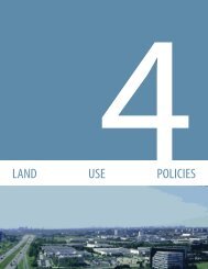
LAND USE POLICIES<br />
1<br />
3. A linear parks and urban open space system shall<br />
be established to provide connections within<br />
the <strong>Richmond</strong> <strong>Hill</strong> Centre and the abutting<br />
neighbourhoods.<br />
Walkable Streets and People Places<br />
2<br />
3<br />
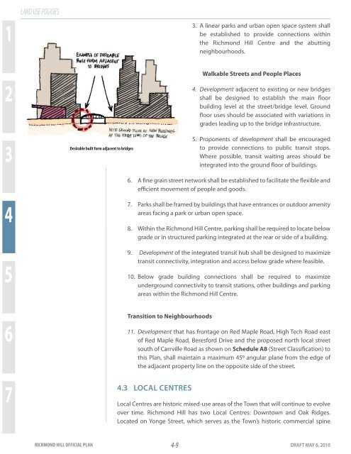
Desirable built form adjacent to bridges<br />
4. Development adjacent to existing or new bridges<br />
shall be designed to establish the main floor<br />
building level at the street/bridge level. Ground<br />
floor uses should be associated with variations in<br />
grades leading up to the bridge infrastructure.<br />
5. Proponents <strong>of</strong> development shall be encouraged<br />
to provide connections to public transit stops.<br />
Where possible, transit waiting areas should be<br />
integrated into the ground floor <strong>of</strong> buildings.<br />
6. A fine grain street network shall be established to facilitate the flexible and<br />
efficient movement <strong>of</strong> people and goods.<br />
4<br />
5<br />
7. Parks shall be framed by buildings that have entrances or outdoor amenity<br />
areas facing a park or urban open space.<br />
8. Within the <strong>Richmond</strong> <strong>Hill</strong> Centre, parking shall be required to locate below<br />
grade or in structured parking integrated at the rear or side <strong>of</strong> a building.<br />
9. Development <strong>of</strong> the integrated transit hub shall be designed to maximize<br />
transit connectivity, integration and access below grade where feasible.<br />
10. Below grade building connections shall be required to maximize<br />
underground connectivity to transit stations, other buildings and parking<br />
areas within the <strong>Richmond</strong> <strong>Hill</strong> Centre.<br />
Transition to Neighbourhoods<br />
6<br />
7<br />
11. Development that has frontage on Red Maple Road, High Tech Road east<br />
<strong>of</strong> Red Maple Road, Beresford Drive and the proposed north local street<br />
south <strong>of</strong> Carrville Road as shown on Schedule A8 (Street Classification) to<br />
this <strong>Plan</strong>, shall maintain a maximum 450 angular plane from the edge <strong>of</strong><br />
the adjacent property line on the opposite side <strong>of</strong> the street.<br />
4.3 LOCAL CENTRES<br />
Local Centres are historic mixed-use areas <strong>of</strong> the <strong>Town</strong> that will continue to evolve<br />
over time. <strong>Richmond</strong> <strong>Hill</strong> has two Local Centres: Downtown and Oak Ridges.<br />
Located on Yonge Street, which serves as the <strong>Town</strong>’s historic commercial spine<br />
RICHMOND HILL OFFICIAL PLAN 4-9<br />
DRAFT MAY 6, 2010
![Canada Day Program [PDF] - Town of Richmond Hill](https://img.yumpu.com/25764872/1/167x260/canada-day-program-pdf-town-of-richmond-hill.jpg?quality=85)


![Ward 4 Profile [PDF] - Town of Richmond Hill](https://img.yumpu.com/25764780/1/190x245/ward-4-profile-pdf-town-of-richmond-hill.jpg?quality=85)


![Statistics Fact Sheet - Fall 2009 [PDF] - Town of Richmond Hill](https://img.yumpu.com/25764746/1/190x146/statistics-fact-sheet-fall-2009-pdf-town-of-richmond-hill.jpg?quality=85)