Town of Richmond Hill Draft New Official Plan - Chapter 4
Town of Richmond Hill Draft New Official Plan - Chapter 4
Town of Richmond Hill Draft New Official Plan - Chapter 4

Create successful ePaper yourself
Turn your PDF publications into a flip-book with our unique Google optimized e-Paper software.
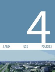
LAND USE POLICIES<br />
4.9.1.1 Priority Infill Areas<br />
It is the policy <strong>of</strong> Council that:<br />
1. The following areas are priority infill areas generally for low-density<br />
residential development:<br />
a. The area bounded by Elgin Mills Road, Bathurst Street, the rear <strong>of</strong> the<br />
lot line on the south side <strong>of</strong> Oxford Street and Yonge Street;<br />
b. The area bounded by the rear <strong>of</strong> the lot line on the north side <strong>of</strong> May<br />
Avenue and Stockdale Crescent, Bathurst Street, Weldrick Road and<br />
Yonge Street;<br />
c. The area bounded by Carville Road, Bathurst Street, the rear <strong>of</strong> the lot<br />
line on the south side <strong>of</strong> Birch Avenue, and Avenue Road;<br />
d. The area bounded by Carville Road, Avenue Road, Edgar Avenue, Scott<br />
Drive, Pearson Avenue, and Yonge Street;<br />
e. The area bounded by both sides <strong>of</strong> Garden Avenue between Pearson<br />
Avenue and Cambridge Crescent.<br />
f. The area bounded by Sixteenth Avenue, Little Don River and the lots<br />
south <strong>of</strong> Duncan Road and Bayview Avenue;<br />
g. The area bounded by the rear <strong>of</strong> the lots on the north side <strong>of</strong> <strong>Hill</strong>sview<br />
Drive and the south side <strong>of</strong> Harding Boulevard;<br />
h. The area bounded by the rear <strong>of</strong> the lots on the west side <strong>of</strong> Fairview<br />
Avenue;<br />
i. The area bounded by Yonge Street to the west, Stouffville Road to the<br />
south, the rear <strong>of</strong> the lots on the north side <strong>of</strong> Muirhead Crescent to<br />
the north and the limits <strong>of</strong> <strong>Plan</strong> 349 to the east, known as Muirhead<br />
Crescent;<br />
j. The area bounded by Jefferson Road to the north, Yonge Street to the<br />
east, the northern boundary <strong>of</strong> 65M-3754 and including the limits <strong>of</strong><br />
<strong>Plan</strong> 1916, known as the Harris-Beech neighbourhood;<br />
k. The area bounded by Bathurst Street, King Road, McCachen Street,<br />
Vitlor Drive and Puccini Drive within the area <strong>of</strong> the Infill Residential<br />
Study for Puccini Drive Neighbourhood which is approved by Council;<br />
l. The area bounded by Bathurst Street, Puccini Drive and the rear <strong>of</strong> the<br />
lot lines north <strong>of</strong> Vitlor Drive within the Residential Infill Study for the<br />
Bathurst Street Neighbourhood which is approved by Council;<br />
m. The area bounded by Grovewood Street, Timbervalley Avenue, Yonge<br />
Street and King Road within the Bond Crescent Neighbourhood Infill<br />
Development Report which is approved by Council;<br />
n. The area bounded by Sunset Beach Road, Lakeland Crescent and<br />
Dun Drive within the Residential Infill Study for the Douglas Road<br />
Neighbourhood which is approved by Council;<br />
o. The area bounded by Yonge Street, 19 th Avenue and the valley lands<br />
to the north and east <strong>of</strong> Anglin Drive within the Anglin Drive /Longhill<br />
Drive/ 19th Avenue Residential Infill Study which is approved by<br />
Council; and<br />
p. The area bounded by Parker Avenue, George Street, Elm Grove Avenue<br />
1<br />
2<br />
3<br />
4<br />
5<br />
6<br />
7<br />
DRAFT MAY 6, 2010<br />
4-34<br />
RICHMOND HILL OFFICIAL PLAN
![Canada Day Program [PDF] - Town of Richmond Hill](https://img.yumpu.com/25764872/1/167x260/canada-day-program-pdf-town-of-richmond-hill.jpg?quality=85)

![Ward 4 Profile [PDF] - Town of Richmond Hill](https://img.yumpu.com/25764780/1/190x245/ward-4-profile-pdf-town-of-richmond-hill.jpg?quality=85)


![Statistics Fact Sheet - Fall 2009 [PDF] - Town of Richmond Hill](https://img.yumpu.com/25764746/1/190x146/statistics-fact-sheet-fall-2009-pdf-town-of-richmond-hill.jpg?quality=85)