

CHANGE SERVICE REQUESTED The California Surveyor ... - CLSA
CHANGE SERVICE REQUESTED The California Surveyor ... - CLSA
CHANGE SERVICE REQUESTED The California Surveyor ... - CLSA

You also want an ePaper? Increase the reach of your titles
YUMPU automatically turns print PDFs into web optimized ePapers that Google loves.
Continued from page 20<br />
vious City of San Diego Subdivision Manual was written in 1967<br />
and had undergone many revisions over the years. However, the<br />
revisions were page changes or paragraph changes issued by<br />
memos reflecting the many changes to City policies and the subdivision<br />
process. In 1972, the Subdivision Map Act went through<br />
a major revision, including the addition of Parcel Maps as a document<br />
for subdividing land. I took it upon myself as a career<br />
enhancement project to complete a current manual. I reviewed<br />
manuals of other jurisdictions to begin the thought process, specifically<br />
reviewing the County of San Diego’s manual. It was important<br />
to me to have consistent mapping requirements within the<br />
region. Additionally, I wanted the manual to be a useful resource<br />
for land surveyors. My desire was to coordinate a collaborative<br />
effort in order to have a well thought out document. My supervisor<br />
and I both wrote explanatory portions of the manual, inclusive<br />
of gaps and overlaps and reversion rights, to name a few topics<br />
covered. After much research, I included current legal requirements<br />
via hyperlinks to the Subdivision Map Act, Professional<br />
Land <strong>Surveyor</strong>s Act, Streets and Highways Code, <strong>California</strong> Civil<br />
Code and the San Diego Land Development Code. I included an<br />
appendix of relevant case law that has been integral in <strong>California</strong>’s<br />
mapping processes.<br />
Upon the completion of the draft manual we formed a committee<br />
of members of the <strong>California</strong> Land <strong>Surveyor</strong>s Association,<br />
San Diego Chapter and City staff. <strong>The</strong> members spent numerous<br />
hours evaluating and rewriting to provide this valuable tool for a<br />
land surveyor working within the City of San Diego. Being a<br />
member of the committee created a sense of ownership and pride<br />
for each professional land surveyor that was involved. <strong>The</strong> 1967<br />
manual gave little guidance to the applicant regarding the preparation<br />
of a map or any other land title document. This updated<br />
manual is now the guide to preparing and processing maps and<br />
other land title documents within the City of San Diego.<br />
Coincident with writing the manual, I completed my graduate<br />
studies in 2006 with a Masters of Science in Civil Engineering<br />
from Fresno State University. My emphasis was in surveying, particularly<br />
the Subdivision Map Act, reversion rights and antiquated<br />
subdivisions. With the aforementioned conglomeration of experience,<br />
I was soon approving the land title documents being<br />
processed through the City as the Deputy City Engineer.<br />
Currently I am working with Field Surveys for the City. I am<br />
privileged to work with Diana Bergen, PLS and our newest PLS,<br />
Teresa Munyer. We have encouraged and supported each other for<br />
many years. We continue to support each other but now we each<br />
have our own areas of expertise. After all, there is a broad brush<br />
of fulfilling career paths for a PLS from aerial mapping to subdivision<br />
mapping to GPS. <strong>The</strong> many aspects of surveying leaves an<br />
open door to any young woman wishing to challenge her logical<br />
thinking and her math skills while enjoying the outdoors.<br />
I enjoy surveying, I cannot leave home without a map, I love<br />
hiking, I have a military background, I love summiting mountains,<br />
and therefore, I ended up volunteering as a fire lookout host. Who<br />
would be better at locating a fire, plotting it on a map and then<br />
calling it in to the forest service other than a surveyor? Once<br />
again, passion and background guided me without a thought.<br />
Come drop by at 9,000 feet to visit me when I am on duty at the<br />
Tahquitz Fire Lookout in Idyllwild, <strong>California</strong>.<br />
Many surveyors get excited about old monuments, probably<br />
because we often follow in the footsteps of the original surveyor.<br />
To satisfy our appetites I organized a <strong>CLSA</strong> backpacking trip to<br />
the San Bernardino Initial Point to do just that and we found all<br />
three points. We also did a bike ride to the Mt Diablo Initial Point.<br />
We have one more <strong>California</strong> Initial Point to go. Gals…hiking and<br />
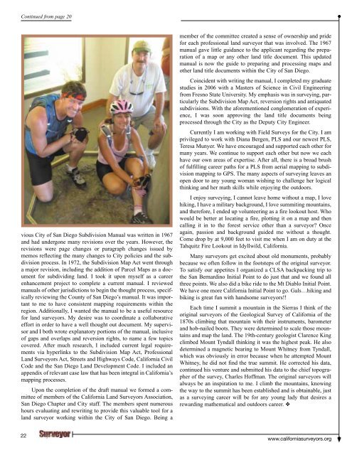
biking is great fun with handsome surveyors!!<br />
Each time I summit a mountain in the Sierras I think of the<br />
original surveyors of the Geological Survey of <strong>California</strong> of the<br />
1870s climbing that mountain with their instruments, barometer<br />
and hob-nailed boots. <strong>The</strong>y were determined to scale those mountains<br />
and map the land. <strong>The</strong> 19th-century geologist Clarence King<br />
climbed Mount Tyndall thinking it was the highest peak. He also<br />
determined a magnetic bearing to Mount Whitney from Tyndall,<br />
which was obviously in error because when he attempted Mount<br />
Whitney, he did not find the true summit. He corrected his data,<br />
continued his venture and submitted his data to the chief topographer<br />
of the survey, Charles Hoffman. <strong>The</strong> original surveyors will<br />
always be an inspiration to me. I climb the mountains, knowing<br />
the way to the summit has been established and is obtainable, just<br />
as a surveying career will be for any young lady that desires a<br />
rewarding mathematical and outdoors career. ❖<br />
22<br />
www.californiasurveyors.org


