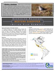
Sanderling Plan - Western Hemisphere Shorebird Reserve Network
Sanderling Plan - Western Hemisphere Shorebird Reserve Network
Sanderling Plan - Western Hemisphere Shorebird Reserve Network

Create successful ePaper yourself
Turn your PDF publications into a flip-book with our unique Google optimized e-Paper software.
also breed on Bathurst Island, Nunavut in variable but relatively low nesting densities (1–3<br />
pairs/km 2 depending on year; Parmelee 1970, Mayfield 1983). Recent studies confirm that<br />
Creswell Bay, Nunavut, is an important breeding site for <strong>Sanderling</strong>s (Latour et al. 2005).<br />
Creswell Bay is the most northern large area of exceptional shorebird breeding density in the<br />
Canadian arctic islands, and marks the northern limit of the <strong>Sanderling</strong>’s breeding range (Latour<br />
et al. 2005).<br />
MIGRATION SITES<br />
<strong>Sanderling</strong>s aggregate at some sites during migration (especially spring), but are more<br />
dispersed during fall migration. Listed below are the sites where many <strong>Sanderling</strong>s aggregate<br />
during migration along the U.S. Atlantic coast (especially Delaware Bay), the Canadian interior<br />
(especially Saskatchewan), and, to a lesser extent, the U.S. Pacific coast (Oregon and<br />
Washington).<br />
In preparation for developing the Conservation <strong>Plan</strong> for the <strong>Sanderling</strong>, the author<br />
analyzed International <strong>Shorebird</strong> Survey (ISS) records for <strong>Sanderling</strong>s (1974–2005). Although<br />
ISS data offer the most complete picture of shorebird distributions in the <strong>Western</strong> <strong>Hemisphere</strong>,<br />
there are some inconsistencies in the data set (as there are in most volunteer-run data efforts). For<br />
instance, the number of times each site is surveyed, and consequently, our certainty about<br />
<strong>Sanderling</strong> use at each site. Hence, the data are presented in a transparent way, by survey period<br />
(decade) and number of years surveyed, arrayed by site. Tables 1, 2, 3, and 4 in Appendix IV<br />
contain the categorized results by season (spring; fall) and length of time surveyed (1–4 years;<br />
5+ years); Tables 5 and 6 (Appendix IV) contain results for winter. The purpose for including<br />
these tables is twofold: 1) to highlight a number of sites that are known to be important to the<br />
<strong>Sanderling</strong> during migration (knowing that in subsequent versions of this plan we will include<br />
other sites not captured by the ISS, especially likely for sites outside the United States); and 2) to<br />
present the best available information on <strong>Sanderling</strong>s in a way that enables managers to better<br />
understand, and then prioritize, their management/conservation efforts.<br />
Other data sources consulted for Version 1.0 of this plan include the World Bird Data<br />
Base (2009) Important Bird Areas of Canada (2009); subsequent versions of the plan should<br />
consult each state’s Important Bird Area list (available online), as well as the Important Bird<br />
Areas of Mexico (available online). These resources highlight additional sites of potential and/or<br />
WHSRN – <strong>Sanderling</strong> Conservation <strong>Plan</strong>, February 2010, v1.1 25