Report for Item 6 - Swale Borough Council
Report for Item 6 - Swale Borough Council
Report for Item 6 - Swale Borough Council

You also want an ePaper? Increase the reach of your titles
YUMPU automatically turns print PDFs into web optimized ePapers that Google loves.
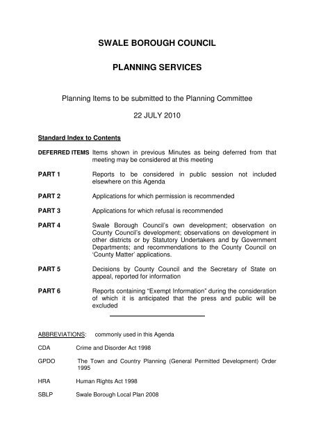
SWALE BOROUGH COUNCIL<br />
PLANNING SERVICES<br />
Planning <strong>Item</strong>s to be submitted to the Planning Committee<br />
22 JULY 2010<br />
Standard Index to Contents<br />
DEFERRED ITEMS <strong>Item</strong>s shown in previous Minutes as being deferred from that<br />
meeting may be considered at this meeting<br />
PART 1<br />
PART 2<br />
PART 3<br />
PART 4<br />
PART 5<br />
PART 6<br />
<strong>Report</strong>s to be considered in public session not included<br />
elsewhere on this Agenda<br />
Applications <strong>for</strong> which permission is recommended<br />
Applications <strong>for</strong> which refusal is recommended<br />
<strong>Swale</strong> <strong>Borough</strong> <strong>Council</strong>’s own development; observation on<br />
County <strong>Council</strong>’s development; observations on development in<br />
other districts or by Statutory Undertakers and by Government<br />
Departments; and recommendations to the County <strong>Council</strong> on<br />
‘County Matter’ applications.<br />
Decisions by County <strong>Council</strong> and the Secretary of State on<br />
appeal, reported <strong>for</strong> in<strong>for</strong>mation<br />
<strong>Report</strong>s containing “Exempt In<strong>for</strong>mation” during the consideration<br />
of which it is anticipated that the press and public will be<br />
excluded<br />
ABBREVIATIONS:<br />
commonly used in this Agenda<br />
CDA Crime and Disorder Act 1998<br />
GPDO<br />
The Town and Country Planning (General Permitted Development) Order<br />
1995<br />
HRA Human Rights Act 1998<br />
SBLP <strong>Swale</strong> <strong>Borough</strong> Local Plan 2008
INDEX OF ITEMS FOR PLANNING COMMITTEE – 22 JULY 2010<br />
• Minutes of last Planning Committee Meeting<br />
• Deferred <strong>Item</strong>s<br />
• Minutes of any Working Party Meetings<br />
Deferred <strong>Item</strong>s:<br />
NONE<br />
Part 1’s<br />
NONE<br />
Part 2’s:<br />
2.1 SITTINGBOURNE SW/10/0701 Land opposite Stumble Inn,<br />
Pg 1 – 10<br />
St Paul’s Street<br />
2.2 FAVERSHAM SW/10/0481 Former Garages Site at<br />
Pg 11 – 16<br />
Ennerdale<br />
2.3 NEWINGTON SW/10/0703 8 School Lane<br />
Pg 17 – 22<br />
2.4 BORDEN SW/10/0459 1 Lower Bannister Cottages,<br />
Pg 23 – 27<br />
Bannister Hill<br />
2.5 SITTINGBOURNE SW/10/0438 132 Borden Lane<br />
Pg 28 – 31<br />
2.6 NEWINGTON SW/10/0631 Land at Wardwell,<br />
Pg 32 – 49<br />
High Oak Hill<br />
2.7 FAVERSHAM SW/10/0502 1 Mountfield<br />
Pg 50 – 53<br />
2.8 SHEERNESS SW/10/0420 Woody’s Nightclub, Wood Street<br />
Pg 54 – 68<br />
2.9 DUNKIRK SW/10/0599 The Brotherhood Woodyard,<br />
Pg 69 – 82<br />
Gatehill<br />
Part 3’s:<br />
3.1 HERNHILL SW/10/0215 The Manor House, Church Hill<br />
Pg 1 – 3<br />
Part 4’s<br />
NONE
Part 5’s:<br />
5.1 HERNHILL Case 23174 Site at Land North West<br />
Pg 1 – 18<br />
of Thanet Way (A299) and<br />
South of High Street Road<br />
5.2 UPCHURCH SW/10/0085 2 Boxted Farm Barns<br />
Pg 19– 20<br />
5.3 NEWINGTON SW/09/1061 Hillview, 104 High Street<br />
Pg 21– 24<br />
5.4 BREDGAR SW/06/1464 Land adjacent Davids House<br />
Pg 25– 26<br />
5.5 NORTON SW/09/0687 Land adjacent Rushetts Lane<br />
Pg 27– 28<br />
5.6 THROWLEY FORSTAL Case 23231 Land and Buildings at Pool<br />
Pg 29 – 36<br />
House, rear of Mill House
PLANNING COMMITTEE – 22 JULY 2010 PART 2<br />
<strong>Report</strong> of the Head of Development Services<br />
PART 2<br />
Applications <strong>for</strong> which PERMISSION is recommended<br />
2.1 SW/10/0701 (Case 07688) SITTINGBOURNE<br />
Location:<br />
Proposal:<br />
Land opposite Stumble Inn, St Paul’s Street, Sittingbourne,<br />
Kent, ME10 2LG<br />
New detached 6 bedroom dwelling, with 3 associated parking<br />
spaces. 1.8m high brick wall to north boundary to prevent any<br />
vehicular access from St Pauls Street. Associated gardens,<br />
rainwater collection system and cycle store<br />
Applicant/Agent: Mr Oliver Woodmansee, c/o Mr Andreas Peyeri, 3A St Alphege<br />
Lane, Canterbury, Kent, CT1 2EB<br />
Application Valid: 7 June 2010 and additional in<strong>for</strong>mation received 21 June 2010<br />
SUBJECT TO:<br />
Any representations received from local residents (closing date<br />
<strong>for</strong> responses 8 th July), and comments from the <strong>Council</strong>’s<br />
Technical Services Team (consultation expires 8 th July 2010).<br />
8 WEEK TARGET: 2 August 2010<br />
Conditions<br />
(1) The development to which this permission relates must be begun not later<br />
than the expiration of three years beginning with the date on which the<br />
permission is granted.<br />
Grounds: In pursuance of Section 91 of the Town and Country Planning<br />
Act 1990 as amended by the Planning and Compulsory Purchase Act 2004.<br />
(2) No development shall take place until details have been submitted to the<br />
District Planning Authority and approved in writing, which set out what<br />
measures have been taken to ensure that the development incorporates<br />
sustainable construction techniques such as water conservation and<br />
recycling, renewable energy production including the inclusion of solar<br />
thermal or solar photo voltaic installations, and energy efficiency. Upon<br />
approval, the details shall be incorporated into the development as approved.<br />
Continued . . .<br />
1
2.1 (Contd) PART 2<br />
Grounds: In the interest of promoting energy efficiency and sustainable<br />
development, and in pursuance of policies E1, U3 and E21 of the <strong>Swale</strong><br />
<strong>Borough</strong> Local Plan 2008.<br />
(3) Details in the <strong>for</strong>m of cross-sectional drawings through the site, of the existing<br />
and proposed site levels shall be submitted to and approved in writing by the<br />
District Planning Authority be<strong>for</strong>e work commences and the development shall<br />
be completed strictly in accordance with the approved levels.<br />
Grounds: In order to secure a satisfactory <strong>for</strong>m of development having<br />
regard to the height relationship with adjacent dwelling in accordance with<br />
Policy E1 of the <strong>Swale</strong> <strong>Borough</strong> Local Plan 2008.<br />
(4) Upon completion, no further development, whether permitted by Classes A, B,<br />
C, D or E of Part 1 of Schedule 2 to the Town and Country Planning (General<br />
Permitted Development) Order 1995 (as amended) (or any order revoking and<br />
re-enacting that Order) or not, shall be carried out without the prior permission<br />
in writing of the District Planning Authority.<br />
Grounds: In the interests of the amenities of the area and in pursuance of<br />
policies E1 and E24 of the <strong>Swale</strong> <strong>Borough</strong> Local Plan 2008.<br />
(5) No construction work in connection with the development shall take place on<br />
any Sunday or Bank Holiday, nor on any other day except between the<br />
following times:-<br />
Monday to Friday 0730 – 1900 hours, Saturdays 0730 – 1300 hours unless in<br />
association with an emergency or with the prior written approval of the District<br />
Planning Authority.<br />
Grounds: In the interests of residential amenity and in pursuance of<br />
policies E1 and E2 of the <strong>Swale</strong> <strong>Borough</strong> Local Plan 2008.<br />
(6) No impact pile driving in connection with the construction of the development<br />
shall take place on the site on any Saturday, Sunday or Bank Holiday, nor any<br />
other day except between the following times:-<br />
Monday to Friday 0900-1700hours unless in association with an emergency<br />
or with the written approval of the District Planning Authority.<br />
Grounds: In the interests of residential amenity and in pursuance of<br />
policies E1 and E2 of the <strong>Swale</strong> <strong>Borough</strong> Local Plan 2008.<br />
(7) No burning of waste or refuse shall take place on site during construction<br />
works other than may be agreed in writing by the District Planning Authority.<br />
Grounds: In the interests of residential amenity and in pursuance of<br />
policies E1 and E2 of the <strong>Swale</strong> <strong>Borough</strong> Local Plan 2008. Continued . . .<br />
2
2.1 (Contd) PART 2<br />
(8) During construction of the development adequate space shall be provided on<br />
site, in a position previously agreed by the District Planning Authority to<br />
enable all employees and contractors vehicles to park, load and off load and<br />
turn within the site.<br />
Grounds: In the interests of highway safety and convenience in accordance<br />
with Policy E1 of the <strong>Swale</strong> <strong>Borough</strong> Local Plan 2008.<br />
(9) Adequate precautions shall be taken during the period of demolition and<br />
construction to prevent the deposit of mud and/or other debris on the public<br />
highway.<br />
Grounds: In the interests of highway safety and convenience in<br />
accordance with Policy E1 of the <strong>Swale</strong> <strong>Borough</strong> Local Plan 2008.<br />
(10) No development approved by this permission shall be commenced prior to a<br />
contaminated land assessment (and associated remediation strategy if<br />
relevant), being submitted to and approved in writing by the District Planning<br />
Authority, comprising:<br />
a) A desk study and conceptual model, based on the historical uses of the<br />
site and proposed end-uses, and professional opinion as to whether<br />
further investigative works are required. A site investigation strategy,<br />
based on the results of the desk study, shall be approved by the<br />
District Planning Authority prior to any intrusive investigations<br />
commencing on site.<br />
b) An investigation, including relevant soil, soil gas, surface and<br />
groundwater sampling, carried out by a suitably qualified and<br />
accredited consultant/contractor in accordance with a Quality Assured<br />
sampling and analysis methodology.<br />
c) A site investigation report detailing all investigative works and sampling<br />
on site, together with the results of analyses, risk assessment to any<br />
receptors and a proposed remediation strategy which shall be of such<br />
a nature as to render harmless the identified contamination given the<br />
proposed end-use of the site and surrounding environment, including<br />
any controlled waters.<br />
Grounds: To ensure any land contamination is adequately dealt with,<br />
pursuant to policies E1, E2 and E3 of the <strong>Swale</strong> <strong>Borough</strong> Local Plan 2008.<br />
(11) Be<strong>for</strong>e any part or agreed phase of the development is occupied, all<br />
remediation works identified in the contaminated land assessment and<br />
approved by the District Planning Authority shall be carried out in full (or in<br />
phases as agreed in writing by the District Planning Authority) on site under a<br />
quality assured scheme to demonstrate compliance with the proposed<br />
methodology and best practice guidance. If, during the works, contamination<br />
is encountered which has not previously been identified, then the additional<br />
contamination shall be fully assessed and an appropriate remediation scheme<br />
agreed with the District Planning Authority.<br />
Continued . . .<br />
3
2.1 (Contd) PART 2<br />
Grounds: To ensure any land contaminated is adequately dealt with,<br />
pursuant to policies E1, E2 and E3 of the <strong>Swale</strong> <strong>Borough</strong> Local Plan 2008.<br />
(12) Upon completion of the works identified in the contaminated land assessment,<br />
and be<strong>for</strong>e any part or agreed phase of the development is occupied, a<br />
closure report shall be submitted which shall include details of the proposed<br />
remediation works with quality assurance certificates to show that the works<br />
have been carried out in accordance with the approved methodology. Details<br />
of any post-remediation sampling and analysis to show the site has reached<br />
the required clean-up criteria shall be included in the closure report together<br />
with the necessary documentation detailing what waste materials have been<br />
removed from the site.<br />
Grounds: To ensure any contaminated land is adequately dealt with,<br />
pursuant to policies E1, E2 and E3 of the <strong>Swale</strong> <strong>Borough</strong> Local Plan 2008.<br />
(13) No development shall take place until full details of the method of disposal of<br />
foul and surface waters have been submitted to and approved by the District<br />
Planning Authority. The approved details shall be implemented be<strong>for</strong>e the first<br />
use of the development hereby permitted.<br />
Grounds: In order to prevent pollution of water supplies and in pursuance<br />
of policy E1, E2 E3 and E4 of the <strong>Swale</strong> <strong>Borough</strong> Local Plan 2008.<br />
(14) Prior to the commencement of development, details of the finish of the velux<br />
rooflights and samples of the brick and timber finishing materials to be used<br />
on the development hereby permitted shall be submitted to and approved in<br />
writing by the District Planning Authority and shall be implemented in<br />
accordance with the approved details.<br />
Grounds: In the interest of visual amenity and in pursuance of policies E1<br />
and E19 of the <strong>Swale</strong> <strong>Borough</strong> Local Plan 2008.<br />
(15) Full details of both hard and soft landscape works, as requested by condition<br />
(1) shall be submitted to and approved in writing by the District Planning<br />
Authority. These details shall include existing trees, shrubs and other<br />
features, planting schedules of plants, noting species, plant sizes and<br />
numbers where appropriate, means of enclosure, hard surfacing materials,<br />
and an implementation programme.<br />
Grounds: In the interests of the visual amenities of the area and in<br />
pursuance of policies E1 of the <strong>Swale</strong> <strong>Borough</strong> Local Plan 2008.<br />
(16) All hard and soft landscape works shall be carried out in accordance with the<br />
approved details. The works shall be carried out prior to the occupation of<br />
any part of the development or in accordance with the programme agreed in<br />
writing with the District Planning Authority.<br />
Continued . . .<br />
4
2.1 (Contd) PART 2<br />
Grounds: n the interests of the visual amenities of the area and in<br />
pursuance of policies E1 of the <strong>Swale</strong> <strong>Borough</strong> Local Plan 2008.<br />
(17) Upon completion of the approved landscaping scheme, any trees or shrubs<br />
that are removed, dying, being severely damaged or becoming seriously<br />
diseased within five years of planting shall be replaced with trees or shrubs of<br />
such size and species as may be agreed in writing with the District Planning<br />
Authority, and within whatever planting season is agreed.<br />
Grounds: In the interests of the visual amenities of the area and in<br />
pursuance of policies E1 of the <strong>Swale</strong> <strong>Borough</strong> Local Plan 2008.<br />
(18) The area shown on the submitted plan as car parking space shall be kept<br />
available <strong>for</strong> such use at all times and no permanent development, whether<br />
permitted by the Town and Country Planning (General Permitted<br />
Development) Order 1995 (or any order revoking or re-enacting that Order) or<br />
not, shall be carried out on the land so shown or in such a position as to<br />
preclude vehicular access thereto; such land and access thereto shall be<br />
provided prior to the occupation of the dwelling(s) hereby permitted.<br />
Grounds: Development without adequate provision <strong>for</strong> the parking or<br />
garaging of cars is likely to lead to car parking inconvenient to other road<br />
users and detrimental to amenity and in pursuance of policies E1 and T3 of<br />
the <strong>Swale</strong> <strong>Borough</strong> Local Plan 2008.<br />
(19) Prior to the commencement of development, details of a secure bin storage<br />
area shall be submitted <strong>for</strong> approval in writing by the District Planning<br />
Authority and shall be implemented in accordance with the approved details<br />
and retained in perpetuity.<br />
Grounds: In the interests of the amenities of the area, in pursuance of Policy<br />
E1 of the <strong>Swale</strong> <strong>Borough</strong> Local Plan 2008.<br />
(20) Development shall not begin until a surface water drainage scheme <strong>for</strong> the<br />
site, based on sustainable drainage principles and an assessment of<br />
hydrological and hydrogeological context of the development, has been<br />
submitted to and approved in writing by the District Planning Authority. The<br />
scheme shall subsequently be implemented in accordance with the approved<br />
details be<strong>for</strong>e the development is completed.<br />
Grounds: To prevent the increased risk of flooding, to improve the protect<br />
water quality, improve habitat and amenity and ensure future maintenance of<br />
the surface water drainage system, to reduce the risk of flooding to the<br />
inhabitants of the property in pursuance of Policy E1 and E4 of the <strong>Swale</strong><br />
<strong>Borough</strong> Local Plan 2008.<br />
Continued . . .<br />
5
2.1 (Contd) PART 2<br />
(21) All ground levels shall be raised by at least 300mm relative to the existing<br />
ground levels on site and there shall be no lowering of the existing ground<br />
levels on the site and no basements/cellars shall be incorporated into the<br />
dwelling.<br />
Grounds: To prevent the increased risk of flooding, to improve the protect<br />
water quality, improve habitat and amenity and ensure future maintenance of<br />
the surface water drainage system, to reduce the risk of flooding to the<br />
inhabitants of the property in pursuance of Policy E1 and E4 of the <strong>Swale</strong><br />
<strong>Borough</strong> Local Plan 2008.<br />
Reasons <strong>for</strong> Approval<br />
Having taken all material considerations into account, it is considered that subject to<br />
compliance with the attached conditions, the proposal would be in accordance with<br />
the development plan and would not cause unacceptable harm to the amenities of<br />
the area or prejudice highway safety or convenience. In resolving to grant<br />
permission, particular regard has been had to the following policies: E1, E2, E3, E4,<br />
E19, H2, T1 and T3 of the <strong>Swale</strong> <strong>Borough</strong> Local Plan.<br />
Description of Proposal<br />
This is a full planning application <strong>for</strong> a detached 6 bedroom dwelling on land<br />
previously the subject of an outline planning permission <strong>for</strong> a detached residential<br />
dwelling. The outline permission had all matters reserved except <strong>for</strong> the access and<br />
layout. The current proposal would site the dwelling in almost the same location as<br />
the approved outline dwelling. It would however, be orientated slightly differently so<br />
that it would be sited parallel with the alignment of St Pauls Street. The current<br />
proposed dwelling would also be 5m wider than that shown on the outline approval.<br />
The parking and garden arrangement would remain the same as the outline<br />
approval. The applicant has provided details of the boundary treatment along the<br />
back edge of the footpath to St Pauls Street. This would be a 1.8m high yellow stock<br />
brick wall.<br />
The proposed dwelling would be 2 storeys high with accommodation comprising 4<br />
bedrooms and a bathroom within the roof space. The ground floor would have a<br />
large living room with a wood burning stove, entrance hall and kitchen/dining room.<br />
The total height of the dwelling would be 10.5m. Three parking spaces are shown to<br />
be provided, two of which would be within a garage court that serves the properties<br />
in Periwinkle Close. The remaining space would be a visitor’s space that would be<br />
located within the 6m wide access to the garage court.<br />
The proposed dwelling would be of a modern design that would incorporate<br />
sustainable construction techniques, solar panels and rainwater harvesting. A cycle<br />
store would also be provided. The applicant also proposes to plant a screen of trees<br />
along the boundaries of the site to reduce road noise within the garden.<br />
Continued . . .<br />
6
2.1 (Contd) PART 2<br />
The finishing materials would be yellow stock brick, timber louvers (slats) with<br />
glazing behind, powder coated aluminium windows, white render and zinc standing<br />
seam roof.<br />
Relevant Site History and Description<br />
This piece of land was essentially left over from the construction of the roundabout<br />
and highway network improvements at St Paul’s Street, Chalkwell Road and Crown<br />
Road. It is oddly shaped as a consequence of this. Kent Highway Services still own<br />
some very small pieces of land that adjoin the application site and a third party owns<br />
a small slither of land between the application site and 51 Church Street.<br />
There have been a number of planning application <strong>for</strong> the development of this site<br />
including its use as a car park <strong>for</strong> a vehicle hire company (SW/99/651) which was<br />
refused and a dismissed appeal (TN/07/0009) <strong>for</strong> the installation of a radio base<br />
station comprising of a 15m high telecommunications monopole.<br />
An outline application <strong>for</strong> the erection of 10 no. apartments (SW/08/1276) was<br />
submitted but was never made valid owing to the incorrect ownership certificate<br />
being signed. Subsequently, outline planning permission was granted under<br />
SW/09/1019 <strong>for</strong> the erection of one dwelling.<br />
This site lies within the built-up area boundary of Sittingbourne. It lies opposite the<br />
Stumble Inn Public House and between two rows of terraced houses fronting Church<br />
Street and Chalkwell Road. The surrounding area is characterised by 2 and 3 storey<br />
dwellings.<br />
Views of Consultees<br />
Comments from the <strong>Council</strong>’s Technical Services Team, <strong>for</strong> comments on on-street<br />
parking in the area are awaited and will be reported to Members at the meeting.<br />
The Environment Agency has no objection to the proposal noting that the site<br />
partially lies within flood zone 3a. They recommend conditions to ensure that the<br />
risk of flooding is minimised and that the development does not cause flooding<br />
elsewhere. They also seek land contamination conditions and provide guidance on<br />
the use of soakaways and the storage of fuel, oil and chemicals.<br />
Other Represenations<br />
I will update Members on any other representations received – closing date 8 July<br />
2010.<br />
Policies<br />
Policies E1 of the <strong>Swale</strong> <strong>Borough</strong> Local Plan 2008 (SBLP) gives general guidance<br />
regarding design and amenity, amongst others. Policy E19 (SBLP) aims to achieve<br />
high quality design on all developments in the <strong>Borough</strong>.<br />
Continued . . .<br />
7
2.1 (Contd) PART 2<br />
Policy H2 (SBLP) encourages the provision of new housing within the built up areas<br />
of the <strong>Borough</strong>, and in locations with good access<br />
Policies T1 and T3 (SBLP) deals with traffic and access, and seek to minimise the<br />
highways impacts of any new development through the provision of adequate<br />
parking, sightlines, turning space, etc.<br />
Policies E2 and E3 (SBLP) seeks to ensure that pollution by way of noise, air and<br />
contamination to ground waters is prevented. Policy E4 seeks to ensure that<br />
development is adequately protected against flooding.<br />
Discussion<br />
I consider the key issues to be the principle of the development, the impact on the<br />
visual amenities of the surrounding area, the impact on the residential amenities of<br />
the adjacent properties and the adequacy of parking, access and living space.<br />
Principle<br />
Policy H2 of the Local Plan notes that permission <strong>for</strong> new housing will be granted <strong>for</strong><br />
sites within the defined built-up areas as shown on the proposals map. All proposals<br />
will be expected to make the most efficient use of land and provide house types<br />
appropriate to its location. The proposed dwelling would be amongst other<br />
residential properties and would there<strong>for</strong>e be in keeping with the character of the<br />
surrounding area. The oddly shaped site and restricted access also restricts the<br />
number of dwellings able to be provided at the site. I there<strong>for</strong>e consider that the<br />
proposal would make the most efficient use of this land. I am also mindful of the<br />
extant outline planning permission <strong>for</strong> the erection of one dwelling on this site. The<br />
applicant could have submitted a detailed application via the reserved matters<br />
procedure whereby the principle of the development would not have been a<br />
consideration. As the application site is within the built-up area boundary of<br />
Sittingbourne, I consider that the proposal would comply with Policy H2 and would<br />
there<strong>for</strong>e be acceptable in principle.<br />
Visual amenities<br />
A detached dwelling in this location would not be like any of the other properties<br />
within the vicinity. Most properties within the surrounding area are terraced.<br />
However, in my view, this should not prohibit the development of a detached<br />
dwelling in this case. The position of the dwelling would ensure that it would be<br />
viewed in relation to the two storey end of terrace dwelling, 51 Church Street. It<br />
would also be seen against a backdrop of three storey townhouses. In this context, I<br />
consider that it would merely add to the variety of built <strong>for</strong>m in the immediate area. I<br />
also consider that its modern design would be appropriate here. The site is very<br />
prominent and any new building would have a significant impact on the street scene.<br />
The quality of the design proposed is of a high standard in my view. I consider that<br />
the position and design of the fenestration would be well proportioned with the<br />
dwelling in my view and the timber slats and use of a mix of render and yellow stock<br />
bricks would articulate the elevations in an interesting and acceptable manner. The<br />
yellow stock bricks and white render would pick up on finishing materials<br />
characteristic to the surrounding area.<br />
Continued . . .<br />
8
2.1 (Contd) PART 2<br />
The pitched roof would reflect the <strong>for</strong>m of the adjacent dwellings and the height of<br />
the new dwelling would, in my view, bridge the difference in height between the two<br />
storey dwellings fronting Church Street and Chalkwell Road and the very prominent<br />
three storey townhouses fronting Periwinkle Close. In this respect, I do not consider<br />
that the dwelling would look out of place.<br />
Residential amenities<br />
The proposed dwelling would also be over 28.5 metres from the rear of the<br />
properties fronting Periwinkle Close and 42 metres from the properties fronting<br />
Chalkwell Road. I there<strong>for</strong>e consider that this distance will limit the potential <strong>for</strong><br />
overlooking between properties. As Members are aware 21 metres is the<br />
recommended back to back separation distance between properties to avoid<br />
overlooking. I there<strong>for</strong>e consider that this proposal would have no undue<br />
overlooking impact. I also consider that the townhouses within Periwinkle Close and<br />
the properties within Chalkwell Road would not significantly overlook the private<br />
amenity space of the propose dwelling.<br />
The proposed dwelling is shown to be 8m from the rear elevation of no. 51 Church<br />
Street. The proposed dwelling would be to the west of this neighbouring property,<br />
only potentially affecting the evening sunlight by a small amount. Members should<br />
note that the proposed dwelling is at an angle to no. 51 and that the proposed<br />
dwelling would not be directly in line with the rear elevation of this property. I<br />
consider that the dwelling would be an adequate distance from this neighbouring<br />
property, to ensure that there would be no overshadowing or overbearing effect.<br />
The windows within the elevation facing no. 51 are at an oblique angle to this<br />
neighbouring property. There would be no direct line of sight to the area of important<br />
private amenity space, immediately to the rear of this property. I there<strong>for</strong>e consider<br />
that the proposed dwelling would not unduly overlook no. 51 Church Street.<br />
Adequacy of Accommodation<br />
The proposed development would have a large garden area to the west of the<br />
dwelling. Although perhaps unconventional in shape, I am of the view that its size<br />
will ensure that the quality is of a standard that it would not disadvantage future<br />
occupants. Internal sizes of rooms are more than sufficient to cater <strong>for</strong> one family.<br />
Highway Implications<br />
I am awaiting comments from the <strong>Council</strong>’s Technical Services Team regarding the<br />
potential impact on the amenities of the area reagarding on-street parking. However,<br />
the provision of 3 parking spaces would comply with the relevant parking standards<br />
<strong>for</strong> a 6 bedroom dwelling.<br />
In respect of the access, I am aware that residents are concerned that they will loose<br />
the ability to park within this access should the development be allowed. This would<br />
be as a consequence of the land owner (the applicant) en<strong>for</strong>cing against the said<br />
parking on his land. In my opinion, this is a private legal matter separate from this<br />
particular application. If the legal powers exist to en<strong>for</strong>ce against parking on his<br />
land, then residents could be at risk of this happening at any time. It is also not<br />
Continued . . .<br />
9
2.1 (Contd) PART 2<br />
appropriate <strong>for</strong> the <strong>Council</strong> to become involved in what could be a legal dispute<br />
regarding landownership. In this case, the applicant has declared that he owns all of<br />
the land outlined in red on the submitted plans and this includes the access. I have<br />
no evidence to dispute this claim and this matter should not there<strong>for</strong>e influence the<br />
outcome of the application.<br />
Other matters<br />
Access <strong>for</strong> emergency services to the site could potentially be taken from St Paul’s<br />
Road as there is an existing vehicular access to the land. The applicant has been<br />
discouraged from using this access by Kent Highway Services. However, it is<br />
possible that it could be used in an emergency if necessary.<br />
With regards to refuse vehicles, the recommended carry distance, under building<br />
regulations, <strong>for</strong> refuse from the front door of a dwelling to a secure storage area is<br />
30m. In addition, the bin store can be located at a point 25m from the refuse<br />
collection point i.e. the highway. A total of 55m is there<strong>for</strong>e allowed, in refuse<br />
collection terms, between the front door of a dwelling and the public highway (or<br />
other collection point). In this case, the total distance would be 45m and would<br />
there<strong>for</strong>e be adequate. I have asked <strong>for</strong> details of a bin storage area to be submitted<br />
under condition (19). This will ensure that permanent, tidy and secure storage is<br />
provided <strong>for</strong> refuse within 25m from the highway.<br />
Recommendation<br />
Having considered the relevant planning policies, I am of the view that this proposal<br />
complies with Policy H2 and is there<strong>for</strong>e acceptable in principle. I also consider that<br />
the design of the dwelling would be of a high standard that would have no detriment<br />
to the visual amenities. The garden area would be of a reasonable size <strong>for</strong> such a<br />
house in my view and there would be the required number of parking spaces<br />
provided within the application site to ensure no significant highway implications.<br />
Taking the above into account I recommend that planning permission be granted<br />
subject to any outstanding comments from local residents and the <strong>Council</strong>’s<br />
Technical Services Team.<br />
___ __________________________________________________________<br />
Responsible Officer: Rob Bailey (Area Planning Officer)<br />
__ ____________________________________________________________<br />
List of Background Documents<br />
1. Application papers <strong>for</strong> SW/10/0701.<br />
2. Correspondence relating to SW/10/0701.<br />
3. Application papers <strong>for</strong> SW/09/1019.<br />
4. Correspondence relating to SW/09/1019.<br />
10
PART 2<br />
2.2 SW/10/0481 (Case 21809) FAVERSHAM<br />
Location:<br />
Proposal:<br />
Former Garages Site at Ennerdale, Faversham, Kent, ME13<br />
8JE<br />
Application <strong>for</strong> a new planning permission to replace an extant<br />
planning permission, Application SW/07/0058 Approved 1 May<br />
2007, in order to extend the time limit <strong>for</strong> implementation <strong>for</strong> the<br />
demolition of remaining garage units and redevelopment of the<br />
site to provide 2 two bed (wheelchair accessible) semi-detached<br />
bungalows and associated parking plus 22 additional (non<br />
allocated) parking spaces <strong>for</strong> local residents<br />
Applicant/ Agent: <strong>Swale</strong> Housing Association, c/o CYMA Architects Ltd,<br />
Crouchers Manor Barn, Westwell Lane, Westwell, Ash<strong>for</strong>d,<br />
Kent, TN25 4JN<br />
Application Valid: 13 April 2010<br />
8 WEEK TARGET: 8 June 2010<br />
Conditions<br />
(1) The development to which this permission relates must be begun not later<br />
than the expiration of five years beginning with the date on which the<br />
permission is granted.<br />
Grounds:<br />
Act 1990.<br />
In pursuance of Section 91 of the Town and Country Planning<br />
Pre-commencement conditions<br />
(2) No development shall take place until details in the <strong>for</strong>m of samples of<br />
materials to be used on the external surfaces have been submitted to and<br />
approved in writing by the District Planning Authority.<br />
Grounds: In the interest of visual amenity and in pursuance of policies E1<br />
and E19 of the <strong>Swale</strong> <strong>Borough</strong> Local Plan 2008.<br />
(3) No development shall take place until full details of both hard and soft<br />
landscape works have been submitted to and approved in writing by the<br />
District Planning Authority and these works shall be carried out as approved.<br />
These details shall include existing features, planting schedules of plants,<br />
noting species, plant sizes and numbers where appropriate, means of<br />
enclosure, hard surfacing materials, and an implementation programme.<br />
Grounds: In the interests of the visual amenities of the area and in<br />
pursuance of policies E1 of the <strong>Swale</strong> <strong>Borough</strong> Local Plan 2008.<br />
Continued . . .<br />
11
2.2 (Contd) PART 2<br />
(4) No development shall take place until details have been submitted to, and<br />
approved in writing by the District Planning Authority, which set out what<br />
measures will be taken to ensure that the development incorporates<br />
sustainable construction techniques such as rainwater harvesting, water<br />
conservation, energy efficiency and, where appropriate, the use of local<br />
building materials, and provisions <strong>for</strong> the production of renewable energy such<br />
as wind power, or solar thermal or solar photo voltaic installations. Upon<br />
approval, the details shall be incorporated into the development as approved.<br />
Grounds: In the interest of promoting energy efficiency and sustainable<br />
development, and in pursuance of Policies U3 and E21 of the <strong>Swale</strong> <strong>Borough</strong><br />
Local Plan 2008.<br />
Non-pre-commencement conditions<br />
(5) The areas shown on the submitted layout plan as vehicle parking spaces shall<br />
be provided, be<strong>for</strong>e the dwellings hereby permitted are first occupied, and<br />
shall be retained <strong>for</strong> the use of the occupiers of, and visitors to, the premises,<br />
and <strong>for</strong> residents of the area as a whole and no permanent development,<br />
whether permitted by the Town and Country Planning (General Permitted<br />
Development) Order 1995 (or any Order revoking and re-enacting that Order),<br />
shall be carried out on that area of land so shown or in such position as to<br />
preclude vehicular access to these areas.<br />
Grounds: Development without adequate provision <strong>for</strong> the parking or<br />
garaging of cars is likely to lead to car parking inconvenient to other road<br />
users and detrimental to amenity and in pursuance of policies E1 and T3 of<br />
the <strong>Swale</strong> <strong>Borough</strong> Local Plan 2008<br />
.<br />
(6) All hard and soft landscape works shall be carried out in accordance with the<br />
approved details. The works shall be carried out prior to the occupation of<br />
any part of the development or in accordance with the programme agreed in<br />
writing with the District Planning Authority.<br />
Grounds: In the interests of the visual amenities of the area and in<br />
pursuance of policies E1 of the <strong>Swale</strong> <strong>Borough</strong> Local Plan 2008<br />
(7) Upon completion of the approved landscaping scheme, any trees or shrubs<br />
removed, dying, being severely damaged or becoming seriously diseased<br />
within five years of planting shall be replaced with trees or shrubs of such size<br />
and species as may be agreed in writing with the District Planning Authority,<br />
and within whatever planting season is agreed.<br />
Grounds: In the interests of the visual amenities of the area and in<br />
pursuance of policies E1 of the <strong>Swale</strong> <strong>Borough</strong> Local Plan 2008<br />
Continued . . .<br />
12
2.2 (Contd) PART 2<br />
Reasons <strong>for</strong> Approval<br />
Having taken all material considerations into account, it is considered that, subject to<br />
compliance with the attached conditions, the proposal would be in accordance with<br />
the development plan and would not cause unacceptable harm to the amenities of<br />
the area or prejudice highway safety. In resolving to grant permission, particular<br />
regard has been had to the following policies: E1, E19, E21, H2 and T3 of The <strong>Swale</strong><br />
<strong>Borough</strong> Local Plan 2008<br />
Description of Proposal<br />
The application is essentially a renewal of the planning permission approved under<br />
reference SW/07/0058 <strong>for</strong> the demolition of 26 existing garage units currently on site<br />
and <strong>for</strong> the erection of 2 two bedroom (wheelchair accessible) semi-detached<br />
bungalows and associated parking; plus an additional 22 (non allocated) parking<br />
spaces <strong>for</strong> local residents.<br />
Relevant Site History and Description<br />
The site is located in Ennerdale, within a large housing estate in Faversham. The<br />
site is within Faversham’s built up area boundary where the principle of new houses<br />
is acceptable. There are 26 garages currently on site, which appear to be in various<br />
states of poor repair.<br />
An application <strong>for</strong> 3 two bed terraced houses and 2 two bed semi detached<br />
bungalow units was withdrawn in 2006.<br />
SW/07/0058 <strong>for</strong> the proposed demolition of existing garages and redevelopment of<br />
the site to provide 2 two bed (wheelchair accessible) semi-detached bungalows and<br />
associated parking plus 22 additional (non allocated) parking spaces <strong>for</strong> local<br />
residents was approved in May 2007 after taking into account details of garage<br />
usage and local parking capacity.<br />
Views of Consultees<br />
Faversham Town <strong>Council</strong> recommend approval of the application subject to works<br />
commencing within one year to ensure that the site, which is at present used <strong>for</strong><br />
tipping rubbish, is tidied up as soon as possible.<br />
Kent Highway Services raise no objections to the proposal.<br />
Other Representations<br />
The application was first received on 13 April 2010. Local notification un<strong>for</strong>tunately<br />
referred to the original description of the earlier 2006 application (3 houses and 2<br />
bungalows) and seven letters of objection were received. When the error was<br />
noticed, local residents were re-consulted on 2 June 2010 and 3 further letters of<br />
objection have since been received. Relevant issues raised cover the following<br />
summarised concerns: Continued . . .<br />
13
2.2 (Contd) PART 2<br />
• The estate was built 30 years ago and parking needs have increased since<br />
then – the situation is very different in the evenings from during the day<br />
• The 22 proposed spaces are not allocated, and will not be adequate to serve<br />
48 houses<br />
• There is no front access to houses and all that would be provided is a 3m<br />
wide vehicular access to one of the houses<br />
• All the remaining garages will be demolished and there will be no access to<br />
either the front or back of our house<br />
• What justification is there <strong>for</strong> 2 dwellings with 2 parking bays when parking<br />
facilities have been taken from 48 houses<br />
• Housing, parking and access could be made which would enhance the area<br />
rather than putting 2 bungalows of a completely different style and colour<br />
which will not be in keeping with the area<br />
• This is an open plan estate, the bungalows will spoil the layout, and the picket<br />
fences are out of place.<br />
• Cobble paving next to disabled properties and near Ambleside (<strong>for</strong> elderly<br />
tenants) is surely inappropriate?<br />
• 2 or 3 purpose built houses would be more in keeping<br />
• Reversing into the main access will be dangerous, access <strong>for</strong> emergency<br />
vehicles will be restricted<br />
• Not all garages are in a poor state of repair – some are used <strong>for</strong> storage by<br />
the Housing Association – although the Housing Association have been asked<br />
to carry out repairs<br />
• The development will devalue nearby homes and affect privacy<br />
• Building more houses will only exacerbate problems of vandalism and bad<br />
youth behaviour which the Housing Association do not control<br />
• The site is a long walk from any amenities<br />
• Has subsidence been taken into account?<br />
Policies<br />
The following policies of The <strong>Swale</strong> <strong>Borough</strong> Local Plan 2008 are relevant:<br />
Policy SP1 Sustainable Development<br />
Policy SP4 Housing<br />
Policy E1 General Development Criteria<br />
Policy E19 Achieving High Quality Design and Distinctiveness<br />
Policy E21 Sustainable Design and Build<br />
Policy H2 Providing <strong>for</strong> New Housing Policy<br />
Policy H3 Providing Af<strong>for</strong>dable Housing<br />
Policy T1 Providing Safe Access to New Development<br />
Policy T3 Vehicle Parking <strong>for</strong> New Development<br />
Continued . . .<br />
14
2.2 (Contd) PART 2<br />
Discussion<br />
I consider that the main considerations in determining this application remain<br />
unchanged and are whether or not the proposed design of the buildings are<br />
suitable to the location, and whether or not the proposal, or the loss of the existing<br />
garages, will have any significant adverse impacts on the surrounding area.<br />
I consider the approved design of the proposed buildings is acceptable, The<br />
proposal offers a different type of dwelling to those which are currently available, and<br />
when the location of the site is considered, (centrally located within an existing<br />
estate), the proposed <strong>for</strong>m of development is more appropriate here than a proposal<br />
which would seek to replicate the existing buildings. Single storey bungalows, by<br />
their very nature have far less visual impact both in terms of overlooking<br />
neighbouring properties and also in terms of their intrusion upon the wider area, as<br />
opposed to two storey houses. The applicants in their previously submitted design<br />
and access statement in<strong>for</strong>med us that the buildings have been designed to meet a<br />
‘very good’ Eco-Homes Standard, minimising energy and water usage as well as<br />
measures to reduce energy construction during their construction. I there<strong>for</strong>e<br />
believe the scale and design of the development to be acceptable.<br />
Kent Highway Services, raise no objection to either the loss of the garages or to the<br />
amount of additional parking spaces that have been proposed.<br />
It is clear that the garages are in a state of disrepair and that it is not economically<br />
viable <strong>for</strong> them to remain in their current use. Many appear to have been boarded<br />
up <strong>for</strong> some time and parking seems to occur mainly on the surrounding streets.<br />
The applicants reiterate that the garages are at the end of their useful life and<br />
becoming unlettable due to their poor structural state.<br />
The applicants have submitted a supporting letter which explains that they have<br />
recently received funding from the Homes and Communities Agency to develop the<br />
site and are working with their consultants to tender the build contract but will not<br />
have let the contract in time to start work on the site by 1 May 2010 when the<br />
planning permission expires. Hence this application.<br />
It is my considered view that the proposal represents an opportunity to enhance the<br />
local environment whilst providing suitable accommodation <strong>for</strong> disabled people and<br />
more useable parking facilities <strong>for</strong> local residents.<br />
Recommendation<br />
The proposal site is within Faversham’s built up area, where the principle of new<br />
dwellings is acceptable. The proposal also seeks to provide some much needed<br />
social housing. Circumstances and planning policies have not changed materially<br />
since 2007 and I see no justification <strong>for</strong> the <strong>Council</strong> refusing planning permission<br />
now.<br />
Continued . . .<br />
15
2.2 (Contd) PART 2<br />
It is regrettable that residents were initially lead to believe that a more intensive<br />
development was proposed, and it is noticeable that far less comments have been<br />
received since the current details have been circulated. I have considered all the<br />
objections to the application but <strong>for</strong> the reasons that have been stated above, I<br />
recommend that planning permission be granted.<br />
Responsible Officer:<br />
Graham Thomas (Area Planning Officer)<br />
List of Background Documents<br />
1. Application Papers and correspondence <strong>for</strong> Application SW/10/0481<br />
2. Application papers <strong>for</strong> Application SW/07/0058<br />
16
PART 2<br />
2.3 SW/10/0703 (Case 04811) NEWINGTON<br />
Location:<br />
Proposal:<br />
8 School Lane, Newington, Sittingbourne, Kent, ME9 7LB<br />
Double storey front extension to enclose existing ground floor<br />
porch and family room and new garage with first floor bedrooms<br />
over<br />
Applicant/Agent: Mr Paul Taylor, c/o Mr Ken Crutchley, 67 Adelaide Drive,<br />
Sittingbourne, Kent, ME10 1XU<br />
Application Valid: 8 th June 2010<br />
SUBJECT TO:<br />
Any comments from Newington Parish <strong>Council</strong><br />
8 WEEK TARGET: 3 August 2010<br />
Conditions<br />
(1) The development to which this permission relates must be begun not later<br />
than the expiration of three years beginning with the date on which the<br />
permission is granted.<br />
Grounds: In pursuance of Section 91 of the Town and Country Planning<br />
Act 1990 as amended by the Planning and Compulsory Purchase Act 2004.<br />
(2) Prior to the commencement of development, details in the <strong>for</strong>m of samples of<br />
external finishing materials to be used in the construction of the development<br />
hereby approved shall be submitted to and approved in writing by the District<br />
Planning Authority and shall be implemented in accordance with the approved<br />
details.<br />
Grounds: In the interest of visual amenity and the setting of the listed<br />
building and in pursuance of policies E1, E14 and E19 of the <strong>Swale</strong> <strong>Borough</strong><br />
Local Plan 2008.<br />
(3) No development hereby permitted shall take place until a schedule of tree and<br />
shrub planting along the front section of the western boundary of the site, with<br />
a plan giving species and planting densities, has been submitted to and<br />
approved by the District Planning Authority. The schedule shall include the<br />
timescale <strong>for</strong> implementation, and planting shall be carried out in accordance<br />
with the approved timescale. Any trees or shrubs removed or dying within 5<br />
years of planting shall be replaced with trees or shrubs of such size or species<br />
as may be agreed in writing by the District Planning Authority.<br />
Continued . . .<br />
17
2.3 (Contd) PART 2<br />
Grounds: In the interests of the visual amenities of the area and the<br />
setting of the listed building and in pursuance of policies E1 and E14 of the<br />
<strong>Swale</strong> <strong>Borough</strong> Local Plan 2008.<br />
(4) The garage hereby permitted shall be used only <strong>for</strong> the parking of a private<br />
motor car or cars or <strong>for</strong> uses ordinarily incidental to the enjoyment of the<br />
occupiers of the dwelling house and no development, whether permitted by<br />
the Town and Country Planning (General Permitted Development) Order 1995<br />
(or any order revoking or re-enacting that Order) or not, shall be carried out on<br />
the site, in such a manner or in such a position as to preclude vehicular<br />
access to the garage.<br />
Grounds: Development without adequate provision <strong>for</strong> the parking or<br />
garaging of cars is likely to lead to car parking inconvenient to other road<br />
users and detrimental to amenity and in pursuance of policies E1 and T3 of<br />
the <strong>Swale</strong> <strong>Borough</strong> Local Plan 2008.<br />
(5) Be<strong>for</strong>e the development hereby permitted is first used, the proposed window<br />
in the first floor west flank elevation to the property shall be obscure glazed<br />
and shall be incapable of being opened except <strong>for</strong> a high level fanlight<br />
opening at least 1.7m above inside first floor level and shall subsequently be<br />
maintained as such.<br />
Grounds: To prevent overlooking of adjoining properties and to safeguard the<br />
privacy of neighbouring occupiers and in pursuance of policies E1 and E24 of<br />
the <strong>Swale</strong> <strong>Borough</strong> Local Plan 2008.<br />
Reasons <strong>for</strong> Approval<br />
Having taken all material considerations into account, it is considered that subject to<br />
compliance with the attached conditions, the proposal would be in accordance with<br />
the development plan and would not cause unacceptable harm to the amenities of<br />
the area or prejudice highway safety or convenience and would preserve the setting<br />
of the adjacent listed building. In resolving to grant permission, particular regard has<br />
been had to the following policies: E1, E15, E19, E24 and T3 of the <strong>Swale</strong> <strong>Borough</strong><br />
Local Plan 2008.<br />
Description of Proposal<br />
This proposal seeks planning permission <strong>for</strong> the erection of a two storey front<br />
extension to enclose an existing ground floor porch and family room projection. A<br />
garage would be provided at ground floor and bedrooms at first floor. The extension<br />
would project a total of 5.7 metres at first floor and 6.7 metres at ground floor. A<br />
canopy would stretch across the front elevation from the garage to the east flank of<br />
the property. The distance between the proposed front elevation and the front<br />
boundary of the property would be 11m.<br />
Continued . . .<br />
18
2.3 (Contd) PART 2<br />
Relevant Site History and Description<br />
There is an extensive planning history <strong>for</strong> this property which was first extended in<br />
the 1970s and 80s. A planning application was refused <strong>for</strong> a double garage<br />
extension and entrance porch in 2000. This was refused due to the detrimental<br />
impact on the visual amenities of the dwelling and the street scene and the<br />
detrimental impact on the setting of the adjacent listed building. An appeal was<br />
dismissed on grounds relating to the streetscene and the impact on the setting of the<br />
adjacent listed building.<br />
A garage and entrance porch extension and first floor side extension was later<br />
approved under SW/01/0233.<br />
An application (SW/06/0636) <strong>for</strong> the erection of a detached double garage in the<br />
front garden and the conversion of the existing garage to a habitable room was<br />
refused and the double garage was later dismissed at appeal on grounds relating to<br />
the character and appearance of the area and the setting of the adjacent listed<br />
building.<br />
An en<strong>for</strong>cement notice was served on the property in 2009 <strong>for</strong> the erection of a car<br />
port structure within the front garden. This structure remains but would need to be<br />
removed should planning permission be granted <strong>for</strong> the current proposal.<br />
Lastly, a planning application <strong>for</strong> a similar scheme to that currently proposed was<br />
withdrawn under SW/10/0348. Officers entered into discussions with the applicant at<br />
this time to seek an improved design. The current application represents the<br />
outcome of these negotiations.<br />
The application site lies within the built-up area boundary of Newington and is<br />
adjacent to a grade II listed building, Parsonage House which fronts the site at a right<br />
angle to the alignment of the highway. The surrounding area is characterised by a<br />
mix of house types and designs. Many have been extended in the past.<br />
Views of Consultees<br />
Comments from Newington Parish <strong>Council</strong> are awaited and will be reported to<br />
Members at the Meeting.<br />
Other Representations<br />
Three letters of objection have been received from the residents of 4 School Lane<br />
and Parsonage House. A summary of their comments is as follows:<br />
• The proposed extension would have a detrimental impact on the setting of<br />
Parsonage House. The extension would be overbearing and takes no<br />
account of the architectural style of the listed building.<br />
Continued . . .<br />
19
2.3 (Contd) PART 2<br />
• A previous double garage proposal was refused and dismissed at appeal due<br />
to its impact on the streetscene and the setting of the listed building.<br />
• The extension would affect the existing streetscene of School Lane.<br />
• There are two inaccuracies in the drawings. These include a failure to show<br />
two existing windows within the west elevation of No. 8 School Lane and the<br />
plans show that the garage has already been converted. This is not the case.<br />
• The design and access statement refers to the dwelling as a bungalow. This<br />
is clearly not the case.<br />
• Detrimental impact on No. 6 School Lane in terms of loss of light, overlooking<br />
and disturbance during construction<br />
Any new letters of representation received as a consequence of the consultation will<br />
be reported to Members at the meeting.<br />
Policies<br />
Policies E1 of the <strong>Swale</strong> <strong>Borough</strong> Local Plan 2008 (SBLP) gives general guidance<br />
regarding design and amenity, amongst others. Policy E19 (SBLP) aims to achieve<br />
high quality design on all developments in the <strong>Borough</strong>.<br />
Policy E24 (SBLP) seeks to ensure that extensions and additions to buildings are of<br />
an acceptable design that has no undue impact on neighbouring properties.<br />
Policy E14 (SBLP) seek to ensure that development that may affect the setting of a<br />
listed building has no detriment to its character or appearance.<br />
Policies T3 (SBLP) deals with traffic, and seek to minimise the highways impacts of<br />
any new development through the provision of adequate parking, sightlines, turning<br />
space, etc.<br />
Discussion<br />
I consider the key issues to be the impact of the proposed extension on the visual<br />
amenities of the surrounding area, the impact on the setting of the listed building, the<br />
impact on the residential amenities of neighbouring properties and the adequacy of<br />
the parking at the site.<br />
The front elevation of the proposed extension would be in keeping with the existing<br />
dwelling and the surrounding modern properties in my view. The side elevations of<br />
the property are somewhat awkward in design and rather bulky. However, the east<br />
flank elevation would not be seen at all from public vantage points and the west flank<br />
elevation would only be partially seen. Of note is the much lower ground level of the<br />
application property from the land to the west, the existing vegetation along this<br />
boundary and the presence of Parsonage House which would obscure views from<br />
the west.<br />
Continued . . .<br />
20
2.3 (Contd) PART 2<br />
The proposed extension would be set away from the eastern boundary of the<br />
property by 2 metres at first floor. This complies with <strong>Council</strong> policy which seeks to<br />
ensure that a terracing effect is not introduced. The distance of the west flank<br />
elevation from the west boundary would not alter. I there<strong>for</strong>e consider that the<br />
proposed extension would not create a terracing effect.<br />
There is no established building line along this part, and on this side of School Lane.<br />
The proposed extension would actually bring the front elevation of the property in<br />
line with no. 6 School Lane, which would to some extent cut across the original<br />
stepped building line, which appears to have been deliberately designed to leave the<br />
façade of the listed building unencumbered. However, I do not consider that the<br />
proposed extension would have an unacceptably adverse impact on the visual<br />
amenities of the surrounding area.<br />
Parsonage House, a grade II listed building, is set much further <strong>for</strong>ward than the<br />
application property. It is also some 7 metres to the west of the proposed extension.<br />
As mentioned above, no. 8 School Lane is set at a lower ground level than<br />
Parsonage House. These factors, and the improved design of the proposal, mean<br />
that the extension would have a limited detrimental impact on the setting of the listed<br />
building only.<br />
The proposed extension would not obscure any principle flank windows within no. 6<br />
School Lane and the proposed extension would project only very slight beyond the<br />
flank elevation (north facing) of Parsonage House and would not be directly adjacent<br />
to any windows within this residential property. There is also a small garage to the<br />
flank of Parsonage House that would limit any impact further. I there<strong>for</strong>e consider<br />
that the proposed extension would have no undue impact on the residential<br />
amenities of the neighbouring properties by way of overshadowing or an overbearing<br />
effect.<br />
There would be one small additional first floor window within the west flank elevation<br />
of 8 School Lane. This would serve an en suite. I have conditioned this window to<br />
be obscure glazed and there<strong>for</strong>e consider that there would be no overlooking of the<br />
adjacent properties as a consequence of the extension.<br />
The proposed garage would be of a size internally that would comply with Kent<br />
Highway Services standards. There is also space <strong>for</strong> a number of cars to park to the<br />
front of the dwelling. I there<strong>for</strong>e consider that there would be adequate parking to<br />
the site.<br />
Other Issues<br />
Neither of the inaccuracies in the plans submitted, as identified by the neighbours,<br />
have a fundamental impact on the determination of this application.<br />
Continued . . .<br />
21
2.3 (Contd) PART 2<br />
Recommendation<br />
Having considered the relevant planning policies, I am of the view that the proposed<br />
extension would have limited detrimental impact on the visual amenities of the<br />
streetscene of the surrounding area, would not on balance unacceptably harm the<br />
setting of the listed building, and would have no detrimental impact on the residential<br />
amenities of the neighbouring properties and would have adequate parking within<br />
the site.<br />
Taking the above into account I recommend that planning permission be granted.<br />
___ ___________________________________________________________<br />
Responsible Officer: Rob Bailey (Area Planning Officer)<br />
__ ____________________________________________________________<br />
List of Background Documents<br />
1. Application papers <strong>for</strong> SW/10/0703.<br />
2. Correspondence relating to SW/10/0703.<br />
3. Application papers <strong>for</strong> SW/10/0348.<br />
4. Correspondence relating to SW/10/0348.<br />
5. Application and appeal papers <strong>for</strong> SW/06/0636.<br />
6. Correspondence relating to SW/06/0636<br />
7. Application and appeal papers <strong>for</strong> SW/00/0087.<br />
8. Correspondence relating to SW/00/0087<br />
22
PART 2<br />
2.4 SW/10/0459 (Case 13382) BORDEN<br />
Location: 1 Lower Bannister Cottages, Bannister Hill, Borden,<br />
Sittingbourne, Kent, ME9 8HU<br />
Proposal:<br />
Single storey rear extension and new retaining wall<br />
Applicant/Agent: Mr A Lee, c/o Home Design Services, Barham Court, Teston,<br />
Maidstone, Kent, ME18 5BZ<br />
Application Valid: 18 th May 2010<br />
8 WEEK TARGET: 13 July 2010<br />
Conditions<br />
(1) The development to which this permission relates must be begun not later<br />
than the expiration of three years beginning with the date on which the<br />
permission is granted.<br />
Grounds: In pursuance of Section 91 of the Town and Country Planning<br />
Act 1990 as amended by the Planning and Compulsory Purchase Act 2004.<br />
(2) Details in the <strong>for</strong>m of samples of the coping stone to be used on the retaining<br />
wall and extension hereby approved shall be submitted to and approved in<br />
writing by the District Planning Authority be<strong>for</strong>e any development takes place<br />
and shall be implemented in accordance with the approved details.<br />
Grounds: In the interest of visual amenity and preserving and enhancing the<br />
character and appearance of the conservation area and in pursuance of<br />
policies E1, E15, E19 and E24 of the <strong>Swale</strong> <strong>Borough</strong> Local Plan 2008.<br />
(3) The roof lantern (in addition to the concertina doors and window to the<br />
extension) hereby permitted shall be of timber construction, joinery details of<br />
which including fittings together with sections through glazing bars, frames<br />
and mouldings shall be submitted to and approved by the District Planning<br />
Authority be<strong>for</strong>e any development takes place. The development shall be<br />
carried out in accordance with the approved details.<br />
Grounds: In the interest of visual amenity and preserving and enhancing the<br />
character and appearance of the conservation area and in pursuance of<br />
policies E1, E15, E19 and E24 of the <strong>Swale</strong> <strong>Borough</strong> Local Plan 2008.<br />
(4) Working drawings of cross and longitudinal constructional sections to a scale<br />
of 1:20 <strong>for</strong> the extension hereby approved shall be submitted to and approved<br />
by the District Planning Authority be<strong>for</strong>e any development takes place.<br />
Continued . . .<br />
23
2.4 (Contd) PART 2<br />
Grounds: In the interest of visual amenity and preserving and enhancing<br />
the character and appearance of the conservation area and in pursuance of<br />
policies E1, E15, E19 and E24 of the <strong>Swale</strong> <strong>Borough</strong> Local Plan 2008.<br />
Reason <strong>for</strong> Approval<br />
Having taken all material considerations into account, it is considered that subject to<br />
compliance with the attached conditions, the proposal would be in accordance with<br />
the development plan and would not cause unacceptable harm to the amenities of<br />
the area and would preserve and enhance the character and appearance of the<br />
conservation area. In resolving to grant permission, particular regard has been had<br />
to the following policies: E1, E15, E16, E19 and E24 of The <strong>Swale</strong> <strong>Borough</strong> Local<br />
Plan 2008.<br />
Description of Proposal<br />
This application seeks planning permission <strong>for</strong> a single storey rear extension and<br />
new retaining wall at 1 Lower Bannister Cottages, Bannister Hill, Borden. The<br />
extension would provide an enlarged kitchen. It would be 2.7 metres deep, 4.4<br />
metres wide, 3 metres tall to flat roof height and 3.5 metres tall to the top of its roof<br />
lantern. The walls would be smooth rendered to match the existing dwelling and the<br />
roof would be mineral felt. The window would be white painted timber and the doors<br />
would be solid oak concertina doors. Details of the lantern materials have not been<br />
provided. The extension would be located 1 metre from the common boundary with 2<br />
Lower Bannister Cottages.<br />
An existing retaining wall would be moved back 2 metres from the rear of the<br />
property to enable the proposed extension to be built. It would feature a central set of<br />
steps and would be 1 metre tall. The garden beyond the retaining wall is at a higher<br />
level than the ground level of the property itself.<br />
Relevant Site History & Description<br />
1 Lower Bannister Cottages is a two storey end of terrace residential property. It is<br />
located within the built-up area boundary of Borden and the Harman’s Corner<br />
Conservation Area as set out in the proposals map of the <strong>Swale</strong> <strong>Borough</strong> Local Plan<br />
2008.<br />
The application site has the following planning history:<br />
• Planning application SW/00/0239- Two storey extension to house- approved.<br />
Views of Consultees<br />
Borden Parish <strong>Council</strong> objects to the application on the following grounds:<br />
‘They would like to object to the application as it appears the proposed extension is<br />
not in keeping with the character of the building which is in a conservation area.’<br />
Continued . . .<br />
24
2.4 (Contd) PART 2<br />
Kent County <strong>Council</strong> Archaeological Officer raises no objection in light of the limited<br />
groundworks involved.<br />
Other Representations<br />
One letter of objection was received from a neighbouring property which is<br />
summarised as follows;<br />
• A legal pedestrian right of way exists to serve the owners of numbers 2, 3 and<br />
4 Bannister Hill Cottages. These cottages enjoy the benefit of pedestrian right<br />
of way to the front, side and rear of numbers 1, 2, 3 and 4 Bannister Hill<br />
Cottages and the proposed extension would block this.<br />
• A previous extension at the application site had already built over the right of<br />
way.<br />
• The extension would obstruct the right of way resulting in residents using the<br />
right of way in the opposite direction, thereby increasing pedestrian activity <strong>for</strong><br />
the houses to the north, to the detriment of residential amenity.<br />
• If the application is to be approved a condition should be attached requiring a<br />
pre-commencement alteration to the title deed amending the right of way.<br />
Policies<br />
<strong>Swale</strong> <strong>Borough</strong> Local Plan 2008<br />
Policy E1 (General Development Criteria) is a broadly based policy which seeks to<br />
ensure that all development is positive, appropriately considered and designed whilst<br />
protecting residential amenity and highway issues.<br />
Policy E15 (Development Affecting a Conservation Area) outlines that development<br />
within a conservation area will preserve or enhance features that contribute<br />
positively to the area’s special character or appearance.<br />
Policy E16 (Scheduled Ancient Monuments and Archaeological Sites) aims to<br />
preserve archaeological sites and their settings.<br />
Policy E19 (Achieving High Quality Design and Distinctiveness) encourages high<br />
quality design that responds positively to its environment.<br />
E24 (Alterations and Extensions) relates specifically to householder extensions,<br />
stating that the <strong>Council</strong> will only grant permission <strong>for</strong> extensions that:<br />
- are of high quality design;<br />
- are of an appropriate scale to the building and its surroundings;<br />
- maintain or enhance the character of the street scene; and<br />
- protect residential amenity.<br />
The <strong>Council</strong>’s Supplementary Planning Guidance entitled ‘Designing an Extension: A<br />
Guide <strong>for</strong> Householders’, is also relevant.<br />
Continued . . .<br />
25
2.4 (Contd) PART 2<br />
Discussion<br />
The objections from the local resident and Borden Parish <strong>Council</strong> are noted.<br />
However, the pedestrian right of way around the dwelling is not a material planning<br />
consideration in the determination of the application. This is a legal matter which<br />
may affect the ability of the applicant to implement the permission should it be<br />
approved in accordance with this recommendation.<br />
The main issues in the determination of this application are considered to be the<br />
effect of the proposal on residential amenity, visual amenity, streetscene, design and<br />
the conservation area.<br />
The proposed extension projects 2.7 metres to the rear of the property and is located<br />
1 metre away from the common boundary with number 2 Lower Bannister Cottages.<br />
This con<strong>for</strong>ms with the guidance contained within the <strong>Council</strong>’s adopted<br />
Supplementary Planning Guidance entitled ‘Designing an Extension: A Guide <strong>for</strong><br />
Householders’. There<strong>for</strong>e minimal harm is envisaged to the residential amenity of the<br />
occupiers of 2 Lower Bannister Cottages as it would not lead to an overbearing<br />
effect or loss of light. The effect of the proposal on residential amenity is there<strong>for</strong>e<br />
considered acceptable.<br />
The retaining wall and resulting change in ground level within the rear garden would<br />
not create any new opportunity <strong>for</strong> overlooking into the rear garden of the<br />
neighbouring properties.<br />
The extension would be visible from Bannister Hill because this is an end of terrace<br />
property set on a slope. Approximately 1.5 metres of the extension would be visible<br />
above the fence line. However, the impact of this upon the visual amenities of the<br />
area is considered to be minimal given the small protrusion above the fence line and<br />
the modest scale of the extension. There<strong>for</strong>e, the effect on the streetscene is also<br />
considered to be acceptable.<br />
The location within the conservation area means consideration must be given to<br />
whether the proposal preserves and enhances its special character and appearance.<br />
Condition (2) is recommended to secure satisfactory coping stone materials <strong>for</strong> the<br />
retaining wall and extension. Furthermore, the roof lantern materials were not<br />
specified within the application so condition (3) is recommended to secure a timber<br />
construction of an appropriate design. The window and concertina doors to the<br />
extension are specified as timber. The use of smooth render is considered<br />
appropriate. The general scale and <strong>for</strong>m of the extension is considered appropriate<br />
to both the host dwelling and its wider setting within the terrace. The proposal is<br />
considered to preserve and enhance the character and appearance of the<br />
conservation area contrary to the objection of Borden Parish <strong>Council</strong>.<br />
The retaining wall will enable the construction of the rear extension. Retaining walls<br />
are a common feature within this terrace of dwellings and as such is considered<br />
acceptable. It would not be seen from public vantage points.<br />
Continued . . .<br />
26
2.4 (Contd) PART 2<br />
Recommendation<br />
This planning application seeks permission <strong>for</strong> a single storey rear extension and<br />
new retaining wall at 1 Lower Bannister Cottages. Its impact upon residential<br />
amenity, visual amenity, streetscene, design and the conservation area are deemed<br />
acceptable.<br />
Having taken all material planning considerations into account, I recommend that<br />
planning permission be granted.<br />
___ ___________________________________________________________<br />
Responsible Officer: Rob Bailey (Area Planning Officer)<br />
__ ____________________________________________________________<br />
List of Background Documents<br />
1. Application papers <strong>for</strong> SW/10/0459<br />
2. Correspondence relating to SW/10/0459<br />
27
PART 2<br />
2.5 SW/10/0438 (Case 01544) SITTINGBOURNE<br />
Location:<br />
Proposal:<br />
132 Borden Lane, Sittingbourne, Kent, ME9 8HR<br />
Retrospective application <strong>for</strong> a two storey rear extension<br />
Applicant/Agent: Mr Peter Hyams, c/o Mr Darren Stoneman, Architecture One<br />
LLP, 97B Maidstone Road, Rochester, Kent, ME1 1RL<br />
Application Valid: 14 th May 2010 and as amended by drawings received 14 May<br />
2010<br />
8 WEEK TARGET: 9 July 2010<br />
Conditions<br />
(1) The materials to be used in the construction of the external surfaces of the<br />
development hereby permitted shall match those on the existing building in<br />
terms of type, colour and texture.<br />
Grounds: In the interest of visual amenity and in pursuance of policies E1<br />
and E19 of the <strong>Swale</strong> <strong>Borough</strong> Local Plan 2008.<br />
(2) The two first floor side windows to the north east elevation hereby permitted<br />
shall be obscure glazed and shall be incapable of opening except <strong>for</strong> a high<br />
level fanlight of at least 1.7m above inside first floor level and shall<br />
subsequently be maintained as such in perpetuity.<br />
Grounds: To prevent overlooking of adjoining properties and to safeguard the<br />
privacy of neighbouring occupiers and in pursuance of policies E1 and E24 of<br />
the <strong>Swale</strong> <strong>Borough</strong> Local Plan 2008.<br />
Reason <strong>for</strong> Approval<br />
Having taken all material considerations into account, it is considered that subject to<br />
compliance with the attached conditions, the proposal would be in accordance with<br />
the development plan and would not cause unacceptable harm to the amenities of<br />
the area. In resolving to grant permission, particular regard has been had to the<br />
following policies: E1, E16, E19 and E24 of The <strong>Swale</strong> <strong>Borough</strong> Local Plan 2008.<br />
Description of Proposal<br />
This application seeks planning permission <strong>for</strong> a stepped two storey rear extension<br />
at 132 Borden Lane, Borden, Sittingbourne. Part of the ground floor to the extension<br />
is under construction at the moment, hence the retrospective relevance. The ground<br />
floor would provide an enlarged living room and kitchen, whilst the first floor would<br />
create two enlarged bedrooms and a bathroom. The extension would be 3 metres<br />
deep where it projects from the north east half of the dwelling and 2.2m deep where<br />
Continued . . .<br />
28
2.5 (Contd) PART 2<br />
it projects from the southwest half of the dwelling. The extension comprises two rear<br />
projections both of which would have dual pitched hipped roofs to match the pitch of<br />
the main dwelling. The proposed materials would match those of the existing<br />
dwelling.<br />
Two first floor windows would be added to the north east elevation of the property.<br />
Both windows would serve bathrooms.<br />
Relevant Site History & Description<br />
132 Borden Lane is a large two storey detached property set on a generous plot of<br />
land. The surrounding area is residential in nature and characterised by large<br />
detached dwellings set on large plots. The site is located within the built up area<br />
boundary of Borden as defined by the proposals map of the <strong>Swale</strong> <strong>Borough</strong> Local<br />
Plan 2008.<br />
A single storey rear projection has been demolished to enable the construction of the<br />
extension. The extension would be 2.5m from the common boundary with 134<br />
Borden Lane and 2 metres from the common boundary with 130 Borden Lane.<br />
The planning history <strong>for</strong> the application site is as follows;<br />
SW/75/0663- Garage and toilet extension- approved.<br />
SW/79/1572- Lounge extension and patio- approved.<br />
SW/80/0031- Alteration to front driveway- refused.<br />
SW/06/0275- First floor rear extension- approved.<br />
SW/10/0011- First floor rear extension- approved but not constructed. The current<br />
proposal would incorporate the approved first floor extension with the ground floor<br />
extension to <strong>for</strong>m the proposed 2 storey addition.<br />
Views of Consultees<br />
Borden Parish <strong>Council</strong> commented that:<br />
‘Borden Parish <strong>Council</strong> were able to discuss the above application and object on the<br />
grounds that the total size of the extension seems to exceed the designated<br />
allowance of 50% of the original building. They also felt that there is potential <strong>for</strong> it to<br />
overlook the neighbouring property and they are not happy that it is a retrospective<br />
application.’<br />
Kent County <strong>Council</strong> Archaeological Officer raised no objection.<br />
Other Representations<br />
No other representations received.<br />
Continued . . .<br />
29
2.5 (Contd) PART 2<br />
Policies<br />
<strong>Swale</strong> <strong>Borough</strong> Local Plan 2008<br />
Policy E1 (General Development Criteria) is a broadly based policy which seeks to<br />
ensure that all development is positive, appropriately considered and designed whilst<br />
protecting residential amenity and highway issues.<br />
Policy E16 (Scheduled Ancient Monuments and Archaeological Sites) aims to<br />
preserve archaeological sites and their settings.<br />
Policy E19 (Achieving High Quality Design and Distinctiveness) encourages high<br />
quality design that responds positively to its environment.<br />
E24 (Alterations and Extensions) relates specifically to householder extensions,<br />
stating that the <strong>Council</strong> will only grant permission <strong>for</strong> extensions that:<br />
- are of high quality design;<br />
- are of an appropriate scale to the building and its surroundings;<br />
- maintain or enhance the character of the street scene; and<br />
- protect residential amenity.<br />
The <strong>Council</strong>’s Supplementary Planning Guidance (SPG) entitled ‘Designing an<br />
Extension: A Guide <strong>for</strong> Householders’ is also relevant.<br />
Discussion<br />
Borden Parish <strong>Council</strong>’s objection is noted. However, they are incorrect in quoting a<br />
soil limit to extensions to properties in the area. They may have been referring to a<br />
60% restriction placed on dwellings within the countryside. The dwelling does not<br />
fall within the countryside as defined by the proposals map of the <strong>Swale</strong> <strong>Borough</strong><br />
Local Plan 2008 and there<strong>for</strong>e this restriction does not apply. Concerns were raised<br />
regarding overlooking of a neighbouring property and in order to address any<br />
potential overlooking as a result of the proposed side windows, condition (2) is<br />
recommended. This will ensure that the windows are obscure glazed and fixed shut<br />
apart from a top hung fanlight. Any new windows that do not comply with these<br />
restrictions would require the submission of a separate planning application. The<br />
Parish <strong>Council</strong> were also unhappy that the application is retrospective. The proposal<br />
must be determined on its merits and cannot simply be refused because it is<br />
retrospective in part.<br />
The main issues in the determination of this application are considered to be the<br />
principle of the extension, the effect on residential amenity and design.<br />
The site is within the built up area boundary of Borden as defined by the proposals<br />
map of the <strong>Swale</strong> <strong>Borough</strong> Local Plan 2008 and is there<strong>for</strong>e acceptable in principle.<br />
Continued . . .<br />
30
2.5 (Contd) PART 2<br />
The ground floor projection of the extension con<strong>for</strong>ms with the maximum 3 metres<br />
advised within the <strong>Council</strong>’s Supplementary Planning Guidance entitled ‘Designing<br />
an Extension: A Guide <strong>for</strong> Householders’. The first floor extends both 0.4 metres and<br />
1.2 metres beyond the 1.8 metres advised by the a<strong>for</strong>ementioned SPG, however,<br />
this document states that leaving a gap to the boundary with a neighbouring property<br />
may offset this requirement to a certain extent. The extension would leave a 2.5<br />
metre separation distance from the common boundary with 134 Borden Lane and 2<br />
metres from the common boundary with 130 Borden Lane. These separation<br />
distances are considered sufficient to mitigate any adverse impact upon the<br />
residential amenity of said neighbouring properties. It should also be noted that both<br />
neighbouring properties have single storey rear extensions and this would limit the<br />
impact further.<br />
In terms of the design of the proposal, the extension would be subservient to the<br />
main dwelling and the roof pitch would match that of the main dwelling which<br />
accords with the guidance within the <strong>Council</strong>’s a<strong>for</strong>ementioned SPG. The proposed<br />
materials would also match the existing property. Condition (1) is recommended to<br />
ensure appropriate materials are used. The design of the proposal is there<strong>for</strong>e<br />
considered acceptable.<br />
The proposal is to the rear of the dwelling and would not be visible from Borden<br />
Lane. The effect upon the visual amenities of the area and the character and<br />
appearance of the streetscene is there<strong>for</strong>e considered to be minimal.<br />
Recommendation<br />
This application seeks retrospective planning permission <strong>for</strong> a two storey rear<br />
extension at 132 Borden Lane, Sittingbourne. The site is within the built up area<br />
boundary of Borden and is there<strong>for</strong>e acceptable in principle. The effect of the<br />
proposal upon residential amenity is considered acceptable due to the significant<br />
separation distances from the common boundaries with neighbouring properties. The<br />
design would dovetail well with that of the existing dwelling.<br />
Having taken all material planning considerations into account, I recommend that<br />
planning permission be granted subject to conditions.<br />
___ ___________________________________________________________<br />
Responsible Officer: Rob Bailey (Area Planning Officer)<br />
__ ____________________________________________________________<br />
List of Background Documents<br />
1. Application papers <strong>for</strong> SW/10/438<br />
2. Correspondence relating to SW/10/0438<br />
3. Application papers and correspondence relating to SW/10/0011<br />
31
PART 2<br />
2.6 SW/10/0631 (Case 24025) NEWINGTON<br />
Location:<br />
Proposal:<br />
Land at Wardwell, High Oak Hill, Newington, Nr Sittingbourne,<br />
Kent, ME9 7HY<br />
Erection of poultry house and temporary stationing of mobile<br />
home with associated improvement of existing access and<br />
provision of parking and turning areas<br />
Applicant/Agent: Mr Steadman, c/o Mr David Bass, George Webb Finn, 43 Park<br />
Road, Sittingbourne, Kent, ME10 1DX<br />
Application Valid: 13 May 2010 as amended by plan received 30 June 2010<br />
SUBJECT TO:<br />
Comments from Kent Highway Services, Kent Wildlife Trust and<br />
the <strong>Council</strong>’s Tree Consultant<br />
13 WEEK TARGET:12 August 2010<br />
Conditions<br />
(1) The development to which this permission relates must be begun not later<br />
than the expiration of three years beginning with the date on which the<br />
permission is granted.<br />
Grounds: In pursuance of Section 91 of the Town and Country Planning Act<br />
1990 as amended by the Planning and Compulsory Purchase Act 2004.<br />
(2) The mobile home hereby permitted shall be removed and the site restored to<br />
its previous condition on or be<strong>for</strong>e 22 nd July 2013.<br />
Grounds: In order that the position may be reviewed at the end of the<br />
period stated in pursuance of Policy E1, E6, E7, E9, RC5 of the <strong>Swale</strong><br />
<strong>Borough</strong> Local Plan 2008.<br />
(3) Details of any mechanical ventilation system that is to be installed shall be<br />
submitted to and approved by the District Planning Authority and upon<br />
approval shall be installed, maintained and operated in a manner that<br />
prevents the transmission of odours, fumes, noise and vibration to<br />
neighbouring premises.<br />
Grounds: In the interests of residential amenity and in pursuance of<br />
policies E1 and E2 of the <strong>Swale</strong> <strong>Borough</strong> Local Plan 2008.<br />
Continued . . .<br />
32
2.6 (Contd) PART 2<br />
(4) Details in the <strong>for</strong>m of British Standards or commercial specifications of the<br />
proposed colouring of the external finishing materials of the poultry building<br />
shall be submitted to and approved by the District Planning Authority be<strong>for</strong>e<br />
the development is commenced.<br />
Grounds: In the interest of visual amenity and in pursuance of policies E1,<br />
E6, E7, E9, E15 and E19 of the <strong>Swale</strong> <strong>Borough</strong> Local Plan 2008.<br />
(5) No development hereby permitted shall take place until a schedule of tree and<br />
shrub planting, with a plan giving species and planting densities, has been<br />
submitted to and approved by the District Planning Authority. The schedule<br />
shall include the timescale <strong>for</strong> implementation, and planting shall be carried<br />
out in accordance with the approved timescale. Any trees removed or dying<br />
within 5 years of planting shall be replaced with trees of such size or species<br />
as may be agreed in writing by the District Planning Authority.<br />
Grounds: In the interests of the visual amenities of the area and in<br />
pursuance of policies E1, E6, E7, E9 and E15 of the <strong>Swale</strong> <strong>Borough</strong> Local<br />
Plan 2008.<br />
(6) No construction work in connection with the development shall take place on<br />
any Sunday or Bank Holiday, nor on any other day except between the<br />
following times:-<br />
Monday to Friday 0730 – 1900 hours, Saturdays 0730 – 1300 hours unless in<br />
association with an emergency or with the prior written approval of the District<br />
Planning Authority.<br />
Grounds: In the interests of residential amenity and in pursuance of<br />
policies E1 and E2 of the <strong>Swale</strong> <strong>Borough</strong> Local Plan 2008.<br />
(7) Adequate precautions shall be taken during the period of construction to<br />
prevent the deposit of mud and/or other debris on the public highway.<br />
Grounds: In the interests of highway safety and convenience in<br />
accordance with Policy E1 of the <strong>Swale</strong> <strong>Borough</strong> Local Plan 2008.<br />
(8) The trees shown on the plans hereby approved as "existing trees" shall be<br />
retained and maintained. Any trees removed, dying, being severely damaged<br />
or becoming seriously diseased within five years of the date of this permission<br />
shall be replaced with trees or shrubs of such size and species as may be<br />
agreed with the District Planning Authority.<br />
Grounds: In the interests of visual amenity and in pursuance of policies<br />
E1, E6, E7, E9 and E10 of the <strong>Swale</strong> <strong>Borough</strong> Local Plan 2008.<br />
(9) No loading/unloading, deliveries or collections shall take place outside of the<br />
hours of (07:00) – (18:00) Monday – Sunday.<br />
Continued . . .<br />
33
2.6 (Contd) PART 2<br />
Grounds: In the interests of residential amenity and in pursuance of<br />
policies E1 and E2 of the <strong>Swale</strong> <strong>Borough</strong> Local Plan 2008.<br />
(10) The area shown on the submitted plan as turning and loading space shall be<br />
kept available <strong>for</strong> such use at all times and no permanent development,<br />
whether permitted by the Town and Country Planning (General Permitted<br />
Development) Order 1995 (or any order revoking or re-enacting that Order) or<br />
not, shall be carried out on the land so shown (other than the erection of a<br />
private garage or garages) or in such a position as to preclude vehicular<br />
access thereto; such land and access thereto shall be provided prior to the<br />
occupation of the dwelling(s) hereby permitted.<br />
Grounds: Development without adequate provision <strong>for</strong> the parking or<br />
garaging of cars is likely to lead to car parking inconvenient to other road<br />
users and detrimental to amenity and in pursuance of policies E1 and T3 of<br />
the <strong>Swale</strong> <strong>Borough</strong> Local Plan 2008.<br />
(11) The occupation of the mobile home hereby approved shall be limited to a<br />
person solely or mainly employed, or last employed locally in agriculture as<br />
defined in Section 336(i) of the Town and Country Planning Act 1990 or in<br />
<strong>for</strong>estry and any dependent of such a person residing with them (but including<br />
a widow or widower of such a person).<br />
Grounds: The site lies outside any area in which planning permission<br />
would normally be granted <strong>for</strong> a new dwelling and this permission is only<br />
granted because the dwelling is considered essential in the interests of<br />
<strong>for</strong>estry or agriculture in pursuance of Policy RC5 of the <strong>Swale</strong> <strong>Borough</strong> Local<br />
Plan 2008.<br />
In<strong>for</strong>mative:<br />
1. The applicant should be advised that the site lies within the proximity of a<br />
Low/Medium/Intermediate Pressure gas main. Please there<strong>for</strong>e contact<br />
Southern Gas Networks at www.scotiagasnetworks.co.uk <strong>for</strong> their advice in<br />
respect of the construction of the poultry building and silos.<br />
2. The Applicant is advised to contact Kent Wildlife Trust to discuss the<br />
implications of the close proximity of the chickens to the woodland and the<br />
impact on ground flora.<br />
Reasons <strong>for</strong> Approval<br />
Having taken all material considerations into account, it is considered that subject to<br />
compliance with the attached conditions, the proposal would be in accordance with<br />
the development plan and would not cause unacceptable harm to the amenities of<br />
the area would preserve the character and appearance of the conservation area or<br />
prejudice highway safety or convenience. In resolving to grant permission, particular<br />
regard has been had to the following policies: SP1, SP3, SP5, TG1, E1, E2, E6, E7,<br />
E9, E15, E19, B2, H2, RC1, RC5, RC7, T1 and T3 of the <strong>Swale</strong> <strong>Borough</strong> Local Plan<br />
2008.<br />
Continued . . .<br />
34
2.6 (Contd) PART 2<br />
Description of Proposal<br />
This application seeks planning permission <strong>for</strong> the erection of a large poultry building<br />
(85m long x 18.6m wide x 5.71m to the ridge) to <strong>for</strong>m part of a new agricultural freerange<br />
chicken egg enterprise on an existing agricultural unit of some 60 acres<br />
(24ha). 9.5ha of this land is currently grassland and the remainder is coppice<br />
woodland. The building would be located within an open area of land immediately<br />
adjacent to the woodland and at the top of a grassland slope <strong>for</strong>ming part of a valley.<br />
Much of the grassland would be used as paddocks <strong>for</strong> the chickens. This element of<br />
the proposal does not <strong>for</strong>m part of this planning application as such an agricultural<br />
use does not require planning permission. The proposed building would be of a size<br />
that would exceed permitted development limits <strong>for</strong> agricultural buildings, hence the<br />
need <strong>for</strong> planning permission. 12,000 chickens would be accommodated within the<br />
building which would have low level openings (pop holes) within the south flank<br />
elevation to allow the chickens to wonder into the open air paddocks.<br />
Two 5.84m high silos would be positioned at the eastern end of the proposed poultry<br />
building. These would be used <strong>for</strong> storing the chicken feed. A turning and loading<br />
area is also indicated as being within the vicinity of the silos.<br />
A temporary mobile home is proposed to be sited 48m to the east of the proposed<br />
poultry building within an area enclosed by mature trees. The mobile home would<br />
provide three bedrooms, kitchen, lounge/dining area and a bathroom. It would have<br />
a pitched artificial tile roof. The period <strong>for</strong> the siting of the mobile home has not been<br />
specified in the applicant’s submission. However, the normal period <strong>for</strong> this type of<br />
development is 3 years in accordance with PPS7 Sustainable Development in Rural<br />
Areas.<br />
The vehicular access to the site would be widened by 1.5 metres. This would be<br />
achieved by removing part of a hedge and a mature oak tree. The hedge to the<br />
south of the access would also be lowered to 1m in height. A gate would be sited<br />
15m from the back edge of the carriageway to allow vehicles, including HGVs, to pull<br />
off of the highway.<br />
The applicant has submitted a business plan which seeks to demonstrate that the<br />
business would justify, at this stage, temporary residential accommodation <strong>for</strong> the<br />
applicant and his fiancée. The financial projections provided in the business plan<br />
show that the business would be commercially viable.<br />
The business plan notes that manure would be removed from the building annually<br />
and taken to local arable farms. Bulk feed will be delivered by lorry approximately<br />
once a month directly to the feed silos. Eggs that have been graded and packed will<br />
be held in the cold room within the poultry building until they are collected once a<br />
week by Fridays, a well-established local packer/producer.<br />
There are two existing buildings on the site at present, one of which is approximately<br />
4m high and the other, 5.3m. These would be used as part of the free-range egg<br />
enterprise <strong>for</strong> storage of machinery associated with general day to day activities.<br />
Continued . . .<br />
35
2.6 (Contd) PART 2<br />
Relevant Site History and Description<br />
There is no planning history <strong>for</strong> this site.<br />
The site lies within the countryside, 220 metres to the northeast of the Newington<br />
Church Conservation Area. The site also lies within and Area of High Landscape<br />
Value and within a Strategic Gap. High Oak Hill, the highway off which the access to<br />
the site is taken, is designated as a Rural Lane.<br />
Wardwell Woods, the adjacent woodland to the north, is designated as a Local<br />
Wildlife Site (previously known as Sites of Nature Conservation Interest) and is<br />
there<strong>for</strong>e important <strong>for</strong> the conservation of wildlife.<br />
The application site lies at the brow of a valley hill which slopes down towards<br />
Newington Village in a southwesterly direction. The site is partially visible (screened<br />
by some trees) from a public footpath that lies across the valley to the southeast of<br />
the site and a railway line, also to the southeast of the site. Glimpses of the<br />
application site can also be had when approaching from the southwest along High<br />
Oak Hill.<br />
A residential property, The Bungalow, lies immediately adjacent to the vehicular<br />
access to the site. This property appears to have rights of access to park vehicles<br />
adjacent to their property via the vehicular access included within the application<br />
site.<br />
A vehicular access to High Oak, a residential property, lies almost directly opposite<br />
the vehicular access to the application site and the access to Harbex – Steel<br />
Grinders and another residential property (<strong>for</strong>mally an agricultural dwelling) is just<br />
70m to the north. The access to the appeal site lies on the brow of a hill.<br />
The wider surrounding area is characterised by woodland and rolling agricultural<br />
fields.<br />
Views of Consultees<br />
Newington Parish <strong>Council</strong> object to the proposal on the following grounds:<br />
• The visual impact on the village skyline – the field slopes from South to North<br />
and the location of the building and silos are to the highest part of the land.<br />
The site lies within an area of high landscape value.<br />
• Rights of way and ownership dispute surrounding the access road.<br />
• Devastating effect on nearby properties especially The Bungalow – the traffic<br />
visiting the site will disturb the residents of this property.<br />
• Problems caused by lorry traffic to the country lanes – the traffic would be in<br />
the <strong>for</strong>m of 8 wheeled 29 tonne feed lorries.<br />
• Smells affecting nearby built up area – the wind would carry the smell down<br />
the hillside, settling over the village.<br />
Continued . . .<br />
36
2.6 (Contd) PART 2<br />
• Detrimental effect on the adjoining conservation area.<br />
• The business plan does not include all set up costs.<br />
• The proposed site plan is incorrect – the site is not adjacent to Wardwell<br />
Lane.<br />
• The proposal would have a detrimental effect on the conservation area.<br />
• The business plan does not include an upfront cost <strong>for</strong> the 12,000 chickens.<br />
The Environment Agency raise no objections.<br />
Southern Gas Networks notes that there is a Low/Medium/Intermediate Pressure<br />
gas main in the proximity of the application site. No mechanical excavations are to<br />
take place above or within 0.5m of the Low pressure and medium pressure system<br />
and 3 metres of the intermediate pressure system. Safe digging practices should be<br />
adopted.<br />
Natural England has no comment to make on the proposal. They do note however,<br />
that if the <strong>Council</strong> is aware of the presence of any protected species on the site then<br />
the Standing Advice should be referred to. Biodiversity enhancements are<br />
suggested.<br />
The Head of Environmental Services has no objection to the proposal. However,<br />
they recommend conditions to ensure that loading and unloading deliveries or<br />
collections only take place within restricted hours and that the details of any<br />
mechanical ventilation system are agreed be<strong>for</strong>e they are installed.<br />
The <strong>Council</strong>’s agricultural consultant has raised the following comments:<br />
• The design and size of the building appears in accord with what would<br />
typically provide <strong>for</strong> a modern unit of this size and type. The building is<br />
there<strong>for</strong>e necessary <strong>for</strong> the applicant’s farming plans.<br />
• The applicant has secured a successful outlet <strong>for</strong> the eggs in principle and a<br />
source <strong>for</strong> much of the funding <strong>for</strong> the required capital investment has been<br />
identified. There appears to be clear evidence of a firm intention and ability to<br />
develop the enterprise.<br />
• The operation of the free-range unit would generate an essential functional<br />
requirement <strong>for</strong> someone to be resident on the site at most times <strong>for</strong> the<br />
proper care of the hens. This would enable a speedy response in the event<br />
that the hens were attacked or panicked by other intrusion or sudden noise,<br />
and would provide close attention to their environment, particularly when shut<br />
up at night to ensure ventilation and watering is adequate. Residential<br />
attendance also provides necessary cover in the event of a fire, storm and<br />
from trespassers. DEFRA’s Welfare Code <strong>for</strong> laying hens does not specifically<br />
state that on-site residence is an essential condition on all free-range units,<br />
however the required standards relating to environment and husbandry,<br />
together with fire and other emergency safety precautions, amount to a strong<br />
case <strong>for</strong> on-site residence. The DEFRA requirements would make it difficult<br />
<strong>for</strong> someone living elsewhere in the area, with no direct visible or audible<br />
contact with what is happening on site, to meet the Welfare Code.<br />
Continued . . .<br />
37
2.6 (Contd) PART 2<br />
• The business plan provided indicates a good level of potential profit against<br />
the amount of capital that would be borrowed. The net projecting profits are<br />
somewhat over-optimistic, nonetheless, based partly on proven experience of<br />
other producers of similar scale supplying the same outlet (Fridays), there<br />
should still be sufficient potential net income from a unit of this size and type<br />
to give an adequate return and conclude that the enterprise has been planned<br />
on a sufficiently sound financial basis.<br />
• There is no existing dwelling on the unit and The Bungalow is not available to<br />
buy or rent and there appears to be nothing else suitable, i.e. within sight and<br />
sound of the premises.<br />
• Commenting on the questions from local residents regarding the business<br />
plan, he notes: The applicant’s preferred distributor has confirmed that they<br />
would provide all necessary packaging and there<strong>for</strong>e the cost to the applicant<br />
would be nil. The price of feed will vary, but this is matched by variations in<br />
egg prices. Other producers without prior experience have been able to set<br />
up viable free-rage units of a similar size, supplying Fridays and have been<br />
able to demonstrate in their accounts, sufficient income to warrant the<br />
construction of a permanent dwelling. Farms are often able to obtain<br />
favourable borrowing terms who currently charge a low interest. Finally, with<br />
regards to the business plan, it should be remembered that the application is<br />
<strong>for</strong> a temporary period to prove viability and if <strong>for</strong> some reason this is not<br />
achieved, the mobile home would be removed. The relevant test is what is<br />
essential <strong>for</strong> the proper operation of the unit, not what is essential to allow the<br />
unit to operate.<br />
• It is not reasonable or practical <strong>for</strong> someone to rely on some unspecified<br />
combination of remote viewing or alarm systems to properly monitor, and<br />
quickly respond, day or night, to all identified and different risks.<br />
• It is reasonable that any responsible owner/occupier, committed to developing<br />
and managing a viable, long-term business here, should be able to utilise<br />
modest family-sized accommodation. The temporary accommodation is<br />
limited to some 82m 2 .<br />
• With the weight of similar allowed cases, including on appeal, it is considered<br />
that the <strong>Council</strong> would be vulnerable to costs at appeal if this case were<br />
refused on the basis of lack of function need.<br />
Kent Wildlife Trust have no objection subject to a condition to control where the<br />
chickens are allowed to roam in order to protect the ground flora of the woodland.<br />
Comments from Kent Highway Services, and the <strong>Council</strong>’s Tree Consultant are<br />
awaited and will be reported to Members at the meeting.<br />
Other Representations<br />
The <strong>Council</strong> <strong>for</strong> the Protection of Rural England object to the proposal on the<br />
grounds that the development would be of an inappropriate scale and location,<br />
detrimental to the landscape character, resulting in an unquantified increase in traffic<br />
along narrow country lanes and represents an unviable business <strong>for</strong> the location.<br />
The proposal would severely detract from the landscape character, Area of High<br />
Landscape Value and would detract from the rural character of the conservation<br />
Continued . . .<br />
38
2.6 (Contd) PART 2<br />
area. They also comment on the business plan noting that the interest rate on the<br />
loan seems too low and that feed consumption levels seem questionable and that<br />
the requirement <strong>for</strong> feed deliveries would be much greater than projected. No costs<br />
are given <strong>for</strong> the installation of a ‘small proprietary incinerator’ or the disposal of birds<br />
at the end of their life. Both could add to the expenditure of the business. The cost<br />
of dealing with the waste has not been accounted <strong>for</strong> and the environmental<br />
implications of disposing of such waste. The smell from the ammonia present in the<br />
litter would cause a nuisance to the surrounding resident in the summer months.<br />
They conclude that the project is not economically viable. They also comment on<br />
the mobile home stating that it is unnecessary as there are suitable dwellings<br />
available in nearby areas and that the presence of one person does not require a<br />
three-bedroom mobile home.<br />
Eight letters of objection have been received. A summary of their comments is as<br />
follows:<br />
• Inappropriate development adjacent to a conservation area;<br />
• The wildlife within the adjoining wood would be adversely affected;<br />
• The removal of the oak tree at the entrance of the site should not be allowed;<br />
• The area is liable to flooding and the increase in hardstanding would increase<br />
this;<br />
• The narrow lanes are unsuitable <strong>for</strong> lorries;<br />
• The development would create smells and pollution;<br />
• The value of properties would be adversely affected;<br />
• The development would set a precedent;<br />
• There are already two egg farms in the area, an additional one would ruin the<br />
character of the area;<br />
• The proposed mobile home would overlook The Bungalow;<br />
• The manure would be stockpiled if only collected from the site annually and<br />
this would create a foul smell and constitute a health hazard;<br />
• Views would be spoilt;<br />
• The access to the site is dangerous;<br />
• The noise from 12,000 chickens should be considered;<br />
• The traffic would be significantly increased – the business plan does not<br />
account <strong>for</strong> the movement of manure from the site and the delivery of hens;<br />
• Harbex, a metal-working company based close to the application site, already<br />
has restrictions on lorry movements;<br />
• The loss of the oak tree and hedge at the access to the site would impact on<br />
wildlife;<br />
• Issues of leaching and contamination of watercourses from stockpiled waste<br />
have not been addressed;<br />
• The plans do not show the area required <strong>for</strong> range access;<br />
• There are other agricultural uses that would not require such a large building<br />
or mobile home;<br />
• The application is a ploy to gain planning permission <strong>for</strong> a permanent dwelling<br />
within the countryside;<br />
• The large building could be turned into another use if the business is not<br />
successful, such as a base <strong>for</strong> manufacturing;<br />
Continued . . .<br />
39
2.6 (Contd) PART 2<br />
• The lorries driving passed The Bungalow would vibrate the house;<br />
• The development would create a private nuisance;<br />
• The location of the free-range chicken farm next to woodland which is a<br />
habitat <strong>for</strong> foxes and badgers is like feeding gladiators to the lions;<br />
• The development would attract vermin;<br />
• The business plan is not viable – it does not give realistic interest rates on the<br />
loan, a possible large arrangement fees <strong>for</strong> the loan is not accounted <strong>for</strong>, an<br />
overdraft fee hasn’t been included, no insurance has been included in the<br />
figures, no cost <strong>for</strong> the packing of eggs prior to transport has been included,<br />
no contingency has been included. The business case is weak;<br />
• The letter from Fridays (the producers/packers) confirming willingness to<br />
issue a contract to the applicant expires at the end of September 2010. The<br />
development would not be built in time.<br />
• The applicant currently lives 6 minutes drive away. Walking from the location<br />
of the proposed mobile home to the poultry shed would take 4 minutes.<br />
Currently farmers are installing remote monitoring systems. This is a perfectly<br />
viable option that would be inexpensive to set up. The fact that the Rural<br />
Consultant is not familiar with such systems does not make them unviable.<br />
There are a number of properties <strong>for</strong> sale within 2 minutes drive of the site.<br />
There is no need <strong>for</strong> accommodation on site, particularly a 3 bedroom<br />
dwelling.<br />
• Each business case should be considered on its merits. Views on the<br />
potential success of a business should not be influenced by past experience<br />
of similar set ups elsewhere.<br />
• The figures suggest that the applicant and his fiancé would be working on less<br />
then the minimum wage.<br />
• The development would be too close to Oak Hill.<br />
• Agricultural dwellings should be commensurate with the functional<br />
requirement of the unit in accordance with PPS7.<br />
• The proposed dwelling cannot be easily dismantled.<br />
• Fridays will be likely to use 6 wheel, 20 ton lorries and these are not small as<br />
the application documents claim.<br />
Policies<br />
Policy SP1 of the <strong>Swale</strong> <strong>Borough</strong> Local Plan 2008 (SBLP) seeks to ensure that<br />
development accords with the principles of sustainable development. Policy SP3<br />
(SBLP) seeks to ensure that that support is given to appropriate employment<br />
opportunities in the rural areas to sustain local communities.<br />
Policy SP5 (SBLP) seeks to increase local self-sufficiency and satisfy local needs<br />
within rural communities. Importantly, it looks to protect the countryside from<br />
unnecessary development and support proposals that assist its sustainable<br />
management.<br />
Policy TG1 (SBLP) identifies the application site as being within the Thames<br />
Gateway Planning Area. This aims to increase local self-sufficiency in rural<br />
communities by initiatives to diversity the rural economy.<br />
Continued . . .<br />
40
2.6 (Contd) PART 2<br />
Policies E1 (SBLP) gives general guidance regarding design and amenity, the<br />
protection of the natural environment, provide safe access, amongst others. Policy<br />
E2 (SBLP) seeks to ensure that development does not harm human health,<br />
residential amenity, flora and fauna and, rural areas by way of pollution. Policy E19<br />
(SBLP) aims to achieve high quality design on all developments in the <strong>Borough</strong> by<br />
providing development that is appropriate to its context in respect of scale, height<br />
and massing.<br />
Policy E6 (SBLP) seeks to protect the countryside of the <strong>Borough</strong> <strong>for</strong> its own sake by<br />
restricting unnecessary development. Development proposal will only be permitted<br />
where it is demonstrated to be necessary <strong>for</strong> agriculture among other criteria. Policy<br />
E7 (SBLP) seeks to maintain the separation of settlements. Within the gaps<br />
between the main settlements, planning permission will not be granted <strong>for</strong><br />
development that would result in the merging of settlements or, the encroachment or<br />
piecemeal erosion of land or its rural open and undeveloped character or, prejudice<br />
the <strong>Council</strong>’s strategy <strong>for</strong> the redevelopment of urban sites.<br />
Policy E9 (SBLP) seeks to protect the quality and character of the <strong>Borough</strong>’s<br />
landscape. Within Areas of High Landscape Value (AHLV), the priority is the<br />
protection and enhancement if the integrity, character and local distinctiveness of<br />
these <strong>Borough</strong> assets, whilst considering the needs of local communities.<br />
Policy E15 (SBLP) notes that development affecting the setting or views from, or into<br />
the conservation area, will preserve or enhance all features that contribute positively<br />
to the area’s special character or appearance.<br />
Policy B2 (SBLP) seeks to provide development <strong>for</strong> new employment within rural<br />
areas in accordance with Policy RC1. Policy RC1 (SBLP) seeks to revitalise the<br />
rural economy. Proposals that would help to diversify the rural economy, provide<br />
new rural jobs and services will be permitted provided that: the proposal is of an<br />
appropriate scale with its locality and the site retains its rural character, there is a<br />
positive impact on, or no detriment to, landscape character, biodiversity or<br />
countryside conservation, the use would not result in a significant increase in traffic<br />
to the detriment of the character, quiet enjoyment or safety of lanes to and from the<br />
site, maximum use is made of existing buildings and previously developed sites in<br />
preference to development on Greenfield land.<br />
Policy H2 (SBLP) notes that permission <strong>for</strong> new residential development will be<br />
granted <strong>for</strong> sites within the defined built-up area boundaries. Outside of these area,<br />
permission <strong>for</strong> new residential development will only be granted in accordance with<br />
the exceptions to Policy E6 (demonstrated that necessary <strong>for</strong> agriculture) and RC3<br />
(meeting rural housing needs).<br />
Policy RC5 (SBLP) states that planning permission <strong>for</strong> agricultural and other<br />
occupational dwellings in the countryside will be permitted provided: it is essential <strong>for</strong><br />
the proper functioning of the enterprise <strong>for</strong> one or more full-time workers to be readily<br />
available at most times; that there is no available suitable dwelling in a nearby<br />
settlement; the location, scale and design of the dwelling maintains or enhances<br />
Continued . . .<br />
41
2.6 (Contd) PART 2<br />
landscape and countryside character and; the siting of the dwelling should, firstly,<br />
explore whether there are suitable buildings available <strong>for</strong> conversion at the<br />
enterprise, or, in the case of a demonstrated need <strong>for</strong> a new building, that it is<br />
located as close as possible to existing buildings on previously-developed land at the<br />
enterprise, or if this is not possible, within the immediate locality on an accepted site.<br />
The supporting text to this policy states that whether a new dwelling is essential in a<br />
particular case will depend on the needs of the enterprise concerned and not on the<br />
personal preferences or circumstances of any individual. Importantly, it notes that it<br />
will normally be appropriate <strong>for</strong> permission to be initially granted <strong>for</strong> a caravan or<br />
temporary structure <strong>for</strong> a limited period, thus enabling the situation to be reassessed<br />
in light of the operation of activity.<br />
Policy T1 (SBLP) seeks to ensure that safe accesses are provided <strong>for</strong> new<br />
development. It notes that development that would generate volumes of traffic in<br />
excess of the capacity of the highway network, and/or result in a decrease in safety<br />
on the highway network, will not be permitted. Development will also not be<br />
permitted where the development would lead to the intensification of any existing<br />
access onto a primary or secondary road unless the access can achieve a high<br />
standard of safety through design.<br />
Policy RC7 (SBLP) seeks to ensure that development is not permitted that would<br />
either phycically, or as a result of traffic levels, signficiantly harm the character of the<br />
rural lane.<br />
Policies T3 (SBLP) deals with traffic, and seek to minimise the highways impacts of<br />
any new development through the provision of adequate parking, sightlines, turning<br />
space, etc.<br />
Planning Policy Statement (PPS) 1 - Delivering Sustainable Development notes that<br />
planning should facilitate and promote sustainable and inclusive patterns of urban<br />
and rural development by:<br />
– making suitable land available <strong>for</strong> development in line with economic,<br />
social and environmental objectives to improve people’s quality of life;<br />
– contributing to sustainable economic development;<br />
– protecting and enhancing the natural and historic environment, the<br />
quality and character of the countryside, and existing communities;<br />
– ensuring high quality development through good and inclusive design,<br />
and the efficient use of resources; and,<br />
– ensuring that development supports existing communities and<br />
contributes to the creation of safe, sustainable, liveable and mixed<br />
communities with good access to jobs and key services <strong>for</strong> all<br />
members of the community.<br />
Continued . . .<br />
42
2.6 (Contd) PART 2<br />
Planning Policy Statement (PPS) 7 - Sustainable Development in Rural Areas states<br />
that the Government’s objective <strong>for</strong> rural areas is to raise the quality of life and the<br />
environment through the creation of sustainable rural communities, sustainable<br />
economic growth whilst preventing urban sprawl. Annex A of PPS7 refers<br />
specifically to new agricultural dwellings within the rural area and sets out five tests<br />
<strong>for</strong> assessing the appropriateness of such development. These are as follows:<br />
1. clear evidence of a firm intention and ability to develop the enterprise<br />
(significant investment in new farm buildings is usually a good indication);<br />
2. functional test i.e. the need <strong>for</strong> accommodation to be on site;<br />
3. clear evidence that the proposed enterprise have been planned on a sound<br />
basis;<br />
4. the functional need could not be fulfilled by another existing dwelling on the<br />
unit, or any other existing accommodation in the area which is suitable and<br />
available <strong>for</strong> occupation by the workers concerned;<br />
5. other normal planning requirements e.g. on siting and access, are satisfied.<br />
Annex A of PPS7 also notes that if a dwelling is essential to support a new farming<br />
activity, it should normally, <strong>for</strong> the first three years, be provided by a caravan or other<br />
temporary accommodation.<br />
Planning Policy Statement (PPS) 4 - Sustainable Economic Growth notes that the<br />
principle aim is to achieve sustainable economic growth. At Policy EC6: Planning <strong>for</strong><br />
Economic Development in Rural Areas, it seeks to ensure that the countryside is<br />
protected <strong>for</strong> its own sake. Economic development in areas of open countryside<br />
should be strictly controlled. <strong>Council</strong>s should support farm diversification <strong>for</strong><br />
business purposes that are consistent in their scale and environmental impact with<br />
their rural area.<br />
Planning Policy Guidance Note (PPG) 24 - Planning & Noise seeks to ensure that<br />
development achieves acceptable noise levels, appropriate to the area within which<br />
the development is proposed.<br />
The <strong>Swale</strong> Landscape Character Assessment and Guidelines document (March<br />
2005) identifies the site as being within the ‘Iwade Arable Farmlands’ character area.<br />
The guidelines <strong>for</strong> development within this area are classified as ‘conserve and<br />
create’. The objective is to conserve the remaining landscape structure of the<br />
woodland, hedgerow, orchard, ditches and shelterbelts and look <strong>for</strong> opportunities to<br />
recreate such features to restore a strong landscape structure. It also seeks to<br />
conserve the distinctive landscape character of the valley and hills, covered by<br />
woodland, trees, pasture/grassland and orchards, that <strong>for</strong>m the eastern and northern<br />
landscape setting of the village of Newington.<br />
Discussion<br />
I consider the key issues to be the principle of the development, the impact on the<br />
visual amenities of the surrounding area and the character and appearance of the<br />
landscape, the impact on the setting of the conservation area, the impact on local<br />
residents in terms of noise and disturbance and the highway implications.<br />
Continued . . .<br />
43
2.6 (Contd) PART 2<br />
Principle<br />
The erection of an agricultural building on agricultural land is wholly compatible with<br />
local and national policies and guidance which seeks to encourage sustainable<br />
economic development within the rural area. These policies and their principle aims<br />
as they relate to this application are set out in detail above. The <strong>Council</strong>’s<br />
agricultural consultant accepts that the size and design of the building is necessarily<br />
required <strong>for</strong> the proposed agricultural enterprise. I there<strong>for</strong>e consider that the<br />
proposed poultry building is acceptable in principle.<br />
The mobile home requires a more detailed level of consideration. Policy RC5 and<br />
Annex A of PPS7 sets out the criteria that must be met in order that the temporary<br />
siting of a mobile home can be accepted on an agricultural site. The main tests of<br />
this policy/guidance are set out in detail above and I am satisfied, having received<br />
confirmation from the <strong>Council</strong>’s consultant, that the proposal satisfies each of them.<br />
Local residents have strongly opposed the application and have carefully responded<br />
in detail to the financial appraisal submitted by the applicant. Assumptions regarding<br />
the set up costs, interest rates <strong>for</strong> the business loan, on going cost of running the<br />
business and projected profits have been called into question. These comments<br />
have been passed back to the agricultural consultant <strong>for</strong> his consideration. He has<br />
addressed these in the last four bullet points of his comments set out above. He<br />
concludes that the proposal, based on his experience of similar enterprises and the<br />
submitted business plan, would be viable and that it is necessary <strong>for</strong> accommodation<br />
to be within sight and sound of the poultry building. Moreover, the true test of the<br />
viability of the business and the need <strong>for</strong> on site accommodation will be after the<br />
temporary permission expires, at which point the applicant can present his financial<br />
records to demonstrate how sustainable and viable the business really is. Members<br />
should note that at this time the applicant would need to submit a new planning<br />
application <strong>for</strong> the retention of the mobile home or, its replacement with a permanent<br />
dwelling. Regardless, at this initial stage, the professional view of the agricultural<br />
consultant is that the business plan demonstrates that at least a temporary<br />
permission should be granted in line with the advice within Policy RC5 and Annex A<br />
of PPS7. It would be unwise, in my view, to ignore this advice despite what some<br />
residents consider to be a floored financial projection.<br />
It is my view that if Members were minded to grant planning permission <strong>for</strong> the<br />
mobile home, this should be on a three year temporary basis in accordance with the<br />
advice within Annex A of PPS7. I am of the strong view that this element of the<br />
proposal is acceptable in principle, subject to the limited time period. Members<br />
should be clear that financial viability is only a consideration in respect of the siting of<br />
a mobile home on the site, not the erection of the poultry building.<br />
I have considered the proposal against Policy E7 – Strategic Gap and consider that<br />
the development would not lead to an erosion of the rural open and undeveloped<br />
character of the area. The scale of the development is such that the impact on the<br />
strategic gap would be inconsequential in terms of the aims of this policy which seek<br />
to ensure that settlements do not merge together. I there<strong>for</strong>e continue to consider<br />
that the proposal would be acceptable in principle.<br />
Continued . . .<br />
44
2.6 (Contd) PART 2<br />
Visual amenities<br />
Whilst the height, width, <strong>for</strong>m and finish of the building is perhaps what one might<br />
expect within an agricultural complex, the length of the building is extensive and this<br />
would significantly contribute to its scale in my view. There is no doubt that there<br />
would be some impact on the visual amenities of the surrounding area. However,<br />
this must be weighted up against the positive impact that this development would<br />
have on the rural economy. It should also be noted that the building is <strong>for</strong> a new<br />
agricultural enterprise, a use that is wholly accepted as being part of the rural area.<br />
On balance, I consider that any detriment caused to the visual amenities of the<br />
surrounding area would be outweighed by the positive economic impacts in this<br />
case. The poultry building would be visible from public vantage points at the bottom<br />
of the valley. Its impact on the landscape will be discussed below.<br />
The proposed silos would be of an industrial/agricultural appearance that might be<br />
considered to be at odds with the rural appearance of the area. However, such<br />
features are common on agricultural land. They would be located close to the<br />
poultry building and would not there<strong>for</strong>e stand out as jarring features within the site.<br />
Their scale and height would be set against the large poultry building. I there<strong>for</strong>e<br />
consider that there would be no significant impact on the visual amenities of the<br />
surrounding area as a consequence of this element of the proposal. It can also be<br />
argued that such structures could be considered to be permitted development under<br />
Schedule 2, Part 6 of the Town and Country Planning (General Permitted<br />
Development) Order 1995.<br />
The proposed mobile home would be located behind a row of existing trees. The<br />
plans show that there would be additional trees planted within the vicinity of the<br />
mobile home and this would limit the visual impact further in my view. I am mindful<br />
that this element of the proposal is temporary and there<strong>for</strong>e, any impact on visual<br />
amenities would be temporary. In any case, the mobile home would not be visible<br />
from long-distance views due to the positioning of mature trees within the application<br />
site. I there<strong>for</strong>e consider that the proposed mobile home would have no significant<br />
impact on the visual amenities of the surrounding area.<br />
The proposed hardsurface to the turning and loading area would only have a limited<br />
visual impact on the immediate area in my view. It would not be seen from any<br />
public vantage points due to its location and the screening provided by buildings and<br />
trees at the site. Such a development would be typical of an agricultural complex<br />
and could be considered as permitted development under Schedule 2, Part 6 of the<br />
Town and Country Planning (General Permitted Development) Order 1995 in any<br />
case.<br />
The removal of the oak tree and hedge to the vehicular access is regrettable but this<br />
tree is not protected and could be removed at any time. I have asked the <strong>Council</strong>’s<br />
Tree Consultant to comment on the health and amenity value of the tree. His<br />
response will be reported to Members at the meeting. Only a small length of the<br />
hedge would be removed (1.5m) and I consider that this would have an insignificant<br />
impact on the visual amenities of the surrounding area.<br />
Continued . . .<br />
45
2.6 (Contd) PART 2<br />
Impact on landscape<br />
In assessing this impact, I have given careful consideration to the guidance with the<br />
<strong>Council</strong>’s Landscape Character Assessment (2005). The application site is identified<br />
as falling within the Iwade Arable Farmlands area, characterised by its gently<br />
undulating rural landscapes. The medium and large-scale fields provide <strong>for</strong> long<br />
views across the open arable landscape. Isolated farmsteads and cottages are<br />
found within the landscape. Wardwell Woods <strong>for</strong>ms one of the few wooded area,<br />
perched on a hill dominating this part of the landscape. The woodland overlooks a<br />
valley providing a setting <strong>for</strong> Newington village. The poultry building would be set in<br />
front of these woods.<br />
The only element of the proposal that would be immediately visible within the<br />
landscape would be the proposed poultry building. The mobile home would be<br />
entirely screened by trees during the summer months and partially screened during<br />
the winter once the trees have shed their leaves. However, the trees would remain<br />
the dominant feature within the landscape in relation to the mobile home throughout<br />
the year in my view.<br />
The poultry building would have a large presence within the landscape in my opinion.<br />
However, I consider that there are number of features within the landscape that<br />
would lessen its effect. Its location at the top of a valley would ensure that it would<br />
not spoil the valley slope itself, which <strong>for</strong>ms an important setting <strong>for</strong> Newington<br />
Village. It would also be a significant visual distance from the Newington Church<br />
which is a landmark feature. The two structures would not visually compete in my<br />
view. Also of consideration is the fact that the building would be set against a<br />
backdrop of dense woodland which contains mature trees that would be higher than<br />
the ridge of the poultry building. The skyline at the top of the valley slope would not<br />
there<strong>for</strong>e be affected by the presence of the proposed building in my opinion. There<br />
is a small barn already close to the top of the hill and close to the location of the<br />
proposed building. This gives a good reference point <strong>for</strong> identifying the location of<br />
the proposed poultry building and assessing its impact. To an extent, it could be<br />
argued that the smaller building has already impacted on the landscape. It is<br />
possible <strong>for</strong> a condition to be used to ensure that the colour of the poultry building is<br />
a dark green. In this case, I consider that it would blend into the backdrop of the<br />
trees to a certain extent.<br />
The Landscape Character Assessment classifies the condition of this particular<br />
landscape as ‘moderate’. It also classifies its sensitivity as ‘moderate’. This<br />
guidance notes that features such as the A249, flytipping and barriers across<br />
entrances to fields have downgraded the aesthetic quality of certain areas. It is of<br />
note that long views include the two overhead cable routes, which are, according to<br />
the Landscape Character Assessment, ‘prominent and intrusive elements that cut<br />
across the land’. The tops of two pylons would be visible from behind the poultry<br />
building. The assessment also notes that the gently undulating topography,<br />
dispersed tree cover and broken hedgerows, help to provide a general sense of<br />
enclosure. I have taken these factors into consideration when assessing the<br />
landscape impact.<br />
Continued . . .<br />
46
2.6 (Contd) PART 2<br />
Weighing up the positive economic impacts of this proposal and the potential impact<br />
on the landscape, I am of the opinion that, on balance, the poultry building, mobile<br />
home and silos would be acceptable. I do not consider that the objectives of policy<br />
E9 – Area of High Landscape Value would be compromised by this proposal.<br />
Impact on Conservation Area<br />
The Newington Church Conservation Area lies 220m to the south of the application<br />
site. There is the potential <strong>for</strong> the proposed poultry building, due to its size and<br />
location, to have an impact on the setting of the conservation area. The test that<br />
should be applied when assessing the acceptability of such an impact is whether the<br />
proposal would preserve or enhance the character and appearance of the<br />
conservation area. Much of this assessment is bound up in the discussion above<br />
which identifies the way in which the proposed development would impact on the<br />
setting of Newington village and its important landmark feature, the church. I am of<br />
the view that in consideration of the above, the proposed development would<br />
continue to preserve the setting of the conservation area and due to the distance<br />
between the application site and the edge of the conservation area, would have a<br />
very limited impact.<br />
Impact on local residents<br />
Local residents have expressed serious concerns about the impact of the proposal<br />
on them in terms of noise, smells and disturbance. This is from the business itself as<br />
well as from the traffic that would be generated by the business. Members should<br />
note however, that this is an agricultural site. Many <strong>for</strong>ms of agricultural<br />
development can produce a large amount of traffic, usually in the <strong>for</strong>m of lorries or<br />
large vehicles, as well as noise and smells. A traditional dairy farm <strong>for</strong> example, can<br />
produce strong smells and a fruit farm can attract a large number of vehicles to it.<br />
The proposed poultry enterprise should be viewed no differently in my opinion.<br />
Nonetheless, I am of the view that the matter of smell from the poultry building can<br />
be adequately controlled under Environmental Health legislation and should not be<br />
used as a reason <strong>for</strong> refusal in this case. Any noise from the chickens themselves<br />
would be minimal in my view. The Bungalow is the closest neighbouring property<br />
and would be 175m from the poultry building. I consider that at this distance, the<br />
chickens would not be audible.<br />
The traffic issues relating to highway safety will be addressed below. However, the<br />
number and type of vehicles generated by this development is of concern to local<br />
residents. The residential use of the mobile home would obviously produce some<br />
traffic but this would be at a low level and would there<strong>for</strong>e have a limited impact on<br />
local residents. The most impact would potentially be caused by passing HGVs or<br />
smaller lorries in association with the poultry building. As I have concluded above,<br />
the siting of a poultry building in this location would be acceptable in principle. It is<br />
there<strong>for</strong>e reasonable to expect that there would be some traffic generated as a<br />
consequence. Indeed, the access to this agricultural land would have, in the past,<br />
seen a certain amount of use in association with the existing agricultural activity at<br />
the site.<br />
Continued . . .<br />
47
2.6 (Contd) PART 2<br />
The applicant states that the manure produced by the chickens would be removed<br />
from the building annually. The waste is allowed to build up within the building and<br />
then once a year, the chickens are relocated and the building striped of the manure<br />
which fills approximately 25 trailer loads. This is immediately taken to a local arable<br />
farm <strong>for</strong> spreading and incorporation. As such, once a year there would be a<br />
noticeable increase in vehicular movement to and from the site. Due to the<br />
infrequency of the arrangement, I do not consider that this would be nuisance to<br />
local residents.<br />
Feed produce would be delivered to the site once a month by way of large lorries<br />
and the eggs would be collected once a week by Fridays in small lorries. There<strong>for</strong>e,<br />
any traffic created by the proposed development would be occasional and<br />
infrequent. Local residents would not have to experience constant traffic using the<br />
rural lanes. I have recommended condition (9) which would ensure that<br />
deliveries/collections are not made at unsociable hours.<br />
I there<strong>for</strong>e consider that the proposal would have no undue impact on the residential<br />
amenities of the neighbouring properties.<br />
Highway Implications<br />
I am awaiting comments from Kent Highway Services in respect of highway safety,<br />
particularly the use of the access and the potential increase in traffic along High Oak<br />
Hill, a narrow country lane. These will be reported to Members at the meeting.<br />
I have considered the proposal against policy RC7 – Rural Lanes and am of the view<br />
that this agricultural enterprise would not create a level of traffic that would be to the<br />
detriment of the character of this country lane.<br />
Other Issues<br />
A number of residents have commented on the potential impact of the proposal on<br />
the wildlife within the adjacent woodland and the impact on wildlife as a<br />
consequence of the removal of the oak tree. I note that Kent Wildlife Trust raise no<br />
objection subject to restricting the areas where the chickens are allowed to roam. I<br />
have there<strong>for</strong>e imposed an in<strong>for</strong>mative to this effect. Members should also note that<br />
no protected species have been identified by local residents or the applicant as<br />
being on the application site itself and I do not there<strong>for</strong>e consider a protected species<br />
survey is necessary.<br />
Members should note that the <strong>Council</strong> has written to the applicant with a screening<br />
opinion under Regulation 7 of the Town and Country Planning (Environmental<br />
Impact Assessment) (England and Wales) Regulations 1999. The conclusion was<br />
that the proposal would not have a significant impact on the environment and that an<br />
Environmental Impact Assessment was not required.<br />
Overlooking of The Bungalow has been raised by an objector. Owing to the distance<br />
between the properties, I do not consider that there would be any overlooking in this<br />
case. Continued . . .<br />
48
2.6 (Contd) PART 2<br />
I do not consider that a condition controlling the areas that the chickens are allowed<br />
to enter would be reasonable in this case. Planning permission is not required <strong>for</strong><br />
the use of the land <strong>for</strong> chickens to graze and the application site is restricted to the<br />
red line only which is drawn tightly around the proposed buildings and access. A<br />
better approach would be <strong>for</strong> the applicant to contact Kent Wildlife Trust to discuss<br />
the potential impact on flora within the woodland and I have recommended an<br />
In<strong>for</strong>mative to this effect.<br />
Recommendation<br />
Having considered the relevant planning policies, comments from local residents, the<br />
parish council and consultees, I am of the view that the proposed development is<br />
acceptable in principle. This would be agricultural development on agricultural land<br />
and the mobile home has been justified on a temporary basis in my view and that of<br />
the <strong>Council</strong>’s agricultural planning consultant. The impact of the development on the<br />
visual amenities, landscape and conservation area has been assessed in detail<br />
above. I have concluded that, on balance, weighted against the positive impacts that<br />
this development would have on the rural economy, the proposal would be<br />
acceptable in this respect. The poultry business would not generate a significant<br />
amount of traffic and I am of the view that there would be no significant disturbance<br />
to local residents as a consequence of the traffic travelling past their properties. The<br />
smell can be controlled by Environmental Health legislation and I do not consider<br />
that there would be any significant noise created by the chickens themselves. The<br />
implications <strong>for</strong> highway safety are yet to be considered in full as I am awaiting<br />
comments from Kent Highway Services.<br />
Taking the above into account I recommend that planning permission be granted<br />
subject to comments from Kent Highway Services and the <strong>Council</strong>’s Tree<br />
Consultant.<br />
___ ___________________________________________________________<br />
Responsible Officer: Rob Bailey (Area Planning Officer)<br />
__ ____________________________________________________________<br />
List of Background Documents<br />
1. Application papers <strong>for</strong> SW/10/0631.<br />
2. Correspondence relating to SW/10/0631.<br />
49
PART 2<br />
2.7 SW/10/0502 (Case No 23866 ) FAVERSHAM<br />
Location:<br />
Proposal:<br />
1 Mountfield Faversham Kent ME13 8SZ<br />
2 storey side and rear extension and room in roof<br />
Applicant/Agent:<br />
Mr M Eaglestone & Miss L Evans, c/o Peter Hutchinson<br />
Architects, 50 Ospringe Street, Faversham, Kent, ME13 8TN<br />
Application Valid: 15 April 2010 and as amended by drawings received 16 and 23<br />
June 2010<br />
8 WEEK TARGET: 10 June 2010<br />
Conditions<br />
(1) The development to which this permission relates must be begun not later<br />
than the expiration of three years beginning with the date on which the<br />
permission is granted.<br />
Grounds: In pursuance of Section 91 of the Town and Country Planning<br />
Act 1990 as amended by the Planning and Compulsory Purchase Act 2004.<br />
(2) Prior to the commencement of development, details of the external finishing<br />
materials to be used on the development hereby permitted shall be submitted<br />
to and approved in writing by the District Planning Authority and shall be<br />
implemented in accordance with the approved details.<br />
Grounds: In the interests of visual amenity and in pursuance of policies E1<br />
and E19 of the <strong>Swale</strong> <strong>Borough</strong> Local Plan 2008.<br />
Reasons <strong>for</strong> Approval<br />
Having taken all material considerations into account, it is considered that subject to<br />
compliance with the attached conditions, the proposal would be in accordance with<br />
the development plan and would not cause unacceptable harm to the amenities of<br />
the area. In resolving to grant permission, particular regard has been had to the<br />
following policies: E1, E19 and E24 of The <strong>Swale</strong> <strong>Borough</strong> Local Plan 2008<br />
Description of Proposal<br />
It is proposed to construct a 2 storey side/rear extension and single storey side<br />
extension along with the relocation of the vehicle access and hardstanding <strong>for</strong> 2<br />
vehicles. The existing roof would be replaced in slate along with the windows in<br />
UPVC which would also involve changes to the size of the openings.<br />
Continued . . .<br />
50
2.7 (Contd) PART 2<br />
The scheme now proposed has been the subject of much discussion having<br />
originally been submitted <strong>for</strong> pre-application advice. The applicant was in<strong>for</strong>med that<br />
the proposed extensions would be unlikely to receive approval due to the scale,<br />
design and siting – being regarded as cramped, overdevelopment of the site, out of<br />
keeping with both the existing building and surrounding area.<br />
After further pre-application discussions, the current scheme of reduced scale was<br />
submitted, but objections were again received – including objections from the Town<br />
<strong>Council</strong> due to the scale, design and siting. Further advice was given to reduce the<br />
height of the ridge to the 2 storey extension, to replace the large velux rooflights with<br />
smaller conservation style ones and to omit the awkward single storey element to<br />
the rear of the proposed single storey side extension. The amendments to the<br />
scheme as now proposed represent some heed to the advice given – although a<br />
small area of flat roof has now been included which was not previously discussed.<br />
The architect has pointed out that the ridge line of the extension has been lowered<br />
as requested, and the flat-roofed area would not be seen as such but as a ridgeline.<br />
The extension has also been narrowed and a solar panel omitted.<br />
Relevant Site History and Description<br />
1 Mountfield is located to the south of the highway. Set back from the highway by<br />
some 4.5m, the property comprises a neat, detached building with attached garage.<br />
Partly rendered with concrete tile over, the building sits in line with the adjoining<br />
property Number 2 and is of similar architectural style to the other dwellings in the<br />
area.<br />
Mountfield is a cul-de-sac development which is excluded from the Faversham<br />
conservation Area. With the exception of 3 pairs of semi-detached properties to the<br />
north east of the application site, the dwellings are detached and set well back from<br />
the highway. There is off road parking provided by way of garages and<br />
drives/hardstanding. The houses opposite are set slightly lower than the level of the<br />
highway<br />
Other than the history described above, given the in<strong>for</strong>mation available, there<br />
appears to be no other relevant planning history to the site.<br />
Views of Consultees<br />
Faversham Town <strong>Council</strong> recommend refusal of the application (even as amended)<br />
as being too large <strong>for</strong> its surroundings and in relation to the existing building. They<br />
also refer to a possible terracing effect. In response to amendments the Town<br />
<strong>Council</strong> say that the changes are insufficient to change their view.<br />
Other Representations<br />
The Faversham Society object to the application because the works would<br />
completely disguise the original <strong>for</strong>m of the property, with fenestration not related to<br />
the remainder of Mountfield, harming the character and appearance of the<br />
conservation area and resulting in loss of amenity to neighbours. They also oppose<br />
the room in the roof and loss of garden area.<br />
Continued . . .<br />
51
2.7 (Contd) PART 2<br />
I have consulted neighbours on the application as originally submitted and as<br />
amended. I have received two letters prior to amendments and one since, opposing<br />
the proposals on the following summarised grounds:<br />
1. Properties in Mountfield do not have dormer windows, so the proposed rear<br />
dormer is out of character and rooflights would be more appropriate.<br />
2. The rear “Juliet” balcony should be omitted.<br />
3. The drawings do not specify measurements from the extensions to the<br />
boundaries<br />
NOTE:<br />
The amended block plan now specifies these dimensions.<br />
4. The size of the resultant property would not be in keeping with Mountfield and<br />
the surrounding area. It more than doubles the size of the house and fails to<br />
reflect its character.<br />
5. Loss of the garage will result in car parking on local roads – especially with<br />
the additional bedrooms proposed.<br />
6. Windows on the east elevation will overlook property in Upper St Ann’s Road.<br />
The extension will also cast shadow over adjacent gardens.<br />
7. It may set a precedent <strong>for</strong> other properties in the area.<br />
Policies<br />
E1, E19, E24 and T3 of The <strong>Swale</strong> <strong>Borough</strong> Local Plan 2008 which aim to ensure<br />
that development is of a high quality, with little adverse impact on the environment<br />
and residential amenity<br />
Supplementary Planning Guidance: ‘Designing an Extension’ is also relevant.<br />
Discussion<br />
Policy E24 of The <strong>Swale</strong> <strong>Borough</strong> Local Plan 2008 requires that alterations and<br />
extensions are of high quality and in scale by height and massing with regard to the<br />
surrounding area or its individual details. Extensions are also required to maintain or<br />
enhance the character of the streetscene. In this regard it should be noted that the<br />
property abuts the Faversham conservation area.<br />
In this case the proposed 2 storey side extension (as amended) would reach an<br />
overall height below that of the existing ridge height of the dwelling, although this<br />
would be achieved by way of the inclusion of a flat roof in order to provide a room<br />
within the roof space. When viewed from the front, the proposed 2 storey extension<br />
would relate well to the original dwelling as the existing window openings would be<br />
altered in size and the windows replaced with a different style. I do not find this<br />
unacceptable per se as the existing building is of little architectural merit but it must<br />
then be accepted that the resulting building wll not resemble the original dwelling.<br />
Continued . . .<br />
52
2.7 (Contd) PART 2<br />
The proposed single storey side extension to the western elevation would be<br />
relatively low key and in scale with the original dwelling.<br />
The character of the streetscene is that of fairly similar, detached dwellings with<br />
steep hipped and tiled roofs and attached or integral garages. Properties, although<br />
fairly close to side boundaries, are set well back from the road and the streetscene<br />
has good spatial quality representative of the era in which the houses were<br />
constructed. The extension would not visually link properties, and I cannot see any<br />
potential terracing effect.<br />
The 2 storey element would have just one obscure glazed window to the flank wall<br />
serving a bathroom. Properties adjoining the site in Upper St Anns Road are some<br />
25m from the eastern boundary and, although would be able to clearly see the new<br />
flank wall of the extension, would not suffer such detriment as to warrant refusal on<br />
grounds of loss of overlooking, privacy, dominance or light.<br />
The scheme comprises 4 bedrooms with a children’s play room and shower room in<br />
the roof. According to the revised drawings there would be space to the side of the<br />
dwelling sufficient <strong>for</strong> the parking of 2 cars off road. A new access/dropped kerb<br />
would also be provided and a front garden area created where the existing drive is<br />
located.<br />
Recommendation<br />
Although this extension is larger, and the drawings show slate rather than tile to all<br />
existing and proposed roof slopes, I see no reason to oppose it on this generous<br />
site. I note local concerns, but can find no substantial harm arising from the<br />
proposals. Accordingly, I recommend that planning permission is granted.<br />
___________<br />
Responsible Officer: Graham Thomas (Area Planning Officer)<br />
List of Background Papers<br />
1. Application papers and correspondence <strong>for</strong> Application SW/10/0502<br />
2. Application papers and correspondence Relating to Application SW/10/0013<br />
53
PART 2<br />
2.8 SW/10/0420 (Case 03009) SHEERNESS<br />
Location:<br />
Proposal:<br />
Woody’s Nightclub, Wood Street, Sheerness, Kent, ME12 1UA.<br />
Amendment to existing (implemented) planning permission<br />
SW/05/0401 – Replacing Medical Centre with lock up<br />
commercial accommodation together with 7 flats over.<br />
Applicant/Agent: Accent Peerless HSG Assc C/O Mr Peter Cook, Cook<br />
Associates, 1 Limes Place, Preston Street, Faversham, Kent<br />
Application Valid: 15 April 2010 and as amended by drawings received 14 June<br />
2010<br />
8 WEEK TARGET: 10 June 2010<br />
Conditions<br />
(1) The development to which this permission relates must be begun not later<br />
than the expiration of three years beginning with the date on which the<br />
permission is granted.<br />
Grounds: In pursuance of Section 91 of the Town and Country Planning<br />
Act 1990 as amended by the Planning and Compulsory Purchase Act 2004.<br />
(2) The development hereby approved shall be carried out in accordance with the<br />
approved drawings 002, 003 Rev A, 003A, 004A, 005A, 006, 007, 550<br />
received on 6 th April 2010 and 14 th June 2010.<br />
Grounds:<br />
For the avoidance of doubt.<br />
Pre-commencement conditions<br />
(3) No development approved by this permission shall be commenced prior to a<br />
contaminated land assessment (and associated remediation strategy if<br />
relevant), being submitted to and approved in writing by the District Planning<br />
Authority, comprising:<br />
a) A desk study and conceptual model, based on the historical uses of the<br />
site and proposed end-uses, and professional opinion as to whether<br />
further investigative works are required. A site investigation strategy,<br />
based on the results of the desk study, shall be approved by the<br />
District Planning Authority prior to any intrusive investigations<br />
commencing on site.<br />
Continued . . .<br />
54
2.8 (Contd) PART 2<br />
b) An investigation, including relevant soil, soil gas, surface and<br />
groundwater sampling, carried out by a suitably qualified and<br />
accredited consultant/contractor in accordance with a Quality Assured<br />
sampling and analysis methodology.<br />
c) A site investigation report detailing all investigative works and sampling<br />
on site, together with the results of analyses, risk assessment to any<br />
receptors and a proposed remediation strategy which shall be of such<br />
a nature as to render harmless the identified contamination given the<br />
proposed end-use of the site and surrounding environment, including<br />
any controlled waters.<br />
Grounds: To ensure any contaminated land is adequately dealt with, in<br />
pursuance of Policies E1, E2 and E3 of the <strong>Swale</strong> <strong>Borough</strong> Local Plan 2008.<br />
(4) No development shall take place until full size joinery details of the windows<br />
and doors to include the shopfront to be used in the development hereby<br />
permitted have been submitted to and approved in writing by the District<br />
Planning Authority. The development shall then proceed in accordance with<br />
the approved details.<br />
Grounds: To preserve or enhance the special character or appearance of<br />
the conservation area and the setting of the adjacent Listed Buildings, as<br />
supported by Policies E1, E14, E15 and E19 of the <strong>Swale</strong> <strong>Borough</strong> Local Plan<br />
2008.<br />
(5) No development shall take place until full constructional details <strong>for</strong> the roof<br />
eaves, ridges, verges, Juliet balconies, metal gate, and brick arches and brick<br />
quoins of the new building, at a scale of 1:5, have been submitted to and<br />
approved in writing by the District Planning Authority. The works shall then be<br />
carried out in accordance with the approved details.<br />
Grounds: To preserve or enhance the special character or appearance of<br />
the conservation area and the setting of the adjacent Listed Buildings, as<br />
supported by Policies E1, E14, E15 and E19 of the <strong>Swale</strong> <strong>Borough</strong> Local Plan<br />
2008.<br />
(6) No development shall take place until samples of the materials (including a<br />
1m square sample panel of brickwork) to be used in the construction of the<br />
external surfaces of the development hereby permitted have been submitted<br />
to and approved in writing by the District Planning Authority. The<br />
development shall then be carried out in accordance with the approved<br />
details.<br />
Grounds: To preserve or enhance the special character or appearance of<br />
the conservation area and the setting of the adjacent Listed Buildings, as<br />
supported by Policies E1, E14, E15 and E19 of the <strong>Swale</strong> <strong>Borough</strong> Local Plan<br />
2008.<br />
Continued . . .<br />
55
2.8 (Contd) PART 2<br />
(7) No development shall take place until full details of hard landscape works<br />
have been submitted to and approved in writing by the District Planning<br />
Authority and these works shall be carried out as approved. These details<br />
shall include means of enclosure, hard surfacing materials, and an<br />
implementation programme.<br />
Grounds: In the interests of the visual amenities of the area and in<br />
pursuance of Policies E1 and E19 of the <strong>Swale</strong> <strong>Borough</strong> Local Plan 2008.<br />
(8) No development shall take place until details of the making good of the party<br />
wall between the application site and the Listed Building at 97 High Street<br />
have been submitted to and approved in writing by the District Planning<br />
Authority. The development shall then be constructed in accordance with the<br />
approved details.<br />
Grounds: To preserve or enhance the special character or appearance of<br />
the conservation area and the setting of the adjacent Listed Buildings, as<br />
supported by Policies E1, E14, E15 and E19 of the <strong>Swale</strong> <strong>Borough</strong> Local Plan<br />
2008.<br />
(9) No development shall take place until details of the design and decoration of<br />
temporary hoardings to the proposed shop fronts (if these are to be left<br />
exposed), together with details of the shop front themselves at a scale of 1:20<br />
and full scale have been submitted to and approved in writing by the District<br />
Planning Authority .The development shall then be constructed in accordance<br />
with such approved details.<br />
Grounds: To preserve or enhance the special character or appearance of<br />
the conservation area and the setting of the adjacent Listed Buildings, as<br />
supported by Policies E1, E14, E15 and E19 of the <strong>Swale</strong> <strong>Borough</strong> Local Plan<br />
2008.<br />
(10) No development shall take place until design details of the metalwork of the<br />
gate hereby permitted shall be submitted to and approved in writing by the<br />
District Planning Authority. The development shall then be constructed in<br />
accordance with such approved details.<br />
Grounds: To preserve or enhance the special character or appearance of<br />
the conservation area and the setting of the adjacent Listed Buildings, as<br />
supported by Policies E1, E14, E15 and E19 of the <strong>Swale</strong> <strong>Borough</strong> Local Plan<br />
2008.<br />
(11) No development shall take place until details have been submitted to, and<br />
approved in writing by the District Planning Authority, which set out what<br />
measures will be taken to ensure that the development incorporates<br />
sustainable construction techniques such as rainwater harvesting, water<br />
Continued . . .<br />
56
2.8 (Contd) PART 2<br />
conservation, energy efficiency and, where appropriate, the use of local<br />
building materials; and provisions <strong>for</strong> the production of renewable energy such<br />
as wind power, or solar thermal or solar photo voltaic installations. Upon<br />
approval, the details shall be incorporated into the development as approved.<br />
Grounds: In the interest of promoting energy efficiency and sustainable<br />
development, and in pursuance of policies E1 and E21 of the <strong>Swale</strong> <strong>Borough</strong><br />
Local Plan 2008<br />
(12) No development shall take place until a surface water drainage scheme <strong>for</strong><br />
the site, based on sustainable drainage principles and an assessment of the<br />
hydrological and hydroecological context of the development has been<br />
submitted to and approved in writing by the District Planning Authority. The<br />
scheme shall be subsequently implemented in accordance with the approved<br />
details prior to the occupation of any part of the development hereby<br />
approved.<br />
Grounds: To mitigate against impact of flooding and in pursuance of policies<br />
E1 and E4 of the <strong>Swale</strong> <strong>Borough</strong> Local Plan 2008.<br />
(13) No development shall take place until details outlining flood-proofing<br />
measures have been submitted to and approved in writing by the District<br />
Planning Authority. The scheme shall then proceed in accordance with the<br />
approved details.<br />
Grounds: To mitigate against impact of flooding and in pursuance of policies<br />
E1 and E4 of the <strong>Swale</strong> <strong>Borough</strong> Local Plan 2008.<br />
Non pre-commencement conditions<br />
(14) Be<strong>for</strong>e any part or agreed phase of the development is occupied, all<br />
remediation works identified in the contaminated land assessment and<br />
approved by the District Planning Authority shall be carried out in full (or in<br />
phases as agreed in writing by the District Planning Authority) on site under a<br />
quality assured scheme to demonstrate compliance with the proposed<br />
methodology and best practice guidance. If during the works, contamination<br />
is encountered which has not previously been identified, then the additional<br />
contamination shall be fully assessed and an appropriate remediation scheme<br />
agreed with the District Planning Authority.<br />
Grounds: To ensure any contaminated land is adequately dealt with, in<br />
pursuance of Policies E1, E2 and E3 of the <strong>Swale</strong> <strong>Borough</strong> Local Plan 2008.<br />
(15) Upon completion of the works identified in the contaminated land assessment,<br />
and be<strong>for</strong>e any part or agreed phase of the development is occupied, a<br />
closure report shall be submitted which shall include details of the proposed<br />
remediation works with quality assurance certificates to show that the works<br />
Continued . . .<br />
57
2.8 (Contd) PART 2<br />
have been carried out in accordance with the approved methodology. Details<br />
of any post-remediation sampling and analysis to show the site has reached<br />
the required clean-up criteria shall be included in the closure report together<br />
with the necessary documentation detailing what waste materials have been<br />
removed from the site.<br />
Grounds: To ensure any contaminated land is adequately dealt with, in<br />
pursuance of Policies E1, E2 and E3 of the <strong>Swale</strong> <strong>Borough</strong> Local Plan 2008.<br />
(16) The commercial units hereby permitted shall only be used <strong>for</strong> uses falling<br />
within class A1 (retail), A2 (financial and professional services) or B1<br />
(business) of the Town and Country Planning (Use Classes) Order 1987 (as<br />
amended)<br />
Grounds: In the interests of the amenities of the area, in pursuance of<br />
Policies E1 and B3 of the <strong>Swale</strong> <strong>Borough</strong> Local Plan 2008.<br />
(17) All hard landscape works shall be carried out in accordance with the approved<br />
details. The works shall be carried out prior to the occupation of any part of<br />
the development or in accordance with the programme agreed in writing with<br />
the District Planning Authority.<br />
Grounds: In the interests of the visual amenities of the area and in<br />
pursuance of Policies E1 and E19 of the <strong>Swale</strong> <strong>Borough</strong> Local Plan 2008.<br />
(18) The buildings hereby permitted shall not be occupied until space has been<br />
laid out <strong>for</strong> cycle parking within the site in accordance with details to be<br />
submitted to the District Planning Authority <strong>for</strong> approval in writing.<br />
Grounds: In the interests of highway safety and in pursuance of Policies<br />
E1 and T3 of the <strong>Swale</strong> <strong>Borough</strong> Local Plan 2008.<br />
(19) The area allocated <strong>for</strong> parking and/or turning on the submitted plan shall be<br />
kept clear of obstruction and shall not be used other than <strong>for</strong> the parking of<br />
vehicles in connection with the development hereby permitted.<br />
Grounds: In the interests of amenity and road safety and in pursuance of<br />
Policy T3 of the <strong>Swale</strong> <strong>Borough</strong> Local Plan 2008.<br />
(20) No impact pile driving in connection with the construction of the development<br />
shall take place on the site on any Saturday, Sunday or Bank Holiday, nor on<br />
any other day except between the following times:<br />
Monday to Friday 0900 – 1700 hours unless in association with an emergency<br />
or with the prior written approval of the District Planning Authority.<br />
Grounds: In the interests of residential amenity and in pursuance of<br />
Policies E1 and E2 of the <strong>Swale</strong> <strong>Borough</strong> Local Plan 2008.<br />
Continued . . .<br />
58
2.8 (Contd) PART 2<br />
(21) No construction work in connection with the development shall take place on<br />
any Sunday or Bank Holiday, nor on any other day except between the<br />
following times:<br />
Monday to Friday 0730 – 1900 hours, Saturday 0730 – 1300 hours unless in<br />
association with an emergency or with the prior written approval of the District<br />
Planning Authority.<br />
Grounds: In the interests of residential amenity and in pursuance of<br />
Policies E1 and E2 of the <strong>Swale</strong> <strong>Borough</strong> Local Plan 2008.<br />
(22) The development hereby permitted shall not be carried out otherwise than in<br />
complete accordance with the approved plans and specifications.<br />
Grounds: To preserve or enhance the special character or appearance of<br />
the conservation area and the setting of the adjacent Listed Buildings, as<br />
supported by Policies E1, E14, E15 and E19 of the <strong>Swale</strong> <strong>Borough</strong> Local Plan<br />
2008.<br />
(23) All rainwater goods to be used as part of the development hereby permitted<br />
shall be of cast iron.<br />
Grounds: To preserve or enhance the special character or appearance of<br />
the conservation area and the setting of the adjacent Listed Buildings, as<br />
supported by Policies E1, E14, E15 and E19 of the <strong>Swale</strong> <strong>Borough</strong> Local Plan<br />
2008.<br />
(24) The brickwork to be laid on the front elevation of the building hereby permitted<br />
shall be laid in Flemish Bond.<br />
Grounds: To preserve or enhance the special character or appearance of<br />
the conservation area and the setting of the adjacent Listed Buildings, as<br />
supported by Policies E1, E14, E15 and E19 of the <strong>Swale</strong> <strong>Borough</strong> Local Plan<br />
2008.<br />
(25) The finished floor level <strong>for</strong> all living accommodation shall be no lower than<br />
6.4maODN.<br />
Grounds: To mitigate against impact of flooding and in pursuance of policies<br />
E1 and E4 of the <strong>Swale</strong> <strong>Borough</strong> Local Plan 2008.<br />
Reason <strong>for</strong> Approval<br />
Having taken all material considerations into account, it is considered that subject to<br />
compliance with the attached conditions, the proposal would be in accordance with<br />
the development plan and would not cause unacceptable harm to the amenities of<br />
the area or prejudice highway safety or convenience or cause unacceptable harm to<br />
Continued . . .<br />
59
2.8 (Contd) PART 2<br />
the special character or appearance of the Conservation Area or the setting of the<br />
adjoining Listed Buildings. In resolving to grant permission, particular regard has<br />
been had to the following policies: E1, E2, E4, E14, E15, E19, E21, B3 & T3 of the<br />
<strong>Swale</strong> <strong>Borough</strong> Local Plan 2008.<br />
Introduction<br />
Planning permission and Conservation Area Consent was granted in March 2006 <strong>for</strong><br />
the demolition of the <strong>for</strong>mer Woody’s nightclub and the erection of a two storey<br />
medical centre and 23 apartments under SW/05/0401 and SW/05/0191 respectively.<br />
The first phase (excluding the medical centre part of the development) has been<br />
completed and these apartments are now occupied.<br />
However the Primary Care Trust have funded and built another medical centre less<br />
than 400m away from the site and no longer have a requirement <strong>for</strong> one on the<br />
application site.<br />
This application is a resubmission following refusal of planning permission <strong>for</strong> a<br />
similar scheme by the planning committee in 2009 under planning reference<br />
SW/08/0644 which sought to replace the approved medical centre with lock up<br />
commercial facilities with apartments over. This application was refused against my<br />
recommendation to approve <strong>for</strong> one reason based on over- intensification of the site.<br />
The specific reason read as follows:<br />
“The proposed building by reason of its height, bulk and mass would represent an<br />
overintensification of development on this site and would neither preserve or<br />
enhance the setting of the adjacent Listed Buildings nor the character or appearance<br />
of the Sheerness Mile Town Conservation Area contrary to Policies E1, E14, E15<br />
and E19 of the <strong>Swale</strong> <strong>Borough</strong> Local Plan 2008 and Policies Ql1, QL6 and QL8 of<br />
the Kent and Medway Structure Plan and to the <strong>Council</strong>’s Supplementary Planning<br />
Guidance entitled Conservation Areas and Listed Buildings: A Guide <strong>for</strong> Owners and<br />
Occupiers.”<br />
The decision followed a well-attended site meeting where the impact on views to the<br />
Sheerness windmill was high on the agenda.<br />
Description of Proposals<br />
The current application also seeks an amendment to the approved two storey<br />
medical centre with what would be mainly a three storey building with some four<br />
storey elements comprising of seven additional flats over two lock up commercial<br />
retail or financial/ professional units. Members may note that in condition (15) above<br />
I have recommended permitting B1 (business) use as I consider offices here would<br />
be an acceptable use of the ground floor units.<br />
Continued . . .<br />
60
2.8 (Contd) PART 2<br />
In terms of the similarities and differences to the most recently refused scheme, the<br />
site layout, building layout and ground, first and second floor layouts are very similar.<br />
However, the third floor would only feature one apartment with one bedroom,<br />
whereas under the previous scheme two apartments were proposed, both with two<br />
bedrooms on the third floor.<br />
The biggest change to the scheme is how the front elevation of the building has been<br />
treated. The design has been altered to reduce the appearance of bulk and scale by<br />
altering the heights of parts of the building. The second phase of the building has<br />
been designed using a range of different materials, different styles and different<br />
heights so that the building reads as four different parts rather than one long<br />
unbroken elevation. The section immediately adjacent to the first phase of the<br />
development has been reduced from four storeys under the previous scheme to<br />
three storeys in the current scheme and subsequently the height has been reduced<br />
from approximately 14 metres to approximately 11.6 metres to the top of the pitch.<br />
The rear elevation has been treated in a similar manner to the front elevation by<br />
featuring different building styles and materials to reduce the appearance of bulk and<br />
scale.<br />
A parking court would be provided to the rear of the building accessed via the<br />
existing underpass constructed as part of the first phase of the development. Nine<br />
parking spaces would be provided, two of which would be designated disabled<br />
spaces. A lockable secure cycle parking area is also proposed. A refuse store is<br />
proposed at ground floor level accessed via the rear of the building.<br />
The two commercial units would be accessed via Wood Street itself and the<br />
elevational drawings show active shop fronts. The first commercial unit would have<br />
a floorspace of 31 square metres and the second 52 square metres.<br />
The application is accompanied by a Design and Access Statement. Extracts read<br />
as follows:<br />
“In 2009, an application was made <strong>for</strong> an amendment to the extant consent. This<br />
was <strong>for</strong> 9 flats to replace the medical centre. It was rejected by Members by one<br />
vote. This was primarily because the development of the flats had enabled the<br />
adjoining landowner to erect a pastiche windmill on the stump of a <strong>for</strong>mer windmill,<br />
the stump being listed. Some Members had expressed concerns that existing views<br />
of that windmill would be lost. In fact, this was a false argument as there were no<br />
existing views as will be explained. At the time it was not made clear to Members<br />
that the Environment Agency had requested the Applicants, and the Officers had<br />
obliged them then imposed an obligation on them, to build above the notional 1,000<br />
year flood plain. That is, there was an imperative laid on the Applicants to build the<br />
lowest floor of their residential accommodation 4.3m above the ground level. This<br />
self-evidently raises both the overall height of the development by 4.3m, but also<br />
substantially increases the cost of the development by circa £20,000.00 per unit.<br />
Continued . . .<br />
61
2.8 (Contd) PART 2<br />
At the time it was also not sufficiently made clear to Members, that the car park site<br />
on the other side of the road from the development site is zoned in the Local Plan <strong>for</strong><br />
residential development and that development too will have to be at a height of circa<br />
4.3m above the existing ground level with the ongoing increase in development cost.<br />
The development has been designed to introduce materials and a <strong>for</strong>m that<br />
distinguishes it from the 23 units already adjoining. This is to give it a more organic<br />
appearance and this design approach is also significantly smaller than the bulk of the<br />
scheme already approved and constructed and smaller that the bulk of the cinema<br />
building that previously occupied the site. It is smaller than the previous application.<br />
The development will utilise both red and yellow stock bricks and also a black stained<br />
featheredged weatherboard. This will distinguish it from the existing that has a pastel<br />
weatherboard, cedar boarding and yellow brick. Materials are detailed on the<br />
drawings.<br />
The development is distanced from the rear of the adjoining listed building. This was<br />
<strong>for</strong>merly attached to the cinema. The wall of the cinema remains to weatherproof the<br />
listed building as the latter has been utilising the cinema wall as its external cladding.<br />
However, because the remaining wall is not of high aesthetic value, a new wall and<br />
gate are to be constructed to screen it. This has been discussed and agreed with<br />
Officers.<br />
It is not considered that the proposal will have a negative impact on others. It<br />
continues the built-up frontage to Wood Street. It is distanced from the listed<br />
building. The impact of development above 2-storeys has been questioned by the<br />
Developer of the windmill project. With respect to that we note the following:<br />
(a)<br />
(b)<br />
(c)<br />
there were no views of the windmill from the street when the site was<br />
occupied by the cinema;<br />
there would have been no views of the windmill from Wood Street if the<br />
medical centre had been constructed. Any difference in height between the<br />
current proposal and the medical centre are irrelevant to this fact as<br />
demonstrated by the sections submitted as part of this application. There<strong>for</strong>e<br />
in terms of impact and views there is no difference between 2 and 3-storey<br />
accommodation.<br />
the car park in Wood Street is zoned <strong>for</strong> development and this would close<br />
down any more distant views. However, the existing apartments already<br />
constructed already close down those views as do the commercial buildings<br />
immediately opposite the site. In other words the only potential view would be<br />
from Wood Street, immediately outside the development, but even 2-storey<br />
development precludes this view. There is a view at the moment solely<br />
because the existing development has not been completed by construction of<br />
the medical centre building, but that building could still be constructed.<br />
There<strong>for</strong>e there is no loss of view arising from the current development<br />
proposal and that is a demonstrable fact, illustrated as part of this application.<br />
The development is in accordance with Local Plan Policy and national guidance.<br />
This has been acknowledged by the Planners. It is considered that there would be<br />
no loss of amenity and the special character of the conservation area would be<br />
upheld.<br />
Continued . . .<br />
62
2.8 (Contd) PART 2<br />
. Objection has previously been made by a Developer that the proposal would impact<br />
on his windmill pastiche development. There is no impact. Argument has been put<br />
<strong>for</strong>ward that a view of the windmill will be lost by development of this site. This is<br />
demonstrably false. There was no view when the cinema stood and there was no<br />
application <strong>for</strong> development of the windmill until after application had been made <strong>for</strong><br />
the 23 apartments and medical centre. The development of the windmill project was<br />
there<strong>for</strong>e carried out in the full knowledge that there would be no views from it<br />
towards Wood Street and no views from Wood Street towards it. This proposed<br />
development is there<strong>for</strong>e not having a negative impact on the commercial viability of<br />
the windmill development.”<br />
Relevant Site History and Description<br />
This application relates to an area of land on the east side of West Street <strong>for</strong>merly<br />
comprising of the large rectangular shaped building known as Woody’s Nightclub.<br />
The site is located within the Sheerness Mile Town Conservation Area.<br />
To the rear of the <strong>for</strong>mer Woody’s building is the newly reconstructed Rides Mill<br />
windmill, which is a Grade II Listed Building. Members will note that both planning<br />
permission and listed building consent were granted <strong>for</strong> the alteration, renovation<br />
and extension of this building to <strong>for</strong>m 3 residential units. These permissions have<br />
been implemented and work on this development is nearing completion. However,<br />
very recently the owner of Rides Mill has been granted planning permission to<br />
change the use of the windmill to A2 (financial and professional services) use.<br />
However the existing extension to the windmill would remain in residential use under<br />
this new permission (application reference SW/10/0569). Beyond this is Portland<br />
Terrace – a terrace of 2 storey houses located at right angles to the application site.<br />
Opposite the site is Rose Street Car Park and the service yards to various shops<br />
which front onto Sheerness High Street. To the south of the site is a large telephone<br />
exchange building beyond which are 2 storey terraced housing. To the north east<br />
side of the application site is a row of mainly 2 and 3 storey terraced commercial<br />
buildings which front onto the High Street, including No. 97, a Grade II Listed<br />
Building.<br />
In terms of the planning history of the application site, permission was granted in<br />
March 1979 <strong>for</strong> the change of use of the building to a nightclub/discotheque (Ref:<br />
SW/78/538). However as mentioned above more recently there have been two<br />
applications, the first <strong>for</strong> the demolition of Woody’s and erection of a two storey<br />
medical centre and 23 apartments which was granted in March 2006 (Ref:<br />
SW/05/0401 and SW/05/0191). Following that was an application to amend that<br />
scheme to replace the medical centre with lock up commercial facilities with<br />
apartments over, which was refused by the Planning Committee.<br />
Views of Consultess<br />
The Environment Agency whilst acknowledging that the site is known to be at risk<br />
from flooding raise no objection to the application provided that the local authority<br />
are content that the site meets the requirements of the sequential test. The Agency<br />
have also recommended three conditions preventing flood risk be attached to the<br />
permission should Members be mindful to approved the scheme.<br />
Continued . . .<br />
63
2.8 (Contd) PART 2<br />
The <strong>Council</strong>’s Head of Environment and Amenities raises no objection and<br />
recommends conditions relating to any potential contamination, limiting the hours of<br />
construction work and hours of any potential impact pile driving, restricting the<br />
opening hours of commercial units, and a programme of dust suppression.<br />
Kent Highway Services have raised no objection to the application. They have<br />
recommended two conditions relating to parking.<br />
Other Representations<br />
Four letters of objection have been received from neighbouring residents. Their<br />
comments can be summarised as follows;<br />
• Object as the flats that have already been built were altered without any<br />
notice to residents (a storey higher than they should have been)<br />
• The top flat overlooks our garden and verandas look into our conservatory<br />
and garden<br />
• Is far less satisfactory than the one that was granted permission<br />
• The height of the buildings are much too tall immediately adjacent to no’s 95<br />
& 97 High Street<br />
• Accept that the scheme is slightly lower than the original building, however,<br />
have to consider the setting of the grade II listed windmill<br />
• The restored windmill will reinstate a long-absent historic landmark and its<br />
presence should be a determining influence on any neighbouring new<br />
development<br />
• Do not suggest that the mill should be isolated and fully visible, but the scale<br />
of surrounding buildings should improve rather than impair its visibility<br />
• A stepped construction from a single storey building up to meet with the<br />
existing units should be required<br />
• Is it prudent to develop more commercial units particularly off the High Street<br />
in the present economic climate?<br />
• Or are the commercial units a means to lift the living accommodation above<br />
the ground floor above flood risk level<br />
• This should be refused on the grounds of replacing one over-scaled and<br />
architecturally undistinguished building with another tall building<br />
• Must protect the visual amenity in a conservation area by taking advantage of<br />
the removal of the Woody’s building<br />
• This represents crude over-development of the site<br />
• Is appalling that another such intrusive application has been put <strong>for</strong>ward,<br />
particularly in view of the close proximity of the listed Rides Mill and<br />
conservation area<br />
• Fails abysmally to respect the integrity of the historic site<br />
• The Island is proud of its beautiful landmark windmill which the owner has<br />
courageously strove to authentically restore<br />
• The original plans were presented to Members of the Planning Committee<br />
with a favourable impression of a mixed healthcare/ housing scheme which<br />
increased the acceptability of the scheme<br />
Continued . . .<br />
64
2.8 (Contd) PART 2<br />
• Would be interested to know the opinion of the Conservation Officer with<br />
regards to boxing the windmill in with yet another high-density overbearing<br />
development<br />
• Would be undesirable anywhere within a town centre, but this is also a<br />
conservation area<br />
• Suggest that you take advice from Cranbrook <strong>Council</strong>lors as Cranbrook<br />
windmill is the sister mill to the Great Mill of Sheerness<br />
• If the application is granted it will fly in the face of the provisions in current<br />
legislation <strong>for</strong> the protection of listed buildings<br />
A letter from Sheerness Society objecting to the development has been received<br />
repeating exactly the concerns raised by the writer in his personal response and<br />
summarised above.<br />
Sheppey Local History Society and Gatehouse Museum have also raised objection.<br />
Their comments can be summarised as follows;<br />
• Have been delighted to see the restoration of the derelict Mill which is now a<br />
monument <strong>for</strong> the town and illustrates aspects of our history<br />
• The potential of the renovation has been reduced already by the construction<br />
of flats rather too close.<br />
• The opportunity to improve the area is being lost<br />
• The new buildings attempt to reflect the character of the surroundings in a<br />
modern way but the ground level is unattractive<br />
• The height level appears to be un<strong>for</strong>tunate<br />
• The need <strong>for</strong> further retail space is questioned<br />
• Also surprised there is a demand <strong>for</strong> flats at present<br />
• It is shame this area could not be landscaped and the development built on<br />
another site nearby<br />
• The whole area between Hope Street and the mill requires a proper plan<br />
Relevant Policies<br />
Planning Policy Statement (PPS5) – Planning <strong>for</strong> the Historic Environment, Policies<br />
E14 & E15 (Development involving listed building and conservation areas) of the<br />
<strong>Swale</strong> <strong>Borough</strong> Local Plan 2008 are relevant to the consideration of this application.<br />
The <strong>Council</strong>’s Supplementary Planning Guidance Note entitled “Conservation Areas”<br />
should also be noted.<br />
Policies E1 and E19 of the <strong>Swale</strong> <strong>Borough</strong> Local Plan 2008 also address design<br />
issues, whilst Policy T3 (parking) of the <strong>Swale</strong> <strong>Borough</strong> Local Plan 2008 is also<br />
pertinent.<br />
Policy E3 deals with land contamination and Policy E4 with flood risk. Policy B3<br />
aims to maintain vitality and viability in town centres. This site lies in a secondary<br />
shopping frontage as defined on the Local Plan proposals map.<br />
Continued . . .<br />
65
2.8 (Contd) PART 2<br />
Policy E21 discusses sustainable construction.<br />
Members should also note that Planning Policy Statement 1 (PPS1) seeks to<br />
promote sustainable development, partly locating new dwellings within existing urban<br />
areas and close to transport links. PPS3 (Housing) stresses the importance of<br />
making the best use of land and the importance of creating mixed communities by<br />
size and type of dwelling and designing <strong>for</strong> quality.<br />
Discussion<br />
I consider the key considerations in this case are whether or not the proposal will<br />
have an unacceptable impact on the neighbouring listed buildings and surrounding<br />
conservation area.<br />
Having considered this at some length, and bearing in mind that the footprint of the<br />
building has not changed, and there has been the removal of one apartment from the<br />
scheme, I consider that the architect has addressed Members’ previous concerns<br />
regarding the bulk and height of the building. In his use of materials, colours and<br />
different design principles, the architect has in my view taken on board the previous<br />
criticisms and managed to retain the value of the accommodation, whilst significantly<br />
improving the design by reducing the visual perception of a bulky and over-intensive<br />
development. I considered the previous scheme to be of an acceptable scale and<br />
height, and this scheme is lower.<br />
I note that the current scheme remains taller than the approved 2005 scheme.<br />
However, as be<strong>for</strong>e, I do not consider that the building would appear out of keeping<br />
with the urban <strong>for</strong>m of the area, which is surrounded by a variety of building heights<br />
and styles. It should also be noted that the building would not be located<br />
immediately adjacent to the two storey listed building, but would be visually<br />
separated by a wall and access gate. I must also stress to Members that not only do<br />
I consider the current building <strong>for</strong>m to be acceptable in its own right, but also taking<br />
into consideration the profile and <strong>for</strong>m of the <strong>for</strong>mer Woody’s building which until<br />
recently was located on the site, this development would amount to a significant<br />
improvement on the setting of the adjacent listed buildings and the character of the<br />
conservation area.<br />
Demolition of the <strong>for</strong>mer Woody’s building was approved in March 2006 given that<br />
the building’s scale and appearance, it made a poor contribution to the character and<br />
appearance of the Conservation Area.<br />
Since the 2009 refusal there has been a change in planning policy and legislation<br />
which should be noted and taken into consideration in the determination of this<br />
application. Firstly, the Kent & Medway Structure Plan has been superseded and<br />
Planning Policy Guidance 15 has been replaced with Planning Policy Statement 5<br />
(PPS5) which advises on Planning <strong>for</strong> the historic environment. The essential<br />
messages contained within PPS5 which are of relevance to this application are not<br />
Continued . . .<br />
66
2.8 (Contd) PART 2<br />
particularly new and follow similar advice to that contained within its predecessor.<br />
However, PPS5 does require applicants to provide a description of the significance<br />
of the heritage assets affected by a proposal. It expects the level of detail should be<br />
proportionate to the importance of the heritage asset.<br />
I note from the correspondence received in respect of the application that the impact<br />
of the development on the adjacent listed buildings (particularly the recently restored<br />
mill) remains of significant concern to neighbouring residents and interested groups.<br />
I have considered this point at length and walked around the surrounding area to<br />
gain a good understanding of where there are currently view points of the mill.<br />
Currently the best public view point of the mill (other than the access to the mill) is<br />
directly outside of the rear of Hope Street church. Here the mill can be seen above a<br />
tree and also to the side of phase 1 of the development. However, as you move<br />
closer towards Bethel Sunday School, the mill becomes obscured by buildings<br />
fronting Rose Street, including the Sheerness Heritage Centre. In Wood Street itself,<br />
it is very hard to see the windmill at all, other than from very close range where even<br />
the approved two storey building would obscure the view entirely. I there<strong>for</strong>e do not<br />
consider that the current proposal would significantly obscure existing or long-term<br />
views of the windmill, which up until recently would have been almost entirely<br />
obscured by the <strong>for</strong>mer Woody’s building, as the current views of the Mill are pretty<br />
limited. To the rear the mill is surrounded by modern housing and shop extensions<br />
which are not particularly beneficial to its setting. I consider the removal of the<br />
<strong>for</strong>mer Woody’s building and its replacement with the current proposal would have a<br />
significantly beneficial impact on the setting of not only the mill, but the adjoining<br />
listed estate agents, and would enhance the character of the conservation area.<br />
In respect of other planning considerations, I consider the site does meet the<br />
requirements of the sequential and exception tests in respect of flood risk. Within<br />
Planning Policy Statement 25 (Flooding), dwellings are described as a more<br />
vulnerable land use and <strong>for</strong> proposals <strong>for</strong> dwellings within flood zone 3a, firstly the<br />
Sequential test should be applied. This seeks to steer new development to areas at<br />
the lowest probability of flooding. Within Sheerness, this is not easily possible as the<br />
whole of the town is located within that flood zone. Following this, the Exceptions<br />
test should be applied. This states that there must be wider community benefits, the<br />
development must be on previously developed land and the Flood Risk Assessment<br />
(FRA) must demonstrate that the development would be safe without increasing<br />
flooding elsewhere. I would argue that this has been demonstrated as the submitted<br />
in<strong>for</strong>mation makes clear that the apartments would have a floor level above 6.4m<br />
ODN and I have also recommended a condition ensuring this is the case. In addition<br />
the Environment Agency have not raised objection to the application.<br />
In terms of any impact on residential amenity the nearest residential are those at<br />
Portland Terrace at present (which are at right angles to the proposed development)<br />
although when completed the extended part of the Listed Windmill will be the closest<br />
residential development to this site. Nevertheless it is important to recognise that<br />
whilst the rear wall of the proposed development would only be 16.7m from the<br />
restored listed windmill it would still be further away than the previous Woody’s<br />
Continued . . .<br />
67
2.8 (Contd) PART 2<br />
building which was 8.5m and also the previous health care building was<br />
approximately 13.8m from the Windmill, both of which had many windows and doors<br />
within their rear elevations. I there<strong>for</strong>e consider that whilst the separation distance of<br />
16.7m between habitable windows would be less than the 21m the <strong>Council</strong> normally<br />
seeks, this is a town centre brownfield site, which would still have a greater<br />
separation distance than previously occurred at the site.<br />
I there<strong>for</strong>e consider that any overlooking, overshadowing, or loss of privacy would<br />
not be so significant to warrant withholding consent <strong>for</strong> this reason alone.<br />
In terms of parking and highway safety, I am content that the scheme is acceptable<br />
and note that Kent Highway Services has not raised objection.<br />
Recommendation<br />
This scheme has been amended to address the concerns of Members raised in<br />
refusing the previous scheme in respect of overdevelopment of the site due to the<br />
height, bulk and mass of the building. I am content that the re-designed scheme<br />
satisfies the statutory tests that are material considerations in this case i.e. that the<br />
development does not cause harm to the special character or appearance of the<br />
conservation area or to the setting of the adjoining listed buildings. This view is<br />
further <strong>for</strong>med by the consideration of the benefits to the character and appearance<br />
of the area brought about by this scheme compared to what the existing situation<br />
was prior to the demolition of the <strong>for</strong>mer Woody’s building.<br />
I there<strong>for</strong>e recommend that planning permission be granted.<br />
Responsible Officer: Graham Thomas (Area Planning Officer)<br />
List of Background Papers<br />
1. Application Papers <strong>for</strong> Application SW/10/0420<br />
2. Application Papers and correspondence <strong>for</strong> Application SW/08/0644<br />
3. Application papers and correspondence <strong>for</strong> applications SW/05/0191,<br />
SW/05/0401 and SW/78/0538.<br />
68
PART 2<br />
2.9 SW/10/0599 (Case 02092) DUNKIRK<br />
Location:<br />
Proposal:<br />
The Brotherhood Woodyard, Gatehill, Dunkirk, Nr Faversham,<br />
Kent, ME13 9LN<br />
The use of land <strong>for</strong> the stationing of caravans <strong>for</strong> residential<br />
purposes <strong>for</strong> 4 gypsy pitches (2 single pitches, 1 double pitch)<br />
together with the <strong>for</strong>mation of additional hard standing,<br />
utility/dayrooms ancillary to that use and the retention of an<br />
existing stable block<br />
Applicant/Agent: Mrs Joseph Robb, c/o Mr Matthew Green, Green Planning<br />
Solutions LLP, Unit D, Lunesdale, Upton Magna Business Park,<br />
Upton Magna, Shrewsbury, SY4 4TT<br />
Application Valid: 18 May 2010<br />
SUBJECT TO:<br />
Clarification of the Forestry Commission’s findings regarding<br />
tree felling<br />
13 WEEK TARGET:17 August 2010<br />
Conditions<br />
(1) The development to which this permission relates must be begun not later<br />
than the expiration of three years beginning with the date on which the<br />
permission is granted.<br />
Grounds: In pursuance of Section 91 of the Town and Country Planning<br />
Act 1990 as amended by the Planning and Compulsory Purchase Act 2004.<br />
(2) There should be no more than three pitches on which no more than seven<br />
caravans, as defined in the Caravan Sites and Control of Development Act<br />
1960 and the Caravan Sites Act 1968, shall be stationed at any time, of which<br />
no more than four shall be residential mobile homes.<br />
Grounds: In accordance with the terms of the application and in the<br />
interest of the amenities of the area, and in pursuance of policies E1, E6, E9,<br />
E19 and H4 of the <strong>Swale</strong> <strong>Borough</strong> Local Plan 2008<br />
(3) The caravans shall be sited in accordance with plan No. 09_308_003 A<br />
Grounds: In accordance with the terms of the application and in the<br />
interest of the amenities of the area, and in pursuance of policies E1, E6, E9,<br />
E19 and H4 of the <strong>Swale</strong> <strong>Borough</strong> Local Plan 2008<br />
Continued . . .<br />
69
2.9 (Contd) PART 2<br />
(4) The site shall not be occupied by any persons other than gypsies and<br />
travellers as defined in paragraph 15 of ODPM Circular 01/2006.<br />
Grounds: In accordance with the terms of the application and in the<br />
interest of the amenities of the area, and in pursuance of policies E1, E6 and<br />
H4 of the <strong>Swale</strong> <strong>Borough</strong> Local Plan 2008<br />
(5) The erection of the utility/day rooms hereby approved shall not take place<br />
until samples of the materials to be used in the construction of the external<br />
surfaces of the building have been submitted to and approved in writing by the<br />
local planning authority. Development shall be carried out in accordance with<br />
the approved details.<br />
Grounds: In accordance with the terms of the application and in the<br />
interest of the amenities of the area, and in pursuance of policies E1, E6, E9<br />
and E19 of the <strong>Swale</strong> <strong>Borough</strong> Local Plan 2008<br />
(6) The site shall only be used <strong>for</strong> residential purposes, and it shall not be used <strong>for</strong><br />
any business, industrial or commercial use other than agriculture and the<br />
keeping or breeding of animals. In this regard no open storage of plant,<br />
products or waste may take place on the land, and no vehicle over 3.5 tonnes<br />
shall be stationed, parked or stored on the land.<br />
Grounds: In accordance with the terms of the application and in the<br />
interest of the amenities of the area, and in pursuance of policies E1, E6, E9,<br />
E19 and H4 of the <strong>Swale</strong> <strong>Borough</strong> Local Plan 2008<br />
(7) No floodlighting, security lighting or other external lighting shall be installed or<br />
operated at the site, other than in accordance with details that have first been<br />
submitted to and agreed in writing by the local planning authority.<br />
Grounds: In accordance with the terms of the application and in the<br />
interest of the amenities of the area, and in pursuance of policies E1, E2, E6,<br />
E9 and E12 of the <strong>Swale</strong> <strong>Borough</strong> Local Plan 2008<br />
(8) No development shall take place until full details of both hard and soft<br />
landscape works, including details of proposed fencing to areas <strong>for</strong> the<br />
keeping of livestock, have been submitted to and approved in writing by the<br />
District Planning Authority. These details shall include existing features,<br />
planting schedules of plants, noting species, plant sizes and numbers where<br />
appropriate, means of enclosure, surfacing materials, and an implementation<br />
programme.<br />
Grounds: In the interests of the visual amenities of the area, and in<br />
pursuance of Policies E1, E6, E9 and E19 of the <strong>Swale</strong> <strong>Borough</strong> Local Plan<br />
2008.<br />
Continued . . .<br />
70
2.9 (Contd) PART 2<br />
(9) All hard and soft landscape works shall be carried out in accordance with the<br />
approved details. The works shall be carried out prior to the occupation of<br />
any part of the development or in accordance with the programme agreed in<br />
writing with the District Planning Authority.<br />
Grounds: In the interests of the visual amenities of the area, and in<br />
pursuance of Policies E1, E6, E9 and E19 of the <strong>Swale</strong> <strong>Borough</strong> Local Plan<br />
2008.<br />
(10) Upon completion of the approved landscaping scheme, any trees or shrubs<br />
removed, dying, being severely damaged or becoming seriously diseased<br />
within five years of planting shall be replaced with trees or shrubs of such size<br />
and species as may be agreed in writing with the District Planning Authority,<br />
and within whatever planting season is agreed.<br />
Grounds: In the interests of the visual amenities of the area, and in<br />
pursuance of Policies E1, E6, E9 and E19 of the <strong>Swale</strong> <strong>Borough</strong> Local Plan<br />
2008.<br />
(11) No further materials including aggregates or topsoil shall be brought on to the<br />
site in connection with enhancement of the paddock, the creation of the<br />
garden or the creation of further hardstanding unless details of its nature,<br />
specification and origin have been submitted to and approved the District<br />
Planning Authority.<br />
Grounds: In the interests of the amenities of the area, and in pursuance of<br />
Policies E1, E2, E6, E9 and E19 of the <strong>Swale</strong> <strong>Borough</strong> Local Plan 2008.<br />
Reasons <strong>for</strong> Approval<br />
Having taken all material considerations into account, it is considered that subject to<br />
compliance with the attached conditions, the proposal would be in accordance with<br />
the development plan and would not cause unacceptable harm to the amenities of<br />
the area or prejudice highway safety or convenience. In resolving to grant<br />
permission, particular regard has been had to the following policies: E1, E2, E6, E9,<br />
E19 and H4 of the <strong>Swale</strong> <strong>Borough</strong> Local Plan 2008<br />
Description of Proposal<br />
This application proposes to re-organise and increase the number of pitches and<br />
caravans on an existing private gypsy site. It is proposed to move from the 2007<br />
approved layout of two pitches (each with a mobile home and touring caravan) to<br />
four pitches – two single pitches and one double pitch. The single pitches would<br />
have one mobile home and one touring caravan, whilst the double pitch would have<br />
two mobile homes and one touring caravan.<br />
Continued . . .<br />
71
2.9 (Contd) PART 2<br />
The application also proposes retention of an existing stable building, and erection of<br />
a permanent day room on each pitch. For the single pitches these would measure<br />
6.5m x 3.4m, and <strong>for</strong> the double pitch 10m x 6m.<br />
The final part of the application is the “enhancement” of an area of recently partly<br />
cleared and hard-cored woodland to create a paddock <strong>for</strong> keeping horses, the<br />
provision of an area of proposed hardstanding along with a garden area.<br />
The application is supported by a Design and Access Statement from which I draw<br />
the following points:<br />
• The day rooms will provide facilities that enable the occupants of the caravans<br />
to minimise hazards associated with cooking and fire in the close confines of<br />
caravans, and provide washing facilities.<br />
• Additional native hedgerow planting will be undertaken<br />
• The site is not in a location at risk from flooding<br />
• Foul drainage will be via an existing mains connection<br />
Relevant Site History and Description<br />
The site is well hidden, located to the south of the A2 slip road at Gate Hill. It is well<br />
screened from all directions by extensive areas of woodland, albeit some has<br />
recently been felled leaving isolated mature trees. The site is not visible from the A2,<br />
and is screened from the adjacent public footpath by a close boarded fence. Open<br />
wooded countryside lies to the side and rear of the site. This <strong>for</strong>ms part of the Blean<br />
Woods Special Landscape Area, and the Blean Woods, South Local Wildlife Site as<br />
defined on the proposals map of the <strong>Swale</strong> <strong>Borough</strong> Local Plan 2008.<br />
Planning permission was granted to the site in 1997 under planning reference<br />
SW/97/0923 <strong>for</strong> the retention of a mobile home. This granted temporary permission<br />
<strong>for</strong> a two year period. The mobile should have been removed from the site by 1999,<br />
but it appears that it was still on the site in 2007.<br />
Prior to this planning permission was granted in 1981 <strong>for</strong> the site to be used as a<br />
fencing yard. This permission was renewed under planning reference SW/86/1053<br />
in 1986, extending the use to 1991. Outline and later detailed, permission <strong>for</strong> a<br />
workshop building on the site were approved in 1991, 1994 and 1996.<br />
More recently and significantly, permanent but personal planning permission <strong>for</strong> two<br />
mobile homes and two touring caravans arranged as two pitches <strong>for</strong> gypsies, was<br />
granted in October 2007 (SW/07/0950). This area was, and remains, fully<br />
hardsurfaced. Members visited the site as part of one of their annual reviews of the<br />
<strong>Borough</strong>. Those applicants have recently vacated the site and the current applicant<br />
has taken over its occupation.<br />
Continued . . .<br />
72
2.9 (Contd) PART 2<br />
It is worth noting that the area of the currently proposed caravan pitches does not<br />
enlarge the area that the 2007 permission extended to. The area of woodland which<br />
has recently been felled was not protected by a Tree Preservation Order (TPO), and<br />
this area is now largely proposed as paddock, but with a small additional area of<br />
proposed hardstanding and garden.<br />
This felled area has since been cleared around the retained trees and a large<br />
quantity of material has been brought in to create a level hardcore base which, I<br />
understand, the applicant wishes to cover in topsoil to create a well drained paddock<br />
where he can keep horses.<br />
Views of Consultees<br />
Dunkirk Parish <strong>Council</strong> object to the application on the following grounds:<br />
“1. “The application only has any basis if the very considerable work<br />
already carried out on the site is accepted”.<br />
2. The application provides no details of waste storage and recycling<br />
facilities. There must be such facilities <strong>for</strong> what will in effect be four<br />
households.<br />
3. No vehicle parking is shown on the drawings/<strong>for</strong>ms.<br />
4. Whilst the site may not be at risk from flooding there are water courses<br />
nearby, and this needs further examination, especially if the paddock<br />
area is to be used <strong>for</strong> grazing horses.<br />
5. The local area is known <strong>for</strong> its wildlife significance and it is<br />
unbelievable that work on the site has not been subjected to more<br />
rigorous examination.<br />
6. The application says no trees are to be felled, but four acres of<br />
woodland have already been removed, which were part of a local<br />
landscape area.<br />
7. Does a gypsy pitch not count as a residential unit?”<br />
The Environment Agency see the proposal as posing low environmental risk, and<br />
has confirmed that they do not wish to comment on this application.<br />
The Highways Agency offers no objection to the application.<br />
Natural England have queried the existence of trees on the site, and note that the<br />
proposals have the potential to adversely affect woodland classified on the ancient<br />
Woodland inventory, and have referred me to their Standing Advice on ancient<br />
woodland. This essentially advises that planning permission should not be granted<br />
<strong>for</strong> any development that results in loss or deterioration of ancient woodland unless<br />
Continued . . .<br />
73
2.9 (Contd) PART 2<br />
the need <strong>for</strong>, and benefits of, the development in that location outweigh the loss of<br />
the woodland habitat. Local authorities are encouraged to include a policy requiring<br />
strict protection of ancient woodland from loss or deterioration in its core strategy. It<br />
is made clear that open land both temporary and permanent, is an important<br />
component of woodlands. However, loss of trees and the understorey and even loss<br />
of the soil, can damage the value of ancient woodland.<br />
Natural England’s Standing Advice on ancient woodland refers to the possibility of<br />
disturbance to protected species, and to require relevant surveys if these are thought<br />
likely to be affected. Natural England has not pointed to any likelihood of protected<br />
species being affected by the proposals.<br />
Kent Wildlife Trust notes that the site lies within the 665ha of the designated Blean<br />
Woods South Local Wildlife Site, as first identified in 1985 and extended to include<br />
land around Chartham Hatch in 1995. They add that the site lies immediately<br />
adjacent to ancient woodland and that the area is noted <strong>for</strong> its varied ground flora.<br />
By reference to aerial photographs from 2007 the Trust notes that the recently felled<br />
area is larger than the original woodyard which the 2007 planning permission related<br />
to, and that the clearance is a clear breach of planning policy in PPS9, which aims to<br />
prevent harm to biodiversity unless that loss is outweighed by the need <strong>for</strong><br />
development, and is adequately mitigated against or compensated <strong>for</strong>.<br />
In “the absence of an exceptional case of justification <strong>for</strong> felling Ancient Woodland<br />
and any compensatory measures” the Trust objects to the grant of planning<br />
permission, and urges that En<strong>for</strong>cement action be taken to halt all uses of the <strong>for</strong>mer<br />
ancient woodland, and to secure its boundaries so that it might be left to ‘naturalise’.<br />
The Trust suggests that a felling licence may have been required and that the<br />
Forestry Commission should be invited to comment, and that if permission is to be<br />
granted conditions should prevent floodlighting of the site and control the disposal of<br />
animal waste and water to avoid further damage to the remaining woodland. The<br />
Trust do not refer to any likelihood of protected species being affected by the<br />
proposals.<br />
The Forestry Commission have provided factual in<strong>for</strong>mation in the <strong>for</strong>m of the<br />
Government’s <strong>for</strong>estry policy, and definition of woodland types and ancient woodland<br />
inventory. This highlights the importance of ancient woodland and strongly<br />
discourages development that results in its loss, unless there are overriding public<br />
benefits arising from the development.<br />
The Commission do not comment on the legitimacy of recent felling, or on whether<br />
they are or not contemplating action to require re-planting of the woodland via a restocking<br />
notice. The Commission have sent a map showing that the southern part of<br />
the recently felled area was Conifer plantation on <strong>for</strong>mer ancient woodland, and that<br />
the northern part was ancient and semi-natural woodland albeit part of a small area<br />
relatively cut-off from the wider ancient woodland by the plantation and other<br />
permanent development.<br />
Continued . . .<br />
74
2.9 (Contd) PART 2<br />
The County Planning Applications Group has commented that recent works have<br />
included importation of crushed concrete, hardcore and road planings to develop<br />
paddocks <strong>for</strong> the keeping and breeding of horses, which constitutes a matter to be<br />
dealt with at District level.<br />
Other Representations<br />
I have one letter of objection to the proposal from a local resident, who raises the<br />
following summarised points:<br />
• There has already been quite a lot of work carried out on this site recently,<br />
and there are already caravans there.<br />
• Was planning permission granted?<br />
• The site access is off a slip road exiting the service station and may become<br />
an accident black spot<br />
• If the site is not properly policed it could become a no-go area and used <strong>for</strong><br />
fly-tipping<br />
• Will the <strong>Council</strong> guarantee our safety, and protect our property, from the<br />
travellers?<br />
• It could set a precedent to anybody with a caravan who wants to live there.<br />
Travelodge, who run a hotel at The Gate Services, object to the application as they<br />
have experienced problems from sites close to their hotels including harassment of<br />
customers and staff (often females working alone), hygiene and environmental<br />
problems, thefts and car crime. At the Dunkirk hotel they report that intruders were<br />
ejected from the premises recently.<br />
One letter from local residents supports the proposal on the understanding that the<br />
site stays the same size applied <strong>for</strong>, and if further pitches are to be added,<br />
application is made through the proper channels. They also ask that no further trees<br />
be felled along the boundary with the A2.<br />
Relevant Planning Policies<br />
The Development Plan comprises the <strong>Swale</strong> <strong>Borough</strong> Local Plan 2008 (LP). LP<br />
Policy E6 seeks to protect the quality, character and amenity of the countryside, and<br />
states that development will not be permitted outside rural settlements in the<br />
interests of countryside conservation, unless related to an exceptional need <strong>for</strong> a<br />
rural location.<br />
Within Special Landscape Areas LP policy E9 gives priority to the long term<br />
protection and enhancement of the quality of the landscape, whilst having economic<br />
and social well being of their communities.<br />
LP policy E12 states that development likely to have an adverse effect on a Local<br />
Wildlife Site will not be permitted unless it can be clearly demonstrated that there is a<br />
need <strong>for</strong> the development which outweighs the interest of the site and that adverse<br />
impacts have been adequately mitigated, or where not possible, compensated <strong>for</strong>.<br />
Continued . . .<br />
75
2.9 (Contd) PART 2<br />
PPS9: “Biodiversity and Geological Conservation” sets out the Government’s<br />
objectives which are to promote sustainable development, conserve, enhance and<br />
restore the diversity of England’s wildlife and geology, and to contribute to rural<br />
renewal and urban renaissance. It seeks to distinguish between local and higher<br />
status wildlife, but to protect ancient woodland <strong>for</strong> its biodiversity value. Finally,<br />
PPS9 encourages the maximisation of opportunities to building-in beneficial<br />
biodiversity features in development proposals.<br />
LP policy E1 sets out standards applicable to all development, saying that it should<br />
be well sited appropriate in scale, design and appearance with a high standard of<br />
landscaping, and have safe pedestrian and vehicular access whilst avoiding<br />
unacceptable consequences in highway terms.<br />
The A2 at this point is described as a Primary route in the Local Plan. LP policy T1<br />
requires that development proposals do not lead to an intensification of use of any<br />
existing access onto a primary or secondary distributor road or route, unless it can<br />
be created in a location which is acceptable to the Local Planning Authority and the<br />
Highway Authority, or where an access can be improved to an acceptable standard<br />
and achieve a high standard of safety through design.<br />
In terms of policies directly related to the provision of gypsy sites, the Local Plan (in<br />
production prior to recent advice) does not assess the need <strong>for</strong> sites, or allocate any<br />
new sites. It does however, encourage gypsies to provide their own sites via Policy<br />
H4 as follows:<br />
“Policy H4<br />
The <strong>Borough</strong> <strong>Council</strong> will only grant planning permission <strong>for</strong> the use of land <strong>for</strong> the<br />
stationing of homes <strong>for</strong> persons who can clearly demonstrate that they are gypsies or<br />
travelling showpersons with a genuine connection with the locality of the proposed site,<br />
in accordance with 1 and 2 below.<br />
1. For proposals involving the establishment of public or privately owned residential<br />
gypsy or travelling showpersons sites:<br />
a) there will be a proven need in the <strong>Borough</strong> <strong>for</strong> the site and <strong>for</strong> the size<br />
proposed;<br />
b) the site will be located close to local services and facilities;<br />
c) there will be no more than four caravans;<br />
d) the site will be located close to the primary or secondary road networks<br />
e) in the case of a greenfield site there is no suitable site available on<br />
previously developed land in the locality;<br />
f) the site is not designated <strong>for</strong> its wildlife, historic or landscape importance;<br />
g) the site should be served, or capable of being served, by mains water<br />
supply and a satisfactory means of sewage disposal and refuse collection;<br />
h) there is no conflict with pedestrian or highway safety;<br />
i) screening and landscaping will be provided to minimise adverse impacts;<br />
j) no industrial, retail, commercial, or storage activities will take place on the<br />
site.<br />
Continued . . .<br />
76
2.9 (Contd) PART 2<br />
k) use of the site will not give rise to significant adverse impacts upon<br />
residential amenity, or agricultural or commercial use, of surrounding<br />
areas; and<br />
i) the land will not be in a designated flood risk area.<br />
2. Additionally to 1, <strong>for</strong> proposals <strong>for</strong> short term stopping places:<br />
m) there will be a planning condition to ensure that the length of stay <strong>for</strong> each<br />
caravan will be no longer than 28 days with no return to the site within 3<br />
months.”<br />
At a national level, Circular 1/94 was <strong>for</strong> a long time the standard advice on gypsy<br />
sites, but this has been superseded by Circular 01/2006 which was published on 2 nd<br />
February 2006, along with a raft of other guidance and draft advice relating to this<br />
field. It has changed the planning landscape in relation to the provision of gypsy<br />
sites, and bears full and careful consideration.<br />
The Circular recognises that the abolition of the duty to provide gypsy sites, and the<br />
encouragement of gypsies to find their own sites, has failed to result in adequate<br />
provision. It has resulted in conflict and controversy, and to anti-social behaviour.<br />
The new guidance aims to plan <strong>for</strong> gypsies, and at the same time to enable<br />
authorities to take more effective action against unlawful encampments where proper<br />
provision is being made. This provision is intended to be through development plan<br />
allocations, and if necessary, acquisition and development of necessary sites, based<br />
on needs assessments – in much the same way as local plans allocate <strong>for</strong><br />
conventional housing.<br />
The new planning Circular explains that traditional gypsy lifestyles involving scrap<br />
metal, laying tarmacadam, seasonal agricultural work, casual labouring and other<br />
employment are changing, and that the community has become more settled, and is<br />
now operating in trades which require less mobility. This is essentially leading to the<br />
need <strong>for</strong> more permanent sites, from which gypsies can travel, and this allows better<br />
access to education and health care.<br />
Sites where on-site business activities can be accommodated, such as keeping and<br />
breeding of horses here, would allow the continuation of traditional gypsy lifestyles,<br />
and the creation of the proposed paddock can be seen as contributing to the<br />
encouragement of such diversity, and responding to the economic and social<br />
wellbeing of the community.<br />
The Circular proposes that the likely scale of gypsy site need is assessed regionally,<br />
with caravan pitch numbers incorporated into Regional Spatial Strategies (RSS), and<br />
then translated into needs <strong>for</strong> individual local authorities. These numbers would in<br />
turn be translated into local allocations in the new development plan documents,<br />
which will eventually supersede the current and emerging Local Plans. This was<br />
intended to provide greater certainty, even though it is recognised as being a more<br />
difficult process than using solely criteria based policies, as we do now. Most<br />
recently, the Secretary of State has abolished the RSS and made it clear that local<br />
<strong>Council</strong>s are best placed to assess the needs of travellers.<br />
Continued . . .<br />
77
2.9 (Contd) PART 2<br />
This RSS process was, however, begun in <strong>Swale</strong> by our involvement in the joint<br />
commissioning of the North Kent Gypsy and Traveller Accommodation Assessment<br />
(GTAA). This was published (December 2007) and indicates that despite the<br />
<strong>Council</strong>’s good record of approving private gypsy sites, the <strong>Borough</strong> has a relatively<br />
high raw need of 62 pitches <strong>for</strong> the 2006-2011 period, one of the highest in Kent.<br />
SEERA consulted on four options on how to distribute the pitch numbers <strong>for</strong> Kent<br />
arising from the GTAA results. The four options consulted on all provide the same<br />
total number of pitches:<br />
Option A: to meet need where it arises<br />
Option B: Redistribution within local advice areas as locally determined, <strong>for</strong> Gypsies<br />
and Travellers only<br />
Option C: Option B plus 50% regional redistribution<br />
Option D: Option B plus 25% regional redistribution, a midpoint between Options B<br />
and C.<br />
Following the consultation and advice from all the South East counties the Regional<br />
Assembly (prior to its recent abolition) submitted Option D to Government, which<br />
gives <strong>Swale</strong> 28 pitches and 2 transit pitches to provide. The new Secretary of<br />
State’s recent abolition of the Regional Spatial Strategy means that the regional pitch<br />
allocation is now unlikely to come to fruition. It may there<strong>for</strong>e be that the GTAA<br />
figure of 62 pitches is the most reliable indicator of need <strong>for</strong> the <strong>for</strong>eseeable future.<br />
This is the best current estimate of likely pitch numbers that the <strong>Council</strong> should<br />
expect to plan <strong>for</strong>.<br />
In the absence of any new need figures the Circular advice about dealing with the<br />
current application is to use other means of assessing need. Aside from any early<br />
results from needs assessments, the circular recommends that authorities utilise the<br />
following in<strong>for</strong>mation sources;<br />
a) continuous assessment of incidents of unauthorised encampments, both<br />
short and long term; these have been quite high in <strong>Swale</strong> but mostly relate to<br />
one particular small group of families, and have reduced recently<br />
b) the numbers and outcomes of planning applications and appeals; here<br />
temporary planning permissions have resulted from most recent gypsy site<br />
appeals, and a number of temporary permissions have been granted by the<br />
<strong>Council</strong>.<br />
c) levels of occupancy, plot turnover and waiting lists <strong>for</strong> public authorised sites;<br />
here we have high levels of site occupancy, low plot turnover and long waiting<br />
lists <strong>for</strong> public sites.<br />
Continued . . .<br />
78
2.9 (Contd) PART 2<br />
d) the status of existing authorised sites, including those which are unoccupied<br />
and those subject to temporary or personal planning permission, one of which<br />
at Oak Lane, Upchurch only had temporary permission until early 2009.<br />
e) the twice-yearly Caravan Count undertaken on behalf of ODPM, which gives<br />
a picture of numbers and historic trends.<br />
The Circular states that local authorities will be expected to demonstrate that they<br />
have considered this in<strong>for</strong>mation, where relevant, be<strong>for</strong>e any decisions to refuse a<br />
planning application <strong>for</strong> a gypsy or traveller site, and to provide it as part of any<br />
appeal documentation.<br />
The Circular goes on to say that where there is an unmet need but there is a<br />
reasonable expectation that new sites are likely to become available at the end of<br />
that period in the area which will meet that need, local planning authorities should<br />
give consideration to granting a temporary planning permission. The advice<br />
suggests that this might be when site allocations are being prepared. However, such<br />
temporary permissions are not seen as setting a precedent <strong>for</strong> a full permission on<br />
any particular site, and should not involve substantial capital outlay.<br />
With regard to the provision of sites in rural areas, the new guidance indicates that,<br />
gypsy sites are acceptable in principle and that local landscape and nature<br />
conservation designations should not be used in themselves to refuse planning<br />
permission <strong>for</strong> gypsy and traveller sites.<br />
Finally, in paragraph 43, the Circular states that where there is a clear and<br />
immediate need such as here, as evidenced by the number of unauthorised<br />
encampments and the GTAA, local authorities should bring <strong>for</strong>ward Development<br />
Plan Documents (DPDs) containing site allocations in advance of regional<br />
consideration of pitch numbers. The <strong>Council</strong> has not felt bound by this advice, but<br />
has embarked on an alternative site identification and provision strategy, which<br />
GOSE has considered compliant with the Circular.<br />
In January 2009 the <strong>Council</strong> published a consultation draft Gypsy and Traveller<br />
Corporate Policy to address the issue of gypsy site provision. This recognised that<br />
the <strong>Borough</strong> has traditionally had one of the largest gypsy and traveller populations<br />
within Kent and the South-East of England, often related to traditional farming<br />
activities.<br />
The policy is based on meeting the predicted site needs from the GTAA subject to<br />
the results of the regional consultations and whilst the Circular advocates a site<br />
allocations policy, the <strong>Council</strong>’s policy explains that the combination of the wide<br />
range of pitch numbers previously potentially required, and the <strong>Council</strong>’s good record<br />
of approving small private sites, meant that at this stage a site allocations approach<br />
is not the right way <strong>for</strong>ward <strong>for</strong> <strong>Swale</strong>.<br />
Continued . . .<br />
79
2.9 (Contd) PART 2<br />
The <strong>Council</strong> has undertaken a full survey of potential sites against a set of criteria in<br />
accordance with Government Guidance. This has included a review of current<br />
temporary permissions and an assessment of the potential of publicly owned land to<br />
meet the identified need. This, together with finding a solution <strong>for</strong> a persistent group<br />
of families at Sittingbourne (who are responsible <strong>for</strong> the vast majority of the<br />
unauthorised encampments in the <strong>Borough</strong>), is expected to see the <strong>Council</strong> making<br />
adequate provision to meet needs.<br />
The Policy has produced a schedule of possible sites to address local need, and the<br />
results of public consultation on that schedule is due to be considered by the <strong>Council</strong><br />
on 5 August 2010. This site is not part of this process as it already has a permanent,<br />
albeit personal, permission. Its greater use as proposed will contribute to meeting<br />
whatever need is required, and on a site already agreed as acceptable in the longer<br />
term.<br />
Discussion<br />
The 2007 planning permission was not a temporary permission, reflecting the<br />
existing developed nature of the site, its seclusion and lack of landscape impact<br />
despite being within a Special Landscape Area, and its acceptable access<br />
arrangements. These basic attributes of the site remain unchanged. The<br />
permission was personal to the then applicants who were able to show local<br />
connections, but alternative occupants could have expected approval, and we are<br />
now routinely imposing a more open ‘gypsy occupation’ condition. As such,<br />
occupation by gypsies or travelers has been sanctioned on a long-term basis <strong>for</strong> the<br />
<strong>for</strong>eseeable future.<br />
In this light the increase on the number of pitches and caravans, and even the<br />
introduction of day rooms, does not to my mind raise significant issues. The<br />
approved site was historically all hard-surfaced, and it remains so. The proposal<br />
involves re-arranging internal sub-divisions to create three (rather than two) distinct<br />
pitches, and an increase in the number of caravans/addition of day rooms. I do not<br />
consider that any of these proposals are unacceptable and whilst the overall number<br />
of caravans would now be seven, the principal mobile homes would be four in<br />
number, as preferred by LP policy H4, with the remaining three being smaller tourers<br />
<strong>for</strong> seasonal traveling.<br />
The more contentious part of the application to my mind is the enhancement of the<br />
paddock and the proposed hardstanding and garden on the recently felled land. As<br />
said above this was partly conifer plantation and partly broadleafed woodland,<br />
probably ancient woodland. None of this land was affected by a Tree Preservation<br />
Order and there<strong>for</strong>e the felling was not a breach of any Order. The Forestry<br />
Commission act to control felling licences <strong>for</strong> over five cubic metres of timber, and<br />
they have not confirmed that such a licence was necessary, or whether or not they<br />
will be requiring re-stocking.<br />
Continued . . .<br />
80
2.9 (Contd) PART 2<br />
In the light of these facts there does not appear to be any evidence that felling of the<br />
trees and clearance of the vegetation contravened any regulations. The area itself is<br />
subject only to local landscape and wildlife designations which do not confer any<br />
legal protection on the area. As such, whether ancient woodland or not, felling would<br />
not necessarily be unauthorized.<br />
Planning policy very strongly seeks to protect ancient woodland, but it is not<br />
statutorily protected and can be felled if not covered by a TPO, subject to felling<br />
licence regulations. This would lead to loss of understorey habitat, and could be<br />
very seriously detrimental to bio-diversity, even if open land is usually an integral part<br />
of ancient woodland. However, planning policy does not anticipate a situation where<br />
trees have already been felled and there is no requirement to re-plant.<br />
In the situation as it is now, the main issue to my mind is whether or not any use of<br />
the felled area should be resisted, and the material brought to the site removed, in<br />
the hope that the woodland will re-establish; or whether there is any new argument<br />
<strong>for</strong> allowing use of the site as open land.<br />
In this case the proposed uses of the openland are hardstanding, garden and<br />
paddock. In turn, I do struggle to find any justification <strong>for</strong> the additional<br />
hardstanding. However, I gather that between them, the proposed caravans will<br />
accommodate a number of children <strong>for</strong> whom I believe that a garden would be a<br />
valuable amenity, bearing in mind that the existing site has long been hardsurfaced.<br />
The third use of the site as a paddock will allow a traditional gypsy occupation of<br />
keeping and breeding horses to be carried out adjacent to the caravans.<br />
Circular 01/2006 aims to recognize, protect and facilitate the traditional traveling way<br />
of life of gypsies and travelers, whilst respecting the interests of the settled<br />
community. The Local Plan aims to protect special areas <strong>for</strong> the countryside, but<br />
also to promote their economic and social well being.<br />
Whilst I do not condone the recent felling of trees on this site, I appreciate that this<br />
was done to allow space to keep horses as part of a traditional gypsy way of life<br />
involving horse breeding and trading – such as at the well known horse fairs across<br />
the country.<br />
The land remains entirely surrounded by woods, and out of an area of 665ha the<br />
loss of this relatively small area (on an area already close to other permanent<br />
development and partly cut-off from the wider broadleafed woodland) is not, to my<br />
mind, likely to have far reaching impacts on the wider woodland.<br />
As such, I believe that the need <strong>for</strong> the development (garden and paddock) is an<br />
appropriate development in this location which can outweigh the need to see the<br />
area revert to woodland.<br />
Continued . . .<br />
81
2.9 (Contd) PART 2<br />
The material brought on to the site appears to be inert hardcore, and the<br />
Environment Agency who have inspected the site, have not raised objection to its<br />
nature or made it known that they will be seeking to have any of the material<br />
removed from the site. In the light of the notoriously poor ground conditions on<br />
Dunkirk Hill arising from its heavy and poor draining clay soil, I can quite see why a<br />
hardcore base would benefit any future paddock and the welfare of any horses kept<br />
in it.<br />
On balance, and taking into account issues relating to children’s welfare, traditional<br />
gypsy lifestyles, landscape impact and the impact on bio-diversity I find that this is a<br />
unique case where normal policy to restrain development is outweighed by the<br />
benefits of the development, as they have to be on all permanent gypsy sites in the<br />
countryside.<br />
Recommendation<br />
I believe that the addition of two more caravan pitches on an established and<br />
suitably located gypsy site can be welcomed as a way of helping to meet the existing<br />
need <strong>for</strong> further pitches, irrespective of the final pitch numbers the <strong>Council</strong> will need<br />
to provide <strong>for</strong>. The site will remain small and readily accommodated within its<br />
setting.<br />
The recent clearance of adjacent woodland has caused local alarm, and resulted in<br />
understandable concern from those concerned to protect bio-diversity. However, the<br />
woodland was not protected and there is no evidence that the clearance breached<br />
any regulations, and the situation is now as it is. The woodland may be capable of<br />
regeneration if the recently imported material were to be removed, but the area is<br />
small in relation to the wider woodland and the benefits would be limited.<br />
The application shows the cleared land to be used <strong>for</strong> purposes consistent with the<br />
amenities and traditional lifestyles of the site occupants, and there are powerful<br />
arguments to support most proposed uses of the cleared land. On this basis, and<br />
subject to the conditions recommended above I consider that the tangible merits of<br />
the proposal outweigh the hypothetical benefits of a relatively small area of woodland<br />
being allowed to regenerate.<br />
Accordingly, and whilst I will be seeking further clarification of the Forestry<br />
Commission’s position regarding the legality of the felling and possible re-stocking, I<br />
recommend that planning permission is granted.<br />
___ ___________________________________________________________<br />
Responsible Officer: Graham Thomas (Area Planning Officer)<br />
__ ____________________________________________________________<br />
List of Background Documents<br />
1. Application papers and correspondence <strong>for</strong> application SW/10/0599<br />
2. Application papers and correspondence <strong>for</strong> application SW/07/0950.<br />
82
PLANNING COMMITTEE – 22 JULY 2010 PART 3<br />
<strong>Report</strong> of the Head of Development Services<br />
PART 3<br />
Applications <strong>for</strong> which REFUSAL is recommended<br />
3.1 SW/10/0215 (Case 10884) HERNHILL<br />
Location:<br />
Proposal:<br />
The Manor House, Church Hill, Hernhill, Nr Faversham, Kent,<br />
ME13 9JU<br />
The erection of 3.45m high wrought iron gates<br />
Applicant/Agent: Mr Edward Roffey, The Manor House, Hernhill, Faversham,<br />
Kent, ME13 9JU<br />
Application Valid: 6 th April 2010<br />
8 WEEK TARGET: 1 June 2010<br />
Reasons<br />
(1) The proposed gates would, due to their scale, design and position, fail to<br />
preserve the setting of the Grade 1 Listed Church or the host Grade 2* Listed<br />
building or the special character and appearance of the conservation area,<br />
contrary to policies E1, E14, E15, and E19 of the <strong>Swale</strong> <strong>Borough</strong> Local Plan<br />
2008.<br />
Description of Proposal<br />
This application seeks retrospective planning permission <strong>for</strong> the erection of tall<br />
wrought iron gates to the front of The Manor House, Church Hill, Hernhill. Each<br />
gate is 1.7 metres wide and rises from a minimum of 2m up to a central section of<br />
over 2.8m.<br />
Relevant Site History and Description<br />
The Manor House is located within the designated Hernhill conservation area and is<br />
a grade 2* listed building (listed in 1967). The property faces on to the village green<br />
and St Michael’s Church which is a Grade 1 listed building.<br />
Planning permission was granted in October 2008 under SW/08/0866 <strong>for</strong> a new<br />
boundary fence which consisted of renovated iron railings with a height of 1.4 metres<br />
painted black. No gate details where submitted or approved as part of that<br />
application.<br />
Continued . . .<br />
1
3.1 (Contd) PART 3<br />
Views of Consultees<br />
I have not received any comments from the Parish <strong>Council</strong>.<br />
English Heritage wish to make no comment on the application.<br />
Other Representations<br />
The Faversham Society have commented that the building is one of the most<br />
interesting properties in Hernhill, and that whilst the railings are acceptable and of a<br />
modest scale, the proposed gates would be pretentious and out of scale with the<br />
character of the building and would harm the setting of a listed building.<br />
13 letters of support have been received making the following comments:<br />
• Gates are an enhancement to the corner of the village green and totally in<br />
keeping with the area<br />
• The applicant has successfully restored the Manor House<br />
• New fencing and gates enhance the village green<br />
• Represents the past and the present<br />
• The views driving into the village remain unchanged and the gates have no<br />
detrimental impact<br />
• Impressive gates and easy on the eye<br />
• In-keeping with the fence line and style of the property<br />
• The fence would appear unfinished without the gates<br />
• The gates add a degree of dignity to the village<br />
• The gates are a benefit to the character of the village<br />
• The gates add to the definition of the backdrop thus enhancing the view<br />
across the village green<br />
Planning Policies<br />
The policies most relevant to this application are-<br />
<strong>Swale</strong> <strong>Borough</strong> Local Plan 2008<br />
E1 General Development Criteria<br />
E14 Listed Buildings<br />
E15 Conservation areas<br />
E19 Achieving high quality design and distinctiveness<br />
Discussion<br />
This application is <strong>for</strong> retrospective planning permission <strong>for</strong> the erection of tall and<br />
ornate wrought iron gates to the front of The Manor House. The main considerations<br />
in the determination of this application are the impact of the gates on the setting of<br />
the Grade 2* listed property, the impact on the special character of the conservation<br />
area and, on the setting of the Grade 1 listed St Michael’s Church.<br />
Continued . . .<br />
2
3.1 (Contd) PART 3<br />
It is my opinion that the gates, through their scale, proportion and design, are<br />
intrusive to the surrounding area and have a detrimental impact on the special<br />
character of the conservation area. The gates dominate the views from across the<br />
village green and appear overly obtrusive in this location. It is important, in this case,<br />
to recognise that the wider setting, which includes St Michael’s Church and The<br />
Manor House, has been significantly altered.<br />
The garden was at one time more openly arranged in relation to the village green to<br />
the west and the church yard to the south-west creating a larger visually open area<br />
without significant boundaries. In my opinion the introduction of the tall gates has<br />
resulted in a division of the previously open space which was seen in a close<br />
relationship with the openness of the village green and in my view this has created<br />
an unacceptable arrangement that has a detrimental impact on the setting of the<br />
listed buildings and on the special character of the conservation area. The gates<br />
would certainly fail to preserve the special character and appearance of the<br />
conservation area, a fundamental test of development with such designations.<br />
The general characteristics of the boundary treatments locally is one of low picket<br />
fences and the low height metal railings. These are significantly less visually<br />
intrusive than the new tall gates now proposed.<br />
The impact of the gates on the wider surrounding area and the conservation area is<br />
evident due to their prominence from across the village green; where the gates<br />
appear dominant and are very noticeable. The gates are very tall and wide and as<br />
such they do, in my view, have a detrimental impact on the setting of The Manor<br />
House and are not in keeping with the character of the property. The gates would be<br />
more suitable <strong>for</strong> a large country house with a large access drive which would be<br />
more historically correct in such a setting.<br />
I do appreciate the volume of local support <strong>for</strong> the proposals, but I am more<br />
convinced by the comments of The Faversham Society.<br />
Recommendation<br />
Taking all of the above into consideration, in my opinion the wrought iron entrance<br />
gates are considered unacceptable by virtue of the size, design and siting and would<br />
harm the setting of nearby listed buildings and would fail to preserve or enhance the<br />
special character and appearance of the conservation area.<br />
I recommend that planning permission is refused.<br />
Responsible Officer:<br />
Graham Thomas (Area Planning Officer)<br />
List of Background Documents<br />
1. Application Papers and correspondence relating to application SW/10/0215.<br />
2. Application Papers and correspondence relating to application SW/08/0866.<br />
3
PLANNING COMMITTEE – 22 JULY 2010 PART 5<br />
<strong>Report</strong> of the Head of Development Services<br />
PART 5<br />
Decisions by County <strong>Council</strong> and Secretary of State, reported <strong>for</strong> in<strong>for</strong>mation<br />
5.1 Case 23174 – Site at Land North West of Thanet Way (A299) and South of<br />
High Street Road, Hernhill, Faversham, Kent<br />
APPEAL ALLOWED AND AWARD OF PARTIAL COSTS AGAINST THE<br />
COUNCIL<br />
The Inspector commented as follows:<br />
“Appeal Ref: APP/V2255/A/09/2117254<br />
Land northwest of Thanet Way (A299)/south of Highstreet Road, Hernhill,<br />
Faversham, Kent ME13 9EJ<br />
• The appeal is made under section 78 of the Town and Country Planning Act<br />
1990 against a refusal to grant planning permission.<br />
• The appeal is made by Moneypeak Ltd against the decision of <strong>Swale</strong><br />
<strong>Borough</strong> <strong>Council</strong>.<br />
• The application No SW/09/0268, dated 2 April 2009, was refused by a notice<br />
dated 29 May 2009.<br />
• The development proposed is described on the application <strong>for</strong>m as being<br />
‘construction of tunnels <strong>for</strong> horticultural production on agricultural land’.<br />
Procedural Matters<br />
1. The description of development set out above is taken from the planning<br />
application <strong>for</strong>m. It was agreed at the Inquiry however, that a more complete<br />
description is ‘construction of tunnels <strong>for</strong> horticultural production, irrigation<br />
reservoir, sedimentation pond, pumping station, associated works and<br />
temporary internal access roads on agricultural land’ (Document 5). All those<br />
elements were clearly referred to on the submitted plans and in the<br />
supporting in<strong>for</strong>mation, and I am satisfied that no one’s interests would be<br />
prejudiced by the revised description. I have dealt with the appeal on this<br />
basis.<br />
2. The Inquiry opened on the 11 May 2010 and sat <strong>for</strong> three days. The site visit,<br />
which took in not only the appeal site and its immediate environs, but also a<br />
number of view points from the wider area, was undertaken on an<br />
accompanied basis following the close of the Inquiry on 13 May 2010.<br />
Inspector’s Decision<br />
3. For the reasons that follow I allow the appeal and grant planning permission<br />
<strong>for</strong> the construction of tunnels <strong>for</strong> horticultural production, irrigation reservoir,<br />
sedimentation pond, pumping station, associated works and temporary<br />
internal access roads on agricultural land to the northwest of Thanet Way<br />
(A299)/south of Highstreet Road, Hernhill, Faversham, Kent in accordance<br />
with the terms of the application, No SW/09/0268, dated 2 April 2009, subject<br />
to the Schedule attached hereto. Continued . . .<br />
1
5.1 (Contd) PART 5<br />
Application <strong>for</strong> Costs<br />
4. At the Inquiry an application <strong>for</strong> costs was made by the appellant against the<br />
<strong>Council</strong>. That application is the subject of a separate Decision.<br />
Main Issues<br />
5. Prior to the opening of the Inquiry, the <strong>Council</strong> confirmed that it would not be<br />
pursuing the second of its three reasons <strong>for</strong> refusal in relation to impact on<br />
the ecology of the site. On this basis, and having regard to the evidence given<br />
to the Inquiry, I consider the main issues to be the effect of the proposal on<br />
the character and appearance of the surrounding area, and the weight to be<br />
attached to any benefits of the development.<br />
Planning Policy and Guidance<br />
6. Although the Kent and Medway Structure Plan was current at the time the<br />
<strong>Council</strong> considered the planning application, it has since been superseded by<br />
the South East Plan. At the time of the Inquiry, the development plan <strong>for</strong> the<br />
area comprised the South East Plan (May 2009) and the <strong>Swale</strong> <strong>Borough</strong><br />
Local Plan (February 2008). A raft of development plan policies was referred<br />
to by the parties. Those included in the reasoning below are, in my view,<br />
those that are the most relevant.<br />
Reasons <strong>for</strong> the Decision<br />
7. Strawberry crops are currently grown on table tops within glasshouses at the<br />
appellant’s Hernhill Nursery site, to the north of the appeal site on the<br />
opposite side of Highstreet Road. I was advised that they are produced in<br />
March-June and September-December, outside the normal growing season,<br />
in order to meet UK customer demand. The crops cannot be grown in the<br />
glasshouses during the summer because the heat is too great. The appeal<br />
scheme involves the table top growing of additional strawberry crops within<br />
the proposed polytunnels, which would allow <strong>for</strong> production during the<br />
summer months, such that strawberry growing can place throughout most of<br />
the year.<br />
Character and Appearance<br />
8. The 27ha appeal site lies to the north of the A299 Thanet Way, immediately<br />
to the west of an overbridge that provides access to both sides of the A299<br />
which is dualled at this point. It is situated outside the settlement boundaries<br />
defined by the Local Plan, in an area of open countryside. The site is divided<br />
into two separate areas by a number of ditches and a narrow strip of shelter<br />
belt tree planting/hedgerow that runs east to west across the centre of the<br />
site. Waterham Industrial Park lies to the north, adjacent to the existing<br />
Nursery site on the opposite side of Highstreet Road. The Nursery site<br />
includes some 15ha of glasshouses in two separate blocks, a combined heat<br />
and power plant, and a packhouse.<br />
9. Local Plan policy E6 seeks to protect and, where possible, enhance the<br />
quality, character and amenity value of the wider countryside, listing the types<br />
of development that will be permitted. The list includes development that is<br />
necessary <strong>for</strong> agriculture. I have some difficulty with the <strong>Council</strong>’s<br />
interpretation that this policy requires that any development within the<br />
specified list should also protect the countryside, not least because the types<br />
Continued . . .<br />
2
5.1 (Contd) PART 5<br />
of development listed include, <strong>for</strong> example, the winning of minerals. Having<br />
regard to the explanatory text behind the policy, I consider that it seeks to<br />
protect the countryside by only allowing <strong>for</strong> specific types of development<br />
within it. Any consideration about the impact of that development on the<br />
quality, character and amenity value of the countryside would be addressed<br />
by other policies, such as policy C4 of the SEP and policies E1 and E9 of the<br />
Local Plan. Since horticulture falls within the definition of agriculture (as set<br />
out at Section 336 of the Town and Country Planning Act 1990), I find no<br />
conflict with policy E6.<br />
10. Among other things, policy C4 requires that developers should protect and<br />
enhance the diversity and local distinctiveness of the region’s landscape,<br />
in<strong>for</strong>med by landscape character assessment. Local Plan policy E1 sets out<br />
general development criteria against which new development will be<br />
assessed and is to be read in conjunction with all other Local Plan policies<br />
and relevant supplementary planning documents. Among other things, it<br />
seeks to protect and enhance the natural environment and requires that<br />
development should be well sited, of a scale, design and appearance<br />
appropriate to the location, with a high standard of landscaping.<br />
11. In addition, policy E9 of the Local Plan looks to protect, and where possible<br />
enhance, the quality, character and amenity value of the wider landscape of<br />
the <strong>Borough</strong>. Within designated areas, namely the Kent Downs Area of<br />
Outstanding Natural Beauty, the Special Landscape Areas (SLAs), and the<br />
Areas of High Landscape Value (AHLVs) priority is given to the protection of<br />
their distinctive features and characteristics. Although close to the<br />
Dargate/Hernhill AHLV, with land further to the south/southeast and beyond<br />
lying within the Blean Woods SLA, the appeal site itself has no specific<br />
landscape designation. This part of the policy only relates to land within those<br />
areas.<br />
12. Within the general countryside, which includes the appeal site, the policy<br />
requires that development should a) be in<strong>for</strong>med by and be sympathetic to<br />
local landscape character and quality, b) consider the guidelines set out in the<br />
<strong>Council</strong>’s SPD so as to contribute to the restoration, creation, rein<strong>for</strong>cement<br />
and conservation, as appropriate, of the landscape likely to be affected, c)<br />
safeguard landscape elements that contribute to the distinctiveness of the<br />
locality or the <strong>Borough</strong>, d) remove features that detract from the character of<br />
the landscape, and e) minimise the adverse impacts of the development on<br />
landscape character. In respect of criterion d), I am satisfied that there is<br />
nothing on the site that detracts from the character of the landscape which<br />
requires removal.<br />
13. The <strong>Swale</strong> Landscape Character Assessment and Guidelines was adopted in<br />
March 2005 as a supplementary planning document (SPD). It supports a<br />
number of Local Plan policies, including E1 and E9 and, since it was adopted<br />
following the prescribed procedures, I af<strong>for</strong>d the guidance therein substantial<br />
weight. The SPD identifies a total of 42 local character areas within the<br />
<strong>Borough</strong>. The majority of the appeal site is located within the Hernhill and<br />
Boughton Fruit Belt area, with the northeastern part lying within the Waterham<br />
Continued . . .<br />
3
5.1 (Contd) PART 5<br />
Clay Farmlands. The Hernhill and Boughton Fruit Belt is characterised as a<br />
traditional rolling Kentish landscape of orchards, overshadowed by Blean<br />
Woods. It is described as a well-managed, intensively farmed landscape,<br />
predominantly in fruit production with occasional arable and hop gardens. It<br />
has a small to medium scale field pattern, with a strong network of<br />
shelterbelts, hedgerows and scattered woodlands. The guidelines <strong>for</strong> the area<br />
promote conservation of the landscape. The key characteristics of the<br />
Waterham Clay Farmlands area, which is crossed by the A299 road corridor,<br />
include distinctive domed hills within an otherwise low lying landscape, small<br />
areas of remnant woodland at field boundaries, rising ground, orchard and<br />
pastures abutting marshland, lost hedgerows and woodland, A and B roads,<br />
and large industrial units. The guidelines focus on the need to restore its<br />
traditional character and to re-create landscape elements lost over time.<br />
14. Much was made on behalf of the appellant that, when considered in isolation,<br />
the appeal site does not display the characteristic features of the respective<br />
character areas. However, the SPD recognises that not all areas within a<br />
landscape character area exhibit all the characteristics of that area, and notes<br />
that it is usual to have some pockets with very few distinctive features. The<br />
landscape character areas there<strong>for</strong>e, identify common characteristics across<br />
an area, rather than grouping areas that are identical.<br />
15. It is proposed to erect some 18ha of polythene tunnels, commonly known as<br />
Spanish polytunnels, to be used <strong>for</strong> the table-top production of strawberries.<br />
The tunnels, which would be separated into five blocks, would each have an<br />
overall height of between 4.25-4.75m, with a span of 8.5m. In addition, an<br />
irrigation reservoir, with an area of around 0.5ha, and a sedimentation pond,<br />
would be created at the eastern end of the central, vegetated part of the site,<br />
next to Thanet Way. The two largest blocks of tunnels, within the northeastern<br />
part of the site, would be separated by an existing track and mature hedgerow<br />
which would be extended. The three smaller blocks to the southwest, on the<br />
far side of the central vegetation belt, would each be separated by new<br />
service roadways and landscaping.<br />
16. I am in no doubt that the development proposed would alter the character and<br />
appearance of the appeal site, which has been used <strong>for</strong> arable purposes in<br />
the recent past and was ploughed at the time of my visit. However, the<br />
tunnels would be split between existing fields, with existing planting along<br />
internal field boundaries to be retained and rein<strong>for</strong>ced, and with additional<br />
planting and landscaping between and around the blocks. Existing vegetation<br />
around the perimeter of the appeal site consists generally of narrow and loose<br />
mixed deciduous field hedgerows along the northern, eastern and southern<br />
boundaries, with much of the western boundary being defined by a small<br />
stream along which is a dense band of mature tall trees and broad<br />
hedgerows. The existing boundary vegetation would be retained and<br />
rein<strong>for</strong>ced, including the filling of gaps where necessary.<br />
17. Prior to the Inquiry, the <strong>Council</strong> and appellant agreed a number of<br />
representative views of the appeal site from public vantage points on roads<br />
and paths in the surrounding countryside. Because the polytunnels would be<br />
spread over a wide area, there is no single viewpoint that includes them all.<br />
The fullest views would be from the nearby overbridge, views that could not<br />
Continued . . .<br />
4
5.1 (Contd) PART 5<br />
be entirely mitigated by the proposed planting. However, although there are<br />
footways on the bridge itself, there are no footways leading to it from either<br />
direction. As a consequence, the majority of traffic passing across it is likely to<br />
be vehicular. Moreover, using established guidelines 1 , I agree with the<br />
appellant that the existing amenity value of the view can be categorised as<br />
low, due largely to the visual dominance of the A299 in the view, associated<br />
street furniture and traffic noise.<br />
18. Other close views from the A299 and Highstreet Road, which again have no<br />
footways, are largely screened by existing field boundary hedges that have<br />
been allowed to grow <strong>for</strong> a number of years, and will be allowed to grow<br />
further so that they increase the screening effect and serve as windbreaks to<br />
protect the polytunnels. It is also proposed to plant new hedges to fill in<br />
existing gaps, although I appreciate that that planting will take some time to<br />
mature. I am also very aware that during the winter, there would be less<br />
foliage on the screen planting with the consequence that the tunnels would be<br />
more visible. During the winter months however, the polythene on the tunnels<br />
would be rolled back to prevent damage, and would be stored in the valleys<br />
between the tunnels, which would significantly reduce their visual impact.<br />
That is a matter that could be secured by condition were the appeal to<br />
succeed. On balance, I consider that whilst there would be some impact on<br />
local views, that impact would not be significant, especially in the longer term.<br />
19. During the site visit, I saw that longer range views from the surrounding area,<br />
including elevated land within the SLA and AHLV, and from Victory Wood,<br />
encompass a wide panorama that includes a diverse array of natural features,<br />
managed agricultural landscape and manmade developments, various<br />
settlements, industrial estates, glasshouses, electricity pylons, polytunnels,<br />
netted hop gardens, and open and plastic covered arable fields. In this<br />
context, the development proposed would, when seen at all, appear as a very<br />
minor element in that landscape and would not appear as a new, unusual or<br />
unduly obtrusive feature. As with the local views mentioned above, the<br />
absence of polythene on the tunnels during the winter months would ensure<br />
that they would be substantially less visible at a time when there would be<br />
less in the way of foliage in the landscape.<br />
20. All in all, although the scale of development is large, I am satisfied that it<br />
would not necessarily offend the defined landscape characteristics of the area<br />
as set out in the SPD, since the site would continue to be intensively farmed<br />
in relation to fruit production, and the existing field pattern would be retained,<br />
with the network of shelter belts and hedgerows to be rein<strong>for</strong>ced. In my<br />
opinion, the development would respect the existing landscape structure of<br />
this part of the countryside, with the planting proposed helping to re-create<br />
lost landscape elements. Whilst there would be some visual impact, that<br />
impact would not be significant and could be mitigated to a large extent,<br />
particularly in the longer term, sufficient to ensure that there would be no<br />
substantial harm to the character or appearance of the surrounding area. I<br />
find no conflict there<strong>for</strong>e, with the thrust of the relevant development plan<br />
policies, or with the <strong>Council</strong>’s SPD.<br />
1 Guidance <strong>for</strong> Landscape and Visual Impact Assessment produced by The Landscape<br />
Institute and Institute of Environmental Management and Assessment Second Edition 2002<br />
and Landscape Character Assessment : Guidance <strong>for</strong> England and Scotland, produced by<br />
the Countryside Agency and Scottish Natural Heritage 2002.<br />
Continued . . .<br />
5
5.1 (Contd) PART 5<br />
Benefits of the Development<br />
21. Planning policies and guidance at national, regional and local levels<br />
recognise the importance of the agricultural sector in securing economic<br />
growth. I am advised in this respect, that polytunnels are the only tried and<br />
tested method of growing soft fruit in volume which is reliable and<br />
economically viable. As a consequence, they are now an integral part of the<br />
modern soft fruit industry in the UK.<br />
22. There is no dispute that the proposed development would enable greater<br />
quantities of better quality soft fruit to be produced, or that the success and<br />
viability of the business would continue to make a positive contribution to the<br />
rural economy. I note in this respect, the calculations of the appellant’s<br />
agricultural consultant and business advisor that the development proposed<br />
would increase strawberry production at the site from around 1.7%, to some<br />
3.4%, of total UK production.<br />
23. The tunnels would protect the developing fruit from rain damage, whilst<br />
allowing picking to continue uninterrupted, and they would extend the growing<br />
season without the need <strong>for</strong> additional heating or lighting, allowing <strong>for</strong><br />
continuity of supply throughout the year when combined with the glasshouse<br />
production. The fruit would be graded and packed at the existing Nursery site,<br />
allowing <strong>for</strong> workers to walk between sites and minimising the need <strong>for</strong><br />
additional infrastructure. The site lies close to a main arterial road network,<br />
which would facilitate delivery of the produce to the local Regional Distribution<br />
Centres, and I am mindful that the substitution of local fruit <strong>for</strong> imported<br />
produce also has significant sustainability benefits.<br />
24. The current enterprise supports 19 full time employees, supplemented by a<br />
core of some 50 workers on short-term contracts but who stay and work <strong>for</strong><br />
the whole year, plus up to 450 seasonal workers who are employed to assist<br />
with harvesting and packing, recruited mainly from Bulgaria and Romania.<br />
Were the appeal to succeed, the business would recruit more full time staff,<br />
hopefully from the locality, to replace seasonal workers. There<strong>for</strong>e, whilst<br />
harvesting would take place <strong>for</strong> almost the whole year, there would be no<br />
increase in overall labour requirements. In addition, it is calculated that the<br />
contribution of the business to the local economy 2 would expect to increase<br />
from around £9.2 million to approximately £15.4 million. 3<br />
25. The benefits of the polytunnels in enabling the production of increased<br />
quantities and quality of soft fruit, the sustainability benefits of reducing food<br />
miles, and the positive contribution made to the rural economy, accord with<br />
the thrust of SEP policy CC1, policies SP1, SP3, SP5 and RC1, and national<br />
guidance in PPS1 and PPS4 4 in this respect.<br />
2 The appellant’s witness confirmed that local in this context meant Kent, rather than the<br />
immediate locality.<br />
3 Based on Local Multiplier 3 (LM3) as developed by the New Economics Foundation.<br />
4 Policy Statement 1 ‘Delivering Sustainable Development’ (PPS1); Planning Policy<br />
Statement 4 ‘Planning <strong>for</strong><br />
Continued . . .<br />
6
5.1 (Contd) PART 5<br />
Other Matters<br />
Flooding<br />
26. Whilst the majority of the site lies outside flood zones 2 and 3, a small<br />
proportion of the proposed tunnels would be located within zone 3a, defined<br />
by PPS25 5 as an area with a high probability of flooding. Within such zones<br />
however, the water compatible and less vulnerable uses set out in Table D.2<br />
of the PPS are appropriate. These include land and buildings used <strong>for</strong><br />
agriculture (which includes horticulture).<br />
27. PPS25 and Local Plan policy E4 also require that a flood risk assessment<br />
(FRA) be carried out. In terms of the likely impact of the development<br />
proposed on flood risk in the area, the FRA confirms that the table top<br />
growing method allows <strong>for</strong> the growing trays to be trickle fed with water and<br />
nutrients. Since the irrigation is applied directly to the trays, there is no<br />
wetting of the ground beneath. Under drainage from the trays would be<br />
collected and recycled within a closed system. Moreover, rainfall intercepted<br />
by the tunnels would accumulate at the legs and would then dissipate over<br />
the grass sward beneath the entire area of the polytunnel covers. The net<br />
effect would be that no additional rainfall run-off volume, or increase in rainfall<br />
run-off rate, would be generated. The development would not detract from the<br />
permeability of the site, with the hydrological characteristics replicating that of<br />
an open meadow scenario.<br />
28. Although local residents drew my attention to flooding that occurs on the local<br />
road network at times, and to the high water table, the FRA demonstrates not<br />
only that the tunnels would remain safe and operational during times of flood,<br />
but that they would not increase the risk of flooding elsewhere.<br />
29. The plans submitted with the original planning application included an<br />
irrigation reservoir and sedimentation pond. The original details showed that<br />
the reservoir would be <strong>for</strong>med by the creation of a bunded area above ground<br />
level within zone 3. By the time of the Inquiry however, a revised arrangement<br />
was suggested, involving the <strong>for</strong>mation of a reservoir of the same surface<br />
area and depth as be<strong>for</strong>e, but set entirely below ground level. Such an<br />
arrangement would not have any adverse implications <strong>for</strong> the capacity of the<br />
flood plain, or <strong>for</strong> the flow of floodwater across the site. It was agreed at the<br />
Inquiry that the final details of the reservoir and sedimentation pond could be<br />
dealt with by an appropriately worded condition.<br />
30. Overall, I consider that there would be no conflict the advice in PPS25 or with<br />
policy E4 of the Local Plan in this respect<br />
Ecology<br />
31. As mentioned at the outset, the <strong>Council</strong> did not defend the reason <strong>for</strong> refusal<br />
relating to ecology. Local residents however, continued to have concerns in<br />
this respect, to the extent that they commissioned their own survey. Although<br />
the survey was not submitted in evidence, I have had regard to the<br />
representations on this matter as set out in correspondence and as<br />
expressed by those who gave evidence at the Inquiry.<br />
5 Planning Policy Statement 25 ‘Development and Flood Risk’<br />
Continued . . .<br />
7
5.1 (Contd) PART 5<br />
32. Policy NRM5 of the SEP and E11 of the Local Plan, together with national<br />
guidance in PPS9, 6 seek to maintain or enhance biodiversity. Whilst there are<br />
no nature conservation designations on the appeal site, Graveney Marshes,<br />
approximately 1km to the north, and Ham Marshes, some 4.3km to the west,<br />
are designated as SSSIs, AONBs and SPAs 7 , two further SSSIs lie within 2-<br />
2.5km of the site, and a local Nature Reserve, Seasalter Level, lies to the<br />
northeast.<br />
33. The appellant’s Habitat and Protected Species Assessment established that<br />
there are no Priority Biological Action Plan Habitats within the appeal site, and<br />
ruled out likely impact on ground nesting birds, including species such as<br />
skylark and grey partridge. In addition the ecological scoping survey<br />
concluded that there is a low level of biodiversity interest within the site, which<br />
is largely confined to the site boundaries and to the small area of meadow<br />
and stream within the centre of the site.<br />
34. I am satisfied that the development of polytunnels on the site would have no<br />
impact on protected or notable species or populations within the locality,<br />
including ground nesting birds. Furthermore, the field boundary hedgerows,<br />
meadow area and stream would be retained and improved, with Natural<br />
England welcoming the proposed biodiversity enhancement measures set out<br />
in the appellant’s Biodiversity Mitigation Strategy, which could be secured by<br />
condition were the appeal to succeed.<br />
Traffic<br />
35. Policy T1 of the Local Plan seeks to ensure the provision of safe access to<br />
new development and, where appropriate, requires the submission of a<br />
Travel Plan. Access to the site would be via an existing field entrance off<br />
Highstreet Road. Local residents expressed concern in relation to a possible<br />
increase in the amount of traffic using the road, which is narrow, almost single<br />
width in places, is unlit, and which has no footways. I was advised that the<br />
road is used by walkers, including children, horse riders, and the workers at<br />
the Nursery who <strong>for</strong> the most part, have to walk in the carriageway. I am<br />
mindful in this respect that the road is used by HGV traffic associated with<br />
local industrial estate, as well as by lorries and tractors associated with the<br />
appellant’s business, and by other local traffic.<br />
36. Whilst traffic movements would be extended over a longer period than is<br />
currently the case, the appellant maintained that those movements are not<br />
expected to be any different I character or daily volume from those associated<br />
with the existing nursery operation. That might well be the case <strong>for</strong><br />
commercial traffic. However, whilst it is intended that the number of workers<br />
at the site is unlikely to change to any material degree, the nature of the<br />
work<strong>for</strong>ce would.<br />
37. At present, the majority of workers are seasonal and live at the Nursery site.<br />
Were the appeal to succeed, it is the stated intention of the appellant to<br />
employ full time workers who would be recruited locally and who would be<br />
bussed in from the surrounding area. I note in this respect that no parking is<br />
6 Planning Policy Statement 9 ‘Biological and Geological Conservation’<br />
7 Site of Special Scientific Interest; Area of Outstanding Natural Beauty; Special Protection<br />
Area.<br />
Continued . . .<br />
8
5.1 (Contd) PART 5<br />
shown in connection with the development proposed, and that Highstreet<br />
Road is narrow, almost single width in places, with no footways. Were the<br />
anticipated volume of local employees to make their own way to the site, it<br />
seems likely to me that there could be significant implications <strong>for</strong> the safety<br />
and free flow of traffic in the area. Although not suggested by the Highway<br />
Authority, I am firmly of the opinion that a Travel Plan is required in this<br />
instance, in order to avoid any material increase in traffic on the local road<br />
network, in particular Highstreet Road. Although the appellant did not feel that<br />
such a condition was necessary, it was confirmed that should I come to a<br />
different view, they would have no objection.<br />
Residential Amenity<br />
38. The occupiers of Brook Hall and Meadow Farmhouse, the two properties<br />
closest to the appeal site, raised concerns in relation to outlook from their<br />
properties. During the site visit, I saw that Meadow Farmhouse is separated<br />
from the appeal site by pony paddocks and boundary planting. The submitted<br />
details indicate that planting along the boundary with the paddocks would be<br />
rein<strong>for</strong>ced which would be sufficient, in my view, to ensure that the tunnels<br />
were not seen as unduly intrusive.<br />
39. The residential curtilage to Brook Hall is much closer to the appeal site.<br />
During my visit, I saw that the boundaries to the curtilage are very open,<br />
providing clear views across the southwestern part of the appeal site.<br />
However, whilst the tunnels would surround the rear boundaries to the<br />
property, the submitted details show that they would be no nearer to the<br />
curtilage than 30m, with a substantial area of planting in between. Although<br />
initially visible, views of the tunnels would diminish as the planting matured<br />
over time. Furthermore, as discussed earlier, the tunnels would be clear of<br />
polythene during the winter months, which would significantly reduce their<br />
visual impact at a time when the planting belt might be more transparent.<br />
Whilst the appellant was concerned that the planting might appear<br />
overbearing, it seems to me that the width of the planting belt proposed would<br />
allow <strong>for</strong> gradations in the height of vegetation.<br />
40. There was also concern that problems experienced in the past in relation to<br />
matters such as noise and disturbance, litter, and the behaviour of some of<br />
the seasonal workers towards local residents, could be exacerbated by the<br />
proposal, which would more than double the area that would be used <strong>for</strong> the<br />
growing of strawberries, and would allow <strong>for</strong> production to continue at the site<br />
throughout the year. I am satisfied however, that a site management condition<br />
along the lines suggested at the Inquiry, could address this matter and would<br />
protect the living conditions of local residents. Other concerns in relation to<br />
lighting within the site could also be dealt with by condition.<br />
Heritage Assets<br />
41. There are a number of listed buildings within the vicinity of the appeal site.<br />
Brook Hall, Meadow Farmhouse and Waterham Farmhouse are all grade II<br />
listed, whilst Dargate House is listed grade II*. Local residents are concerned<br />
at the likely impact of the development proposed on their setting.<br />
Continued . . .<br />
9
5.1 (Contd) PART 5<br />
42. Waterham Farm and Dargate House lie some way from the appeal site,<br />
separated by intervening fields and areas of woodland, and in the case of<br />
Dargate House, by the A299. Brook Hall and Meadow Farmhouse are the<br />
closest buildings to the appeal site. The setting of a listed building is often an<br />
essential part of its character and can extend beyond its curtilage. However,<br />
there is nothing to indicate that the properties were planned to take in<br />
significant views across the appeal site. To my mind, the properties,<br />
particularly those closest to the appeal site, have an intimate setting that does<br />
not extend beyond the curtilage. The appeal site would remain in agricultural<br />
use and in any event, whilst the tunnels would be seen initially, their visual<br />
impact would, as noted above, diminish as the proposed planting matures. I<br />
am satisfied there<strong>for</strong>e, that the immediate setting of the buildings would not<br />
be harmed and I find no conflict with Local Plan policy E14 in this respect, or<br />
with guidance in PPS5. 8<br />
43. The occupiers of Dargate House were also concerned that the appellant<br />
might be considering a similar development on the fields which surround that<br />
property. There was no evidence be<strong>for</strong>e me however, that this is the case, but<br />
in any event, any application would need to be considered on its own merits<br />
in the light of relevant planning policy and guidance.<br />
Conclusion<br />
44. I have found that whilst there would be some harm to the character and<br />
appearance of the area, it would not be significant. I have also found that<br />
there would be substantial benefits in terms of the rural economy. Since the<br />
visual impact of the development could be mitigated to a large extent, I<br />
consider that the balance of considerations lies with the benefits, which<br />
outweigh the limited harm. There<strong>for</strong>e, <strong>for</strong> the reasons set out above, I<br />
conclude on balance that the appeal should succeed.<br />
Planning Conditions<br />
45. I have considered the suggested conditions in the light of advice in Circular<br />
11/95 and the related discussion at the Inquiry. In addition to the standard<br />
time limit condition, it is now necessary to list the plans to which the<br />
permission relates <strong>for</strong> the avoidance of doubt and in the interest of proper<br />
planning. The plans listed exclude those showing details of the proposed<br />
reservoir and sedimentation pond, which are dealt with separately.<br />
46. A Roman farmstead is known to have existed just to the west of the site, on<br />
the far side of Waterham Lane, and I understand that the area may have<br />
been an attractive spot <strong>for</strong> settlement. A condition is there<strong>for</strong>e necessary to<br />
secure a programme of archaeological work, to ensure that any features are<br />
properly examined and recorded.<br />
47. In order to protect and enhance the character and appearance of the area,<br />
and to protect the living conditions of nearby residents, conditions securing a<br />
scheme of hard and soft landscape works is necessary, including a landscape<br />
management plan, as is a condition to ensure that the tunnels are clear of<br />
polythene <strong>for</strong> at least three months of the year. For the same reasons, a<br />
condition precluding the installation of lighting on the site is necessary. Since I<br />
8 Planning Policy Statement 5 ‘Planning <strong>for</strong> the Historic Environment’<br />
Continued . . .<br />
10
5.1 (Contd) PART 5<br />
have found that the tunnels would cause some harm to the character and<br />
appearance of the area, albeit limited, with the harm outweighed by economic<br />
benefits, a condition is also required to secure their removal were they to<br />
become redundant.<br />
48. In addition to the tunnels, a small pumping station and associated switchroom<br />
and mixing tanks, are required in connection with the reservoir and irrigation<br />
system. These are relatively small elements and would be contained within<br />
the central vegetated belt. A condition is required to secure details of their<br />
siting, design and appearance, in order to protect the visual amenity the area.<br />
49. The need <strong>for</strong> conditions to secure a travel plan <strong>for</strong> employees, the submission<br />
of details <strong>for</strong> the reservoir and sedimentation pond, and <strong>for</strong> a site<br />
management plan, is set out in my reasoning above. Having regard to the<br />
provisions of the relevant development plan policies to secure improvements<br />
to biodiversity, a condition to ensure that the ecological mitigation measures<br />
set out in the appellant’s specialist report is required. In addition, details of<br />
surface water drainage, including provision <strong>for</strong> it to be disposed of by means<br />
of a sustainable drainage system, need to be agreed, in order to avoid<br />
increased run-off.”<br />
“Schedule of Conditions attached to<br />
Appeal Decision APP/V2255/A/09/2117254<br />
Land northwest of Thanet Way (A299)/south of Highstreet Road,<br />
Hernhill, Faversham, Kent<br />
1) The development hereby permitted shall begin not later than three years from<br />
the date of this decision.<br />
2) The development hereby permitted shall be carried out in accordance with the<br />
following approved plans: Nos 94.468.C6, 94.468.C10-1, C10-2 and C10-3,<br />
and 94.446.C21A.<br />
3) No development shall take place until the applicant, or their agents or<br />
successors in title, has secured the implementation of a programme of<br />
archaeological work in accordance with a written scheme of investigation and<br />
timetable, which has been submitted to and approved in writing by the local<br />
planning authority. Development shall be carried out only in accordance with<br />
the approved details.<br />
4) No development shall take place until full details of both hard and soft<br />
landscape works have been submitted to and approved in writing by the local<br />
planning authority and these works shall be carried out as approved. These<br />
details shall include existing features, means of enclosure; hard surfacing;<br />
planting plans; written specifications (including cultivation and other<br />
operations associated with plant and grass establishment); schedules of<br />
plants, noting species, plant sizes and proposed numbers/densities where<br />
appropriate; and a programme of implementation.<br />
Continued . . .<br />
11
5.1 (Contd) PART 5<br />
5) A landscape management plan, including long term design objectives,<br />
management responsibilities and maintenance schedules <strong>for</strong> all landscape<br />
areas, shall be submitted to and approved in writing by the local planning<br />
authority prior to commencement of development. The landscape<br />
management plan shall be carried out as approved.<br />
6) No internal or external lighting, including security lighting, shall be installed on<br />
the site.<br />
7) Prior to commencement of development, details of surface water drainage<br />
works shall be submitted to and approved in writing by the local planning<br />
authority. Be<strong>for</strong>e these details are submitted, an assessment shall be carried<br />
out of the potential <strong>for</strong> disposing of surface water by means of a sustainable<br />
drainage system in accordance with the principles set out in Annex F of<br />
PPS25 (or any subsequent version) and the results of the assessment<br />
provided to the local planning authority. The approved scheme shall be<br />
implemented and thereafter managed and maintained in accordance with the<br />
approved details. Where a sustainable drainage scheme is to be provided,<br />
the submitted details shall:<br />
i) provide in<strong>for</strong>mation about the design storm period and intensity, the<br />
method employed to delay and control the surface water discharged<br />
from the site and the measures taken to prevent pollution of the<br />
receiving groundwater and/or surface waters;<br />
ii)<br />
include a timetable <strong>for</strong> its implementation; and provide a management<br />
and maintenance plan <strong>for</strong> the lifetime of the development which shall<br />
include the arrangements <strong>for</strong> adoption by any public authority or<br />
statutory undertaker and any other arrangements to secure the<br />
operation of the scheme throughout its lifetime.<br />
8) None of the tunnels hereby permitted shall be covered with polythene <strong>for</strong><br />
more then 9 months in any calendar year and all tunnels shall be clear of<br />
polythene <strong>for</strong> at least 3 months of the year, in accordance with a scheme to<br />
be submitted to and agreed in writing by the local planning authority.<br />
9) In the event that the tunnels become redundant <strong>for</strong> horticultural purposes, the<br />
polythene, supporting structures, and any fixtures and fittings within them,<br />
shall be removed from the site within a period not exceeding 9 months from<br />
the date they become redundant.<br />
10) The measures set out in the Habitat and Protected Species Assessment and<br />
Biodiversity Mitigation Strategy (Ref 1438/03B) shall be fully implemented in<br />
accordance with a timetable that shall previously have been submitted to an<br />
agreed in writing by the local planning authority. The measures implemented<br />
shall, where appropriate, be retained thereafter.<br />
11) Prior to commencement of development, full details of the siting, design and<br />
appearance of the pumping station, switchroom and mixing tanks shall be<br />
submitted to and approved in writing by the local planning authority.<br />
Development shall be carried out only in accordance with the approved<br />
details. Continued . . .<br />
12
5.1 (Contd) PART 5<br />
12) The development hereby permitted shall not be brought into use unless and<br />
until details of a Travel Plan <strong>for</strong> employees, aimed at mitigating the potentially<br />
harmful effects of travel generated by the development, has been submitted<br />
to and approved in writing by the local planning authority. Development shall<br />
be carried out only in accordance with the approved details.<br />
13) Prior to commencement of development, details of the proposed irrigation<br />
reservoir and sedimentation pond shall be submitted to and approved in<br />
writing by the local planning authority. Development shall be carried out in<br />
accordance with the approved details.<br />
14) Prior to commencement of development, a site management plan shall be<br />
submitted to and agreed in writing by the local planning authority. The plan<br />
shall include measures <strong>for</strong> the regulation and operation of the site so as to<br />
mitigate any adverse impact on the living conditions of occupiers of residential<br />
properties that adjoin the site.”<br />
“Costs application in relation to Appeal No APP/V2255/A/09/2117254<br />
Land northwest of Thanet Way (A299)/south of Highstreet Road, Hernhill,<br />
Faversham, Kent ME13 9EJ<br />
• The application is made under the Town and Country Planning Act 1990,<br />
sections 78, 320 and Schedule 6, and the Local Government Act 1972,<br />
section 250(5).<br />
• The application is made by Moneypeak Limited <strong>for</strong> a full, and failing that a<br />
partial award of costs against <strong>Swale</strong> <strong>Borough</strong> <strong>Council</strong>.<br />
• The Inquiry was in connection with an appeal against the refusal of planning<br />
permission <strong>for</strong> what is described on the planning application <strong>for</strong>m as the<br />
‘construction of tunnels <strong>for</strong> horticultural production on agricultural land’.<br />
Summary of Decision: The application is allowed in the terms set out below in<br />
the Formal Decision and Costs Order.<br />
Procedural Matter<br />
1. The description of development set out above is taken from the planning<br />
application <strong>for</strong>m. It was agreed at the Inquiry however, that a more complete<br />
description is ‘construction of tunnels <strong>for</strong> horticultural production, irrigation<br />
reservoir, sedimentation pond, pumping station, associated works and<br />
temporary internal access roads on agricultural land’. All those elements were<br />
clearly referred to on the submitted plans and in the supporting in<strong>for</strong>mation,<br />
and I am satisfied that no one’s interests would be prejudiced by the revised<br />
description. I dealt with the planning appeal on the basis of this description.<br />
The Submissions <strong>for</strong> the Appellant<br />
2. The detailed submission in relation to the application <strong>for</strong> costs comprises<br />
Document 11 listed in the Decision Letter relating to the planning appeal.<br />
Continued . . .<br />
13
5.1 (Contd) PART 5<br />
3. In response to the <strong>Council</strong>’s rebuttal, additional comments were made on<br />
behalf of the appellant. Whilst normally, the wording of the reasons <strong>for</strong> refusal<br />
would be a starting point where they were issued lawfully, they should<br />
properly reflect the minutes of the relevant meeting. That is not the case here.<br />
The Decision Notice was issued without lawful authority Since it could not be<br />
challenged by Judicial Review, since that is a course of last resort and the<br />
case would have been rebutted, the only recourse <strong>for</strong> appellant was an<br />
appeal under Section 78 of the Town and Country Planning Act 1990. The<br />
starting point here has to be the Committee resolution, not the Decision<br />
Notice. The discrepancy between the two is a significant material<br />
consideration.<br />
4. Paragraph B18 of the Circular makes it clear that ‘vague, generalised or<br />
inaccurate assertions about the impact of a proposal, unsupported by any<br />
objective analysis, are more likely to result in a costs award.’ The<br />
development plan refers to the need <strong>for</strong> an objective analysis, requiring that<br />
new development should be considered against the guidelines set out in the<br />
<strong>Council</strong>’s supplementary planning document ‘Landscape Character<br />
Assessment and Guidelines’ (SPD). The <strong>Council</strong> did not undertake that that<br />
assessment and its analysis was not complete. Nothing was presented to<br />
support the judgement of Members in this respect. Whilst the <strong>Council</strong> refers to<br />
a lack of available resources, that is no basis <strong>for</strong> failing to produce an<br />
objective analysis.<br />
5. With regard to the withdrawn reason <strong>for</strong> refusal, paragraph B56 of the Circular<br />
makes it clear that following an appeal against a refusal of planning rmission,<br />
authorities should undertake a prompt review of their case. The appeal was<br />
lodged in November 2009 and the <strong>Council</strong>’s Statement of Case indicated that<br />
it would be pursuing all three of the reasons <strong>for</strong> refusal. It was not until 9<br />
February 2010, only two weeks be<strong>for</strong>e the proofs had to be lodged, that the<br />
<strong>Council</strong> confirmed that the reason relating to ecology would not be pursued.<br />
By that time, preparation was well advanced. The costs involved were wasted<br />
because of the late withdrawal of the reason by the <strong>Council</strong>.<br />
The Response by the <strong>Council</strong><br />
6. The detailed rebuttal statement comprises Document 12 listed in the Decision<br />
Letter relating to the planning appeal.<br />
Conclusions<br />
7. Circular 03/2009 advises that, irrespective of the outcome of the appeal, costs<br />
may only be awarded against a party who has behaved unreasonably and<br />
thereby caused the party applying <strong>for</strong> costs to incur unnecessary or wasted<br />
expense in the appeal process.<br />
8. The planning application was recommended <strong>for</strong> approval by the <strong>Council</strong>’s<br />
major projects officer, as was a previous application in 2008 <strong>for</strong> a similar<br />
scheme, the main differences being additional planting, the inclusion of a<br />
water management strategy, a slight reduction in the overall height of the<br />
proposed tunnels and their siting further away from Brook House, a grade II<br />
Continued . . .<br />
14
5.1 (Contd) PART 5<br />
listed building. After hearing representations from interested parties and<br />
following Members’ discussion, it was resolved that permission should be<br />
refused. The minutes of the meeting record the decision as being taken on<br />
the grounds that that the proposal was contrary to policy E11 of the Local<br />
Plan in relation to biodiversity, and that it would have a detrimental impact on<br />
the visual amenity and the environment of the area.<br />
9. The eventual decision notice set out three reasons <strong>for</strong> refusal: the first<br />
concerns the detrimental impact of the development ‘upon the whole<br />
environment of the area’; the second concerns the impact of the development<br />
on the ecological interest of the site; and the third sets out that the<br />
development would have a ‘distinct and unacceptably intrusive visual impact<br />
on the surrounding area’. The <strong>Council</strong> accepted that the wording of the<br />
resolution was not perfect and I am mindful in this respect that the reasons<br />
include policies additional to that cited in the minute. I am satisfied however,<br />
that the reasons generally reflect the thrust of the three elements set out in<br />
the resolution and that there is no material discrepancy.<br />
10. The appellant feels that the Committee was overly influenced by the views of<br />
local residents. I have no reason to suppose however, that local opposition<br />
unduly influenced Members of the Committee, simply that Members and local<br />
residents assessed the proposal and came to a different view from that of the<br />
planning officer.<br />
11. Planning authorities are not bound to accept the recommendation of their<br />
officers but if they don’t, they will need to show reasonable planning grounds<br />
<strong>for</strong> so doing, and area expected to produce evidence at appeal to<br />
substantiate each reason <strong>for</strong> refusal with reference to the development plan,<br />
and all other material considerations. The key test is whether the evidence<br />
produced provides a respectable basis <strong>for</strong> the authority’s stance. Planning<br />
appeals often involve matters of judgement concerning the character and<br />
appearance of a local area. Accordingly, where the outcome of an appeal<br />
turns on an assessment of such an issue, it is unlikely that costs will be<br />
awarded if realistic and specific evidence is provided about the consequences<br />
of the proposal.<br />
12. Putting the ecology/biodiversity reason <strong>for</strong> refusal to one side <strong>for</strong> the moment<br />
the two remaining reasons, which are interlinked at a large extent, cited<br />
relevant policies from the Local Plan 1 and summarised the <strong>Council</strong>’s<br />
concerns. Among other things, policy E9 of the Local Plan specifically<br />
requires that development should be in<strong>for</strong>med by and sympathetic to local<br />
landscape character and quality, and that the guidelines set out in the SPD<br />
should be considered. Whilst matters of character and appearance are, by<br />
and large, subjective, the <strong>Council</strong>’s SPD sets out a framework which provides<br />
a useful starting point.<br />
1 Policies from the Structure Plan were also cited but these have since been superseded by<br />
the South East Plan<br />
13. The SPD identifies a total of 42 local character areas within the <strong>Borough</strong>. As<br />
noted in the <strong>Council</strong>’s evidence, the majority of the appeal site is located<br />
within the Hernhill and Boughton Fruit Belt area, with the northeastern part<br />
lying within the Waterham Clay Farmlands. Prior to the Inquiry, the <strong>Council</strong><br />
Continued . . .<br />
15
5.1 (Contd) PART 5<br />
had agreed a number of public vantage points with the appellant, from which<br />
an assessment of the impact of the development proposed should be<br />
undertaken. The <strong>Council</strong>’s officer took photographs of the appeal site from<br />
several of the vantage points and provided a commentary on each,<br />
concluding that the development would be visible in the landscape from a<br />
number of different locations. He then went on to consider that impact in the<br />
light of the SPD. He came to the view that there would be a substantial<br />
adverse impact on the landscape.<br />
14. I am satisfied that the <strong>Council</strong>’s evidence properly addressed, albeit in not as<br />
much detail as did the appellant, the likely impact of the development against<br />
the landscape characteristics and guidelines set out in the SPD. Whether or<br />
not I agree with the <strong>Council</strong>’s conclusions, it did identify valid reasons <strong>for</strong><br />
refusal in this respect, relying on relevant development plan policies and other<br />
planning guidance. The <strong>Council</strong>’s witness at the Inquiry, an experienced<br />
officer of the <strong>Council</strong>, was able to articulate the factors taken into account by<br />
Members in reaching their decision and evidence was produced to<br />
substantiate the reasons <strong>for</strong> refusal. This is a case where a balance has to be<br />
made between the visual impact of a proposal against other considerations.<br />
Whilst the appellant may not agree with the weight that Members gave to the<br />
effect of the development on the character and appearance of the area, it is a<br />
matter of judgement and there is no call, to my mind, to find the <strong>Council</strong>’s<br />
behaviour in this respect, unreasonable, merely that it gave the issue a<br />
different weight.<br />
15. Moving on then to the withdrawn reason <strong>for</strong> refusal, which related to the<br />
impact of the proposal on ecology, I am mindful that paragraph B56 of the<br />
Costs Circular makes it clear that authorities should undertake a prompt<br />
review of their case following an appeal against a refusal of planning<br />
permission. The appeal was lodged on 19 November 2009 and the <strong>Council</strong>’s<br />
statement of case, which was submitted on 7 January 2010, confirmed that all<br />
three reasons <strong>for</strong> refusal would be defended. It was not unsurprising<br />
there<strong>for</strong>e, that the appellant should have then instructed witnesses to deal<br />
with the various matters raised.<br />
16. In a letter dated 20 January 2010, having taken advice, the appellant queried<br />
what evidence the <strong>Council</strong> was likely to present in relation to its case on<br />
ecology, especially the particular bird species it was concerned about. Given<br />
the prescribed timetable <strong>for</strong> the submission of evidence - at that time, the<br />
parties were working to an Inquiry date of 23 March 2010 - a response was<br />
requested by return. It was not until 9 February 2010 however, just a couple<br />
of weeks be<strong>for</strong>e proofs were due, that the <strong>Council</strong> confirmed that it would not<br />
be pursuing that particular reason <strong>for</strong> refusal, by which time preparations on<br />
the appellant’s case would have been well underway. The <strong>Council</strong>’s<br />
consideration of the reasons <strong>for</strong> refusal was not prompt, and the late<br />
withdrawal of the reason <strong>for</strong> refusal led to wasted expense on the part of the<br />
appellant in preparing evidence on the matter of ecology. On this basis, I find<br />
that unreasonable behaviour resulting in unnecessary expense, as described<br />
in Circular 03/2009, has been demonstrated and that a partial award of costs<br />
is justified.<br />
Continued . . .<br />
16
5.1 (Contd) PART 5<br />
Formal Decision and Costs Order<br />
17. In exercise of my powers under section 250(5) of the Local Government Act<br />
1972 and Schedule 6 of the Town and Country Planning Act 1990 as<br />
amended, and all other powers enabling me in that behalf, I HEREBY<br />
ORDER that <strong>Swale</strong> <strong>Borough</strong> <strong>Council</strong> shall pay to Moneypeak Limited, the<br />
costs of the appeal proceedings, limited to those costs incurred in relation to<br />
the preparation of evidence relating to the second of the <strong>Council</strong>’s reasons <strong>for</strong><br />
refusal, which related to ecology, such costs to be assessed in the Supreme<br />
Court Costs Office if not agreed. The proceedings concerned an appeal more<br />
particularly described in the heading of this decision.”<br />
Observations<br />
Decision on Planning Appeal<br />
As Members will recall, this proposal was refused by the Planning Committee<br />
despite the recommendation from Officers that planning permission should be<br />
granted. The application was refused on three grounds, relating to visual impact,<br />
landscape impact and the implications <strong>for</strong> ecology on the site. However, in<br />
preparation <strong>for</strong> the Inquiry it was decided that the ecological reason would not be<br />
defended due to it not being supported by any evidence of harm to ecology or an<br />
objection from Natural England.<br />
A robust defence of the two remaining reasons was mounted at the Inquiry, by<br />
Officers and two Members of the Planning Committee, and the Inspector notes at<br />
paragraph 14 on page 15 of her decision that:<br />
“The <strong>Council</strong>’s witness at the Inquiry, an experienced Officer of the <strong>Council</strong>, was able<br />
to articulate the factors taken into account by Members in reaching their decision and<br />
evidence was produced to substantiate the [two remaining] reasons <strong>for</strong> refusal”.<br />
Despite this, the Inspector decided that permission should be granted.<br />
Partial Award of Costs<br />
The appellant felt that the <strong>Council</strong> had behaved unreasonably in deciding to refuse<br />
permission on the three grounds set out in the decision notice. With regard to the<br />
two grounds defended at the Appeal, the Inspector disagreed with the appellant,<br />
concluding that the <strong>Council</strong> had not behaved unreasonably. However, with regard to<br />
the ecological reason, the Inspector agreed with the appellant that there was no<br />
evidence to justify refusal on this ground and there<strong>for</strong>e that the <strong>Council</strong> had behaved<br />
unreasonably by including this refusal reason.<br />
As explained above, the decision not to defend this reason at the Inquiry was taken<br />
well in advance of it opening. However, the appellant was able to successfully argue<br />
that despite not having had to put <strong>for</strong>ward an expert ecologist at the Inquiry, they<br />
nonetheless had to prepare a proof setting out their ecological justification, because<br />
the <strong>Council</strong> did not withdraw the ecological reason <strong>for</strong> refusal at the start of the<br />
appeal process. The Inspector accepted this and has awarded partial costs against<br />
the <strong>Council</strong>.<br />
Continued . . .<br />
17
5.1 (Contd) PART 5<br />
I must stress that refusal reasons, not backed up by sound evidence, are likely to<br />
leave the <strong>Council</strong> vulnerable not only to losing planning appeals, but also to having<br />
potentially substantial costs awarded against it. In this case, the action of Officers<br />
and the <strong>Council</strong>’s Legal team have reduced the size of the costs award (although the<br />
appellant has not yet made a costs application), by limiting the amount of<br />
professional work undertaken by the appellant in defence of the ecological reason <strong>for</strong><br />
refusal.<br />
Responsible Officer:<br />
Jim Wilson (Major Projects Officer)<br />
List of Background Papers<br />
1. Planning Inspectorate Appeal Decision ref: APP/V2255/A/09/2117254/NWF<br />
2. Appeal Papers (statements and correspondence) <strong>for</strong><br />
APP/V2255/A/09/2117254/NWF<br />
3. SBC Decision on Application SW/09/0268<br />
18
PART 5<br />
5.2 SW/10/0085 (Case 13283) – Side extension to existing property – 2 Boxted<br />
Farm Barns, Upchurch, Sittingbourne, Kent, ME9 7BY<br />
APPEAL DISMISSED<br />
The Inspector commented as follows:<br />
“Decision<br />
1. I dismiss the appeal.<br />
Main Issues<br />
2. I consider the main issues to be;<br />
• The effect of the proposal on the character and appearance of the<br />
Boxted Lane area of the countryside.<br />
• The effect of the proposal on the aims of Local Plan Policy RC4 which<br />
seeks to retain a supply of smaller, more af<strong>for</strong>dable dwellings in the<br />
rural area.<br />
Reasons<br />
Character and Appearance<br />
3. The building was converted to residential use under permission SW/91/0010<br />
which predates the stated publication date of the Supplementary Planning<br />
Guidance ‘The Conservation of Traditional Farm Buildings’ and the present<br />
Local Plan. The <strong>Council</strong> in<strong>for</strong>ms me that permitted development rights to<br />
enlarge the dwelling were removed at that time. The present arrangement is<br />
of a larger barn structure, converted to a dwelling, with the appeal dwelling<br />
appearing as an adjunct to it, and turning as a <strong>for</strong>m of enclosure to the front of<br />
the buildings. The ensemble retains an essentially agricultural character and<br />
appearance and the appeal building contributes significantly to this. The<br />
retention of the agricultural character is one of the reasons why such<br />
conversion would be permitted contrary to the usual policies of restraint in the<br />
development of new dwellings in the countryside.<br />
4. The enlargement of the building as proposed would erode the agricultural<br />
character and appearance of the group and unbalance the arrangement of<br />
the larger barn with the smaller building alongside. The present ‘L’ shaped<br />
plan <strong>for</strong>m also directs the public view towards the larger barn, whereas the<br />
proposed extension, on the further side of the group, <strong>for</strong>ming a ‘T’ shape,<br />
would lead the eye away, resulting in a less well-resolved grouping and<br />
reducing the prominence of the larger barn. The intention of extending the<br />
dwelling by way of a ridge height the same as the existing further emphasises<br />
the length of the building and the importance of the extension at the expense<br />
of the <strong>for</strong>mer agricultural group.<br />
5. The current policy <strong>for</strong> allowing residential conversion of agricultural buildings<br />
is RC6 which requires that the building does not need significant extension, in<br />
order to preserve the building <strong>for</strong> its existing agricultural interest, and the<br />
Supplementary Planning Guidance already referred to also provides <strong>for</strong> such<br />
conversion to ensure preservation of its value as a building in its setting. It is<br />
Continued . . .<br />
19
5.2 (Contd) PART 5<br />
my judgement that the extension proposed would undermine the visual and<br />
cultural value of the building. I conclude on this issue that the proposal does<br />
not achieve a high quality of design as sought in Policy E19, causing harm to<br />
the countryside contrary to Policy E6 and would not reflect the positive<br />
characteristics and features of the site; a <strong>for</strong>mer agricultural group, as<br />
required under Policy E1. However I determine on the requirements of Policy<br />
RC4 in the next main issue, I consider the extension not to be appropriate in<br />
scale or mass, and hence not in line with that policy’s aims.<br />
Af<strong>for</strong>dable Rural Housing<br />
6. The existing dwelling scales to be more than 50m2 and from the planning<br />
history the conversion was more than 10 years ago. The relevant part of<br />
Policy RC4 states that the <strong>Council</strong> will permit only modest extensions to such<br />
properties subject to it being appropriate in scale mass and appearance to the<br />
location. That does not preclude there<strong>for</strong>e the possibility that no extension<br />
may be permissible. The purpose of the policy is to address the loss of a<br />
supply of smaller, more af<strong>for</strong>dable dwellings in the rural area.<br />
7. The dwelling is not deficient in size or facilities <strong>for</strong> family use and there is no<br />
pressing need to extend the dwelling to reach a particular standard of<br />
provision. I am aware of an earlier appeal decision <strong>for</strong> what was apparently a<br />
larger extension (Ref; APP/V2255/A/09/2109078) and the then Inspector<br />
commented on the appellant’s view of the need <strong>for</strong> additional<br />
accommodation. Although this proposal be<strong>for</strong>e me is <strong>for</strong> less<br />
accommodation, I find the extension to be more than a modest enlargement<br />
of the dwelling, and do not consider that there is an overriding need to set<br />
aside policies of restraint. I conclude that the proposal would there<strong>for</strong>e<br />
compromise the ability of the <strong>Council</strong> to secure a supply of smaller dwellings<br />
in rural areas contrary to Policy RC4.<br />
Conclusions<br />
8. Policy RC4 is not satisfied in two important respects, the loss of a small<br />
dwelling and through the design of the proposal not being appropriate to the<br />
location. In addition, other policies aims would be breached by the extension<br />
failing to respect the character and appearance of the area and the interest of<br />
the <strong>for</strong>mer agricultural buildings. For the reasons given above I conclude that<br />
the appeal should be dismissed.”<br />
Observations<br />
An excellent decision, where the Inspector fully supported the <strong>Council</strong>’s decision to<br />
refuse this inappropriate extension to a converted barn.<br />
Responsible Officer:<br />
Rob Bailey (Area Planning Officer)<br />
List of Background Papers<br />
1. Planning Inspectorate Appeal Decision reference: APP/V2255/D/10/2128835<br />
2. Appeal Papers (statements and correspondence)<br />
20
PART 5<br />
5.3 SW/09/1061 (Case 19385) – Erection of two storey extension to front and first<br />
floor extension to rear of Hillview number 104 High Street, Newington.<br />
Erection of new dwelling – revised application and alterations to vehicular<br />
access – Hillview, 104 High Street, Newington, Sittingbourne, Kent, ME9 7SH<br />
APPEAL DISMISSED IN RELATION TO THE ERECTION OF A NEW DWELLING<br />
APPEAL ALLOWED IN RELATION TO THE EXTENSION OF THE EXISTING<br />
DWELLING<br />
The Inspector commented as follows:<br />
“Decision<br />
1. I dismiss the appeal insofar as it relates to the erection of a new dwelling. I<br />
allow the appeal insofar as it relates to the extension of the existing dwelling<br />
and I grant planning permission <strong>for</strong> erection of two storey extension to front<br />
and first floor extension to rear of Hillview, 104 High Street, Newington,<br />
Sittingbourne, Kent ME9 7JH in accordance with the terms of the application,<br />
Ref SW/09/1061, dated 23 October 2009 subject to the following conditions:<br />
1) The development hereby permitted shall begin not later than three<br />
years from the date of this decision.<br />
2) The development hereby permitted shall be carried out in accordance<br />
with the approved plans as follows, and as far as are applicable to that<br />
part of the development permitted; site plan 1:1250, P2, P3, P4A, P6A<br />
and P10.<br />
3) No development shall take place until samples of the materials to be<br />
used in the construction of the external surfaces of the extensions<br />
hereby permitted have been submitted to and approved in writing by<br />
the Local Planning Authority, such materials are to match those in<br />
place on the existing building in type, colour and texture. Development<br />
shall be carried out in accordance with the approved samples.<br />
4) No development shall take place until layouts and full details of both<br />
hard and soft landscape works have been submitted to and approved<br />
in writing by the Local Planning Authority. These details shall include<br />
alteration to hardstandings, manoeuvring and parking areas, together<br />
with associated landscaping, planting and lawns and shall include an<br />
implementation programme.<br />
5) All hard and soft landscape works shall be carried out in accordance<br />
with the approved details. The works shall be carried out prior to the<br />
occupation of any part of the extensions hereby approved or in<br />
accordance with the programme agreed in writing with the Local<br />
Planning Authority.<br />
6) Upon completion of the approved landscaping scheme, any trees or<br />
shrubs that are removed, dying, being severely damaged or becoming<br />
seriously diseased within five years of planting shall be replaced with<br />
trees or shrubs of such size and species as may be agreed in writing<br />
with the Local Planning Authority, and within whatever planting season<br />
is agreed.<br />
Continued . . .<br />
21
5.3 (Contd) PART 5<br />
Main Issues<br />
7) No external construction work in connection with the development<br />
shall take place on any Sunday or Bank or Public Holiday, nor on any<br />
other day except between the following times:-Monday to Friday 0730<br />
– 1900 hours, Saturdays 0730 – 1300 hours unless in association with<br />
an emergency or with the prior written approval of the Local Planning<br />
Authority.<br />
2. The main issues in this appeal are;<br />
Reasons<br />
• The effect of the development on the character and appearance of the<br />
High Street area of Newington<br />
• .The effect of the development on the living conditions of residential<br />
occupiers of 102 High Street.<br />
3. The <strong>Council</strong> refused permission only on the basis of their objections to the<br />
proposed new dwelling, made clear in the wording of the two reasons <strong>for</strong><br />
refusal. There was no objection raised to the proposed front and rear<br />
extensions which also <strong>for</strong>med part of the application. Whilst no discussion<br />
took place, this was confirmed at my site inspection and it was agreed that<br />
there would be no objection to me issuing a split decision granting permission<br />
<strong>for</strong> the extensions if that was the result of my considerations and reasoning.<br />
Character and Appearance<br />
4. The development along the south side of High Street is mixed and comprises<br />
a variety of house types and spaces between. There is a predominance of<br />
two storey buildings, including the chalet bungalow next door, and whilst there<br />
is space between adjacent dwellings in places, there is also close<br />
development of pairs of semi-detached houses to the west that have a<br />
somewhat terraced appearance. The existing house at 104 is unusual in<br />
some respects in being set back, and the adjoining number 102 does not<br />
follow either of the established lines to the east or west. The site represents a<br />
distinct break within the frontage. On the north side of the road there is a<br />
wider spacing and in particular significant open frontage directly opposite, but<br />
I attach only limited weight to this openness in its effect to the south.<br />
5. The proposed new dwelling would be sited <strong>for</strong>ward of the existing house and<br />
its intended front extension, and would line with a set-back on the chalet next<br />
door. This new line would not match any nearby strongly established line, and<br />
would, in my view, introduce a muddled and poorly resolved arrangement of<br />
built <strong>for</strong>m, not sufficiently well related to the main lines of development along<br />
High Street, attempting to mediate between that main line and the<br />
incongruously placed number 104. The proposed <strong>for</strong>ward extension of<br />
number 104 would improve the situation only slightly in this respect, and<br />
insufficient to overcome the harm.<br />
Continued . . .<br />
22
5.3 (Contd) PART 5<br />
6. In elevation I find the development of the new dwelling to appear cramped<br />
against that of number 102 along a significant proportion of the publicly visible<br />
boundary and also against both the existing and the extended flank wall of<br />
number 104. Whilst the proposed extension might assist in reconciling the<br />
frontage line, it would emphasise the undue proximity of the proposed<br />
dwelling’s flank wall. In addition I find the low stature of the proposed dwelling<br />
at odds with the full height and bearing of number 104 and to relate poorly in<br />
its roof arrangement to the pitch of number 102. In all I consider the proposed<br />
development of the new dwelling would appear unattractive in the street<br />
scene, introducing further variety in line and size, that is not justified by the<br />
existing variety but rather, would cause harm. I conclude that the dwelling<br />
would not accord with the aims of Local Plan Policies E1 and E19 of<br />
responding positively to characteristics and features of the site and locality,<br />
would harm instead of strengthen the sense of place, and would not be well<br />
sited or be of a scale, design and appearance that is acceptable.<br />
7. Turning to the proposed extensions, the one to the rear would be built over an<br />
existing rear addition and would be suitably proportioned and relate well to<br />
the design of the existing house. To the front, there would be a <strong>for</strong>ward<br />
projection and porch to the side, both of which would go some way to bringing<br />
the building into the general line of built <strong>for</strong>m along the road, reducing its<br />
isolation. It would also introduce modelling to the front which appears plain at<br />
present. I conclude that the proposed extensions would satisfy the<br />
requirements of Polices E1 and E19 that promote good quality design.<br />
Living Conditions<br />
8. The <strong>Council</strong> states that the proposed new dwelling would overshadow and be<br />
overbearing to the occupiers of number 102. However, it appears to me that<br />
there is a rear extension to that property along the boundary with the<br />
proposed new dwelling and that the rear line of the proposed dwelling would<br />
be at the further extent of that addition. I do not consider that, due to the low<br />
height proposed, there would be the harmful effect stated.<br />
9. The appellant has drawn my attention to the proposed blocking of a first floor<br />
window of the existing number 104, stating that this would reduce present<br />
overlooking of number 102. That appears to be part of the proposed<br />
extension work. Firstly, this is a pre-existing situation and does not appear to<br />
have anything to do with the proposal to erect the new dwelling, other than<br />
being in the same application, and there<strong>for</strong>e as a benefit it has little weight in<br />
determining the acceptability of the house. Secondly, there would need to be<br />
a mechanism <strong>for</strong> ensuring that this work was carried out and retained. That<br />
last could be by way of condition. However, I do not regard this as an<br />
essential aspect of the development and find the new dwelling would not<br />
cause overlooking with or without the window.<br />
10. Due to the layout proposed and the relative positions of the buildings, I do not<br />
find that there would be an undue loss of sunlight or daylight, and that the<br />
proposed new dwelling would not appear overbearing to the occupiers of<br />
number 102. The extensions would have no unacceptable effect in my<br />
judgement. I conclude that neither the dwelling nor the extensions would be<br />
sited or be of a design that would harm the living conditions of the neighbours<br />
and hence would cause no demonstrable harm to residential amenities as<br />
required in Policy E1. Continued . . .<br />
23
5.3 (Contd) PART 5<br />
Conclusions and Conditions<br />
11. The proposed extension would be well integrated with the design and layout<br />
of the existing house and would cause no harm to the street scene or<br />
neighbours, and planning permission can be granted. The new dwelling would<br />
however appear cramped and in too close proximity to both adjoining<br />
buildings and would introduce further unattractive variety that would disrupt<br />
the street scene, contrary to the thrust of Local Plan policies identified.<br />
Planning permission should not be granted <strong>for</strong> that part of the proposal. The<br />
existence of the extension, whilst moving the frontage line <strong>for</strong>ward, does not<br />
sufficiently justify the development of the house in this position.<br />
12. The two parts are separable and it is my view that I can issue a split decision.<br />
Conditions would be required to ensure that the extension matched the main<br />
house in use of materials, <strong>for</strong> which I consider samples would be required. I<br />
consider it reasonable and necessary to include the condition on construction<br />
working hours suggested by the <strong>Council</strong> <strong>for</strong> the house development, but<br />
varied to include only external work. The full scheme of new dwelling and<br />
extensions included re-arrangement of parking and hardstanding, whilst the<br />
front extension alone would occasion some necessary alteration. I consider<br />
that a series of conditions requiring details of hard and soft landscaping would<br />
be required to ensure that this is incorporated in the scheme at the correct<br />
time. With those conditions I conclude, <strong>for</strong> the reasons given above, that the<br />
appeal should be allowed in part and dismissed in part.”<br />
Observations<br />
Full support <strong>for</strong> Members’ decision to refuse planning permission <strong>for</strong> the erection of a<br />
new dwelling. However the Inspector did take the unusual step of issuing a split<br />
decision <strong>for</strong> this appeal as he granted permission <strong>for</strong> the erection of a 2 storey<br />
extension to the existing dwelling, which Members had not raised any objection to.<br />
Responsible Officer:<br />
Rob Bailey (Area Planning Officer)<br />
List of Background Papers<br />
1. Planning Inspectorate Appeal Decision reference: APP/V2255/A/10/2125025<br />
2. Appeal Papers (statements and correspondence)<br />
24
PART 5<br />
5.4 SW/06/1464 (Case 07380) – Planning Application <strong>for</strong> New Dwelling – Land<br />
adjacent Davids House, Parsonage Lane, Bredgar, Sittingbourne, Kent, ME9<br />
8HA<br />
APPEAL DISMISSED<br />
The Inspector commented as follows:<br />
“Decision<br />
1. I dismiss the appeal.<br />
Main Issues<br />
2. The main issues in this appeal are;<br />
• The principle of development.<br />
• The effect of the proposal on the character and appearance of the<br />
Bredgar Conservation Area.<br />
Reasons<br />
Principle<br />
3. At the time of the application, the Development Plan included the <strong>Swale</strong><br />
<strong>Borough</strong> Local Plan 2000 and the site was within the settlement boundary of<br />
Bredgar. The <strong>Swale</strong> <strong>Borough</strong> Local Plan 2008, which <strong>for</strong>ms part of the<br />
Development Plan at the time of my decision, places this site outside the<br />
boundary. I have read of the evolution of this change and the lack of<br />
objections, and note the <strong>Council</strong>’s contention that the change was there<strong>for</strong>e<br />
inevitable at the time of the application. I am unable to comment on the extent<br />
to which the appellants knew of the impending change nor the likely outcome<br />
had they objected; these are not matters be<strong>for</strong>e me. Section 38(6) of the<br />
Planning and Compulsory Purchase Act 2004 requires that if regard is to be<br />
had to the Development Plan <strong>for</strong> the purpose of any determination to be<br />
made under the planning Acts the determination must be made in accordance<br />
with the plan unless material considerations indicate otherwise.<br />
4. The site is outside the settlement boundary and hence in open countryside<br />
where policies of restraint apply. The use of the dwelling is not <strong>for</strong> any of the<br />
purposes <strong>for</strong> which an exception may be made and hence does not accord<br />
with Local Plan Policy E6 and advice in Planning Policy Statement 7<br />
“Sustainable Development in Rural Areas”. I conclude that, in principle, this is<br />
not a suitable site <strong>for</strong> the development of a new dwelling. I will now consider<br />
whether there is harm to the character and appearance of the conservation<br />
area and then whether there are material considerations indicating a decision<br />
other than in accordance with the Development Plan.<br />
Character and Appearance<br />
5. It appears that an outline application was made but later the appellants were<br />
in<strong>for</strong>med that the site lies within the Bredgar Conservation Area and a full<br />
application was requested and agreed to. It is the full detail shown on drawing<br />
VA/06/200.01E that I shall consider, that revision having omitted the garage.<br />
Continued . . .<br />
25
5.4 (Contd) PART 5<br />
6. The dwelling would occupy space alongside the existing house and currently<br />
being lawn separated from the garden and car park of the public house by a<br />
fence of just above head height. The house would share its drive with David’s<br />
House and would have its own car parking and garden area. In that aspect it<br />
would sit within an area of some development including the dwelling Bricketts<br />
to the south-east.<br />
7. However, as is clear from the south-west elevation and my observations on<br />
site, this substantial building would be evident in views from Parsonage Lane<br />
and the main road around the entry to that lane and the public house car<br />
park. This would consolidate the impression of sporadic backland<br />
development and appear as an intrusion in the open space to the rear of<br />
buildings along the main road. The fact that it would not be seen from further<br />
north might limit the harm but the harm that I have identified is real and<br />
serious in its effect on the conservation area in a part where the rural<br />
character and appearance is beginning to be noticeable and <strong>for</strong>ms an<br />
attractive green edge to the village.<br />
8. I conclude on this main issue that the proposed development would not<br />
accord with the aims of Policies SP5 and E6 of protecting the countryside,<br />
and would be contrary to Policy E1(3). The proposal would fail to preserve the<br />
character and appearance of the Bredgar Conservation Area contrary to<br />
Policy E15 and the test in Section 72(1) of the Planning (Listed Buildings and<br />
Conservation Areas) Act 1990.<br />
Other Considerations and Conclusions<br />
9. I can understand the appellants’ frustration over the change in the settlement<br />
boundary, but from all that I have read, and the timetable of the consultation<br />
and adoption of that change, I am not persuaded that, given the date of the<br />
application, this could have been avoided. I have read also of the medical<br />
condition of the appellants’ son, and can appreciate the benefit of<br />
independent living whilst being close to parents. However, I concur with the<br />
view of the <strong>Council</strong> that the in<strong>for</strong>mation given does not justify a four bedroom<br />
house in a location where house building would not normally be permitted.<br />
For the reasons given above I conclude that these material consideration fail<br />
to indicate a decision other than in accordance with the Development Plan<br />
and that as a result, the appeal should be dismissed.”<br />
Observations<br />
Full support <strong>for</strong> the decision of the <strong>Council</strong>.<br />
Responsible Officer:<br />
Rob Bailey (Area Planning Officer)<br />
List of Background Papers<br />
1. Planning Inspectorate Appeal Decision reference: APP/V2255/A/10/2120329<br />
2. Appeal Papers (statements and correspondence)<br />
26
PART 5<br />
5.5 SW/09/0687 (Case 20348) – Conversion of redundant general purpose farm<br />
building and change of use into holiday let accommodation – Land adjacent<br />
Rushetts Lane, Norton, Nr Faversham, Kent, ME13 0SG<br />
APPEAL DISMISSED<br />
The Inspector commented as follows:<br />
“Main Issues<br />
2. The main issues are;<br />
Reasons<br />
• The effect of the development on the character and appearance of the<br />
area.<br />
• The effect of the development on the provision of tourism and<br />
agricultural facilities in the area.<br />
Character and Appearance<br />
3. The building was described as being ‘as yet incomplete’ on the <strong>Council</strong>’s<br />
reason <strong>for</strong> refusal. At the time of my site inspection the building appeared<br />
complete and in use, although different in certain aspects from that shown on<br />
the appeal drawing. It comprises an open central storage area, a closed store<br />
to the south and a stable to the north with access to a paddock. The building<br />
is agricultural in its character and appearance, with plain and simple finishes,<br />
agricultural-style doors and limited other openings, apart from the largely<br />
open front; a feature of many agricultural buildings. At present the building<br />
and its grass and hardstanding surroundings appear to harmonise with the<br />
open land and uses nearby.<br />
4. In order to fit it <strong>for</strong> its proposed new use, the building would, in my opinion, be<br />
substantially altered with the insertion of windows and doors of a more<br />
domestic nature, the closing in of part of the open storage area and the<br />
<strong>for</strong>mation of terraces and what appear to be garden areas, which, even if only<br />
laid to grass, could contain domestic paraphernalia such as patio tables and<br />
chairs, parasols and the like. All of these alterations would change the<br />
agricultural character and appearance to one more akin to a residential<br />
character and appearance. I understand the difference between full-time<br />
residential use and tourism use, but the adverse effect on the landscape<br />
would still be over a significant period of the year.<br />
5. The access lane is narrow in both directions, but I do not consider the<br />
additional traffic, allowing <strong>for</strong> there being some associated with the present<br />
use, would cause harm. Nevertheless, I find the effect of the works to the<br />
building and the use to be harmful to the rural surroundings and contrary to<br />
the aims of Local Plan Policy E1 by not reflecting the positive characteristics<br />
of the area, not protecting the natural environment and not being well suited<br />
and of a design and appearance that is appropriate to the surroundings. The<br />
requirement to protect the countryside in Policy E6 would not be met.<br />
Continued . . .<br />
27
5.5 (Contd) PART 5<br />
Tourism and Agriculture<br />
6. There is provision in Policy RC1 <strong>for</strong> helping to revitalise the rural economy by,<br />
as an example in the supporting text, tourism. The policy wording requires the<br />
proposal to be appropriate in scale with its locality and <strong>for</strong> the site to retain its<br />
rural character. The preference is expressed <strong>for</strong> the re-use of buildings. Policy<br />
B5 provides <strong>for</strong> new tourist facilities and the supporting text refers to new self<br />
catering accommodation through the conversion of suitable existing rural<br />
buildings. I am not persuaded that this policy, and RC1, is limited to only<br />
those buildings that are of interest and worthy of retention, and neither am I<br />
persuaded that there is a need to show redundancy from an agricultural use.<br />
7. The appeal building was developed as an exception to general policies of<br />
restraint on new buildings in the countryside, Policy E6 requiring that the<br />
building should, among other things, be demonstrated to be necessary <strong>for</strong><br />
agriculture. It is my understanding that this was the justification <strong>for</strong> the<br />
building under reference SW/08/1135. The reason why the building is now<br />
described as being ‘redundant’ appears to be as a result of a change in the<br />
circumstances of the owner, and there is reference to working abroad and not<br />
farming the land. However, whilst mindful of the Local Plan requirements, I<br />
find the recent development of this building as an exception, and then the<br />
recent decision that it is no longer needed <strong>for</strong> that exceptional use to militate<br />
against the change of use on the in<strong>for</strong>mation be<strong>for</strong>e me. I conclude that<br />
notwithstanding the encouragement in Policy B5, this is not a building that I<br />
consider should be described as a suitable existing rural building <strong>for</strong><br />
conversion.<br />
Conclusions<br />
8. There is encouragement in Local Plan policies <strong>for</strong> conversion to tourism uses,<br />
but there are also requirements that development protects the environment<br />
and the countryside in particular, and that the re-use of buildings retains their<br />
character or appearance. In this case I find harm to the character and<br />
appearance of the rural area and that is not overcome by the other<br />
considerations. For the reasons given above I conclude that the appeal<br />
should be dismissed.”<br />
Observations<br />
A good decision where the Inspector recognises the potential harm to the character<br />
of the countryside from the proposed development.<br />
Responsible Officer:<br />
Graham Thomas (Area Planning Officer)<br />
List of Background Papers<br />
1. Planning Inspectorate Appeal Decision reference: APP/V2255/A/10/2124902<br />
2. Appeal Papers (statements and correspondence)<br />
3. SBC Decision on Application SW/09/0687<br />
28
PART 5<br />
5.6 Case 23231 – Land and Buildings at Pool House, rear of Mill House, Throwley<br />
Forstal, Faversham, Kent, ME13 0PJ<br />
APPEAL A – DISMISSED AND THE ENFORCEMENT NOTICE UPHELD AND<br />
APPELLANT’S CLAIM FOR COSTS REFUSED<br />
APPEAL B - INVALID<br />
The Inspector commented as follows:<br />
“Appeal A: APP/V2255/C/09/2100248<br />
Land and buildings at Pool House, rear of Mill House, Throwley Forstal,<br />
Faversham, Kent ME13 0PJ<br />
• The appeal is made under section 174 of the Town and Country Planning Act<br />
1990 as amended by the Planning and Compensation Act 1991.<br />
• The appeal is made by Ms Anne Marie Kyle against an en<strong>for</strong>cement notice<br />
issued by <strong>Swale</strong> <strong>Borough</strong> <strong>Council</strong>.<br />
• The <strong>Council</strong>'s reference is THR 2:08.<br />
• The notice was issued on 6 March 2009.<br />
• The breach of planning control as alleged in the notice is without planning<br />
permission the material change of use of the Building from its <strong>for</strong>mer use as a<br />
building ancillary to the property known as “Mill House” to a self-contained<br />
and independent residential use in its own right.<br />
• The requirement of the notice is to cease using the Building <strong>for</strong> self-contained<br />
independent residential use.<br />
• The period <strong>for</strong> compliance with the requirement is 6 months.<br />
• The appeal is proceeding on the ground set out in section 174(2)(d) of the<br />
Town and Country Planning Act 1990 as amended. Since the prescribed fees<br />
have not been paid within the specified period, the application <strong>for</strong> planning<br />
permission deemed to have been made under section 177(5) of the Act as<br />
amended does not fall to be considered.<br />
Summary of Decision: The appeal is dismissed and the en<strong>for</strong>cement notice<br />
upheld.<br />
Appeal B: APP/V2255/X/09/2117243<br />
The Pool House, rear of Mill House, Throwley Forstal, Faversham, Kent<br />
ME13 0PJ<br />
• The appeal is made under section 195 of the Town and Country Planning Act<br />
1990 as amended by the Planning and Compensation Act 1991 against a<br />
refusal to grant a certificate of lawful use or development.<br />
• The appeal is made by Duncan Kyle against the decision of <strong>Swale</strong> <strong>Borough</strong><br />
<strong>Council</strong>.<br />
• The application Ref SW/09/0777, dated 16 August 2009, was refused by<br />
notice dated 30 October 2009.<br />
• The application was made under section 191(1)(a) of the Town and Country<br />
Planning Act 1990 as amended.<br />
• The use <strong>for</strong> which a certificate of lawful use or development is sought is use<br />
as a dwelling house (C3).<br />
Continued . . .<br />
29
5.6 (Contd) PART 5<br />
Summary of Decision: The appeal is invalid and I shall take no further<br />
action.<br />
Application <strong>for</strong> costs<br />
1. At the Inquiry an application <strong>for</strong> costs was made by the appellant against<br />
<strong>Swale</strong> <strong>Borough</strong> <strong>Council</strong>. This application is the subject of a separate<br />
Decision.<br />
Procedural matters<br />
2. All oral evidence to the inquiry was given on oath.<br />
3. The application <strong>for</strong> the lawful development certificate was made by Duncan<br />
Kyle, and the appeal against the <strong>Council</strong>’s refusal of the certificate was also<br />
made by him. Whilst any person may apply to the <strong>Council</strong> to ascertain<br />
whether any existing use of the land is lawful, the application <strong>for</strong>m requires,<br />
amongst other matters, that the applicant state his interest in the land. The<br />
requirements are set out in some detail at Article 24 of The Town and Country<br />
Planning (General Development Procedure) Order 1995 as amended,<br />
particularly Article 24(2). The application <strong>for</strong>m stated that the applicant’s<br />
interest in the land was as owner. The evidence put to me at the Inquiry was<br />
that the applicant was not the owner at the time of the application, although<br />
he had <strong>for</strong>merly been a joint owner with Roger Kyle of the land, until about<br />
2001 or 2002. He did not appear at the Inquiry, nor did he give any evidence<br />
in writing.<br />
4. In the en<strong>for</strong>cement appeal the appellant is Ms Anne Marie Kyle, who, on the<br />
Appeal Form, declares her interest in the land as owner. She was the only<br />
person on whom the <strong>Council</strong> served a copy of the en<strong>for</strong>cement notice. She is<br />
also named as the Proprietor on the Land Register <strong>for</strong> the en<strong>for</strong>cement<br />
appeal site, which is the land edged red on the plan attached to the<br />
en<strong>for</strong>cement notice. The land <strong>for</strong> which a lawful development certificate is<br />
sought is rather smaller than the land edged red on the plan attached to the<br />
en<strong>for</strong>cement notice, but lies within that land. The signed lawful development<br />
certificate application <strong>for</strong>m with regard to ownership of the land was clearly<br />
misleading.<br />
5. The signed appeal <strong>for</strong>m and its accompanying documents did not include any<br />
correction to the ownership in<strong>for</strong>mation, but included the application <strong>for</strong>m as<br />
submitted to the <strong>Council</strong>. Notwithstanding that the appellant’s husband<br />
asserted otherwise, there is no evidence that the owner was notified by<br />
Duncan Kyle of the application, as is required by law. The owner did not<br />
appear at the Inquiry, nor did she give any evidence in writing. It was<br />
accepted by the appellant that the ownership error was a defect in the<br />
application.<br />
6. Although I have no reason to conclude that the owner was not aware of the<br />
lawful development certificate application and appeal, I do not know that <strong>for</strong> a<br />
fact. In any case the correct procedures had not been followed. The<br />
requirements <strong>for</strong> the application are specific and mandatory, precisely to<br />
avoid this kind of situation. In these particular circumstances I consider that<br />
Appeal B is invalid, and I shall take no further action on it.<br />
Continued . . .<br />
30
5.6 (Contd) PART 5<br />
Appeal A: The appeal on ground (d)<br />
7. For this ground of appeal to succeed it is <strong>for</strong> the appellant to show that, at the<br />
date when the notice was issued, no en<strong>for</strong>cement action could be taken in<br />
respect of any breach of planning control which may be constituted by the<br />
matters alleged in the en<strong>for</strong>cement notice.<br />
8. By reason of section 171B(2) of the Town and Country Planning Act 1990 as<br />
amended, where there has been a breach of planning control consisting in the<br />
change of use of any building to use as a single dwellinghouse, no<br />
en<strong>for</strong>cement action may be taken after the end of the period of four years<br />
beginning with the date of the breach. In this particular appeal the appellant<br />
there<strong>for</strong>e needs to show that the change of use occurred on or be<strong>for</strong>e 6<br />
March 2005, that is, 4 years be<strong>for</strong>e the date of issue of the en<strong>for</strong>cement<br />
notice, and that the residential use has been continuous between those<br />
dates, albeit that occasional gaps and small interruptions, such as weekends<br />
or summer holidays, do not prevent a period of immunity arising.<br />
9. The Pool House was originally built in 1968 as ancillary to the dwellinghouse,<br />
Mill House, and was originally used in connection with the outdoor swimming<br />
pool. The swimming pool has now been filled in, and all that can be seen is a<br />
roughly level garden area which is mainly grass. Although <strong>for</strong>merly in the<br />
same ownership, Mill House and Pool House became separately owned<br />
properties in 2002. While the evidence was that the appeal building had been<br />
used <strong>for</strong> residential purposes in the past, the key period to look at is from<br />
March 2005 onwards.<br />
10. Kieran Kyle, who is the occupier of the appeal building, and whose mother is<br />
the appellant and the owner, stated that he moved in just after Christmas<br />
2002, whilst an undergraduate at Brunel University in Uxbridge. In term time<br />
he stayed in Halls of Residence during the week, and stayed at the appeal<br />
building at weekends, and during vacations. He was in Halls of Residence in<br />
his first and third years, and stayed at a property in Hayes <strong>for</strong> his second<br />
year. He graduated in June 2004, and then he worked at a number of local<br />
companies, and also attended a course at Kent University. He lived at the<br />
appeal building during this period, which is from June 2004 until August 2008,<br />
when he went to Aylesbury, <strong>for</strong> a teaching post, but returned in December<br />
2008. Again, he spent weekends at the appeal building during the latter<br />
period.<br />
11. The facilities at the appeal building included a small fitted kitchen with<br />
worktops, a microwave and an oven, a shower room with basin and WC, a<br />
lounge with TV, armchairs and a chest of drawers also used as a table, a<br />
bedroom with a bed, shelves, books, a DVD player, and clothes. There is<br />
bottled gas, electricity and water at the building. Post and parcels are<br />
delivered to the garage to Mill House, and his parents’ home as well as Mill<br />
House and Pool House were used <strong>for</strong> addresses <strong>for</strong> organisations such as<br />
banks. Sometimes he used to have tea with his grandmother, Mrs Kyle, in Mill<br />
House, until she died in about 2008. Mr Lacey was her partner, and he still<br />
lives in Mill House on a lifetime tenancy. Although Kieran Kyle very<br />
occasionally meets Mr Lacey, he has no need to use Mill House <strong>for</strong> its<br />
facilities. He had not stayed at Mill House since he was a child.<br />
Continued . . .<br />
31
5.6 (Contd) PART 5<br />
12. I was told that Mr Lacey is paid <strong>for</strong> some of the utility services, that is the<br />
water and electricity which are supplied from Mill House, and that Kieran Kyle<br />
pays no rent to his mother <strong>for</strong> the use of the property, albeit that he makes ad<br />
hoc financial contributions towards the cost of gas and water. Two BT phone<br />
bills from 2007 and 2008 were alleged to be <strong>for</strong> Pool House, although the<br />
address on the bills was Mill House. Two gas bills from Novagas of July and<br />
December 2009 are outside the 4 year period under consideration.<br />
13. A cheque <strong>for</strong> £500 from Mr R L & Mrs A M Kyle to Mr A W Lacey of May 2008<br />
is of no help as it is not known precisely what it was <strong>for</strong>, or whether it had any<br />
connection with the continuous residential use of Pool House. Similarly a<br />
letter from NHS Blood and Transplant relating to a blood donor appointment<br />
in December 2009, and an address sheet from Herne Bay High School of<br />
October 2009, both addressed to The Pool House, but the latter is c/o Mill<br />
House, are of little help in showing continuous residential use between March<br />
2005 and March 2009. It is not disputed that Kieran Kyle occupied the appeal<br />
building at times, including many weekends. Kieran Kyle was registered as<br />
being on the Electoral Roll at Mill House from 2002 to September 2009. No<br />
<strong>Council</strong> Tax was paid <strong>for</strong> the appeal building, although it was and is paid <strong>for</strong><br />
Mill House.<br />
14. Several documents which were put in to the Inquiry were called “Statutory<br />
Declarations”. They all appeared to be very similar, and possibly drafted by<br />
the same hand, and all referred to the wrong section of the Town and Country<br />
Planning Act 1990 as amended with regard to this appeal. As a matter of fact<br />
the appeal relates to section 171B(2) of the Act, as it concerns the change of<br />
use of any building to use as a single dwellinghouse, and not section 171B(1),<br />
which concerns building and other operations. Moreover, those Statutory<br />
Declarations of Robert Bird, Brenda Lillywhite, Francis Bortoli, and Jon Giles,<br />
are not in the prescribed <strong>for</strong>m <strong>for</strong> Statutory Declarations, as they have not<br />
been made be<strong>for</strong>e a justice of the peace, a notary public, or other person<br />
authorised to administer an oath, and can only be af<strong>for</strong>ded very little weight<br />
as a consequence of that fact.<br />
15. The Statutory Declaration of Luke Kyle does not assist the appellant’s case<br />
as, whilst he states that Pool House has been his cousin’s (Kieran Kyle’s)<br />
main residence from 2002, he did not appear at the Inquiry to answer<br />
questions, and his evidence does not show the property to have been in<br />
continuous residential use as opposed to being a main residence <strong>for</strong> the<br />
relevant period. The Statutory Declaration of Paul McCabe relates only to a<br />
period outside the 4 year period with which the appellant’s case is concerned.<br />
16. Similarly Arthur Lacey’s Statutory Declaration adds little in that he states that<br />
Kieran Kyle has resided in the property <strong>for</strong> a number of years, but he has not<br />
defined precisely when, or <strong>for</strong> how long, or how he used or uses it as a<br />
residence. He did not explain why Kieran Kyle used his address <strong>for</strong> voting<br />
purposes. Mrs Marjorie Bird in her Statutory Declaration stated that Kieran<br />
Kyle has been using the property as his sole residence <strong>for</strong> at least the last<br />
five years (presumably up to 12 January 2009). Again, she did not appear at<br />
the Inquiry to answer questions, but the evidence from Kieran Kyle himself<br />
was that Pool House was not his sole residence, but that he had lived in a<br />
number of properties, and Mrs Bird’s evidence can there<strong>for</strong>e only be af<strong>for</strong>ded<br />
very little weight. Continued . . .<br />
32
5.6 (Contd) PART 5<br />
17. Turning to ownership, Mill House, although lived in by Mr Lacey on a life<br />
tenancy, is owned by the brothers Roger and Duncan Kyle, the sons of the<br />
late Mrs Kyle. Pool House is owned by Anne Kyle, who is Roger Kyle’s wife<br />
and Duncan Kyle’s sister-in-law. The occupier of Pool House is Kieran Kyle,<br />
the son of Roger and Anne Kyle. There is a clear family connection between<br />
the ownership of both properties, and no physical separation, although I was<br />
told that that was to enable Roger Kyle to more easily look after the gardens<br />
of both properties. It shares the same curtilage as Mill House.<br />
18. The relationship thus suggests something more akin to an ancillary building to<br />
Mill House, which it clearly was originally, albeit that it has all the facilities <strong>for</strong><br />
normal living, but so too, it would appear, did the original Pool House. For<br />
these reasons, Pool House does not <strong>for</strong>m a separate planning unit from Mill<br />
House, as it was, and is, ancillary to Mill House. I agree that it does not need<br />
its own curtilage to be a separate planning unit, but there is no evidence to<br />
show it being a separate planning unit, but only an ancillary building.<br />
19. The evidence thus shows that the residential use of the appeal building from<br />
2002 onwards was intermittent, and mainly weekends and vacations only until<br />
June 2004. The breaks in occupation are far longer breaks than might be<br />
considered to show continuous occupation, and are far more than weekends<br />
or summer holidays. From June 2004 to August 2008 the residential<br />
occupation was reasonably continuous, and sufficient to be a self-contained<br />
residential use, but it did not last <strong>for</strong> the requisite 4 year period, from March<br />
2005 to March 2009, which is a precise and unambiguous requirement in law.<br />
20. The continuous period that is established is from March 2005 to August 2008,<br />
when the pattern was broken by the move to Aylesbury. The use solely at<br />
weekends from August 2008 to December 2008 does not constitute a<br />
continuous use. Although the continuous residential use began again after<br />
December 2008, the break of several months <strong>for</strong> at least 5 days a week of<br />
being empty is significant, and it does not enable, on the balance of<br />
probability, the period of 4 years continuous residential use to be achieved.<br />
21. Furthermore, there is little documentary evidence to support the residential<br />
use of the building. There are very few documents, <strong>for</strong> example utilities bills or<br />
any other correspondence, from the 4 year period, which is surprising.<br />
Correspondence addressed to Kieran Kyle at Pool House would have been<br />
expected, from banks, mobile phone companies, BT, employers, including<br />
records such as pay slips, tax returns, driving licences, insurance records,<br />
letters from friends, University and teaching records, and so <strong>for</strong>th, to show a<br />
regular and continuing residential use of the property by Kieran Kyle, but<br />
there are virtually none. The evidence of witnesses supports the period of<br />
undisputed residential use, but there is no evidence to support the missing<br />
period, which is not surprising, as the occupier accepted that he was not living<br />
at the appeal building during the week in this period.<br />
22. On the balance of probability, I there<strong>for</strong>e consider that the residential use has<br />
not been made out <strong>for</strong> the requisite period of 4 years be<strong>for</strong>e the issue of the<br />
en<strong>for</strong>cement notice, and the appeal on ground (d) must there<strong>for</strong>e fail.<br />
Continued . . .<br />
33
5.6 (Contd) PART 5<br />
Conclusions<br />
23. For the reasons given above I consider that the section 174 appeal should not<br />
succeed. The section 195 appeal is invalid, and I shall there<strong>for</strong>e take no<br />
further action.<br />
Decision<br />
Appeal A: APP/V2255/C/09/2100248<br />
24. I dismiss the appeal and uphold the en<strong>for</strong>cement notice.<br />
Appeal B: APP/V2255/X/09/2117243<br />
25. The appeal is invalid and I shall take no further action.”<br />
“Costs application in relation to Appeal Ref: APP/V2225/C/09/2100248 and<br />
Appeal Ref: APP/V2255/X/09/2117243<br />
Land and buildings at Pool House, rear of Mill House, Throwley Forstal,<br />
Faversham, Kent ME13 0PJ<br />
• The application is made under the Town and Country Planning Act 1990,<br />
sections 174, 195, 320 and Schedule 6, and the Local Government Act 1972,<br />
section 250(5).<br />
• The application is made by Ms Anne Marie Kyle <strong>for</strong> a full award of costs<br />
against <strong>Swale</strong> <strong>Borough</strong> <strong>Council</strong>.<br />
• The inquiry was in connection with an appeal against an en<strong>for</strong>cement notice<br />
alleging without planning permission the material change of use of the<br />
Building from its <strong>for</strong>mer use as a building ancillary to the property known as<br />
“Mill House” to a self-contained and independent residential use in its own<br />
right, and an appeal against the refusal of a certificate of lawful use or<br />
development <strong>for</strong> use as a dwelling house (C3).<br />
Summary of Decision: I refuse the application <strong>for</strong> an award of costs.<br />
The Submissions <strong>for</strong> the appellant<br />
1. These were submitted in writing.<br />
The Response by the <strong>Council</strong><br />
2. This was submitted in writing.<br />
Conclusions<br />
3. Circular 8/93 Awards of Costs Incurred in Planning and Other (including<br />
Compulsory Purchase Order) Proceedings and Circular 03/2009 Costs<br />
Awards in Appeals and other Planning Proceedings advise that, irrespective<br />
of the outcome of the appeal, costs may only be awarded against a party who<br />
has behaved unreasonably and thereby caused the party applying <strong>for</strong> costs to<br />
incur unnecessary or wasted expense in the appeal process.<br />
Continued . . .<br />
34
5.6 (Contd) PART 5<br />
4. The appellant’s concern is that the <strong>Council</strong> has failed to produce any serious<br />
evidence to contradict her case. In cases such as this the onus is on the<br />
appellant to produce evidence. The <strong>Council</strong> failed to adequately investigate<br />
the alleged breach of planning control prior to the issue of the en<strong>for</strong>cement<br />
notice. If they had, the appeal could have been avoided.<br />
5. Circular 10/97 En<strong>for</strong>cing Planning Control: Legislative Provisions and<br />
Procedural Requirements states at paragraph 8.15 that the applicant’s own<br />
evidence does not need to be corroborated by “independent” evidence in<br />
order to be accepted. If the LPA have no evidence of their own, or from<br />
others, to contradict or otherwise make the appellant’s view less than<br />
probable, there is no good reason to refuse the application, provided the<br />
applicant’s evidence alone is sufficiently precise and unambiguous to justify<br />
the grant of a certificate “on the balance of probability”. The LPA should<br />
proceed on the basis that neither the identity of the applicant (except to the<br />
extent that he or she may or may not be able personally to confirm the<br />
accuracy of any claim being made about the history of a parcel of land), nor<br />
the planning merits of the operation, use or activity, are relevant to the<br />
consideration of the purely legal issues which are involved in determining an<br />
application.<br />
6. The evidence that was put to the Inquiry showed that, on the balance of<br />
probability, the <strong>Council</strong> were correct, and the 4 year period of continuous<br />
residential use had not been achieved. This was in no small measure due to<br />
the appellant’s own evidence about working away in Aylesbury, which the<br />
appellant would have known would have been likely to have prevented the<br />
appeal being successful. The rest of the evidence showed that the appellant<br />
had been in continuous residential use be<strong>for</strong>e and after the Aylesbury period.<br />
The judgements put in by the appellant referred to weekends and summer<br />
holidays as not preventing the period of immunity from being achieved, but<br />
clearly being away <strong>for</strong> 5 days in every 7 cannot represent continuous<br />
residential use, and plainly did prevent the period being achieved. The appeal<br />
was manifestly necessary, and could not have been avoided.<br />
7. Whilst there was late evidence submitted the day be<strong>for</strong>e the Inquiry, the fact<br />
that it was late, whilst of considerable concern, was not of itself unreasonable,<br />
and there was sufficient time <strong>for</strong> it to be properly dealt with at the Inquiry.<br />
There is clearly nothing wrong in the <strong>Council</strong> taking urgent en<strong>for</strong>cement<br />
action to control the alleged use. There is also no need <strong>for</strong> the <strong>Council</strong> to<br />
issue a planning contravention notice.<br />
8. In the light of all of these circumstances I do not find that the <strong>Council</strong> has<br />
behaved unreasonably or caused unnecessary waste or expense. The<br />
application fails.<br />
Formal Decision<br />
9. I refuse the application <strong>for</strong> an award of costs.”<br />
Continued . . .<br />
35
5.6 (Contd) PART 5<br />
Observations - Appeal A: APP/V2255/C/09/2100248<br />
A very good decision where the Inspector concludes that there was and is a clear<br />
family connection between the ownership of the main house and the annexe and that<br />
this relationship suggests something more akin to an ancillary building to Mill House<br />
and is there<strong>for</strong>e not in separate residential use. The Inspector also concludes that<br />
the submitted documentary evidence to support the claim of an independent<br />
residential use was poor and surprisingly lacking in number. The Inspector gave<br />
very little weight to the submitted statutory declarations as he says they all appeared<br />
to be very similar, possibly drafted by the same hand and all referred to the wrong<br />
section of the act and several were not made be<strong>for</strong>e a justice of peace, a notary<br />
public or other person authorised to administer an oath.<br />
Observations - Appeal B: APP/V2255/X/09/2117243<br />
This appeal was declared invalid by the Inspector as during the Inquiry it became<br />
clear that the appellant was not the owner of the land. The Inspector concluded in<br />
this respect that the signed lawful development certificate application <strong>for</strong>m with<br />
regard to the ownership of the land was clearly misleading and as the Inspector did<br />
not know <strong>for</strong> a fact that the correct owner had been aware of the lawful development<br />
certificate application and appeal, and the correct procedures had not been followed<br />
by the applicant/appellant, the appeal was invalid.<br />
Responsible Officer:<br />
Graham Thomas (Area Planning Officer)<br />
List of Background Papers<br />
1. Planning Inspectorate Appeal Decision ref: APP/V2255/C/09/2100248 and<br />
APP/V2255/X/09/2117243<br />
2. Appeal Papers (statements and correspondence) <strong>for</strong><br />
APP/V2255/C/09/21100248 and APP/V2255/X/09/2117243<br />
3. SBC En<strong>for</strong>cement Notice reference: ENF/09/011<br />
36