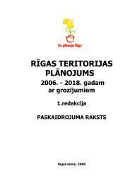
Rigas teritorijas izmantosanas un apbuves noteikumi
Rigas teritorijas izmantosanas un apbuves noteikumi
Rigas teritorijas izmantosanas un apbuves noteikumi

You also want an ePaper? Increase the reach of your titles
YUMPU automatically turns print PDFs into web optimized ePapers that Google loves.
1.103. The depth of land plot - the horizontal distance between the front and rear<br />
border of plot. Where these borders are not parallel, the depth of land plot<br />
means the length of straight line, which links the midpoint of plot’s front<br />
border with midpoint of plot’s rear border. If there is no rear border of plot,<br />
the depth of plot means the length of straight line linking the midpoint of<br />
front border of plot with an apex of triangle, which have been formed by the<br />
sides of borders of plot.<br />
1.104. Frontline of plot – horizontal distance along the red line of street between<br />
the side borders of plot.<br />
1.105. Land plot– an area of land, which has been delimited with natural elements<br />
of the situation (with the roads, hydrographic, outlines of terrain etc.) or with<br />
borders, which have been determined in the area, but the cadastre number<br />
may be not be issued thereof.<br />
1.106. Type of utilization of land (territory) – totality of all permitted utilizations<br />
determined in spatial planning provided for the local government’s portion of<br />
territory with specified different planned (permitted) utilization.<br />
1.107. Science institution – the utilization of land, structure or part thereof to<br />
provide scientific research or similar institution.<br />
1.108. Fence – a structure, which is located on the border of the land plot or<br />
streets’ red line or along them.<br />
2. General Issues<br />
2.1. These binding regulations prescribes the requirements for the utilization of<br />
land plots, structures and buildings as well, according to Riga Spatial<br />
Planning 2006 - 2018 (hereinafter – Riga Spatial Planning or in the wider<br />
sense – Riga Development Plan)<br />
2.2. These binding regulations concerns the administrative territory of Riga City<br />
and are liable to all natural and legal persons – landowners and users within<br />
the bo<strong>un</strong>daries of Riga Spatial Planning.<br />
2.3. These binding regulations do not <strong>un</strong>bo<strong>un</strong>d the natural and legal persons from<br />
the necessity to comply with the requirements of laws and other effective<br />
legal provisions.<br />
2.4. If any of territories of Riga City has a detail plan, which is developed and<br />
bo<strong>un</strong>ded, determine more detailed utilization of plot and requirements of the<br />
building thereof, then binding regulations of the detail plan shall be<br />
complied.<br />
2.5. No lands may be utilized and no constructions may be built, re-built,<br />
arranged or used, if they do not require with these binding regulations.<br />
2.6. No permits may be issued for utilization of the foreseen land or for the<br />
building, rebuilding, arrangement, extension or utilization of foreseen<br />
construction by local governments, if any of these binding regulations have<br />
been violated by this.<br />
2.7. The Clauses of binding regulations, which have references on option to<br />
determine, detail or clarify, when the additional activities are carried out, for<br />
example, developing of the detail plan, shall be regarded as the provisions<br />
and may not be classified as the amendments of spatial planning and<br />
regulations concerning the utilization and building of the territory as well.<br />
2.8. In special cases, if subject of the amendments is not related with the<br />
necessity of graphical changes in spatial planning, the amendments in the