

Download PDF - Anchor Environmental
Download PDF - Anchor Environmental
Download PDF - Anchor Environmental

Create successful ePaper yourself
Turn your PDF publications into a flip-book with our unique Google optimized e-Paper software.
2. GEOGRAPHIC AND SOCIO-ECONOMIC CONTEXT<br />
2.1 Location and extent of the estuary and its catchment<br />
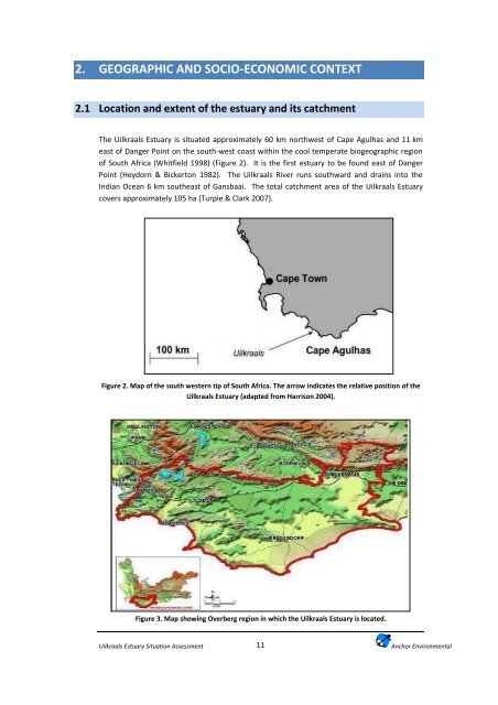
The Uilkraals Estuary is situated approximately 60 km northwest of Cape Agulhas and 11 km<br />
east of Danger Point on the south-west coast within the cool temperate biogeographic region<br />
of South Africa (Whitfield 1998) (Figure 2). It is the first estuary to be found east of Danger<br />
Point (Heydorn & Bickerton 1982). The Uilkraals River runs southward and drains into the<br />
Indian Ocean 6 km southeast of Gansbaai. The total catchment area of the Uilkraals Estuary<br />
covers approximately 105 ha (Turpie & Clark 2007).<br />
Figure 2. Map of the south western tip of South Africa. The arrow indicates the relative position of the<br />
Uilkraals Estuary (adapted from Harrison 2004).<br />
Figure 3. Map showing Overberg region in which the Uilkraals Estuary is located.<br />
Uilkraals Estuary Situation Assessment<br />
11<br />
<strong>Anchor</strong> <strong>Environmental</strong>


