Download PDF - Anchor Environmental
Download PDF - Anchor Environmental
Download PDF - Anchor Environmental
You also want an ePaper? Increase the reach of your titles
YUMPU automatically turns print PDFs into web optimized ePapers that Google loves.
EXECUTIVE SUMMARY<br />
Introduction<br />
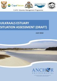
The Uilkraals Estuary is a relatively large estuary, with a total area of 105 ha, and is located on the<br />
Southern Cape Coast of South Africa. The Uilkraals is an important estuary from a conservation<br />
perspective, particularly in respect of macrophyte diversity and bird fauna. The large expanse of sand<br />
and mud flats as well as the high plant diversity within the estuary makes the Uilkraals, together with the<br />
Klein and Heuningnes Estuaries, unique along the Southern Cape Coastline. The estuary faces pressure<br />
from reduced freshwater inflow due to the upstream Kraaibosch Dam, planned rural developments and<br />
increasing tourism at the estuary mouth. Recognising the importance of the Uilkraals Estuary and<br />
estuaries in South Africa more generally, the C.A.P.E. Regional Estuaries Management Programme<br />
commissioned <strong>Anchor</strong> <strong>Environmental</strong> Consultants cc to prepare a management plan for the Uilkraals<br />
Estuary. This report is the Situation Assessment that forms the background material for the development<br />
of the management plan, and should be read in conjunction with the Management Plan itself.<br />
Geographic and socio-economic context<br />
The Uilkraals Estuary is situated approximately 60 km northwest of Cape Agulhas and 11 km east of<br />
Danger Point on the south-west coast of South Africa. It is the first estuary east of Danger Point and lies<br />
within the warm-temperate biogeographic region of South Africa. The catchment lies entirely within the<br />
Western Cape Province which receives most precipitation during the winter rainfall season. The estuary is<br />
classified as a temporarily open-closed mixed blackwater system, which is relatively common along the<br />
south west and east coast. The Mean Annual Runoff (MAR) is approximately 18 Mm 3 , which is 20% lower<br />
than under natural conditions. The Kraaibosch Dam was built 10 km upstream of the estuary in 1999,<br />
covers a surface area of 102 ha and has a storage capacity of 5.5 Mm 3 . Numerous smaller farm dams are<br />
found throughout parts of the catchment too.<br />
The total population living within the Overstrand Local Municipality, in which the Uilkraals River<br />
Catchment is located, was estimated at 74 546 in the 2007 StatsSA Community Survey. The population<br />
density was estimated at 35 people per square kilometre and the total household count was 24 485. The<br />
overall population of the Uilkraals River catchment (G40M) is a small proportion of the total for the<br />
Overstrand local municipality, as it contains a small urban area. Larger settlements such as Gansbaai with<br />
approximately 20 000 residents and Stanford with 8 000 residents are located outside of the boundaries<br />
of the Uilkraals catchment. Agriculture, residential development and nature conservation are the main<br />
land use activities in the catchment. The Uilkraals Estuary and surrounding areas are aesthetically<br />
beautiful and this remains a strong draw card to the estuary.<br />
Ecological characteristics and functioning of the estuary<br />
The Uilkraals Estuary is important in terms of its conservation value. Based on an index which takes size,<br />
estuary type, rarity and biodiversity (plants, invertebrates, fish, birds) into account, the estuary was<br />
ranked 34 th overall in terms of conservation importance in South Africa (Turpie et al. 2002).<br />
Structures associated with the estuary include a bridge approximately 220 m long which crosses the river<br />
approximately 800 m from the mouth. The bridge was constructed in 1973 and replaced an old wooden<br />
footbridge (Heydorn & Bickerton 1982). It is supported on the eastern side by a high embankment of<br />
Uilkraals Estuary Situation Assessment<br />
i<br />
<strong>Anchor</strong> <strong>Environmental</strong>


