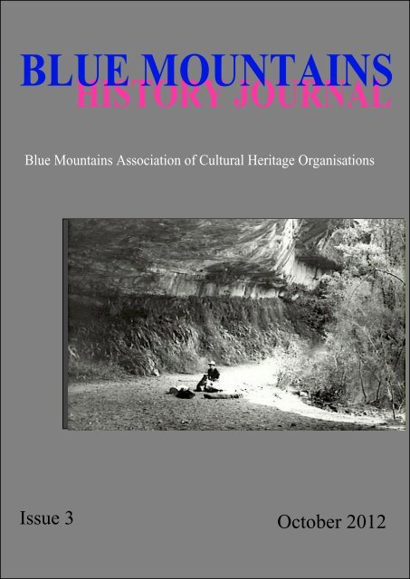
Blue Mountains History Journal Issue 3
Blue Mountains History Journal Issue 3
Blue Mountains History Journal Issue 3

You also want an ePaper? Increase the reach of your titles
YUMPU automatically turns print PDFs into web optimized ePapers that Google loves.
BLUE MOUNTAINS<br />
HISTORY JOURNAL<br />
<strong>Blue</strong> <strong>Mountains</strong> Association of Cultural Heritage Organisations<br />
<strong>Issue</strong> 3 October 2012<br />
I
<strong>Blue</strong> <strong>Mountains</strong> <strong>History</strong> <strong>Journal</strong><br />
Editor<br />
Dr Peter Rickwood<br />
Editorial Board<br />
Associate Professor R. Ian Jack<br />
Mr John Leary OAM<br />
Associate Professor Carol Liston<br />
Professor Barrie Reynolds<br />
Dr Peter Stanbury OAM<br />
Web Preparation<br />
Mr Peter Hughes<br />
The <strong>Blue</strong> <strong>Mountains</strong> <strong>History</strong> <strong>Journal</strong> is published online under the auspices of BMACHO (<strong>Blue</strong> <strong>Mountains</strong><br />
Association of Cultural Heritage Organisations Inc.).<br />
It contains refereed, and fully referenced articles on the human history and related subjects of the Greater<br />
<strong>Blue</strong> <strong>Mountains</strong> and neighbouring areas. Anyone may submit an article which is intermediate in size between<br />
a Newsletter contribution and a book chapter.<br />
Hard copies of all issues, and hence of all published articles, are archived in the National Library of Australia,<br />
the State Library of NSW, the Royal Australian Historical Society, the Springwood Library, the Lithgow<br />
Regional Library and the <strong>Blue</strong> <strong>Mountains</strong> Historical Society,Wentworth Falls.<br />
III
<strong>Blue</strong> <strong>Mountains</strong> Historical <strong>Journal</strong> 3; 2012<br />
http://www.bluemountainsheritage.com.au/journal.html<br />
(A publication of the BLUE MOUNTAINS ASSOCIATION OF CULTURAL HERITAGE ORGANISATIONS INCORPORATED)<br />
ABN 53 994 839 952<br />
–––––––––––––––––––––––––––––––––––––––––––––––––––––––––––––––––––––––––––––<br />
ISSUE No. 3 SEPTEMBER 2012 ISSN 1838-5036<br />
–––––––––––––––––––––––––––––––––––––––––––––––––––––––––––––––––––––––––––––<br />
CONTENTS<br />
Editorial Peter Rickwood V<br />
The <strong>Blue</strong> <strong>Mountains</strong>: where are they? Andy Macqueen 1<br />
The Mystery of Linden’s Lonely Gravestone:<br />
who was John Donohoe? John Low, OAM 26<br />
Forensic history: Professor Childe’s Death<br />
near Govetts Leap - revisited. Peter Rickwood 35<br />
EDITORIAL<br />
<strong>Issue</strong> 3 of The <strong>Blue</strong> <strong>Mountains</strong> <strong>History</strong> <strong>Journal</strong> differs from its predecessors in that it has three papers<br />
rather than four. But the total number of pages is actually almost the same as <strong>Issue</strong> 2 because the authors<br />
of the first and last papers required greater than usual space to fully develop their topics.<br />
The longest, and first, paper is by Andy Macqueen, a well-known <strong>Blue</strong> <strong>Mountains</strong> author who has<br />
contributed a most thoughtful paper on the meaning of the term ‘<strong>Blue</strong> <strong>Mountains</strong>’. Aided by a generous<br />
collection of maps he demonstrates that the term means different things to different people. Thus to some<br />
the <strong>Blue</strong> <strong>Mountains</strong> extend north-south from the Hunter Valley to Picton and east-west from Emu Plains to<br />
Jenolan and that latter parameter raises the issue of whether the <strong>Blue</strong> <strong>Mountains</strong> should include rocks older<br />
than Permian and whether part of the Great Dividing Range should be accepted as being within the area.<br />
Andy makes it quite clear that there is no unique definition that is acceptable to all. This scholarly work<br />
will for many years undoubtedly be the definitive account of the topic.<br />
Our pre-eminent historian in the <strong>Blue</strong> <strong>Mountains</strong>, John Low, has written a captivating paper about a<br />
gravestone that is located at Linden. It all revolves about the occupation of the person whose remains<br />
were interred - was he a soldier, a mounted policeman or a convict? The topic has been thoroughly<br />
researched and I suggest that you read John’s lucid story to find out.<br />
V
<strong>Blue</strong> <strong>Mountains</strong> Historical <strong>Journal</strong> 3; 2012<br />
The final paper has been written by this Editor but it has undergone the same peer reviewing as the other<br />
contributions, and as a result underwent considerable reorganisation and expansion. It relates to a now<br />
controversial historic event that took place almost half a century ago, the death of Professor Gordon<br />
Childe, a world renowned archaeologist who died close to Govetts Leap waterfall at Blackheath.<br />
Inconsistencies in various reports and inquest statements make for intrigue - where did it occur? - was it<br />
an accident or was it a suicide? - how believable are the 'facts' presented by the last person to see him?<br />
Re-examination of all available reports of the incident have brought to the fore many conflicting aspects<br />
and demonstrates the lack of reliability of contemporary accounts, which should be a warning to<br />
historians who rely on a small number of old writings.<br />
BMACHO is grateful to the Commonwealth Department of the Environment and Heritage for<br />
funding,through the RAHS and GVEHO Grants Programmes, which has assisted in the publication of this<br />
issue of The <strong>Blue</strong> <strong>Mountains</strong> <strong>History</strong> <strong>Journal</strong>.<br />
Dr Peter C. Rickwood,<br />
Editor<br />
VI
<strong>Blue</strong> <strong>Mountains</strong> <strong>History</strong> <strong>Journal</strong> 3: 2012<br />
THE BLUE MOUNTAINS: WHERE ARE THEY?<br />
Andy Macqueen<br />
PO Box 204<br />
Wentworth Falls NSW 2782<br />
andymacqueen@gmail.com<br />
Abstract<br />
When the name ‘<strong>Blue</strong> <strong>Mountains</strong>’ was first applied in New South Wales in 1789 it referred to the<br />
extensive ranges that were visible from, and bounded, the colony. It was widely considered in the<br />
nineteenth century that the <strong>Blue</strong> <strong>Mountains</strong> extended from the Goulburn area in the south to the Hunter<br />
Valley in the north. Today the name is applied in various ways, but usually in a very local sense. This<br />
evolution reflects the cultural history of the region. Today’s official definition validates the evolved<br />
narrative that Blaxland, Wentworth and Lawson completely crossed the <strong>Blue</strong> <strong>Mountains</strong> in 1813.<br />
Key Words: <strong>Blue</strong> <strong>Mountains</strong>, definition, Greater, National Park, maps, explorers.<br />
Introduction<br />
If people standing at Echo Point or Mount Tomah are asked where they think the <strong>Blue</strong> <strong>Mountains</strong> extend<br />
to in the landscape before them, a very diverse response is obtained.<br />
Few people today have a clear idea of the coverage of the <strong>Blue</strong> <strong>Mountains</strong> (Figure 1), and that has been<br />
the case since the colony began.<br />
It is not a trivial question. For over two centuries the name ‘<strong>Blue</strong> <strong>Mountains</strong>’ has been entwined with the<br />
story of the region, and indeed of New South Wales. But if the name has had different meanings at<br />
different times or in different contexts, it is necessary to understand those meanings if history is to be<br />
properly interpreted.<br />
Origin of the name<br />
In the earliest weeks of the colony European names were assigned to particular portions of the ranges<br />
visible to the west. Having observed the most prominent eminences to the west-north-west, which<br />
included Mounts Hay, Banks and Tomah, Phillip wrote in May 1788:<br />
“The most northern of them he named Carmarthen Hills, the most southern Lansdown Hills; one<br />
which lay between these was called Richmond Hill.” (Phillip 1789, p.99).<br />
He had probably first named these ‘Hills’ when he was standing on Prospect Hill on 26 April 1788<br />
(Andrews 1999, p.160). Surgeon John White then wrote:<br />
“From the top of this hill we saw a chain of hills or mountains, which appeared to be about thirty or<br />
forty miles distant, running in a north and south direction. The northernmost being conspicuously<br />
higher than the rest, the governor Governor called it Richmond Hill; the next, or those in the centre,<br />
Lansdown Hills; and those to the southward, which are by much the lowest, Carmarthen Hills.” (White<br />
1790, p.130; Andrews 1999, p.160 italics entries).<br />
White’s version of the names was different from Phillip’s. This need not concern us, except to say that<br />
the then Richmond Hill could not have been the lowly hill next to the Hawkesbury River which Phillip<br />
visited a year later and assigned the same name.<br />
It was during that trip up the Hawkesbury that one of Phillip’s entourage, Captain John Hunter (later<br />
Governor Hunter), noted,<br />
“We frequently, in some of the reaches which we passed through this day, saw very near us the hills,<br />
which we suppose as seen from Port Jackson, and called by the governor the <strong>Blue</strong> <strong>Mountains</strong>.”<br />
(Hunter 1793, p.150).<br />
1
<strong>Blue</strong> <strong>Mountains</strong> <strong>History</strong> <strong>Journal</strong> 3: 2012<br />
2
<strong>Blue</strong> <strong>Mountains</strong> <strong>History</strong> <strong>Journal</strong> 3: 2012<br />
Hunter’s remark is contained in observations of about 5 July 1789 (his dates are confused), and is the<br />
earliest known documentation of the name <strong>Blue</strong> <strong>Mountains</strong>. The reason for the name is clear, and was<br />
expressed in 1793 by Judge Advocate Collins:<br />
“... , the western mountains, (commonly known in the colony by the name of the <strong>Blue</strong> <strong>Mountains</strong>, from<br />
the appearance which land so high and distant generally wears,) …” (Collins 1798, p.312; Chapter<br />
XXI, pp.225-226 in 2nd Edition).<br />
It is conjectural whether Phillip thought of the name during the 1789 expedition or beforehand, and<br />
indeed whether he thought it up himself or took it from his officers or the common populace. However,<br />
the view of one historian that it originated from “the seductive power of the vulgar.” and came “to the<br />
written record, as early as 1793-96, ” is respectively unfounded and incorrect (Atkinson 1997, p.191).<br />
Regardless of who first uttered the name, it has been very plausibly suggested that it was prompted by<br />
familiarity with the sight of the <strong>Blue</strong> <strong>Mountains</strong> of Jamaica, which would have been known to Phillip and<br />
other naval officers in the colony who had visited the West Indies (Dunphy 1969, pp.10-11).<br />
A day or two after Hunter’s first reference to the name, Phillip and his party stood on Richmond Hill and<br />
Hunter observed<br />
“... we were not more than five or six miles from a long range of mountains ... This range of<br />
mountains we supposed to be those which are seen from Port Jackson, and called the <strong>Blue</strong> <strong>Mountains</strong>:<br />
they limit the sight to the west-north-west. In that range of high land there is a remarkable gully, or<br />
chasm, which is seen distinctly at a distance, and from which we appeared to be distant about five<br />
miles. The hills on each side of this gap were named by Governor Phillip; on one side the Carmarthen,<br />
on the other, the Lansdown hills; and that on which we stood was called Richmond-hill.” (Hunter<br />
1793, p.151).<br />
It is clear that while the Carmarthen and Lansdown Hills were specific parts of the mountains, the name<br />
<strong>Blue</strong> <strong>Mountains</strong> referred to the whole range as “seen from Port Jackson”.<br />
What could they see from Port Jackson? As one can verify today, a person standing on Observatory Hill<br />
would have seen what appeared to be one blue hazy range extending far to the south. In fact, a<br />
multiplicity of ranges is involved. The most southern visible point in the ranges west of the Wollondilly<br />
River was the summit of Mount Colong (near Yerranderie). Further south, those ranges were obscured<br />
by the ranges around the Nattai River (and the Earth’s curvature). Even further southward, in the<br />
Mittagong direction, the view was obscured by close high ground around Leichhardt. To the north, the<br />
view terminated at about Mount Tomah, owing to the interruption of high ground on the North Shore.<br />
Phillip had had more expansive views from Prospect Hill, west of Parramatta. In the Mittagong direction<br />
the view was not interrupted by close hills, but by the high country around Mittagong itself (featuring<br />
Mounts Gibraltar and Jellore). The Nattai country again obscured the view of the ranges west of the<br />
Wollondilly, the most southerly visible point in those ranges still being Mount Colong. This time the<br />
view to the northward extended to ranges north of the Colo River, though the more remote heights such<br />
as Mounts Coricudgy and Yengo were obscured thanks to the curvature of the earth.<br />
Today, a person armed with binoculars, compass and map can pick out many of the features and interpret<br />
the views (though most of Prospect Hill has regrettably been removed for its blue metal and we can no<br />
longer obtain the exact historic view from there). The early observers could only discern that the<br />
mountain country extended an indefinite distance. The illusion that they faded in height further south or<br />
north did not fool them, however. Watkin Tench was no doubt fully aware of the tricks played by<br />
perspective and the curvature of the Earth when he visited Prospect Hill in 1789 and observed<br />
“... a view of the great chain of mountains, called Carmarthen hills extending from north to south<br />
farther than the eye can reach.” (Tench 1789, p.111).<br />
3
<strong>Blue</strong> <strong>Mountains</strong> <strong>History</strong> <strong>Journal</strong> 3: 2012<br />
While the names Carmarthen and Lansdown gradually disappeared, the notion of an extensive but<br />
somewhat indefinite <strong>Blue</strong> <strong>Mountains</strong> persisted through the early decades of the colony. The name was<br />
synonymous with the ill-defined barrier that was perceived as constraining the colony.<br />
Some specific references, taken out of context, might suggest that the <strong>Blue</strong> <strong>Mountains</strong> consisted only of<br />
the parts closest to Sydney. For instance, when Colonel Paterson planned to take boats up the Grose<br />
River in 1793 he referred to his “journey to the <strong>Blue</strong> <strong>Mountains</strong>” (Paterson 1793). However, that does<br />
not imply that the <strong>Blue</strong> <strong>Mountains</strong> were limited to that vicinity. Some nine years later Ensign Barrallier<br />
understood the Nattai, Yerranderie and Kanangra country to be part of the “Montagnes <strong>Blue</strong>s”, according<br />
to his journal (Barrallier c1805, Entry of 25 November 1802, p.796). Further correspondence by<br />
Barrallier and Governor King suggests that their <strong>Blue</strong> <strong>Mountains</strong> were considered to be the whole range<br />
that was thought to terminate as far south as the latitude of Jervis Bay (Macqueen 1993, p.87).<br />
Perhaps the earliest attempt to properly describe the extent of the <strong>Blue</strong> <strong>Mountains</strong> was by another<br />
explorer, George Bass. During the famous expedition down the coast to Bass Strait, at Kiama on 7<br />
December he wrote<br />
“The <strong>Blue</strong> <strong>Mountains</strong>, in short, appear to be nothing more than a body of mountains that, getting up<br />
somewhere to the northward – where, we cannot tell, but not very far, I am well convinced, on the<br />
north side of Port Stephens, perhaps at Cape Hawke – run southerly in about a S.b.W. or S.S.W.<br />
direction as far as the Cow Pastures, and then turn away eastward and come to the sea 18 or 20 miles<br />
to the southward of Botany Bay. Their breadth where they come to the sea is about 25 or 30 miles, but<br />
I suspect that as they advance northward their breadth decreases.” (Bass 1797-1798, p.315).<br />
In stating that the <strong>Mountains</strong> came “to the sea” Bass was referring to the Illawarra escarpment. His idea<br />
of a considerable northern extent to the <strong>Blue</strong> <strong>Mountains</strong> is consistent with that of Lieutenant Grant, who<br />
while standing on Mount Hunter in the Hunter Valley (between Maitland and Singleton) in 1801, wrote<br />
that he could see<br />
“... the <strong>Blue</strong> <strong>Mountains</strong>, which we saw until lost to the eye, stretching in a northerly direction into the<br />
interior.” (Grant 1801, p.408).<br />
Colonel Paterson — formerly Captain Paterson — was present with Grant, as was Ensign Barrallier, and<br />
presumably both concurred with Grant’s use of the name (Macqueen 1993, p.60).<br />
According to the visiting Frenchman François Peron, the <strong>Blue</strong> <strong>Mountains</strong><br />
“envelopes the whole county [of Cumberland] in a sort of semicircle” (Peron 1809, p.285.).<br />
This notion is not consistent with the extensive northern extent described above, but it does fit Bass’s idea<br />
that the range came to the sea south of Botany Bay.<br />
If we accept Bass and Peron’s versions, John Wilson and his companions certainly crossed the <strong>Blue</strong><br />
<strong>Mountains</strong>, as then defined, in two expeditions in early 1798. The party negotiated the upper Nepean and<br />
Nattai country, at one time summiting Mount Jellore (834m), and crossed the Mittagong Range: having<br />
thus passed all barriers they proceeded almost to the site of Goulburn (Brownscombe 2004, pp.60-81).<br />
Unfortunately the party’s diarists did not mention the name <strong>Blue</strong> <strong>Mountains</strong> and we do not know what<br />
Wilson himself thought about it. He was an illiterate convict and was murdered soon afterwards, so he<br />
had no opportunity to trumpet his achievement.<br />
Few maps produced in the first 30 years of the colony shed light on the definition of the <strong>Blue</strong> <strong>Mountains</strong>,<br />
which is not surprising given the limited understanding of the topography. Neither Barrallier nor Caley<br />
placed the name on their maps and sketches, though it is clear from his writings that Caley, like<br />
Barrallier, thought the <strong>Blue</strong> <strong>Mountains</strong> covered a broad area.<br />
4
<strong>Blue</strong> <strong>Mountains</strong> <strong>History</strong> <strong>Journal</strong> 3: 2012<br />
Figure 2. William Dymock’s 1810 map of the settlements (Dymock 1810).<br />
A series of maps produced<br />
in 1810 ‘by order of the<br />
government’ variously by<br />
John Booth, Robert Rowe<br />
and William Dymock<br />
indicate that the <strong>Blue</strong><br />
<strong>Mountains</strong>, described as<br />
“successive immense<br />
ridges”, lay along the parts<br />
from west of the Nattai<br />
River in the south, almost<br />
to the Colo River in the<br />
north. However, given<br />
that that was the extent of<br />
the maps, it is not to be<br />
assumed that the <strong>Blue</strong><br />
<strong>Mountains</strong> were not<br />
considered more extensive<br />
(Dymock 1810). (Figure<br />
2).<br />
Blaxland, Wentworth and Lawson<br />
Despite the entrenched narrative which holds that Blaxland and friends completely crossed the <strong>Blue</strong><br />
<strong>Mountains</strong>, the men themselves did not at the time claim to have done so. While Blaxland’s journal<br />
declares that the purpose was to<br />
“effect a passage over the <strong>Blue</strong> <strong>Mountains</strong>” (Richards 1979, p.67),<br />
the outcome of the expedition, according to the same journal, was simply that<br />
“... they had sufficiently accomplished the design of their undertaking, having surmounted all the<br />
difficulties …” (Richards 1979, p75).<br />
Wentworth admitted<br />
“... we have not actually traversed the <strong>Mountains</strong> [though] we have at all events proved that they are<br />
traversable …” (Richards 1979, p114).<br />
Macquarie at first evaded the question, in the one document declaring that the trio had<br />
“... effected a Passage over the <strong>Blue</strong> <strong>Mountains</strong>, ...” (Macquarie in Campbell 1814, col.2),<br />
and that he had sent George Evans<br />
“... to discover a passage over the <strong>Blue</strong> <strong>Mountains</strong>, ” (Macquarie in Campbell 1814, col.1).<br />
It was only while he himself was making the journey to Bathurst in 1815 that he decided to set the<br />
goalpost at Mount York, which, although being the point where he found himself descending from the<br />
sandstone plateau, is well short of the watershed of the Great Dividing Range to the west. He wrote in his<br />
journal:<br />
“Here we halted for a little while to view this frightful tremendous pass, as well as to feast our eyes<br />
with the grand and pleasing prospect of the fine low country below us and now in view from this<br />
termination of the <strong>Blue</strong> <strong>Mountains</strong>” (Macquarie 1815, 29 April 1815).<br />
This has come to be relied on as proof that the explorers completed the crossing of the <strong>Blue</strong> <strong>Mountains</strong><br />
when they descended from Mount York. One prolific historian has cited it as evidence that Macquarie’s<br />
divine service at Coxs River was the first held to the west of the <strong>Blue</strong> <strong>Mountains</strong> (Havard 1935, p.70).<br />
5
<strong>Blue</strong> <strong>Mountains</strong> <strong>History</strong> <strong>Journal</strong> 3: 2012<br />
However, Macquarie seems to have had a change of heart. He never published his original journal. In<br />
the edited version published soon after his trip he refrained from defining the termination of the <strong>Blue</strong><br />
<strong>Mountains</strong>, stating that Mount York represented<br />
“... only the abrupt termination of a ridge.” (Macquarie in Campbell 1815, p.1, cols.2-3),<br />
and that the explorers had merely crossed<br />
“... the most rugged and difficult part of the <strong>Blue</strong> <strong>Mountains</strong>.” (Macquarie in Campbell 1815, p.1,<br />
col.1).<br />
Possibly Macquarie was not entirely objective in this moving of the goalposts. It may be that he decided<br />
the credit for the complete crossing should be given to Surveyor George Evans, whom Macquarie had<br />
despatched to further the explorers’ finds, rather than credit the explorers themselves, who were private<br />
citizens who had acted on their own initiative (Lavelle 2002, p.47).<br />
On the other hand, Macquarie may have changed his mind after reflecting on the broader topography. On<br />
descending from Mount York he was still in a coastal catchment. He found that he yet had to cross a<br />
series of “very lofty hills and narrow valleys” involving “numerous steep ascents and descents” before he<br />
was across the Great Dividing Range (Macquarie 1815, 1 May 1815).<br />
Macquarie suggested that the <strong>Blue</strong> <strong>Mountains</strong> was a barrier that extended 80 miles (129 km) south and<br />
north of Port Jackson — virtually from Goulburn to the Hunter Valley (Macquarie in Campbell 1815).<br />
This is consistent with the concept mentioned by Wentworth eight years later, that the <strong>Blue</strong> <strong>Mountains</strong><br />
was a<br />
“chain of mountains” which “run from North to South, dividing the Eastern and well settled part of the<br />
Colony from the great Western Wilderness, ...” (Wentworth 1823, col.2 footnote).<br />
Such concepts of considerable north-south extent do not sit well with the idea of a western terminus at<br />
Mount York, short of the Great Dividing Range, and Macquarie quite probably realised that.<br />
In short, notwithstanding Macquarie’s journal entry, the collective evidence does not support the idea that<br />
in 1813-1815 there was a definitive view that the <strong>Blue</strong> <strong>Mountains</strong> terminated at Mount York. That such a<br />
view developed later reflects the evolving mythology concerning the whole crossing event.<br />
Nineteenth century maps<br />
One might think that as further exploration brought an improved understanding of the topography, a more<br />
precise definition of the <strong>Blue</strong> <strong>Mountains</strong> might have developed. On the contrary, the situation remained<br />
as hazy as the mountains themselves.<br />
Perhaps the first informative map was “A map of New South Wales: from the best authorities and from<br />
the latest discoveries 1825” (Tyrer 1825). It shows the “<strong>Blue</strong> <strong>Mountains</strong> Range” essentially extending<br />
from the Mount Colong area in the south, almost to Scone in the Hunter Valley (Figure 3).<br />
While examining hundreds of maps available on-line via the Australian National Library’s Trove website,<br />
the author identified 41 maps, published by 17 different cartographers between 1825 and 1903, that seem<br />
to label the <strong>Blue</strong> <strong>Mountains</strong> in a meaningful way. Most are maps of the whole of New South Wales, and<br />
only one is specifically a map of the <strong>Blue</strong> <strong>Mountains</strong>. That map, an 1885 tourist map (Figure 4), takes in<br />
all the Coxs River and Kanangra country in the south, the Newnes Plateau in the north, Oberon and<br />
Tarana in the west, but only Lawson in the east (Cooper 1885). It does not attempt to show a boundary as<br />
such, and as with all tourist maps the coverage has obviously been selected on the basis of the area of<br />
tourist interest: the cartographer may well have accepted that the <strong>Blue</strong> <strong>Mountains</strong> covered a greater area<br />
than shown.<br />
The southern extent of the <strong>Blue</strong> <strong>Mountains</strong> as indicated on the 41 maps varies from the Goulburn area to<br />
the Jenolan Caves-Coxs River area, while the northern extent is generally either the Capertee and Colo<br />
Rivers, or the Hunter Range or Hunter Valley. Tables 1 and 2 summarise the findings.<br />
6
<strong>Blue</strong> <strong>Mountains</strong> <strong>History</strong> <strong>Journal</strong> 3: 2012<br />
Figure 3. Portion of James Tyrer’s 1825 map of NSW (Tyrer 1825).<br />
Table 1. Southern extent of the <strong>Blue</strong> <strong>Mountains</strong>.<br />
Location<br />
Number of maps where this location is<br />
suggested as the approximate southern extent<br />
Goulburn or Wombeyan Caves or Taralga 27<br />
Mount Werong-Mount Colong 11<br />
Jenolan Caves-Coxs River 3<br />
7
<strong>Blue</strong> <strong>Mountains</strong> <strong>History</strong> <strong>Journal</strong> 3: 2012<br />
Figure 4. William Cooper’s tourist map of the <strong>Blue</strong> <strong>Mountains</strong> (Cooper 1885).<br />
Table 2. Northern extent of the <strong>Blue</strong> <strong>Mountains</strong>.<br />
Location<br />
Number of maps where this location is<br />
suggested as the approximate northern extent<br />
Capertee River-Colo River 25<br />
Hunter Range or Hunter Valley 12<br />
Other 4<br />
8
<strong>Blue</strong> <strong>Mountains</strong> <strong>History</strong> <strong>Journal</strong> 3: 2012<br />
Figure 5 provides an example of<br />
a map depicting a <strong>Blue</strong><br />
<strong>Mountains</strong> roughly from Taralga<br />
to the Hunter Range (Hughes<br />
1870).<br />
Figure 5. Portion of William Hughes’ 1870 map of NSW (Hughes 1870).<br />
While this analysis was not<br />
rigorous, it can be seen that<br />
nineteenth century cartographers<br />
overwhelmingly considered the<br />
<strong>Mountains</strong> to extend at least as<br />
far as Mounts Werong and<br />
Colong in the south. To the<br />
north, nearly all cartographers<br />
considered the <strong>Mountains</strong> to<br />
extend at least as far as the<br />
Capertee and Colo Rivers. As to<br />
the eastern and western extent, in<br />
most cases the intent is obscure.<br />
An 1882 Bartholomew map of<br />
Australia depicts the <strong>Blue</strong><br />
<strong>Mountains</strong> following the Great<br />
Dividing Range from west of<br />
Goulburn to around Capertee, as<br />
opposed to the more<br />
‘mountainous’ terrain to the east<br />
of the divide which appears to be<br />
the target of most maps<br />
(Bartholomew 1882).<br />
No temporal trend could be found in the extent of the <strong>Blue</strong> <strong>Mountains</strong> as indicated by the 41 maps.<br />
Fourteen of them were by John Bartholomew or his son John George Bartholomew, in the period 1850 to<br />
1903, and there is no consistency or trend even within those.<br />
The prevailing cartographic notion of an extensive <strong>Blue</strong> <strong>Mountains</strong> did not suddenly die out in 1903. For<br />
instance, maps in a 1920 atlas variously showed that the <strong>Blue</strong> <strong>Mountains</strong> extended from Crookwell to<br />
Rylstone, Tuglow to Newnes; and Tuena (northwest of Crookwell) to Mudgee (Philip 1920).<br />
Nineteenth century textual references<br />
There are countless textual references to crossing the <strong>Blue</strong> <strong>Mountains</strong>, or places and events in the <strong>Blue</strong><br />
<strong>Mountains</strong>, but very few provide a meaningful interpretation of the extent of the <strong>Mountains</strong>.<br />
Some writers equated the <strong>Blue</strong> <strong>Mountains</strong> to the entire Great Dividing Range. An official party exploring<br />
the Brisbane River in 1825 reported<br />
“... ; the <strong>Blue</strong> <strong>Mountains</strong> apparently distant about ten leagues.” (Gray 1825)<br />
and an 1851 article first published in The Times about the gold discoveries in Australia mentioned that the<br />
<strong>Blue</strong> <strong>Mountains</strong> extended from<br />
“... the 38th degree of south latitude to the Tropic of Capricorn, ...” (Anonymous 1851, col.1).<br />
9
<strong>Blue</strong> <strong>Mountains</strong> <strong>History</strong> <strong>Journal</strong> 3: 2012<br />
Another article had the <strong>Blue</strong> <strong>Mountains</strong> running from New Guinea down to Tasmania! (Anonymous<br />
1847, col.4). A little less ambitious, Wells’ Gazetteer of 1848 was content to limit it to the New South<br />
Wales portion of the Divide (Wells 1848, p.294). Such ideas did not persist into the second half of the<br />
century.<br />
Consistent with the mapping evidence however, the concept of a <strong>Blue</strong> <strong>Mountains</strong> extending from the<br />
Goulburn area to the Hunter was quite common and enduring in textual material. It was a logical<br />
definition, for it is in the Goulburn area and the Hunter Valley that the Great Dividing Range is<br />
interrupted significantly and easy passage to the west is afforded. Alexander Berry took this view when<br />
he wrote about the regional geology in 1827 (Berry 1827, col.1) while an article of 1844, derived from<br />
the Penny Cyclopaedia, stated that the sandstone country in the area of the Goulburn River (a tributary of<br />
the Hunter)<br />
“... is to be considered as a portion of the <strong>Blue</strong> <strong>Mountains</strong>, ...” (Anonymous 1844, col.1).<br />
An 1855 article stated that Charles Throsby, when he reached Bathurst in 1819 by crossing the divide<br />
south of Taralga, had rounded “... the south-western termination, ...” of the <strong>Blue</strong> <strong>Mountains</strong> instead of<br />
crossing them (Anonymous 1855, col.5), while a later article by the botanist Rev William Woolls<br />
mentioned that the high country around Mittagong was<br />
“... an easterly spur of the <strong>Blue</strong> <strong>Mountains</strong>” (Woolls 1865, col.1).<br />
In contrast is the view apparently held by the visitor Paul Edmund Strzelecki, who travelled the region in<br />
1839. An analysis of his subsequent writings suggests he considered the<br />
“sandstone locality commonly called <strong>Blue</strong> <strong>Mountains</strong>” (Strzelecki 1845a, p.57)<br />
to be limited to the vicinity of today’s Great Western Highway and perhaps the Bell Range (Strzelecki<br />
1845a, pp.41-42). However, his accompanying map carries a label suggesting the <strong>Blue</strong> <strong>Mountains</strong><br />
extended at least to Kanangra Walls in the south and to the Wolgan and Colo Rivers in the north<br />
(Strzelecki 1845b). (The confusion may have arisen from the fact that the map was actually drawn by<br />
John Arrowsmith based on Strzelecki’s detailed mapping: possibly Arrowsmith was imposing his own<br />
view.).<br />
Surveyor General Mitchell unfortunately refrained from both placing the name on his maps and<br />
proposing a formal definition (Mitchell 1834). The same may be said of Surveyor Robert Dixon and his<br />
1837 map (Dixon 1837). However, there are two pieces of text suggesting Mitchell considered the <strong>Blue</strong><br />
<strong>Mountains</strong> extended in effect from Goulburn to the Hunter. One is contained in a published 1833<br />
description of his trigonometrical survey, almost certainly written by Mitchell himself, which states:<br />
“on the west to Mount Macalister (sic), Werong, Murruin [Shivering], Colong, Jenolan, Mount Hay,<br />
and Mount Tomah, which are the highest points of the <strong>Blue</strong> <strong>Mountains</strong>;” (Anonymous 1833, p.49).<br />
The other is his description, in a field book, of the view from Mount Warrawalong, near Newcastle, in<br />
which he refers to<br />
“Tomah and the <strong>Blue</strong> <strong>Mountains</strong> on the West with Yengo and Werong [Wareng]” (Mitchell 1828,<br />
Frame 0022, entry for Monday 14 July 1829).<br />
He was looking past Mounts Yengo and Wareng towards the Wollemi country from the Colo River north<br />
to the Hunter Range.<br />
The author has found no official government document that offers a clear definition. It is however<br />
interesting that an 1829 government notice stated that a particular area of land at the confluence of the<br />
Hunter and Goulburn Rivers (that is, near Denman) was<br />
“bounded … on the South by the <strong>Blue</strong> <strong>Mountains</strong>; ...” (NSW Government 1829, col.3).<br />
A most detailed description of the geography of New South Wales was published by The Sydney<br />
Morning Herald in 1870. It portioned the Great Dividing Range in New South Wales into the New<br />
England, the Liverpool, the <strong>Blue</strong> Mountain, the Cullarin, the Gourock, the Monaro and the Muniong<br />
Ranges, thereby clearly defining the <strong>Blue</strong> <strong>Mountains</strong> as the Goulburn to Hunter portion. It further stated<br />
10
<strong>Blue</strong> <strong>Mountains</strong> <strong>History</strong> <strong>Journal</strong> 3: 2012<br />
“(3) The <strong>Blue</strong> Mountain Range is subdivided into the three Chief Lateral Branches of - 1. Hunter<br />
Range; 2. Mittagong Range; and 3. Macquarie Range.” (Anonymous 1870, col.2.).<br />
Bailliere’s 1866 New South Wales Gazetteer proposed an expansive view of the <strong>Blue</strong> <strong>Mountains</strong>, while<br />
acknowledging — significantly — that a much more limited definition was in common use. It stated:<br />
“The portion of the great dividing chain, generally known by this name, is very limited in extent, but in<br />
these pages will include all the mountainous tract stretching from the Liverpool range to Lake Burrah<br />
Burrah [near Taralga], south of the 34 th parallel.” (Whitworth 1866, p.53).<br />
This is the only nineteenth century reference that the author has encountered that mentions a tension<br />
between a broad and a localised definition. Perhaps with this tension in mind, the gazetteer’s<br />
cartographer did not label the <strong>Blue</strong> <strong>Mountains</strong> at all on its accompanying map.<br />
The fact that this acknowledgement of a commonly-used limited definition appeared in 1866 contradicts<br />
an assertion by bushwalking conservationist Myles Dunphy that the localised definition first emerged in<br />
the tourism era in the 1870s after the railway crossed the mountains (Dunphy 1969, p.34). Nevertheless,<br />
nineteenth century textual references proposing a limited <strong>Blue</strong> <strong>Mountains</strong> are rare. Strzelecki’s view<br />
poses one example. Another possible example is the following from 1843:<br />
“The <strong>Blue</strong> <strong>Mountains</strong> to the west of the Nepean, form a series of mural precipices from the<br />
Cowpastures to the Colo, traversed by those transverse fissures, through which the rivers in question<br />
flow.” (Anonymous 1843, col.3).<br />
The rise of the limited view<br />
Notwithstanding the dominance of maps and texts reflecting an expansive extent, it is clear that by the<br />
middle of the nineteenth century there existed a more localised <strong>Blue</strong> <strong>Mountains</strong>. It was apparently a<br />
colloquial viewpoint, not properly reflected in texts, and it may have irritated many of the educated as it<br />
gained acceptance.<br />
How might this colloquial view have arisen? The author proposes six factors:<br />
1. People attached the name to the part of the mountains they were familiar with, either because they<br />
had visited or crossed the mountains themselves or because they had heard of places or events on<br />
them. The wild parts of the mountains remote from the Western Road were, to most people, a useless<br />
and nameless terra nullius. As Eleanor Dark suggested, through the thoughts of her character Johnny<br />
Prentice, early travellers over the mountains were so affected by the grim reputation of the place that<br />
“All their thoughts would be fixed upon the kind, fertile plains beyond, and they would see nothing<br />
in the wild hills and gorges which might tempt them to turn aside” (Dark 2002, p.481).<br />
2. No other name arose to denote the country in the vicinity of the Western Road and Bells Line of<br />
Road.<br />
3. The above roads lie across a sandstone plateau famously bounded by huge cliffs. The name became<br />
attached to that particular landscape.<br />
4. While tourist maps of the mountains, commencing with Du Faur’s 1878 map, naturally covered only<br />
the parts most accessible to tourists, people were conditioned to thinking that they showed the whole<br />
of the <strong>Blue</strong> <strong>Mountains</strong>. In fact, the maps did not purport to do so (Du Faur 1878).<br />
5. Settled parts of the <strong>Blue</strong> <strong>Mountains</strong> came to be defined as administrative areas for various purposes.<br />
At least as early as 1832 the “<strong>Blue</strong> Mountain District” was defined, for the purposes of furnishing<br />
government supplies, as<br />
“The Bathurst road from Emu Ford to one mile East of Mount Vittoria (sic); and all parties between<br />
it and the Upper Branch of the Hawkesbury.” (NSW Government 1832, col.2.).<br />
The <strong>Blue</strong> <strong>Mountains</strong> Shire was established in 1907. While the boundaries of such areas were based on<br />
administrative considerations, people were gradually conditioned to think of them as representing the<br />
whole of the <strong>Blue</strong> <strong>Mountains</strong>.<br />
11
<strong>Blue</strong> <strong>Mountains</strong> <strong>History</strong> <strong>Journal</strong> 3: 2012<br />
6. Finally, the evolving mythology surrounding the expedition by Blaxland, Lawson and Wentworth<br />
held that the trio had completed the crossing of the <strong>Blue</strong> <strong>Mountains</strong> when they descended from Mount<br />
York, thereby defining the western extent of the <strong>Mountains</strong>.<br />
Although the localisation process may have commenced soon after the 1813 crossing, arguably it<br />
accelerated rapidly with the tourism era that began to flourish after the railway crossed the mountains in<br />
the 1870s.<br />
The corollary to all this is that had the original main route to the west proceeded, say, in the area of<br />
Barrallier’s explorations, today’s ‘<strong>Blue</strong> <strong>Mountains</strong>’ would be very much attached to the likes of<br />
Mount<br />
Colong and the rugged Kanangra area, and the sandstone plateau to the north might well have acquired a<br />
quite different name, or even become nameless except for its outstanding features — the converse of<br />
today’s situation. Further, it is conceivable that, had the opening of the interior followed John Wilson’s<br />
1798 footsteps to Goulburn, the <strong>Blue</strong> <strong>Mountains</strong> might today be the distinctive high points of the<br />
Mittagong area.<br />
If Blaxland and friends had taken the Bell Range, and Coxs Road had followed by that route, today’s<br />
concept of the <strong>Blue</strong> <strong>Mountains</strong> would probably be centred at Mount Tomah or Bilpin instead of<br />
Katoomba.<br />
The <strong>Blue</strong> <strong>Mountains</strong> Plateau<br />
The term “<strong>Blue</strong> Mountain plateau” was first applied to the localised area by the geologist Reverend<br />
William Clarke in the 1860s. The extent of his plateau is not clear, nor is it clear whether he considered<br />
the plateau to be the entirety of the <strong>Blue</strong> <strong>Mountains</strong>, or simply one part (Clarke 1865, col.1). Three<br />
decades later the geologist T.W. Edgeworth David referred to “the plateau of the <strong>Blue</strong> <strong>Mountains</strong> proper”<br />
and placed it within the following boundaries:<br />
“The southern boundary line is usually fixed at the valley of Cox’s River and that of the Warragamba<br />
River; and the northern boundary at the Capertee valley and Colo valley.” (David 1896, p.41).<br />
Perhaps unaware of the history involving a more expansive definition, David seemed disappointed that<br />
the <strong>Blue</strong> <strong>Mountains</strong> were so locally defined, pointing out that, geologically, the boundaries were “coterminus”<br />
with those of the extensive sandstones which we would now describe as the Triassic series. As<br />
he noted, these sandstones range from the Nowra area to the Liverpool Ranges (David 1896, p.41).<br />
Now, while it seems admirable of David to recognise that the name had become unduly localised, his<br />
attempt to tie it to the sandstone has little basis in history. Previous concepts were based on concepts of<br />
general topography and appearance, not geology. Phillip named the range before anyone had checked the<br />
rocks.<br />
In any event, David confirmed what many had come to believe: that the <strong>Blue</strong> <strong>Mountains</strong> were simply the<br />
sandstone plateau in the area of the Western Road and Bell Range. The possibility of re-expanding the<br />
<strong>Blue</strong> <strong>Mountains</strong> into the Lachlan Fold Belt metamorphic rocks to the south became nigh impossible.<br />
David’s view was reinforced by other academics, most notably his protégé Professor T. Griffith Taylor.<br />
He was so taken with the idea that the Plateau of the <strong>Blue</strong> <strong>Mountains</strong> was not mountainous in the classical<br />
sense, that he proposed dropping the term “mountains”. He wrote<br />
“One would like to see the term “<strong>Blue</strong> Plateau” introduced into our literature, if that were possible.”<br />
(Taylor 1922, col.5).<br />
This was ironic. In the process of localising the <strong>Blue</strong> <strong>Mountains</strong>, some of the areas most worthy of the<br />
name ‘mountains’ — areas to the north and south which are more dissected or of different geology<br />
altogether — had been removed. Deletion of the word ‘mountains’ would have confirmed the localised<br />
definition forever.<br />
12
<strong>Blue</strong> <strong>Mountains</strong> <strong>History</strong> <strong>Journal</strong> 3: 2012<br />
Nevertheless, Taylor’s <strong>Blue</strong> Plateau was more extensive than David’s plateau. It extended to cover all the<br />
elevated sandstone from around the Nattai in the south to the Hunter in the north. In 1958 he claimed that<br />
for many years he had<br />
“... endeavoured to get the public to use the term <strong>Blue</strong> Plateau for this wide extent of Hawkesbury<br />
Sandstone.” (Taylor 1958, p.99).<br />
The fact that some still argued for a relatively expansive <strong>Blue</strong> <strong>Mountains</strong> upset the writers of the first<br />
Australian Encyclopaedia, who stated:<br />
“The name ‘<strong>Blue</strong> <strong>Mountains</strong>’ is often used in a vague and erroneous way to denote the whole main<br />
range region west of Sydney; thus the Jenolan caves (q.v.) are said to lie ‘in the heart of the <strong>Blue</strong><br />
<strong>Mountains</strong>,’ though they are at least 25 miles from their nearest edge. The name is properly applied<br />
only to the sandstone plateau bounded on the north by the Capertee and Colo rivers, and on the south<br />
and west by the Cox; the Kurrajong Ridge, though a part of this plateau, is usually considered a<br />
separate area.” (Jose & Carter 1925, p.177).<br />
This was to rile Myles Dunphy, with justification. The broader definition may well have been vague, but<br />
not erroneous. It could certainly be claimed that Jenolan Caves lies within the <strong>Blue</strong> <strong>Mountains</strong> (Dunphy<br />
1969, p.23).<br />
Other publications took a similar view to the Encyclopaedia. For instance, from 1897 “The<br />
Mountaineer” newspaper published the “Illustrated Tourists’ Guide to the <strong>Blue</strong> <strong>Mountains</strong> and Jenolan<br />
Caves” implying that Jenolan Caves was outside the <strong>Blue</strong> <strong>Mountains</strong> (Mountaineer 1897-8).<br />
The second Australian Encyclopaedia, which appeared in 1958, was less dogmatic than the first, but<br />
nonetheless stuck to the localised definition:<br />
“... an ill-defined region which may be taken to embrace the country bounded by the Cox River on the<br />
west and south and the lower Nepean and Hawkesbury on the east, and extending north roughly to the<br />
latitude of Lithgow.” (Chisholm 1958, p.37, col.2.).<br />
The Greater <strong>Blue</strong> <strong>Mountains</strong>?<br />
Myles Dunphy drew many bushwalking maps, especially of what he called the Southern <strong>Blue</strong> <strong>Mountains</strong><br />
— the country generally between Katoomba, Jenolan Caves and Yerranderie. The Lands Department’s<br />
<strong>Blue</strong> <strong>Mountains</strong> and Burragorang Tourist Map, which ran to many editions from 1932, was prepared at<br />
Dunphy’s persuasion and with much of his input. It covers from Lidsdale and Mount Tootie in the north,<br />
down to Taralga and Moss Vale in the south, thereby implying that the mountains were more extensive<br />
than many would have supposed, though no actual boundaries of the <strong>Blue</strong> <strong>Mountains</strong> were supplied (NSW<br />
Department of Lands 1932).<br />
Dunphy was well aware of the early history of the name and believed it should be applied in the<br />
expansive sense. Accordingly, when in 1932 he and his National Parks and Primitive Areas Council<br />
formally proposed a huge national park covering almost to the Hunter Range in the north, and almost to<br />
Wombeyan Caves road in the south, he simply called it a “<strong>Blue</strong> <strong>Mountains</strong> National Park” (Dunphy<br />
1934). (Figure 6).<br />
However, he was also aware of the contradictory definitions that had taken hold, believing the name had<br />
been hijacked by parochial tourism interests. He came to realise that if his vision was to be realised he<br />
would need<br />
“... to by-pass the political, local government and mountain tourist interests and so avoid an argument<br />
… as to the limits of the <strong>Blue</strong> <strong>Mountains</strong>.” (Dunphy 1969, p.39).<br />
Accordingly, he gradually introduced the word ‘Greater’. In an 1934 item titled <strong>Blue</strong> <strong>Mountains</strong> National<br />
Park Scheme, he stated:<br />
13
<strong>Blue</strong> <strong>Mountains</strong> <strong>History</strong> <strong>Journal</strong> 3: 2012<br />
“The <strong>Blue</strong> <strong>Mountains</strong> National Park proposal is that all the unalienated, inferior Crown lands of<br />
the Greater <strong>Blue</strong> <strong>Mountains</strong> region, be set apart and dedicated as the <strong>Blue</strong> <strong>Mountains</strong> National<br />
Park.” (Dunphy 1934,col.6).<br />
14
<strong>Blue</strong> <strong>Mountains</strong> <strong>History</strong> <strong>Journal</strong> 3: 2012<br />
Three years later, in an article titled <strong>Blue</strong> <strong>Mountains</strong> National Park, he stated, misleadingly, that the<br />
“Greater <strong>Blue</strong> <strong>Mountains</strong> National Park” had been proposed in 1932, though at other places in the article<br />
the park was named without the word ‘Greater’ (Dunphy 1937, p.49).<br />
It was not until 1959 that the <strong>Blue</strong> <strong>Mountains</strong> National Park was created. Initially it was confined mainly<br />
to the Grose River catchment, a fact much lamented by Dunphy, though in time areas were added almost<br />
as far south as Wombeyan Caves — albeit subjected to a massive intrusion by Kanangra-Boyd National<br />
Park. The Park only covered a little of the country north of the Bell Range: when, in the 1970s, there was<br />
a campaign to reserve most of the crown land between that range and the Hunter, the result was a huge<br />
new park named after Wollemi Creek, a central feature of the area.<br />
In keeping with his original vision, Dunphy would have liked Kanangra-Boyd and Wollemi National<br />
Parks, and also Nattai and Gardens of Stone National Parks, to be part of <strong>Blue</strong> <strong>Mountains</strong> National Park.<br />
That they were not, reflects the reality that new parks earn more credos for politicians than park additions,<br />
rather than any meaningful departure from Dunphy’s vision.<br />
In a way Dunphy’s wish came true with bonuses, when in 2000 all the area covered by those parks, as<br />
well as Yengo National Park and other areas, became the Greater <strong>Blue</strong> <strong>Mountains</strong> World Heritage Area.<br />
In advancing that name, the proponents, as Dunphy had done, included the word ‘Greater’ to facilitate<br />
acceptance in the public eye, making the wishful claim that the area had<br />
“for decades been identified by the public as the Greater <strong>Blue</strong> <strong>Mountains</strong>” (NPWS 1998, p.14.; Jones,<br />
2011).<br />
In fact, according to the view of history and geography propounded by Dunphy himself, the word<br />
‘Greater’ was redundant: it was not part of his original proposal and arguably need not have been<br />
included in the name of the World Heritage Area.<br />
The Geographical Names Board<br />
In 1968 the fledging NSW Geographical Names Board, under the chairmanship of Surveyor General Noel<br />
Fletcher, decided it needed a formal definition of the <strong>Blue</strong> <strong>Mountains</strong>. It referred the matter to its<br />
Counsellors — an advisory group representing various interests. Dunphy was one of the Counsellors, as<br />
were archivist Peter Orlovich, historians Alec Chisholm and Bernard Dowd, and bushwalker Wilf Hilder<br />
(CGNB 1969-1970).<br />
The Counsellors recognised the difficulties associated with the different historical, geological and<br />
physical viewpoints. In fact, they debated the matter for six of their monthly meetings, a debate that was<br />
complicated when two new counsellors, geographers Dennis Jeans and Maurice Daly, were appointed<br />
midway. There was majority support for a relatively expansive <strong>Blue</strong> <strong>Mountains</strong>, with at least one<br />
Counsellor, Jeans, in favour of the whole range from Goulburn in the south to the Hunter Valley in the<br />
north. However, the detail was difficult. It is all very well to tie the definition to a portion of the Great<br />
Dividing Range, but the reality is that much of the mountain country under consideration—including<br />
most of the part now most commonly associated with the <strong>Blue</strong> <strong>Mountains</strong> — lies on spurs off that Range.<br />
The country of the Nattai is not attached to the Range at all, so there was particular vexation concerning<br />
the south-eastern boundary.<br />
At the fifth meeting, in August 1969, the Counsellors resolved to send a map prepared by Dunphy and<br />
Jeans — which no one agreed on — with amendments proposed by each individual. This was rescinded<br />
at the September meeting, when majority agreement was reached on a description written by Jeans and<br />
Hilder. That was provided to the Board, along with a dissenting view by Dunphy and Dowd.<br />
The 400-word majority description involved an area more or less bounded by the Goulburn and Hunter<br />
Rivers in the north; the Wombeyan Caves Road in the South; the Great Dividing Range and Bylong<br />
Valley in the west; and the Nattai country, the Nepean River, the Putty Road and Martindale Creek in the<br />
east (CGNB 1969). Dunphy and Dowd’s version was also extensive but they proposed to limit the<br />
15
<strong>Blue</strong> <strong>Mountains</strong> <strong>History</strong> <strong>Journal</strong> 3: 2012<br />
northern boundary at the Hunter Range; moreover, perhaps anticipating that the Board would take a<br />
restricted view, Dunphy and Dowd proposed the title Greater <strong>Blue</strong> <strong>Mountains</strong> for their area (Dunphy and<br />
Dowd 1969). Both proposals involved complex descriptions involving watercourses, roads and ridges.<br />
The Board considered the matter at its meeting of 3 December 1969; only four of the seven members<br />
were present. The problem they faced was that the material before them (which included a treatise by<br />
Dunphy) was lengthy, complex and confused (Dunphy 1969). In agonising over the detail the<br />
Counsellors had been eluded by a simple, broad-brush vision. Unsurprisingly, the Board ignored their<br />
views and recommendations and embarked on a discussion based on their own conceptions — as they<br />
were entitled to do (GNB 1969). As a result they came up with relatively localised boundaries.<br />
When the Counsellors later asked the reasons for its decision, the Board acknowledged the Counsellors’<br />
case for a broader definition but said that it had decided to<br />
“restrict boundaries to coincide to a large extent with the popular concept of the region as at the<br />
present time” (Millar 1970).<br />
The Board’s minutes provide more insight. For instance, with regard to the northern boundary the Board<br />
considered<br />
“few inhabitants of the area north of the Colo and Capertee Rivers would consider themselves in the<br />
<strong>Blue</strong> <strong>Mountains</strong>” (GNB 1969).<br />
Believing that a sound definition of the mountains should involve river boundaries, they selected the<br />
Wolgan and Colo Rivers for the northern boundary and the Coxs River in the south.<br />
As to the western boundary, the Board stated<br />
“<strong>History</strong> records that Blaxland, Wentworth and Lawson made the first known crossing of the <strong>Blue</strong><br />
<strong>Mountains</strong>”,<br />
and therefore settled on Coxs River as part of the western boundary in order to ensure that the explorers’<br />
terminus, Mount Blaxland, lay beyond the <strong>Mountains</strong> .<br />
As we have seen, it cannot be claimed that the explorers completely crossed the <strong>Blue</strong> <strong>Mountains</strong><br />
according to the concept of the <strong>Blue</strong> <strong>Mountains</strong> of their time. The ‘history’ the Board relied on was<br />
based on the mythology that grew around the whole crossing narrative. In making its determination the<br />
Board gave official credence not only to an unimaginatively localised view, but to an entrenched<br />
mythology.<br />
Further, to the extent that they chose an area which is quite separate from the watershed of the Great<br />
Dividing Range, they departed completely from the concept that the <strong>Blue</strong> <strong>Mountains</strong> constituted a portion<br />
of that range. On the other hand, they gave no credence to any geological perspective, for the sandstone<br />
country extends far beyond the Board’s boundaries, even crossing the Dividing Range in the Cullen<br />
Bullen area.<br />
The determination, entered in the Geographical Names Register on 24 April 1970, was that the <strong>Blue</strong><br />
<strong>Mountains</strong> was<br />
“A series of dissected plateaus, ranges and escarpments bounded on the N by the Wolgan and Colo<br />
Rivers, on the W and S by Coxs River and Lake Burragorang and on the E by the Nepean and<br />
Hawkesbury River.” (GNB 1970a).<br />
Confusingly, the next month the Board also defined a “<strong>Blue</strong> <strong>Mountains</strong> Range”, described as a<br />
“A range of mountains, plateau and escarpments extending off the Great Dividing Range about 4.8 km<br />
N.W. of Wolgan Gap in a generally S.E. direction for about 96 km, terminating at Emu Plains. For<br />
about 2/3 of its length it is traversed by the Great Western Highway and the Main Western Railway.<br />
Several established towns are situated on its heights, including Katoomba, Blackheath, Mt. Victoria,<br />
16
<strong>Blue</strong> <strong>Mountains</strong> <strong>History</strong> <strong>Journal</strong> 3: 2012<br />
and Springwood. It forms the watershed between Coxs River to the S and the Grose and Wolgan<br />
Rivers to the N.” (GNB 1970b).<br />
Again, the range so-described does not represent any part of the Great Dividing Range, but constitutes an<br />
east-trending branch of that Range.<br />
These definitions remain current. They are quite different from the boundaries of a plethora of other<br />
‘<strong>Blue</strong> <strong>Mountains</strong>’ entities — the City Council, the State Electorate and the National Park, to name just<br />
three. Because they involve matters of land management, administration and law, precise boundaries are<br />
needed for such entities. However, the whole idea of defining an intricate boundary for the purposes of<br />
recognising the <strong>Blue</strong> <strong>Mountains</strong> in the Geographical Names Register was perhaps misguided. As we<br />
have seen, the ‘colonial’ <strong>Blue</strong> <strong>Mountains</strong> was extensive but indefinite. An appropriate modern<br />
definition might well retain those characteristics, and also acknowledge that it has evolved through<br />
history.<br />
The highest mountain?<br />
It’s a simple question: what is the highest mountain in the <strong>Blue</strong> <strong>Mountains</strong>? Unfortunately the answer is<br />
almost as vexed as the name <strong>Blue</strong> <strong>Mountains</strong>, though certain geographers of the nineteenth century were<br />
in little doubt about it. Robert Whitworth, author of Bailliere’s NSW Gazetteer of 1866, proclaimed<br />
“Beemarang, Mount (Co. Cook) is the loftiest peak of the <strong>Blue</strong> mountain range. It is 4100 feet<br />
[c.1250m] in height. Sandstone.” (Whitworth 1866, p.34).<br />
The assertion appears in other publications at least as late as 1892, though without mentioning the<br />
elevation, the county or the sandstone (Levey 1892 p.33). However, no mention of Mount Beemarang<br />
can be found on any early parish or county map, or other official record.<br />
Before addressing the identity of Mount Beemarang, it is interesting to examine the highest points*<br />
according to today’s nomenclature and data (LPI 2011). [Most of the summits named in this section are<br />
shown on Figure 1].<br />
If we take the nineteenth century idea of an expansive <strong>Blue</strong> <strong>Mountains</strong>, extending from Goulburn to the<br />
Hunter, then the highest point is Mount Bindo, located on the western side of the Great Dividing Range<br />
in State Forest near Hampton, in the County of Westmoreland. Its surface elevation is 1,362.4m (4,470<br />
feet). It features not Sydney Basin Triassic sandstone but Lachlan Fold Belt metamorphic rocks. Only a<br />
few metres lower than Bindo is Shooters Hill (1353.9m). Located 21 km south of Oberon, also in State<br />
Forest, and also in Westmoreland, it is built from fold belt metamorphics, and is the highest point in an<br />
expansive <strong>Blue</strong> <strong>Mountains</strong> that is situated on the watershed of the Great Dividing Range (Raymond,<br />
Pogson, et al. 1998).<br />
If we consider only the <strong>Blue</strong> <strong>Mountains</strong> as defined by the Geographical Names Board, the highest named<br />
feature is Mount Walker, about four km west of Lithgow. Its elevation is 1186.8m. It is in the County<br />
of Cook and the Lithgow Local Government Area and, like Mount Bindo and Shooters Hill, it features<br />
fold belt metamorphics, not sandstone.<br />
However, Mount Walker is not the highest point. Research for this paper using a Differential GPS has<br />
located a hill with elevation approximately 1189.4m, some 2.6m higher than Walker. Built on Sydney<br />
Basin Triassic sandstone, it is located at grid reference GDA 56H 239496 6297634, 6.8 km NNE of<br />
Lithgow Railway Station, on the Newnes Plateau. As well as being situated in the Geographical Names<br />
Board’s <strong>Blue</strong> <strong>Mountains</strong>, the hill happens to lie on the Board’s <strong>Blue</strong> <strong>Mountains</strong> Range. The author has<br />
dubbed the hill “Mount Ben” after the young lad who accompanied the survey team.<br />
Several other mountains come into the picture when we choose other defined areas. For instance, the<br />
highest in the <strong>Blue</strong> <strong>Mountains</strong> National Park is Mount Werong (1215m), on the western side of the<br />
* Note that all mountain elevations provided have been reduced to approximate ground-level.<br />
17
<strong>Blue</strong> <strong>Mountains</strong> <strong>History</strong> <strong>Journal</strong> 3: 2012<br />
Great Dividing Range. The highest in the Greater <strong>Blue</strong> <strong>Mountains</strong> World Heritage Area is Mount<br />
Emperor on the Boyd Plateau (about 1334m). The highest in the <strong>Blue</strong> <strong>Mountains</strong> Local Government<br />
Area is usually thought to be One Tree Hill (1111m), though Mount Kitosh on Shipley Plateau may be a<br />
few metres higher.<br />
Let’s return to Mount Beemarang. Bailliere’s Gazetteer mentioned in a separate entry that Mount<br />
Beemerang (sic) was located “at the head of Campbell’s River, a little to the north of the 34 th parallel”. It<br />
also admitted that it was only “probably” the highest mountain (Whitworth 1866, p.54).<br />
The Gazetteer’s map does not show it anywhere, but maps published in 1870 and 1880 by John<br />
Bartholomew indeed show “Beemarang 4100” near the head of Campbells River and just north of the<br />
34 th .<br />
It seems to be located just west of the position where Shooters Hill would be depicted on the Great<br />
Dividing Range, if it were depicted. The 1880 map also indicates that Mount Beemarang lies on or near a<br />
track which followed the Great Dividing Range from the south before cutting down into the head of<br />
Campbells River (Bartholomew 1870, 1880). (Figure 7).<br />
Figure 7. Portion of John Bartholomew’s 1880 map showing “Beemarang 4100”<br />
at the head of Campbells River (Bartholomew, 1880).<br />
Certainly the name “Beemarang” is well-connected to the head of Campbells River. On 7 May 1819,<br />
while on his expedition to Bathurst via Taralga, Charles Throsby stopped at Campbells River at a place<br />
he recorded as “Burnmaring”, apparently an Aboriginal name (Brownscombe 2004, p.308). This was at<br />
or near the spot where in 1834 Assistant Surveyor James Larmer surveyed the location of a hut andnamed<br />
it on his plan as “Beemarang or Swatchfield”. He repeated the names in his field book, noting that<br />
the place was owned by “Davis” (Larmer 1834a,b).<br />
18
<strong>Blue</strong> <strong>Mountains</strong> <strong>History</strong> <strong>Journal</strong> 3: 2012<br />
Larmer’s “Beemarang”, which is most likely another interpretation of Throsby’s “Burnmaring”, is<br />
clearly the origin of the name of the Parish of Beemarang, which is centred there. The 1885 map of the<br />
parish names the property Swatchfield and indicates that it was held by William Davis (NSW<br />
Department of Lands 1885). Larmer connected his surveys with prior work by Assistant Surveyor<br />
William Govett, who traced the Great Dividing Range in the area in 1832. Neither Larmer nor Govett<br />
named any high points in the area (Govett 1832).<br />
It is possible that Mount Beemarang is actually Shooters Hill, which has a surface elevation of 1354m.<br />
However, Shooters Hill was shown, and named as such, on an 1872 map of the County of Westmoreland<br />
(Basch 1872, map 7). Further, it is not strictly at the head of Campbells River, and it cannot be seen from<br />
the river valley due to several hills<br />
(Photo - Andy Macqueen)<br />
Figure 8. The probable Mount Beemarang, as seen from the<br />
tower on Shooters Hill.<br />
which are at its head. The most<br />
prominent of these, when viewed from<br />
Swatchfield (Figure 8), is in the Vulcan<br />
State Forest 4.8 km west of Shooters<br />
Hill, at grid reference GDA 55H<br />
758708 6245362. It is unnamed, but it<br />
has an elevation of approximately<br />
1336m — 18m lower than Shooters Hill<br />
(LPMA 2010).<br />
William Davis and his fellow settlers could well have formed the idea that this was the highest mountain,<br />
and promoted it accordingly. While they undoubtedly would have climbed it, even if the forest of the day<br />
did not obscure the view from the summit it would have been impossible without a suitable instrument to<br />
determine that Shooters Hill was higher. As to the claimed height of 4,100 feet (1,250m), in those days<br />
most surveyors were using compass and chain, not levels and theodolites. The figure was either a guess,<br />
or was obtained erroneously.<br />
In summary, Mount Beemarang may have been an alternative name for Shooters Hill or, more likely, it<br />
was the local name of the now-unnamed hill 4.8 km to the west of it. We must ignore the claims that<br />
Mount Beemarang was in the County of Cook, that it was 4,100 feet high and that it was made of<br />
sandstone.<br />
Whatever the truth, the ghost of Beemarang is intent on haunting us. An Internet search readily turns up a<br />
number of websites claiming that Mount Beemarang or Beemerang is the highest in the <strong>Blue</strong> <strong>Mountains</strong>,<br />
and has an elevation of 1,247m. In a classic example of the pitfalls of Internet research, this information<br />
seems to have been absurdly derived from digitised versions of Bailliere’s Gazetteer or other obscure<br />
nineteenth century publications, to the extent of a precise metric conversion of the original “4100 feet” —<br />
an elevation that applies to no candidate for Mount Beemarang, nor any other relevant “highest mountain<br />
in the <strong>Blue</strong> <strong>Mountains</strong>”.<br />
One website (Osaka University 2011) goes further, claiming “Mount Beemerang” is “now called<br />
Birds Rock, about 15 km north of Lithgow”, and attributing the claim to Hutchinson's Australasian<br />
Encyclopaedia (Levey 1892, p.33). However, that Encyclopaedia does not mention Birds Rock, which is<br />
in the Newnes Plateau area and was named after R.E.B. “Bert” Bird (1891-1961) in the 1940s — and<br />
incidentally was the probable terminus of an 1823 expedition by Robert Hoddle (Macqueen 2001). It<br />
appears that someone in more recent years was under the impression that Birds Rock was the true highest<br />
point of the <strong>Blue</strong> <strong>Mountains</strong> and therefore assumed it was Mount Beemarang. They were wrong on both<br />
counts. At about 1180m, Birds Rock Trig is lower than several other points in the “official” <strong>Blue</strong><br />
<strong>Mountains</strong>, and it was never called Mount Beemarang.<br />
19
<strong>Blue</strong> <strong>Mountains</strong> <strong>History</strong> <strong>Journal</strong> 3: 2012<br />
Conclusion<br />
The name <strong>Blue</strong> <strong>Mountains</strong> has meant, and continues to mean, many things to many people. Initially it<br />
involved an extensive but indefinite barrier, but as time progressed its connotations have been influenced<br />
variously by the <strong>Blue</strong> <strong>Mountains</strong> crossing narrative and the outlooks of road and rail builders, settlers,<br />
tourists, tourism operators, geographers, geologists, recreationists, conservationists and countless<br />
administrators of various ilk.<br />
In the mind of the individual, the concept of the <strong>Blue</strong> <strong>Mountains</strong> will depend very much on which of<br />
those narratives and themes is dominant in his or her world view. For instance, the region perceived to be<br />
covered by the <strong>Blue</strong> <strong>Mountains</strong> Association of Cultural Heritage Organisations would differ greatly<br />
depending on whether one’s interest lay in the archaeology of Coxs Road, built heritage more generally,<br />
Aboriginal cultural sites, or exploration history — or whether one lived in Katoomba or Putty.<br />
The Geographical Names Board was brave and perhaps misguided when it decided to define a precise<br />
boundary of the <strong>Blue</strong> <strong>Mountains</strong>, and would have been well advised to devise a definition reflecting the<br />
indefinite and evolving character. The definition it actually chose, while consistent with many people’s<br />
notions today, is very limited compared with historical notions. Moreover, it unfortunately validates the<br />
evolved narrative that Blaxland, Wentworth and Lawson completely crossed the <strong>Blue</strong> <strong>Mountains</strong>.<br />
Many parts of the Great Dividing Range and its branches between Goulburn and the Hunter, that once<br />
would have carried the label <strong>Blue</strong> <strong>Mountains</strong>, have been left nameless. While the gaps are sometimes<br />
filled in part by referring to the ‘Southern’ or ‘Northern’ <strong>Blue</strong> <strong>Mountains</strong>, such names are unsatisfactory<br />
as it is not clear whether they are actually part of the <strong>Blue</strong> <strong>Mountains</strong>, or are located north or south of the<br />
actual <strong>Blue</strong> <strong>Mountains</strong>. There is similar ambiguity in the name Greater <strong>Blue</strong> <strong>Mountains</strong>: are the ‘Greater’<br />
parts really in the <strong>Blue</strong> <strong>Mountains</strong> or not? Furthermore, some areas that have in the past been associated<br />
with the <strong>Blue</strong> <strong>Mountains</strong> remain beyond even those labels. For instance, Mount McAlister, an eminence<br />
near Taralga of similar altitude to Katoomba, has now to be content simply with being located on the<br />
Great Dividing Range.<br />
An exception to the rule is <strong>Blue</strong> <strong>Mountains</strong> National Park, which extends almost to Wombeyan Caves, far<br />
to the south of the Names Board’s boundary.<br />
All these anomalies might be rectified if the name <strong>Blue</strong> <strong>Mountains</strong> was discarded and a new set of<br />
names, perhaps based on Aboriginal nomenclature, were adopted. Indeed, there has been a recent attempt<br />
to attach Aboriginal names to various ‘sectors’ of the World Heritage Area. It involves, for instance, the<br />
application of the name ‘Kedumba’ to the area most people would regard as the <strong>Blue</strong> <strong>Mountains</strong>. The<br />
suggested nomenclature has yet gained no currency: the existing names are so entrenched that such a<br />
move is not likely to succeed.<br />
While the change in application of the name may seem regrettable, that change is simply a reflection of<br />
over 220 years of history. The important thing is to understand that history when talking of events at any<br />
given time. The <strong>Blue</strong> <strong>Mountains</strong> that one might cross today are a different <strong>Blue</strong> <strong>Mountains</strong> to those<br />
almost crossed in 1813 and almost crossed by Barrallier in 1802 and by Caley in 1804, and, arguably,<br />
those actually crossed by John Wilson in 1798.<br />
Of course, whatever definition we might choose for the <strong>Blue</strong> <strong>Mountains</strong>, we can be sure that Aboriginal<br />
people have been crossing them for thousands of years.<br />
20
<strong>Blue</strong> <strong>Mountains</strong> <strong>History</strong> <strong>Journal</strong> 3: 2012<br />
Acknowledgements<br />
The author gratefully acknowledges the assistance of:<br />
Mr. Kevin Richards, Secretary of the Geographical Names Board, for access to their files; Mr. Les<br />
Gardner, Survey Infrastructure & Geodesy, Land & Property Management Authority, for assistance with<br />
survey data on trig stations; and Mr. Richard Delaney, Epacris Environmental Consultants Pty Ltd, for<br />
assistance with a survey on the Newnes Plateau using a Differential GPS.<br />
Abbreviations<br />
CGNB Counsellors of the Geographical Names Board<br />
GNB NSW Geographical Names Board<br />
LPI NSW Land and Property Information (2 June 2011- )<br />
LPMA NSW Land & Property Management Authority (1 July 2009 - 4 April 2011)<br />
NPWS NSW National Parks & Wildlife Service<br />
References<br />
Andrews, A.E.J. (1999) The three land excursions of Governor Phillip. <strong>Journal</strong> of the Royal Australian<br />
Historical Society, 85(2): 148-162.<br />
Anonymous (1833) On the Trigonometrical Survey of New South Wales. New South Wales Magazine, 1<br />
August 1833, pp.46-53. [Mitchell Library 059/N;<br />
http://library.sl.nsw.gov.au/search~S2?/tNew+South+Wales+Magazine+(Online)/tnew+south+wales+<br />
magazine+online/-3,-1,0,B/l856~b3633317&FF=tnew+south+wales+magazine+online&1,1,,1,0<br />
<br />
Anonymous (1843) On the Ancient and Present Condition of the River Drainage of New South Wales.<br />
No.II. The Sydney Morning Herald, 3 January 1843, p.2, cols.1- 4.<br />
Anonymous (1844) Basin of the Hunter River. (From the Penny Cyclopaedia.) The Sydney Morning<br />
Herald, 23 November, 1844, p.4, cols.1-2.<br />
Anonymous (1847) Geology. Comparison of Russia and Australia. The Sydney Morning Herald, 28<br />
September 1847, p.2, cols. 3-4.<br />
Anonymous (1851) The Gold Discovery. The Empire, 27 December 1851, p.4, cols.3-4.<br />
Anonymous (1855) Annals of Squatting. The Empire, 12 May 1855, p.4, cols.4-6.<br />
Anonymous (1870) New South Wales, Australia, 1870. Geographical Outline. The Sydney Morning<br />
Herald, 7 September 1870, p.7, cols.1- 3.<br />
Atkinson, A. (1997) The Europeans in Australia: A <strong>History</strong>, Volume 1. Oxford University Press,<br />
Melbourne. 429pp. [Mitchell Library REF 1/994/262A;[Wentworth Falls Library 994 ATK]<br />
Bailliere (1866) see Whitworth (1866).<br />
Barrallier, F. (c1805) <strong>Journal</strong> du Voyage entrepris par ordre de son Excellence le Gouverneur King dans<br />
l’intérieur de New South Wales. Appendix A. pp.748-825 in Bladen, F.M. (ed) (1897) Historical<br />
Records of NSW, Vol.V.–King. 1803, 1804, 1805. Sydney: Willam Applegate Gullick, Government<br />
Printer. 866pp.<br />
Bartholomew, J. (1870) New South Wales (map). George Philip & Son, London. 1870.<br />
http://nla.gov.au/nla.map-f268 <br />
Bartholomew, J. (1880) New South Wales, Victoria, Queensland and South Australia. George Phillip &<br />
Son, London. 1880. [Australian National Library Map t1452*] http://nla.gov.au/nla.map-t1452<br />
<br />
Bartholomew, J. (1882) Physical map of Australasia. W. & R. Chambers, London. 1882.<br />
http://www.nla.gov.au/apps/cdview?pi=nla.map-rm2210-s1-e <br />
Basch & Coy (1872) Atlas of Settled Counties of NSW: County of Westmoreland. Sydney: Basch and<br />
Co. (not paginated; 20 Maps). [Mitchell Library DSM/F981.01/B]<br />
Bass, G. (1797-1798) Mr Bass’s <strong>Journal</strong> in the Whale Boat between the 3rd of December 1797 and the<br />
25th of February, 1798. pp.312-333 in Bladen, F.M. (ed) (1895) Historical Records of NSW, Vol.<br />
III.–Hunter. 1796-1799. Sydney: Charles Potter, Government Printer. 856pp.<br />
http://www.archive.org/stream/historicalrecor02walegoog#page/n10/mode/2up <br />
Berry, A. (1827) On the Geology of part of the Coast of New South Wales. Sydney Gazette, 17<br />
September 1827, p.4, cols.1-3.<br />
21
<strong>Blue</strong> <strong>Mountains</strong> <strong>History</strong> <strong>Journal</strong> 3: 2012<br />
Brownscombe, R. (2004) On Suspect Terrain: <strong>Journal</strong>s of Exploration in the <strong>Blue</strong> <strong>Mountains</strong> 1795-<br />
1820. Forever Wild Press: Brighton East, Victoria. 336pp.<br />
Campbell, J.T. (1814) Government Order. Government House, Sydney. 12th February, 1814. Sydney<br />
Gazette, 12 February 1814, p.1, cols.1-2.<br />
Campbell, J.T. (1815) Government and General Orders. Government House, Sydney. 10th June, 1815.<br />
Sydney Gazette, 10 June 1815, p.1, cols.1-4; p.2, col.1.<br />
Chisholm, A.H. (ed) (1958) The Australian Encyclopaedia. Volume II BIRD to CONSCRIPTION.<br />
Angus & Robertson, Limited: Sydney. 504pp. [State Records A0 Q17]<br />
Clarke, W.B. (1865) On the transmutation of rocks in Australasia with photographic illustrations of<br />
examples from the neighbourhood of Sydney. Part III. The Sydney Morning Herald, 26 May 1865,<br />
p.2, cols.1-4.<br />
Collins, D. (1798) An Account of the English Colony in New South Wales, v.1. London: T. Cadell Jun. &<br />
W. Davies. 520pp. [Mitchell Library MAV/FM4/10597]<br />
http://acms.sl.nsw.gov.au/album/albumView.aspx?itemID=846401&acmsid=0 Frame 407JofJ720.<br />
Second Edition 1804 374pp. [Mitchell Library MAV/FM4/10598]<br />
Cooper, W. (1885) Tourist map of the <strong>Blue</strong> <strong>Mountains</strong>, New South Wales. Government Printing Office,<br />
Sydney. 1885. [Australian National Library MAP rm1826. Part 1*]<br />
http://www.nla.gov.au/apps/cdview?pi=nla.map-rm1826-s1-v <br />
CGNB (1969) Proposed Boundaries of the <strong>Blue</strong> <strong>Mountains</strong>, approved 8 September 1969. In CGNB<br />
(1969-1970).<br />
CGNB (1969-1970) Counsellors of the Geographical Names Board, Minutes and papers 1969-70.<br />
Archives of the NSW Geographical Names Board, Bathurst.<br />
Dixon, R. (1837) Map of the Colony of New South Wales. Scale 8 Miles to an Inch. J. Cross, Holborn,<br />
London. [Mitchell Library MT4 811/1837/1; also reproduced in Ellis 1994, p.23]<br />
Dark, E., (2002) No Barrier. A&R Classics Edition. Sydney: HarperCollinsPublishers. 486pp. First<br />
published 1953. [Mitchell Library 823.912/153]<br />
David, T.W.E. (1896) Anniversary Address. <strong>Journal</strong> of the Royal Society of NSW, 30: 1-69.<br />
Du Faur, E. (1878) Tourists map showing the Great Western Railway of New South Wales crossing the<br />
<strong>Blue</strong> <strong>Mountains</strong>. Leigh and Co.: Sydney. 1878. http://nla.gov.au/nla.map-f261 <br />
Dunphy, M.J. (1934) <strong>Blue</strong> <strong>Mountains</strong> National Park Scheme. Katoomba Daily, 24 August 1934,<br />
Supplement p.2, cols.6-7.<br />
Dunphy, M.J. (1937) <strong>Blue</strong> <strong>Mountains</strong> National Park: the first step accomplished. The Bushwalker, 1: 49-<br />
52. [Mitchell Library 796.3606/3]<br />
Dunphy, M.J. (1969) The Name <strong>Blue</strong> <strong>Mountains</strong>. With accompanying notes. Unpublished ms. 51pp.<br />
Dunphy papers. [Mitchell Library, MSS 4457/MLK 3343.]<br />
Dunphy, M.J. and Dowd, B.T. (1969) Greater <strong>Blue</strong> <strong>Mountains</strong> Region: Description of Outer Regional<br />
Boundaries, Sept 1969. 1pp. In CGNB (1969-70) and in Geographical Names Counsellors<br />
Committee file. Dunphy papers. [Mitchell Library, MSS 4457/MLK 3343.]<br />
Dymock, W. (1810) A new plan of the settlements in New South Wales, taken by order of Government.<br />
July 20th 1810. William Dymock: London. [Australian National Library Map f377*]<br />
http://nla.gov.au/nla.map-f377 <br />
Ellis, E. (1994) Conrad Martens: Life & Art. State Library of New South Wales: Sydney. 212pp.<br />
GNB (1969) Minutes of the Geographical Names Board meeting of 3 December 1969. Archives of the<br />
NSW Geographical Names Board. Also in Geographical Names Counsellors Committee file. Dunphy<br />
papers. [Mitchell Library, MSS 4457/MLK 3343.]<br />
GNB (1970a) <strong>Blue</strong> <strong>Mountains</strong>. http://www.gnb.nsw.gov.au/name_search/extract?id=TRckFxtL<br />
<br />
GNB (1970b) <strong>Blue</strong> <strong>Mountains</strong> Range. http://www.gnb.nsw.gov.au/name_search/extract?id=TRckFxrX<br />
<br />
22
<strong>Blue</strong> <strong>Mountains</strong> <strong>History</strong> <strong>Journal</strong> 3: 2012<br />
Govett, W.R. (1832) Survey of main Dividing Range from head of Fish River to Burrah Burrah Lake. 15<br />
September 1832. Surveyor General’s Map C.2.752<br />
[State Records NSW. Surveyor General's Maps and Plans, 1792-1886. Item 2515.]<br />
Grant, J. (1801) Remarks, &c., on board His Majesty’s armed surveying vessel, Lady Nelson, in Hunter<br />
River, 1801. pp.404-409 in Bladen, F.M. (ed) (1896) Historical Records of NSW, Vol.IV.–Hunter and<br />
King. 1800, 1801, 1802. Sydney: Charles Potter, Government Printer. 1066pp.<br />
Gray, J.M. (1825) Letter to editor. Sydney Gazette, 24 November 1825, p.4, col.1.<br />
Havard, W.L. (1935) First Divine Service West of the <strong>Blue</strong> <strong>Mountains</strong>. <strong>Journal</strong> of the Royal Australian<br />
Historical Society 21(1): 68-70.<br />
Hughes, W. (1870) New South Wales [map]. Virtue & Co. Limited: London. 1870. [Australian<br />
National Library Map nk2456-121] http://nla.gov.au/nla.map-nk2456-121 <br />
Hunter, J. (1793) An Historical <strong>Journal</strong> of the Transactions at Port Jackson and Norfolk Island. John<br />
Stockdale, London. January 1. 1793. Reprint by Libraries Board of South Australia: Adelaide. 1968.<br />
583pp. [Mitchell Library Q994.4/2]<br />
http://library.sl.nsw.gov.au/search~S2?/aHunter%2C+John%2C+1737-<br />
1821/ahunter+john+1737+1821/1,2,52,B/l856~b3368334&FF=ahunter+john+1737+1821&20,,51,1,0<br />
; http://freeread.com.au/ebooks/e00063 <br />
Jones, W. (2011) Pers. com.<br />
Jose, A.W. & Carter, H.J. (ed) (1925) The Australian Encyclopaedia. Vol. 1 A to Lys. Angus &<br />
Robertson Limited: Sydney. 182pp. [State Reference Library EQ919.4/AUS SET 1]<br />
Larmer, J. (1834a) Survey of the Dividing Range between the Abercrombie, Campbell and Belubula<br />
Rivers. [State Records NSW. Surveyors' Field Books, 1794-1860. Item 417.]<br />
Larmer, J. (1834b) Survey of Range between Abercrombie, Campbell & Belubula Rivers .... Surveyor<br />
General’s Map R.861.<br />
[State Records NSW. Surveyor General's Maps and Plans, 1792-1886. Item 5104.]<br />
Lavelle, S. (2002 2004) Founding Fathers and Founding Myths: monuments to explorers in the <strong>Blue</strong><br />
<strong>Mountains</strong>. University of Newcastle, Thesis 2834. 336pp.<br />
Levey, G.C. (compiler) (1892) Hutchinson's Australasian Encyclopaedia. London: Hutchinson & Co. ,<br />
437 pp. [Mitchell Library 990/L]<br />
LPMA (2010) 8830-2-S Shooters Hill. 1:25,000 Topographic & Orthophoto Map. Third Edition. New<br />
Series. NSW Land & Property Management Authority, Bathurst.<br />
LPI (NSW Land and Property Information) (2011) Spatial Information Exchange database.<br />
https://six.lands.nsw.gov.au/wps/portal/portal/ <br />
Macqueen, A. (1993) <strong>Blue</strong> <strong>Mountains</strong> to Bridgetown: the life and journeys of Barrallier 1773-1853.<br />
Andy Macqueen, Springwood. 160pp.<br />
Macqueen, A. (2001) Unpublished research, including interview with Danny Whitty.<br />
Macquarie, L. (1815) Tour to the New Discovered Country in April 1815. pp.89-110 in Lachlan<br />
Macquarie, Governor of New South Wales. <strong>Journal</strong>s of His Tours in New South Wales and Van<br />
Diemen’s Land 1810-1822. Published by the Trustees of the Public Library of New South Wales,<br />
1956. 280pp. [Springwood Local Studies 919.4 MACQ]<br />
Millar, D.C. (1970) Letter: Secretary of the Geographical Names Board Letter to Mr. P. Orlovich, The<br />
Archives Authority of N.S.W. 10 April 1970. in Geographical Names Counsellors Committee file.<br />
Dunphy papers. [Mitchell Library, MSS 4457/MLK 3343.]<br />
also see Letter to Counsellors of the Geographical Names Board Letter to Counsellors of the<br />
Geographical Names Board 10 April 1970. In CGNB (1969-70).<br />
Mitchell, T. (1828) Field, note and sketch book. Sir Thomas Mitchell papers. (not paginated)<br />
[Mitchell Library C42 CY1144].<br />
Mitchell, T. (1834) Map of the Colony of New South Wales. London, John Carmichael. 1834.<br />
Mountaineer (1897-8) “The Mountaineer” Illustrated Tourist Guide to the <strong>Blue</strong> <strong>Mountains</strong> and Jenolan<br />
Caves. The “Mountaineer” Office, Katoomba. 136pp. Price 1d.<br />
[<strong>Blue</strong> <strong>Mountains</strong> Historical Society Inc., Rare Books]<br />
NPWS (1998) The Greater <strong>Blue</strong> <strong>Mountains</strong> Area World Heritage Nomination. New South Wales<br />
National Parks and Wildlife Service in association with Environment Australia. 287pp.<br />
23
<strong>Blue</strong> <strong>Mountains</strong> <strong>History</strong> <strong>Journal</strong> 3: 2012<br />
http://www.environment.gov.au/heritage/places/world/blue-mountains/values.html <br />
NSW Department of Lands (1885) Parish of Beemarang, County Georgiana, Bathurst Land District.<br />
25th. March 1885. http://parishmaps.lands.nsw.gov.au/pmap.html <br />
NSW Department of Lands (1932) <strong>Blue</strong> <strong>Mountains</strong> and Burragorang Valley Tourist Map. Special<br />
Walking Clubs’ <strong>Issue</strong>. (Price 3/-) Department of Lands, Sydney, N.S.W.<br />
[Mitchell Library Z/M4 812.17/1932/1]<br />
McLeay, A. NSW Government (1829) Government Notice. Colonial Secretary’s Office, Sydney. July<br />
16, 1829. Sydney Gazette, 25 July 1829, p.1, col.2-3.<br />
NSW Government (1832) Commissariat Office, Sydney. 25th September, 1832. CONTRACTS FOR<br />
THE YEAR 1833. Sydney Gazette, 29 September 1832, p.1, cols. 1-4.<br />
Osaka University (2011) http://www.let.osaka-u.ac.jp/seiyousi/Ghost-<br />
Gazetteer/maps/HP/NSW/lithgow.htm <br />
Paterson, W. (1793) Letter to Banks, 23 May 1793. Banks Papers, v.18 p.161.<br />
http://library.sl.nsw.gov.au/search~S2?/t"Banks+papers"/tbanks+papers/1,1,1,B/l856~b3666289&FF=t<br />
banks+papers&1,1,,1,0/indexsort=-<br />
/startreferer//search~S2/t"Banks+papers"/tbanks+papers/1,1,1,B/frameset&FF=tbanks+papers&1,1,/en<br />
dreferer/ Series 27.05 CY 3008 / 244 <br />
Peron, F. (1809) A Voyage of Discovery to the Southern Hemisphere. Richard Phillips: London. 1809.<br />
314pp. [Mitchell Library DSM/980/P]<br />
Philip, G. (1920) Philips' new-world atlas : a geographical survey of the new era, dealing with<br />
territorial changes & international relations, travel and communications, history and colonisation ... /<br />
edited by George Philip. London : George Philip & Son, [192-]<br />
[University of Newcastle, Cultural Coll/RB SEAWARD: Q912/52]<br />
Phillip, A. (1789) The Voyage of Governor Phillip to Botany Bay. Stockdale, London. 298pp.<br />
Reproduced by the Libraries Board of South Australia, Adelaide. 1968. [Mitchell Library Q991/ P]<br />
Raymond, O.L., Pogson, D.J. et al. (1998) 1:250 000 geological map SI55-08. Bathurst Geology Second<br />
Edition. Australian Geological Survey Organisation Canberra / Geological Survey of New South<br />
Wales / Sydney.<br />
Richards, J.A. (ed) (1979) Blaxland-Lawson-Wentworth 1813. Blubber Head Press, Hobart. 222pp.<br />
[Springwood Local Studies 919. 445 BLA]<br />
Strzelecki, P.E. de (1845a) Physical Description of New South Wales and Van Diemen’s Land. London:<br />
Longman, Brown, Green and Longmans. 462pp. [Mitchell Library DSM508.9/S]<br />
Strzelecki, P.E. de (1845b) Map of New South Wales & Van Diemen Land. Arrowsmith: London. 1845.<br />
Taylor, T.G. (1922) Mountain Building. II.–The <strong>Blue</strong> <strong>Mountains</strong>. The Sydney Morning Herald, 14<br />
January 1922, p.9, cols.4-5.<br />
Taylor, T.G. (1958) Sydneyside Scenery And How It Came About. Angus & Robertson Ltd.: Sydney.<br />
1958. 239pp.<br />
Tench, W. (1789) 1788 : comprising A Narrative of the Expedition to Botany Bay and A Complete<br />
Account of the Settlement at Port Jackson. Edited and introduced by Tim Flannery. Text Publishing<br />
Company: Melbourne. 1996. 276pp.<br />
Tyrer, J. (1825) A map of New South Wales: from the best authorities and from the latest discoveries<br />
1825. J. Souter: St. Pauls Ch. Yard, March 1825. http://nla.gov.au/nla.map-nk2456-114 <br />
Wells, W.H. (1848) A geographical dictionary or gazetteer of the Australian colonies. W. & F. Ford:<br />
Sydney. 438pp.<br />
http://library.sl.nsw.gov.au/search~S2?/tGeographical+dictionary+or+gazetteer+of+the+Austr/tgeogra<br />
phical+dictionary+or+gazetteer+of+the+australian+colonies/-3,-<br />
1,0,B/l856~b1715890&FF=tgeographical+dictionary+or+gazetteer+of+the+australian+colonies+their<br />
+ <br />
Wentworth, W.C. (1823) Australasia in Poetry. Sydney Gazette, 25 March 1824, p.4, cols.1-4.<br />
White, J. (1790) <strong>Journal</strong> of a Voyage to New South Wales. Angus & Robertson Ltd.: Sydney. 1962.<br />
282pp.<br />
24
<strong>Blue</strong> <strong>Mountains</strong> <strong>History</strong> <strong>Journal</strong> 3: 2012<br />
Whitworth, R.P. (1866) Bailliere’s New South Wales Gazetteer and Road Guide. F.F. Bailliere: Sydney.<br />
664pp. [Mitchell Library REF 1/F/251/SET v.1]<br />
Woolls, W. (1865) Remarks on the Botany of Berrima and the Mittagong Range, with a glance at “Free<br />
Selection.” The Sydney Morning Herald, 2 February 1865, p.2, cols.1-5.<br />
25
<strong>Blue</strong> <strong>Mountains</strong> Historical <strong>Journal</strong> 3; 2012<br />
THE MYSTERY OF LINDEN’S LONELY GRAVESTONE:<br />
WHO WAS JOHN DONOHOE?<br />
John Low<br />
39, Highland Street<br />
Leura NSW 2780<br />
grizzlybear3au@yahoo.com<br />
Abstract<br />
Engraved on a lone headstone at Linden is the name of John Donohoe who died in 1837. Since the early<br />
years of the twentieth century the headstone and a nearby over-hang cave, known as King’s Cave, have<br />
been associated with the unsubstantiated story of a local bushranger (King) who shot and killed a<br />
constable (Donohoe) who pursued him. While some writers have questioned the historical accuracy of<br />
this legend, none have satisfactorily identified John Donohoe. In this paper I argue that Donohoe was a<br />
convict working in an iron gang at 17 Mile Hollow (Linden) under the supervision of the 4 th King’s Own<br />
Regiment.<br />
Key Words: Donohoe, graves, convicts, Western Road, Linden, <strong>Blue</strong> <strong>Mountains</strong>.<br />
Introduction<br />
In Burke Road, a short distance west of Linden Railway Station and close to the access track to King’s<br />
Cave, is a gravestone (Figure 2) originally inscribed:<br />
“Erected to the memory of John Donohoe who departed this life June 25 th A.D. 1837 aged 58 years”<br />
(Figure 1).<br />
While the actual grave now lies beneath the present railway embankment, the stone itself,<br />
“... a small Georgian style semicircular topped sandstone headstone ...” (<strong>Blue</strong> <strong>Mountains</strong> City Council<br />
2009),<br />
has been moved a number of times. Disturbed first when the original single-track rail line was<br />
constructed in the late 1860s, it was moved a second time during the duplication of the line in 1902 when<br />
it was apparently damaged during the removal process and the shortened top section left “haphazard in<br />
the ground” (Loftus 1909). In the early 1950s it was shifted again and then remained undisturbed until<br />
the Linden Citizens’ Association (LCA) took charge of it in 1970, re-engraved the badly weathered<br />
inscription on the reverse of the stone and resited it in its present position (Searle 1980, p.15).<br />
Inadvertently, the LCA engraver cut ‘Donohue’ instead of the original ‘Donohoe’ – a portent of the<br />
multiple spellings any curious researcher would encounter!<br />
(Anonymous n.d. a; BMCL Local Studies Collection) (Photo – John Low 2009)<br />
Figure 1. The grave as it looked c.1909.<br />
Figure 2. The grave as it is today.<br />
26
<strong>Blue</strong> <strong>Mountains</strong> Historical <strong>Journal</strong> 3; 2012<br />
The Legend<br />
An 1891 newspaper reference to Linden’s “... lonely tombstone cut out of sandstone.” states that it marks<br />
“the resting place of one of the soldiers who guarded the convicts when making the Bathurst road, ...”<br />
(‘Eucalyptus’ 1891)<br />
and it seems that the identification of Donohoe as a soldier may date back a lot further. In 1909<br />
Constable William Loftus of Springwood, in the course of preparing a report on the grave for his<br />
superiors in Sydney, interviewed Thomas Ellison, “the oldest resident in this district”. Ellison’s father<br />
(also Thomas Ellison) was apparently a carrier at the time of the military presence<br />
“and used to convey Government Stores from Emu Plains Depot, to the Depot at 17 Mile Hollow”<br />
(Loftus 1909).<br />
Ellison Sen. (1817-1903) later became the toll keeper at 17 Mile Hollow (1849) and moved his family<br />
into the new toll house there, acquiring about 5 acres (2.02 ha) of adjacent land and building an<br />
accommodation house, the Toll Bar Inn, in the mid-1850s (Cook & Halse 1988, pp.17 & 19). Ellison Jun.<br />
(1841-1929) remembered seeing the grave as a child and hearing<br />
“his father refer to it as the Grave of John Donohoe, the Soldier, who died at the Barracks from natural<br />
causes” (Loftus 1909).<br />
This suggestion that Donohoe was a soldier, however, took a somewhat different and more dramatic turn<br />
in the early years of the twentieth century when the historian Frank Walker became interested in the early<br />
history of the Western Road. During the course of his research, speaking to locals and listening to their<br />
reminiscences, he seems to have uncovered a variant story that convinced him that he had discovered the<br />
truth about the grave and its occupant. In a paper, “The Romance of the Western Road”, read before the<br />
Australian Historical Society on 23 March 1909 (but not published until 1916) he said:<br />
“... we find in the neighbourhood of Linden station one of those natural caverns, which in the early<br />
days offered such welcome shelter to the desperadoes of the bush. King’s Cave perpetuates the<br />
memory of a noted bushranger who was the terror of the district. About a hundred yards from the<br />
Linden station at the very foot of the huge embankment over which the line passes, is a small<br />
headstone, marking the lonely grave of a soldier named Donaghue (sic), who was shot by King in<br />
1837. The body is under the railway line, but the stone was removed to the position it now occupies.”<br />
(Walker 1916, p.371).<br />
The term ‘soldier’, used in the published version of his paper quoted above, may have been a later<br />
amendment, for it appears that during the original lecture Walker referred to Donohoe as a ‘police<br />
constable’ (Brennan 1909a) and when the Historical Society wrote subsequently to the Inspector General<br />
of Police requesting his assistance in having the grave restored, a debate of sorts ensued as to Donohoe’s<br />
status as an officer of the law. The police argued, largely on the advice of Martin Brennan a historically<br />
knowledgeable retired member of the force who was present at Walker’s lecture, that under the Police Act<br />
of 1833 no civil police constables were then operating beyond “the town and port of Sydney” (Brennan<br />
1909a; Day 1909). They also questioned the existence of a bushranger named King (Brennan 1909b)<br />
and, on the basis of the report by Constable Loftus, preferred the suggestion that Donohoe had died of<br />
natural causes (Day 1909).<br />
Frank Walker, however, would have none of it. He responded briefly and forcibly that the term<br />
“constable” in his paper referred to a “mounted trooper”, a member of the corps of soldier-police<br />
established under the authority of the military in 1825 to control bushranging in the rural districts. This,<br />
he said,<br />
“agrees with the statement of an old resident ... that it contained the body of a soldier, but he [the old<br />
resident] was in error in stating that the man died from natural causes” (Walker 1909).<br />
As far as Walker was concerned that was the end of the debate. There was no further elaboration in<br />
support of his position and, to my knowledge, none was ever forthcoming. A soldier-policeman shot by a<br />
desperate bushranger was the interpretation of the grave at Linden that Walker stuck to and promoted. It<br />
re-appeared unchanged in his 1913 Official <strong>History</strong> of the First Crossing of the <strong>Blue</strong> <strong>Mountains</strong>:<br />
27
<strong>Blue</strong> <strong>Mountains</strong> Historical <strong>Journal</strong> 3; 2012<br />
“A small gravestone, at the foot of the railway embankment near Linden, records an old-time tragedy,<br />
the occupant of the grave meeting his death at the hands of the bushranger King, in the year 1837. The<br />
victim was a member of the soldier-police, named Donoghue (sic), who, in an attempt to apprehend<br />
the desperado, was shot dead. The huge cavern, a few rods to the north of the grave, is still known as<br />
‘King’s Cave’, and was used as a place of retreat prior to his capture and execution.” (Walker 1913).<br />
And again in 1923 when he led an excursion to Woodford and Linden on Saturday 16 June:<br />
“King’s Cave, the onetime retreat of the notorious bushranger King, was visited, and the grave of one<br />
of his victims – Constable Donohoe – was pointed out at the foot of the railway embankment.”<br />
(Walker 1923, p.223) (Figure 3).<br />
The Walker version became the<br />
accepted explanation of the headstone.<br />
In 1928 it was repeated word-for-word<br />
from the Official <strong>History</strong> of the First<br />
Crossing (though unacknowledged) by<br />
the photographer and <strong>Blue</strong> <strong>Mountains</strong><br />
enthusiast Harry Phillips in his popular<br />
<strong>Blue</strong> <strong>Mountains</strong> and Jenolan Caves<br />
Illustrated Tourist Guide (Phillips<br />
1928, p.25; Figure 3) and, with minor<br />
variation, was recounted by later<br />
historians such as Alfred E. Stephen of<br />
the Royal Australian Historical Society<br />
(Stephen 1945, p.256) and Andrew<br />
Mayne of the <strong>Blue</strong> <strong>Mountains</strong><br />
Historical Society (Mayne 1948, p.6),<br />
the latter adding that King had an<br />
accomplice whose name was,<br />
curiously, O’Donoghue . Like Walker,<br />
none of these writers provides any<br />
corroborating evidence from official or<br />
other reputable sources for the validity<br />
of this account. It appears to have<br />
come solely from the ‘local legend’ as<br />
interpreted and publicised by Frank<br />
Walker.<br />
(Phillips 1928; BMCL Local Studies Collection)<br />
Figure 3. Donohoe’s Grave and Kings Cave.<br />
In terms of folklore, it is interesting<br />
how the deceased constable’s name,<br />
‘Donohoe’, and the introduction by<br />
Mayne of a second bushranger called<br />
‘O’Donoghue’ evoke resonances of a<br />
real incident that occurred only seven<br />
years prior to 1837 and aroused<br />
considerable popular attention. In<br />
1830 another John Donahoe, the<br />
convict bushranger and original ‘Wild<br />
Colonial Boy’, was cornered in the bush at Bringelly by the mounted soldier police and shot dead by<br />
trooper John Muggleston (Low 2010). ‘Bold Jack’, like the supposed bushranger King, also maintained a<br />
number of cave hideouts and it is possible that the widely narrated (and sung) folk legend, that developed<br />
28
<strong>Blue</strong> <strong>Mountains</strong> Historical <strong>Journal</strong> 3; 2012<br />
around him after his death, fed into and got mixed up with other more local, less widely known, incidents<br />
and happenings. In this case with the outlaw’s name becoming that of the policeman!<br />
Questioning the Myth<br />
Though the account of what happened at 17 Mile Hollow (Linden) in 1837 as promoted by Frank Walker<br />
became the established story, it was nevertheless questioned by some, as we have seen with the police<br />
response in 1909. In 1921 the historian J.M. Forde, who wrote a popular column in the Sydney Truth<br />
tabloid under the pseudonym ‘Old Chum’, labelled the story of bushranger King as just “... another<br />
Mountain Myth”, though he seemed prepared to accept that Donohoe could have been "a constable who<br />
died from natural causes” (Forde 1921). In his 1980 study Historic Woodford and Linden,<br />
the Springwood historian Allan Searle also questioned the authenticity of the traditional<br />
explanation and like Forde before him concluded that, considering the military presence at 17<br />
and 18 Mile Hollows (Linden-Woodford) during the second half of the 1830s and the complete<br />
absence of any supporting evidence, the generally held story that Donohoe was a constable shot<br />
by a local bushranger named King was doubtful.<br />
“... all that can be said is that he may have been a constable, ... [or] some unfortunate traveller who was<br />
buried, ... , beside the road where he died.” (Searle 1980, p.15).<br />
At the completion of Mitchells Pass up the Lapstone escarpment convict iron gangs under military control<br />
were moved into the 17 and 18 Mile Hollows area to improve this particularly difficult section of the<br />
Western Road (Low 2011). In 1835 the Quaker missionary, James Backhouse, noted in his journal the<br />
presence there of two large iron gangs, each made up of about 60 men and supervised by a contingent of<br />
soldiers under the authority of a “young military officer” (Backhouse 1843, p.200). The presence of 57<br />
soldiers of the 4 th King’s Own Regiment commanded by Lt. F.M. Campbell is confirmed by the NSW<br />
Calender & Post Office Directory for 1836 (Searle 1980, pp.14-15). As both Forde and Searle argued, it<br />
is hard to believe that a bushranger could have operated and hid in this part of the <strong>Mountains</strong> at this time.<br />
Further, while Backhouse describes in detail the makeshift facilities provided to shelter the convict road<br />
workers, he makes no mention of troop accommodation. It would seem far more logical that, rather than<br />
a bushranger’s lair, the large over-hang cave (Figures 4 & 5) located a short distance into the bush (and<br />
not visible to Backhouse) was used by the 4 th Kings Own Regiment as a store and barracks during the<br />
several years they were stationed at 17 Mile Hollow (Searle 1980, p.15; Chinn 2006, p.24; Low 2011).<br />
The once well made access road, retained by substantial early stonework, along with the size of the cave<br />
(Anonymous n.d. c; BMCL Local Studies Collection (Photo – Marika Low, 10 June 2011)<br />
/Springwood Historical Society)<br />
Figure 4. Kings Cave in the 1970s.<br />
Figure 5. Kings Cave as it is today.<br />
Though later writers have generally taken note of Searle’s more measured and thoughtful account<br />
(Hungerford & Donald 1982, p.66; Chinn 2006, p.24), the story that Donohoe was a constable shot by a<br />
bushranger has proved persistent and is still being repeated in some tourist literature (Anonymous 2012,<br />
29
<strong>Blue</strong> <strong>Mountains</strong> Historical <strong>Journal</strong> 3; 2012<br />
pp.31-32). In the remainder of this paper I want to suggest that the John Donohoe buried at Linden was<br />
neither soldier, constable nor traveller but, rather, a convict who worked in one of the local iron gangs.<br />
Identifying John Donohoe<br />
It is, I think, somewhat surprising that the possibility of Donohoe being a convict has not previously been<br />
explored. Had he been a soldier/constable his military affiliation would most likely have been included<br />
on the headstone, as it was in the case of Francis Smith, a Lance-Corporal in the 4 th King’s Own who was<br />
transferred from 17 Mile Hollow to the military depot at Springwood in early 1836 and died there later<br />
that same year. While his remains lie somewhere near the present Springwood Police Station, his<br />
gravestone is now in the Springwood Cemetery (Grady 1990; Pollard 2012, p.6). Similarly, Daniel<br />
Collins, a Private in the 28 th North Gloucestershire Regiment, died at 20 Mile Hollow in October 1840<br />
and his headstone with rank and regiment inscribed survives at the Woodford Academy (Medcalf 2005).<br />
It was, also, not unknown for convicts who died while working on the roads to have an inscribed stone<br />
marker placed above their graves. Edgar Church, a young convict buried at Pulpit Hill in 1822, was<br />
granted this mark of respect, the engraved headstone witnessed and transcribed by the French scientist<br />
and explorer Dumont d’Urville during his journey to Bathurst two years later (Duyker & Low 2009,<br />
p.35). In 1843, only six years after Donohoe’s death, another Irish convict, George Conway, died and<br />
was buried at 20 Mile Hollow. Like that of Private Collins, broken pieces of Conway’s headstone survive<br />
at the Woodford Academy (Medcalf 2005).<br />
With far easier access to historical and<br />
genealogical information than was available to<br />
earlier historians, it didn’t take long to confirm<br />
that there was, indeed, a convict named John<br />
Donahue (sic) who died at 17 Mile Hollow in<br />
1837 (State Records n.d. a, Fiche 749, p.57).<br />
He had arrived in NSW on the ‘Earl St.<br />
Vincent’ just before Christmas 1818 (Baxter<br />
1999, p.154), an Irish labourer, quarryman and<br />
well-sinker from Cahir, Tipperary (Figure 6).<br />
Sentenced to ‘life’ for an unspecified crime, he<br />
spent a short period as a ‘servant’ at Windsor<br />
before being moved into ‘government employ’<br />
in Sydney where the 1828 Census records him<br />
residing at the Hyde Park Barracks (State<br />
Records n.d. b, Fiche 640, p.181; Sainty &<br />
Figure 6. Cahir Castle, Tipperary (Valdoria 2006). A Johnson 1985, p.126).<br />
landmark with which Donohoe would have been familiar.<br />
A further question, though, still remained. What had Donohoe done to find himself working in irons on<br />
the <strong>Blue</strong> <strong>Mountains</strong> Road nearly 20 years after his arrival? An ironed convict was generally a recidivist,<br />
one who had committed a further crime in NSW and received an additional sentence from a colonial<br />
court. Again, the answer was soon found with the help of the National Library of Australia’s Trove and a<br />
search of its on-line digital newspaper collection.<br />
In May 1834 John Donohoe, a messenger in the Commissariat Stores (Figure 7), and Adam Sproule<br />
(sometimes spelt ‘Sprowle’ or ‘Sproul’), a sergeant of the 4 th King’s Own Regiment, were charged with<br />
“larceny in the King’s warehouse” (Anonymous 1834b), their trial taking place in August the same year<br />
before Justice James Dowling and a jury of ‘civil inhabitants’. The trial was conducted over the course of<br />
a full day with witness after witness building up the evidence against them. Senior officers and officials<br />
from the military and the Commissariat spoke on behalf of the prisoners but no amount of previous good<br />
character could defend them against having been ‘caught in the act’.<br />
30
<strong>Blue</strong> <strong>Mountains</strong> Historical <strong>Journal</strong> 3; 2012<br />
Private Robert Wetherell of the<br />
4 th King’s Own Regiment<br />
repeated what he had already<br />
stated at the initial hearing in<br />
May, that he was on guard duty<br />
on the evening of the alleged<br />
incident and during his rounds<br />
“... observed on passing<br />
the<br />
spirit stores a light inside, which<br />
attracted his attention, knowing<br />
that no person could be on legal<br />
business at that time; on putting<br />
his eye to a crevice in the door,<br />
he observed the Sergeant of the<br />
Guard holding a light near a<br />
cask of spirits, and the prisoner<br />
Donaghoe (sic) pumping from<br />
one cask into another of smaller<br />
size ...” (Anonymous 1834a; and<br />
different wording in Anonymous<br />
(Pickering 1872; Mitchell Library, SLNSW)<br />
Figure 7. The Commissariat Stores, George Street North, Sydney, 1872.<br />
The jury quickly found the two men guilty and they were remanded until the following day when Judge<br />
Dowling declaimed upon the seriousness of their crime and his determination to make an example of<br />
them both. Adam Sproule was sentenced<br />
“To transportation out of the colony for the term of his natural life”<br />
while John Donohoe,<br />
“...in consideration of his advanced stage of life and former good character, [was sentenced] to be<br />
Worked in irons on the public roads of the colony for seven years” (Anonymous 1834d).<br />
Sproule was shipped off to Tasmania where, after several years, he got his ticket-of-leave (Anonymous<br />
1837) and was, ironically, appointed a constable (Anonymous 1840). In 1845 he received an absolute<br />
pardon (Anonymous 1845) and went on to raise a large family with his wife Maria (née Orpen) whom he<br />
had married at the Presbyterian Scots Church in Sydney a few months before his arrest (NSW BD&M<br />
1834). In his elder years as a respected resident of Snug River he even had a variety of apple named after<br />
Him, the "Sproule’s Pearmain" (Anonymous 1883).<br />
While Adam Sproule lived to a ripe old age, his partner in crime, John Donohoe, survived the harsh<br />
conditions of the road for only three years. A man considered old by the standards of his time, it was not<br />
only the hard daily round of manual labour in irons that he had to endure. James Backhouse wrote:<br />
“The prisoners were lodged in huts, upon large open areas, by the roadside ... A few of the prisoners<br />
lodge in moveable caravans, which have doors, and iron-barred windows, on one side. Four or five<br />
men sleep in each end of them, on the floor, and as many more, on platforms. They are not less<br />
crowded than the huts, and are unwholesome dormitories. Many of the men sleeping in them, become<br />
Affected with the scurvy.” (Backhouse 1843, p.201).<br />
With unknowing prescience regarding Donohoe, Frank Walker wrote in an article about the Commissariat<br />
Stores published in the Sydney Morning Herald in 1912 of<br />
“... The stern justice meted out to the offender caught robbing the stores, and his punishment was of that<br />
Nature that he never had any opportunity of repeating the offence” (Walker 1912).<br />
31
<strong>Blue</strong> <strong>Mountains</strong> Historical <strong>Journal</strong> 3; 2012<br />
Conclusion<br />
When John Donohoe was buried at 17 Mile Hollow on 25 June 1837 he was either 60 years of age<br />
(according to the Convict Death Register) or 58 years of age (according to those who erected his<br />
headstone). Whatever was correct, he was a long way from his birthplace in Ireland and was fated to lose<br />
his identity to the obscure and powerful forces of local myth-making for almost the next two centuries.<br />
Perhaps now his story can begin to be told.<br />
Acknowledgements<br />
I acknowledge the State Library of NSW (Mitchell Library), the <strong>Blue</strong> <strong>Mountains</strong> City Library (Local<br />
Studies Section) and Springwood Historical Society for permission to use historical photographs from<br />
their collections. I am also grateful to Margaret Chapman, Marika Low, Neryl Medcalf, John Merriman<br />
(BMCL) and Donna Newton (RAHS) for help with various aspects of my research.<br />
Abbreviations<br />
BMCL <strong>Blue</strong> <strong>Mountains</strong> City Library<br />
LCA Linden Citizens’ Association<br />
n.d. no date<br />
NSW BD&M NSW Registry of Births, Deaths & Marriages<br />
RAHS Royal Australian Historical Society<br />
SLNSW State Library of New South Wales<br />
References<br />
Anonymous (1834a) Police Incidents. Sydney Herald, 19 May 1834, p.2, cols.4-5.<br />
Anonymous (1834b) Supreme Criminal Court. Thursday, August 14. Sydney Gazette and New South<br />
Wales Advertiser, 19 August 1834, p.2, col.6.<br />
Anonymous (1834c) Law Intelligence: Supreme Court.–Crown Side. The Australian, 19 August 1834,<br />
p.3, col.2.<br />
Anonymous (1834d) Supreme Criminal Court. Friday. Sydney Gazette and New South Wales Advertiser,<br />
2 September 1834, p.2, col.6.<br />
Anonymous (1837) Tickets of Leave. Hobart Town Courier, 20 October 1837, p.1S, col.6.<br />
Anonymous (1840) Supreme Court Criminal Sittings. Hobart Town Courier & Van Diemen’s Land<br />
Gazette, 11 September 1840, p.2, cols.5-6.<br />
Anonymous (1845) From the Hobart Town Gazette. Cornwall Chronicle (Launceston), 9 August 1845,<br />
p.62, col.2.<br />
Anonymous (1883) Apples. Mercury (Hobart), 31 March 1883, p.2, col.7.<br />
Anonymous (2012) Touring Guide. <strong>Blue</strong> <strong>Mountains</strong> Wonderland, Autumn 2012: 31-35.<br />
Anonymous (n.d. a) Old Grave of John Donohoe. BMCL Local Studies Section, Image Library File<br />
001/001737A. http://www.photosau.com.au/bluemountains/scripts/home.asp <br />
Anonymous (n.d. b) King’s Cave. Unpublished typed manuscript in VF Linden, Local Studies<br />
Collection, <strong>Blue</strong> <strong>Mountains</strong> City Library, Springwood (possibly written by Allan Searle).<br />
Anonymous (n.d. c) The Kings Cave Linden. BMCL Local Studies Section, Image Library File<br />
HSO/HSO603. http://www.photosau.com.au/bluemountains/scripts/home.asp <br />
Backhouse, J. (1843) A Narrative of a Visit to the Australian Colonies. Chapter XXVII, pp.300-342;<br />
reprinted as ‘Account of a Journey from Parramatta, Across the <strong>Blue</strong> <strong>Mountains</strong> to Wellington, 1835’<br />
pp.197-225 in Mackaness (1965).<br />
Baxter, C.J. (editor) (1999) General Muster List of New South Wales 1823, 1824, 1825. Sydney: Society<br />
of Australian Genealogists. 844pp.<br />
<strong>Blue</strong> <strong>Mountains</strong> City Council (2009) Ld002 : Grave of John Donohoe, Burke Road, Linden. <strong>Blue</strong><br />
<strong>Mountains</strong> Heritage Register, State Heritage Inventory, SHI Number 1170705. Updated: 03 Jan 05<br />
http://www.heritage.nsw.gov.au/07_subnav_04_2.cfm?itemid=1170705 <br />
32
<strong>Blue</strong> <strong>Mountains</strong> Historical <strong>Journal</strong> 3; 2012<br />
Brennan, M. (1909a) Letter dated 5 May 1909 to E.C. Day, Supt. of Police. Royal Australian Historical<br />
Society Correspondence Files, Series 2, Box 1, 2.1.1 – 2.3.1.<br />
Brennan, M. (1909b) Letter dated 3 July 1909 to C.T. Burfitt, Secretary Australian Historical Society.<br />
Royal Australian Historical Society Correspondence Files, Series 2, Box 1, 2.1.1 – 2.3.1.<br />
Chinn, P. (2006) The Thin Red and <strong>Blue</strong> Lines. A <strong>History</strong> of the Military and Police Presence in the <strong>Blue</strong><br />
<strong>Mountains</strong> Between the Nepean and Cox’s Rivers 1814-2005. Springwood NSW: Springwood<br />
Historical Society. 114pp.<br />
Cook, R. & Halse, N. (1988) A Look into the Past: Ellison, the Name, the School. Springwood NSW:<br />
Ellison Public School. 60pp.<br />
Day, E.C. (1909) Letter dated 1 May 1909 to T. Garvin, Inspector General of Police. Royal Australian<br />
Historical Society Correspondence Files, Series 2, Box 1, 2.1.1 – 2.3.1.<br />
Duyker, E. & Low, J. (2009) A Church on Pulpit Hill: Unlocking a <strong>Blue</strong> <strong>Mountains</strong> Mystery.<br />
Doryanthes, 2(3 August): 33-36.<br />
‘Eucalyptus’ (1891) The <strong>Blue</strong> <strong>Mountains</strong>. A soldier's grave. Clarence and Richmond Examiner, 8<br />
August 1891, p.3, cols.1-2.<br />
Forde, J.M. [‘Old Chum’] (1921) Old Sydney. Australiana. No. 721 – All rights reserved. On the <strong>Blue</strong><br />
<strong>Mountains</strong> – ... Truth (Sydney), 4 September 1921, p.12, col.6. [quoted in Anonymous (n.d. b)].<br />
Grady, B. (1990) Springwood’s Solitary Soldier. Unpublished manuscript in Local Studies Collection,<br />
<strong>Blue</strong> <strong>Mountains</strong> City Library, Springwood.<br />
Hungerford, M.E. & Donald, J.K. (1982) Exploring the <strong>Blue</strong> <strong>Mountains</strong>. Kenthurst NSW: Kangaroo<br />
Press. 192pp.<br />
Loftus, W. (1909) Report re Grave at Linden supposed of Constable Donohoe, shot by Bushranger King.<br />
Royal Australian Historical Society Correspondence Files, Series 2, Box 1, 2.1.1 – 2.3.1.<br />
Low, J. (2010) 'He fought six rounds with the horse police' --- the shooting of Bold Jack Donahoe.<br />
Heritage, the Newsletter of the <strong>Blue</strong> <strong>Mountains</strong> Association of Cultural Heritage Organisations, July-<br />
August: 4-5.<br />
Low, J. (2011) Redcoat Relics: Two Short Historical Walks at Linden. Hobby’s Outreach: Newsletter of<br />
<strong>Blue</strong> <strong>Mountains</strong> Historical Society, 23(3 August-September): 8-10.<br />
Mackaness, G. (editor) (1965) Fourteen Journeys over the <strong>Blue</strong> <strong>Mountains</strong> of New South Wales 1813-<br />
1841. Sydney: Horwitz-Grahame. 273pp.<br />
Mayne, A. (1948) Crossing the <strong>Blue</strong> <strong>Mountains</strong> Part III. [Katoomba NSW]: <strong>Blue</strong> <strong>Mountains</strong> Historical<br />
Society Archives, Lecture Transcripts.<br />
Medcalf, N. (2005) Inscriptions on headstones recovered in 1908 at Woodford Academy, Great Western<br />
Highway, Woodford NSW. Unpublished paper provided by the author.<br />
NSW Registry of Births, Deaths & Marriages (1834) NSW Marriage Registration No. V18342691<br />
74A/1834.<br />
http://www.bdm.nsw.gov.au/cgibin/Index/IndexingOrder.cgi/search?SessionID=35882055&event=marriages<br />
<br />
Phillips, H. (1928) <strong>Blue</strong> <strong>Mountains</strong> and Jenolan Caves Illustrated Tourist Guide. Willoughby, NSW:<br />
The Author. 112pp. [The Local Studies Collection, <strong>Blue</strong> <strong>Mountains</strong> City Library, Springwood]<br />
Pickering, C.P. (1872) Photographs of Public and Other Buildings, State Library of NSW PXD 524<br />
(No.21, Commissariat Stores SH 567); viewed at:<br />
http://www.dictionaryofsydney.org/building/commissariat_stores <br />
Pollard, K. (2012) Springwood’s Hidden <strong>History</strong>. <strong>Blue</strong> <strong>Mountains</strong> Gazette Review, July/August: 6.<br />
Sainty, M.R. & Johnson, K.A. (editors) (1985) Census of New South Wales, November 1828. Sydney:<br />
Library of Australian <strong>History</strong>. 475pp.<br />
Searle, A.E. (1980) Historic Woodford and Linden. Springwood NSW: Springwood Historical Society.<br />
90pp.<br />
State Records NSW (n.d. a) Principal Superintendent of Convicts: Convict Death Register 1828-1879,<br />
4/4549, AO Fiche 749-751.<br />
State Records NSW (n.d. b) Principal Superintendent of Convicts: Bound Indents 1818-1819, 4/4006,<br />
AO Fiche 639-642.<br />
33
<strong>Blue</strong> <strong>Mountains</strong> Historical <strong>Journal</strong> 3; 2012<br />
Stephen, A.E. (1945) Numantia. A Place of Disillusioned Aspirations. Royal Australian Historical<br />
Society <strong>Journal</strong>, XXXI(IV): 249-276.<br />
Valdoria (2006) File: Cahir- castle- Ireland..jpg Wikipedia, the free encyclopedia.<br />
http://en.wikipedia.org/wiki/File:Cahir-_castle-_Ireland..jpg <br />
Walker, F. (1909) Note appended to a transcribed passage from Our Antipodes by Lieut. Col. G. C.<br />
Mundy describing the military mounted police force created in 1825 and sent to the Police in support<br />
of his argument. Held in the Royal Australian Historical Society Correspondence Files, Series 2, Box<br />
1, 2.1.1 – 2.3.1.<br />
Walker, F. (1912) The Old Commissariat Stores. Sydney Morning Herald, 12 October 1912, p.7, col.7.<br />
Walker, F. (1913) Official <strong>History</strong> of the First Crossing of the <strong>Blue</strong> <strong>Mountains</strong> in 1813. Sydney: <strong>Blue</strong><br />
<strong>Mountains</strong> Centenary Committee, [no page numbers].<br />
Walker, F. (1916) Two Great Roads of New South Wales. Australian Historical Society <strong>Journal</strong> &<br />
Proceedings, III(VIII): 367-384.<br />
Walker, F. (1923) The Old Western Road Relics. Royal Australian Historical Society <strong>Journal</strong> &<br />
Proceedings, IX(IV): 222-224.<br />
34
<strong>Blue</strong> <strong>Mountains</strong> Historical <strong>Journal</strong> 3;<br />
FORENSIC HISTORY:<br />
PROFESSOR CHILDE’S DEATH NEAR GOVETTS LEAP - REVISITED.<br />
Peter C. Rickwood<br />
BEES<br />
University of New South Wales<br />
Sydney NSW 2052<br />
p.rickwood@unsw.edu.au<br />
Abstract<br />
The world-renowned, Australian born, archaeologist Professor V. Gordon Childe disappeared at<br />
Blackheath in 1957, the first year of his retirement. His body was found next day and other bones two<br />
years later. Many accounts of the death get some aspect of the event wrong, and they are inconsistent in<br />
detail, so this is a re-examination of the reports in an attempt to reveal what actually occurred. Most<br />
probably it was suicide but Childe was unsteady in balance, short-sighted and without spectacles at the<br />
time, and he was known to take risks at cliff edges, so an accidental fall is a distinct possibility.<br />
Key Words: Childe, archaeologist, suicide, Govetts Leap, Blackheath, <strong>Blue</strong> <strong>Mountains</strong>.<br />
Introduction<br />
Perhaps the most famous incident at Govetts Leap, ignoring the fictitious plunge of the supposed<br />
bushranger Govett (Rickwood 2005), occurred on Saturday 19 October 1957 when Professor Vere Gordon<br />
Childe failed to return from a walk south-eastwards along the Cliff Top Track at Blackheath. He fell over<br />
the cliff near to Govetts Leap and his body was found next day on a ledge but it was two years later that<br />
other bones were discovered on different ledges. Coroner John Ebenezer Tonkin gave his verdict on 6<br />
December 1957 of death<br />
“On the nineteenth day of October 1957 at Luchetti Look-out, Blackheath...”<br />
as being<br />
“... From the effects of injuries accidentally received, ...” (Thomas 2003, p.230) “… when he fell<br />
From a cliff top.” (State Records 1957a).<br />
but it masks the curious set of circumstances and inconsistencies in the reports of this event.<br />
WHO WAS THIS MAN?<br />
(Photo: Peter Rickwood March 2012)<br />
Figure 1. The vandalised<br />
grave of Stephen & Harriet<br />
Childe, Wentworth Falls<br />
Cemetery.<br />
Vere Gordon Childe, called Gordon by his family, was the son of the<br />
Reverend Stephen Henry Childe (Watson 1923, p.17) and Harriet Eliza<br />
Gordon the second of his three wives (Allen 1979) (or the third of his four<br />
wives according to Duvollet (1978) although that seems dubious), having<br />
been born on 14 April 1892 in North Sydney (Anonymous 1957d; Slade<br />
1990, p.5). His main connection with the <strong>Blue</strong> <strong>Mountains</strong> is that his<br />
parents often took the family to their vacation house at 46, Wilson Street,<br />
Wentworth Falls (Duvollet 1978) when it was called Chalet Fontenelle<br />
(Dudman, 1991, pp.14-36); now it is Whispering Pines. But the<br />
connection goes further for his parents, Stephen (died 23 May 1928) and<br />
Harriet (died 26 July 1910 at Chalet Fontenelle (Dudman 1991, footnote<br />
30)), are buried in the Church of England section of Wentworth Falls<br />
Cemetery, in WCE4 Plot 5 (Figure 1), which is adjacent to the Great<br />
Western Highway opposite the eastern boundary of Mountain High Pies.<br />
35
<strong>Blue</strong> <strong>Mountains</strong> Historical <strong>Journal</strong> 3;<br />
● Education & Employment<br />
Gordon Childe attended Sydney Grammar School and in 1911 he entered Sydney University to study<br />
Latin, Greek and Philosophy; he graduated in 1914 with a University Medal (Mulvaney 1994, p.56). A<br />
classmate was H.V. Evatt, who was to become Leader of the Labor Party and President of the United<br />
Nations General Assembly; he “.. had been a close friend.” (Anonymous 1957a). Childe’s education<br />
continued when he went to Oxford University for 1914-1917 to learn about Archaeology (Mulvaney<br />
1994, p.55) but he also became involved in politics.<br />
As a pacifist, he was not well received when he returned to Australia in August 1917, nevertheless late<br />
that year he was appointed Senior Resident Tutor at St. Andrew’s College, University of Sydney. He<br />
made no secret of his political views, which proved so distasteful to the college authorities that,<br />
anticipating dismissal, he resigned in June 1918 (Mulvaney 1994, p.59). His frequently expressed beliefs<br />
brought him a lot of trouble in the repressive period between the World Wars, with job applications being<br />
blocked and his mail being censored (Mulvaney 1994). But he succeeded in getting an appointment to<br />
teach classics at Maryborough Grammar School, Queensland, where unruly students made his life so<br />
uncomfortable (Evans 1995, p.13) that he only stayed for a short time.<br />
At the end of 1919 he returned to Sydney and became personal secretary to the Leader of the Opposition<br />
Labor Party. After the Labor Party won the election in 1920 he was transferred to the NSW Agent-<br />
General’s office in London but he did not depart until September 1921 (Green 1981, p.38; Harris 1994,<br />
p.viii). He held that position for almost a year until he was given a month’s notice on 20 April 1922<br />
(Green 1981, p.39; Mulvaney 1994, p.55) by the incoming Liberal Party (Gathercole 1994, p.71),<br />
although formal dismissal was delayed until 4 June 1922 (Green 1981, p.40). As a result of his<br />
experiences he wrote a seminal volume ‘How Labor Governs’ which was published in 1923<br />
(Trigger 1980, p.34; 1994, p.17; Mulvaney 1994, p.55).<br />
That dismissal was a turning point in his career for he next became an archaeologist and in succeeding<br />
years he developed an internationally renowned reputation, being regarded as probably the leading<br />
authority of his era on prehistoric European archaeology. He was multi-lingual and travelled extensively<br />
to visit various archaeological digs, but he was also regarded as a great synthesiser of archaeological<br />
publications (Harris 1994, p.2) although his views were somewhat controversial. For several years he<br />
appears to have had only part-time employment (Green 1981, pp.45-46) until in 1925 he gained a job in<br />
the library of the Royal Anthropological Institute (Trigger 1980, p.36; Green 1981, p.49). His subsequent<br />
appointments were Abercromby Professor of Archaeology, University of Edinburgh (1927-1946) and<br />
Director & Professor of Prehistoric European Archaeology, University of London (1946-1956). [A most<br />
useful summary of his life and research has been published (Anonymous 1982).]<br />
● Eccentricities<br />
“Childe was not an easy man to know, ... ” (Anonymous 1957d)<br />
but one who was often very kindly (Harris 1994, p.viii). He had an unfortunate physical appearance<br />
which has been most cruelly portrayed in a caricature (Harris 1994, frontispiece; Thomas 2003, Plate 18).<br />
Gordon Childe has been described as being an eccentric, workaholic, bachelor with Marxist leanings<br />
(Dutt 1957; Duvollet 1978;Higham 2011, p.56). One anecdote in relation to the first of these attributes is<br />
that while staying in Katoomba at the Carrington Hotel, just prior to his death, his dining companions<br />
noted that he behaved unusually, such as marking his wine glass when he temporarily left the table so as<br />
to be able to check whether anybody had drunk from his glass whilst it was unattended! Others of his<br />
eccentricities were verbally expressed by attendees at a conference held in 1992 (Harris 1994, p.viii) and<br />
some, who could not be present, wrote of a few instances (Harris 1994, pp.134-139) but they also<br />
mentioned his generosity.<br />
36
<strong>Blue</strong> <strong>Mountains</strong> Historical <strong>Journal</strong> 3;<br />
DEATH AND FUNERAL<br />
In retirement, and at the age of 65, he arrived in Australia on his birthday 14 April 1957 to give lectures<br />
and attend conferences and<br />
“He also spent much time hiking and studying rock formations in the <strong>Blue</strong> <strong>Mountains</strong> near Sydney, an<br />
area associated with happy memories of his youth.” (Trigger 1980, p.166).<br />
He last went to Katoomba on 11 October 1957 (Thomas 2003, p.217) and<br />
“On the three occasions he visited Katoomba in these last months he stayed at the Carrington, a hotel<br />
he thought greatly superior to most in Australia.” (Green 1981, p.151).<br />
Early on Saturday 19 October 1957, he took a taxi to Govetts Leap Lookout, Blackheath, but did not<br />
return from a walk south-eastwards along the cliff edge.<br />
On the day after Childe’s disappearance, his body was discovered by a 15-year-old Blackheath<br />
schoolboy, Malcolm Longton (Anonymous 1957a,b), supposedly<br />
“ ... two-thirds of the way down a 1,500ft. cliff called Govett’s Leap ...” (Anonymous 1957c)<br />
and with some difficulty it was recovered on that Sunday.<br />
The funeral was swiftly arranged for 10.30 a.m. on Wednesday 23 October 1957 at St. Thomas’ Church<br />
of England, North Sydney (Anonymous 1957f), the church at which Childe’s father had been rector from<br />
1880-1913 (Anonymous 1957g).<br />
“The cortege afterwards left for the Northern Suburbs Crematorium.” (Anonymous 1957g);<br />
and subsequently a memorial plaque (NT 451A) was placed in their gardens (Barton 2000). Probate was<br />
granted on 22 April 1958 with a Date of Death 19 October 1957 but with the curious annotation “(Death<br />
Assumed)” (State Records Probate Index 475138).<br />
ANOMALIES<br />
There are many articles and books in which the death of Professor V. Gordon Childe (1892-1957) is<br />
mentioned, and most get some aspect of the event wrong. Even the contemporary accounts of this event<br />
contain contradictions so here the focus is on the inconsistencies in the various statements relating to this<br />
incident, for in the interest of historical truth these warrant reconsideration. Critical to this investigation<br />
are the inquest papers (State Records 1957a).<br />
The coronial inquiry opened briefly on 20 November 1957 at the District Hospital, Katoomba, for<br />
Sergeant Asquith to confirm the identity of the body. The inquest adjourned until 22 November at the<br />
Court House, Katoomba, when Alexander Gordon (Childe's cousin), Senior Constable James Wally<br />
Morey, Francis Eric Hoyle Smith (Assistant Manager at the Carrington Hotel), and Dr Stephania<br />
Winifred Siedlecky (Government Medical Officer) gave sworn statements. It was adjourned for a second<br />
time until 6 December 1957 when taxi driver Henry Newstead was called (State Records 1957a). Many<br />
of these papers have been accurately, and fairly completely, transcribed and published by Martin Thomas<br />
(2003, pp.216-230) and as these are more easily accessible than the inquest papers themselves, they have<br />
been cited where possible.<br />
● The date.<br />
There is no doubt that Gordon Childe fell to his death on 19 October 1957 yet David Morrison’s reports<br />
(1985, p.22; 1988, p.23) of this incident have the wrong year - 1956, and in his recent paper Professor<br />
Charles Higham (2011, p.57) gave the incorrect date of 17 October!<br />
● The location<br />
The Death Certificate<br />
“... states that V. Gordon Childe died from an accidental fall at Luchetti Lookout (Govett’s Leap),<br />
Blackheath, on 19 October 1957.” (Barton 2000)<br />
and the death was also reported to have been the “... result of an accident at Katoomba.” (Anonymous<br />
1957e). Another contemporary report was that Childe<br />
37
<strong>Blue</strong> <strong>Mountains</strong> Historical <strong>Journal</strong> 3;<br />
“ ... , who was 65, died when he fell 1,000 feet down Govett’s Leap at Blackheath on Saturday.”<br />
(Anonymous 1957g).<br />
But Katoomba is definitely an incorrect location and Govetts Leap is only an approximate position.<br />
Moreover, the electronic version of a recent article (Higham 2011) has a misleading map on which the<br />
marker implying the site of Childe’s death has been placed on Darling Causeway at the head of the Grose<br />
River Gorge, whereas the stated location of Govetts Leap is c.21km distant along the river systems<br />
and on an entirely different water catchment. *<br />
Writing nearly half a century after the incident, Thomas (2003, pp.211, 220, 221, 230 & 270) also<br />
maintained that the death occurred below Luchetti Lookout. But some details do not fit the location of<br />
that seldom visited lookout (Figure 2) which is between Govetts Leap and Evans Lookout, and the Cliff<br />
Top Track between those sites is pretty rough and steep in places, particularly in the eastern part. But<br />
Luchetti Lookout was accessed by an even more rough side route, c.100 m long, which descended down a<br />
steep slope and then ascended a short distance to the cliff edge. For many years the side track to that<br />
location has been overgrown and now, because of the need to bush-bash to get to it, there are few people<br />
living who have been to Luchetti Lookout. It seems unlikely that a taxi driver in his normal work attire<br />
would have walked those rough tracks.<br />
Map data ©2012 Google<br />
Figure 2. Govetts Leap Lookout, Barrow Lookout and Luchetti Lookout.<br />
Under oath, driver Newstead stated that the distance to the location where Childe’s coat was seen was 1.5<br />
– 2 miles (2.4 - 3.2 km) from the end of Govetts Leap Road (Thomas 2003, p.224). That range is<br />
unbelievable for the distance from the car park at the end of Govetts Leap Road to Luchetti Lookout is c.<br />
0.9 miles (1.46 km), and the distance all the way to Evans Lookout is only c.1.8 miles (2.9 km)!<br />
* Govetts Leap Brook flows over an escarpment to create the famous waterfall and then the Brook joins the western bank of Govetts Creek<br />
about midway along Govett Gorge; in turn, Govetts Creek flows northwards and joins to the Grose River well to the SE of its headwater.<br />
38
<strong>Blue</strong> <strong>Mountains</strong> Historical <strong>Journal</strong> 3;<br />
Additionally, Senior Constable Morey stated (Thomas 2003, p.220) that Childe’s initialled hat, spectacles<br />
and compass were found outside a safety fence and driver Newstead claimed that he had found them<br />
“... on the ledge outside the safety fence and alongside it.” (Thomas 2003, p.224)<br />
yet there has never been a fence at Luchetti Lookout. Had the fall occurred at Luchetti Lookout then the<br />
recovery of the body would have taken a huge effort, and possibly it would not have been achievable in a<br />
single day (Thomas 2003, p.221), for there is no walking trail from the slope below that lookout to the<br />
Williams Track at the base of Govetts Leap to where the corpse was carried on a stretcher (Thomas 2003,<br />
p.235).<br />
However the recovery site was also said to have been below where<br />
"This Lookout is on a promontory that projects from the cliff line. The safety fence is three-sided."<br />
(Thomas 2003, p.220)<br />
and that description fits Barrow Lookout (Figure 3).<br />
(Photo: Peter Rickwood 2007) (Photo: Peter Rickwood 2004)<br />
Figure 3. Barrow Lookout. The safety fence has been renewed but is similar to that in 1957.<br />
On Tuesday 24 February 1959 additional human remains described as “... the bones of a left arm...”<br />
(Anonymous 1959b) were discovered by Ernest (always known as Ernie) Constable (Low 1988, p.169 -<br />
photo) - a botanical collector for the Royal Botanic Gardens from 1946 until 1968. Constable’s protégé,<br />
Colin Slade (1990, p.5), has written that the agile Constable<br />
“... was a smallish built man which enabled him to crawl into many normally inaccessible places, ...”<br />
and at the time he was seeking the rare plant Isopogon fletcheri<br />
“not sighted for nearly sixty years.” but “... which was thought to grow in the Govett’s Leap area.”<br />
and where he subsequently relocated it (Low 1984; 1988, p.170). Confirmation of the proximity of this<br />
famous waterfall to the discovery site came in a recording for an Oral <strong>History</strong> Project (Low 1984; 1988,<br />
p.170), in which the botanist noted that the plant he was seeking was only known from<br />
“... permanently wet places at Govetts Leap; ” (Low 1984; 1988, p.170)<br />
Initially, Ernie Constable retrieved “a heavy boot and a cap ... and various other things” (Low<br />
1988,<br />
p.170) that he handed to the Police and on Thursday 26 February 1959 (Anonymous 1959b) he guided<br />
Detective-Sergeant Cox and three other policemen to the discovery site<br />
“... just to the south side of the Falls and under Luchetti Lookout. ... After we had collected everything<br />
we could see we boiled the billy under the falls, ...” (Low 1984; 1988, p.170).<br />
Constable’s friend, the late Lewis Hodgkinson, had the clear impression of being told that the recovery<br />
site was in the spray area of Govett’s Leap and on the southern side beneath the first lookout south of<br />
Govetts Leap Brook which he thought was called Luchetti Lookout (pers. comm. the late Lewis<br />
Hodgkinson 3 January 2004) but actually is Barrow Lookout (Figures 3 & 4). This latter name was not<br />
known to the Blackheath community in the 1950s because it was only introduced by Brian Fox in March<br />
1999 (Fox 1999, p.14, item 43). However, Luchetti Lookout had been opened on Monday 28 January<br />
1946 (Shaw & King 1946) and its location should not have been in doubt for it is clearly marked on maps<br />
of that era e.g. Coleman (1946; reproduced by Fox 1999, p.88, item 616), some having been reprinted in<br />
39
<strong>Blue</strong> <strong>Mountains</strong> Historical <strong>Journal</strong> 3;<br />
[Photograph BMHS 775]<br />
Figure 4. In this<br />
photograph the<br />
position of Barrow<br />
Lookout is at the end<br />
of the track seen<br />
vertically above the<br />
impact area of the<br />
water flowing over<br />
Govetts Leap.<br />
The location of<br />
Barrow Lookout is in<br />
accord with all of<br />
those descriptions of<br />
the site from where<br />
Childe fell for it is<br />
adjacent to the<br />
famous Govetts Leap<br />
waterfall (Figure 4).<br />
- Deduction<br />
Thus the oft-stated location of the death site of V. Gordon Childe as Luchetti Lookout is totally<br />
implausible. He has to have plunged from Barrow Lookout (Figure 3).<br />
● Height of the Fall<br />
In 1832, the height of Govetts Leap was estimated by Surveyor William Romaine Govett and later he<br />
reported:<br />
“... , when I had no other means of ascertaining or forming an opinion of the perpendicular fall of these<br />
walls of rock, it was a practice with me to cause a chain (which is about 66 feet) to be dropped from<br />
the lowest edge of the precipice, if accessible, and having a piece of tin attached to the end of it,<br />
observe from an opposite, how many chains, from the distance of one, wd. (sic) likely reach the<br />
bottom of the rock. It has appeared to me therefore that in some places it would take 5 to 8 of these<br />
chains, which is a perpendicular fall of 528 feet – and I shd. (sic) say it was 1000 to 1500 feet from the<br />
bottom of these rocks to the bed of the river ...” (Govett 1836).<br />
To the best of my knowledge the height of the waterfall has never been accurately measured, but<br />
plausible values given in various articles range from 520 to 600 feet (159 to 183 metres) and other nearby<br />
locations have comparable vertical drops. It is a common human failing to overestimate the height of<br />
impressive cliffs and the location of this incident is no exception. Thus Senior Constable Morey stated<br />
(Thomas 2003, p.221) that Childe’s fall was 1,000 feet (305 m) to a ledge yet Govetts Leap is only half<br />
that height! In 1957 a journalist stated that the discovery of Childe’s body was<br />
“... in dense scrub on a ledge 500 feet above the bottom of the falls.” (Anonymous 1957b)<br />
but that would place the ledge implausibly close to the top of the falls. Another contemporary report was<br />
that<br />
“It lay on a ledge 100 feet from the valley floor.” (Anonymous 1957a)<br />
and Senior Constable Morey estimated that ledge to be higher viz:<br />
“... lying on a ledge 1,000 feet below Luchetti Lookout and 200 feet from the floor of the valley at the<br />
bottom of Bridal Veil Falls.” ** (Thomas 2003, p.221).<br />
But did they mean 100 feet (30 m) & 200 feet (61 m), respectively, above the base of the waterfall? Such<br />
positions would be plausible for it would be impossible for any object dropped from a lookout in this area<br />
to continue rolling down the talus slope far beyond the base of the cliff towards the actual valley bottom.<br />
** Bridal Veil Falls is the obsolete name for Govetts Leap.<br />
40
<strong>Blue</strong> <strong>Mountains</strong> Historical <strong>Journal</strong> 3;<br />
One journalist gave the distance of the fall as 900 feet (274 m) (Anonymous 1957a), 1,000 feet (305 m)<br />
was reported by Trigger (1980, p.166), Green (1981, p.154) and Thomas (2003, p.221), 1,500 feet (457<br />
m) by Green (1981, p.xxii) and even more outrageous is the height from which Childe said that he<br />
proposed to fall:<br />
“I know a 2,000ft cliff in Australia. I intend to jump off it.” (Professor W.F. Grimes 14.viii.1979 in<br />
Daniel 1980, p.1; Higham 2011, p.57).<br />
In 1957 the recovery team had to carry the corpse from the bottom of Govetts Leap (c.322 feet asl, 99 m)<br />
to the car park at Govetts Leap Lookout which is (980 feet asl, 299 m) (CMA 1980) a vertical ascent of<br />
c.658 feet (c.200 m) (Low 1984; 1988, p.170) and less than half the estimate of 1,500 feet (457 m) given<br />
in a contemporary report and repeated in subsequent accounts.<br />
- Deduction<br />
Map data ©2012 Google<br />
Figure 5. Barrow Lookout (Red Marker) is 60m<br />
east of the top of Govetts Leap (Green Marker).<br />
The reality is that on 19 October 1957 Professor Childe<br />
jumped or fell from Barrow Lookout (910 feet; 277<br />
metres asl) only 66 yards (60 metres) to the east of,<br />
and 60 feet (18 metres) above the top of, Govetts Leap<br />
waterfall (850 feet; 259 metres asl) (CMA 1980)<br />
(Figure 5). He died after falling for up to 580 feet (177<br />
metres) and on an initial, or subsequent, impact<br />
“...the body was badly smashed and mutilated...”<br />
(Morey in Thomas 2003, p.221)<br />
Over four decades later, Thomas wrote that the body<br />
“Was also incomplete” (Thomas 2003, p.235).<br />
But how did he know for no such statement was made<br />
at the inquest?<br />
In February 1959, botanist Ernie Constable was looking for rare plants in the spray area of the waterfall<br />
when he discovered some human remains and personal effects“..., Up on one of the ledges,...” (Low<br />
1984; 1988, p.170) so seemingly above the base of the falls. Hence these came from a body that failed to<br />
reach the base of Govetts Leap, but quite where it ended up is unclear for the precise location of the ledge<br />
in question was not recorded. But were they remains of Gordon Childe as Constable inferred (Low 1984;<br />
1988, p.170)?<br />
● Who informed the Police in 1957?<br />
Initially, driver Newstead was reported (Anonymous 1957a) to have informed the police that Childe had<br />
not returned to his taxi, and in his sworn statement Senior Constable Morey confirmed that indeed<br />
Newstead had reported the disappearance “At about 2pm ...” (Thomas 2003, pp.219-220). However one<br />
contemporary newspaper report included:<br />
“Then a Sydney visitor to the leap, Mr. Brian Darragh, found the professor’s compass and personal<br />
Belongings at the top of the cliff and notified Blackheath police.” (Anonymous 1957b).<br />
so the latter part of that sentence must be a case of journalistic error!<br />
41
<strong>Blue</strong> <strong>Mountains</strong> Historical <strong>Journal</strong> 3;<br />
● Who found what belongings?<br />
- Discoveries in 1957<br />
On 19 October 1957 Childe’s belongings were found at two different locations.<br />
“... about 12 o’clock. Some people came along ... I was near the cab and these people came and told<br />
me they had found a coat”.<br />
From his sworn statement it would appear that “these people” did not collect the coat for driver Newstead<br />
continued:<br />
“I went to have a look and I found his coat before I came to the lookout.” (Thomas 2003, p.224).<br />
and at the inquest, Senior Constable Morey stated that he had been informed by Newstead that he<br />
went looking for Childe.<br />
“... a short way along the track leading to Evans Lookout he found a coat lying on a tree beside the<br />
track.” (Thomas 2003, p.220).<br />
The statement continues:<br />
“I went with Newstead to Govetts Leap about half a mile along the track from Govetts Leap (sic i.e.<br />
Lookout) ... I took possession of the blue-green sports coat which was lying on a tree which had fallen<br />
across the track. ..in the pockets were a pipe and a tobacco pouch..” (Morey 1957)<br />
On oath, Newstead stated that when Childe went to the taxi rank early on the fateful day<br />
“He seemed to be smoking heavily on his pipe.” (Thomas 2003, p.224).<br />
Then<br />
“About 200 yards further along the track at a point called Luchetti Lookout ...” (Morey 1957)<br />
other items were collected (Thomas 2003, p.220). Newstead claimed<br />
“I found his hat and glasses and compass. They were on the ledge outside the safety fence and<br />
alongside it. I looked around to see if I could find him and then ... I went and reported it to Constable<br />
Morey.” (Thomas 2003, p.224).<br />
But Newstead must have left these items where they were as Senior Constable Morey confirmed that<br />
outside a safety fence were Childe’s initialled hat, bifocal glasses and compass and<br />
“The compass was open and sighted on a feature known as Pulpit Rock ...” (Morey 1957).<br />
The amount of detail provided by Morey makes it likely that the policeman saw these items before they<br />
were moved and hence it was he who collected them. However a journalist (Anonymous 1957a) claimed<br />
that the Police found the compass but did he mean retrieved? Another contemporary newspaper report<br />
included the conflicting statement that<br />
“Then a Sydney visitor to the leap, Mr. Brian Darragh, found the professor’s compass and personal<br />
belongings at the top of the cliff ... .” (Anonymous 1957b; also see Green 1981, p.154).<br />
As to the items, Green (1981, p.154) listed “... compass, mackintosh, pipe and spectacles ...” and fairly<br />
recently another secondary report specified<br />
“... Childe’s pipe and spectacles were found by the cliff edge.” (Higham 2011, p.57).<br />
- Deduction<br />
Hence in 1957 one or more visitors found the coat and reported it to taxi driver Henry Newstead who then<br />
walked along the Cliff Top Track to see it. Newstead continued to walk further to Barrow Lookout where<br />
he also saw a hat, glasses and compass, but it would seem likely that the tourists may have been the first<br />
to discover those items. Uncharacteristically, it is almost certain that neither the tourists nor Newstead<br />
collected any of the belongings for Senior Constable Morey clearly stated that he retrieved the coat and<br />
he provided considerable detail about the other objects and their location.<br />
- Discoveries in 1959<br />
On 24 February 1959 Ernie Constable<br />
“... came across, up on one of the ledges, a heavy boot and a cap like the American sailors used to<br />
wear and various other things.” (Low 1984; 1988, p.170).<br />
These belongings were handed to the Police and<br />
42
<strong>Blue</strong> <strong>Mountains</strong> Historical <strong>Journal</strong> 3;<br />
“The next day I had to go to Orange for a special job and when I came back three days later (did he<br />
mean 27 or 28 February?) ... I went to see Constable Wotherspoon and he said ‘Oh yes they’ve been<br />
identified as the shin bone and various other bones of a human being.’ ” (Low 1984; 1988, p.170).<br />
But a contemporary report (Anonymous 1959b) clearly states that the initial discovery was on the<br />
Tuesday, and it was on Thursday 26 February 1959 that Ernie Constable took Detective-Sergeant Cox<br />
and three other policemen to the site where they also found<br />
“... the bones of a left arm, a plastic raincoat, boot, wrist-watch, spectacles in a case, and a torch.”<br />
(Anonymous 1959b).<br />
[Note that Morrison (1985, p.22; 1988, p.23) gave an abbreviated list of this second discovery of “... a hat<br />
and a human arm with a watch.”]<br />
Thus Ernie Constable’s recollection decades after the event was somewhat fallible in relation to dates so<br />
was the journalist correct in reporting the bones as those of “a left arm” (Anonymous 1959b) or was<br />
Constable correct in stating that he was told that they were “ the shin bone and various other bones of a<br />
human being.” (Low 1984; 1988, p.170)? That is a big anatomical difference.<br />
But were these bones (whatever they were) part of Gordon Childe’s body? Constable said so in an Oral<br />
<strong>History</strong> Recording (Low 1984; 1988, p.170) and both Anonymous (1959) and Slade (1990, p.5) were<br />
convinced, but the association was seemingly based on the location of the discovery for there were no<br />
DNA testing procedures at the time so the bones were not proven to be those of Childe. Moreover, there<br />
is no indication as to how long the bones might have been exposed prior to discovery, nor to the gender of<br />
the owner although for some bones that may be indeterminate. Most significantly, at the inquest (State<br />
Records 1957a) neither Dr Stephania Siedlecky, the examining medical practioner, nor Senior Constable<br />
Morey made note of any parts missing from the body!<br />
But in relation to these 1959 discoveries there are other worrying anomalies.<br />
● Gordon Childe had discarded a blue-green sports coat along the track so it is unlikely that when he<br />
fell<br />
he would have been carrying the ‘plastic raincoat’ that was recovered.<br />
● Childe’s initialled brown felt hat was discovered at Barrow Lookout yet Ernie Constable was clear that<br />
he found “a cap like the American sailors used to wear” so of a style most unlikely to be favoured by an<br />
elderly academic and, in any case, Childe would not have been wearing two head covers!<br />
● Childe was short sighted (Gordon 1957) and “without his spectacles he was almost blind” (Anonymous<br />
1957a). His bifocal spectacles (Morey 1957) were found at Barrow Lookout and that multi-purpose<br />
prescription indicates that he would not have needed a separate pair for reading. So is it likely that he<br />
would be carrying a second pair of “spectacles in a case” (Anonymous 1959b) on such a trip?<br />
● Also, it seems improbable that Childe would have taken a torch with him on that morning walk!<br />
● Perhaps the most convincing evidence is the footwear. Thus the discoverer of Childe’s body is reported<br />
as having said<br />
“While I was searching through rugged dense bush about 9 a.m., I noticed a boot protruding from a<br />
bush.” (Anonymous 1957b).<br />
So although there was no mention of a second boot at least it is certain that Childe was not barefoot.<br />
Thus when on 24 February 1959 Ernie Constable found “a heavy boot” (Low 1984; 1988, p.170) and two<br />
days later the police found another boot (Anonymous 1959b), and even though there is no indication that<br />
they were a pair, one of these cannot have been from Childe whose body was already found with at least<br />
one boot!<br />
- Deduction<br />
These are a sufficient number of inconsistencies to make it doubtful that the bones found in 1959 were<br />
those of Gordon Childe. This might have been resolved had there been a follow-up on the belongings that<br />
were discovered at that time.<br />
● The spectacle lenses could have been checked against those that Childe was known to have<br />
been prescribed - but were they?<br />
● Was the ‘heavy boot’ of the size of Childe’s foot? – and was it the same size and style as the<br />
second boot found two days later?<br />
43
<strong>Blue</strong> <strong>Mountains</strong> Historical <strong>Journal</strong> 3;<br />
● Although the wrist watch and the spectacle case might have been engraved with initials -<br />
such identification marks were not mentioned in the reports so had a check been made?<br />
● The plastic raincoat, boot and torch are common items that were unlikely to have personal<br />
identification marks.<br />
Hence there has to be considerable uncertainty as to the identity of the owner of these things.<br />
OTHER DEATHS IN THAT AREA.<br />
If the bones and belongings found in 1959 were not related to Gordon Childe whose were they? Barrow<br />
Lookout is a spot that intending suicide victims might be expected to search out yet records of deaths<br />
from that place are sparse. Records have been seen of only two other deaths in this area in the post WWII<br />
period prior to Childe’s death in 1957; a male who was found soon after a fall in 1947 and a female who<br />
also died in 1947 but whose body was not discovered until 1949.<br />
The male was discovered on Sunday 20 April 1947 (Anonymous 1947a) and reported thus:<br />
“The battered body of William Skidmore (40), of Homebush, was found 800ft. below the lookout at<br />
Bridal Veil Falls, Blackheath, in the <strong>Blue</strong> <strong>Mountains</strong>...” (Anonymous 1947b).<br />
He was a<br />
“...taxi-cab proprietor, of Shortland Avenue, Homebush, ...” (Anonymous 1947c).<br />
In their sworn statements, Dr Alexander Allan reported that “The body was greatly knocked about.”<br />
(Allan 1947) and Sergeant Taylor stated that “The body was fully clad except for shoes.” (Taylor 1947)<br />
but neither indicated that there had been dismemberment. From the location of a “hat, coat and walking<br />
stick” …found “30 yards up stream”, and the position of “the body at the foot of the falls”, Taylor<br />
surmised that Skidmore had walked down the creek and slipped on the greasy rocks at the top of Govetts<br />
Leap. Although this is in the vicinity of where Childe fell, this accident was some metres to the west and<br />
within the waterfall. Moreover Skidmore was barefooted so the boot with the foot that was found in<br />
1959 cannot have come from Skidmore! But he would have worn footwear to walk along the track to the<br />
top of the waterfall and when he took them off (as was his habit) surely he would have placed his<br />
footwear in a safe position. The second boot found in 1959 might have been his but why it came to be at<br />
the base of the cliff is inexplicable.<br />
On 19 April 1949 a 13-year old boy discovered<br />
“... the skeleton of an elderly woman in thick bush near the bottom of Govett's Leap in the <strong>Blue</strong><br />
<strong>Mountains</strong> at Blackheath ... The woman is believed to have died about three years ago.” (Anonymous<br />
1949a).<br />
That date was later changed when<br />
“Detectives investigating discovery of a skeleton at Govetts Leap are now of the opinion it is that of<br />
Miss Kathleen Maud Solomons (sic), 62, of Barunga Road, Northbridge, who has been missing, since<br />
January 17, 1947.” (Anonymous 1949b) – actually Kathleen Maud Solomon (1885-1947).<br />
There was no indication that she had fallen over the cliff for her skeleton was behind a rock (Anonymous<br />
1949c) but the exact site has not been re-established.<br />
The bones found in 1959 by Ernie Constable seem unlikely to be those of either Skidmore or Solomon.<br />
- Deduction<br />
There is no certainty as to what was discovered when, and by whom, in 1957, but most probably the<br />
visitors from Sydney first saw Childe’s belongings. Nor is it certain as to who actually retrieved the<br />
items although the likelihood is that in 1957 the policeman collected the personal effects. In February<br />
1959 botanist Ernie Constable made the first, and the police, the second of the retrievals but were they<br />
items belonging to Gordon Childe? - it seems unlikely. No other possible owner is known.<br />
THE TIMING.<br />
Under oath at the inquest, driver Henry Newstead stated (Thomas 2003, p.224) that he and Childe had<br />
started from the taxi rank in Katoomba at 7.40 a.m. and that the taxi arrived at the end of Govetts Leap<br />
44
<strong>Blue</strong> <strong>Mountains</strong> Historical <strong>Journal</strong> 3;<br />
Road, Blackheath, at about 8.00 a.m. (Anonymous 1957b; Green 1981, p.xxii). Note that Sally Green<br />
(1981, p.154) wrote that Harry (sic) Newstead was Childe’s regular driver but, on oath, the latter clearly<br />
stated<br />
“He had travelled in the cab before but not with me.” (Thomas 2003, p.224)<br />
and when questioned Newstead indicated that he had not been instructed by Childe to wait but before<br />
setting out another driver had told him to do that.<br />
“I waited in the cab until about 12 o’clock.” (Thomas 2003, p.224)<br />
and that was the time that Senior Constable Morey (Thomas 2003, p.220) said he had been told by<br />
Newstead.<br />
So the time that the search was supposed to have been initiated came solely from Newstead, but was it<br />
correct? Newstead continued that statement:<br />
“Some people came along ... I was near the cab and these people came and told me they had found a<br />
coat.” (Thomas 2003, p.224).<br />
It must have been a clear day for it to have been inferred that Childe was taking compass bearings to<br />
distant locations (Thomas 2003, p.220). So it beggars belief that on a nice Saturday morning in<br />
November nobody came westward along the popular and highly frequented Cliff Top Track for what is<br />
supposed to have been four hours! Added to that concern is the report written by a journalist just one day<br />
after the death (Anonymous 1957a) stating that it was two hours before the taxi driver went looking for<br />
Childe. If that shorter waiting time is true then Newstead would have set out to search at about 10.00<br />
a.m., so leaving at least another two hours to be accounted for! As Newstead did not report the incident<br />
to the police in Blackheath until 2.00 p.m. (Thomas 2003, pp.219-220) it is a puzzle as to why it took him<br />
so long to undertake the search and report the disappearance - possibly as much a four hours based on the<br />
journalist’s estimate of the start of the search at 10.00 a.m. or two hours based on Newstead’s claimed<br />
time of starting at 12.00 p.m. Even the latter duration seems excessive as the time taken to report to the<br />
police would have been trivial with the Police Station being only 3 km away at 119 Wentworth Street -<br />
barely a four minute drive in his taxi. Unfortunately, these timings cannot be clarified for Henry<br />
Newstead died on 27 January 1959 (Anonymous 1959a), just prior to Ernie Constable’s discovery of the<br />
second set of bones.<br />
- Deduction<br />
There are inconsistencies in the reported times of the stated activities of taxi driver Newstead. It is<br />
certain that he and Childe arrived at Govetts Leap Lookout at about 8.00 a.m. and that six hours later the<br />
disappearance of his passenger was reported to the Police by Newstead. But exactly what he did during<br />
that long interval is unclear.<br />
CAUSE OF DEATH<br />
At the inquest, Childe's cousin, Alexander Gordon (1957, p.3), was recalled to add to his first statement<br />
and said:<br />
“I know of no reason that the deceased had to fear violence from anybody...”<br />
and there never has been a suggestion of foul play. So did he have an accident?<br />
● Accident due to recklessness?<br />
“He was ... said to be prone to take risks when mountaineering.” (Trigger 1980, p.166)<br />
and in a letter dated 8 October 1957, Childe mentioned a:<br />
“... youthful craving to understand the complicated arrangement of the pale blue ranges that bounded<br />
the wide valley on the precipitous edge of which we had a summer house. (i.e. The Jamison Valley).<br />
Now I have reached most of the vantage points in taxis and climbed to some.” (Case 1957).<br />
This interest no doubt stemmed from the geological training at the University of Sydney where he had<br />
been instructed by Professor T.W. Edgeworth David (Gathercole et al. 1995, p.xiii-xv). Humphrey Case,<br />
who accompanied him on some of these ‘expeditions’, wrote of his bravado:<br />
45
<strong>Blue</strong> <strong>Mountains</strong> Historical <strong>Journal</strong> 3;<br />
“... I well remember his habit of taking bearings with a pocket compass, his remarkable energy<br />
in<br />
climbing, his disregard of slopes when consideration of his age might have advised caution, and his<br />
zest and delight to be among the high peaks.” (Case 1957).<br />
Latterly, these measurements were really in relation to his<br />
“... stated intention of investigating the geology of the cliffs along the valley’s rim near Govetts<br />
Leap.” (Low 2010).<br />
Immediately after Professor Childe disappeared, journalists wrote that he had mislaid his spectacles and<br />
had fallen while taking compass bearings (Anonymous 1957a,b), it being his habit to make such<br />
measurements. Senior Constable James Morey confirmed (Thomas 2003, p.220) that outside a safety<br />
fence were a few of Childe’s belongings and<br />
“The compass was open and sighted on a feature known as Pulpit Rock ...”.<br />
But there is no proof that Childe set that alignment of the compass for others had been to the site before<br />
Morey arrived. So it was a supposition by the Police (Thomas 2003, p.220), albeit a plausible one, that<br />
he was so engaged when he fell to his death from a precarious position.<br />
● Accident due to a health issue?<br />
His cousin noted:<br />
“I know the deceased wore glasses ... and he was reasonably short sighted .. he always wore glasses.”<br />
(Gordon 1957, p.3)<br />
so his penchant for cliff top walks is at odds with his<br />
“... poor health, giddiness and failing eyesight ...” (Trigger 1980, p.166).<br />
Of his balance, a former walking companion, Jack Lindsay (1958, p.136), recalled that he used to go to<br />
with him to Mt. Tambourine, Queensland, and<br />
“I can still see Childe standing near the cliff-edge, staring with vague intentness, swaying a little with<br />
bent shoulders and sliding his glasses to the end of his nose.”<br />
● Suicide ?<br />
At various times, Childe had made clear to several people his intent to end his life at some stage (Low<br />
1985, pp.20-21;Thomas 2003, pp.243, 246, 251 & 262; Higham 2011, p.57) and after the event a suicide<br />
note to Professor W.F. Grimes, his successor as Director at the Institute of Archaeology, was found with<br />
the instruction that it was not to be opened for ten years (Low 1985, pp.19-20) the actual wording being<br />
“... be not opened till January 1968, ...” (Childe 20/10/57 in Daniel 1980, p.1; Thomas 2003, pp.247 &<br />
263; also see Green 1981, p.152)<br />
In that document Childe wrote that<br />
“On my pension I certainly could not maintain the standard without which life would seem to me<br />
intolerable and which may be really necessary to prevent me becoming a worse burden on society as<br />
an invalid. I have always intended to cease living before that happens.” “An accident may easily and<br />
naturally befall me on a mountain cliff.” (Childe pp.2-3 in Daniel 1980; Green 1981, p.154; Thomas<br />
2003, p.249)<br />
Note that the date on Childe’s letter was the day after his death! (Daniel 1980, p.3). Apparently he had<br />
gained the impression that doctors were concealing from him the fact that he had cancer (Green 1981,<br />
p.143). Childe is reputed to have said:<br />
“I know a 2,000ft cliff in Australia. I intend to jump off it.” (Professor W.F. Grimes 14.viii.1979 in<br />
Daniel 1980, p.1; Higham 2011, p.57).<br />
There is also circumstantial evidence that he intended to end his life. In a telephone conversation in 2006,<br />
an unidentified lady related to the late Geoffrey Sadler (pers. comm., G. Sadler 12 January 2007) that in<br />
October 1957 at the Carrington Hotel, Katoomba, she had been one of several unaccompanied guests<br />
whom the staff had seated together at the dining table. One of the other people at this table was a<br />
gentleman who travelled with a portable typewriter, an object that then was greatly valued, and one day<br />
she overheard him insisting that the receptionist at the hotel accept it as a gift (see Low 1985, p.21 for a<br />
longer account). At the time she thought it an exceptionally generous gesture but shortly thereafter she<br />
46
<strong>Blue</strong> <strong>Mountains</strong> Historical <strong>Journal</strong> 3;<br />
Geoffrey Sadler she agreed that this man was the deceased Professor Childe (pers. comm., G. Sadler 12<br />
January 2007). So may be Childe was planning not to return for there is also the observation of a Mrs.<br />
C.,*** a receptionist at the Carrington Hotel, who noted about his last day<br />
“... that it was quite out of character for him, ... not to have settled his account at the hotel.” (Low<br />
1985, p.21; also see Low 2010).<br />
His belongings must have been left in his hotel room yet there seems to be no record of what happened to<br />
them!<br />
On the other hand his cousin told the coroner that on 11 October 1957 Childe<br />
“... was in good health and an extremely active man ... his normal spirits were very cheerful ... to the<br />
best of my knowledge he was in comfortable circumstances financially … all I know was that he had<br />
some thousands of pounds …” (Gordon 1957).<br />
[His estate in New South Wales was valued at £1046 (Laurence 1958) but he had greater assets in<br />
England so he had no financial worries.] Similarly favourable in relation to his health on the day of his<br />
death, was the sworn statement made to the coroner eight days later by the Assistant Manager of the<br />
Carrington Hotel, Francis Smith, that:<br />
“… his manner and spirits that morning were just the same as usual ... he was a very cheerful type of<br />
gentleman ... and he was just the same as usual.” (Smith 1957).<br />
Yet his cousin also stated to the coroner that Childe<br />
“... was feeling the heat rather badly and he proposed to return to England earlier than his passage was<br />
booked ... he was proposing to cancel that and fly home ...” (Gordon 1957).<br />
and Solicitor Atkins interjected that Childe also complained of the heat in a letter that he wrote on the day<br />
before he died. But it is hardly likely that the heat alone would have sufficed to trigger a suicide eight<br />
days after making that complaint and stating those intentions to his cousin.<br />
However, several of his eminent peers were so convinced that Childe intentionally plunged over the cliff<br />
that they published their beliefs that he committed suicide (Harris 1994, p.vii; Trigger 1994, p.16;<br />
Gathercole 1994, p.72; Kilbride-Jones 1994, p.139).<br />
- Deduction<br />
Childe was sometimes unsteady so might a medical problem have caused him to fall? And then there is<br />
the possibility that he tripped and had an accidental fall. The cause of his fall will remain unknown but<br />
suicide is the most likely.<br />
IN SUMMARY<br />
The demise of this world famous archaeologist, Professor Vere Gordon Childe, on Saturday 19 October<br />
1957, is one of the more puzzling events in the history of the <strong>Blue</strong> <strong>Mountains</strong> during the twentieth century.<br />
The circumstances of his death still remain a mystery.<br />
Definite corrections to the accounts of Childe’s death are<br />
● the location of the incident was Barrow Lookout not Luchetti Lookout,<br />
● the stated heights of the fall are wildly incorrect, it has to have been less than c.580 feet (177 metres),<br />
● the claimed height up which that the corpse had to be carried is incorrect, it was c.700 feet (213 metres)<br />
at most.<br />
Unknown are<br />
● the exact location of the ledge from which Childe’s body was recovered,<br />
● the exact locations of the ledges from which other items were recovered in 1959.<br />
*** identified (pers. comm. John Low 30 March 2011) as Mrs Vida Clift of Leura who would have been 43 at the time and died 10 August<br />
2007 aged 93 (Anonymous 2007a,b,c) and who had been a ‘Secretary/Telephonist’ (Anonymous 2007d) .<br />
47
<strong>Blue</strong> <strong>Mountains</strong> Historical <strong>Journal</strong> 3;<br />
There is doubt about<br />
● who discovered, and who retrieved, the personal belongings of Childe in 1957,<br />
● exactly where taxi driver Newstead walked,<br />
● that Newstead did, and when, between arriving at Govetts Leap Lookout at c.8.00 a.m. and<br />
reporting<br />
● Childe’s disappearance to the Blackheath police station at 2.00 p.m..<br />
The remains found in 1957 are undoubtedly those of Gordon Childe but<br />
● the owner of the bones and associated items found in 1959 is unknown, but almost certainly it was not<br />
Professor Childe.<br />
CONCLUSION - UNRELIABILTY OF WITNESSES<br />
Re-examination of the documentation on this subject has brought home the need to avoid, or at least be<br />
cautious of, reliance on secondary accounts. Contemporary newspaper reports will at least usually get the<br />
dates correct, even if sometimes they are prone to journalistic changes to the truth on other matters.<br />
Inquest reports are only as good as the persons giving the sworn statements and, as has been shown, some<br />
of these may be of questionable value. Most confidence can be placed in eyewitness accounts given<br />
by impartial persons experienced in accurate reporting.<br />
Postscript<br />
“Both as a scholar and as a man Gordon Childe was something of a wanderer...… it is some solace to<br />
Know that he died contemplating his native land of Australia, a wanderer returned.” (Clark 1957).<br />
Childe’s last book ‘The Prehistory of European Society’ was completed only a few months before he died<br />
and was published posthumously. It was most favourably reviewed thus:<br />
“As in previous books, Professor Childe astonishes by his mastery of so many fields of prehistory.”<br />
(Hainsworth 1958).<br />
Acknowledgements<br />
I am grateful to Professor Barrie Reynolds and Mr. John Low OAM for their constructive criticism of<br />
drafts of this paper and to the latter for assistance in identifying Mrs. C.<br />
Abbreviations.<br />
asl = above sea level.<br />
BMHS = <strong>Blue</strong> <strong>Mountains</strong> Historical Society Inc.<br />
CMA = Central Mapping Authority of NSW, Bathurst.<br />
References<br />
Allan, A. (1947) Sworn Statement of Alexander Allan, 20 June 1947. In State Records (1947).<br />
Allen, J. (1979) Childe, Vere Gordon (1892–1957). pp.636-637 in Australian Dictionary of Biography 7:<br />
1891-1939 A-Ch. Canberra: Australian National University. 647pp.<br />
http://adb.anu.edu.au/biography/childe-vere-gordon-5580/text9521 .<br />
Anonymous (1947a) Man Falls 800ft In <strong>Blue</strong> <strong>Mountains</strong>. The Argus 21 April 1947, p.8, cols.5-6.<br />
Anonymous (1947b) Body at Bottom of 800 ft. Cliff. The Mercury 21 April 1947, p.4, col.6.<br />
Anonymous (1947c) Six Week-End Fatalities. Body At Foot of 800ft Cliff. The Sydney Morning<br />
Herald 21 April 1947, p.1, col.4.<br />
Anonymous (1949a) Ticket fixed year of death? Morning Bulletin (Rockhampton) 20 April 1949, p.1,<br />
cols. 8-9.<br />
Anonymous (1949b) Police Theory in Skeleton Find. The Sydney Morning Herald 20 April 1949, p.1,<br />
col. 8.<br />
Anonymous (1949c) Police Theory in Skeleton Find. Canberra Times 22 April 1949, p.2, col. 4.<br />
Anonymous (1957a) Professor’s Body on Cliff Ledge. Daily Telegraph 21 October 1957, p.5, cols.1-5.<br />
Anonymous (1957b) Body of Professor found 1,000ft below top of cliff. Sydney Morning Herald 21<br />
October 1957, p.1, cols.3-5.<br />
48
<strong>Blue</strong> <strong>Mountains</strong> Historical <strong>Journal</strong> 3;<br />
Anonymous (1957c) Dr. Gordon Childe’s body found. Fall over cliff. The Times 21 October 1957, p.10,<br />
col.E.<br />
Anonymous (1957d) Obituary. Prof. V. Gordon Childe. An Eminent Prehistorian. The Times 21<br />
October 1957, p.12, col.D.<br />
Anonymous (1957e) Deaths. Childe, Vere Gordon October 19, 1957. Sydney Morning Herald 22<br />
October 1957, p.28, col.1.<br />
Anonymous (1957f) Funerals. Childe. Sydney Morning Herald 22 October 1957, p.28, col.4.<br />
Anonymous (1957g) Funeral of Professor V.G. Childe. Sydney Morning Herald 24 October 1957, p.13,<br />
col.5.<br />
Anonymous (1959a) Deaths. Newstead, Henry. Sydney Morning Herald 28 January 1959, p.36, col.2.<br />
Anonymous (1959b) Death Fall. Bones Puzzle Solved. The Sun 27 February 1959, p.13, col.5.<br />
Anonymous (1982) Fall from Govetts Leap ended life of top scientist. The Daily Mirror 23 April 1982,<br />
p.60, cols.1-6.<br />
Anonymous (2007a) Deaths & Funerals. Clift, Vida. Sydney Morning Herald 15 August 2007, p.17,<br />
col.4.<br />
Anonymous (2007b) Deaths & Funerals. Clift, Vida (nee Hopper-Cuthbert). The Age 15 August 2007,<br />
p.12, col.3.<br />
Anonymous (2007c) Deaths. Clift, Vida (nee Hopper-Cuthbert). The <strong>Blue</strong> <strong>Mountains</strong> Gazette 15 August<br />
2007, p.56, col.2.<br />
Anonymous (2007d) Legal Notices. The <strong>Blue</strong> <strong>Mountains</strong> Gazette 5 December 2007, p.65, col.3.<br />
Barton, H. (2000) In memoriam V. Gordon Childe. Antiquity, 74: 769-770.<br />
Case, H. (1957) Prof. V. Gordon Childe. The Times 13 November 1957, p.13, col.D.<br />
Clark, G. (1957) Prof. V. Gordon Childe. A world-wide reputation. The Times 14 November 1957,<br />
p.16, col.G.<br />
CMA (1980) Blackheath U2875-9 Orthophotomap 1: 4 000 series. Central Mapping Authority of NSW,<br />
Bathurst.<br />
Coleman, V.E. (1946) Tourist map of Blackheath and Mount Victoria. Compiled and drawn by Victor E.<br />
Coleman for the <strong>Blue</strong> <strong>Mountains</strong> City Council. April. [The Local Studies Collection, <strong>Blue</strong> <strong>Mountains</strong><br />
City Library, Springwood.] [Reproduced in part on back cover of Yeaman (1976) and part is opposite<br />
p.22 of Fox (1999)]<br />
Daniel, G.E. (1980) Editorial. Antiquity 54 (210): 1-3.<br />
Dudman, V. (1991) Two Houses by E. Jeaffreson Jackson R.I.B.A.. B.Arch dissertation, University of<br />
Technology Sydney. 79pp. [Springwood Library, VF Childe Family.]<br />
Dutt, R.P. (1957) Prof. V. Gordon Childe. The Times 24 October 1957, p.14, col.D.<br />
Duvollet, M. (1978) Vere Gordon Childe. Newsletter of the Royal Australian Historical Society, May<br />
1978, p.8.<br />
Evans, R. (1995) 1 “Social Passion”: Vere Gordon Childe in Queensland, 1918-19. pp.1-26 in<br />
Gathercole et al. (1995).<br />
Fox, B. (1999) Upper <strong>Blue</strong> Mountain Geographical Encyclopaedia. Brian Fox, Bathurst, NSW 2795.<br />
166pp.<br />
Gathercole, P. (1994) Discussion. pp.70-73 in Harris (1994).<br />
Gathercole, P., Irving, T.H., and Melleuish, G.(eds.) (1995) Childe and Australia: archaeology, politics<br />
and ideas. University of Queensland Press, St. Lucia, 4067. 245pp.<br />
Gordon, A. (1957) Sworn Statement, 22 November 1957. In State Records (1957a).<br />
Govett, W.R. (1836) ‘Govett’s Leap’ a cascade at the head of the Grose River, New South Wales.<br />
Initialled WRG. Jan. 1, ‘36”. Handwritten account p.42-45 in Govett, W.R. (1830-1835) Notes and<br />
Sketches, <strong>Blue</strong> <strong>Mountains</strong> 1830-1835. [Mitchell Library, MS A 330/1-110; CYA 330; CYReel 422].<br />
Green, S. (1981) Prehistorian : a biography of V. Gordon Childe. Moonraker Press, Bradford-on-Avon,<br />
Wiltshire. 200 pp. [State Reference Library N930.10924/C536.1/2]<br />
Hainsworth, R. (1958) Europe’s Remote Past. A Fascinating Analysis. Sydney Morning Herald 7 June<br />
1958, p.12, cols.4-5.<br />
Harris, D.R. (ed.) (1994) The archaeology of V. Gordon Childe: contemporary perspectives. Melbourne<br />
University Press, Carlton, Victoria. 148pp.<br />
49
<strong>Blue</strong> <strong>Mountains</strong> Historical <strong>Journal</strong> 3;<br />
Higham, C. (2011) Govett’s Leap. Gordon Childe’s final journey. World Archaeology, 45 (Feb-Mar):<br />
56-57. &<br />
http://www.world-archaeology.com/travel/govetts-leap <br />
Kilbride-Jones, H. (1994) Letter 6 April 1992. pp.135-139 in Harris (1994).<br />
Laurence, A. (1958). Probate Jurisdiction in the will of Vere Gordon Childe. 20 March 1958. In State<br />
Records (1957b).<br />
Lindsay, J. (1958) Life Rarely Tells. An autobiographical account ending in the year 1921 and situated<br />
mostly in Brisbane, Queensland. The Bodley Head, London. 224pp. [Mitchell Library<br />
828.912/L748/2]<br />
Low, J. (1984) That’s not an Isopogon Fletcheri: that’s a human leg. The <strong>Blue</strong> <strong>Mountains</strong> Echo 14<br />
November 1984, p. 25.<br />
Low, J. (1985) New light on the death of V. Gordon Childe. The Hummer, No. 8, February – March: 19-<br />
21.<br />
Low, J. (1988) 10. Speaking of the Past: The <strong>Blue</strong> <strong>Mountains</strong> Through Oral <strong>History</strong>. pp.157-184 in<br />
Stanbury (1988).<br />
Low, J. (2010) Tragedy at the Falls. Hut News, 272, July: 11.<br />
Morey, J.W. (1957) Sworn Statement, 22 November 1957. In State Records (1957a).<br />
Morrison, D. (1985) 2 Plants and Animals. pp.14-30 in Stanbury & Bushell (1985).<br />
Morrison, D. (1988) 2 A Voice From the Country. Plants and Animals of the <strong>Blue</strong> <strong>Mountains</strong>. pp.15-31<br />
in Stanbury (1988).<br />
Mulvaney, J. (1994) “Another university man gone wrong” V. Gordon Childe 1892-1922. pp.55-73 in<br />
Harris (1994).<br />
Rickwood, P.C. (2005) Legends. pp.63-72 in Rickwood & West (2005).<br />
Rickwood, P.C. & West, D.J. (Eds.) (2005) BLACKHEATH: Today from Yesterday. The <strong>History</strong> of a<br />
town in the <strong>Blue</strong> <strong>Mountains</strong> of New South Wales. A project of the Rotary Club of Blackheath Inc.,<br />
2005. Published in the 100th year of Rotary International. WriteLight Pty. Ltd., Blackheath, NSW,<br />
2785 for The Rotary Club of Blackheath Inc., 640pp.<br />
Shaw, G.M. & King, J.R.W. (1946) Municipality of Blackheath. Official Opening of Geo. Phillips<br />
Lookout, Bradshaw Point, Luchetti Lookout, Boyd's Beach, Churchill Bridge ... at Phillip's Lookout<br />
near Govett’s Leap on Monday, January 28th, 1946 at 3p.m.." <strong>Blue</strong> <strong>Mountains</strong> Advertiser, 25 January<br />
1946, p.7, col.3.<br />
Siedlecky, S.W. (1957) Sworn Statement, 22 October 1957. In State Records (1957a).<br />
Slade, C. (1990) A tribute to Ernie Constable, Botanical Collector, with reference to Vere Gordon<br />
Childe, Archaeologist (Part One). Hobby’s Outreach, <strong>Blue</strong> <strong>Mountains</strong> Historical Society Newsletter,<br />
1(2): 5-6.<br />
Smith, F.E.D. (1957) Sworn Statement, 22 October 1957. In State Records (1957a).<br />
Stanbury, P. (editor) (1988) The <strong>Blue</strong> <strong>Mountains</strong>. Grand Adventure for All. Second Edition. The<br />
Second Back Row Press, Pty. Ltd., Leura and the Macleay Museum, University of Sydney. 204pp.<br />
Stanbury, P. and Bushell, L. (Editors) (1985) ‘The <strong>Blue</strong> <strong>Mountains</strong>. Grand Adventure for All.’ The<br />
Macleay Museum, The University of Sydney, Sydney. 146pp.<br />
State Records (1947) Inquest into the death of William Skidmore. (Inquest no. 780 of 1947, [19/3767]).<br />
[State Records, Kingswood.]<br />
State Records (1957a) Inquest into the death of Vere Gordon Childe. (Inquest no. 2389 of 1957,<br />
[13/8459]). [State Records, Kingswood.]<br />
State Records (1957b) Probate Package Series: 4, Container:14344, Item:188907, Title: Vere Gordon<br />
Childe, Date of Death: 19/10/1957, Granted On: 20/03/1958.<br />
Taylor, K.P. (1947) Sworn Statement of Kenneth Pat Taylor, 20 June 1947. In State Records (1947).<br />
Thomas, M. (2003) The Artificial Horizon. Imagining the <strong>Blue</strong> <strong>Mountains</strong>. Melbourne University<br />
Press, Carlton, Victoria. 313pp.<br />
Trigger, B.G. (1980) Gordon Childe: revolutions in archaeology. Thomas & Hudson, London. 207pp.<br />
[Mitchell Library 930.10924/C536.1/1]<br />
Trigger, B.G. (1994) Childe’s relevance to the 1990s. pp.9-34 in Harris (1994).<br />
50
<strong>Blue</strong> <strong>Mountains</strong> Historical <strong>Journal</strong> 3;<br />
Watson, J.H. (1923) A short history of S. Thomas’ Church North Sydney. Parochial Council, November<br />
1923. 32pp. [Mitchell Library 283.91/W]<br />
Yeaman, J. (editor) (1976). Historic Blackheath. A community service project of the Rotary Club of<br />
Blackheath 1975: 1976. 382pp.<br />
51