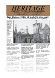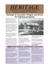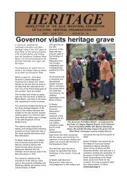
Blue Mountains History Journal Issue 3
Blue Mountains History Journal Issue 3
Blue Mountains History Journal Issue 3

You also want an ePaper? Increase the reach of your titles
YUMPU automatically turns print PDFs into web optimized ePapers that Google loves.
<strong>Blue</strong> <strong>Mountains</strong> <strong>History</strong> <strong>Journal</strong> 3: 2012<br />
northern boundary at the Hunter Range; moreover, perhaps anticipating that the Board would take a<br />
restricted view, Dunphy and Dowd proposed the title Greater <strong>Blue</strong> <strong>Mountains</strong> for their area (Dunphy and<br />
Dowd 1969). Both proposals involved complex descriptions involving watercourses, roads and ridges.<br />
The Board considered the matter at its meeting of 3 December 1969; only four of the seven members<br />
were present. The problem they faced was that the material before them (which included a treatise by<br />
Dunphy) was lengthy, complex and confused (Dunphy 1969). In agonising over the detail the<br />
Counsellors had been eluded by a simple, broad-brush vision. Unsurprisingly, the Board ignored their<br />
views and recommendations and embarked on a discussion based on their own conceptions — as they<br />
were entitled to do (GNB 1969). As a result they came up with relatively localised boundaries.<br />
When the Counsellors later asked the reasons for its decision, the Board acknowledged the Counsellors’<br />
case for a broader definition but said that it had decided to<br />
“restrict boundaries to coincide to a large extent with the popular concept of the region as at the<br />
present time” (Millar 1970).<br />
The Board’s minutes provide more insight. For instance, with regard to the northern boundary the Board<br />
considered<br />
“few inhabitants of the area north of the Colo and Capertee Rivers would consider themselves in the<br />
<strong>Blue</strong> <strong>Mountains</strong>” (GNB 1969).<br />
Believing that a sound definition of the mountains should involve river boundaries, they selected the<br />
Wolgan and Colo Rivers for the northern boundary and the Coxs River in the south.<br />
As to the western boundary, the Board stated<br />
“<strong>History</strong> records that Blaxland, Wentworth and Lawson made the first known crossing of the <strong>Blue</strong><br />
<strong>Mountains</strong>”,<br />
and therefore settled on Coxs River as part of the western boundary in order to ensure that the explorers’<br />
terminus, Mount Blaxland, lay beyond the <strong>Mountains</strong> .<br />
As we have seen, it cannot be claimed that the explorers completely crossed the <strong>Blue</strong> <strong>Mountains</strong><br />
according to the concept of the <strong>Blue</strong> <strong>Mountains</strong> of their time. The ‘history’ the Board relied on was<br />
based on the mythology that grew around the whole crossing narrative. In making its determination the<br />
Board gave official credence not only to an unimaginatively localised view, but to an entrenched<br />
mythology.<br />
Further, to the extent that they chose an area which is quite separate from the watershed of the Great<br />
Dividing Range, they departed completely from the concept that the <strong>Blue</strong> <strong>Mountains</strong> constituted a portion<br />
of that range. On the other hand, they gave no credence to any geological perspective, for the sandstone<br />
country extends far beyond the Board’s boundaries, even crossing the Dividing Range in the Cullen<br />
Bullen area.<br />
The determination, entered in the Geographical Names Register on 24 April 1970, was that the <strong>Blue</strong><br />
<strong>Mountains</strong> was<br />
“A series of dissected plateaus, ranges and escarpments bounded on the N by the Wolgan and Colo<br />
Rivers, on the W and S by Coxs River and Lake Burragorang and on the E by the Nepean and<br />
Hawkesbury River.” (GNB 1970a).<br />
Confusingly, the next month the Board also defined a “<strong>Blue</strong> <strong>Mountains</strong> Range”, described as a<br />
“A range of mountains, plateau and escarpments extending off the Great Dividing Range about 4.8 km<br />
N.W. of Wolgan Gap in a generally S.E. direction for about 96 km, terminating at Emu Plains. For<br />
about 2/3 of its length it is traversed by the Great Western Highway and the Main Western Railway.<br />
Several established towns are situated on its heights, including Katoomba, Blackheath, Mt. Victoria,<br />
16