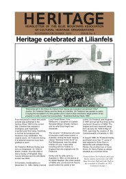
Blue Mountains History Journal Issue 3
Blue Mountains History Journal Issue 3
Blue Mountains History Journal Issue 3

You also want an ePaper? Increase the reach of your titles
YUMPU automatically turns print PDFs into web optimized ePapers that Google loves.
<strong>Blue</strong> <strong>Mountains</strong> Historical <strong>Journal</strong> 3;<br />
“ ... , who was 65, died when he fell 1,000 feet down Govett’s Leap at Blackheath on Saturday.”<br />
(Anonymous 1957g).<br />
But Katoomba is definitely an incorrect location and Govetts Leap is only an approximate position.<br />
Moreover, the electronic version of a recent article (Higham 2011) has a misleading map on which the<br />
marker implying the site of Childe’s death has been placed on Darling Causeway at the head of the Grose<br />
River Gorge, whereas the stated location of Govetts Leap is c.21km distant along the river systems<br />
and on an entirely different water catchment. *<br />
Writing nearly half a century after the incident, Thomas (2003, pp.211, 220, 221, 230 & 270) also<br />
maintained that the death occurred below Luchetti Lookout. But some details do not fit the location of<br />
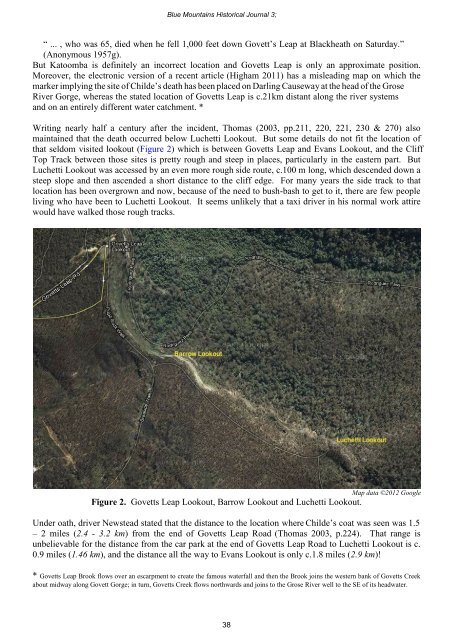
that seldom visited lookout (Figure 2) which is between Govetts Leap and Evans Lookout, and the Cliff<br />
Top Track between those sites is pretty rough and steep in places, particularly in the eastern part. But<br />
Luchetti Lookout was accessed by an even more rough side route, c.100 m long, which descended down a<br />
steep slope and then ascended a short distance to the cliff edge. For many years the side track to that<br />
location has been overgrown and now, because of the need to bush-bash to get to it, there are few people<br />
living who have been to Luchetti Lookout. It seems unlikely that a taxi driver in his normal work attire<br />
would have walked those rough tracks.<br />
Map data ©2012 Google<br />
Figure 2. Govetts Leap Lookout, Barrow Lookout and Luchetti Lookout.<br />
Under oath, driver Newstead stated that the distance to the location where Childe’s coat was seen was 1.5<br />
– 2 miles (2.4 - 3.2 km) from the end of Govetts Leap Road (Thomas 2003, p.224). That range is<br />
unbelievable for the distance from the car park at the end of Govetts Leap Road to Luchetti Lookout is c.<br />
0.9 miles (1.46 km), and the distance all the way to Evans Lookout is only c.1.8 miles (2.9 km)!<br />
* Govetts Leap Brook flows over an escarpment to create the famous waterfall and then the Brook joins the western bank of Govetts Creek<br />
about midway along Govett Gorge; in turn, Govetts Creek flows northwards and joins to the Grose River well to the SE of its headwater.<br />
38