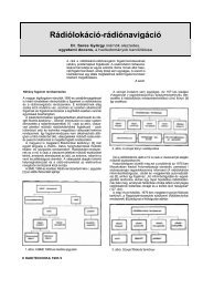
Abstract form
Abstract form
Abstract form

You also want an ePaper? Increase the reach of your titles
YUMPU automatically turns print PDFs into web optimized ePapers that Google loves.
Large-scale mapping of solonetzic complexes in the Northern Caspian<br />
Lowland using automated interpretation of Quickbird images<br />
Mariya V. KONYUSHKOVA<br />
V.V. Dokuchaev Soil Science Institute, Russian Academy of Agricultural Sciences,<br />
Pyzhevskiy per. 7/2, Moscow, 119017 Russia<br />
Contact e-mail: mkon@inbox.ru<br />
The goal of this study was to develop a procedure for large-scale mapping of solonetzic<br />
complexes using automated interpretation of very-high-resolution space-borne images.<br />
Solonetzic complexes are widespread in the northern part of the Caspian Lowland. They<br />
include the soils with different degrees of salinization: strongly saline Solonetzes (SN),<br />
slightly saline light chestnut soils (Kastanozems, KS) and nonsaline Chernozem-like<br />
(CL) soils replacing one another at distances of about 5–30 m. Dark-coloured CL<br />
occupy microlows with a relative depth of 10–30 cm, SN occur on microhighs, and KS<br />
occupy slopes. The portion of SN in the soil complexes varies from 25 to 75%.<br />
Earlier, large-scale soil maps of solonetzic complexes were developed on the basis of<br />
detailed surveys at key plots with a further extrapolation of the obtained data. The<br />
reliability of such extrapolation is low, because the proportions between different soils<br />
in the complexes may change considerably at distances of about 500 m. High-resolution<br />
(30%<br />
of CL were identified. In group 1, the portions of KS and CL were interrelated: K1(%)<br />
= –4.17CL(%) + 86.8 (R 2 =0.94). In group 2, the area of K1 is about 20% (15–25%).<br />
III. These regularities were used to develop the soil map of the test polygon (scale<br />
1:25000) with the following mapping units (solonetzic complexes): (1) CL 0-5%, КS<br />
70-80%, SN 20-30%; (2) CL 5-10%, KS 50-70%, SN 30-40%; (3) CL 10-15%, KS 35-<br />
50%, CN 40-50%; (4) CL 15-30%, KS 15-25%, SN 50-75%.<br />
Thus, this method ensured an automated delineation of the areas with CL with high<br />
(90%) reliability, on the basis of statistically reliable (R 2 =0.94) relationships, the<br />
portions of SN and KS were determined in each mapping area. This study was<br />
supported by the Russian Foundation for Basic Research, project no. 07-04-00136a).<br />
Key words: Solonetzic soil complexes, Caspian Lowland, Quickbird imagery, image<br />
interpretation, large-scale soil mapping.<br />
26