CAST Fiscal Year 2004-2005 Annual Report - Center for Advanced ...
CAST Fiscal Year 2004-2005 Annual Report - Center for Advanced ...
CAST Fiscal Year 2004-2005 Annual Report - Center for Advanced ...

Create successful ePaper yourself
Turn your PDF publications into a flip-book with our unique Google optimized e-Paper software.
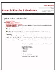
Met with Robert Guadagnini of Fayetteville<br />
Public Schools regarding CommunityViz and his<br />
useage of this tool within the school district.<br />
February <strong>2005</strong><br />
I meet with Jan Dixon, Sara Santos and Stephan<br />
Pollard of the University of Arkansas Library to<br />
determine which ESRI products would be most<br />
useful <strong>for</strong> their student support ef<strong>for</strong>ts in the<br />
Mullins Library.<br />
I helped organize an Optec Scanner<br />
demonstration at the Carlson Terrace Buildings<br />
on the University of Arkansas campus. I invited<br />
several interested parties out to view Angie<br />
Smith, Snow Winters and Malcolm Williamson<br />
as they scanned a section of a creek. This<br />
project was of interest to the UA Facilities<br />
Management (Jay Huneycutt) and the Audubon<br />
Arkansas representatives <strong>for</strong> Northwest<br />
Arkansas. The data was provided to Dawn<br />
Farver of the UA Engineering department <strong>for</strong><br />
use in here masters research project.<br />
John Wilson and I taught an Introduction to<br />
ArcGIS class <strong>for</strong> county/local government<br />
employees in Benton County. The total number<br />
of students was fifteen.<br />
March <strong>2005</strong><br />
John Wilson and I taught another Introduction to<br />
ArcGIS class <strong>for</strong> county/local government<br />
employees in Benton County. The total number<br />
of students was twelve.<br />
I assisted six undergraduate students with their<br />
GIS projects within various classes offered<br />
within the GeoSciences department (rm<br />
208/209) within Ozark Hall.<br />
I spent approximately 2.5hrs assisting University<br />
of Arkansas Graduate students with their<br />
geospatial issues in the Ozark GIS classrooms.<br />
Several of these issues were related to their<br />
graduate coursework and involved their use of<br />
GeoStor.<br />
April <strong>2005</strong><br />
I traveled to Little Rock <strong>for</strong> 4 days to assist the<br />
AGIO’s office during their transition to managing<br />
GeoStor.<br />
I traveled to Green Forest, Arkansas and<br />
presented an overview of how GIS and GPS can<br />
assist rural decision makers. The Carroll County<br />
Leadership organization invited me over to<br />
discuss this topic during their spring meeting.<br />
Approximately 17 local community leaders were<br />
present, and they were all enrolled in the<br />
LeadAR program.<br />
May <strong>2005</strong><br />
I attended the <strong>2005</strong> Regional Wetlands<br />
Technical Conference in Corpus Christi, TX and<br />
presented a paper on the Arkansas Wetland<br />
Resource Management In<strong>for</strong>mation System<br />
(AWRIMS) project we have with the Arkansas<br />
Soil and Water Conservation Commission.<br />
I met with John Lewis of the Beaver Water<br />
District Board to discuss the upcoming CADIS<br />
ef<strong>for</strong>t <strong>for</strong> the summer <strong>2005</strong>. Fred Limp and<br />
Malcolm Williamson were present too.<br />
June <strong>2005</strong><br />
I attended the 2006 Imagery Task Force Kick-off<br />
planning meeting at the Northwest Arkansas<br />
Regional Planning Commission.<br />
GORHAM, BRUCE<br />
<strong>2004</strong>-<strong>2005</strong> Member of the Arkansas Precision<br />
Agriculture Working Group (ARPAWG)<br />
<strong>Year</strong>long.<br />
<strong>2004</strong>-<strong>2005</strong> Serve on the AmericaView<br />
“Research” and “Remote Sensing Education”<br />
committees. <strong>Year</strong>long.<br />
<strong>2004</strong> Brian Haggard (USDA-ARS): Provided<br />
assistance with obtaining digital land-use maps.<br />
July<br />
<strong>2004</strong> Greg Thoma (UA Chemical Engineering):<br />
GPS training and checkout. July.<br />
Indrajeet Chaubey (UA Biological & Agricultural<br />
Engineering): provided assistance with the<br />
purchase of 10 Landsat scenes. July.<br />
<strong>2004</strong> Daniel Hayes (Oregon State University):<br />
Provided assistance with obtaining MODIS<br />
satellite imagery.<br />
<strong>2004</strong> Bret Collier (UA, Arkansas Cooperative<br />
Fish and Wildlife Research Unit): Provided<br />
assistance with using digital land-use maps. July<br />
<strong>2004</strong> Susan Henderson Houston, TX, Marathon<br />
Oil) Assistance with accessing data on GeoStor.<br />
August.<br />
<strong>2004</strong> Greg Thoma (UA Chemical Engineering):<br />
GPS checkout. August.<br />
CENTER FOR ADVANCED SPATIAL TECHNOLOGIES 59