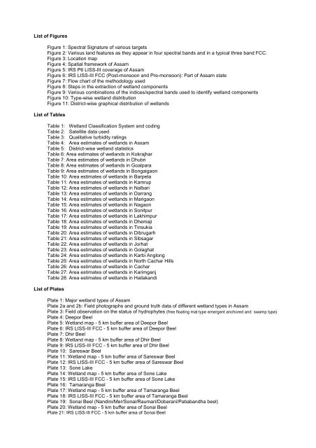
List <strong>of</strong> FiguresFigure 1: Spectral Signature <strong>of</strong> various targetsFigure 2: Various l<strong>and</strong> features as they appear in four spectral b<strong>and</strong>s <strong>and</strong> in a typical three b<strong>and</strong> FCC.Figure 3: Location mapFigure 4: Spatial framework <strong>of</strong> <strong>Assam</strong>Figure 5: IRS P6 LISS-III coverage <strong>of</strong> <strong>Assam</strong>Figure 6: IRS LISS-III FCC (Post-monsoon <strong>and</strong> Pre-monsoon): Part <strong>of</strong> <strong>Assam</strong> stateFigure 7: Flow chart <strong>of</strong> the methodology usedFigure 8: Steps in the extraction <strong>of</strong> wetl<strong>and</strong> componentsFigure 9: Various combinations <strong>of</strong> the indices/spectral b<strong>and</strong>s used to identify wetl<strong>and</strong> componentsFigure 10: Type-wise wetl<strong>and</strong> distributionFigure 11: District-wise graphical distribution <strong>of</strong> wetl<strong>and</strong>sList <strong>of</strong> TablesTable 1: Wetl<strong>and</strong> Classification System <strong>and</strong> codingTable 2: Satellite data usedTable 3: Qualitative turbidity ratingsTable 4: Area estimates <strong>of</strong> wetl<strong>and</strong>s in <strong>Assam</strong>Table 5: District-wise wetl<strong>and</strong> statisticsTable 6: Area estimates <strong>of</strong> wetl<strong>and</strong>s in KokrajharTable 7: Area estimates <strong>of</strong> wetl<strong>and</strong>s in DhubriTable 8: Area estimates <strong>of</strong> wetl<strong>and</strong>s in GoalparaTable 9: Area estimates <strong>of</strong> wetl<strong>and</strong>s in BongaigaonTable 10: Area estimates <strong>of</strong> wetl<strong>and</strong>s in BarpetaTable 11: Area estimates <strong>of</strong> wetl<strong>and</strong>s in KamrupTable 12: Area estimates <strong>of</strong> wetl<strong>and</strong>s in NalbariTable 13: Area estimates <strong>of</strong> wetl<strong>and</strong>s in DarrangTable 14: Area estimates <strong>of</strong> wetl<strong>and</strong>s in MarigaonTable 15: Area estimates <strong>of</strong> wetl<strong>and</strong>s in NagaonTable 16: Area estimates <strong>of</strong> wetl<strong>and</strong>s in SonitpurTable 17: Area estimates <strong>of</strong> wetl<strong>and</strong>s in LakhimpurTable 18: Area estimates <strong>of</strong> wetl<strong>and</strong>s in DhemajiTable 19: Area estimates <strong>of</strong> wetl<strong>and</strong>s in TinsukiaTable 20: Area estimates <strong>of</strong> wetl<strong>and</strong>s in DibrugarhTable 21: Area estimates <strong>of</strong> wetl<strong>and</strong>s in SibsagarTable 22: Area estimates <strong>of</strong> wetl<strong>and</strong>s in JorhatTable 23: Area estimates <strong>of</strong> wetl<strong>and</strong>s in GolaghatTable 24: Area estimates <strong>of</strong> wetl<strong>and</strong>s in Karbi AnglongTable 25: Area estimates <strong>of</strong> wetl<strong>and</strong>s in North Cachar HillsTable 26: Area estimates <strong>of</strong> wetl<strong>and</strong>s in CacharTable 27: Area estimates <strong>of</strong> wetl<strong>and</strong>s in KarimganjTable 28: Area estimates <strong>of</strong> wetl<strong>and</strong>s in Hailak<strong>and</strong>iList <strong>of</strong> PlatesPlate 1: Major wetl<strong>and</strong> types <strong>of</strong> <strong>Assam</strong>Plate 2a <strong>and</strong> 2b: Field photographs <strong>and</strong> ground truth data <strong>of</strong> different wetl<strong>and</strong> types in <strong>Assam</strong>Plate 3: Field observation on the status <strong>of</strong> hydrophytes (free floating mat type emergent anchored <strong>and</strong> swamp type)Plate 4: Deepor BeelPlate 5: Wetl<strong>and</strong> map - 5 km buffer area <strong>of</strong> Deepor BeelPlate 6: IRS LISS-III FCC - 5 km buffer area <strong>of</strong> Deepor BeelPlate 7: Dhir BeelPlate 8: Wetl<strong>and</strong> map - 5 km buffer area <strong>of</strong> Dhir BeelPlate 9: IRS LISS-III FCC - 5 km buffer area <strong>of</strong> Dhir BeelPlate 10: Sareswar BeelPlate 11: Wetl<strong>and</strong> map - 5 km buffer area <strong>of</strong> Sareswar BeelPlate 12: IRS LISS-III FCC - 5 km buffer area <strong>of</strong> Sareswar BeelPlate 13: Sone LakePlate 14: Wetl<strong>and</strong> map - 5 km buffer area <strong>of</strong> Sone LakePlate 15: IRS LISS-III FCC - 5 km buffer area <strong>of</strong> Sone LakePlate 16: Tamaranga BeelPlate 17: Wetl<strong>and</strong> map - 5 km buffer area <strong>of</strong> Tamaranga BeelPlate 18: IRS LISS-III FCC - 5 km buffer area <strong>of</strong> Tamaranga BeelPlate 19: Sonai Beel (N<strong>and</strong>ini/Mer/Sonai/Raumari/Dobarani/Patiab<strong>and</strong>ha beel)Plate 20: Wetl<strong>and</strong> map - 5 km buffer area <strong>of</strong> Sonai BeelPlate 21: IRS LISS-III FCC - 5 km buffer area <strong>of</strong> Sonai Beel
1.0 INTRODUCTIONIt is increasingly realized that the planet earth is facing grave environmental problems with fast depletingnatural resources <strong>and</strong> threatening the very existence <strong>of</strong> most <strong>of</strong> the ecosystems. Serious concerns are voicedamong scientists, planners, sociologists, politicians, <strong>and</strong> economists to conserve <strong>and</strong> preserve the naturalresources <strong>of</strong> the world. One <strong>of</strong> the constraints most frequently faced for decision making is lack <strong>of</strong> scientificdata <strong>of</strong> our natural resources. Often the data are sparse or unauthentic, rarely in the form <strong>of</strong> geospatialdatabase (map), thus open to challenges. Hence, the current emphasis <strong>of</strong> every country is to have anappropriate geospatial database <strong>of</strong> natural resources based on unambiguous scientific methods. The wetl<strong>and</strong>atlas <strong>of</strong> <strong>Assam</strong>, which is part <strong>of</strong> the National Wetl<strong>and</strong> Atlas <strong>of</strong> India, is an attempt in this direction.1.1 Wetl<strong>and</strong>sWetl<strong>and</strong>s are one <strong>of</strong> the crucial natural resources. Wetl<strong>and</strong>s are areas <strong>of</strong> l<strong>and</strong> that are either temporarily orpermanently covered by water. This means that a wetl<strong>and</strong> is neither truly aquatic nor terrestrial; it is possiblethat wetl<strong>and</strong>s can be both at the same time depending on seasonal variability. Thus, wetl<strong>and</strong>s exhibitenormous diversity according to their genesis, geographical location, water regime <strong>and</strong> chemistry, dominantplants <strong>and</strong> soil or sediment characteristics. Because <strong>of</strong> their transitional nature, the boundaries <strong>of</strong> wetl<strong>and</strong>sare <strong>of</strong>ten difficult to define. Wetl<strong>and</strong>s do, however, share a few attributes common to all forms. Of these,hydrological structure (the dynamics <strong>of</strong> water supply, throughput, storage <strong>and</strong> loss) is most fundamental tothe nature <strong>of</strong> a wetl<strong>and</strong> system. It is the presence <strong>of</strong> water for a significant period <strong>of</strong> time which is principallyresponsible for the development <strong>of</strong> a wetl<strong>and</strong>. One <strong>of</strong> the first widely used classifications systems, devised byCowardin et al, 1979, was associated to its hydrological, ecological <strong>and</strong> geological aspects, such as: marine(coastal wetl<strong>and</strong>s including rock shores <strong>and</strong> coral reefs, estuarine (including deltas, tidal marshes, <strong>and</strong>mangrove swamps), lacustarine (lakes), riverine (along rivers <strong>and</strong> streams), palustarine ('marshy'- marshes,swamps <strong>and</strong> bogs). Given these characteristics, wetl<strong>and</strong>s support a large variety <strong>of</strong> plant <strong>and</strong> animal speciesadapted to fluctuating water levels, making the wetl<strong>and</strong>s <strong>of</strong> critical ecological significance. Utility wise,wetl<strong>and</strong>s directly <strong>and</strong> indirectly support millions <strong>of</strong> people in providing services such as food, fiber <strong>and</strong> rawmaterials, storm <strong>and</strong> flood control, clean water supply, scenic beauty <strong>and</strong> educational <strong>and</strong> recreationalbenefits. The Millennium Ecosystem Assessment estimates conservatively that wetl<strong>and</strong>s cover seven percent<strong>of</strong> the earth’s surface <strong>and</strong> deliver 45% <strong>of</strong> the world’s natural productivity <strong>and</strong> ecosystem services <strong>of</strong> which thebenefits are estimated at $20 trillion a year (Source: www.MAweb.org). The Millennium Assessment (MA)uses the following typology to categorise ecosystem services:Provisioning services: The resources or products provided by ecosystems, such as food, raw materials(wood), genetic resources, medicinal resources, ornamental resources (skin, shells,flowers).Regulating services: Ecosystems maintain the essential ecological processes <strong>and</strong> life support systems, likegas <strong>and</strong> climate regulation, water supply <strong>and</strong> regulation, waste treatment, pollination,etc.Cultural <strong>and</strong> Amenity services: Ecosystems are a source <strong>of</strong> inspiration to human culture <strong>and</strong> educationthroughout recreation, cultural, artistic, spiritual <strong>and</strong> historic information, Science <strong>and</strong>education.Supporting services: Ecosystems provide habitat for flora <strong>and</strong> fauna in order to maintain biological <strong>and</strong>genetic diversity.Despite these benefits, wetl<strong>and</strong>s are the first target <strong>of</strong> human interference <strong>and</strong> are among the mostthreatened <strong>of</strong> all natural resources. Around 50% <strong>of</strong> the earth’s wetl<strong>and</strong> area is estimated to already havedisappeared over the last hundred years through conversion to industrial, agricultural <strong>and</strong> residentialdevelopments. Even in current scenario, when the ecosystem services provided by wetl<strong>and</strong>s are betterunderstood - degradation <strong>and</strong> conversion <strong>of</strong> wetl<strong>and</strong>s continues. This is largely due to the fact that the‘full value’ <strong>of</strong> ecosystem functions is <strong>of</strong>ten ignored in policy-making, plans <strong>and</strong> corporate evaluations <strong>of</strong>development projects.1.2 Mapping <strong>and</strong> Geospatial TechniqueTo conserve <strong>and</strong> manage wetl<strong>and</strong> resources, it is important to have inventory <strong>of</strong> wetl<strong>and</strong>s <strong>and</strong> theircatchments. The ability to store <strong>and</strong> analyse the data is essential. Digital maps are very powerful tools toachieve this. Maps relate the feature to any given geographical location has a strong visual impact. Maps arethus essential for monitoring <strong>and</strong> quantifying change over time scale, assist in decision making.The technique used in the preparation <strong>of</strong> map started with ground survey. The Survey <strong>of</strong> India (SOI)topographical maps are the earliest true maps <strong>of</strong> India showing various l<strong>and</strong> use/cover classes includingwetl<strong>and</strong>s. Recent years have seen advances in mapping technique to prepare maps with much moreinformation. Of particular importance is the remote sensing <strong>and</strong> geographic information system (GIS)1


