National Report of Sweden to the NKG General ... - Lantmäteriet
National Report of Sweden to the NKG General ... - Lantmäteriet
National Report of Sweden to the NKG General ... - Lantmäteriet
You also want an ePaper? Increase the reach of your titles
YUMPU automatically turns print PDFs into web optimized ePapers that Google loves.
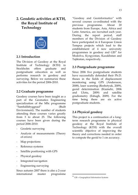
132. Geodetic activities at KTH,<strong>the</strong> Royal Institute <strong>of</strong>Technology2.1 IntroductionThe Division <strong>of</strong> Geodesy at <strong>the</strong> RoyalInstitute <strong>of</strong> Technology (KTH) inS<strong>to</strong>ckholm <strong>of</strong>fers graduate andpostgraduate education as well asperforms research in geodesy andsurveying. Below we summarize <strong>the</strong>seactivities for <strong>the</strong> period 2006-2010.2.2 Graduate programmeGeodesy courses have been taught as apart <strong>of</strong> <strong>the</strong> Geomatics Engineeringspecialization <strong>of</strong> <strong>the</strong> MSc programme“Samhällsbyggnad”(BuiltEnvironment). The number <strong>of</strong> studentsattending <strong>the</strong>se courses varies greatlyfrom 3 <strong>to</strong> about 25. The followingcourses have been given during <strong>the</strong>period 2006-2010:- Geodetic surveying- Analysis <strong>of</strong> measurements (Theory<strong>of</strong> errors)- Map projections- Reference systems- Satellite positioning with GPS- Physical geodesy- Integrated navigation- Engineering surveyingSince autumn 2007 <strong>the</strong>re is also a 2-yearinternational master programme“Geodesy and Geoinformatics” withseveral courses co-ordinated with <strong>the</strong>previous programme. About 20students from Europe, Asia, Africa andLatin America, are recruited each year.During <strong>the</strong> report period, staffmembers <strong>of</strong> <strong>the</strong> Division <strong>of</strong> Geodesyhave participated in 4 European UnionTempus projects which lead <strong>to</strong> <strong>the</strong>establishment <strong>of</strong> 4 new universityprogrammes in geodesy and GIS 35 forModolva, Kyrgyzstan, Kazakhstan andTajikistan, respectively.2.3 Postgraduate programmeSince 2006 five postgraduate studentshave successfully defended <strong>the</strong>ir Ph.D.<strong>the</strong>ses in <strong>the</strong> fields <strong>of</strong> displacementmoni<strong>to</strong>ring using GPS (Andersson,2008), laser scanning (Reshetyuk, 2009),geoid determination (Kiamehr, 2006and Ulotu, 2009) and satellitegradiometry (Eshagh, 2009). For <strong>the</strong>time being <strong>the</strong>re are six activepostgraduate students.2.4 Physical geodesyThis project is a continuation <strong>of</strong> a longtermresearch programme in physicalgeodesy at <strong>the</strong> Royal Institute <strong>of</strong>Technology (KTH) with <strong>the</strong> overallscientific objective <strong>of</strong> improving <strong>the</strong><strong>the</strong>ory and corrections needed in order<strong>to</strong> compute <strong>the</strong> geoid <strong>to</strong> 1 cm accuracy.35GIS = Geographical Information Systems


