National Report of Sweden to the NKG General ... - Lantmäteriet
National Report of Sweden to the NKG General ... - Lantmäteriet
National Report of Sweden to the NKG General ... - Lantmäteriet

You also want an ePaper? Increase the reach of your titles
YUMPU automatically turns print PDFs into web optimized ePapers that Google loves.
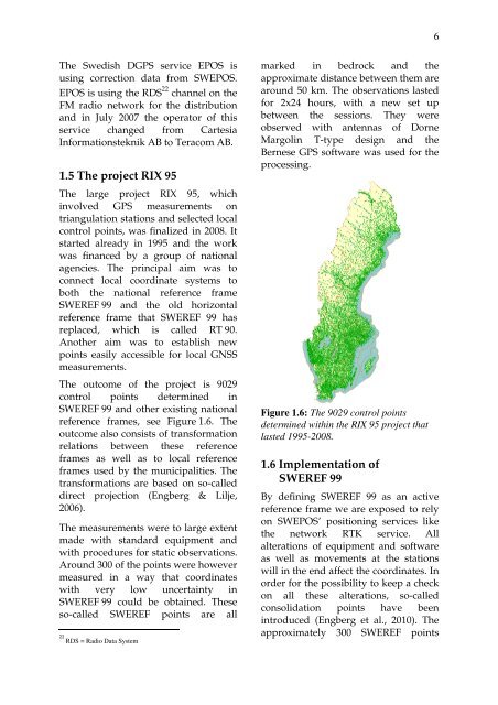
6marked in bedrock and <strong>the</strong>The Swedish DGPS service EPOS is22RDS = Radio Data Systemapproximately 300 SWEREF pointsusing correction data from SWEPOS.EPOS is using <strong>the</strong> RDS 22 channel on <strong>the</strong>FM radio network for <strong>the</strong> distributionapproximate distance between <strong>the</strong>m arearound 50 km. The observations lastedfor 2x24 hours, with a new set upand in July 2007 <strong>the</strong> opera<strong>to</strong>r <strong>of</strong> this between <strong>the</strong> sessions. They wereservice changed from Cartesia observed with antennas <strong>of</strong> DorneInformationsteknik AB <strong>to</strong> Teracom AB. Margolin T-type design and <strong>the</strong>Bernese GPS s<strong>of</strong>tware was used for <strong>the</strong>processing.1.5 The project RIX 95The large project RIX 95, whichinvolved GPS measurements ontriangulation stations and selected localcontrol points, was finalized in 2008. Itstarted already in 1995 and <strong>the</strong> workwas financed by a group <strong>of</strong> nationalagencies. The principal aim was <strong>to</strong>connect local coordinate systems <strong>to</strong>both <strong>the</strong> national reference frameSWEREF 99 and <strong>the</strong> old horizontalreference frame that SWEREF 99 hasreplaced, which is called RT 90.Ano<strong>the</strong>r aim was <strong>to</strong> establish newpoints easily accessible for local GNSSmeasurements.The outcome <strong>of</strong> <strong>the</strong> project is 9029control points determined inSWEREF 99 and o<strong>the</strong>r existing national Figure 1.6: The 9029 control pointsreference frames, see Figure 1.6. The determined within <strong>the</strong> RIX 95 project tha<strong>to</strong>utcome also consists <strong>of</strong> transformation lasted 1995-2008.relations between <strong>the</strong>se referenceframes as well as <strong>to</strong> local reference1.6 Implementation <strong>of</strong>frames used by <strong>the</strong> municipalities. Thetransformations are based on so-calledSWEREF 99direct projection (Engberg & Lilje,2006).By defining SWEREF 99 as an activereference frame we are exposed <strong>to</strong> relyon SWEPOS’ positioning services likeThe measurements were <strong>to</strong> large extent<strong>the</strong> network RTK service. Allmade with standard equipment andalterations <strong>of</strong> equipment and s<strong>of</strong>twarewith procedures for static observations.as well as movements at <strong>the</strong> stationsAround 300 <strong>of</strong> <strong>the</strong> points were howeverwill in <strong>the</strong> end affect <strong>the</strong> coordinates. Inmeasured in a way that coordinatesorder for <strong>the</strong> possibility <strong>to</strong> keep a checkwith very low uncertainty inon all <strong>the</strong>se alterations, so-calledSWEREF 99 could be obtained. Theseconsolidation points have beenso-called SWEREF points are allintroduced (Engberg et al., 2010). The