

222893e
222893e
222893e

Create successful ePaper yourself
Turn your PDF publications into a flip-book with our unique Google optimized e-Paper software.
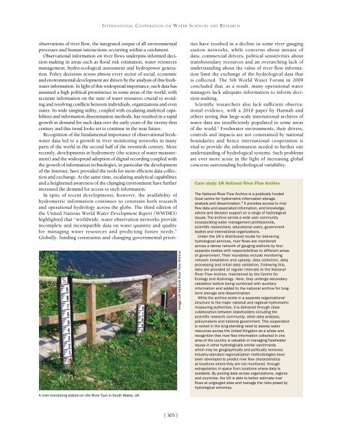
INTERNATIONAL COOPERATION ON WATER SCIENCES AND RESEARCHobservations of river flow, the integrated output of all environmentalprocesses and human interactions occurring within a catchment.Observational information on river flows underpins informed decision-makingin areas such as flood risk estimation, water resourcesmanagement, hydro-ecological assessment and hydropower generation.Policy decisions across almost every sector of social, economicand environmental development are driven by the analysis of this freshwaterinformation. In light of this widespread importance, such data hasassumed a high political prominence in some areas of the world, withaccurate information on the state of water resources crucial to avoidingand resolving conflicts between individuals, organizations and evenstates. Its wide ranging utility, coupled with escalating analytical capabilitiesand information dissemination methods, has resulted in a rapidgrowth in demand for such data over the early years of the twenty-firstcentury and this trend looks set to continue in the near future.Recognition of the fundamental importance of observational freshwaterdata led to a growth in river monitoring networks in manyparts of the world in the second half of the twentieth century. Morerecently, developments in hydrometry (the science of water measurement)and the widespread adoption of digital recording coupled withthe growth of information technologies, in particular the developmentof the Internet, have provided the tools for more efficient data collectionand exchange. At the same time, escalating analytical capabilitiesand a heightened awareness of the changing environment have furtherincreased the demand for access to such information.In spite of recent developments, however, the availability ofhydrometric information continues to constrain both researchand operational hydrology across the globe. The third edition ofthe United Nations World Water Development Report (WWDR3)highlighted that “worldwide, water observation networks provideincomplete and incompatible data on water quantity and qualityfor managing water resources and predicting future needs.”Globally, funding constraints and changing governmental priori-A river monitoring station on the River Tywi in South Wales, UKImage: UK National River Flow Archiveties have resulted in a decline in some river gaugingstation networks, while concerns about misuse ofdata, commercial drivers, political sensitivities abouttransboundary resources and an overarching lack ofunderstanding about the value of river flow informationlimit the exchange of the hydrological data thatis collected. The 5th World Water Forum in 2009concluded that, as a result, many operational watermanagers lack adequate information to inform decision-making.Scientific researchers also lack sufficient observationalevidence, with a 2010 paper by Hannah andothers noting that large-scale international archives ofwater data are insufficiently populated in some areasof the world. 1 Freshwater environments, their drivers,controls and impacts are not constrained by nationalboundaries and hence international cooperation isvital to provide the information needed to further ourunderstanding of hydrological systems. Such problemsare ever more acute in the light of increasing globalconcerns surrounding hydrological variability.Case study: UK National River Flow ArchiveThe National River Flow Archive is a publically fundedfocal centre for hydrometric information storage,analysis and dissemination. 2 It provides access to riverflow data and associated information, and knowledge,advice and decision support on a range of hydrologicalissues. The archive serves a wide user communityincorporating water management professionals,scientific researchers, educational users, governmentbodies and international organizations.Under the UK’s distributed model for deliveringhydrological services, river flows are monitoredacross a dense network of gauging stations by fourseparate bodies with responsibilities to different areasof government. Their mandates include monitoringnetwork installation and upkeep, data collection, dataprocessing and initial data validation. Following this,data are provided at regular intervals to the NationalRiver Flow Archive, maintained by the Centre forEcology and Hydrology. Here, they undergo secondaryvalidation before being combined with auxiliaryinformation and added to the national archive for longtermstorage and dissemination.While the archive exists in a separate organizationalstructure to the major national and regional hydrometricmeasuring authorities, it is delivered through closecollaboration between stakeholders including thescientific research community, other data analysts,policymakers and national government. This cooperationis rooted in the long-standing need to assess waterresources across the United Kingdom as a whole andrecognition that river flow information collected in onearea of the country is valuable in managing freshwaterissues in other hydrologically similar catchmentswhich may be geographically and politically removed.Industry-standard regionalization methodologies havebeen developed to predict river flow characteristicsat locations where they are not monitored, throughextrapolation in space from locations where data isavailable. By pooling data across organizations, regionsand countries, the UK is able to better estimate riverflows at ungauged sites and manage the risks posed byhydrological extremes.[ 305 ]