SUBCOURSE EDITION - Modern Prepper
SUBCOURSE EDITION - Modern Prepper
SUBCOURSE EDITION - Modern Prepper

You also want an ePaper? Increase the reach of your titles
YUMPU automatically turns print PDFs into web optimized ePapers that Google loves.
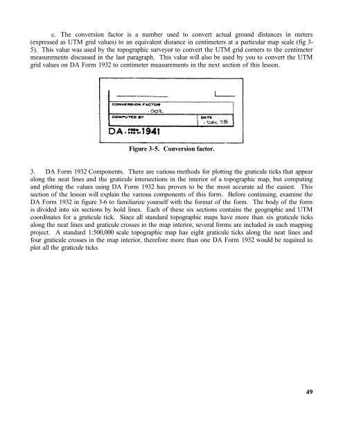
c. The conversion factor is a number used to convert actual ground distances in meters(expressed as UTM grid values) to an equivalent distance in centimeters at a particular map scale (fig 3-5). This value was used by the topographic surveyor to convert the UTM grid corners to the centimetermeasurements discussed in the last paragraph. This value will also be used by you to convert the UTMgrid values on DA Form 1932 to centimeter measurements in the next section of this lesson.Figure 3-5. Conversion factor.3. DA Form 1932 Components. There are various methods for plotting the graticule ticks that appearalong the neat lines and the graticule intersections in the interior of a topographic map, but computingand plotting the values using DA Form 1932 has proven to be the most accurate ad the easiest. Thissection of the lesson will explain the various components of this form. Before continuing, examine theDA Form 1932 in figure 3-6 to familiarize yourself with the format of the form. The body of the formis divided into six sections by hold lines. Each of these six sections contains the geographic and UTMcoordinates for a graticule tick. Since all standard topographic maps have more than six graticule ticksalong the neat lines and graticule crosses in the map interior, several forms are included in each mappingproject. A standard 1:500,000 scale topographic map has eight graticule ticks along the neat lines andfour graticule crosses in the map interior, therefore more than one DA Form 1932 would be required toplot all the graticule ticks.49