

Storm Data and Unusual Weather Phenomena - CIG - Mesonet
Storm Data and Unusual Weather Phenomena - CIG - Mesonet
Storm Data and Unusual Weather Phenomena - CIG - Mesonet

You also want an ePaper? Increase the reach of your titles
YUMPU automatically turns print PDFs into web optimized ePapers that Google loves.
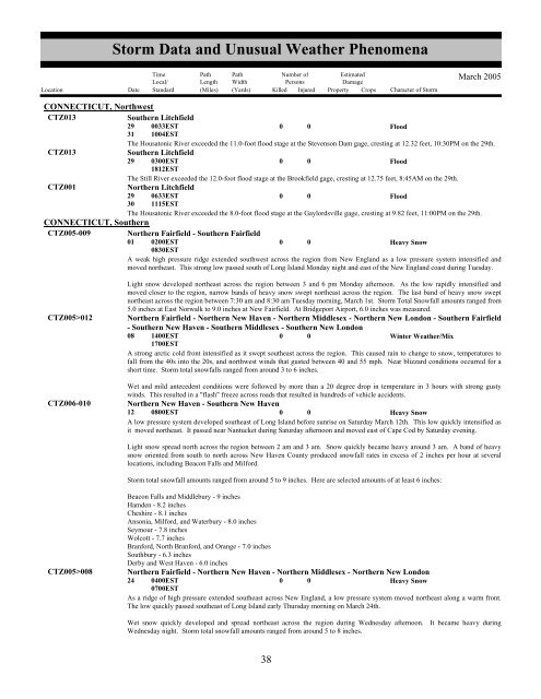
<strong>Storm</strong> <strong>Data</strong> <strong>and</strong> <strong>Unusual</strong> <strong>Weather</strong> <strong>Phenomena</strong>TimeLocal/PathLengthPathWidthNumber ofPersonsEstimatedDamageLocation Date St<strong>and</strong>ard (Miles) (Yards) Killed Injured Property Crops Character of <strong>Storm</strong>March 2005CONNECTICUT, NorthwestCTZ013Southern Litchfield29310033EST1004EST0 0FloodThe Housatonic River exceeded the 11.0-foot flood stage at the Stevenson Dam gage, cresting at 12.32 feet, 10:30PM on the 29th.CTZ013Southern Litchfield29 0300EST1812EST0 0FloodThe Still River exceeded the 12.0-foot flood stage at the Brookfield gage, cresting at 12.75 feet, 8:45AM on the 29th.CTZ001Northern Litchfield29300633EST1115EST0 0FloodThe Housatonic River exceeded the 8.0-foot flood stage at the Gaylordsville gage, cresting at 9.82 feet, 11:00PM on the 29th.CONNECTICUT, SouthernCTZ005-009 Northern Fairfield - Southern Fairfield01 0200EST0830EST0 0Heavy SnowA weak high pressure ridge extended southwest across the region from New Engl<strong>and</strong> as a low pressure system intensified <strong>and</strong>moved northeast. This strong low passed south of Long Isl<strong>and</strong> Monday night <strong>and</strong> east of the New Engl<strong>and</strong> coast during Tuesday.CTZ005>012CTZ006-010Light snow developed northeast across the region between 3 <strong>and</strong> 6 pm Monday afternoon. As the low rapidly intensified <strong>and</strong>moved closer to the region, narrow b<strong>and</strong>s of heavy snow swept northeast across the region. The last b<strong>and</strong> of heavy snow sweptnortheast across the region between 7:30 am <strong>and</strong> 8:30 am Tuesday morning, March 1st. <strong>Storm</strong> Total Snowfall amounts ranged from5.0 inches at East Norwalk to 9.0 inches at New Fairfield. At Bridgeport Airport, 6.0 inches was measured.Northern Fairfield - Northern New Haven - Northern Middlesex - Northern New London - Southern Fairfield- Southern New Haven - Southern Middlesex - Southern New London08 1400EST0 0Winter <strong>Weather</strong>/Mix1700ESTA strong arctic cold front intensified as it swept southeast across the region. This caused rain to change to snow, temperatures tofall from the 40s into the 20s, <strong>and</strong> northwest winds that gusted between 40 <strong>and</strong> 55 mph. Near blizzard conditions occurred for ashort time. <strong>Storm</strong> total snowfalls ranged from around 3 to 6 inches.Wet <strong>and</strong> mild antecedent conditions were followed by more than a 20 degree drop in temperature in 3 hours with strong gustywinds. This resulted in a "flash" freeze across roads that resulted in hundreds of vehicle accidents.Northern New Haven - Southern New Haven12 0800EST0 0Heavy SnowA low pressure system developed southeast of Long Isl<strong>and</strong> before sunrise on Saturday March 12th. This low quickly intensified asit moved northeast. It passed near Nantucket during Saturday afternoon <strong>and</strong> moved east of Cape Cod by Saturday evening.Light snow spread north across the region between 2 am <strong>and</strong> 3 am. Snow quickly became heavy around 3 am. A b<strong>and</strong> of heavysnow oriented from south to north across New Haven County produced snowfall rates in excess of 2 inches per hour at severallocations, including Beacon Falls <strong>and</strong> Milford.<strong>Storm</strong> total snowfall amounts ranged from around 5 to 9 inches. Here are selected amounts of at least 6 inches:CTZ005>008Beacon Falls <strong>and</strong> Middlebury - 9 inchesHamden - 8.2 inchesCheshire - 8.1 inchesAnsonia, Milford, <strong>and</strong> Waterbury - 8.0 inchesSeymour - 7.8 inchesWolcott - 7.7 inchesBranford, North Branford, <strong>and</strong> Orange - 7.0 inchesSouthbury - 6.3 inchesDerby <strong>and</strong> West Haven - 6.0 inchesNorthern Fairfield - Northern New Haven - Northern Middlesex - Northern New London24 0400EST0 0Heavy Snow0700ESTAs a ridge of high pressure extended southeast across New Engl<strong>and</strong>, a low pressure system moved northeast along a warm front.The low quickly passed southeast of Long Isl<strong>and</strong> early Thursday morning on March 24th.Wet snow quickly developed <strong>and</strong> spread northeast across the region during Wednesday afternoon. It became heavy duringWednesday night. <strong>Storm</strong> total snowfall amounts ranged from around 5 to 8 inches.3438


