RESERVOIR SEDIMENTATION ASSESSMENT GUIDELINE - Aneel
RESERVOIR SEDIMENTATION ASSESSMENT GUIDELINE - Aneel
RESERVOIR SEDIMENTATION ASSESSMENT GUIDELINE - Aneel
Create successful ePaper yourself
Turn your PDF publications into a flip-book with our unique Google optimized e-Paper software.
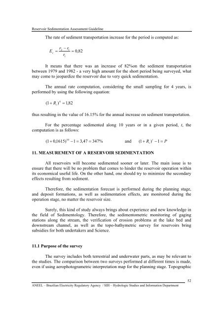
Reservoir Sedimentation Assessment GuidelineThe rate of sediment transportation increase for the period is computed as:E c=r2− r1r1= 0,82It means that there was an increase of 82%on the sediment transportationbetween 1979 and 1982 - a very high amount for the short period being surveyed, whatmay come to jeopardize the reservoir due to very quick sedimentation.The annual rate computation, considering the small sampling for 4 years, isperformed by using the following equation:(1+ R i)4 =1,82thus resulting in the value of 16.15% for the annual increase on sediment transportation.For the percentage sedimented along 10 years or in a given period, t, thecomputation is as follows:10(1 + 0,1615) −1= 3,47 = 347% and ( 1+ R )t −1P11. MEASUREMENT OF A <strong>RESERVOIR</strong> <strong>SEDIMENTATION</strong>i=All reservoirs will become sedimented sooner or later. The main issue is toensure that there will be no problem that comes to hinder the reservoir operation withinits economical useful life. On the other hand, one should try to minimize the secondaryeffects resulting from sediment.Therefore, the sedimentation forecast is performed during the planning stage,and deposit formations, as well as sedimentation effects, are monitored during theoperation stage, no matter the reservoir size.Surely, this kind of study always brings about experience and new knowledge inthe field of Sedimentology. Therefore, the sedimentometric monitoring of gagingstations along the stream, the verification of erosion problems at the lake bed anddownstream channel, as well as the topo-bathymetric survey for reservoirs bringsubsidies for both undertakers and Science.11.1 Purpose of the surveyThe survey includes both terrestrial and underwater parts, as may be relevant tothe studies. The comparison between two surveys performed at different times is made,even if using aerophotogrametric interpretation map for the planning stage. TopographicANEEL – Brazilian Electricity Regulatory Agency / SIH – Hydrologic Studies and Information Department52


