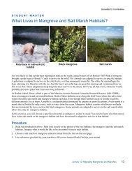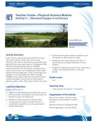
Teacher GuideâEarth Science Module - Estuaries NOAA
Teacher GuideâEarth Science Module - Estuaries NOAA
Teacher GuideâEarth Science Module - Estuaries NOAA

You also want an ePaper? Increase the reach of your titles
YUMPU automatically turns print PDFs into web optimized ePapers that Google loves.
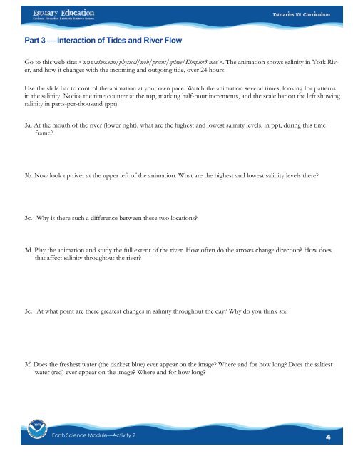
Part 3 — Interaction of Tides and River FlowGo to this web site: . The animation shows salinity in York River,and how it changes with the incoming and outgoing tide, over 24 hours.Use the slide bar to control the animation at your own pace. Watch the animation several times, looking for patternsin the salinity. Notice the time counter at the top, marking half-hour increments, and the scale bar on the left showingsalinity in parts-per-thousand (ppt).3a. At the mouth of the river (lower right), what are the highest and lowest salinity levels, in ppt, during this timeframe?3b. Now look up river at the upper left of the animation. What are the highest and lowest salinity levels there?3c. Why is there such a difference between these two locations?3d. Play the animation and study the full extent of the river. How often do the arrows change direction? How doesthat affect salinity throughout the river?3e. At what point are there greatest changes in salinity throughout the day? Why do you think so?3f. Does the freshest water (the darkest blue) ever appear on the image? Where and for how long? Does the saltiestwater (red) ever appear on the image? Where and for how long?Earth <strong>Science</strong> <strong>Module</strong>—Activity 24