Teacher GuideâEarth Science Module - Estuaries NOAA
Teacher GuideâEarth Science Module - Estuaries NOAA
Teacher GuideâEarth Science Module - Estuaries NOAA

Create successful ePaper yourself
Turn your PDF publications into a flip-book with our unique Google optimized e-Paper software.
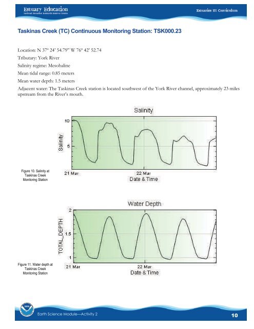
Taskinas Creek (TC) Continuous Monitoring Station: TSK000.23Location: N 37º 24’ 54.79” W 76º 42’ 52.74Tributary: York RiverSalinity regime: MesohalineMean tidal range: 0.85 metersMean water depth: 1.5 metersAdjacent water: The Taskinas Creek station is located southwest of the York River channel, approximately 23 milesupstream from the River’s mouth.Figure 10. Salinity atTaskinas CreekMonitoring StationFigure 11. Water depth atTaskinas CreekMonitoring StationEarth <strong>Science</strong> <strong>Module</strong>—Activity 210