- Page 3 and 4:
PRICING We publish our catalogue ev
- Page 5 and 6:
SKYLER ELLIS REX BALSOM COLIN LAKE
- Page 7 and 8:
STAINLESS STEEL SCREWS Flat head, f
- Page 9 and 10:
S.S HEX NUTS 18-8 STAINLESS STEEL 6
- Page 12 and 13:
Hydraulics TYPICAL HYDRAULIC INSTAL
- Page 14 and 15:
Hydraulics Head Assembly Size 90°
- Page 16 and 17:
Hydraulics GALTECH CONTROL VALVE (Q
- Page 18 and 19:
Hydraulics HYDRAULIC GEAR PUMPS An
- Page 20 and 21:
Hydraulics HY SERIES CRIMP FITTINGS
- Page 22 and 23:
Hydraulics HYDRAULIC TANKS Heavy du
- Page 24 and 25:
Commercial Fishing Products XLE-PER
- Page 26 and 27:
Commercial Fishing Products BRAIDED
- Page 28 and 29:
Commercial Fishing Products 66-080
- Page 30 and 31:
Commercial Fishing Products 5” &
- Page 32 and 33:
Commercial Fishing Products CRAB PO
- Page 34 and 35:
Recreational Fishing Genuine World
- Page 36 and 37:
Recreational Fishing BAITED HOOKS C
- Page 38 and 39:
Recreational Fishing 11 Not actual
- Page 40 and 41:
Recreational Fishing SPARTAN BOAT R
- Page 42 and 43:
Recreational Fishing FLY REEL "SYMP
- Page 44 and 45:
Recreational Fishing OLD TYPE TROUT
- Page 46 and 47:
Knives & Sharpeners DEXTER SPLITTIN
- Page 48 and 49:
Knives & Sharpeners Icel knives are
- Page 50 and 51:
Knives & Sharpeners ATTENTION FISHE
- Page 52 and 53:
Knives & Sharpeners STRATA MULTI-PL
- Page 54 and 55:
Knives & Sharpeners ACCUSHARP SHARP
- Page 56 and 57:
Gloves, Aprons & Hairnets N-Dex Dis
- Page 58 and 59:
Industrial Gloves LATEX COATED GLOV
- Page 60 and 61:
Industrial Gloves Soft, Flexible, S
- Page 62 and 63:
Industrial Gloves ENDURA WORK GLOVE
- Page 65 and 66:
POWER STEERING HELMS The helms have
- Page 67 and 68:
Capilano Teleflex Hydraulic steerin
- Page 69 and 70:
FRONT MOUNT SEASTAR FRONT MOUNT“O
- Page 71 and 72:
ELECTRIC TRIM TAB SYSTEMS Lenco Ele
- Page 73 and 74:
NEW XTREME SSX176 MECHANICAL STEERI
- Page 75 and 76:
HARDWOOD WHEELS Beautifully built f
- Page 77 and 78:
Steering,Controls & Cables S AND TW
- Page 79 and 80:
Amega Series Gauges FEATURES • In
- Page 81 and 82:
Model CC205 (479) for OMC / Johnson
- Page 83 and 84:
Drivetrain PILLOW BLOCK BEARINGS 44
- Page 85 and 86:
KEEL COOLER PIPE & FITTINGS Type
- Page 87 and 88:
DO-NUT SHAFT ZINC ANODES 38-614R...
- Page 89 and 90:
1 1/2” ELECTRIC CLUTCH PUMP A hea
- Page 91 and 92:
PERKO WATER INTAKE STRAINERS PERKO
- Page 93 and 94:
90 0 STREET ELBOWS BRONZE 38-584R .
- Page 95 and 96:
BILGEFLEX BILGE PUMP HOSE Shields B
- Page 97 and 98:
HEAVY DUTY T-BOLT CLAMPS Stainless
- Page 99 and 100:
HIGH VOLUME WATER PRESSURE SYSTEM W
- Page 101 and 102:
3700 BILGE PUMPS Heavy duty constru
- Page 103 and 104:
3-WAY BILGE PUMP SWITCH PANEL Very
- Page 105 and 106:
PERKO P-TRAP VENT VALVE Stainless s
- Page 107 and 108:
RACOR AQUABLOC ELEMENTS Always rely
- Page 109 and 110:
3.2 US Gal 9 US Gal 6.6 US Gal 3 US
- Page 111 and 112:
HOSE TO ENGINE FITTINGS OMC 48-011R
- Page 113 and 114:
4-STROKE O.B. MOTOR BRACKET Built f
- Page 115 and 116:
Ladders 24-100 Optional Quick Relea
- Page 117 and 118:
Helmsmen Seat SeaPost engineers hav
- Page 119 and 120:
48251 SEWN SEAT Attractive and comf
- Page 121 and 122:
HIGH BACK FOLDING SEATS Now A Comfo
- Page 123 and 124:
SPRINGFIELD SEAT SLIDE/MOUNT 2-7/8
- Page 125 and 126:
ANODIZED ALUMINUM MARINE WINDOWS Fe
- Page 127 and 128:
COMMERCIAL DUTY DECK HATCHES Strong
- Page 129 and 130:
STAINLESS STEEL CLAM SHELL VENTS 30
- Page 131 and 132:
Small Sea•B•Que Sturdy, neat an
- Page 133 and 134:
3 BURNER PROPANE STOVE / OVEN Attra
- Page 135 and 136:
RADEX CABIN HEATERS Heat your cabin
- Page 137 and 138:
Lighting 33” Lever Control Remote
- Page 139 and 140:
Lighting 7" SEALED BEAMS 30-067P ..
- Page 141 and 142:
10-30VDC Work Lights Rhyno outdoor
- Page 143 and 144:
Lighting HELLA OPTILUX CUBE 4 LED D
- Page 145 and 146:
Lighting SIDE LIGHTS For Vessels to
- Page 147 and 148:
DELTA SERIES POLE LIGHT Vessels und
- Page 149 and 150:
Lighting DOME LIGHT Standard Models
- Page 151 and 152:
LuxOr LED provides energy efficient
- Page 153 and 154:
DECK OUTLETS Watertight way to pass
- Page 155 and 156:
BLUE SEA CIRCUIT BREAKER PANELS & A
- Page 157 and 158:
DC CIRCUIT PANELS Electrical 28-295
- Page 159 and 160: Electrical 250 AMP BUS BAR Single t
- Page 161 and 162: “CHARGE PRO” BATTERY CHARGERS
- Page 163 and 164: CHARGEMASTER Make the most of your
- Page 165 and 166: Electrical THIS BULL HAS GILLS. MAI
- Page 167 and 168: SHORE POWER SYSTEMS Electrical “L
- Page 169 and 170: SHORE POWER SYSTEMS Electrical FEMA
- Page 171 and 172: ONGARO HORNS Premium Stainless Stee
- Page 173 and 174: ROTO STYLE FAN/HEATER Owners can de
- Page 175 and 176: Clocks & Barometers SHIP’S WHEEL
- Page 177 and 178: DORIS BOX COMPASS Traditional compa
- Page 179 and 180: EXPLORER SERIES Explorer is conside
- Page 181 and 182: BUSHNELL POWERVIEW BINOCULAR An ide
- Page 183 and 184: HD Trail Cameras TROPHY CAM HD AGGR
- Page 185 and 186: JENSEN MSX60SR WATERPROOF SPEAKERS
- Page 187 and 188: ICOM M324 MARINE VHF RADIO (CLASS D
- Page 189 and 190: Electronics & Accessories 26-185 Mo
- Page 191 and 192: 3' AM/FM ANTENNA This 3ft combinati
- Page 194 and 195: Electronics & Accessories To activa
- Page 196 and 197: Electronics & Accessories GARMIN GP
- Page 198 and 199: Electronics & Accessories 3” 26-7
- Page 200 and 201: Electronics & Accessories GARMIN GP
- Page 202 and 203: Electronics & Accessories GARMIN FO
- Page 204 and 205: Electronics & Accessories 50 ft of
- Page 206 and 207: Electronics & Accessories 26-792 26
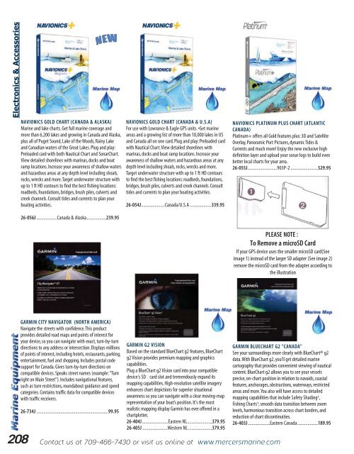
- Page 208 and 209: Electronics & Accessories Fits 1 1/
- Page 212 and 213: Electronics & Accessories GARMIN "S
- Page 214 and 215: Electronics & Accessories 7” GARM
- Page 216 and 217: Electronics & Accessories 3” 5”
- Page 218 and 219: Electronics & Accessories 1000 ft D
- Page 220 and 221: Electronics & Accessories 7” 9”
- Page 222 and 223: Electronics & Accessories 7” 3000
- Page 224 and 225: Electronics & Accessories 16 MILE R
- Page 226 and 227: Oars & Oarlocks WOODEN OARS Quality
- Page 228 and 229: Boat Trailer Acc. ROCKER ROLLER - R
- Page 230 and 231: Railing & Acc. 60 0 END BASES Polis
- Page 232 and 233: Marine Hardware DELUXE STAINLESS ST
- Page 234 and 235: Marine Hardware DANFORTH STYLE ANCH
- Page 236 and 237: Marine Hardware 234 QUICK LINKS 316
- Page 238 and 239: Marine Hardware PERKO RIM LOCK SET
- Page 240 and 241: Marine Hardware PERKO CUPBOARD CATC
- Page 242 and 243: Marine Hardware CONTINUOUS HINGES (
- Page 244 and 245: Dock Equipment & Acc. 9” 3 5/8”
- Page 246 and 247: Boat Care & Maintenance DEPRESSED C
- Page 248 and 249: Boat Care & Maintenance FIBERGLASS
- Page 250 and 251: Boat Care & Maintenance BOTTOMKOTE
- Page 252 and 253: Boat Care & Maintenance CETOL MARIN
- Page 254 and 255: Boat Care & Maintenance The keel of
- Page 256 and 257: Boat Care & Maintenance SIERRA TC-W
- Page 258 and 259: Boat Care & Maintenance PERMATEX®
- Page 260 and 261:
Boat Care & Maintenance FLAGSHIP PR
- Page 262 and 263:
Boat Care & Maintenance 3M LIGHT CU
- Page 264 and 265:
Boat Care & Maintenance MERCER’S
- Page 266 and 267:
Boat Care & Maintenance PERMATEX®
- Page 268 and 269:
Boat Care & Maintenance J.B. WELD "
- Page 270 and 271:
Boating Safety SKY-LITE DISTRESS SI
- Page 272 and 273:
Boating Safety BOAT ESSENTIALS KIT
- Page 274 and 275:
Boating Safety AQUALARM MONITORING
- Page 276 and 277:
Dry Suits MUSTANG SENTINEL SERIES B
- Page 278 and 279:
Immersion Suits OC8003 HR IC9002-02
- Page 280 and 281:
Floatation Products Mens Womens MUS
- Page 282 and 283:
Floatation Products M.I.T. 100 INFL
- Page 284 and 285:
Floatation Products INFLATABLE BELT
- Page 286 and 287:
Floatation Products Optional Insula
- Page 289 and 290:
NL favorite for Years Rainwear RANP
- Page 291 and 292:
ABBOTSFORD FOUL WEATHER SUITS FROM
- Page 293 and 294:
Rainwear INDUSTRIAL SLEEVES Tear re
- Page 295 and 296:
Rinsable Lining! GRUNDENS SHOREMAN
- Page 297 and 298:
Rainwear GRUNDENS WEATHER WATCH HOO
- Page 299 and 300:
Rainwear GRUNDENS BRIS 22 SLEEVES T
- Page 301 and 302:
Rainwear “COMFORT ZONE” SUITS 1
- Page 303 and 304:
Rainwear WAVERLY STORMSUIT (70620)
- Page 305 and 306:
Work Clothing HELLY HANSEN CHELSEA
- Page 307 and 308:
Work Clothing Prices are subject to
- Page 309 and 310:
76312 Parka - Regular - Navy Ord. N
- Page 311 and 312:
Work Clothing HELLY HANSEN PILE JAC
- Page 313 and 314:
Work Clothing “HEATFX” MERINO B
- Page 315 and 316:
Work Clothing LADIES 2 LAYER CREW S
- Page 317 and 318:
Work Clothing WENAAS THERMAL COVERA
- Page 319 and 320:
Work Clothing HELLY HANSEN 3-1 POTS
- Page 321 and 322:
Work Clothing PIONEER HI-VIZ 6 IN 1
- Page 323 and 324:
Work Clothing PIONEER "6-IN-1" BOMB
- Page 325 and 326:
Work Clothing HI-VIZ FLAME RESISTAN
- Page 327 and 328:
Work Clothing WORK KING 5 IN 1 LINE
- Page 329 and 330:
Pioneer Flame Resistant Clothing Al
- Page 331 and 332:
Helly Hansen Flame Resistant Clothi
- Page 333 and 334:
Work Clothing PIONEER FR QUILTED LO
- Page 335 and 336:
3M HALF-MASK FACEPIECE This Mask fr
- Page 337 and 338:
CAP MOUNT EARMUFF This lightweight
- Page 339 and 340:
Work Clothing PIONEER BIRDSEYE SAFE
- Page 341 and 342:
Big Al, Canadian Made Coveralls. 65
- Page 343 and 344:
Work Clothing Orange INSULATED COVE
- Page 345 and 346:
INSULATED Work Clothing KIDS INSULA
- Page 347 and 348:
65% Polyester / 35% Cotton, Quality
- Page 349 and 350:
Work Clothing BIG AL CARGO PANT MOD
- Page 351 and 352:
Work Clothing PLAID HOODED PILE JAC
- Page 353 and 354:
All Tough Duck garments are premium
- Page 356 and 357:
Camo Clothing 354 Contact us at 709
- Page 358 and 359:
Camo Clothing BACKWOODS “PREDATOR
- Page 360 and 361:
Camo Clothing BACKWOODS LADIES "HUN
- Page 362 and 363:
Camo Clothing BACKWOODS FLEX BACKPA
- Page 364 and 365:
Camo Clothing SPORTCHIEF CITATION J
- Page 366 and 367:
Camo Clothing SPORTCHIEF MENS BEAVE
- Page 368 and 369:
Tilley Hats LTM6 AIRFLO NYLAMTIUM H
- Page 370 and 371:
Hats & Bug Nets SKIPPER HATS Heavy
- Page 372 and 373:
Fur Hats SYNTHETIC FUR HAT Syntheti
- Page 374 and 375:
Canada Goose 5 -30 C + EXPEDITION P
- Page 376 and 377:
Canada Goose 4 -15/-25 C LANGFORD P
- Page 378 and 379:
Canada Goose 3 -10/-20 C 2 0 /-15 C
- Page 380 and 381:
Canada Goose Black Navy Graphite Li
- Page 382 and 383:
Canada Goose Black Red Admiral Blue
- Page 384 and 385:
Canada Goose Black 4 -15/-25 C Red
- Page 386 and 387:
Canada Goose 3 -10/-20 C LADIES SAV
- Page 388 and 389:
Canada Goose 3 -10/-20 C LADIES KIN
- Page 390:
Canada Goose LADIES BASKET STITCH H
- Page 393 and 394:
-25°C Quartz LADIES LAURENTIA JACK
- Page 395 and 396:
-25°C Quartz LADIES KIMBERLY JACKE
- Page 397 and 398:
COLD INSULATED RATING ICONS Insulat
- Page 399 and 400:
Shell Only Insulated Combo Shell On
- Page 401 and 402:
Shell Only Insulated Combo FXR Grey
- Page 403 and 404:
Black Black/Red Black/ Orange FXR B
- Page 405 and 406:
FXR Insulated Insulated HARDWEAR JA
- Page 407 and 408:
Shell Only FXR Insulated Combo LADI
- Page 409 and 410:
Insulated FXR Wineberry/White Black
- Page 411 and 412:
FXR Insulated Black/Wineberry Black
- Page 413 and 414:
FXR Insulated CHILD/YOUTH SQUADRON
- Page 415 and 416:
FXR Insulated CHILD/YOUTH FRESH JAC
- Page 417 and 418:
FXR Insulated CHILD/YOUTH CLUTCH JA
- Page 419 and 420:
FXR Black Red Yellow Cyan COLD STOP
- Page 421 and 422:
FXR MEN’S FUEL GLOVE Thinsulate 3
- Page 423 and 424:
Black/Orange FXR Black/Hot Pink Whi
- Page 425 and 426:
FXR RIDE PACK Suspension System For
- Page 427 and 428:
FXR FXR TORQUE X RECOIL HELMET Toug
- Page 429 and 430:
FXR MISSION RECON GOGGLES New 4 den
- Page 431 and 432:
Klim Klimate Parka & Pant - Insulat
- Page 433 and 434:
Klim Kaos Parka & Pant - Insulated
- Page 435 and 436:
Klim Tomahawk Parka - Non-Insulated
- Page 437 and 438:
Klim Ladies Jackson Parka & Bib Pan
- Page 439 and 440:
Klim Yukon Pullover - Mid Layer The
- Page 441 and 442:
Klim PowerXross Glove The KLIM® Po
- Page 443 and 444:
Klim Ridge Beanie One size fits mos
- Page 445 and 446:
Klim KLIM F3 Helmet KLIM 's F3 Off-
- Page 447 and 448:
Klim Krew Pak Large main compartmen
- Page 449 and 450:
Black 13-30650J....................
- Page 451 and 452:
Divas Zip off Upper Bib, Converts t
- Page 453 and 454:
Mitts & Gloves Navy Red Rose Black
- Page 455 and 456:
Mitts & Gloves SNOWMOBILE MITT MODE
- Page 457 and 458:
Hats,Gloves & Socks BRIGGS & LITTLE
- Page 460 and 461:
458 Contact us at 709-466-7430 or v
- Page 462 and 463:
Kneeboots ESR -50 O C PUROFORT THER
- Page 464 and 465:
Kneeboots -50 O C -40 O C BEKINA TH
- Page 466 and 467:
Kneeboots -50 O C -50 O C BAFFIN IC
- Page 468 and 469:
Kneeboots Kneeboots MEN’S BAFFIN
- Page 470 and 471:
Winter Safety -30 O C Non-Metallic
- Page 472 and 473:
Workboots & Shoes METAL-FREE TERRA
- Page 474 and 475:
Workboots & Shoes CAT CONTROL 8”
- Page 476 and 477:
Workboots & Shoes STC "DUNCAN" WORK
- Page 478 and 479:
Workboots & Shoes TIMBERLAND 8” B
- Page 480 and 481:
Workboots & Shoes 478 Contact us at
- Page 482 and 483:
Workboots & Shoes MENS “THUNDER
- Page 484 and 485:
Workboots & Shoes KODIAK BLUE MONST
- Page 486 and 487:
Workboots & Shoes Also Available in
- Page 488 and 489:
Workboots & Shoes TIMBERLAND PRO PO
- Page 490 and 491:
Workboots & Shoes JB GOODHUE "CYCLO
- Page 492 and 493:
Blundstone 490 Contact us at 709-46
- Page 494 and 495:
Winter Snow Boots POLAR SERIES Baff
- Page 496 and 497:
Winter Snow Boots -20 O C -30 O C M
- Page 498 and 499:
Winter Snow Boots -20 O C -20 O C W
- Page 500 and 501:
Winter Snow Boots LADIES DRIFT SERI
- Page 502 and 503:
Winter Snow Boots -30 O C KIDS EASE
- Page 504 and 505:
Hunting Boots BAFFIN “AMBUSH” 1
- Page 506 and 507:
Hunting Boots MEN’S 13 1/2” PRA
- Page 508 and 509:
Muck Boots -50 O C -50 O C -40 O C
- Page 510 and 511:
Muck Boots MUCK LADIES “ARCTIC AD
- Page 512 and 513:
Waders & Acc. Comes with Removable
- Page 514 and 515:
Waders & Acc. STREAMSIDE GUARDIAN B
- Page 516 and 517:
Bogs -40 O C MENS CLASSIC ULTRA HIG
- Page 518 and 519:
Liners,Insoles & Socks TERRA DELUXE
- Page 521 and 522:
Backpacks COOLER BAGS Insulated coo
- Page 523 and 524:
Backpacks STEALTH 35 TECHNICAL DAYP
- Page 525 and 526:
STAINLESS STEEL WIRE Supplied in 1
- Page 527 and 528:
--42 C 0 -43 F 0 Specifications Out
- Page 529 and 530:
-50°F / -45°C Use it 3 ways: 1.4-
- Page 531 and 532:
Medical Kits AMK DAY TRIPPER MEDICA
- Page 533 and 534:
“Mug-Up Time” Camping Acc. Tin
- Page 535 and 536:
RIDGELINE STAINLESS STEEL DUO COOKS
- Page 537 and 538:
Camping Acc. LONG BURN EMERGENCY CA
- Page 539 and 540:
Camping Acc. TELESCOPING FORK Chrom
- Page 541 and 542:
Camping Acc. FIRE STICKS (PK. OF 12
- Page 543 and 544:
Actual Size Camping Acc. COGHLANS "
- Page 545 and 546:
Camping Acc. LARGE BINER CARRY HAND
- Page 547 and 548:
Great for Snowmobilers Camping Acc.
- Page 549 and 550:
Snowshoes GV MENS SNOW AEROLITE SNO
- Page 551 and 552:
GARANT AXES Great new line of axes.
- Page 553 and 554:
RATCHET PULLER Steel construction.
- Page 556 and 557:
Housewares GREAT PRODUCT! USE ONLY
- Page 558 and 559:
Housewares CUISINART ICE CREAM MAKE
- Page 560 and 561:
Housewares BLACK OIL CAST IRON FRYI
- Page 562 and 563:
Housewares STAINLESS KETTLES 70-016
- Page 564 and 565:
Housewares BAGUETTE PAN Non-stick.
- Page 566 and 567:
Housewares PUDDING BAGS 70-2403K ..
- Page 568 and 569:
Fabric & Acc. ZIPPERS “Costumaker
- Page 570 and 571:
Locally Made Here at Mercer’s, we
- Page 572 and 573:
Index A Absorbents Oil Spill ......
- Page 574 and 575:
Index H Hairnets & Beard ..........
- Page 576 and 577:
Index V.H.F. (Handheld) ...........
- Page 578:
Index 576 Contact us at 709-466-743