DESIGNING TERRITORIAL METABOLISM
978-3-86859-489-8 https://www.jovis.de/de/buecher/product/designing_territorial_metabolism.html
978-3-86859-489-8
https://www.jovis.de/de/buecher/product/designing_territorial_metabolism.html

Create successful ePaper yourself
Turn your PDF publications into a flip-book with our unique Google optimized e-Paper software.
170 RESEARCH BY DESIGN<br />
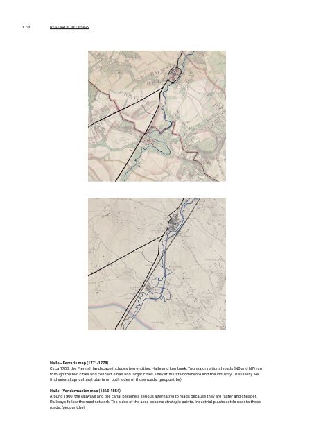
Halle - Ferraris map (1771-1778)<br />
Circa 1700, the Flemish landscape includes two entities: Halle and Lembeek. Two major national roads (N6 and N7) run<br />
through the two cities and connect small and larger cities. They stimulate commerce and the industry. This is why we<br />
find several agricultural plants on both sides of those roads. (geopunt.be)<br />
Halle - Vandermaelen map (1846-1854)<br />
Around 1900, the railways and the canal become a serious alternative to roads because they are faster and cheaper.<br />
Railways follow the road network. The sides of the axes become strategic points. Industrial plants settle near to those<br />
roads. (geopunt.be)