

Archeomatica International 2017
Special supplement to Archeomatica 3 2017
Special supplement to Archeomatica 3 2017

You also want an ePaper? Increase the reach of your titles
YUMPU automatically turns print PDFs into web optimized ePapers that Google loves.
Quarterly Magazine, Volume VIII<br />
Issue 3 Special Supplement<br />
DECEMBER <strong>2017</strong><br />
ArcheomaticA<br />
Cultural Heritage Technologies<br />
i n t e r n a t i o n a l<br />
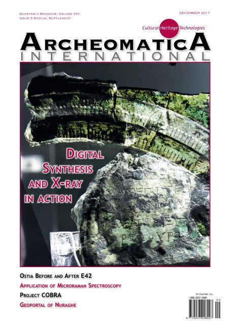
Digital<br />
Synthesis<br />
and X-ray<br />
in action<br />
Ostia Before and After E42<br />
Application of Microraman Spectroscopy<br />
Project COBRA<br />
Geoportal of Nuraghe<br />
Ar cheomat i ca<br />
I SSN 2037- 2485<br />
0 0<br />
9 772037 248007
EDITORIAL<br />
<strong>Archeomatica</strong> <strong>International</strong> second time<br />
It’s a pleasure to announce the digital publication of the second special issue of <strong>Archeomatica</strong><br />
<strong>International</strong>. In this number we host a variety of articles dedicated to many fields of the scientific<br />
research: the new findings from Antikythera Mechanism front plate astronomical dial and its reconstruction,<br />
the COBRA Project: a successful technology transfer and scientific divulgation method, the<br />
Nurnet Geoportal, Aerial Ostia - before and after E42 and Application of micro-Raman spectroscopy for<br />
conservation projects in art and archaeology with a case study on Cappadocia rock-hewn wall paintings.<br />
Aristeidis Voulgaris, Andreas Vossinakis and Christophoros Mouratidis present their latest “findings” about<br />
the Antikythera Mechanism and the state-of-the-art of their investigations developed on this mechanism.<br />
In particular, the authors investigated the astronomical calendar-dial display of the Antikythera Mechanism<br />
Front Plate. The ancient prototype has been analysed through special photographs which provided new<br />
information on the functioning mechanism of the front dial. The authors conclude that the users of the<br />
device were able to easily perform astronomical calculations.<br />
Beatrice Calosso and Roberta Fantoni describes the CO.B.RA Project: an Italian project developed for the<br />
dissemination of methods, technologies and advanced tools for the Cultural Heritage conservation, which<br />
has been implemented by the divisions of the Agenzia nazionale per le nuove tecnologie, l’energia e lo<br />
sviluppo economico sostenibile (ENEA). The main goal of the project is the dissemination and transfer to<br />
SMEs (operating in the cultural heritage sector) of the ENEA skills and Research Center Laboratories tools.<br />
The Geoportal Nurnet is an open access webGIS dedicated to the Bronze Age Culture in Sardinia.<br />
The authors Valentina Spanu, Eva Barbara Lorrai, Laura Muscas e Roberto Demontis describes the<br />
potentiality of the geoportal to promote the Pre-Nuragic and Nuragic civilizations, which also provide a<br />
large variety of geo-information for the study of this civilizations.<br />
Developed and released in 2014 by the Center for Advanced Studies, Research and Development in Sardinia<br />
(CRS4) and the Nurnet Fondation, the Geoportal represent one of the first initiative of this type on the<br />
Nuraghe’s field.<br />
Massimiliano David, Gian Piero Milani and Roberto Cassanelli analyse the evolution of the archaeological<br />
area of Ostia from the aerial photography: fifteen photos coming from the archive of the Aerofototeca<br />
Nazionale, which cover a time range from 1911 to 1983, have been studied within the Ostia Marine<br />
Project, an archaeological mission of the University of Bologna active on the field since ten years.<br />
The last article describes an overview of the applications of micro-Raman spectroscopy for cultural<br />
heritage, with a special eye on the case study of rock-hewn wall paintings in Cappadocia (Turkey),<br />
presented as exemplificative of application of Raman techniques for the knowledge of the materials, it’s<br />
conservation and for the identification of degradation processes.<br />
<strong>Archeomatica</strong> is actually recorded in many databases, as the ISI Web of Science and the DOAJ directory of<br />
open access journal. Published quarterly in the Italian version with an <strong>International</strong> special issue published<br />
every year in English language, is actually the reference journal for the dissemination of technologies<br />
applied to cultural heritage to readers, not only scientist, but belonging to all the professional,<br />
institutional and academic field devoted to fruition, valorisation and conservation of cultural heritage.<br />
Renzo Carlucci<br />
dir@archeomatica.it
SUMMARY<br />
REVELATIONS<br />
6 The new findings from<br />
Antikythera mechanism front<br />
plate astronomical dial and its<br />
reconstruction<br />
by Aristeidis Voulgaris, Andreas Vossinakis,<br />
Christophoros Mouratidis<br />
In the cover a representation by a digital synthesis<br />
of the Egyptian calendar ring mechanism<br />
with the front plate astronomical dial<br />
found in Antikythera.<br />
3D Target 2<br />
Cultour Active 25<br />
Geogrà 42<br />
Heritage 46<br />
Salone del Restauro 48<br />
Testo 19<br />
Topcon 47<br />
26 NURNET – GEOPORTAL<br />
by Valentina Spanu, Eva Barbara<br />
DOCUMENTATION<br />
20 COBRA Project: a<br />
successful technology<br />
transfer and scientific<br />
divulgation method<br />
ENEA opens its labs to<br />
improve cooperation with<br />
SMEs and CH Institution<br />
by Beatrice Calosso, Roberta Fantoni<br />
Lorrai, Laura Muscas, Roberto<br />
Demontis<br />
ArcheomaticA<br />
CULTURAL HERITAGE Technologies<br />
Quarterly Magazine, Volume VIII - Issue<br />
3 Special Supplement December <strong>2017</strong><br />
<strong>Archeomatica</strong>, quarterly published since 2009, is the first Italian<br />
magazine for dissemination, promotion and exchange of<br />
knowledge on technologies for the preservation, enhancement<br />
and enjoyment of cultural heritage. Publishing about technologies<br />
for survey and documentation, analysis and diagnosis,<br />
restoration and maintenance, museums and archaeological<br />
parks, social networking and "smart" peripherals. As a reference<br />
point in the field is the sharing media for the industry, the<br />
professionals, the institutions, the academia, including research<br />
institutions and government agencies.<br />
Editor-in-Chief<br />
Renzo Carlucci<br />
dir@archeomatica.it<br />
Managing Editor<br />
Michele Fasolo<br />
michele.fasolo@archeomatica.it<br />
Editorial Board<br />
Maurizio Forte, Bernard Frischer<br />
Giovanni Ettore Gigante, Sandro Massa,<br />
Maura Medri, Mario Micheli,<br />
Francesco Prosperetti, Marco Ramazzotti,<br />
Antonino Saggio, Francesca Salvemini<br />
Editors<br />
redazione@archeomatica.it<br />
Giovanna Castelli<br />
giovanna.castelli@archeomatica.it<br />
Elena Latini<br />
elena.latini@archeomatica.it<br />
Valerio Carlucci<br />
valerio.carlucci@archeomatica.it<br />
Daniele Pipitone<br />
daniele.pipitone@archeomatica.it<br />
Domenico Santarsiero<br />
domenico.santarsiero@archeomatica.it<br />
Luca Papi<br />
luca.papi@archeomatica.it
30 Aerial Ostia.<br />
Before and After E42<br />
by Massimiliano David, Gian Piero<br />
Milani, Roberto Cassanelli<br />
36 COMPANIES AND<br />
PRODUCTS<br />
State-of-the-Art Solutions<br />
44 AGORÀ<br />
News from the world of<br />
Technologies for Cultural<br />
Heritage<br />
RESTORATION<br />
38 Application of micro-Raman spectroscopy for<br />
conservation projects in art and archaeology with a<br />
case study on Cappadocia rock-hewn wall paintings<br />
46 EVENTS<br />
by Pietro Baraldi, Cecilia Baraldi, Claudia Pelosi<br />
Follow us on:<br />
twitter.com/archeomatica<br />
Follow us on:<br />
Facebook.com/archeomatica<br />
a publication<br />
Science & Technology Communication<br />
Science & Technology Communication<br />
Marketing<br />
Alfonso Quaglione<br />
a.quaglione@archeomatica.it<br />
Graphic Design<br />
Daniele Carlucci<br />
daniele@archeomatica.it<br />
Subscriptions<br />
Tatiana Iasillo<br />
diffusione@archeomatica.it<br />
MediaGEO soc. coop.<br />
Via Palestro, 95<br />
00185 Roma, ITALY<br />
Phone +39 06 6227 9612<br />
Fax +39 06 6220 9510<br />
www.archeomatica.it<br />
Publisher<br />
MediaGEO soc. coop.<br />
<strong>Archeomatica</strong> è una testata registrata al<br />
Tribunale di Roma con il numero 395/2009<br />
del 19 novembre 2009<br />
ISSN 2037-2485<br />
Printed by<br />
SPADAMEDIA S.r.l.<br />
Viale del Lavoro 31 - 0043 Ciampino (Roma)<br />
Signed articles engages only the<br />
responsibility of the author. It is forbidden<br />
partial reproduction of the contents of<br />
this journal in any form and by any means,<br />
electronic or mechanical, including data storage<br />
systems and download, without any written<br />
permission.
REVELATIONS<br />
The new findings from Antikythera<br />
mechanism front plate astronomical<br />
dial and its reconstruction<br />
by Aristeidis Voulgaris, Andreas Vossinakis, Christophoros Mouratidis<br />
Fig. 1 - Extreme<br />
‘’depth of field’’<br />
images, of the<br />
back face of Fragment<br />
C. The fossilized<br />
Lunar Disc<br />
on the back face<br />
of the front plate<br />
is clearly detectable.<br />
Credits:<br />
National Archaeological<br />
Museum,<br />
Athens.<br />
A. Voulgaris - Copyright<br />
© Hellenic<br />
Ministry of Culture<br />
& Sports/Archaeological<br />
Receipts<br />
Fund.<br />
This paper refers to the investigation of<br />
the Zodiac scale and the Egyptian calendar<br />
ring of the Antikythera Mechanism front<br />
plate, based on the known surviving<br />
fragments of the Mechanism, mainly of<br />
Fragment C (National Archaeological<br />
Museum, Athens, inventory number<br />
X.15087). Fragment C is the preserved<br />
part of the front plate of the Antikythera<br />
Mechanism, located in front and above the<br />
large gear b1. Until now, only a portion<br />
and other isolated smaller fragments of<br />
the front plate survive.<br />
The front plate dial was the cadran of the Annual and<br />
the Astronomical – calendar of the Mechanism. The<br />
manufacturer engraved on the front plate the information<br />
about the recurring events of every year on the<br />
Egyptian calendar ring and the Zodiac scale. During its revolution<br />
(1 turn/year), the pointer of the Golden Sphere<br />
- Sun (Gnomonion) pointed on the Egyptian Calendar ring,<br />
traversing the 12 months with 365 subdivisions and simultaneously<br />
the 12 zodiac constellations, engraved in arcs<br />
with subdivisions around the inside ring, just next to the<br />
Egyptian ring. The pointer - Gnomonion of the Sun – Golden<br />
Sphere (a bronze sphere with a pointer, which was possibly<br />
placed close to the perimeter of the annual gear b1) (Voulgaris<br />
et al 2018), as it traversed the two rings, informed the<br />
user about the position of the Sun on the sky, (on Zodiac<br />
Constellation), during the corresponding Egyptian month<br />
and day.<br />
Ophthalmoscopic examination of Fragment C shows that<br />
the front plate had a large hole in the center (Bitsakis and<br />
Jones 2016). Two plates with engraved inscriptions of the<br />
parapegma were on the top and on the bottom of the front<br />
plate of the Mechanism (Anastasiou et al 2013; Freeth and<br />
Jones 2016; Bitsakis and Jones 2016). In Fragment C, an<br />
6 ArcheomaticA <strong>International</strong> Special Issue
Cultural heritage Technologies 7<br />
Fig. 2 - In the Isogeometrical-Multilayer<br />
Image, are presented parts of the front<br />
and rear faces of Fragment C. On the<br />
left of the image are clearly seen the<br />
two dial rings and on the right, the<br />
Bearing Base ring. It is evident that only<br />
the half width of the Egyptian calendar<br />
ring is supported on the Bearing Base<br />
ring. Close to the ‘’Moon Sphere’’ the<br />
only one preserved staple is detected.<br />
Right above is clearly seen the sliding<br />
catch. Credits: Copyright © Hellenic<br />
Ministry of Culture & Sports/Archaeological<br />
Receipts Fund, A. Voulgaris<br />
almost well preserved part of the parapegma inscriptions,<br />
is situated fossilized in front of the surviving dial rings and<br />
the Lunar Disc (Ptolemy; Wright 2012 notes; Carman and Di<br />
Cocco 2016). On the back side of Fragment C, lies the Lunar<br />
Disc, also fossilized (Fig.1), which was at the center of the<br />
mechanism before the ancient artifact was destroyed. By<br />
hand rotating the Lunar Disk (Voulgaris et al 2018), the user<br />
was also informed about the phases of the Moon, looking at<br />
the Moon Phases Sphere.<br />
DATA MINING<br />
Critical and determinant for our investigation, was the design<br />
and construction by A. Voulgaris of an optomechanical<br />
device with a modified camera lens, mounted on a micro<br />
moving x-y-z axes for tilting and aiming of the lens. This<br />
setup is capable to capture images of the fragments with<br />
extremely different position angles up to 83˚, eliminating<br />
the defocusing problem arising from the limited depth of<br />
field, which is strongly detected in conventional-non modified<br />
camera lenses (Fig. 1, 4, 5).<br />
We also captured high resolution – ‘’isogeometrical’’ images<br />
of the front and rear faces of Fragment C. We named our<br />
images ‘’isogeometrical’’ because the capturing was done<br />
with the same optical system, in almost the same distance<br />
and perpendicularity from the well detected center of the<br />
fragment, so the parallax is the same and totally minimized<br />
on all of the images. So the images of the front and the rear<br />
faces are all of about the same scale and orientation. After<br />
the digitally processing (mirror invert in y axis) by the one<br />
the two images, we adding together and we constructed<br />
the Master Isogeometrical, Multilayered - high resolution<br />
– (visual) Image (Fig. 1,5). Then we added some of the corresponding<br />
AMRP X-ray tomographies (Figures 3,7). The very<br />
accurate-precise aligning of the set of these images was<br />
achieved by aligning on some distinctive - sharp areas of the<br />
boundaries of the fragment and especially the side to side<br />
mechanical (perpendicular on the plate) holes and other<br />
formations, avoiding aligning on the random cracks of the<br />
material or deformed areas. Therefore the Master Isogeometrical<br />
Multilayer Image offers the simultaneous selective<br />
observations of the front and rear areas of Fragment C.<br />
After the digital processing, some very important new data<br />
about the design, the construction of the astronomical dial<br />
of the front plate, the handling and the using of the Mechanism<br />
were detected. Also some crucial differences from the<br />
published bibliography about the design and the role of the<br />
front plate dial have resulted.<br />
THE DESIGN OF THE ANTIKYTHERA<br />
MECHANISM FRONT PLATE DIAL<br />
The information about the annual astronomical events was<br />
engraved in the front plate of the Antikythera Mechanism<br />
(parapegma) and also in the two concentric rings: the<br />
Egyptian months ring and the Zodiac Constellations ring.<br />
The front plate of the Antikythera Mechanism was divided<br />
into three separate sections: the two Rectangular Sections,<br />
where the star events of the parapegma were inscribed<br />
Fig. 3 - The Multilayer<br />
Isogeometrical<br />
Image of<br />
the Fragment C, in<br />
combination with<br />
corresponding (multi<br />
combined) CT of<br />
the AMRP. On the<br />
left it is detectable<br />
the stabilizer of the<br />
Egyptian calendar<br />
ring (front face) and<br />
the position of the<br />
staple (rear face).<br />
On the right are<br />
presented the form<br />
of the stabilizer.<br />
Credits: Copyright<br />
© Hellenic Ministry<br />
of Culture & Sports/<br />
Archaeological<br />
Receipts Fund, A.<br />
Voulgaris-©AMRP.
Fig. 4 - Extreme<br />
‘’depth of field’’<br />
image, shows the<br />
two rings which<br />
are located in the<br />
same level with<br />
the Middle Section<br />
of the front plate.<br />
Credits: National<br />
Archaeological<br />
Museum, Athens,<br />
A. Voulgaris. Copyright<br />
© Hellenic<br />
Ministry of Culture<br />
& Sports/Archaeological<br />
Receipts<br />
Fund.<br />
Fig. 5 - On the top<br />
left: the Fragment<br />
C image with extreme<br />
depth field<br />
of view. The equal<br />
level of the two<br />
dial rings is shown<br />
and the rear stopper<br />
with a central<br />
hole. On the right:<br />
AMRP X-ray tomography<br />
in sideways<br />
direction. Bottom<br />
left: the stopper<br />
position compared<br />
to the boundaries<br />
of the two dial<br />
rings.<br />
Credits: National<br />
Archaeological Museum,<br />
Athens, A.<br />
Voulgaris.<br />
Copyright © Hellenic<br />
Ministry of<br />
Culture & Sports/<br />
Archaeological<br />
Receipts Fund and<br />
©AMRP.<br />
8 ArcheomaticA <strong>International</strong> Special Issue
Cultural heritage Technologies 9<br />
Fig. 6 - Left: A clock cadran digital composition<br />
of eleven frames on time 30s-31s, 35s-<br />
36s, 40s-41s, 45s-46s, 50s-51s and 55s. The<br />
pointer of the seconds it is not in the correct<br />
aligning in relation of the 6 th , 7 th , 8 th and 9 th<br />
subdivision of the cadran, because the lack<br />
of the calibration. The clock cadran needs an<br />
offset CCW rotation about 1.5˚, so the distinct<br />
positions of the pointer of the seconds to be<br />
aligned with the corresponding subdivisions.<br />
Right: On the ‘’24 hours clock’’, the two<br />
pointers are in opposite ‘’line’’ direction (i.e.<br />
12 o clock), but the clock cadran needs an<br />
offset CCW rotation about 6˚, so the positions<br />
of the two pointers to be aligned with the corresponding<br />
subdivisions (24 th and 12 th ).<br />
A. Voulgaris Collection.<br />
(Anastasiou et al 2013; Freeth and Jones 2016; Bitsakis and<br />
Jones 2016) and the almost square Middle Section, with the<br />
central hole (Bitsakis and Jones 2016; Wright 2012). Around<br />
the central hole of the Middle Section, the Egyptian calendar<br />
and the Zodiac Constellations were engraved in circular<br />
distribution. As shown in Fig.2, from the Master Isogeometrical<br />
Multilayer Image of Fragment C, three totally<br />
independent rings surround the central hole of the Middle<br />
Section:<br />
The Bearing-Base ring (Wright shows this as not in dependent<br />
from the Middle Section and present this as a sink digged<br />
on the Middle Section, (Video presentation at 50:55’’<br />
and 50:58’’).<br />
b) The inlaid Egyptian calendar ring<br />
c) The Zodiac Constellations ring (totally independent),<br />
(Wright shows in https://www.youtube.com/<br />
watch?v=cSh551cdIEY at 50:55’’ and 50:58’’and also Bitsakis<br />
and Jones (2016) and Jones (<strong>2017</strong>) refer to this, as a not independent<br />
part from the Middle Section, i.e. a ‘’solid body’’<br />
with the Middle Section).<br />
The detection from CTs that the Zodiac Constellations Ring<br />
and the Bearing Base ring is an independent ring, it is not<br />
easy, because of strong fossilization, which transformed the<br />
rings as ‘’one body’’ with the Middle Section. The Bearing-<br />
Base ring is stabilized to the almost square Middle Section<br />
by staples, from which only one from the four survives<br />
(Fig.2). As detected from the Master Isogeometrical Multilayer<br />
Image and the composition of the corresponding CT<br />
by the AMRP, this staple is the rear edge of (one of the four,<br />
preserved and detected in CTs (Bitsakis and Jones 2016)<br />
peripheral stabilizers of the Egyptian calendar ring Fig.3.<br />
These stabilizers prevent the Egyptian Calendar ring from<br />
falling outside.<br />
In X-ray CT scans, out of a possible total of 365 holes, 87<br />
Fig. 7 - A digital synthesis of front face of the Fragment C with the corresponding X-ray CT by AMRP. The preserved ‘’day’’ holes of the Bearing-Base ring are<br />
located between the subdivisions of the Egyptian calendar ring. Credits: Copyright © Hellenic Ministry of Culture & Sports/Archaeo logical Receipts Fund, A.<br />
Voulgaris - and © AMRP
have been detected on the Bearing-Base ring with diameter<br />
0.7mm - 0.8mm (Wright 2012; Evans et al 2010). These holes<br />
well drilled by the manufacturer in a circular allocation on<br />
the Bearing-Base ring with excellent accuracy (Fig.7).<br />
Some of these holes were also detected in our visual photographs<br />
of Fragment C, with the help of the X-ray images.<br />
From our photographs with extremely sideways capture<br />
angle, it is evident that the Zodiac Constellation and the<br />
Egyptian calendar rings are on the same level with the<br />
Middle Section of the front plate Fig.4 (Wright Video presentation;<br />
Bitsakis and Jones 2016; Jones <strong>2017</strong>). About half<br />
of the width of the Egyptian calendar ring is positioned on<br />
the half of the width of the Bearing-Base ring Fig.7, while<br />
the Zodiac Constellations ring does not have any contact<br />
with the Bearing-Base ring. It is of course mandatory that<br />
the Zodiac Constellations ring is somehow supported.<br />
In Fig.5 behind the two rings, just at their contact boundaries,<br />
a formation is detected, which seems it could well be<br />
one of four (or three) rear stops. This elongated formationstopper<br />
has a cylindrical perforated cross section and it is<br />
curved following the circular boundaries between the contacts<br />
of the two rings. This formation could be stuck (soldered?)<br />
on the rear face of the Zodiac Constellations ring (or<br />
on the Egyptian calendar ring, but it is not easily evident<br />
from the tomographies), preventing this ring from falling<br />
outside (or inside). We also assume that of 3 or 4 stops acting<br />
also as little pointers (needles), stuck on the front side<br />
of the Zodiac Constellations ring (or on Egyptian calendar<br />
ring) were necessary to prevent this ring from falling inside<br />
(outside). These totally necessary front and back stops placed<br />
the Zodiac Constellations ring on the same level with<br />
the Egyptian calendar ring and allowed its free rotation.<br />
The free - independent rotation of the Zodiac Constellations<br />
ring, offers the ability of the very precisely aiming<br />
and calibration of the ring, in relation to the positions of<br />
the Golden Sphere- Sun pointer and the Lunar Disc pointer<br />
(see chap…..). It also offers the ability of correction of the<br />
Callippic calendar which requires the subtraction of one day<br />
every four Metonic cycles (Theodosiou and Danezis 1995;<br />
Freeth et al 2008): after four Metonic cycles, the user can<br />
rotate the independent Zodiac Constellation Ring CCW by<br />
one subdivision (one day). A similar ability can be detected<br />
on the clocks cadran: after the assembling of a clock, it is<br />
possible that the pointer of the seconds does not coincide<br />
exactly with the clock’s cadran subdivisions (usually 1 subdivision/5<br />
sec-min) (Fig.6). The clock maker must calibrate<br />
the clock: he can rotate the clock cadran CW or CCW to<br />
achieve the absolute coincidence of the pointer of seconds<br />
with the subdivisions of the cadran.<br />
The three rings of the front plate of the Mechanism, had<br />
engraved measuring scales with subdivisions or holes, so it<br />
is logical to assume that they were sequentially made by<br />
dividing, engraving, drilling machines (Voulgaris et al <strong>2017</strong>;<br />
Irby 2016). According to our precise measurements about<br />
the drilling process of these holes, the dividing error must<br />
be ˂ 0.3˚ to avoid overlapping of the holes. Even today the<br />
dividing and drilling of 365 holes with a diameter of 0.8mm<br />
with mechanical conventional tools, is an arduous work<br />
and requires extreme accuracy and attention. The FRAMe<br />
Project team designed and constructed the conventional<br />
cutting-dividing-drilling machine for the Bearing-Base ring<br />
and studied the procedure and the duration of the drilling<br />
on the Bearing Base ring.<br />
The central section of the front plate was secured with four<br />
sliding caches (Wright 2012; Bitsakis and Jones 2016), of<br />
which only one is preserved. The sliding pin was secured on<br />
the rear face of the two rectangular parts of the parapegma<br />
(upper and bottom). In Rehm’s photograph of Fragment A,<br />
Fig. 8 - Digital reconstruction of the Middle Section (AMRP radiography) of<br />
Fragment C, in relative scale of Rehm’s image of the Fragment a (Bayerische<br />
Staats bibliothek Rehmiana III/9). In Rem’s image we also added digitally<br />
the (lost) wooden outline on the right part. From this reconstruction it is<br />
obvious that the Middle Section is not supported on the lower part of the<br />
wooden outline and supported on the left-right wooden outline. On the<br />
lower part of the wooden outline is supported the parapegma rectangular<br />
plates.<br />
taken on 1904/5 (Rehm 1906), some preserved wooden linear<br />
formations, in vertical and horizontal positions (a part<br />
of wooden outline there is Fragment F via radiography of<br />
AMRP) (Fig.8) (Wright 2012). Based on the preserved Fragment<br />
C photographs and CTs, we digitally reconstructed<br />
the possible view of the Middle Section of the ancient prototype<br />
Fig.8. In this digital reconstruction, we also added<br />
Rehm’s reconstructed photograph of Fragment A. In Figure<br />
8 it seems that the vertical fossilized wood acts as a bearing<br />
spacer between the Front Middle Section and the Medium<br />
plate. The lower boundaries of the Middle Section plate are<br />
not matching with the wooden horizontal outline formation.<br />
The horizontal wooden outline formation acted as a bearing<br />
spacer of the lower Rectangular Section (parapegma).<br />
By measuring the dimensions of the preserved deformed,<br />
distorted and incomplete parts of the Mechanism, the possible<br />
true dimensions of the Front Plate of the Mechanism<br />
(including the partially preserved wooden outline, as detected<br />
from the radiographies of the Fragment B) were at<br />
least 200mm X 330mm. In our functional models we chose<br />
the ratio of the sides equal to the golden ratio φ=1.618,<br />
which was used by ancient designers, sculptors, mathematicians<br />
and applied in a lot of constructions in ancient Greece<br />
(Hambidge 1924; Euclid).<br />
THE EGYPTIAN CALENDAR RING<br />
The inlaid freely rotating ring represented the Egyptian<br />
months ΘΩΘ (Thoth), ΦΑΟΦΙ (Phaophi), ΑΘΥΡ (Athyr),<br />
ΧΟΙΑΚ (Hoiak), ΤΥΒΙ (Tybi), ΜΕΧΙΡ (Mechir), ΦΑΜΕΝΩΘ<br />
(Phamenoth), ΦΑΡΜΟΥΘΙ (Pharmouthi), ΠΑΧΩΝ (Pachon),<br />
ΠΑΥΝΙ (Payni), ΕΠΙΦΙ (Epiphi), ΜΕΣΟΡΙ (Mesori) of 30<br />
subdivisions each (days) and 5 induced (epagomenai) days.<br />
According Figure 2 the Egyptian calendar ring was adapted<br />
onto the Bearing Base ring (see the previous chapter)<br />
10 ArcheomaticA <strong>International</strong> Special Issue
Cultural heritage Technologies 11<br />
and was held in place by four peripheral stabilizers (Bitsakis<br />
and Jones 2016). Setting the disc in a given position, the<br />
fixation was probably done by inserting one (or two) pins,<br />
applied in one (or two opposing) of the 365 peripheral holes<br />
of the Bearing-Base ring (Wright 2012). The user removed<br />
the pins every four years or 53.4 full rotations of the Lunar<br />
Disc (sidereal months), rotated the Egyptian calendar ring<br />
anticlockwise by one hole and placed the pins back, thus accounting<br />
for the slide of the Egyptian calendar ring relative<br />
to the solar year.<br />
The Egyptian calendar had 365 days per year and did not<br />
account for a correction over the actual duration of 365.25<br />
days. This meant that it preceded the actual year by one<br />
day, every four years or 6 months in 720 years and essentially<br />
the seasons and the risings and settings of the stars<br />
did not occur in the same Egyptian date overtime. Every<br />
1460 years, namely during a Sothic Cycle (Theodosiou and<br />
Danezis 1995) or Canicular Period (Murray 1828), the Egyptian<br />
calendar would return to its original starting position.<br />
The Sothic Cycle began with 1 st Thoth (the first month of<br />
the Egyptian calendar) at the first day of the morning rising<br />
of Sirius. Censorinus and Theon of Alexandria report that<br />
on July 19, 139 AD (Theodosiou and Danezis 1995), a new<br />
Sothic Cycle began on the morning rising of Sirius (when the<br />
Sun was at 24 th day in the constellation of Cancer). The start<br />
of the previous Sothic Cycle was on July 9, 1321 BC (according<br />
to the Starry Night planetarium software program),<br />
when Menefres Ramsey I or one of his successors, Seti II or<br />
Meneftha II, was the pharaoh of Egypt.<br />
The gap between 139 AD and 150 BC (an hypotethical date of<br />
construction of the Mechanism), is 289 years. So, 1 st Thoth<br />
of 150 BC should point at the third subdivision of the month<br />
‘’Χηλαί’’ (Libra). By examining the surviving fossilized Egyptian<br />
calendar ring and the Zodiac Constellations scale ring<br />
of the Fragment C, 1 st Payni points to 18 th subdivision (day,<br />
see next chapter 2.3) of Libra and this correlation happened<br />
on 569 BC (see also Price 1974).<br />
The position of the Egyptian calendar ring does not affect<br />
and is not related with the measurement system of the Mechanism,<br />
the pointers or with the gears. Its role is ‘’more<br />
passive’’ and its position depended entirely from the other<br />
scales-calendars.<br />
As described below, the Mechanism was constructed so it<br />
could be readily used at any given date and year and it is<br />
possible that it was set to this specific date by the user and<br />
the Egyptian calendar ring position followed the position of<br />
the rest rings and pointers.<br />
THE ZODIAC MONTHS SCALE - RING<br />
Concentric to the Egyptian Calendar ring, was the smaller<br />
inlaid and freely rotating Zodiac Constellations ring. On<br />
this ring were engraved the zodiacal constellations Libra<br />
(ΧΗΛΑΙ), Scorpio, Sagittarius, Capricorn, Aquarius, Pisces,<br />
Aries, Taurus, Gemini, Cancer, Leo and Virgo. Of the 12 zodiacal<br />
constellations, Libra (by naked eye) and Scorpio (by<br />
CTs) are completely preserved in Fragment C, with 30 subdivisions<br />
each and also parts of Virgo and Sagittarius survive<br />
(Bitsakis and Jones 2016). Because of the existence of the<br />
subdivisions, this ring was also a measuring scale.<br />
According to Price 1974, the Zodiac scale was probably divided<br />
into 12 equal arcs, with 30 subdivisions each, therefore<br />
was divided into 360 subdivisions i.e. degrees (Wright<br />
2002b). If the Zodiac scale was divided into 360 equal subdivisions,<br />
then the solar anomaly could not be represented<br />
(Evans et al 2010).We will argue that the Zodiac ring was<br />
divided into 365 (equal) subdivisions (or less possibly in 364<br />
divisions + 1.25, a more extended one) i.e. days (and not<br />
degrees), with 12 zodiac (unequal arcs) months, with an<br />
Fig. 9 - The old analog multimeter with the concentric scales and the common<br />
pointer. The three inside scales (black, red and red arcs) have equal<br />
subdivisions of Volts/milliamperes (DC-AC). Note that the concentric scales<br />
of Ohms and Decibels do not have equal subdivisions.<br />
uneven number of days, depending on the duration of each<br />
zodiac month, for the following reasons:<br />
1) The fact that the rotation of the Lunar Disc and the<br />
revolution of the Golden Sphere-Sun with its pointer,<br />
traced the 365 subdivisions-days of the Egyptian calendar<br />
ring, indicates that the Mechanism acted as an<br />
astronomical calendar-time measuring device. Thus, in<br />
the front plate, the quantum unit of the front dial measuring<br />
system was one day (time unit) and in the back<br />
plate was one synodic lunar month.<br />
The Egyptian Calendar ring and the Zodiac Constellations<br />
ring seem to be concentric and both of these<br />
have engraved subdivisions. The pointer of the Golden<br />
Sphere traced simultaneously the subdivisions of the<br />
two scales during its revolution.<br />
A characteristic paradigm of a measuring machine - device<br />
with two concentric scales with a common central<br />
pointer is the old analog voltage-current multimeter<br />
Fig.9. An analog multimeter measures the electrical<br />
current in Amperes (A) and with the addition of some<br />
electrical resistances it can also measure the voltage<br />
in Volts (V). The current and the voltage scales with<br />
equal subdivisions are in concentric circular arcs. The<br />
center of the common pointer is placed on the center<br />
of the two circular scales. Using the multimeter for<br />
a measurement, the angle declination of the pointer<br />
from the ‘’zero’’ position, is given by the equation φ v =<br />
k*V (1) for the Voltage measurement and θ A = n*A (2)<br />
for the current measurements (where k and n are constant<br />
numbers). By dividing the equations (1) and (2)<br />
we argue that φ v /θ A = k/n * V/A → φ v /θ A = k/n* R (3) (V/<br />
A=R, Resistant). This ratio (3) is a constant number. So<br />
the two arc scales can be concentric with a common<br />
pointer, because their ratio is a constant number i.e.<br />
the two scales are related with a constant ratio or they<br />
have the same units.<br />
Because the Zodiac Scale and the Egyptian calendar<br />
ring of the Mechanism are circular and concentric<br />
with a common pointer (pointer-Golden Sphere), the<br />
ratio of their measuring units (subdivisions) must be<br />
a constant number. If the measuring unit of the Egyptian<br />
month dial ring is days (t days ) and the zodiac scale<br />
units is x, the ratio t days /x (units) = a (4) must be a constant<br />
number. If we assume that the zodiac scale had<br />
360 subdivisions i.e. angle degrees, the equation (4)
Fig. 10 - Representation<br />
in relative scale<br />
of a possible set up of<br />
the Meridian Wall that<br />
could be used by Meton<br />
and Callippus, for<br />
measuring (at the wall)<br />
the height of the sun<br />
at noon during the seasons,<br />
using a mercury<br />
mirror.<br />
is written in an analog function: (x degrees ) = a*t days (5).<br />
The time (t days ) that the Sun takes to cross an angular<br />
distance of d˚ in the zodiac circle in the sky, is given<br />
by the equation<br />
t days =d˚/v sun (6). Because of the solar anomaly, Sun’s<br />
velocity v sun is not constant, so the equations 6 and 5<br />
cannot be constant. Therefore, the hypothesis that the<br />
zodiac scale had 360 equal subdivisions of degrees is<br />
not correct.<br />
2) The parapegma of the Mechanism (Anastasiou et al<br />
2013) referred to observations on specific dates (i.e.<br />
days) when the risings/settings occurred. The manufacturer<br />
engraved the numbering of the risings/settings<br />
of the stars of the parapegma, on some of the<br />
subdivisions of the zodiac scale with index letters (in<br />
Fragment C, 12 index letters are preserved on some zodiac<br />
scale subdivisions) (Bitsakis and Jones 2016). The<br />
user read the index letters on the zodiac subdivisions<br />
and simultaneously these letters were engraved on the<br />
beginning of each parapegma corresponding sentence<br />
of the star event.<br />
We do not think that the manufacturer converted the<br />
dates of the star events (days) in the corresponding<br />
degrees and then engraved the letters on the subdivisions<br />
of the zodiac scale, using a different scale unit<br />
than days. The ratio 365 days/360˚= 1.01388888 days/<br />
degree and this conversion creates periodically errors<br />
during the dividing-engraving of the subdivisions, because<br />
of the rounding error, which downgrades the<br />
accuracy: in the beginning of the two scales (Egyptiandays<br />
and Zodiac-‘’degrees’’), the subdivisions are coincident,<br />
but as the subdivisions proceed the two scales<br />
Fig. 11 - Representation<br />
in relative scale<br />
of a possible set up,<br />
that could be used by<br />
Meton and Callippus,<br />
for measuring (at the<br />
floor) the height of the<br />
sun at noon during the<br />
seasons, using a camera<br />
obscura-pinhole<br />
camera.<br />
12 ArcheomaticA <strong>International</strong> Special Issue
Cultural heritage Technologies 13<br />
Seasons Era 432 BC Days Era 330 BC Days Era 130 BC Days Era 80 BC Days<br />
Autumn<br />
89<br />
Season<br />
Winter<br />
Season<br />
Spring<br />
Season<br />
Summer<br />
Season<br />
28/9-25/12<br />
(perihelion 29 th<br />
Noe)<br />
89 27/9 – 24/12<br />
(perihelion 30 th<br />
Noe)<br />
89 26/9 – 23/12<br />
(perihelion 1 st<br />
Dec)<br />
89 26/9 – 23/12<br />
(perihelion 30 th<br />
Noe)<br />
26/12-25/3 90 25/12 – 24/3 90 24/12 – 22/3 89 24/12 – 22/3 89<br />
26/3-27/6<br />
(aphelion 29 th May)<br />
94 25/3 – 26/6<br />
(aphelion 30 th May)<br />
94 23/3 – 24/6<br />
(aphelion 31 st<br />
May)<br />
94 23/3 – 25/6<br />
(aphelion 30 th May)<br />
28/6-27/9 92 27/6 – 26/9 92 25/6 – 25/9 93 26/6 – 25/9 92<br />
Tab. 1 - The dates of the Solstices and Equinoxes and the duration of the seasons for different Eras.<br />
95<br />
diverge, e.g in 73th day the difference is 1 subdivision<br />
(73rd day= 72˚).<br />
3) Taking into consideration the constructional techniques<br />
at that time, it would be more precise and easy<br />
to simultaneously divide and engrave two concentric<br />
rings, attached to a common center. The probable divisional<br />
machine of the manufacturer was already calibrated<br />
in 365 subdivisions for engraving the ring of the<br />
Egyptian months and for drilling the 365 holes on the<br />
Bearing Base ring. If the zodiac scale had 360 subdivisions,<br />
then he would need to recalibrate the dividing<br />
machine tool for 360 divisions. This task at that time<br />
was quite painful and slow.<br />
4) If the Zodiac scale had 360 subdivisions in degrees,<br />
then to account for the solar anomaly, it would require<br />
360 unevenly distributed subdivisions (closer spaced at<br />
the months that the Sun’s velocity is faster). We consider<br />
this hypothesis unlikely, because we must assume<br />
more hypotheses and more structural-constructional<br />
modifications of the front plate (Evans et al 2010). This<br />
contradicts the principle (philosophy) of the fewest<br />
assumptions, as first stated by pythagoreans philosophers<br />
and later known as the Occam’s razor (https://<br />
plato.stanford.edu/entries/logical-construction).<br />
Therefore, the hypothesis that since both the two surviving<br />
constellations, Libra and Scoprio, were divided in 30 subdivisions,<br />
then all of the remaining constellations would also<br />
be divided in 30 subdivisions (degrees) is neither necessary,<br />
nor mandatory for the proper functioning of the Mechanism.<br />
Instead it hinders the functionality of the Mechanism. There<br />
is no reason to divide the zodiac scale in 360 subdivisions,<br />
since the dividing into 365 subdivisions is simplest, easier,<br />
ZODIAC<br />
CONSTELLATION<br />
Date on 130 BC<br />
Equinoxes and<br />
Solstices<br />
Duration of the Zodiac<br />
Months<br />
Libra 27 September-26 October Autumnal 30 (Fragment C)<br />
equinox<br />
Scorpio 27 October -25 November 30 (Fragment C)<br />
Sagittarius<br />
26 November-24 December<br />
(perihelion on 1 st December)<br />
autumn season duration<br />
29<br />
89 days duration<br />
Capricorn 25 December - 22 January Winter Solstice 29<br />
Aquarius 23 January -21 February 30<br />
Pisces 22 February -24 March 30<br />
winter season duration<br />
89 days duration<br />
Aries 25 March-24 April Vernal equinox 31<br />
Taurus 25 April-26 May 31<br />
Gemini<br />
27 May-26 June<br />
(aphelion on 31 st May)<br />
32<br />
vernal season duration<br />
94 days duration<br />
Cancer 27 June-27 July Summer 31<br />
Solstice<br />
Leo 28 July-27 August 31<br />
Virgo 28 August-27 September 31 (parapegma inscriptions)<br />
summer season duration 93 days duration<br />
Tab. 2 - The duration of the Zodiac Months.
Fig. 12 - The sinusoidal graph<br />
represents the variable distance<br />
of the Sun-Earth, in Astronomical<br />
Units, during the year, through<br />
the zodiac months, for the era<br />
of 130 BC (according to ‘’Starry<br />
Night’’ program). The graph starts<br />
from zodiac month of Libra, in<br />
date of the Autumn Solstice.<br />
Because of the 2nd Kepler’s<br />
law, during the minimum of the<br />
distance, the ‘’solar velocity’’<br />
and also the angular velocity is<br />
maximum.<br />
without errors and fully functional.<br />
So we believe that the Antikythera Mechanism was a time<br />
measuring machine and not a machine like a sextant (for<br />
angles measuring).<br />
THE ANCIENT MEASUREMENTS OF A SEASONAL DURATION<br />
The unequal duration of the seasons and also the different<br />
duration of each zodiac month were known in ancient Greece,<br />
from observations of Meton and his partner, Euktemon<br />
(Pavel 2006; Jones <strong>2017</strong>). The calculation of the dates of<br />
the solstices and the equinoxes, was done from the hill of<br />
Pnyka in Athens, using their invention, the Heliotropion or<br />
Helioscopion. Meton identified the repetition of the positions<br />
of the Sun and Moon in relation to the sky (stars) in the<br />
era of about 432 BC, known as the 19 years Metonic cycle<br />
(Freeth et al 2008; Theodosiou and Danezis1995). About one<br />
hundred years after Meton, around the era of 330 BC, Callippus<br />
continued the observations and improved the accuracy<br />
of the calculation of the duration of the seasons and the<br />
dates of the Solstices and Equinoxes.<br />
One possible setup of the Helioscopion and a method for<br />
calculating the dates of the solstices and equinoxes in ancient<br />
time, could be based on the use of an East-West aligned<br />
oblong container, filled with mercury, which acted like<br />
a permanent leveled mirror reflecting the sun’s light Fig.5<br />
(mercury as cinnabar was in use in ancient Greece and Egypt<br />
for the separation of gold ore) (Theophrastus). The observer<br />
secured the container to a fixed place on the ground in<br />
some distance from a wall several meters high (e.g. The Horologion<br />
of Kyristos - Ωρολόγιοn του Κυρρήστου, known also<br />
as the ‘’Tower of the Winds’’ in Pnyka of Athens, was 12m<br />
high) (Noble and Price 1968). By making observations for<br />
a few consecutive days and recording the maximum daily<br />
height of the reflection of the sun rays on the wall, he could<br />
determine a point of the ‘’reflected’’ local meridian. Next,<br />
by using a plumb line cord (‘’Σταφυλίς- Staphylis’’) (Orlandos<br />
1955), he drew the local meridian on the wall, as a vertical<br />
line. The reflected sunrays from an oblong mirror have<br />
also oblong form, thus making the measurements easier and<br />
more accurate. The lowest height of the solar reflection was<br />
during the date of the Winter Solstice (Sun’s Declination<br />
-23.4˚) and the highest during the date of the Summer Solstice<br />
(Sun’s Declination +23.4˚). Using trigonometry (calculations<br />
on the Meridian Wall or using the local latitude), the<br />
observer could calculate the point on the Meridian Wall at<br />
the dates of the equinoxes (Sun’s Declination 0˚). He could<br />
also design-mark other useful information of the celestial<br />
sphere e.g. the projection of the Ecliptic in different dates.<br />
If the distance between the two solstices on the wall was<br />
about 5m (i.e. the distance of the mirror from the wall<br />
was about 2.5m), the scale on the Meridian Wall, would<br />
be about 0.1˚/1 cm. This scale offers a resolution of about<br />
4 arc min, enough for precise calculations. In this manner,<br />
also some nighttime lunar observations could be performed.<br />
A second idea of how Helioscopion could be implemented is<br />
the pinhole camera-(camera obscura). The pinhole camera<br />
was known in Ancient Greece since Aristotle (Gatton 2016;<br />
Aristotle; Euclidis; http://paleo-camera.com/) . In a dark<br />
room with a small hole on the wall, located towards the<br />
meridian, the Sun’s image was projected on the floor and<br />
the projection of the solstices was inverted: the Summer<br />
Solstice closest to the wall with the hole and the Winter<br />
Solstice farthest (Sutter 1964, https://www.youtube.com/<br />
watch?v=MnnntOVHw4Y) . The distance of 2.5m between of<br />
the hole and the floor offers the same resolution with the<br />
Fig. 13 - The numbered preserved part of Virgo zodiac Month. With<br />
purple numbers is the numbering beginning from the end, with red<br />
numbers the ‘’false’’ measurement and with yelow the correct measurement<br />
of the subdivisions.<br />
14 ArcheomaticA <strong>International</strong> Special Issue
Cultural heritage Technologies 15<br />
meter about of 93.5 mm on perihelion or about 90.5 mm on<br />
aphelion i.e. sufficient enough for someone to realize and<br />
measure the change of the apparent solar diameter from<br />
perihelion to aphelion.<br />
We consider unlikely the possibility that the Heliotropion,<br />
designed-constructed and used by the excellent geometerengineer<br />
Meton, could be only a high pillar, because the<br />
projected shadow on the ground is of too much low contrast<br />
with very extensive and blurred limits.<br />
Fig. 14 - The Zodiac Months ring of the FRAMe model of Antikythera<br />
Mechanism. We correct align by tilting, our front plate model in an optical<br />
bench. The red line represents the line of solstices, the green line<br />
represents the line of equinoxes and the yellow line represents the line<br />
of apsides (perihelion-aphelion). The blue lines show the unequal central<br />
angles of the zodiac months with respect to the center of rotation of the<br />
Sun - Golden Sphere (and the Lunar Disc) i.e. Earth, which is also the<br />
center of the two dial scales. Because autumn and winter seasons had 89<br />
days each, the line of Equinoxes is perpendicular to the line of Solstices,<br />
but their intersection does not coincide to the common center of the two<br />
dial scales, because of the solar anomaly.<br />
Meridian Wall.<br />
Moreover, if the distance between the pinhole and the<br />
projected image on the floor is large enough, then it is even<br />
possible to measure the diameter of the solar image (as a<br />
pinhole camera solar projection). For example for a holefloor<br />
distance of 10m, the projected solar image has a dia-<br />
THE ZODIAC MONTHS RING RECONSTRUCTION<br />
The division of the Zodiac scale ring into 365 equal subdivisions<br />
(days) converts it to a Zodiac Months ring. Each Zodiac<br />
Month begins when the Sun transits (projected on) the Zodiac<br />
Sign of the corresponding Zodiac Constellation and its<br />
duration is measured in days. The 12 arcs of zodiac months<br />
are not equal, because they have a different number of<br />
days, due to the solar anomaly. Of course we don’t know<br />
which data, astronomical map, zodiac signs, observations<br />
and calculations about the duration of each zodiac month<br />
the manufacturer used.<br />
We assume that on the ancient astronomical map used by<br />
the manufacturer, the Ecliptic was divided in 12 equal arcs<br />
of 30˚ each. Each of the 12 zodiac constellations began with<br />
its zodiac sign, as usually inscribed on most ancient astronomical/astrological<br />
maps of Babylon, ancient Greece and<br />
even on most recent maps until today (Theodosiou and Danezis<br />
1995; Rogers 1998; Powel 2006).<br />
For the calculation of the duration of each zodiac month in<br />
era of 130 BC (the possible era of the Mechanism’s construction)<br />
(Freeth et al 2006), we firstly calculate the duration of<br />
each seasonal period.<br />
Each seasonal period of three months, started with the date<br />
of the corresponding solstice or equinox. According to the<br />
ancient Greek calendar (Theodosiou and Danezis 1995), the<br />
beginning of every day was the time of the sunrise and for<br />
our calculations we used the exact time of sunrise (about<br />
6 a.m. ±1 hour, depending on the season). Using the recalibrated<br />
astronomical planetarium software Starry Night<br />
Fig. 15 The Mechanologist of the Heavens. Because of the Earth’s rotation the star trails are visible. The total exposure time is about 3 hours.
(https://starrynight.com), we calculated the durations of<br />
the seasons and the perihelion/aphelion dates for the years<br />
430 BC (Metonic Era astronomical observations), 330 BC<br />
(Callippic Era astronomical observations), 130 BC (possible<br />
era of the construction of the Mechanism) and 80 BC (possible<br />
era of the shipwreck) (Freeth et al 2006), (Table 1).<br />
As seen from Table 1, the same seasonal period, calculated<br />
in different eras, has a different duration, because of the<br />
Precession. In every year, each seasonal period has a different<br />
duration, because of the solar anomaly. Afterwards we<br />
calculated the duration of each Zodiac Month, for 130 BC<br />
(Table 2-Fig.12).<br />
In the era close to 130 BC, the autumn season duration was<br />
89 days. The two zodiac months Libra and Scorpio fully<br />
preserved on Fragment C, each have 30 subdivisions-days<br />
(Bitsakis and Jones 2016). So the duration of Sagittarius (the<br />
third zodiac month of the autumn season) must be 29 days.<br />
In this way the zodiac month of Sagittarius, has the smallest<br />
duration in days, which is in correlation with the fact that it<br />
includes the date of perihelion i.e. the date when the Sun’s<br />
velocity is in its highest value (so the duration of this zodiac<br />
month must be shorter).<br />
The duration of the winter season is also 89 days. The duration<br />
of the three missing zodiac months of the winter season,<br />
were chosen to be of 29, 30 and 30 days respectively.<br />
These numbers were chosen because of the gradual decrease<br />
of the sun’s velocity after the date of perihelion. As a<br />
result, the duration of each month of the winter season is<br />
in mirror - axial symmetry to the corresponding months of<br />
autumn season.<br />
The spring season has duration of 94 days and the summer<br />
season of 93 days. In the same manner, we keep the pattern<br />
of the axial mirror symmetry of the duration of months with<br />
respect to the line of apsides (and also close to the Solstices).<br />
The month with 32 days (to account for the extra day<br />
of the spring season) was chosen to be the zodiac month of<br />
Gemini, because this month includes the date of aphelion,<br />
when the Sun’s velocity is in its lowest value. The rest two<br />
months of spring season were chosen to be of 31 days each.<br />
Also for the summer season duration of 93 days we chose<br />
the duration of each month to be 31 days so that the axial<br />
mirror symmetry of the duration of months with respect to<br />
the line of apsides continues to apply.<br />
Another proof of the above calculations is the crucial observation<br />
from the Front Dial inscriptions (Bitsakis and Jones<br />
2016). In the preserved part of Fragment C of the constellation<br />
of Virgo, Bitsakis-Jones report the detection of two<br />
subdivision letters (index letters), Ψ on the 19 th subdivision<br />
engraving and Ω on the 21 st . The part of Virgo constellation<br />
arc with engraved subdivisions 1-14 is missing and the numbering<br />
of the index letters Ψ and Ω was calculated from the<br />
existing end of the month, counterclockwise, assuming the<br />
presence of 30 subdivisions (for Ψ, 30-12=19 th sub. and for<br />
Ω, 30-10=21 th sub.).<br />
On the preserved Fragment 28, detected individual letters<br />
may be associated with the constellation of Virgo. Parts of<br />
words and two (date) numerals {IC and K[A,B….]} are preserved<br />
on fragment 28 (Bitsakis and Jones 2016):<br />
Line 1: [Zodiacal constellation begins ris]ing [A]<br />
Line 2: …… (male attribute) [rises/sets in the even]ing ΙC<br />
(i.e. in 16th subdivision of the zodiac month scale)<br />
Line 3: …… (female attribute) [rises/sets in the even]ing K<br />
[A,B…]<br />
Line 4: Rising ……… …….E…[K+1, KA+1, ΚB+1,…]<br />
Bitsakis and Jones suggest the following star events associated<br />
with Fragment 28:<br />
Line 1: Virgo begins to rise [A]<br />
Line 2: …… (male attribute) [rises/sets in the even]ing ΙC<br />
(i.e. in 16 th subdivision of the zodiac month scale)<br />
Line 3: Capella (Αίξ-Αίγα) rises in the evening Κ or K[A,B…]<br />
(20 th or 21 th , 22 nd ,…. subdivision of the zodiac month scale)<br />
for ‘’Ψ’’ index letter<br />
Line 4: Arcturus rises in the morning [KA or K(B,Γ…..)] (21 th<br />
or 22 nd , 22 nd or 23 rd , ….) for ‘’Ω’’ index letter<br />
The correlation between Fragment 28 and the preserved<br />
index letters of Virgo in Fragment C, leads us to the conclusion<br />
that the index letters Ψ and Ω must be at the 20th<br />
(Κ) (Line 3) and the 22 th (ΚΒ) (Line 4) respectively engraved<br />
subdivisions and not at 19 th and 21 st subdivision. So in the<br />
Zodiac Month scale, the arc sector of Virgo, must had 31<br />
subdivisions i.e. 31 days (Fig.13).<br />
If the zodiac month of Virgo has a duration of 31 days, then<br />
the two previous months should also have at least 31 days<br />
each (see below) (because they are closer to the date of<br />
aphelion). As a result, the summer season had a duration ≥<br />
93 days. The 93 days of the summer season is valid for 130<br />
BC, but not for 432, 330 and 80 BC (see Table 1) and also not<br />
for the era of 150 BC (according to Starry Night program).<br />
So the astronomical data used for the construction of the<br />
Zodiac Month scale by the manufacturer, must originate<br />
from observations made at about 130 BC (or a few years<br />
later) (Hipparchus age c. 190-c. 120 BC). At that time the<br />
access to astronomical information was slow and delayed<br />
for a few years, since the publication of the observations<br />
was time consuming and expensive. So we believe that the<br />
date of the construction of the mechanism was between 125<br />
and 100 BC.<br />
According to Table 2, we reconstructed the Zodiac Months<br />
ring. The division of the Zodiac Months ring scale into 12<br />
zodiac unequal months and 365 equal subdivisions creates<br />
unequal arcs of the zodiac months, depending on the<br />
number of days in each zodiac month. Therefore with this<br />
design, the calculation of the solar anomaly is included in<br />
the Antikythera Mechanism mechanical model, without any<br />
other assumptions. Figure 14 shows the possible representation<br />
of the Zodiac Months ring of the front plate with 365<br />
subdivisions of the 12 unequal zodiac months.<br />
Because the Zodiac Months Ring was free to rotate, it is<br />
obvious that the position of the four seasonal columns of<br />
the parapegma does not correlate with the preserved position<br />
of the Zodiac Months Ring (Price 1974; Freeth and<br />
Jones 2016; Bitsakis and Jones 2016). So it is possible that<br />
on the top left position of the parapegma, the summer season<br />
star events were engraved (Cancer, Leo, Virgo) and not<br />
the winter season star events, because the Callippic Cycle<br />
started at the Summer Solstice (Theodosiou and Danezis<br />
1995, Evans 1998).<br />
ANTIKYTHERA MECHANISM AS A TIMELESS COMPUTER<br />
As we mentioned above, the Zodiac Months Ring was also<br />
independent and free to rotate. Although the manufacturer<br />
could engrave the zodiac months around the perimeter of<br />
the central hole in a fixed position, he did not do so.<br />
The mechanical system of the engaged gears that moved<br />
the Moon and the Sun was fixed (‘’closed’’ system), therefore<br />
it was impossible to accurately rotate the Golden<br />
Sphere independently to the Lunar Disc-Moon Sphere to any<br />
position (date), without disengaging some of the gears. It is<br />
obvious that the manufacturer designed the Zodiac Months-<br />
Sky, as an independent ring, so that he could quickly set<br />
the front plate dial to a specific date (by turning ‘’the sky’’<br />
of the Mechanism) starting the mechanism in any desired<br />
date, as a perpetual computational calendar mechanism<br />
with very extensive time limits. With this process, it seems<br />
that the mechanism had the ability of fast recalibration and<br />
of necessary minor adjustments, to account for mismatches<br />
16 ArcheomaticA <strong>International</strong> Special Issue
Cultural heritage Technologies 17<br />
between the actual calendar date and front plate dial indications<br />
caused by mechanical errors (Edmunds 2011; Jones<br />
<strong>2017</strong>) and also the subtraction of the one day in every Callippic<br />
cycle (Freeth et al 2008).<br />
Moreover, to move forward in Time, the Mechanism should<br />
be rotated clockwise from the Lunar Disc. For the past<br />
dates, the user needed to rotate the Lunar Disc counter<br />
clockwise. This change in the direction of the rotation introduced<br />
some mechanical problems between the teeth of<br />
the gears, a lot of ‘’backlash effects’’ and aiming errors<br />
of the pointers (especially in ‘’slower’’ pointers) (Edmunds<br />
2011). All of these errors disappear, if the Lunar Disc was<br />
continuously rotated (only) clockwise, as the Time moves<br />
forward: for a desired date of the Past, the user rotated<br />
the Zodiac Months ring (just on the desired date) and then<br />
continued the clockwise rotation of the Lunar Disc.<br />
For example the ancient user could start the Mechanism<br />
from the date of the total solar eclipse on 15 th August of 310<br />
BC (i.e. during the 20th year of the first Callippic cycle, the<br />
first day of the third synodic month of the ancient Greek<br />
calendar, in the corresponding 18th day of Zodiac Month<br />
of Leo, for 310 BC), known as the eclipse of Agathocles<br />
(https://eclipse.gsfc.nasa.gov/SEsearch/SEsearchmap.<br />
php?Ecl=-03090815 ; www.mreclipse.com ; Stephenson<br />
1997). Firstly the ancient user, via clockwise rotation set<br />
the pointer of the Lunar Disc, aiming to the Sun-Golden<br />
Sphere (New moon). Then he rotated the independent Zodiac<br />
Months ring up to the pointer of the Golden Sphere<br />
aiming to the 18th zodiac day of Leo. After this calibration,<br />
he started the back dial plate calibration (Voulgaris et al<br />
under writing). Finally he rotated the Egyptian calendar ring<br />
to the corresponding date. After the calibration of the Egyptian<br />
calendar ring, the user knew the dates of the equinoxes<br />
/solstices on the corresponding Egyptian dates.<br />
The Mechanism was a ‘’time measuring machine computer’’<br />
(Fig. 15), designed and constructed so as to minimize all the<br />
mechanical and calendrical errors. Because of the engraved<br />
days on the Zodiac Months Ring and its freedom to rotate,<br />
we argue that the tropical year was known and in use (as a<br />
measured part of the 1/19 of the Metonic Cycle) in Ancient<br />
Greece, but the synodic month was more usable in that era.<br />
We strongly believe that the Mechanism was constructed for<br />
some governmental or administrative authority of that era.<br />
This hypothesis is enhanced by the detection of the pointer<br />
and the indications of the Stephanites Games, engraved at<br />
the back plate of the Mechanism (Freeth et al 2008): several<br />
synodic months before the starting date of the Olympic<br />
Games, the ‘’spondophoroi messengers’’ (Σπονδοφόροι<br />
Αγγελιοφόροι) traveled to the Greek cities to announce the<br />
starting date of the Olympic Games on the 2nd full moon<br />
after the Summer Solstice (Perrotet 2004).<br />
The new findings of the front astronomical dial, shows us<br />
that the Mechanism could calculate the positions of the Sun,<br />
the Moon and also the Moon Phases and that it entailed all<br />
of the astronomical knowledge known in antiquity (Moussas<br />
2009), like a ‘’bronze astronomical book’’, equipped with<br />
all the parameters required to perform astronomical calculations,<br />
thus making it a real astronomical calendar-time<br />
computer.<br />
ACKNOWLEDGEMENTS<br />
We are very grateful to the AMRP for the permission to use<br />
the CT X-rays images. Thanks are due to the National Archeological<br />
Museum of Athens for the permission to photograph<br />
and study the fragments of the Mechanism and the Bayerische<br />
Staads Bibliothek for the photo permission of A. Rehm.<br />
We would also like to thank Prof. T. Economou of Fermi Institute,<br />
University of Chicago, for his suggestions in CTs,<br />
prof. E. Vanidhis Optics Laboratory of Aristotle University of<br />
Thessaloniki, Greece for his suggestions about the construction<br />
of our optomechanical systems. Last but not least to K.<br />
Papathanassopoulos and M. Aspridis for supplying some of<br />
the raw materials.<br />
Abstract<br />
The present study aims to investigate the astronomical calendar-dial<br />
display of the Antikythera Mechanism Front Plate. The design, position<br />
and role of the Zodiac ring, are investigated and discussed. Special<br />
photographs taken from the ancient prototype, give us new information<br />
about the design and operation of the front dial. From these<br />
new findings about the Zodiac ring, we conclude that the user of the<br />
mechanism was able to easily perform astronomical calculations at<br />
any selected time - of past or future date. Based on the new findings<br />
during ‘’The Functional Reconstruction of Antikythera Mechanism<br />
Project’’ (FRAMe), we reconstructed the new bronze front plate and<br />
we placed it in our functional model of the Antikythera Mechanism.<br />
Keywords<br />
Antikythera Mechanism; Front Plate; Zodiac Month; Zodiac Ring<br />
Front Dial; Egyptian calendar ring<br />
Authors<br />
Aristeidis Voulgaris<br />
Hellenic Ministry of Culture and Sports, S.C. of Thessaloniki, Greece<br />
arisvoulgaris@gmail.com<br />
frameproject2016@gmail.com<br />
Andreas Vossinakis<br />
Thessaloniki, Astronomy Club, Greece<br />
Christophoros Mouratidis<br />
Department of Mathematics, Aristotle University of Thessaloniki, Greece
References<br />
National Archaeological Museum, Athens, inventory number X.15087.<br />
Antikythera Mechanism Research Project, (2016) http://www.antikythera-mechanism.gr, April 2004 (accessed February 12, 2016).<br />
Total Solar Eclipse of -309 August 15 https://eclipse.gsfc.nasa.gov/SEsearch/SEsearchmap.php?Ecl=-03090815 (accessed February 3,<br />
<strong>2017</strong>).<br />
Immagini del fenomeno dello Gnomone nel duomo di Firenze: https://www.youtube.com/watch?v=MnnntOVHw4Y<br />
Espenac, F., Solar Eclipses, www.mreclipse.com (accessed February 3, <strong>2017</strong>).<br />
Gatton, M., http://paleo-camera.com/ (accessed January 20, <strong>2017</strong>)<br />
Secrets of the Antikythera Mechanism: Session 1, Wright’s presentation video https://www.youtube.com/watch?v=cSh551cdIEY<br />
Anastasiou, M., Seiradakis, J. H., Evans, J., Drougou, S., & Efstathiou, K. (2013). The astronomical events of the parapegma of the<br />
Antikythera Mechanism. Journal for the History of Astronomy, 44(2), 173-A10.<br />
Aristotle, The works of Aristotle, Aristotle’s Problemata. Forster, E.S., Oxford University Press<br />
Bitsakis, Y. & Jones, A. (2016). The Front Dial and Parapegma Inscriptions. Almagest, Vol. 7, Issue 1, p.68-137<br />
Bitsakis, Y., & Jones, A. (2016). The Back Cover Inscription. Almagest, Vol. 7, Issue 1, p.216-249<br />
Carman, C.C., & Di Cocco, M. (2016). The Moon Phase Anomaly in the Antikythera Mechanism. ISAW Papers 11, http://dlib.nyu.edu/<br />
awdl/isaw/isaw-papers/11/.<br />
Euclidis, Opera Omnia (Optica, Opticorum Recensio Theonis, Catoptrica) (1895) I.L. Heiberg, Lipsiae, Aedibus b.g. Teubneri<br />
(MDCCCXCV)<br />
Euclid, Euclid’s Elements of Geometry, The Greek text of J.L. Heiberg (1883–1885) from Euclidis Elementa, edidit et Latine interpretatus<br />
est I.L. Heiberg, in aedibus, B.G. Teubneri, 1883–1885, edited, and provided with a modern English translation, by Richard<br />
Fitzpatrick<br />
Edmunds, M. G. (2011). An initial assessment of the accuracy of the gear trains in the Antikythera Mechanism. Journal for the History<br />
of Astronomy, 42(3), 307.<br />
Evans, J. (1998). The History & Practice of Ancient Astronomy, New York / Oxford: Oxford University Press, pp. 186–187, ISBN 0-19-<br />
509539-1<br />
Evans, J., Carman, C.C., Thorndike A.S. (2010). Solar anomaly and planetary displays in the Antikythera mechanism. Journal for the<br />
History of Astronomy 41.1: 1-39.<br />
Freeth, T., Bitsakis, Y., Moussas, X., Seiradakis, J. H., Tselikas, A., Mangou, H., Zafeiropoulou, M., Hadland, R., Bate, D., Ramsey, A.,<br />
et al. (2006). Decoding the ancient greek astronomical calculator known as the Antikythera Mechanism. Nature, 444(7119):587-591.<br />
Freeth T., & Jones, A. (2016). The Cosmos in the Antikythera Mechanism. ISAW Papers 11, http://dlib.nyu.edu/awdl/isaw/isawpapers/4/.<br />
Freeth, T., Jones, A., Steele, J. M., Bitsakis, Y. (2008). Calendars with olympiad display and eclipse prediction on the Antikythera<br />
Mechanism. Nature, Supplementary 454(7204):614-617.<br />
Gatton, M. (2016). The Eleusinian Projector: The hierophant’s optical method of conjuring the goddess. The Oxford Handbook of<br />
Light in Archaeology (Papadopoulos, C. and Earl G.) Oxford: Oxford University Press.<br />
Hambidge, J. (1924). The Parthenon and other Greek Temples, their dynamic symmetry. Yale University Press, ASIN: B0026WSK9S<br />
Holden, H. (1982). Ancient House Division. Journal of Research of the American Federation of Astrologers Vol. 1, No. 1.<br />
Irby, G. L. (2016). A Companion to Science, Technology, and Medicine in Ancient Greece and Rome. Vol. 2, Wiley Blackwell Publications,<br />
ISBN: 978-1-118-37267-8A.<br />
Jones, A. (<strong>2017</strong>). A Portable Cosmos: Revealing the Antikythera Mechanism, Scientific Wonder of the Ancient World. Oxford University<br />
Press.<br />
X. Moussas, (2009). The Antikythera Mechanism: The oldest mechanical universe in its scientific milieu. Proceedings of the <strong>International</strong><br />
Astronomical Union, 5(S260):135-148.<br />
Murray, J. (1828). The Quarterly Journal of Science. Literature and Art, (25).<br />
Noble, J. V. & Price, D. S. (1968). The Water Clock in the Tower of the Winds. American Journal of Archaeology, Vol. 72, No. 4, pp.<br />
345-355.<br />
Orlandos, A. (1955-1960). The Physical Structure of the Ancient Greeks. Archaeological Society at Athens.<br />
Perrottet, T. (2004). The Naked Olympics: The True Story of the Ancient Games. New York, Random House, ISBN 978-0-81296-991-7<br />
Powell, R. (2006). History of the Zodiac. Sophia Academic Press, ISBN-13: 978-1597311526<br />
Price, D. S. (1974). Gears from the Greeks, The Antikythera mechanism: a calendar computer from ca. 80 BC. Transactions of the<br />
American Philosophical Society, New Series 64, Part 7.<br />
Ptolemy, C. Syntaxis Mathematica, Heiberg J. (1880), Teubner, Libros I-VI<br />
Rehm A. (1906). Notizbuch (unpublished notebook). Bayerische Staatsbibliothek, Rehmiana III/7. Athener Vortrag (unpublished paper).<br />
Bayerische Staatsbibliothek, Rehmiana III/9<br />
Rogers, J. H. (1998). Origins of the ancient constellations: I. The Mesopotamian traditions. Journal of the British Astronomical Association,<br />
vol.108, no.1, p.9-28<br />
Scott, A. D. (1990). Bronze Disease: A review of some chemical problems and the role of relative humidity. Journal of the American<br />
Institute for Conservation, Volume 29, Number 2, article7, pp193-206<br />
Stanford Encyclopedia of Philosophy, https://plato.stanford.edu/entries/logical-construction<br />
Starry Night planetarium software program, https://starrynight.com<br />
Steele, J. M. (2000). A Re‐analysis of the Eclipse Observations in Ptolemy’s Almagest. Centaurus 42.2: 89-108.<br />
Stephenson, F. R. (1997). Historical Eclipses and Earth’s Rotation. Cambridge University Press, page 348<br />
Suter, R. (1964). Leonardo Ximenes and the Gnomon at the Cathedral of Florence (1964) The University of Chicago Press on behalf<br />
of The History of Science Society, Isis, Vol. 55, No. 1, pp. 79-82<br />
Theodosiou, S. & Danezis, M. (1995). The Calendar Odyssey. Diaylos GR, ISBN:960-7140-81-8<br />
Theophrastus, On stones, English translation and commentary E. R. Caley and J. F. Richards, Columbus, Ohio University, 1956<br />
Wright M.T. (2002). A planetarium display for the Antikythera Mechanism. Horological Journal, 144(5):169-173.<br />
Wright, M.T. (2002b). Antikythera Error, Horological Journal<br />
Wright M.T. (2006). The Antikythera Mechanism and the early history of the Moon Phase Display. Antiquarian Horology, 29 (3):<br />
319–329.<br />
Wright M.T. (2012). The front dial of the Antikythera mechanism. In Explorations in the History of Machines and Mechanisms, Springer<br />
pages 279-292.<br />
Wright M.T. (2001-notes 2012). The Antikythera Mechanism. Astron Geophys 42.9<br />
Voulgaris, A. Mouratidis, C. Vossinakis, A. (2018). Conclusions from the functional reconstruction of the Antikythera Mechanism,<br />
submitted.<br />
18 ArcheomaticA <strong>International</strong> Special Issue
Cultural heritage Technologies 19<br />
Controllo del clima<br />
in musei e archivi<br />
Il data logger WiFi testo 160 consente di monitorare, in continuo<br />
e con la massima discrezione, le condizioni climatiche delle opere<br />
esposte o archiviate. Sempre e ovunque.<br />
Valori di<br />
misura<br />
sempre sotto<br />
controllo.<br />
• Sensori per temperatura, umidità, lux, UV, concentrazione di CO 2<br />
e pressione atmosferica<br />
• Forma compatta, cover personalizzabile<br />
• Funzioni di allarme individuali (e-mail & SMS)<br />
Testo SpA l Tel: 02/335191 l e-mail:info@testo.it l www.testo.it
DOCUMENTATION<br />
COBRA Project: a successful technology<br />
transfer and scientific divulgation method<br />
ENEA opens its labs to<br />
improve cooperation with<br />
SMEs and CH Institutions<br />
By Beatrice Calosso, Roberta Fantoni<br />
The main objective of CO.B.RA Project is to<br />
develop and disseminate methods, technologies<br />
and advanced tools for the conservation of<br />
Cultural Heritage (CH), based on the application<br />
of radiation and enabling technologies.<br />
Fig. 1 - Church of San Costanzo in Ronciglione: a detail first and after laser cleaning.<br />
ENEA leads the project as the only institution funded by<br />
the Lazio Region to carry out all the activities which<br />
started on July the 21st 2015 and will end on December<br />
the 20th <strong>2017</strong>.<br />
The laboratories involved are dislocated in the Lazio Region<br />
ENEA (Frascati and Casaccia) research centres and in<br />
Rome Headquarters (STUDI unit); the former belong to 3 Departments:<br />
• Energy Technologies Department<br />
• Fusion and Technology for Nuclear Safety and Security Department<br />
• Territorial and Production Systems Sustainability Department.<br />
The results obtained by COBRA project include: diagnostic<br />
activities on sites, prevention of natural and human hazard,<br />
new way of fruition CH, performed upon specific intervention<br />
requests by stakeholders. Instruments and technologies<br />
have been adjusted to the solicitations of end-users,<br />
technology transfer demonstrators have been realized and<br />
put at disposal of Small and Medium Enterprises (SMEs). The<br />
implementation of ICT facilities made easier conserving the<br />
acquired data and exchanging the obtained results.<br />
The effectiveness of COBRA has been demonstrated through<br />
the results obtained during the experimental campaigns carried<br />
out in these sites:<br />
1. Church of Costanzo Martire in Ronciglione: Laser spectroscopic<br />
diagnostics and Laser Cleaning on frescoes by<br />
Cavalier D’Arpino atelier.<br />
2. Forum Traiani Museum: 3D reconstruction of marble frieze<br />
pieces by structured light scanner and photogrammetric<br />
relief; Laser cleaning of stone fragments.<br />
3. Roman Domus Valeriorum archeologic site: laser spec-<br />
troscopic characterization and laser cleaning of frescoes<br />
fragments.<br />
4. Bell Tower of the Cathedral and Theatre in Rieti: Structural<br />
monitoring by fiber optic sensors.<br />
5. Priscilla Catacombs in Rome: 3D photogrammetry and 3D<br />
reconstruction and image processing with SfM technique;<br />
2D / 3D laser imaging of frescoes.<br />
7. Temple of Minerva Medica in Rome: Dynamic structural<br />
characterization of the monument monitoring structural<br />
risk caused by environmental vibrations; non-destructive<br />
investigations.<br />
8. Saint Alexander Catacombs in Rome: Compositional and<br />
structural characterization of two frescoes; Photogrammetry;<br />
Thermography; vibrometry.<br />
9. Etruscan Necropolis in Tarquinia: Acquisition of the 3D color<br />
model by laser scanning and photogrammetry; Laser<br />
spectroscopic characterizations of painted walls.<br />
10. Etruscan Necropolis in Veio: acquisition of 3D model by<br />
Photogrammetry; Spectroscopic characterization of painted<br />
walls; Non-destructive testing application.<br />
11. National Museum of Musical Instruments in Rome: Radiography<br />
of wooden historical instruments.<br />
12. Roman National Museum in Rome (Altemps Palace): study<br />
of the state of conservation and renaissance restoration<br />
works on three roman sculptural groups.<br />
13.Museum of Sarcophagi - San Sebastian Catacombs: laser<br />
spectroscopic characterization of Orantorum Sarcophagus<br />
prior to a restoration campaign.<br />
14.Aurelian Walls Museum in Rome: data collection via high<br />
resolution laser scanner in the guard tower where hardly<br />
observable historical inscriptions and graffiti are located.<br />
In this article the methodological instruments used into the<br />
project in order to create a new “shared space” - both real<br />
and virtual - where Research Organizations, Cultural Institu-<br />
20 ArcheomaticA <strong>International</strong> Special Issue
Cultural heritage Technologies 21<br />
tions and SMEs cold better comprehend and work with each<br />
other, are described. Within this shared space, from now on<br />
it should be easier to:<br />
• create a common language that combines scientific,<br />
technological and humanistic knowledge with the craftsmanship<br />
and application expertise;<br />
• meet needs of each other, interacting directly on site, before<br />
and during the restoration activities, in order to better<br />
plan the intervention and to adapt technologies to suit<br />
some specific needs.<br />
In details, the benefits of creating this "shared space" are:<br />
• for SMEs: increasing the supply of innovative technology<br />
tools; updating internal skills, by training on the job; accessing<br />
laboratories, in order to use instruments which<br />
may be expensive or unique, often made available only by<br />
public research organizations such as ENEA is.<br />
• For CH Institutions: increasing the methods to investigate<br />
artworks through the use of technologies for diagnostic<br />
measures; improving the monitoring of the state of monuments<br />
“health” in order to prevent risks; reducing maintenance<br />
costs thanks to planning focused restoration, due to<br />
diagnostic measurements available; access to a long-term<br />
repository of row and post-processed data about all the<br />
restorations carried out; updating promotional strategies<br />
for CH.<br />
• For Research Organizations: approaching CH by working directly<br />
on artworks and monuments with restorers: only in<br />
this way it is possible to learn about the pragmatic lacks<br />
and necessities expressed by both Institutions and SMEs<br />
working on sites; testing-phase conduced on site, to develop<br />
more effective tools; simplify technologies by creating<br />
user-friendly tools (Demonstrators) that meet the capabilities<br />
and skills of restorers and experts.<br />
The shared space is formed by:<br />
1. Project Website<br />
2. Demonstrators<br />
3. Open Labs<br />
4. Cloud and Data Storage<br />
5. Focus Group.<br />
Fig. 2 - Catacombs of Sant'Alessandro in Rome: laser induced fluorescence<br />
(LIF) on an inscription.<br />
It is important to stress the complementarity of these various<br />
tools, which firstly provide access to knowledge and<br />
information at different levels of details.<br />
Project Website<br />
The website www.cobra.enea.it achieves the aim to provide,<br />
with a synthetic and informative language, a valid support to<br />
the knowledge about demonstrator's tools and technologies<br />
developed in ENEA's laboratories, as well as about the results<br />
of their applications. It addresses not only the project<br />
end-user (SMEs) and stakeholders (CH Institutions), but also<br />
a wide-ranging public. It has been developed using the Content<br />
Management System (CMS) open-source Plone, since it<br />
has been used for years in ENEA, and also because it allows<br />
us to manage the ongoing updating of contents via web.<br />
In the process of designing its main architecture, to define<br />
the main areas issues, all the information about the main<br />
characteristics of labs involved have been collected by interviewing<br />
the ENEA experts researchers and technicians. In<br />
order to simplify the scientific contents, the experts were<br />
asked to fill a form with fixed fields with specific but brief<br />
information about how labs and technologies work.<br />
Therefore, the “National Confederation of Crafts and Small<br />
and Medium Enterprises (C.N.A)” was asked to evaluate these<br />
laboratories' forms. Thanks to the feedback received from<br />
C.N.A., the contents and the website areas have been set up<br />
to meet the suggestions collected by SMEs: first focusing on<br />
the application and usefulness of tools, and then linking a<br />
contact person to email directly.<br />
During the first project workshop, the level of interest of<br />
SMEs to the service of ICT provide by ENEA have been surveyed<br />
by a questionnaire. The most SMEs had expressed interest<br />
to an easy access to information, first of all about instruments<br />
and services available. Therefore, even the website's<br />
contents have been editing to satisfy these requests.<br />
This website has managed to fill an ENEA internal communication<br />
gap, creating a single web point to access the most of<br />
technologies and skills on CH in Latium Region.<br />
The website section Laboratories was structured as follows:<br />
• Laboratories for diagnostic investigation;<br />
• Laboratories for the structural characterization and protection<br />
from natural hazards;<br />
• Laboratories for the materials and surface's treatment.<br />
Fig. 3 - Priscilla catacombs in Rome: 3D model of the Greek Chapel.
To better describe activities and results two additional sections<br />
have been created:<br />
• Interventions: includes forms filled with information about<br />
all the campaigns of measures carried on CH, which have<br />
been also highlighted on a multimedia map implemented<br />
using Web GIS Application.<br />
• Demonstrators: includes forms about technical characteristics<br />
of some instruments developed in the project and<br />
designed to be used by SMEs on sites. These forms describe<br />
also the demonstrarors' innovative functions, situated in<br />
laboratories available to SMEs.<br />
Between the site's main sections - Laboratories, Interventions<br />
and Demonstrators - there is a close connection, which<br />
is pointed out by the numerous internal reference links. In<br />
order to explain better Demonstrators’ functioning and applications,<br />
some available Tutorial's videos have been produced.<br />
The offer of instruments by enterprises collaborating with<br />
some labs, is in the section about the Showroom: a staged<br />
room (inside Frascati Research Centre) where laser systems<br />
are made available of SMEs for laser cleaning texts and experiments.<br />
In order to make easier the cooperation with SMEs,<br />
a "request for action" form has been designed and it is available<br />
on the website Home Page: filling out this, the SMEs<br />
and CH Institutions located in Lazio Region can ask ENEA to<br />
cooperate on a specific intervention.<br />
For foreign public relevant pages have been translated in<br />
English.<br />
Fig. 4 - Mercati di Traiano - Museum of Imperial Forums in Rome: 3D<br />
reconstruction of the Sphinx Frieze by structured light scanner.<br />
DEMONSTRATORS<br />
User-friendly prototypes have been implemented during the<br />
project in order to be used by SMEs’ restorers and technicians.<br />
New functionality, applicability and usability are the<br />
main features of these instruments. In some case, Demonstrators<br />
are manufactured for specific actions which need<br />
new and mobile instruments, easier to be used than the most<br />
advanced technologies already available at ENEA. In other<br />
case, fixed tools available only in labs, have been customized<br />
to fit the most common way-of-working for CH professionals.<br />
The companies interested to test them and to learn their<br />
functions can contact directly the developers.<br />
List of Demonstrators:<br />
1. COBRAKIN: 360 degree and 3D real-time video for monitoring<br />
and surveillance of internal environments (e.g.: museums)<br />
2. SPRITZ: Terahertz Imaging Spectrometer, for morphological<br />
and chemical characterization<br />
3. Dynamic and structural monitoring by optical fiber sensors<br />
FBG<br />
4. J-SYSTEM SMART - optical fiber sensors integrated into<br />
structural elements for permanent monitoring<br />
5. CALIFFO: Laser induced fluorescence measurements<br />
6. PIXE: Particle Induced X-ray Emission, based on proton accelerator<br />
7. LIRA: Laser Induced Breakdown Spectroscopy and RAMAN<br />
Spectroscopy Integrated System<br />
8. LINAC: LINear Accelerator for volume treatments to remove<br />
biodegradation and organisms on the first layers of<br />
artefacts (paper, canvas and wood).<br />
9. SAGACE: Software for Algorithms for Management, Statistical<br />
Analysis, Comparison and Elaboration of spectrographic<br />
data in image format.<br />
10.DREAM: Multiple Excite Raman Demonstrator.<br />
11.Demonstrator of handling and transportation of art works.<br />
12.Demonstrator of tests on vibrating table.<br />
OPEN LABS<br />
Since some ENEA labs are not usually open to everybody, due<br />
to safety and security matters, another goal of the project<br />
has been to make possible sharing of technologies and remote<br />
fruition of experiments. Thus, a network of webcams<br />
has been supplied into the labs to allow video and data<br />
streaming on the web. Moreover, the integration between<br />
streaming and archiving systems will allow everyone to see<br />
experiments in a delayed time.<br />
Structural Dynamic, numerical Simulation qualification tests<br />
and vibration Control - DySCO is the first example in Italy of<br />
Virtual Lab for remotely shared experimental tests on a network<br />
platform consisting of two large scale oleo dynamic seismic<br />
tables and two electro dynamic shakers. Within COBRA<br />
project a 3DVision system was recently updated with new<br />
NIR cameras and ICT tools were integrated to improve data<br />
sharing and streaming by the Cloud E3S.(Mongelli, 2016).<br />
Cloud E3S ENEA Staging Storage Sharing System<br />
E3S is a Staging Storage Sharing System for Data Handling in<br />
a multisite laboratories and organizations designed by ENEA<br />
ICT experts, in order to meet the needs of researchers, technicians<br />
and specialists working on CH. In large organizations<br />
the laboratory experiments produce a huge amount of data<br />
and their processing and storage management are a challenging<br />
issue. Cloud architectures are exploited for storage<br />
solutions and data sharing as well, in order to realize a collaborative<br />
worldwide distributed platform. Whilst large experimental<br />
facilities manage themselves ICT resources such<br />
as: compute, networking and storage, small experimental laboratories<br />
are demanding more and more resources for their<br />
22 ArcheomaticA <strong>International</strong> Special Issue
Cultural heritage Technologies 23<br />
own scientific instruments aided by<br />
data acquisition and control systems,<br />
especially in terms of storage and<br />
sharing/publishing data solutions. E3S<br />
system has been developed over the<br />
ENEA GRID infrastructure using Own-<br />
Cloud as architectural component for<br />
file syncing and sharing. E3S provides<br />
a homogeneous platform able to store<br />
and share heterogeneous data produced<br />
by many different laboratories<br />
geographically spread on several sites<br />
and working on collaborative tasks.<br />
The systems for CH diagnostic include<br />
computer aided instruments, producing<br />
a huge amount of raw data that<br />
need post-processing analysis. The different<br />
diagnostic instruments generate<br />
a large variety of data, spanning from<br />
slow time-series to high frequencies<br />
sampling, to 2D and 3D scans and so<br />
on. Experiments are often carried out<br />
on the CH site and the data acquisition<br />
systems are remotely controlled. The<br />
structure of the raw and post-processed<br />
data of all diagnostic instruments<br />
has thus a high complexity, and designing<br />
a common data model for an uniform<br />
data access is not a convenient<br />
THEMATIC<br />
AREAS<br />
Development<br />
and<br />
management<br />
policies sector<br />
Economy and<br />
market<br />
Innovation and<br />
technology<br />
transfer<br />
Impact on PAs<br />
and companies<br />
strategy. A solution was designed in order to hide the data<br />
structure complexity allowing users to store data in local<br />
staging areas and synchronize there with distributed filesystems<br />
for worldwide sharing. In this way the data integrity is<br />
guaranteed, whereas the security is provided by the singlesigned<br />
on authentication/authorisation system that includes<br />
also the Access Control List for storage areas (Iannone, <strong>2017</strong>,<br />
pp. 1-3).<br />
Access via data-sharing by authorized external users through<br />
the cloud-sharing system is guaranteed by the middleware<br />
node, accessible from any location. The E3S interface allows<br />
the data manager to define the data sharing policies in a simple<br />
and secure way. This architecture fits well with the CH<br />
needs, where the results of the experiments have to be shared<br />
- in a safe way - with a number of different subjects: authorities,<br />
restorers, students, etc. The actual data repository<br />
over time can also be threatened by the rapid obsolescence<br />
of technologies. To overcome this future problem the data<br />
have to be accompanied by metadata about format, acquisition<br />
equipment and software used in post-processing. These<br />
solutions include also physical backup strategies and proper<br />
disaster recovery procedures (Calosso, 2016, pp. 24-29).<br />
SCENARIO 1<br />
TECHNOLOGICAL<br />
ACCELERATION<br />
POLICIES<br />
Main solutions from<br />
the public sector<br />
PA subsidies and<br />
rewards in the most<br />
innovative technology<br />
announcements.<br />
Technological<br />
innovation key role.<br />
Public research<br />
speeds up.<br />
The most innovative<br />
companies remain<br />
on the market; small<br />
non-specialized<br />
operators disappear.<br />
PA invests in<br />
upgrading and<br />
training specialists.<br />
REFERENCE SCENARIO<br />
SCENARIO 2<br />
TECHNICAL<br />
TRANSFER<br />
POLICIES<br />
Main solutions<br />
from the public<br />
sector<br />
PA subsidies to<br />
create business<br />
networks and<br />
to access<br />
technologies at<br />
low cost.<br />
the public sector<br />
helps strategic<br />
organization of<br />
knowledge and<br />
skills<br />
Business<br />
networks<br />
become industry<br />
lobby. PA defines<br />
new professional<br />
figures.<br />
SCENARIO 3<br />
INNOVATION<br />
DRIVERS<br />
ENTERPRISES<br />
Main solutions<br />
from the private<br />
sector<br />
Companies fund<br />
research and get<br />
technological<br />
innovation.<br />
Technological<br />
innovation key<br />
role. Private<br />
research speeds<br />
up.<br />
More forwardlooking<br />
companies<br />
innovate and<br />
operate on a<br />
global scale.<br />
PA adjusts to<br />
progress.<br />
SCENARIO 4<br />
COMPANY<br />
NETWORKS<br />
Main solutions<br />
from the private<br />
sector<br />
Companies<br />
aggregate in<br />
competitive<br />
multiservice<br />
networks.<br />
Strategic<br />
organization of<br />
knowledge and<br />
skills made by<br />
companies.<br />
Companies adjust<br />
to technological<br />
innovation as<br />
needed. PA more<br />
receptive to<br />
innovation.<br />
Through COBRA FG it has been possible to identify problems<br />
and barriers to the development of a successful technology<br />
transfer process, looking for their causes and then plan actions<br />
for overcoming them. In fact, the analysis of opinions<br />
has been aimed, in one hand, at comprehending the level of<br />
acceptance of the new technologies already established and,<br />
on the other hand, at exploring what are the new tools that<br />
CH operators really need.<br />
Stakeholders operating on Lazio Region have been pre-selected<br />
to participate to FG Cobra from the following lists:<br />
• National Institute for Conservation and Restoration (ISCR)<br />
• Italian Restorers Association (ARI)<br />
FOCUS GROUP<br />
Since the project is addressed to implement different ways<br />
to engage technical collaboration with regional end-users,<br />
meetings were held using the Focus Group (FG) approach.<br />
During three FG meetings the actors of the CH chain have<br />
been given the opportunities to face and discuss altogether<br />
specific issues about the use of technology.<br />
The FG methodology is based on interactions, focused on a<br />
given subject, between selected groups of people, by interviews<br />
aimed at an in-depth exploration of opinions, motivations<br />
and attitudes, highlighting the elements of convergence.<br />
It is a very common technique used in social research,<br />
usefull to have an overview of a given situation in a short<br />
time and with low investment.<br />
Fig. 5 - Roman National Museum: Two Demonstrators during measurements<br />
on sculptures: imaging system and line scanning system.
• Italian Association for Architectural, Artistic and Urban Restoration<br />
(ASSORESTAURO)<br />
• National Anti-Corruption Authority (ANAC)<br />
• The list of enterprises available on the website “Lazio Futouring”<br />
of the Technological District for Cultural Heritage<br />
and Activities of Latium Region.<br />
THE FIRST FG<br />
An investigation on existing and potentials networks of SMEs<br />
and other relevant stakeholders in CH was conducted. Thus,<br />
it was possible to analyse dynamics that can affect the transfer<br />
of technological innovation.<br />
Because of one of the FG's success requirements concerns the<br />
presence of well-informed participants, before the FG two<br />
project workshops were organized: the 1st workshop main<br />
purpose was to present the project aims; the 2nd was about<br />
the preliminary results of activities carried on artworks. Before<br />
and during these workshops a survey was done to better<br />
know who were the end-users and the stakeholders, in order<br />
to subdivide FG participants into three homogeneous groups:<br />
1. ICT companies, fruition, valorisation and technical<br />
2. Restoration and construction companies<br />
3. CH Institutions and Research.<br />
Each group worked with the help of a facilitator and with<br />
the support of some ENEA experts involved in the project.<br />
In the 1st phase each participant was asked to illustrate the<br />
role and weight the technologies currently have in his work.<br />
Therefore, the advantages and obstacles perceived about the<br />
use of technology were talked about. Then, the results of the<br />
work made by each group was shared with all the other 2<br />
groups with brief presentations.<br />
The 2nd phase started with the presentation, made by ENEA<br />
experts, about:<br />
1. Diagnostic analysis aimed at treatment of materials and<br />
surfaces<br />
2. Structural characterization and preservation by natural<br />
hazards<br />
3. Fruition of 3D models and digital data storage.<br />
The participants were divided into 3 groups focused on these<br />
3 research areas. First the "concrete" interest in these areas,<br />
and then the barriers that the specialists could encounter<br />
using the related tools and technologies were highlighted.<br />
The debate was very useful, since relevant clarifications<br />
were provided by ENEA.<br />
Finally, all the participants were asked to suggest some solutions<br />
for an efficient technology transfer strategy: creation<br />
of a database; easy access to application experiences; a greater<br />
adaptability of equipment to various contexts of use;<br />
a stronger support for training about upgraded tools and a<br />
real valuation by public administration (PA) of technological<br />
instruments in use.<br />
THE SECOND FG<br />
It has focused on the definition of a scenario shared between<br />
participants at a regional scale, in order to define a future<br />
technology transfer common strategy. The methodology<br />
used was the “Planning Scenario”: a strategic method that<br />
organizations use to make their long-term plans flexible. It<br />
allows us to imagine what might happen to be ready to face<br />
or address problems and variations. It does not concern the<br />
prediction of the future but rather intends to describe what<br />
is most likely to happen based on the status quo assessment.<br />
It allows us to associate specific problems with those who<br />
have the responsibility to resolve them. It is the only method<br />
of participation officially recognized by the European Commission<br />
with a registered trademark: European Awareness<br />
Workshop Scenario, EASW®.<br />
Few days before the FG, some Reference Scenarios were preliminarily<br />
proposed at all the invited participants:<br />
At the beginning, participants were divided into 2 groups,<br />
each of whom were asked to imagine being in 2027 and to assume<br />
that through the COBRA project the technical-scientific<br />
outcomes have been successfully transferred to Lazio Region's<br />
SMEs, enhancing their ability to compete. Each group<br />
discussed about what strategies have been activated and by<br />
whom, for economy, market, innovation and technology transfer.<br />
Finally, the participants were able to elaborate their<br />
specific scenario for the medium to long term, with actions<br />
and indicating who can take the responsibility to promote<br />
their realization.<br />
THE THIRD FG<br />
The Logical Framework Approach (LFA) methodology was<br />
used in order to identify the priorities to be implemented in<br />
a scenario which was shared with all the operators. LFA was<br />
developed in the second half of the 60's by the US Agency<br />
of <strong>International</strong> Development to improve the planning and<br />
evaluation system of projects. It is currently widely adopted<br />
by the EU Commission for the identification of strategies and<br />
projects within the Community.<br />
The LFA method involves two phases:<br />
1. SWOT analysis of the present situation: a strategic planning<br />
tool used to evaluate strengths, weaknesses, opportunities<br />
and threats, based on which it is possible to imagine how<br />
the situation could develop in the future.<br />
2. Plan of actions necessary to achieve future goals, to ensure<br />
the feasibility and sustainability of the scenario. In this<br />
phase, the European Awareness Workshop Scenario (EASW)<br />
method is used to find an agreement between stakeholders.<br />
The work, articulated in 2 groups, was based on the results<br />
and, above all, on the scenarios already shared in the second<br />
FG. Each group worked on 2 strategies:<br />
• Group A<br />
Strategy 1: Support for the aggregation process of operators;<br />
Strategy 2: Promoting innovation and technology access by<br />
SMEs.<br />
• Group B<br />
Strategy 3: Increased investment and demand for "highly<br />
qualified" interventions with high technological know-how;<br />
Strategy 4: Create a DB; training specialists with a multidisciplinary<br />
approach.<br />
Then, for each strategy were identified general objectives<br />
(long-term benefits for CH and society), specific objectives<br />
and the activities, through which the strategy will be implemented<br />
by actors, and also the beneficiaries.<br />
Finally, each strategy was shared with both groups. It is important<br />
to emphasize that the shared scenario is at the base<br />
of the synthetic document "Acts on strategic and shared actions<br />
for innovation and technology transfer in the cultural<br />
heritage sector of Latium Region". This document may support<br />
the Region in drafting new funding calls for projects on<br />
"Technologies for CH".<br />
CONCLUSIONS<br />
The project is concluded, thus, we are able to say that all its<br />
goals have been achieved thanks to the technology transfer<br />
methods and scientific divulgation instruments used. In particular,<br />
into the “shared space”, both real and virtual, which has<br />
been created, even after the end of COBRA, it will be easier:<br />
24 ArcheomaticA <strong>International</strong> Special Issue
Cultural heritage Technologies 25<br />
• The interaction between SMEs, Research Organizations and<br />
CH Institutions, in order to better plan different interventions<br />
on monuments and artworks<br />
• The development of specific scientific skills and new and<br />
more efficient technologies for CH<br />
• The construction of a bigger network made up of labs integrating<br />
interdisciplinary skills and tools, that has to be<br />
opened to enterprises, researchers and public institutions,<br />
for instance within the new DTC of Latium Region.<br />
Meanwhile the ENEA labs are becoming an hub for, on one<br />
hand, the institutions which need much specific and high level<br />
interventions and, on the other and, for the SMEs which<br />
are not strong enough to make research by themselves.<br />
In conclusion, the method used to create this “shared space”<br />
could be easily reused and replied also in other local and<br />
national contests, even with different historical and CH conservation<br />
issues.<br />
Bibliography<br />
Iannone, F. (<strong>2017</strong>), A Staging Storage Sharing System for Data<br />
Handling in a Multisite Scientific Organization, Workshop on<br />
Cloud Services for Synchronisation and Sharing (CS3), Amsterdam.<br />
Calosso, B. (2016), Archiviazione di dati digitali nell’infrastruttura<br />
cloud ENEA, Energia, Ambiente e Innovazione ENEA Magazine,<br />
Rome.<br />
ACKNOWLEDGEMENT<br />
The participation to the COBRA project of Salvatore Almaviva,<br />
Giulia Bazzano, Irene Bellagamba, Francesca Bonfigli,<br />
Fabio Borgognoni, Luisa Caneve, Michele Caponero, Sofia<br />
Ceccarelli, Massimiliano Ciaffi, Monica Cimino, Francesco Colao,<br />
Rosaria D’Amato, Gerardo De Canio, Mauro Falconieri,<br />
Andrea Fidanza, Vincenzo Fioriti, Massimo Francucci, Serena<br />
Gagliardi, Gabriele Giovanetti, Massimiliano Guarneri, Francesco<br />
Iannone, Flavio Miglietta, Silvio Migliori, Marialuisa<br />
Mongelli, Rosa Montereali, Laura Padovani, Ester Palombo,<br />
Antonio Palucci, Antonio Perozziello, Franca Persia, Samuele<br />
Pierattini, Adriana Puiu, Andrea Quintiliani, Roberto Romano,<br />
Ivan Roselli, Claudio Seccaroni, Valeria Spizzichino, Angelo<br />
Tatì, Monia Vadrucci, Maria Aurora Vincenti made possible<br />
to achieve the results here presented.<br />
The support from Ecoazioni (Massimo Bastiani and Virna Venerucci)<br />
is acknowledged for the Focus Group actions.<br />
Abstract<br />
The article describes the technology transfer methods and scientific divulgation<br />
instruments through which COBRA project has achieved its main goal: the<br />
diffusion and transfer to SMEs, operating in the field of Cultural Heritage into<br />
the Lazio Region, of ENEA technologies and skills available in the laboratories<br />
at the regional research centres, by developing also specific instruments. Most<br />
of these instruments have already been applied with success in interventions on<br />
different types of artworks, such as archaeological sites and frescos.<br />
Keywords<br />
Technology Transfer; Open Labs; Cloud; Focus Group<br />
Authors<br />
Beatrice Calosso<br />
beatrice.calosso@enea.it<br />
Roberta Fantoni<br />
roberta.fantoni@enea.it<br />
ENEA Centro Ricerche Frascati<br />
Via Enrico Fermi, 45, 00044 Frascati RM<br />
NEW WAYS NEW TECHNOLOGIES NEW LANGUAGES<br />
CREAZIONI E SCENOGRAFIE DI<br />
SPECIAL EFFECTS CREATURES STUDIOS SRL<br />
ARTANDHISTORY<br />
AREEXHIBITED<br />
WITH NEW<br />
EMOTIONS<br />
www.cultouractive.com<br />
info@cultouractive.com<br />
f cultouractive
DOCUMENTATION<br />
NURNET – GEOPORTAL<br />
by Valentina Spanu, Eva Barbara Lorrai,<br />
Laura Muscas, Roberto Demontis<br />
The scope of this paper is to explain<br />
how the Geoportal Nurnet (net of<br />
Nuraghes, the typical Sardinian<br />
building from the Bronze Age )<br />
has been developed to manage,<br />
share and promote the Bronze Age<br />
culture in Sardinia, identified in the<br />
Pre-Nuragic (3200−2700 BC) and<br />
Nuragic (up to the 2nd century AD)<br />
Fig. 1 - The island of Sardinia in the centre of Mediterranean basin.<br />
civilization .<br />
A<br />
cultural heritage landscape is defined geographical area<br />
of cultural heritage significance that has been modified<br />
by human activities and is valued by a community. A cultural<br />
landscape involves individual heritage features, such as<br />
structures, spaces, archaeological sites and natural elements<br />
that together form a significant type of heritage form, distinctive<br />
from that of its constituent elements or parts (Ontario<br />
Heritage Trust, 2012).<br />
The promotion and protection of cultural heritage landscape<br />
are an inseparable binomial. Thanks to sophisticated programs<br />
and the web, the main goals of cultural inheritance<br />
conservation and the accessibility to the historical knowledge<br />
are easier than before. It is very important to make data<br />
available to the public and/or to help the production of new<br />
knowledge. For this topic, CRS4, by means of GIS, developed<br />
the Geoportal Nurnet. Here, the users may have an active<br />
role improving the quality and quantity of existing data. A<br />
mobile app has been designed to run on Android smartphones<br />
and allow the user to get information also when the device<br />
is offline. As a main goal, Nurnet wants to empower the<br />
identity link between local population, the relative cultural<br />
heritage landscapes and the awareness of their different possible<br />
interpretations; this would be impossible to reach without<br />
a proper data collection: the philosophy of the project<br />
is working with open GIS data. Other two objectives aim to<br />
provide useful information to mobile application via API (Application<br />
Protocol Interface) and to provide new information<br />
and feedbacks from tourists.<br />
THE CHOICE OF A GEOPORTAL TO PRESERVE/PROMOTE SAR-<br />
DINIAN HISTORY<br />
The Nuragic civilization developed in Sardinia from the Bronze<br />
Age (18th century BC) to the 2nd century AD. The name<br />
comes from the most distinctive expression of their architecture,<br />
the tower-fortresses, ‘nuraghes’ (Fig. 1).<br />
It is estimated that there are about 8000 Nuraghes, more<br />
than 2400 Domus de Janas (literally “house of the fairies”,<br />
pre-Nuragic chamber tombs) have been discovered, more<br />
than 50 holy wells, 800 giants’ graves, more than 300 menhirs,<br />
and 78 dolmens (https://en.wikipedia.org/wiki/Nuragic_civilization;<br />
Lilliu 2006; Dyson and Rowland 2007).<br />
The use of digital map libraries and so called ‘geo-portals’<br />
as tools for the conservation of cultural heritage is relatively<br />
new (Fernández-Wyttenbach et al. 2007; Cuca et al. 2012;<br />
Karabegovic et al. 2012) but it is already giving positive results,<br />
demonstrating the multiple advantages of the Web Map<br />
Services (WMS) (Cuca et al. 2013).<br />
The creation of the geoportal Nurnet was aimed at several<br />
benefits: a more accurate database of the Nuragic archaeological<br />
sites of Sardinia, facilities to retrieve internet information<br />
concerning this topic, make use of the strengths<br />
of Participatory GIS (PGIS) and Crowdsourcing, so providing<br />
local governments with a concrete base on which to plan and<br />
set up activities to protect and promote the historical heritage,<br />
improving services for tourists and visitors.<br />
The Nurnet Geoportal, accessible via the web and provided<br />
with functionalities allowing citizens, tourists, associations,<br />
institutions an interactive access to the data in a PGIS perspective,<br />
has been created as a tool for the management<br />
and sharing of knowledge about the Nuragic and pre-Nuragic<br />
cultural heritage of Sardinia. Through the portal it is possible<br />
to visualize all the elements in the map, consult information<br />
regarding selected elements, let confirmed users modify the<br />
current information,and add new elements (nuraghes, menhirs,<br />
giant’s graves, etc.). It is distributed with Creative Commons<br />
Attribuzione 4.0 Internazionale Licence.<br />
WEBGIS AND CROWDSOURCING<br />
The use of WebGIS and crowdsourcing for research is a new<br />
practice, but it is gaining in popularity given the facility in<br />
26 ArcheomaticA <strong>International</strong> Special Issue
Cultural heritage Technologies 27<br />
collecting and cross-checking data (Ballatore and Bertolotto<br />
2011; McCall et al. 2015). It has been shown to be extremely<br />
useful in monitoring processing in several fields: vegetation<br />
cover (Guidry 2011), collecting and recording local names for<br />
rural areas (Rampl 2014), promoting environmental awareness<br />
and change (Spanu et al. 2015), and providing timely<br />
data that may otherwise be unavailable to policy makers in<br />
soil and water conservation management (Werts et al. 2012).<br />
The case study of Nurnet presents multiple reasons supporting<br />
the use of these technological resources to reach the<br />
main goal of the promotion and protection of cultural heritage<br />
in Sardinia. Firstly, there is an absolute need to collect<br />
better information in a territory where numbers and data are<br />
still imprecise.<br />
Data collection of the historical heritage of Sardinia of the<br />
Bronze Age is a constant ‘work in progress’; oftentimes the<br />
only way to get more information is to elicit local knowledge<br />
and gather the ‘historical memory’ of the people, seeking<br />
to understand the connections between names and places,<br />
that is, the relevant science of “toponomy”, defined by the<br />
UNGEGN, the United Nations Group of Experts on Geographical<br />
Names, as “Place names as intangible cultural heritage”<br />
(UNGEGN 2015).<br />
The people who know the territory most comprehensively<br />
and who can provide accurate information are the local<br />
people. Through webGIS and crowdsourcing therefore it is<br />
possible to collect detailed information about what is called<br />
“cultural natural landscape”, testifying to those places<br />
that represent the “combined works of nature and of man”<br />
(WHC 2015) and embracing a diversity of manifestations of<br />
the interactions between humankind and our natural environment.<br />
Information collection from local people is needed,<br />
in order to record the history and memory of the traditional<br />
cultural landscapes (WHC 1972). This cooperation between<br />
the two sets of actors, experts and local citizens, leads to<br />
another key point that is also one of the key statements of<br />
the project: the cultural identity of the local people, which<br />
is a component of cultural heritage and its protection. Indeed,<br />
while they are helping in the process of information<br />
collection, the local participants can rediscover their own roots<br />
and keep alive their cultural heritage, cultural landscape<br />
and memory (McCall et al. 2015), also making it available to<br />
younger generations. Consequently, the preservation and the<br />
monitoring of the historical sites also benefit.<br />
Preservation and monitoring<br />
In the operationalization of the Nurnet platform, the processes<br />
of preservation and monitoring of the archaeological sites<br />
are performed both by experts and local volunteers. Experts<br />
collect data and information, record the state of conservation<br />
of specific sites, structures and artifacts, monitor the various<br />
types of tourism and the expectations of visitors, analyse the<br />
impacts of visitors on sites and structures and the risks of<br />
deterioration and degradation, and suggest protection measures<br />
for the public bodies in charge of conservation.<br />
Local people and tourists contribute considerably to these<br />
processes: local people supplement and complement the basic<br />
information about the archaeological sites, but also because<br />
they live in the locality, they are the first people to<br />
recognize the state of conservation and any changes in the<br />
sites which require maintenance from technicians; tourists<br />
contribute to the preservation and monitoring processes as<br />
well, specifically because they have fresh eyes and externally-formed<br />
opinions. Because they visit a site for the first<br />
time or only occasionally, they notice things from an external<br />
(visitor’s) point of view: the state of conservation, comparisons<br />
with other places they have visited, hints on how a place<br />
might be valued by other visitors, services needed to allow<br />
Fig. 2 - Structure of the Web Portal: a CMS based on the Entando platform<br />
with the support of the PostgreSQL DBMS and Geoserver for the Web-GIS<br />
interoperability.<br />
better access for e.g. elderly people, disabled, children.<br />
Tourists are actually the actors perceiving the archaeological<br />
site as users of goods and services, so their perception<br />
and feedback are extremely significant for protecting and<br />
monitoring the historical sites as places of touristic attraction.<br />
The Nurnet apps for smartphones can thus contribute<br />
to monitoring whilst they are being used for exploring the<br />
historical landscape.<br />
OPEN SOURCE, OPEN DATA AND OPEN SERVICE<br />
Implementation of the Nurnet Geoportal is in line with the<br />
“Open source” philosophy - the software used to realize it is<br />
open source, and the published data are open data available<br />
via open services.<br />
The choice of the “Open” philosophy is derived from the<br />
choice of Participatory GIS as the engine of the Geoportal.<br />
The participation of local people and visitors in making and<br />
sharing the knowledge implies an open infrastructure that is<br />
able to involve a large number of people so as to ensure a<br />
significant data set.<br />
Tab.1 - New elements created in the period May 2014--July 2015.<br />
Tab. 2 - Modified elements in the period May 2014--July 2015.
Fig. 3 - Structure<br />
of the entities and<br />
their relations.<br />
Applying an “open philosophy” approach by itself does not<br />
guarantee the quality of the data. For this reason, after their<br />
input in the portal by the users - who are also editors - the<br />
data items will be validated by an expert before being published.<br />
The validation mechanism is similar to that used in<br />
Wikipedia for instance, though somewhat more restrictive.<br />
ORGANIZATION OF THE WORK AND STRUCTURE OF THE GE-<br />
OPORTAL<br />
The idea of a geoportal was born in the beginning of 2014.<br />
After a first stage of data collection and project design , it<br />
was implemented and published on-line in beta version in<br />
June 2014. The interest that this instrument generated was<br />
immediate, thanks also to the Nurnet Foundation activities.<br />
This indicates that participatory solutions benefit from the<br />
direct involvement in data management of local people, local<br />
organizations and visitors.<br />
The organization of the work for the development and management<br />
of the Geoportal has been structured as following:<br />
1. data collection from all available sources (databases of<br />
Regione Sardegna (http://www.sardegnageoportale.it/<br />
webgis2/sardegnamappe/?map=base) and Wikimapia<br />
(http://wikimapia.org/#lang=it&lat=39.622615&lon=9.22<br />
5769&z=9&m=b&tag=37157), cross checking, filtering and<br />
cleaning from imprecise data or double records,<br />
2. new data model definition,<br />
3. extraction, transformation and loading of collected data<br />
into a geodatabase<br />
4. planning and implementation of the Participatory GIS web<br />
instruments<br />
5. deployment of the Geoportal<br />
6. monitoring and promotion<br />
The virtual machine where the system resides has 24GB of<br />
ram and 500 GB of disk storage. The operating system is a<br />
Linux Ubuntu Server 14.04.<br />
The portal (Fig. 2 shows the structure) is essentially a CMS<br />
(Content Management System) based on the Entando Platform<br />
(http://www.entando.com/) with the support of dbms<br />
PostgreSQL (http://postgresql.org/) and PostGis (http://postgis.net/)<br />
functionalities.<br />
The CMS allows the dynamic management of the data model<br />
in terms of: taxonomy, the categories of contents; content<br />
types, the content structure; and relations between contents<br />
and languages for textual description. At the same time the<br />
presentation layer is easily modifiable.<br />
DATA MODEL AND DATA SHARING<br />
The Data Model consists of three types of entity: “Nurnet”<br />
the archeological site, “Museum” and “Archeological Finds”.<br />
The relations between entities are shown in Figure 3 where<br />
the attribute of “Mono Text” is a non-translatable text,<br />
“LongText” is a translatable text with a maximum of 500 characters,<br />
“Monolist” is a list of elements, “Link” is a web link.<br />
The attribute “Youtube” in the “Nurnet” entity contains a<br />
Youtube video code. Currently no data are collected for the<br />
“Museum” and “Archaeological Finds” entities. Each “Nurnet”<br />
entity has a category. As shown in Figure 4 there are 8<br />
macro categories and 14 sub categories.<br />
The Geoportal is multilingual, so all the textual attributes<br />
can be inserted for any chosen language.<br />
In the realization of the Geoportal, special attention has<br />
been placed on the mechanisms and instruments for data<br />
publishing. Firstly, the Nurnet API was created for data sharing<br />
and management. Later the Geoserver (www.geoserver.<br />
org ), an Open GIS Consortium (OGC) Web Service Compliant<br />
application, has been added. Obviously all the available data<br />
have metadata that describe their genealogy and properties.<br />
An example of the use of Geoportal data in mobile device<br />
is the “Nurnet Map” App developed for the Android environment.<br />
The App can be found in Google Play Store (https://<br />
play.google.com/store/apps/details?id=cordand.nurmap).<br />
RESULTS AND SUSTAINABILITY<br />
One year since beginning activities Nurnet Geoportal has 96<br />
editors of content and 15 validators. The number of daily<br />
unique users of the data is around 50, with peaks of 200 and<br />
more in periods near to festivals. The total number of catalogued<br />
archaeological sites is 7800, of which 2032, approximately<br />
25%, have been edited and validated.<br />
The archaeological sites and structures, categorized by type,<br />
are shown in Tab. 1 and Tab.2. They show the editing activity,<br />
using PGIS, from May 2014 to July 2015. In particular, Tab.1<br />
shows the new elements created and Tab.2 those added to<br />
the Geodatabase.<br />
Note: in October 2014 only one log-in to modify elements was<br />
registered because the server was under maintenance.<br />
Even though it is based on open source software, the system<br />
nevertheless has costs, both in terms of financial resources<br />
and people with appropriate skills for its management. In order<br />
to guarantee the long-term sustainability of the project<br />
it is necessary to consider some forms of support. The main<br />
cost is the maintenance of the portal that requires certain<br />
competencies.<br />
At the moment, the sustainability of the Geoportal Nurnet<br />
is guaranteed by voluntary work and research activity but<br />
it is clear that a web solution with a discreet favour (successful<br />
application of web services) also has some intrinsic<br />
potentials if it is possible to apply analytic tools similar to<br />
Google analytics. It is clear that the users’ data request to<br />
data indicates an interest to a specific archaeological site<br />
28 ArcheomaticA <strong>International</strong> Special Issue
Cultural heritage Technologies 29<br />
of Nuragic and pre-Nuragic period. Furthermore, a user data<br />
request can have his geolocation.<br />
The analysis of the user data requests can contribute to the<br />
development and selection of indicators regarding the attractiveness<br />
of the sites, other than only the site-accessibility<br />
indicator; and this can help identify their potentials as<br />
economically-valuable touristic resources.<br />
This approach to evaluating the attractiveness of the archeological<br />
sites is essentially empirical, therefore CRS4 and the<br />
Nurnet Foundation are working to implement a statistical<br />
model based on structured data related to tourist access and<br />
available tourist services.<br />
FUTURE DEVELOPMENTS AND CONCLUSIONS<br />
Main objective of the Geoportal is the promotion of the cultural<br />
heritage landscape in Sardinia.<br />
Future works may include providing more than one language<br />
for the textual descriptions and the implementation of<br />
a statistical tool, a sort of decision support system, to help<br />
the managers of archeological sites to diagnose the attractiveness<br />
of a site, the changes over time, and comparisons<br />
with managed and unmanaged sites. Finally the API of the<br />
geoportal will be extended to better manage the feedback<br />
from users.<br />
There are many social webs that permit to create and share<br />
GIS data (e.g. Wikimapia, OpenStreetMap, Google, etc.). The<br />
main idea of Nurnet Geoportal is to create a more accurate<br />
and reliable database with a better taxonomy and descriptions<br />
of the sites, which will be built on the inputs of the<br />
population living in the territory.<br />
The results obtained highlight that the participatory process<br />
is a bottom-up approach: it is linked to a local territory and<br />
to an issue realized through the direct involvement of local<br />
NGOs in the data management and they will be the organizations<br />
who will use the data in order to manage a sustainable<br />
tourism in the sites interesting from an archaeological point<br />
of view. It is also very important to detect where the tourist<br />
attractions are not easily accessible to people (Demontis<br />
et al. 2013). This approach gives positive results in terms of<br />
quantity and quality of the data, and in terms of involving<br />
the local population in the production of the data, and thus<br />
helping to empower them.<br />
The methodology employed is flexible and replicable for<br />
other territories and for other topics.<br />
Finally the Geoportal can be managed in a cloud environment<br />
at a relatively low cost. Its success in terms of user access<br />
can generate a lot of useful information for the analysis of<br />
tourism flows and for regional spatial economic management.<br />
Bibliography<br />
Ballatore, A., & Bertolotto, M. (2011). Semantically enriching VGI in support<br />
of implicit feedback analysis. In Web and Wireless Geographical Information<br />
Systems (pp. 78-93). Springer Berlin Heidelberg.<br />
Cuca, B., Brumana, R., & Oreni, D. (2013, August). Geo-portals: more sustainable<br />
governance of territory within spatial data framework. In First <strong>International</strong><br />
Conference on Remote Sensing and Geoinformation of Environment<br />
(pp. 87950G-87950G). <strong>International</strong> Society for Optics and Photonics.<br />
Cuca, B., Oreni, D., & Brumana, R. (2012, September). Digital cartographic<br />
heritage in service to the society: Landscape analysis for informed decision<br />
making. In Virtual Systems and Multimedia (VSMM), 2012 18th <strong>International</strong><br />
Conference on (pp. 499-506). IEEE.<br />
Demontis, R., Lorrai, E. B., Muscas, L., DeMarr, M., Estabrook, S. (2013).<br />
Cost function for route accessibility with a focus on disabled people confined<br />
to a wheelchair: the TOURRENIA Project.<br />
29th Urban Data Management Symposium, London, May , page 7--13 – 2013.<br />
Fernández-Wyttenbach, A., Álvarez, M., Bernabé-Poveda, M., & Borbinha,<br />
J. (2007). Digital map library services in the spatial data infrastructure (sdi)<br />
framework: The digmap project. In Proceedings of the 23th <strong>International</strong><br />
Conference in Cartography. <strong>International</strong> Cartographic Association (ICA-<br />
ACI). Moscow,(Russia) August (pp. 4-10).<br />
Guidry, L. (2011). Using WebGIS and Crowdsourcing to Locate an Invasive<br />
Species in Pima County, Arizona.<br />
Karabegovic, A., & Ponjavic, M. (2012, September). Geoportal as decision<br />
support system with spatial data warehouse. In Computer Science and Information<br />
Systems (FedCSIS), 2012 Federated Conference on (pp. 915-918).<br />
IEEE.<br />
Lilliu, G. (2006). Sardegna Nuragica, Edizioni Maestrali.<br />
McCall, M. K., Martinez J. and Verplanke J. (2015). Shifting boundaries of<br />
Volunteered Geographic Information systems and modalities: Learning from<br />
PGIS. ACME An <strong>International</strong> E-Journal for Critical Geographies 14.Nurnet<br />
geoportal address http://nurnet.crs4.it/nurnetgeo/.<br />
Pictures and maps have been taken from Nurnet Geoportal and website of<br />
Nurnet Foundation.<br />
Ontario Heritage Trust (2012). Cultural Heritage Landscape- An introduction.<br />
www.heritagetrust.on.ca Rampl, G. (2014). Crowdsourcing and GIS-based<br />
Methods in a Field Name survey in Tyrol (Austria), United Nations Group<br />
of Experts on Geographical Names, Working Paper NO. 16/9, Twenty-eight<br />
session, 28 April – 2 May 2014, Item 9 of the Provisional Agenda Activities<br />
relating to the Working Group on Toponymic Data Files and Gazetteers.<br />
Regione Sardegna Geoportale (2013), http://www.sardegnageoportale.it/<br />
webgis2/sardegnamappe/?map=base<br />
Spanu, V., Gaprindashvili, G., McCall, M. K. (2015). Participatory Methods in<br />
the Georgian Caucasus: Understanding Vulnerability and Response to Debrisflow<br />
Hazards. <strong>International</strong> Journal<br />
of Geosciences 6 (7), 666-674<br />
United Nations Group on Geographical Names- Romano- Hellenic Division<br />
(2015), <strong>International</strong> scientific symposium, Place names as intangible cultural<br />
heritage, Firenze – Italy, 26th - 27th<br />
March 2015<br />
Werts, J. D., Mikhailova, E. A., Post, C. J., & Sharp, J. L. (2012). An integrated<br />
WebGIS framework for volunteered geographic information and social<br />
media in soil and water conservation.<br />
Environmental management, 49(4), 816-832.<br />
Wikimapia (2013), http://wikimapia.org/#lang=it&lat=39.622615&lon=9.2<br />
25769&z=9&m=b&tag=37157<br />
Wikipedia (2015), https://en.wikipedia.org/wiki/Nuragic_civilization<br />
World Heritage Convention (1972), Convention Concerning the Protection<br />
of the World Cultural<br />
and Natural Heritage Adopted by the General Conference at its seventeenth<br />
session, Paris, 16<br />
november 1972.<br />
Abstract<br />
CRS4 (Center for Advanced Studies, Research and Development in Sardinia) developed<br />
the Geoportal Nurnet (http://nurnet.crs4.it/nurnetgeo/) to manage<br />
and share information about the Bronze Age in Sardinia (Italy).<br />
The scope of this paper is to explain how the Geoportal Nurnet (net of Nuraghes,<br />
the typical Sardinian building from the Bronze Age) has been developed<br />
to promote the Bronze Age culture in Sardinia, identified in the Pre-Nuragic<br />
(3200−2700 BC) and Nuragic (up to the 2nd century AD) civilization. It is<br />
fed by a net of conventional social connections and social web networks empowered<br />
by private citizens, agents and public administrations sharing the same<br />
goals and interests.<br />
Keywords<br />
cultural heritage landscape; public participatory gis; geoportal;<br />
Sardinia; archaeology<br />
Authors<br />
Valentina Spanu<br />
valespanu@crs4.it<br />
Eva Barbara Lorrai<br />
eva@crs4.it<br />
Laura Muscas<br />
muscas@crs4.it<br />
Roberto Demontis<br />
demontis@crs4.it<br />
CRS4 (Centro di Ricerca, Sviluppo e Studi Superiori in Sardegna)<br />
Fig. 4 - Nurnet archeological features type as listed in the Geoportal legend.
DOCUMENTATION<br />
Aerial Ostia. Before and After E42<br />
by Massimiliano David, Gian Piero Milani, Roberto Cassanelli<br />
Fig. 1 - Battaglione Specialisti<br />
del Genio, “Rilievo topofotografico<br />
dal pallone” (1911), indicating<br />
the monumental areas: A.<br />
Forum; B. Decumanus maximus<br />
with the Theatre, the Neptunus<br />
Baths and the Necropolis outside<br />
porta Romana; C. Necropolis outside<br />
porta Laurentina; D. Maritime<br />
Baths; E. Marciana Baths; F.<br />
Temple of Cybele; G. So-called<br />
Imperial Palace.<br />
The research hereby presented on the history of Aerial Photography of the site of Ostia (Rome) has been carried<br />
out in the framework of the activities of the Ostia Marina Project, archaeological mission of the University of<br />
Bologna, active by ten years in Ostia 1 .<br />
This paper aims to analyze the development of aerial photography in Ostia, with a particular focus<br />
for the importance of such material for the study of the evolution of the archaeological area, of its<br />
surroundings and of its landscape. During an extensive research in the funds of the Aerofototeca<br />
Nazionale of the Italian Ministry of Cultural Heritage 2 , fifteen photos have been identified, covering a time<br />
range from 1911 to 1983.<br />
THE MATERIAL<br />
Between the end of the XIX and the start of the XX century, Italian archaeology gets acquainted to the<br />
new technology of aerial photography. After the groundbreaking experience of Giacomo Boni in the Roman<br />
Forum from 1899 onward, along with the development of specific abilities in the Photographic Section of<br />
the Military engineering division 3 , aerial photography started to be systematically used for the study of<br />
sites like ancient Ostia and Pompeii (Stefani 2008).<br />
For the history of aerial photography at Ostia 1911 is the starting point, with the Rilievo Topofotografico<br />
dal Pallone (‘Topophotographic relief from balloon’) (Fig. 1): a huge photomosaic carefully studied by<br />
Elizabeth Jane Shepherd (Shepherd 2006).<br />
30 ArcheomaticA <strong>International</strong> Special Issue
Cultural heritage Technologies 31<br />
Ostia will see another campaign of aerial photography in 1934<br />
by the SARA company, and during WWII will be covered twice<br />
by the runs of the British Royal Air Force (RAF), in 1943 and<br />
1944. In the second half of the XX century we have three<br />
photographic campaigns by the SARA company under different<br />
names: ETA in 1953; SAF in 1964; again SARA in 1983. The<br />
Geographic Institute of the Italian Aviation has covered the<br />
area of Ostia in two different runs: 1957 and 1960.<br />
Catalogue of<br />
the studied<br />
material<br />
Year Author Frames<br />
1911 Italian Army 1<br />
1934 S.A.R.A.<br />
2<br />
(Società per Azioni Rilevamenti<br />
Aerofotogrammetrici)<br />
1943 British Royal Air Force 1<br />
1944 British Royal Air Force 1<br />
1953 E.T.A. 2<br />
1957 Italian Air Force 1<br />
1960 Italian Aviation 2<br />
1964 S.A.F. 3<br />
1983 S.A.R.A. 1<br />
fIG. 2 - “Rilievo topofotografico dal pallone” (1911), with the Dead River (‘fiume<br />
morto’) pointed out.<br />
DANTE VAGLIERI AND THE RILIEVO TOPOFOTOGRAFICO<br />
The arrival, in 1907, of Dante Vaglieri 4 to the direction of the<br />
Office for the excavations at Ostia starts a new chapter in the<br />
history of the research in the site 5 . Vaglieri arrives in an area<br />
which has seen for century spoliations, depredations and by<br />
the XVIII century excavations conceived as treasure hunts to<br />
feed the enormous market of antiquities, whose fortune increased<br />
impressively with the spread of neoclassical taste 6 .<br />
The result of the activities carried out in the area for centuries<br />
was a site marked by the presence of isolated groups<br />
of ruins, separated by hills shaped by the still interred buildings,<br />
with a substantial lack of knowledge of the urbanization<br />
and history of the ancient city in its complex.<br />
The answer of Dante Vaglieri to this condition consisted in<br />
the development of a real program of works, enunciated in<br />
his foreword to Lodovico Paschetto’s book Ostia colonia romana<br />
(Paschetto 1912). “My program is threefold, and under<br />
these three points of view I will consider this excavation: 1)<br />
complete the excavation of the partially digged out buildings,<br />
taking care in the meanwhile of the preservation of all<br />
the ruins previously unearthed; 2) connect isolated groups<br />
of ruins; 3) through deep excavations and through analysis,<br />
bring light on the development of the history of Ostia” 7 .<br />
Dante Vaglieri, well fitting in the cultural milieu of positivism,<br />
was particularly enthusiast of technological novelties:<br />
needing for his project a detailed knowledge of the site and<br />
its topography, he made request in 1911 to the Ministry of<br />
War of a ‘topophotographic relief’ of the site, such as the<br />
one realized during the year before in Pompeii, suitable also<br />
as cartographic base.<br />
By the analysis of this huge photomosaic, we can individuate<br />
the different isolated nuclea of ruins: the area N of the<br />
Forum along the Cardo Maximus [1]; the area around the Decumanus<br />
Maximus with the Theatre, the Baths of Neptunus<br />
and the necropolis outside porta Romana [2]. Easily recognizable<br />
are as well: the tombs of the necropolis outside porta<br />
Laurentina [3], digged by Carlo Lodovico Visconti between<br />
1855 and 1857, and under further investigation at the time of<br />
the relief; the Terme Marittime [4], built along the track of<br />
the republican walls; the Terme della Marciana [5] (digged by<br />
the Scottish painter Gavin Hamilton between 1774 and 1775 8 ,<br />
and again by Giovanni Pietro Campana between 1831 and<br />
1835), still called with the traditional name of Porta Marina,<br />
even if in the photomosaic the walls appear clearly distant;<br />
the temple of Cybele [6] (digged by Visconti between 1867<br />
and 1869), even if the whole complex is still not recognizable<br />
in its integrity; the enormous complex of the so-called<br />
Palazzo Imperiale [7], digged out by Visconti as well.<br />
E42: THE BIRTH OF THE ARCHAEOLOGICAL AREA<br />
As Vaglieri couldn’t fulfill his program (he died while working<br />
in his office during the night between December 12th and<br />
13th 1913), for some years there is no progress in aerial photographic<br />
documentation. With the only interruption of the<br />
years of WWI and the immediate aftermath, the methodic<br />
exploration of the ancient city was continued by Guido Calza 9<br />
(director of the site by 1924 onward) and Italo Gismondi 10 : an<br />
archaeologist and an architect, whose joint efforts and vision<br />
gave to Ostia the shape that we still can see visiting the site.<br />
The progresses after the first decade of Guido Calza as director<br />
can be seen in a zenithal photograph of 1934 by SARA,<br />
when the drachenballon was already over, due to the success<br />
of airships and airplanes (Fig. 2).<br />
In the perspective of the continuation of the program of<br />
Dante Vaglieri to connect isolated groups of ruins, we see<br />
that the nuclei of the Theatre (in the meanwhile partially<br />
renovated, with the rebuilding of the cavea 11 ) and of the Forum<br />
(in the previous twenty years extensively excavated with<br />
its surroundings). Furthermore, also the Horrea Epagathiana,<br />
the Terme dei Sette Sapienti, and the Terme della Marciana<br />
have been digged out.<br />
Only few years after, Ostia will attract the attention of the<br />
fascist government. For the Universal Exposition foreseen to<br />
Fig. 3 - “Rilievo topofotografico dal pallone” (left) and SARA photograph, 1934<br />
(right). Theatre and Forum area.
Fig. 4 - Ancient Ostia, SARA photograph, 1934.<br />
Fig. 7 - I. Gismondi, Scale model of ancient Ostia; Rome, Museo della via ostiense.<br />
take place in 1942 in Rome, the regime will project the building<br />
of a new Rome and the excavation of the ancient Ostia.<br />
The original project, presented on the occasion of the symposium<br />
for the conclusion of the celebrations for the two<br />
thousandth anniversary of the birth of the emperor Augustus<br />
in 1938 12 , consisted in the excavation of the so-called monumental<br />
centre of the city (Fig. 3), operated in continuity with<br />
the program of Dante Vaglieri. The idea was to extend the<br />
digged area toward S, following the path of the so-called Decumanus<br />
Maximus, to reach the already digged Terme della<br />
Marciana; toward SE to the temple of Cybele with its complex;<br />
and toward SW to the Terme dei Sette Sapienti.<br />
The aerial photographs taken during WWII by the British Royal<br />
Air Force (RAF)(Fig. 4) bring evidence of how in some cases<br />
the digging has gone beyond the original project, completing<br />
the excavation of buildings or blocks only half-way explorated,<br />
such as for the complex of the Case a giardino. In other<br />
cases the foreseen objectives have not been reached, mostly<br />
for the interruption of the activities due to the start of WWII,<br />
this is in particular the case of the insula IV,ix, currently investigated<br />
by the Ostia Marina Project.<br />
NEW URBANISTIC ELEMENTS<br />
The high quality of the aerial photographs taken by the RAF<br />
(especially of the frame 4072 of the strip of the year 1944) allows<br />
to evaluate not only the progression of the excavations<br />
in the years 1938-1942, but also to develop some reflections<br />
on the urbanization of the city. In particular appears worth of<br />
mention the SE area of the city, around the gate in the city<br />
walls at the end of via del Sabazeo. The crucial importance<br />
of this area will emerge afterwards thanks to the research of<br />
the German Archaeological Institute, that here will identify<br />
the Christian episcopal group. 13 In an ETA photograph of 1953,<br />
it is possible to read clearly the marks of the two roads bringing<br />
to the aforementioned gate (Fig. 5).<br />
Fig. 5 - The foreseen<br />
excavation areas by<br />
the E42 project, as<br />
reported on the RAF<br />
aerial photograph of<br />
1944.<br />
32 ArcheomaticA <strong>International</strong> Special Issue
Fig. Cultural 6 - Excavation heritage Technologies 33<br />
project of the “monumental<br />
centre of ancient<br />
city”: highlighted<br />
in pink the already<br />
excavated areas, in<br />
yellow the areas to<br />
be excavated, in light<br />
green the areas with<br />
grass, and in dark green<br />
the areas to be planted<br />
with trees (with changes,<br />
from CALZA 1938).<br />
MODERN (MOSTLY DESTRUCTIVE) ROADS<br />
If by one side, as it has been already illustrated, the history<br />
of the landscape of Ostia has been deeply influenced by the<br />
vision of Dante Vaglieri of a unique archaeological area, by<br />
the other side ironically the needs of the work for the circulation<br />
and the urbanization of the surroundings, decade by<br />
decade have cut out some sites from the main archaeological<br />
area. Aerial photography is in this case a privileged instrument<br />
for the study of such a phenomenon.<br />
Part of the E42 Project was the realization of a branch of<br />
the Rome-Ostia highway, the so-called “via panoramica”,<br />
just along the border of the archaeological site with a new<br />
access to the area for the foreseen tourists. The “via panoramica”<br />
cuts out from the site the Necropolis outside porta<br />
Laurentina, an extremely important funerary area explored<br />
already during XIX century under the papal government; as<br />
the original plan of the E42 project shows, the Necropolis was<br />
originally even meant to be reinterrated and planted with<br />
trees as part of the landscaping of the site.<br />
In the decade before the Olympic Games of Rome (1960), the<br />
borders of the archaeological park were interested by two<br />
interventions: the first one was the construction of the new<br />
bridge over the Tiber toward the<br />
Isola Sacra (the so-called “Ponte<br />
della Scafa”) with the isolation of<br />
the ruins of Tor Boacciana, previously<br />
connected to the site with<br />
a large curve of the road; the<br />
second intervention, even more<br />
important, has been the construction<br />
of the highway SS269 for the<br />
new international airport of Fiumicino,<br />
a work that has meant the<br />
destruction of the part of the site<br />
overlooking the ancient seashore<br />
and of part of the via Severiana<br />
(Fig. 6). The works for the connection<br />
of the SS269 with adjoining<br />
roads in 1961 led to the discovery<br />
of the Synagogue of Ostia, 14 eventually<br />
included in a photograph of<br />
1983.<br />
Morto” (Dead River)(Fig. 7), the ancient course of the river<br />
before the flooding of 1557, survived until the XX century as<br />
a swamp, and to evaluate the erosive strength of the Tiber,<br />
that surely impacted the crucial area of the in-river harbor<br />
of the ancient city with consequences that it’s still difficult<br />
to determinate.<br />
The need to control the river and limit the erosion that<br />
threatened to endanger the “castrum”, the originary heart<br />
of the ancient city, is reflected in the redesign of the left<br />
embankment visible in the 1934 photographs: works meant<br />
to safeguard both from erosion and the danger of floodings<br />
such as the one occurred in 1892, with the reuse of land from<br />
excavations to strengthen the levee.<br />
A NATURALISTIC OASIS<br />
Air photographs allow also to observe and follow the development<br />
and diffusion of vegetation in Ostia as part of the<br />
landscaping. 16 The 1911 “relief” documents the first two gardens<br />
of the site: a French garden at the “Casone del Sale”<br />
(headquarter of the archaeological site) and another garden<br />
in the “Foro delle Corporazioni”. These gardens, studied by<br />
Massimo de Vico Fallani, 17 were meant to recall ancient gar-<br />
THE STRENGTH OF THE TIBER<br />
The 1911 “relief” allows to evaluate<br />
impressive changes of the natural<br />
landscape and in particular<br />
the variations of the course of the<br />
Tiber, 15 with the so-called “Fiume<br />
Fig. 8 - Photo-mosaic of ancient Ostia, ETA photographs, 1953.
Fig. 9 - Photo-mosaic of ancient Ostia, Aeronautica Militare photographs, 1960.<br />
dens, and they fit well in the architectural taste of the early<br />
XX century.<br />
The SARA photographs of 1934 show the systematic planting<br />
of pines along the path of the Decumanus Maximus (Fig. 8-9).<br />
The turning point happened with the E42 project, that joined<br />
to the extensive excavation of the ancient city an ambitious<br />
landscaping program, overseen directly by the architect<br />
Michele Busiri Vici 18 which was meant to include originally<br />
massive plantings of trees, both to provide shadow and relief<br />
from the sun to visitors and to help in the readability of some<br />
monuments, such as the harbor supposed on the left embankment,<br />
to be recalled by a wood that was never realized.<br />
Afterwards cypresses will be used to recall the original position<br />
of the lost columns of the Forum outside porta Marina, as<br />
appears in a SARA 1983 photograph.<br />
CONCLUSIONS<br />
This review of the aerial photograph imagery of Ostia over a<br />
period of more than seventy years, allows to carry on different<br />
readings, ranging from<br />
the analysis of the geomorphological<br />
features of<br />
the area to the assessment<br />
of the impact of the works<br />
of the archaeologists. It is<br />
particularly interesting to<br />
evaluate this last factor of<br />
human influence: while we<br />
usually think to excavation<br />
as the systematic analysis<br />
of layers, this study does<br />
shed light on the footprint<br />
of such activities. Archaeological<br />
activities emerge<br />
therefore as the last (and<br />
still today visible) layer<br />
of an incredibly complex<br />
palimpsest. In the case of<br />
Ostia it is possible to see<br />
this footprint in the selective<br />
diggings and in the<br />
extensive works aimed at the<br />
preservation and landscaping of<br />
the site.<br />
Another crucial aspect that<br />
must be noted is the different<br />
approach to aerial photography<br />
that archaeologits have taken<br />
over time. While in the first period<br />
(and in particular for the<br />
‘rilievo’ by Dante Vaglieri) aerial<br />
imagery has been approached<br />
chiefly as topographic tool for<br />
the management of sites, in the<br />
decades after WWII the interest<br />
has shifted toward landscape<br />
studies.<br />
For sure the turning point<br />
matches the development of<br />
Aerial and Landscape Archaeology<br />
after the war, and can be<br />
linked to the specific interest<br />
for such disciplines of former Allied<br />
pilots. A particular mention<br />
must be given to John Bradford: former RAF pilot, photographer<br />
and photo-interpreter, after the end of wartime operations,<br />
being attached to the University of Oxford, he did<br />
pioneer archaeological landscape studies with an extensive<br />
use of the Allied material. 19<br />
After the war aerial photograph imagery will be used also to<br />
look for elements useful for the understanding of the topography<br />
of Ostia and Portus, the most famous example being<br />
the search for traces of the harbour of Claudius. 20<br />
Overall Ostia is, among the archaeological sites, one of the<br />
most covered by aerial photographs in Italy during XX century,<br />
allowing aerial imagery to be a privileged instruments<br />
for archaeologists to study the birth and development of the<br />
site itself, its natural landscape, and try to read in the soil<br />
some marks whispering us the stories that one day those hills<br />
and fields will tell us (Fig. 10).<br />
Fig. 10 - Photo-mosaic of ancient Ostia, SAF photographs, 1964.<br />
34 ArcheomaticA <strong>International</strong> Special Issue
Cultural heritage Technologies 35<br />
References<br />
Arnoldus-Huyzendveld A. (1995), Alcune considerazioni sullo sviluppo<br />
storico dell’ansa del Tevere presso Ostia, Archeologia laziale 12, 383-<br />
392.<br />
Arnoldus-Huyzendveld A., A. Pellegrino (1995), Development of the Lower<br />
Tiber Valley in historical times, Memorie descrittive della Carta<br />
Geologica d’Italia 54, 219-226.<br />
Bauer A., M. Heinzelmann (1999), The Constantinian Bishop’s church at<br />
Ostia: preliminary report on the 1998 season, JRA 12, 342-354.<br />
Bignamini I. (2003), Ostia, Porto e Isola Sacra: scoperte e scavi dal<br />
Medioevo al 1801, RIA 58, 37-78.<br />
Boemi M.F. (2011), The ‘ICCD-Aerofototeca Nazionale’ Aerial Photo Collections<br />
(Lodewijckx 2011), 9-22.<br />
Bradford J. (1957), Ancient Landscapes: Studies in Field Archaeology,<br />
London.<br />
Bruun, C., A. Gallina Zevi, (eds.) (2002), Ostia e Portus nelle loro relazioni<br />
con Roma, atti del convegno, Institutum Romanum Finlandiae,<br />
3-4 dicembre 1999 = ActaInstRomFin, 27.<br />
Calza G. (1920), Aviation and Archaeology, Art and Archaeology 10, 48-<br />
150.<br />
Calza G. (1938), La Resurrezione di Ostia Antica per l’esposizione universale<br />
del ventennale – Omaggio ai partecipanti al convegno augusteo<br />
23-27 sett. 1938-XVI, Roma.<br />
Calza G. (1953), Scavi di Ostia I. Topografia generale, Roma.<br />
Cassidy B. (2011), Life and letters of Gavin Hamilton, London.<br />
Castrianni, L., E. Cella, P. Fortini, (2012), Boni e il Genio. La nascita<br />
della fotografia aerea archeologica, Forma Urbis XVII/5, 39-44.<br />
Ceraudo G. (2004), Un secolo e un lustro di fotografia aerea archeologica<br />
in Italia (1899-2004), AAerea I, 47-68.<br />
Ceraudo G. (2013), Pronao. PROgetto Nuovo Atlante di Ostia Antica,<br />
AAerea 7, 13-17.<br />
Ceraudo G., E.J. Shepherd (2010), Italian aerial photographic archives:<br />
holdings and case studies, (Cowley 2010), 237-246.<br />
Cowley D.C., R.A. Standring, M.J. Abicht (2010), Landscapes through<br />
the lens: aerial photography and environment, Oxford.<br />
David M. et alii (2009), Ostia (Roma), OCNUS 17, 198–202.<br />
David M. (2013a), Un nuovo complesso edilizio pubblico a Ostia antica.<br />
Prime annotazioni sulle Terme del Sileno, in OCNUS 21, 229–236<br />
David M. et alii (2013b), Un nuovo “sectile” policromo dalle Terme del<br />
Sileno nel quartiere fuori porta Marina, AISCOM - Atti del XVIII colloquio<br />
dell’Associazione italiana per lo studio e la conservazione del<br />
mosaico (Cremona, 2012), Tivoli, 705-716.<br />
David M. et alii (2014), Un nuovo mosaico pavimentale adrianeo dalle<br />
Terme del Sileno di Ostia. Anticipazioni in corso di scavo, AISCOM - Atti<br />
del XIX colloquio dell’Associazione italiana per lo studio e la conservazione<br />
del mosaico (Isernia 2013), Tivoli, 337-343.<br />
Descoeudres, J.-P. (ed.) (2001), Ostie port et porte de Rome antique,<br />
catalogo della mostra, Genève.<br />
De Vico Fallani M. (2014), I giardini ostiensi di Dante Vaglieri. Brevi<br />
osservazioni a margine (De Vico Fallani, Shepherd 2014) 55-64.<br />
De Vico Fallani M., E.J. Shepherd (2014), Omaggio a Dante Vaglieri<br />
(1865-1913) nel centenario della scomparsa, atti del convegno (Roma,<br />
Fondazione Marco Besso, 21 gennaio 2014), Bollettino di Archeologia<br />
online, V(2).<br />
Filippi F. (2014), Ricostruire l’antico prima del virtuale. Italo Gismondi<br />
un architetto per l’archeologia (1887-1974), Roma.<br />
Floriani Squarciapino M. (1964), La sinagoga di Ostia, Roma.<br />
Fortini, P. M. Taviani, (eds.) (2014), In Sacra via. Giacomo Boni al Foro<br />
Romano. Gli scavi nei documenti della Soprintendenza, Milano.<br />
Guaitoli M. (2003), Lo sguardo di Icaro. Le collezioni dell’Aerofototeca<br />
Nazionale per la conoscenza del territorio, Roma.<br />
Lodewijckx M., R. Pelegrin (2011), A view from the air. Aerial Archaeology<br />
and remote sensing techniques, Results and opportunities, Oxford,<br />
BARIntSer 2288.<br />
Marini F. (1998), La grande escavazione ostiense di Papa Pio VII. Considerazioni<br />
storiche, metodologiche e topografiche, RIASA 53, 61-109.<br />
Marini Recchia, F., D. Pacchiani, F. Panico, (2002), Scavi ad Ostia<br />
nell’Ottocento. Dalle ‘escavazioni’ pontificie alle ‘indagini’ di Rodolfo<br />
Lanciani (Bruun, Gallina Zevi 2002), 247-270.<br />
Meiggs R. (1960), Roman Ostia, Oxford.<br />
Natoli M. (2001), Michele Busiri Vici. Paesaggio e architettura nel litorale<br />
laziale 1941-1973, Roma.<br />
Olivanti, P. (2001), Les fouilles d’Ostie de Vaglieri à nos jours (Descoeudres<br />
2001), 56-64.<br />
Olivanti P. (2014), “Con abnegazione, amore ed intelligenza”, Dante<br />
Vaglieri a Ostia (1908-1913), (De Vico Fallani 2014), 35-46.<br />
Olsson B. et alii (2001), The Synagogue of Ostia and the Jews of Rome.<br />
Interdisciplinary Studies, SkrRom 57.<br />
Paschetto L. (1912), Ostia colonia romana. Storia e monumenti, Roma.<br />
Shepherd E.J. (2005), L’evocazione rapida di un sogno: prime esperienze<br />
di teatro all’aperto a Ostia Antica, Acta Photographica. Rivista di<br />
fotografia, cultura e territorio, 2/3,133-169.<br />
Shepherd E.J. (2006), Il “Rilevo Topofotografico di Ostia dal Pallone”<br />
(1911), in AAerea II, 15-38.<br />
Shepherd E.J., Olivanti P. (2008), Giardini ostiensi, BCom 109, 69-98.<br />
Stefani, G. (2008), “Il rilievo topofotografico di Pompei (1910)”, AAerea,<br />
III, 15-20.<br />
Tardivo C. (1911) Sugli ultimi progressi della fotografia dal pallone, Atti<br />
del Terzo Congresso Fotografico Italiano (Roma, Castel S.Angelo, 24-28<br />
aprile 1911), Firenze, 93-97.<br />
Vaglieri D. (1912), I recenti scavi d’Ostia Antica (Paschetto 1912), V-XI.<br />
Endnotes<br />
1. The Ostia Marina Project is active particularly in the suburban area<br />
along the ancient seacost outside the gate of the city walls called<br />
Porta Marina; for an overview of the activities of the OMP see (David<br />
2009), (David 2013a), (David 2013b), (David 2014).<br />
2. For an overview of the collections of the Aerofototeca Nazionale see<br />
(Guaitoli 2003) (Ceraudo, Shepherd 2010) and (Boemi 2011).<br />
3. The historical and cultural environment in which aerial photography<br />
developed in Italy from 1899 onward is focused by (Ceraudo 2004)<br />
that remains crucial for the understanding of the phenomenon and<br />
its implications; for some details on the technology see (Tardivo<br />
1911).<br />
4. The centennial of the death of Dante Vaglieri has been celebrated<br />
with a conference promoted by the Italian Ministry of Culture, whose<br />
proceedings (De Vico Fallani, Shepherd 2014) provide a complete<br />
overview of the biography, work and achievements of Vaglieri.<br />
5. The last years of his life, spent at the direction of the excavations of<br />
Ostia, have been studied by Paola Olivanti with particular attention<br />
for the cultural environment to which the figure of this archaeologist<br />
belongs (Olivanti 2014).<br />
6. A concise history of the excavations at ancient Ostia can be found<br />
in the first chapter of (Calza 1953); more details can be found in<br />
(Bignamini 2003) for the period up to 1801; for the XIX century<br />
and the first years of the XX see (Marini 1998), (Olivanti 2001) and<br />
(Marini Recchia 2002).<br />
7.(Vaglieri 1912), translation from the authors.<br />
8. Gavin Hamilton has been the first digger of Ostia of whom we have<br />
some detailed knowledge about; his biography has been recently<br />
published along with the corpus of his letters (Cassidy 2011).<br />
9. A contribution to the debate on aerial archaeology in the first two<br />
decades of XX century has been given by Guido Calza, in an article<br />
published in 1920 (Calza 1920).<br />
10.(Filippi 2007) with bibliography.<br />
11. For the Theatre and its rebuilding see (Shepherd 2005).<br />
12. (Calza 1938).<br />
13. For the Episcopal Group see (Bauer 1999).<br />
14. (Floriani Squarciapino 1964), (Olsson 2001).<br />
15. The variations of the course of the Tiber have been studied<br />
extensively by Antonia Arnoldus-Huyzendveld: (Arnoldus-<br />
Huyzendveld 1995), (Arnoldus-Huyzendveld 2000).<br />
16.The gardens of Ostia have been studied by E.J. Shepherd (Shepherd<br />
2008).<br />
17.(De Vico Fallani 2014)<br />
18.For other details on the figure of Busiri Vici see (Natoli 2001).<br />
19.Bradford 1957, see vii-xi on Allied imagery.<br />
20.Meiggs 1960, pl IV-V.<br />
Abstract<br />
During the XXth century, numerous studies were carried out in the site of<br />
ancient Ostia, also thanks to the support of aerial photography. Starting<br />
from the “Topophotographich survey” realized by the Italian Army in 1911,<br />
up to the “Atlante di Ostia antica” realized in 1996, Ostia has become one<br />
of the most photographed from up high among archeological sites all around<br />
Italy. The analysis of aerial photographs allows to develop a research structured<br />
in two main branches: the study of the ancient city and of its urban<br />
development, and the transformation of the landscape conceived by archaeologists<br />
during the last century. Through aerial photographs it is possible to<br />
understand the impact of the extensive excavations carried out from 1938<br />
onward under the will of the fascism on the occasion of the Universal Exhibition<br />
foreseen for 1942 in Rome (E42).<br />
Keywords<br />
Ancient Ostia; Aerial Photography; E42<br />
Authors<br />
Massimiliano David<br />
massimiliano.david@unibo.it<br />
University of Bologna, Dipartimento di Storia, Culture, Civiltà (DiSCI)<br />
Gian Piero Milani<br />
gianpiero.milani@hotmail.it<br />
Rome<br />
Roberto Cassanelli<br />
robertocassanelli@virgilio.it<br />
Catholic University, Milan – Scuola di specializzazione in beni storico-artistici<br />
Captions<br />
Unless otherwise indicated, the images come from Aerofototeca Nazionale,<br />
Rome
COMPANIES AND PRODUCTS<br />
THE IMPORTANCE OF MONITORING<br />
AIR QUALITY IN CONSERVATIVE ENVIRONMENTS<br />
The study of air quality in the cultural heritage sector: a wide<br />
selection of accurate data acquisition systems will allow monitoring<br />
the exhibition and conservation spaces at all times of the<br />
day, ensuring the control of the main environmental parameters<br />
involved in the deterioration processes of artwork.<br />
Air pollution is one of the main causes of damage to human<br />
health and to materials exposed both outdoors and inside buildings.<br />
Currently, the interest of the international scientific community<br />
in the study of air quality in confined environments is<br />
mainly linked to the health effects caused by exposure to toxic<br />
or potentially harmful substances. However, the control of the<br />
indoor environment has repercussions not only with regard to<br />
public health and workers but also in the cultural heritage sector.<br />
Controlling the air quality in contact with the museum object<br />
means not only containing the concentration of the gaseous<br />
and particulate pollutants present in the air but also knowing<br />
the damage that each pollutant can cause on the single object<br />
exposed.<br />
In particular, the effects that pollutants have on the materials<br />
with which they come into contact are different: discoloration,<br />
stains, yellowing, loss of gloss and shine, corrosion of metals<br />
and glass, embrittlement, oxidation, phenomena of hydrolysis<br />
of organic materials etc. The interactions that occur between<br />
artifacts, the surrounding environment and pollutants are therefore<br />
very complex and depend mainly on:<br />
- exchange phenomena between indoor and outdoor air<br />
- modalities of diffusion of air masses and therefore of pollutants<br />
in the internal environment<br />
- chemical-physical reactivity of pollutants in indoor air<br />
- adsorption and deposition processes on surfaces<br />
Particular attention must be paid to the conditions of presence<br />
of high relative humidity or condensation water which are the<br />
best conditions for a rapid deterioration of materials, favoring<br />
both the action of pollutants and the damages due to the physical<br />
stress of materials.<br />
Scheme with the possible vehicles of pollutants in museum environments.<br />
In particular, the deposition of atmospheric particulate on surfaces,<br />
besides being a potential risk for the initiation of harmful<br />
chemical processes, can also cause aesthetic damage, causing<br />
blackening of the same and altering the visual perception. The<br />
particulate suspended in the atmosphere can be transported directly<br />
inside the public, or it can penetrate through any type of<br />
opening towards the outside.<br />
Long-term monitoring and precise measurements of the concentration<br />
of atmospheric pollutants are not easy to perform, as<br />
they require specific equipment normally managed by specialized<br />
technical personnel. Ascisse S.r.l., a company specializing<br />
in the field of measuring instruments for environmental control,<br />
offers a wide selection of accurate data acquisition systems<br />
dedicated to the Cultural Heritage sector, always offering the<br />
right compromise between functionality and aesthetic requirements.<br />
In addition to providing the instrumentation, specialized<br />
technicians will analyze and interpret the data collected, providing<br />
an overall assessment of the state of the premises from<br />
the point of view of air quality.<br />
An environmental control that is not limited only to the monitoring<br />
of the hygrothermal parameters, but also takes into account<br />
the quality of the ambient air, is essential to optimize both the<br />
conservative conditions of the collections and to better support<br />
the curators who deal with the management museum.<br />
For more information on the systems and services offered, visit<br />
www.ascisse.it<br />
RESTORATION, MUSEUMS AND<br />
CULTURAL BUSINESS INTERNATIONAL TRADE SHOW<br />
From March 21th to 23rd, the Restoration, Museums and Cultural<br />
Business <strong>International</strong> Trade Show, supported by MiBACT – the<br />
Italian Ministry of Cultural Heritage and Tourism – will be back in<br />
the historical premises of Ferrara for its XXV year.<br />
Three days of celebrations for the achievement of this important<br />
twenty-fifth anniversary with an unmissable calendar of<br />
exhibitions, meetings, events and conferences, in the attempt<br />
to promote the cultural and environmental heritage, in all its<br />
dimensions.<br />
One of the greatest news this year is the international ISF certification<br />
from the Euro Fair Statistics Bureau, as a celebration of<br />
the strategic key role played by the Trade Show in the international<br />
world of fairs.<br />
The Trade Show looks to new market strategies, to opportunities<br />
and to the country’s need to change in the belief that the historical,<br />
artistic and environmental heritage is its main asset. An<br />
asset that should find synergic places, opportunities and professional<br />
skills that can enhance and turn into an important chance<br />
for national economy. This is what the fair wants to show every<br />
year as the go-to showcase of cultural business.<br />
Through the active involvement of leading companies and institutions,<br />
the Trade Show will showcase and address the most<br />
topical and urgent issues, the technology, innovation and results<br />
providing updates on the most important restorations and redevelopments<br />
of the cultural and environmental heritage.<br />
As usual, this year the Trade Show will be there in the format<br />
developed with MiBACT, the Italian Ministry of Cultural Heritage<br />
and Tourism, historical partner of the event, which found there<br />
the perfect stage for the Italian network of Museums in all its<br />
entirety and complexity.<br />
There will be the 30 most important Italian museums, the selfgoverning<br />
institutes and the regional museum facilities.<br />
With a view to embracing the new dimensions of the Italian museum<br />
world, pride of place will be given to those companies that<br />
interact with public and private museums, working in lighting<br />
engineering, climatology, transport of artworks, software and<br />
technology, reception, security, catering, bookshops and merchandising,<br />
which will be supporting the usual exhibitors.<br />
The full programme of the event and a list of exhibitors will be<br />
available at www.salonedelrestauro.com.<br />
36 ArcheomaticA <strong>International</strong> Special Issue
Cultural heritage Technologies 37<br />
Cultural Tecnologie heritage per i Beni Technologies Culturali 37<br />
INSTA360 PRO: SPHERICAL VR<br />
360 8K CAMERA!<br />
The new Insta360 Pro, a professional<br />
3D spherical camera<br />
and video camera capable of<br />
shooting at up to 8K resolution.<br />
It is the most powerful and<br />
complete platform that combines<br />
VR and 3D in a single<br />
tool, not giving up compactness<br />
and ease of use. Insta360<br />
Pro is equipped with 6 independent<br />
lenses and is capable<br />
of recording images at 360° to<br />
8K (real time stitching), 360<br />
° video at 8K (through postprocessing)<br />
or 4K in real time<br />
stitching or live streaming,<br />
slow-motion capture at 4K up<br />
to 120 frames in high-speed<br />
mode. Furthermore, it is possible<br />
to shoot 3D spherical video<br />
at 4 / 6K in real-time stitching<br />
mode.<br />
Stitching can be performed live<br />
up to 4K for spherical video as<br />
well as with post processing<br />
with Insta360 Studio software.<br />
There is no lack of live connections:<br />
the spherical 4K videos<br />
can be posted in live streaming<br />
through dedicated iOS and<br />
Android applications, via Wi-Fi<br />
and Ethernet.<br />
INSTA360 PRO uses from 3 to<br />
6 lenses, complying with the<br />
scene.<br />
3D spherical still pictures are<br />
captured with a 60 megapixel<br />
3D resolution, with support for<br />
both HDR and RAW formats.<br />
Spherical time-lapse mode is<br />
also available.<br />
INSTA360 PRO enhances the<br />
rich 360° product catalogue<br />
supplied by 3D Target.<br />
For futher details contact 3D<br />
Target at info@3dtarget.it or<br />
+39 02 00614452.<br />
PRESERVATION OF UNDERWATER<br />
WORLD HERITAGE SITES: AN INNO-<br />
VATIVE 2G-ROBOTICS WILL CREATE<br />
AN HIIGH RESOLUTION 3D MODEL OF<br />
THE TITANIC SHIPWRECKS<br />
OceanGate Inc., a provider of manned<br />
submersible services and 2G Robotics,<br />
a global leader in underwater laser<br />
scanners, have formed a strategic alliance<br />
to capture laser data of the RMS<br />
Titanic shipwreck and debris field. 2G<br />
Robotics dynamic underwater laser<br />
scanner, the ULS-500 PRO, will be installed<br />
on OceanGate's Cyclops 2, the<br />
first manned submersible to survey<br />
the Titanic since 2005.<br />
The six-week Titanic Survey Expedition<br />
will depart from St. John’s,<br />
Newfoundland in June with scientists,<br />
content experts, and mission specialists<br />
joining the crew in a series of<br />
week-long missions. The innovative<br />
2G Robotics equipment will generate<br />
real-time 3D models with millimetric<br />
resolution. Using the highly accurate<br />
laser data, the team will overlay 4K<br />
images captured throughout the expedition<br />
to create a detailed 3D virtual<br />
model of the wreck. This model will<br />
serve as an objective baseline to assess<br />
the decay of the wreck over time<br />
and help to document and preserve its<br />
submerged history.<br />
“Laser scanning provides maximum<br />
detail in less time than other techniques,”<br />
notes Stockton Rush, Ocean-<br />
Gate CEO. “2G Robotics has provided<br />
us with a solution that will generate<br />
an entirely new perspective of the Titanic.”<br />
Cyclops 2 will be outfitted with 2G<br />
Robotics’ ULS-500 Pro. This dynamic<br />
underwater laser scanner is significantly<br />
quicker and delivers fine-scale<br />
dimensional features not captured<br />
by other methods. The scanner will<br />
document the present-day condition<br />
of the historic site without any need<br />
for physical interaction. Documenting<br />
the debris field and creating a nearly<br />
lifelike digital model without disrupting<br />
the habitat or any artifacts is of<br />
top priority to OceanGate. "We recognize<br />
that the entire site is a memorial<br />
and we undertake our expedition with<br />
great respect for those who died in<br />
the sinking”, said Rush. The expedition<br />
is to be conducted in accordance<br />
with NOAA and UNESCO guidelines for<br />
the preservation of underwater world<br />
heritage sites. “From a young age, I<br />
dreamt about underwater exploration<br />
and archaeology and it is this passion<br />
that 2G was built upon,” states Jason<br />
Gillham, 2G Robotics CEO. “So, for our<br />
team, contributing to the preservation<br />
of one of the most culturally significant<br />
maritime sites is an exciting<br />
culmination to over a decade of hard<br />
work. We are extremely proud to be a<br />
part of the Titanic Survey Expedition.”<br />
www.maritime-executive.com<br />
PIX4D ANNOUNCES ITS<br />
PRESENCE AT THE ROMA<br />
DRONE CAMPUS EVENT<br />
Pix4D is a dynamic and rapidly<br />
expanding software<br />
company with headquarters<br />
in Lausanne, Switzerland,<br />
and local offices in<br />
San Francisco, Shanghai<br />
and Berlin. The company<br />
develops a line of endto-end<br />
mapping solutions<br />
which convert images into<br />
georeferenced maps and<br />
models. Using advanced<br />
algorithms based on computer<br />
vision and photogrammetry,<br />
Pix4D offers<br />
survey-grade accuracy, as<br />
well as a unique bundle of<br />
desktop and cloud processing.<br />
Pix4D will be present at<br />
Roma Drone Campus Event<br />
from February 21-22 with<br />
a specific professional oriented<br />
workshop and with a<br />
presence at iDRONI booth,<br />
commercial partner of Pro<br />
S3.<br />
The two days workshop is<br />
tailored for professionals<br />
using photogrammetry, orthomosaics,<br />
3D modelling<br />
and UAVs in their practice.<br />
During this in-person training,<br />
the users can learn<br />
how to create accurate<br />
maps and models, as well<br />
as improve your results,<br />
from mission planning to<br />
cloud processing and desktop<br />
integration.<br />
The detailed agenda:<br />
https://pix4d.formstack.<br />
com/forms/rome<br />
Gabriele Ruggiero<br />
Key Account Executive<br />
Pix4D headquarters<br />
Lausanne (Switzerland)
RESTORATION<br />
Application of micro-Raman spectroscopy for<br />
conservation projects in art and archaeology with a<br />
case study on Cappadocia rock-hewn wall paintings<br />
By Pietro Baraldi, Cecilia Baraldi, Claudia Pelosi<br />
Micro-Raman technique is today widely used in cultural heritage investigation both for inorganic and organic<br />
analysis. This paper would make a short review about possible applications of micro-Raman with a special focus<br />
on the results obtained on the wall painting materials of Cappadocia rupestrian churches.<br />
AN OVERVIEW ON RAMAN SPECTROSCOPY<br />
Raman spectroscopy has been proposed as a reliable,<br />
sensitive, specific, non-destructive technique ideal in the<br />
examination of artwork materials [1-2]. Raman spectroscopy<br />
is a relevant technique for knowledge of the techniques<br />
in artworks [3-6], for conservative purposes [7-10], for<br />
authentication assessment [11-12].<br />
Raman technique probes molecular and crystal lattice<br />
vibrations and therefore is sensitive to the composition,<br />
bonding, chemical environment, phase, and crystalline<br />
structure of the sample materials [2]. The technique is<br />
based on the effect of scattering process in a sample<br />
irradiated with a monochromatic photon beam. In<br />
particular, the inelastic scattering of the monochromatic<br />
radiation is at the base of the technique [13]. Raman<br />
spectroscopy had some intrinsic limitations that in the<br />
past prevented a wide use of this technique, especially in<br />
cultural heritage applications. In fact, the Raman scattering<br />
gives rise to weak signals, which sometimes are covered<br />
by broadband fluorescence emission from samples. These<br />
limitations, coupled with the high costs of instrumentations<br />
clearly limited the use of the technique in respect to other<br />
molecular spectroscopies such as FT-IR. The introduction<br />
of new optical configurations and CCD detectors improved<br />
a lot the sensitivity of modern Raman spectrometers also<br />
reducing the costs [14-15]. Moreover, the introduction of<br />
near-IR lasers together with dispersive or interferometric<br />
spectrometers further removed the limitations due to<br />
fluorescent materials samples [1, 16]. Furthermore, the<br />
coupling of a Raman spectrometer to an optical microscope<br />
further increased the versatility of the method making<br />
possible the analysis of components of heterogeneous<br />
samples on a micrometre scale and by reducing greatly the<br />
amount of sample required from precious materials [2, 17].<br />
Further development in Raman spectroscopy derived from<br />
the use of portable instruments, particularly suited in art<br />
and archaeology applications, even if these spectrometers<br />
have several limitations mainly due to their low sensitivity<br />
in detecting low scattering materials [18], and in SERS<br />
(Surface‐enhanced Raman scattering) a specific technique<br />
useful in enhancing weak Raman signals (from 10 8 to 10 15<br />
times) or decrease the fluorescence broad-bands [19].<br />
The SERS effect is mainly due to the enhancing of the<br />
electromagnetic field in correspondence of a surface that<br />
has been made appropriately nano-rough or of metal nanostructured<br />
systems (nanoparticles of Au, Ag, Pt, Cu, etc.).<br />
The different kinds of supports for this technique are called<br />
SERS substrates. In the last fifteen years, several substrates<br />
have been developed thanks to the nanotechnologies [20-<br />
21].<br />
In the field of cultural heritage the most used substrates<br />
are silver colloids prepared according to various techniques<br />
[22-24]. SERS technique have be employed for identifying<br />
organic dyes, binders, resins, in textiles, paintings, ancient<br />
cosmetics, inks, with a quick detection of low concentrations<br />
of molecules, until 10 -5 M [25-26]. The method is based on<br />
the application of few microliters of colloid suspension<br />
to the surface to be analysed or otherwise the sample<br />
solution could be mixed with the colloid sometimes with<br />
the addition of aggregating agents improving the contact<br />
between the analyte and the Ag nanoparticles [25, 27]. In<br />
case of complex matrices, a pre-treatment of the samples<br />
could be useful such as the extraction of the dye compound<br />
from the sample mixture [24]. So, SERS can be considered a<br />
micro-invasive and micro-destructive technique.<br />
In this contribution, a case study about rock-hewn wall<br />
paintings in Cappadocia (Turkey) will be presented, as<br />
relevant example of application of Raman spectroscopy<br />
to investigate in depth the constituent materials and their<br />
change in use during the mediaeval centuries for knowledge<br />
and for conservative purposes.<br />
EXPERIMENTAL<br />
The Raman analysis were performed by a Labram Model<br />
spectrometer of the Horiba JobinYvon with a spatial<br />
resolution of 1 µm and the possibility of fast detection owing<br />
to the use of a CCD detector with 1026 x 256 pixels cooled<br />
to -70°C by the Peltier effect. The spectral resolution was<br />
1 cm -1 . The exiting wavelength was the 632.8 nm red line<br />
of a He-Ne laser. Integration times varied between 10 and<br />
20 s with 5 accumulations. The output power for the He-Ne<br />
laser was 5 mW.<br />
Identification of pigments, minerals, and others was<br />
performed by comparing the experimental spectrum with<br />
38 ArcheomaticA <strong>International</strong> Special Issue
Cultural heritage Technologies 39<br />
Fig. 1 - the Forty Martyrs church<br />
at Şahinefendi (Cappadocia, Turkey):<br />
A) a view of the interior of<br />
the church before the restoration;<br />
B) a view of the interior of<br />
the church after the restoration;<br />
C) cross section of a sample including<br />
three painting phases<br />
of the wall decoration with the<br />
points analysed by micro-Raman<br />
spectroscopy; D) cross section<br />
of the fourth phase (13 th century)<br />
with the points analysed<br />
by micro-Raman spectroscopy;<br />
E) Raman spectrum of point 6<br />
in C) showing calcite (band at<br />
1088 cm -1 and 281 cm -1 ) and<br />
gypsum (band at 1008 cm -1 ); F)<br />
Raman spectrum of red layer,<br />
points 3 and 4 in C), showing all<br />
main bands of hematite (Fe2O3)<br />
and traces of anhydrite (band at<br />
1026 cm -1 ); G) Raman spectrum<br />
of green layer, point 2 in C),<br />
with the characteristic bands of<br />
green earth; H) Raman spectrum<br />
of point 5 in C) with the bands of<br />
high crystalline gypsum; I) Raman<br />
spectrum of point 5 in D) showing<br />
the presence of hematite (bands<br />
at cm -1 : 225, 246, 410), goethite<br />
(bands at cm -1 : 299, 390), lead<br />
oxide (band at 143 cm -1 ), calcium<br />
oxalate (bands at cm -1 : 896, 1465,<br />
1492), jarosite, KFe 3<br />
(SO 4<br />
) 2<br />
(OH) 6<br />
,<br />
(bands at cm-1: 432, 1006, 1101)<br />
calcite and gypsum; L) Raman<br />
spectrum of point 1 in D) showing<br />
the presence of all main bands of<br />
jarosite.<br />
those found in the main database available on-line [28-31]<br />
or with spectra obtained in our laboratories during the years<br />
of work on different artefacts.<br />
RESULTS - ROCK-HEWN WALL PAINTINGS IN CAPPADOCIA<br />
Since 2006, an Italian group has been entangled in a<br />
project on “Rupestrian art and habitat in Cappadocia<br />
(Turkey) and in central and southern Italy. Rock, excavated<br />
architecture, painting: between knowledge, preservation<br />
and enhancement”, directed by Prof. Maria Andaloro. The<br />
project has been developed thanks to the funding of Italian<br />
Ministry of Education, University and Research (PRIN 2010)<br />
and the permission granted by the Turkish Ministry for<br />
Culture.<br />
Within this project, an important part was devoted to the<br />
study of the materials and techniques in Cappadocia’s<br />
churches, both of the support rock and paintings [6, 32-<br />
33] with different aims: at knowing these never studied<br />
materials, at understanding their degradation phenomena,<br />
at finding the most appropriate methodologies to preserve<br />
them as extraordinary heritage (UNESCO heritage).<br />
In this regards, micro-Raman spectroscopy was widely<br />
used as powerful technique to study pigments, mortar<br />
binders, degradation products. More than fifty churches<br />
were studied starting from 2006 until today so gathering<br />
a deep knowledge of the materials and techniques of the<br />
rock hewn wall paintings of Cappadocia region through the<br />
Middle Ages centuries.<br />
An interesting characteristic of Cappadocia paintings is the<br />
use of gypsum rich mortars or of gypsum as setting layer<br />
for paintings (Fig. 1). This was supposed due to the use of<br />
a so-called “sweet plasters” by adding lime to that rock<br />
containing calcium sulphate [34]. Gypsum or gypsum rich<br />
mortars are well preserved in Cappadocia due to the quite<br />
dry climate that prevents the solubilization of calcium<br />
sulphate. Sometimes, anhydrite was also found in the wall<br />
paintings to testify the dry environmental conditions (Fig.<br />
1F). A mapping of gypsum was made by using micro-Raman<br />
spectroscopy directly on the cross-sections resulting in a<br />
clearly presence of this compound associated to calcite<br />
(Fig. 1E) or as high crystalline material (Fig. 1H).<br />
Micro-Raman spectroscopy was particularly useful to<br />
characterize pigments allowing defining the palette<br />
employed in Cappadocia rupestrian paintings.<br />
A wide use of ochre and earth based pigments was found.<br />
These materials are often constituted by very pure crystalline<br />
compounds, such as hematite, goethite and jarosite (Figs.<br />
1F, I, L). A peculiarity of goethite based pigments from<br />
Cappadocia is their extreme stability to laser irradiation<br />
during Raman analysis. In fact, usually goethite undergoes<br />
transformation into hematite due to laser irradiation. Also<br />
green earths in Cappadocia paintings give well defined<br />
Raman spectra even if the red line of He-Ne laser has been<br />
used (Fig. 1G).<br />
Apart traditional pigments of medieval wall paintings, in<br />
Cappadocia also other compounds were found such as leadbased<br />
pigments, especially in the oldest churches, indigo,<br />
ultramarine blue, red lakes, often applied by a secco<br />
technique.
Fig. 2 - The Tokalı church at Göreme (Cappadocia,<br />
Turkey): A) a view of the interior<br />
of the church; B) a detail of the paintings<br />
showing the extraordinary use of ultramarine<br />
blue; C) cross section of a sample<br />
from the blue background in B) showing<br />
the presence of a grey setting under ultramarine<br />
blue; D) cross section of a sample<br />
from the north wall, visible in A), under<br />
ultraviolet radiation showing a red fluorescent<br />
organic dye; E) Raman spectrum a<br />
blue pigment showing the typical pattern<br />
of pure and crystalline ultramarine blue;<br />
F) Raman spectrum of the red organic dye,<br />
showing the bands of alizarin-type compound;<br />
G) Raman band of a dark red area<br />
showing the presence of hematite and carbon<br />
black bands. This last material has two<br />
broad bands at about 1340 and 1590 cm -<br />
1<br />
, the first one partially overlapped with<br />
that of hematite at 1312 cm -1 ; H) Raman<br />
spectrum of a dark blue area exhibiting<br />
the presence of the ultramarine bands associated<br />
to weak peaks due to indigo, a<br />
natural organic dye (cm -1 : 140, 601, 1575,<br />
1584). Indigo was found also in other samples<br />
from the Tokalı church.<br />
High purity ultramarine blue (Fig. 2) was widely used<br />
in the Tokalı church (10 th century) for backgrounds,<br />
garments, haloes giving extraordinary wall paintings. In the<br />
backgrounds ultramarine was used on a grey setting layer<br />
made of gypsum and carbon black (see Fig. 2C). Often,<br />
pigments are found to be mixed with carbon black in order<br />
to obtain darker hue (Fig. 2G). In the Tokalı church organic<br />
dye were also found such as indigo and red lake (Figs. 2F, H).<br />
Indigo was found in mixture with ultramarine in dark blue<br />
areas (Fig. 2H).<br />
Lead-based pigments are used especially in the archaic<br />
churches in different forms: lead white (basic lead<br />
carbonate), red lead (lead tetra-oxide) and litharge (lead<br />
oxide). For example, in the church of Karşibecak (6 th -7 th<br />
century) the red aniconic decoration are made of red lead<br />
and hematite on a gypsum setting layer (Fig. 3). The careful<br />
micro-Raman investigation on pigment powders sampled<br />
from a blackened area (Fig. 3B), allowed for discovering the<br />
presence of different compounds: red lead associated with<br />
anglesite (Fig. 3C); hematite associated with magnetite,<br />
anglesite and gypsum (Fig. 3D); plattnerite, a dark brown<br />
compound generally produced by alteration of lead based<br />
pigments (Fig. 3E); anglesite associated to gypsum (Fig. 3F).<br />
Plattnerite is a very low Raman scattering compound giving<br />
a quite noisy spectrum.<br />
CONCLUSIONS<br />
This paper tried to outline the principles of Raman<br />
spectroscopy with a general presentation on the main<br />
methods used in investigating cultural heritage materials,<br />
on the base of authors’ experience in the specific field.<br />
The case study proposed offers a clear evidence of how<br />
micro-Raman spectroscopy is a powerful technique able<br />
to study pigments, binders, minerals etc. both on powders<br />
and cross sections so giving valuable information on the<br />
constituent materials, on the execution techniques and on<br />
the conservation state of the artefact.<br />
The project in Cappadocia was a great opportunity to apply<br />
a work methodology based on a multidisciplinary approach<br />
to deepen the knowledge of the rupestrian habitats and,<br />
specifically concerning Raman analysis, to create a database<br />
of spectra for materials never investigated before by this<br />
technique.<br />
40 ArcheomaticA <strong>International</strong> Special Issue
Cultural heritage Technologies 41<br />
Fig. 3 - the Karşibecak church<br />
(Cappadocia, Turkey): A) a<br />
view of the interior of the<br />
church; B) a detail of the<br />
paintings with a clear darkened<br />
area; C) Raman spectrum<br />
of a red-orange grain in powder<br />
microsample taken from B)<br />
area showing the bands of red<br />
lead (Pb 3<br />
O 4<br />
, cm -1 : 122, 152,<br />
550) and anglesite (PbSO 4<br />
, cm -<br />
1<br />
: 439, 450, 978); D) Raman<br />
spectrum of a red grain in powder<br />
microsample taken from B)<br />
area showing the bands of hematite,<br />
magnetite (662 cm-1),<br />
gypsum and anglesite; E) Raman<br />
spectrum of a dark brown<br />
taken from B) area showing<br />
the bands of plattnerite (PbO 2<br />
)<br />
F) Raman spectrum of white<br />
grains in powder microsample<br />
taken from B) area showing<br />
the bands of gypsum and anglesite.<br />
ACKNOWLEDGMENTS<br />
The Raman analysis was performed within the project PRIN 2010 “Rupestrian art and habitat in Cappadocia (Turkey)<br />
and in central and southern Italy. Rock, excavated architecture, and painting: between knowledge, preservation and<br />
enhancement” directed by Prof. Maria Andaloro. The project could not have been carried out without the kind permission<br />
granted by the Turkish Ministry for Culture. The photographs of the churches shown in Figures 1-3 were taken by Gaetano<br />
Alfano.<br />
Abstract<br />
This paper aims at reporting an overview of the principles and<br />
applications of micro-Raman spectroscopy in cultural heritage.<br />
Micro-Raman was used for characterizing painting pigments, inorganic<br />
binders, degradation materials in artworks with different goals:<br />
to know the materials and so the execution technique, to investigate<br />
the state of preservation, to establish the authenticity of<br />
the artefacts. The micro-Raman analyses were often performed on<br />
the occasion of conservative projects and they were able to supply<br />
valid and useful information to the conservators during their work.<br />
As case study, the project on the investigation of rock-hewn wall<br />
paintings in Cappadocia (Turkey) will be shortly presented as exemplificative<br />
of application of Raman techniques for the knowledge<br />
of the constituent materials, for supporting the conservation work<br />
and for detecting degradation products. The analysis was performed<br />
in the Interdepartmental instrument Center of Modena and<br />
Reggio Emilia University by a bench top system equipped with a<br />
microscope allowing for studying in non-destructive way different<br />
kinds of samples: powders, cross and thin sections, pre-treated<br />
samples.<br />
Keywords<br />
micro-Raman spectroscopy; Surface Enhanced Raman Spectroscopy; cultural<br />
heritage; pigments; conservation; Cappadocia wall paintings<br />
Authors<br />
Pietro Baraldi<br />
pietro.baraldi@unimore.it<br />
Università di Modena e Reggio Emilia, Dipartimento di Scienze Chimiche e Geologiche<br />
Cecilia Baraldi<br />
cecilia.baraldi@unimore.it<br />
Università di Modena e Reggio Emilia, Dipartimento di Scienze della Vita<br />
Claudia Pelosi<br />
Diagnostica per la Conservazione e il Restauro, pelosi@unitus.it<br />
Università degli Studi della Tuscia, Dipartimento di Economia, Ingegneria,<br />
Società e Impresa
References<br />
[1] Burgio L., Clark R.J.H. (2001),<br />
Library of FT-Raman spectra of pigments,<br />
minerals, pigment media and varnishes,<br />
and supplement to existing library of<br />
Raman spectra of pigments with visible<br />
excitation. Spectrochimica Acta A, 57,<br />
1491-1521.<br />
[2] Smith G.D., Clark R.J.H. (2004), Raman<br />
microscopy in archaeological science.<br />
Journal of Archaeological Science, 31,<br />
1137-1160.<br />
[3] De Santis A., Mattei E., Montini I.,<br />
Pelosi C. (2012), A microRaman and<br />
internal microstratigraphic study of<br />
ceramic sherds from the kilns of the Medici<br />
castle at Cafaggiolo, Archaeometry, 54<br />
(1), 114-128.<br />
[4] Baraldi P., Della Monica E., Pelosi C.<br />
(2011), The Murals of Calvi dell’Umbria, a<br />
painted town in Central Italy. Analysis of<br />
the materials and preservation problems.<br />
In: Science for Contemporary Art,<br />
Ferruccio Petrucci Ed., Pàtron Editore,<br />
Bologna, 210-218.<br />
[5] Baraldi P., Cuozzo V., Lo Monaco<br />
A., Pelosi C. (2012), A 15th Century<br />
Polychromatic Wooden Statue by<br />
Francesco of Valdambrino. The scientific<br />
investigation and preservation challenges.<br />
Proceedings of the VII Congress of<br />
Archaeometry, Giovanna Vezzalini and<br />
Paolo Zannini Eds., Pàtron Editore,<br />
Bologna, 816-828.<br />
[6] Pelosi C., Agresti G., Andaloro M.,<br />
Baraldi P., Pogliani P., Santamaria U.,<br />
La Russa M.F., Ruffolo S.A., Rovella N.<br />
(in press), Micro-Raman and microstratigraphic<br />
analysis of the painting<br />
materials in the rock-hewn church of the<br />
Forty Martyrs in Şahinefendi, Cappadocia<br />
(Turkey), Archaeometry, doi: 10.1111/<br />
arcm.12184.<br />
[7] Baraldi P., Barberini M.G., Fodaro<br />
D., Martino L.P.M., Pelosi C., Sforzini L.<br />
(2013), Use of laser technology for the<br />
conservation project of an eighteenth<br />
century terracotta sculpture by Gaspare<br />
Sibilla, LaconaIX Proceedings, Archetype,<br />
London, 75-83.<br />
[8] Lo Monaco A., Mattei E., Pelosi C.,<br />
Santancini M. (2013), The scientific<br />
investigation for the study and<br />
conservation of the wooden Model of S.<br />
Maria della Consolazione’s church (Todi,<br />
Italy), Journal of Cultural Heritage, 14(6),<br />
537-543.<br />
[9] Pelosi C., Falletta G., De Dominicis B.,<br />
Baraldi P. (2013), The painted silk panels of<br />
Palazzo Barberini at Rome. The scientific<br />
investigation and preservation challenge.<br />
Procedia Chemistry, 8, 248-257.<br />
[10] Pelosi C., Fodaro D., Sforzini L.,<br />
Falcucci C., Baraldi P. (in press), The<br />
terracotta modelli of Palazzo Venezia in<br />
Rome: Investigation of the constituent<br />
materials for fundamental knowledge and<br />
to aid conservation decisions, Studies in<br />
Conservation, doi: 10.1179/2047058415Y.<br />
0000000021.<br />
[11] De Santis A., Mattei E., Pelosi C.<br />
(2007), Micro-Raman and stratigraphic<br />
studies of the paintings on the ‘Cembalo’<br />
model musical instrument (A.D. 1650) and<br />
laser-induced degradation of the detected<br />
pigments, Journal of Raman Spectroscopy,<br />
38 (10), 1368-1378.<br />
[12] Baraldi P., Lo Monaco A., Ortenzi F.,<br />
Pelosi C., Quarato F., Rossi L. (2014), Study<br />
of the technique and of the materials of<br />
a 19th C. polychrome wood mask from<br />
Papua New Guinea, Archaeometry, 56 (2),<br />
313-330<br />
[13] Long D.A. (2002), The Raman Effect,<br />
Chichester: Wiley.<br />
[14] Lenain B.P. (2000), Analytical Raman<br />
spectroscopy: a new generation of<br />
instruments. Analysis, 28, 11–14.<br />
[15] Harris C.M. (2002), Raman revisited.<br />
Analytical Chemistry, 57, 433A–438A.<br />
[16] Harvey S.D., Peters T.J., Wright<br />
B.W. (2003), Safety considerations for<br />
sample analysis using a near-infrared<br />
(785 nm) Raman laser source. Applied<br />
Spectroscopy, 57, 580–587.<br />
[17] Turrell G., Corset J. (Eds.) (1996),<br />
Raman Microscopy: Developments and<br />
Applications, London:Academic Press.<br />
[18] Vandenabeele P., Castro K.,<br />
Hargreaves M., Moens L., Madariaga J.M.,<br />
Edwards H.G.M. (2007), Comparative<br />
study of mobile Raman instrumentation<br />
for art analysis. Analytica Chimica Acta,<br />
588 (1), 108-116.<br />
[19] Kudelski A. (2008), Analytical<br />
application of Raman spectroscopy,<br />
Talanta, 76 (1), 1-8<br />
[20] Fan M., Andrade G.F.S, Brolo A.G.<br />
(2011), A review on the fabrication of<br />
substrates for surface enhanced Raman<br />
spectroscopy and their applications in<br />
analytical chemistry, Analytica Chimica<br />
Acta, 693, 7–25.<br />
[21] Lin X.-M., Cui Y., Xu Y.-H., Ren B., Tian<br />
Z.-Q. (2009), Surface-enhanced Raman<br />
spectroscopy: substrate-related issues,<br />
Analytical and Bioanalytical Chemistry,<br />
394, 1729–1745.<br />
[22] Lee P.C, Meisel D. (1982), Adsorption<br />
and surface-enhanced Raman of dyes<br />
on silver and gold sols, The Journal of<br />
Physical Chemistry, 86, 3391-3395.<br />
[23] Creighton J.A. (1983), Surface Raman<br />
electromagnetic enhancement factors for<br />
molecules at the surface of small isolated<br />
metal spheres: The determination of<br />
adsorbate orientation from SERS relative<br />
intensities, Surface Science, 124, 209-219.<br />
[24] Leona M. (2009), An improved<br />
method for identifying red lakes on art<br />
and historical artifacts Proceedings of the<br />
National Academy Sciences, USA (PNAS),<br />
106 (36), 14757-14762.<br />
[25] Leona M., Stenger J., Ferloni E.<br />
(2006), Application of surface-enhanced<br />
Raman scattering techniques to the<br />
ultrasensitive identification of natural<br />
dyes in works of art, Journal of Raman<br />
Spectroscopy, 37, 981–992.<br />
[26] Whitney A.V., Casadio F., Van<br />
Duyne R.P. (2007), Identification<br />
and Characterization of Artists’ Red<br />
Dyes and Their Mixtures by Surface-<br />
Enhanced Raman Spectroscopy, Applied<br />
Spectroscopy, 61(9), 994-1000.<br />
[27] Cañamares M.V., Garcia-Ramos<br />
J.V., Sanchez-Cortes S., Castillejo M.,<br />
Oujja M. (2008), Comparative SERS<br />
effectiveness of silver nanoparticles<br />
prepared by differentmethods: A study<br />
of the enhancement factor and the<br />
interfacial properties, Journal of Colloid<br />
and Interface Science, 326, 103–109.<br />
[28] http://www.fis.unipr.it/phevix/<br />
ramandb.php<br />
[29] http://minerals.gps.caltech.edu/<br />
FILES/raman<br />
[30] http://rruff.info<br />
[31] http://minerals.gps.caltech.edu/<br />
FILES/raman<br />
[32] La Russa M.F., Ruffolo S.A., Rovella<br />
N., Belfiore C.A., Pogliani P., Pelosi<br />
C., Andaloro M., Crisci G.M. (2014),<br />
Cappadocian ignimbrite cave churches:<br />
stone degradation and conservation<br />
strategies, Periodico di Mineralogia, 83<br />
(2), 187-206.<br />
[33] La Russa M.F., Rovella N., Ruffolo<br />
S.A., Pelosi C., Rossi D., Benucci M.,<br />
Romagnoli G., Selva Bonino V.E., Casoli<br />
A. (in press), A multi-analytical approach<br />
applied to the archaeometric study of<br />
mortars from the Forty Martyrs rupestrian<br />
complex in Cappadocia (Turkey),<br />
Microchemical Journal, doi: 10.1016/j.<br />
microc.2015.11.001.<br />
[34] Kurugöl S., Tekin, Ç. (2011),<br />
Evaluation of Sivas Traditional “Sweet<br />
Plasters”, Gazi University Journal of<br />
Science, 24(1), 161-73.<br />
Via Indipendenza, 106<br />
46028 Sermide - Mantova - Italy<br />
Phone +39.0386.62628<br />
42 info@geogra.it<br />
ArcheomaticA <strong>International</strong> Special Issue<br />
www.geogra.it
Cultural heritage Technologies 43<br />
REGISTER FOR FREE*<br />
BUSINESS 2018<br />
LONDON • UK 22 – 23 MAY<br />
Registration now open<br />
Register online today and attend the geospatial event<br />
designed for everyone involved in the gathering, storing,<br />
processing and delivery of geospatial information.<br />
Exhibition • Conference • Seminars • Workshops • Networking<br />
GeoBusinessShow.com<br />
Background image provided by Ordnance Survey stand L10.<br />
*Exhibition, seminars and workshops are free to attend. There is a fee to attend the conference.
AGORÀ<br />
The Italian Archaeometry Society turns 25...<br />
and the 10th Congress is looking very youthful<br />
indeed!-The Italian Archaeometry Society (Associazione<br />
Italiana di Archeometria - AIAr) is presently<br />
the main Italian association of scholars and<br />
researchers involved in the scientific investigation<br />
of the tangible Cultural Heritage. The Association<br />
aims at promoting and developing research, education,<br />
training and professional activities addressed<br />
to further the knowledge and the preservation<br />
of Cultural Heritage through scientific methods<br />
and techniques. Within this framework, it encourages<br />
synergies between the sciences and the<br />
humanities in order to face the various emerging<br />
issues in the conservation and the study of materials in the Cultural Heritage domain, from archaeological<br />
sites to modern art museums”.<br />
The 10th AIAr National Congress will be held from the 14th to the 17th of February in Torino<br />
(Italy) and will be a celebration of the 25th anniversary of AIAr’s constitution. The organizer of<br />
such a unique event is a team of researchers from Universities and Institutions of the Italian<br />
North-West that are already involved in the field of archaeometry: five departments of the Università<br />
di Torino as well as the Politecnico di Torino and the Università del Piemonte Orientale,<br />
and several research institutions (CCR, INFN, CNR-INRiM and the scientific laboratory of the<br />
Valle D’Aosta Region). TecnArt srl, a past-spin off of the Università di Torino and presently active<br />
member of the AIAr network of enterprises, is also among the organizers.<br />
More than 150 contributors will participate to the congress, which is expected to be very rich,<br />
judging from the high scientific level of the abstracts that have been submitted. In the afternoons<br />
and after the closing remarks, a number of social events will provide an informal environment<br />
to share ideas and experiences among participants. As a side event, twenty young graduates<br />
in either the sciences or the humanities will attend the 2nd AIAr school “Archaeometry<br />
and/is multidisciplinarity: common issues and different approaches”. The title is a pun - and it<br />
does work in Italian! -, because it highlights the synergy among various fields of expertise involved<br />
in the study, conservation and enhancement of the material cultural heritage.<br />
Three invited lecturers will open each of the three days of the congress. They will illustrate<br />
their research activity in a multidisciplinary environment, from museums to informatics. In more<br />
detail, dr Christian Greco (director of the “Museo Egizio” of Torino, the second most relevant<br />
museum in the world entirely devoted to the ancient Egyptian Culture) will report on the “archaeology<br />
of the invisible”, Sofia Pescarin (Institute for Technologies Applied to Cultural heritage)<br />
will discuss state-of-the-art digital technologies in museums and prof Matthew Collins (University<br />
of Copenhagen and York) will give a lecture on the “Ancient Biomolecule Revolution”.<br />
Importantly, early-stage researchers will be central in the congress. Several oral presentations<br />
are scheduled for young researchers and professionals who are presently involved in the Cultural<br />
Heritage sphere. These young minds contribute strongly to the development of the field,<br />
adding value and novelty with their ideas, and yet they are still lacking a clear professional/<br />
institutional recognition.<br />
Info: http://www.associazioneaiar.com/wp/eventi/x-congresso-nazionale/<br />
Visual Heritage 2018 - Digitize: Research – Record - Reactivate - Reconstruct<br />
The next edition of CHNT (Cultural Heritage and New Technologies – www.chnt.at) will be organized<br />
in cooperation with the EG GCH (Eurographics Symposium and Graphics Cultural Heritage)<br />
and other partners (will be announced soon) in the City Hall of Vienna Austria.The aim of this<br />
federated event is again to bring different communities in the same venue, to share experiences<br />
and discuss methodologies concerning digital visual media and their use in the context of<br />
heritage applications, to document digitally on at-risk archaeological sites, historical buildings,<br />
museums… and their texts, books, paints, pictures, objects …all records of through collecting<br />
original image collection’s source.<br />
The 2018 edition will be a special event, since 2018 has been declared by the European Commission<br />
the “European Year of Cultural Heritage”. The event will also take place during the Austrian<br />
Presidency of the Council of the European Union, at 2nd half of 2018.<br />
Therefore, Visual Heritage 2018 will be an ideal context for discussing European policies on<br />
digital heritage and digital humanities.<br />
Visual Heritage 2018 hosted by CHNT 23 2018 - (Vienna, Austria – November 12 – 15, 2018)<br />
The eye tracker as a potential natural<br />
interaction device in a museum<br />
audioguide system - Scholars<br />
Moayad Mokatren, Tsvi Kuflik and<br />
Ilan Shimshoni used and examined<br />
a mobile eye tracker, as a natural<br />
interaction device, in an audioguide<br />
system for museum visitors. Use as a<br />
pointing device allows the system to<br />
reasonably reflect on user attention<br />
and provide relevant information as<br />
needed.<br />
To accomplish this goal, the researchers<br />
integrated a technique based<br />
on image matching for indoor positioning<br />
and an eye-gaze detection<br />
technique to identify the focus of<br />
user attention in two different versions<br />
of a mobile audio guide: (1 ) a<br />
proactive version that automatically<br />
provides the information whenever<br />
a user’s interest is detected and (2)<br />
a reactive version that notifies users<br />
of the availability of informations,<br />
thus giving it greater control over<br />
the transmission of information. In<br />
addition, they have developed a<br />
mobile guidance system for visitors<br />
to conventional museums using a<br />
smartphone and low-energy Bluetooth<br />
beacon for positioning; this<br />
guide has been used as a reference<br />
system.<br />
The three visitor guides were evaluated<br />
in realistic settings at the<br />
Hecht Museum, a small museum<br />
located at the University of Haifa,<br />
which has both archaeological and<br />
artistic collections. The experimental<br />
evaluation compared the contribution<br />
of the three versions of the<br />
audio guide to the visiting experience.<br />
The results showed that the mobile<br />
eye tracking technology, although<br />
not familiar and perhaps even<br />
immature, was accepted by the<br />
participants. The mobile eye tracker<br />
audioguide was perceived as preferable<br />
to the traditional museum<br />
guide, particularly as regards learning<br />
during the visit. Moreover, as<br />
regards the proactivity in contextaware<br />
systems, the results showed<br />
that participants like to have control<br />
and that most of them preferred the<br />
reactive version of the mobile eye<br />
tracker audio tracker compared to<br />
the proactive one.<br />
44 ArcheomaticA <strong>International</strong> Special Issue<br />
44 ArcheomaticA <strong>International</strong> Special Issue
Cultural heritage Technologies 45<br />
The collection of animal mummies from the Egyptian Museum<br />
of Turin: diagnostics, restoration and conservation<br />
The collection of the Egyptian Museum in Turin contains<br />
within it a large number of animal mummies. These are<br />
complex products, consisting mainly of materials of organic<br />
nature, such as fabrics (mainly linen), skeletal remains<br />
and sometimes soft tissues and residues of substances used<br />
for mummification, in addition to the foreign material<br />
used for the padding (canes, sticks of wood, palm leaves,<br />
sand, etc.).<br />
The study and conservation project of this collection,<br />
promoted and financed by the Egyptian Museum, under<br />
the protection of the Superintendence of Archeology,<br />
Fine Arts, Landscape for the Metropolitan City of Turin,<br />
has been entrusted for the different phases to TecnArt<br />
Srl (diagnostics), Cinzia Olive (restoration) and Consorzio<br />
Croma (realization of supports). It aims to increase the<br />
knowledge of this particular category of artifacts and to<br />
apply conservation strategies to improve the aspects related<br />
to the enhancement of this significant collection.<br />
Finally, the study will convene in a catalog drawn up by<br />
Professor Salima Ikram.<br />
Initially, most of the findings were subjected to radio /<br />
tomographic surveys, which allowed the contents of the<br />
bundles to be known and studied in a non-invasive way. In<br />
the case of animal remains present within them, the study<br />
will be investigated in such a way as to be able to identify<br />
animal species.<br />
Subsequently, the diagnostic plan was oriented to obtain<br />
useful information on various aspects, currently still little<br />
studied for animal mummies. The use of different scientific<br />
techniques will allow, for example, to deepen the study<br />
of the different types of bandage, the knowledge of the<br />
materials and techniques used for the realization of the<br />
decorations, as well as the materials used in the embalming<br />
process and to improve the information in on the<br />
chronology of these findings.<br />
The second phase of this project consists of the intervention<br />
of maintenance and restoration, currently underway<br />
in a laboratory set up within the museum, of a hundred<br />
artifacts that present particularly precarious conservative<br />
conditions. In fact, on these finds, there can be a collapse<br />
of the structure, of the decorative module and of the<br />
external fabrics. Almost always there are gaps in the fabric,<br />
with the consequent spilling of the vegetable fibers,<br />
often used in the padding, or even the organic fragments<br />
of the animal kept inside the wrapper. These factors make<br />
the restoration phase particularly complex: it will be necessary<br />
to restore solidity to the structure and restore the<br />
correct reading of the finds, in view of their future exhibition<br />
location and/or storage.<br />
Once the restoration is finished, in fact, most of the animal<br />
mummies will find a place in the windows dedicated to<br />
the warehouses that can be visited, within the new exhibition<br />
itinerary.<br />
4th <strong>International</strong> Conference on Metrology for Archaeology and<br />
Cultural Heritage<br />
Invited to submit papers for the 4th <strong>International</strong> Conference on<br />
Metrology for Archaeology and Cultural Heritage to be held in Cassino,<br />
Italy.<br />
MetroArchaeo brings together researchers and operators in the enhancement,<br />
characterization and preservation of archaeological<br />
and cultural heritage with the main objective of discussing production,<br />
interpretation and reliability of measurements and data.<br />
The conference is conceived to foster exchanges of ideas and information,<br />
create collaborative networks and update innovations on<br />
“measurements” suitable for cultural heritage for archaeologists,<br />
conservators and scientists.<br />
Paper submission<br />
Authors are invited to submit an original extended abstract (4 pages),<br />
reporting original research of a theoretical or applied nature<br />
using the Open Conference System. The paper should<br />
explain the significance of the contribution and contain a list of<br />
key references. All papers must be written in English according to<br />
the guidelines provided on the MetroArchaeo 2018 website: http://<br />
www.metroarcheo.com<br />
All Accepted Papers will be submitted for publication to IEEE Xplore.<br />
Special Sessions<br />
Special sessions will be organized on specific topics, see online at<br />
http://www.metroarcheo.com/special-session<br />
Awards<br />
The best contributions will be awarded, including the Best Student<br />
Paper Award, the Best Paper authored and presented by a<br />
woman, the Best Poster and the Best Demonstration.<br />
Topic Areas<br />
• Methodologies and measurements for diagnostics and conservation<br />
• Geomatics for Cultural Heritage research and management<br />
• Non-destructive techniques for archaeological diagnostics<br />
• 3D recording and modelling for Cultural Heritage<br />
• Metrology in landscape archaeology<br />
• Metrological approaches to the study of written Heritage<br />
• Metrological approaches in architecture and visual<br />
• Bioarchaeology and palaeodiet measurements<br />
• Archaeometry<br />
• Archaeozoology<br />
• Archaeobotany<br />
• Metrological analyses of raw materials<br />
• Computer science and 3D survey<br />
• Metadata and digital management in archaeology<br />
• Ancient scientific instruments<br />
Important Dates<br />
MARCH 30, 2018 - Special Session Proposal<br />
JULY 10, 2018 - Extended Abstract Submission<br />
AUGUST 30, 2018 - Notification of Acceptance<br />
OCTOBER 1, 2018 - Full Paper Submission<br />
Further information<br />
www.metroarcheo.com<br />
http://www.tecnart.unito.it/about.html
EVENTS<br />
14 – 17 FEBRUARY<br />
10th AIAR National Congress<br />
Torino (Italy)<br />
http://www.associazioneaiar.com/wp/<br />
eventi/x-congresso-nazionale/<br />
15 – 18 FEBRUARY 2018<br />
tourismA - Archeology and Cultural<br />
Tourism Salon<br />
Firenze (Italy)<br />
http://www.tourisma.it/<br />
19 – 23 MARCH 2018<br />
CAA 2018 - 46th Computer Applications<br />
and Quantitative Methods in Archaeology<br />
Conference<br />
Tübingen (Germany)<br />
http://2018.caaconference.org/<br />
21 – 23 MARZO 2018<br />
Restoration, Museums and Cultural Business<br />
<strong>International</strong> Trade Show<br />
Ferrara (Italia)<br />
http://www.salonedelrestauro.com/<br />
26 - 29 MARZO 2018<br />
3rd <strong>International</strong> Conference on Innovation<br />
in Art Research and Technology - inArt 2018<br />
Parma (Italy)<br />
http://www.inart2018.unipr.it/<br />
17 – 20 APRILE 2018<br />
Archiving 2018<br />
Washington (Usa)<br />
http://www.imaging.org<br />
2 – 5 MAY 2018<br />
Archaeology Channel – Conference on<br />
Cultural Heritage and Media<br />
Oregon (Usa)<br />
https://goo.gl/a3KVZg<br />
16 – 17 MAY 2018<br />
Esri Italia Conference 2018<br />
Roma (Italy)<br />
http://www.esriitalia.it<br />
16 – 18 MAY 2018<br />
Salone dell’Arte e del Restauro di Firenze<br />
Firenze (Italy)<br />
http://www.salonerestaurofirenze.com/<br />
restauro/2018/<br />
16 – 18 MAY 2018<br />
<strong>International</strong> Conference Florence Heritech<br />
– The Future of Heritage Science and<br />
Technologies<br />
Firenze (Italy)<br />
http://www.florenceheritech.com/<br />
23 – 25 MAY 2018<br />
YOCOCU 2018 - Dialogues in Cultural<br />
Heritage<br />
Matera (Italy)<br />
http://www.yococu2018.com/<br />
24 – 25 MAY 2018<br />
16th KUI Conference “Culture and<br />
Computer Science”<br />
Berlin (Germany)<br />
https://inka.htw-berlin.de/kui/18/<br />
3 – 7 JUNE 2018<br />
ISPRS Symposium Towards Photogrammetry<br />
2020<br />
Riva del Garda (Italy)<br />
http://www.isprs.org/tc2-symposium2018/<br />
18 – 20 GIUGNO<br />
Museum Next Europe 2018<br />
London (Uk)<br />
http://www.museumnext.com<br />
24 – 27 GIUGNO 2018<br />
Salento AVR 2018<br />
Otranto (Italy)<br />
http://www.salentoavr.it<br />
3 – 6 JULY 2018<br />
XXXIV° Science and Cultural Heritage<br />
Conference<br />
Bressanone (Italy)<br />
http://www.scienzaebeniculturali.it/<br />
22 – 27 JULY 2018<br />
Scientific Methods in Cultural Heritage<br />
Research<br />
Castelldefels (Spain)<br />
https://goo.gl/xNwJfw<br />
12 – 15 NOVEMBER 2018<br />
Congress Visual Heritage<br />
Vienna (Austria)<br />
http://www.chnt.at/<br />
We're designing the future<br />
of cultural heritage<br />
Technology and content to promote culture<br />
Heritage Content Management. Web. Mobile. VR & AR.<br />
SMART CULTURAL HERITAGE<br />
46 ArcheomaticA <strong>International</strong> Special Issue<br />
www.heritage-srl.it
Cultural heritage Technologies 47<br />
SOLUZIONI DI GEOPOSIZIONAMENTO<br />
topconpositioning.it<br />
PRESENTA<br />
AERIAL MAPPING<br />
IMAGING FALCON 8 SIRIUS PRO MAGNET<br />
LA PIÙ AVANZATA TECNOLOGIA DI RACCOLTA DATI<br />
Mappatura aerea ad alta precisione combinata con GNSS RTK.<br />
Per applicazioni di ispezione, monitoraggio, topografia e cartografia.<br />
© <strong>2017</strong> Topcon Positioning Group


