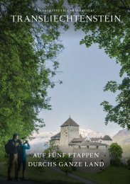
Princely Hikes in Liechtenstein
Which country in Europe has the densest network of hiking trails? It’s not the alpine classics of Switzerland or Austria, but in fact the small Principality of Liechtenstein nestling between those two countries. More than 400 kilometres of well-maintained and clearly signposted trails and majestic mountains up to 2600 metres above sea level attract walkers and hikers to Liechtenstein.
Which country in Europe has the densest network of hiking trails? It’s not the alpine classics of Switzerland or Austria, but in fact the small Principality of Liechtenstein nestling between those two countries. More than 400 kilometres of well-maintained and clearly signposted trails and majestic mountains up to 2600 metres above sea level attract walkers and hikers to Liechtenstein.

Create successful ePaper yourself
Turn your PDF publications into a flip-book with our unique Google optimized e-Paper software.
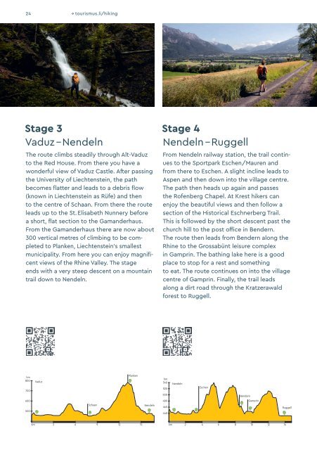
24 → tourismus.li/hik<strong>in</strong>g<br />
Stage 3<br />
Vaduz – Nendeln<br />
The route climbs steadily through Alt-Vaduz<br />
to the Red House. From there you have a<br />
wonderful view of Vaduz Castle. After pass<strong>in</strong>g<br />
the University of Liechtenste<strong>in</strong>, the path<br />
becomes flatter and leads to a debris flow<br />
(known <strong>in</strong> Liechtenste<strong>in</strong> as Rüfe) and then<br />
to the centre of Schaan. From there the route<br />
leads up to the St. Elisabeth Nunnery before<br />
a short, flat section to the Gamanderhaus.<br />
From the Gamanderhaus there are now about<br />
300 vertical metres of climb<strong>in</strong>g to be completed<br />
to Planken, Liechtenste<strong>in</strong>’s smallest<br />
municipality. From here you can enjoy magnificent<br />
views of the Rh<strong>in</strong>e Valley. The stage<br />
ends with a very steep descent on a mounta<strong>in</strong><br />
trail down to Nendeln.<br />
Stage 4<br />
Nendeln – Ruggell<br />
From Nendeln railway station, the trail cont<strong>in</strong>ues<br />
to the Sportpark Eschen/Mauren and<br />
from there to Eschen. A slight <strong>in</strong>cl<strong>in</strong>e leads to<br />
Aspen and then down <strong>in</strong>to the village centre.<br />
The path then heads up aga<strong>in</strong> and passes<br />
the Rofenberg Chapel. At Krest hikers can<br />
enjoy the beautiful views and then follow a<br />
section of the Historical Eschnerberg Trail.<br />
This is followed by the short descent past the<br />
church hill to the post office <strong>in</strong> Bendern.<br />
The route then leads from Bendern along the<br />
Rh<strong>in</strong>e to the Grossabünt leisure complex<br />
<strong>in</strong> Gampr<strong>in</strong>. The bath<strong>in</strong>g lake here is a good<br />
place to stop for a rest and someth<strong>in</strong>g<br />
to eat. The route cont<strong>in</strong>ues on <strong>in</strong>to the village<br />
centre of Gampr<strong>in</strong>. F<strong>in</strong>ally, the trail leads<br />
along a dirt road through the Kratzerawald<br />
forest to Ruggell.<br />
hm<br />
800<br />
700<br />
Vaduz<br />
Planken<br />
hm<br />
540<br />
520<br />
500<br />
Nendeln<br />
Eschen<br />
Bendern<br />
600<br />
500<br />
Schaan<br />
Nendeln<br />
480<br />
460<br />
440<br />
Gampr<strong>in</strong><br />
Ruggell<br />
6<br />
9 12<br />
km 3 15<br />
4 6<br />
km 2 8 10 12 14