Aroundtown Magazine May June 2023 edition
Read the May/June edition of Aroundtown Magazine, South Yorkshire's free premier lifestyle magazine.
Read the May/June edition of Aroundtown Magazine, South Yorkshire's free premier lifestyle magazine.

Create successful ePaper yourself
Turn your PDF publications into a flip-book with our unique Google optimized e-Paper software.
OUT & ABOUT<br />
Double delights<br />
A walk around two Bradfields and two reservoirs<br />
A delightful moderate walk of<br />
just over eight miles taking in<br />
the villages of Low and High<br />
Bradfield, and then across<br />
open countryside to Agden and<br />
Dale Dike reservoirs before<br />
returning through woods and<br />
along country lanes back to Low<br />
Bradfield.<br />
Start point: ‘The Sands’ free car park,<br />
Low Bradfield (S6 6LA). Public toilets<br />
are nearby.<br />
Start by going through a gap in the wall and<br />
turning right to follow a narrow path that goes<br />
along a stream. Ignore the first footbridge on the<br />
right and continue until a second one.<br />
Cross it and continue up steps and up a<br />
path to the lane. Cross the lane and take the<br />
signposted footpath through a gate and uphill<br />
across fields until you reach the church in High<br />
Bradfield, St Nicholas, dating from the 1480s.<br />
Go up a few steps on the left alongside the<br />
churchyard. Follow the path and turn left at the<br />
end to reach the main church gate. Go through<br />
it and continue in front of the church then turn<br />
right past the church tower, then left through the<br />
cemetery to its end.<br />
Go through the gate and straight across<br />
onto the narrow path that goes through the<br />
trees and eventually down through a gate onto<br />
a walled path. Follow this to the left until you see<br />
a gate ahead. Just before this turn right then<br />
immediately left through an open gateway.<br />
Turn right to go steeply uphill for a short while<br />
until you reach a level grassy path to the left.<br />
Follow this until you reach a ladder stile on your<br />
left. Go over it and turn right to continue on a field<br />
path and through a disused gateway onto more<br />
open field paths until you reach the ruined farm<br />
buildings of Rocher Head. This is a good place<br />
for your coffee stop!<br />
Go past these ruins and ahead is a gate and<br />
stile. Go over the stile and follow the path (usually<br />
quite wet as near a stream) to another gate. Go<br />
through it and continue until you reach the lane.<br />
Turn left along the lane and then after another<br />
25m turn right down another lane until you see a<br />
gate on your left. Go through this and a second<br />
gate and follow a path bearing left along a wall<br />
on your left.<br />
Follow this path downhill until you reach<br />
Agden Reservoir. Turn right and follow the path<br />
along the reservoir over a stone bridge. Continue<br />
uphill slightly until you reach some birdfeeders on<br />
your right.<br />
At this point before the stone bridge, bear<br />
right off the track to enter Windy Bank Wood.<br />
Follow the path as it turns left over a bridge and<br />
up to a lane. Turn left and after about 100m, turn<br />
right up a farm bridlepath until you reach a high<br />
stile on your right. Go over this and follow the<br />
path along the ridge across fields until it meets<br />
a gate.<br />
Go left through another gate and follow the<br />
path downhill to a lane, Dale Rd. Turn right soon<br />
turning left at the entrance to Dale Dike Reservoir<br />
and continue on around it to a footbridge at the<br />
far end of the reservoir.<br />
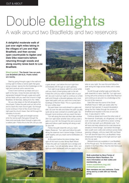
Dale Dike was the scene of the Great<br />
Sheffield Flood in 1864 just weeks after the<br />
reservoir had opened. It caused devastation<br />
along the Don Valley through the centre of<br />
Sheffield and resulted in the loss of over 250<br />
lives. It was rebuilt in 1875.<br />
Continue ahead and round the other side of<br />
the reservoir. Eventually, at a fingerpost, turn right<br />
over a wall stile, and uphill into a wood, turning<br />
left at the next path up to Blindside Lane. Turn<br />
left here and keep ahead as the road descends<br />
steadily to Annet bridge. Just before the bridge,<br />
take a path over a stile and continue across fields<br />
passing cottages, until you reach Mill Lee Road.<br />
Turn left downhill back into Low Bradfield. Keep<br />
ahead past the bridge on the right and turn right<br />
into the car park.<br />
Refreshments are available in Low Bradfield<br />
at The Plough pub, The Schoolrooms cafe, and<br />
snacks in the Post Office. Also the Old Horns pub<br />
in High Bradfield.<br />
Walk submitted by Beryl Faries of<br />
Rotherham Metro Ramblers. For<br />
more information on their walks and<br />
membership, see<br />
www.ramblers.org.uk/<br />
rotherham-metro.<br />
New members are very welcome. Come<br />
along and try a walk with our friendly<br />
group.<br />
38 aroundtownmagazine.co.uk