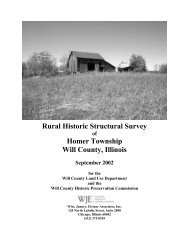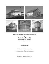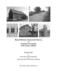
Rural H Historic c Struct tural S Survey - Will County Land Use
Rural H Historic c Struct tural S Survey - Will County Land Use
Rural H Historic c Struct tural S Survey - Will County Land Use

You also want an ePaper? Increase the reach of your titles
YUMPU automatically turns print PDFs into web optimized ePapers that Google loves.
Wiss, Janney, Elstner Associates, Inc.<br />
The Arrival of European Settlers<br />
French Explorers and Settlers in the Illinois Territory<br />
By the time of the French explorations of the seventeenth century, the native inhabitants of Illinois as a<br />
group belonged to the Algonquian linguistic family, closely related to the Chippewa. The specific tribes<br />
in the northeast Illinois region included the Miami (located on sites near the Calumet River, the juncture<br />
of the Des Plaines and Kankakee Rivers, and the Fox River) and the Illinois (present throughout the rest<br />
of modern-day Illinois). “Illinois” was a native word signifying “men” or “people.” 9 By the early to mid-<br />
1700s, the Potawatomi moved into the area from the region of Michigan and northern Wisconsin.<br />
In 1673, the expedition of Father Jacques Marquette and Louis Jolliet traveled primarily along the<br />
Mississippi River and up the Illinois River to the region of Cook and <strong>Will</strong> Counties. 10 This expedition<br />
claimed the region for France. In 1678, an expedition led by Robert de La Salle with Henry Tonti and<br />
Father Hennepin explored the region along the Mississippi River and adjacent territory on behalf of<br />
France. A Jesuit mission was established at Chicago in 1696 by Father Pierre Pinet, but it failed to last<br />
more than a year. As time progressed the French centered their principal activities in the middle<br />
Mississippi valley, focusing on Fort de Chartres near Kaskaskia and its connections with Québec via the<br />
Ohio, Maumee, and Wabash Rivers and the Great Lakes, well to the south and east of the upper Illinois<br />
Valley.<br />
During this period, the Native Americans were undergoing migrations, often leading to conflict among<br />
the various tribes. The Sauk, Fox, Kickapoo, and Potawatomi displaced the Miami and Illinois in the<br />
Chicago region. The Potawatomi, followed by the Sauk and the Fox, were the predominant peoples in the<br />
northeastern Illinois by the later 1700s. Also present in the region were the Winnebago and the<br />
Shawnee. 11<br />
French colonial settlers in the southern and central portions of Illinois brought with them traditional<br />
agricul<strong>tural</strong> practices from northern France, including open-field plowlands divided into longlots, and<br />
communal pasturing areas. 12 However, unlike labor practices in France, colonial settlers utilized African<br />
slaves. By the middle of the eighteenth century, black slaves comprised one-third of the region’s<br />
population.<br />
Early settlements founded as missions and fur trading posts, such as Cahokia and Kaskaskia, developed<br />
into the core of agricul<strong>tural</strong> communities. 13 French colonial farms produced wheat for human<br />
9<br />
John R. Swanton, The Indian Tribes of North America (1952, Bureau of American Ethnology Bulletin Number<br />
145; reprint, Washington, D.C.: Smithsonian Institution Press, 1969), 241.<br />
10<br />
Louis Jolliet was born at Beauport, near Québec, in September 1645. He began to study at the Jesuit College of<br />
Québec in 1655 and in 1662 he received minor religious orders from Bishop Laval. After leaving the seminary and<br />
becoming a fur trader, he gained proficiency in surveying and mapmaking. Jolliet was chosen by the government of<br />
France to be a member of a delegation meeting with the chieftains of the Indian tribes assembled at Sault Sainte<br />
Marie in 1671. Beginning the next year, Jolliet led an expedition down the Mississippi, during which he traveled up<br />
the Illinois and Des Plaines Rivers. During this expedition he surmised that digging a canal to connect the<br />
waterways in this region would allow transportation from the Great Lakes to the Mississippi and the Gulf of Mexico.<br />
The Illinois and Michigan Canal constructed in the 1830s and 1840s was the realization of this route.<br />
11<br />
Jean L. Herath, Indians and Pioneers: A Prelude to Plainfield, Illinois (Hinckley, Illinois: The Hinckley Review,<br />
1975), 20–21.<br />
12<br />
Carl J. Ekberg, French Roots in the Illinois Country: The Mississippi Frontier in Colonial Times (Urbana, Illinois:<br />
University of Illinois Press, 1998), 2–3. “Longlots” are, as the name implies, long narrow plots of cultivated land<br />
that developed because of the difficulty for plowing teams to turn around. Forms of longlots date back to ancient<br />
Mesopotamia; French colonial forms developed from Medieval European models. The longlots in Illinois typically<br />
had length to width ratios of 10 to 1.<br />
13<br />
Ibid., 33.<br />
<strong>Will</strong> <strong>County</strong> <strong>Rural</strong> <strong>Historic</strong> <strong>Struct</strong>ural <strong>Survey</strong><br />
Page 8 Florence Township