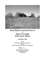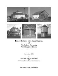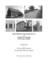
Rural H Historic c Struct tural S Survey - Will County Land Use
Rural H Historic c Struct tural S Survey - Will County Land Use
Rural H Historic c Struct tural S Survey - Will County Land Use

Create successful ePaper yourself
Turn your PDF publications into a flip-book with our unique Google optimized e-Paper software.
Wiss, Janney, Elstner Associates, Inc.<br />
Settlement and Development of Northeast Illinois<br />
By 1826, more European settlers began to move to the northeast Illinois region, so that by 1831 a few<br />
hamlets were present between LaSalle and Chicago. Also present in the region was a tribe of nearly 1,000<br />
Potawatomi in the area along the Du Page River south of what would become Plainfield. 25 At the<br />
beginning of the Black Hawk War in 1832 the largest settlement north of the Illinois River (except for<br />
Chicago) was on Bureau Creek, where there were about thirty families. A few other settlers had located<br />
along the river at Peru and LaSalle, and at Ottawa. At Walker’s Grove or Plainfield, there were twelve or<br />
fifteen families. 26 Along the Du Page River, partially located in the region that would become <strong>Will</strong><br />
<strong>County</strong> in 1836, there were about twenty families. In Yankee settlements, which embraced part of the<br />
towns of Homer, Lockport and New Lenox, there were twenty or twenty-five families. Along the Hickory<br />
in the town of New Lenox there were approximately twenty more families, and at the Reed’s and Jackson<br />
Grove there were six or eight more. 27<br />
In 1832, a band of Sauk Indians led by Black Sparrow Hawk resisted their deportation by European<br />
settlers from their ancestral lands. Although most of the fighting occurred in the Rock River area in<br />
Northwest Illinois and southern Wisconsin, an Indian panic swept through <strong>Will</strong> <strong>County</strong> settlements. The<br />
settlers in Walker’s Grove together with about twenty-five fugitives from the Fox River area hurriedly<br />
constructed a stockade from the logs of Stephen Begg’s pigpen, outbuildings, and fences (“Fort Beggs”).<br />
The prospect of engaging Indians in pitched battle from the confines of “Fort Beggs” prompted the<br />
settlers to leave the makeshift stockade in favor of Fort Dearborn in Chicago. Meanwhile homesteaders in<br />
the eastern <strong>Will</strong> <strong>County</strong> area gathered at the Gougar homestead and decided to flee to Indiana. 28<br />
Also in 1832, northwest <strong>Will</strong> <strong>County</strong> was the scene of an epidemic of smallpox among the Potawatomi,<br />
inflicting a mortality rate at least twice that of European settlers. Approximately one-third of the Native<br />
American population in the region died during the epidemic. 29<br />
The end of the Black Hawk War brought about the expulsion of the Sauk and Fox from lands east of the<br />
Mississippi River. Also in 1832, the Winnebago ceded their lands in Wisconsin south and east of the<br />
Wisconsin River and east of the Fox River to Green Bay. The Potawatomi, Ottawa, and Chippewa tribes<br />
still held title to land in northern Illinois outside of the Indian Boundary lines. In September 1833, a<br />
gathering of Native American chiefs and leaders was held in Chicago to “negotiate a treaty whereby the<br />
lands might be peaceably ceded, and the Indians removed therefrom, to make way for the tide of white<br />
emigration which had begun to set irresistibly and with ever increasing volume to the coveted region.” 30<br />
A Chicago historian, A.T. Andreas, writing in the 1880s, emphasized the disadvantaged position of the<br />
Native Americans, who had seen the effects of war on other Native Americans and experienced the ravages<br />
of epidemic on their own peoples:<br />
Black Hawk’s ill-starred campaign, followed by the subsequent treaty made by his tribe, showed<br />
them the inevitable result [that] must follow resistance. They knew quite well that they had no<br />
alternative. They must sell their lands for such a sum and on such terms as the Government agents<br />
might deem it politic or just or generous to grant. The result of the treaty was what might have<br />
been expected. The Indians gave up their lands and agreed for certain considerations, the most of<br />
25<br />
Herath, 21.<br />
26<br />
A Potawatomi village was located to the south of Walker’s Grove. (Helen Hornbeck Tanner, ed., Atlas of Great<br />
Lakes Indian History (Norman, Oklahoma: University of Oklahoma Press, 1987), Map 26, 140.)<br />
27<br />
Ibid.<br />
28<br />
Robert E. Sterling, A Pictorial History of <strong>Will</strong> <strong>County</strong>, Volume 1 (Joliet: <strong>Will</strong> <strong>County</strong> <strong>Historic</strong>al Publications,<br />
1975).<br />
29<br />
Tanner, ed., Atlas of Great Lakes Indian History, 173.<br />
30<br />
Andreas, History of Chicago, 123.<br />
<strong>Will</strong> <strong>County</strong> <strong>Rural</strong> <strong>Historic</strong> <strong>Struct</strong>ural <strong>Survey</strong><br />
Page 14 Florence Township