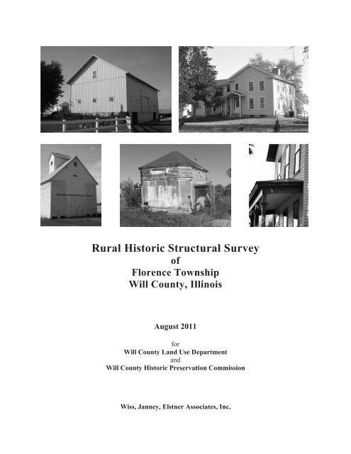
Rural H Historic c Struct tural S Survey - Will County Land Use
Rural H Historic c Struct tural S Survey - Will County Land Use
Rural H Historic c Struct tural S Survey - Will County Land Use

Create successful ePaper yourself
Turn your PDF publications into a flip-book with our unique Google optimized e-Paper software.
<strong>Rural</strong> <strong>Historic</strong> H c <strong>Struct</strong><strong>tural</strong><br />
S<strong>Survey</strong><br />
of<br />
Florenc ce Townnship<br />
<strong>Will</strong> W <strong>County</strong>,<br />
Illlinois<br />
Au ugust 2011<br />
for<br />
Wi ill <strong>County</strong> <strong>Land</strong> L <strong>Use</strong> Deepartment<br />
and<br />
<strong>Will</strong> Cou unty Histori ic Preservattion<br />
Commiission<br />
Wis ss, Janney, Elstner E Assoociates,<br />
Inc. .
Wiss, Janney, Elstner Associates,<br />
Inc.<br />
330 Pfingsten P Roadd<br />
Northbro ook, Illinois 600062<br />
(84 47) 272-7400<br />
ww ww.wje.com
<strong>Rural</strong> <strong>Historic</strong> <strong>Struct</strong>ural <strong>Survey</strong><br />
Florence Township<br />
<strong>Will</strong> <strong>County</strong>, Illinois<br />
TABLE OF CONTENTS<br />
Wiss, Janney, Elstner Associates, Inc.<br />
Executive Summary vii<br />
Federal Assistance Acknowledgement viii<br />
Chapter 1 – Background and Methodology<br />
Background 1<br />
<strong>Survey</strong> Methodology 1<br />
<strong>Survey</strong> Gaps and Future Research 2<br />
Chapter 2 – Context History of the <strong>Rural</strong> <strong>Survey</strong> Area<br />
Geologic and Topographic Background to the Illinois Region 5<br />
First Nations in the Illinois Region 6<br />
The Arrival of European Settlers 8<br />
Settlement and Development of Northeast Illinois 14<br />
Florence Township Developmental History 22<br />
Schools 26<br />
Churches and Cemeteries 30<br />
Bridges 32<br />
Joliet Arsenal 33<br />
Former Farmsteads on the Arsenal Site 44<br />
Chapter 3 – American <strong>Rural</strong> Architecture<br />
Farmstead Planning 57<br />
Development of Balloon Framing 57<br />
Masonry Construction 61<br />
Classification of Farmhouses 66<br />
Development of the Barn 76<br />
Barn Types 80<br />
Chapter 4 – <strong>Survey</strong> Summary and Recommendations<br />
Period of Significance 93<br />
Significance 94<br />
Potential <strong>Historic</strong> Districts, Thematic Designations, and <strong>Land</strong>marks 98<br />
<strong>Survey</strong> Summary 100<br />
Table 3. <strong>Survey</strong>ed Farmsteads and Related Sites in Florence Township 102<br />
Table 4. Farmhouses in Florence Township 126<br />
Table 5. Barns in Florence Township 132<br />
Notable Farmsteads in Jackson Township 135<br />
Kennedy Family Farmsteads 135<br />
White Family Farmsteads 136<br />
Lovell Farmstead 138<br />
Swival–Stewart Farmstead 139<br />
Barr Brothers Farmstead 139<br />
Morey Farmstead 140<br />
Martin–Ohlhues Farmstead 141<br />
Baskerville Farmsteads 142<br />
<strong>Will</strong> <strong>County</strong> <strong>Rural</strong> <strong>Historic</strong> <strong>Struct</strong>ural <strong>Survey</strong><br />
Florence Township v
Wiss, Janney, Elstner Associates, Inc.<br />
Dixon–Jackson Farmstead 145<br />
McGinnis Farmstead 146<br />
Howard Hyde House 146<br />
Nelson and Strong Family Farmsteads 147<br />
Shirk–Stewart Farmstead 148<br />
Thompson Farmstead 149<br />
Bibliography 151<br />
Glossary 162<br />
Appendix A: <strong>Historic</strong> Plat Maps<br />
Appendix B: <strong>Survey</strong> Maps<br />
Key to Properties by Map ID number<br />
Map 1 – <strong>Will</strong> <strong>County</strong> Key Map<br />
Map 2 – Florence Township: Overview of <strong>Survey</strong> – South Part of Township<br />
Map 3 – Florence Township: Overview of <strong>Survey</strong> – North Part of Township<br />
Map 4 – Florence Township: Significance of Sites – South Part of Township<br />
Map 5 – Florence Township: Significance of Sites – North Part of Township<br />
Map 6 – Florence Township: 1939 Aerial Photography – South Part of Township<br />
Map 7 – Florence Township: 1939 Aerial Photography – North Part of Township<br />
Map 8 – Florence Township: Potential Midewin Buffer District<br />
<strong>Will</strong> <strong>County</strong> <strong>Rural</strong> <strong>Historic</strong> <strong>Struct</strong>ural <strong>Survey</strong><br />
vi Florence Township
Executive Summary<br />
Wiss, Janney, Elstner Associates, Inc.<br />
At the request of the <strong>Will</strong> <strong>County</strong> <strong>Land</strong> <strong>Use</strong> Department, acting as liaison for the <strong>Will</strong> <strong>County</strong> <strong>Historic</strong><br />
Preservation Commission, Wiss, Janney, Elstner Associates, Inc. (WJE) has prepared this summary report<br />
of the intensive survey of existing farmsteads in Florence Township in <strong>Will</strong> <strong>County</strong>, Illinois. The survey<br />
was performed between October 2010 and April 2011 and included approximately twenty square miles with<br />
70 farmsteads and related sites containing more than 360 individual structures.<br />
Florence Township contains one <strong>Will</strong> <strong>County</strong> <strong>Land</strong>mark, the Lovell Farmstead, which was designated a<br />
landmark in 2009. Of the 70 farmsteads identified in the current survey, 18 additional sites have the<br />
potential to be considered for <strong>Will</strong> <strong>County</strong> <strong>Historic</strong> <strong>Land</strong>mark designation or listing in the National Register<br />
of <strong>Historic</strong> Places. In some cases, the eligibility of the site would be enhanced if certain historic features<br />
were restored or non-historic cladding materials such as vinyl siding were removed. Other sites have either<br />
been designated Contributing, which means in the context of this report that they retain their overall<br />
character as historically agricul<strong>tural</strong> sites but lack individual distinction; or Non-contributing, which<br />
indicates that the site lacks sufficient integrity to present the theme of agricul<strong>tural</strong> history in the survey<br />
region. One potential historic district encompassing portions of Florence Township has been identified as<br />
part of the survey work: a Midewin Buffer District. Building upon a recommendation previously developed<br />
as part of the survey of Manhattan Township in 2006, the proposed district would encompass portions of<br />
Florence, Jackson, and Manhattan Townships adjacent to the Midewin National Tallgrass Prairie. For<br />
continuity, future consideration of extending the district into Wilton Township should await survey of that<br />
township.<br />
The Florence Township intensive survey was performed to update the previous survey of the township<br />
performed in 1988. In the previous survey, 76 farmsteads and related sites were identified in the township,<br />
containing at least 360 structures. Because of the rapid pace of contemporary development in <strong>Will</strong> <strong>County</strong><br />
in the 1990s, the <strong>Will</strong> <strong>County</strong> <strong>Historic</strong> Preservation Commission recognized the need to reassess the<br />
agricul<strong>tural</strong> heritage of the region. WJE has previously completed eleven intensive survey projects in fifteen<br />
of the <strong>County</strong>’s twenty-four townships covering Wheatland–Plainfield–Lockport, Du Page, Homer, New<br />
Lenox, Green Garden, Manhattan, Frankfort, Joliet–Troy, Channahon, Wilmington, Jackson, and Reed<br />
Townships as well as field survey work in Custer Township. Copies of the previous survey reports were<br />
provided to public libraries and respective governing agencies in the area. Cumulatively, the surveys have<br />
documented almost 6,000 structures on more than 1,350 sites over approximately 575 square miles of <strong>Will</strong><br />
<strong>County</strong>. Performing a separate survey for each township has allowed more detailed information to be<br />
collected, such as individual photographs of each historic structure, an assessment of current conditions, and<br />
preparation of site sketch plans. With the permission of property owners, the survey work was performed<br />
with close-up access to the buildings, which allowed for close range photography and a reliable<br />
identification of building materials. The survey data was compiled and analyzed using database software<br />
and geographic information system (GIS) software.<br />
In this report, Chapter 1 contains a description of the project methodology. Chapters 2 and 3 provide the<br />
historical and architec<strong>tural</strong> context, within which the surveyed farmsteads were established, grew, were<br />
reconfigured, and in some cases were abandoned. Chapter 2 covers the historical context of <strong>Will</strong> <strong>County</strong><br />
agriculture, as well as the historical development of Florence Township. Chapter 3 discusses the<br />
architec<strong>tural</strong> context of the rural survey area. Chapter 4 summarizes the survey results and includes a<br />
discussion of the National Register and <strong>Will</strong> <strong>County</strong> criteria for designation of historical and architec<strong>tural</strong><br />
significance. Also in Chapter 4 are several tabulations of the survey results and an overview of a select<br />
number of historically and/or architec<strong>tural</strong>ly significant farmsteads. A bibliography of research sources<br />
follows the text. Appendices include historic and contemporary plat maps for Florence Township, and maps<br />
developed for this report to present the results of the survey and research.<br />
<strong>Will</strong> <strong>County</strong> <strong>Rural</strong> <strong>Historic</strong> <strong>Struct</strong>ural <strong>Survey</strong><br />
Florence Township vii
Wiss, Jann ney, Elstner Associates, A<br />
Inc c.<br />
Federal Assistance Acknowledg<br />
A gement<br />
The activi ity, which is the t subject of f the <strong>Will</strong> Cou unty <strong>Rural</strong> Hiistoric<br />
<strong>Struct</strong>uural<br />
<strong>Survey</strong>, hhas<br />
been finannced<br />
in part with<br />
federal fun nds from the Department D of<br />
the Interior, , administeredd<br />
by the Illinoois<br />
<strong>Historic</strong><br />
Preservati ion Agency. However, H the contents and d opinions do not necessariily<br />
reflect the views or poliicies<br />
of the Dep partment of th he Interior no or the Illinois <strong>Historic</strong> Preservation<br />
Ageency,<br />
nor doess<br />
the mentionn<br />
of<br />
trade nam mes or commercial<br />
products s constitute en ndorsement oor<br />
recommenddation<br />
by the Department oof<br />
the<br />
Interior no or the Illinois s <strong>Historic</strong> Pres servation Age ency.<br />
This program<br />
receives Federal finan ncial assistanc ce for identifiication<br />
and prrotection<br />
of hhistoric<br />
properrties<br />
Under Tit tle VI of the Civil C Rights Act A of 1964, Section S 504 of<br />
the Rehabiliitation<br />
Act off<br />
1973, and thhe<br />
Age Discr rimination Ac ct of 1975, as amended, the e U.S. Departtment<br />
of the IInterior<br />
prohibits<br />
discriminnation<br />
on the bas sis of race, co olor, national origin, or disa ability or agee<br />
in its federallly<br />
assisted prrograms.<br />
If yoou<br />
believe yo ou have been discriminated d against in an ny program, aactivity,<br />
or faacility<br />
as desccribed<br />
above, or if<br />
you desire e further infor rmation, please<br />
write to:<br />
Office for r Equal Oppor rtunity<br />
National Park P Service<br />
P.O. Box 37127<br />
Washington,<br />
D.C. 20013-7127<br />
or<br />
Equal Em mployment Op pportunity Off fficer<br />
Illinois Hi istoric Preservation<br />
Agenc cy<br />
One Old State S Capitol Plaza<br />
Springfiel ld, IL 62701<br />
viii<br />
<strong>Will</strong> C<strong>County</strong><br />
<strong>Rural</strong> Hisstoric<br />
<strong>Struct</strong>ural <strong>Survey</strong><br />
Florence Toownship
CHAPTER 1<br />
BACKGROUND AND METHODOLOGY<br />
Background<br />
Wiss, Janney, Elstner Associates, Inc.<br />
At the request of the <strong>Will</strong> <strong>County</strong> <strong>Land</strong> <strong>Use</strong> Department, acting as liaison for the <strong>Will</strong> <strong>County</strong> <strong>Historic</strong><br />
Preservation Commission, Wiss, Janney, Elstner Associates, Inc. (WJE) has prepared this summary report<br />
of the intensive survey of farmsteads in Florence Township in <strong>Will</strong> <strong>County</strong>, Illinois. A previous survey of<br />
farmsteads in <strong>Will</strong> <strong>County</strong> was performed in 1988. Beginning in 1999, WJE has prepared intensive<br />
surveys of individual townships in <strong>Will</strong> <strong>County</strong>. Previous townships surveyed included Plainfield,<br />
Wheatland, and Lockport (completed November 2000), Du Page (November 2001), Homer (November<br />
2002), New Lenox (August 2003), Green Garden (July 2004), Manhattan (September 2006), Frankfort<br />
(December 2007), Joliet and Troy (April 2009), Channahon (April 2009), Wilmington (December 2009),<br />
Jackson (December 2009), and Reed (January 2011). In 2010, field survey work was also undertaken in<br />
Custer Township.<br />
The objectives of the study are to provide comprehensive information on all historic rural structures<br />
located in the area; to assess the eligibility of rural districts or individual buildings for designation as local<br />
landmarks or nomination to the National Register of <strong>Historic</strong> Places; to inventory the existing structures<br />
in the area for future study; to provide background on significant architec<strong>tural</strong> styles and rural structure<br />
types common to the area; and to provide background history of the development of the area. The present<br />
study has been developed to meet the requirements and standards of the Certified Local Government<br />
program.<br />
<strong>Survey</strong> Methodology<br />
<strong>Survey</strong> Team<br />
The survey team from WJE consisted of Kenneth Itle, Michael Ford, Gregory Dowell, and Deborah<br />
Slaton. Mr. Itle served as Project Manager and developed the summary report and performed some field<br />
survey work. Mr. Ford and Mr. Dowell performed field survey work. Ms. Slaton was the reviewer of the<br />
summary report.<br />
Background Research<br />
Work on the rural survey began in September 2010. Background research was performed at the State of<br />
Illinois Library in Springfield, the University of Illinois Libraries, the Joliet Public Library, and the<br />
Wilmington Public Library. In addition, extensive historic research materials compiled for previous <strong>Will</strong><br />
<strong>County</strong> rural survey reports were available.<br />
Field <strong>Survey</strong><br />
A project initiation meeting was held to discuss the project approach and scope. The previous 1988<br />
survey and historic aerial photography of the township dating to 1939 was reviewed to identify historic<br />
and existing farmstead sites. Intensive field survey work was performed from October 2010 through April<br />
2011. The survey team first approached the primary residence on the site to request permission of the<br />
homeowner/tenant to conduct the survey on the farmstead site. At sites where no one was home, or where<br />
owner permission was not provided, the site was surveyed from the public right-of-way. Typically each<br />
structure on the site was photographed individually using a digital camera. A sketch plan of the farmstead<br />
was prepared. Written notes for each building included a listing of exterior materials, overall condition,<br />
and estimated decade of construction based on struc<strong>tural</strong> type and style. Any history information provided<br />
by the owner, such as dates of construction or names of original owners, was also noted.<br />
<strong>Will</strong> <strong>County</strong> <strong>Rural</strong> <strong>Historic</strong> <strong>Struct</strong>ural <strong>Survey</strong><br />
Florence Township Page 1
Wiss, Janney, Elstner Associates, Inc.<br />
The field survey also included the documentation of 1940s-era structures on the Joliet Army Ammunition<br />
Plant property, as well as documentation of pre-1940 foundations and other ruins in this area of Florence<br />
Township. Based on the historic 1939 aerial photography and a plat map from circa 1940 indicating<br />
property owners, locations of interest within the arsenal property were identified. The locations were then<br />
compared to contemporary aerial photography. In some cases, the locations of interest overlapped<br />
arsenal-era construction or infrastructure. At these sites, no pre-arsenal features could survive. Other<br />
locations of interest corresponded to undeveloped or wooded portions of the site. Field survey teams<br />
attempted to reach these locations in late fall to search for above-ground evidence of construction. If<br />
observed, surviving foundations and similar elements were documented, and adapted versions of the<br />
survey form were prepared to compile the photographs and field sketches.<br />
Database and Base Map Preparation<br />
Mapping for the survey was prepared using ArcGIS. 1 Baseline mapping showing railways, streams,<br />
township boundaries, etc., as well as 2005 aerial photography of the survey area, was downloaded from<br />
the Illinois Na<strong>tural</strong> Resources Geospatial Data Clearinghouse internet site. 2 Additional baseline data<br />
showing roads and municipal boundaries was provided by the <strong>Will</strong> <strong>County</strong> <strong>Land</strong> <strong>Use</strong> Department.<br />
Updated 2008 aerial photography was also provided by the <strong>Will</strong> <strong>County</strong> <strong>Land</strong> <strong>Use</strong> Department for<br />
reference during the project. Individual points were added to the baseline map at the location of each<br />
farmstead site surveyed. Each point represents a particular record in the Microsoft Access database. The<br />
database contains all field survey information; historical information specific to each property, such as<br />
names of previous owners based on historic atlases and plat maps; and the assessment of historic<br />
significance. On the database forms, the “notes” field typically contains other miscellaneous observations<br />
of the project team from the field work. Occasionally, this field contains verbal information from the<br />
resident or another source; these are so noted.<br />
Prior to inserting the digital photographs into the database, the photograph files were converted from<br />
color .jpg files to reduced-size black-and-white .bmp files. The Microsoft Access database was used to<br />
generate the property lists included in this summary report, as well as the individual survey forms. The<br />
ArcGIS software was used to generate the maps of the survey area included in the appendix.<br />
Presentations<br />
A presentation of the survey results was made to the <strong>Will</strong> <strong>County</strong> <strong>Historic</strong> Preservation Commission<br />
(HPC) on April 6, 2011. This final summary report incorporated comments provided by the HPC<br />
members and <strong>Will</strong> <strong>County</strong> staff on a draft of the report.<br />
Report and Submittals<br />
The summary report was prepared using Microsoft Word. <strong>Will</strong> <strong>County</strong> was provided with the following<br />
final materials under separate cover: printed copies of the final summary report; printed copies of the<br />
individual property survey forms; digital photographs as original color .jpg files; ArcGIS mapping files;<br />
Microsoft Access database file; survey sheets as .pdf file; and report text as Microsoft Word file and .pdf<br />
file.<br />
<strong>Survey</strong> Gaps and Future Research<br />
The present study is not meant to be a definitive review of the history of each property surveyed; rather,<br />
based on historic research and field survey, the relative significance of each property has been assessed.<br />
In the future, as new development or renovation work may affect particular properties, the history and<br />
1<br />
ArcGIS is one brand of GIS software. GIS stands for geographic information system, a computerized methodology<br />
for organizing data geographically.<br />
2<br />
<br />
<strong>Will</strong> <strong>County</strong> <strong>Rural</strong> <strong>Historic</strong> <strong>Struct</strong>ural <strong>Survey</strong><br />
Page 2 Florence Township
Wiss, Janney, Elstner Associates, Inc.<br />
significance of the particular property should be researched in detail, using the present survey as a starting<br />
point.<br />
A detailed survey of the village of Symerton was beyond the scope of this rural historic structures survey.<br />
The village contains numerous historic houses as well as former commercial and public buildings now<br />
converted to residential purposes. Existing documentation of these structures is limited to photography<br />
taken as part of the 1988 survey.<br />
The present study focused on architec<strong>tural</strong> features of the survey region. Other studies could be<br />
undertaken to assess the archaeological potential of the survey region; to identify and assess cul<strong>tural</strong><br />
landscape features such as fence rows, hedges, and earthworks; to study historic transportation<br />
infrastructure and routes in detail; or to study particular architec<strong>tural</strong> themes, such as limestone masonry<br />
construction, in greater detail.<br />
The present study also is focused on built structures of the historic period. Throughout <strong>Will</strong> <strong>County</strong> are<br />
important archaeological sites. Pending further study, some of these sites may be determined to be<br />
eligible for listing in the National Register of <strong>Historic</strong> Places under Criterion D for archeology.<br />
A detailed historical, architec<strong>tural</strong>, and archeological survey of the former Joliet Arsenal, now Midewin<br />
National Tallgrass Prairie, was beyond the scope of this study. As part of the ongoing redevelopment of<br />
the site, the U.S. Forest Service interprets both the historic agricul<strong>tural</strong> activities as well as the twentieth<br />
century military and industrial uses while focusing on the restoration of a na<strong>tural</strong> prairie habitat. More<br />
detailed documentation of surviving built features or archeological resources may be appropriate, in<br />
particular if these features will be affected by proposed habitat restoration.<br />
<strong>Will</strong> <strong>County</strong> <strong>Rural</strong> <strong>Historic</strong> <strong>Struct</strong>ural <strong>Survey</strong><br />
Florence Township Page 3
Wiss, Janney, Elstner Associates, Inc.<br />
<strong>Will</strong> <strong>County</strong> <strong>Rural</strong> <strong>Historic</strong> <strong>Struct</strong>ural <strong>Survey</strong><br />
Page 4 Florence Township
CHAPTER 2<br />
CONTEXT HISTORY OF THE RURAL SURVEY AREA<br />
Geologic and Topographic Background to the Illinois Region<br />
Wiss, Janney, Elstner Associates, Inc.<br />
As with most of Illinois, the survey area was profoundly altered by glaciation. Over approximately one<br />
million years during the Pleistocene era, the northern hemisphere was alternately covered by, and free of,<br />
large ice sheets that were hundreds to a few thousand feet thick. Pleistocene glaciers and the waters melting<br />
from them changed the landscapes they covered. The ice scraped and smeared the landforms it overrode,<br />
leveling and filling many of the minor valleys and even some of the larger ones. Moving ice carried colossal<br />
amounts of rock and earth, for much of what the glaciers wore off the ground was kneaded into the moving<br />
ice and carried along, often for hundreds of miles.<br />
A significant feature left by the advance and retreat of glaciers in the northeast corner of the state are<br />
glacial moraines—low mounds several miles long left by the furthest advance of glaciers in the<br />
Wisconsinan period. The last ice sheets in this area began to retreat approximately 13,500 years ago. The<br />
retreating and melting glaciers continued to impact the area for a few more thousand years, as the outflow<br />
deposited sand and gravel. Florence Township lies primarily to the west of the Valparaiso Morainic<br />
System in the valley of the former glacial Lake Wauponsee. The isolated Rockdale Moraine crosses the<br />
township from northwest to southeast. Lake Wauponsee was impounded by glacial moraines to the south<br />
but drained through a narrow gap in the moraines near the present-day city of Kankakee. The resulting<br />
Kankakee Torrent formed the Kankakee River valley and deposited sand, gravel, boulders, and rubble along<br />
the valley as well as exposing outcroppings of bedrock. 3 The soils in Florence Township are primarily silt<br />
loams and silty clay loams and are considered prime farmland, particularly where well drained. Soils on<br />
steeper slopes (more than 4 or 5 percent slope) are oftentimes eroded. 4<br />
Florence Township lies within the watershed of the Kankakee River. The Kankakee River arises near<br />
South Bend, Indiana, and flows 130 miles, heading southwest to Aroma Park, Illinois, and then turning<br />
abruptly northwest, ultimately reaching the Illinois River. The Kankakee River basin includes 3,125<br />
square miles in Indiana and 2,155 square miles in Illinois, encompassing most of Iroquois and Kankakee<br />
Counties as well as the southern half of <strong>Will</strong> <strong>County</strong>. Its largest tributary, the Iroquois River, joins the<br />
Kankakee at Aroma Park in Kankakee <strong>County</strong>. The Kankakee River lies almost entirely on bedrock, with<br />
a major bedrock outcropping creating a sharp fall at Momence, Illinois.<br />
The southern two-thirds of Florence Township is drained primarily by Jordan Creek and its minor<br />
tributaries, running east to west across the township from Sections 12 and 13 to Section 31. Jordan Creek<br />
continues west, defining the northern edge of downtown Wilmington, before entering the Kankakee River<br />
just downstream of the Union Pacific railroad bridge in Section 25. A small area at the southeastern<br />
corner of the township, primarily Sections 35 and 36, is drained by a minor branch of Forked Creek,<br />
which flows through Wesley Township, then enters Florence Township at the western edge of Section 31<br />
and joins with Jordan Creek before the latter stream enters Wilmington Township. The northern third of<br />
Florence Township is drained by Prairie Creek and its tributaries, although the development of the Joliet<br />
Arsenal resulted in substantial alteration to the na<strong>tural</strong> drainage patterns. Prairie Creek flows generally<br />
east to west across the township, from Section 3 to Section 7, before meeting the Kankakee River in<br />
3<br />
Kankakee River Basin Study: A Comprehensive Plan for Water Resource Development (Springfield: Illinois<br />
Bureau of Water Resources, 1967), 2–8.<br />
4<br />
Soil <strong>Survey</strong> of <strong>Will</strong> <strong>County</strong>, Illinois (Washington, D.C.: U.S. Department of Agriculture, Na<strong>tural</strong> Resources<br />
Conservation Service, in cooperation with Illinois Agricul<strong>tural</strong> Experiment Station, 2004).<br />
<strong>Will</strong> <strong>County</strong> <strong>Rural</strong> <strong>Historic</strong> <strong>Struct</strong>ural <strong>Survey</strong><br />
Florence Township Page 5
Wiss, Jann ney, Elstner Associates, A<br />
Inc c.<br />
Section 15<br />
of Wilmin ngton Townsh hip. Althoug gh much of tthe<br />
townshipp<br />
has gently rrolling<br />
terrainn,<br />
the<br />
creeks hav ve defined low w valleys, par rticularly in th he western paart<br />
of the towwnship.<br />
First Nations<br />
in the Illinois Reg gion<br />
Human ha abitation of the t North Am merican contin nent from thee<br />
Paleo-Indiaan<br />
culture hass<br />
been dated to the<br />
end of the e last glacial advance a (abou ut 15,000 to 12,000 years ago). Increassing<br />
warmth ttoward<br />
the cloose<br />
of<br />
the Pleisto ocene Era cau used the melting<br />
and disap ppearance of tthe<br />
ice sheet iin<br />
approximaately<br />
9000 B.CC.<br />
The<br />
arrival of the First Nati ions, or Nativ ve Americans,<br />
in the regionn<br />
between thee<br />
middle Misssissippi<br />
Valleey<br />
and<br />
Lake Mic chigan appear rs to date from m the earliest t period folloowing<br />
the retrreat<br />
of the poolar<br />
ice sheet.<br />
This<br />
time is kn nown as the Paleo-Indian<br />
P Period, when n peoples in tthe<br />
region brriefly<br />
occupieed<br />
campsites while<br />
subsisting g on deer, sma all mammals, nuts, and wil ld vegetables and other plaants.<br />
Illustrated above a are the mo oraine systems in n northeastern Illinois. Il Most of FFlorence<br />
Townsship<br />
lies west of tthe<br />
Valparaiso<br />
Morainic Sy ystem in the Lake e Wauponsee ou utwash area; the Rockdale moraine<br />
crosses the ccenter<br />
of the towwnship<br />
from nortthwest<br />
to southeast t. (H.B. <strong>Will</strong>man n, Summary of th he Geology of th he Chicago Area, , Illinois State GGeological<br />
Surveey<br />
Circular 460<br />
(Urbana, Ill linois, 1971), 43.)<br />
Page 6<br />
<strong>Will</strong> C<strong>County</strong><br />
<strong>Rural</strong> Hisstoric<br />
<strong>Struct</strong>ural <strong>Survey</strong><br />
Florence Toownship
Wiss, Janney, Elstner Associates, Inc.<br />
The first signs of specific colonization date from the Archaic Period, prior to 1000 B.C., when deer<br />
hunting and wild plant gathering supported a dispersed population. As climatic conditions changed over<br />
the next several thousand years, populations tended to concentrate near river floodplains and adjacent<br />
areas. In the Woodland Period (1000 B.C. to A.D. 1000), crude grit-tempered pottery appeared in<br />
northeastern Illinois. The end of this period saw the advent of large fortified towns with platform mounds,<br />
such as the community at Cahokia located east of St. Louis. Further north, villages in the upper Illinois<br />
River Valley lacked large platform mounds. 5 It was also a period of a widespread trading network known<br />
to modern anthropology as the Hopewell Interaction Sphere. The villages of this period were typically<br />
located on valley bottom lands, close to river transportation. Agricul<strong>tural</strong> development included<br />
cultivation of floodplain lands; by A.D. 650 maize was being grown in the Illinois River Valley. 6<br />
The time span between A.D. 1000 and the coming of European explorers and settlers is known as the<br />
Mississippian Period. Northeast Illinois was at the fringe of the larger Middle Mississippi culture present<br />
in central and southern Illinois. At the beginning of this period, the communities of large fortified towns<br />
and ceremonial platform mounds reached their zenith. Compared to other townships in the southwestern<br />
portion of <strong>Will</strong> <strong>County</strong>, Florence Township contains relatively few known pre-European settlement<br />
archeological sites. Only one known site has been documented, called the Jackson site in Section 22, an<br />
early archaic upland brief habitation site identified in 1977 as part of the survey for the East Frankfort<br />
electrical transmission line corridor. 7<br />
Recent archaeological surveys of the former Joliet Arsenal site have identified a greater variety and extent<br />
of prehistoric resources in the township. For example, a Phase 1 Archeological Investigation of 1698<br />
acres in the Jordan Creek watershed and bunker field 66A, covering portions of Sections 2, 3, 9, 10, 11,<br />
13, 14, 15, and 16 in the township identified 15 historic farmstead or related sites (sites also surveyed as<br />
part of this rural survey project) and 13 prehistoric archaeological sites, covering the Paleoindian, Archaic<br />
Woodland, and Middle Woodland periods. Two prehistoric sites (identified as 11-Wi-3351 in the<br />
northeast quarter of Section 14 and 11-Wi-3357 in the southwest quarter of Section 14) were determined<br />
to be potentially eligible for listing in the National Register of <strong>Historic</strong> Places under criterion D for their<br />
archaeological information potential. 8<br />
5 Several Woodland sites are present in the river valleys of the Des Plaines and Du Page Rivers. See John Doershuk,<br />
Plenemuk Mound and the Archaeology of <strong>Will</strong> <strong>County</strong>, Illinois Cul<strong>tural</strong> Resource Study No. 3 (Springfield, Illinois:<br />
Illinois <strong>Historic</strong> Preservation Agency, 1988), 11–14.<br />
6 James E. Davis, Frontier Illinois (Bloomington, Indiana: Indiana University Press, 1998), 25. “The Late Woodland<br />
is a period of increasing dependence on corn agriculture, although northeastern Illinois groups appear less corndependent<br />
than do central and lower Illinois River valley peoples.” (Doershuk, Plenemuk Mound and the<br />
Archaeology of <strong>Will</strong> <strong>County</strong>, 13–14.)<br />
7 Doershuk, 64–65, 76–87, citing Ann L. Koski and Kenneth B. Farnsworth, An archaeological survey and test<br />
excavation study of the Plano and east Frankfort transmission line corridors, LaSalle, Grundy, Kendall, and <strong>Will</strong><br />
<strong>County</strong>, Illinois (Foundation for Illinois Archaeology Contract, Archaeology Program, Reports of Investigations,<br />
1977), 41. This site is IAS no. Wi-136.<br />
8 <strong>Historic</strong> Resource Inventory <strong>Survey</strong> for the Jordan Creek Watershed and Group 66A Bunker Field, Midewin<br />
National Tallgrass Prairie, <strong>Will</strong> <strong>County</strong>, Illinois: Report of Investigations Number 628 (Milwaukee, Wisconsin:<br />
Great Lakes Archaeological Research Center, circa 2007), 40. The Midewin National Tallgrass Prairie U.S. Forest<br />
Service office retains copies of this report as well as other, more recent draft reports.<br />
<strong>Will</strong> <strong>County</strong> <strong>Rural</strong> <strong>Historic</strong> <strong>Struct</strong>ural <strong>Survey</strong><br />
Florence Township Page 7
Wiss, Janney, Elstner Associates, Inc.<br />
The Arrival of European Settlers<br />
French Explorers and Settlers in the Illinois Territory<br />
By the time of the French explorations of the seventeenth century, the native inhabitants of Illinois as a<br />
group belonged to the Algonquian linguistic family, closely related to the Chippewa. The specific tribes<br />
in the northeast Illinois region included the Miami (located on sites near the Calumet River, the juncture<br />
of the Des Plaines and Kankakee Rivers, and the Fox River) and the Illinois (present throughout the rest<br />
of modern-day Illinois). “Illinois” was a native word signifying “men” or “people.” 9 By the early to mid-<br />
1700s, the Potawatomi moved into the area from the region of Michigan and northern Wisconsin.<br />
In 1673, the expedition of Father Jacques Marquette and Louis Jolliet traveled primarily along the<br />
Mississippi River and up the Illinois River to the region of Cook and <strong>Will</strong> Counties. 10 This expedition<br />
claimed the region for France. In 1678, an expedition led by Robert de La Salle with Henry Tonti and<br />
Father Hennepin explored the region along the Mississippi River and adjacent territory on behalf of<br />
France. A Jesuit mission was established at Chicago in 1696 by Father Pierre Pinet, but it failed to last<br />
more than a year. As time progressed the French centered their principal activities in the middle<br />
Mississippi valley, focusing on Fort de Chartres near Kaskaskia and its connections with Québec via the<br />
Ohio, Maumee, and Wabash Rivers and the Great Lakes, well to the south and east of the upper Illinois<br />
Valley.<br />
During this period, the Native Americans were undergoing migrations, often leading to conflict among<br />
the various tribes. The Sauk, Fox, Kickapoo, and Potawatomi displaced the Miami and Illinois in the<br />
Chicago region. The Potawatomi, followed by the Sauk and the Fox, were the predominant peoples in the<br />
northeastern Illinois by the later 1700s. Also present in the region were the Winnebago and the<br />
Shawnee. 11<br />
French colonial settlers in the southern and central portions of Illinois brought with them traditional<br />
agricul<strong>tural</strong> practices from northern France, including open-field plowlands divided into longlots, and<br />
communal pasturing areas. 12 However, unlike labor practices in France, colonial settlers utilized African<br />
slaves. By the middle of the eighteenth century, black slaves comprised one-third of the region’s<br />
population.<br />
Early settlements founded as missions and fur trading posts, such as Cahokia and Kaskaskia, developed<br />
into the core of agricul<strong>tural</strong> communities. 13 French colonial farms produced wheat for human<br />
9<br />
John R. Swanton, The Indian Tribes of North America (1952, Bureau of American Ethnology Bulletin Number<br />
145; reprint, Washington, D.C.: Smithsonian Institution Press, 1969), 241.<br />
10<br />
Louis Jolliet was born at Beauport, near Québec, in September 1645. He began to study at the Jesuit College of<br />
Québec in 1655 and in 1662 he received minor religious orders from Bishop Laval. After leaving the seminary and<br />
becoming a fur trader, he gained proficiency in surveying and mapmaking. Jolliet was chosen by the government of<br />
France to be a member of a delegation meeting with the chieftains of the Indian tribes assembled at Sault Sainte<br />
Marie in 1671. Beginning the next year, Jolliet led an expedition down the Mississippi, during which he traveled up<br />
the Illinois and Des Plaines Rivers. During this expedition he surmised that digging a canal to connect the<br />
waterways in this region would allow transportation from the Great Lakes to the Mississippi and the Gulf of Mexico.<br />
The Illinois and Michigan Canal constructed in the 1830s and 1840s was the realization of this route.<br />
11<br />
Jean L. Herath, Indians and Pioneers: A Prelude to Plainfield, Illinois (Hinckley, Illinois: The Hinckley Review,<br />
1975), 20–21.<br />
12<br />
Carl J. Ekberg, French Roots in the Illinois Country: The Mississippi Frontier in Colonial Times (Urbana, Illinois:<br />
University of Illinois Press, 1998), 2–3. “Longlots” are, as the name implies, long narrow plots of cultivated land<br />
that developed because of the difficulty for plowing teams to turn around. Forms of longlots date back to ancient<br />
Mesopotamia; French colonial forms developed from Medieval European models. The longlots in Illinois typically<br />
had length to width ratios of 10 to 1.<br />
13<br />
Ibid., 33.<br />
<strong>Will</strong> <strong>County</strong> <strong>Rural</strong> <strong>Historic</strong> <strong>Struct</strong>ural <strong>Survey</strong><br />
Page 8 Florence Township
Wiss, Janney, Elstner Associates, Inc.<br />
consumption and maize as feed for hogs. A staple of the settlers’ diet was wheat bread. Livestock for use<br />
as dairy production, meat consumption, and draft animals were also present on the region’s farms. The<br />
open field agriculture system continued in use beyond the era of French domination, and ended only with<br />
the influx of settlers from the east coast after 1800. 14<br />
Illinois in the English Colonial Period and Revolutionary War<br />
<strong>Land</strong> ownership was not an original right when the Virginia Company settled Jamestown in 1607. The<br />
company owned the land and paid its employees for their labor in food and supplies out of a common<br />
storehouse, limiting their motivation to farm. After a period of starvation that nearly wiped out the<br />
settlement, the company gave each employee an incentive of a three-acre garden, which led to regular<br />
land distribution consisting of a 50 acre “headright.” 15<br />
French influence in the Illinois territory began to wane by the mid-1700s. Québec on the St. Lawrence<br />
River fell to the British in September 1759 during the French and Indian War, opening a route through the<br />
Great Lakes to the middle part of the continent. In 1763, the French ceded land east of the Mississippi to<br />
the British. In October 1765, the British took possession of Fort Chartres (and briefly renamed it Fort<br />
Cavendish), extending British authority across the continent east of the Mississippi River. Unchallenged<br />
British control of the Illinois region lasted until the Revolutionary War. In 1778, at the direction of the<br />
Governor of Virginia, George Rogers Clark led an expedition against the British and captured their posts<br />
in the frontier northwest. Clark marched across southern Illinois, and by July 1778 had disarmed the<br />
British-held frontier forts of Kaskaskia, Cahokia, and Vincennes, claiming the region for the newly<br />
independent American colonies.<br />
<strong>Land</strong> Division and Distribution in the New Nation<br />
When land claims of several of the newly independent states overlapped, the United States Congress,<br />
under the Articles of Confederation, struggled to maintain control over the territory extending to the<br />
Mississippi River. After making all land west of the Pennsylvania Line to the Mississippi River common<br />
national property, a system of land division was developed based on meridians and base lines, which were<br />
subdivided further into a series of rectangular grids. In the “Rectangular System,” distances and bearing<br />
were measured from two sets of lines that are at right angles to each other: the Principal Meridians, which<br />
run north and south, and the Base Lines, which run east and west. Subdividing lines called Range Lines<br />
are spaced at six mile intervals between the meridians and base lines. Range Lines defined territories<br />
known as townships. 16<br />
On May 20, 1785, Congress adopted this system as the <strong>Land</strong> <strong>Survey</strong> Ordinance of 1785. (Eventually,<br />
frontier settlers west of Pennsylvania and north of Texas could walk up to a plat map on the wall of a<br />
regional land office and select a one quarter Section property for farming, which was thought to be<br />
14<br />
Ibid., 173–251.<br />
15<br />
John Opie, The Law of the <strong>Land</strong>: Two Hundred Years of Farm Policy (Lincoln: University of Nebraska Press,<br />
1994), 19.<br />
16<br />
Townships were the largest subdivision of land platted by the United States. After the township corners were<br />
located, the section and quarter section corners were established. Each township was six miles square and contained<br />
23,040 acres, or 36 square miles, as nearly as possible to fit specific geographic conditions such as lakes and rivers,<br />
political boundaries such as state boundaries, as well as survey errors. Each township, unless irregular in shape due<br />
to the factors cited above, was divided into 36 squares called sections. These sections were intended to be one mile,<br />
or 320 rods, square and contain 640 acres of land. Sections were numbered consecutively from 1 to 36, utilizing the<br />
same criss-cross numbering pattern on each section regardless of national location or actual township configuration.<br />
Sections were subdivided into various smaller parcels for individual farms. A half section contains 320 acres; a<br />
quarter section contains 160 acres; half of a quarter contains 80 acres, and quarter of a quarter contains 40 acres, and<br />
so on. Today, legal descriptions of real estate continue to describe parcels according to the portion of the section<br />
within which they are located.<br />
<strong>Will</strong> <strong>County</strong> <strong>Rural</strong> <strong>Historic</strong> <strong>Struct</strong>ural <strong>Survey</strong><br />
Florence Township Page 9
Wiss, Janney, Elstner Associates, Inc.<br />
sufficient to sustain individual farmers. 17 ) In 1787, after about twenty months of surveying work, the first<br />
national public land sales occurred, consisting of 72,934 acres with $117,108.22 in revenue. 18 Also in that<br />
year, the Ordinance of 1787 organized the Northwest Territory, including what would become Illinois,<br />
Indiana, Michigan, Ohio, and Wisconsin.<br />
After the ratification of the new United State Constitution, land legislation was not addressed for several<br />
years. Meanwhile, settlement continued on the portions already surveyed and sold by the government, and<br />
extended into unsurveyed land with settlement by squatters (many of whom were later evicted by federal<br />
troops). Additional federal land sales took place in 1796, and in 1800 the government opened land offices<br />
in Cincinnati, Chillicothe, Marietta, and Steubenville, all in Ohio.<br />
Development of the Northwest Territory<br />
In 1801, Illinois, then part of the Northwest Territory, became part of the Indiana Territory. Eight years<br />
later the Illinois Territory was formed, including the region of Wisconsin. By 1800, fewer than 5,000<br />
settlers lived in the territorial region, with most located in the southern portion of what became Illinois<br />
along the Mississippi, Ohio, and Wabash Rivers. The northern portion of the state was more sparsely<br />
populated, as European settlers did not begin to enter this area until the early years of the 1800s.<br />
At this time, the Native American tribe leader Tecumseh organized the tribes of the Northwest Territory<br />
against European settlers. Although defeated in the Battle of Tippecanoe of 1811, Tecumseh remained<br />
active throughout the War of 1812 and aided British forces in capturing many European-settled areas.<br />
These reverted to American control at the end of the war. A series of treaties with Native American<br />
populations influenced the future of northeast Illinois. In 1795, a peace treaty with Native Americans<br />
included the ceding of “one piece of land, six miles square, at the mouth of the Chicago River, emptying<br />
into the southwest end of Lake Michigan, where a fort formerly stood.” 19 It was on this land that Fort<br />
Dearborn was established in 1803, where a settlement of French traders and their Native American wives<br />
developed. The site grew initially from the fur trade, and despite the Fort Dearborn Massacre of 1812,<br />
more settlers came to the area.<br />
Cutting across the western half of the region later known as <strong>Will</strong> <strong>County</strong> was a land corridor ceded by the<br />
Potawatomi, Ottawa, and Chippewa in a treaty signed in St. Louis on August 24, 1816. The corridor,<br />
defined by the cartographic features now known as the Indian Boundary Lines (and still present on many<br />
maps of the area), was meant to allow European settlers access to Lake Michigan for the construction of a<br />
waterway (later developed as the Illinois and Michigan Canal). The corridor was physically surveyed by<br />
James M. Duncan and T.C. Sullivan in 1819; its southern boundary was defined by a line drawn from a<br />
point on the shore of Lake Michigan ten miles south of the Chicago River, to a point on the Kankakee<br />
River ten miles north of its mouth. 20 Florence Township is bisected by the southern boundary of this<br />
corridor, which runs from Section 12 southwest to Section 31. Portions of Florence Township to the north<br />
of the line were surveyed in 1821, while portions to the south of the boundary line were not surveyed<br />
until 1834.<br />
17<br />
Opie, The Law of the <strong>Land</strong>, 10.<br />
18<br />
Ibid., 15.<br />
19<br />
As quoted by A.T. Andreas in his History of Chicago, from the Earliest Period to the Present Time (Chicago: A.T.<br />
Andreas, 1884), 79.<br />
20<br />
<strong>Will</strong> <strong>County</strong> Property Owners, 1842 (Joliet, Illinois: <strong>Will</strong> <strong>County</strong> <strong>Historic</strong>al Society, 1973), 1.<br />
<strong>Will</strong> <strong>County</strong> <strong>Rural</strong> <strong>Historic</strong> <strong>Struct</strong>ural <strong>Survey</strong><br />
Page 10 Florence Township
Original 1821<br />
survey plat of Florence Town nship north of th he Indian boundaary<br />
line. Most off<br />
the township was<br />
open prairie,<br />
although tim mber was indicat ted in Sections 30 3 and 31. Prairi ie Creek is showwn<br />
in the northerrn<br />
part of the towwnship,<br />
as well aas<br />
a<br />
short portio on of Jordan Cre eek in Section 30 0.<br />
<strong>Will</strong> <strong>County</strong> y <strong>Rural</strong> <strong>Historic</strong> <strong>Struct</strong>ural Surve ey<br />
Florence To ownship<br />
Wiss, Janney, Elstnner<br />
Associates,<br />
Inc.<br />
PPage<br />
11
Wiss, Jann ney, Elstner Associates, A<br />
Inc c.<br />
Map of the 1834 1 survey of Florence F Townsh hip south of the Indian boundaryy<br />
line. This entirre<br />
area is indicatted<br />
as open prairie,<br />
and no wate ercourses are ind dicated.<br />
Page 12<br />
<strong>Will</strong> C<strong>County</strong><br />
<strong>Rural</strong> Hisstoric<br />
<strong>Struct</strong>ural <strong>Survey</strong><br />
Florence Toownship
Wiss, Janney, Elstner Associates, Inc.<br />
Illinois Statehood<br />
The United States Congress passed an enabling act on April 18, 1818, admitting Illinois as the twentyfirst<br />
state as of December 3, 1818. A bill had passed Congress in early 1818 moving the northern<br />
boundary northward to include the mouth of the Chicago River within the Illinois Territory. 21 The<br />
statehood act was approved despite the fact that the population of the state was only 40,258 persons, less<br />
than the 60,000 persons required by the Ordinance of 1787. The state capital was established first at<br />
Kaskaskia and moved to Vandalia two years later. Much of the land in the state was the property of the<br />
United States government. Early sales offices were located at Kaskaskia, Shawneetown, and Vincennes.<br />
Until the financial panic of 1819, there was an initial rush of sales and settlement at the southern end of<br />
the state where navigable streams and the only road system were located. 22<br />
The Native Americans who occupied the area were divided into powerful tribes who at times fought the<br />
European settlers to hold their hunting grounds. Chief among these tribes was the Kickapoo, who were<br />
among the first to engage in war with European settlers and the last to enter into treaties with the United<br />
States government. On July 30, 1819, by the Treaty at Edwardsville, the Kickapoo ceded their land to<br />
United States and began to retreat to Osage <strong>County</strong>. By 1822, only 400 Kickapoo were left in the state.<br />
The 1832 Peace Treaty of Tippecanoe was negotiated with the Potawatomi tribe, resulting in the ceding<br />
of the land now occupied by Chicago and Joliet to the federal government.<br />
The early 1830s saw the greatest land boom to that date in American history. <strong>Land</strong> sales gradually came<br />
under the control of the General <strong>Land</strong> Office as the survey moved westward. In 1834 and 1835 alone,<br />
twenty-eight million acres were shifted from closed to open land for purchase. Two years later the Van<br />
Buren administration placed an enormous 56,686,000 acres on the market. These lands were located in<br />
some of the most fertile farming regions of the nation: Illinois, Iowa, Alabama, Mississippi, Arkansas,<br />
and Missouri. 23 The building of the Illinois and Michigan Canal in the later 1830s and 1840s led to a land<br />
boom in Chicago, which had been platted in 1830 and incorporated in 1833. 24 The rate of growth in<br />
northern Illinois soon matched and then surpassed that in the southern portion of the state.<br />
21<br />
The northern boundary of the Illinois Territory was on an east-west line from the southern line of Lake Michigan.<br />
In order to give the future state a portage on Lake Michigan, the boundary line was moved ten miles north of the<br />
initial boundary. The Congressional legislation was amended before passage, moving the future state’s northern<br />
boundary a total of fifty-one miles north. This gave the region more potential economic security as well as less<br />
potential for the area to align politically with the slave states of the South.<br />
22<br />
Olin Dee Morrison, Prairie State, A History: Social, Political, Economical (Athens, Ohio: E. M. Morrison, 1960),<br />
24–25.<br />
23<br />
Ibid., 51.<br />
24<br />
Between 1840 and 1860 the population of Chicago increased from 4,470 to nearly 100,000, growth tied to the<br />
economic boom resulting from the opening of the Illinois and Michigan Canal. By 1890, Chicago’s population was<br />
more than 1,000,000 persons (Harry Hansen, ed., Illinois: A Descriptive and <strong>Historic</strong>al Guide (New York: Hastings<br />
House Publishers, 1974), 176–83).<br />
<strong>Will</strong> <strong>County</strong> <strong>Rural</strong> <strong>Historic</strong> <strong>Struct</strong>ural <strong>Survey</strong><br />
Florence Township Page 13
Wiss, Janney, Elstner Associates, Inc.<br />
Settlement and Development of Northeast Illinois<br />
By 1826, more European settlers began to move to the northeast Illinois region, so that by 1831 a few<br />
hamlets were present between LaSalle and Chicago. Also present in the region was a tribe of nearly 1,000<br />
Potawatomi in the area along the Du Page River south of what would become Plainfield. 25 At the<br />
beginning of the Black Hawk War in 1832 the largest settlement north of the Illinois River (except for<br />
Chicago) was on Bureau Creek, where there were about thirty families. A few other settlers had located<br />
along the river at Peru and LaSalle, and at Ottawa. At Walker’s Grove or Plainfield, there were twelve or<br />
fifteen families. 26 Along the Du Page River, partially located in the region that would become <strong>Will</strong><br />
<strong>County</strong> in 1836, there were about twenty families. In Yankee settlements, which embraced part of the<br />
towns of Homer, Lockport and New Lenox, there were twenty or twenty-five families. Along the Hickory<br />
in the town of New Lenox there were approximately twenty more families, and at the Reed’s and Jackson<br />
Grove there were six or eight more. 27<br />
In 1832, a band of Sauk Indians led by Black Sparrow Hawk resisted their deportation by European<br />
settlers from their ancestral lands. Although most of the fighting occurred in the Rock River area in<br />
Northwest Illinois and southern Wisconsin, an Indian panic swept through <strong>Will</strong> <strong>County</strong> settlements. The<br />
settlers in Walker’s Grove together with about twenty-five fugitives from the Fox River area hurriedly<br />
constructed a stockade from the logs of Stephen Begg’s pigpen, outbuildings, and fences (“Fort Beggs”).<br />
The prospect of engaging Indians in pitched battle from the confines of “Fort Beggs” prompted the<br />
settlers to leave the makeshift stockade in favor of Fort Dearborn in Chicago. Meanwhile homesteaders in<br />
the eastern <strong>Will</strong> <strong>County</strong> area gathered at the Gougar homestead and decided to flee to Indiana. 28<br />
Also in 1832, northwest <strong>Will</strong> <strong>County</strong> was the scene of an epidemic of smallpox among the Potawatomi,<br />
inflicting a mortality rate at least twice that of European settlers. Approximately one-third of the Native<br />
American population in the region died during the epidemic. 29<br />
The end of the Black Hawk War brought about the expulsion of the Sauk and Fox from lands east of the<br />
Mississippi River. Also in 1832, the Winnebago ceded their lands in Wisconsin south and east of the<br />
Wisconsin River and east of the Fox River to Green Bay. The Potawatomi, Ottawa, and Chippewa tribes<br />
still held title to land in northern Illinois outside of the Indian Boundary lines. In September 1833, a<br />
gathering of Native American chiefs and leaders was held in Chicago to “negotiate a treaty whereby the<br />
lands might be peaceably ceded, and the Indians removed therefrom, to make way for the tide of white<br />
emigration which had begun to set irresistibly and with ever increasing volume to the coveted region.” 30<br />
A Chicago historian, A.T. Andreas, writing in the 1880s, emphasized the disadvantaged position of the<br />
Native Americans, who had seen the effects of war on other Native Americans and experienced the ravages<br />
of epidemic on their own peoples:<br />
Black Hawk’s ill-starred campaign, followed by the subsequent treaty made by his tribe, showed<br />
them the inevitable result [that] must follow resistance. They knew quite well that they had no<br />
alternative. They must sell their lands for such a sum and on such terms as the Government agents<br />
might deem it politic or just or generous to grant. The result of the treaty was what might have<br />
been expected. The Indians gave up their lands and agreed for certain considerations, the most of<br />
25<br />
Herath, 21.<br />
26<br />
A Potawatomi village was located to the south of Walker’s Grove. (Helen Hornbeck Tanner, ed., Atlas of Great<br />
Lakes Indian History (Norman, Oklahoma: University of Oklahoma Press, 1987), Map 26, 140.)<br />
27<br />
Ibid.<br />
28<br />
Robert E. Sterling, A Pictorial History of <strong>Will</strong> <strong>County</strong>, Volume 1 (Joliet: <strong>Will</strong> <strong>County</strong> <strong>Historic</strong>al Publications,<br />
1975).<br />
29<br />
Tanner, ed., Atlas of Great Lakes Indian History, 173.<br />
30<br />
Andreas, History of Chicago, 123.<br />
<strong>Will</strong> <strong>County</strong> <strong>Rural</strong> <strong>Historic</strong> <strong>Struct</strong>ural <strong>Survey</strong><br />
Page 14 Florence Township
Wiss, Janney, Elstner Associates, Inc.<br />
which did not redound to their profit, to cede all their lands to the Government, and to leave<br />
forever their homes and the graves of their fathers for a land far toward the setting sun, which they<br />
had never seen and of which they knew nothing. 31<br />
In the resulting treaty, the three tribes ceded land “along the western shore of Lake Michigan, and<br />
between this lake and the land ceded to the United States by the Winnebago nation at the treaty of Fort<br />
Armstrong. . . .” 32 As compensation, the tribes received land on the east bank of the Missouri River and a<br />
series of monetary payments. 33<br />
Immigration into <strong>Will</strong> <strong>County</strong> after the Black Hawk War increased so markedly that settlers began<br />
agitating for separation from Cook <strong>County</strong>. Residents of these settlements, then part of Cook <strong>County</strong>,<br />
demanded a more convenient place to record their land purchases and to pay their taxes. Accordingly, Dr.<br />
A. W. Bowen of Juliet and James Walker of Plainfield went to the state capital of Vandalia and<br />
successfully lobbied a detachment petition through the General Assembly. On 12 January 1836, an act<br />
was passed creating <strong>Will</strong> <strong>County</strong> from portions of Cook, Iroquois, and Vermilion Counties. <strong>Will</strong> <strong>County</strong><br />
also included at that time the northern part of what would later become Kankakee <strong>County</strong>. (In 1845, the<br />
boundaries of <strong>Will</strong> <strong>County</strong> were changed to their present extent.) The county was named in honor of Dr.<br />
Conrad <strong>Will</strong>, a member of the state legislature who lived in the southern part of Illinois. 34<br />
On March 7, 1836, an election was held to select <strong>Will</strong> <strong>County</strong>’s first public officials. They in turn set the<br />
price of tavern licenses and created a book for recording the ear markings of livestock. Since swine,<br />
sheep, cows, and other livestock freely roamed the city streets and open fields, settlers devised special ear<br />
markings consisting of slits, crops, and holes to identify their animals. These “brands” were recorded with<br />
pen and ink drawings in the county clerk’s office. 35<br />
The primary concern of pioneer farmers was providing food for their families and livestock. Most farmers<br />
homesteaded around wooded land to provide building materials and fuel. On cultivated land, settlers<br />
would need to grub out tree stumps before breaking the prairie sod with a walking plow. This latter<br />
activity was often difficult, since the soil tended to ball up on the plow. In 1833, John Lane of Lockport<br />
invented the breaking plow, which eliminated this problem. Lane’s innovation developed from an<br />
improvised steel plow attached to the plow molding board. It successfully cut the prairie sod so that the<br />
soil could be turned over. 36<br />
31 Ibid.<br />
32 As quoted in Andreas, History of Chicago, 124.<br />
33 It has been reported that Native Americans returned to <strong>Will</strong> <strong>County</strong> as late as 1900 on pilgrimages (Herath, 21):<br />
Though officially ousted, the Indians, being great travelers, made pilgrimages back to the land of their<br />
childhood for many years. Small ragtag bands of women and children were seen as late as the 1870s<br />
along the Du Page, wending their way north in the spring and south in the fall. In 1900 an old Indian<br />
man, a small boy and a horse pulling a travois were seen along the Kankakee River.<br />
34<br />
Born near Philadelphia, Pennsylvania, on June 3, 1779, Conrad <strong>Will</strong> migrated westward after studying medicine.<br />
He was instrumental in the formation of Jackson <strong>County</strong> from the lower half of Randolph <strong>County</strong> and part of present<br />
day Perry <strong>County</strong>. <strong>Will</strong> served first in the Illinois state Senate and later the state House of Representatives, until his<br />
death on June 11, 1835. On the following January 12, the state legislature passed an act sectioning the southern<br />
portion of Cook <strong>County</strong> in northern Illinois, naming it after Conrad <strong>Will</strong>. (Alice C. Storm, Doctor Conrad <strong>Will</strong><br />
(Joliet, Illinois: Louis Joliet Chapter of the Daughters of the American Revolution, 1917), 1–5.)<br />
35<br />
Address of George H. Woodruff, Sixth Annual Reunion of the <strong>Will</strong> <strong>County</strong> Pioneer Association (Joliet: The Press<br />
Company, 1886), 5–6.<br />
36<br />
Fayette Baldwin Shaw, <strong>Will</strong> <strong>County</strong> Agriculture (<strong>Will</strong> <strong>County</strong> <strong>Historic</strong>al Society, 1980), 1. The site of Lane’s<br />
farmstead at the northeast corner of 163rd Street and Gougar Road in Homer Township was marked with a historical<br />
marker commemorating his importance due to the invention of this plow. The marker was removed for its protection<br />
<strong>Will</strong> <strong>County</strong> <strong>Rural</strong> <strong>Historic</strong> <strong>Struct</strong>ural <strong>Survey</strong><br />
Florence Township Page 15
Wiss, Janney, Elstner Associates, Inc.<br />
The boom in agricul<strong>tural</strong> production that coincided with the opening of the Illinois and Michigan Canal in<br />
1848 was soon followed by the introduction of railroad service in the following decade. Plank roads were<br />
also a significant mode of transportation in the mid-nineteenth century.<br />
In the late 1840s, the United States still owned 14,060,308 acres of land in Illinois. Between 1848 and<br />
1857, much of this land passed into private hands. In addition to land that could be purchased from the<br />
government, alternate five mile Sections each side of the route planned for the Illinois and Michigan<br />
Canal in western <strong>Will</strong> <strong>County</strong> were offered for sale by the canal authority. Later, alternate six mile<br />
Sections on each side of the route granted to the Illinois Central Railroad (which passed through eastern<br />
<strong>Will</strong> <strong>County</strong>) were available for purchase from the railroad. 37<br />
In 1848, Illinois adopted township government as the basic level of local government, although in most<br />
locations functioning governments were not set up until 1850. By law, three services were to be provided<br />
by the townships: general assistance to the needy, property assessment for tax purposes, and maintenance<br />
of township roads and bridges. A unique feature of township government was the annual town meeting,<br />
held each April in all townships. This system continues to the present day. 38 Until the twentieth century,<br />
almost all public infrastructure (such as roads) was thus maintained by each township with local tax<br />
revenue.<br />
Agricul<strong>tural</strong> Development<br />
By the 1850s, Illinois was a major agricul<strong>tural</strong> state. Its corn production was 57.65 million bushels, which<br />
increased to 115.2 million in 1860, making it the leading corn producer in the nation. 39 Wheat was also a<br />
major crop—the state was fifth in wheat production in 1850 and first in 1860. Acreage in improved<br />
farmland increased two and one half times in the decade. Other principal farm crops were oats, rye, and<br />
barley. The average price for corn and wheat was $1.25 per bushel. In the early- to mid-1800s,<br />
agricul<strong>tural</strong> implements were primitive and included reapers, iron plowshares, and hay tenders. The first<br />
McCormick reaper in the <strong>County</strong> appeared in Wheatland Township in 1846. Some local inventions that<br />
could be attached to modify the McCormick included gearing produced by W. Holmes of Hickory Creek<br />
in <strong>Will</strong> <strong>County</strong>, produced at Adams’ Foundry, followed by a turf and stubble plow. 40<br />
The major crops in <strong>Will</strong> <strong>County</strong> historically have been corn and wheat, although wheat production<br />
declined in the later 1800s after infestations of the chinch bug and the army worm. (Wheat farming<br />
revived during World War I due to incentives from the U.S. government.) As early as 1850, corn was the<br />
during construction of the Interstate 355 tollway extension and associated overpasses. The marker was re-erected in<br />
July 2011 about 150 feet north of its original location.<br />
37<br />
The lands were sold to settlers and speculators. It is estimated that six million acres passed into the hands of<br />
speculators between 1849 and 1856. There were several types of speculators. Small farmers bought the land for<br />
pasturage, timber, or simply as an investment. Small businessmen also bought land as an investment, and in this<br />
group was included practically every prominent politician in Illinois except Abraham Lincoln. Professional<br />
speculators operated on a large scale, with corporations or individuals owning land in many states. Finally, East<br />
Coast capitalists invested in western lands—Samuel Allerton, a wealthy resident of New York, owned 2,000 acres in<br />
Frankfort, New Lenox, and Homer Townships in <strong>Will</strong> <strong>County</strong> and an additional 400 acres in Cook <strong>County</strong>. In time,<br />
settlers purchased the land from speculators. The Chicago <strong>Land</strong> Office was the last one opened and the last one<br />
closed, except for Springfield which took over all the unfinished work of all offices and remained open until 1877.<br />
(Shaw, <strong>Will</strong> <strong>County</strong> Agriculture, 1–2.)<br />
38<br />
Bryan Smith, “Township Government in Illinois: A Rich History, A Vibrant Future.”<br />
<br />
39<br />
“Corn” was the medieval term used in England for the grain known later as wheat. Settlers given “Indian corn”<br />
(maize) by the Native Americans began to sow it themselves, and corn (maize) became one of the leading grain<br />
crops in the United States by the 1800s. (United States Department of Agriculture, Yearbook of Agriculture (1936),<br />
496.)<br />
40<br />
Shaw, <strong>Will</strong> <strong>County</strong> Agriculture, 13.<br />
<strong>Will</strong> <strong>County</strong> <strong>Rural</strong> <strong>Historic</strong> <strong>Struct</strong>ural <strong>Survey</strong><br />
Page 16 Florence Township
leading c<br />
products. 4<br />
grown in<br />
followed<br />
1870s. 42<br />
rop in the survey<br />
area, since it coul ld be fed to livestock ass<br />
well as proocessed<br />
into other<br />
41<br />
Other grain n crops includ ded oats, barley<br />
(used in bbeer<br />
productioon),<br />
and rye. Potatoes were<br />
also<br />
the region th hrough the la ate 1800s, bu ut several seaasons<br />
of wet t summers ledd<br />
to rotting ccrops,<br />
in subsequent<br />
years by potato<br />
bugs. Str rawberries annd<br />
grapes werre<br />
grown in liimited<br />
areas bby<br />
the<br />
Two of the variety v of mecha anical farm imple ements that were e available to W<strong>Will</strong><br />
<strong>County</strong> farmeers<br />
after the Civil<br />
War. Above lef eft: A<br />
self-raking reaper. r Above ri ight: A mower. Both B of these wer re advertised by y Noble Jones, a ffarm<br />
implementt<br />
dealer with offiices<br />
in<br />
Joliet and Mokena, M in the 18 872 <strong>Will</strong> <strong>County</strong> y directory.<br />
The chang ge from self-s sufficient farm ming to cash crop c farming occurred dur<br />
Prior to th hat time, a fa armstead typic cally had less s than ten acrres.<br />
Most farm<br />
end of the e century, som metimes with additional pa arcels of 40 an and 80 acres.<br />
<strong>Will</strong> Coun nty owned lar rger parcels of o land. In ord der to divide t<br />
farmers used u split-rail fencing and vegetation su uch as osage h<br />
available after 1860, an nd barbed wir re, introduced d in the 1880s<br />
43<br />
their parcels o<br />
hedges. Othe<br />
s. 44<br />
ring the mid-nnineteenth<br />
cenntury.<br />
ms were 80 aacres<br />
in size bby<br />
the<br />
3<br />
However, a few individuuals<br />
in<br />
of land and ennclosure<br />
pastuurage,<br />
er means incluuded<br />
wire fenncing,<br />
Cattle, ho ogs, and shee ep were also a significan nt part of norrtheastern<br />
Illinois<br />
agricultture.<br />
The Chhicago<br />
Union Sto ock Yards, in ncorporated by b act of the Illinois Statee<br />
Legislaturee<br />
in 1865, waas<br />
a ready mmarket.<br />
Horses we ere also bred, , as they were e an indispens sable for the ooperation<br />
of ffarm<br />
machineery;<br />
oxen werre<br />
also<br />
used into the 1870s. Th he dairy indus stry also was initially a siggnificant<br />
part of the region’s<br />
agriculturee.<br />
45<br />
The avera age value of a southern Illi inois farm in 1910 was $155,000;<br />
in the northern partt<br />
of the state iit<br />
was<br />
$20,700. The T annual value v of farm products mea asured in dollars<br />
rose fromm<br />
$186 millioon<br />
in 1896 too<br />
$277<br />
million in n 1912; this was w accompan nied by an in ncrease in prooduction<br />
of fiield<br />
crops by 70 percent aand<br />
76<br />
percent re espectively fo or those years s. During this time, wheat, , rye, and oat t production wwas<br />
on the deecline.<br />
Livestock k production remained fai irly constant in overall vvalue<br />
but salees<br />
of animalss<br />
decreased bby<br />
50<br />
41 Souvenir<br />
r of Settlement t and Progress of <strong>Will</strong> <strong>County</strong> y Illinois (Chiccago:<br />
<strong>Historic</strong>aal<br />
Directory Puublishing<br />
Co., 1884),<br />
244.<br />
42<br />
Shaw, <strong>Will</strong> W <strong>County</strong> Agr riculture, 8.<br />
43<br />
It should d be noted that plat maps from m the period re eflect land ownnership,<br />
not tillled<br />
land or the extent (througgh<br />
land<br />
leasing or barter) b of a far rmstead.<br />
44<br />
Ibid., 5.<br />
45<br />
The dair ry industry in the t Midwest was w centered on n Elgin, Illinoiss,<br />
and the westtern<br />
counties aaround<br />
Chicagoo<br />
until<br />
the beginning<br />
of World War W I, after wh hich Wisconsin n came to be knnown<br />
as “Ameerica’s<br />
Dairylannd.”<br />
(Daniel RRalston<br />
Block, “Th he Developmen nt of Regional Institutions of f Agriculture: TThe<br />
Chicago MMilk<br />
Marketingg<br />
Order” (Ph.D.<br />
diss.,<br />
University of California at a Los Angeles s, 1997), 49–52 2).<br />
<strong>Will</strong> <strong>County</strong> y <strong>Rural</strong> <strong>Historic</strong> <strong>Struct</strong>ural Surve ey<br />
Florence To ownship<br />
Wiss, Janney, Elstnner<br />
Associates,<br />
Inc.<br />
PPage<br />
17
Wiss, Janney, Elstner Associates, Inc.<br />
percent during this period. Vegetable production was led by root crops like potatoes, turnips, and carrots.<br />
Of orchard fruits, apples had the greatest production. 46<br />
Rascher’s Birds Eye View of the Chicago Packing Houses & Union Stock Yards (Charles<br />
Rascher, 1890; Library of Congress collection).<br />
With the development of the gasoline engine and adaptation to the tractor, working conditions on the farm<br />
improved considerably. Water could be pumped using gasoline engines instead of depending on the wind<br />
to run windmills. Engines also provided power to operate milking machines, grind feed, and run various<br />
kinds of machinery. The coming of the gas powered automobile and truck led to demands for better roads<br />
in Illinois. At the 1913 meeting of the Illinois Farmers’ Institute, Illinois State Highway Engineer A.N.<br />
Johnson recognized these needs:<br />
In particular, there is a vast field for the development of motor truck traffic, which it has not been<br />
necessary heretofore to consider in plans for road improvement. It is believed that in many<br />
Sections of the State the opportunity is big for the development of this class of traffic, and<br />
provision should be made in the future for road building on a majority of the main roads for the<br />
eight and ten ton motor truck. Already truck farmers in the vicinity of Chicago have clubbed<br />
together in the purchase of a motor truck by which a 24-hour trip has been reduced to 8 hours,<br />
while the delivery of milk from the farm to the city by motor truck is already an economic<br />
proposition.<br />
It is believed therefore that the construction to be undertaken on our main roads should be a<br />
character that can withstand the heavy motor traffic, heavy horse drawn traffic, as well as the<br />
lighter forms of traffic, and that a serious mistake will be made to put down any other than rigid,<br />
durable forms of pavement. In Illinois this reduces the choice of the road surface to brick and<br />
concrete. 47<br />
With the implementation of the Civil Administrative Code in 1917, which formed the departmental<br />
structure within the executive branch, the Illinois Department of Agriculture was formed as a regulatory<br />
and promotional agency. 48<br />
46 Morrison, Prairie State, A History, 98.<br />
47 A.N. Johnson, “Cost of a System of Durable Roads for Illinois,” in Eighteenth Annual Report of the Illinois<br />
Farmers’ Institute, edited by H.A. McKeene (Springfield, Illinois: Illinois State Journal Company, 1913), 149.<br />
48 Information from the website of the Illinois Department of Agriculture . The<br />
department actually dated back to 1819, when the Illinois Agricul<strong>tural</strong> Association was formed. Although little is<br />
known of the activities of this early group other than a collection of letters by its founders, it established an<br />
<strong>Will</strong> <strong>County</strong> <strong>Rural</strong> <strong>Historic</strong> <strong>Struct</strong>ural <strong>Survey</strong><br />
Page 18 Florence Township
Twentieth h Century De evelopments<br />
<strong>Land</strong> area a of farms in the t Chicago area a declined from 88.7 peercent<br />
of totall<br />
area in 1900<br />
1920 and to 80 percent<br />
in 1925. In the century between b 18300<br />
and 1925, thhe<br />
number of<br />
in 1900. By 1925, the e total numbe er of farms was w 5,000 less<br />
than in 18880.<br />
livestock production (including<br />
swin ne) peaked in n 1900. For thhe<br />
counties w<br />
average number n of dai iry cows per square mile of o farmland ddeclined<br />
from<br />
Acreage in<br />
cereal prod duction showe ed a gradual increase<br />
after 1925. Sheep<br />
1880 and horses and mules m in 1920, , declining as a direct resullt<br />
of the intro<br />
truck. Dai iry production n in the Chica ago region pe eaked in 19000<br />
and declined<br />
49 0 to 84.9 perccent<br />
in<br />
f farms had peaked<br />
Duringg<br />
that same pperiod<br />
within fifty miles<br />
of Chicaggo,<br />
the<br />
m 46.1 in 19000<br />
to 42.8 in 1925.<br />
and wool prooduction<br />
peakked<br />
in<br />
duction of thee<br />
tractor and mmotor<br />
d markedly inn<br />
the followinng<br />
two<br />
decades. 50 0<br />
Although the Great Depression D of f the 1930s had h a dramattic<br />
impact onn<br />
all Americaans,<br />
for Ameerican<br />
farmers th he economic decline bega an a decade earlier. e Numeerous<br />
factors led to the ddecline<br />
of thee<br />
farm<br />
economy in the post-W World War I era. To meet<br />
the needs of the wartiime<br />
economyy<br />
that was feeeding<br />
American n and European<br />
population ns, American n farmers inccreased<br />
produuction<br />
by culltivating<br />
landds<br />
that<br />
formerly were kept fallow. f Follow wing the wa ar, farmers coontinued<br />
thiss<br />
trend, overrproducing<br />
ddespite<br />
reductions s in demand. . As commod dity prices fe ell, so did thee<br />
standard off<br />
living of mmany<br />
farmers since<br />
prices in the t rest of the e economy were w increasin ng. Farmers wwent<br />
into debtt,<br />
mortgaged their propertyy,<br />
and<br />
in many cases c lost their<br />
farms to cre editors.<br />
organizatio on that became e the Illinois St tate Agricultur ral Agency in 11853.<br />
This semmi-public<br />
organnization<br />
continnued<br />
to<br />
function until u replaced in i 1871 by th he Department t of Agriculturre<br />
under the ssupervision<br />
off<br />
the State Board<br />
of<br />
Agriculture e.<br />
49<br />
Edward A. Duddy, Agr riculture in the e Chicago Regi ion (Chicago: UUniversity<br />
of CChicago,<br />
1929) ), 3.<br />
50<br />
Ibid., 4.<br />
<strong>Will</strong> <strong>County</strong> y <strong>Rural</strong> <strong>Historic</strong> <strong>Struct</strong>ural Surve ey<br />
Florence To ownship<br />
Wiss, Janney, Elstnner<br />
Associates,<br />
Inc.<br />
Farm machinerry<br />
changed drasttically<br />
in the earrly<br />
twentieth cenntury<br />
with the introduuction<br />
of internaal<br />
combustion enngines.<br />
At left, a tractor<br />
advertisement ffrom<br />
Ruge & Wiilke<br />
in Beecher, IIllinois,<br />
illustrattes<br />
the<br />
types of tractors rs available in thhe<br />
1910s as well as listing the<br />
tremendous varriety<br />
of other impplements<br />
that weere<br />
available. Frrom<br />
the Prairie Farmmer’s<br />
Reliable DDirectory<br />
of Farmmers<br />
and Breederrs,<br />
<strong>Will</strong> and Southeern<br />
Cook Countties,<br />
Illinois (Chiicago:<br />
Prairie FFarmer<br />
Publishing Commpany,<br />
1918), 3449.<br />
PPage<br />
19
Wiss, Janney, Elstner Associates, Inc.<br />
The coming of the Great Depression deepened the crisis further. Agricul<strong>tural</strong> production in Illinois<br />
collapsed from almost $6.25 billion in 1929 to $2.5 billion in 1933. As unemployment in industrial<br />
centers soared, some people fled to rural communities, putting additional pressure on rural areas as most<br />
did not have access to welfare relief. 51 Within days of the inauguration of Franklin Roosevelt, legislation<br />
was formulated that Congress would later pass as the Agricul<strong>tural</strong> Adjustment Act. The numerous<br />
adjustment programs initiated under the New Deal led to limitations in agricul<strong>tural</strong> production in order to<br />
raise crop prices to acceptable levels. These included twenty percent of the land or 1,218,062 acres used<br />
in corn production being retired; over 1,000,000 acres of land in wheat production were also retired. 52 In<br />
1934, 15,734,600 acres of land were in production, for a total crop value of $218,569,000 nationally; this<br />
grew to 17,692,100 acres and a crop value of $273,931,000 the following year. 53<br />
Soybeans were first planted in the late 1930s as a forage crop mainly to be fed to dairy cows and cattle.<br />
Although some soybeans were processed through a threshing machine and sold on the market it was not a<br />
popular grain product. Ten or fifteen years later, however, soybeans became a valuable food and<br />
commercial product as new uses were developed with the assistance of state and federal agricul<strong>tural</strong><br />
programs.<br />
During World War II, farmers were encouraged by the federal government to increase their production by<br />
the use of power machinery and the latest scientific processes. When a decline in demand arose, the<br />
farmer was forced to continue his heavy production rate. Cash crop income in 1950 was $2.038 billion<br />
nationally. Of this livestock and livestock products accounted for $1.26 billion; crops, $763 million; and<br />
government pay for adaptation of production program, with $10.6 million paid to the farmers in Illinois.<br />
Principal crops were corn, soybeans, wheat, oats, hay, fruit, and greenhouse products. The average value<br />
of a farm in Illinois in 1950 was $28,400. 54 The farm population in Illinois declined from 1,341,104 in<br />
1900 to 772,521 in 1950. 55<br />
The abandoning of farms and the consolidation of small farms into large ones resulted in many buildings<br />
being razed or abandoned. Moreover, changes in farming meant that many old farm buildings were too<br />
small, or unsuitable for other reasons, and were replaced by larger, more suitable and flexible structures.<br />
By the twentieth century many barns were constructed by professional builders following plans<br />
influenced by farm journals and using mass-produced lumber from a nearby yard or sawmill. In 1987,<br />
there were 1,239 farms in <strong>Will</strong> <strong>County</strong> covering 328,729 acres. Ten years later, the continued decline in<br />
agricul<strong>tural</strong> production in northeastern Illinois was apparent, as farmland was lost to suburban<br />
development. By 1997, there were only 910 farms in <strong>Will</strong> <strong>County</strong>, and though the average farm was<br />
larger, the total acreage devoted to agriculture had declined by more than 10 percent to 293,526 acres.<br />
After dipping to only 830 farms in the county in 2002, the number of farms in the county increased<br />
slightly by 2007 to 877. The total acreage in the county continued to decline steadily, however, and by<br />
2007 only 220,851 acres remained in agricul<strong>tural</strong> use, representing less than half the total area of the<br />
county and a loss of more than 100,000 acres in the twenty years since 1987. In recent years almost half<br />
the farm acreage in the county remained planted in corn, with soybeans covering another quarter of the<br />
acreage. Raising beef cattle, dairy, and hogs also remained significant cash products in the county. The<br />
average farm sold crops worth more than $145,000 in 2007. Between 2002 and 2007, the value of<br />
products sold directly to individual consumers by <strong>Will</strong> <strong>County</strong> farms more than doubled to $1.3 million,<br />
reflecting the increasing popularity of farmer’s markets and vegetable crops in the county. 56<br />
51<br />
Morrison, Prairie State, A History, 108.<br />
52<br />
United States Department of Agriculture, Yearbook of Agriculture (1936), 1155–1156.<br />
53<br />
Ibid., 1146.<br />
54<br />
Morrison, Prairie State, A History, 116.<br />
55 Salamon, 35.<br />
56 Ibid.; Census of Agriculture.<br />
<strong>Will</strong> <strong>County</strong> <strong>Rural</strong> <strong>Historic</strong> <strong>Struct</strong>ural <strong>Survey</strong><br />
Page 20 Florence Township
Wiss, Janney, Elstner Associates, Inc.<br />
The continuing importance of <strong>Will</strong> <strong>County</strong>’s agriculture is recognized by the U.S. Department of<br />
Agriculture, which considers nearly 75 percent of the county, or more than 400,000 acres, to be prime<br />
farmland:<br />
Prime farmland, as defined by the U.S. Department of Agriculture, is land that has the best<br />
combination of physical and chemical characteristics for producing food, feed, forage, fiber, and<br />
oilseed crops and is available for these uses. It could be cultivated land, pastureland, forestland, or<br />
other land, but it is not urban or built-up land or water areas. The soil qualities, growing season,<br />
and moisture supply are those needed for the soil to economically produce sustained high yields of<br />
crops when proper management, including water management, and acceptable farming methods<br />
are applied. In general, prime farmland has an adequate and dependable supply of moisture from<br />
precipitation or irrigation, a favorable temperature and growing season, acceptable acidity or<br />
alkalinity, an acceptable salt and sodium content, and few or no rocks. It is permeable to water and<br />
air. It is not excessively erodible or saturated with water for long periods, and it either is not<br />
frequently flooded during the growing season or is protected from flooding. Slope ranges mainly<br />
from 0 to 6 percent. In the last two decades, a trend in land use in some parts of [<strong>Will</strong> <strong>County</strong>] has<br />
been the loss of some prime farmland to industrial and urban uses. The loss of prime farmland to<br />
other uses puts pressure on marginal lands, which generally are more erodible, droughty, and less<br />
productive and cannot be easily cultivated. 57<br />
By 1997, there were 79,000 Illinois farms utilizing 28 million acres and about 80 percent of the total land<br />
area in the state. Illinois was the leading state in agricul<strong>tural</strong>-related industries such as soybean<br />
processing, meat packing, dairy manufacturing, feed milling, vegetable processing, machinery<br />
manufacturing, foreign exports, and service industries. 58<br />
Recent decades have seen tremendous suburban growth in formerly rural areas near Chicago, particularly<br />
in the northern portions of <strong>Will</strong> <strong>County</strong>. Along with this suburban development has come conflict<br />
between the “new” settlers and established farmers:<br />
A while back, farmer Ray Dettmering was arrested for plowing his fields late at night in Matteson,<br />
Illinois, a rural community 30 miles southwest of Chicago. The 28-year-old farmer told police<br />
officers that he needed to prepare his fields for spring planting after days of rain had put him<br />
behind schedule. The real problem? A few years earlier, subdivisions had been built near<br />
Dettmering’s corn and soy bean fields. The new residents claimed they couldn’t hear their TVs<br />
above the tractor noise. Others were having trouble sleeping. Two neighbors complained to the<br />
police, and Dettmering was booked and fingerprinted. “What were these people thinking when<br />
they moved to the country?” he asked. “It’s not like these farms snuck up on them.” 59<br />
Perhaps in response to incidents such as this, the Illinois Farm Bureau issued a booklet in 1999 titled The<br />
Code of <strong>County</strong> Living, targeted at former city dwellers and suburbanites who have moved to rural areas<br />
on the metropolitan fringe. The booklet discusses the comparative limitations of rural living compared to<br />
more established suburban areas.<br />
In rural Illinois, you’ll find working farms. You’ll also find a level of infrastructure and services<br />
generally below that provided through the collective wealth of an urban community. Many other<br />
factors, too, make the country living experience very different from what may be found in the<br />
city. 60<br />
57 Soil <strong>Survey</strong> of <strong>Will</strong> <strong>County</strong>, Illinois (Washington, D.C.: U.S. Department of Agriculture, Na<strong>tural</strong> Resources<br />
Conservation Service, in cooperation with Illinois Agricul<strong>tural</strong> Experiment Station, 2004), 187.<br />
58 Census of Agriculture.<br />
59 Charles Lockwood, “Sprawl,” Hemispheres, United Airlines magazine (September 1999), 82–84.<br />
60 The Code of Country Living (Bloomington, Illinois: Illinois Farm Bureau, 1999), 3.<br />
<strong>Will</strong> <strong>County</strong> <strong>Rural</strong> <strong>Historic</strong> <strong>Struct</strong>ural <strong>Survey</strong><br />
Florence Township Page 21
Wiss, Janney, Elstner Associates, Inc.<br />
Florence Township Developmental History<br />
Although sometimes mistakenly listed as residing in Jackson Township, Lewis Linebarger is considered<br />
the first settler of Florence Township. Lewis and other family members arrived in 1832 and originally<br />
settled in Starr’s Grove (the northeast quarter of Section 8 of the township) where he constructed the first<br />
log cabin in the township and made other improvements. Linebarger eventually sold to Arthur Potts and<br />
moved to Oregon. 61 Arthur Potts, originally from Indiana, moved to Florence Township circa 1836. He<br />
lived on the original Linebarger settlement until he moved from the township in 1854. 62<br />
Settlers arriving in 1835 included Henry Althouse, a native of Prussia who immigrated to Baltimore in<br />
1819. He worked as a baker until he moved to the southwest portion of Florence Township and became a<br />
farmer. At one point he owned 1,500 acres of land. He subsequently subdivided the land among his nine<br />
children and moved to Wilmington. John Kahler also arrived in Florence Township in 1835. 63<br />
James Martin immigrated from Ireland and settled in Section 28 of Florence Township in 1836. Martin<br />
was one of first School Trustees serving in 1842. Martin had two sons, <strong>Will</strong>iam and James. James Martin<br />
served as the <strong>County</strong> Treasurer.<br />
Also in 1836, Walter and Thomas Monteith from New York settled in Florence Township on adjoining<br />
farms in Sections 22 and 27. David Bell, also from New York, first moved to Wilmington where he<br />
worked as a carpenter; he later bought land and settled in Florence Township. 64<br />
Notable settlers in 1837 include Duncan McIntyre and Daniel Stewart, both from New York. McIntire<br />
had a claim on Section 28 and built a cabin. He later married Joseph Hadsel’s daughter. The couple<br />
returned to New York in 1843, and then returned to Florence Township again prior to McIntyre’s death. 65<br />
Daniel Stewart was a well-respected citizen of Florence Township. He accumulated extensive land<br />
holdings prior to his death. 66<br />
These early settlers in the township congregated on wooded land adjacent to the streams crossing the<br />
township, primarily in Sections 7 and 8 in the northwest portion of the township and Sections 28 through<br />
32 in the southwest portion of the township. Due to the settlement of the timbered areas, a saw mill was<br />
one of the first improvements within the township. However, the mill did not operate for very long, as it<br />
was recognized that wood from Michigan and Wisconsin was more easily worked for construction<br />
purposes. 67 As the population increased, settlement expanded into the upland prairie portions of the<br />
township, which proved to be superior for agriculture.<br />
Walter W. Monteith (cousin of Thomas Monteith) arrived in 1841 and became one of the most popular<br />
citizens of the township. He was the first supervisor of Florence Township and held numerous other<br />
positions within the local government. 68<br />
Charles Starr native of Nova Scotia and father of Judge C. R. Starr of Kankakee arrived in Florence<br />
Township in 1842. Also in 1842, <strong>Will</strong>iam Van der Bogert arrived from New York he became one of the<br />
first three school trustees. Isaac Jackson, also a Nova Scotia native, settled in Starr’s grove in 1842. He<br />
61 Woodruff (1878), 576.<br />
62 Woodruff (1878), 576.<br />
63 Woodruff (1878), 577.<br />
64 Woodruff (1878), 577.<br />
65 Woodruff (1878), 577–578.<br />
66 Woodruff (1878), 577.<br />
67 George H. Woodruff, History of <strong>Will</strong> <strong>County</strong>, Illinois (Chicago: Wm. Le Baron Jr., & Company, 1878), 575.<br />
68 Woodruff (1878), 578.<br />
<strong>Will</strong> <strong>County</strong> <strong>Rural</strong> <strong>Historic</strong> <strong>Struct</strong>ural <strong>Survey</strong><br />
Page 22 Florence Township
Wiss, Janney, Elstner Associates, Inc.<br />
was a Quaker preacher noted to be very inventive and handy. His son Enoch Jackson served for 18 years<br />
as justice of the peace. 69<br />
By 1848, the population of Florence Township was nearly 100. Settlers arriving from 1842 to 1848<br />
include John Jordan, Rufus Corbett, George A Gray, Adam White, Edward Gurney, the Baskerville<br />
family, Selah and Leonard Morey, <strong>Will</strong>iam Barrett, Dr. E. H. Strong, Adam White and sons, C. G. Jewell,<br />
R. H. Nott, Andrew Layton, Henry Hand, and Hezekiah Warner. 70 By 1900 the population of the<br />
township was 760. 71<br />
In 1850, the first year township governments were organized in Illinois, Florence Township was<br />
combined with present-day Wesley and Wilmington Townships under one administration. John Frazier of<br />
Wesley was first supervisor of the large township. In 1851, residents of Florence Township began to<br />
organize a government of their own. The first officers of the new township were W. W. Monteith as<br />
Supervisor, <strong>Will</strong>iam Van der Bogert as Assessor, and Leonard Morey as Clerk. C. G. Jewell, R. H. Nott,<br />
and G. A. Gray were elected Highway Commissioners, and Charles Starr and Hezekiah Warner as<br />
Justices of the Peace. Henry Hand and Andrew Layton served as Constables, Rufus Corbett as Overseer<br />
of the Poor, and Henry Hand as Collector. 72<br />
During the Civil War (1861–1865) Florence Township residents were represented in the Union Army.<br />
Walter Van der Bogart, Charles Morey, Henry Ohlhues, Daniel Linebarger, Norman Kahler, Thomas<br />
Martin, Charles Jackson, Thomas Stewart, <strong>Will</strong>iam and John Shoemaker, Albert Wilkins, and Almon<br />
Merrill all died of war related causes. 73<br />
In addition to farming, other interests in Florence Township include dairying, stock-raising, and<br />
quarrying. In the nineteenth century, typical stock included swine and crops included corn, oats, and rye.<br />
Dairy products include butter and cheese. 74<br />
In 1880, the Wabash Railroad was completed across Florence Township. 75 A depot was built in<br />
Section 23 of Florence Township, and a small village, named Symerton, was platted. A post office was<br />
established in the village in 1881, and a grain elevator was built alongside the tracks. A few commercial<br />
enterprises were opened in the village, but with the City of Wilmington already established as the nearby<br />
commercial center for residents of Florence Township, the village did not expand beyond a few<br />
commercial and residential buildings. 76 One of the one-room schoolhouses, formerly located in the<br />
southeast quarter of Section 22, was replaced by a school in the village prior to 1900, and the German<br />
Evangelical Church congregation in Section 10 had also moved to the village by the 1920s. Symerton was<br />
incorporated as a village in 1904. 77<br />
69 Woodruff (1878), 578.<br />
70 Woodruff (1878), 579.<br />
71 Stevens (1907), 83.<br />
72 Woodruff (1878), 580.<br />
73 Woodruff (1878), 580–583.<br />
74 Woodruff (1878), 575–576.<br />
75 The rail line was initially begun by the Chicago and Strawn Railroad Company but was soon sold to the Wabash<br />
Railroad. The portion of the line in Florence Township has been inactive for decades and has now been adapted as<br />
part of the Wauponsee Glacial Trail.<br />
76 W. W. Stevens, Past and Present of <strong>Will</strong> <strong>County</strong>, Illinois (Chicago: S. J. Clarke Publishing, 1907), 81.<br />
77 Illinois Counties & Incorporated Municipalities (Springfield: Illinois Secretary of State, May 2006), 23.<br />
<strong>Will</strong> <strong>County</strong> <strong>Rural</strong> <strong>Historic</strong> <strong>Struct</strong>ural <strong>Survey</strong><br />
Florence Township Page 23
Wiss, Jann ney, Elstner Associates, A<br />
Inc c.<br />
Postcard vie ews of Symerton n, likely in the fir rst decade of the twentieth centurry.<br />
Left: the elevvator<br />
built by A. N. Hilton was loocated<br />
just to the ea ast of the railroa ad and north of Commercial C Stre eet in the villagee.<br />
Right: A view looking west down<br />
Commerciall<br />
Street<br />
with the dep pot in the foregro ound, likely take en from inside the<br />
elevator. Notee<br />
the church steep eple visible beyonnd<br />
the trees at leeft<br />
and<br />
the open agricul<strong>tural</strong><br />
fields beyond the one-street<br />
of the vill lage.<br />
Views of Sym merton today. Above<br />
left: The fo ormer Wabash Railroad<br />
in the toownship<br />
is now tthe<br />
Wauponsee GGlacial<br />
Trail. Abbove<br />
right: A view w looking west down d Commercia al Street today. Neither N the grainn<br />
elevator nor thhe<br />
depot survivee.<br />
There has beenn<br />
almost no new<br />
construction in the village, and a many of the existing e structurres<br />
are visible inn<br />
the earlier vieww.<br />
Below left: Thhe<br />
Florence To ownship Hall in the village. Belo ow right: A former<br />
commercial bbuilding<br />
in Symeerton.<br />
Page 24<br />
<strong>Will</strong> C<strong>County</strong><br />
<strong>Rural</strong> Hisstoric<br />
<strong>Struct</strong>ural <strong>Survey</strong><br />
Florence Toownship
Plat map of f the village of Sy ymerton, 1893. Although A five blo ocks were plattedd,<br />
many of the loots<br />
shown remaiined<br />
vacant. “Noorth<br />
Street” depi icted at the top of o the plan was apparently a never r graded or laid out, although thhe<br />
one block defi fined by “South SStreet”<br />
and “James s Street” still exi ists today. Comm mercial Street ex xtended east acrooss<br />
the centerline<br />
of Section 23, while “Northernn<br />
Avenue” wa as a pre-existing g Section-line roa ad in the township.<br />
After Wor rld War I, wh heat began to be cultivated d on the farmss<br />
in Florence<br />
Roads that exxisted<br />
in 1928 in ncluded U.S. Route 66, wh hich was desig gnated a fedeeral<br />
route in 11926.<br />
In Floreence<br />
Townshiip,<br />
the<br />
highway was a concre ete road runn ning south fr rom Joliet whhich<br />
entered the townshipp<br />
at the nortthwest<br />
corner of Section 6 an nd followed the t western to ownship line of Sections 18 and 19 annd<br />
half way aacross<br />
Section 30<br />
before turn ning west tow ward Wilmin ngton. The noorth-south<br />
cennterline<br />
of thhe<br />
township wwas<br />
a<br />
stone-surf faced road, to oday’s Old Ch hicago Road / <strong>Will</strong> <strong>County</strong>y<br />
Highway 7. Another stonne-surface<br />
roaad<br />
ran<br />
east-west to the south h of Sections s 19 through h 24, today’ss<br />
Wilmingtonn-Peotone<br />
Rooad<br />
/ <strong>Will</strong> C<strong>County</strong><br />
Highway 25. A third st tone-surfaced d road ran nor rth through Syymerton<br />
and continued north<br />
to the towwnship<br />
centerline e, today’s Sym merton Road. The remainder<br />
of the roadds<br />
in the townnship<br />
were graaded<br />
dirt roadds.<br />
79<br />
With even n better conne ections via au utomobile in the t twentieth century, the ssmall<br />
village of Symerton could<br />
not comp pete with the e more established<br />
comm mercial centerr<br />
of Wilminggton,<br />
and litttle<br />
public acctivity<br />
remained in the village e. The post office<br />
closed in i 1931, and the school cllosed<br />
with disstrict<br />
consoliddation<br />
in the 195 50s. The chur rch merged with w a congre egation in Wiilmington<br />
in tthe<br />
same era. . Today, Symmerton<br />
has a popu ulation of a li ittle more than n 100 persons s.<br />
Florence Township wa as greatly aff fected by the e constructionn<br />
of the Elwoood<br />
Ordnancee<br />
Plant unit oof<br />
the<br />
Joliet Ars senal in 1940 0–1941. Almo ost half the area a of the toownship<br />
camee<br />
under federral<br />
ownershipp,<br />
and<br />
farm fami ilies living in the area were e forced to relocate.<br />
Todayy,<br />
only ruins oof<br />
building fooundations<br />
annd<br />
two<br />
cemeteries<br />
remain as physical p evide ence of the pre e-1940 develoopment<br />
of thee<br />
area.<br />
78<br />
August Maue, M History of <strong>Will</strong> <strong>County</strong> y, Illinois (Indianapolis:<br />
Histoorical<br />
Publishinng,<br />
1928), 2044.<br />
79<br />
Maue (1928),<br />
205.<br />
<strong>Will</strong> <strong>County</strong> y <strong>Rural</strong> <strong>Historic</strong> <strong>Struct</strong>ural Surve ey<br />
Florence To ownship<br />
Wiss, Janney, Elstnner<br />
Associates,<br />
Inc.<br />
Township. 78<br />
PPage<br />
25
Wiss, Janney, Elstner Associates, Inc.<br />
Schools<br />
The first school in Florence Township was established in Henry Althouse’s house in the southwest<br />
portion of the township. Classes were taught by a young lady employed by Althouse. Those enrolled<br />
included Althouse’s children and a few neighbors’ children. A public school was officially established in<br />
the winter of 1842–1843. There were six attendees of the so-called Florence Academy, of which Sarah<br />
Fisher was the principal. In 1845, the attendance was up to twenty-four students, although classes were<br />
still held in rooms of private homes. 80<br />
The first permanent school building was constructed in Section 8 by Selah Morey in 1849 at a cost of<br />
$250. As the population of the township grew during the 1850s and 1860s, the number of schools<br />
increased to eight by 1877, with fourteen teachers serving 342 pupils. 81<br />
By 1907, all eight schools remained open, but the population had declined, and there were only<br />
171 pupils. 82 The township maintained eight separate one-room school districts as late as the 1920s. 83<br />
There was some discussion of consolidation in the 1920s, but residents feared increased costs as well as<br />
difficult logistics of transportation, so consolidation did not occur. 84 The eight one-room schools included<br />
the Symerton school in the village; the Oak Grove school in Section 29; the White school in Section 34;<br />
the Union school in Section 25; the Starr’s Grove school in Section 8; the Forsythe school in Section 4;<br />
the Hayden School in Section 1, and Center School in Section 16. 85<br />
The establishment of the Joliet Arsenal in 1940 greatly affected the schools of Florence Township. Four<br />
of the one-room schools were located within the arsenal site (in Sections 1, 4, 8, and 16) and were closed<br />
immediately and demolished. However, as part of the influx of population in the local area related to the<br />
development of the arsenal, two new schools were constructed in summer 1943 with federal funding,<br />
Brookside school and Northcrest school.<br />
One of the remaining one-room schoolhouses, the Union school, closed in 1948, leaving only the<br />
Symerton school in the village and the Oak Grove and White schools in operation, to serve a total<br />
enrollment of 51 elementary students and 16 high school students.<br />
In the 1950s, the three remaining Florence Township schools were consolidated into the Wilmington-<br />
Lorenzo District 209U. This unified district covers an expansive geographic area that was served by<br />
twenty-six separate school districts in the 1920s. By the 1960s, the district operated five elementary<br />
schools (Central, Bruning, Brookside, Northcrest, and Lorenzo, all in Wilmington or Wesley townships)<br />
and a combined middle school-high school. 86<br />
80 Woodruff (1878), 579.<br />
81 Farrington, 70–71; Woodruff (1878), 579.<br />
82 Stevens (1907), 82.<br />
83 Farrington, 134–135.<br />
84 Maue (1928), 205.<br />
85 Farrington, 231. The name of the school in Section 1 was provided by Mr. Merle Jones, who attended this school<br />
from 1917 to 1925, during an interview by Midewin National Tallgrass Prairie on September 18, 2001. The name of<br />
the Section 16 school was provided by Denise Issert of the <strong>Will</strong> <strong>County</strong> <strong>Historic</strong> Preservation Commission.<br />
86 Farrington, 232–235.<br />
<strong>Will</strong> <strong>County</strong> <strong>Rural</strong> <strong>Historic</strong> <strong>Struct</strong>ural <strong>Survey</strong><br />
Page 26 Florence Township
This duplex residence at 30789–30791<br />
Symerton<br />
Road is lik kely the former vvillage<br />
school, closed<br />
in the 1950s.<br />
The originall<br />
schoolhouse e character has been b obscured by b subsequent rem modeling.<br />
Currently,<br />
the district maintains m fou ur schools: Br runing Elemenntary<br />
School for kindergarrten<br />
and first grade<br />
built in 1961<br />
in Lakewood<br />
Shores s south of Wilmington; W SStevens<br />
Intermmediate<br />
Schoool<br />
for studennts<br />
in<br />
second through<br />
fifth gr rades at 221 Ryan R Street in i Wilmingtonn,<br />
built in 19971;<br />
Wilmington<br />
Middle SSchool<br />
for sixth through t eight th grades at 715 7 South Jol liet Street in Wilmington, built in 19533;<br />
and Wilmiington<br />
High Sch hool, construc cted in 2008. The interme ediate and miiddle<br />
schoolss<br />
share the saame<br />
campus at the<br />
south end d of Wilming gton. The present-day<br />
intermediate<br />
schhool<br />
was formmerly<br />
the high<br />
school, unttil<br />
the<br />
opening of o the new hig gh school one-half<br />
mile ea ast. The histooric<br />
Central SSchool<br />
in the block boundded<br />
by<br />
Jackson, Kankakee, K Van V Buren, an nd Joliet stree ets in downtoown<br />
Wilminggton,<br />
recentlyy<br />
known as BBooth<br />
Elementar ry School, ha as been closed d since 2008.<br />
<strong>Will</strong> <strong>County</strong> y <strong>Rural</strong> <strong>Historic</strong> <strong>Struct</strong>ural Surve ey<br />
Florence To ownship<br />
Wiss, Janney, Elstnner<br />
Associates,<br />
Inc.<br />
PPage<br />
27
Table 1. Former One-Room Schoolhouses in Florence Township<br />
Site ID 37 PIN 1988 <strong>Survey</strong> Number<br />
Address Section 34<br />
Parcel small parcel, SW 1/4<br />
Name White School<br />
Notes<br />
Per Farrington, closed during consolidation in early 1950s.<br />
Site ID 48 PIN 1988 <strong>Survey</strong> Number<br />
Current status Demolished<br />
Significance of site N/A<br />
Address Section 29<br />
Parcel small parcel, SW 1/4<br />
Name Oak Grove School<br />
Notes<br />
Per Farrington, closed during consolidation in early 1950s.<br />
Site ID 85 PIN 18-25-200-003 1988 <strong>Survey</strong> Number 25-02<br />
Current status Demolished<br />
Significance of site N/A<br />
Address 16801 Warner Bridge Road Section 25<br />
Parcel small parcel<br />
Name Union School<br />
Notes<br />
Current status Residential<br />
Significance of site Non-contributing<br />
A former one-room schoolhouse. Per Farrington, this school had closed by 1948.<br />
Site ID 137 PIN 1988 <strong>Survey</strong> Number<br />
Address Section 16<br />
Parcel small parcel, SE 1/4<br />
Name Center School<br />
Notes<br />
Closed and demolished in 1940–1941<br />
Site ID 151 PIN 1988 <strong>Survey</strong> Number<br />
Current status Demolished<br />
Significance of site N/A<br />
Address Section 8<br />
Parcel small parcel, NW 1/4<br />
Name Starr's Grove School<br />
Notes<br />
Page 28<br />
Closed and demolished in 1940–1941<br />
Current status Demolished<br />
Significance of site N/A<br />
<strong>Will</strong> <strong>County</strong> <strong>Rural</strong> <strong>Historic</strong> <strong>Struct</strong>ural <strong>Survey</strong><br />
Florence Township
Site ID 178 PIN 1988 <strong>Survey</strong> Number<br />
Address Section 1<br />
Parcel small parcel, SW 1/4<br />
Name Hayden School<br />
Current status Demolished<br />
Significance of site N/A<br />
Notes Name provided by Merle Jones, who attended this school from 1917 to 1925 (Telephone interview with<br />
Midewin National Tallgrass Prairie, 9/18/2001)<br />
Closed and demolished in 1940–1941<br />
Site ID 187 PIN 1988 <strong>Survey</strong> Number<br />
Address Section 4<br />
Parcel small part of SE 1/4<br />
Name Forsythe School<br />
Notes<br />
Closed and demolished in 1940–1941<br />
Current status Demolished<br />
Significance of site N/A<br />
<strong>Will</strong> <strong>County</strong> <strong>Rural</strong> <strong>Historic</strong> <strong>Struct</strong>ural <strong>Survey</strong><br />
Florence Township Page 29
Wiss, Jann ney, Elstner Associates, A<br />
Inc c.<br />
Churches s and Cemete<br />
The first church in Flo<br />
southwest t corner of S<br />
constructi ion, 32 feet in<br />
first met in various sc<br />
eastern pa art of the tow<br />
attended churches c in E<br />
church to o the east.<br />
resident o<br />
abandone<br />
where the<br />
a Method<br />
Residents<br />
89<br />
eries<br />
orence Towns ship was the<br />
Section 10. As A described<br />
n width and 43 4 feet in leng<br />
choolhouses and a private h<br />
wnship; many y residents in<br />
Elwood or Wi ilmington.<br />
This church<br />
of a nearby farm, who k<br />
d as long as he could rem<br />
e Symerton Ev vangelical Ch<br />
dist congrega ation in Wilm<br />
worship in nearby n commu<br />
88 A<br />
apparently h<br />
knew the bui<br />
member. 90 German Eva<br />
in published<br />
gth. The cong<br />
homes.<br />
It s<br />
hurch had bee<br />
mington. By<br />
unities such a<br />
87 angelical Chu<br />
d sources, the<br />
gregation had<br />
This church cater<br />
the northweestern<br />
or sout<br />
A township hhall<br />
was built<br />
had been abaandoned<br />
by t<br />
lding as the “Dunker Ch<br />
eems likely tthat<br />
the congr<br />
en built prior to 1910. The<br />
1928, no chhurches<br />
were<br />
as Wilmingtonn.<br />
91<br />
urch, construccted<br />
in 1874 at the<br />
e building wwas<br />
of wood frame<br />
d been organiized<br />
in 1866 aand<br />
at<br />
red primarilyy<br />
to families in the<br />
thwestern parrts<br />
of the towwnship<br />
soon afterwaards<br />
adjacent to the<br />
the early tweentieth<br />
centuury.<br />
A<br />
hurch,” statedd<br />
that it had been<br />
regation reloccated<br />
to Symmerton,<br />
church eventtually<br />
mergedd<br />
with<br />
e maintainedd<br />
in the townnship.<br />
This buildin ng at the corner of o South Street and a Symerton Ro oad is likely the fformer<br />
Symertonn<br />
Evangelical Ch Church, much<br />
remodeled.<br />
87<br />
Stevens<br />
88<br />
Woodruf<br />
89<br />
Stevens<br />
90<br />
Telepho<br />
(1907), 82.<br />
ff (1878), 583.<br />
(1907), 83.<br />
one interview of o Merle Jone es (257 North Raynor Streett,<br />
Joliet, Illinoois)<br />
by staff oof<br />
Midewin Naational<br />
Tallgrass Prairie, P Septem mber 18, 2001. Mr. Jones was<br />
born in 19111<br />
and left the ttownship<br />
in 19927.<br />
His father was a<br />
tenant on a farm owned by b Sarah Carey y in the northea ast quarter of seection<br />
14.<br />
91<br />
Maue (1928),<br />
205.<br />
Page 30<br />
<strong>Will</strong> C<strong>County</strong><br />
<strong>Rural</strong> Hisstoric<br />
<strong>Struct</strong>ural <strong>Survey</strong><br />
Florence Toownship
The Germ man Evangelic cal Cemetery y, presumably y associated wwith<br />
this churrch<br />
and congrregation,<br />
is lo<br />
three-quar rters mile sou uth of the for rmer site of the t church, inn<br />
the southwwest<br />
quarter oof<br />
Section 15<br />
cemetery also contains s several buri ials from prio or to 1900 off<br />
members of<br />
the Zion Congregation<br />
o<br />
Evangelic cal Associatio on, a small chu urch congreg gation located in Jackson TTownship,<br />
noww<br />
disbanded.<br />
cemetery remained act tive into the tw wentieth cent tury, with burrials<br />
as late as<br />
1990. Curre<br />
is surroun nded by a post t-and-rail woo od fence and landscaped wwith<br />
turf grasss.<br />
9<br />
ocated<br />
. This<br />
of the<br />
92<br />
The<br />
ently, the cemmetery<br />
Above: Two o views of the Ge erman Evangelic cal Cemetery in Section S 10 of Floorence<br />
Townshipp.<br />
The Starr Grove Ceme etery is locate<br />
of oak tre ees and contai ins burials da<br />
remained an active cemetery<br />
until<br />
mid-ninet teenth century y. 93<br />
ed in the north heast quarter of Section 8. . The cemeterry<br />
is set in a grove<br />
ating to as ear rly as 1845. AAlthough<br />
surrrounded<br />
by thhe<br />
Joliet Arseenal,<br />
it<br />
circa 1960, although a mosst<br />
of the exissting<br />
grave mmarkers<br />
date tto<br />
the<br />
Above: Two o views of the Sta arr Grove Cemet tery in Section 8 of Florence Towwnship.<br />
<strong>Will</strong> <strong>County</strong> y <strong>Rural</strong> <strong>Historic</strong> <strong>Struct</strong>ural Surve ey<br />
Florence To ownship<br />
Wiss, Janney, Elstnner<br />
Associates,<br />
Inc.<br />
92<br />
D. Andrew<br />
Bale, ed., , The Cemeter ries of <strong>Will</strong> <strong>County</strong>, C Illinois, s, No. 6: The Arsenal Cemeeteries<br />
(Wilmiington:<br />
<strong>Will</strong>/Grund dy Counties Ge enealogical So ociety, 2002), 1.<br />
93<br />
Bale, ed.,<br />
The Arsenal Cemeteries, 35 5.<br />
PPage<br />
31
Wiss, Jann ney, Elstner Associates, A<br />
Inc c.<br />
Bridges<br />
Two 1920 0s–1930s era a concrete bri idges survive e in Florence Township, wwhere<br />
Wiltonn<br />
Center Roaad<br />
and<br />
Warner Bridge B Road cross c Prairie Creek C near the<br />
southeast coorner<br />
of Secttion<br />
12. In adddition<br />
to thesse<br />
two<br />
historic co oncrete bridges,<br />
limestone abutments re emain intact wwithin<br />
Midewwin<br />
National TTallgrass<br />
Praairie<br />
at<br />
the locatio on where Sym merton Road crossed c<br />
Above left: The Wilton Cent ter Road bridge over Prairie Creek.<br />
Above rightt:<br />
The Warner BBridge<br />
Road briddge<br />
over Prairie Creek.<br />
Below: One e of two survivin ng limestone bri idge abutments where Symertonn<br />
Road crossed Jordan Creek iin<br />
sections 14-115,<br />
now<br />
part of Mide ewin National Tallgrass Ta Prairie. .<br />
Page 32<br />
<strong>Will</strong> C<strong>County</strong><br />
<strong>Rural</strong> Hisstoric<br />
<strong>Struct</strong>ural <strong>Survey</strong><br />
Florence Toownship
Joliet Ars senal<br />
The Joliet<br />
Arsenal wa as authorized by the U.S. Army in Se<br />
establishe ed after the start of Wo orld War II in Europe.<br />
nationwid de from June 1940 to Dece ember 1942. T<br />
was opera ated by a priv vate contracto or. Production<br />
other chemicals<br />
and th he loading, assembling, a a<br />
buildings, , 1,138 datin ng to the World W War II<br />
temporary y use. Of par rticular histor ric interest ar<br />
represents s the first exam mple of a late er widely used<br />
94<br />
eptember 19440,<br />
one of thhe<br />
first such pplants<br />
4<br />
Ultimately sixty plants were establlished<br />
The plant wass<br />
owned by thhe<br />
United Stattes<br />
governmeent<br />
but<br />
n activities inncluded<br />
the mmanufacturingg<br />
of explosivees<br />
and<br />
and packagingg<br />
of ammuniition.<br />
The sitte<br />
contained 1,391<br />
I era. These utilitarian bbuildings<br />
werre<br />
constructeed<br />
for<br />
re six buildinngs<br />
comprisinng<br />
the TNT LLine<br />
7; this group<br />
d industrial process<br />
for thee<br />
manufacturiing<br />
TNT.<br />
Prior to th he 1940s, the site was used<br />
(These ce emeteries are e now within<br />
Evangelic cal Cemetery and Starr Gr<br />
and Ceme eteries,” abov ve.) When the<br />
were dem molished, but ten farmhous<br />
wood fram med structure es and were r<br />
Section 17 7 of Florence e Township. A<br />
as site 195<br />
in the prese ent survey. A<br />
on Illinois s Highway 53 3 in Florence<br />
two house es still exists and is docum<br />
streams were w straighte ened, ditches<br />
was create ed. Farm fam milies in the ar<br />
their land to the govern nment.<br />
by farmer rs who were<br />
residents that t they mus<br />
95 d for farming.<br />
The site inccluded<br />
six cemmeteries,<br />
whicch<br />
were preseerved.<br />
n the Midew win National Tallgrass Praairie;<br />
two ceemeteries,<br />
Geerman<br />
rove Cemeter ry, are locatedd<br />
in Florencee<br />
Township; rrefer<br />
to “Chuurches<br />
e arsenal was developed, mmost<br />
of the aagricul<strong>tural</strong><br />
buuildings<br />
on thhe<br />
site<br />
ses were reloc cated to servee<br />
as staff houusing.<br />
Eight oof<br />
the housess<br />
were<br />
relocated to the t Administtrative<br />
Area oof<br />
the Elwoood<br />
Unit, locatted<br />
in<br />
A gatehouse for f the Adminnistrative<br />
Areea<br />
still exists and is docummented<br />
Additionally, tw wo brick farmmhouses<br />
weree<br />
retained on their originaal<br />
sites<br />
Township, ne ear the southwwest<br />
corner off<br />
the Elwood Unit. One off<br />
these<br />
mented as sit te 43 in the ppresent<br />
surveey.<br />
Throughouut<br />
the arsenaal<br />
site,<br />
and drain tile es were consttructed,<br />
and a complex rooad<br />
and rail syystem<br />
rea were give en as little as thirty days too<br />
pack their bbelongings<br />
annd<br />
sell<br />
The government began b the proocess<br />
of condeemnation<br />
of tthe<br />
property oowned<br />
reluctant to sell in Nove ember 1940; letters weree<br />
sent informming<br />
the remaaining<br />
st vacate the area a by March h 1, 1941.<br />
Left: The former<br />
gatehouse to the Administr rative Area (Gro oup 60) in Sectioon<br />
17, site 195 inn<br />
the present surrvey.<br />
Right: The fformer<br />
Oscar Morg gan house in Se ection 7, retained d on the arsena al site for resideential<br />
use as parrt<br />
of Group 74 aand<br />
documentedd<br />
in the<br />
present surv vey as site 43.<br />
94<br />
This section<br />
is based on<br />
the following g sources: Pete er Rathbun, “Jooliet<br />
Army Ammmunition<br />
Plannt:<br />
Written Hisstorical<br />
and Descri iptive Data” <strong>Historic</strong> H American<br />
Engineerin ng Record Surrvey<br />
No. IL-18<br />
(1984); Ritaa<br />
Walsh and PPatricia<br />
Wango, Th he World War r II Ordnance Department’s Government-OOwned<br />
Contraactor-Operatedd<br />
(GOCO) Indu dustrial<br />
Facilities: Joliet Army Ammunition Plant P <strong>Historic</strong> Investigationn<br />
(Cincinnati, Ohio: Gray & Pape, Inc., under<br />
contract to o Geo-Marine, , Inc., and the e U.S. Army Corps of Enggineers,<br />
1995); ; USDA Natioonal<br />
Forest Seervice,<br />
Midewin <strong>Land</strong> L and Reso ource Manage ement Plan with w Final Envvironmental<br />
Immpact<br />
Statemennt<br />
(2002); andd<br />
U.S.<br />
Departmen nt of Veteran ns Affairs, “Abraham “ Lincoln<br />
Nationnal<br />
Cemetery, ,” .<br />
95<br />
,<br />
posted Noovember<br />
11, 20009.<br />
<strong>Will</strong> <strong>County</strong> y <strong>Rural</strong> <strong>Historic</strong> <strong>Struct</strong>ural Surve ey<br />
Florence To ownship<br />
Wiss, Janney, Elstnner<br />
Associates,<br />
Inc.<br />
PPage<br />
33
Wiss, Jann ney, Elstner Associates, A<br />
Inc c.<br />
World War II-era plan of th he Elwood Ordn nance Plant. The e road labeled “ “Road 1 North” corresponds to the northern booundary<br />
of Florence Township.<br />
The 37,00 00-acre Joliet<br />
Arsenal complex<br />
was constructed c bbeginning<br />
in mid-Novembber<br />
1940. Thhe<br />
site<br />
appealed to army plan nners due to it ts location ou utside of majoor<br />
populationn<br />
centers (duee<br />
to the potenntially<br />
hazardous s nature of pr roduction); its s location nea ar to Joliet annd<br />
Chicago ( for easy acceess<br />
to a labor force<br />
and indus strial supplies s); the level character c of the t land; andd<br />
the proximiity<br />
of the Sannta<br />
Fe, Chicaago<br />
&<br />
Alton, and<br />
Wabash Ra ailroads. One e of the first tasks t the buillders<br />
of the pplant<br />
had to aaccomplish<br />
wwas<br />
to<br />
harvest th he crops of corn<br />
and other grains, g which h had been plaanted<br />
by the ffarmers<br />
on thee<br />
site in the sppring.<br />
Originally y, the comple ex was built and adminis stered as twoo<br />
separate pllants.<br />
The Kaankakee<br />
Orddnance<br />
Works, to o the western n part of the site, s produced d and stored explosives inncluding<br />
trinitrotoluene<br />
(TTNT),<br />
dinitrotolu uene (DNT), lead azide, and tetryl. The T Elwood Ordnance Pllant,<br />
also knnown<br />
as the Load,<br />
Assembly y, and Pack (L LAP) unit, to the eastern part p of the sitee,<br />
loaded, assembled,<br />
and packed bombbs<br />
and<br />
artillery ammunition. a Within W the Elwood<br />
Ordnan nce Plant werre<br />
36 buildingg<br />
groups. Grooups<br />
1 througgh<br />
9 in<br />
Florence Township were w used for shell bomb loading andd<br />
component parts such aas<br />
Fuses, booosters,<br />
detonators s, and primers.<br />
Other bui ilding groups s were storagge<br />
bunkers an and warehousses.<br />
Manufactturing<br />
processes began even n before con nstruction wa as complete, with operattions<br />
at Group<br />
2 in Floorence<br />
Township p, a medium caliber c loading g line, beginn ning on July 112,<br />
1941.<br />
Ironically y, by 1942, the e army realize ed that the ord dnance plant encompassedd<br />
more land thhan<br />
was neceessary.<br />
Therefore e, an agricultu ural lease prog gram was init tiated in 19433.<br />
Approximaately<br />
10,866 aacres<br />
in the Ellwood<br />
plant were e leased for so oybeans, hay,<br />
oats, corn, wheat, w and paasture<br />
land.<br />
Page 34<br />
<strong>Will</strong> C<strong>County</strong><br />
<strong>Rural</strong> Hisstoric<br />
<strong>Struct</strong>ural <strong>Survey</strong><br />
Florence Toownship
Major Production Lines<br />
Elwood Ordnance Plant: Major Building Groups<br />
Group 1: fixed ammunition production line; Sections 15 and 16 of Florence<br />
Group 3A: demolition bomb loading line; Section 10 of Florence<br />
Group 2: medium and major caliber loading line; Section 10 of Florence<br />
Group 3: demolition bomb loading line; Sections 2 and 3 of Florence<br />
Other Production Lines<br />
Storage Bunkers<br />
Groups 4 and 5: fuse loading lines; north part of Section 18 of Florence<br />
Groups 6 and 7: booster loading lines; south part of Section 18 of Florence<br />
Group 8: primer loading line; east part of Section 7 of Florence<br />
Group 9: detonator loading line; west part of Section 7 of Florence<br />
Group 61: ammonia nitrate preparation area; Section 4 of Florence<br />
Group 62: bunkers in Sections 8 and 9 of Florence<br />
Group 63: explosive magazines; Section 5 and 6 of Florence and Section 32 of Jackson<br />
Group 64: ammunition magazines; Sections 11 and 12 of Florence<br />
Group 65: smokeless powder magazines; Sections 14 and 15 of Florence<br />
Group 66: finished ammunition; Section 1 of Florence and Section 36 of Jackson<br />
Group 66A: finished ammunition; Sections 35 and 36 of Jackson<br />
Group 68: fuses, boosters, primers; adjacent to Groups 4 through 9, in Section 8 of Florence<br />
Support and Other Facilities<br />
Group 60: Administrative Area, Section 17 of Florence<br />
Group 74: residential buildings along U.S. Route 66A (present-day Highway 53)<br />
Wiss, Janney, Elstner Associates, Inc.<br />
Group 20: sewage treatment plant, between Groups 8 and 9, in Section 7 of Florence Township along Prairie Creek<br />
Group 22: electrical substations, located throughout site<br />
Group 23: unknown<br />
Groups 24 and 26: rail yard and salvage yard; Section 32 of Jackson<br />
Groups 25 and 27: rail yard and storage warehouses; Section 34 of Jackson<br />
Group 28: pistol range; Section 14 of Florence<br />
Group 45: miscellaneous buildings along U.S Route 66A (present-day Highway 53) in Section 7 of Florence Township<br />
Group 67: water tanks and radio antennas, located throughout site<br />
Group 70: unknown; north of Administrative Area in Section 17<br />
Group 73: unknown; east of Administrative Area in Section 17<br />
The complex was placed on standby status in September 1945. The Kankakee and Elwood Units were<br />
merged under one administration as the Joliet Arsenal in 1946. In the years following World War II, the<br />
chemical plants of the Kankakee Ordnance Works were used to produce fertilizer, while the Elwood<br />
Ordnance Plant continued work in ammunition reclamation and experimental bomb loading. Due to the<br />
Korean War, Elwood resumed active production from 1951 to 1955, and Kankakee from 1951 to 1957.<br />
<strong>Will</strong> <strong>County</strong> <strong>Rural</strong> <strong>Historic</strong> <strong>Struct</strong>ural <strong>Survey</strong><br />
Florence Township Page 35
Wiss, Jann ney, Elstner Associates, A<br />
Inc c.<br />
The facili ity was renam med the Joliet t Army Amm munition Plantt<br />
in August 1964.<br />
Producttion<br />
resumed again<br />
during the e Vietnam War, W from 1965<br />
to 1976. Major M rehabilittation<br />
and moodernization<br />
of the facilitiies<br />
on<br />
the site oc ccurred in the e early 1970s.<br />
The south hern part of th he Elwood Ordnance O Plan nt originally iincluded<br />
almmost<br />
half of Florence<br />
Townnship,<br />
covering Sections 1 to o 18 west of f the Wabash h Railroad. EExcept<br />
for onne<br />
former faarmhouse,<br />
noo<br />
built<br />
structures dating prior to the 1940s are known to o survive in thhis<br />
area of thee<br />
township. HHowever,<br />
wheen<br />
the<br />
arsenal was<br />
developed d, most pre-ex xisting structu ures were demmolished<br />
onlyy<br />
to their founndations.<br />
On many<br />
former farmstead fa sites,<br />
stone an nd concrete foundations and pavingg<br />
still surviive.<br />
Shortly after<br />
World Wa ar II, western n portions of the t government<br />
site were ssold<br />
to privatee<br />
industrial uusers<br />
or turnedd<br />
over<br />
to the Sta ate of Illinois. Even with th hese sales of land, by 19900<br />
the U.S. Arrmy<br />
still ownned<br />
23,500 accres<br />
in<br />
<strong>Will</strong> Coun nty, including g all of the lan nd originally acquired a in FFlorence<br />
Townnship.<br />
Above: The current status of o land ownersh hip in the former r Joliet Arsenal and vicinity. Thhe<br />
heavy black lline<br />
indicates Fllorence<br />
Township. Isolated I pockets of land within Midewin M Nationa al Tallgrass Praairie<br />
in Florencee<br />
Township are pparcels<br />
that havve<br />
been<br />
retained by the army, pend ding the cleanup p of industrial wastes w or other hazardous itemms.<br />
Source: Figuure<br />
7, USDA NNational<br />
Forest Servi ice, Midewin La and and Resource<br />
Management Plan P (2002).<br />
Page 36<br />
<strong>Will</strong> C<strong>County</strong><br />
<strong>Rural</strong> Hisstoric<br />
<strong>Struct</strong>ural <strong>Survey</strong><br />
Florence Toownship
In June 1992,<br />
the arm my announced d its intention n to decommiission<br />
the sitee.<br />
In 1997, 15,080<br />
acres oof<br />
the<br />
former Jo oliet Arsenal were w transferr red to the US SDA Forest SService,<br />
creatiing<br />
Midewin National Tallgrass<br />
Prairie. Th he majority of o the former arsenal lands in Florence TTownship<br />
aree<br />
included in Midewin. Peending<br />
cleanup of<br />
industrial wastes w on addi itional portion ns of the site by the army, , Midewin Taallgrass<br />
Prairiie<br />
will<br />
eventually y expand to include i 19,00 00 acres. A portion<br />
of the arsenal, locaated<br />
in Jacksoon<br />
and Channnahon<br />
Township ps, was retain ned by the ar rmy as the Joliet J Army TTraining<br />
Areea,<br />
used by thhe<br />
Army Naational<br />
Guard. Al lso, a new nat tional cemete ery, Abraham Lincoln Natiional<br />
Cemeterry,<br />
was dediccated<br />
on Octoober<br />
3,<br />
1999, incl luding parcel ls in Channah hon, Wilming gton, and Jackkson<br />
Townshhips,<br />
on 982 aacres<br />
of the fo former<br />
arsenal. Other O portion ns of the ars senal site we ere zoned foor<br />
private inndustrial<br />
and commercial uses,<br />
including a large interm modal freight t transportatio on facility whhich<br />
began ooperation<br />
in 22002<br />
in Channnahon<br />
Township p, a new <strong>Will</strong> l <strong>County</strong> land dfill in Sectio ons 8 and 17 of Florence TTownship,<br />
annd<br />
a new induustrial<br />
park in Se ections 16, 17 7, and 18 of Florence F Tow wnship along Arsenal Roadd.<br />
Some landd<br />
within the fo former<br />
arsenal co ontinues to be<br />
leased for farming or as<br />
pasture lannd.<br />
Within Florence<br />
Townnship,<br />
an exteensive<br />
number of<br />
abandoned arsenal-era st tructures still exist. The loong<br />
term restooration<br />
of Miidewin<br />
calls ffor<br />
the<br />
removal of o many of the ese above-gro ound structure es.<br />
Above left: Cattle graze in section s 1 of Flor rence Township near a bunker fi field, Group 66 oof<br />
the former arssenal.<br />
Above rigght:<br />
The<br />
new <strong>Will</strong> Co ounty <strong>Land</strong>fill de eveloped in Secti ions 8 and 17 on n former arsenall<br />
land.<br />
Above: Buil ldings of Group 1, the fixed amm munition product tion line.<br />
<strong>Will</strong> <strong>County</strong> y <strong>Rural</strong> <strong>Historic</strong> <strong>Struct</strong>ural Surve ey<br />
Florence To ownship<br />
Wiss, Janney, Elstnner<br />
Associates,<br />
Inc.<br />
PPage<br />
37
Wiss, Jann ney, Elstner Associates, A<br />
Inc c.<br />
Above: Buil ldings of Group 2, the medium and<br />
major caliber<br />
loading line.<br />
Above: Buil ldings of Group 3, demolition bo omb loading line e.<br />
Page 38<br />
<strong>Will</strong> <strong>County</strong> <strong>Rural</strong> <strong>Historic</strong> <strong>Struct</strong>ural <strong>Survey</strong><br />
Florence Toownship
Above: Buil ldings of Group 3A, demolition bomb b loading lin ne.<br />
Above: Buil ldings of Groups s 4 and 5, fuse lo oading lines, in Section 18 of Fllorence<br />
Township ip.<br />
<strong>Will</strong> <strong>County</strong> y <strong>Rural</strong> <strong>Historic</strong> <strong>Struct</strong>ural Surve ey<br />
Florence To ownship<br />
Wiss, Janney, Elstnner<br />
Associates,<br />
Inc.<br />
PPage<br />
39
Wiss, Jann ney, Elstner Associates, A<br />
Inc c.<br />
Above: Buil ldings of Group 6, booster loadi ing line, in Secti ion 18 of Florencce<br />
Township.<br />
Above: Buil ldings of Group 9, detonator loa ading line, in Sec ction 7 of Florennce<br />
Township.<br />
Above: Utili ity shelter and bunker b at Group 23.<br />
Page 40<br />
<strong>Will</strong> C<strong>County</strong><br />
<strong>Rural</strong> <strong>Historic</strong> <strong>Struct</strong>ural <strong>Survey</strong><br />
Florence Toownship
Above: Buil ldings of Group 23.<br />
Above: Buil ldings of Group 61, the ammonia a nitrate prepara ation area, in Seection<br />
4 of Floreence<br />
Township.<br />
Above: War rehouses of Grou up 62 in Section 9 of Florence Township. T<br />
<strong>Will</strong> <strong>County</strong> y <strong>Rural</strong> <strong>Historic</strong> <strong>Struct</strong>ural Surve ey<br />
Florence To ownship<br />
Wiss, Janney, Elstnner<br />
Associates,<br />
Inc.<br />
PPage<br />
41
Wiss, Jann ney, Elstner Associates, A<br />
Inc c.<br />
Above: Stor rage bunkers of Group G 63 in Section<br />
5 of Florenc ce Township.<br />
Above: Arse enal-era road inf frastructure in Section S 5 of Flor rence Township. Note the woodeen<br />
electrical polees<br />
with streetlighhts,<br />
part of the 1940s 1 construction<br />
of the arsena al.<br />
Above: Mas sonry warehouse es of Group 64 for fo storage of am mmunition magazzines,<br />
in Section 11 of Florence Township.<br />
Page 42<br />
<strong>Will</strong> C<strong>County</strong><br />
<strong>Rural</strong> Hisstoric<br />
<strong>Struct</strong>ural <strong>Survey</strong><br />
Florence Toownship
Above left: Typical T earth-co overed bunker, Group G 65 in Sect tion 14 of Florennce<br />
Township. Above<br />
right: A typpical<br />
bunker,<br />
Group 68, Section S 8 in Flor rence Township. Below: A row of bunkers in Grooup<br />
68 in Sectionn<br />
8 of Florence Township.<br />
<strong>Will</strong> <strong>County</strong> y <strong>Rural</strong> <strong>Historic</strong> <strong>Struct</strong>ural Surve ey<br />
Florence To ownship<br />
Wiss, Janney, Elstnner<br />
Associates,<br />
Inc.<br />
PPage<br />
43
Wiss, Janney, Elstner Associates, Inc.<br />
Former Farmsteads on the Arsenal Site<br />
As part of the intensive rural survey of Florence Township, 1939 aerial photography of the township was<br />
compared to present-day aerial photography. The 1939 aerial photography was used to identify farmstead<br />
sites that existed just prior to the establishment of the arsenal in 1940–1941. Comparing to the presentday<br />
photography, it was clear that some former farmstead sites were obliterated completely by arsenal-era<br />
construction. However, other sites were located in wooded, undeveloped areas of the arsenal site. Field<br />
survey work was conducted to determine if above ground evidence of these former sites still exists.<br />
Unfortunately, some potential sites were inaccessible during the field work due to restrictions on access or<br />
physical constraints such as flooded trails or missing bridges. The following table lists the sites with<br />
identified surviving above-ground features. In the table, Y-RUINS indicates that the former farmstead site<br />
was located in the field and that some above-ground evidence of built structures was observed; X-1940<br />
indicates that the farmstead site either could not be located in the field or that no above-ground evidence<br />
survives.<br />
Refer also to Map 3 in Appendix B.<br />
<strong>Will</strong> <strong>County</strong> <strong>Rural</strong> <strong>Historic</strong> <strong>Struct</strong>ural <strong>Survey</strong><br />
Page 44 Florence Township
Table 2. Florence Township Farmsteads in the Joliet Arsenal<br />
Site ID 127 Section 14 Parcel NE 1/4<br />
Name Carey tenant Farmstead<br />
Identified ruins? Y-RUINS<br />
1940 Owner Sarah Carey<br />
Notes In the 1910s and 1920s, the John H. Jones family was a tenant on this farm. His son,<br />
Merle, born 1911, lived here until 1927. (Telephone interview with Merle Jones on<br />
9/18/2001 by Midewin National Tallgrass Prairie.) See also site 177.<br />
Site ID 128 Section 14 Parcel NW 1/4<br />
Name Yunker Farmstead<br />
Identified ruins? Y-RUINS<br />
Notes<br />
1940 Owner Equitable Life Insurance Co.<br />
Site ID 129 Section 15 Parcel S 1/2 of NW 1/4<br />
Name<br />
Identified ruins? Y-RUINS<br />
1940 Owner Arthur Rauworth<br />
Notes Illustrated in 1873 atlas, plate 125.<br />
Documented in 2007 survey by Great Lakes Archaeological Research Center. Could<br />
not be located in 2010.<br />
Site ID 130 Section 15 Parcel N 1/2 of NE 1/4<br />
Name Hoffman–Jackson Farmstead<br />
Identified ruins? Y-RUINS<br />
1940 Owner Mrs. Una Jackson<br />
Notes Documented in 2007 survey by Great Lakes Archaeological Research Center.<br />
2010: seven features identified: concrete foundation 3' x 3'; stone<br />
outcropping/depression 15' x 15'; concrete foundation 10' x 20'; concrete slab 5' x 8';<br />
concrete foundation 15' x 30'; stone & concrete foundation 15' x 15'; large depression<br />
50' x 50'<br />
<strong>Will</strong> <strong>County</strong> <strong>Rural</strong> <strong>Historic</strong> <strong>Struct</strong>ural <strong>Survey</strong><br />
Florence Township Page 45
Table 2. Florence Township Farmsteads in the Joliet Arsenal<br />
Site ID 131 Section 15 Parcel N 1/2 of SE 1/4<br />
Name Rathke Farmstead<br />
Identified ruins? Y-RUINS<br />
Notes<br />
1940 Owner Frank Deutschman<br />
Site ID 133 Section 15 Parcel S 1/2 of SW 1/4<br />
Name Nelson Farmstead<br />
Identified ruins? Y-RUINS<br />
1940 Owner J. L. Nelson<br />
Notes Illustrated in 1873 atlas, plate 125. <strong>Survey</strong>ed on 11/08/2001 by Midewin National<br />
Tallgrass Prairie, listed as site 091500004. Documented in 2007 survey by Great<br />
Lakes Archaeological Research Center. See Woodruff (1878), 794.<br />
2010 identified features: concrete foundation 5' x 5'; crib barn foundation 5' x 20';<br />
concrete foundation 10' x 20'; well/slab 5' x 5'; concrete foundation 10' x 20'<br />
Site ID 135 Section 16 Parcel NW 1/4 of SW 1/4<br />
Name T. L. Baskerville Farmstead<br />
Identified ruins? Y-RUINS<br />
1940 Owner T. L. Baskerville<br />
Notes Refer to summary report, Baskervillle family farmsteads.<br />
Site ID 140 Section 17 Parcel S 1/2 of NE 1/4<br />
Name Hansen Farmstead<br />
Identified ruins? Y-RUINS<br />
Notes<br />
Page 46<br />
1940 Owner Michael Hayden<br />
<strong>Will</strong> <strong>County</strong> <strong>Rural</strong> <strong>Historic</strong> <strong>Struct</strong>ural <strong>Survey</strong><br />
Florence Township
Table 2. Florence Township Farmsteads in the Joliet Arsenal<br />
Site ID 145 Section 18 Parcel part of SW 1/4<br />
Name Harland–Bell Farmstead<br />
Identified ruins? Y-RUINS<br />
Notes<br />
1940 Owner Thomas Bell<br />
Site ID 146 Section 18 Parcel E 1/4<br />
Name Dixon–McQueen Farmstead<br />
Identified ruins? Y-RUINS<br />
Notes<br />
1940 Owner Geo. McQueen<br />
Site ID 147 Section 7 Parcel E 1/2 of SE 1/4<br />
Name Reed Farmstead<br />
Identified ruins? Y-RUINS<br />
1940 Owner <strong>Will</strong>ard White<br />
Notes <strong>Will</strong>iam H. H. Reed: Stevens (1907), 653–654. Reed was a Civil War veteran and<br />
purchased this farm circa 1869.<br />
Site ID 148 Section 7 Parcel NW 1/4<br />
Name Royal Corbin Farmstead<br />
Identified ruins? Y-RUINS<br />
Notes Illustrated in 1873 atlas, plate 125.<br />
Royal D. Corbin: Stevens (1907), 708–709.<br />
1940 Owner Royal Corbin<br />
<strong>Will</strong> <strong>County</strong> <strong>Rural</strong> <strong>Historic</strong> <strong>Struct</strong>ural <strong>Survey</strong><br />
Florence Township Page 47
Table 2. Florence Township Farmsteads in the Joliet Arsenal<br />
Site ID 149 Section 7 Parcel NE 1/4<br />
Name Ward–Jackson Farmstead<br />
Identified ruins? Y-RUINS<br />
Notes Henry Ward: Woodruff (1878), 799.<br />
Charles Jackson: Woodruff (1878), 793.<br />
Delancy M. Jackson: Woodruff (1878), 792–793<br />
Arthur D. Jackson: Stevens (1907), 743–744.<br />
1940 Owner A. D. Jackson<br />
Site ID 150 Section 7 Parcel N part, SW 1/4<br />
Name Morgan Farmstead<br />
Identified ruins? Y-RUINS<br />
Notes Royal D. Corbin: Stevens (1907), 708–709.<br />
1940 Owner Royal Corbin<br />
Site ID 155 Section 8 Parcel N 1/2 of NW 1/4<br />
Name Isaac Jackson Farmstead<br />
Identified ruins? Y-RUINS<br />
1940 Owner A. D. Jackson<br />
Notes Isaac Jackson was a pioneer settler of <strong>Will</strong> <strong>County</strong> in the 1830s. Jackson Township is<br />
named for him.<br />
See: Charles Jackson: Woodruff (1878), 793.<br />
Delancy M. Jackson: Woodruff (1878), 792–793<br />
Arthur D. Jackson: Stevens (1907), 743–744.<br />
Site ID 158 Section 9 Parcel NW 1/4<br />
Name Elmer C. Buss Farmstead<br />
Identified ruins? Y-RUINS<br />
Notes Illustrated in 1873 atlas, plate 125.<br />
Henry E. Buss: Stevens (1907), 770–771.<br />
Page 48<br />
1940 Owner Henry E. Buss<br />
<strong>Will</strong> <strong>County</strong> <strong>Rural</strong> <strong>Historic</strong> <strong>Struct</strong>ural <strong>Survey</strong><br />
Florence Township
Table 2. Florence Township Farmsteads in the Joliet Arsenal<br />
Site ID 161 Section 9 Parcel part of SE 1/4<br />
Name Fridley–Younker Farmstead<br />
Identified ruins? Y-RUINS<br />
1940 Owner Mrs. Mary Younker<br />
Notes Documented in 2007 survey by Great Lakes Archaeological Research Center.<br />
2010<br />
F1. stone foundation, 5' x 5'<br />
F2. depression<br />
F3. stone foundation, concrete slab, 20' x 50'<br />
F4. clay tile, brick, concrete fragments<br />
F5. stone foundation, 20' x 50'<br />
F6. concrete foundation wall, 75' x 25'<br />
F7. concrete crib barn foundation, 40' x 60'<br />
F8. not located<br />
F9. concrete foundation wall, 20' x 30' x 18" high<br />
F10. concrete slab and foundation, 15' x 20'<br />
Site ID 162 Section 16 Parcel NE 1/4 of NE 1/4 of NE 1/4<br />
Name Rausch Farmstead<br />
Identified ruins? Y-RUINS<br />
Notes<br />
1940 Owner A. R.<br />
<strong>Survey</strong>ed on 11/08/2001 by Midewin National Tallgrass Prairie. Documented in 2007<br />
survey by Great Lakes Archaeological Research Center. Could not be located in 2010.<br />
Site ID 163 Section 10 Parcel small part, SW 1/4<br />
Name German Evangelical Church<br />
Identified ruins? Y-RUINS<br />
1940 Owner<br />
Notes Constructed in 1874. Described as a wood frame building, 32' x 43'. Apparently<br />
abandoned by early 20th century; demolished 1940–1941.<br />
Documented in 2007 survey by Great Lakes Archaeological Research Center. Could<br />
not be located in 2010.<br />
<strong>Will</strong> <strong>County</strong> <strong>Rural</strong> <strong>Historic</strong> <strong>Struct</strong>ural <strong>Survey</strong><br />
Florence Township Page 49
Table 2. Florence Township Farmsteads in the Joliet Arsenal<br />
Site ID 164 Section 10 Parcel E 1/2 of SW 1/4<br />
Name Yates Farmstead<br />
Identified ruins? Y-RUINS<br />
1940 Owner Arthur Rauworth<br />
Notes Documented in 2007 survey by Great Lakes Archaeological Research Center.<br />
2010: Concrete foundation 5' x 8'; concrete foundation wall/slab 20' x 30'; stone and<br />
concrete fragments; 5' high paving debris pile; electrical transformer box<br />
Site ID 165 Section 10 Parcel SE 1/4<br />
Name Fridley Farmstead<br />
Identified ruins? Y-RUINS<br />
1940 Owner C. H. Moser agent<br />
Notes John Fridley: Woodruff (1878), 792.<br />
Documented in 2007 survey by Great Lakes Archaeological Research Center.<br />
2010 located only a 10' long stone wall; milk bottle "Bowman Dairy Company" and<br />
other glass fragments<br />
Site ID 167 Section 10 Parcel NE 1/4<br />
Name John Hayden, Jr., Farmstead<br />
Identified ruins? Y-RUINS<br />
1940 Owner Rev. M. G. & Julia Hayden<br />
Notes Documented in 2007 survey by Great Lakes Archaeological Research Center.<br />
John Hayden: Woodruff (1878), 792; Stevens (1907), 623.<br />
Daniel Hayden: Stevens (1907), 550.<br />
2010<br />
F2. Stone foundation, 30' x 30'<br />
F3. Wood framed pen with boards across top.<br />
Features 1 and 4 not located.<br />
Site ID 168 Section 10 Parcel S 1/2 of NW 1/4<br />
Name Witschi Farmstead<br />
Identified ruins? Y-RUINS<br />
Notes<br />
Page 50<br />
1940 Owner Howard Kirkham<br />
<strong>Will</strong> <strong>County</strong> <strong>Rural</strong> <strong>Historic</strong> <strong>Struct</strong>ural <strong>Survey</strong><br />
Florence Township
Table 2. Florence Township Farmsteads in the Joliet Arsenal<br />
Site ID 170 Section 11 Parcel W 1/2 of SE 1/4<br />
Name Geiss–Miller Farmstead<br />
Identified ruins? Y-RUINS<br />
Notes<br />
1940 Owner F. Miller<br />
Site ID 171 Section 11 Parcel E 1/2 of SE 1/4<br />
Name Geiss Farmstead<br />
Identified ruins? Y-RUINS<br />
Notes<br />
1940 Owner Mrs. Nettie Geise<br />
Site ID 172 Section 12 Parcel NW 1/4<br />
Name John Hayden Farmstead<br />
Identified ruins? Y-RUINS<br />
1940 Owner Edmund Hayden<br />
Notes John Hayden: Woodruff (1878), 792; Stevens (1907), 623.<br />
Daniel Hayden: Stevens (1907), 550.<br />
Site ID 174 Section 12 Parcel NE 1/4<br />
Name Daniel Hayden Farmstead<br />
Identified ruins? Y-RUINS<br />
1940 Owner John Hayden, estate<br />
Notes John Hayden: Woodruff (1878), 792; Stevens (1907), 623.<br />
Daniel Hayden: Stevens (1907), 550.<br />
<strong>Will</strong> <strong>County</strong> <strong>Rural</strong> <strong>Historic</strong> <strong>Struct</strong>ural <strong>Survey</strong><br />
Florence Township Page 51
Table 2. Florence Township Farmsteads in the Joliet Arsenal<br />
Site ID 175 Section 1 Parcel NE 1/4<br />
Name Lichtenwalter Farmstead<br />
Identified ruins? Y-RUINS<br />
Notes<br />
1940 Owner A. A. Lichtenwalter<br />
Site ID 178 Section 1 Parcel small parcel, SW 1/4<br />
Name Hayden School<br />
Identified ruins? Y-RUINS<br />
1940 Owner [schoolhouse]<br />
Notes Closed and demolished in 1940–1941<br />
Name provided by Merle Jones, who attended this school from 1917 to 1925<br />
(Telephone interview with Midewin National Tallgrass Prairie, 9/18/2001)<br />
Site ID 179 Section 2 Parcel SW 1/4 of SW 1/4<br />
Name<br />
Identified ruins? Y-RUINS<br />
1940 Owner Gotfred Arnstrom<br />
Notes Documented in 2007 survey by Great Lakes Archaeological Research Center.<br />
2010: Rubble pile with broken concrete, terra cotta, corrugated fiberglass panel,<br />
asphalt paving<br />
Site ID 181 Section 3 Parcel S 1/2 of SE 1/4<br />
Name Kirk Farmstead<br />
Identified ruins? Y-RUINS<br />
1940 Owner Gotfred Arnstrom<br />
Notes Documented in 2007 survey by Great Lakes Archaeological Research Center.<br />
2010<br />
F1. Stone foundation, 25' x 25'<br />
F2. Concrete foundation 5' x 5'<br />
F3. Concrete foundation, 15' x 15'<br />
F4. not located<br />
One stone circular foundation 5' diameter<br />
Page 52<br />
<strong>Will</strong> <strong>County</strong> <strong>Rural</strong> <strong>Historic</strong> <strong>Struct</strong>ural <strong>Survey</strong><br />
Florence Township
Table 2. Florence Township Farmsteads in the Joliet Arsenal<br />
Site ID 183 Section 3 Parcel SW 1/4<br />
Name Forsythe Farmstead<br />
Identified ruins? Y-RUINS<br />
Notes<br />
1940 Owner David Forsythe<br />
Site ID 185 Section 4 Parcel NE 1/4<br />
Name Alex–Fridley Farmstead<br />
Identified ruins? Y-RUINS<br />
Notes<br />
1940 Owner J. F. Fridley<br />
Site ID 186 Section 4 Parcel SE 1/4<br />
Name Forsythe Farmstead<br />
Identified ruins? Y-RUINS<br />
Notes<br />
1940 Owner Mrs. Mary Forsythe<br />
Site ID 187 Section 4 Parcel small part of SE 1/4<br />
Name Forsythe School<br />
Identified ruins? Y-RUINS<br />
Notes Closed and demolished in 1940–1941<br />
1940 Owner [school]<br />
<strong>Will</strong> <strong>County</strong> <strong>Rural</strong> <strong>Historic</strong> <strong>Struct</strong>ural <strong>Survey</strong><br />
Florence Township Page 53
Table 2. Florence Township Farmsteads in the Joliet Arsenal<br />
Site ID 188 Section 5 Parcel E 1/2 of NW 1/4<br />
Name Cavanaugh Farmstead<br />
Identified ruins? Y-RUINS<br />
Notes<br />
1940 Owner J. A. Cavanaugh<br />
Site ID 191 Section 5 Parcel W 1/2 of SE 1/4<br />
Name McIntyre Farmstead<br />
Identified ruins? Y-RUINS<br />
Notes Lucinda McIntyre: Woodruff (1878), 794.<br />
James W. McIntyre: Stevens (1907), 432–435.<br />
1940 Owner Kenneth Roderick<br />
Site ID 192 Section 6 Parcel SE 1/4<br />
Name Henry E. Buss Farmstead<br />
Identified ruins? Y-RUINS<br />
1940 Owner Henry Buss<br />
Notes Henry E. Buss: Stevens (1907), 770–771. Buss purchased 100 acres in 1899 and 160<br />
acres in 1902, establishing his home here.<br />
Site ID 193 Section 6 Parcel NE 1/4<br />
Name Rodgers Farmstead<br />
Identified ruins? Y-RUINS<br />
Notes<br />
Page 54<br />
1940 Owner Arthur States<br />
<strong>Will</strong> <strong>County</strong> <strong>Rural</strong> <strong>Historic</strong> <strong>Struct</strong>ural <strong>Survey</strong><br />
Florence Township
Table 2. Florence Township Farmsteads in the Joliet Arsenal<br />
Site ID 194 Section 6 Parcel SW 1/4<br />
Name Lacey Farmstead<br />
Identified ruins? Y-RUINS<br />
1940 Owner George Freis<br />
Notes Thomas Lacey: Woodruff (1878), 793; Stevens (1907), 687–688.<br />
Thomas Lacey married Mary A. Baskerville, daughter of James Baskerville. [Stevens<br />
(1907), 253]<br />
Site ID 196 Section 14 Parcel W 1/2 of SW 1/4<br />
Name Ohlhues–Reiles Farmstead<br />
Identified ruins? Y-RUINS<br />
1940 Owner Charles Reiles<br />
Notes Documented in 2007 survey by Great Lakes Archaeological Research Center. Refer to<br />
summary report for detailed information on the related Ohlhues and Reiles family. See<br />
also Woodruff (1878), 794–795.<br />
2010<br />
F1. 12' x 10' depression, possible stone foundation<br />
F2. 12' x 12' concrete foundation<br />
F3. 12' x 20' concrete foundation<br />
F4. not located<br />
one other concrete pier<br />
Site ID 197 Section 14 Parcel E 1/2 of SW 1/4<br />
Name Reiles Farmstead<br />
Identified ruins? Y-RUINS<br />
1940 Owner Charles Reiles<br />
Notes John Reils: Woodruff (1878), 795.<br />
Documented in 2007 survey by Great Lakes Archaeological Research Center.<br />
2010<br />
F1. not located<br />
F2. concrete foundation 15' x 15' x 30" tall<br />
F3. depression 20' x 20' x 8' deep<br />
F4. depression/stone foundation 5' x 5'<br />
<strong>Will</strong> <strong>County</strong> <strong>Rural</strong> <strong>Historic</strong> <strong>Struct</strong>ural <strong>Survey</strong><br />
Florence Township Page 55
Table 2. Florence Township Farmsteads in the Joliet Arsenal<br />
Site ID 198 Section 15 Parcel S 1/2 of SE 1/4<br />
Name Ohlhues–Rathke Farmstead<br />
Identified ruins? Y-RUINS<br />
1940 Owner G. K.<br />
Notes Documented in 2007 survey by Great Lakes Archaeological Research Center.<br />
2010<br />
F1. crib barn foundation, 20' x 45' x 30" tall<br />
F2. concrete foundation, 20' x 45'<br />
F3. concrete foundation 18' x 24'<br />
F4. 25' x 35' x 36" deep depression/ concrete and stone foundation<br />
F5. capped well/septic tank<br />
Page 56<br />
<strong>Will</strong> <strong>County</strong> <strong>Rural</strong> <strong>Historic</strong> <strong>Struct</strong>ural <strong>Survey</strong><br />
Florence Township
CHAPTER 3<br />
AMERICAN RURAL ARCHITECTURE<br />
Farmstead Planning<br />
Wiss, Janney, Elstner Associates, Inc.<br />
The relationship of the farmhouse to the barn and other farm buildings was generally determined by five<br />
factors: topography, weather conditions, convenience and labor efficiency, land survey organization, and,<br />
most importantly for some settlers, ethnic or regional tradition. A south facing orientation secured<br />
maximum light; an orientation toward the east allowed a barn to place its back against west prevailing<br />
winds. Local snow accumulation also influenced barn locations. In much of the Midwest, the geometric<br />
grid of roads and survey lines was basically aligned with compass directions, and farmers often lined up<br />
their barns and farm buildings in conformity. Where the terrain was more rugged, farmers followed the<br />
contours of the land in laying out buildings. In terms of labor efficiency, the barn did not need to be near<br />
the house except in areas where winters were cold and harsh. It was desirable to locate the barn closer to<br />
the field and other outbuildings than to the house.<br />
Development of Balloon Framing<br />
The initial settlement of <strong>Will</strong> <strong>County</strong> coincided with one of the most revolutionary developments in<br />
American building construction: the introduction of the balloon frame. Referred to as “that most<br />
democratic of building technologies,” 96 the balloon frame allowed the construction of a house with a<br />
minimum of labor and a moderate amount of carpentry skills. The key to the success of the balloon frame<br />
was the proper construction and erection sequence of its components. Prior to the development of the<br />
balloon frame, builders using timber for the construction of houses and other structures used struc<strong>tural</strong><br />
systems such as the box frame or braced frame. It utilized heavy timbers to form posts, girts, girders,<br />
braces, and rafters, all fastened together with traditional carpentry joining such as mortise and tenons,<br />
splices, dovetails, and others. This type of struc<strong>tural</strong> system required builders to have a crew of five or six<br />
men to raise and set the heavy timbers. 97 The materials used in the construction of a balloon frame<br />
structure consisted of milled lumber that was much lighter in weight than heavy timbers. 98<br />
Credit for the development of the balloon frame is usually given to George Washington Snow of<br />
Chicago, 99 although others give note that the originator of the system was a carpenter, Augustine Taylor,<br />
who with Snow built the first structure using balloon frame construction, St. Mary’s Church, in 1833. 100<br />
At that time Chicago lacked a sawmill to produce the cut lumber, but mills were present in Indiana and in<br />
96 Michael P. Conzen, “The Birth of Modern Chicago,” in 1848: Turning Point for Chicago, Turning Point for the<br />
Region (Chicago: The Newberry Library, 1998), 22.<br />
97 For a thorough discussion of the early architec<strong>tural</strong> history of Illinois, see Thomas Edward O’Donnell, “An<br />
Outline of the History of Architecture in Illinois,” Transactions of the Illinois State <strong>Historic</strong>al Society (Springfield,<br />
Illinois, 1931); and Thomas Edward O’Donnell, “Recording the Early Architecture of Illinois in the <strong>Historic</strong><br />
American Buildings <strong>Survey</strong>,” Illinois State <strong>Historic</strong>al Society, Transactions for the Year 1934 (Springfield, Illinois,<br />
1934).<br />
98 Advances in milling techniques in the early 1800s and the invention and development of machinery to produce<br />
nails from iron in the late 1700s and early 1800s preceded the development of the balloon frame.<br />
99 Paul E. Sprague, “Chicago Balloon Frame: The Evolution During the 19th Century of George W. Snow’s System<br />
for Erecting Light Frame Buildings from Dimension Lumber and Machine-made Nails,” in The Technology of<br />
<strong>Historic</strong> American Buildings, H. Ward Jandl, ed. (Washington, D.C.: Foundation for Preservation Technology for<br />
the Association for Preservation Technology, 1983), 36.<br />
100 Fred W. Peterson, Homes in the Heartland: Balloon Frame Farmhouses of the Upper Midwest, 1850–1920<br />
(Lawrence, Kansas: University Press of Kansas, 1992), 14.<br />
<strong>Will</strong> <strong>County</strong> <strong>Rural</strong> <strong>Historic</strong> <strong>Struct</strong>ural <strong>Survey</strong><br />
Florence Township Page 57
Wiss, Jann ney, Elstner Associates, A<br />
Inc c.<br />
Traditional heavy timber br raced framing is used at the histo oric bank barn oon<br />
the Swival–Sttewart<br />
Farmsteaad,<br />
site 22 in Secction<br />
32<br />
of Florence Township.<br />
Plainfield d in northwe estern <strong>Will</strong> <strong>County</strong>.<br />
transporta ation of mille ed heavy timb<br />
more econ nomical const truction syste<br />
101 However, H theese<br />
mills wwere<br />
relativelly<br />
far away,<br />
and<br />
bers difficult and expensivve.<br />
Thereforee,<br />
it was neceessary<br />
to deveelop<br />
a<br />
em.<br />
The classi ic balloon fra ame consists of o the followin ng elements:<br />
� A sill l, made from m a large secti ion of milled<br />
2x8s) , set on a mas sonry or conc crete foundatio<br />
� Floor joists (2x10,<br />
2x12, etc.), typically at<br />
nailed d to the sill an nd nailed to:<br />
� Studs (2x4 or 2x6 6), also set at 16 inches on<br />
which h is nailed:<br />
� Ledge ers to support t the second floor fl joints,<br />
� Exteri ior wall sheat thing, consist ting of wood<br />
diaph hragm,<br />
� A top p plate on the stud wall, on which are set<br />
� Roof rafters (2x10 0, 2x12, etc.) set at 16 to 2<br />
wood d boards are na ailed, followe ed by wood ro<br />
� Exteri ior wall sidin ng,<br />
� Floori ing nailed to the wood joi ists, consistin<br />
follow wed by a finis shed wood str rip surface),<br />
� Interio or wall finish h, consisting of o wood lath<br />
of pla aster.<br />
1102<br />
d lumber (e.gg.,<br />
4x8) or tw<br />
on,<br />
16 inches onn<br />
center,<br />
n center, runn<br />
boards (1x8)<br />
t:<br />
24 inches on c<br />
oofing shingle<br />
ng of two lay<br />
nailed to the<br />
103 wo or more smmaller<br />
piecess<br />
(two<br />
reeinforced<br />
by diagonal briddging,<br />
ning the full height of thee<br />
building waall,<br />
to<br />
, often set at a diagonal too<br />
create a struuc<strong>tural</strong><br />
center, to whiich<br />
roof sheaathing<br />
consistiing<br />
of<br />
es,<br />
yers of wood boards (a rouugh<br />
board subbfloor<br />
e wood studs, , covered by ttwo<br />
to three llayers<br />
Since a ca<br />
the balloo<br />
was a 40 p<br />
frame. 104 arpenter with h one or two helpers h could d frame and ssheath<br />
a smalll<br />
one story hhouse<br />
in one wweek,<br />
on allowed a settler s to have e a dwelling on their land in a short ammount<br />
of timee.<br />
In addition, , there<br />
percent savin ngs in the amo ount of materi ial to enclosee<br />
the same vollume<br />
as comppared<br />
to the bbraced<br />
Additions A we ere as easy to construct as the t original hhouse,<br />
and eassier<br />
to frame into than if bbraced<br />
101 Sprague<br />
e, “Chicago Ba alloon Frame,” 37.<br />
102<br />
As with h any new syste em or techniqu ue, there was a period of trannsition<br />
in whichh<br />
older framingg<br />
methods werre<br />
used<br />
alongside balloon b framin ng. This is discu ussed in Spragu ue, “Chicago BBalloon<br />
Framee.”<br />
103<br />
Platform m framing, als so called Wes stern framing, developed froom<br />
balloon fraaming,<br />
allowinng<br />
floor joists to be<br />
spaced up to 24 inches on n center. Platfo orm framing in nvolved settingg<br />
each floor levvel<br />
as a platforrm<br />
on the stud walls,<br />
allowing th he use of shorte er stud walls.<br />
104<br />
Peterson n, 9 and 11.<br />
Page 58<br />
<strong>Will</strong> C<strong>County</strong><br />
<strong>Rural</strong> Hisstoric<br />
<strong>Struct</strong>ural <strong>Survey</strong><br />
Florence Toownship
framing was w used. Ano other benefit of o the balloon n frame’s lighht<br />
weight wass<br />
that it alloweed<br />
a structuree<br />
to be<br />
moved more m easily to o a new site, , if more roo om was needded<br />
on a prooperty<br />
for othher<br />
buildings or if<br />
additional l land was obt tained.<br />
The balloon n frame derived its i name from the<br />
lightweight fra aming that allowwed<br />
a large volumme<br />
of space to bbe<br />
enclosed economically.<br />
The drawing g shown above is s from was publ lished nearly sixt ty years after thee<br />
system was devveloped<br />
[Masonnry,<br />
Carpentry, Jooinery,<br />
Internationa al Library of Tec chnology Volume e 30 (1889; repr rint Chicago: Chhicago<br />
Review PPress,<br />
1980), Carrpentry<br />
section,<br />
drawing bet tween pages 101 1 and 102]. Abov ve right: This ou utbuilding on thee<br />
Whitten–McDoowell<br />
Farmstead, d, site 107 in Secttion<br />
21<br />
of Florence Township, show ws the use of ball loon framing for r agricul<strong>tural</strong> buuildings<br />
in the suurvey<br />
area. Below<br />
right is a drawwing<br />
of<br />
balloon fram ming from 1894 [<strong>Will</strong>iam E. Bell l, Carpentry Mad de Easy, or the SScience<br />
and Art of Framing (Phiiladelphia:<br />
Fergguson<br />
Bros. & Co. ., 1894), plate 5] ]. Below left is a drawing of platf tform or Westernn<br />
framing constrruction,<br />
a develoopment<br />
from ballloon<br />
framing, published<br />
in the 19 930s [Charles George G Ramsey and a Harold Reevve<br />
Sleeper, Archiitec<strong>tural</strong><br />
Graphicc<br />
Standards, 3rdd<br />
ed.<br />
(New York: John Wiley and d Sons, 1941)].<br />
<strong>Will</strong> <strong>County</strong> y <strong>Rural</strong> <strong>Historic</strong> <strong>Struct</strong>ural Surve ey<br />
Florence To ownship<br />
Wiss, Janney, Elstnner<br />
Associates,<br />
Inc.<br />
PPage<br />
59
Wiss, Janney, Elstner Associates, Inc.<br />
Farming trade publications touted the benefits of the balloon frame. 105 Its inherent advantages led<br />
American farmers to adopt the balloon frame as the standard struc<strong>tural</strong> framing system for houses by the<br />
end of the century. Although many ethnic groups brought their own techniques of constructing<br />
farmhouses and farm buildings with them to the United States, they often adopted balloon framing<br />
techniques in whole or in part and adapted it to their traditions. 106<br />
As different architec<strong>tural</strong> styles were introduced, the balloon frame was easily modified to create the<br />
forms and spaces required. Albert Britt of Illinois, in his book An America That Was, describes his<br />
family’s new farmhouse that “cost nearly a thousand dollars”: 107<br />
Farmhouses were built without benefit of architect or reference to a particular style or period. Such<br />
plans as existed were principally in the head of the local carpenter who bossed the job. Ours was<br />
named Perkins and he came from Alexis, all of six miles away . . . A model of our house could<br />
have been made easily with a set of child’s building blocks, but it was roomy and comfortable<br />
without dormers, turrets, or scrollsaw ornamentation, which were unpleasantly common on<br />
dwellings of that time. Prime consideration was enough interior space to suit a family’s needs, and<br />
if the house was leakproof through rain and snow and windproof for anything short of a cyclone,<br />
all hands were satisfied. Houses were painted white, window blinds green. Barns were always<br />
painted red and as the color weathered some of the barns were beautiful. If a barn was in sight<br />
from the road it usually had the year of construction painted on it in large white numerals. 108<br />
With the completion of the new farmhouse, Britt goes on to describe how the older farm structures were<br />
adapted for new functions: “with the building of a new home the little old one became a stable for horses,<br />
and the lean-to kitchen the family smokehouse.” 109 This shows the flexibility that the framing system<br />
allowed, since these new functions required new or larger openings, relocating the structure, or<br />
construction of additions.<br />
105 Peterson, 15–24.<br />
106 One example was German-Russian farmers from Eastern Europe: “German-Russians eventually combined Batsa<br />
brick with balloon-frame construction, placing clay brick in walls between the studs to stabilize and insulate the<br />
dwelling.” (Michael Koop, “German-Russians,” in America’s Architec<strong>tural</strong> Roots: Ethnic Groups that Built<br />
America, Dell Upton, ed. (New York: Preservation Press, John Wiley & Sons, 1986), 131.)<br />
107 Albert Britt, An America That Was (Barre, Massachusetts: Barre Publishers, 1964), 33.<br />
108 Ibid.<br />
109 Ibid.<br />
<strong>Will</strong> <strong>County</strong> <strong>Rural</strong> <strong>Historic</strong> <strong>Struct</strong>ural <strong>Survey</strong><br />
Page 60 Florence Township
Masonry y Construct tion<br />
Brick<br />
<strong>Historic</strong>al lly, brick mas sonry construction<br />
is relati ively uncommmon<br />
in the surrvey<br />
region. NNineteenth<br />
ceentury<br />
examples of brick con nstruction are e very rare; typically, thee<br />
locally abuundant<br />
limesttone<br />
was useed<br />
for<br />
masonry work. A num mber of early y to late twe entieth centurry<br />
brick and clay masonrry<br />
structures were<br />
document ted in Florenc ce Township, primarily inc cluding resideences.<br />
Left: The bu ungalow-type house<br />
at the John R. R Baskerville Farmstead, F site 999<br />
in Section 22, is constructed oof<br />
brick masonryy.<br />
Right: The Oscar O Morgan house, h site 43 in Section 7, is ano other local examp mple of a brick mmasonry<br />
farmhouuse.<br />
Joliet Lim mestone<br />
One build ding material dating from the t earliest pe eriod of Europpean<br />
settlemeent<br />
in northweestern<br />
<strong>Will</strong> C<strong>County</strong><br />
was limestone<br />
quarrie ed from the Des Plaines and Du Pagee<br />
River Vallleys.<br />
These ssame<br />
regionss<br />
later<br />
provided gravel for us se in concrete e construction n in <strong>Will</strong> Couunty<br />
and the Chicago areaa.<br />
The Des Plaines<br />
River Val lley northwes st of Florenc ce Township contains nummerous<br />
quarriies<br />
of limestoone,<br />
referred to as<br />
Joliet Lim mestone. The ese quarries were utilized d first for limmestone<br />
for masonry construction<br />
buut<br />
are<br />
primarily used today as s sources of gravel. g<br />
The area surrounding<br />
Niagaran strata. Owin<br />
ranges fro om buff near t<br />
porous, brittle<br />
dolomit<br />
mass, whi ich upon long<br />
layers to delaminate. d<br />
110<br />
Joliet contai ins abundant supplies of limestone, deerived<br />
predomminantly<br />
fromm<br />
the<br />
ng to oxidatio on of ferrous minerals conntained<br />
in thhe<br />
stone, the color of the stone<br />
the surface to o gray tones at a deeper levels.<br />
Its surfacee<br />
is a hard, coompact<br />
and slightly<br />
te. The stone e has thin sea ams of greennish<br />
clay (cheert)<br />
running tthrough<br />
the wwhole<br />
g exposure in n alternately wet w and dry coonditions<br />
cauuses<br />
the solid calcium carbbonate<br />
0<br />
A prosper rous period fo<br />
the end of f the century.<br />
on the bl luffs west of<br />
quarrying g activities be<br />
of their qu uarries in 184<br />
curve of the<br />
river. 111<br />
or quarrying stone in the Joliet J area began<br />
during thhe<br />
1830s and lasted until nnearly<br />
Martin H. Demmond D was s the first to qquarry<br />
stone iin<br />
the Joliet ddistrict,<br />
most likely<br />
f the Des Pla aines River overlooking o tthe<br />
fledgling Joliet settlemment.<br />
Commmercial<br />
gan about a decade d later, when <strong>Will</strong>iamm<br />
Davidson aand<br />
his brothher<br />
opened the<br />
first<br />
45, one mile south s of Joliet t at a point wwhere<br />
the canaal<br />
turns west- southwest wiith<br />
the<br />
110<br />
Linda Ponte, P “The Ce elebrated Joliet t Marble Field, ,” in An Historrical<br />
Geographhy<br />
of the Lowerr<br />
Des Plaines Valley<br />
Limestone Industry, Time e and Place in Joliet, Michae el Conzen, ed. ( (Chicago: The University of Chicago, 19888),<br />
15.<br />
111<br />
Robert E. Sterling, Joliet: J Transpo ortation and In ndustry: A Picctorial<br />
Historyy<br />
(St. Louis, MMissouri:<br />
G. BBradley<br />
Publishing g, Inc., 1997), 116. 1<br />
<strong>Will</strong> <strong>County</strong> y <strong>Rural</strong> <strong>Historic</strong> <strong>Struct</strong>ural Surve ey<br />
Florence To ownship<br />
Wiss, Janney, Elstnner<br />
Associates,<br />
Inc.<br />
PPage<br />
61
Wiss, Jann ney, Elstner Associates, A<br />
Inc c.<br />
The opening<br />
of the I & M Canal in n 1848 provid ded an easy mmeans<br />
to trannsport<br />
stone qquarried<br />
in weestern<br />
<strong>Will</strong> Cou unty. Also, by y the mid-1850s<br />
tracks fo or the Chicaggo<br />
and Rock Island Railrroad<br />
had beenn<br />
laid<br />
between the t river and d canal, afford ding quarries s access to mmore<br />
transporrtation<br />
facilitiies.<br />
The limeestone<br />
industry grew g steadily, , both in numb ber and acrea age size of firmms.<br />
The Great t Chicago Fir<br />
was stone e needed at o<br />
ordinance es created a<br />
quarries were w started<br />
incorporated<br />
in 1872.<br />
out by m<br />
establishe<br />
more adva<br />
by newer<br />
11<br />
re of 1871 pro ovided enorm mous stimulatiion<br />
to the stonne<br />
quarrying industry. Not<br />
only<br />
nce to replac ce destroyed buildings, b esppecially<br />
in thhe<br />
city center,<br />
but new buuilding<br />
“fire” zone in i which wood<br />
constructiion<br />
was (in theory) prohhibited.<br />
Manyy<br />
new<br />
to cater to the increased<br />
demand. For examplle,<br />
the Joliett<br />
Stone Commpany<br />
12<br />
As the quar rry industry peaked<br />
in the 11880s,<br />
many smaller businnesses<br />
were bbought<br />
much larger operations<br />
or forced by co ompetition too<br />
abandon thheir<br />
sites. The<br />
consolidatiion<br />
of<br />
ed quarries ch hanged the me ethods of the business. Toools<br />
to crush, cut, rub, and saw stone beecame<br />
anced and rai ised productio on, while som me of the old eestablished<br />
quuarries<br />
saw thhemselves<br />
ecllipsed<br />
and larger en nterprises.<br />
Surviving ex xamples of local l limestone construction<br />
identifie ed in Florence TTownship<br />
often iinclude<br />
foundatiions<br />
for residenttial<br />
and<br />
agricul<strong>tural</strong> l structures. The ese examples are e from the Jame es Kennedy Farmmstead,<br />
site 8 inn<br />
Section 35 (above<br />
left); the EEdward<br />
Long Farms stead, site 13 in Section 34 (abo ove right); the la andmark Lovell FFarmstead<br />
, sitee<br />
21 in Section 332<br />
(below left); aand<br />
the<br />
Swival–Stew wart Farmstead, site 22 in Sectio on 32 (below rig ght).<br />
However, , the development<br />
of smo oother business<br />
links withh<br />
customers inn<br />
metropolitaan<br />
areas coulld<br />
not<br />
offset com mpetition from m alternative e sources wit th superior buuilding<br />
stonee,<br />
especially llimestone<br />
quuarried<br />
near Bedf ford, Indiana. . The availab bility of the more m durable Indiana limeestone<br />
and thhe<br />
discovery oof<br />
the<br />
112 Ibid.<br />
Page 62<br />
<strong>Will</strong> C<strong>County</strong><br />
<strong>Rural</strong> Hisstoric<br />
<strong>Struct</strong>ural <strong>Survey</strong><br />
Florence Toownship
Wiss, Janney, Elstner Associates, Inc.<br />
lack of long-term durability of the Joliet stone, in addition to the introduction of other building materials<br />
such as concrete, led to the gradual decline of the Joliet area stone industry. Some quarries survived by<br />
shifting production to crushed stone to use as aggregate for concrete or road and railroad construction.<br />
Concrete<br />
Although concrete was used by the Romans in antiquity, its use in recent times dates from the midnineteenth<br />
century. In 1860, S. T. Fowler patented a type of reinforced concrete wall construction, but it<br />
was not until the 1870s and 1880s that examples had actually been constructed. By 1900 numerous<br />
systems of reinforced concrete construction had been patented. 113<br />
Concrete was seen as a material with great potential for use on the farm. Farmers were given guidance in<br />
using concrete on the farm, recommending its use in a variety of structures:<br />
Concrete can be used on the farm for residences, barns, poultry houses, garages, piggeries, stalls<br />
and mangers, milk houses, machine sheds, ice houses, silos, all kinds of tanks and troughs, vats<br />
and wallows, manure pits, septic tanks, piers and foundations, sidewalls, steps, driveways, hen<br />
nests, pump pits, fence posts, etc. . . .<br />
Of all the buildings on the farm, which should be built of concrete, probably none is more<br />
important than the silo. Here is a structure in which it is essential to keep the silage fresh in order<br />
that the stock may be keep thrifty and growing all winter. The silo prevents a waste of corn stalks,<br />
which contain about one-third of the food value of the entire crop, and it enables a large number of<br />
animals to be maintained on a given number of acres. The concrete silo is ratproof, windproof,<br />
fireproof and will withstand cyclones. It will not dry out in the hot summer months, keeps the<br />
silage in perfect condition and can be constructed at a moderate first cost. There are four types of<br />
silos: Monolithic, cement block, stave and cement plaster construction.<br />
. . . Concrete buildings contain no crevices in which to harbor vermin, and this freedom from lice<br />
makes it possible for the birds to retain more flesh at the end of the setting period and therefore<br />
more strength. Poultry can withstand dry cold when housed, but cannot endure dampness or drafts<br />
from below, and a concrete floor will also keep out rats. Instances are known where concrete is<br />
used successfully for nests, dropping platforms and roosts, thus greatly simplifying the problem of<br />
cleaning. The first requirement of a milk house is that it is scrupulously clean, and the construction<br />
should be such as to eliminate breeding places for germs and cracks or crevices for dirt to collect,<br />
making cleaning difficult or impossible. A milk house properly constructed of concrete fulfills<br />
these requirements, and concrete floors are recommended for sanitary reasons, with proper<br />
provisions for draining. The milk house should be located with reference to other buildings, such<br />
as stables and manure pits. 114<br />
The survey area contains relatively few examples of cast-in-place concrete structures, which were<br />
generally observed only for building foundations.<br />
Concrete Block<br />
Beginning in the early 1900s, mass production of concrete block units succeeded after several earlier<br />
developments failed to lead to widespread production. 115 Harmon S. Palmer patented a cast iron machine<br />
with a removable core and adjustable sides in 1900, allowing companies and cottage industries to spring<br />
up across the country. Palmer founded the Hollow Building Block Company in 1902, selling $200 block<br />
113<br />
<strong>Will</strong>iam B. Coney, “Preservation of <strong>Historic</strong> Concrete: Problems and General Approaches,” National Park<br />
Service Preservation Brief 15, 2.<br />
114<br />
“The <strong>Use</strong> of Concrete Work on the Farm,” Building Age (February 1917), 102–103.<br />
115<br />
Pamela H. Simpson, Cheap, Quick, and Easy: Imitative Architec<strong>tural</strong> Materials, 1870–1930 (Knoxville,<br />
Tennessee: University of Tennessee Press, 1999), 11.<br />
<strong>Will</strong> <strong>County</strong> <strong>Rural</strong> <strong>Historic</strong> <strong>Struct</strong>ural <strong>Survey</strong><br />
Florence Township Page 63
Wiss, Jann ney, Elstner Associates, A<br />
Inc c.<br />
machines. . Other man nufacturers who w flooded the market with similaar<br />
machines (without diirectly<br />
infringing g on Palmer’s patent) led to o increased us se of concretee<br />
block in buiilding<br />
construuction.<br />
The block ks were prod<br />
mixture in n the machin<br />
from the machine. Ne<br />
Blocks we ere made wit<br />
most popu ular styles. 116<br />
duced by mix xing Portland cement, watter,<br />
sand, andd<br />
gravel aggrregate;<br />
placinng<br />
the<br />
e and tampin ng it down to eliminate vooids;<br />
and pullling<br />
a lever too<br />
release the block<br />
wly made blocks<br />
were stacked<br />
until thhe<br />
concrete ccured,<br />
typicallly<br />
for one mmonth.<br />
h a variety of f face texture es and even coolor,<br />
with “roockface”<br />
blocck<br />
being one of the<br />
The survey area includes a number of conc crete block struc ctures. Above lef eft: An outbuildinng<br />
at the Moreyy<br />
Farmstead, sitte<br />
57 in<br />
Section 29, is built of concr rete masonry. Ab bove right: The well house at BBaxter–Heck<br />
Farrmstead,<br />
site 1144<br />
in Section 20, is also<br />
built of con ncrete masonry. Below: Larger structures built<br />
of concrete mmasonry<br />
in the ssurvey<br />
area incllude<br />
the garagee<br />
at the<br />
Mahoney–P Phelan Farmstea ad, site 82 in Sec ction 26, and the e rock-faced conncrete<br />
masonry garage at the RRink<br />
Farmstead, site 91<br />
in Section 24.<br />
Although early block k machines and block manufacture<br />
contempo orary units, by y the mid-192 20s standards s were introdu<br />
included fabrication of o units 8 by 8 by 16 inc ches in size.<br />
Associatio on of Cement t <strong>Use</strong>rs, the Concrete C Produ ucers Associa<br />
Associatio on, promoted d testing to im mprove quality y.<br />
a building g facing mat terial during this same p<br />
dominate the industry as architec<strong>tural</strong><br />
styles cha<br />
units bega an to supplant t the use of ea arlier concrete<br />
117 ers producedd<br />
units relattively<br />
larger than<br />
uced by concrrete<br />
productss<br />
organizationns<br />
that<br />
Other standaards,<br />
produceed<br />
by the Naational<br />
ation, and thee<br />
Concrete Block<br />
Manufaccturers<br />
Howeverr,<br />
concrete bloock<br />
began to fall out of favvor<br />
as<br />
eriod. Duringg<br />
the 1930s, smooth-faceed<br />
block beggan<br />
to<br />
anged. Also bby<br />
the later 19930s,<br />
mass production<br />
of block<br />
e block machhines.<br />
116<br />
Ibid., 24 4.<br />
117<br />
Ibid., 21 1–22.<br />
Page 64<br />
<strong>Will</strong> C<strong>County</strong><br />
<strong>Rural</strong> Hisstoric<br />
<strong>Struct</strong>ural <strong>Survey</strong><br />
Florence Toownship
Just as wi ith concrete, farmers were e encouraged to use concrrete<br />
block forr<br />
their structuures.<br />
At the aannual<br />
meeting of o the Illinois Farmers’ Inst titute in 1913,<br />
one lecturerr<br />
discussed cooncrete<br />
block for silos:<br />
It is clear that the cash outla ay for materia al becomes of the first impo<br />
be ecomes second d. To illustrate,<br />
a man in such<br />
circumstancees<br />
might have<br />
he e might have lu umber, which he could use temporarily t forr<br />
the scaffold.<br />
molds m is slight, and if this ma an were somew what of a mechhanic,<br />
he woul<br />
se ecure a mold or<br />
molds and make m his own ce ement blocks aat<br />
odd times. In<br />
si ilo could be built<br />
with less ca ash outlay than any other formm<br />
of silo. 118<br />
ortance and coost<br />
of labor<br />
gravel on his farm. Also,<br />
The cost of ceement<br />
block<br />
ld find it advaantageous<br />
to<br />
n this way a ceement<br />
block<br />
Building trade t journals s also promote ed the use of concrete blocck<br />
on the farmm:<br />
If f one may judg ge from the dem mand and the variety v of usess<br />
to which it is put, the concrrete<br />
block is<br />
th he most impor rtant of all cement<br />
produc cts. When prooperly<br />
made itt<br />
has not failled<br />
to give<br />
sa atisfaction as a building ma aterial and mu uch of its poppularity<br />
has reesulted<br />
from thhe<br />
pleasing<br />
ar rchitec<strong>tural</strong> eff fects that have been brought about. Holloww<br />
blocks repressent<br />
a considerrable<br />
saving<br />
in n cost, without reducing the strength s so as to t impair the saafety<br />
of the buuilding.<br />
The use<br />
of facings<br />
to o bring about pleasing<br />
exterio or treatments has<br />
its advantagges<br />
while the innterior<br />
air chammbers<br />
allow<br />
th hem to conduct t heat or cold but b slowly. This s fact makes buuildings<br />
of thiss<br />
material warmm<br />
in winter.<br />
The surve ey area has a few historic structures bu uilt of concreete<br />
blocks, including<br />
outbuuildings<br />
as wwell<br />
as<br />
garages. Concrete C bloc ck is also wide ely used for building b founddations<br />
in thee<br />
survey area.<br />
By the 1910 0s, farmers had several s choices of o silos using con ncrete block. Booth<br />
advertisemennts<br />
are from the ffarm<br />
journal Hooard’s<br />
Dairyman, 1909. 1<br />
118<br />
M.L. King, K “Planning g the Silo,” in Eighteenth An nnual Report of the Illinois FFarmers’<br />
Instittute,<br />
H.A. McKKeene,<br />
ed. (Spring gfield, Illinois: Illinois State Journal J Compa any, 1914), 64.<br />
<strong>Will</strong> <strong>County</strong> y <strong>Rural</strong> <strong>Historic</strong> <strong>Struct</strong>ural Surve ey<br />
Florence To ownship<br />
Wiss, Janney, Elstnner<br />
Associates,<br />
Inc.<br />
PPage<br />
65
Wiss, Jann ney, Elstner Associates, A<br />
Inc c.<br />
Classific cation of Far rmhouses<br />
Most buil lt structures can c be groupe ed into one of o three categories<br />
of stylistic<br />
classificaation:<br />
“high sstyle,”<br />
where the e building cle early relates to t a defined architec<strong>tural</strong> a sstyle<br />
in form m and detail; vvernacular<br />
or “folk<br />
architectu ure,” where bu uilders or own ners without formal archittec<strong>tural</strong><br />
traininng<br />
construct bbuildings<br />
bassed<br />
on<br />
regional or o cul<strong>tural</strong> customs,<br />
and where w stylistic c elements derrived<br />
from sttyle<br />
books aree<br />
applied or mmixed<br />
within the e same structu ure; and utilit tarian, where style is entirrely<br />
secondarry<br />
and efficient<br />
use of matterials<br />
is the prim mary factor in i the design. . Most buildi ings fall into the categoriees<br />
of vernacuular<br />
and utilittarian.<br />
Farmhous ses were usua ally built by a builder or ca arpenter, and rreflect<br />
generaal<br />
types of hoouses<br />
popular at the<br />
time. A di iscussion of the t utilitarian types of farm m buildings is covered laterr<br />
in this chaptter.<br />
The discuussion<br />
below firs st describes th he architectur ral styles foun nd to some deegree<br />
in the ssurvey<br />
area. TThis<br />
is followwed<br />
by<br />
an outline e of the types of farmhouse es, since mos st of these struuctures<br />
are beetter<br />
categoriized<br />
by this mmeans,<br />
with only the applied ornament o bein ng classified by b style. Somme<br />
houses in tthe<br />
survey area<br />
have undeergone<br />
extensive renovations, making identification<br />
of a style or typee<br />
difficult. Inn<br />
these situatioons,<br />
an assesssment<br />
has been made as to possible p orig ginal style or type with nootes<br />
made inn<br />
the commennt<br />
portion off<br />
each<br />
survey for rm giving add ditional inform mation on add ditions or alteerations.<br />
Architec c<strong>tural</strong> Style<br />
In the sec cond half of t<br />
promoting g not only a<br />
environment.<br />
builders r<br />
houses be<br />
those hou<br />
designs o<br />
carpenters<br />
119 the nineteenth h century, arc chitec<strong>tural</strong> sty tyles were dissseminated<br />
thhrough<br />
style bbooks<br />
esthetic featu ures of house es but also tthe<br />
orderly qqualities<br />
for a proper dommestic<br />
Anoth her source of f building ide eas was agriicul<strong>tural</strong><br />
jourrnals.<br />
Althouugh<br />
carpenterrs<br />
and<br />
rarely followe ed such book ks and journa als exactly, thhese<br />
publicattions<br />
did influuence<br />
the typpes<br />
of<br />
eing construc cted (as discu ussed in the next n section) as well as thhe<br />
stylistic ellements<br />
appliied<br />
to<br />
uses. Althoug gh it is unlik kely that man ny of the buiildings<br />
in thee<br />
survey areaa<br />
were built using<br />
or supervision<br />
of academ mically traine ed architects, , many of tthe<br />
farmhousses<br />
were buiilt<br />
by<br />
s and builders s competent at a applying fashionable<br />
arcchitec<strong>tural</strong><br />
styyles<br />
in their wwork.<br />
Left: The ho ouse at the More ey Farmstead, sit te 65 in Section 28, was built in the 1860s usingg<br />
the Greek Revivval<br />
style, althouggh<br />
later remod deling has obscur red some stylistic<br />
details.<br />
Greek Re evival<br />
The Greek k Revival sty yle was popul lar in the Uni ited States beeginning<br />
in thhe<br />
1820s and continued in some<br />
regions un ntil the 1870s s. Inspired by y archaeologic cal excavatioons<br />
and measuured<br />
drawinggs<br />
of ancient GGreek<br />
temples, the t style was developed by b America’s first trained architects annd<br />
spread by pattern bookks<br />
that<br />
119 Peterson<br />
Page 66<br />
n, Homes in the<br />
Heartland, 68. 6<br />
<strong>Will</strong> C<strong>County</strong><br />
<strong>Rural</strong> Hisstoric<br />
<strong>Struct</strong>ural <strong>Survey</strong><br />
Florence Toownship
influenced d carpenters and a builders across the rel latively younng<br />
United Staates.<br />
Americaan<br />
culture fouund<br />
an<br />
identificat tion with the e democracy in Ancient Greece. G Greekk<br />
Revival buuildings<br />
have simple rectiilinear<br />
forms, pro ominent class sical ornamen nt, molded co ornices and wwindow<br />
lintells,<br />
and other ornamental mmotifs<br />
inspired by b Classical architecture. a The T style’s sim mple massingg<br />
and details went along wwith<br />
the someetimes<br />
limited materials m and resources<br />
of ru ural areas.<br />
Gothic Re evival<br />
Gothic Re evival was rou ughly contem mporary with Greek G Revivaal,<br />
although wwith<br />
very diffe ferent inspiratiion.<br />
It<br />
utilized la ate Medieval Gothic forms s that have vertically<br />
oriennted<br />
massingg<br />
with steeplyy<br />
sloped roofs fs, and<br />
detail fea atures such as a pointed ar rches, narrow w lancet winndows,<br />
decorrative<br />
bargebboards<br />
and fi finials,<br />
battlemen nted parapets,<br />
and cluster rs of chimne ey stacks. LLike<br />
Greek RRevival,<br />
patttern<br />
books gguided<br />
architects and builder rs. Andrew Jackson Dow wning’s Thee<br />
Architecturre<br />
of Countrry<br />
Houses hhelped<br />
popularize e this style. Gothic G Reviva al architecture e was not obseerved<br />
in the ssurvey<br />
area.<br />
Second Empire E<br />
The Secon nd Empire sty yle took its name n from the e public builddings<br />
with maansard<br />
roofs built under FFrench<br />
emperor Napoleon N III. (The first em mpire was the reign of his uuncle,<br />
Napoleeon).<br />
The stylle<br />
was transfoormed<br />
and applie ed in the United<br />
States to domestic as well w as instituutional<br />
buildiings.<br />
In addition<br />
to the maansard<br />
roof and architec<strong>tural</strong> l features oft ten present on o Italianate buildings, SSecond<br />
Empirre<br />
buildings often<br />
feature ric ch classical or o baroque det tailing and do ormer windowws<br />
with molddings<br />
or hoodds.<br />
No exampples<br />
of<br />
Second Em mpire are ext tant in the sur rvey area.<br />
Italianate e<br />
Italianate, , or Italianate Victorian, was w one of the e most populaar<br />
and fashionnable<br />
buildingg<br />
styles in thee<br />
mid-<br />
1800s, po opular from about a 1850 to o 1880. Inspired<br />
by Italiaan<br />
Renaissannce<br />
architectuure,<br />
Italianatee<br />
style<br />
houses fea ature rectiline ear massing, low pitched roofs, r overhaanging<br />
eaves wwith<br />
bracketeed<br />
cornice, annd<br />
tall<br />
rectangula ar windows. Other feature es often prese ent are moldiings<br />
or hoodss<br />
around winddow<br />
lintels (wwhich<br />
are somet times arched) ) and polygon nal or rectang gular bays or towers. Exammples<br />
of Italiaanate<br />
style deesigns<br />
were only y identified on n select porch h elements wit thin the surveey<br />
area.<br />
Left: The ho ouse at the Bell– –Hazzard Farmst tead, site 53 in Section S 30, was bbuilt<br />
in 1904 disp splays the irreguular<br />
massing typiical<br />
of<br />
the Queen Anne A style. Right t: The house at th he O'Brien Farm mstead, site 92 inn<br />
Section 24, is a locally rare exxample<br />
of the usee<br />
of<br />
Queen Anne e style detailing on a house.<br />
Queen An nne<br />
Popular in n the last two o decades of the nineteen nth century, thhis<br />
building sstyle<br />
in its puurest<br />
form uttilized<br />
irregular, asymmetrica al massing and a floor pla ans, several ttypes<br />
of building<br />
materiaals,<br />
and exteensive<br />
ornament to create an eclectic archi itec<strong>tural</strong> tapestry<br />
that was often pictureesque<br />
and enttertaining.<br />
Noone<br />
of<br />
the farmh houses in the survey regio on reflect all of the primmary<br />
elementss<br />
of Queen AAnne,<br />
althouggh<br />
the<br />
<strong>Will</strong> <strong>County</strong> y <strong>Rural</strong> <strong>Historic</strong> <strong>Struct</strong>ural Surve ey<br />
Florence To ownship<br />
Wiss, Janney, Elstnner<br />
Associates,<br />
Inc.<br />
PPage<br />
67
Wiss, Jann ney, Elstner Associates, A<br />
Inc c.<br />
massing and a details of f some of them m show Quee en Anne influuence,<br />
likely ddue<br />
to the inffluence<br />
of thee<br />
style<br />
on builde ers and carpe enters. The name n “Queen<br />
Anne” forr<br />
this style oof<br />
design waas<br />
popularizeed<br />
by<br />
nineteenth h century Eng glish architect ts led by Rich hard Normann<br />
Shaw, althouugh<br />
the archittec<strong>tural</strong><br />
preceedents<br />
from the reign r of Quee en Anne (1702 2–1714) have e little connecction<br />
to this hheavily<br />
ornammented<br />
style. A few<br />
Queen An nne style hous ses were docu umented in th he survey areaa.<br />
Colonial and a Georgian n Revival<br />
After the comparative excesses of th he Italianate, Second Empiire,<br />
and Queeen<br />
Anne style es, the Coloniaal<br />
and<br />
Georgian Revival sty yles are mor re restrained and utilize stricter use of ornamennt<br />
and propoortion.<br />
Introduced<br />
on the east coast at the end e of the nin neteenth centu tury, the Coloonial<br />
Revival style spread to the<br />
Midwest over o the next t decade and became b an in nfluential stylle<br />
for larger hhomes<br />
and puublic<br />
buildinggs<br />
into<br />
the 1930s s. The rectilin near forms of f Colonial Re evival structuures<br />
are oftenn<br />
symmetricaal<br />
and have ggabled<br />
roofs with h dormers, cla assical colum mns and ornam ment, and ornnamental<br />
winddow<br />
shutters. . Georgian Reevival<br />
buildings differ in that<br />
they adhere e more closel ly to symmettrical<br />
floor pllans,<br />
have strrong<br />
cornice lines,<br />
Flemish bond b brick co oursing, water rtables, and other o elementts<br />
of traditionnal<br />
Colonial pperiod<br />
architeecture.<br />
Colonial Revival arch hitecture is not<br />
strongly present p in thee<br />
survey area,<br />
although ssome<br />
houses have<br />
Colonial Revival R eleme ents.<br />
Left: The ho ouse at the James<br />
Kennedy Farm mstead, site 8 in Section S 35, was built in 1883 annd<br />
is an early exaample<br />
of the usee<br />
of<br />
Colonial Re evival details suc ch as the classica al porch column ns. Right: This HHoward<br />
Hyde Hoouse,<br />
site 110 in Section 20 showws<br />
some Colo onial Revival styl le details applied d to an American n Foursquare typ ype house.<br />
Craftsman<br />
or Arts and d Crafts Style e<br />
The Arts and Crafts movement m orig ginated in En ngland in the mid-nineteennth<br />
century, aalthough<br />
it diid<br />
not<br />
become fashionable f in n the United States until the t first two decades of thhe<br />
twentieth century. Thee<br />
style<br />
favored simple s design ns with natu ural materials,<br />
low-pitchedd<br />
roofs, batttered<br />
wall treeatments,<br />
exposed<br />
rafters, an nd casement and double hung window ws. No true examples off<br />
Craftsman style houses were<br />
identified in the surve ey area, altho ough several of the housees<br />
in the survvey<br />
include CCraftsman-insspired<br />
features.<br />
Page 68<br />
<strong>Will</strong> C<strong>County</strong><br />
<strong>Rural</strong> Hisstoric<br />
<strong>Struct</strong>ural <strong>Survey</strong><br />
Florence Toownship
Left: The bu ungalow at the Barr B Brothers Fa armstead, site 26 6 in Section 31, sshows<br />
Craftsmann-inspired<br />
detaills<br />
such as the eaave<br />
brackets. Ri ight: The house at a James White Farmstead, F site 17 in Section 333,<br />
has a Craftsmaan-style<br />
porch thhat<br />
was likely addded<br />
to<br />
an older mid d-nineteenth cen ntury house in th he early twentieth h century.<br />
Prairie St tyle<br />
The Prair rie Style was developed by b several arc chitects in thhe<br />
Midwest bbut<br />
originatedd<br />
chiefly fromm<br />
the<br />
Chicago area, where Frank Lloyd d Wright, Walter<br />
Burley Griffin, Marrion<br />
Mahonyy<br />
Griffin, W<strong>Will</strong>iam<br />
Purcell, an nd George El lmslie (among g others) form mulated a set of principles uniquely suiited<br />
to and insspired<br />
by the Am merican subu urban and rur ral landscape.<br />
In many wways<br />
this stylee<br />
developed from the Artts<br />
and<br />
Crafts mo ovement, altho ough it was a distinct style<br />
with its owwn<br />
characterisstics.<br />
Prairie SStyle<br />
structures<br />
are<br />
characteri ized by broad d, horizontal massing, m hipp ped and gableed<br />
roofs withh<br />
deep overhaangs,<br />
asymmeetrical<br />
floor plan ns, and geom metric detailin ng based on nature n motifs.<br />
Na<strong>tural</strong> andd<br />
earth-tonedd<br />
materials suuch<br />
as<br />
wood, stu ucco, and bri ick predomin nate, and win ndows often hhave<br />
leaded glass windowws<br />
that repeaat<br />
and<br />
develop nature n motifs. . The style was w fashionable<br />
from arouund<br />
1895 to 11920.<br />
The surrvey<br />
area doees<br />
not<br />
have any “high style” Prairie P Style houses. h<br />
Left: The Os scar Morgan Ho ouse, site 43 in Section S 7, is a typ pical local examp mple of the Tudorr<br />
Revival style.<br />
Tudor Re evival<br />
From abo out 1910 to 19 940, Tudor Revival R was on ne of several fashionable rrevival<br />
styless<br />
in practice. BBased<br />
on Englis sh late mediev val architectu ure, the style was adapted to unique Ammerican<br />
buildding<br />
forms crreated<br />
by the ba alloon frame. Although Tu udor Revival buildings weere<br />
also builtt<br />
in stone, thee<br />
use of woood<br />
and<br />
stucco to imitate a half-timbered<br />
ap ppearance wa as a predominnant<br />
feature. Often times oonly<br />
the grouund<br />
or<br />
first floor was clad wit th stone while e the upper sto ory was clad with wood annd<br />
stucco “haalf-timbering.<br />
.” The<br />
style also o utilized asy ymmetrical floor f plans and a massing, , narrow muulti-paned<br />
wiindows,<br />
promminent<br />
masonry chimneys, c an nd steeply slop ped roofs. One O Tudor Reevival<br />
style hoouse<br />
was notted<br />
during thee<br />
field<br />
survey.<br />
<strong>Will</strong> <strong>County</strong> y <strong>Rural</strong> <strong>Historic</strong> <strong>Struct</strong>ural Surve ey<br />
Florence To ownship<br />
Wiss, Janney, Elstnner<br />
Associates,<br />
Inc.<br />
PPage<br />
69
Wiss, Janney, Elstner Associates, Inc.<br />
House Types<br />
Vernacular residential dwellings are not always suited to classification by architec<strong>tural</strong> style because style<br />
is not the primary organizing principle in their design. Most vernacular houses relate to a type that<br />
describes or classifies their massing and floor plan. This section discusses the different types of housing<br />
found specifically in the survey area. Additional types and subtypes do exist but have been excluded<br />
because they are not pertinent to the discussion of Florence Township.<br />
During the survey, very few structures could be readily identified that date from the earliest period of<br />
settlement (approximately the 1840s and 1850s). House types dating from the earliest settlement may<br />
have used configurations known as single pen or double pen, which basically are one or two room houses<br />
respectively. A double pen dogtrot consists of two rooms with the space in between covered by the roof.<br />
A saddlebag house is similar to the double pen except for the inclusion of a central chimney between the<br />
two rooms.<br />
The house types classified below are those that are typically found in the survey area. As with any<br />
classification system, alternate systems could be utilized. Most of the definitions provided below were<br />
derived from How to Complete the Ohio <strong>Historic</strong> Inventory by Stephen C. Gordon. 120 Building forms<br />
followed the movement of settlers from New England westward through the Ohio Valley to Illinois. 121<br />
However, a significant number of the settlers in the survey area were new immigrants to the United<br />
States. Their influence on the region’s buildings is visible in some of the extant house types, but more<br />
readily visible in the barns and other farm structures.<br />
I House<br />
The name “I House” was first recognized in 1930 as a housing type in Indiana that had originated in the<br />
Middle Atlantic states. The form was later identified in the other Midwestern “I” states of Illinois and<br />
Iowa. 122 The form consists of a two story, one room deep plan that is at least two rooms wide. Chimneys<br />
were often placed at each end of the floor plan. No examples of the I House type were identified in<br />
Florence Township during the survey.<br />
Hall and Parlor<br />
The Hall and Parlor house is a simple rectangular plan dwelling one to one-and-a-half stories in height,<br />
with a side oriented gable roof. In plan, these types of houses have one larger room for the kitchen and<br />
daily living and a side room used as a more formal parlor or a bedroom. There is often an addition at the<br />
rear of the house extending from the parlor side. Chimneys are often placed at each end of the house. The<br />
type was used less often after the late 1800s. 123 No Hall and Parlor houses were identified in the survey<br />
area.<br />
New England One and a Half<br />
This house type is a rectangular plan dwelling, one to one-and-a-half stories in height and at least two<br />
bays wide. Flanking a central entrance hall and stairs are two large rooms with two or more smaller rooms<br />
120<br />
Stephen C. Gordon, How to Complete the Ohio <strong>Historic</strong> Inventory (Columbus, Ohio: Ohio <strong>Historic</strong> Preservation<br />
Office, 1992).<br />
121<br />
For overviews of patterns of ethnic migration and diffusion, see Fred B. Kniffen, “Folk Housing: Key to<br />
Diffusion,” in Common Places: Readings in American Vernacular Architecture, Dell Upton and John Michael<br />
Vlach, eds. (Athens, Georgia: University of Georgia Press, 1986); and John A. Jakle, Robert W. Bastian, and<br />
Douglas K. Meyer, Common Houses in America’s Small Towns: The Atlantic Seaboard to the Mississippi Valley<br />
(Athens, Georgia: University of Georgia Press, 1989).<br />
122<br />
Kniffen, 7–8.<br />
123<br />
Gordon, 125. Since the form can be confused with later cottage types of houses, one feature that can date it<br />
properly is the height to width ratios of the window openings: tall window openings usually date a house to the<br />
1800s.<br />
<strong>Will</strong> <strong>County</strong> <strong>Rural</strong> <strong>Historic</strong> <strong>Struct</strong>ural <strong>Survey</strong><br />
Page 70 Florence Township
across the e rear of the house. Some e houses of th his type are nnot<br />
symmetriical<br />
across thhe<br />
front, depeending<br />
upon the interior layout.<br />
New Eng gland One an nd a Half houuses<br />
were poppular<br />
from thhe<br />
earliest daays<br />
of<br />
settlement t in <strong>Will</strong> Cou unty in the 18 830s up to the e Civil War. TThey<br />
often innclude<br />
Greek Revival ornaament,<br />
such as pilasters, p arch hitraves, corni ice returns, and a entablaturre<br />
panels. Faarming<br />
settlerrs<br />
emigratingg<br />
from<br />
New England,<br />
where this t house typ pe originated d, brought this<br />
house type with them too<br />
the Midwesst.<br />
No<br />
examples of the New England E One and a a Half typ pe were identtified<br />
in the suurvey<br />
area.<br />
Side Hall lway<br />
Side Hallw way houses are a typically simple s rectilin<br />
roofs orie ented to the front fr or the si ide. In plan th<br />
into the main m stair hal ll. Adjacent to t the hall is<br />
house. Th he form was popular p until the 1880s.<br />
survey are ea. Some hou uses may hav<br />
to other ty ypes through subsequent ad<br />
124<br />
near volumess,<br />
two stories in height, annd<br />
often with gable<br />
he entry is att<br />
the end bay of the front elevation, oppening<br />
the main parrlor<br />
with addditional<br />
roomss<br />
at the rear oof<br />
the<br />
Several Sidee<br />
Hallway typpe<br />
houses were<br />
identified in the<br />
e been origin nally construccted<br />
as Side HHallway<br />
typess<br />
but have evvolved<br />
dditions.<br />
Upright and a Wing<br />
The Uprig ght and Wing g was popula<br />
with a gab ble end, usual lly one-and-a<br />
end of the e wing is usu ually at or bel<br />
L-shaped floor plans. Inside, the w<br />
parlor and d additional bedrooms. b<br />
prevalent in Florence T<br />
126 ar in the mid to late 1800ss.<br />
a-half to two stories, s and a<br />
ow the eave of the uprigh<br />
wing contains s a kitchen an<br />
The T Upright and a Wing typ<br />
Township. Ab bout twenty percent<br />
of the<br />
125 The typee<br />
consists of an upright poortion<br />
one to one-aand-a-half<br />
storry<br />
wing. The gable<br />
ht. Upright annd<br />
Wing type houses have T- or<br />
and one or twwo<br />
bedrooms and the upriight<br />
a<br />
pe is commonn<br />
throughout W<strong>Will</strong><br />
<strong>County</strong> aand<br />
is<br />
surveyed farmmhouses<br />
are tthis<br />
type.<br />
Upright and d wing type hou uses common in Florence Town nship. Left: The house at the Jaames<br />
J. Kennedy dy Farmstead, siite<br />
7 in<br />
Section 35, shows the defining<br />
characterist tics of the uprigh ht and wing typee.<br />
Right: The hoouse<br />
at the Swivval–Stewart<br />
Farmmstead,<br />
site 22 in Se ection 32, is an upright u and wing g type.<br />
Gabled Ell E<br />
The Gabled<br />
Ell house type usually dates from th he two decaddes<br />
after the CCivil<br />
War.<br />
plan, som metimes with additions a to fo orm a T-shaped<br />
plan, and uusually<br />
is two<br />
roof. With hin the main “L” “ there is often o a porch. In most arranngements,<br />
the<br />
127<br />
It has an L-shhaped<br />
o stories in heeight<br />
with a ggabled<br />
e gable end oof<br />
the shorter of the<br />
124<br />
Ibid., 12 26.<br />
125<br />
Peterso on groups the Upright and Wing W with the Gabled Ell tyype<br />
(both beinng<br />
forms of L-<br />
or T-plan hoouses),<br />
making it “the most num merous and fa amiliar farmho ouse type in thhe<br />
Upper Middwest…”<br />
(Peteerson,<br />
Homes in the<br />
Heartland, , 96.) Peterson n also notes tha at many L- and d T-plan housees<br />
are the resullt<br />
of additions being construccted<br />
to<br />
existing rectangular<br />
hous se forms (Ibid., , 99).<br />
126<br />
Gordon n, How to Comp plete the Ohio <strong>Historic</strong> Inven ntory, 132.<br />
127<br />
Ibid., 13 36.<br />
<strong>Will</strong> <strong>County</strong> y <strong>Rural</strong> <strong>Historic</strong> <strong>Struct</strong>ural Surve ey<br />
Florence To ownship<br />
Wiss, Janney, Elstnner<br />
Associates,<br />
Inc.<br />
PPage<br />
71
Wiss, Jann ney, Elstner Associates, A<br />
Inc c.<br />
two wings s faces the str reet or main approach a with h the broad siide<br />
of the othher<br />
wing at the<br />
side. The GGabled<br />
Ell type is s common in Florence Tow wnship, repres senting aboutt<br />
twenty perceent<br />
of the survveyed<br />
farmhoouses.<br />
The Gabled d Ell type is com mmon in Florenc ce Township. Lef eft: the house at the Martin–Basskerville<br />
Farmsttead,<br />
site 94 in SSection<br />
23, Right: th he house at the Dixon–Jackson D<br />
Farmstead, F site 98 9 in Section 222.<br />
Four-over-Four<br />
The Four-over-Four<br />
ba asically consi ists of a centr ral hallway flaanked<br />
by twoo<br />
rooms on eaach<br />
side in a house<br />
two to tw wo-and-a-half f stories in he eight. This house h type ussually<br />
has a gable roof, wwith<br />
the ridge<br />
line<br />
running parallel p to the e front face. Exploiting balloon b framee<br />
constructionn,<br />
the form wwas<br />
popular iin<br />
the<br />
middle 18 800s, although h it returned during d the vo ogue of the Coolonial<br />
and GGeorgian<br />
Reviival<br />
styles. Seeveral<br />
Four-over r-Four type fa armhouses we ere identified in Florence TTownship.<br />
Gable Fro ont<br />
The Gable e Front house e describes a variety v of hou use types datiing<br />
from the mmid-1800s<br />
thrrough<br />
the 19220s.<br />
It<br />
is similar to the Four-o over-Four, ex xcept that the main entrancce<br />
at the gablle<br />
end facingg<br />
the street orr<br />
main<br />
approach. It is also sim milar to the Side S Hallway y type, and uusually<br />
has a rectangular ffloor<br />
plan. Seeveral<br />
Gable Fro ont type houses<br />
were ident tified in Flore ence Townshiip.<br />
Most exammples<br />
are onee-and-a-half<br />
sstories<br />
in height.<br />
Two exampl les of the Gable e Front type in Florence F Townsh hip: at left, the Ohlhues-Watlingg<br />
Farmstead, siite<br />
69 in Sectionn<br />
28; at<br />
right, site 10 03 in Section 21.<br />
Page 72<br />
<strong>Will</strong> C<strong>County</strong><br />
<strong>Rural</strong> Hisstoric<br />
<strong>Struct</strong>ural <strong>Survey</strong><br />
Florence Toownship
American n Foursquare e<br />
The Amer rican Foursqu uare<br />
consists of o a two to tw<br />
floor. Roo ofs are hippe<br />
elevation and sometim<br />
also have bay window<br />
were built t from plans d<br />
journals; others were p<br />
Roebuck and Compan<br />
the survey y area, represe<br />
128 was in ntroduced aro ound 1900 andd<br />
continued tto<br />
be popularr<br />
until the 19220s.<br />
It<br />
wo-and-a-half story block with w a roughly ly square flooor<br />
plan with ffour<br />
rooms onn<br />
each<br />
ed or pyrami idal, with dormer<br />
windowws<br />
(hipped annd<br />
gable) onn<br />
at least the front<br />
mes the side and a rear elev vations. Fourssquares<br />
usuallly<br />
have fronnt<br />
porches butt<br />
may<br />
ws (some exte ending both stories) s and oone<br />
story reaar<br />
additions. MMany<br />
Foursqquares<br />
developed by y local lumber r companies oor<br />
mail orderr<br />
sources that advertised inn<br />
farm<br />
purchased wh hole and deli ivered as pree-cut,<br />
ready-to-assemble<br />
hhouses<br />
from SSears,<br />
ny or home manufacturers<br />
m . American FFoursquare<br />
tyype<br />
farmhousses<br />
are commmon<br />
in<br />
enting approx ximately fifteen<br />
percent of f the farmhousses<br />
surveyed. .<br />
Two examples<br />
of the Four Square type in n Florence Town nship: at left, thhe<br />
house at the James Kennedyy<br />
Farmstead, siite<br />
8 in<br />
Section 35; at right, the hou use at the Claren nce E. White Far rmstead, site 20 in Section 32.<br />
Bungalow w<br />
The term bungalow der rives from the e word bangl la, an Indian wword<br />
adoptedd<br />
by the Britissh<br />
in the ninetteenth<br />
century fo or a one stor ry house with h porches. Th he American house form descended frrom<br />
the Craft ftsman<br />
movemen nt, using natur ral materials and a simple fo orms to createe<br />
an informal domestic envvironment.<br />
Poopular<br />
from appr roximately 19 905 to 1935, there t are two basic types oof<br />
bungalows (and numeroous<br />
subtypes) , each<br />
deriving its i name from m the dominan nt roof forms. . The Dormerr<br />
Front Bungaalow<br />
(also called<br />
the Shedd<br />
Roof<br />
Bungalow w) has a gable e or shed roof<br />
turned para allel to the froont<br />
elevation and a single large dormerr.<br />
The<br />
Gable Fro ont has a fro ont facing ga able, with th he ridge of thhe<br />
roof runnning<br />
perpendiicular<br />
to the main<br />
elevation. The relative ely few exam mples of the Bungalow B typpe<br />
in the survvey<br />
area are somewhat simpler<br />
than those e found in ci ity and subur rban neighbo orhoods and llack<br />
stylistic features succh<br />
as exposedd<br />
roof<br />
beams, or rnamental wa all trim, or shingle s siding g. Several buungalow<br />
typee<br />
houses were<br />
identified iin<br />
the<br />
survey are ea.<br />
128<br />
The term m “American Foursquare” F was w coined by Clem C Labine, fo former editor of<br />
the Old-Housse<br />
Journal. (Gordon,<br />
How to Co omplete the Ohio<br />
<strong>Historic</strong> Inv ventory, 137.)<br />
<strong>Will</strong> <strong>County</strong> y <strong>Rural</strong> <strong>Historic</strong> <strong>Struct</strong>ural Surve ey<br />
Florence To ownship<br />
Wiss, Janney, Elstnner<br />
Associates,<br />
Inc.<br />
PPage<br />
73
Wiss, Jann ney, Elstner Associates, A<br />
Inc c.<br />
Two exampl les of the bunga alow type in Flor rence Township:<br />
at left, the Barrr<br />
Brothers Farmmstead,<br />
site 26 in Section 31; aat<br />
right,<br />
the John R. Baskerville Farm mstead, site 99 in i Section 22.<br />
Cape Cod d<br />
The Cape e Cod was a popular hous se type from the 1920s to<br />
eighteenth h century cot ttages in Massachusetts<br />
and a Virginia.<br />
plan, one story in hei ight with dor rmers and a<br />
Township p were docum mented during the survey.<br />
1<br />
o the early 19950s.<br />
The typpe<br />
was inspirred<br />
by<br />
129<br />
The Capee<br />
Cod has a ssimple<br />
rectanngular<br />
gable roof. SSeveral<br />
Capee<br />
Cod type hhouses<br />
in Floorence<br />
Two exampl les of the Cape Cod type in Flor rence Township:<br />
at left, the Skeehan<br />
Tenant Farrmstead,<br />
site 18 in Section 32; aat<br />
right,<br />
the Rink Farmstead,<br />
site 91 in Section 24.<br />
Ranch<br />
Because the t ranch type<br />
is a relative ely recent domestic<br />
archittecture<br />
develoopment<br />
(it geenerally<br />
datess<br />
from<br />
the post-W World War II I era), ranch h style houses<br />
were generrally<br />
not recoorded<br />
in the rural surveyy.<br />
The<br />
presence of a ranch sty yle house wa as noted on th he site plan oof<br />
surveyed fa farmsteads to indicate that these<br />
houses lik kely replaced the original house on the e site or proviided<br />
an addittional<br />
dwellinng<br />
on the prooperty.<br />
Ranch sty yle houses are e usually one e or at most two t stories an and have rambbling<br />
floor plans<br />
and relaatively<br />
low-pitched<br />
hipped or gabled roofs. . Although much m of the neewer<br />
housing in recently developed<br />
areaas<br />
has<br />
features and a elements reminiscent r of o older archit tec<strong>tural</strong> styless<br />
(Colonial RRevival,<br />
Dutchh<br />
Colonial, orr<br />
even<br />
Queen An nne), its true architec<strong>tural</strong> a lineage l traces s back to the rranch<br />
houses of the 1950s and 1960s.<br />
129<br />
Ibid., 14 40.<br />
Page 74<br />
<strong>Will</strong> C<strong>County</strong><br />
<strong>Rural</strong> Hisstoric<br />
<strong>Struct</strong>ural <strong>Survey</strong><br />
Florence Toownship
Two exampl les of the Ranch h type in Florenc ce Township: at left, site 101 in Section 21; at rright,<br />
the Gibbonns–Quigley<br />
Farmmstead,<br />
site 121 in Section S 13.<br />
<strong>Will</strong> <strong>County</strong> y <strong>Rural</strong> <strong>Historic</strong> <strong>Struct</strong>ural Surve ey<br />
Florence To ownship<br />
Wiss, Janney, Elstnner<br />
Associates,<br />
Inc.<br />
PPage<br />
75
Wiss, Janney, Elstner Associates, Inc.<br />
Development of the Barn<br />
The barns of the Midwest have several typical functions: animal shelter, crop storage, crop processing,<br />
equipment storage, and machinery repair. However, barns also have specialized functions designated by<br />
adjectives such as “sheep” barn or “dairy” barn. In some instances a substitute term was used such as hog<br />
house or implement shed, especially if a larger multipurpose “barn” is also on the farm. Nonetheless,<br />
these structures shared some similar forms and struc<strong>tural</strong> systems. 130<br />
Pioneer settlers, faced with clearing virgin forest or breaking sod, usually had little time to do more than<br />
erect a roughhouse and perhaps a crude animal shelter in the first years of settlement. Not until after some<br />
ten years on a homestead, or perhaps not even until the second generation, did the pioneer have the means<br />
to construct a large barn. 131<br />
The need for large barns necessitated the development of struc<strong>tural</strong> systems to enclose large volumes of<br />
space. As the frontier of settlement passed into the Midwest, many early barns were constructed of logs<br />
by settlers who either possessed log-building skills or gained these techniques by association with other<br />
ethnic or cul<strong>tural</strong> groups. Although the eastern Midwest was well forested, providing sufficient log<br />
materials, the prairies of the central Midwest (including Illinois) had less forested land to supply log<br />
construction. Therefore, other solutions were required. 132<br />
The skeletal framework of barns consists typically of sill timbers resting directly on the foundation<br />
(usually stone, although concrete was introduced in the early 1900s). The sills also form the substructure<br />
for the floor joists and wall framing. The barn’s joists sometimes remained round, except for the top side,<br />
which was flattened to accommodate floorboards. Most early barns had a gable roof composed of rafters,<br />
rough sawn boards, and wooden shingles. Vertically attached boards, some as large as fourteen inches<br />
wide, ran from the sill to the top plate of the wall for siding on timber frame barns. 133<br />
As discussed earlier in this chapter, light framing techniques and advanced wood milling machines<br />
influenced the development of Midwestern farmhouses. However, barns continued to be built with heavy<br />
timber. As these large framing members became scarce and expensive in the early twentieth century, new<br />
innovations were sought, such as plank framing that featured the substitution of plank lumber for heavy<br />
long, square timbers. 134<br />
130<br />
Allen G. Noble and Hubert G. H. Wilhelm, “The Farm Barns of the American Midwest,” in Barns of the<br />
Midwest, Allen G. Noble and Hubert G. H. Wilhelm, ed. (Athens, Ohio: Ohio University Press, 1995), 9.<br />
131<br />
Hubert G.H. Wilhelm, “Midwestern Barns and Their Germanic Connections,” in Barns of the Midwest, 65.<br />
132<br />
Ibid.<br />
133<br />
Ibid., 48–50.<br />
134<br />
Lowell J. Soike, “Within the Reach of All: Midwest Barns Perfected,” in Barns of the Midwest, Allen G. Noble<br />
and Hubert G. H. Wilhelm, ed. (Athens, Ohio: Ohio University Press, 1995), 147. Two major forms of plank<br />
framing developed. The first took dimension plank lumber and imitated heavy timber framing, carrying the loads<br />
through posts and beams. The second type opened up the center of the barn by using a truss for the framing bents.<br />
This was followed by an adaptation of the balloon framing for barn construction. Stud walls replaced posts and girts<br />
for handling loads; roof loads were carried by trusses made from lighter weight lumber (Ibid., 155–156).<br />
<strong>Will</strong> <strong>County</strong> <strong>Rural</strong> <strong>Historic</strong> <strong>Struct</strong>ural <strong>Survey</strong><br />
Page 76 Florence Township
Left: A draw wing of heavy tim mber barn framin ng from 1894 [W <strong>Will</strong>iam E. Bell, CCarpentry<br />
Madee<br />
Easy, or the Science<br />
and Art off<br />
Framing (Ph hiladelphia: Fer rguson Bros. & Co., C 1894), plate e 7]. Right: This type of braced fframing<br />
is evidennt<br />
at the historicc<br />
bank<br />
barn on the Swival–Stewart t Farmstead, site e 22 in Section 32<br />
of Florence Toownship.<br />
At the be eginning of th he twentieth century, new w barn buildi<br />
experts: agricul<strong>tural</strong> a en ngineers, exp periment stati ion researche<br />
The Amer rican Society y of Agricultu ural Engineers s (ASAE) soo<br />
after its formation. f Th he result of these t efforts widened the<br />
farmers an nd encourage ed improved building b stand dards.<br />
of pre-cut t, ready-to-as ssemble hous ses (such as<br />
entered th he market for r barn constr ruction. Two<br />
Fairfield and a the Gordo on-Van Tine Company of<br />
with their r pre-cut home es.<br />
135 ing ideas emmerged<br />
from a growing fieeld<br />
of<br />
ers, and commmercial<br />
farm planning serrvices.<br />
on contained a committee on farm strucctures<br />
variety of barn<br />
building plans availabble<br />
to<br />
At aabout<br />
this timme,<br />
manufactuurers<br />
and markketers<br />
the Americaan<br />
Foursquaree<br />
house typee<br />
discussed aabove)<br />
major Iowa firms, the LLouden<br />
Machiinery<br />
Compaany<br />
of<br />
f Davenport, aadvertised<br />
plaans<br />
for their ppre-cut<br />
barns along<br />
Engineeri ing research led l to the dev velopment of f framing for gambrel roofs,<br />
culminatin<br />
Iowa truss.<br />
(The shape e of the gamb brel roof allo owed a largerr<br />
loft space too<br />
store hay th<br />
allowed.) The first ste ep in this dev velopment wa as the work oof<br />
John Shawwver<br />
of Ohio,<br />
gambrel truss t form usi ing sawn lum mber. The Iow wa truss was ddeveloped<br />
byy<br />
A.W. Clyde<br />
the Iowa State S College e farm extensi ion service, around a 1920. IIt<br />
allowed coonstruction<br />
of<br />
lower cost<br />
than the Sha awver truss, which w require ed expensive eextra-length<br />
mmaterial.<br />
136<br />
ng in the Clyyde<br />
or<br />
han the gablee<br />
roof<br />
, who develooped<br />
a<br />
e, an engineerr<br />
with<br />
f a stiff frame at far<br />
135<br />
Ibid., 15 58.<br />
136<br />
Ibid. The T open loft, free from inte erior braces li ike those usedd<br />
in the Shawvver<br />
and Iowa trusses, was finally<br />
achieved with w the lamina ated gothic arch h roof. The got thic roof was ddeveloped<br />
over r a two decade period, with ann<br />
early<br />
system usin ng sawn board ds 12 inches wi ide, 1 inch thic ck, and 3 to 4 fe feet long from wwhich<br />
the outsside<br />
edge was sshaved<br />
to the need ded curvature. Three or four r plies were la aminated togetther<br />
with nailss,<br />
with splices staggered alonng<br />
the<br />
curve. The ese rafters were e placed 2 feet on center. How wever, due to tthe<br />
material waasted<br />
in shavinng<br />
the lumber aand<br />
the<br />
labor consu umed in sawin ng and nailing, , farmers and builders b were sslow<br />
to adopt tthis<br />
system. Bent<br />
or sprung arches<br />
<strong>Will</strong> <strong>County</strong> y <strong>Rural</strong> <strong>Historic</strong> <strong>Struct</strong>ural Surve ey<br />
Florence To ownship<br />
Wiss, Janney, Elstnner<br />
Associates,<br />
Inc.<br />
PPage<br />
77
Wiss, Jann ney, Elstner Associates, A<br />
Inc c.<br />
The Shawve er and sawn goth hic arch barn roo of rafters. [Dean ne G. Carter andd<br />
W.A. Foster, FFarm<br />
Buildings, Third Edition. NNew<br />
York: John Wiley & Sons, 1941),<br />
136, 141.] ]<br />
During th he 1930s, the e Gothic roof f entered the<br />
College, Henry Giese e tested existing<br />
types o<br />
shortcomi ings. Working g in collabora ation with Ro<br />
Forest Pro oducts, he exp plored the po otential of mo<br />
fir, clear of knots an nd defects, gl lue-laminated<br />
pressure and a shaped to o an arch for rm, the rafter<br />
nails and bolts (either r the shaved- or bent-lumb<br />
with the use u of hinge connections c at a the support<br />
under the trademark of o Rilco by 19 938.<br />
tests on glued g laminat ted constructi<br />
four times s stronger tha an ordinary be<br />
137 last phase oof<br />
its evolutioon.<br />
At Iowa<br />
of laminated bent rafters in an attem<br />
ock Island Luumber<br />
Compaany,<br />
distribut<br />
odern glues too<br />
yield a stronnger<br />
bent raft<br />
d under apprroximately<br />
1000<br />
pounds p<br />
r was strongeer<br />
than those laminated co<br />
ber techniquees).<br />
Rafter peerformance<br />
w<br />
ts. Weyerhauser<br />
was markketing<br />
these f<br />
The United U States Forest Produucts<br />
Laborato<br />
ion. Their lab boratory testss<br />
showed thatt<br />
laminated r<br />
ent and sawed d rafters laminnated<br />
with naails.<br />
138<br />
State Agricuul<strong>tural</strong><br />
mpt to solve their<br />
or of Weyerhhauser<br />
fter. Using Doouglas<br />
per square innch<br />
of<br />
onventionallyy<br />
with<br />
was also impproved<br />
factory-built rrafters<br />
ory also perfoormed<br />
rafters were twwo<br />
to<br />
The two-s story loft barn n ceased to be b built shortl<br />
century th he dependenc ce on draft an nimals waned<br />
and farme ers no longer needed loft space. s<br />
which were<br />
susceptible e to fires, as m<br />
140 ly after World<br />
War II.<br />
and mechani<br />
Farm mers began to<br />
manufactured d buildings us<br />
139 IIn<br />
the first haalf<br />
of the tweentieth<br />
ical power inn<br />
the form of tractors increeased,<br />
o build fewer custom woodd<br />
frame strucctures,<br />
sing steel becaame<br />
availablee.<br />
Early metall-barn<br />
were the se econd major ty ype of curved rafter construc ction, first usedd<br />
in an experimment<br />
in Davis, California, inn<br />
1916.<br />
The percei ived savings in n material and d labor required d to produce tthe<br />
same contoour<br />
by bendingg<br />
instead of saawing,<br />
made this system more popular. Ben nt-rafter gothic c arch construuction,<br />
althouggh<br />
more econoomical<br />
in laboor<br />
and<br />
material, proved p less rigid<br />
that the more e expensive saw wed type. For tthis<br />
reason, maany<br />
farmers addopted<br />
a combiination<br />
of the two, , with the sawe ed rafters space ed every 8 to 12 1 feet and thee<br />
bent rafters sppaced<br />
betweenn,<br />
twenty-four inches<br />
on center (Ibid., ( 161–2).<br />
137<br />
Ibid., 16 62–163.<br />
138<br />
Ibid., 16 64.<br />
139<br />
Ibid., 16 65.<br />
140<br />
In 1930 0, 61,000 comb bines were coun nted by the U. S. Census; in 11953,<br />
918,000. . One in six farrmers<br />
already oowned<br />
a tractor by y 1932. In 194 44, 14 percent of the nation’ s hay was harv rvested with wwindrow<br />
balers; ; by 1948, the figure<br />
was 46 per rcent. See Glen nn A. Harper and a Steve Gor rdon, “The Moodern<br />
Midwestern<br />
Barn, 19000–Present,”<br />
in Barns<br />
of the Midw west, Noble an nd Wilhelm, ed d., 225.<br />
Page 78<br />
<strong>Will</strong> C<strong>County</strong><br />
<strong>Rural</strong> Hisstoric<br />
<strong>Struct</strong>ural <strong>Survey</strong><br />
Florence Toownship
types, suc ch as Quonse ets, developed<br />
initially in the 1930s a<br />
among so ome Midweste ern farmers immediately<br />
after a World W<br />
Quonset barns b and sh heds was the e Great Lake es Steel Corp<br />
purported d to be firepro oof, rat-proof f, and sag-pro oof. Corrugat<br />
wooden barn b siding, and organiza ations as the e Asbestos F<br />
asbestos-b based cement t boards for re e-siding old barns.<br />
141<br />
and gained a notable meaasure<br />
of popuularity<br />
War II. One oof<br />
the leadingg<br />
manufacturrers<br />
of<br />
poration of DDetroit,<br />
whosse<br />
structures were<br />
ted metal wass<br />
also a sugggested<br />
coverinng<br />
for<br />
Farm Servicee<br />
Bureau proomoted<br />
the uuse<br />
of<br />
Because lofts l were no<br />
years. Th he shift from<br />
adopted th he “loose-hou<br />
scientists argued that c<br />
and out of f the barn at w<br />
all-steel barns. b<br />
implemen<br />
small, ind<br />
struc<strong>tural</strong><br />
1930s. He<br />
used for t<br />
are comm<br />
farm build<br />
142 longer neede ed, one-story y barn construuction<br />
becam<br />
loose to bale ed or choppe ed hay reduceed<br />
the need<br />
using” or “loa afing” system m for housingg<br />
cattle. Unive<br />
cows would be b more cont tent and give more milk if<br />
will. The loos se-housing sy ystem resultedd<br />
in the const<br />
The pole barn wa as a simple method m for coonstructing<br />
th<br />
nts and the lim mited amount t of hay still required r on thhe<br />
farm. Pole<br />
dividual found dations, to wh hich engineere ed roof trussees<br />
and wall gi<br />
concept for the t modern pole<br />
barn was developed byy<br />
H. Howard<br />
e and George e Perkins, his s farm manag ger, used creeosoted<br />
wood<br />
telephone pol les) for the ve ertical structu ural memberss.<br />
mon throughou ut the survey area, and rem main the stand<br />
dings.<br />
143 me more standdard<br />
in the poostwar<br />
for haymowss<br />
as many faarmers<br />
ersity of Wisconsin<br />
agricuul<strong>tural</strong><br />
f they were aallowed<br />
to roam<br />
in<br />
truction of onne-story<br />
galvaanized<br />
he necessary eenclosure<br />
forr<br />
farm<br />
e barns use roound<br />
poles seet<br />
into<br />
irts and sidingg<br />
are attachedd.<br />
The<br />
Doane of St. . Louis in thee<br />
early<br />
d poles (whicch<br />
were commmonly<br />
Pole barrns<br />
and manuufactured<br />
builldings<br />
dard means off<br />
constructionn<br />
for contempporary<br />
Left: An adv vertisement for a metal covered machine shed si imilar in form too<br />
a Quonset shedd,<br />
from the Peoriia<br />
publication Thhe<br />
Illinois Farm mers Guide, Aug gust 1939. Right: : An advertising postcard for a MMorton<br />
Buildingg,<br />
manufactured by Interlocking Fence<br />
Company of f Morton, Illinois s.<br />
141<br />
Ibid., 22 26.<br />
142<br />
Ibid., 22 25.<br />
143 Ibid.<br />
<strong>Will</strong> <strong>County</strong> y <strong>Rural</strong> <strong>Historic</strong> <strong>Struct</strong>ural Surve ey<br />
Florence To ownship<br />
Wiss, Janney, Elstnner<br />
Associates,<br />
Inc.<br />
PPage<br />
79
Wiss, Jann ney, Elstner Associates, A<br />
Inc c.<br />
Barn Ty ypes<br />
As with house h types, several syste ems have bee en used to cllassify<br />
barns, , either by fuunction;<br />
shappe<br />
and<br />
struc<strong>tural</strong> system; ethn nic traditions and their inf fluence; or reegional<br />
charaacteristics<br />
andd<br />
commonaltties.<br />
The classification<br />
type es developed below are ba ased on Allenn<br />
G. Noble annd<br />
Richard KK.<br />
Cleek’s Th<br />
Barn Boo ok: A Field Guide G to Nor rth American Barns & Otther<br />
Farm Sttructures<br />
and Allen G. No<br />
Wood, Brick<br />
& Stone. Classification<br />
C n is generally made by the shape and fuunction<br />
of the barn.<br />
144<br />
he Old<br />
oble’s<br />
Three-bay y Threshing Barn B<br />
The three e-bay threshin ng barn (also called the En nglish barn) w<br />
English colonial c settl lement in so outhern New w England.<br />
immigran nts of the earl ly 1800s intro oduced this b<br />
single fun nction barn to o store or proc cess grain an<br />
is a single e level, rectan ngular structur re divided int<br />
145<br />
was introduced<br />
into Northh<br />
America through<br />
5<br />
The Engliish<br />
and conntinental<br />
Euroopean<br />
barn type to thhe<br />
Midwest. It was originnally<br />
designedd<br />
as a<br />
d was most ssuitable<br />
for smmall-scale,<br />
suubsistence<br />
farrms.<br />
It<br />
to three parts or sections, eeach<br />
termed a bay.<br />
Two exampl les of the three- bay threshing barn<br />
type in Flor rence Township: : left, the local llandmark<br />
Lovelll<br />
Farmstead, sitte<br />
21 in<br />
Section 32; right, the Martin n–Baskerville Fa armstead, site 94 4 in Section 23.<br />
Large dou uble doors are<br />
done in th he central ba<br />
opened to o create a draf<br />
carry it aw way. Flanking<br />
used durin ng the fall or<br />
used for storing s the thr<br />
horses an nd cattle.<br />
foundatio<br />
Windows<br />
sheds wer<br />
146 e centered on<br />
y, sometimes<br />
ft, which, dur<br />
g the central<br />
r winter to sto<br />
reshed grain,<br />
Early E example<br />
ns. They wer re sided in ve<br />
are largely absent, a althou<br />
re a common addition. 147<br />
both long sid des of the struucture.<br />
Hand threshing with<br />
a grain flaiil<br />
was<br />
s called the th hreshing bayy.<br />
Following tthreshing,<br />
thee<br />
large doorss<br />
were<br />
ring winnowi ing, would seeparate<br />
the chhaff<br />
from the heavier grainn,<br />
and<br />
bay were the e other two baays<br />
of generaally<br />
equal dimmensions.<br />
Onne<br />
was<br />
ore sheaves of o harvested ggrain,<br />
awaitinng<br />
threshing. The other bayy<br />
was<br />
commonly in n bins, and strraw,<br />
which wwas<br />
used as feeed<br />
and beddinng<br />
for<br />
es had steepl ly pitched (over<br />
45 degreees)<br />
gable roofs<br />
and low stone<br />
ertical boards with small vventilation<br />
oppenings<br />
high on the gable ends.<br />
ugh later vers sions includeed<br />
them at annimal<br />
stall loccations.<br />
Gablle-end<br />
Eventually y, as dairyin ng replaced wheat w produc ction in the aagricul<strong>tural</strong><br />
eeconomy,<br />
thee<br />
threshing/sttorage<br />
function of o this barn type became e less import tant. At first animals werre<br />
not housedd<br />
in the struucture,<br />
although interior i remo odeling was often<br />
made to introduce annimal<br />
stalls inn<br />
one of the twwo<br />
side bays.<br />
This<br />
144<br />
Often th here are more conflicts c than agreements a bet tween differentt<br />
classificationn<br />
systems. The types defined herein<br />
seem to be est describe the e structures actu ually present an nd the social aand<br />
ethnic origiins<br />
of their buiilders.<br />
145<br />
Fred B. B Kniffen, “Fo olk-Housing: Key K to Diffus sion,” in Commmon<br />
Places, RReadings<br />
in American<br />
Vernaacular<br />
Architectur re, Dell Upton and John Mich hael Vlach, ed.<br />
(Athens, Geoorgia:<br />
Universitty<br />
of Georgia PPress,<br />
1986), 11.<br />
146<br />
Charles s Calkins and Martin M Perkins s, “The Three-b bay Threshing Barn,” in Barrns<br />
of the Midwwest,<br />
Allen G. Noble<br />
and Hubert t G.H. Wilhelm m, ed. (Athens, , Ohio: Ohio University U Presss,<br />
1995), 40–41.<br />
147<br />
Allen G. G Noble and Richard R K. Cle eek, The Old Barn B Book: A FField<br />
Guide to North Americcan<br />
Barns and Other<br />
Farm Struc ctures (New Brunswick,<br />
New w Jersey: Rutge ers University Press, 1995), 777.<br />
Page 80<br />
<strong>Will</strong> C<strong>County</strong><br />
<strong>Rural</strong> Hisstoric<br />
<strong>Struct</strong>ural <strong>Survey</strong><br />
Florence Toownship
effectively y reduced th<br />
number of<br />
animals.<br />
then could<br />
148 he grain stora age and proc cessing funct<br />
In I some cases s this barn typ pe was lifted u<br />
d house the an nimals, espec cially dairy co ows. 149<br />
tion and onlyy<br />
offered sheelter<br />
for a mmodest<br />
up and placedd<br />
onto a raiseed<br />
basement, wwhich<br />
Raised, Bank, B and Bas sement Barns s<br />
The raised d or bank bar rn originated in i central New w York as a sshelter<br />
for daairy<br />
cattle. It wwas<br />
the first mmulti<br />
purpose barn b to gain widespread w po opularity. The ese barns are uusually<br />
largerr<br />
than three-bbay<br />
threshing barns<br />
and have a ground floo or level for ca attle and dairy y cows with aan<br />
upper leveel<br />
for hay andd<br />
feed storagee.<br />
This<br />
upper leve el is reached by b an earthen n ramp, bridge e, or the naturral<br />
slope of ann<br />
embankmennt.<br />
Basement barns<br />
are simila ar to raised barns, b in that t the foundat tion walls exttend<br />
up to thhe<br />
bottom off<br />
the second floor.<br />
However, , basement ba arns do not ha ave ramps nor r are they siteed<br />
to utilize th the na<strong>tural</strong> toppography<br />
to aaccess<br />
the second d floor. Two bank b barns were w identified d in the surveyy<br />
area.<br />
Two exampl les of bank barn ns were identified d in Florence To ownship: at left, , the Swival–Stewwart<br />
Farmsteadd,<br />
site 22 in Section<br />
32;<br />
at right, the John R. Baskerv ville Farmstead, , site 99 in Sectio on 22.<br />
German Barn B<br />
German barns, b also called c German/Swiss<br />
bar rns or Pennssylvania<br />
barnns,<br />
include a group of barns<br />
introduced d into the De elaware valley y by German n-speaking setttlers.<br />
It was one of the fiirst<br />
Americann<br />
barn<br />
types to combine c crop p storage and animal shelte er. It becamee<br />
a structure ssynonymous<br />
with Pennsyllvania<br />
Dutch cul lture and its mixed m grain-l livestock agri iculture. Thesse<br />
barns had a lower storyy<br />
partially cuut<br />
into<br />
the natura al slope of th he land and an a upper leve el that was acccessed<br />
from a slope or rramp.<br />
A forebbay<br />
is<br />
formed by y recessing th he ground floo or wall and en nclosing it at t each end witth<br />
the masonrry<br />
gable end walls.<br />
Another distinctive d fea ature is the us se of a combination<br />
of stoone<br />
masonry and wood fraamed<br />
and sheeathed<br />
walls: stone<br />
was typica ally reserved for gable end d walls and/oor<br />
north facingg<br />
walls. This barn type waas<br />
not<br />
observed in the survey area.<br />
Plank Fra ame Barn<br />
This relat tively small barn b type orig ginated in the eastern Midwwest<br />
around 11875.<br />
have gabl le or gambrel l roofs and ar re typically one<br />
story in hheight<br />
plus a l<br />
purpose, with w small gro ound floor wi indows for an nimal stalls annd<br />
a large slid<br />
floor plan ns are usually small, approx ximately 30 by b 40 feet. Pllank<br />
frame ba<br />
lumber ra ather than the e heavy timber<br />
framing of o earlier barnn<br />
types. The<br />
common in i Florence Township, T rep presenting more<br />
than half oof<br />
the barns su<br />
150 Plannk<br />
frame barnns<br />
can<br />
large hay lofft.<br />
They are mmulti-<br />
ding door forr<br />
equipment. Their<br />
arns use smalll<br />
dimension mmilled<br />
plank frame barn type iss<br />
very<br />
urveyed.<br />
148<br />
Allen G. G Noble, Wood d, Brick and St tone, The Nort<br />
<strong>Struct</strong>ures (Amherst, Massachusetts:<br />
Un niversity of Ma<br />
149<br />
Calkins s and Perkins, “The “ Three-bay y Threshing Ba<br />
150<br />
Noble and a Cleek, The Old Barn Book,<br />
117<br />
th American Seettlement<br />
<strong>Land</strong>dscape,<br />
Volumme<br />
2: Barns andd<br />
Farm<br />
assachusetts Prress,<br />
1984), 566–58.<br />
arn,” Barns of f the Midwest, 559.<br />
<strong>Will</strong> <strong>County</strong> y <strong>Rural</strong> <strong>Historic</strong> <strong>Struct</strong>ural Surve ey<br />
Florence To ownship<br />
Wiss, Janney, Elstnner<br />
Associates,<br />
Inc.<br />
PPage<br />
81
Wiss, Jann ney, Elstner Associates, A<br />
Inc c.<br />
Examples of the plank fram me barn type fro om Florence To ownship. Above left: Baxter–Heeck<br />
Farmstead, ssite<br />
114 in Secttion<br />
20.<br />
Above right t: the Bell–Hazza ard Farmstead, site 53 in Sectio on 30. Lower lefft:<br />
The gambrel-roof<br />
plank framme<br />
barn at the Cllarence<br />
E. White Fa armstead, site 20 0 in Section 32, is an unusual ex xample incorporrating<br />
a corn crrib<br />
at one end off<br />
the bar. Lowerr<br />
right:<br />
An example e of the plank frame f barn typ pe illustrated in n Smith & Bettts<br />
Farm and Buuilding<br />
Book (CChicago:<br />
The RRadford<br />
Architectura al Company, 191 15).<br />
Three-end ded Barn<br />
This barn type is a modification<br />
to the t three-bay threshing baarn,<br />
adding a hhay<br />
barn addiition<br />
perpenddicular<br />
to an exis sting barn. Th his addition, sometimes ca alled a straw shed, could have less height<br />
than the main<br />
portion of f the barn or be taller than n the main ba arn. The addittions<br />
could allso<br />
have an oopen<br />
bay at ground<br />
level into which a cart could drive to t unload hay y into the loft space. No thhree-ended<br />
barns<br />
were idenntified<br />
in the surv vey area.<br />
Round Ba arn<br />
Non-ortho ogonal barns (round or pol lygonal in pla an) were popuular<br />
in the firrst<br />
two decaddes<br />
of the tweentieth<br />
century. In I Illinois, ag griculture prof fessor Wilber r J. Fraser of tthe<br />
Universityy<br />
of Illinois ppromoted<br />
the uuse<br />
of<br />
round bar rns. No existin ng round barn ns were docum mented in thee<br />
survey area.<br />
Round Ro oof Barn<br />
Round ro oof barns cam me into exist tence with st truc<strong>tural</strong> advvances<br />
in thee<br />
first quarterr<br />
of the tweentieth<br />
century. Although A cal lled round, roof r shapes for f this type are often goothic<br />
arch inn<br />
form. The name<br />
describes the roof sha ape, although h the configu uration of theeir<br />
floor planns<br />
were usuallly<br />
based on more<br />
Page 82<br />
<strong>Will</strong> C<strong>County</strong><br />
<strong>Rural</strong> Hisstoric<br />
<strong>Struct</strong>ural <strong>Survey</strong><br />
Florence Toownship
typical ba arn types such h as plank fra ame, dairy, or r raised barnss.<br />
No round rooof<br />
barns weere<br />
identified in the<br />
survey are ea.<br />
Wisconsin n Dairy Barn n<br />
A barn associated a wi ith dairying is the Wisco onsin dairy bbarn,<br />
which originated a<br />
Agricul<strong>tural</strong><br />
Experiment<br />
Station at Madison M arou und 1915. It wwas<br />
speciallyy<br />
designed to p<br />
for efficie ent dairy farm ming. This larg ge barn was typically<br />
36 bby<br />
100 feet orr<br />
larger. It had<br />
occasiona ally a round roof, althoug gh early versions<br />
were offten<br />
gable-roofed<br />
with ho<br />
Rows of small windows<br />
and gable-end<br />
doors were typicall.<br />
There was usually a la<br />
opening and a a triangu ular hay hood d. Frequently y there are rooof<br />
ventilatorrs.<br />
identified in the survey y area.<br />
151 at the Wisconnsin’s<br />
provide a struucture<br />
d a gambrel rooof<br />
or<br />
orizontal boarding.<br />
arge gable-ennd<br />
loft<br />
Severall<br />
dairy barns were<br />
Examples of f the Wisconsin Dairy Barn typ pe in Florence Township: T at left ft, the Hill–White te Farmstead, site<br />
15 in Sectionn<br />
33; at<br />
right, the Ba arr Brothers Far rmstead, site 26 in Section 31.<br />
Feeder Ba arn<br />
During th he last two dec cades of the nineteenth n cen ntury, Illinoiss<br />
and Iowa deeveloped<br />
into the regional ccenter<br />
for beef production. p Fa armers with rougher r land, more suited to cattle thann<br />
crops, raiseed<br />
their cattlee<br />
from<br />
birth to fi inished beef. They fattened<br />
their stock on surplus ccorn,<br />
alfalfa, aand<br />
feed suppplements,<br />
andd<br />
sold<br />
them to the t rail-conne ected beef-pr rocessing ind dustry in Chiicago.<br />
The inndustry<br />
was also aided bby<br />
the<br />
introducti ion of the ref frigerated box x car. In orde er to build a bbarn<br />
to hold cattle and haay,<br />
the feederr<br />
barn<br />
(sometime es called the hay barn) wa as developed. Cattle are hooused<br />
and fedd<br />
on the grounnd<br />
floor with a loft<br />
above to hold h hay. Sev veral examples<br />
of the feede er barn type wwere<br />
identifiedd<br />
in Florence Township.<br />
Two exampl les of the Feeder r Barn type in Florence F Townsh hip: at left, the KKahler–Hunt<br />
Farrmstead,<br />
site 30 in Section 31; aat<br />
right,<br />
the Bell–Ha azzard Farmstead,<br />
site 53 in Sect tion 30.<br />
151<br />
Noble and a Cleek, 77.<br />
<strong>Will</strong> <strong>County</strong> y <strong>Rural</strong> <strong>Historic</strong> <strong>Struct</strong>ural Surve ey<br />
Florence To ownship<br />
Wiss, Janney, Elstnner<br />
Associates,<br />
Inc.<br />
PPage<br />
83
Wiss, Jann ney, Elstner Associates, A<br />
Inc c.<br />
Pole Barn n<br />
The latest t major barn type, t called th he pole barn, e<br />
are hung on poles that t are driven in nto individua<br />
floor is typically t con ncrete slab or r dirt. There<br />
especially y those erecte ed after World<br />
War II.<br />
technique es applied to modern m agricu<br />
152 evolved in thhe<br />
eastern Middwest.<br />
The walls<br />
of the buuilding<br />
al footings buuried<br />
in the grround<br />
below the frost linee.<br />
The<br />
e is no loft. Later versioons<br />
usually hhave<br />
metal ssiding,<br />
The T pole barnn<br />
is an exammple<br />
of economical<br />
construuction<br />
ulture.<br />
Quonset Shed S<br />
Sometime e referred to as a Quonset “h huts,” this me etal building ttype<br />
is namedd<br />
for the U.S. . Naval Air SStation<br />
at Quonse et Point in Da avisville, Rhode<br />
Island, wh here sheds of this type werre<br />
built in 19442,<br />
although wwood-<br />
framed ex xamples were e already com mmon in the e 1930s. Its uuniversal<br />
usee<br />
in the milittary<br />
during WWorld<br />
War II ma ade Quonset sheds seem to t be an ideal<br />
economicall<br />
building typpe<br />
in the posttwar<br />
years, fiinding<br />
use as storage<br />
faciliti ies, offices, homes, and commercial ventures succh<br />
as movie theaters. Miilitary<br />
Quonsets often had st teel framing members to support the corrugated ggalvanized<br />
meetal<br />
sheathingg,<br />
but<br />
civilian examples e use ed wood fram ming as wel ll. Only a ffew<br />
examples<br />
were idenntified<br />
in Floorence<br />
Township p.<br />
Two exampl les of the Quons set Shed type in Florence Towns ship: at left, the John A. Long, JJr.,<br />
Farmstead, site 1 in Sectionn<br />
36; at<br />
right, site 10 03 in Section 21.<br />
Manufact tured Buildin ng<br />
While pol le barn structu ures use manu ufactured mat terials assembbled<br />
by a locaal<br />
builder or tthe<br />
farmer himmself,<br />
manufactu ured building gs originated in the early decades of tthe<br />
twentieth century but were offeredd<br />
as a<br />
complete system from m the 1940s. Companies including BButler,<br />
Bryannt,<br />
and Mortoon<br />
have prodduced<br />
manufactu ured building gs that are pre esent in <strong>Will</strong> <strong>County</strong>. C Suchh<br />
buildings offfer<br />
quick connstruction<br />
timme<br />
and<br />
potentially y lower cost because of th he use of stan ndardized commponents.<br />
Thhe<br />
buildings aalso<br />
allow forr<br />
large<br />
floor area as, giving farm mers flexibilit ty of usage. This T building ttype<br />
remains common for newly constrructed<br />
agricultur ral buildings in i the survey area.<br />
152<br />
Noble and a Cleek, The Old Barn Boo ok, 120.<br />
Page 84<br />
<strong>Will</strong> C<strong>County</strong><br />
<strong>Rural</strong> Hisstoric<br />
<strong>Struct</strong>ural <strong>Survey</strong><br />
Florence Toownship
Pole barns and manufactu ured buildings are a common in Florence Townnship:<br />
at left, tthe<br />
pole barn aat<br />
the James KKennedy<br />
Farmstead, site 8 in Section n 35; at right, a manufactured m<br />
bu uilding at the Baarrett<br />
Farmsteadd,<br />
site 6 in Sectioon<br />
35.<br />
Grain Ele evators<br />
Grain elev vators began to be constru ucted alongside<br />
developinng<br />
rail system<br />
nineteenth h century. Ea arly elevators s were often associated wwith<br />
the flour<br />
usually ti imber-framed d structures, as a were the mills themseelves.<br />
usually co onstructed in banks of two o to ten or mo ore, were cons<br />
century.<br />
153 ms during the second half oof<br />
the<br />
r mills they sserved.<br />
They were<br />
Conccrete<br />
grain ellevators<br />
and silos,<br />
structed in thee<br />
early decaddes<br />
of the tweentieth<br />
Corncribs s<br />
Pioneer fa armers freque ently built log g corncribs du uring their twwo<br />
centuries o<br />
of the Mid dwest. Most crude c frontier r log cribs we ere little moree<br />
than bins, lo<br />
split rails and laid up with w saddle notching n to ho old them togeether.<br />
lessen the e danger of infestation i by y worms and d insect. The<br />
thatch or cornstalks to help shed th he rain; a boa ard and shing<br />
therefore was more exp pensive. Unfo ortunately, tha atch roof corn<br />
Log const truction of corncribs<br />
remai ined popular through t the 1<br />
readily ac ccessible.<br />
154 of migration iinto<br />
and settleement<br />
oosely construucted<br />
of saplinngs<br />
or<br />
Someetimes<br />
the loggs<br />
were skinnned<br />
to<br />
bin-like cribbs<br />
were typiccally<br />
coveredd<br />
with<br />
gle roof took mmore<br />
effort, rrequired<br />
nailss,<br />
and<br />
ncribs were mmore<br />
readily innfested<br />
by rodents.<br />
800s in areass<br />
where timbeer<br />
resources pproved<br />
The inven ntion of the c<br />
made lum mber cheap en<br />
be built of o narrow lum<br />
frame cor rncrib, two m<br />
either hor rizontally or v<br />
practice about<br />
1900. 157<br />
circular saw<br />
nough for gen<br />
mber slats. 155 in 1860 and its growing adaptation too<br />
steam pow<br />
neral use on outbuildings<br />
o such as cornccribs,<br />
enablin<br />
The T corncrib usually resteed<br />
on log or stone piers.<br />
methods of att taching the sl lat siding or ccribbing<br />
were<br />
vertically; cri ibbing attache ed diagonallyy<br />
for extra str<br />
15<br />
wer by mid-ceentury<br />
ng later versioons<br />
to<br />
6<br />
In constructing<br />
a<br />
e used. The sslats<br />
were atttached<br />
rength seems to have comme<br />
into<br />
The size of the corncr ribs remained d small, even n as corn prodduction<br />
rose<br />
century, in<br />
part due to o the practice of corn shoc cking. Corn ccould<br />
be grad<br />
and haule ed to the crib b or barn for milling and feeding to liivestock.<br />
Lar<br />
since farm mers could lea ave much of their t corn in the t field untill<br />
spring. 158 during muchh<br />
of the ninetteenth<br />
dually “shuckked<br />
out” as nneeded<br />
rge corncribs were unneceessary<br />
Crrib<br />
width wass<br />
influenced bby<br />
the<br />
153<br />
Keith E. E Roe, Corncr ribs in History, Folklife, and Architecture A (AAmes,<br />
Iowa: IIowa<br />
State Uniiversity<br />
Press, 1988),<br />
176.<br />
154<br />
Noble and a Cleek, The Old Barn Boo ok, 170–171.<br />
155<br />
Roe, Co orncribs in His story, Folklife, and Architectu ure, 26.<br />
156<br />
Noble and a Cleek, The Old Barn Boo ok, 155.<br />
157<br />
Roe, Co orncribs in His story, Folklife, and Architectu ure, 27.<br />
158<br />
Keith E. E Roe, “Corncr ribs to Grain Elevators: E Exten nsions of the BBarn,<br />
” in Barnss<br />
of the Midweest,<br />
170.<br />
<strong>Will</strong> <strong>County</strong> y <strong>Rural</strong> <strong>Historic</strong> <strong>Struct</strong>ural Surve ey<br />
Florence To ownship<br />
Wiss, Janney, Elstnner<br />
Associates,<br />
Inc.<br />
PPage<br />
85
Wiss, Jann ney, Elstner Associates, A<br />
Inc c.<br />
climate of f a region; dr rier condition ns allowed for r wider cribs with no increeased<br />
loss of<br />
As corn production p ou utgrew the single<br />
crib in the developinng<br />
Corn Beltt,<br />
double crib<br />
extending g the roof ove er a pair of cr ribs to form a gable roof. If the gap beetween<br />
the cri<br />
over, extr ra space was gained g benea ath the roof fo or overflow sttorage<br />
of ear corn. Spread<br />
not only increased the e loft space but b created a storage areaa<br />
below for wwagons,<br />
tools<br />
These stru uctures, calle ed crib barns, , became com mmon in the Midwest by 1900.<br />
corncribs and their overhead<br />
grain bins depende ed upon the iinvention<br />
of<br />
and ear corn c higher th han a farmer r could scoop p it. High criibs<br />
were mad<br />
adaptation n of continuou us belt and cu up elevators from f grain miills<br />
and by the<br />
159 f corn due to mold.<br />
bs were formmed<br />
by<br />
ibs was then lofted<br />
ding the cribss<br />
apart<br />
s, and implemments.<br />
Thee<br />
creation of larger<br />
new methodss<br />
to raise the grain<br />
de possible bby<br />
the commmercial<br />
e portable graain<br />
elevator grrain.<br />
In the ea arly decades<br />
constructi ion materials<br />
in those parts p of the M<br />
most com mmon variety<br />
with vent tilating slots.<br />
rodents. The T blocks w<br />
enabling the t structure<br />
corncribs of this type<br />
and 1940,<br />
concrete w<br />
corncribs. .<br />
grain bins<br />
161 of the twent tieth century, , both concreete<br />
and steell<br />
were promooted<br />
as altern<br />
for corncribs s and grain ele evators. The uuse<br />
of holloww<br />
clay tiles waas<br />
also encou<br />
idwest where e they were manufactured,<br />
m<br />
notably in Ioowa,<br />
Illinois, aand<br />
Indiana.<br />
of concrete corncrib c was made of inteerlocking<br />
stavve<br />
blocks, wh<br />
In some cas ses, steel wir res or rods wwere<br />
incorpoorated<br />
in the<br />
were laid up in the form of o a circular bin. These wwere<br />
encircle<br />
to withstand lateral pressu ures from thee<br />
corn heapedd<br />
within. Sing<br />
were most co ommon, altho ough four-binn<br />
corncribs wwere<br />
not unusu<br />
as promoted as a do-it-yo ourself materrial,<br />
poured iinto<br />
rented fo<br />
Wood-framed<br />
corn cr ribs are not common c in thhe<br />
survey areea.<br />
Crib barn<br />
s are much mo ore common.<br />
16<br />
native<br />
uraged<br />
60<br />
The<br />
hich had beenn<br />
cast<br />
vents to keeep<br />
out<br />
ed with steel rods,<br />
gle and double<br />
bin<br />
ual. Betweenn<br />
1900<br />
forms, for buuilding<br />
ns, silos, and metal<br />
Crib Barn ns<br />
Crib barns<br />
are simple structures s form med of pens or o cribs that hhave<br />
a space bbetween<br />
the ccribs<br />
for impleement<br />
storage. There T are tw wo basics types:<br />
crib barn ns with the ggable<br />
or rooffline<br />
parallell<br />
to the cribss,<br />
and<br />
transverse e crib barns with the roofline<br />
perpen ndicular to tthe<br />
pens. Thhe<br />
configurattion<br />
of crib barns<br />
developed d from practic cal limitation ns and needs, such as the hheight<br />
to whiich<br />
a scoopfuul<br />
of corn couuld<br />
be<br />
pitched fr rom a wagon (which dictat ted the bin he eight) and thee<br />
size of farmm<br />
equipment ( (which dictateed<br />
the<br />
spacing between b bins) ). Later crib barns, b includi ing many exaamples<br />
in thee<br />
survey areaa,<br />
have mechaanical<br />
elevators housed in a small s projecti ing cupola at the ridge of tthe<br />
crib barn roof. Crib baarns<br />
are preseent<br />
on<br />
approximately<br />
one-qua arter of the far rmstead sites surveyed.<br />
Wood crib barns b are commo on in the survey area. At left, the e John A. Long, JJr.,<br />
Farmstead, site 1 in Sectionn<br />
36; at right, thee<br />
James White e Farmstead, sit te 17 in Section 33. 3<br />
159<br />
Roe, Co orncribs in His story, Folklife, and Architectu ure, 60.<br />
160<br />
Ibid., 17 77.<br />
161<br />
Ibid., 17 76.<br />
Page 86<br />
<strong>Will</strong> C<strong>County</strong><br />
<strong>Rural</strong> Hisstoric<br />
<strong>Struct</strong>ural <strong>Survey</strong><br />
Florence Toownship
Crib barns, usually with two o bins, abound in n the survey area.<br />
Illustrated abbove<br />
are framingg<br />
details of a cribb<br />
barn from Smiith<br />
&<br />
Betts Farm and Building Bo ook (Chicago: The Th Radford Arch hitec<strong>tural</strong> Compaany,<br />
1915).<br />
<strong>Will</strong> <strong>County</strong> y <strong>Rural</strong> <strong>Historic</strong> <strong>Struct</strong>ural Surve ey<br />
Florence To ownship<br />
Wiss, Janney, Elstnner<br />
Associates,<br />
Inc.<br />
PPage<br />
87
Wiss, Jann ney, Elstner Associates, A<br />
Inc c.<br />
Metal Bin ns<br />
Metal con nstruction for corn storage came into us se early in thee<br />
twentieth ceentury<br />
and waas<br />
promoted bby<br />
the<br />
steel indu ustry during World W War I as a crop saver s for the patriotic farmmer.<br />
Rectanggular<br />
or hexaagonal<br />
corncribs were const tructed from flat, galvan nized-steel ssheet<br />
metal with ventilaating<br />
perforaations.<br />
Corrugate ed, curved she eets created th he more com mmon cylindriical<br />
bin type, which was uusually<br />
toppedd<br />
with<br />
a conical roof. r The stee el corncrib ha ad wall ventila ation slits andd,<br />
most times,<br />
a roof ventillator<br />
at its peaak.<br />
162<br />
Steel was ideal for fab bricating stand dard parts, as well as beinng<br />
vermin-pro<br />
included such s factors as a ventilation n, consideratio on of structurral<br />
loads from<br />
use of a concrete c or heavy<br />
timber foundation with w the exteriior<br />
walls anc<br />
usually co onsisted of ov verlapping she eets to form a conical formm.<br />
163<br />
oof. Proper deesign<br />
of metaal<br />
bins<br />
m the feed to be containedd,<br />
and<br />
chored to the foundation. RRoofs<br />
Corn bins s made of stee el rods or hea avy wire mesh h also becamee<br />
available inn<br />
the 1930s. TThe<br />
wire meshh<br />
type<br />
was partic cularly popula ar after World<br />
War II beca ause of its loww<br />
cost, ease oof<br />
filling, andd<br />
low maintennance.<br />
Wire mes sh-type bins have h fallen ou ut of use sinc ce the 1980s, but the solidd<br />
metal bins aare<br />
still commmonly<br />
used today y. Grain bins are fairly com mmon in Flor rence Townshhip.<br />
Above: Illus strations of two types t of metal co orn bins from Th he Illinois Farmeer’s<br />
Guide, Auguust<br />
1939. Below: : Grain bins at thhe<br />
Wilson–Nug gent–Holschuh Farmstead, F site 5 in Section 36 (left) ( and the Jammes<br />
Kennedy Faarmstead,<br />
site 8 iin<br />
Section 35.<br />
162 Ibid.<br />
163<br />
R.E. Ma artin, “Steel Bi in Design for Farm F Storage of o Grain,” Agriicul<strong>tural</strong><br />
Enginneering<br />
(April 1940): 144 andd<br />
146.<br />
Page 88<br />
<strong>Will</strong> C<strong>County</strong><br />
<strong>Rural</strong> Hisstoric<br />
<strong>Struct</strong>ural <strong>Survey</strong><br />
Florence Toownship
Wiss, Janney, Elstner Associates, Inc.<br />
Silos<br />
Silos are structures used for preserving green fodder crops, principally field corn, in a succulent condition.<br />
Silos are a recent phenomenon, employed only after 1875 and not truly established until shortly before the<br />
turn of the twentieth century. The stored green fodder material is termed ensilage, which is shortened to<br />
silage. The acceptance of silos was gradual, but this type of structure eventually came to be<br />
enthusiastically embraced by farmers because it offered certain advantages. First, larger numbers of cattle<br />
could be kept on the farm because the food value of corn is greater than that of a combination of hay and<br />
grain. Second, less water was needed for stock in the winter, lessening labor requirements as frequent ice<br />
breaking and thawing was no longer required. Finally, because succulent green fodder could be fed<br />
throughout the year, cows produced milk during the entire winter season, increasing the income of the<br />
farm. 164<br />
The first silos were pits excavated inside the barn. The earliest upright or tower silos date from the late<br />
1880s and were rectangular or square in form and constructed with the same materials and techniques as<br />
those used in the barn itself, with framed lumber walls. 165 Many were constructed within the barn<br />
building. 166 Later examples of this silo type had rounded corners on the inside formed by a vertical<br />
tongue-in-groove lining. The rectangular silo appeared in some areas as late as 1910. The octagonal silo<br />
type that followed attempted to achieve the advantages of a circular silo while keeping the ease of angular<br />
construction. In the 1890s circular forms began to be seen. A shift from the rectangular to the circular<br />
stems from the efficiency of the circular form in storing corn ensilage by eliminating air space and<br />
thereby reducing spoilage.<br />
The wooden-hoop silo was formed with wood, soaked and shaped into gigantic circular hoop forms and<br />
then fastened together horizontally in the tower shape. This style did not become popular because the<br />
hoops tended to spring apart. A more common type of wood silo was the panel or Minneapolis silo, also<br />
known by several other names. It was advertised in numerous farm journals in the early twentieth century.<br />
It consisted of ribs set about 20 inches to 24 inches apart and horizontal matched boards (known as<br />
staves) set in grooves in the ribs. Steel hoops were placed around silo to lock the boards in place. This<br />
type of silo was made with either single or double wall construction and was polygonal in plan.<br />
Masonry silos, constructed of hollow clay tile, brick, or concrete block, appeared in the first decades of<br />
the twentieth century. In comparison with the other two types of silos, brick silos were more difficult to<br />
construct because of the time required to erect the relatively small masonry units. There were many<br />
patents on concrete blocks for silo purposes, with some blocks curved and other finished with rock-faced<br />
building blocks. Some patented blocks had reinforcing sold with the blocks or integral with the block<br />
units. 167 Concrete block silos were finished on the interior with a layer of cement mortar to seal joints that<br />
might otherwise leak air or water.<br />
The hollow clay tile silo, generally known as the “Iowa Silo,” was developed by the Experiment Station<br />
of the Iowa State College and erected during the summer of 1908 on the college farm. 168 Brick and tile<br />
companies manufactured curved blocks for silos, advertising them in farm journals. The main complaint<br />
regarding the hollow block silo was that the masonry units were porous and leaked water. The mortar<br />
joints on both inside and outside of wall needed to be properly pointed as a precaution against leakage.<br />
Some silo builders washed the interior of the wall with cement mortar as a further precaution. Steel<br />
reinforcing consisted of heavy wire embedded in the mortar joints.<br />
164<br />
Noble, Wood, Brick and Stone, 71–72.<br />
165<br />
Noble and Cleek, The Old Barn Book, 158.<br />
166<br />
Ingolf Vogeler, “Dairying and Dairy Barns in the Northern Midwest,” Barns of the Midwest (Athens: Ohio<br />
University Press, 1995), 108.<br />
167<br />
W.A. Foster, “Silo Types and Essentials,” Hoard’s Dairyman (21 February 1919) 201, 216, 217, and 232.<br />
168 Ibid.<br />
<strong>Will</strong> <strong>County</strong> <strong>Rural</strong> <strong>Historic</strong> <strong>Struct</strong>ural <strong>Survey</strong><br />
Florence Township Page 89
Wiss, Jann ney, Elstner Associates, A<br />
Inc c.<br />
Concrete<br />
staves. 169<br />
stave silos were w construct<br />
Several paten nts existed for<br />
Illinois, dating d from 19 914.<br />
silo or oth her farm stru<br />
long, 10 inches i wide, a<br />
allow fitti ing the blocks<br />
170 ted as early as<br />
1904 in Ca<br />
r cement stave<br />
silos, includ<br />
Farme ers also could d make their o<br />
cture. Concre ete staves cou uld vary in si<br />
and 2-1/2 inc ches thick. On ne end of the<br />
s in the assem mbled structur re. 171<br />
assopolis, Misssouri,<br />
which used book-shhaped<br />
ding that of thhe<br />
Mason & LLawrence<br />
of EElgin,<br />
own concretee<br />
staves or bloocks<br />
to consttruct<br />
a<br />
ize, but were often approxximately<br />
30 iinches<br />
e block was cooncave<br />
and thhe<br />
other convvex<br />
to<br />
This excerpt<br />
from Concrete<br />
magazin ne from 1927 7 outlines the erection proccedure<br />
for a concrete<br />
stavee<br />
silo:<br />
Page 90<br />
Concrete<br />
stave silos s are quick kly and easily e<br />
si ilos each week k and some crews<br />
can do bett<br />
at t hand. . . . Con ncrete staves are a generally se<br />
ty ypes a grove is s molded entire ely around the<br />
to o reinforce the silo, are set as s the erection o<br />
tw wo or three sections,<br />
dependin ng upon the dia<br />
sp pecial lugs. Af fter the hoops are placed in p<br />
po osition. . . . Af fter the entire silo walls are<br />
ex xercised to dra aw them all to o the same ten<br />
tig ghtened, the in nterior walls are a ready for a<br />
im mpervious surf face. A ceme ent wash, mad<br />
co onsistency of th hick paint, is often o used. 172<br />
erected. Three men can easilly<br />
erect two avverage<br />
sized<br />
ter than that, eespecially<br />
whenn<br />
the proper eqquipment<br />
is<br />
et up dry, no mmortar<br />
being uused<br />
in the joinnts.<br />
In some<br />
edge of the staave.<br />
. . . The hhoops<br />
or steel rrods,<br />
placed<br />
of the wall proggressed.<br />
Hoopss<br />
are usually coomposed<br />
of<br />
ameter of the ssilo.<br />
The sectioons<br />
are joined bby<br />
means of<br />
position they aare<br />
drawn tighht<br />
enough to hoold<br />
them in<br />
e completed, tthe<br />
hoops aree<br />
drawn tight, care being<br />
nsion. . . . Afteer<br />
the walls ar are erected andd<br />
the hoops<br />
a wash that seeals<br />
the jointss<br />
and producess<br />
a smooth,<br />
de of a mixtuure<br />
of cemennt<br />
and water and of the<br />
Above: A de etail view of the steel s hoops and turnbuckles on a<br />
concrete sta ave silo. Right: An A advertisement<br />
for concrete sta ave<br />
silos from th he Prairie Farme er’s Reliable Directory<br />
(1918), 359.<br />
169 Foster,<br />
“Silo Types and a Essentials. ” Patents were e granted on thhis<br />
type of staave<br />
silo in 19008,<br />
and the typpe<br />
was<br />
known com mmercially as the t Playford pa atent cement st tave silo.<br />
170<br />
“How to o Make and Se ell Concrete Sil lo Staves,” Con ncrete (Octobeer<br />
1927): 32–35.<br />
171<br />
David Mocine, M “Keep p Workmen Bu usy the Year Ro ound,” Concrette<br />
Products (Jaanuary<br />
1948): 161.<br />
172<br />
“How to o Make and Se ell Concrete Sil lo Staves,” Con ncrete (Octobeer<br />
1927) 32–355.<br />
<strong>Will</strong> C<strong>County</strong><br />
<strong>Rural</strong> Hisstoric<br />
<strong>Struct</strong>ural <strong>Survey</strong><br />
Florence Toownship
Wiss, Janney, Elstner Associates, Inc.<br />
Silos constructed with monolithic concrete walls also appeared in the early decades of the twentieth<br />
century. Concrete silos were built using “slip-forms,” with the forms usually about two feet high and<br />
lifted once the level below had cured sufficiently, leaving horizontal cold joints between each level. 173<br />
Such silos could be expensive to construct since labor was required to prepare the concrete and lift the<br />
forms. However, forms could be rented from contractors or cement manufacturers. Farmers who chose to<br />
build a concrete silo could obtain guidance from farm and building trade journals. Qualities of the<br />
reinforcing steel and type, concrete components and mixing, formwork, and concrete placement were<br />
outlined, as stated in this excerpt from Hoard’s Dairyman from 1919:<br />
When used, the cement should be in perfect condition and contain no lumps, which cannot readily<br />
be pulverized between the fingers. Sand and gravel or broken stone should conform to the<br />
requirements of proper grading and cleanliness. . . . Water must be clean, free from oil, alkali, silt,<br />
loam, and clay in suspension. Steel used in reinforcement should be secured from one of the<br />
manufacturers specializing in steel for use in concrete construction. . . . Wire mesh fabrics may be<br />
used instead of steel bars but if used should contain an amount of metal equal in cross-section area<br />
to the rods for which substituted. 174<br />
In 1913, farmers were lectured at the annual gathering of the Illinois Farmers’ Institute not only about the<br />
utility of the silo but also other issues to consider:<br />
The question of general arrangement of the farm buildings is too often neglected. This should be<br />
of second consideration, as there is beauty in utility. Often the upper portion of a well-built silo<br />
showing above the sloping roof of some of the other buildings adds very materially to the general<br />
appearance of the group of buildings. Also the side near the top often affords the best place for the<br />
farm name. 175<br />
Farm journals gave their readers information for constructing a silo with the “essential features . . .<br />
necessary to secure good, sweet silage,” focusing primarily on the silo walls. 176 Wall strength, smoothness<br />
of interior wall surfaces, and air and water tightness were considered essential features. The foundation<br />
for the silo typically consisted of a wall ten inches minimum in width extending below the frost line and<br />
six to eight inches above grade. Conical roof shapes were common on some early silos, but gambrel and,<br />
later, domical roofs became more prevalent. 177 An essential feature of any roof was a snug fit to prevent<br />
birds from entering the silo.<br />
After 1949, a new type of silo appeared: the blue Harvestore silos. Constructed of fiberglass bonded to<br />
sheets of metal, they were first introduced in Wisconsin. The glass-coated interior surface prevented<br />
silage from freezing and rust from forming. Because the container was airtight, the silage would not spoil.<br />
Augers, derived from coal-mining equipment, were used to bore the silage out at the bottom of the silo, a<br />
great change from the earlier top-unloaded silos. A large plastic bag at the top of the structure allowed<br />
changes in gas pressure to be equalized, and took up the space vacated by removal of silage. 178 In 1974<br />
the company launched another line of products for the containment of manure called Slurrystore. By<br />
173<br />
The presence of cold joints had the potential to allow air to enter the silo. Therefore, it was important to coat the<br />
silo interior with a layer of cement mortar. As with other silo types, this mortar layer needed to be renewed<br />
periodically.<br />
174<br />
H. Colin Campbell, “Concrete Silo Construction,” Hoard’s Dairyman (21 February 1919): 200.<br />
175<br />
King, “Planning the Silo,” in Eighteenth Annual Report of the Illinois Farmers’ Institute, 64.<br />
176<br />
W.A. Foster, “Silo Types and Essentials,” Hoard’s Dairyman (21 February 1919): 201.<br />
177<br />
Gambrel and domical roofs allowed for filling the silo to the top of the outer wall, maximizing the storage<br />
capacity.<br />
178<br />
Noble and Cleek, The Old Barn Book, 108–9.<br />
<strong>Will</strong> <strong>County</strong> <strong>Rural</strong> <strong>Historic</strong> <strong>Struct</strong>ural <strong>Survey</strong><br />
Florence Township Page 91
Wiss, Jann ney, Elstner Associates, A<br />
Inc c.<br />
1999, ove er 70,000 of Harvestore structures s of various sizees<br />
(tall or shoort,<br />
narrow oor<br />
stout) hadd<br />
been<br />
built. 179<br />
Silos are not particula arly common in Florence Township; thhis<br />
relates to the lesser immportance<br />
of f dairy<br />
farming and a stock rais sing in the agricul<strong>tural</strong><br />
eco onomy of the township. Thhe<br />
observed eexamples<br />
typpically<br />
use concre ete stave cons struction.<br />
Disused con ncrete stave silos s are present at the Barr Brothers<br />
Farmstead, siite<br />
26 in Sectionn<br />
31; and the Belll–Hazzard<br />
Farmmstead,<br />
site 53 in Se ection 30.<br />
Other Far rm <strong>Struct</strong>ure es<br />
Page 92<br />
We W did much of o our own carp pentering as a matter of cou<br />
ow wn henhouse or o woodshed wasn’t w much of a farmer. 180<br />
urse. The farmeer<br />
who couldnn’t<br />
build his<br />
Farmhous ses, barns, cor rn cribs, and silos make up<br />
approximattely<br />
half of thhe<br />
buildings ssurveyed<br />
as ppart<br />
of<br />
this study y. The remaini ing outbuildin ngs include many m of the buuilding<br />
types illustrated beelow.<br />
They innclude<br />
chicken houses, h hog houses, h milk houses, h smok kehouses, waater<br />
tanks andd<br />
windmills. As implied bby<br />
the<br />
above quo ote, many of these t outbuild dings likely were w built by tthe<br />
farmers thhemselves.<br />
Left: A smal ll cellar. Right: A chicken coop.<br />
179 Harvest<br />
tore Systems, DeKalb, D Illinoi is, www.harves store.com<br />
180<br />
Britt, An n America Tha at Was, 127.<br />
<strong>Will</strong> C<strong>County</strong><br />
<strong>Rural</strong> Hisstoric<br />
<strong>Struct</strong>ural <strong>Survey</strong><br />
Florence Toownship
CHAPTER 4<br />
SURVEY SUMMARY AND RECOMMENDATIONS<br />
Period of Significance: 1835 to 1970<br />
Wiss, Janney, Elstner Associates, Inc.<br />
The first settlement by settlers of European origin occurred in <strong>Will</strong> <strong>County</strong> in the 1830s. Settlers first<br />
came to the Starr’s Grove area of present-day Florence Township in 1832–1835, although large portions<br />
of the township were sold to private owners only in the late 1840s or 1850s. An approximate starting date<br />
of 1835 is used for the period of significance.<br />
Florence Township began its development as a farming community, with the nearby city of Wilmington<br />
serving as the primary market and commercial town for the residents of the township. Following<br />
construction of the Wabash Railroad in 1880, the village of Symerton was established in the township,<br />
but this new village never developed into a major commercial center, and Florence Township remained an<br />
entirely rural community up to 1940.<br />
In 1940–1941, the United States government purchased almost half of the land in the township for<br />
construction of the Elwood Ordnance Plant. All of the farmland was cleared, and little physical evidence<br />
remains of the farmsteads and rural settlements that once occupied this territory. The development of the<br />
arsenal greatly impacted the surrounding communities, leading to a rapid increase in population in<br />
Wilmington but a significant reduction in the population of Florence Township. When school<br />
consolidation proceeded in the 1950s, the historic connections that had always made Florence Township<br />
socially and economically joined to the City of Wilmington were reinforced.<br />
In the last twenty years, the final decommissioning of the arsenal has brought new commercial, industrial,<br />
and residential development to the western portions of the township; these new developments are<br />
typically annexed to the City of Wilmington. The largest portion of the former arsenal in Florence<br />
Township has been retained by the federal government as the Midewin National Tallgrass Prairie. A<br />
closing date of 1970 is used for the period of significance, for consistency with other portions of <strong>Will</strong><br />
<strong>County</strong>.<br />
The use of the closing date of 1970, however, does not mean that all elements constructed prior to that<br />
time were surveyed. Only a select number constructed between 1950 and 1970 have been included.<br />
Agricul<strong>tural</strong> support structures such as manufactured buildings or grain bins that may post-date 1970 were<br />
included in the documentation of historic farmsteads.<br />
<strong>Will</strong> <strong>County</strong> <strong>Rural</strong> <strong>Historic</strong> <strong>Struct</strong>ural <strong>Survey</strong><br />
Florence Township Page 93
Wiss, Janney, Elstner Associates, Inc.<br />
Significance<br />
National Register and Local <strong>Land</strong>mark Criteria<br />
A selected number of properties within the rural survey area are potentially eligible for listing in the<br />
National Register of <strong>Historic</strong> Places. The National Register Criteria for Evaluation, as cited below,<br />
provide standards that significant historic properties are required to meet in order to be listed in the<br />
National Register:<br />
The quality of significance in American history, architecture, archeology, engineering, and culture<br />
is present in districts, sites, buildings, structures, and objects that possess integrity of location,<br />
design, setting, materials, workmanship, feeling, and association, and:<br />
A. That are associated with events that have made a significant contribution to the broad patterns<br />
of our history; or<br />
B. That are associated with the lives of persons significant in our past; or<br />
C. That embody the distinctive characteristics of a type, period, or method of construction, or<br />
that represent the work of a master, or that possess high artistic values, or that represent a<br />
significant and distinguishable entity whose components may lack individual distinction; or<br />
D. That have yielded, or may be likely to yield, information in prehistory or history. 181<br />
The three criteria that are most applicable to the rural survey area are A, B, and C. Under Criterion A, the<br />
survey region has significance as a historic agricul<strong>tural</strong> region with over 100 years of historical<br />
significance. The survey region has less significance under Criterion B, except on a local level as<br />
discussed below. Under Criteria A and C, the survey region contains architec<strong>tural</strong>ly significant structures<br />
that represent the diverse range of agricul<strong>tural</strong> practices that occurred during the period of significance.<br />
In addition to eligibility for national listing, properties within the survey region are also eligible for local<br />
<strong>Will</strong> <strong>County</strong> listing, either individually as landmarks or as a group as a preservation district. The<br />
following are the criteria for <strong>Will</strong> <strong>County</strong> landmark listing as stated in the <strong>Will</strong> <strong>County</strong> Preservation<br />
Ordinance:<br />
Criteria for Consideration of Nomination. The Commission may recommend to the <strong>County</strong> Board<br />
the designation of landmarks and preservation districts, where not more than fifty percent (50%)<br />
of the property owners whose property is located within the boundaries of the proposed district<br />
object to designation, when after a thorough investigation results in a determination that a<br />
property, structure or improvement, or area so recommended meets one (1) or more of the<br />
following criteria:<br />
a) It has character, interest, or value which is part of the development, heritage, or cul<strong>tural</strong><br />
characteristics of a local community, the <strong>County</strong> of <strong>Will</strong>, State of Illinois or the Nation;<br />
b) Its location is a site of a significant local, <strong>County</strong>, State, or National event;<br />
c) It is identified with a person or persons who significantly contributed to the development<br />
of the local community <strong>County</strong> or <strong>Will</strong>, State of Illinois, or the Nation;<br />
d) It embodies distinguishing characteristics of an architec<strong>tural</strong> style valuable for the study<br />
of a period, type, method of construction, or use of indigenous materials;<br />
e) It is identified with the work of a master builder, designer, architect, engineer, or<br />
landscape architect whose individual work has influenced the development of the local<br />
area, <strong>County</strong> of <strong>Will</strong>, State of Illinois, or the Nation;<br />
f) It embodies elements of design, detailing, materials, or craftsmanship that render it<br />
architec<strong>tural</strong>ly significant;<br />
g) It embodies design elements that make it struc<strong>tural</strong>ly or architec<strong>tural</strong>ly innovative;<br />
181 Quoted from National Register Bulletin 15, How to Apply the National Register Criteria for Evaluation<br />
(Washington, D.C.: U.S. Department of the Interior, National Park Service, Cul<strong>tural</strong> Resources Division, 1997), 2;<br />
originally published in Code of Federal Regulations, Title 36, Part 60.<br />
<strong>Will</strong> <strong>County</strong> <strong>Rural</strong> <strong>Historic</strong> <strong>Struct</strong>ural <strong>Survey</strong><br />
Page 94 Florence Township
Wiss, Janney, Elstner Associates, Inc.<br />
h) It has a unique location or singular physical characteristics that make it an established or<br />
familiar visual feature;<br />
i) It has character which is a particularly fine or unique example of a utilitarian structure<br />
with a high level of integrity or architec<strong>tural</strong> significance;<br />
j) It is suitable for preservation or restoration;<br />
k) It is included in the National Register of <strong>Historic</strong> Places and/or the Illinois Register of<br />
<strong>Historic</strong> Places.<br />
l) It has yielded, or may be likely to yield, information important to pre-history, history or<br />
other areas of archaeological significance.<br />
In the event a property, structure, or an area is found to be of such significant character and quality<br />
where it is determined that its designation as a landmark or preservation district is in the overall<br />
best interest of the general welfare, any person may nominate and the Commission may<br />
recommend to the <strong>County</strong> Board such appropriate designation.<br />
One of the differences between national and local listing is that local significance may be easier to justify<br />
than national significance. Properties that are eligible and listed as local landmarks, but may be more<br />
difficult to nominate for the National Register, receive important recognition and thereby afforded a<br />
certain measure of protection. Eventually, these properties could be listed as National Register properties<br />
if the case for their nomination improves. Additionally, local landmark designation often gives<br />
protections that National Register listing does not. The suggested properties have been researched<br />
sufficiently in performing this survey to merit consideration as <strong>Will</strong> <strong>County</strong> <strong>Land</strong>marks. 182 It should be<br />
noted that some of the properties with local landmark potential could be determined, after performing<br />
additional research, to have sufficient significance for National Register designation.<br />
Another measure of recognition is the listing of farmsteads that have been “owned by a straight or<br />
collateral line of descendants of the original owner for at least 100 years.” 183 Since 1972, the Illinois<br />
Department of Agriculture has administered the Illinois Centennial Farms Program. Illinois has been<br />
settled by farmers since the early 1800s, meaning that some farms have been in the same family for more<br />
than 100 years. To recognize the achievement of 150 years of ownership, the Illinois Sesquicentennial<br />
Farms Program was established in 2000. Application for either program requires a written legal<br />
description and the familial line of farmer owners.<br />
182 It is useful at this point to provide general readers of this report with information on the issues surrounding the<br />
designation of a property as a <strong>Land</strong>mark as embodied in the <strong>Will</strong> <strong>County</strong> Preservation Ordinance. (The issues<br />
discussed herein are current as of the date of this report.) <strong>Land</strong>marks may be properties (including districts),<br />
structures, or na<strong>tural</strong> features. Any individual or group may propose a property for designation to the <strong>Historic</strong><br />
Preservation Commission. Although the property owner does not need to be the party proposing designation, and the<br />
property owner does not need to grant consent in event of approval by the <strong>Historic</strong> Preservation Commission and the<br />
<strong>Will</strong> <strong>County</strong> Board, the property owner is notified in accordance with legal requirements of public hearings<br />
(adjacent property owners are notified as well).<br />
The <strong>Will</strong> <strong>County</strong> Preservation Ordinance protects historic sites designated as <strong>Land</strong>marks from alteration and<br />
demolition. (The ordinance also has a clause that provides for the review of demolition permits on buildings and<br />
structures 30 years and older.) All work on the <strong>Land</strong>mark (with the exception of normal maintenance) must be<br />
reviewed by the <strong>Historic</strong> Preservation Commission prior to beginning work, although work limited by economic<br />
hardship or in response to emergency situations is allowable with proper documentation. Demolition of a <strong>Land</strong>mark<br />
is permitted only after review of the demolition application by the <strong>Historic</strong> Preservation Commission, who may<br />
require written, graphic, and/or photographic documentation of the <strong>Land</strong>mark prior to demolition. Owners of <strong>Will</strong><br />
<strong>County</strong> <strong>Land</strong>marks are not obligated to preserve, rehabilitate, or restore their properties; however, owners may be<br />
eligible for low-interest loans, tax credits, or grants to assist with such actions. (Source: “<strong>Will</strong> <strong>County</strong> <strong>Land</strong>mark<br />
Nomination Questions,” n.d.)<br />
183 Introduction to the Illinois Centennial Farms Program application form, Illinois Department of Agriculture.<br />
<strong>Will</strong> <strong>County</strong> <strong>Rural</strong> <strong>Historic</strong> <strong>Struct</strong>ural <strong>Survey</strong><br />
Florence Township Page 95
Wiss, Janney, Elstner Associates, Inc.<br />
Integrity<br />
One important issue in the consideration of significance of a property or site is its historical and<br />
architec<strong>tural</strong> integrity. This can be defined as the degree that a structure or group of structures retains its<br />
original configuration and materials, and that these materials are in good enough condition that measures<br />
can be taken to extend their service life. Replacement of selected elements, such as rotted wood members,<br />
may be necessary, but total replacement is not necessary. The issue applies primarily to the exterior of the<br />
structure, although in some cases the integrity of the interior may be a factor as well.<br />
In the areas of <strong>Will</strong> <strong>County</strong> included in this and past intensive surveys, individual buildings on farmsteads<br />
may be in poor condition or significantly altered. In these instances, determination of significance can<br />
only be made on the historical importance of the original owner or builder. Some farmstead sites have an<br />
eroded integrity because of the loss of one or more significant structures, making it difficult to recognize<br />
the agricul<strong>tural</strong> connections of the site. Determination of integrity has to be made on a case by case basis.<br />
In many instances, the presence of a former farmhouse or barn alone communicates agricul<strong>tural</strong> origin of<br />
the site.<br />
Another issue that defines the integrity of a structure is the presence of historically appropriate materials.<br />
Since a 150-year-old farmhouse is unlikely to have all of its original wood siding in place, an appropriate<br />
replacement would be wood siding material of similar dimension to the original. The presence of artificial<br />
or synthetic siding material, such as metal, aluminum, or vinyl siding, seriously detracts from the integrity<br />
of the building or element. It should be noted that this applies not only to farmhouses but barns and other<br />
agricul<strong>tural</strong> support buildings. To address the addition of contemporary finish materials to historic<br />
buildings while still identifying structures of historic interest, this survey report uses the terminology<br />
“potentially” significant. This terminology is used to describe structures for which the overall form and<br />
architec<strong>tural</strong> character remains intact, but for which contemporary finish materials have been added to the<br />
building exterior. The removal of these finish materials and the repair of the original wood siding (which<br />
typically is left in place in such installations) is a straightforward activity that, if implemented, would<br />
restore the integrity of these historic structures. Although the presence of contemporary finish materials<br />
generally disqualifies a structure from individual listing as a historic landmark in some registries, this<br />
survey report is intended to serve as a planning tool, and the identification of sites with a potential to be<br />
listed as historic landmarks increases the usefulness of this tool.<br />
This issue is addressed in Preservation Brief No. 8: Aluminum and Vinyl Siding on <strong>Historic</strong> Buildings,<br />
which states the following:<br />
Preservation of a building or district and its historic character is based on the assumption that the<br />
retention of historic materials and features and their craftsmanship are of primary importance.<br />
Therefore, the underlying issue in any discussion of replacement materials is whether or not the<br />
integrity of historic materials and craftsmanship has been lost. <strong>Struct</strong>ures are historic because the<br />
materials and craftsmanship reflected in their construction are tangible and irreplaceable evidence<br />
of our cul<strong>tural</strong> heritage. To the degree that substitute materials destroy and/or conceal the historic<br />
fabric, they will always subtract from the basic integrity of historically and architec<strong>tural</strong>ly<br />
significant buildings. 184<br />
Contributing and Non-contributing Properties<br />
Many of the farmsteads and supporting rural sites in the survey can be considered contributing to a<br />
potential rural heritage district or simply retain the character of an agricul<strong>tural</strong> development. In evaluating<br />
the sites in this survey, a contributing site is one that retains a coherent appearance as a farmstead or<br />
184 John H. Myers, with revisions by Gary L. Hume, Preservation Brief No. 8, Aluminum and Vinyl Siding on<br />
<strong>Historic</strong> Buildings: The Appropriateness of Substitute Materials for Resurfacing <strong>Historic</strong> Wood Frame Buildings<br />
(October 1984).<br />
<strong>Will</strong> <strong>County</strong> <strong>Rural</strong> <strong>Historic</strong> <strong>Struct</strong>ural <strong>Survey</strong><br />
Page 96 Florence Township
Wiss, Janney, Elstner Associates, Inc.<br />
whatever its original function once was. Most of the structures on the property were observed to be in<br />
good or fair condition, although a few of the structures might be considered to be in poor condition. Noncontributing<br />
sites are listed as such because they lack integrity, such as potentially significant structures<br />
that have been significantly altered or were observed to be in poor condition. Abandoned farmsteads are<br />
also generally listed as non-contributing.<br />
<strong>Will</strong> <strong>County</strong> <strong>Land</strong> <strong>Use</strong> Department Planning Documents<br />
In April 2002, <strong>Will</strong> <strong>County</strong> adopted a new <strong>Land</strong> Resource Management Plan. The plan addresses the<br />
importance of <strong>Will</strong> <strong>County</strong> <strong>Land</strong>marks and National Register designated properties and sites through<br />
preservation planning. The document is also very realistic, recognizing that growth likely will occur and,<br />
if not regulated properly, could have a detrimental impact on the character of the <strong>County</strong>’s rural areas.<br />
The <strong>Land</strong> Resource Management Plan focuses primarily on land use and development forms, but<br />
advocates that the preservation of rural areas should include the preservation of those elements significant<br />
to agricul<strong>tural</strong> production and the agricul<strong>tural</strong> landscape, such as rural structures. Therefore, the <strong>Land</strong><br />
Resource Management Plan supports the goals for the preservation of rural structures.<br />
The new <strong>Land</strong> Resource Management Plan also includes discussion of different forms of development in<br />
rural areas, both historically and at present. This includes preserving the character of hamlets and other<br />
small rural crossroad settlements. Contemporary development trends include Conservation Design<br />
Subdivisions, which rearrange the typical layout of streets and housing lots, setting aside a substantial<br />
amount of land as permanent open space. Conventional Suburban Residential subdivisions typically<br />
consume the entire development parcel. <strong>Historic</strong> structures and landscapes are specifically recognized in<br />
the <strong>Land</strong> Resource Management Plan as meriting protection when developing a Conservation Design<br />
Subdivision. 185<br />
A detailed review of the new <strong>Land</strong> Resource Management Plan, and its application to the rural survey<br />
area, is beyond the scope of this report. However, the information provided in this new document should<br />
be considered in the development of protection measures for the rural heritage areas and sites discussed<br />
below.<br />
Municipal and <strong>County</strong> Government Coordination<br />
As part of the survey of Florence Township, historically agricul<strong>tural</strong> areas within the present-day<br />
incorporated limits of the City of Wilmington and the Village of Symerton were surveyed. No existing<br />
farmstead sites were identified within these limits. Generally, the <strong>Will</strong> <strong>County</strong> <strong>Historic</strong> Preservation<br />
Commission does not consider landmark nominations for properties within incorporated municipalities.<br />
However, the City of Wilmington does not have a local historic preservation ordinance. Through the<br />
passage of a municipal ordinance granting <strong>Will</strong> <strong>County</strong> the authority to designate a property, a property<br />
nominated within the municipality could proceed through the normal landmark designation review<br />
process. If, in the future, the City of Wilmington were to adopt a local historic preservation ordinance,<br />
jurisdiction of county landmarks within the municipality would be transferred to local from county<br />
jurisdiction. If a municipality without a local historic preservation ordinance were to annex a property that<br />
is already designated as a county landmark, the <strong>Will</strong> <strong>County</strong> preservation ordinance would continue to<br />
govern protection of the property.<br />
185 To view the <strong>Land</strong> Resource Management Plan in its entirety, please visit http://www.willcountylanduse.com/<br />
lrmp/lrmpmain.html, or contact the <strong>Will</strong> <strong>County</strong> <strong>Land</strong> <strong>Use</strong> Department, Planning Division, at (815) 727-8430.<br />
<strong>Will</strong> <strong>County</strong> <strong>Rural</strong> <strong>Historic</strong> <strong>Struct</strong>ural <strong>Survey</strong><br />
Florence Township Page 97
Wiss, Janney, Elstner Associates, Inc.<br />
Potential <strong>Historic</strong> Districts, Thematic Designations, and <strong>Land</strong>marks<br />
Midewin Buffer District<br />
One potential historic district was identified as part of the survey project. Building upon a<br />
recommendation previously developed as part of the survey of Manhattan Township in 2006, the<br />
proposed district would encompass portions of Florence, Jackson, and Manhattan Townships adjacent to<br />
the Midewin National Tallgrass Prairie. For continuity, future consideration of extending the district into<br />
Wilton Township should await survey of that township. The intent of the buffer district is to provide a<br />
transitional area around the restored tallgrass prairie, where agricul<strong>tural</strong> uses could continue to exist.<br />
Intensive contemporary suburban residential or industrial development adjacent to the restored na<strong>tural</strong><br />
areas would be avoided.<br />
Within Florence Township, the buffer district is proposed to include Sections 12, 13, and 14 outside of<br />
the boundaries of Midewin National Tallgrass Prairie. Extending south, the district is proposed to<br />
encompass Sections 22, 23, and 24, as well as a portion of Section 21. Farther west, contemporary<br />
residential development annexed to the City of Wilmington has occurred, and to the north, industrial<br />
development on former arsenal land has been proposed. The Village of Symerton is excluded from the<br />
proposed historic district. Consideration could be given to extending the district farther south; however, in<br />
keeping with the buffer concept, the district as suggested is limited to those areas closest to the former<br />
arsenal. Furthermore, the Wilmington-Peotone Road is heavily traveled and forms a na<strong>tural</strong> dividing line.<br />
Refer to Map 8 in Appendix B for suggested district boundaries.<br />
Individual <strong>Land</strong>marks<br />
Throughout the survey, there are eighteen individual sites that have clear potential for local landmark<br />
status. There is one existing <strong>Will</strong> <strong>County</strong> landmark in Florence Township, the Lovell Farmstead,<br />
PIN 18-32-400-011, included as site 21 in the present survey. Some of these sites may also have the<br />
potential for National Register nomination after additional research.<br />
It is clear from the limited research performed for this survey that at least the John R. Baskerville<br />
Farmstead, site 99 in the present survey, would likely be considered eligible for listing in the National<br />
Register of <strong>Historic</strong> Places. This does not mean that other sites are not eligible; merely that further study<br />
is required before a determination of eligibility could be made. The route of former Alternate U.S. Route<br />
66 from Joliet to Wilmington, present-day Illinois Route 53 through the northwest corner of Florence<br />
Township, was listed in the National Register of <strong>Historic</strong> Places in 2006. There are no other National<br />
Register-listed properties in the township.<br />
Based upon the research conducted for this study, the following properties are considered to be eligible<br />
for <strong>Will</strong> <strong>County</strong> landmark designation.<br />
� Site 7 PIN 18-35-200-003 James J. Kennedy Farmstead (page 135)<br />
� Site 8 PIN 18-35-400-003 James Kennedy Farmstead (page 135)<br />
� Site 15 PIN 18-33-200-001 Hill–White Farmstead (page 136)<br />
� Site 17 PIN 18-33-400-007 James White Farmstead (page 136)<br />
� Site 20 PIN 18-32-400-006 Clarence E. White Farmstead (page 136)<br />
� Site 21 PIN 18-32-400-011 Lovell Farmstead (page 138) <strong>Will</strong> <strong>County</strong> landmark<br />
� Site 22 PIN 18-32-200-001 Swival–Stewart Farmstead (page 139)<br />
� Site 26 PIN 18-31-200-003 Barr Brothers Farmstead (page 139)<br />
� Site 53 PIN 18-30-300-033 Bell–Hazzard Farmstead<br />
� Site 65 PIN 18-28-100-003 Morey Farmstead (page 140)<br />
<strong>Will</strong> <strong>County</strong> <strong>Rural</strong> <strong>Historic</strong> <strong>Struct</strong>ural <strong>Survey</strong><br />
Page 98 Florence Township
Wiss, Janney, Elstner Associates, Inc.<br />
� Site 68 PIN 18-28-400-004 Martin–Ohlhues Farmstead (page 141)<br />
� Site 82 PIN 18-26-400-004 Mahoney–Phelan Farmstead<br />
� Site 91 PIN 18-24-400-002 Rink Farmstead<br />
� Site 93 PIN 18-23-200-004 Andrew J. Baskerville Farmstead (page 142)<br />
� Site 94 PIN 18-23-304-006 Martin–Baskerville Farmstead (page 142)<br />
� Site 98 PIN 18-22-100-009 Dixon–Jackson Farmstead (page 145)<br />
� Site 99 PIN 18-22-300-003 John R. Baskerville Farmstead (page 142) NR eligible<br />
� Site 110 PIN 18-20-200-026 Howard Hyde House (page 146)<br />
� Site 118 PIN 18-19-400-002 Burton–Gould–Myers Farmstead<br />
As noted above, the John R. Baskerville Farmstead is additionally considered eligible for listing in the<br />
National Register of <strong>Historic</strong> Places. None of the identified properties are located within the incorporated<br />
limits of the City of Wilmington or the Village of Symerton.<br />
These properties, as well as other farmsteads associated with prominent families in Florence Township,<br />
are discussed in detail beginning on page 135.<br />
<strong>Will</strong> <strong>County</strong> <strong>Rural</strong> <strong>Historic</strong> <strong>Struct</strong>ural <strong>Survey</strong><br />
Florence Township Page 99
Wiss, Janney, Elstner Associates, Inc.<br />
<strong>Survey</strong> Summary<br />
The survey of Florence Township documented approximately 364 structures, including 61 houses and 30<br />
major barns on 70 farmsteads and related sites. Cumulatively since 1999, the <strong>Will</strong> <strong>County</strong> <strong>Rural</strong> <strong>Historic</strong><br />
<strong>Struct</strong>ural <strong>Survey</strong> has documented almost 6,000 structures on more than 1,350 sites. 186 The tables below<br />
provide a breakdown of the survey results for Reed, Custer, Florence, and Wilmington Townships. 187<br />
Note that these tabulations do not include any structures located on the former Joliet Arsenal site.<br />
House Type Reed<br />
Farmhouses<br />
Custer Florence Wilmington Totals<br />
I House — 2 — — 32<br />
Hall and Parlor — — — — 20<br />
New England 1-1/2 — 1 — — 10<br />
Four over Four — 1 3 4 88<br />
Side Hallway — — 3 4 16<br />
Upright and Wing 3 5 12 12 215<br />
Gabled Ell — 11 13 13 247<br />
Gable Front 3 12 3 3 87<br />
Foursquare — — 8 1 104<br />
Bungalow 3 6 3 6 69<br />
Cape Cod — 1 3 1 43<br />
Ranch 9 17 9 13 *<br />
Other — 10 4 13 226<br />
Totals 18 66 61 70 1,157<br />
* Ranch type houses are grouped with the “Other” category.<br />
Barn Type Reed<br />
Barns<br />
Custer Florence Wilmington Totals<br />
Three-bay Threshing — 1 4 2 186<br />
Bank — 2 2 — 27<br />
Raised — — — — 9<br />
Pennsylvania German — — — — 9<br />
Three-ended — — — — 12<br />
Plank frame 3 10 16 2 136<br />
Feeder — 6 4 4 47<br />
Dairy 1 2 3 3 100<br />
Round roof — — — — 6<br />
Round — — — — 2<br />
Other or Unclassified 2 — 1 — 21<br />
Totals 6 21 30 11 551<br />
186<br />
It should be noted that the rapid suburbanization of <strong>Will</strong> <strong>County</strong> since survey work began in 1999 means that<br />
some of these structures have already disappeared. For example, the 1999–2000 survey documented sites in<br />
Plainfield and Wheatland Townships. During an updated survey by WJE for the Village of Plainfield of the village’s<br />
planning area in 2005–2006, it was found that 35 of 112 farmstead sites existing in 1999 had been demolished<br />
within the intervening six years.<br />
187<br />
These townships have been selected since they are geographically close to Florence Township and have been<br />
surveyed recently.<br />
<strong>Will</strong> <strong>County</strong> <strong>Rural</strong> <strong>Historic</strong> <strong>Struct</strong>ural <strong>Survey</strong><br />
Page 100 Florence Township
Outbuildings<br />
Wiss, Janney, Elstner Associates, Inc.<br />
Building Type Reed Custer Florence Wilmington Totals<br />
Animal shed or shelter 4 7 18 4 127<br />
Barn (secondary) — 1 — — 27<br />
Cellar 1 2 4 — 17<br />
Chicken coop 1 6 7 5 139<br />
Corn crib — — — — 15<br />
Crib barn — 16 31 5 469<br />
Foundation — 9 6 2 95<br />
Garage 13 47 40 47 558<br />
Horse stable — 5 1 — 22<br />
Hog house 1 — — 1 16<br />
Implement shed — 6 3 1 195<br />
Machine shed 9 26 21 19 176<br />
Mesh bin — 3 2 — 48<br />
Metal bin 18 69 38 20 568<br />
Milk house 2 2 — 94<br />
Pole barn /<br />
Manufactured building<br />
14 38 44 20 533<br />
Privy — — 1 1 13<br />
Pump house /<br />
3 9 4 2 102<br />
Well house<br />
Shed 12 51 34 39 545<br />
Silo 3 8 6 6 277<br />
Smoke house — — 1 1 28<br />
Summer kitchen — — 1 1 30<br />
Windmill — 2 4 1 52<br />
Other 6 5 5 9 138<br />
Totals 85 312 273 184 4,284<br />
Total, including<br />
houses and barns<br />
109 399 364 265 5,992<br />
Comparison to 1988 <strong>Survey</strong> Results<br />
As part of the data compilation, a limited comparison was made between the results of the 1988<br />
reconnaissance survey of <strong>Will</strong> <strong>County</strong> and the existing conditions in Florence Township in 2009. The<br />
1988 survey, conducted by Michael A. Lambert in September–October 1988 for the State of Illinois, was<br />
a reconnaissance-level survey performed from the public right-of-way. In the 1988 survey of Florence<br />
Township, approximately 360 buildings on 76 farmstead sites were documented. 188<br />
Among the farmstead sites documented in 1988, no historic structures survive at 12 farmstead sites in<br />
Florence Township. At several other sites, major buildings such as historic barns or houses have been<br />
lost. Although relatively little contemporary residential or industrial development has occurred in the<br />
township, farmsteads have been lost through the consolidation of farming operations and the replacement<br />
of historic buildings with new structures adapted to contemporary agricul<strong>tural</strong> practices.<br />
The following table lists all farmsteads and sites included in the survey area of Florence Township and<br />
each site’s potential for landmark designation. The table also includes photographs of the house and barn<br />
on each site and other noteworthy information as available. Two other tables list farmhouses with type<br />
and major barns with type. The ID numbers listed on the tables correlate to the maps included in<br />
Appendix B.<br />
188 Excluded from this total are four farmstead sites in Florence Township that were not documented during the 1988<br />
survey, but which are included in the present survey and therefore obviously existed at that time.<br />
<strong>Will</strong> <strong>County</strong> <strong>Rural</strong> <strong>Historic</strong> <strong>Struct</strong>ural <strong>Survey</strong><br />
Florence Township Page 101
Table 3. <strong>Survey</strong>ed Farmsteads and Related Sites in Florence Township<br />
ID PIN Street Name Name<br />
<strong>Land</strong>mark Potential<br />
40 Wilton Center Road Wilton Center Road Bridge<br />
Contributing<br />
42 — Warner Bridge Road Warner Bridge Road Bridge<br />
Contributing<br />
43 — Illinois Highway 53 Oscar Morgan House<br />
Contributing<br />
Page 102<br />
Royal D. Corbin: Stevens (1907), 708–709.<br />
<strong>Will</strong> <strong>County</strong> <strong>Rural</strong> <strong>Historic</strong> <strong>Struct</strong>ural <strong>Survey</strong><br />
Florence Township
ID PIN Street Name Name<br />
<strong>Land</strong>mark Potential<br />
195 — Arsenal Road Joliet Arsenal Gatehouse<br />
Not assessed<br />
123 18-12-400-001 Warner Bridge Road Hayden–Hartley Farmstead<br />
Contributing<br />
Daniel Hayden: Stevens (1907), 550.<br />
John Hayden: Woodruff (1878), 792; Stevens (1907), 623<br />
121 18-13-400-007 Arsenal Road Gibbons–Quigley Farmstead<br />
Non-contributing<br />
Tornado in 1962 destroyed farmstead. All existing structures are 1960s (or later).<br />
<strong>Will</strong> <strong>County</strong> <strong>Rural</strong> <strong>Historic</strong> <strong>Struct</strong>ural <strong>Survey</strong><br />
Florence Township Page 103
ID PIN Street Name Name<br />
<strong>Land</strong>mark Potential<br />
119 18-14-400-002 Arsenal Road Riorden–Quigley Farmstead<br />
Contributing<br />
Denis Riorden: Woodruff (1878), 795.<br />
Prior to 1940 arsenal development, farm included entire SE 1/4 of section 14.<br />
116 18-19-100-002 Illinois Highway 53 Gurney–Collins–Gorman Farmstead Non-contributing<br />
1860 census: Daniel Bell (46)<br />
John Bell: Stevens (1907), 547–548.<br />
"Jim Gorman's Vegetables"<br />
117 18-19-200-001 Riley Road Gurney–Riley Farmstead<br />
Contributing<br />
Page 104<br />
<strong>Will</strong> <strong>County</strong> <strong>Rural</strong> <strong>Historic</strong> <strong>Struct</strong>ural <strong>Survey</strong><br />
Florence Township
ID PIN Street Name Name<br />
<strong>Land</strong>mark Potential<br />
118 18-19-400-002 Wilmington-Peotone Road Burton–Gould–Myers Tenant Farmstea<br />
d<br />
Local landmark potential<br />
109 18-20-100-003 Riley Road Martin–Fridley–Doyle Farmstead Contributing<br />
112 18-20-200-006 Indian Trail Road Gurney–Hyde Farmstead<br />
Non-contributing<br />
<strong>Will</strong> <strong>County</strong> <strong>Rural</strong> <strong>Historic</strong> <strong>Struct</strong>ural <strong>Survey</strong><br />
Florence Township Page 105
ID PIN Street Name Name<br />
<strong>Land</strong>mark Potential<br />
111 18-20-200-012 Arsenal Road —<br />
Non-contributing<br />
Nothing at this site in 1939. Newly constructed following subdivision of farmland in late 1970s.<br />
41 18-20-200-018 Indian Trail Road Hyde Farmstead<br />
Contributing<br />
Nothing on this site in 1939. House possibly relocated from arsenal area to this site in 1940–1941.<br />
110 18-20-200-026 Arsenal Road Howard Hyde House<br />
Local landmark potential<br />
Page 106<br />
Nothing at this site in 1939.<br />
Refer to summary report.<br />
<strong>Will</strong> <strong>County</strong> <strong>Rural</strong> <strong>Historic</strong> <strong>Struct</strong>ural <strong>Survey</strong><br />
Florence Township
ID PIN Street Name Name<br />
<strong>Land</strong>mark Potential<br />
114 18-20-300-005 Wilmington-Peotone Road Baxter–Heck Farmstead<br />
Contributing<br />
1860 census: Ann Baxter (54); sons <strong>Will</strong>iam (21), Andrew (18), John (15)<br />
Property owned by L&L Farms - commercial<br />
101 18-21-100-003 Indian Trail Road —<br />
Non-contributing<br />
102 18-21-200-004 Old Chicago Road Kavanaugh Farmstead<br />
Contributing<br />
Crib barn demolished since 1988.<br />
<strong>Will</strong> <strong>County</strong> <strong>Rural</strong> <strong>Historic</strong> <strong>Struct</strong>ural <strong>Survey</strong><br />
Florence Township Page 107
ID PIN Street Name Name<br />
<strong>Land</strong>mark Potential<br />
103 18-21-200-007 Old Chicago Road Kavanaugh Tenant House<br />
Contributing<br />
Nothing at this site in 1939.<br />
104 18-21-300-008 Wilmington-Peotone Road Whitten–Phillips Farmstead<br />
Non-contributing<br />
Barn demolished since 1988.<br />
106 18-21-400-001 Wilmington-Peotone Road McDowell Farmstead<br />
Non-contributing<br />
Page 108<br />
Nothing at this site in 1939.<br />
<strong>Will</strong> <strong>County</strong> <strong>Rural</strong> <strong>Historic</strong> <strong>Struct</strong>ural <strong>Survey</strong><br />
Florence Township
ID PIN Street Name Name<br />
<strong>Land</strong>mark Potential<br />
107 18-21-400-012 Old Chicago Road Whitten–McDowell Farmstead Contributing<br />
House has been highly altered but has historic core. Numerous historic structures. Nice.<br />
98 18-22-100-009 Old Chicago Road Dixon–Jackson Farmstead<br />
Local landmark potential<br />
1860 census: Francis Pauling (40)<br />
Refer to summary report for Dixon–Jackson Farmstead information.<br />
Judged potential local landmark due to outbuildings and private bridge, even though house has lost integrity.<br />
99 18-22-300-003 Wilmington-Peotone Road John R. Baskerville Farmstead National Register potential<br />
Refer to summary report, Baskervillle family farmsteads.<br />
<strong>Will</strong> <strong>County</strong> <strong>Rural</strong> <strong>Historic</strong> <strong>Struct</strong>ural <strong>Survey</strong><br />
Florence Township Page 109
ID PIN Street Name Name<br />
<strong>Land</strong>mark Potential<br />
96 18-23-100-004 Commercial Street Miller–Neilson Farmstead<br />
Contributing<br />
Indication of Carey family ownership on historic plats may be a map-making error.<br />
93 18-23-200-004 Commercial Street Andrew J. Baskerville Farmstead Local landmark potential<br />
Refer to summary report, Baskervillle family farmsteads.<br />
94 18-23-304-006 Wilmington-Peotone Road Martin–Baskerville Farmstead Local landmark potential<br />
Page 110<br />
Refer to summary report, Baskervillle family farmsteads.<br />
<strong>Will</strong> <strong>County</strong> <strong>Rural</strong> <strong>Historic</strong> <strong>Struct</strong>ural <strong>Survey</strong><br />
Florence Township
ID PIN Street Name Name<br />
<strong>Land</strong>mark Potential<br />
90 18-24-100-002 Arsenal Road —<br />
Non-contributing<br />
Crib barn demolished since 1988.<br />
89 18-24-100-004 Arsenal Road Roach–Waddell Farmstead<br />
Non-contributing<br />
91 18-24-400-002 Wilmington-Peotone Road Donahue–Rink Farmstead<br />
Local landmark potential<br />
Until 1960s, this 40-acre parcel was joined with a 40-acre parcel at NW 1/4 of NE 1/4 of section 25.<br />
<strong>Will</strong> <strong>County</strong> <strong>Rural</strong> <strong>Historic</strong> <strong>Struct</strong>ural <strong>Survey</strong><br />
Florence Township Page 111
ID PIN Street Name Name<br />
<strong>Land</strong>mark Potential<br />
92 18-24-400-005 Warner Bridge Road Donahue–O'Brien Farmstead<br />
Contributing<br />
Mary O'Brien was previous historic owner. Jack Nugent sold house to current owner. Rubble stone foundation of house was replaced<br />
with concrete block. Lake located nearby before land was filled 20 years ago.<br />
83 18-25-100-013 Martin Long Road John Long Farmstead<br />
Contributing<br />
Also includes PIN 18-25-100-014. House is only remaining historic structure.<br />
85 18-25-200-003 Warner Bridge Road Union School<br />
Non-contributing<br />
Page 112<br />
A former one-room schoolhouse. Per Farrington, this school had closed by 1948.<br />
<strong>Will</strong> <strong>County</strong> <strong>Rural</strong> <strong>Historic</strong> <strong>Struct</strong>ural <strong>Survey</strong><br />
Florence Township
ID PIN Street Name Name<br />
<strong>Land</strong>mark Potential<br />
77 18-26-100-002 Wilmington-Peotone Road Baskerville–Connor Farmstead Non-contributing<br />
78 18-26-200-001 Wilmington-Peotone Road Long Farmstead<br />
Contributing<br />
1860 census: Walter Monteith (27)<br />
82 18-26-400-004 Martin Long Road Mahoney–Barry–Phelan Farmstead Contributing<br />
1860 census: Daniel Mahony (50)<br />
<strong>Will</strong> <strong>County</strong> <strong>Rural</strong> <strong>Historic</strong> <strong>Struct</strong>ural <strong>Survey</strong><br />
Florence Township Page 113
ID PIN Street Name Name<br />
<strong>Land</strong>mark Potential<br />
81 18-26-400-006 Kennedy Road Barrett–Baskerville–Spangler Tenant F<br />
armstead<br />
Contributing<br />
Daniel Barrett: Stevens (1907), 437–438.<br />
Refer to summary report for Baskerville family.<br />
Outbuildings are a separate parcel, PIN 18-26-400-005<br />
73 18-27-200-003 Symerton Road Thompson Farmstead<br />
Contributing<br />
Illustrated in 1873 atlas, plate 125.<br />
75 18-27-300-008 Old Chicago Road Murphy–Long Tenant Farmstead Contributing<br />
Page 114<br />
Traditionally, this approx. 40-acre farm parcel was associated with an approx. 80-acre parcel, E 1/2 of NE 1/4 of section 33<br />
<strong>Will</strong> <strong>County</strong> <strong>Rural</strong> <strong>Historic</strong> <strong>Struct</strong>ural <strong>Survey</strong><br />
Florence Township
ID PIN Street Name Name<br />
<strong>Land</strong>mark Potential<br />
76 18-27-400-003 Symerton Road Maher–Fridley Farmstead<br />
Contributing<br />
65 18-28-100-003 Indian Trail Road Selah R. Morey Farmstead<br />
Local landmark potential<br />
1860 census: Selah Morey (54)<br />
Selah R. Morey, born Pennsylvania 1830; came to <strong>Will</strong> <strong>County</strong> with parents, 1847; married Louisa Smith, 1861; children, Emeline,<br />
Grace, Horace, Selah. Refer to summary report.<br />
<strong>Survey</strong> from road only per owner request.<br />
Illustrated in 1873 atlas plate 124<br />
66 18-28-300-003 Indian Trail Road Strong Farmstead<br />
Non-contributing<br />
1860 census: Erwin H. Strong (29), wife Lucy (36), children Warner (14), Caroline (12), Sarah (9), and Mary (7).<br />
Warner P. Strong: Stevens (1907), 628–631.<br />
Original house demolished since 1988 survey. No historic buildings remain. <strong>Survey</strong> performed from road due to dogs.<br />
<strong>Will</strong> <strong>County</strong> <strong>Rural</strong> <strong>Historic</strong> <strong>Struct</strong>ural <strong>Survey</strong><br />
Florence Township Page 115
ID PIN Street Name Name<br />
<strong>Land</strong>mark Potential<br />
70 18-28-300-005 Indian Trail Road Nelson–Strong Farmstead<br />
Non-contributing<br />
1860 census: <strong>Will</strong>iam T. Nelson (41)<br />
Illustrated in 1873 atlas, plate 123.<br />
Warner P. Strong acquired this site in 1900. See Stevens (1907), 628–631.<br />
Also includes PIN 18-28-300-004. Gated drive, surveyed from road only.<br />
68 18-28-400-004 Old Chicago Road Martin–Ohlhues Farmstead<br />
Local landmark potential<br />
Refer to summary report for detailed information on Martin and Ohlhues families. See also Woodruff (1878), 793, 794–795.<br />
69 18-28-400-012 Old Chicago Road Ohlhues–Watling Farmstead<br />
Contributing<br />
Page 116<br />
Likely a newly established site, circa 1920s–1930s. Unique crib barn.<br />
No access; viewed from right of way.<br />
<strong>Will</strong> <strong>County</strong> <strong>Rural</strong> <strong>Historic</strong> <strong>Struct</strong>ural <strong>Survey</strong><br />
Florence Township
ID PIN Street Name Name<br />
<strong>Land</strong>mark Potential<br />
57 18-29-200-005 Wilmington-Peotone Road Horace E. Morey Farmstead<br />
Contributing<br />
1860 census: Rufus Corbett (49)<br />
Rufus Corbett: Woodruff (1878), 791.<br />
58 18-29-200-007 Wilmington-Peotone Road <strong>Will</strong>ard–Smith Farmstead<br />
Contributing<br />
1860 census: Milton Tuttle (54)<br />
61 18-29-300-016 <strong>County</strong> Road McGinnis Farmstead<br />
Contributing<br />
<strong>Will</strong>iam McG. born in Rochester, New York, 1826. Moved to Joliet, <strong>Will</strong> <strong>County</strong>, in 1837. Settled in Florence Township circa 1875.<br />
[Woodruff (1878), 794]<br />
Refer to summary report.<br />
<strong>Will</strong> <strong>County</strong> <strong>Rural</strong> <strong>Historic</strong> <strong>Struct</strong>ural <strong>Survey</strong><br />
Florence Township Page 117
ID PIN Street Name Name<br />
<strong>Land</strong>mark Potential<br />
60 18-29-300-029 Smith Road Skehan Farmstead<br />
Contributing<br />
1873: Quarry indicated on atlas map near this site.<br />
59 18-29-400-014 <strong>County</strong> Road Shirk–Stewart Tenant Farmstead Contributing<br />
1860 census: Joseph Shirk (43)<br />
Woodruff (1878), 796<br />
Illustrated in 1873 atlas, plate 123.<br />
All historic outbuildings demolished prior to current owner moving in.<br />
51 18-30-300-017 216th Avenue Stewart–Kremarik Farmstead<br />
Non-contributing<br />
Page 118<br />
1860 census: Daniel Stuart [sic] (45), son Peter<br />
Additional group of buildings associated with this property (illustrated in 1955 book) has been demolished.<br />
<strong>Will</strong> <strong>County</strong> <strong>Rural</strong> <strong>Historic</strong> <strong>Struct</strong>ural <strong>Survey</strong><br />
Florence Township
ID PIN Street Name Name<br />
<strong>Land</strong>mark Potential<br />
52 18-30-300-021 <strong>County</strong> Road Allott Farmstead<br />
Contributing<br />
1860 census: Charles E. Jewel (44)<br />
53 18-30-300-033 <strong>County</strong> Road Bell–Hazzard Farmstead<br />
Local landmark potential<br />
1860 census: Daniel Bell<br />
John Bell: Stevens (1907), 547–548.<br />
Hazzard Brothers farm, established 1947. 1999, designated Conservation Farm Family.<br />
54 18-30-400-014 <strong>County</strong> Road Site 54<br />
Non-contributing<br />
See summary report for White family information.<br />
<strong>Will</strong> <strong>County</strong> <strong>Rural</strong> <strong>Historic</strong> <strong>Struct</strong>ural <strong>Survey</strong><br />
Florence Township Page 119
ID PIN Street Name Name<br />
<strong>Land</strong>mark Potential<br />
26 18-31-200-003 Barr Road Barr Brothers Farmstead<br />
Local landmark potential<br />
1860 census: John Linebarger (48)<br />
Refer to summary report for Barr family information.<br />
28 18-31-300-010 Kahler Road Whitten–Kahler–Beckwith Farmstead Contributing<br />
1980s aerial view provided by Denise Issert. Farmstead was divided in 1976, when Issert family purchased house and Robertson family<br />
purchased outbuildings and land.<br />
<strong>Historic</strong> farmhouse is PIN 18-31-300-010. All outbuildings are PIN 18-31-300-023.Two historic main barns and crib barn have been de<br />
molished<br />
30 18-31-300-017 Kahler Road Kahler–Hunt Farmstead<br />
Non-contributing<br />
Page 120<br />
John Kahler arrived in township in 1835. [Woodruff (1878), 577].<br />
<strong>Will</strong> <strong>County</strong> <strong>Rural</strong> <strong>Historic</strong> <strong>Struct</strong>ural <strong>Survey</strong><br />
Florence Township
ID PIN Street Name Name<br />
<strong>Land</strong>mark Potential<br />
22 18-32-200-001 Kahler Road Swival–Stewart Farmstead<br />
Local landmark potential<br />
1860 census: Henry Swivel (19)<br />
Refer to summary report for Swival family information.<br />
18 18-32-200-005 Kahler Road Skehan Tenant Farmstead<br />
Contributing<br />
John Kahler arrived in township in 1835. [Woodruff (1878), 577].<br />
Crib barn demolished since 1988.<br />
23 18-32-300-003 Kahler Road Lovell–Olivetti Farmstead<br />
Non-contributing<br />
Refer to summary report for Lovell family information. Purchased by Ralph Lovell after his mother Olive Jane Lovell's death in 1919,<br />
then sold to Peter Olivetti, Sr., in 1939.<br />
Only historic barn survives.<br />
<strong>Will</strong> <strong>County</strong> <strong>Rural</strong> <strong>Historic</strong> <strong>Struct</strong>ural <strong>Survey</strong><br />
Florence Township Page 121
ID PIN Street Name Name<br />
<strong>Land</strong>mark Potential<br />
20 18-32-400-006 Indian Trail Road Clarence E. White Farmstead<br />
Local landmark potential<br />
See summary report for White family information<br />
Judged to be potential local landmark due to unique local example of barn/crib barn combination.<br />
21 18-32-400-011 Kahler Road Lovell Farmstead<br />
Local landmark<br />
Refer to summary report for Lovell Farmstead information. 1918 directory lists George W., Sr., wife Esther, resident since 1872. Ralph<br />
E., wife Tessie, resident since 1877. George W., Jr., wife Louise, resident since 1897.<br />
Joan Alexander resides here. All structures historic, except machine shed and maybe garage.<br />
15 18-33-200-001 Kahler Road Hill–White Farmstead<br />
Local landmark potential<br />
Page 122<br />
See summary report for White family information<br />
<strong>Will</strong> <strong>County</strong> <strong>Rural</strong> <strong>Historic</strong> <strong>Struct</strong>ural <strong>Survey</strong><br />
Florence Township
ID PIN Street Name Name<br />
<strong>Land</strong>mark Potential<br />
17 18-33-400-007 Old Chicago Road James White Farmstead<br />
Local landmark potential<br />
See summary report for White family information<br />
Main barn demolished since 1988.<br />
10 18-34-200-005 Kahler Road Naughton–Carey Farmstead<br />
Non-contributing<br />
1860 census lists Patrick Norton (28).<br />
Crib barn demolished since 1988 survey; no historic buildings remain on site.<br />
12 18-34-400-001 Kahler Road Murphy–Kennedy Farmstead<br />
Non-contributing<br />
1860 census lists Thomas Murphy (40) and Cornelius Murphy (32)<br />
Thomas Kennedy, son of James Kennedy (site 8). Refer to summary report for Kennedy family information.<br />
Since 2005, house and major barn demolished. Only grain bin remains.<br />
<strong>Will</strong> <strong>County</strong> <strong>Rural</strong> <strong>Historic</strong> <strong>Struct</strong>ural <strong>Survey</strong><br />
Florence Township Page 123
ID PIN Street Name Name<br />
<strong>Land</strong>mark Potential<br />
13 18-34-400-002 Symerton Road Edward Long Farmstead<br />
Non-contributing<br />
Cornelius Norton married Catherine Kennedy, daughter of James Kennedy (site 8). Cornelius had died by 1907. Refer to summary<br />
report for Kennedy family information. [Stevens (1907), 355]<br />
No historic outbuildings remain.<br />
6 18-35-100-002 Kahler Road Barrett Tenant Farmstead<br />
Non-contributing<br />
1860 census lists <strong>Will</strong>iam Barrett (78) and John Barrett (55).<br />
Daniel Barrett: Stevens (1907), 437–438.<br />
<strong>Will</strong>iam Barrett's daughter Margaret married James Kennedy (see site 8).<br />
No house; used for storage.<br />
7 18-35-200-003 Kennedy Road James Kennedy Farmstead<br />
Local landmark potential<br />
Page 124<br />
Refer to summary report for Kennedy family information.<br />
Outbuildings seem to have been abandoned since 1988.<br />
<strong>Will</strong> <strong>County</strong> <strong>Rural</strong> <strong>Historic</strong> <strong>Struct</strong>ural <strong>Survey</strong><br />
Florence Township
ID PIN Street Name Name<br />
<strong>Land</strong>mark Potential<br />
8 18-35-400-003 Town Line Road Michael Kennedy Farmstead<br />
Local landmark potential<br />
Refer to summary report for Kennedy family information.<br />
1 18-36-100-007 Martin Long Road John A. Long, Jr., Farmstead<br />
Contributing<br />
1899 directory lists John Long and John Long, Jr., owners of 480 acres.<br />
Basically unchanged since 1988 survey.<br />
5 18-36-400-003 Kahler Road Wilson–Nugent–Holschuh Farmstead Contributing<br />
Largely unchanged since 1955 aerial view. Several outbuildings removed since 1988; one outbuilding demolished since 2005.<br />
<strong>Will</strong> <strong>County</strong> <strong>Rural</strong> <strong>Historic</strong> <strong>Struct</strong>ural <strong>Survey</strong><br />
Florence Township Page 125
Table 4. Farmhouses in FlorenceTownship<br />
ID House Type Style<br />
Date Significance<br />
195 — —<br />
1941<br />
Not assessed<br />
1 American Foursquare Colonial Revival<br />
1900s<br />
Contributing<br />
5 Gabled Ell —<br />
1900s<br />
Non-contributing<br />
7 Upright and Wing —<br />
1870s<br />
Contributing<br />
8 Side Hallway Colonial Revival<br />
1883<br />
Contributing<br />
10 Ranch —<br />
1960s<br />
Non-contributing<br />
13 Upright and Wing —<br />
1890s<br />
Non-contributing<br />
15 Four over Four —<br />
1860s<br />
Non-contributing<br />
17 Upright and Wing Craftsman<br />
1860s<br />
Contributing<br />
18 Cape Cod —<br />
1930s<br />
Contributing<br />
20 American Foursquare —<br />
1900s<br />
Contributing<br />
21 Upright and Wing —<br />
Page 126<br />
c. 1880<br />
Contributing<br />
Materials<br />
Foundation:<br />
Walls:<br />
Roof:<br />
Foundation:<br />
Walls:<br />
Roof:<br />
Foundation:<br />
Walls:<br />
Roof:<br />
Foundation:<br />
Walls:<br />
Roof:<br />
Foundation:<br />
Walls:<br />
Roof:<br />
Foundation:<br />
Walls:<br />
Roof:<br />
Foundation:<br />
Walls:<br />
Roof:<br />
Foundation:<br />
Walls:<br />
Roof:<br />
Foundation:<br />
Walls:<br />
Roof:<br />
Foundation:<br />
Walls:<br />
Roof:<br />
Foundation:<br />
Walls:<br />
Roof:<br />
Foundation:<br />
Walls:<br />
Roof:<br />
Concrete<br />
Concrete block, wood siding<br />
Asphalt shingle<br />
Concrete, parging<br />
Vinyl siding<br />
Asphalt shingle<br />
Concrete block, parging<br />
Vinyl siding<br />
Asphalt shingle<br />
Concrete<br />
Vinyl siding<br />
Asphalt shingle<br />
Stone<br />
Vinyl siding<br />
Asphalt shingle<br />
Concrete<br />
Brick<br />
Asphalt shingle<br />
Stone, concrete block, brick, concrete<br />
Vinyl siding, brick<br />
Asphalt shingle<br />
Stone<br />
Stucco, asphalt composition siding<br />
Asphalt shingle<br />
Stone, concrete<br />
Aluminum siding<br />
Asphalt shingle<br />
Concrete block<br />
Vinyl siding<br />
Asphalt shingle<br />
Concrete block<br />
Aluminum siding<br />
Asphalt shingle<br />
Stone<br />
Asphalt composition siding<br />
Sheet metal<br />
<strong>Will</strong> <strong>County</strong> <strong>Rural</strong> <strong>Historic</strong> <strong>Struct</strong>ural <strong>Survey</strong><br />
Florence Township
ID House Type Style<br />
Date Significance<br />
22 Upright and Wing —<br />
1870s<br />
Contributing<br />
23 Ranch —<br />
1990s<br />
Non-contributing<br />
26 Bungalow Craftsman<br />
1920s<br />
Contributing<br />
28 Side Hallway Queen Anne<br />
1860s<br />
Contributing<br />
30 Upright and Wing —<br />
1870s<br />
Non-contributing<br />
41 American Foursquare —<br />
1910s<br />
Contributing<br />
43 Gabled Ell Tudor Revival<br />
1920s<br />
Contributing<br />
51 Cape Cod —<br />
1930s<br />
Non-contributing<br />
52 American Foursquare —<br />
1880s<br />
Contributing<br />
54 Four over Four —<br />
1980s<br />
Non-contributing<br />
57 Gable Front —<br />
1890s<br />
Non-contributing<br />
58 Upright and Wing —<br />
1880s<br />
Contributing<br />
Materials<br />
Foundation:<br />
Walls:<br />
Roof:<br />
Foundation:<br />
Walls:<br />
Roof:<br />
Foundation:<br />
Walls:<br />
Roof:<br />
Foundation:<br />
Walls:<br />
Roof:<br />
Foundation:<br />
Walls:<br />
Roof:<br />
Foundation:<br />
Walls:<br />
Roof:<br />
Foundation:<br />
Walls:<br />
Roof:<br />
Foundation:<br />
Walls:<br />
Roof:<br />
Foundation:<br />
Walls:<br />
Roof:<br />
Foundation:<br />
Walls:<br />
Roof:<br />
Foundation:<br />
Walls:<br />
Roof:<br />
Foundation:<br />
Walls:<br />
Roof:<br />
Stone, concrete<br />
Vinyl siding<br />
Asphalt shingle<br />
Concrete<br />
Brick, wood siding<br />
Asphalt shingle<br />
Concrete block<br />
Vinyl siding<br />
Asphalt shingle<br />
Stone, concrete block<br />
Vinyl siding<br />
Asphalt shingle<br />
Stone, concrete<br />
Vinyl siding<br />
Asphalt shingle<br />
Concrete<br />
Wood siding<br />
Asphalt shingle<br />
Concrete<br />
Brick<br />
Cement asbestos shingle<br />
Concrete<br />
Vinyl siding<br />
Asphalt shingle<br />
Unknown<br />
Stone, stucco<br />
Asphalt shingle<br />
Concrete<br />
Vinyl siding<br />
Asphalt shingle<br />
Stone<br />
Vinyl siding<br />
Asphalt shingle<br />
Stone, concrete block<br />
Aluminum siding<br />
Asphalt shingle<br />
<strong>Will</strong> <strong>County</strong> <strong>Rural</strong> <strong>Historic</strong> <strong>Struct</strong>ural <strong>Survey</strong><br />
Florence Township Page 127
ID House Type Style<br />
Date Significance<br />
59 Gabled Ell —<br />
1900s<br />
Contributing<br />
60 Ranch —<br />
c. 2010<br />
Non-contributing<br />
61 Side Hallway Italianate<br />
c. 1875<br />
Contributing<br />
65 Gabled Ell Greek Revival<br />
1860s<br />
Contributing<br />
68 Upright and Wing Queen Anne<br />
1860s<br />
Contributing<br />
69 Ranch —<br />
1920s<br />
Contributing<br />
73 Upright and Wing —<br />
1860s<br />
Non-contributing<br />
75 Upright and Wing —<br />
1860s<br />
Contributing<br />
76 Upright and Wing —<br />
1860s<br />
Contributing<br />
78 Gabled Ell —<br />
1870s<br />
Contributing<br />
81 Upright and Wing —<br />
1860s<br />
Contributing<br />
82 Gabled Ell —<br />
Page 128<br />
1870s<br />
Contributing<br />
Materials<br />
Foundation:<br />
Walls:<br />
Roof:<br />
Foundation:<br />
Walls:<br />
Roof:<br />
Foundation:<br />
Walls:<br />
Roof:<br />
Foundation:<br />
Walls:<br />
Roof:<br />
Foundation:<br />
Walls:<br />
Roof:<br />
Foundation:<br />
Walls:<br />
Roof:<br />
Foundation:<br />
Walls:<br />
Roof:<br />
Foundation:<br />
Walls:<br />
Roof:<br />
Foundation:<br />
Walls:<br />
Roof:<br />
Foundation:<br />
Walls:<br />
Roof:<br />
Foundation:<br />
Walls:<br />
Roof:<br />
Foundation:<br />
Walls:<br />
Roof:<br />
Stone<br />
Vinyl siding<br />
Asphalt shingle<br />
Concrete<br />
Brick<br />
Asphalt shingle<br />
Stone<br />
Vinyl siding<br />
Asphalt shingle<br />
Stone<br />
Vinyl siding<br />
Asphalt shingle<br />
Stone<br />
Stucco<br />
Asphalt shingle<br />
Concrete block<br />
Vinyl siding<br />
Asphalt shingle<br />
Stone<br />
Vinyl siding<br />
Asphalt shingle<br />
Stone<br />
Cement siding<br />
Asphalt shingle<br />
Stone, concrete block<br />
Vinyl siding<br />
Asphalt shingle<br />
Stone<br />
Vinyl siding<br />
Asphalt shingle<br />
Stone, concrete<br />
Vinyl siding<br />
Asphalt shingle<br />
Stone<br />
Vinyl siding<br />
Asphalt shingle<br />
<strong>Will</strong> <strong>County</strong> <strong>Rural</strong> <strong>Historic</strong> <strong>Struct</strong>ural <strong>Survey</strong><br />
Florence Township
ID House Type Style<br />
Date Significance<br />
83 American Foursquare —<br />
1900s<br />
Contributing<br />
85 Gable Front —<br />
1900s<br />
Non-contributing<br />
89 Split Level —<br />
1970s<br />
Non-contributing<br />
91 Cape Cod —<br />
1940s<br />
Contributing<br />
92 Gabled Ell Queen Anne<br />
1900s<br />
Contributing<br />
93 Four over Four —<br />
1870s<br />
Contributing<br />
94 Gabled Ell —<br />
1870s<br />
Contributing<br />
96 Gabled Ell Queen Anne<br />
1890s<br />
Contributing<br />
98 Gabled Ell —<br />
1870s<br />
Non-contributing<br />
99 Bungalow Craftsman<br />
1920s<br />
Contributing<br />
101 Ranch —<br />
1960s<br />
Non-contributing<br />
102 American Foursquare —<br />
1900s<br />
Contributing<br />
Materials<br />
Foundation:<br />
Walls:<br />
Roof:<br />
Foundation:<br />
Walls:<br />
Roof:<br />
Foundation:<br />
Walls:<br />
Roof:<br />
Foundation:<br />
Walls:<br />
Roof:<br />
Foundation:<br />
Walls:<br />
Roof:<br />
Foundation:<br />
Walls:<br />
Roof:<br />
Foundation:<br />
Walls:<br />
Roof:<br />
Foundation:<br />
Walls:<br />
Roof:<br />
Foundation:<br />
Walls:<br />
Roof:<br />
Foundation:<br />
Walls:<br />
Roof:<br />
Foundation:<br />
Walls:<br />
Roof:<br />
Foundation:<br />
Walls:<br />
Roof:<br />
Concrete block<br />
Vinyl siding<br />
Asphalt shingle<br />
Concrete<br />
Brick, aluminum siding<br />
Asphalt shingle<br />
Concrete<br />
Brick, wood siding<br />
Asphalt shingle<br />
Concrete block<br />
Vinyl siding<br />
Cement asbestos shingle<br />
Concrete block<br />
Vinyl siding<br />
Asphalt shingle<br />
Stone<br />
Aluminum siding<br />
Asphalt shingle<br />
Stone<br />
Asphalt composition siding<br />
Asphalt shingle<br />
Stone<br />
Vinyl siding<br />
Asphalt shingle<br />
Concrete, brick<br />
Vinyl siding, brick<br />
Asphalt shingle<br />
Concrete<br />
Brick<br />
Asphalt shingle<br />
Concrete<br />
Vinyl siding<br />
Asphalt shingle<br />
Concrete<br />
Vinyl siding<br />
Asphalt shingle<br />
<strong>Will</strong> <strong>County</strong> <strong>Rural</strong> <strong>Historic</strong> <strong>Struct</strong>ural <strong>Survey</strong><br />
Florence Township Page 129
ID House Type Style<br />
Date Significance<br />
103 Gable Front —<br />
1900s<br />
Contributing<br />
104 Upright and Wing Greek Revival<br />
1860s<br />
Non-contributing<br />
106 Split Level —<br />
1960s<br />
Non-contributing<br />
107 Side Hallway —<br />
1860s<br />
Non-contributing<br />
109 Gabled Ell<br />
1870s<br />
Non-contributing<br />
110 American Foursquare Colonial Revival<br />
1940s<br />
Local landmark potential<br />
111 Ranch —<br />
c. 1978<br />
Non-contributing<br />
112 American Fourtsquare —<br />
1890s<br />
Non-contributing<br />
116 American Foursquare<br />
1900s<br />
Non-contributing<br />
117 Bungalow Craftsman<br />
1920s<br />
Contributing<br />
118 American Foursquare —<br />
1910s<br />
Contributing<br />
119 Gabled Ell —<br />
Page 130<br />
1870s<br />
Contributing<br />
Materials<br />
Foundation:<br />
Walls:<br />
Roof:<br />
Foundation:<br />
Walls:<br />
Roof:<br />
Foundation:<br />
Walls:<br />
Roof:<br />
Foundation:<br />
Walls:<br />
Roof:<br />
Foundation:<br />
Walls:<br />
Roof:<br />
Foundation:<br />
Walls:<br />
Roof:<br />
Foundation:<br />
Walls:<br />
Roof:<br />
Foundation:<br />
Walls:<br />
Roof:<br />
Foundation:<br />
Walls:<br />
Roof:<br />
Foundation:<br />
Walls:<br />
Roof:<br />
Foundation:<br />
Walls:<br />
Roof:<br />
Foundation:<br />
Walls:<br />
Roof:<br />
Concrete block<br />
Vinyl siding<br />
Asphalt shingle<br />
Stone, concrete block<br />
Vinyl siding<br />
Asphalt shingle<br />
Concrete block<br />
Aluminum siding<br />
Asphalt shingle<br />
Concrete<br />
Vinyl siding<br />
Asphalt shingle<br />
Stone; concrete<br />
Vinyl siding<br />
Asphalt shingle<br />
Concrete<br />
Stucco<br />
Clay tile<br />
Concrete<br />
Vinyl siding<br />
Asphalt shingle<br />
Stone<br />
Vinyl siding<br />
Asphalt shingle<br />
Concrete block<br />
Cement siding<br />
Asphalt shingle<br />
Concrete block<br />
Wood siding<br />
Asphalt shingle<br />
Concrete<br />
Vinyl siding<br />
Asphalt shingle<br />
Stone<br />
Vinyl siding<br />
Asphalt shingle<br />
<strong>Will</strong> <strong>County</strong> <strong>Rural</strong> <strong>Historic</strong> <strong>Struct</strong>ural <strong>Survey</strong><br />
Florence Township
ID House Type Style<br />
Date Significance<br />
121 Ranch —<br />
1960s<br />
Non-contributing<br />
123 Gabled Ell —<br />
1870s<br />
Non-contributing<br />
53 Gabled Ell Queen Anne<br />
1904<br />
Contributing<br />
53 Ranch —<br />
2000s<br />
Non-contributing<br />
Materials<br />
Foundation:<br />
Walls:<br />
Roof:<br />
Foundation:<br />
Walls:<br />
Roof:<br />
Foundation:<br />
Walls:<br />
Roof:<br />
Foundation:<br />
Walls:<br />
Roof:<br />
Brick<br />
Brick<br />
Asphalt shingle<br />
Stone, concrete<br />
Wood siding<br />
Asphalt shingle<br />
Stone<br />
Vinyl siding<br />
Asphalt shingle<br />
Concrete<br />
Brick<br />
Asphalt shingle<br />
<strong>Will</strong> <strong>County</strong> <strong>Rural</strong> <strong>Historic</strong> <strong>Struct</strong>ural <strong>Survey</strong><br />
Florence Township Page 131
Table 5. Barns in Florence Township<br />
ID Barn Type<br />
Date Significance<br />
Materials<br />
99 Bank barn Foundation: Stone<br />
1870s Contributing<br />
Walls: Sheet metal siding<br />
Roof: Sheet metal<br />
22 Bank barn Foundation: Stone<br />
1870s Contributing<br />
Walls: Sheet metal<br />
Roof: Sheet metal<br />
68 Dairy barn Foundation: Stone<br />
1900s Contributing<br />
Walls: Wood siding<br />
Roof: Sheet metal<br />
15 Dairy barn Foundation: Concrete<br />
1920s Contributing<br />
Walls: Vertical board & batten siding<br />
Roof: Asphalt shingle<br />
26 Dairy barn Foundation: Concrete<br />
1920s Contributing<br />
Walls: Vertical wood siding<br />
Roof: Sheet metal<br />
5 Feeder barn Foundation: Concrete<br />
1940s Contributing<br />
Walls: Vertical board siding<br />
Roof: Asphalt shingle<br />
53 Feeder barn Foundation: Concrete block<br />
1940s Contributing<br />
Walls: Board & batten siding<br />
Roof: Sheet metal<br />
30 Feeder barn Foundation: Concrete<br />
1960s Non-contributing<br />
Walls: Sheet metal<br />
Roof: Sheet metal, asphalt shingle<br />
20 Plank farme barn Foundation: Concrete<br />
1900s Local landmark potential<br />
Walls: Board & batten vertical siding<br />
Roof: Sheet metal<br />
91 Plank farme barn Foundation: Concrete<br />
1900s Contributing<br />
Walls: Board & batten<br />
Roof: Cement asbestos shingle<br />
116 Plank frame Foundation: Unknown<br />
1900s Non-contributing<br />
Walls: Board and batten<br />
Roof: Sheet metal<br />
114 Plank frame barn Foundation: Concrete<br />
Page 132<br />
1910s Contributing<br />
Walls:<br />
Roof:<br />
Wood siding<br />
Sheet metal<br />
<strong>Will</strong> <strong>County</strong> <strong>Rural</strong> <strong>Historic</strong> <strong>Struct</strong>ural <strong>Survey</strong><br />
Florence Township
ID Barn Type<br />
Date Significance<br />
Materials<br />
23 Plank frame barn Foundation: Concrete<br />
1900s Contributing<br />
Walls: Sheet metal<br />
Roof: Sheet metal<br />
107 Plank frame barn Foundation: Stone<br />
1900s Contributing<br />
Walls: Horizontal wood siding<br />
Roof: Asphalt shingle<br />
8 Plank frame barn Foundation: None<br />
1910s Contributing<br />
Walls: Corrugated metal siding<br />
Roof: Sheet metal<br />
7 Plank frame barn Foundation: Unknown<br />
1900s Contributing<br />
Walls: Wood siding<br />
Roof: Sheet metal<br />
117 Plank frame barn Foundation: Concrete<br />
1920s Contributing<br />
Walls: Wood siding<br />
Roof: Sheet metal<br />
82 Plank frame barn Foundation: Unknown<br />
1900s Contributing<br />
Walls: Wood siding<br />
Roof: Sheet metal<br />
99 Plank frame barn Foundation: Concrete<br />
1910s Contributing<br />
Walls: Wood siding<br />
Roof: Sheet metal<br />
53 Plank frame barn Foundation: Concrete<br />
1900s Contributing<br />
Walls: Vertical wood siding<br />
Roof: Asphalt shingle<br />
118 Plank frame barn Foundation: Unknown<br />
1910s Contributing<br />
Walls: Wood siding<br />
Roof: Sheet metal<br />
57 Plank frame barn Foundation: Unknownd<br />
1910s Contributing<br />
Walls: Board & batten<br />
Roof: Sheet metal<br />
98 Plank frame barn Foundation: Concrete<br />
1900s Contributing<br />
Walls: Metal and wood siding<br />
Roof: Sheet metal<br />
82 Plank frame barn Foundation: Unknown<br />
1900s Contributing<br />
Walls: Wood siding<br />
Roof: Sheet metal<br />
76 Plank frame barn Foundation: Concrete<br />
1900s Contributing<br />
Walls:<br />
Roof:<br />
Sheet metal<br />
Sheet metal<br />
<strong>Will</strong> <strong>County</strong> <strong>Rural</strong> <strong>Historic</strong> <strong>Struct</strong>ural <strong>Survey</strong><br />
Florence Township Page 133
ID Barn Type<br />
Date Significance<br />
Materials<br />
21 Plank frame barn Foundation: Concrete<br />
1900s Contributing<br />
Walls: Wood siding<br />
Roof: Asphalt shingle<br />
54 Stable Foundation: Concrete<br />
1980s Non-contributing<br />
Walls: Wood siding<br />
Roof: Asphalt shingle<br />
109 Three-bay Threshing Foundation: Unknown<br />
1870s Contributing<br />
Walls: Sheet metal<br />
Roof: Sheet metal<br />
94 Three-bay threshing barn Foundation: Stone<br />
1870s Contributing<br />
Walls: Sheet metal<br />
Roof: Sheet metal<br />
21 Three-bay threshing barn Foundation: Concrete<br />
1860s Contributing<br />
Walls: Horizontal wood siding<br />
Roof: Asphalt shingle<br />
52 Three-bay threshing barn Foundation: Stone<br />
1880s Contributing<br />
Walls: Wood siding<br />
Roof: Sheet metal<br />
65 Three-bay threshing barn Foundation: Unknown<br />
Page 134<br />
1860s Contributing<br />
Walls:<br />
Roof:<br />
Asphalt siding<br />
Sheet metal<br />
<strong>Will</strong> <strong>County</strong> <strong>Rural</strong> <strong>Historic</strong> <strong>Struct</strong>ural <strong>Survey</strong><br />
Florence Township
Notable Farmsteads s in Florenc ce Township p<br />
Kennedy Family Farm msteads<br />
Site 7 (PIN 118-35-200-0003);<br />
Site 8 (PIIN<br />
18-35-4000-003)<br />
Sit te 12 (PIN 188-34-400-0011);<br />
Site 13 (PIIN<br />
18-34-4000-002)<br />
John Ken nnedy and his wife Catheri ine were nativ ves of Tippeerary<br />
<strong>County</strong>, , Ireland, andd<br />
immigrated to the<br />
United St tates in 1856. . They lived in New York k City prior too<br />
settling in Florence Towwnship<br />
circa 1858.<br />
Catherine e died on Aug gust 23, 1863, , and James died d in 1890 aat<br />
the age of nninety.<br />
They had three sonns<br />
and<br />
a daughte er, Thomas (1 1835–Novem mber 1894), Ja ames (born inn<br />
1837), Marrgaret<br />
(later rresiding<br />
in WWilton<br />
Township p), and John (w who later moved<br />
to Iowa). .<br />
James Kennedy<br />
was bo orn in Ireland d in 1837 and d left home to come to Neww<br />
York in 18<br />
to Florenc ce Township in 1858. In 1864, James Kennedy mmarried<br />
Margaaret<br />
Barrett (h<br />
Barrett ha ad a farm in Section S 35, sit te 6 in the pre esent survey) and together they had sixt<br />
working as a a tenant far rmer, by 1873 3 he had acqu uired land in SSections<br />
35 an and 36 of Flor<br />
1883, he built a new house h for his family at a farmstead f in Section 35, ssite<br />
8 in the p<br />
worked pr rimarily at ra aising beef ca attle, hogs, an nd horses, andd<br />
by 1907 haad<br />
acquired a<br />
James Kennedy<br />
served d as school dir rector for the township forr<br />
eighteen yeaars.<br />
189<br />
55. He also mmoved<br />
her father W<strong>Will</strong>iam<br />
teen children. After<br />
rence Townshhip.<br />
In<br />
present surveey.<br />
He<br />
total of 440 acres.<br />
Among th he sixteen children<br />
of Jame es and Margar ret Kennedy, several remaained<br />
in the arrea<br />
as adults:<br />
� Catherine C marr ried Corneliu us Norton and resided in Seection<br />
34, sitee<br />
13 in the preesent<br />
survey.<br />
� Thomas, T born in 1870, marr ried Julia Lon ng and residedd<br />
in Section 334,<br />
site 12 in tthe<br />
present suurvey.<br />
� Ja ames J., born n circa 1869, , married Ell len McGoverrn<br />
and resideed<br />
in Sectionn<br />
35, site 7 iin<br />
the<br />
pr resent survey y.<br />
� Michael, M born circa 1876, married m Marga aret O’Connoor<br />
and inheriteed<br />
the family homestead, ssite<br />
8.<br />
� <strong>Will</strong>iam W marrie ed Margaret Barry B and resided<br />
in Symeerton.<br />
� Daniel, D born in n 1879, marrie ed Margaret Klover K and reesided<br />
in Secttion<br />
3 of Wessley<br />
Townshipp.<br />
� Andrew, A born in 1884, marr ried Mary Ba arry and also rresided<br />
in Secction<br />
3 of Weesley<br />
Township.<br />
Due to it ts association n with a prom minent local farm family y and its intaact<br />
1883 farmmhouse,<br />
the JJames<br />
Kennedy Farmstead (site ( 8 in the e present sur rvey) is conssidered<br />
to bee<br />
local landmmark<br />
eligiblee.<br />
The<br />
farmstead d of his son, James J J. Kenn nedy (site 7 in i the presentt<br />
survey) mayy<br />
also be connsidered<br />
to bee<br />
local<br />
landmark eligible, pend ding further consideration<br />
c<br />
of the integriity<br />
of the site.<br />
Sites 12 andd<br />
13 are consiidered<br />
non-contr ributing due to o a loss of his storic integrity y.<br />
Views of the<br />
James Kenned dy Farmstead. Left: L the farmho ouse built by Keennedy<br />
in 1883. Right: One of the nineteenth ccentury<br />
agricul<strong>tural</strong> l outbuildings on n the site.<br />
189 Stevens<br />
s (1907), 355–3 356.<br />
<strong>Will</strong> <strong>County</strong> y <strong>Rural</strong> <strong>Historic</strong> <strong>Struct</strong>ural Surve ey<br />
Florence To ownship<br />
Wiss, Janney, Elstnner<br />
Associates,<br />
Inc.<br />
Paage<br />
135
Wiss, Janney, Elstner Associates, Inc.<br />
White Family Farmsteads Site 15 (PIN 18-33-200-001)<br />
Site 17 (PIN 18-33-400-007)<br />
Site 20 (PIN 18-32-400-006)<br />
Site 54 (PIN 18-30-400-014)<br />
Adam and Margaret White, natives of Scotland, immigrated to the United States in 1837 with their<br />
children. In 1845, Adam White moved to Wilmington. After working for a time in a factory, he built a log<br />
house on unbroken land in Section 12 of Wilmington Township. Circa 1848, the log house was relocated<br />
to a new farmstead in the east half of the northwest quarter of Section 33 of Florence Township (this<br />
farmstead no longer exists). Adam and Margaret had twelve children, including John M., Mary, Adam J.,<br />
Robert, and James. 190 The 1860 census lists Adam (age 64) and Margaret (age 58) and their sons Adam<br />
(age 22), Robert (age 19), James (age 17); by 1860, John M. was married and living at his own farm.<br />
The 1862 atlas map shows Adam White’s farm in Section 33, as well as a farm owned by his son John M.<br />
White in Section 28. By 1873, the farmsteads had passed to the next generation: John M. had the same<br />
farm in Section 28 (site 67, no longer existing); Adam J. had the family homestead in Section 33 (no<br />
longer existing); Robert White had a farm in Section 32 (site 20 in the present survey); and James White<br />
had a farm in Section 33 (site 17 in the present survey).<br />
Adam and Margaret’s son John M. White was born in Bridgeton, Scotland, in 1823. He immigrated to the<br />
United States in 1833 and went to live with an uncle in New York state until his parents arrived in 1837.<br />
He began to work his own farm in Florence Township in the 1840s. In spring 1850, he and his brother<br />
<strong>Will</strong>iam journeyed west to California. After two years spent prospecting during the gold rush, John<br />
returned to Florence Township in summer 1852, establishing a farmstead in Section 28. He married<br />
Marjorie McIntosh in 1853, and they had six children, including <strong>Will</strong>iam W. (born 1853), Daniel M.<br />
(born 1855), John B. (born 1859), Frank E. (born 1861), and Arthur R. (born 1867). 191<br />
Another of Adam and Margaret’s sons, James White, was born in 1842 in Lycoming <strong>County</strong>,<br />
Pennsylvania, and moved to Wilmington with his parents in 1845. He married Sarah Hazard in 1865, and<br />
they had four children Clarence E. (born 1868), Fannie E., Florence A., and Charles A. White (born<br />
1874). 192 James and Sarah resided at a farm in Section 33, site 17 in the present survey. He later acquired<br />
the original family homestead from his brother, Adam J. White.<br />
By the early twentieth century, the White family farms had passed to a younger generation. Two of James<br />
and Sarah’s sons were farming in Florence Township in 1918. Clarence E. White had a farm in Section 32<br />
(formerly owned by his uncle, Robert White; site 20 in the present survey). Charley A. White had taken<br />
over the farm in Section 33 (site 17 in the present survey). Another property in the northeast quarter of<br />
Section 33, site 15 in the present survey, had also been acquired by James White in the early twentieth<br />
century.<br />
One other property in the present survey is associated with the White family. Site 54 in Section 30 was<br />
owned by John B. White, the son of John M. and Marjorie White. He likely did not reside at this site, but<br />
used the farm to breed horses to support his livery business in Wilmington. 193<br />
190<br />
Woodruff (1878), 796; Stevens (1907), 372.<br />
191<br />
Woodruff (1878), 796; Stevens (1907), 372–374.<br />
192<br />
Woodruff (1878), 796. Sarah Hazard was the daughter of local farmer Charles Hazard. See Woodruff (1878),<br />
792.<br />
193<br />
See Stevens (1907), 357. John B. White was born in Florence Township on December 2, 1859. He received a<br />
business degree from a college in Springfield and began farming in Florence Township in 1883, working primarily<br />
to breed Norman horses. In 1884, he married Florence Hart. In 1892, he sold his farm and moved to Wilmington,<br />
buying the livery business established by his brother, Daniel, and in 1895 also acquired his uncle’s livery business.<br />
<strong>Will</strong> <strong>County</strong> <strong>Rural</strong> <strong>Historic</strong> <strong>Struct</strong>ural <strong>Survey</strong><br />
Page 136 Florence Township
Among th he farmsteads s associated with w the Whit te family, sitees<br />
15, 17, andd<br />
20 have suffficient<br />
integrrity<br />
to<br />
be considered<br />
for local l landmark lis sting.<br />
Views of the e James White Farmstead, F site 17 in Section 33 3. Left: the 18600s<br />
upright and wwing<br />
type house has a Craftsmaan-style<br />
front porch likely added in the t early twentie eth century. Righ ht: there is a largge<br />
crib barn at tthe<br />
farm.<br />
Views of the e Clarence E. White W Farmstead d, site 20 in Section<br />
32. The plaank<br />
frame barn (left) and Amerrican<br />
foursquaree<br />
house<br />
(right) were e likely built after<br />
Clarence acqu uired this site fro om his uncle Robbert<br />
White arounnd<br />
1900.<br />
Views of the e Hill–White Fa armstead, site 15 5 in Section 33. The house on the site (left) waas<br />
likely built by A. Hill, a nineteenth<br />
century own ner of the site. The T existing grou up of outbuilding gs including the dairy barn (righht)<br />
were likely aadded<br />
to the site after it<br />
was acquire ed by the White family f in the first<br />
decade of the twentieth t centuryy.<br />
<strong>Will</strong> <strong>County</strong> y <strong>Rural</strong> <strong>Historic</strong> <strong>Struct</strong>ural Surve ey<br />
Florence To ownship<br />
Wiss, Janney, Elstnner<br />
Associates,<br />
Inc.<br />
Paage<br />
137
Wiss, Jann ney, Elstner Associates, A<br />
Inc c.<br />
Lovell Fa armstead<br />
Site 21 (PIIN<br />
18-32-4000-011)<br />
The Love ell Farmstead d was designa ated a <strong>Will</strong> <strong>County</strong> C landmmark<br />
on Julyy<br />
16, 2009. AAs<br />
noted wheen<br />
the<br />
nominatio on was accept ted:<br />
Locate ed in Florence e Township, th his farmstead contributes c to the rural charracter<br />
of the arrea.<br />
The actuual<br />
farmst tead property was w purchased in 1864. . . . The T farmstead eenjoys<br />
unique status as farm that has been in<br />
the Lo ovell Family fo or five generat tions: Oliver Lovell, L Georgee<br />
Lovell, Archiie<br />
Lovell, Franncis<br />
Lovell, annd<br />
curren ntly, Joan Lovell.<br />
The exact t date for the construction ffor<br />
buildings oon<br />
this designaated<br />
property is<br />
unkno own. . . .<br />
The nomi<br />
atlas lists<br />
the towns<br />
history. 195<br />
ination inform<br />
<strong>Will</strong>iam Kerr<br />
ship.<br />
worked th<br />
upright an<br />
newer, da<br />
194 mation does not n correlate with the owwners<br />
indicateed<br />
on historicc<br />
atlases; the 1873<br />
r as owner, an nd Kerr is als so listed in thee<br />
1878 countyy<br />
history as a property owwner<br />
in<br />
Oliver r Lovell is fir rst indicated as the owner r of a farm inn<br />
Section 32 iin<br />
the 1884 ccounty<br />
5<br />
This sugges sts that he likely<br />
acquired the farm betwween<br />
1878 annd<br />
1884, althhough<br />
he mayy<br />
have<br />
he land as ten nant prior to this date. The<br />
two oldest existing structures<br />
on thee<br />
site are likely<br />
the<br />
nd wing type e house and the three-bay y threshing bbarn.<br />
The remmaining<br />
outbuuildings<br />
are likely<br />
ating to the lat te nineteenth and early twe entieth centurries.<br />
Views of the e Lovell Farmst tead. The two oldest<br />
structures on the site are likely the housee<br />
(above left) annd<br />
three-bay thrreshing<br />
barn (above e right). If not built<br />
by Kerr, the ese two structure es were likely buuilt<br />
by Oliver Loovell<br />
shortly aftter<br />
he acquired tthe<br />
site<br />
circa 1880. The other outbu uildings on the si ite (like the plank<br />
frame barn, lef eft, and crib barnn,<br />
right) were likkely<br />
built later.<br />
194<br />
Woodru<br />
195<br />
Souven<br />
uff (1878), 964 4.<br />
nir of Settleme ent and Progre ess of <strong>Will</strong> Co ounty, Illinois (Chicago: Hisstorical<br />
Directtory<br />
Publishingg<br />
Co.,<br />
1884), 403 3.<br />
Page 138<br />
<strong>Will</strong> C<strong>County</strong><br />
<strong>Rural</strong> Hisstoric<br />
<strong>Struct</strong>ural <strong>Survey</strong><br />
Florence Toownship
Swival–St tewart Farms stead<br />
Site 222<br />
(18-32-2000-001)<br />
Henry Sw wival is listed d in the 1860<br />
census in Florence Towwnship.<br />
He wwas<br />
19 yearss<br />
old in 1860<br />
and<br />
working as a a hired la aborer at a farm f owned by b Torrey annd<br />
Ann Averry<br />
in the northwest<br />
quarrter<br />
of<br />
Section 12 2. By 1873, he h acquired hi is own farmst tead in Sectioon<br />
32, site 22 of the presennt<br />
survey. By 1888,<br />
the county y directory li ists him as th he owner of 220 2 acres. Heenry<br />
had appaarently<br />
died bby<br />
1918, wheen<br />
the<br />
directory lists Mrs. Ma ary Swival, li ikely his wid dow, as the owwner<br />
of the “ “Swival Hommestead”<br />
in Seection<br />
32, along with their children<br />
Roy V.,<br />
Clara F., Jo ohn, Nellie, MMinnie,<br />
and W<strong>Will</strong>iam<br />
T.<br />
By 1940, W. J. Stewart<br />
had acquir red the site. This T farmsteaad<br />
is notable pprimarily<br />
forr<br />
its large andd<br />
very<br />
well prese erved bank ba arn, which lik kely dates to th he late 1860ss<br />
or 1870s andd<br />
was built foor<br />
Swival.<br />
Two views of o the exemplary y and well preser rved bank barn at a the Swival–Steewart<br />
Farmsteadd,<br />
site 22 in Secttion<br />
32.<br />
Barr Brot thers Farmst tead<br />
Site 226<br />
(18-31-2000-003)<br />
According g to historic plat maps and atlases and based oon<br />
the 1918 directory, thhis<br />
farmsteadd<br />
was<br />
apparently y acquired by y the Barr fam mily circa 1912.<br />
All of the eexisting<br />
builddings<br />
on the ssite<br />
have beenn<br />
built<br />
since that t time. The 1918 1 directory y lists Mrs. John J Barr, a resident of tthe<br />
county siince<br />
1912, annd<br />
the<br />
owner of f 268 acres in n Section 31 and the ten nant of additiional<br />
farmlannd<br />
in Sectionn<br />
30. Her chhildren<br />
included John, J <strong>Will</strong>iam m, Catherine, Robert, Eliza abeth, and George.<br />
Her sonn<br />
Robert is lissted<br />
as the operator<br />
of the farm m in Section 31. Another son George, his wife Mabbel<br />
and their ddaughter<br />
Ruthh<br />
were operaating<br />
a<br />
farm as te enants in Sect tion 19 of Flo orence Towns ship. The Barrr<br />
Brothers Faarmstead,<br />
sitee<br />
26 in Sectioon<br />
31,<br />
is conside ered to be loca al landmark eligible e as a lo ocally represeentative<br />
exammple<br />
of a farmmstead<br />
developped<br />
in<br />
the 1910s.<br />
The Barr Brothers B farmstea ad includes a bungalow<br />
(left) and a a dairy barrn<br />
(right) as welll<br />
as numerous other outbuildinngs,<br />
all<br />
dating to the e 1910s.<br />
<strong>Will</strong> <strong>County</strong> y <strong>Rural</strong> <strong>Historic</strong> <strong>Struct</strong>ural Surve ey<br />
Florence To ownship<br />
Wiss, Janney, Elstnner<br />
Associates,<br />
Inc.<br />
Paage<br />
139
Wiss, Jann ney, Elstner Associates, A<br />
Inc c.<br />
Morey Fa armstead<br />
Selah R. Morey M was bo orn in Pennsy ylvania in 183<br />
father, als so named Sela ah Morey, is listed in the 1<br />
1861, and d they had fou ur children, Emeline, E Grac<br />
township, , including To ownship Cler rk, School Tre<br />
in Section n 28 of Flor rence Townsh hip.<br />
Revival style<br />
house, which w still exi<br />
after his marriage. m After<br />
Selah Mor<br />
the early twentieth cen ntury, atlas m<br />
Morey, who w with his wife w Lucy ow<br />
Horace E. . Morey famil ly.<br />
196 Site 665<br />
(18-28-1000-003)<br />
30 and came tto<br />
<strong>Will</strong> Countty<br />
with his paarents<br />
in 18477.<br />
(His<br />
1860 census aas<br />
54 years olld.)<br />
He marrieed<br />
Louisa Smmith<br />
in<br />
ce, Horace, annd<br />
Selah. He held many puublic<br />
offices in the<br />
easurer, and RRoad<br />
Overseeer.<br />
By 1878, he owned 80 acres<br />
His fa arm was illusstrated<br />
in thee<br />
1873 atlas. . The large GGreek<br />
ists on the sit te, was likelyy<br />
built by Moorey<br />
in the eaarly<br />
1860s, shhortly<br />
rey died circa a 1890, the faarm<br />
passed too<br />
his son, Selaah<br />
Morey [IIII].<br />
By<br />
maps indicate that the farmm<br />
was owned by another rrelative,<br />
Eugeene<br />
E.<br />
wned 313-1/2 acres in Secttion<br />
28. By 1940,<br />
the farmm<br />
had passed to the<br />
Views of the e Morey Farmst tead. Top left: th he barn on the site s dates to thee<br />
1860s. Top rigght:<br />
the Greek RRevival<br />
style houuse<br />
was<br />
likely built for f Selah Morey y shortly after hi is marriage in 1861.<br />
Bottom left ft: the crib barn was likely addedd<br />
to the site durring<br />
the<br />
period when n Eugene Morey y owned the site e. Bottom right: : View of the farm<br />
from the Coombination<br />
Atlas<br />
Map of <strong>Will</strong> C<strong>County</strong><br />
(Elgin: Thom mpson Brothers & Burr, 1873), plate p 124. The main m house and tthe<br />
barn at far le left still exist on the site.<br />
196 Woodru<br />
Page 140<br />
uff (1878), 794 4.<br />
<strong>Will</strong> C<strong>County</strong><br />
<strong>Rural</strong> Hisstoric<br />
<strong>Struct</strong>ural <strong>Survey</strong><br />
Florence Toownship
Martin–O Ohlhues Farm mstead<br />
James Ma artin was born n in Ireland in n 1809. He married m Cather<br />
Ireland, in<br />
1836 in Rochester, R Ne ew York. Th he young fam<br />
acquired this t farm in Section S 28 of f Florence To ownship at a p<br />
the first School S Trustees<br />
serving in 1842. James Martin went<br />
with hope es of prospect ting for gold but b died in Au ugust 1851. 197<br />
Site 668<br />
(18-28-4000-004)<br />
rine Graham (or Garrihand),<br />
also a nattive<br />
of<br />
mily settled iin<br />
<strong>Will</strong> Counnty<br />
in 1837. They<br />
public land ssale<br />
in 1838. Martin was oone<br />
of<br />
to Californiaa<br />
overland in the spring off<br />
1850<br />
7<br />
The 1860 census lists John J Martin, a<br />
(his moth her); Edward (aged 22, bo<br />
Illinois), and a <strong>Will</strong>iam (12, ( born in I<br />
whom only<br />
three survi ived by the 1<br />
Catherine e listed in the 1860 census<br />
100th Illi inois Volunte eer Infantry a<br />
oldest, die ed in 1870, and a Edward<br />
sons, dyin ng in Novemb ber 1898. 198<br />
aged 26 and born b in New YYork;<br />
Catheriine,<br />
aged 43 aand<br />
born in Irreland<br />
orn in Illinois s), Thomas (118,<br />
born in Illlinois),<br />
Jamees<br />
W. (14, boorn<br />
in<br />
llinois). Altog gether, Jamess<br />
and Catherinne<br />
Martin hadd<br />
eight childrren,<br />
of<br />
1870s, Mary, James W., annd<br />
<strong>Will</strong>iam. OOf<br />
the other sons of Jamees<br />
and<br />
s, Thomas Ma artin enlisted during the CCivil<br />
War in CCompany<br />
A of the<br />
and died of disease d at MMurfreesboro,<br />
Tennessee, iin<br />
1862. Johnn,<br />
the<br />
died in 1864 4. Catherine llong<br />
outlivedd<br />
her husbandd<br />
and many oof<br />
her<br />
The two youngest son<br />
Martin was w elected C<br />
married Viola V Linton o<br />
and John L. Martin. Ch<br />
Spanish-A American Wa<br />
remainder r of his life.<br />
was likely<br />
19<br />
ns, James W. . Martin and <strong>Will</strong>iam, conntinued<br />
to faarm<br />
in <strong>Will</strong> C<strong>County</strong>.<br />
Jamees<br />
W.<br />
<strong>County</strong> Treasu urer in 1873 and reelecteed<br />
two yearss<br />
later, servinng<br />
until 18777.<br />
He<br />
on January 13 3, 1875, and they t had fourr<br />
sons, Charlees<br />
H., Robert W., James WWalter,<br />
harles H. Mar rtin served as s a first lieuteenant<br />
in the siignal<br />
service in Cuba durinng<br />
the<br />
ar in 1898. In n 1887, Jame es W. Martinn<br />
moved to JJoliet,<br />
where he resided fo for the<br />
99<br />
He is indica ated as the ow wner of this fa farmstead on tthe<br />
1893 and 1902 maps, wwhich<br />
y rented out at<br />
this time.<br />
By 1909,<br />
Germany,<br />
Magdalen<br />
owned a<br />
survey). 20<br />
the farm ha ad been acqu uired by the Ohlhues O famiily.<br />
John J. OOhlhues<br />
was born in Hollstein,<br />
, in 1837 and immigrated to t the United States in 18559.<br />
John and hhis<br />
wife Maryy<br />
had five children:<br />
na, Henry, Ed dward (born in n 1874 per th he 1918 directtory),<br />
Emma, and Mary. TThe<br />
Ohlhues ffamily<br />
farm in the southwest qu uarter of Sec ction 14 of FFlorence<br />
Towwnship<br />
(site 1196<br />
in the prresent<br />
00<br />
As noted in n the 1918 di irectory, the farm f in Sectiion<br />
28 was mmanaged<br />
by EEdward<br />
P. Ohhlhues<br />
and his wife w Alma, lis sted as a tena ant on 200 ac cres owned bby<br />
John Ohlhhues.<br />
The farmm<br />
remained in the<br />
Ohlhues family f into th he 1980s. Du ue to its asso ociation with two long-timme<br />
farm famiilies<br />
and the well-<br />
preserved d stucco-clad upright-and-w wing type ho ouse, the Marrtin–Ohlhues<br />
Farmstead is<br />
considered to be<br />
eligible fo or local landm mark listing.<br />
Views of the e Martin–Ohlhue es Farmstead. Left:<br />
the stucco-c clad house likely y dates to the latee<br />
1860s or earlyy<br />
1870s, after Jammes<br />
W.<br />
Martin took k over the farm. Right: R the dairy barn on the site likely dates to thhe<br />
Ohlhues famiily<br />
period of ownnership.<br />
197 Woodru<br />
198 Ibid..<br />
199 Ibid.<br />
200 Woodru<br />
uff (1878), 793 3; Stevens (190 07), 396.<br />
uff (1878), 794 4–795.<br />
<strong>Will</strong> <strong>County</strong> y <strong>Rural</strong> <strong>Historic</strong> <strong>Struct</strong>ural Surve ey<br />
Florence To ownship<br />
Wiss, Janney, Elstnner<br />
Associates,<br />
Inc.<br />
Paage<br />
141
Wiss, Jann ney, Elstner Associates, A<br />
Inc c.<br />
Baskervil lle Farmstead ds<br />
Three farm msteads in th he present surv vey are assoc<br />
born in 18 833 in Tipper rary, Ireland. He was orph<br />
and his si ix brothers im mmigrated to the United S<br />
years prio or to moving to t Florence Township T in 1<br />
By 1878 they had sev ven children, Mary A., A<br />
Anna M., George, John n (born 1875),<br />
and Helen<br />
township and retired fr rom farming in i 1902. 201<br />
Site 93 (PIIN<br />
18-23-2000-004)<br />
Site 94 (PIIN<br />
18-23-3044-006)<br />
Site 99 (PIIN<br />
18-22-3000-003)<br />
ciated with thhe<br />
Baskervillee<br />
family. Jammes<br />
Baskervillle<br />
was<br />
haned at the agge<br />
of twelve. . In 1847, Jammes,<br />
his two ssisters<br />
States. He livved<br />
in Oneidaa<br />
<strong>County</strong>, Neew<br />
York, for three<br />
850. On Febbruary<br />
26, 18660,<br />
James married<br />
Jane Foogarty.<br />
Andrew J. (boorn<br />
1863 perr<br />
1918 directtory),<br />
Charlotte<br />
J.,<br />
R. Baskervillle.<br />
James ultiimately<br />
owneed<br />
680 acres in the<br />
Farmstead d site 99 in th he southwest quarter of Se ection 22 wass<br />
likely Baskeerville’s<br />
origiinal<br />
homesteaad.<br />
By<br />
1918, it was w worked by y his son John n R. Baskervi ille. Later, thee<br />
farm was owwned<br />
by his ddaughter,<br />
Chaarlotte<br />
J. Baskerv ville. By 194 48, it had be een acquired by George FFreis.<br />
Due too<br />
its intact grrouping<br />
of hiistoric<br />
agricultur ral outbuildings<br />
and associ iation with a prominent loocal<br />
farm fammily,<br />
this site iis<br />
consideredd<br />
to be<br />
National Register R eligib ble.<br />
Views of fa armstead site 99 9. Above left: th he existing hous se is a brick mmasonry<br />
bungaloow,<br />
perhaps buuilt<br />
after Georgee<br />
Freis<br />
acquired the<br />
site. Above rig ght: The crib ba arn, which likely ly dates to the JJohn<br />
R. Baskervville<br />
period of ownership.<br />
Beloww:<br />
Two<br />
historic bar rns are present on o the site; both likely l date to the e nineteenth centtury.<br />
201 Woodru<br />
Page 142<br />
uff (1878), 791;<br />
Stevens (190 07), 252–253.<br />
<strong>Will</strong> C<strong>County</strong><br />
<strong>Rural</strong> Hisstoric<br />
<strong>Struct</strong>ural <strong>Survey</strong><br />
Florence Toownship
Farmstead d site 93 in th he northeast quarter q of Se ection 23 had d been acquireed<br />
by James Baskerville bby<br />
the<br />
early 187 70s. This farm m was later worked w by hi is son Andreew<br />
J. Baskervville.<br />
He is listed in the 1918<br />
directory along with hi is wife Mary Whalen and their t childrenn<br />
Angela, Rutth,<br />
and Racheel.<br />
At that timme,<br />
the<br />
farm was called the “M Mountain Ash h Farm.” The farm f is apparrently<br />
still owwned<br />
by Baskeerville<br />
descenndants<br />
today. Du ue to its association<br />
with h a locally prominent p farrm<br />
family annd<br />
the integrrity<br />
of its hiistoric<br />
structures,<br />
this site is considered<br />
to be b local landm mark eligiblee.<br />
Above: The crib barn and house<br />
at site 93, the t Andrew J. Ba askerville Farmsstead.<br />
Farmstead d site 94 in th he southwest quarter of Se ection 23 wass<br />
owned in thhe<br />
nineteenthh<br />
century by JJames<br />
W. Marti in (refer to Martin–Ohlh hues Farmstea ad, above). BBy<br />
1902, it had been aacquired<br />
by JJames<br />
Baskerville,<br />
although it was likely y rented to tenants<br />
in the early part off<br />
the twentietth<br />
century. BBy<br />
the<br />
middle of f the twentieth h century, it had been acq quired by the Kennedy fammily.<br />
Due its association wwith<br />
a<br />
locally prominent<br />
farm m family and the t integrity of o its historicc<br />
structures, thhis<br />
site is connsidered<br />
to bee<br />
local<br />
landmark eligible.<br />
Above: The historic house and a three-bay th hreshing barn at t site 94, both off<br />
which date to the nineteenth ccentury,<br />
at the MMartin–<br />
Baskerville Farmstead.<br />
Three oth her farmstead d sites assoc ciated with th he Baskervillle<br />
family weere<br />
located iin<br />
the area oof<br />
the<br />
township acquired for the t arsenal:<br />
� Site 132,<br />
north half<br />
of the south hwest quarter of Section 155.<br />
This farm wwas<br />
illustratedd<br />
in the 1873 atlas,<br />
when it was the ho ome of Bened dict Yunker. It t had been accquired<br />
by thee<br />
Baskerville family by 1902.<br />
In<br />
1918, it was the home of Ha arry R. Baske erville, his wwife<br />
Gertrudee,<br />
and their son Durwoodd.<br />
No<br />
eviden nce of this sit te could be located.<br />
<strong>Will</strong> <strong>County</strong> y <strong>Rural</strong> <strong>Historic</strong> <strong>Struct</strong>ural Surve ey<br />
Florence To ownship<br />
Wiss, Janney, Elstnner<br />
Associates,<br />
Inc.<br />
Paage<br />
143
Wiss, Jann ney, Elstner Associates, A<br />
Inc c.<br />
� Site 135 1 in the so outhwest quar rter of Sectio on 16. This ffarm<br />
had beeen<br />
acquired bby<br />
the Baskeerville<br />
family y by 1902. By B 1918, it was the hom me of Thomaas<br />
L. Baskerrville<br />
(born iin<br />
1871), hiss<br />
wife<br />
Marga aret, and their r children. Fo oundation rem mnants have bbeen<br />
identifiedd<br />
at this site.<br />
� Site 136<br />
in the sou utheast quarter r of Section 16. 1 This farm had been acqquired<br />
by the Baskerville ffamily<br />
by 18 893. In 1918, it was the ho ome of J. Arthur<br />
Baskerviille<br />
(born in 11881),<br />
his wiffe<br />
Grace, andd<br />
their<br />
childr ren. No evidence<br />
of this sit te could be lo ocated.<br />
Other Ba askerville rela atives owned farms in Ma anhattan Townnship<br />
(refer tto<br />
the <strong>Rural</strong> H<strong>Historic</strong><br />
Strucc<strong>tural</strong><br />
<strong>Survey</strong> of f Manhattan Township, T Sep ptember 2006 6).<br />
Farmstead site s 132 as illust trated in the Com mbination Atlas Map of <strong>Will</strong> Coounty<br />
(Elgin: Thhompson<br />
Brotherrs<br />
& Burr, 1873) ), plate<br />
125. This fa arm was demolish hed in 1940–194 41.<br />
Page 144<br />
<strong>Will</strong> C<strong>County</strong><br />
<strong>Rural</strong> Hisstoric<br />
<strong>Struct</strong>ural <strong>Survey</strong><br />
Florence Toownship
Dixon–Ja ackson Farms stead<br />
Site 998<br />
(18-22-1000-009)<br />
As shown n on historic plat p maps, in the nineteent th century, thiis<br />
farmstead wwas<br />
owned by<br />
John Dixonn.<br />
The<br />
1888 directory<br />
indicate ed that he own ned 300 acres s in Sections 16, 18, and 222<br />
of the townnship.<br />
In the firs st decade of th he twentieth century, c the fa arm was acquuired<br />
by Lanccelot<br />
Jackson. He resided hhere<br />
at<br />
the “Jorda an Creek Farm m” with his wife w Sara Jane<br />
Parson and d their childrenn<br />
Charles E., , Bernice, Wiilliam,<br />
Rosie, Ma ary, Martha, Mabel, M and Maud. M By 194 40, the farm hhad<br />
passed too<br />
their son Chharles,<br />
who oowned<br />
the farm into i the 1980s s.<br />
The farm mstead contain ns a number of historic agricul<strong>tural</strong> a ooutbuildings,<br />
and is considered<br />
to be local<br />
landmark eligible. Of particular int terest is the privately-own<br />
p ned iron-trusss<br />
bridge crosssing<br />
Jordan CCreek<br />
and leadin ng to Old Chi icago Road.<br />
The Dixon– –Jackson Farmst tead contains a number of histo oric structures inncluding<br />
an ironn<br />
truss bridge (aabove<br />
left) and a plank<br />
frame barn and silo (above right).<br />
Lancelot Jackson J was<br />
was a nat tive of Nova<br />
Jackson Township T in t<br />
Delancy, Enoch, and<br />
Isaac lived d until 1875. 2<br />
descended fr rom one of th he earliest piooneer<br />
familiess<br />
in <strong>Will</strong> Couunty.<br />
Isaac Jaackson<br />
Scotia, born n circa 1785. He and his wwife<br />
Hannah settled on government<br />
laand<br />
in<br />
the 1830s, an nd they later divided d their holdings amoong<br />
four of thheir<br />
sons (Chharles,<br />
Samuel). Jackson<br />
Townsh hip was nameed<br />
in his honnor.<br />
Hannah died in 18566,<br />
and<br />
202<br />
Charles Ja ackson, son of o Isaac and Hannah, H was born b in Nova Scotia on Maarch<br />
18, 1815.<br />
He left Canaada<br />
in<br />
1850, fina ally rejoining his father’s family f in <strong>Will</strong> l <strong>County</strong> in 1851.<br />
He marrried<br />
Martha CCating<br />
in 1851,<br />
and<br />
they purc chased a farm m in Section 9 of Floren nce Townshipp<br />
in 1856. TTheir<br />
childrenn<br />
included Faannie,<br />
Malcolm, Estella, Mar rgaret, and Jo osephine. (La ancelot Jackson,<br />
who had d a son namedd<br />
Charles, mmay<br />
be<br />
Charles an nd Martha’s grandson.) g<br />
Delancy M. M Jackson, another a son o<br />
and came with his pare ents to <strong>Will</strong> C<br />
his father’s<br />
holdings were w divided,<br />
owned 40 00 acres. Upo on his death<br />
James) rec ceived an 80-acre<br />
tract. 203<br />
of Issac and Hannah, H was born in Novaa<br />
Scotia on SSeptember<br />
3, 1823,<br />
<strong>County</strong>. He married m Harriett<br />
Gould of WWesley<br />
Townsship<br />
in 1849. WWhen<br />
he received a farm in Secction<br />
8 of Floorence<br />
Townsship.<br />
He evenntually<br />
in 1879, each<br />
of his fivee<br />
sons (Andreew,<br />
Aaron, AAlbert,<br />
Arthurr,<br />
and<br />
202<br />
For Jack kson family, se ee Woodruff (1 1878), 792–793 3, and Stevens (1907), 743–7744.<br />
203<br />
Ibid. On ne of Delancy and Harriet Jac ckson’s sons was w Arthur D. JJackson,<br />
born on November 2, 1857. After living<br />
for a time in South Dako ota, he returned d to <strong>Will</strong> Coun nty in 1887 annd<br />
opened a meeat<br />
market in WWilmington.<br />
Inn<br />
1889<br />
<strong>Will</strong> <strong>County</strong> y <strong>Rural</strong> <strong>Historic</strong> <strong>Struct</strong>ural Surve ey<br />
Florence To ownship<br />
Wiss, Janney, Elstnner<br />
Associates,<br />
Inc.<br />
Paage<br />
145
Wiss, Jann ney, Elstner Associates, A<br />
Inc c.<br />
McGinnis s Farmstead<br />
Site 6<br />
<strong>Will</strong>iam was w born in Rochester, R Ne ew York, in 1826<br />
and soonn<br />
after movedd<br />
to Boston w<br />
moved to <strong>Will</strong> <strong>County</strong> y in 1837 and lived in Jolie et with his moother<br />
until 18849.<br />
<strong>Will</strong>iam<br />
between 1849 and 18 851 and then n returned to Joliet, wherre<br />
he lived bbriefly<br />
before<br />
Township p. He remaine ed in Reed Township T unt til 1870, thenn<br />
lived in Livvingston<br />
Cou<br />
before fin nally settling in Florence Township circa c 1875. W<strong>Will</strong>iam<br />
and his wife Eliz<br />
children, four f living in n 1878. <strong>Will</strong>ia am McGinnis owned a totaal<br />
of 670 acres.<br />
Of those, 2<br />
Florence Township T and d 400 acres in n Livingston <strong>County</strong>. Thiss<br />
farmstead reemained<br />
in the<br />
into the 19 920s. The pro operty is notab ble for the Ita alianate detailling<br />
of the hoouse.<br />
204<br />
61 (18-29-3000-016)<br />
with his familly.<br />
He<br />
lived in Califfornia<br />
e moving to Reed<br />
unty for four years<br />
za Palmer haad<br />
six<br />
270 were locaated<br />
in<br />
e McGinnis ffamily<br />
The house at a the McGinnis s Farmstead, sit te 61 in Section 29, was likely built by <strong>Will</strong>iamm<br />
McGinnis shoortly<br />
after he setttled<br />
in<br />
Florence To ownship circa 18 875.<br />
Howard Hyde H House<br />
Site 1110<br />
(18-20-2000-026)<br />
<strong>Historic</strong> plat p maps and aerial photog graphy indica ated that this hhouse<br />
was built<br />
for Howarrd<br />
Hyde after 1939.<br />
Its distinc ctive architect ture blends th he American Foursquare F tyype<br />
with Crafttsman-derivedd<br />
detailing.<br />
The Howard d Hyde House, site<br />
110 in Sectio on 20.<br />
he returned d to the 80-acr re farm in secti ion 5 of Floren nce Township iinherited<br />
fromm<br />
his father. Hee<br />
eventually acquired<br />
356 acres and a specialized d in breeding and a raising cat ttle, Norman hhorses,<br />
Shropshhire<br />
sheep, andd<br />
hogs, working<br />
with<br />
his brother r-in-law, Royal l D. Corbin. He<br />
married Bern nice Corbin in 1875, and theyy<br />
had only onee<br />
daughter, whho<br />
died<br />
as a young g child. See Ste evens (1907), 743–744. 7<br />
204<br />
Woodru uff (1878), 794 4.<br />
Page 146<br />
<strong>Will</strong> C<strong>County</strong><br />
<strong>Rural</strong> Hisstoric<br />
<strong>Struct</strong>ural <strong>Survey</strong><br />
Florence Toownship
Nelson an nd Strong Fa amily Farmste eads<br />
<strong>Will</strong>iam Nelson N was born b in Sterlin ngshire, Scotland,<br />
on Novvember<br />
8, 18<br />
1830 befo ore coming to o the United States in 183 33. He was oone<br />
of the ea<br />
Township p in <strong>Will</strong> Cou unty in the la ate 1830s. Wh hile living in New Lenox<br />
Mary A. Rudd. R Among<br />
their childr ren were Mar ry, <strong>Will</strong>iam WW.,<br />
Nettie, O<br />
1860, the e Nelson fam mily moved to<br />
Florence Township T to a house in<br />
descendan nts until it wa as demolished d for the arsen nal in 1940–11941).<br />
Section 28 8, site 70 in th he present sur rvey. Both of f these propert<br />
205 Site 70 (PIIN<br />
18-28-3000-005)<br />
Site 66 (PIIN<br />
18-28-3000-003)<br />
16. He immiggrate<br />
to Canaada<br />
in<br />
arliest inhabittants<br />
in Manhhattan<br />
Township inn<br />
1846, he mmarried<br />
live Z., and LLeonard.<br />
In MMarch<br />
Section 15 ( (owned by NNelson<br />
The family also oowned<br />
a nursery<br />
in<br />
rties were illustrated<br />
in the 1873 atlas.<br />
In the twe entieth centur ry, site 70 was<br />
owned by th he Strong fammily.<br />
Erwin aand<br />
Lucy Stroong<br />
were nativves<br />
of<br />
Pennsylva ania who cam me to Florence e Township ar round 1850 aand<br />
settled a ffarm<br />
in Sectioon<br />
28, site 66 in the<br />
present su urvey. Erwin Strong studi ied at Jefferson<br />
Medical CCollege<br />
in Phhiladelphia<br />
annd<br />
was one oof<br />
the<br />
earliest ph hysicians in the Wilming gton area. Erw win and Luccy’s<br />
children included Waarner<br />
P., Carroline,<br />
Sarah E., and Mary. The T daughters s Caroline an nd Mary remmained<br />
at the old homesteaad,<br />
and Warnner<br />
P.<br />
Strong an nd his wife Anna A acquired d the former Nelson N familyy<br />
nursery (sitte<br />
70 in Sectiion<br />
28) in 19900.<br />
Both Stro ong family properties p wer re eventually y inherited byy<br />
Warner Sttrong’s<br />
son MMarcus<br />
A. S<br />
Currently,<br />
site 70 con ntains only a crib barn (lik kely built byy<br />
Strong afterr<br />
1900) and iis<br />
considered<br />
contributi ing due to a loss of inte egrity. Site 66, 6 the Stronng<br />
family hoomestead,<br />
coontains<br />
no hi<br />
structures and is consid dered non-con ntributing.<br />
206<br />
trong.<br />
d nonistoric<br />
Above: the residence r of Wil lliam Nelson in Section S 15 of Flo orence Townshipp,<br />
as illustrated in the Combinaation<br />
Atlas Map of <strong>Will</strong><br />
<strong>County</strong> (Elg gin: Thompson Brothers B & Burr r, 1873), plate 125. 1 This farm wwas<br />
demolished in 1940–1941. BBelow<br />
left: the nnursery<br />
owned by <strong>Will</strong>iam W Nelson in n Section 28, sit te 70 in the present<br />
survey, 18733<br />
atlas plate 1233.<br />
Below right: ttoday,<br />
the site coontains<br />
only a later crib barn.<br />
205<br />
Woodru<br />
206<br />
Stevens<br />
uff (1878), 794 4.<br />
s (1907), 628–6 631.<br />
<strong>Will</strong> <strong>County</strong> y <strong>Rural</strong> <strong>Historic</strong> <strong>Struct</strong>ural Surve ey<br />
Florence To ownship<br />
Wiss, Janney, Elstnner<br />
Associates,<br />
Inc.<br />
Paage<br />
147
Wiss, Jann ney, Elstner Associates, A<br />
Inc c.<br />
Shirk–Ste ewart Farmst tead<br />
Joseph Sh hirk was bor rn August 17 7, 1819, in Washington, W PPennsylvania<br />
family to Indiana in 18 824. His gran ndfather came e from Switzeerland<br />
and fo<br />
participati ing in battles at Trenton an nd Yorktown. . In 1841 he mmarried<br />
his fi<br />
had five children c and moved m to Wi ill <strong>County</strong> in 1854, where Mrs. Shirk d<br />
Mary A. Brown B in Dec cember 1854, and they had d four childrenn.<br />
207<br />
Site 59 (PIIN<br />
18-29-4000-014)<br />
a, and movedd<br />
with his faather’s<br />
ought in the RRevolutionaryy<br />
War,<br />
irst wife, Marrgaret<br />
Linton. They<br />
died. Joseph SShirk<br />
remarriied,<br />
to<br />
The Shirk k family resid dence was illu ustrated in th he 1873 atlas. It remained under the owwnership<br />
of JJoseph<br />
Shirk unti il the 1880s. By B 1893, it ha ad been acqui ired by Georgge<br />
Stewart. Itt<br />
remained in the Stewart ffamily<br />
into the 1940s. 1 Curren ntly, a histori ic house (built<br />
after 1873) ) survives at the site, but t all of the hiistoric<br />
outbuildin ngs have been n demolished. .<br />
The residence<br />
of Joseph Shirk<br />
in Section 29 9 of Florence To ownship, as illusstrated<br />
in the Combination<br />
Atlaas<br />
Map of <strong>Will</strong> C<strong>County</strong><br />
(Elgin: Thom mpson Brothers & Burr, 1873), plate p 123. None e of the buildingss<br />
seen here still eexist.<br />
207 Woodru<br />
Page 148<br />
uff (1878), 796 6.<br />
<strong>Will</strong> C<strong>County</strong><br />
<strong>Rural</strong> Hisstoric<br />
<strong>Struct</strong>ural <strong>Survey</strong><br />
Florence Toownship
Thompson<br />
Farmstead d<br />
Site 73 (PIIN<br />
18-27-2000-003)<br />
As indica ated on histor ric maps and d atlases, the original ownner<br />
of this faarmstead<br />
wass<br />
Main Thommpson.<br />
According g to the 1860 0 census, Mai in Thompson was born cirrca<br />
1825 in SScotland.<br />
His wife Marie, also a<br />
native of Scotland, wa as 33 years old<br />
at the time e of the censsus.<br />
Their chiildren<br />
includeed<br />
Jeannette, John,<br />
and Elizab beth, all born n in New York k. After Main n Thompson’ss<br />
death in the early 1870s, the farm passed<br />
to<br />
his son, John J O. Thom mpson. It was s owned by Thompson T deescendants<br />
too<br />
at least the 1970s. The house<br />
illustrated d in the 1873 atlas a still exis sts at this site.<br />
Above: the Thompson family ly residence in Section S 22 of Flo orence Townshipp,<br />
as illustrated in the Combinattion<br />
Atlas Map of <strong>Will</strong><br />
<strong>County</strong> (Elg gin: Thompson Brothers B & Bur rr, 1873), plate 125. Below, left ft: The house illuustrated<br />
in 18733<br />
still exists at tthe<br />
site<br />
(photograph hed here from the reverse an ngle). Below rig ght: The site aalso<br />
contains a number of eaarly<br />
twentieth ccentury<br />
outbuildings s, including this crib barn.<br />
<strong>Will</strong> <strong>County</strong> y <strong>Rural</strong> <strong>Historic</strong> <strong>Struct</strong>ural Surve ey<br />
Florence To ownship<br />
Wiss, Janney, Elstnner<br />
Associates,<br />
Inc.<br />
Paage<br />
149
Wiss, Janney, Elstner Associates, Inc.<br />
<strong>Will</strong> <strong>County</strong> <strong>Rural</strong> <strong>Historic</strong> <strong>Struct</strong>ural <strong>Survey</strong><br />
Page 150 Florence Township
BIBLIOGRAPHY<br />
Previous <strong>Survey</strong>s<br />
Wiss, Janney, Elstner Associates, Inc.<br />
In 1988, <strong>Will</strong> <strong>County</strong> performed a survey of unincorporated rural areas, documenting approximately 4,867<br />
structures dating from before 1945. The documentation, performed by architect Michael A. Lambert, consisted of<br />
black and white photographs and a completed information card utilizing a format established by the Illinois <strong>Historic</strong><br />
Preservation Agency. Recorded information included the approximate age, architec<strong>tural</strong> style, construction<br />
materials, noticeable additions or alterations, and overall condition of the structure. For most sites, survey data was<br />
gathered from the public right-of-way. In addition to the survey a report was prepared, “<strong>Historic</strong> <strong>Struct</strong>ures of <strong>Will</strong><br />
<strong>County</strong>,” dated 1991. The report examined the overall rural themes present in the county and identification of<br />
noteworthy structures.<br />
In 1999, the <strong>Will</strong> <strong>County</strong> <strong>Land</strong> <strong>Use</strong> Department, acting as liaison for the <strong>Will</strong> <strong>County</strong> <strong>Historic</strong> Preservation<br />
Commission, engaged Wiss, Janney, Elstner Associates, Inc. to perform an intensive survey of Wheatland,<br />
Plainfield, and Lockport Townships in northwest <strong>Will</strong> <strong>County</strong>, Illinois. In 2001, an intensive survey was performed<br />
of Du Page Township in <strong>Will</strong> <strong>County</strong>, followed by Homer Township in 2002; New Lenox Township in 2003; Green<br />
Garden Township in 2004; Manhattan Township in 2006; Frankfort Township in 2007; Joliet and Troy Townships<br />
in 2009; Channahon Township, Jackson Township, and Wilmington Township in 2009; and Reed Township in 2011.<br />
The resulting reports from these surveys were used as a basis for developing this report.<br />
Books, Articles, and Other Publications<br />
Adelmann, Gerald W. “A Preservation History of the Illinois and Michigan Canal.” In Illinois and Michigan Canal<br />
National Heritage Corridor: A Guide to Its History and Sources. Edited by Michael P. Conzen and Kay J.<br />
Carr. DeKalb, Illinois: Northern Illinois University Press, 1988.<br />
Agricul<strong>tural</strong> Schedules for Illinois (7th Federal Census). 1850. Record Series 951.008, Illinois State Archives.<br />
In comparing cumulative data for <strong>Will</strong> <strong>County</strong> from the 1850 census with later census data, it should be<br />
noted that the land of Kankakee <strong>County</strong> was part of <strong>Will</strong> <strong>County</strong> until 1851.<br />
Agricul<strong>tural</strong> Schedules for Illinois (8th Federal Census). 1860. Record Series 951.009, Illinois State Archives.<br />
Agricul<strong>tural</strong> Schedules for Illinois (9th Federal Census). 1870. Record Series 951.010, Illinois State Archives.<br />
Agricul<strong>tural</strong> Schedules for Illinois (10th Federal Census). 1880. Record Series 951.011, Illinois State Archives.<br />
Alvord, Clarence Walworth. The Illinois Country: 1673–1818. The Sesquicentennial History of Illinois, Volume<br />
One. Urbana, Illinois: University of Illinois Press, 1920.<br />
Andreas, A.T. History of Chicago, from the Earliest Period to the Present Time. Three volumes. Chicago: A.T.<br />
Andreas, 1884.<br />
Auer, Michael J. Preservation Brief 20. The Preservation of Barns. National Park Service, Technical Preservation<br />
Services, October 1989.<br />
Bale, D. Andrew, editor. The Cemeteries of <strong>Will</strong> <strong>County</strong>, Illinois: Oakwood: Wilmington, Part 1. Wilmington,<br />
Illinois: <strong>Will</strong>/Grundy Counties Genealogical Society, 1993.<br />
���. A Necrology of <strong>Will</strong> <strong>County</strong> Pioneers, 1886–1890. Wilmington, Illinois: <strong>Will</strong>/Grundy Counties<br />
Genealogical Society, 1992.<br />
���. A Necrology of <strong>Will</strong> <strong>County</strong> Pioneers, 1890–1897. Wilmington, Illinois: <strong>Will</strong>/Grundy Counties<br />
Genealogical Society, 1993.<br />
<strong>Will</strong> <strong>County</strong> <strong>Rural</strong> <strong>Historic</strong> <strong>Struct</strong>ural <strong>Survey</strong><br />
Florence Township Page 151
Wiss, Janney, Elstner Associates, Inc.<br />
���. A Necrology of <strong>Will</strong> <strong>County</strong> Pioneers, 1902–1907. Wilmington, Illinois: <strong>Will</strong>/Grundy Counties<br />
Genealogical Society, 1994.<br />
���. A Necrology of <strong>Will</strong> <strong>County</strong> Pioneers, 1911–1921. Wilmington, Illinois: <strong>Will</strong>/Grundy Counties<br />
Genealogical Society, 1998.<br />
Berg, Donald J. American Country Building Design. New York: Sterling Publishing Co., 1997.<br />
Birnbaum, Charles A. Preservation Brief 36. Protecting Cul<strong>tural</strong> <strong>Land</strong>scapes: Planning, Treatment and<br />
Management of <strong>Historic</strong> <strong>Land</strong>scapes. National Park Service, Technical Preservation Services, September<br />
1994.<br />
Blair, Emma Helen [translator and editor]. The Indian Tribes of the Upper Mississippi Valley and Region of the<br />
Great Lakes. 1911. Reprint, Lincoln, Nebraska: University of Nebraska Press, 1996.<br />
Block, Daniel Ralston. “The Development of Regional Institutions in Agriculture: The Chicago Milk Marketing<br />
Order.” Ph.D. diss., University of California at Los Angeles, 1997.<br />
Britt, Albert. An America That Was: What Life Was Like on an Illinois Farm Seventy Years Ago. Barre,<br />
Massachusetts: Barre Publishers, 1964.<br />
Bruce, Alfred, and Harold Sandbank. A History of Prefabrication. Research Study 3. Raritan, New Jersey: John B.<br />
Pierce Foundation, Housing Research Division, 1945.<br />
Calkins, Charles F. The Barn as an Element in the Cul<strong>tural</strong> <strong>Land</strong>scape of North America: A Bibliography.<br />
Monticello, Illinois: Vance Bibliography, September 1979.<br />
Campbell, H. Colin. “Concrete Silo Construction.” Hoard’s Dairyman (21 February 1919): 200.<br />
Carter, Deane G. and W.A. Foster. Farm Buildings, 3rd ed. New York: John Wiley & Sons, 1941.<br />
Chicoine, David Lyle. “Farmland Values in an Urban Fringe: An Analysis of Market Data from <strong>Will</strong> <strong>County</strong>,<br />
Illinois.” Ph.D. diss., University of Illinois at Urbana-Champaign, 1979.<br />
The Code of Country Living. Bloomington, Illinois: Illinois Farm Bureau, 1999.<br />
Colton, J.H. (Joseph Hutchins). Colton’s Railroad & Township Map, Western States Compiled from the United<br />
States <strong>Survey</strong>s. New York, 1853.<br />
Concrete for the Farmer. Chicago: Universal Portland Cement Co., 1914.<br />
Concrete on the Dairy Farm. N.p.: Portland Cement Association, n.d. [circa 1920s].<br />
Concrete Silos: A Booklet of Practical Information for the Farmer and <strong>Rural</strong> Contractor. Chicago: Universal<br />
Portland Cement Co., 1914.<br />
Conzen, Michael P. “1848: The Birth of Modern Chicago.” In 1848: Turning Point for Chicago, Turning Point for<br />
the Region. Chicago: The Newberry Library, 1998.<br />
Cooley, Verna. “Illinois and the Underground Railroad to Canada.” Transactions of the Illinois State <strong>Historic</strong>al<br />
Society XXIII (1916).<br />
Coppa & Avery Consultants. Farm Architecture: A Guide to Farmhouses and Buildings. Monticello, Illinois: Vance<br />
Bibliography, April 1982.<br />
<strong>Will</strong> <strong>County</strong> <strong>Rural</strong> <strong>Historic</strong> <strong>Struct</strong>ural <strong>Survey</strong><br />
Page 152 Florence Township
Wiss, Janney, Elstner Associates, Inc.<br />
Cul<strong>tural</strong> & <strong>Historic</strong>al Preservation Plan. <strong>Will</strong> <strong>County</strong>, Illinois: <strong>Will</strong> <strong>County</strong> Regional Planning Commission, 1976.<br />
Danckers, Ulrich, and Jane Meredith. Early Chicago. River Forest, Illinois: Early Chicago, Incorporated, 1999.<br />
Davis, James E. Frontier Illinois. Bloomington, Indiana: Indiana University Press, 1998.<br />
Doane Ideas on Farm Buildings. St. Louis: Doane Agricul<strong>tural</strong> Service, 1955.<br />
Doershuk, John. Plenemuk Mound and the Archaeology of <strong>Will</strong> <strong>County</strong>. Illinois Cul<strong>tural</strong> Resources Study No. 3.<br />
Springfield, Illinois: Illinois <strong>Historic</strong> Preservation Agency, 1988.<br />
Dotson, Michael E. In Search of the Golden Fleece: A Study of the Fur Trade in <strong>Will</strong> <strong>County</strong>, 1673–1825. N.p.: <strong>Will</strong><br />
<strong>County</strong> <strong>Historic</strong>al Society, 1986.<br />
Drury, John. This is <strong>Will</strong> <strong>County</strong>, Illinois. The American Aerial <strong>County</strong> History Series, No. 26. Chicago: The Loree<br />
Company, 1955.<br />
Duddy, Edward A. Agriculture in the Chicago Region. Chicago: University of Chicago Press, 1929.<br />
Early German churches (before 1900) of Illinois. Illinois Chapter, Palatines to America, 1989.<br />
Ekberg, Carl J. French Roots in the Illinois Country: The Mississippi Frontier in Colonial Times. Urbana, Illinois:<br />
University of Illinois Press, 1998.<br />
Ellis, Edward Robb. A Nation in Torment: The Great American Depression, 1929–1939. 1970. Reprint New York:<br />
Kodansha International, 1995.<br />
Farm Buildings. Chicago: Sanders Publishing, 1905.<br />
Farm Buildings. Chicago: Sanders Publishing, 1911.<br />
Farm Buildings: How to Build Them. Charles City, Iowa: W.E. Frudden, 1916.<br />
Farm Buildings: New and Enlarged Edition. Chicago: The Breeder’s Gazette, 1913.<br />
Farrington, Leslie Joseph. “Development of Public School Administration in the Public Schools of <strong>Will</strong> <strong>County</strong>,<br />
Illinois, As Shown in a Comparison of Three Selected Years: 1877, 1920, and 1965.” Ph.D. diss., Northern<br />
Illinois University, 1967.<br />
Fetherston, David. Farm Tractor Advertising In America: 1900-1960. Osceola, Wisconsin: Motorbooks<br />
International, 1996.<br />
Fisher, D.J. Geology and Mineral Resources of the Joliet Quadrangle. Bulletin No. 51 of the Illinois State<br />
Geological <strong>Survey</strong>. Urbana, Illinois, 1925.<br />
Fitzgerald, Deborah. “Farmers Deskilled: Hybrid Corn and Farmers’ Work.” In Technology and American History:<br />
A <strong>Historic</strong>al Anthology from “Technology & Culture.” Edited by Stephen H. Cutcliffe and Terry S.<br />
Reynolds. Chicago: University of Chicago Press, 1997.<br />
Foster, W.A. “Silo Types and Essentials.” Hoard’s Dairyman (21 February 1919): 201, 216, 217, and 232.<br />
Gardner, Frank D. Traditional American Farming Techniques [Successful Farming]. 1916. Reprint, Guilford,<br />
Connecticut: The Lyons Press, 2001.<br />
<strong>Will</strong> <strong>County</strong> <strong>Rural</strong> <strong>Historic</strong> <strong>Struct</strong>ural <strong>Survey</strong><br />
Florence Township Page 153
Wiss, Janney, Elstner Associates, Inc.<br />
Gardner, John S., editor. The Fitzpatrick Homestead: A University of Illinois Case Study in Recording <strong>Historic</strong><br />
Buildings. Springfield, Illinois: Illinois <strong>Historic</strong> Preservation Agency, n.d.<br />
Genealogical and Biographical Record of <strong>Will</strong> <strong>County</strong>, Illinois. Chicago: Biographical Publishing Company, 1900.<br />
Genealogical and Biographical Record of Kendall and <strong>Will</strong> Counties, Illinois. Chicago: Biographical Publishing<br />
Company, 1901.<br />
Goldthwait, James Walter. Physical Features of the Des Plaines Valley. Illinois State Geological Society Bulletin<br />
No. 11. Urbana, Illinois: University of Illinois, 1909.<br />
Gordon, Stephen C. How to Complete the Ohio <strong>Historic</strong> Inventory. Columbus, Ohio: Ohio <strong>Historic</strong>al Society, 1992.<br />
Halsted, Dr. Byron D., and Edwin C. Powell, editors. Barn Plans and Outbuildings. New York: Orange Judd<br />
Company, 1917.<br />
Hardick, Jane E. “Suburbanization and Annexation since 1930.” Time and Place in Joliet: Essays on the<br />
Geographical Evolution of the City. Edited by Michael P. Conzen. Chicago: University of Chicago, 1988.<br />
Harris, Emily J. Prairie Passage: The Illinois and Michigan Canal Corridor. Urbana, Illinois: University of Illinois<br />
Press, 1998.<br />
Heck, R. J. Gleanings and Biographies. Joliet: <strong>Will</strong> <strong>County</strong> <strong>Historic</strong>al Society, 1969.<br />
History of State Departments, Illinois Government, 1787–1943. Compiled by Margaret C. Norton, Illinois State<br />
Archives.<br />
“How to Make and Sell Concrete Silo Staves.” Concrete (October 1927): 32–35.<br />
Illinois Department of Public Works and Buildings, Division of State Parks. Illinois Park, Parkway and<br />
Recreational Area Plan. Chicago: Illinois State Planning Commission, 1938.<br />
“Illinois-Michigan Canal Reaches Century Mark.” Illinois Public Works 6, no. 2 (summer 1948): 14–16.<br />
Illinois Place Names. Edited by <strong>Will</strong>iam E. Keller and compiled by James N. Adams with an addendum by Lowell<br />
E. Volkel. Springfield, Illinois: Illinois State <strong>Historic</strong>al Society, 1989.<br />
Illinois Public Domain <strong>Land</strong> Tract Sales Database, website located at http://www.cyberdriveillinois.com/<br />
departments/archives/genealogy/landsrch.html (State of Illinois Secretary of State).<br />
Inventory of <strong>Historic</strong> <strong>Struct</strong>ures in <strong>Will</strong> <strong>County</strong>: Interim Report. Chicago: Illinois <strong>Historic</strong> <strong>Struct</strong>ures <strong>Survey</strong>, and<br />
Springfield: Illinois Department of Commerce, October 1972.<br />
Jackson, Kenneth T. Crabgrass Frontier: The Suburbanization of the United States. New York: Oxford University<br />
Press, 1985.<br />
Jakle, John A., Robert W. Bastian, and Douglas K. Meyer. Common Houses in America’s Small Towns: The Atlantic<br />
Seaboard to the Mississippi Valley. Athens, Georgia: University of Georgia Press, 1989.<br />
Jessup, Theodore. “Starved Rock and Its Neighborhood.” Transactions of the Illinois State <strong>Historic</strong>al Society XI<br />
(1906).<br />
Johnson, A. N. “Cost of a System of Durable Roads for Illinois.” The Eighteenth Annual Report of the Illinois<br />
Farmers’ Institute. Edited by H.A. McKeene. Springfield, Illinois: Illinois State Journal Company, 1913.<br />
<strong>Will</strong> <strong>County</strong> <strong>Rural</strong> <strong>Historic</strong> <strong>Struct</strong>ural <strong>Survey</strong><br />
Page 154 Florence Township
Joliet Region Chamber of Commerce. 1968 Directory of Manufacturers. 1968.<br />
Wiss, Janney, Elstner Associates, Inc.<br />
Jones, Edward Richard. Farm <strong>Struct</strong>ures. Madison, Wisconsin: University of Wisconsin Press, 1933.<br />
King, M.L. “Planning the Silo.” The Eighteenth Annual Report of the Illinois Farmers’ Institute. Edited by H.A.<br />
McKeene. Springfield, Illinois: Illinois State Journal Company, 1913.<br />
Kniffen, Fred B. “Folk Housing: Key to Diffusion,” in Common Places: Readings in American Vernacular<br />
Architecture, Dell Upton and John Michael Vlach, eds. Athens, Georgia: University of Georgia Press, 1986.<br />
Krey, Frank, and J.E. Lamar. Limestone Resources of Illinois. Urbana, Illinois: State of Illinois Department of<br />
Registration and Education, Division of the State Geological <strong>Survey</strong>, 1925.<br />
Lambert, Michael A. “<strong>Rural</strong> Crossroads: Meaning and Architecture.” [Master’s degree student paper, University of<br />
Illinois, 1985.]<br />
Lockwood, Charles. “Sprawl.” Hemispheres. September 1999.<br />
MacMillan, Thomas C. “The Scots and Their Descendants in Illinois.” Transactions of the Illinois State <strong>Historic</strong>al<br />
Society XXVI (1919).<br />
Martin, R.E. “Steel Bin Design for Farm Storage of Grain.” Agricul<strong>tural</strong> Engineering (April 1940): 144 and 146.<br />
Maue, August. History of <strong>Will</strong> <strong>County</strong>, Illinois. Indianapolis: <strong>Historic</strong>al Publishing, 1928.<br />
McKeene, H.A., editor. The Eighteenth Annual Report of the Illinois Farmers’ Institute. Springfield, Illinois: Illinois<br />
State Journal Co., State Printers, 1914.<br />
Meyer, Douglas K. Making the Heartland Quilt: A Geographical History of Settlement and Migration in Early-<br />
Nineteenth Century Illinois. Carbondale, Illinois: Southern Illinois University Press, 2000.<br />
The Midwest Farm Handbook. Ames, Iowa: Iowa State College Press, 1957.<br />
Morrison, Olin Dee. Prairie State, A History: Social, Political, Economical. Athens, Ohio: E. M. Morrison, 1960.<br />
Myers, John H., and revised by Gary L. Hume. Preservation Brief 8. Aluminum Siding and Vinyl Siding on <strong>Historic</strong><br />
Buildings: The Appropriateness of Substitute Materials for Resurfacing <strong>Historic</strong> Wood Frame Buildings.<br />
National Park Service, Technical Preservation Services, October 1984.<br />
National Park Service, in association with the Georgia Trust for <strong>Historic</strong> Preservation. Guide to Sustainable<br />
Earthworks Management. 90 Percent Draft. 1998.<br />
National Register Bulletin 15. How to Apply the National Register Criteria for Evaluation. Washington, D.C.: U.S.<br />
Department of the Interior, National Park Service, Cul<strong>tural</strong> Resources Division, 1997.<br />
National Register Bulletin 30. Guidelines for Evaluating and Documenting <strong>Rural</strong> <strong>Historic</strong> <strong>Land</strong>scapes. Washington,<br />
D.C.: U.S. Department of the Interior, National Park Service, Interagency Resources Division, n.d.<br />
Neth, Mary. Preserving the Family Farm: Women, Community, and the Foundations of Agribusiness in the<br />
Midwest, 1900–1940. Baltimore: Johns Hopkins University Press, 1995.<br />
Noble, Allen G., and Richard K. Cleek. The Old Barn Book: A Field Guide to North American Barns & Other Farm<br />
<strong>Struct</strong>ures. New Brunswick, New Jersey: Rutgers University Press, 1995.<br />
Noble, Allen G., and G.H. Wilhelm, editors. Barns of the Midwest. Athens, Ohio: University of Ohio Press, 1995.<br />
<strong>Will</strong> <strong>County</strong> <strong>Rural</strong> <strong>Historic</strong> <strong>Struct</strong>ural <strong>Survey</strong><br />
Florence Township Page 155
Wiss, Janney, Elstner Associates, Inc.<br />
Noble, Allen G. Wood, Brick, & Stone. The North American Settlement <strong>Land</strong>scape, Volume 2: Barns and Farm<br />
<strong>Struct</strong>ures. Amherst, Massachusetts: University of Massachusetts Press, 1984.<br />
Opie, John. The Law of the <strong>Land</strong>: Two Hundred Years of American Farmland Policy. Lincoln, Nebraska: University<br />
of Nebraska Press, 1987.<br />
Peck, J. M. A Gazetteer of Illinois, in Three Parts: Containing a General View of the State, a General View of Each<br />
<strong>County</strong>, and a Particular Description of Each Town, Settlement, Stream, Prairie, Bottom, Bluff, Etc.;<br />
Alphabetically Arranged. Philadelphia: Grigg & Elliot, 1837.<br />
Peterson, Fred W. “Anglo-American Wooden Frame Farmhouses in the Midwest, 1830–1900: Origins of Balloon<br />
Frame Construction.” In People, Power, Places: Perspectives in Vernacular Architecture VIII. Edited by<br />
Sally McMurry and Annmarie Adams. Knoxville: University of Tennessee Press, 2000.<br />
Peterson, Fred W. Homes in the Heartland: Balloon Frame Farmhouses of the Upper Midwest, 1850–1920.<br />
Lawrence, Kansas: University Press of Kansas, 1992.<br />
Plans for Concrete Farm Buildings. N.p.: Portland Cement Association, n.d. [circa 1920s].<br />
Portrait and Biographical Album of <strong>Will</strong> <strong>County</strong>, Illinois. Chicago: Chapman Bros., 1890.<br />
Prairie Farmer’s Reliable Directory of Farmers and Breeders of <strong>Will</strong> and Southern Cook Counties, Illinois.<br />
Chicago: Prairie Farmer Publishing Company, 1918.<br />
Radford, <strong>Will</strong>iam A. Cement Houses and How to Build Them. Chicago: The Radford Architec<strong>tural</strong> Company, n.d.<br />
[Circa 1910s.]<br />
Ramsower, Harry C. Farm Equipment and How to <strong>Use</strong> It. 1917. Reprint, Guilford, Connecticut: The Lyons Press,<br />
2001.<br />
Rathbun, Peter. “Joliet Army Ammunition Plant: Written <strong>Historic</strong>al and Descriptive Data.” <strong>Historic</strong> American<br />
Engineering Record <strong>Survey</strong> No. IL-18, 1984.<br />
Roe, Keith E. Corncribs in History, Folklife, and Architecture. Ames, Iowa: Iowa State University Press, 1988.<br />
Roll of Property Owners in <strong>Will</strong> <strong>County</strong>, Illinois, in the Year 1842. <strong>Will</strong> <strong>County</strong>, Illinois: <strong>Will</strong> <strong>County</strong> <strong>Historic</strong>al<br />
Society, 1992.<br />
Salamon, Sonya. Prairie Patrimony: Family, Farming, & Community in the Midwest. Chapel Hill, North Carolina:<br />
University of North Carolina Press, 1992.<br />
Sanders, J.H. Practical Hints About Barn Building. Chicago: J.H. Sanders, 1892.<br />
Schofield, <strong>Will</strong>iam W. Contemporary Local History. 2 vols. Joliet: <strong>Will</strong> <strong>County</strong> <strong>Historic</strong>al Society, 1972.<br />
Shaw, Fayette Baldwin, Ph.D. <strong>Will</strong> <strong>County</strong> Agriculture. <strong>Will</strong> <strong>County</strong> <strong>Historic</strong>al Society, 1980. [This publication is<br />
“a selected portion of a thesis written and submitted by Dr. Shaw in partial fulfillment of the requirements for<br />
the degree of Doctor of Philisophy, Harvard University, 1933.”]<br />
Silos: Types and Construction. Washington, D.C.: U.S. Department of Agriculture, 1948.<br />
Simpson, Pamela H. Cheap, Quick, & Easy: Imitative Architec<strong>tural</strong> Materials, 1870-1930. Knoxville: University of<br />
Tennessee Press, 1999.<br />
<strong>Will</strong> <strong>County</strong> <strong>Rural</strong> <strong>Historic</strong> <strong>Struct</strong>ural <strong>Survey</strong><br />
Page 156 Florence Township
Wiss, Janney, Elstner Associates, Inc.<br />
Small Farm Buildings of Concrete: A Booklet of Practical Information for the Farmer and <strong>Rural</strong> Contractor.<br />
Chicago: Universal Portland Cement Co., 1914.<br />
Smith & Betts Farm and Building Book. Chicago: The Radford Architec<strong>tural</strong> Company, 1915.<br />
Souvenir of Settlement and Progress of <strong>Will</strong> <strong>County</strong>, Illinois: A Review. Chicago: <strong>Historic</strong>al Directory Publishing,<br />
1884.<br />
Souvenir Sketch of the Wheatland Plowing Match with Programme for Meeting of 1898. Joliet, Illinois: Republican<br />
Printing Co., 1898.<br />
Sprague, Paul E. “Chicago Balloon Frame: The Evolution During the 19th Century of George W. Snow’s System<br />
for Erecting Light Frame Buildings from Dimension Lumber and Machine-made Nails.” The Technology of<br />
<strong>Historic</strong> American Buildings. Edited by H. Ward Jandl. Washington, D.C.: Foundation for Preservation<br />
Technology for the Association for Preservation Technology, 1983.<br />
Spies, L. A. “How to Make Money Dairying on <strong>Land</strong> Worth Two Hundred Dollars per Acre.” The Eighteenth<br />
Annual Report of the Illinois Farmers’ Institute. Edited by H.A. McKeene. Springfield, Illinois: Illinois State<br />
Journal Company, 1913.<br />
Sproat, Iva Gillett. Heritage of Faith, Heritage of <strong>Land</strong>. Coal City, Illinois: Bailey Printing and Publishing<br />
Company, 1983.<br />
Sterling, Robert E. A Pictorial History of <strong>Will</strong> <strong>County</strong>: Volume I. Joliet, Illinois: 2H Printing, 1975.<br />
Sterling, Robert E. A Pictorial History of <strong>Will</strong> <strong>County</strong>: Volume II. Joliet, Illinois: <strong>Will</strong> <strong>County</strong> <strong>Historic</strong>al<br />
Publications Company, 1976.<br />
Stevens, Darlene Gavron. “Golf course treasure trove: home of ancient Americans.” Chicago Tribune.<br />
December 13, 1993.<br />
Stevens, W. W. Past and Present of <strong>Will</strong> <strong>County</strong>, Illinois. Chicago: S.J. Clarke Publishing, 1907.<br />
Stewart, John T. Engineering on the Farm: A Treatise on the Application of Engineering Principles to Agriculture.<br />
Chicago: Rand McNally and Co., 1923.<br />
Storm, Alice C. Doctor Conrad <strong>Will</strong>. Joliet, Illinois: Louis Joliet Chapter of the Daughters of the American<br />
Revolution, 1917.<br />
Tanner, Helen Hornbeck, editor. Atlas of Great Lakes Indian History. Norman, Oklahoma: University of Oklahoma<br />
Press, 1987.<br />
Taylor, Florence Walton. “Culture in Illinois in Lincoln’s Day.” Transactions of the Illinois State <strong>Historic</strong>al Society<br />
42 (1935).<br />
Teska Associates, Inc., and <strong>Will</strong> <strong>County</strong> <strong>Land</strong> <strong>Use</strong> Department, Planning Division. <strong>Will</strong> <strong>County</strong> <strong>Land</strong> Resource<br />
Management Plan. October 1990, amended November 1996.<br />
United States Department of Agriculture. Yearbook of Agriculture. Washington, DC: United States Government<br />
Printing Office, 1936.<br />
United States Department of Agriculture Forest Service. Midewin <strong>Land</strong> and Resource Management Plan with Final<br />
Environmental Impact Statement. Wilmington, Illinois, 2002.<br />
United States Department of Commerce, Bureau of the Census.<br />
<strong>Will</strong> <strong>County</strong> <strong>Rural</strong> <strong>Historic</strong> <strong>Struct</strong>ural <strong>Survey</strong><br />
Florence Township Page 157
Wiss, Janney, Elstner Associates, Inc.<br />
Eleventh Census of the United States: 1890. Part 3: Agriculture. Washington, D.C.<br />
Twelfth Census of the United States: 1900. Census of Agriculture. Washington, D.C.: 1901.<br />
Thirteenth Census of the United States: 1910. Census of Agriculture. Washington, D.C.: 1914.<br />
Fourteenth Census of the United States: 1920. Agriculture: Part V: General Report and Analytical Tables.<br />
Washington, D.C.: 1922.<br />
Fifteenth Census of the United States: 1930.<br />
Agriculture, Volume I: Farm Acreage and Farm Values by Township or Other Minor Civil Divisions.<br />
Washington, D.C.: 1931.<br />
Agriculture, Volume II: Part I – The Northern States, Reports by States, with Statistics for Counties<br />
and a Summary for the United States. Washington, D.C.: 1931.<br />
United States Census of Agriculture: 1935. Volume II: Reports for States with Statistics for Counties and a<br />
Summary for the United States. Washington, D.C., 1936.<br />
Sixteenth Census of the United States: 1940.<br />
Agriculture, Volume III: General Report. Washington, D.C.: 1943.<br />
Agriculture: Value of Farm Products by Color and Tenure of Farm Operator. A Special Study by Irvin<br />
Holmes, Principal Statistician for Income and Value. Washington, D.C.: 1944.<br />
Agriculture: Abandoned or Idle Farms. A Special Study. Washington, D.C.: 1943.<br />
Seventeenth Census of the United States: 1950. Volume I, Part 12: Illinois. Washington, D.C.: 1950.<br />
United States Census of Agriculture: 1945. Volume I, Part 5: Illinois. Statistics for Counties. Washington,<br />
D.C.: 1946.<br />
United States Census of Agriculture: 1954. Volume I: Counties and State Economic Areas; Part 5: Illinois.<br />
Washington, D.C.: 1957.<br />
United States Census of Agriculture: 1964. Volume I, Part 12: Illinois. Washington, D.C.: 1967.<br />
1974 Census of Agriculture. Volume I, Part 13: Illinois. Washington, D.C.: 1977.<br />
1982 Census of Agriculture. Volume I, Geographic Area Series, Part 13: Illinois. Washington, D.C.: 1984.<br />
1992 Census of Agriculture. Volume I, Geographic Area Series, Part 13: Illinois. Washington, D.C.: 1994.<br />
1997 Census of Agriculture. Volume I, Geographic Area Series, Part 13: Illinois. Washington, D.C.: 1999.<br />
2002 Census of Agriculture. Volume I, Geographic Area Series, Part 13: Illinois. Washington, D.C.: 2004.<br />
2007 Census of Agriculture. Volume I, Geographic Area Series, Part 13: Illinois. Washington, D.C.: 2009.<br />
United States Department of Veterans Affairs. “Abraham Lincoln National Cemetery.” .<br />
Upton, Dell, and John Michael Vlach, editors. Common Places: Readings in American Vernacular Architecture.<br />
Athens, Georgia: University of Georgia Press, 1986.<br />
<strong>Will</strong> <strong>County</strong> <strong>Rural</strong> <strong>Historic</strong> <strong>Struct</strong>ural <strong>Survey</strong><br />
Page 158 Florence Township
Wiss, Janney, Elstner Associates, Inc.<br />
Upton, Dell, editor. America’s Architec<strong>tural</strong> Roots: Ethnic Groups that Built America. New York: Preservation<br />
Press, John Wiley & Sons, 1986.<br />
“The <strong>Use</strong> of Concrete Work on the Farm.” Building Age. (February 1917): 99–105.<br />
Vlach, John Michael. Barns. New York: W.W. Norton & Company, and Washington, D.C.: Library of Congress,<br />
2003.<br />
Vierling, Philip E. Early Powered Mills of the Des Plaines River and Its Tributaries, Illinois. Volume I. Chicago:<br />
Illinois Country Outdoor Guides, 1995.<br />
���. Early Powered Mills of the Des Plaines River and Its Tributaries, Illinois. Volume II. Chicago: Illinois<br />
Country Outdoor Guides, 1998.<br />
Walsh, Rita, and Patricia Wingo, Gray & Pape, Inc. The World War II Ordnance Department’s Government-Owned<br />
Contractor-Operated (GOCO) Industrial Facilities: Joliet Army Ammunition Plant <strong>Historic</strong> Investigation.<br />
December 1995.<br />
What the Farmer Can Do with Concrete. Montreal, Quebec: Canada Cement Company Limited, n.d. [Circa 1920s.]<br />
<strong>Will</strong> <strong>County</strong> Directory for 1859–60. Compiled by John C.W. Bailey. Chicago: <strong>Will</strong>iam H. Rand, 1859.<br />
<strong>Will</strong> <strong>County</strong> Gazetteer and Farmers’ and <strong>Land</strong> Owners’ Directory. Springfield: J. E. Fitzpatrick & Co., 1888.<br />
<strong>Will</strong> <strong>County</strong>, Illinois: <strong>Land</strong> Resource Management Plan. April 18, 2002.<br />
<strong>Will</strong> <strong>County</strong> Places, Old and New. <strong>Will</strong> <strong>County</strong> <strong>Historic</strong>al Society, 1982.<br />
<strong>Will</strong> <strong>County</strong> Property Owners, 1842. Reprint, Joliet, Illinois: <strong>Will</strong> <strong>County</strong> <strong>Historic</strong>al Society, 1973.<br />
<strong>Will</strong>man, H.B. Summary of the Geology of the Chicago Area. Illinois State Geological <strong>Survey</strong> Circular 460. Urbana,<br />
Illinois, 1971.<br />
Winds of Fury: The <strong>Will</strong> <strong>County</strong> Tornado of 1990. Sun City West, Arizona: C.F. Boone, 1990.<br />
Woodruff, George H. Forty Years Ago: A Contribution to the Early History of Joliet and <strong>Will</strong> <strong>County</strong>. Joliet,<br />
Illinois: Joliet Republican Steam Printing House, 1874.<br />
���. Patriotism of <strong>Will</strong> <strong>County</strong>: Designed to Preserve the Names and Memory of <strong>Will</strong> <strong>County</strong> Soldiers. Joliet,<br />
Illinois: Joliet Republican Book and Job Steam Printing House, 1876.<br />
���. History of <strong>Will</strong> <strong>County</strong>, Illinois. Chicago: Wm. Le Baron Jr., & Company, 1878.<br />
Wooley, John C. M.S. Farm Buildings. New York: McGraw-Hill Book Company, 1941.<br />
Works Progress Administration, Federal Writers Project. Illinois: A Descriptive and <strong>Historic</strong>al Guide. Chicago:<br />
A.C. McClurg, 1939.<br />
Worthen, A.H. Economical Geology of Illinois. Volume II. Springfield, Illinois, 1882.<br />
Wysocki, Gina. Digging Up the Dirt, the History and Mysteries of the <strong>Will</strong> <strong>County</strong> Poor Farm and Potter’s Field.<br />
iUniverse Inc., 2008.<br />
Ziemba, Stanley. “Bridge to Southwest around the Corner.” Chicago Tribune May 13, 2007, sec. 14, pp. 1, 4.<br />
<strong>Will</strong> <strong>County</strong> <strong>Rural</strong> <strong>Historic</strong> <strong>Struct</strong>ural <strong>Survey</strong><br />
Florence Township Page 159
Wiss, Janney, Elstner Associates, Inc.<br />
Maps and Aerial Photographs<br />
Many of the historic maps listed below were viewed on the websites of the Library of Congress at<br />
.<br />
Atlas and Supplement: Indian Villages of the Illinois Country. Compiled by Sara Jones Tucker (1942) with<br />
supplement compiled by Wayne C. Temple (1975). Springfield, Illinois: Illinois State Museum, 1975.<br />
Bateman, Newton, and Paul Selby, editors. <strong>Historic</strong>al Encyclopedia of Illinois and History of Du Page <strong>County</strong>.<br />
Chicago: Munsell Publishing Company, 1913.<br />
Burhans, S.H., and J. Van Vechten. Map of Cook <strong>County</strong>, Illinois. 1861.<br />
���. Map of Cook <strong>County</strong>, Illinois. 1862.<br />
���. Map of <strong>Will</strong> <strong>County</strong>, Illinois. 1862.<br />
Chicago & Northwestern Railroad- <strong>Land</strong> Department. Map showing the Location of the Chicago & Northwestern<br />
Railway with its Branches & Connections through Illinois, Iowa, Nebraska, Wisconsin, Minnesota, Michigan.<br />
Chicago, 1862.<br />
Combination Atlas Map of <strong>Will</strong> <strong>County</strong>. Elgin, Illinois: Thompson Brothers & Burr, 1873.<br />
Ensign, Bridgman & Fanning. Railroad and <strong>County</strong> Map of Illinois Showing Its Internal Improvements 1854. New<br />
York, 1854.<br />
Geo. A. Ogle & Co. Plat Book, <strong>Will</strong> <strong>County</strong>, Illinois. Chicago, 1893.<br />
Geo. A. Ogle & Co. Standard Atlas of <strong>Will</strong> <strong>County</strong>, Illinois. Chicago, 1909.<br />
Map of the Counties of Cook, Du Page, the East Part of Kane and Kendall, the Northern Part of <strong>Will</strong>, State of<br />
Illinois. Chicago: James H. Rees, 1851.<br />
Map of Illinois Showing State Highways. State of Illinois Department of Public Works and Buildings, Division of<br />
Highways, 1 July 1930. Contained in Illinois Tourists Guide, 1930.<br />
Map of <strong>Will</strong> <strong>County</strong>, Illinois. Rockford, Illinois: Hixson Map Co., 1902.<br />
McBean, <strong>Will</strong>iams. A Map of a part of the Southern & Western States Showing the Contemplated Route of the New<br />
Orleans & Ohio Railroad and the Central Railroad of Illinois, also the Route of the Mobile & Ohio Railroad<br />
Representing the Most Central, Direct and Practical Route for a Great National and Commercial Highway<br />
Between the Gulf of Mexico and the Great Northern Lakes, and by Various Branches and Intersections with<br />
Other Railways Connecting With All the Principal Cities of the United States. New Orleans, 1850.<br />
Plat Book of <strong>Will</strong> <strong>County</strong>, Illinois. Rockford, Illinois: W.W. Hixson and Co., n.d. [Circa 1928.]<br />
Plat Book of <strong>Will</strong> <strong>County</strong>, Illinois. Rockford, Illinois, W.W. Hixson and Co., n.d. [Circa 1940.]<br />
Rand McNally and Company. Map of Illinois Central R.R. Chicago: 1892.<br />
Rand McNally and Company. Railroad Map of Illinois Prepared Under the Direction of, and presented by, Cicero<br />
J. Lindly, Chas. S. Rannells, and Jos. E. Bidwell, Railroad and Warehouse Commissioners. Chicago: April 1,<br />
1898.<br />
Snyder’s Real Estate Map of Cook <strong>County</strong>, Illinois. Chicago: L.M. Snyder and Co., 1886.<br />
<strong>Will</strong> <strong>County</strong> <strong>Rural</strong> <strong>Historic</strong> <strong>Struct</strong>ural <strong>Survey</strong><br />
Page 160 Florence Township
Wiss, Janney, Elstner Associates, Inc.<br />
Snyder’s Real Estate Map of Cook, Du Page, and Part of <strong>Will</strong> Counties. Chicago: <strong>Will</strong>iam L. Mitchell, 1898.<br />
United States Agricul<strong>tural</strong> Adjustment Agency. Aerial photographs of <strong>Will</strong> <strong>County</strong>, 1939.<br />
<br />
United States Department of Agriculture, Soil Conservation Service, Soil Map – <strong>Will</strong> <strong>County</strong>, Illinois, 1980.<br />
Van Vechten, J. Map of Cook and Du Page Counties. 1870.<br />
<strong>Will</strong> <strong>County</strong> <strong>Land</strong> Atlas & Plat Book: <strong>Will</strong> <strong>County</strong>, Illinois. (Various titles.) Rockford, Illinois: Rockford Map<br />
Publishers, Inc., 1948, 1953, 1957, 1963, 1966, 1969, 1972, 1974, 1976, 1978, 1980–1981, 1985, 1988, 1994,<br />
1996, 1998, 2000, 2003, 2005, 2007.<br />
<strong>Will</strong> <strong>County</strong>, Illinois: Official Farm Plat Book and Directory. Joliet, Illinois: Dreher & Schorie, 1970.<br />
<strong>Will</strong> <strong>County</strong>, Illinois: Plat Book & Index of Owners. (Various titles.) La Porte, Indiana: Town & <strong>County</strong> Publishing<br />
Co., Inc., 1960, 1974.<br />
<strong>Will</strong> <strong>County</strong> <strong>Rural</strong> <strong>Historic</strong> <strong>Struct</strong>ural <strong>Survey</strong><br />
Florence Township Page 161
Wiss, Janney, Elstner Associates, Inc.<br />
GLOSSARY<br />
abutment. A masonry mass (or the like) which receives the thrust of an arch, vault, or strut.<br />
adaptive reuse. The conversion or functional change of a building from the purpose or use for which it was<br />
originally constructed or designed. Such conversions are accomplished with varying degrees of alterations to the<br />
building. The more change that is necessary, the less likely that particular new use is appropriate for a historic<br />
building.<br />
addition. An extension or increase in floor area, number of stories, or height of a building or structure.<br />
arch. A curved construction which spans an opening; usually consists of wedge-shaped blocks call voussoirs, or a<br />
curved or pointed struc<strong>tural</strong> member which is supported at the sides or ends. Arches vary in shape from<br />
semicircular and semi-elliptical to bluntly or acutely pointed arches.<br />
architec<strong>tural</strong> conservation. The science of preserving architecture and its historic fabric by observing and<br />
analyzing the evolution, deterioration, and care of structures; the conducting of investigations to determine the<br />
cause, effect, and solution of struc<strong>tural</strong> problems; and the directing of remedial interventions focused on maintaining<br />
the integrity and quality of historic fabric.<br />
balloon frame. A system of framing a wooden building where all vertical struc<strong>tural</strong> elements of the exterior walls<br />
and partitions consist of light single studs (usually 2x4, but sometimes larger) which may extend the full height of<br />
the frame and are fastened by nails to the studs. Balloon framing differs from a braced frame in that a balloon<br />
framed wall acts as a bearing wall and does not rely on posts and beams to support joists.<br />
baluster. One of a number of short vertical members, often circular in section used to support a stair, porch, or<br />
balcony handrail or a coping.<br />
balustrade. An entire railing system (as along the edge of a balcony) including a top rail and its balusters, and<br />
sometimes a bottom rail.<br />
barrel vault. A masonry vault of plain, semicircular cross section, supported by parallel walls or arcades and<br />
adapted to longitudinal areas.<br />
bay. one architec<strong>tural</strong> subdivision of a wall, roof, or structure marked by repetition of similar elements, such as<br />
columns or windows.<br />
beam. A horizontal struc<strong>tural</strong> member whose prime function is to carry transverse loads, as a joist, girder, rafter, or<br />
purlin<br />
brick. A solid or hollow masonry unit of clay or shale, molded into a rectangular shape while plastic, and then burnt<br />
in a kiln<br />
column. A slender vertical element carrying compressive loads from other struc<strong>tural</strong> elements above.<br />
contributing. A historic property which retains historical integrity and forms a part of a grouping of related<br />
properties<br />
corbel. In masonry, a projection or one of a series of projections, each stepped progressively farther forward with<br />
height; anchored in a wall, story, column, or chimney; used to support an overhanging member above or, if<br />
continuous, to support overhanging courses<br />
<strong>Will</strong> <strong>County</strong> <strong>Rural</strong> <strong>Historic</strong> <strong>Struct</strong>ural <strong>Survey</strong><br />
Page 162 Florence Township
Wiss, Janney, Elstner Associates, Inc.<br />
cornice. The exterior trim of a structure at the meeting of the roof and wall or at the top of the wall in the case of a<br />
parapet, usually consisting of bed molding, soffit, fascia, and crown molding; any molded projection which crowns<br />
or finishes the part to which it is affixed; the third or uppermost division of an entablature, resting on the frieze; an<br />
ornamental molding, usually of wood or plaster, running round the walls of a room just below the ceiling; a crown<br />
molding; the molding forming the top member of a door or window frame<br />
course. a continuous horizontal range of masonry units such as bricks, as in a wall.<br />
dormer. a projecting structure built out from a sloping roof, usually containing a vertical window or louver.<br />
elevation. A drawing showing the vertical elements of a building, either exterior or interior, as a direct projection of<br />
the vertical plane; also used for the exterior walls of a building other than the facade (front).<br />
fabric. The struc<strong>tural</strong> and material portions that make up the building (frames, walls, floors, roof, etc.).<br />
facade. The exterior face of a building which is the architec<strong>tural</strong> front, sometimes distinguished from the other faces<br />
by elaboration of architec<strong>tural</strong> or ornamental details.<br />
gable. The vertical triangular portion of wall at the end of a building having a double-sloping roof, from the level of<br />
the cornice or eaves to the ridge of the roof.<br />
gambrel. A roof which has two pitches on each side.<br />
hip. A roof which has equal pitches on all sides of a building.<br />
integrity. A district, site, building, structure, or object with intact original location, design, setting, materials,<br />
workmanship, feeling, and association, to an extent that its historic character is discernible.<br />
joist. One of a series of parallel beams of timber, reinforced concrete, or steel used to support floor and ceiling<br />
loads, and supported in turn by larger beams, girders, or bearing walls; the widest dimension is vertically oriented.<br />
landmark. A property or district which has been designated by a government entity as possessing historic<br />
significance.<br />
lintel. A horizontal struc<strong>tural</strong> member (such as a beam) over an opening which carries the weight of the wall above.<br />
mansard. A roof having a double slope on four or more sides of the building, the lower slope being much steeper.<br />
mortar. A mixture of cementitious materials (such as cement and/or lime) with water and a fine aggregate (such as<br />
sand); can be troweled in the plastic state; hardens in place. When used in masonry construction, the mixture may<br />
contain masonry cement or ordinary hydraulic cement with lime (and often other admixtures) to increase its<br />
plasticity and durability.<br />
mortise. A hole, cavity, notch, slot, or recess cut into a timber or piece of other material; usually receives a tenon,<br />
but also has other purposes, as to receive a lock.<br />
National Register of <strong>Historic</strong> Places. The official list of the Nation's cul<strong>tural</strong> resources worthy of preservation.<br />
The National Register includes districts, sites, buildings, structures, and objects that are significant in American<br />
history, architecture, archeology, engineering, and cultures.<br />
National <strong>Historic</strong> <strong>Land</strong>mark (NHL). <strong>Historic</strong> and archeological sites, buildings, and objects possessing<br />
exceptional value as commemorating or illustrating the history of the United States. NHLs are buildings, sites,<br />
districts, structures, and objects are of exceptional national significance in American history and culture.<br />
non-contributing. A property physically located within a historic district or area of study which does not relate to<br />
the defined criteria of historic significance for the area.<br />
<strong>Will</strong> <strong>County</strong> <strong>Rural</strong> <strong>Historic</strong> <strong>Struct</strong>ural <strong>Survey</strong><br />
Florence Township Page 163
Wiss, Janney, Elstner Associates, Inc.<br />
parapet. A low guarding wall at any point of sudden drop, as at the edge of a terrace, roof, battlement, balcony, etc;<br />
in an exterior wall, fire wall, or party wall, the part entirely above the roof.<br />
pointing. In masonry, the final treatment of joints by the troweling of mortar into the joints. The removal of mortar<br />
from between the joints of masonry units and the replacing of it with new mortar is properly called “repointing.”<br />
pyramidal. A hip roof in which all planes of the roof come together at a single point.<br />
rehabilitation. Returning a property to a state of usefulness through repair or alteration which makes possible an<br />
efficient contemporary use while preserving those portions or features of the property which are significant to its<br />
historical, architec<strong>tural</strong>, and cul<strong>tural</strong> values.<br />
restoration. Accurately recovering the form and details of a property and its setting as it appeared at a particular<br />
period of time by means of the removal of later work or by replacement of missing earlier work.<br />
ridge. The horizontal line at the junction of the upper edges of two sloping roof surfaces.<br />
shed. A roof consisting of a single, sloping plane.<br />
significant. A district, site, building, structure, or object that has integrity and that is associated with historical<br />
events or patterns of events; or that are associated with the lives of significant persons; or that embody the<br />
distinctive characteristics of a type, style, period, or method construction, or possess high artistic values.<br />
sill. A horizontal timber, at the bottom of the frame of a wooden structure, which rests on the foundation; the<br />
horizontal bottom member of a window or door frame.<br />
spandrel. In a multistory building, a wall panel filling the space between the top of the window in one story and the<br />
sill of the window in the story above.<br />
stabilization. Applying measures designed to reestablish a weather-resistant enclosure and the struc<strong>tural</strong> stability of<br />
an unsafe or deteriorated property while maintaining the essential form as it exists at present.<br />
stud. An upright post or support, especially one of a series of vertical struc<strong>tural</strong> members which act as the<br />
supporting elements in a wall or partition.<br />
tenon. The projecting end of a piece of wood, or other material, which is reduced in cross section, so that it may be<br />
inserted in a corresponding cavity (mortise) in another piece in order to form a secure joint.<br />
tension. The state or condition of being pulled or stretched.<br />
truss. A structure composed of a combination of members that resist axial loads, usually in some triangular<br />
arrangement so as to constitute a rigid framework.<br />
vault. A masonry covering over an area which uses the principle of the arch.<br />
wythe. One thickness of brick or other masonry material in a wall, commonly about 4 inches.<br />
<strong>Will</strong> <strong>County</strong> <strong>Rural</strong> <strong>Historic</strong> <strong>Struct</strong>ural <strong>Survey</strong><br />
Page 164 Florence Township