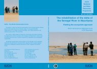
The return of the water - IUCN
The return of the water - IUCN
The return of the water - IUCN

Create successful ePaper yourself
Turn your PDF publications into a flip-book with our unique Google optimized e-Paper software.
Streng<strong>the</strong>ning management and planning<br />
Managers need to be adequately informed in order to make appropriate decisions. A major problem<br />
in many basins in sub-Saharan Africa is <strong>the</strong> lack <strong>of</strong> effective hydrometric networks, while at <strong>the</strong><br />
same time huge investments are made in infrastructure for irrigation (which, according to World<br />
Bank statistics, sometimes exceed a capital investment <strong>of</strong> 15,000 per hectare). Management and<br />
planning capacities are streng<strong>the</strong>ned by:<br />
140<br />
Towards Sustainability<br />
• Up-grading data collection.<br />
Given that in <strong>the</strong> past, collection <strong>of</strong> hydrological data in <strong>the</strong> area has been inadequate (and<br />
to a large extent continues to be so), <strong>the</strong> hydrometric network on <strong>the</strong> Logone River should<br />
be maintained or rehabilitated, and <strong>the</strong> relevant hydrological data collected, managed in<br />
appropriate databases and analysed. To expand fur<strong>the</strong>r <strong>the</strong> area under flooding, and to allow<br />
for proper development planning, suitable topographic maps should be made available.<br />
Ground-based information needs to be complemented by data from remote sensing by aircraft<br />
and satellite, so that data from particular sites can be scaled up to <strong>the</strong> size <strong>of</strong> <strong>the</strong> Waza Logone<br />
floodplain. This will enable detailed maps to be made <strong>of</strong>, for example, <strong>the</strong> extent, volume<br />
and depth <strong>of</strong> flood<strong>water</strong> and resulting vegetation patterns. This information will provide <strong>the</strong><br />
basis for sound planning and management <strong>of</strong> <strong>the</strong> area.<br />
• Streng<strong>the</strong>ning hydrological management.<br />
<strong>The</strong>re is great potential for intensifying <strong>the</strong> land use in <strong>the</strong> Waza Logone floodplain through<br />
<strong>the</strong> implementation <strong>of</strong> relatively low-level irrigation projects. Such projects can produce<br />
over five times more per hectare, and infinitely more per unit <strong>of</strong> <strong>water</strong> used, than <strong>the</strong> formal<br />
irrigation schemes (Barbier, 1993). <strong>The</strong>re is also scope for traditional floating rice or sorghum<br />
cultivation in flood-prone areas, support towards traditional flood-recession agriculture, and<br />
implementation <strong>of</strong> sustainable small-scale fisheries activities.<br />
Given <strong>the</strong> fact that <strong>the</strong> Maga reservoir is grossly oversized, <strong>the</strong> floodplain could sustain<br />
much larger floods than those currently implemented through <strong>the</strong> openings made in <strong>the</strong><br />
Logone River levees. This would ensure maximum spread <strong>of</strong> available <strong>water</strong> over <strong>the</strong> largest<br />
possible area. However, apart from widening existing breaks in <strong>the</strong>se levees, more <strong>water</strong><br />
could only be made available through <strong>the</strong> rehabilitated sluice-gates on <strong>the</strong> Vrick channel<br />
(see Chapter 10), to ensure that managed flood releases would coincide with high in-flows<br />
from <strong>the</strong> Logone River. Such a strategy would provide for a more equitable distribution <strong>of</strong><br />
<strong>water</strong> resources over a large area, by providing more <strong>water</strong> each year, and would result in a<br />
larger flow <strong>of</strong> <strong>water</strong> into <strong>the</strong> Waza National Park.<br />
<strong>The</strong> project has carried out initial studies indicating that <strong>the</strong> provision <strong>of</strong> additional, artificial,<br />
sustained flooding through restoration <strong>of</strong> <strong>the</strong> main sluice gate on <strong>the</strong> dam and <strong>the</strong> Vrick<br />
channel would be both feasible and cost-effective in <strong>the</strong> long term.<br />
• Designing communal and village management plans.<br />
Clearly, pilot releases implemented from 1994 onwards have brought significant benefits to<br />
both floodplain communities and wildlife. <strong>The</strong>y have also triggered a regional process <strong>of</strong><br />
immigration (Pires, 1998; Scholte, 2003) whose impact upon natural resources could be<br />
both important and insoluble, if people continue to move onto <strong>the</strong> restored floodplain. This<br />
phenomenon is poorly documented, and research must be carried out to gain a better<br />
understanding <strong>of</strong> <strong>the</strong> likely impact <strong>of</strong> an increased population upon limited <strong>water</strong> resources<br />
and upon wildlife, especially <strong>the</strong> wild animals that live in and around <strong>the</strong> Waza National<br />
Park. Immigration could have highly detrimental impacts upon biodiversity in <strong>the</strong> floodplain<br />
and beyond.