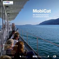
À la carte 2012 - BSG - Bielersee Schifffahrt
À la carte 2012 - BSG - Bielersee Schifffahrt
À la carte 2012 - BSG - Bielersee Schifffahrt

Create successful ePaper yourself
Turn your PDF publications into a flip-book with our unique Google optimized e-Paper software.
30<br />
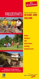
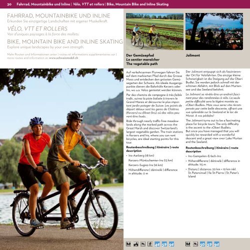
Fahrrad, mountainbike und Inline | vélo, vTT et rollers | Bike, mountain Bike and Inline Skating<br />
fahrrad, MOuNtaiNBiKe uNd iNliNe<br />
erkunden sie einzigartige <strong>la</strong>ndschaften mit eigener Muskelkraft.<br />
VéLO, VTT ET ROLLERS<br />
Voir d’uniques paysages à <strong>la</strong> force des mollets.<br />
BiKe, MOuNtaiN BiKe aNd iNliNe sKatiNG<br />
explore unique <strong>la</strong>ndscapes by your own strength.<br />
Mehr routen und informationen unter | routes et informations supplémentaires sur |<br />
more routes and information at: www.schweizmobil.ch<br />
Der Gemüsepfad<br />
le sentier maraîcher<br />
The vegetable path<br />
auf verkehrsarmen flurwegen fahren sie<br />
auf dem markierten Pfad durch das Grosse<br />
Moos und entdecken den grössten Gemüsegarten<br />
der schweiz. als ideale ausgangspunkte<br />
dienen die Bahnhöfe Kerzers oder<br />
ins, wo u.a. Velos gemietet werden können.<br />
Par des chemins de campagne à très faible<br />
trafic, suivez <strong>la</strong> piste balisée à travers le<br />
Grand Marais et découvrez le plus important<br />
jardin potager de Suisse. Les points de<br />
départ idéaux sont les gares de Chiètres<br />
(Kerzers) ou d’Anet (Ins), où des vélos peuvent<br />
être loués.<br />
ride through nearly traffic-free meadow<strong>la</strong>nds<br />
along the marked path across the<br />
Great Marsh and discover switzer<strong>la</strong>nd’s<br />
<strong>la</strong>rgest vegetable garden. the train stations<br />
in Kerzers and ins, where you can rent<br />
bicycles, are ideal starting points for this<br />
tour.<br />
routenbeschreibung | itinéraire | route<br />
description<br />
• Ins–Aarberg (18 km)<br />
Kerzers– Müntschemier–ins (13 km)<br />
Kerzers–sugiez–ins (16 km)<br />
• Höhendifferenz | dénivelé | difference<br />
in altitude: 0 m<br />
Jolimont<br />
der Jolimont entpuppt sich als faszinierender<br />
Ort für Velofahrten. die einzige kleine<br />
schwierigkeit ist die steigung auf die Oberi<br />
Budlei. sie werden jedoch schnell mit der<br />
schönen abfahrt, mit Blick auf den Murtensee<br />
und das see<strong>la</strong>nd belohnt.<br />
Le Jolimont se révèle être un endroit fascinant<br />
pour des randonnées à vélo. La seule<br />
petite difficulté sera <strong>la</strong> légère montée au<br />
«Oberi Budlei». Mais vous serez vite récompensés<br />
par cette belle descente, offrant une<br />
vue splendide sur le See<strong>la</strong>nd et le <strong>la</strong>c de<br />
Morat. A vos pédales!<br />
the Jolimont turns out to be a fascinating<br />
p<strong>la</strong>ce for bicycle tours. the only difficulty<br />
is the ascent to the «Oberi Budlei».<br />
But once you have managed that you will<br />
quickly be rewarded with a wonderful<br />
descent and a great view over <strong>la</strong>ke Murten<br />
and the see<strong>la</strong>nd.<br />
routenbeschreibung | itinéraire | route<br />
description<br />
• Ins–Gampelen–Er<strong>la</strong>ch–Ins<br />
• Höhendifferenz | dénivelé | difference in<br />
altitude: 115 m<br />
• Distanz | distance: 20 km + 10 km inkl.<br />
st. Petersinsel | ile st-Pierre | st. Peter’s<br />
is<strong>la</strong>nd