Buletin Geospatial Sektor Awam - Bil 1/ 2007 - Malaysia Geoportal
Buletin Geospatial Sektor Awam - Bil 1/ 2007 - Malaysia Geoportal
Buletin Geospatial Sektor Awam - Bil 1/ 2007 - Malaysia Geoportal
- No tags were found...
Create successful ePaper yourself
Turn your PDF publications into a flip-book with our unique Google optimized e-Paper software.
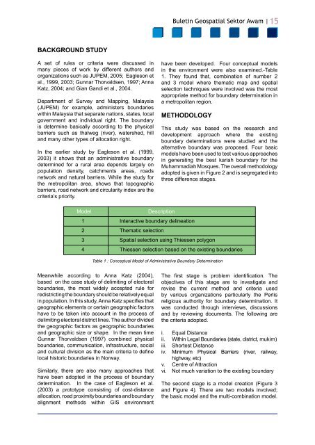
<strong>Buletin</strong> <strong>Geospatial</strong> <strong>Sektor</strong> <strong>Awam</strong> |15BACKGROUND STUDYA set of rules or criteria were discussed inmany pieces of work by different authors andorganizations such as JUPEM, 2005; Eagleson etal., 1999, 2003; Gunnar Thorvaldsen, 1997; AnnaKatz, 2004; and Gian Gandi et al., 2004.Department of Survey and Mapping, <strong>Malaysia</strong>(JUPEM) for example, administers boundarieswithin <strong>Malaysia</strong> that separate nations, states, localgovernment and individual right. The boundaryis determine basically according to the physicalbarriers such as thalweg (river), watershed, hilland many other types of allocation right.In the earlier study by Eagleson et al. (1999,2003) it shows that an administrative boundarydetermined for a rural area depends largely onpopulation density, catchments areas, roadsnetwork and natural barriers. While the study forthe metropolitan area, shows that topographicbarriers, road network and circularity index are thecriteria’s priority.have been developed. Four conceptual modelsin the environment were also examined.-Table1. They found that, combination of number 2and 3 model where thematic map and spatialselection techniques were involved was the mostappropriate method for boundary determination ina metropolitan region.METHODOLOGYThis study was based on the research anddevelopment approach where the existingboundary determinations were studied and thealternative boundary was proposed. Four basicmodels have been used to test various approachesin generating the best kariah boundary for theMuhammadiah Mosques. The overall methodologyadopted is given in Figure 2 and is segregated intothree difference stages.ModelDescription1 Interactive boundary delineation2 Thematic selection3 Spatial selection using Thiessen polygon4 Thiessen selection based on the existing boundariesTable 1 : Conceptual Model of Administrative Boundary DeterminationMeanwhile according to Anna Katz (2004),based on the case study of delimiting of electoralboundaries, the most widely accepted rule forredistricting the boundary should be relatively equalin population. In this study, Anna Katz specifies thatgeographic elements or certain geographic factorshave to be taken into account in the process ofdelimiting electoral district lines. The author dividedthe geographic factors as geographic boundariesand geographic size or shape. In the mean timeGunnar Thorvaldsen (1997) combined physicalboundaries, communication, infrastructure, socialand cultural division as the main criteria to definelocal historic boundaries in Norway.Similarly, there are also many approaches thathave been adopted in the process of boundarydetermination. In the case of Eagleson et al.(2003) a prototype consisting of cost-distanceallocation, road proximity boundaries and boundaryalignment methods within GIS environmentThe first stage is problem identification. Theobjectives of this stage are to investigate andrevise the current method and criteria usedby various organizations particularly the Perlisreligious authority for boundary determination. Itwas conducted through interviews, discussionsand by reviewing documents. The following arethe criteria adopted.i. Equal Distanceii. Within Legal Boundaries (state, district, mukim)iii. Shortest Distanceiv. Minimum Physical Barriers (river, railway,highway, etc)v. Centre of Attractionvi. Not much variation to the existing boundaryThe second stage is a model creation (Figure 3and Figure 4). There are two models involved;the basic model and the multi-combination model.


